assessing fire risk from land abandonment in evora ... - esrievora has been identified by previous...
TRANSCRIPT
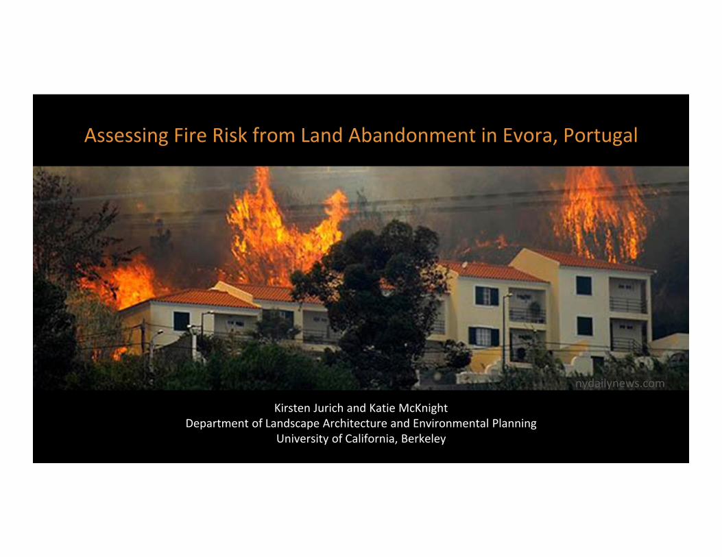
Kirsten Jurich and Katie McKnightDepartment of Landscape Architecture and Environmental Planning
University of California, Berkeley
Assessing Fire Risk from Land Abandonment in Evora, Portugal
nydailynews.com

OVERVIEWPortugal: highest incidence of fire ignitions in Europe
Potential catalyst for more effective fire management plans
Social deser fica on → decrease in farmers, increase in unmanaged land
Abandoned areas experiencing shift from grassland to shrubland
AIM: ASSESS FIRE RISK OF DIFFERENT TWO LAND COVER TYPE SCENARIOS, SHRUBLAND VS. GRASSLAND

Evora has been identified by previous fire risk maps as a very high fire ignition risk zone
STUDY SITE
Source: (Catry and Rego 2009)


● 1.5 square mile study area
● Wildland Urban Interface:
○ high density housing
○ open grasslands
○ orchards & farmland
STUDY SITE

METHODS
Collected 90 GPS ground control points
Collected additional ground points, georeferenced photos and fuel details with FireSphere mobile application
FlamMap used to analyze fire behavior between two scenarios:
(1) existing conditions (shrubland encroachment)
(2) maintained grassland

METHODS

DA
TA C
OLL
EC
TIO
N

FUEL MODEL
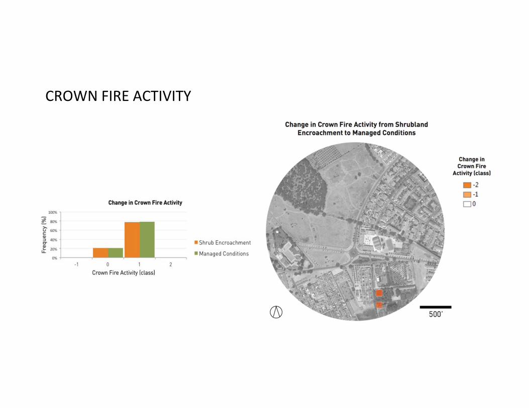
CROWN FIRE ACTIVITY

HEAT PER UNIT AREA
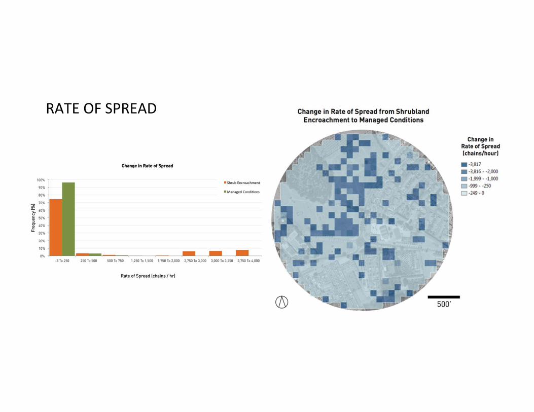
RATE OF SPREAD

FLAME LENGTH

FINDINGS
● Minimizing shrub encroachment can greatly reduce flame length, rate of spread, heat per burned area, and crown fire activity
● A summary of total effects of shrub removal include
○ minimal to no effect on crown fire activity
○ significant decreases in heat per unit area from extreme rates (between 50,000 to 150,000 kJ/m2) to more manageable levels (0 ‐ 5,000 kJ/m2)
○ overall decrease in high rates of spread at dangerous intervals (1,250 to 2,000 chains per hour) to more manageable intervals (0 to 250 chains per hour)
○ reduction from very large flame length (between 60 – 130 feet) to moderate lengths (0 to 10 feet).
CONCLUSIONS

RECOMMENDATIONS
● Explore ways to integrate crowdsourced fire risk assessments, modeling and participatory management to reduce overall fire hazards.
● Determine community outreach measures to educate homeowners and local residents on fire risk indicators and mitigation measures to increase awareness of potential vulnerabilities.
● Integrate local‐scale methods such as goat grazing or manual management to curb potential fire risks as climate change continues to influence unprecedented and unpredictable climatic conditions in central Portugal.
FUTURE RESEARCH

WORKS CITEDAnderson, Hal E. “Aids to Determining Fuel Models for Estimating Fire Behavior,” The Bark Beetles,Fuels, and Fire Bibliography,
1982, 143.Botequim, Brigite. “Modeling Fire Behavior and Risk in Portuguese’s Forest: Guidelines for Sustainable Landscape Management.”
“Decision Support Tools for Integrating Fire and Forest Management Planning.”18 May 2010.Catry, F. X., F. C. Rego, F. L. Bação, and F. Moreira. “Modeling and Mapping Wildfire Ignition Risk in Portugal.” International Journal of
Wildland Fire 18, no. 8 (2009): 921–31.Correia, P. T. (1993). Land abandonment: Changes in the land use patterns around the Mediterranean basin. CIHEAM, 1(2), 97 –
112.Linton, Jeremy V. Wildfires: Issues and Consequences. Nova Publishers, 2004.Moreira, F., P. Vaz, F. Catry, and J. S. Silva. “Regional Variations in Wildfire Susceptibility of Land-Cover Types in Portugal:
Implications for Landscape Management to Minimize Fire Hazard.” International Journal of Wildland Fire 18, no. 5 (2009): 563–74.
Paton, Douglas, and Fantina Tedim. “Enhancing Forest Fires Preparedness in Portugal: Integrating Community Engagement and Risk
Management.” Planet @ Risk 1.1 (2013): 44-52. Print.Peterson, S.H., M.E. Morais, J.M. Carlson, P.E. Dennison, D.A. Roberts, M.A. Moritz, and D.R. Weise. 2008. Spatial Modeling of Fire
in Shrublands Using HFire. Res. Pap. PSW-RP-259. Department of Agriculture, Forest Service, Pacific Southwest Research Station: Albany, CA. http://www.treesearch.fs.fed.us/pubs/31914
“Projected Changes in Annual Mean Temperature and Annual Precipitation— European Environment Agency.” Figure. http://www.eea.europa.eu/data-and-maps/figures/projected-change-in-annu al-mean.