assessment of soil erosion effect on inle lake in...
TRANSCRIPT
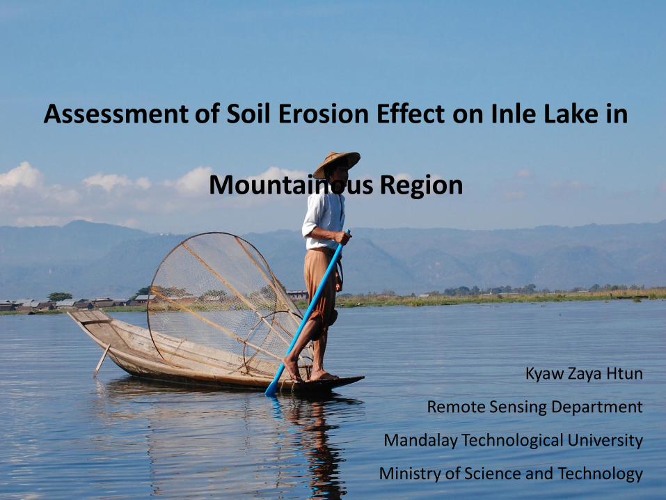
Assessment of Soil Erosion Effect on Inle Lake in
Mountainous Region
Kyaw Zaya Htun
Remote Sensing Department
Mandalay Technological University
Ministry of Science and Technology
Contents
• Inle watershed
• Estimated open water area change in Inle Lake
• Major Environmental Problems
• Land use & Soil Erosion
• Conclusions
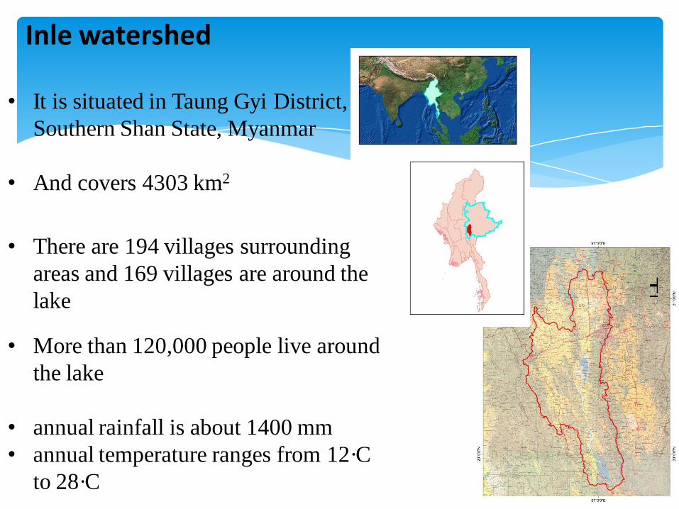
• It is situated in Taung Gyi District,
Southern Shan State, Myanmar
• And covers 4303 km2
• There are 194 villages surrounding
areas and 169 villages are around the
lake
• More than 120,000 people live around
the lake
• annual rainfall is about 1400 mm
• annual temperature ranges from 12·C
to 28·C
Inle watershed
±

Inle watershed (cont.)
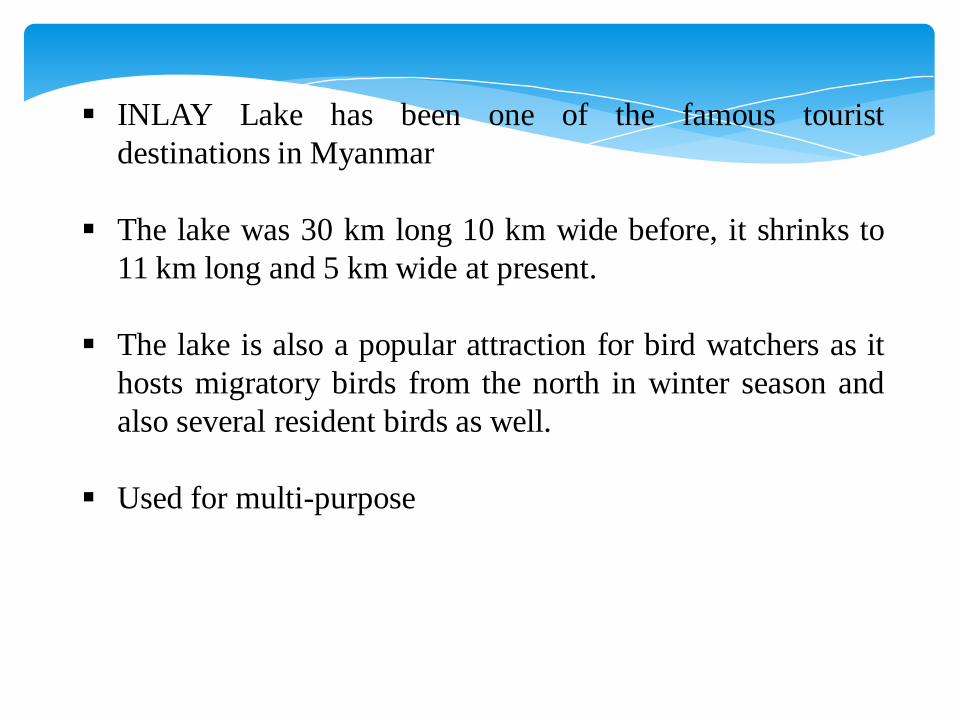
INLAY Lake has been one of the famous tourist
destinations in Myanmar
The lake was 30 km long 10 km wide before, it shrinks to
11 km long and 5 km wide at present.
The lake is also a popular attraction for bird watchers as it
hosts migratory birds from the north in winter season and
also several resident birds as well.
Used for multi-purpose

Estimated open water area change in Inle Lake
between 1935/1936 and 2000
• Based on the 1935/1937 maps,
Inle Lake was composed of
approximately 69km2 of open
water, not including river
channels .
• By 2000, this area had decreased
substantially to approximately 45
km2.

Major Environmental Problems
Increase Population
Progressiveness of economic activities
Deforestation
Shifting cultivation practices in adjacent watershed area
Chemical fertilizer usage in floating gardens
Waste water sewage from villages and towns
• Increasing
amt of silt &
nutrients into
shallow lakes
which results
in sediments
Land use of Inle Watershed
• It is famous for various agricultural products being favorable
condition for various types of fruits and vegetables.
• More than 60% of the whole watershed is utilized as agriculture
permanently or seasonally.
• About 100-250km2 forest land was converted to other land use
mostly into cultivated land from 1990 to 2005
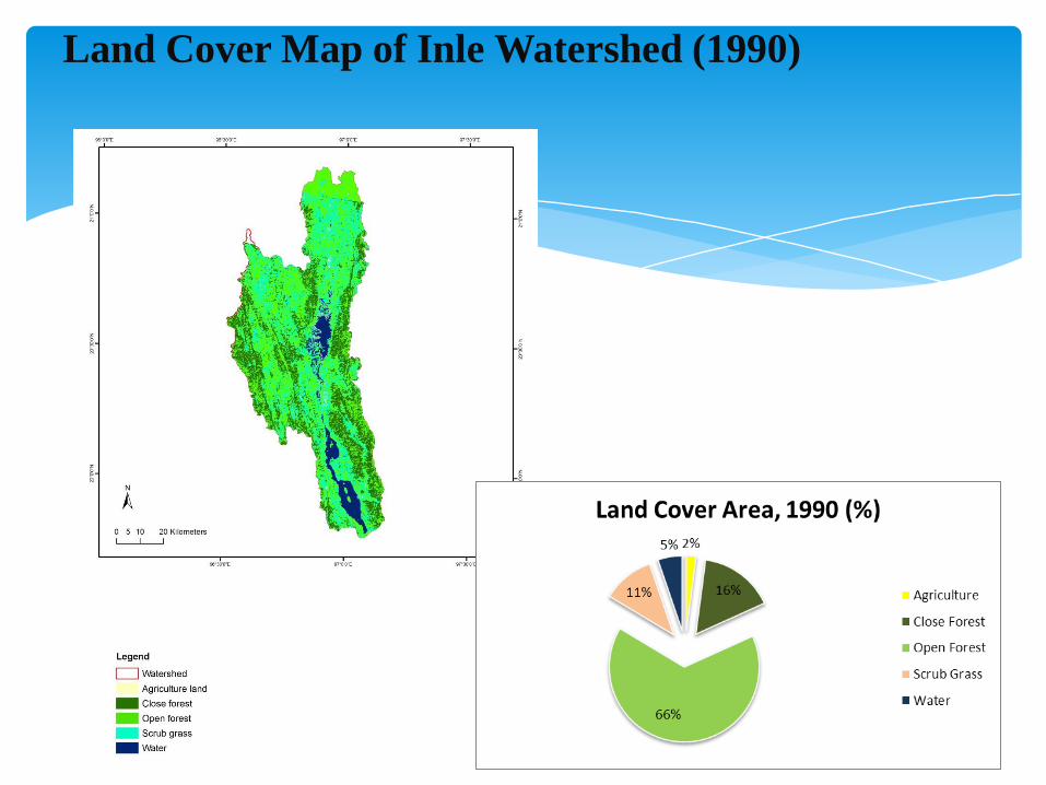
Land Cover Map of Inle Watershed (1990)

Land Cover Map of Inle Watershed (2000)

Land Cover Map of Inle Watershed (2010)

Change Detection
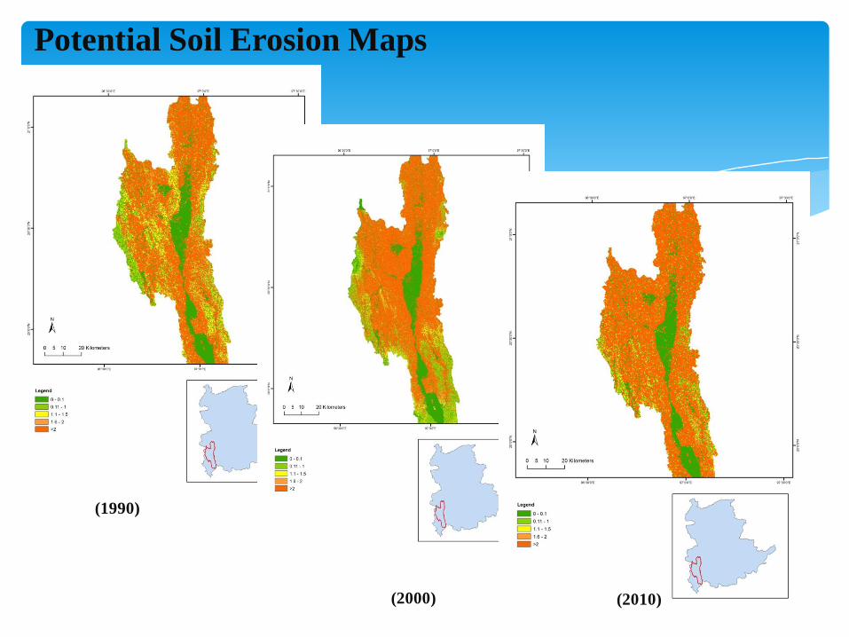
Potential Soil Erosion Maps
(1990)
(2000) (2010)


• Deforestation is a major problem in the surrounding mountains, especially in
the western watersheds.
• Shifting cultivation, wood for construction, firewood cutting, frequent burning
and village expansion has greatly increased erosion. Erosion from these areasshould follow drainages into the south-eastern portion of the lake.
• Estimates of sediment delivery to Inle Lake range widely from 0.65 millionm3 year–1 to 0.84 million m3 year–1
• Using chemical fertilizers on the floating tomato gardens can cause pollution of
the water.
• Transportation of local and tourism agencies pollute the lake water to some
extent.
Conclusion
12
1
08188.05.1
2
10log
10735.1i
p
p
R
i
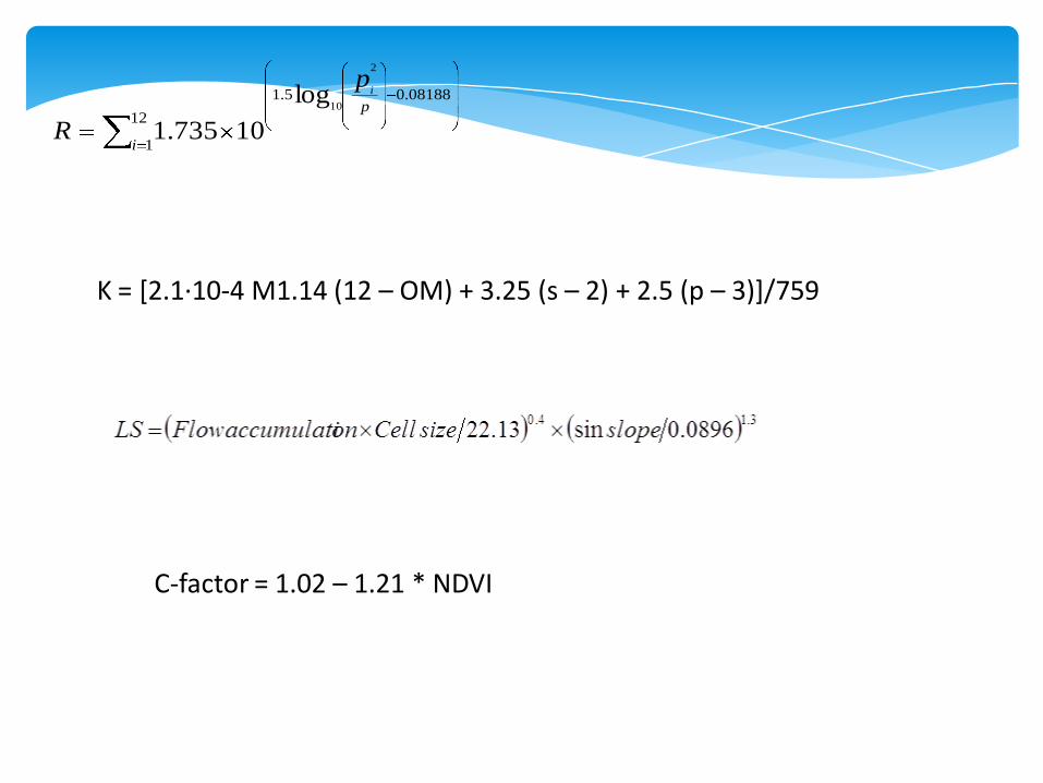
K = [2.1·10-4 M1.14 (12 – OM) + 3.25 (s – 2) + 2.5 (p – 3)]/759
C-factor = 1.02 – 1.21 * NDVI
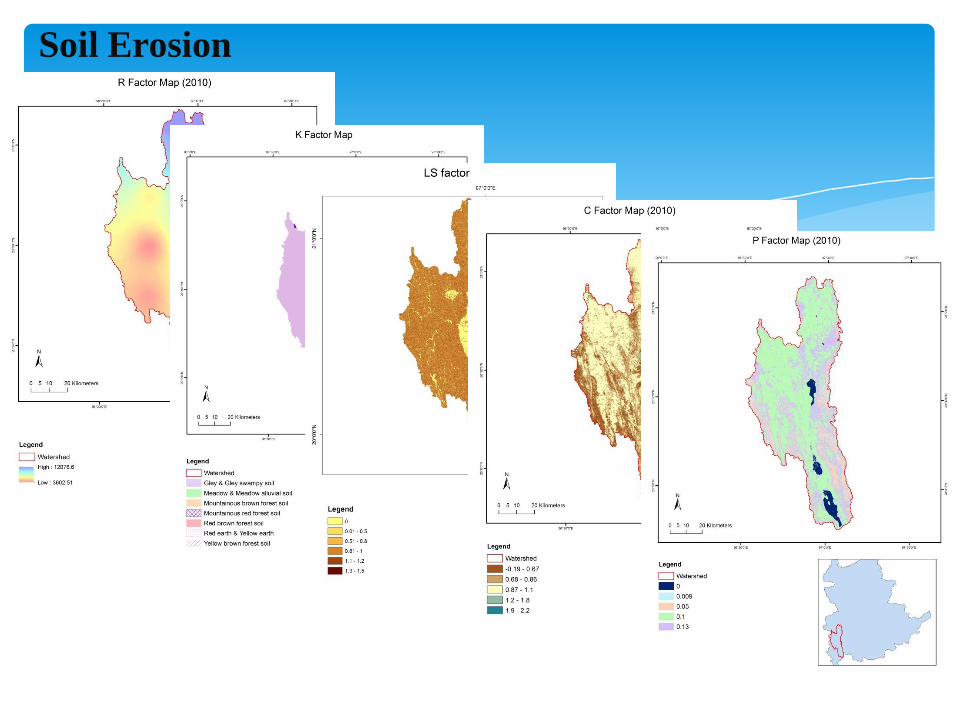
Soil Erosion

Legend
0 - 0.1
0.11 - 1
1.1 - 1.5
1.6 - 2
>2

NDVI
NDVIC exp

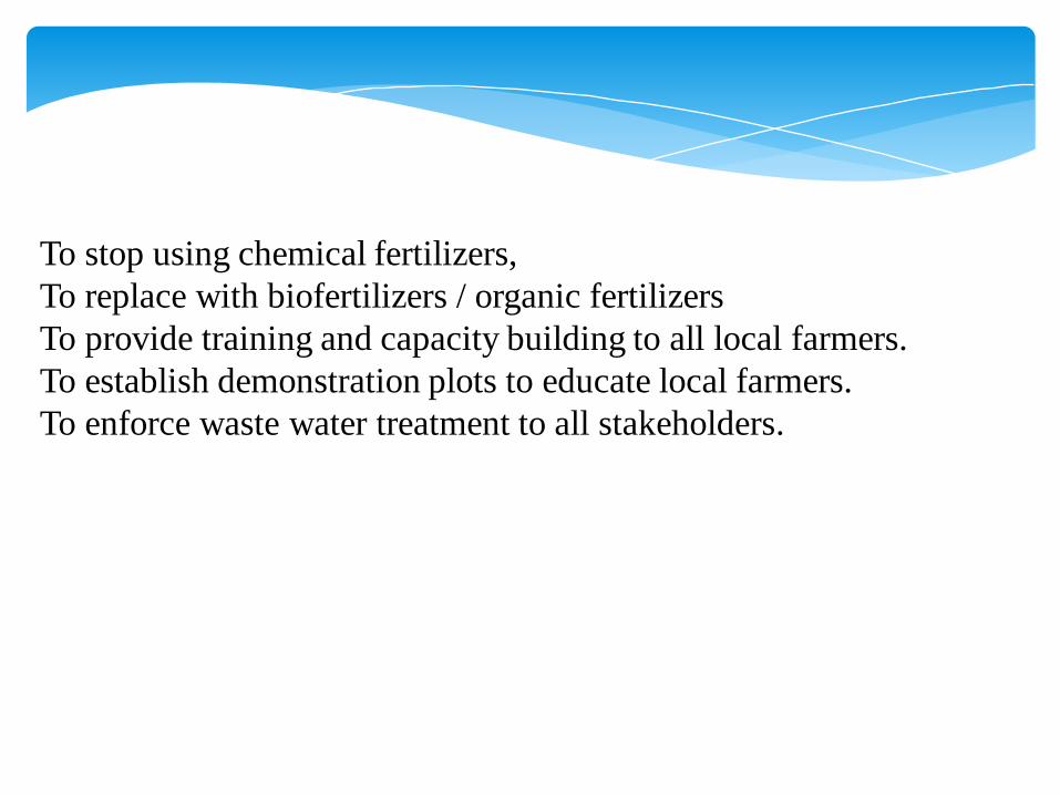
To stop using chemical fertilizers,
To replace with biofertilizers / organic fertilizers
To provide training and capacity building to all local farmers.
To establish demonstration plots to educate local farmers.
To enforce waste water treatment to all stakeholders.
Importance of Inle Lake nationally/globally
Deterioration of Inle Lake environment
Draw lessons from one past experience
11. I would say the Lake itself is a “National Heritage
Site of Myanmar” and we have to save this “Valuable
NationalAsset” by all means.
12. I do hope, these 3 days’ workshop provide more
information on the causes of deteriorating environment and
also help to solve varieties of environmental problems and
throw more light and vision for the future of this lovely
Lake “INLAY”.

- Awareness of all level
(Policy maker, implementers, experts, user, public)
- Coordination in each other
- Participation of public & stakeholder
- Financial & budgeting
- Comprehensive legislative framework
- Capacity building is the most important
14-Mar-201326
6. Suggestion