astronomical slte survey 1n leh - ladham
TRANSCRIPT

TECHNICAL REPORT ON ASTRONOMICAL SlTE SURVEY 1N
LEH - LADHAM (I 984-1 989)
Sponsored By
GOVERNMENT OF INDIA MINISTRY OF SCIENCE & TECHNOLOGY
DEPARTMENT OF SCIENCE AND TECHNOLOGY TECHNOLOGY BHAWAM
MEW DELHl 110 016

TECHNICAL REPORT ON THE
DST PROJECT ASTRONOMICAL AND ATMOSPHERIC
OBSERVATIONS IN LADHAK REGION WITH LONG TERM VIEW OF SETTING UP A NATIONAL
HIGH ALTITUDE ASTRONOMICAL OBSERVATORY FOR INFRA -RED AND OPTICAL STUDIES.
(APRIL 1984 TO OCTOBER 1989)
Compiled by
ARVIND BHATNAGAR AND S.L.GANDHI Udaipur Solar Observatory,
Udaipur.
April 1991
Sponsored by GOVERNMENT OF INDIA
MINISTRY OF SCIENCE & TECHNOLOGY DEPARTMENT OF SCIENCE AND TECHNOLOGY
TECHNOLOGY BHAWAN NEW DELHl110 016

TO SEE INTO BEYOND REQUIRE PURITY
AS LITTLE AIR AS MAY BE AND
THAT ONLY OF THE BEST IS OBLIGATORY
TO ASTRONOMER'S ENTERPRISE
MUST ABANDON CITIES AND FORGET PLAINS
ONLY IN PLACES RAISEDABOVEANDALOOF FROM MEN
CAN ASTRONOMER PURSUE HIS RESEARCH
- PERCIVAL LO WELL

CONTENTS FOREWORD
ACKNOWLEDGEMENTS
1. . HISTORICAL BACKGROUND
2. PRELIMINARY RECONNAISSANCE
3. SEARCH FOR ALTERNATE SiTE
4. DST APPROVAL OF THE PROJECT, BUDGET ETC.
5. PARAMETERS FOR SITE SURVEY
6. SPECIAL INSTRUMENTS AND SOFTWARE DEVELOPED FOR SITE SURVEY AND EQUIPMENT USED 7
7. COLLECTION OF DATA AND ANALYSIS 9
8. SPIN OFF FROM PROJECT WORK 20
9. PROBLEMS FACED, LESSONS LEARNT 22
10. COMPARISON OF RESULTS WiTH OTHER HIGH ALTITUDE OBSERVATORIES OF THE WORLD 23
11. RECOMMENDATIONS 24
ANNEXURES
LIST OF INSTITUTIONS AND INVESTIGATORS 26
COMPOSITION OF REVIEW-CUM-MONITORING COMMITTEE 27
COMPOSITION OF SCREENING COMMITTEE 27
COMPOSITION OF STEERING COMMITTEE 27
LIST OF PUBLICATIONS 28
BIBLIOGRAPHY 29
IMD 30 YEAR CLIMATOLOGICAL DATA FOR LEH 32
CLIMATOLOGICAL DATA FOR OCTOBER 1986 OCTOBER 1988 BASED ON SITE SURVEY OBSERVATIONS

FOREWORD Promotion of Astronomy and Astrophysics is one of the thrust areas of the Department of Science & Technology (DST). Astronomers from research institutions and Universities in the country were encouraged by DST to formulate proposals for a National High Altitude Astronomical ~ a c i l i t ~ : Accordingly, leading astronomers representing the Indian lnstitute of Astrophysics (IIA), Tata lnstitute of Fundamental Research (TIFR), Physical Research Laboratory (PRL), Udaipur Solar Observatory (USO), U.P. State Observatory (UPSO), Osmania University and Punjabi University made a reconnaissance visit to Leh-Ladhak, in association with the Defence Research and Development Organisation (DRDG) in 1982. Subsequently, a multi-institutional project to pursue ASTRONOMICAL AND ATMOSPHERIC OBSERVATIONS IN LEH-LADHAK REGION WITH LONG TERM VIEW OF SETTING UP A NATIONAL HIGH ALTITUDE ASTRONOMICAL OBSERVATORY FOR INFRA-RED AND OPTICAL STUDIES was sponsored by DST in 1984. Nine DST MONITORING-CUM-REVIEW COMMITTEE meetings were periodically held to take note of the progress of the project. A Workshop was held at UPS0 Nainital in April 1985, t o review the adopted and mid- term correction methodology. The DST also set up a Screening Committee under the Chairmanship of Prof. G. Srinivasan for evaluation of the work and to recommend corrective measures, if any. A meeting was also held in January 1987 under the Chairmanship of Dr. Vasant Gowariker, Secretary, DST to review the progress and take appropriate advance steps for implementing the recommendations
at the end of the project. Accordingly, Prof J.C. Bhattacharyya prepared a concept report for a large national high altitude IR telescope.
This is one of the first systematic astronomical site surveys conducted in the country for location of a large telescope. A medium size te!escope located at a good astronomicsi site can be several times more productive than a large telescope at a poor site. The DST was not only able to bring several institutions to collaborate and carry out the project war/( under one umbrellabut also get valuable logistic support from DRDO. The Indian Meteorological Department (IMD) set up a METEOROLOGICAL OBSERVATORY and DATA COLLECTION PLATFORM (DCP) for continuous monitoring of meteorological data through INSAT- IB in record time. The Indian Air Force provided invaluable help in positioning a 6-inch coude telescope on Mt. Nimmu top by a helicopter and also provided useful Meteorological Data.
The equipment, methodology and the expertise developed during.this project, will be useful in future site surveys for astronomical telescopes.
F~nally, I will like to place on record my deep sense of appreciation to Dr. Arvind Bhatnagar and Shri S.L. Gandhi for the complete commitment, devotion and sacrifice with which they fulfilled their contributions to this project over an extended period of five years without any thought of credit or compensation.
R.R. DAN1 EL Chairman
Review-Cum-Monitoring Committee of the Project.

ACKNOWLEDGEMENTS This multi-rnstitutlonal project of site survey in Leh-Ladhak for an Astronomical Observatory, was sponsored by the Department of Science and Technology, Government of India. It was a very ambitious and challenging project, ~nvolving large number of people with varied expertise, institutions and organisations. The scient~fic objectives of the project were well defined from the beginning, but the mechanism to achieve these objectives remained rather nebulous, in spite of several meet~ngs which took place before the project began. As the project started taking shape, very serious and unexpected problems cropped up, first due to the non-availability of the 24-inch telescope from the Punjabi University, shifting of the 20-~nch Bhavnagar telescope from Kavalur to Leh, transportation of the FRP 5.6 metre diameter astronomical dome before the closure of roads due to snow (1984). Acute problems arose due to lack of logistic and manpower support to operate the field station at Leh and at Mt. Nimmu base camp. Further, poor communication facilities available in Leh-Ladhak made the problem even more difficult. In spite of tremendous problems there was always a "silver lining" in the form of enormous encouragement and help received from a large number of senior scientists of the country, especially Prof. R.R. Daniel, Sr. Professor at TIFR, Bombay, Dr. Vasant Gowariker, Secretary DST, Prof. J, C. Bhattacharyya, Director IIA, Bangalore, Dr. P. J. Lavakare, Advisor, DST, Prof. S.P. Pandya, Director PRL, Ahmedabad.
We would like to mention briefiy the historical backdrop of this project. In 1981, Dr. Raja Ramanna, the then Advisor to the Raksha Mantri enthusiastically endorsed this idea of site survey and offered all possible help, through their Field Research Laboratory in Leh. He put us (A. Bhatnagar) in touch with Dr.
Krishnamurthy the then Chief Controller, and Shri S. L. Gandhi the then Director of Material and Agricultural Sciences, Defence Research and Development Organisation (DRDO). Dr. V. Arunachalum, the next Advisor t o R.M., displayed much more enthusiasm and unstinted support for this project. Seeing Sri Gandhi's dynamism and readiness to go out of his way to shoulder responsibility, the project scientists were highly impressed and were encouraged to embark 'on this project.
The Department of Science and Technology took a very keen interest in this project. Were it not for Dr. Lavakare's constant monitoring and being always readily available for any help and advise, this project would not have been completed. Dr. Lavakare along with his number of colleagues at DST, notably Drs. K. R. Gupta, Sulbha Gupta and J. K. Sharma, took keen interest and helped us out through difficult periods.
At the time of formulating the scientific programme of the project, consideration of a very important component of the project namely - logistic problems were somehow under-estimated. This was perhaps, due to the inexperience of the scientists of working in difficult logistic conditions such as in Leh- Ladhak. We thankfully acknowledge the enormous help both in the form of logistics and manpower provided by the various laboratories of DRDO, namely the Defence Agriculture Research Laboratory (DARL), Almora and the Field Research Laboratory (FRL) Leh. Shri M. C. Joshi, Director DARL, took personal interest in this project and visited the project site many times and deputed several scientists, assistants and helpers to Leh-Ladhak for taking site survey observations, when astronomers from the participating institutions were not

available. The Officer-Commanding of FRL posted from time-to-time took interest and provided valuable help. Notabiy i t . Col. Rao, Lt. Col. Chinna and Major Shandal went out of their way to see that iogistic problems were sorted out or at least minimized. A very significant contribution for arranging of air transporiation to Leh, of the 20-inch telescope made by i t . Col. M. S. Sanga, the then Assistant Director, Material and Agricultural sciences, DWDO can not be forgotten. The Station Commander of the kip Force base, Leh helped us in installing the 15-cm Zeiss coude telescope on Mt. Nimmu and help of Air Comm. Natrajan of the Air Head Quarters for providing cloud coverage data is acknowledged.
The enthusiasm of the then Director General of Meteorology - Shri S. K. Das for this project is worth mentioning. We along with the then DDGI, Pune Dr. Srivastava and Dr. Sreedharan, Director Instruments, I. Met. D., provided the meteorological instruments and arranged to establish a Met. Observatory in record time of less than 2 months at Mt. Nimmu Base camp in October 1984 and in 1985 the Data Collecting Platforrrt (DCP). Number of scientists from I.Met.D., visited Leh site for checking and calibration of the instruments. The present DGM, Dr. S.M. Kulshrestha has continued giving full support and help for the project. Shri O.P.N. Calla and Shri S. S. Rana of the Space Application Centre, Ahmedabad also contributed to.the project by providing a 22 GWz., radiometer for estimation of water vapour. For measuring the precipitable water vapour, a portable meter given to PRL by Prof. Westphal of Caitech, USA was used. The Department of Non-Conventional Energy Sources (DNES) got interested in this project and provided free of cost several solar photo voltaic power panels. These panels worked very satisfactorily for almost 4 years in Leh-Ladhak. The help of a local
contractor - Shri T. Morup, who had taken the chailenge of cons~ructing the telescope pier on Mf. Nimniu 2nci the rest house at the Base Camp, is acknowledged. Last, but not the least, this project would not have started and been completed, were it not for enormous contributions made by a large number of individuals from the participating institutions, name!!! DRDO (FRL ti. DARI), l iA, Bangalore, TIFR, Bombay, PRL, Ahmedabad, UPSO, Nainital, Osmania University: Wyderabad, Punjabi University and of course USO, Udaipur. We vdouid have liked to acknowledge and thank all the people by name who worked so hard and devotedly for several years under very harsh environmental conditions for the success of this project, but the limitation of space constrains us to do so.
A. Rhatnagar Project Co-ordinator
Photo credit : All colour pictures reproduced in this reporf were phofographed by Dr. Arvind Bhatnagar, except fhose mentioned in the captions.

1. HISPQWTCAL BACKGROUND
The suggestion to look for an astronomical site in Ladhak region located more than 3,000 metres, above mean sea level was mooted in November 1981 at a meeting organized by ADCOS held under the Chairmanship of the late Prof. M. K. Vainu Bappu. At this meeting it was pointed out that the Ladhak region remains relatively clear during the monsoon period, when rest of the country experiences cloudy sky due to monsoon conditions. It was also noted that only at such high altitudes, precipitable atmospheric water vapour will be low enough for high quality infrared observations.
In a subsequent meeti'ng on 29 April 1982, Prof. Bappu ernphaslsed that a site survey should be undertaken to examine whather Leh- Ladhak region is as good a site as ~t is generally thought to be. He mentioned that "our aim should be to make such measurements and observations over a period, which will enable us to decide once for all, the quality of astronomical observations that can be made from Ladhak."
Other astronomers also had a similar view that Ladhak was likely to be a promising site for IR astronomical observations. This was partly based on the 30 years Meteorological Climatological Tables of observations from 1931 to 1960 for Leh. This table is reproduced in the Appendix giving Cloud Coverage, Rainfall, Wind and other meteorological parameters. The low rainfall and the number of clear days indicated that the site was worth a thorough investigation.
In September 1982, a team of astronomers headed by Prof. R.R. Daniel visited Leh-Ladhak for a preliminary survey of the area. The team collected the following general information of this region:-
(a) CLOUD COVERAGE AND SKY TRANSPARENCY.
Leh-Ladhak is a Trans-Himalayan
region, where generally monsoon does not reach and the annual precipitation is scanty ... Also,because of the rarefied atmosphere, the sky is very dark whenever there are no clouds.
(b) AIR DRYNESS AND RESULTING WATER PRECIPITATION.
The entire area is a high altitude cold desert. The average annual rainfall as per the 30 years of climatological data is only 115 mm.
(c) WIND
The Leh valley is by and large free from gales and very high winds.
(d) NATURAL AIR POLLUTION
The dust content in the air seems to be low near Mt. Nimmu, which is about 25 km from Leh town, as there the terrain is generally gravel. However,it was pointed out that during summer months the dust from Sahara and other deser~s sometimes may rise even up to 5.000-6,000 metres in the Himalayan region. Very preliminary examination indicated possibility of clarity of the sky though not as good as one would expect for an altitude of 4.000 metres. After the monsoon and snow fall the sky transparency usually improves considerably.
(e) NATURAL LIGHT POLLUTION
The 34" N latitude of Len is not high enough to be affected by aurora borealis etc.
( f i ) SELECTION OF MT. NIMMU.
Leh is connected by road from Srinagar and Manali which is open during the summer months from July to October. During rest of the year, the access to Leh is only by air. The initial impression of the team was favourable. A quick survey of the region extending about 50 km, along the road'on either side of Leh and inspection of possible sites in the accessible neigbourhood showed that Mt.Nimmu at a height of 4100 metres is potentially a most attractive site

Figure I Panoramic view of Mr. Nimmu and slirrounding region showing Leh- Srinagar high way
due to the following considerations;
that, Mt. Nimmu is an isolated mountain peak, having no higher peak near the immediate vicinity of about 10 km radius. The top of Mt. Nimmu has a large flat area for locating number of telescopes and other facilities. The reconnaissance team went up to the top and confirmed the availability of a fairly large stretch of flat land at the top. This mountain peak is located in a long valley running east-west of more than 150 km long stretch. The shape of the peak is convex and therefore may provide laminar air flow.
(g) SEISMIC ACTIVITY OF THE REGION
Regarding the selsmic activity, it is reported by WADlA INSTITUTE OF HIMALAYAN GEOLOGY that " the town of Leh lies along the lndus Suture Zone. Se~sm~cally the area has not witnessed any major seismic event in the recent past (as per published literature). The town and its surroundings, however fall in the influence of major events occurring in Pamir, Hindukush, Kinnaur and Kangra, e.g., in Kangra earthquake of 1905 it was in iso-seismal 5-6 while for Kinnaur earthquake of 1975 it lay in iso-seismal4-5. For the Parnir and Hindukush earthquakes of 1939, it was in iso-seismal 3-4. Thus the town of Leh and surrounding lie in seismic
zone of 4-5 intensity (maximum). According to Kaila and Narain (1976) the town is situated in between two seismic highs of Srinagar in the west and Kailash in the east. But their influences is also minimal. (low A value of 2 only)."
(la) ARTlFlClAL AIR AND LIGHT POLLUTION
Mt. Nimmu top is about 3 km away from Leh-Srinagar metalled highway- and there appears to be hardly any danger of air pollution due to traffic and industry. The terrain near and around Mt. Nimmu is generally gravel and thus dust does not rise due to the road traffic.
Nit. Nimmu is about 25 km from the Leh town. There appears to be no' danger due to artificial light pollutioil from the city lights as in the foreseeable future no industrialization is expected in that region. Leh has a- population of about 15,000-20,000 and is situated in a velley surrounded by high mountains. Two high mountain r~dges separate Leh and Mt. Nimmu. Hence the town is not directly visible from Mt. Nimmu peak.
(i) ACCESSIBBLITY TO THE TOP
The road between Leh and Mt. Nimmu remains open even during winter months. Accessibility to the top d ~ d not appear to be insurmountable. The team felt that Mt. Nimmu satisfies the requirements for considerations as an astronomical observatory site.
The Department of Science & Technology took note of November 1981 ADCOS's meeting and the reconnaissance team's reports of September 1982. Subsequently, at the 1983 Ahmedabad meeting at PRL, it was decided by the scientists to formulate a multi-institutional project to pursue--
ASTRONOMICAL AND ATMOSPHERIC OBSERVATIONS IN LADHAK REGION WITH LONG TERM VIEW OF SETTING UP A NATIONAL HIGH ALTITUDE

3. SEARCH FOR O f HER POSSlBLE SITES
4. DST APPROVAL FOR THE PROJECT, BUDGET ETC.
ASTRONOMICAL OBSERVATORY FOR INFRA-RED AND OPTICAL STUD I ES.
The possibility of locating possible sites other than Mt. Nirnrnu in Ladhak was also explored. In 1985, a team carried out a survey of 232 km long reg ion between Leh and Kargil and about 50 k r n on Leh-Manali road, to locate more suitable sites. The search was for a mountain peak, which could be made easily accessible from the Srinagar-Leh-Manali highway and has a fairly flat area on the top suitable for establishing a large observatory.
This team could not locate a site better than Mt. Nimmu in this region, because most of the prospective sites were surrounded by high mountain peaks and were quite inaccessible. The Mount Nirnmu peak is easily accessible from the main highway and is only 25 krn from Leh town and accessible throughout the year.
This inter-institutional project of site survey for high altitude observatory rn Leh-Ladhak for IR telescope, was finally formulated in February 1984, after several meetings and a workshop held in 1982,1983 and in early 1984, of scientists from the participating institutions. The project was approved by DST in May 1984 and funds were released in August
Figure 2. View of Mt. Nimmu top
1984. As this was an inter-institutional project, specific tasks required for implementation of the project were assigned to the various participating institutions and accordingly the necessary funds were made available to each of the eight institutions. The original and revised sanction of the budget by DST is given below :
Institution Original Revised ( Rupees in lahks )
1. Defence Research & Deve. Orgn. 2. Udaipur Solar Observatory 3. Physical Research Laboratory 4. Tata institute of Fundamental Res. 5. Indian institute of Astrophysics 6. Punjabi University 7. U.P. State Observatory 8. Osmania University
Total

As the project started laking shape, number of unforeseen problems cropped up. For example, i t was proposed that the 60-cm Zeiss telescope of the Punjabi University, Patiala would be made available for the project for aslrononiical observations from ieh-Ladhak, bi;t unfortunately this telescope was not available. Hence, art aiiernale solution was sougihi: b y making use 0.i a very old 50-crn Bhavnagar telescope of IIA. It was a major problem to transport this heavy telescope by air from Bangaiore to Leh and to reach there before AugustISeptember 1984, !t was through the untiring efforts of Major M.S. Sanga and Mr. S.L. Gandhi, with the help of the lndian Air force, ihat the teiescope could be air iified and positioned in October '1984 at Skara- Leh. The 5.6 metre diameter FHP astronomical dorrre could not be transported before the roads were closed in October 1984. ilence, the telescope had to be ltept in a round 6- feet high wall enclosure for nearly 'i year without a proper dome. However, telescope was protected from rain and snow with the help of a FRP canopy, which had to be removed for taking observations. Due to the logistic difficulties, it was very
Figure 3 Base Labnrafory-cum-Guest hostel at Skara-Leh siie
4
I I 1 I difficult i o make even minor i
; alterations and repairs required for the telescope. It was due to the
! irigerruity and wide experience of the
/ i lA vior'kshop team. that the 50-cm
1 teiescope could be installed within 2-
1 L? months. Although, a site near the r Dase of Mt. F\limrnu was selected for
i-rstail~l ion of the 50-cm teiescope by
( 2 tear? of scientists in July 1984. But j .
1 13 .vievb, 31 the operational difficulties: I i i was d e c i d ~ d i o keep the le!eccope j 5.: Skara-Ceh flea;' :he DST- \ it:bsrator!~-cum-guest house cite j F::r i4siiing scientists, observers
s.:zd iai15ratoiy, a spacious house with I I rccms was rented near the Field I ._ . qesearcn Laboratory in viliage Skara- / Lei?, which served as a iaboratory- 1 cum-guest house.
i The project faced a major crisis in I i3ciobes 1984 when the Fieid / Research Laboratory (FRL) e: D'IDCI.
declined to operate the grant and / provide tne necessary inr?asrruciure ; SLIppor?. A t this stage the 2roject had i a!reaay ":&?ken-off," a nice house for 1 the laboratory-cum-guest house was / rented, major instruments were
i positioned or were in the process of installation. Hence, this responsibility 1 ot running the statiori and to provide
i infrastructure support eic., was given 1 to the Udaipur Solar Observatory and
to the Project Coordinator.
On the manpower front, ii was proposed in the project proposal that observers and scientisis ~vou ld be drawn from ihe participating astronomical institirtions, who would ' stay at: Lehfor a period of 2 months / and also take observations required for the site survey along with the 50- cm telescope. Hence, in the proposal, no provision was made for salaries of the project personnel. But in actual practice, no observers or scientists
/ volunteered to stay at Leh-ladhak $91
a period of 2 months. A search was- made for suitable person or persons who 'had astronomical background and managerial capability to man ti ie station. In November 1984, in view of the logistic difficulties, i t was decided

to appoint an observer and a manage, from the local population on temporary basis, until some better arrangement could be made. Mr. Arvind Paranjpye from, IIA, volunteered to stay at Leh for this project, but it was a major work for ir single hand, hence a request was made, through Shri S.L. Gandhi te Shri M.C. Joshi, Director, Deience Agriculture Researeh Laboratory (DARL) Almora, to provide, 3 cr 4 qualified scientific assistants for taking site survey observations and man the station. The Director, DARL indeed continuously provided scientific personnel and helpers for smooth running of the station. It may be mentioned that the astronomers for whom the efforts were being made, were most reluctarlt to stay at Leh-Ladhak for taking observations for the site-survey. Due to the logistic difficulties especially manpower and infrastructure problems, the site survey data obtained from November 1984 through August 1986, had large gaps. Some of the essential instruments, such as the Double Beam Telescope for seeing measurements and the Micro-thermal Tower and the mule track upto Mount Nimmu top were not available until mid 1986, therefore the project had to be extended by 2 years. In view of the possible delay in designing and fabrication of the Double Beam Telescope, it was decided in November 1985 to acquire a 15-cm aperture coude telescope from Zeiss, for "seeing" measurement using the polar trail method. This telescope was obtained on very high priority basis from Carl Teiss, Jena, in April 1986. It was tested and arrangement for polar trail photography was made at Udaipur in May 1986 and transported to Leh-Ladhak in August 1986, when Elie road opened. The telescope was installed on Mt. Nimrnu in September W86, with the help of Air Force heficopters. The micro-thermal tower was installed in August 1986 and the meteorological instruments in September 1985, on top of Mt.
Nimmu. Among the major difficulties in operating in Leh-Ladhak region is that the effective operating period for transportation of heavy equipment and building construction etc., is confined only to 4/5 months from July through Nowernbet., out of.the 12 months. If certairi tasks could not be accomplished dpring the summer months, then they have to be postponed for the next year. Hence, this project was delayed by neariy 2 years, beyond that envisaged. After trying various possibilities to solve the manpower problem it was decided in early 1986, that regular observers (scientific.assistants) and helpers should be employed for this DST project, who would be 100% responsible for site survey data collection and data analysis. Hence from June 1986 until the end of project, 3 scientific assistants for taking observations to be stationed at Leh-Ladhak and 2 scientific assistants for data analysis were employed by DARL, Almora and UPS0 Nainital respectively. For liaison with DRDO, DARL, FRL, DST and management of the project, the services of Shri S.L. Gandhi, as an Honorary Project Officer was obtained.

5. PARAMETERS FOR SITE SURVEY
For any ground based major astronomical observatory, the site of the telescope is an extremely important parameter in view of the efficiency, quality and quantity of observations. A medium sized telescope located at a good astronomical site can be several times more productive than a-large telescope at a poor site. The characteristics of site parameters are dictated by the type of astronomical observations being planned. In recent times, all over the world, number of extensive site surveys are being carried out to look for promising observatory sites for optical, Infrared, milli-meter and sub-millimeter wave astronomies. During the last three decades interest in lnfrared wavelengths has grown to such an extent that most major observatory site surveys give high priority to Infrared ( iR ) observations. To qualify as a good site for IR work, it is essential that the precipitable water vapour (PWV) above the site (under clear sky conditions) should be around 1-2 mm for a good fraction of time. The amount of water vapour above a site depends in a complex way on the atrriospheric stratification and global circulation pattern. However, logic and abundant evidence indicate that the first order
eTTec1 IS aepenaenr on tne erevation and to some extent on the latitude of the site. It has been observed that PWV decreases with increasing latitude.
In Figure 4 is shown the infrared absorption bands due to the atmospheric gases ( 0 2 , H20, C02, CH4, N20, 0 3 ) It will be noticed that the major absorbing constituent is the water vapour in 5-7 micron and 18- 100 micron spectral bands. Other terrestrial gases also significantly contribute. Thus by proper choice of the site, where the precipitable water vapour is minimum, it is possible to observe faint stellar sources in these 1R and sub-millimeter spectral windows.
It is generally accepted that site parameters of purely atmospheric nature are:-
(i) cloud coverage, (ii) air dryness and precipitation, (iii) atmospheric turbulence (seeing) (iv) sky brightness (v) extinction, and (vi) wind speed and direction.
Parameters linked essentially with location are:-
(i) altitude above the atmospheric inversion layer,
(ii) topography of the site,
5)" 0 7 0.8 0.9 1.0 1 1 1.4 16 1.8 20 2.4 3.0 4.0
3 .
2 .
16's 1
40 42 L I 50 8 5 5 . 0 6 5 7 0 88S.O 1 0 l i 14 lE 20 30 50100 t I ------ 4 I ,.- ,
v .-.---C4
t - - - - - = H a - ---*,o
. TSIO
-- . S t l d
P
! , -3 -
',$ ----' : i \
%008 12QbO 10000 BOW 6000 loOD 1000 26W 2400 2200 ZOOO I8W 1600 lL00 1200 1000 800 600 400 100 0
3, d F~gure 4 Absorption spectrum due to atmosphertc gases 3 , m4

6. SPECIAL INSTRUMENTS AND SOFTWARE DEVELOPED FOR SITE SURVEY AND EQUIPMENT USED
(iii) temperature stability, (iv) air pollution, (v) light pollution, and (vi) seismic activity.
Parameters connected with human created sources of interferences are:-
(i) artificial light pollution,and (ii) artificial air pollution.
Parameters connected with actual operations are:-
( i ) convenience of locatioii, (ii) availabiiity of water, electricity
and essential food supplies, (iii) general accessibility of station to
ensure maintenance of equipment etc., and
(iv) access by air and road.
For astronomical site surveys, major instruments required are for meteorological and astronomical observations. The meteorologica! instruments are generally of standard design and are readily available and were provided by the Indian Meteorological Department, while for the astronomical observations the necessary equipment had to be designed, fabricated or acquired and modified for the required data. TIFR, USO, PRL and IIA groups made significant contributions in designing and fabrication 0.f the necessary equipment. In the foiiowing is given a brief description of the various equipment developed for t h~s slte survey programme.
The Tata Institute of Fundamental Research (TIFR) built an ALL SKY CAMERA using a 180 degree Fish- eye lens attached to a 35 mm camera back, to photographically record the cloud coverage during night time for checking visual estimates made by observers.
The Udaipur Solar Observatory (USO) group also designed and fabricated a simple and inexpenswe All Sky Camera using an aluminized convex mirror and a 35 mm camera T h ~ s group also developed an optical arrangement using 15-cm aperture
I Zeiss coude telescope, for polar tratl
photography and software for analysis of voiuminous meteorologicai data. US0 designed and fabricated an insulated light weight hut for observers at Mt. Nimmu top, making use of the natural solar heating.
For measuring the star motion resulting from turbulence in the atmosphere a double beam telescope was constructed for this project by the TIFR group. This group also fabricated microthermal sensors and a 12-metre high tower for measuring the temperature fluctuations of air above the ground at three heights (3.6, 7.2 and 12 metres).
Figure 5. All Sky Camera using aluminized convex mirror and 35 rnm camera back.
Figure 6. 360-degree daytime exposure of cloud coverage obtained using convex mirror ali sky camera.

In TABLE I is given a list of equipment used for measuring various site survey parameters.
TABLE I . LIST OF EQUIPMENT USED FOR SITE SURVEY
Equipment (Source) Type of data acquired
1. METEOROLOGICAL
(I) Anemometer and wind vane (IMD) W ~ n d speed and direction for instantaneous rneasurerne~t
(ii) Anemograph (IMD) Wind speed (chart recording) (111 ) Thermograph (IWID) Ambient temperature (IV) Hygrograph (I Ril D) Surface humidity (v) Sunshine recorder (IMD) Sunshine hours
(vi) Rain and snow gauge (IMG) Ra~n & snowfall (vii) Automatic Data Collecting Met, data directly relayed
Figure 7. Star trails laken dur~ng clear sky using Platform-DCP (IMD) by INSAT 18 to 5elhi [hourly) " ~ i s h eye" /ens a// sky camera (v i~ i ) All Sky Camera (TI FR) Photographic record QS
cloud coverage (1x1 M~crothermai Tower (TIFR) Temperature iluctilulion at
F~gure 8. Star trails taken dunng partfatly clear
2. ASTRONOMICAL
(i) Evan's day sky brightness photo- meter (USO)
(ii) Westphal water vapour meter (PRL)
(~ i i ) N~ght time "seeing" (a) 15-cm Zeiss coude tele- scope using polar trail method (USO) (b) Double Beam Telescope (TIFR)
(iv) Night time sky brightness (a) Portable photometer (PRL)
(b) 20-inch Bhavnagar telescope (JIA)
3 heights (3, 6 B 12 meter's)
For day sky brightness in terms of solar disk. For measurement of precipitable water vapour Stellar "seeing" from Nit. N~mrnu
D~lfereniial star lrrlage rnotion from Mt. W~rnmu
Might sky brightness from Mt. Nimmu Night sky brightness from Skara-Leh
(v) Extinction (a) 20-inch Bhavnagar telescope UBV and IR extinction
measurements from ~kara-t;84

7 . COLLECTION OF DRTL AND ANALYSIS.
(A) Weatlser Parameters
(i) Cioud Coverage The estimation of the cloud
coverage was made visually by observers from the Skara-Leh Observatory, Base camp and M!. ~ i m m u top. As the distance from Skara-Leh and Mt. Nimmu is only about 25 km, the cioud coverage aP both places remains generally the same. Observations were norma!l:' taken every 2 hours in terms of tile total cloud coverage of the sky sn octas, (8 octas indicate complete cloud coverage, while 0 octas means clear sky). Initially, visual observations were started from 15 November 1984 until September 1986. During this period, continuoc~s observations could not be taken due t o unavoidable circumstances. From October 1986 until the end of the project, i n October 1988, comprehensive and systematic observations are available. To check on the visual observations of cloud coverage an Ail Sky Camera using a Fish-eye lens, covering 180 degrees of the sky was used on a few nights. The estimation of the cloud coverage with the All Sky Camera was made from the visibility of star trails on the exposures.
Hourly values of cloud coverage data are plotted in 2-dimensional panels for each month and are given in Part l l of this report. Figures I l a and 11 b show sample panels for a relatively cloudy month of February 1988 and for a clear month of October 1988. From these panels one could easily infer cyclic pattern of clear and cloudy spells, i f any. For many years, the meteorological observations are being taken by the Indian Air Force (IAF) from the Leh airport. For comparison purposes the cloud coverage data obtained by IAF, was also acquired for the period 1985 through.1988.
The following criteria to estimate the photometric and spectroscopic hours and nights were adapted :
(i) Clear: When cloud cover is zero octas for the complete night,
(ii) Partly clear : When the cYoud cover is zerc octas for more than 4 continuous hours,
(iii) 3 Octas : When the cioud coverage is 3 octas for more than 4 continuous hours,
(iv) Useless : The nights other than the critena given in (i), (ii) and (iii;,
(iv) Photometric nights : (a) nights in categories (i) and (ii) above, (b) relative humidity of < 90%, (c) wind speed < 50 krn/hour, (d) zenith extinction in V < 0.3 mag.
(v) Spectroscopic nights : (a) Photometric nights plus nights in category (iii), (b ) zenith extinction in 0.5 mag.
(vii) Photometric hours :
Number of night hours when the cloud coverage is zero octz for more than 4 consecutive hours.
(viii) Spectroscopic hours : Number of night hours when the photometric hours and the cloud coverage is less than 3 octas for more than 4 continuous hours.
The criteria adapted for this site survey for consideration as photometric and spectroscopic nights and hours are more stringent as compared to the La Palma Observatory criteria. (ref. P. Murdian, 1985, Vistas in Astronomy, Vol. 26. p.449).

Figure 9. General view of Mt. Nimmu showing 15 crn coude telescope. microthermal tower and insulated hut.
Figure 10. 12-metre high microthermel tower
10
SUMMARY OF CLOUD COVERAGE DATA : (i) DAY TlME :
From the histograms for the period November 1984 to September 1986, it is found that 15% of the days were clear, 11% were partly clear, 9% were cloudy with less than 3 octas and 65% days were useless or completely cloudy. The histograms for the period from October 1986 to October 1988, indicate that 9% o i the days were clear, 12% of days were partly clear, 19% were cloudy with less than 3 octas and 60% were useless days.
( i i ) MlGHT TlME : From the analy-sis of the cloud coverage data for night time hours (i.e. from the end of astronomical twilight to the begi~nin! of astronomical twilight), for the periods, (i) November 1984 to September 1986 and (ii) from Octobe 1986 to October 1988, the followihg conclusions are drawn :
(a) For the period November 1984 to September 1986 :
( i ) 32% hours were photometric, (ii) 39% hours were spectroscopic,
and (iii) 61% hours were found useless.
These compare well with independent cloud coverage observations made by the IIA team, observing with the 20 ~ n c h telescope. Their findings are :
(i) 32% hours were available for photometric, and
(ii) 44% hours were good for spectroscopic work.
(b) For period October 1986 to October 1988 :
( i ) 27% of nights were photornetriq (ii) 48% of nights were
spectroscopic, [iii) 26% hours were photometric,
and (iv) 50% hours were spectroscepic

FEBRUARY-8988 Day - - - - I
OCTOBER-1938 Day ---->
Figure I I. Panels display,ng hourly cloud coverage The filling of boxes indicate cloud coverage during the hour from 0-6 OCtaS.

In TABLE II is given a summary of the average percentage and the total number of usable and useless hours and nights available annually and during variou seasons.
Year P S Use- Use- P I 3 Use- Use- (season) able less octas able less
TABLE II : SUMMARY OF NIGHT TIME CLOUD COVERAGE DATA
1986 (IV) 31 30 61 :: 15 47 .5: 1987 (I) 25 33 58 42 13; 24 45 1987 (1 I) 27 18 45 16 42 58 1987 (111) 28 28 56 44 20 32 57 43 1987 ( IV) 55 15 70 30 37 20 14 71 29
Yearly
O/o HOURS
mean 35 23 58 42 1 2 1 11 22 54 46 1988 (I) 14 7 21 79 1 4 10 6 20 80
% of NIGHTS
1988i lh ;; ;; ; ;; ;; ;; 1988 (111) 1988 (Oct.) 22 73 37 32 13 29 74 26
Yearly
mean 19 37 63 13 22 42 58
Note : In column 1 is given the year and in parenthesis the season i.e. (I) January to March (11) April to June (Ill) July to September (IV) October to December
P - means photometric hours/nights S - means spectroscopic hourshights
ANNUAL AVERAGE NUMBER OF HOURS AND NIGHTS (October 1986 October 1988)
No, of hrs. No. of nights PHOTOMETRIC 896 66 SPECTROSCOPIC 704' 33" USABLE ( 3 OCTAS) 1600 173 USELESS 1600 193
* Total spectroscopic hours and nights will include both spectroscopic and photometric sky condition.
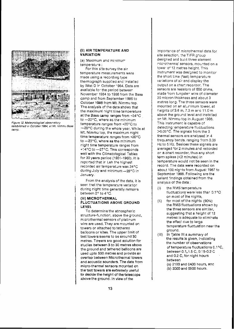
Figure 12. Meteorological obsen/atory established in October 1984, a t Mt. Nimrnu Base camp.
(ii) AIR TEMPERATURE AND VARIATION
(a) Maximum and minimum temperature :
For this site survey the air temperature measurements were made using a recording type thermograph supplied and installed by lMet D in October 1984. Data are available for the period between November 1984 to 1986 from the Base camp and from September 1986 to October 1QB8 fro,m Mt. Nimmu top. The analysis of the data shows that the maximum night time temperature at the Base camp ranges from +-24OC to -22OC, where as the minimum temperature ranges from +20°C to -28°C during the whole year. While at Mt. Nimmu top, the maximum night time temperature ranges from +20°C to --23OC, where as the minimum night time temperature ranges from + l4 "C to -27OC. This corresponds well with the Climatological Tables for 30 years period (1931-1960). I t is reported that in Leh the highest recorded air temperature was 34OC during July and minimum-28°C in January.
From the analysis of the data, ~t is seen that the temperature varratlon during night tlme generally remains between Z0 to 4°C (iii) MECROTHERMAL FLUCTUATIONS ABOVE GROUND LEVEL
To determine the atmospheric structure-function, above the ground, microthermal sensors of platinum wire are used. They are mounted on towers or attached to tethered balloons or kites. The upper limit of test towers seems to be around 30 metres. Towers are good solution for studies between 3 to 30 metres above the ground and tethered balloons are used upto 500 metres and provide an overlap between Microthermal towers and acoustic sounders. The data from micro-thermal sensors mounted on the test towers are extremely useful to decide the height of the telescope above the ground. In view of the
importance of microthermal data for site selection, the TlFR group designed and built three element microthermal sensors, mounted on a tower of 12 metres height. This instrument was designed to monitor the short time (fast) temperature variations of air and display the output on a chart recorder. The sensors are resistors of 600 ohms, made from tungsten wire of diameter 20 micron thickness and about 3 metres long. The three sensors were mounted on an aluminum tower, at heights o f 3.6 m, 7.3 m and 11.0 rn above the ground level and installed on Mt. Nimmu top in August 1986. This instrument is capable of detecting temperature fluctuations >0.05OC. The signals from the 3 thermal sensors are analysed in 4 frequency bands, ranging from 0.05 Hz to 5 Hz. Besides these signals are averaged for 2 minutes and recorded on a chart recorder, thus any short term spikes (<2 minutes) in temperature would not be seen in the record. The data were recorded on about 100 nights from August 1987 to September 1988. Following are the salient findings obtained from the analysis of the data :
( i ) the RMS temperature fluctuations were less than 0.1"C on most of ;he nights,
(ii) for most of the nights (90%) the RMS fluctuations shown by the three sensors are similar, suggesting that a height of 12 metres is adequate to eliminate the effect due to large temperature fluctuation near the ground.
(iii) In Table Ill a summary of the results is given, indicating the number of observations of temperature fluctuations 0.1 "C, between 0.1,1.5 C, 0.1 5-0.2 C and 0.2 C, for night hours between (a) 2100 and 0400 hours, and (b) 2000 and 0500 hours.

I TABLE I l l :
MICROTHERMAL TEMPERATURE FLUCTUATIONS
(a) For 2100 to 0400 hrs.
RMS temp. < 0.1 C 0.1-0.15 C 0.15-0.2 C > 0.2 C fluctuation
Top sensor 1513 6 3 0 Mid sensor 1482 17 6 17 Bottom sensor 1485 13 8 46
(b) For 2000 to 0500 hrs
RMS temp. <0.1C 0.1-0.152 0.15-0.2C > 0 . 2 C fluctuation Top sensor 1827 7 4 0 Mid sensor 1789 19 6 24 Bottom sensor 1753 18 9 59
(iv) RELATIVE HUMlDlTV (RH) The ground level relative humidity
(RH) was measured using a recording hair hygrograph from the Base camp and also from the Mt. Nimmu top. The RH during the night time remains generally less than 60%. However, i t was noted that during the winter season when the ambient temperature is below the freezing point, the relative humidity measurements are not reliable, but RH is expected to be very low.
(v) WIND SPEED AND DlRECTlON An anemometer and wind vane
was installed in October, 1984 at the Base camp. The observations were recorded manually every 2 hours. The direction of the prevailing wind is mostly from the west to east during the afternoon hours, which continues in the same direction until the early hours of the night, thereafter the wind speed considerably decreases.
In October 1985, a recording anemograph was installed at Mt. Nimmu top. From the histograms plotted for the various ranges of wind speed, during different months, it is noted that the wind speed generally remains less than 30 km/hour during night time. However, htgh speed wind upto 50 kmlhour is prevalent during July, August and September months, but mainly during the day t~me.
Normally, the wind picks up high speed in the afternoon and may continue upto 8 or 9 pm, thereafter the wind dies out and it becomes calm around mid-night. Occasionally, higher winds may continue even upto early morning hours, but in no case wind speed higher than 62 kmlhour was ever recorded.
(vi) SUNSHINE A sunshine recorder was used to
estimate the total duration of sunshine. The data obtained from this instrument was used to check the visu8l observations of the cloud coverage during the day.
( 8 ) ASTRONOMICAL PARAMETERS (i) SKY BRIGHTNESS
(a) DAY SKY BRIGHTNESS Evan's sky photometer was used,
to visually measure the day sky brightness in terms of the solar disk. These observations were made 4 times a day from Skara-Leh or fro; Mt. Nimmu, whenever the sky conditions permitted. Marked decrease in the sky brightness valubs were noticed from Mt. Nirnmu top as compared to Skara-Leh, confirming that 500 metres higher elevation considerably improves the sky condition. It may also be due to the fact that Skara-Leh site is located in a comparatively dusty environment, while the Mt. Nimmu terrain is mostly gravel. From the analysis of all the observations, it is noticed that :
12% show sky brightness < 30x10-6 28% observations between 30-60x10-6 12Oio observations between 60-90x 10-6 1 I % observations between 90-120x104 37% observations more than 200x104
of the solar disk. Thus, more than 50% of the time, solar coronagraphic studies could be made from Mt. Nimmu. However, i t may be mentioned that the observed day sky brightness was not sufficiently low, considering the high altitude of 4100 metres. The higher dust content in" the atmosphere is perhaps due to the dust rising from the Sahara, Arabian and Rajasthan deserts. Apparently,

Figurs 13. 20-inch'~havnag8r telescope with : metre FRP astronomEcaldome at the Skara-L site. (photo by K. T. Rajanj
the fine dust from these regions could rise upto even 6,000-7,000 metres height during the summer months. It is noticed that the sky condition considerably improves during the winter months and after rainy season.
(b) NIGHT SKY BRIGHTNESS The dark night sky brlghtness was
measured using the followrng two techniques.
(i) A portable nlght sky brightness measuring photometer was bull% by PRL group and observations were made on a few nights in July 1988, by the PRL team from Mt. Nimmu top. The data indicates an average sky brightness of 20.4 magnitude per square second of arc, in the V band filter.
However, thrs value seems to be rather h~gh, which may be due to the summer month, when the dust content is comparatively high irr the atmosphere in Leh-Ladhak regron.
(ii) The night sky brlghtness measurements were made using also the 20-inch telescope by the IIA teams, through UBV filter at Skara-Leh. The average value of the sky brightness obtained mostly In September and October 1989 are as follows: V = 20.8 i 0.2 mag. per sq. arc sec B = 21.4 i 0.2 mag per sq. arc sec U = 20.7 k 0.2 mag, per sq. arc sec
The site of the 20-inch telescope was in relatively dusty location and also about 500 metres less than Mt. Nimmu, therefore one may perhaps expect increased brightness level of at least 0.25 magnitude from the Mt. Nimmu top.
( i i ) PWEGIPIIABLE WATER QAPOUR (PWV) :
For measuring PWV, a water vapour meter (No.18) designed and built by Prof. Westphal and loaned to PRL was used. This instrument responds to the product of pressure (p) and water abundance (m) (pxm) by comparing the solar intensity in 1.86 micron atmospheric water vapour band, with the intensity in the nearby continuum at 1.65 micron. The limitation of this type of instrument is that it can be used only during the daytime. Thus, the diurnal variation of PWV remains a largely unknown factor. Normally, such water vapour meters tend to be inaccurate for low PWV, in the range of 1 mm or less. However, similar water vapour meters have been used in the past for other site surveys. Hence, it was considered quite appropriate for comparison purposes, in spite of it's limitations. This water vapour meter was taken to the Kiti Peak Solar Observatory for calibration with high precision spectroscopic determination of water vapour column density, using the double pass high resolution solar spectrograph available there. The observations were made during all seasons 4 to 5 times a day (whenever sky was clear).
These observations were made from Skara-Leh observatory (3,600 m) and from Mt. N~mrnu top (4,100 m). A slight variation in the PWV was noticed from these two sites, due to the height difference of about 500 metres, this is considered marginal and within 10-15% of the insttumental sensitivity. Therefore, all observations made from Skara-Leh and Mt. Nimmu were combined. The PWV data were corrected for zenith angle and instrumental calibration. The seasonal variation of the zenith PWV (ZPWV) is quite noticeable, as during July, August and September (rainy season) the average value was around 2.5-3.0 mm, while during dry months of January, February, March,

November and December the average value decreases to 1-1.5 mm. From the histograms of all the ZPWV observations it is concluded that :
15% observations indicate < 1 mm 50% observations indicate 1-2 mm 27% observations indicate 2-3 mm 8% observations indicate > 3 mrn
(iii) PHOTOMETRIC QUAL17'Y OF SKY: E%TlNC"BION
The extinction coefficients in U,B and V filters were determined using the 20-inch telescope at Skara-Leh site by the IIA teams, during their normal stellar photometric observations on 68 nights during 1985-3,988.
The extinction coefficient Kv, Kb and Ku have been found to vary between 0.1-0.3, 0.2-0.4, and 0.4 -0.6 respectively, and the average values obtained are:
K, = 0.07 i 0.04 mag (s.d.) Kb = 0.27 zt 0.01 mag (s.d.) Ku = 0.51 0.04 mag (s.d.)
A seasonal variation of the extinction coefficient was also noticed. During July August, the extinction was higher compared to observations made in other months. Extinction coefficient i n the Infrared bands of J , H , and K was also measured on a few nights in August 1988.
These observations indicate the following : KJ = 0.05 1 0.01 mag KH = 0.04 i 0.01 mag KK = 0.04 i 0.01 mag
(iv) IR SKY RADlATlON AND IR SKY NOISE
The IR sky radiation emission and sky noise measurements are very important for an IR observatory site selection. In the thermal infrared band both the emission from the sky and absorption due to the atmosphere, contribute toward limiting the quality of ground based IR observations. The emission and absorption by the terrestrial atmosphere are directly related. In the case of atmospheric windows, where the water vapour absorption is relatively weak but where the water vapour is a major absorber, the relationship between emission ana sky absorption is monotonic (lower emission means less absorption). Variations in the emission or absorption within the atmospheric windows at 5,lO, 20 microns and longer wavelengths are dominated-by the variations in the water vapour content of the atmosphere. Merrill (refer to NNTT report) has measured the IR sky background radiations with NOAO's IR Sky Background Monitor (IRSB monitor) in 11, 18 and 25 microns wave bands and tried to drive a correlation between the precipitable water vapour and IR sky radiation. In Figure 2 of Merrill's paper "A PreliminaryAssessment o f NOAO/NNTTIR Sky Background Monitor Performance", shows a relation between the emissivity at -1 8.5 micron and the precipitable water vapour (PWV). For low PWV the I R emissivity is also low.
For this site selection, it was not possible to acquire an I R Sky Background Monitor, therefore the- actual values of IR sky emissivity are not available. However, one is able. to derive some estimates of the IR emissivity from the PWV observations. Generally, the zenith PWV value at Mt. Nimmu remains lass than 1.5-2 mm, therefore i t may be presumed that the IR sky radiation would be also quite low.

Figure 74. Samf
(v) ASTRONOMICAL 'SEEIING'
The astronomical night time seeing has been measured from Mt. Nimmu top using the following two methods :
(1) From polar trails : Walker's 'polar trail' method (1 970)
has been widely used for several site surveys, and it provides seeing measures comparable on a world- wide basis. Further, the technique is simple for remote sites and requires minimum infra-structure. A 15-cm aperture f/15 refracting Zeiss coude telescope was used, with a 9 rnm focal length eye piece enlarging lens to yield an image scale of 15 arc sec/mm, exactly the same as Walker's polar trail experiment. It was very difficult to transport the heavy 15 cm coude telescope to Mt. Nimmu top, because of non-availability of a proper road. Therefore, the telescope was dismantled and carried by a helicopter directly to the top of Mt. Nimmu, in September 1986. The telescope was mounted on a one meter high pillar, without a dome. Thus the objective lens was about 3.5 m above the ground level. The Polar trail exposures were made every two hours through a RG-2 filter and exposed for 10 minutes, on ORWO 25 ASA fine grain film and developed for 4 minutes in 50% diluted D-19
)le polar trails exposures taken from Mt Nimmu indlcattng variation of seelng.
17
developer at 20°C.These exposures were made every two hours during the night, whenever the sky condition and wind (less than 40 kmlhour) permitted.
The detailed analysis of polar trail observations for estimating the stellar 'seeing' indicates that the best seeing of about 1 arc second is available during October, November and December months, (obtained by comparing wrth Walker's polar trails). However, the median value of all the observations is between 2-3 arc seconds. Seasonal variation of 'seeing' has been also noticed. Generally, the seeing is poor during the summer months. The variation in observed seeing due to wind speed, temperature and relative humidity was studied. With higher wind speeds the seeing seems to deteriorate. At lower ambient air temperature the seeing seems to improve, which substantiates that the seeing improves during the winter months. The relative humidity does not seem to have any noticeable effect on seeing.
(ii) Double Beam Telescope (DBT) From the measurement of
differential image motion of stars, i t Is possible to determine with precision the image quality and from it one could infer the stellar seeing. A double beam telescope, utilizing this principle of differential star motion was designed and built by the TlFR group. This instrument was installed on Mt. Nimmu in August 1988. As it was made available only towards the end of the project, hence observations on only 14 nights could be taken during August and September 1988.
The salient results of these observations are summarized in Table IV.

Figure 15. Double beam telescope at Mt N~mmu. Seen in the background are insulated hut and wind charger. (Photo by B. C.Bhatf).
TABLE V : A COMPARISON OF 'SEEING' ESTIMATES OBTAINED BY METHODS
Wind speed & direction
km/h
35 NW
35 NW 25 20 30
32 NW
35
42NW 38 NW 44 NW 15 NW 25 NW 35 35 25 NW 20 NW 20 W
32 W 30 W
36 NW
DOUBLE BEAM TELESCOPE
Date Double beam data
1988 Time Seeing I ST Arc sec.
1018 21 :30 lU-2" 1118 21 :OO 2"-3"
21 :oo 1"-2" 00:20 2"-3" 03:OO 1" 03:OO 1u-2"
1218 21 :00 lV-2" 13/8 0O:OO lW-2"
0O:OO 1" 18/8 22:30 1"
22:30 jW-2" 19/8 00:40 1v-2"
00:40 1" 19/8 21:OO 1"
21:00 1"-2" 20/8 21 :OO 1"
24:OO 2"-3" 21:oo 1" 24:OO 211-3"
24/8 23:50 10"
29/8 20:30 10-2"
30/8 20:15 lN-2" 23:45 lv-2"
31 /8 20:15 1 " 23:31 1"
01/9 02:30 jw-2" 03:OO I *'
06/9 1957 2"-3" 07/9 203 3 2"-3"
23:lO 2"-2"
AND POLAR TRAIL
Polar trail data
Time Seeing I ST Arc sec. - -
21 :00 6 - -
23:15 6"
21:15 6" 23:OO 4"-6" 01 :00 2"-3" 21 :59 2"
01:12 2"-3"
21 :05 6" 21 :30 2"-3"
21 :35 10" 00:43 6" 02: 13 6" 21:15 2"-3" 23:OO 2"-3" 20:45 6" 09:Ol 2"-3" 20:45 4"-6" 23:40 2"-3" 01 :OO 2"-3"
21 :03 2"-3" 20:5Q 2" 23:OO No image 0054 2"-3"

SEEING ESTIMATES FROM DBT IN SECONDS OF ARC.
No. of (seeing ) (seeing) samples" (35 El) (90 El)**
3 0.7" 0.5" 43 0.7-1.1 0.5-0.8 58 1.1 -1.6 0.8-1.1 71 1.6-2.0 1.1-1.4 141 2.0-2.7 1.4-1.9 96 2.7-3.6 1.9-2.6 91 3.6-4.7 2.6-3.4 23 4.7-6.0 3.4-4.3
* each samples averages 16 seconds of time. ** extrapolated to zenith.
It may be noted that TABLE IV is for long exposure image sizes for 35' degrees elevation (for polaris) and the zenith (90°)The original data is for the relative image motion and it has been converted using the formulae from literature to get the above Table (Ulick, B.L, and Davison, W.B., 1985, PASP, 97, 609)
The conversion factors are : One dim. image motion for35"EI 0.5 0.7 0.9 1.15 1.45 1.8 2.25 2.75
Est. long exp.image size for35OEI 0.92 1.36 1.81 2.32 3.16 4.1 5.3 6.7
A comparison of 'seeing' estimates obtained by the double beam telescope and polar trail method was made and is given in the TABLE V. Further, the two methods yield slightly different parameters. The polar trail method gives an integrated effect of image blurring and image motion, while the double beam telescope yields only image motion. The seeing estimates obtained by the two methods do not generally tally. This may be due to the location of the two telescopes, as the 15-cm Zeiss coude polar trail telescope was mounted on the top of Mt. Nimmu and was about 3.5 metres above the ground, while the double beam telescope was mounted some 100 metres,away, in a depressed area below the top of the peak and the telescope objectives were reiatively near the ground level.

8. SPIN OFF FROM PROJECT WORK
(i) The completion of this multi- institutional project, involving all major astronomical institutions in the country, to work for a common goal of site survey for a National High Altitude Observatory is a trend setter. The Department of Science and Technology motivated several scientific groups to develop techniques and special instruments such as the DOUBLE BEAM TELESCOPE, MICRO-THERMAL TOWER, ALL SKY CAMERA etc., which would be extremely valuable for future investigations of this nature. This was possible largely due to the personal interest taken by Prof R.R. Daniel and Dr. P.J. Lavakare, Advisor to DST and importantly the commitment and initiative of the scientific community.
During the course of this investigation, several workshops and meetings were held of the participating institutions. A comprehensive search for SITE SURVEY LITERATURE has resulted in locating more than 40 important references. This bibliography will be
Figure 16. Rest house-cum-laboratory space at valuable guidance for future ~ t . ~ i m m u base camp. investigations.
Flgure 77 Insulated hut and solar volta~c panels on Mt N~mrnu top,
(ii) Establishment of Base Camp The Mt. Nimmu top is 4100 metres
above sea level, while the base is at 3800 metres.Pending construction of an access track to Mi. Nimrnu, it was decided in 1984, to install the Meteoroiogical instruments at the base of M:. Nimrnu. A srnal! two roonl house with "Trombe walls" to utiiise solar energy for keeping the h o u s ~ warm was constructed. This housa could accommodate 3-4 people anci proved useful as a "Base Camp" for all operations on top of the mountairi. The weather station and the D.C.P. were installed at the base camp in October 1984 and October 1985 respectively.
(iii) Development of access road Serious problems were faced to
make an approach track to Mt. Nimmu top. At one time, it was felt that it would be desirable to abandon plan for taking observations from the top and be content with operating from the Base camp. The cost estimates of just making a survey and mapping of shortest route to the top by a government agency, was several lakhs of rupees and therefore the cost of construction of a road was beyond the budget estimates of the entire project. However, a dedicated team of 6 to 10 people from the local Field Research Laboratory (DRDO), were able to make a "mule track" in about 30 days, at a cost of just a few thousand rupees. The track in course of time was widened to transport even heavy equipment and the components for the insulated hut that was later erected on Mt. Nirnmu top.
(iv) Insulated hut on Mt. N~rnmu top The f~e ld observers stat~oned on
Mt. N ~ m m u needed a shelter. lnit~ally an improvised bunker dug out in the ground and covered with FRP 15 feet" canopy was used to shelter the staff, this was h~ghly unsatisfactory. Later, an insulated hut 9'x 12' was des~gned by US0 group and fabricated at PRL workshop, Thls was installed in October 1987. The temperature inside this hut was reasonably comfortable

Figure IB. First landing of a helicopter on Mt. Nimrnu top in August 1986.
Figure 19. Helicopter lowering the heavy pier of the 15 cm coude telescope on Mt. Nimmu top.
F~gure 20. Coude telescope being installed on Mf. Nimmu.
(10°-120C), even during the winter months, when the temperature outside was -20 '~ . It had a large double walled glass opening to trap solar energy inside and was heavily insulated to ensure good comfort and warmth. The shelter was used to keep sensitive instruments and could accommodate two or three observers and also some space for cooking food.
(v) Transportation of telescope The 15-cm coude Zeiss telescope
is too heavy and bulky and the track up to the mountain top was not wide enough to transport it. Hence the assistance of the Indian Air Force was sought to transport the telescope by a helicopter. A small heiipad was also built on the top. Thus Mt. Nimmu peak has become accessible by air ! (vi) Power requirement.
Photovoltaic power panels were provided by DNES and were used to provide electric power to operate essential equipment and for lighting purposes at Skara-Leh observatory. portable generating sets both at Skara-Leh base observatory and at MY. Nimmu top were also available. Sorne of the sensitive instruments on top of Mt. Nirnrnu were fed by another set of photovoltaic panels as well as by wind chargers, provided by DARL, Almora.
(vii) Water requirement. Water for the base camp and MZ.
Nimmu top had to be carried in jerrycans ail the way from Skara-Leh observatory. Attempts were also made to "harvest" the snow fall by digging a coliection area on Mt. Mimmu top and lining the dug out portion with a plastic film and by melting snow.
(viii) Sanitary system. Septic tanks were dug out at
Skara-Leh observatory and at the base camp, but they did not work during winter months.
(ix) Transport The observers invariably had to
walk up the 3 km stretch from the

Figure 21. 15 crn &perlure Ze~ss coude telescope in conjunction w~th image enlarging system on Mt Nimrnu top
base camp to Mt. Nimmu top. However, occasionally mules were also available. Water, food materials, fuel and equipment were generally hauled up by local people, mules and
9. PROBLEMS FACED LESSONS LEARNT
yaks,
The project team faced several problems in :
(a) establishing a base camp at Mt Nimmu base,
(b) developing of access road to Mt. Nimmu top,
(c) providing shelter to observers at Mt. Nimmu top, where the temperature drops to below -20°C.
(d) arranging reliable power supply for operating sensitive instruments, and
(e) transport, water and provision of reasonable sanitary living conditions.
It is felt that for any future
( investigation in a very difficult and
hostile climatic conditions, the problems connected with creation of infra-structure and facilities should be first carefully examined and solutions sought, before embarking on a major programme of this nature.
Important lessons have been learnt during the course of the project. Foremost-among them are the following :
(I) All prospectrve s~tes must be first subject to a prellmlnary examlnatlon of the cloud coverage, other meteorolog~cal quantltles and logistic problems If we had made a seriods attempt to get all available cloud cover data for Leh and made an analys~s of them, we mlght not have undertaken this project
(11) The state-of-the-art of the space photography have now advanced to a stage where even 5 km resolution photographs are readily available The future lnvestigatlons of thls nature should utrl~ze these data to evaluate the topography and cloud cover before large man-power and f~nancial comm~tments are made.
(111) DST's efforts for thls multl- instrtutional project provided rich dlvldends I t IS recommended that thls trend of co-operatwe multl- ~nstttutional programmes be kept up. However, ~t would be des~rable to have at least one dedicated young scrent~st assocrated on a full-tlme basis, for such future investtgal~ans Associatron of the field workers who were rnvolved In thrs project, ~f avarlable, may prov~de useful help partrcularly In avoidlng prtfalls learnt from t he~ r personal experiences

18. COMPARlSON OF To evaluate the suitability of Mt.
RESULTS WITH OTHER Nimmu for a high altitude
HIGH ALTITUDE astronomical observatory site, all important and necessary parameters
OBSERVATORIES OF THE (except for the measurement of I R
WORLD sky radiation in 10 microns and longer wavebands) have been obtained, in an exhaustive manner for over two years and covered all seasons.
The results of this site survey were compared with other established high altitude observatories in the world (e.g. Mauna Kea, Hawaii and La Palma in Canary islands).
A comparison of the usable hours and nights available for photometric and spectroscopic work, at various observatory sites is given in TABLE VI.
TABLE VI : COMPARISON OF ASTRONOMICAL SITES
Location Altitude Lat. & Average no. % of useful (metres) long. hours/year nights per
(photo.& year spectro.) (per year)
1. Mt. Nimmu 41 00 +34O 09' 1600 52 77 O 34'E
2. Kavatur 725 +12O 34' 1535 4 1 78" 49'E
3. Gurushikhar 1700 +24O 36' 1900 58 72'43'E
4. Nainital 1927 +29O 21' 1900 65 7Q0 42'E
5. Japal-Rangapur 554 +17O 6' 1700 58 78O 43'E
6. Mauna Kea 421 5 t1g0 49' 2800 87 155O 28'W
7. Las Campanas 2280 -29' 00' 251 0 78 70" 42'W
8. Cerro-Tololo 221 5 -30' 10' 78 70' 49'W
9. Mt. Palomar 1706 +33O 21' 2200 68 116°51fW
10. La Palma 2300 +28O 45' 241 0 75 17O52'W
From a detailed analysis of the data and comparing with established high quality observatory sites in the world, it is concluded that the Mt. Nimmu site is acceptable as regards the following parameters:
(i) Zenith precipitable water vapour (ZPWV),
(ii) temperature variation (AT) during night time,
(iii) wind speed and direction, (iv) relative humidity, (v) astronomical "seeing", (vi) day sky brightness (marginally
accedtable), (vii) night dark sky brightness
(marginally acceptable), (viii) extinction coefficient in UBVlJH
bands, and (ix) microthermal temperature
fluctuations.
Due to the low percentage of the available clear weather, this site may not be acceptable for optical observational astronomy.
11. WECOMMENDAT98W FOR THE FUTURE
If %)as been found that on an
average onfy 52% wseful nights per
year are available af ML Nfmmu9
therefore this site mqy not be as goo&
as the best sites elsewhere in the
warfd for brge opflccel astronomical
observatories. Even wBdhin fn@IiaI
other comparable obsersrirt~ries
seem to Be marginally better than Me
Nlmmu.

LIST OF INVESTIGATORS AND INSTITUTIONS
NAME OF INSTITUTION NAME OF INVESTIGATORS
1. TATA INSTITUTE OF R. R. DANIEL FUNDAMENTAL RESEARCH, BOMBAY S.N. TANDON
2. INDIAN INSTITUTE OF ASTROPHYSICS, J. C. BHATTACHARYYA BANGALORE. JAGDEV SlNGH
3. PHYSICAL RESEARCH LABORATORY, P. V. KULKARNI AHMEDABAD. J. N. DESAl
4. U.P. STATE OBSERVATORY NAINITAL.
5. OSMANlA UNIVERSITY, HYDERABAD.
6. PUNJABI UNIVERSITY, PATI ALA.
7. DEFENCE RESEARCH AND DEVELOPMENT ORGANISATION
8. MEDIA METEROLOGICAL DEPARTMENT
9. UDAIPUR SOLAR OBSERVATORY
I UDAIPUR. (Nodal institution) I
M. C. PANDEY H. S. MAHRA
M. B. K. SARMA K. D. ABHYANKAR
H. S. G U R M
DIRECTOR GENERAL
A. BHATNAGAR

REVIEW-CUM-MONITORING COMMITTEE FOR PROJECT ASTRONOMY LEH-LADWAK
1. PROF. R. R. DANIEL TIFR Chairman 2. DR. P. J. LAVAKARE DST 3. PROF. J. C. BHATTACHARYYA IIP, 4. PROF. S. N. TANDON TlFW 5. DR. M. C. PANDE UPS0 6. DR. W. S. MAWRA UPS0 7. DR. S. M. KULSHRESTHA lMD 8. DR. M. C. JOSH1 DARL 9. PROF. A. BHATNAGAR US0
Project Coordinator 10. SHRI S. L. GANDHl Project Officer
STEERING COMMlTTEE FOR
PROJECT ASTRONOMY LEH-LADHAK
(Constituted in Nov.1981 by DST)
PROF. M. K. V. BAPPU IIA Cha~rrnan PROF. P. V. KULKARNI PRL PROF. J. C. BHATTACHARYYA IIA DR. A. BHATNAGAR US0 DR. C. D. KANDPAL UPS0 PROF. R. R. DANIEL TlFR DR. M. K. TIWARI ISRO, HCI
SCREENING COMMlTTEE FOR
PROJECT ASTRONOMY LEH-LADHAK
1. PROF. G. SRINIVASAN RRI Chairman 2. DR. K. KASTURIRANGAN ISRO 3. DR. A. BHATNAGAR US0 4. PROF. R. R. DANIEL Ti FR 5. DR. H. S. MAHRA UPS0 6. PROF K. R. SIVARAMAN IIA 7. PROF. M. S. VARDYA TIFR 8. SHRl S. L. GANDHI Special lnvitee 9. DR. K. Rt GUPTA DST Convenor

1. High altitude Atmospheric water vapour Measurements in the Himalayan Region. (1983) Chandrasekhar T. Sahu, K.C., and Desai, J.N., lnfrared Phys. Vol. 23, No. 2, 119.
2. Photoelectric observations of R Cr B during the recent light minimum (1986), Ashoka, B.N. and Pukalenthi, S., Information Bull. on Variable Stars. IAU Commission-27.
3. Occultation of SAO 185428 by 336 Lacadiera (1986), Arvind Paranjpye and Babu, G.S.D., Current Science, 55, 1020.
4. Extinction measurements at Leh (1988), Jagdev Singh, Bhattacharyya, J.C., Raveendran, A.V., Mohin, S., Ashoka, B.N., Rajamohan, R., Jayakumar, K., Rozario, M.J., Kuppuswamy, K., Arvind Paranjpye, Appakutty, M. Pukalenthi, A,, Munaindi, A., Murthy and Selvakumar, G., Bull. Astr. Soc. India, 16, 15.
5. Technical Report (1987), Bhattacharyya, J.C.. Proposed high altitude observing facility research proposal.
6. Observing conditions for optical astronomy at Leh (1 989), Jagdev Singh, Bhattacharyya, J.C., Babu, G.S.D., Ashoka, B.N., Appakutty, M., Rangarajan, K.E., Narayanan Kutty, K., Moorthy, V., Selvakumar, G., Michael, P., Muniyandi, A. and Gabriel, F., Bull. Astr. Soc. India. 17, 83.
7. Atmospheric extinction at Leh in near Infrared bands (1990) Bhattacharyya, J.C., Scaria, K.K., JagdevSingh, Babu, G.S.D., Muraleedharan Nair and Sivaraman, K.R., Bull. Astr. Soc. India., 18, 1.
8. Some further characteristics of observing conditions at Leh (1990), Jagdev Singh, Bhattacharyya, J.C., Babu, G.S.D., Appakutty, M., Kuppuswamy, K., Moorthy, V., Devendran, P., Velu, C. and Sivakumar, R., Bull. Astr. Soc. India, 18, 7.
9. A double-beam photoelectric seeing Monitor : Bisht, R.S., lyengar, K.V.K., and Tandon, S.N., (1990) PASP, 102,599.
1. Night time skies above the Canary islands: Murdin, P. 1985, Vistas in Astronomy 28, p. 449
2. Polar star-trail observations for Astronomical seeing in Arizona, Baja California, Chile and Australia: Walker, M.F. 1971, PASP 83, p.401
3. Astronomical site testing in the Canary islands: Mclnnes, B., and Walker, M.F., 1974, PASP 86, p.529
4. Microthermal fluctuations and their relation to seeing conditions at Roque de Los Muchachos Observatory La Palma: Hartley, M., Mclnnes, B., and Smith, F.G., 1981, Quarterly J. R ~ y a l Astron. SOC., 22, p. 272
5. Observatorio del Roque de 10s Muchachos The Swedish Experience: Ardeberg, A., 1984, ESO Workshop on Site Testing for future large telescope, La Silla 4 6 Oct. 1983, No. 18, p. 73
6. Site testing at the Roque de Los Muchachos Observatory: Ardeberg, A., Simpson, S., and Wiesel, T., 1984 Proc. Nordic Astron. Meeting. Sept. 3 5, 1984, Obs. and Astro. Lab., Univ, of Helsinki, Report 6194, p. 115-120
7. Internal report on site quaiity : Scharmer, G. 1985 Royal Swedish Academy
8. Instrumentation for recording of microthermal and image quality data : Ardeberg A,, Hansson, N., Obsen, E., Simpson, S.K., and Wiesel, T. 1984, Lund Observatory Report No. 19, p. 1 10.
9. Site testing on Hawaii, Madiera and the Canary islands : Mclnnes, P., 1981, Quarterly J. Royal Astron. Soc. 22, p. 266 271.
10. Evaluation of Mauna Kea, Hawaii as an Observatory site: Morrison, D., Murphy, R.E., Cruikshank, D.P., Sinton, W.M., and Martin, 1 T.Z., 1973, PASP , p.255
11. International conference on the identification, optimization and protection of optical telescope sites held at Flagstaff Arizona in May 22 23, 1986, following important papers on site surveys were presented :
(i) Site testing with an acoustic sounder at McDonald Observatory theory and practice: Baker, E.S., p. 49
(ii) Acoustic soundings of optical telescope sites : Forbes, F.F., p. 58
(iii) The Physics of seeing: Application of theory to site evaluation and testing, Roddier, F., p. 12
(iv) Determination of the quasi- instantaneous estimate of the Fried parameter from high spatial resolution astronomical observations: Christou, J.C. and Keith Heg, E., p. 64
(v) Seeing and the University of Sydney Stellar interferometer programme A progress report: Davis, J.O., Byrne, J.W., and Tango, W.J., p. 68
(vi) Seeing measurements with a pupil plane rotation shearing interferometer: Roddier, C., and Roddier, F., p. 77
(vii) Seeing measurements with the multiple mirror telescope: Ulick, B.L., p. 82
(viii) The physics of seeing: Coulman, C.E., p. 2
(ix) Characteristics of the observatory site of the Max- Planck lnstitut fur Astronomie: Elsaser, H., p. 122
(x) Characteristics of optimum sites Walker, M. F., p. 128
(xi) Out of site out of mind the common sense of site selection: Woolf, N.J., p. 119

(xii) NNTT site evaluation project : An overview: Merrill Michael,K., p. 30
(xiii) Modern methods of site testing: Ardeberg, A,, p. 20
(xi?) Identification of optimum sites f o i daytime and nighttime observations at Mauna Kea Observatory, Erasmus, A.D., p. 85
(xv) Carnegie lnstitutior; of Washington Southern Observatory site survey, 1963 68: Babcock, H.W. and Irwin, J.B., p. 89
(xvi) Existing and potential telescope sites in China: Qubin, L., p. 103
(xvii) South pole as a site for stellar photometry: Chen, K.Y., Oliver, J.P. and Wood F.B., p. 106
(xviii) Economy, figure of merit for large telescope sites: Beckers, J.M., p. 138
(xix) Progress of the site testing for the ESO VLT: Ardeberg, A., Lindgren, H., Luncistrom, I., and Sarazin, M., p. 94
(xx) Telescope sites: Summary and conclusions: Beckers, J.M., p. 212
(xxi) A modern approach to the assessment of astronomical seeing: Brosterhes, E.B.F., p. 40
12. Prospects for development of ground based optical astronomy: Efremov, Yu, N., Novikov, S.B. and Shcheglov, P.V. 1975, Sov. Physics Usp., 18, No. 2, p. 151
13. The Physics of seeing programme of final report on the initial experimental phase: C.R. Lynds, 1970, private circulation obtain from the author, KPNO, Tucson.
14. In IAU Symposium No. 27 on the construction of large telescope by Crowford 1966, interesting problems on astronomical site development have been
discussed
15. Observatory-site reconnaissance Lynds Royer, and Goad Jean, W.,The NNTT technology development program report No 7
16. NNTT site evaluation project, Assessing Image quality h'lerrill, K.M., NNTT Technicai Report.
17, A preliminary assessment of NOAA/NIVTT inira-red sky background monitor periormanc: Merrill, K.i\ii., NNTT Technical .Report.
18. Pianniiig the National New Technology Telescope (NNTT)) site survey instrumentation: Forbes, F.F., Morse, D.A., and Poczulp, H.,1986 NNTT Report No. 8.
19. Planning the National New Technology Telescope (NNTT) Vl I: site evaluation project observation and analysis procedures: Merrill, K.M., Forot, G., Morse, D., and Poczulp, G. 1986, NNTT Report No. 8.
20. Night sky brightness at observatories and sites: Garstang R.H., 1989 PASP 101, p. 306.
21. Atmospheric and facility seeing on Mauna Kea, Hawaii: Ravine Aene et.a1.,1989, PASP 101, p. 436.
22. Precipitable water vapour conter above Pico Veleta: Quesada, J.A 1989, PASP, 101, p. 441.
23. Water vapour radiometer: Buscher, E., and Lemke, D., 1980, Infra-red Phys. 20. 321.
24. Site survey for an infra-red observatory: Bhatnagar, A., 1974 Proc. of seminar on "lnfra-red ar millimeter range astronomy", Hyderabad Feb. 1974, p.
25. Regarding acute mountain sickness in medical literature: Hulgren, H.N., and Lundberg, E. 1962 in "Modern concepts of cardio vascular disease", 31, p. 719.

26. Cautions for astronomy's golden age: Wolff, S.C., 1988, Mercury p. I 28
27. A four year comparison of astronomical observing conditions at seven observatories, Baum, W.A.,and Ferguson, H.M., 1974, paper presented at AAS meeting in Rochester, New York, Aug. 1374.
28. Characteristics of water vapour over Kitt Peak: Wallace, L., and Livingston, W.C., 1984, PASP, 96, p. 182.
29. Atmospheric modulation transfer function for desert and mountain location: The atmospheric effect on r . Walkers, D.L., and Kunkel, K.E., 1981, J. Opt. Soc. Am. 71, p.397.
30. Atmospheric modulation transfer function for desert and mountain Iodations measures: Walters, D.L., 1981, J.Opt Soc. Am., 71, p. 406.
31. Atmospheric absorption between 4 and 30 cm measured above Mauna Kea: Moffat, P.H., Bohlander, R.A., Macrae, W.R., and Gebbie, H.A., 197, Oct. 22, Nature, 269, p. 679.
32. Vertical path atmospheric MTF measurements: Walters, D.L., Favier, D.L., and Hines, J.R., 1989, J.Opt. Soc. Am., 69, p. 828.
33. Precipitable water vapour measurements with the 22 GHz test receiver: Bobby Ulich, 1984, SMT technical memorandum UA- 84-2 University of Arizona (private circulation).
34. Optical scintillation: A survey of the literature: Mayer Arendt, J.R., and Emmanuel, C.B., 1965, National Bureau of Standards, Technical Note 225.
35. Following papers concerning site selection appeared in the proc. of the workshop on "ESO's very large telescope" held at Cargese, 16-19 May 1983, Ed. Swings, J.P., and Kjar, K.
( i ) Site selection for a very large telescope: Ardeberg, A,, p. 217.
(ii) Testing seeing quality: Roddier. F., p. 225.
(iii) Speckle site testing: Weight, G., p. 263.
36. The effects of atmospheric turbulence in the optical Astronomy: Roddier, F., 1981, Progress in optics, E., Wolfed. Voi. 19, p. 281.
37. Daytime and nighttime r measurements at La Palma in June 1982: Borgnino, J., arid Brandt, P.N., 1983, JOSO Report. 38. A star-trail telescope for astronomical site testing: Harlan, E. A,, and Walker, M.F., 1965, PASP, 77, p. 246.
39. Polar trail observations: Walker, M.F., 1970, PASP,82, p. 672. Walker, M.F., 1971, PASP, 83, p. 41.
40. Relation between 10.7 cm solar radio flux and dark sky in U, B, V: Walker, M.L. 1988, PASP, 100, p. 496.
41. For seismic activity the following references :
(i) Evolution of the Himalaya based on seismo-tectonic and deep seismic sounding: Kaila, K.L., and Narain, H.,1976, Proc. Int. Him. Geo. Sem. (New Delhi).
(ii) Atlas of isoseismal maps of major earthquakes in India: Kaila, K.L., and Sarkar, D., 1978, Geophysical Res. Bull. 16 (4), p. 233

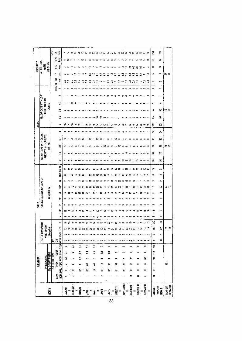


ST
AT
ION
: Mt.
Nim
mu,
top
(Leh
) Con
td.