aus cover perth 6 june 2016
TRANSCRIPT
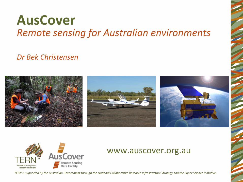
AusCover Remote sensing for Australian environments Dr Bek Christensen
www.auscover.org.au

AusCover Produc1on and delivery of na#onally consistent long-‐1me series of satellite-‐based biophysical map products and next genera1on remote sensing research data that is validated for Australian condi#ons.
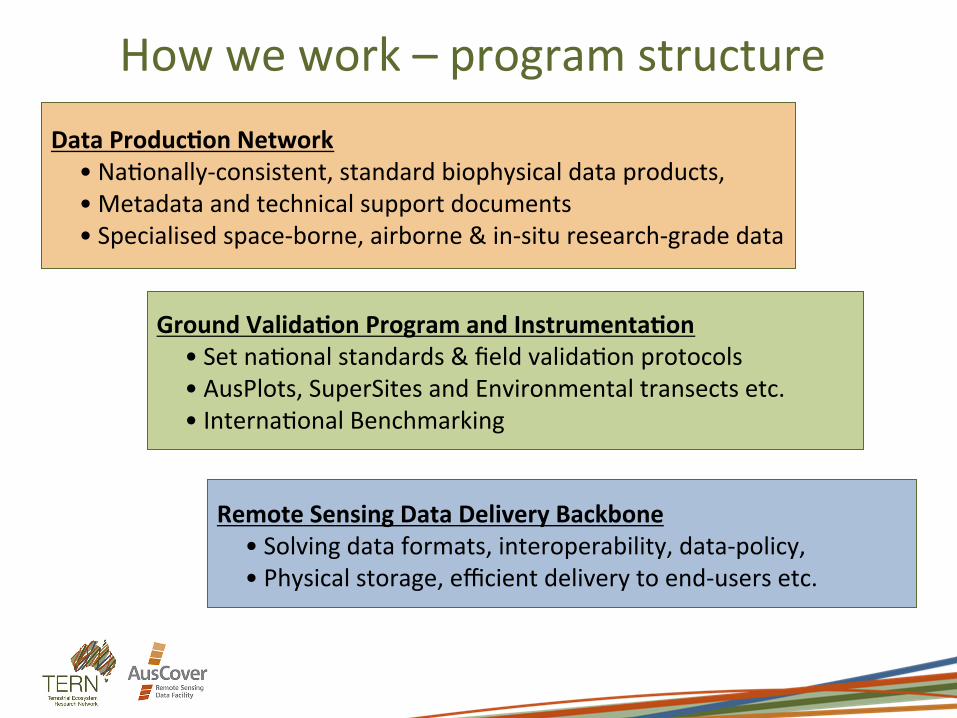
Remote Sensing Data Delivery Backbone • Solving data formats, interoperability, data-‐policy, • Physical storage, efficient delivery to end-‐users etc.
Data Produc;on Network • Na1onally-‐consistent, standard biophysical data products, • Metadata and technical support documents • Specialised space-‐borne, airborne & in-‐situ research-‐grade data
Ground Valida;on Program and Instrumenta;on • Set na1onal standards & field valida1on protocols • AusPlots, SuperSites and Environmental transects etc. • Interna1onal Benchmarking
How we work – program structure

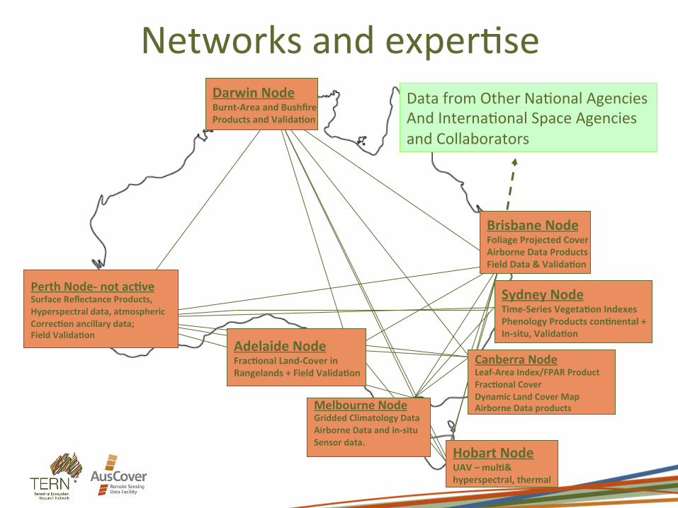
Perth Node-‐ not ac;ve Surface Reflectance Products, Hyperspectral data, atmospheric Correc;on ancillary data; Field Valida;on
Data from Other Na1onal Agencies And Interna1onal Space Agencies and Collaborators
How we work – na1onal network
Hobart Node UAV – mul;& hyperspectral, thermal
Melbourne Node Gridded Climatology Data Airborne Data and in-‐situ Sensor data.
Adelaide Node Frac;onal Land-‐Cover in Rangelands + Field Valida;on
Canberra Node Leaf-‐Area Index/FPAR Product Frac;onal Cover Dynamic Land Cover Map Airborne Data products
Sydney Node Time-‐Series Vegeta;on Indexes Phenology Products con;nental + In-‐situ, Valida;on
Brisbane Node Foliage Projected Cover Airborne Data Products Field Data & Valida;on
Darwin Node Burnt-‐Area and Bushfire Products and Valida;on
User Reference Group Current AusCover User Advisory Group membership:
Dr John Leys (OEH) Dr Shan1 Reddy (DoE) Dr Dan Tindall (DSITI) Dr Michele Barson (Dept of Ag) Dr Peter Stone (CSIRO) Prof Phil Tickle (CRCSI) Dr Stephen Roxburgh (CSIRO) Dr Andrew Edwards (CDU) Dr Brendan McAtee Dr Wendy Thompson Dr Stephen van Leeuwen (DoPWS) Dr Lalage Cherry (DoE -‐ ERIN)

Infrastructure
• Data products – satellite, airborne, field • Data delivery and access • Tools and protocols • Networks and exper1se

Landcover dynamics and phenology
• Frac1onal cover • Persistent green • Phenology
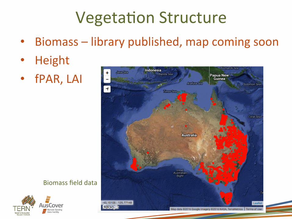
Vegeta1on Structure • Biomass – library published, map coming soon • Height • fPAR, LAI
Biomass field data
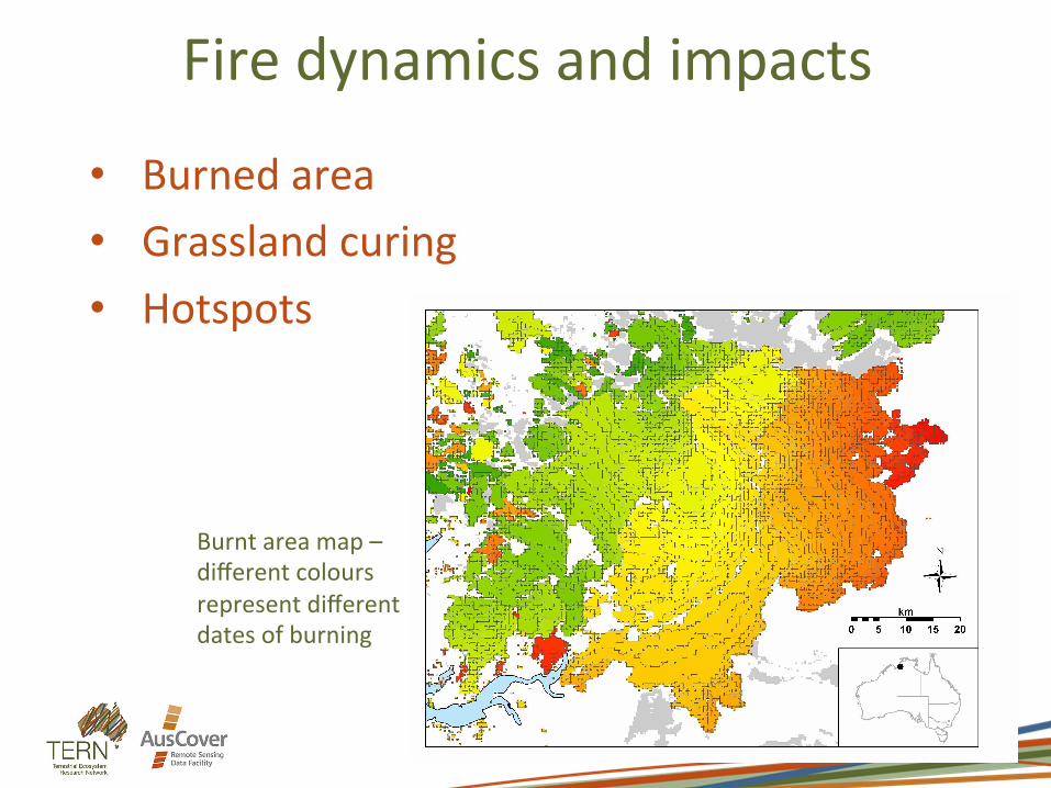
Fire dynamics and impacts
• Burned area • Grassland curing • Hotspots
Burnt area map – different colours represent different dates of burning

Cal/val
• Star transects + tree structure • Terrestrial LiDAR (TLS) • Hemispherical photos • Airborne hyperspectral and LiDAR Hemi photo, Chowilla
TLS scan, Tumbarumba

Other environmental data
• Water vapour • Cloud • Surface reflectance • Rainfall • Air temperature • Water vapour pressure • Solar radia1on • Land surface temperature
Daily solar radia1on
Daily rainfall
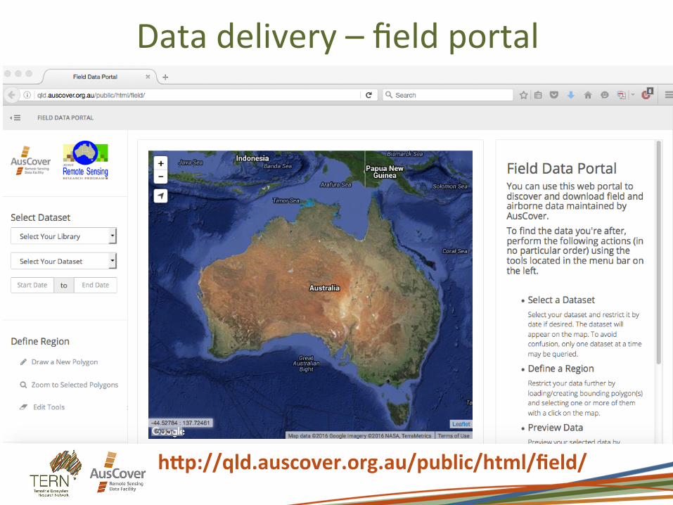
Data delivery – field portal
hVp://qld.auscover.org.au/public/html/field/

Data delivery h^p://auscover.org.au/data/product-‐list

Data delivery
Links to detailed metadata (Xwiki), data download, visualisa1on tool and status updates as relevant

Data delivery – metadata lis1ng
E.g.-‐ h^p://www.auscover.org.au/xwiki/bin/view/Product+pages/Landsat+Frac1onal+Cover
• Preview image • Link to data • Data licence and
access rights • Alternate 1tle • Abstract/summary • Spa1al extent
• Temporal extent • Point of contact • Credit • Keywords • Data quality • Valida1on status • Related products
• References • Algorithm
summary • Version history • Metadata history
Metadata includes:

Protocols and tools • Data handling and processing standards • ‘Good prac1ce guidelines’ for field cal/
val • Geo-‐Wiki
Perth Node-‐ not ac;ve Surface Reflectance Products, Hyperspectral data, atmospheric Correc;on ancillary data; Field Valida;on
Data from Other Na1onal Agencies And Interna1onal Space Agencies and Collaborators
Hobart Node UAV – mul;& hyperspectral, thermal
Melbourne Node Gridded Climatology Data Airborne Data and in-‐situ Sensor data.
Adelaide Node Frac;onal Land-‐Cover in Rangelands + Field Valida;on
Canberra Node Leaf-‐Area Index/FPAR Product Frac;onal Cover Dynamic Land Cover Map Airborne Data products
Sydney Node Time-‐Series Vegeta;on Indexes Phenology Products con;nental + In-‐situ, Valida;on
Brisbane Node Foliage Projected Cover Airborne Data Products Field Data & Valida;on
Darwin Node Burnt-‐Area and Bushfire Products and Valida;on
Networks and exper1se

In development (2016-‐2017) • UAV (mul1spectral, hyperspectral, thermal,
LiDAR) • New data streams, e.g. Himawari-‐8, RADAR,
Sen1nel1&2 • Improved user-‐friendliness – online tools to
visualise and explore data products

16/17 and beyond • Reinvigora1ng na1onal network • Improving useability for non-‐research
audience • Engaging user community now to understand
needs for the future…

Links AusCover website – www.auscover.org.au AusCover data products list -‐ h^p://auscover.org.au/data/product-‐list Field data portal -‐ h^p://qld.auscover.org.au/public/html/field/ AusCover Geo-‐Wiki -‐ h^p://www.geo-‐wiki.org/branches/auscover/

Contacts Bek Christensen – Engagement, [email protected] Alex Held – Facility Director, [email protected] Ma^ Paget – Data and Systems Coordinator,