australian bureau of meteorology space weather services ... sww2016... · • originally...
TRANSCRIPT
Australian Bureau of Meteorology
Space Weather Services:
Recent Initiatives
Phillip Maher, Mike Terkildsen, Vickal Kumar, Zahra Bouya, Graham Steward, Vasili Lozbin, Richard Marshall.
SWPC Space Weather Workshop
28 April 2016
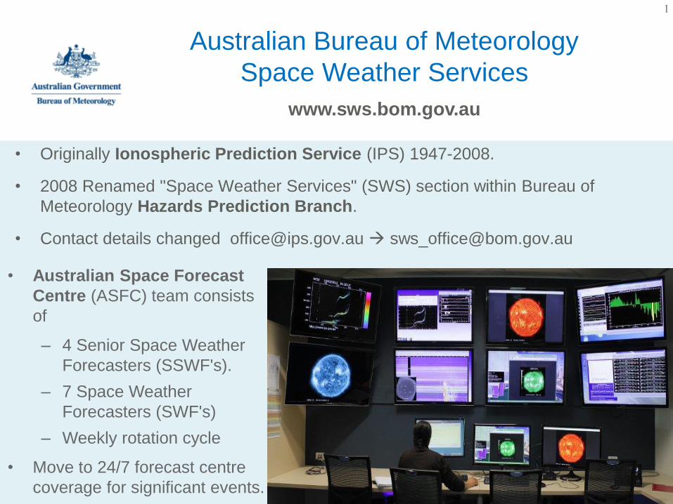
• Originally Ionospheric Prediction Service (IPS) 1947-2008.
• 2008 Renamed "Space Weather Services" (SWS) section within Bureau of
Meteorology Hazards Prediction Branch.
• Contact details changed [email protected] [email protected]
Australian Bureau of Meteorology
Space Weather Services
www.sws.bom.gov.au
• Australian Space Forecast
Centre (ASFC) team consists
of
– 4 Senior Space Weather
Forecasters (SSWF's).
– 7 Space Weather
Forecasters (SWF's)
– Weekly rotation cycle
• Move to 24/7 forecast centre
coverage for significant events.
1

Presentation Overview
1. Overview of Space Weather Services
– Space Weather Network
– Online Services
2. National Positioning Infrastructure Project
3. Ionospheric Modelling and Forecasting
– Data Driven Models
4. Solar and Geophysical Forecasting tools
– Solar Forecast Tools
– Severe Space Weather Model
5. Recent engagement with …
– Critical Infrastructure Groups & Aviation.
– Key Stakeholders/Industry/General Public
2

1. SWS Overview: Space Weather Network
Sensors and Locations
3

1. SWS overview: Online Products and
Services
4

• 2.5 year research project with collaboration
between
– Bureau of Meteorology's Space Weather
Services
– Cooperative Research Centre for Spatial
Information (CRCSI)
• Aims to deliver a highly accurate real time
ionospheric model to support the operational
implementation of PPP-RTK (Precise Point
Positioning Real-Time Kinematic) for the
National Positioning Infrastructure.
2.1 Ionospheric modelling to support
the National Positioning Infrastructure
5

"Instantaneous, reliable and fit-for-purpose access to positioning and timing information
anytime and anywhere across the Australian landscape and its maritime jurisdictions"
2. National Positioning Infrastructure
6
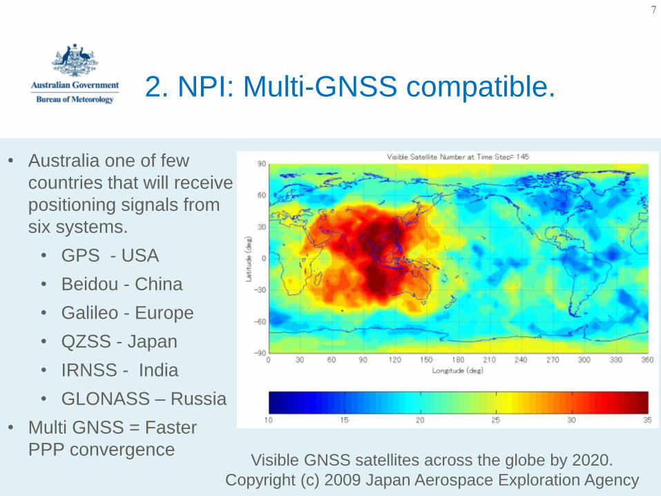
Visible GNSS satellites across the globe by 2020.
Copyright (c) 2009 Japan Aerospace Exploration Agency
• Australia one of few
countries that will receive
positioning signals from
six systems.
• GPS - USA
• Beidou - China
• Galileo - Europe
• QZSS - Japan
• IRNSS - India
• GLONASS – Russia
• Multi GNSS = Faster
PPP convergence
2. NPI: Multi-GNSS compatible.
7

2. National Positioning Infrastructure
project
• CORS (Continuously Operating Reference Station) networks operated
independently on an ad-hoc basis by state governments and industry
– However, an Australia wide CORS network (@70km spacing) would be
too expensive.
• PPP-RTK provides standard PPP users with additional information
(ionosphere, ephemeris data, clock offset) derived from a reference network,
enabling high accuracy & low convergence times.
– Bottleneck though is with the accuracy with which ionospheric
corrections must be provided to the user.
• Success of the PPP-RTK implementation for the NPI requires a significant
improvement in ionospheric modelling accuracy over existing capability
– precise sub-TECU ionospheric corrections required to enable rapid
ambiguity resolution to achieve positioning at the level of a few cm.
8

Mid latitudes
Storm-Enhanced Density
(SED)
Medium Scale Travelling
Ionospheric Disturbances
(MSTID)
Low latitudes
Equatorial Plasma Bubbles
(EPB)
Large spatial gradients
Ionospheric Scintillation
High latitudes
Storm-Enhanced (Sub-
Auroral) gradients
2. Ionospheric Modelling challenges
for the Australian region.
9
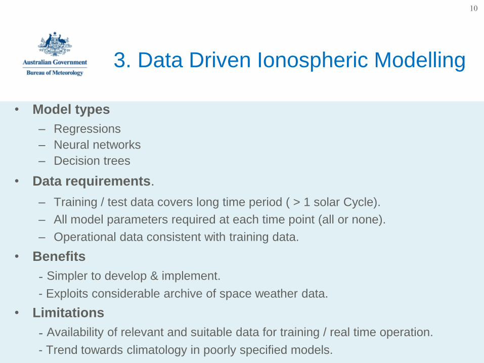
• Model types
– Regressions
– Neural networks
– Decision trees
• Data requirements.
– Training / test data covers long time period ( > 1 solar Cycle).
– All model parameters required at each time point (all or none).
– Operational data consistent with training data.
• Benefits
- Simpler to develop & implement.
- Exploits considerable archive of space weather data.
• Limitations
- Availability of relevant and suitable data for training / real time operation.
- Trend towards climatology in poorly specified models.
3. Data Driven Ionospheric Modelling
10
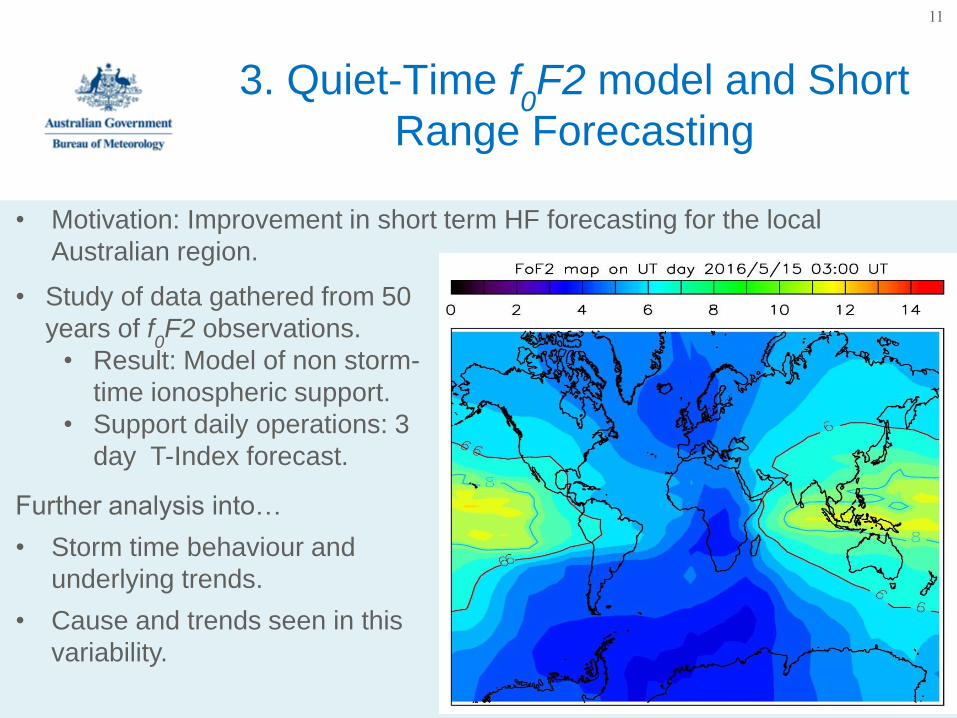
• Motivation: Improvement in short term HF forecasting for the local
Australian region.
3. Quiet-Time f0F2 model and Short
Range Forecasting
• Study of data gathered from 50
years of f0F2 observations.
• Result: Model of non storm-
time ionospheric support.
• Support daily operations: 3
day T-Index forecast.
Further analysis into…
• Storm time behaviour and
underlying trends.
• Cause and trends seen in this
variability.
11
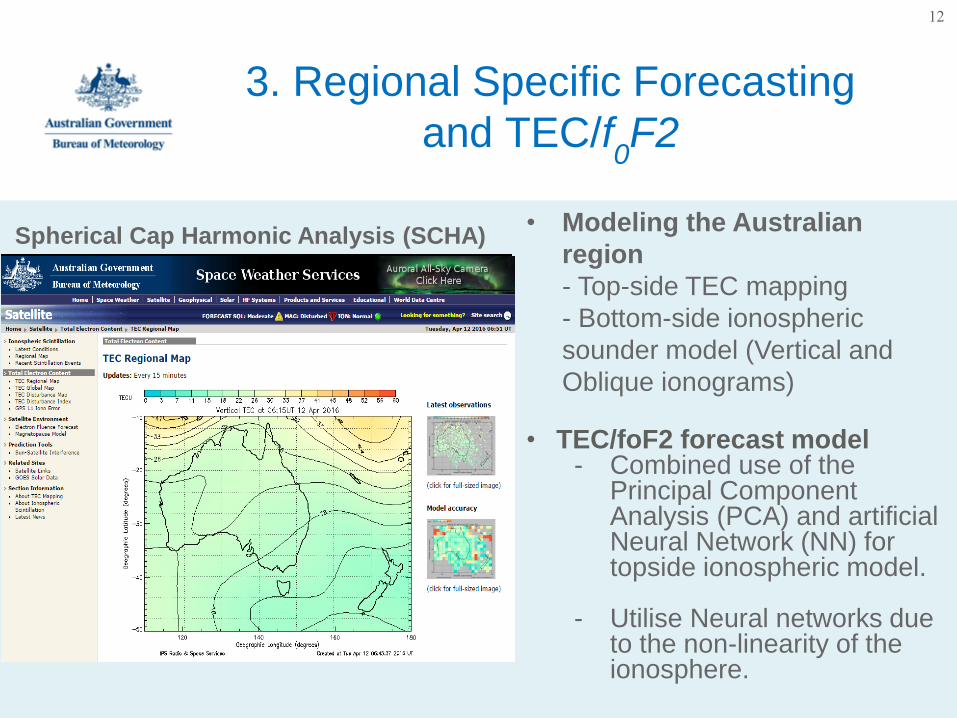
3. Regional Specific Forecasting
and TEC/f0F2
Spherical Cap Harmonic Analysis (SCHA) • Modeling the Australian
region
- Top-side TEC mapping
- Bottom-side ionospheric
sounder model (Vertical and
Oblique ionograms)
• TEC/foF2 forecast model- Combined use of the
Principal Component Analysis (PCA) and artificial Neural Network (NN) for topside ionospheric model.
- Utilise Neural networks due to the non-linearity of the ionosphere.
12

• Tools used to assist with daily forecasts and nowcasts in the ASFC…
– Enlil (SWPC)
– Flarecast Model (SWS)
– Flare Probability Model (SWS)
– Severe Space Weather model (SWS)
4. Solar and Geophysical Analysis
Tools.
• Enlil
• Low resolution simulations
of ambient solar wind
conditions.
• CME modelling via
parameters obtained from
CAT tool.
• Simulation times ~1hr (8
core Linux workstation).
13

• Automated solar flare forecast based on region characteristics
• Deterministic model: uses Solar Dynamic Observatory (SDO) or GONG HMI solar
magnetograms and image processing to automatically identify active regions.
• Output is generated in near real-time as new input data becomes available.
• Many different parameters of the active region and the neutral lines are estimated.
• Estimates capability of a region to produce M, M5+ or X-class solar flares.
4. Forecasting Tools: Flarecast
14
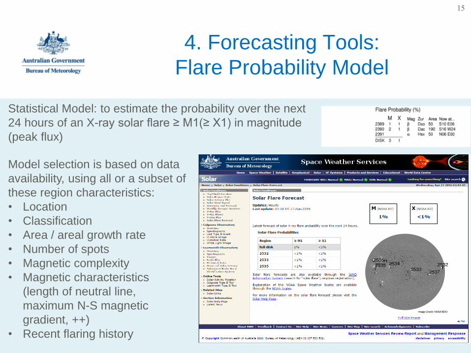
4. Forecasting Tools:
Flare Probability Model
Statistical Model: to estimate the probability over the next
24 hours of an X-ray solar flare ≥ M1(≥ X1) in magnitude
(peak flux)
Model selection is based on data
availability, using all or a subset of
these region characteristics:
• Location
• Classification
• Area / areal growth rate
• Number of spots
• Magnetic complexity
• Magnetic characteristics
(length of neutral line,
maximum N-S magnetic
gradient, ++)
• Recent flaring history
15
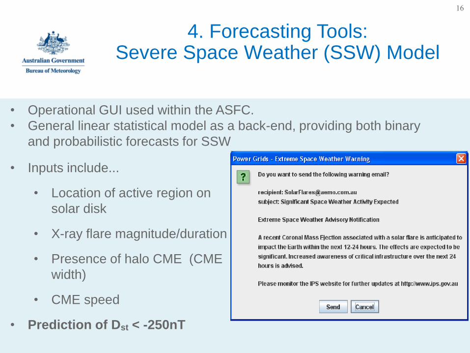
4. Forecasting Tools: Severe Space Weather (SSW) Model
• Inputs include...
• Location of active region on
solar disk
• X-ray flare magnitude/duration
• Presence of halo CME (CME
width)
• CME speed
• Prediction of Dst < -250nT
16
• Operational GUI used within the ASFC.
• General linear statistical model as a back-end, providing both binary
and probabilistic forecasts for SSW
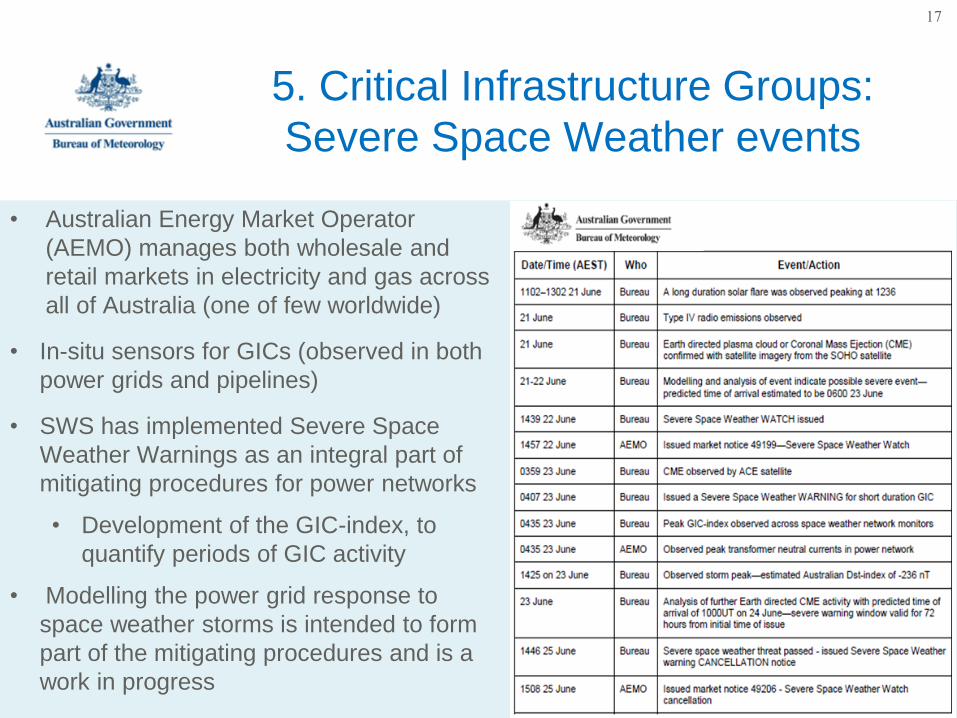
5. Critical Infrastructure Groups:
Severe Space Weather events
• Australian Energy Market Operator
(AEMO) manages both wholesale and
retail markets in electricity and gas across
all of Australia (one of few worldwide)
• In-situ sensors for GICs (observed in both
power grids and pipelines)
• SWS has implemented Severe Space
Weather Warnings as an integral part of
mitigating procedures for power networks
• Development of the GIC-index, to
quantify periods of GIC activity
• Modelling the power grid response to
space weather storms is intended to form
part of the mitigating procedures and is a
work in progress
17

To enable space weather products produced by the Bureau to be more
specific and relevant to the aviation industry
• Aviation focussed user workshop planned for the second half of 2016
• Focus on
– working with the aviation industry to tailor current products & services
(impact focussed)
– Identify un-met aviation user needs.
– Determine need for specific space weather products through a
common portal with Bureau’s Aviation Weather Services.
• Short term: Space weather training for aviation meteorologists
• Longer term: Develop products and services addressing user
requirements identified in consultations
5. Aviation Space Weather strategy
18
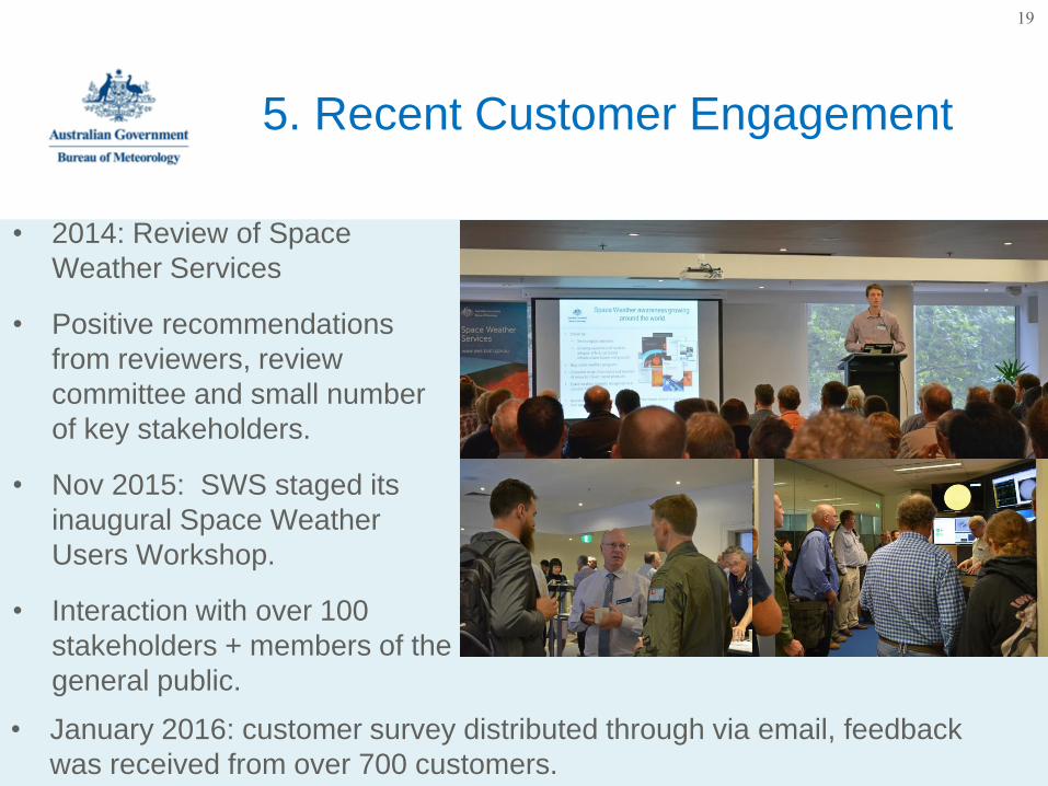
• 2014: Review of Space
Weather Services
• Positive recommendations
from reviewers, review
committee and small number
of key stakeholders.
• Nov 2015: SWS staged its
inaugural Space Weather
Users Workshop.
• Interaction with over 100
stakeholders + members of the
general public.
• January 2016: customer survey distributed through via email, feedback
was received from over 700 customers.
5. Recent Customer Engagement
19
Thank you…
Phillip Maher
Consultancy and Development
Digital HF/VHF/UHF Systems

Extra info/graphics on NPI (spare)
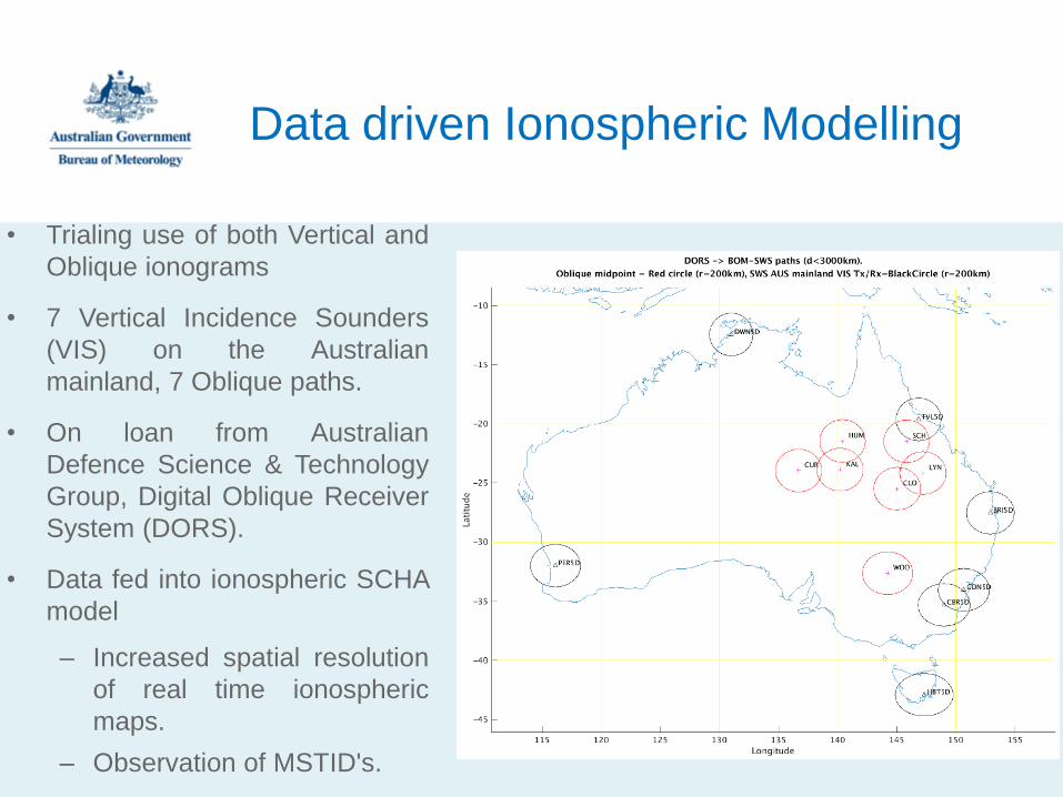
Data driven Ionospheric Modelling
• Trialing use of both Vertical and
Oblique ionograms
• 7 Vertical Incidence Sounders
(VIS) on the Australian
mainland, 7 Oblique paths.
• On loan from Australian
Defence Science & Technology
Group, Digital Oblique Receiver
System (DORS).
• Data fed into ionospheric SCHA
model
– Increased spatial resolution
of real time ionospheric
maps.
– Observation of MSTID's.