austrian federal railways infra:geodata -...
TRANSCRIPT

OVERVIEW • The Austrian Federal Railways (German: Österreichische
Bundesbahnen, ÖBB) is the national railway system of Austria • The ÖBB group is owned entirely by the Republic of Austria
and is divided into several separate businesses that manage the infrastructure and operate passenger and freight services
CHALLENGES / OPPORTUNITIES • big data: huge heterogenous data collections, file system
storage, no spatial access • mission management: quality assurance, historiography • minimize acquisition expenses: automation of processing
steps, avoidance of multiple surveys
SOLUTIONS • Oracle Database 12c Enterprise Edition
• Spatial Option with Pointcloud and GeoRaster, • Oracle Fusion Middleware 11.1.1.7
• MapViewer
RESULTS • Direct and uniform access to pointcloud data • Lowering costs of geodata usage by service access • Consolidation of raster, vector and pointcloud data in a
central repository • Increase of quality using metadata • Lowering process costs using homogenous processes
Austrian Federal Railways infra:geodata

May 2014 Oracle Spatial Summit

May 21, 2014 Walter E. Washington Convention Center
Washington, DC USA

Rinaldo Wurglitsch Software Development Manager, IQSOFT

End-To-End LiDAR Data Processing at Austrian Federal Railways Infrastructure AG
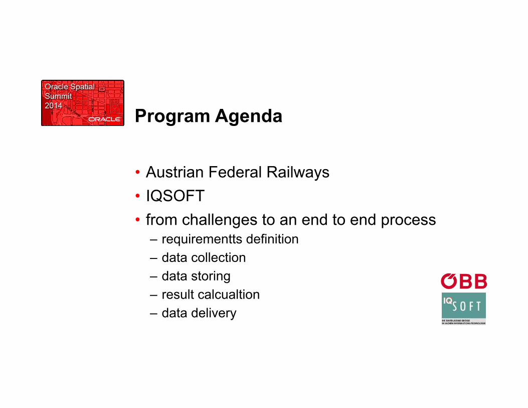
Program Agenda
• Austrian Federal Railways • IQSOFT • from challenges to an end to end process
– requirementts definition – data collection – data storing – result calcualtion – data delivery
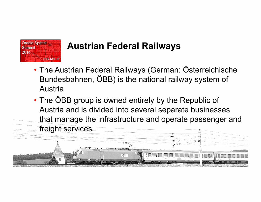
Austrian Federal Railways
• The Austrian Federal Railways (German: Österreichische Bundesbahnen, ÖBB) is the national railway system of Austria
• The ÖBB group is owned entirely by the Republic of Austria and is divided into several separate businesses that manage the infrastructure and operate passenger and freight services

Austrian Federal Railways - Statistics
Source: Annual Report
• carried 464 million passengers • ~ 5,700 km (~ 3,500 route miles) • 10,780 km of track • 1,230 locomotives • 3,136 passenger vehicles • employed 42,893 ÖBB Infrastructure Corp. • employed 17,612 staff
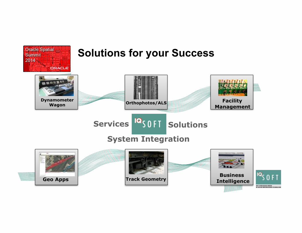
Solutions for your Success
Services
System Integration
Solutions
Dynamometer Wagon
Track Geometry Business Intelligence
Facility Management
Orthophotos/ALS
Geo Apps

Challenges
RLS Railborne Laserscanning"
ALS Airborne
Laser- Scanning "
• TLS Terrestrial Laser Scanning

R&D Project Vision
RLS"
ALS
TLS
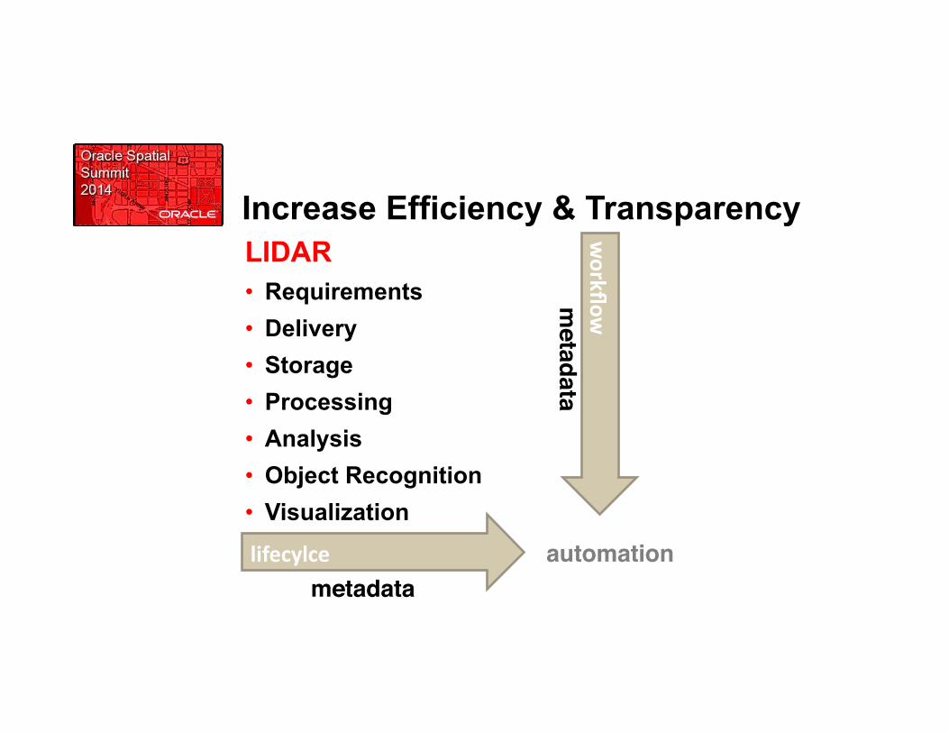
Increase Efficiency & Transparency LIDAR • Requirements • Delivery • Storage • Processing • Analysis • Object Recognition • Visualization
workflow
m
etadata!
lifecylce
metadata!automation!

Making Available …
results
3D visualization"
GIS objects"
mission data"
data acquisition
• Digital Aerial Images
• Digital Orthophotos • Pointclouds!• Trajectories!• Digital Terrain
Models!• Mission Report!• …!
Automatic Processing • CSW catalog • Object Recognition!• Pointcloud
Extraction!• …!

Process Flow
requirements definition"
data collection"
data storage & preparation"
result calculation"
data delivery"
Quality Management driven by metadata"
• user request • process flow • handover results

Requirements Definition
requirements definition data collection data storing result calculation data delivery
Define ISO conform Metadata!
Requirements Definition Template!

Geodata & Metadata Store
Metadata Store
BLOB"
Geodata Store
BLOB"
CSW Catalog-Service"
Up/Download Service"
• Digital Aerial Images • Digital Orthophotos • Pointclouds!• Trajectories!• Digital Terrain Models!• Mission Report!• …!
requirements definition data collection data storing result calculation data delivery
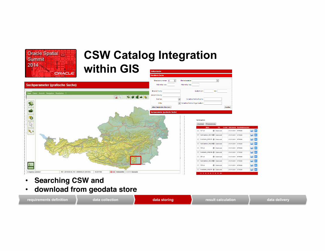
CSW Catalog Integration within GIS
• Searching CSW and !• download from geodata store!requirements definition data collection data storing result calculation data delivery

Object Recognition
• remote sensing delivers railway corridor recordings!
• automated processing with innovative methods of object recognitionis applied to"
automated processing"
requirements definition data collection data storing result calculation data delivery

requirements definition data collection data storing result calculation data delivery
Object Recognition process mask" process profile"
classification" process Ransac" process pylon"
recognition"example: track axis/pylon

Integration with existing data e.g: railway track
Object: track
fusion"
geodetic site plans"
pointclouds"
orthophotos"assets"
buildings"Object A: track residing in
rail geometry db"
Object B: track result from recognition"
Object C: track extracted from
geodetic site plans"metadata A" metadata B" metadata C"
track geometry"
„One Truth“ „Golden Record“
requirements definition data collection data storing result calculation data delivery

Transfer to GIS
Geodata Store
Metadata Store
Object: track
Georaster Processing Mosaicking!
GIS Object Creation!
SDO_GEORASTER
SDO_GEOMETRY
references mission data & processing!
requirements definition data collection data storing result calculation data delivery

Interactive 3D Visualization System
3D Viewer"
pointcloud stream"
• Seamless Navigation!• Absolute Coordinate System!• Vector Data and Label Integration!
Geodata Store
Metadata Store
Object: track
vector data"
requirements definition data collection data storing result calculation data delivery
WebGL DirectX"

Quality Management and Feedback Service!
requirements definition data collection data storing result calculation data delivery

GUI GIS!
Solution Overview geodata-‐ processing
metadata collec6on
CSW
geodata metadata WMS
WFS
content check
CAD … … …
pre-‐processing (extent extrac@on, …)
technical check
WPS
mosaic crea6on!GIS Layer crea6on!
pointcloud crea6on!delivery data download!
transforma6on, conversion!
..…
data-‐storage Pointcloud
Store
... GIS store
mosaic store
layer store
search and download!Administra6on system-‐management

Oracle Spatial
Oracle Spatial Objects in use: • Oracle Pointcloud • Oracle Mosaic • SDO Geometry • SDO Georaster • Custom Coordinate Systems
Statistics per 100 km: number of points
1,7 Mio. points storage on filesystem
ca. 750 GB storage in geostore
ca. 400 GB storage of Oracle Spatial objects
SDO_ PC & Georaster ca. 400 GB resolution of raster
5 cm density of points
15 Punkte pro m²

Summay
• Optimize railway planning, construction and maintenance • Stores and processes more than 8 billion points of objects
along railway tracks • Enables LiDAR data to be viewed with existing
infrastructure vector data • Provides comprehensive metadata about railway tracks
trough CSW • Delivers Data through open WebServices

Q&A