aviatr: aerial vehicle for in situ and airborne titan reconnaissance · · 2011-10-28thus the...
TRANSCRIPT

AVIATR: Aerial Vehicle for In situ and Airborne Titan Reconnaissance
Jason W. Barnes Assistant Professor of Physics University of Idaho
OPAG Meeting 2011 October 20
Pasadena, CA

TSSM: Titan Saturn System Mission
$~4-6 billion
TSSM

Titan Exploration Program
Titan Exploration Program
AVIATR
TiME
JET

Mission Scope: Why not a balloon?
Airplane vs. Balloon
In general, either a balloon or an airplane is capable of achieving similar sets of scientific objectives. AVIATR is better suited to the task than a balloon:
BETTER SCIENCE: With go-to capability, stereo, repeat imaging, rapid altitude-change capability, remaining on the dayside, and direct-to-Earth communcations, a fixed-wing heavier-than-air plane can address more scientific objectives than a balloon and can be done on a New Frontiers budget.
MORE EFFICIENT 238Pu USAGE: Because a hot-air balloon uses MMRTG waste heat for buoyancy, it will not work with more efficient ASRGs. Conversely, MMRTG's are too inefficient in terms of Watts/kg to fly an airplane. Thus the ASRG is an enabling technology for a Titan Airplane.
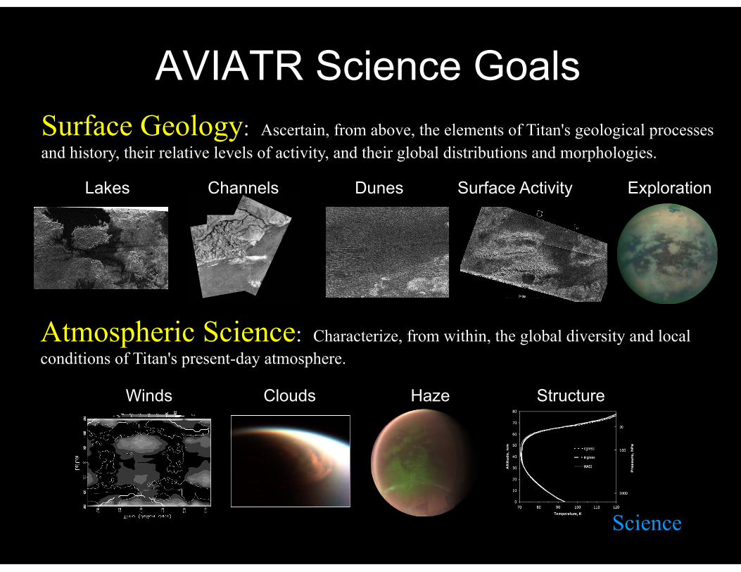
AVIATR Science Goals Surface Geology: Ascertain, from above, the elements of Titan's geological processes and history, their relative levels of activity, and their global distributions and morphologies.
Winds Clouds Haze Structure
Atmospheric Science: Characterize, from within, the global diversity and local conditions of Titan's present-day atmosphere.
Lakes Channels Dunes Surface Activity Exploration
Science

UAV Design
Titan Flight Parameters
Surface Gravity – 1.352 m/s2 (0.138 x Earth) Atmospheric Density – 3.9 kg/m3 (at 10 km; E=1.2 kg/m3)
Temperature – 85 K Wind Speed at Flight Altitude – 0.0-3.0 m/s Speed of Sound – 200 m/s Specific Kinetic E for Flight – 1/30*Earth, 1/1200*Mars With 3.25 times more air and 7 times less gravity than Earth (or 500 times more air and 2 times less gravity than Mars), along with a workable thermal environment, heavier-than-air flight makes more sense on Titan than anywhere else in the solar system.

UAV Design
Aircraft Design
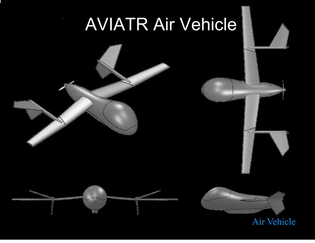
AVIATR Air Vehicle
Air Vehicle

AVIATR Air Vehicle Internal Layout
Internals
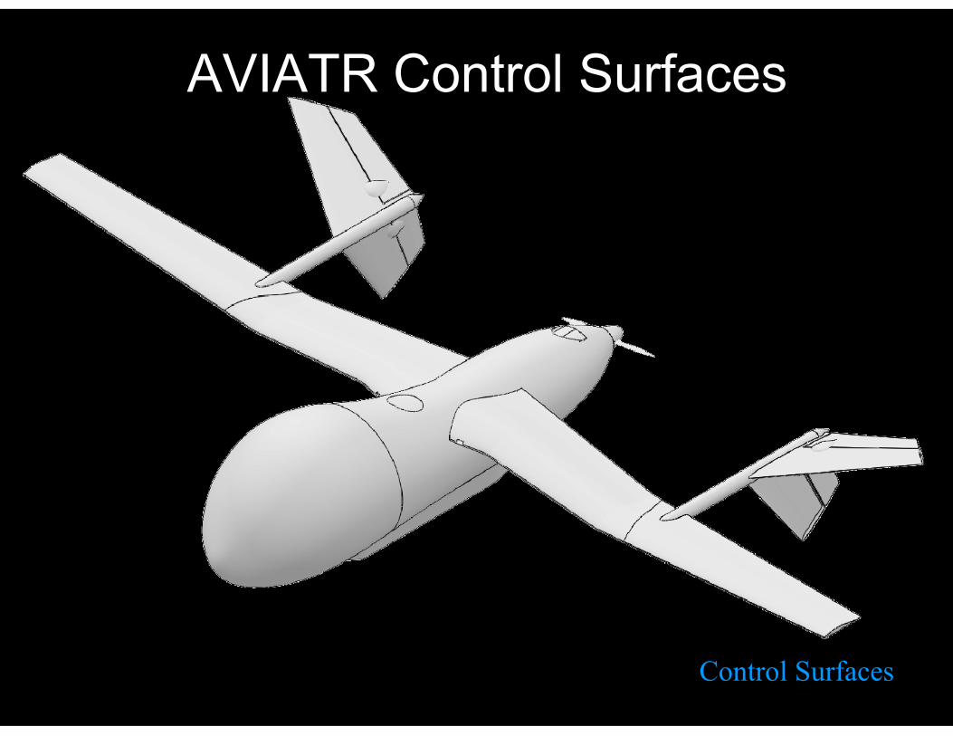
AVIATR Control Surfaces
Control Surfaces

UAV Design
Safe Mode
● With wing dihedral angle (left), stable and consistent weight and balance without consuming fuel, and proper trim, the aerial vehicle is inherently stable. Without control inputs, will return to straight and level flight. Long-wavelength oscillations can build up over many hour timescales.
● AVIATR will have a built-in safe mode, just like any other modern interplanetary spacecraft. In safe mode the vehicle will fly so as to keep the solar zenith angle below a given value (say, 45o), and point the antenna toward the Sun for communication with Earth to wait for further instruction.
● Like safe mode for a vehicle in space: the AVIATR safe mode requires no prior knowledge of the vehicle's position or orientation.
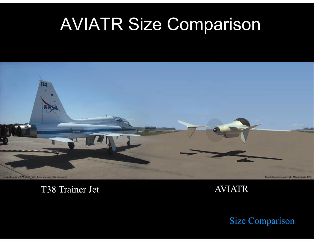
AVIATR Size Comparison
Size Comparison
AVIATR T38 Trainer Jet

AVIATR Entry Vehicle
Entry Vehicle

Rocket and Spacecraft
Getting to Titan

Science Instruments: Optical Remote Sensing Suite
ORS Instrumentation
Wavelength: 4.87 to 5.15 µm (5 micron methane window)
Ground Scale: ~15 to 34 m/pixel
Horizon-Looking Imager
1.97 – 2.09 µm (2 micron methane window)
0.5 m/pix at 3.5 km altitude
(~2 m/pix at 15 km)
High-Resolution Imager
Near-Infrared Spectrometer
1.05 to 5.4 µm (with >=400 channels across this range)
3.5 to 8 m/pixel at 3.5 km alt ( ~15 to 34 m/pixel at 15 km)

Science Instruments: Atmospheric Suite
Atmospheric Instrumentation
Atmospheric Structure: P, T, humidity, haze Student Raindrop Sensor
Ultrastable Oscillator / Doppler Wind
Radar Altimeter

Operations
Data Management Strategy
Bandwidth is limited; storage is cheap, small, & low-mass. We will build in far more onboard storage than we will be able to return to Earth.
Downlink only those data thought highest priority, but keep the others. Download them from the aircraft if and when a request is made for them.
Send back meta-data and thumbnail-sized initial versions of images so that the science team can select which to return at full resolution
Both lossless and lossy compression available for science team to select on a per-image basis.
This approach and these abilities allow us to be highly efficient users of our limited bandwidth, in order to maximize the science return.
Operations
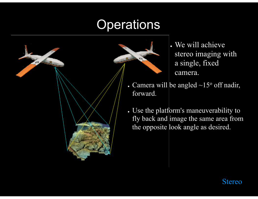
Stereo
● We will achieve stereo imaging with a single, fixed camera.
● Camera will be angled ~15o off nadir, forward.
● Use the platform's maneuverability to fly back and image the same area from the opposite look angle as desired.

Operations
Acquiring Context
● Repeated experience from planetary missions has shown that high-resolution postage stamps require context for proper geologic interpretation.
● AVIATR will use both its horizon-looking camera and its altitude flexibility to gather contextual imaging
● Context mapping from 14-km altitude resulting in 4-m resolution; high-res at 3.5-km altitude with 1-m resolution.

Operations
Mosaics
● On important targets we will execute large image mosaics, not individual frames.
● Mosaics will take most of the mission's bandwidth.
● Mosaics will (in general) have 4 components:
1. Full surface scan just below the horizon 2. Low resolution (4 m) mosaic from 14 km 3. Stereo observations at either 4-m or 1-m res 4. High resolution (1 m) mosaic from 3.5 km

Climb / Glide Power Management Strategy
Climb / Glide
Operations
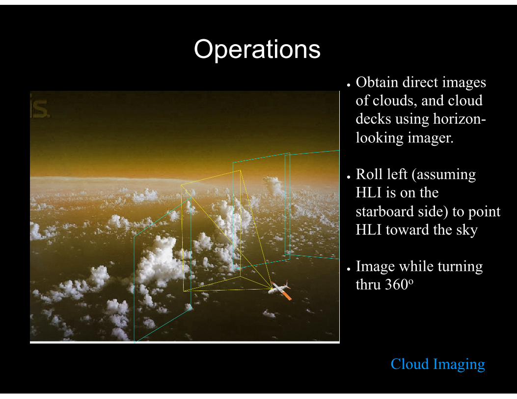
Cloud Imaging
● Obtain direct images of clouds, and cloud decks using horizon-looking imager.
● Roll left (assuming HLI is on the starboard side) to point HLI toward the sky
● Image while turning thru 360o
Operations
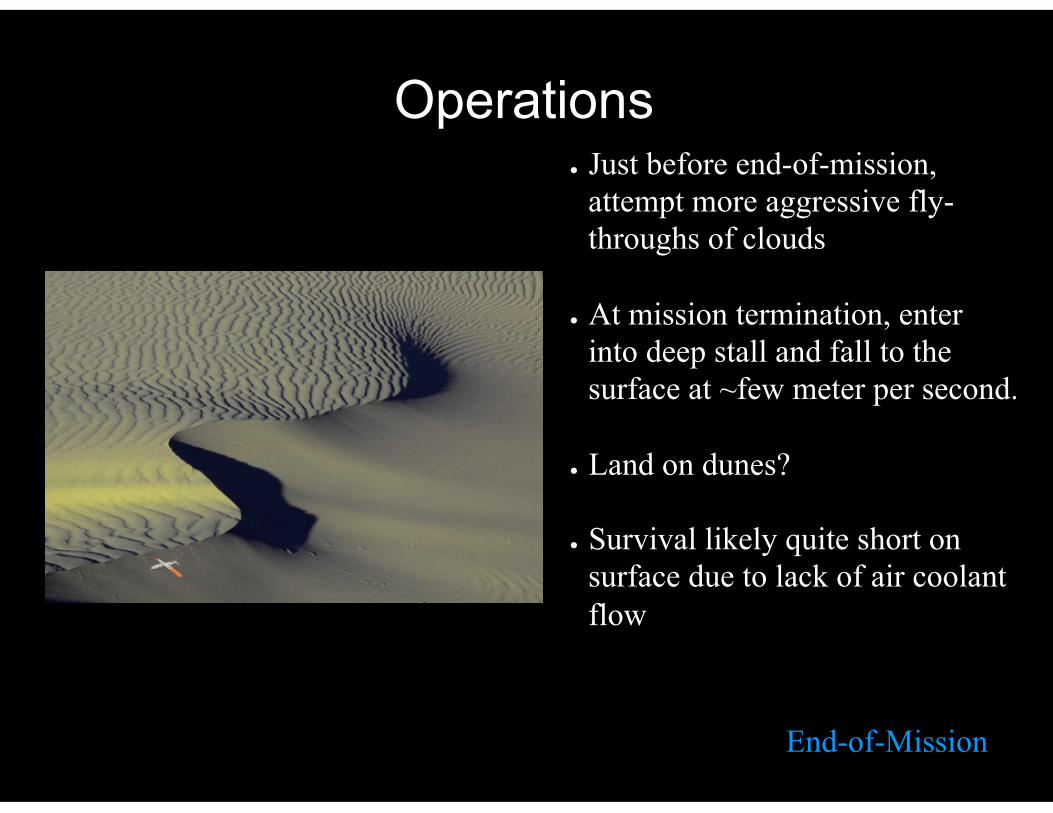
End-of-Mission
● Just before end-of-mission, attempt more aggressive fly-throughs of clouds
● At mission termination, enter into deep stall and fall to the surface at ~few meter per second.
● Land on dunes?
● Survival likely quite short on surface due to lack of air coolant flow
Cost Estimate: $715M
JPL Team-X
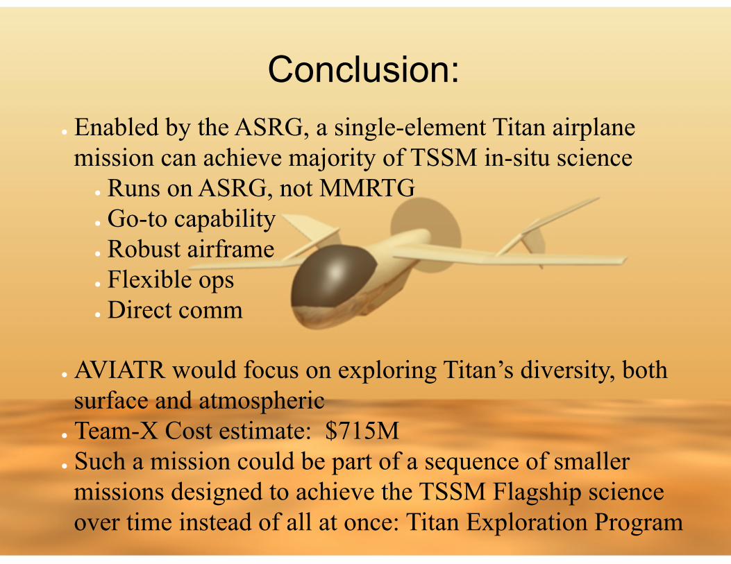
Conclusion: ● Enabled by the ASRG, a single-element Titan airplane mission can achieve majority of TSSM in-situ science
● Runs on ASRG, not MMRTG ● Go-to capability ● Robust airframe ● Flexible ops ● Direct comm
● AVIATR would focus on exploring Titan’s diversity, both surface and atmospheric
● Team-X Cost estimate: $715M ● Such a mission could be part of a sequence of smaller missions designed to achieve the TSSM Flagship science over time instead of all at once: Titan Exploration Program

Cost Breakdown
Cost Breakdown