background report - bc parks
TRANSCRIPT

Proposed Gilpin-Morrissey Wildlife Management Area
BACKGROUND REPORT
August, 2005 Revised September, 2007
Ministry of
Environment
Ministry of Environment
Environmental Stewardship Division Okanagan Region

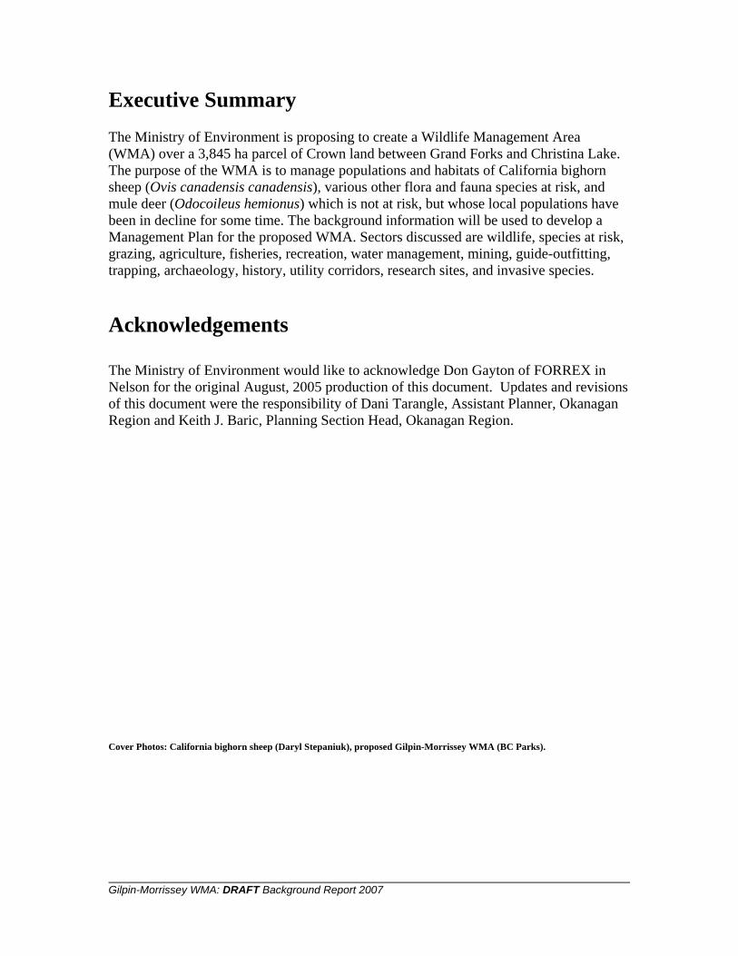
Executive Summary The Ministry of Environment is proposing to create a Wildlife Management Area (WMA) over a 3,845 ha parcel of Crown land between Grand Forks and Christina Lake. The purpose of the WMA is to manage populations and habitats of California bighorn sheep (Ovis canadensis canadensis), various other flora and fauna species at risk, and mule deer (Odocoileus hemionus) which is not at risk, but whose local populations have been in decline for some time. The background information will be used to develop a Management Plan for the proposed WMA. Sectors discussed are wildlife, species at risk, grazing, agriculture, fisheries, recreation, water management, mining, guide-outfitting, trapping, archaeology, history, utility corridors, research sites, and invasive species. Acknowledgements The Ministry of Environment would like to acknowledge Don Gayton of FORREX in Nelson for the original August, 2005 production of this document. Updates and revisions of this document were the responsibility of Dani Tarangle, Assistant Planner, Okanagan Region and Keith J. Baric, Planning Section Head, Okanagan Region. Cover Photos: California bighorn sheep (Daryl Stepaniuk), proposed Gilpin-Morrissey WMA (BC Parks).
Gilpin-Morrissey WMA: DRAFT Background Report 2007

Table of Contents Introduction .....................................................................................................................................................1 Overview .........................................................................................................................................................1
Archeological and Historical Significance........................................................................................2 Adjacent Provincial Parks ...............................................................................................................................5 Land Tenure ....................................................................................................................................................5
History...............................................................................................................................................5 Adjacent Properties ...........................................................................................................................5 Private Land and Other Inholdings ...................................................................................................6 Agricultural Land Reserves...............................................................................................................7
Wildlife and Wildlife Habitat ..........................................................................................................................9 Large Ungulates ................................................................................................................................9 Species at Risk ..................................................................................................................................9
Vertebrates........................................................................................................................10 Plants ................................................................................................................................11 Ecological Communities ...................................................................................................11 Wildlife Habitat Areas ......................................................................................................12
Other Wildlife .................................................................................................................................12 Fisheries ..........................................................................................................................................12 Vegetation .......................................................................................................................................13 Invasive Species ..............................................................................................................................15
Commercial Tenures and Resource Management .........................................................................................16 Recreation .......................................................................................................................................16 Access .............................................................................................................................................16 Water Management .........................................................................................................................17 Forestry ...........................................................................................................................................17 Grazing............................................................................................................................................17 Agriculture ......................................................................................................................................18 Mineral Resources...........................................................................................................................18 Trapping ..........................................................................................................................................19 Guide Outfitting ..............................................................................................................................19 Utility Corridors ..............................................................................................................................19 Research Sites and Projects.............................................................................................................19
References Cited............................................................................................................................................20 Maps Consulted ................................................................................................................21 Individuals Consulted .......................................................................................................21
Appendices ....................................................................................................................................................22 Appendix A .....................................................................................................................................22 Appendix B .....................................................................................................................................24 Appendix C .....................................................................................................................................26 Appendix D .....................................................................................................................................29
Map 1: Context Map........................................................................................................................................4 Map 2: ALR Interface .....................................................................................................................................8 Map 3: BEC Zone Context ............................................................................................................................14
Gilpin-Morrissey WMA: DRAFT Background Report 2007

DRAFT ONLY-UNDER REVIEW
Introduction Under the British Columbia Wildlife Act (Section 4.2), the Minister may designate a Wildlife Management Area (WMA). A WMA is an area where “conservation and management of wildlife, fish and their habitats is the priority land use but other uses may be permitted”. The Ministry of Environment is proposing a WMA be created on a portion of land known as the Gilpin-Morrissey. The primary rationale for considering this WMA is three-fold and concerns the presence of year-round wild sheep habitat, the presence of essential winter mule deer habitat, and the presence of species at risk and ecological communities at risk. The purpose of this document is to present background information on the various interests and resources in preparation for the WMA Management Plan. This document is not intended to resolve any outstanding resource management issues. A comprehensive management plan will be drafted that will outline known (or projected) management issues and identify objectives and strategies to mitigate those issues. Overview The area of the proposed WMA is approximately 3,845 hectares just east of the community of Grand Forks, lying in the Monashee Range and the Boundary region of southern British Columbia. The boundaries can be roughly described as follows: An irregular, southeast-to-northwest trending band of land, with the southern boundary formed by the Crowsnest Highway, the western boundary by the community of Grand Forks and the Granby River, the northern boundary by the BC Hydro Power 500KV power line, and the eastern boundary by the intersection of the power line and the highway, just west of the community of Christina Lake. A small portion of the area, which lies along the Kettle River, is at 500 meters elevation. Above that is a broad, southwest-facing band of grass and shrub land that extends up to roughly 900 meters, at which point the vegetation grades into open forest, with closed forest on the level and north aspects. The elevation of the power line, which forms the northern boundary, varies between 1200 to 1400 meters. The WMA encompasses three distinct biogeoclimatic subzones, the PPdh1, IDFxh1, and ICH1, and is found within the Southern Okanagan Highlands ecosection. The following small creek drainages are included within the proposed WMA boundaries: Sand, Morrissey, Dan O’Rea, Gilpin, Hurly and Ben Stubbs. A small portion of the area extends below Highway 3 to the Kettle River. This portion includes abandoned river channel habitat (“The Oxbow”) as well as a cultivated pasture (“The Boothman”), sections of which are now designated as Provincial Park.
1
1 Biogeoclimatic zones coding changed during 2006. This data was not affected by those changes. Further information on biogeoclimatic zones can be found at: http://www.for.gov.bc.ca/hre/becweb/index.html.
Gilpin-Morrissey WMA: DRAFT Background Report 2007

DRAFT ONLY-UNDER REVIEW
Archeological and Historical Significance The subject area of the proposed WMA was frequented by people from the Sinixt and Okanagan nations. Archaeological evidence, including pit houses, fire pits and a large dugout canoe have been found around the Cascade Falls area, a few kilometres east of the proposed WMA. The large valley corridor, comprising of the Kettle River and the grassland/upland forested areas would have been used by First Nations as an east-west travel corridor, for winter horse pasture, and for hunting and fishing. There are several recorded archeological sites2 within the subject area. Early European explorers, traders and settlers passed through the Gilpin on their way from the settlement at Kettle Falls (Washington). This route was upgraded by Edgar Dewdney in the 1860’s, and became formally known as the Dewdney Trail. An early map of the area shows the Trail crossing the Kettle above Cascade Falls and then more or less following the route of the current Crowsnest Highway into Grand Forks. A stone retaining wall visible from the Kettle River in the Oxbow area is said to be a remnant of the original Trail.
Rock wall (laid by hand) on the Dewdney Trail
2 Registered ‘Borden Number’ and thus protected under the Heritage Conservation Act
Gilpin-Morrissey WMA: DRAFT Background Report 2007
2

DRAFT ONLY-UNDER REVIEW
3 Gilpin-Morrissey WMA: DRAFT Background Report 2007
In 1882, Ranulph Robert Gilpin, from Ontario, established a farm on the bench that is intersected by Gilpin Creek and the Crowsnest Highway. Some footings and other evidence of those farm buildings remain. In 1888, Mr. Gilpin was named Customs Officer, and his farmhouse served as the Customs House for all north-south traffic until 1900. There is a Doukhobor Sons of Freedom and Reformed Freedomite settlement across the Kettle River named Gilpin. During the conflicts about public schooling of Doukhobor children in the 1950’s, a footbridge was built across the river so that children had access to the school bus. The bridge, located about two kilometres downstream from the Gilpin Creek outlet, is now gone, but the footings remain. Ned Hurley, a reclusive bachelor who had a homestead somewhere in the upper slopes of the Gilpin, was buried there in 1940.

DRAFT ONLY-UNDER REVIEW
4 Gilpin-Morrissey WMA: DRAFT Background Report 2007
Map 1: Context Map

DRAFT ONLY-UNDER REVIEW
Adjacent Provincial Parks Gilpin Grasslands Provincial Park and Boothman’s Oxbow Provincial Park were introduced in Bill 24-2007 and received Royal Assent in May, 2007. Gilpin Grasslands Provincial Park (791 hectares) is located east of the City of Grand Forks adjacent to Highway 3. This park was identified for protection through the West Kootenay-Boundary Land Use Plan ‘Goal 2’ process. The park has high grassland and wildlife values, including a rare ponderosa pine/bunchgrass ecosystem, numerous plant and animal species at risk, and provides essential winter range for California bighorn sheep. Boothman’s Oxbow Provincial Park (43 hectares) is located east of Grand Forks near Highway 3 (approximately two kilometres west of Gilpin Grasslands Provincial Park). This park was also identified for protection through the West Kootenay-Boundary Land Use Plan ‘Goal 2’ process. The park protects important riparian values, including a cottonwood ecological community at risk and is an important site for nature study and other compatible recreation activities. Gilpin Grasslands Provincial Park is referenced in Schedule D of the Protected Areas of British Columbia Act and as such continues to allow for existing range tenure that was in effect on the establishment date. This use must be administered and managed in accordance with the Range Act and the Forest and Range Practices Act. Land Tenure
History The Dominion Government originally granted the entire Gilpin area to the Victoria, Vancouver and Eastern Railroad. Portions of that original land grant were then surveyed, subdivided, and sold to private interests. The remnant of the original railway land grant is DL 2700 (District Lot). Some of the subdivided lots, plus the remainder of DL 2700, reverted back to the Crown during the drought and Depression years of the 1930’s.
Adjacent Properties The proposed WMA may be influenced directly or indirectly by developments and management on adjacent properties. Adjacent to the southeast corner, Cantex operates a large gravel pit (DL 719). Closer to Grand Forks, an active dolomite quarry is situated between the highway and the proposed Gilpin-Morrissey WMA, on DL 496. South of the highway, in the same area, is a horticultural nursery (DL 350 and DL 331). In the same area, there is a cattle farm on the north and south sides of the highway (DL 416 and DL 351, respectively). A newer residential area of Grand Forks, known as the Golden
Gilpin-Morrissey WMA: DRAFT Background Report 2007
5

DRAFT ONLY-UNDER REVIEW
Heights subdivision, shares a boundary with the proposed WMA along its southwest side. The slag piles from the Phoenix mine are situated along the Granby River, adjacent to the west side of the proposed WMA. A few kilometres east of the proposed WMA, a run-of-the river dam just above Cascade Falls has been proposed. Ducks Unlimited, in conjunction with the Okanagan Region Wildlife Heritage Fund, owns Edwards Pond, which is on the south side of the Kettle River, adjacent to the Oxbow area. Ducks Unlimited’s primary interest in the pond is for migratory waterfowl nesting habitat. The proposed WMA straddles Areas C and D of the Regional District of Kootenay-Boundary. The adjacent properties of Area D (the Grand Forks side) have an “Agricultural Resource” land-use designation, except for the quarry, which is zoned as “Industrial”. The relevant goals of the Area D Official Community Plan are:
• Protection groundwater quality in the Kettle and Granby river valleys • Wise use of natural resources, ensuring long-term community stability and
prosperity • Minimization of opportunities for incompatible land uses to become established in
predominantly agricultural areas. • Encouragement of farming practices that minimize impacts on the environment.
In Area C (the Christina Lake side) adjacent properties have a “Rural” and “Natural Resource” land-use designation. Relevant goals and objectives of their Official Community Plan are:
• Natural Resource areas are reserved for biological diversity, wildlife habitat and for resource-based activities.
• Natural Resource lands are managed in a manner which enhances protection from wildfire.
• Provincial agencies with jurisdiction are encouraged to protect Natural Resource designated Crown land from sale or lease.
• Provincial agencies having jurisdiction are encouraged to manage natural resources in an environmentally sustainable manner.
• Water quality and the natural environment is protected and recognized as vital to the community’s long term well being.
• Natural Resource lands are recognized as providing valuable recreational opportunities.
• Agricultural land preservation and environmental sustainable farming are encouraged.
Private Land and Other Inholdings Table 1 lists the significant private land parcels that are within the boundary of the proposed WMA. The number of sides shared gives an indication of the reciprocal
Gilpin-Morrissey WMA: DRAFT Background Report 2007
6

DRAFT ONLY-UNDER REVIEW
7 Gilpin-Morrissey WMA: DRAFT Background Report 2007
influences between the private parcel and the proposed WMA; parcels with three or more shared sides are inholdings; parcels with two or less are along the proposed boundary. Table 1: Private land parcels within the proposed Gilpin-Morrissey WMA
Lot Number Hectares* # Sides Shared w/ Proposed WMA DL 496 60 2 DL 1826S 65 4 DL1827S 56 2+ DL 2808S 66 4 DL 3395 79 3 DL 587S 126 3+ DL 2810S 64 2 * Property size may be approximate due to rounding. The proposed WMA incorporates several lots owned by the Nature Trust (Table 2). Table 2: Nature Trust properties located within the proposed Gilpin-Morrissey WMA
Lot Number Hectares* Comments DL 493 (part) 10 DL 494 68 DL 2736 65 DL 2700, SL 14 54
192 hectares in total, purchased with 2nd Century Funds in 1973.
* Property size may be approximate due to rounding.
Agricultural Land Reserves Portions of the proposed WMA are within the Agricultural Land Reserve.

DRAFT ONLY-UNDER REVIEW
8 Gilpin-Morrissey WMA: DRAFT Background Report 2007
Map 2: ALR Interface
DRAFT ONLY-UNDER REVIEW
Wildlife and Wildlife Habitat
Large Ungulates3
California bighorn sheep (Ovis canadensis canadensis, previously known as Ovis canadensis californiana), were transplanted from Vaseaux Lake to Pass Creek in the 1980’s and to the subject area in 1986. The ‘Gilpin’ herd is currently estimated at 120 animals, and resides primarily within the proposed WMA area. The animals make extensive use of the steep, south-facing terrain between Morrissey and Ben Stubbs creeks, and are occasionally seen near the highway. There are no longer any sheep at Pass Creek. Approximately 400 mule deer (Odocoileus hemionus) are found in the larger Gilpin-Morrissey area. Some of the deer use the proposed WMA area during the winter. The population rebound of mule deer from the 1996 crash has been slower in the Grand Forks area than elsewhere. There are 8 animals in this herd that are currently radio-collared and recent radio-collar tracking observations indicate local mule deer movement both southward and northward across the International Boundary. Long-term genetic consequences for the herd may result if the nearly-completed wildlife fence along Highway 3 interrupts this cross-boundary flow. (See below for more detail on the fence). A herd of approximately fifty Rocky Mountain elk (Cervus elaphus) are in the area and use proposed WMA area occasionally during the winter. This population is most likely descended from an elk transplant that was sourced from Alberta national parks in the early 1970’s. There are approximately 3,000 whitetail deer (Odocoileus virginianus) in the area, which typically do not migrate as far as the mule deer. Whitetail population numbers appear to be stable. A significant amount of ungulate mortality has occurred along the Crowsnest Highway as it passes through the proposed WMA. As a consequence, wildlife interests have constructed a game-proof fence along the north side of the highway from Grand Forks to beyond the Gilpin Forest Service Road (FSR). Eastward expansion of the fence is under consideration.
Species at Risk Appendix B catalogues the 59 red- and blue-listed animals found within the Arrow Boundary Forest District; Appendix C provides the 95 red and blue plant listings; and Appendix D lists the 38 ecological communities. Red-listed species have been determined to be endangered, threatened, extirpated or at risk of becoming classified as such. Blue-listed species are those that are not considered to be under immediate threat, 3 Ungulate information was obtained prior to the original 2005 document from Penticton Ministry of Environment staff. The public is cautioned that census flight counts are subject to wide variation based upon weather conditions and other factors. Gilpin-Morrissey WMA: DRAFT Background Report 2007
9

DRAFT ONLY-UNDER REVIEW
but are considered to be vulnerable due to characteristics that make them sensitive or susceptible to disturbance. In the animal and plant appendices, species are further categorized as potentially occurring in the area, or actually observed in the area by confirmed sighting. A comprehensive inventory of listed vertebrates, plants and plant communities of the Gilpin-Morrissey area has not been conducted to date. High concentrations of listed species may be attributed to a number of factors: grassland and open forest ecosystems tend to have higher levels of biodiversity and listed species concentration than closed forest environments (Scudder, 2003), and low gradient riparian and palustrine environments such as those found along the Kettle River are also known habitats for listed species. Many Great Basin species, though more common in the US, are rare in Canada, and occur only in extreme southern regions (Kettle, South Okanagan, and Similkameen valleys). Many species resident in the subject area of the proposed WMA reflect this climate-based distribution. In addition, species observations tend to be concentrated in low-elevation, accessible areas near population centers. Vertebrates Several of the listed species are confined to specific areas. The two listed amphibians are found in and around the wetlands of the Oxbow area below the highway; rattlesnakes favor exposed lower slopes and rock formations; bighorn sheep predictably stay near steep, rocky, south-facing terrain between Morrissey and Gilpin creeks. The listed bats favor veteran wildlife trees, caves and old mine shafts. Two of the listed plants are riparian. The speckled dace is found only in the Kettle and Granby rivers. Other listed species, such as the badger, are wide-ranging. The speckled dace (Rhinichthys osculus), a small non-game fish, is a red-listed species found only in the Kettle River:
The outlook for speckled dace is of concern. Because of their restricted distribution (only a single Canadian river), the entire population is increasingly vulnerable to major catastrophic events; as well as habitat loss resulting from the building of impoundments and reservoirs, and habitat degradation resulting from water pollution. There are no secondary isolated populations to restock the unique Canadian form of speckled dace into the Kettle River should the Canadian populations be lost (COSEWIC, 2002).
Gilpin-Morrissey WMA: DRAFT Background Report 2007
10

DRAFT ONLY-UNDER REVIEW
Speckled dace photo courtesy of Royal BC Museum It is not known whether the speckled dace has been identified in the Kettle adjacent to the proposed WMA, but the description of their preferred home, which is stony habitat subject to scouring by spring flooding, fits that river portion. Plants One vegetation anomaly is the presence of buffaloberry (Shepherdia argentea) just east of Ben Stubbs Creek. This shrub is extremely rare in BC, with only one other occurrence near the Alberta border. The buffaloberry, according to a local rancher, was planted in the 1970’s for game habitat enhancement, has survived and is reproducing (Gayton, personal communication, 2005). Ecological Communities A small amount of the trembling aspen-black cottonwood/common snowberry/common horsetail community can be found in the Oxbow portion of the proposed WMA. A relatively large and potentially undisturbed example of this community is found on the river flat along the Granby in the northwest corner of the proposed WMA (UREP 0164980; WHA 8-001). Although degraded, examples of the bluebunch wheatgrass/arrowleaf balsamroot community are found in various locations adjacent to the highway, and examples of the ponderosa pine/common snowberry/bluegrass community are fairly common at midslope.
Gilpin-Morrissey WMA: DRAFT Background Report 2007
11

DRAFT ONLY-UNDER REVIEW
The Gilpin-Morrissey area includes ecologically-sensitive ecosystems
Wildlife Habitat Areas The area contains three designated Wildlife Habitat Areas (WHA). WHA’s are “mapped areas that have been approved by the Environment Minister as requiring special management. The purpose of a WHA is to conserve those habitats considered most limiting to a given species” (Ministry of Water, Land and Air Protection, 2004). They are WHA 8-001 (ponderosa pine/black cottonwood/snowberry plant community), WHA 8-055 (gopher snake), and WHA 8-056 (gopher snake).
Other Wildlife Appendix A lists all of the vertebrate species that have been observed on, or immediately adjacent to, the proposed WMA. The species listed are not considered at risk. Ducks Unlimited maintains a pump in the Oxbow area (now residing within Boothman’s Oxbow Provincial Park), along the Kettle River. This 10-inch pump is normally used to pump water from the Kettle into the Oxbow pond every spring, providing migratory waterfowl nesting habitat.
Fisheries Of the five named creeks in the proposed WMA, only one is fish bearing. Sand Creek contains rainbow trout. The Kettle River, which forms a short portion of the boundary of the proposed WMA, has very high fish values. Species found in the Kettle River system are eastern brook trout, brown trout, bull trout, chiselmouth (formerly chiselmouth chub), cutthroat trout, largescale sucker, mottled sculpin, mountain whitefish, rainbow trout,
Gilpin-Morrissey WMA: DRAFT Background Report 2007
12

DRAFT ONLY-UNDER REVIEW
13 Gilpin-Morrissey WMA: DRAFT Background Report 2007
redside shiner, shorthead sculpin, speckled dace, sucker (general), Umatilla dace, and walleye.
Vegetation The proposed Gilpin-Morrissey WMA sits entirely within the Southern Okanagan Highlands ecosection, including three distinct biogeoclimatic (BEC) subzones; PPdh1, IDFxh1 and ICH, and spans a diverse ecological range from riparian to semidesert grassland, from open savanna forest to closed, north-aspect cedar-hemlock forests. Naturalist Ron Walker’s 1974 broadleaf floristic list contains 355 entries (Tallas, n.d.). JMJ Holdings, sampling primarily in the grassland portions of the area, generated a list of 205 broadleaved species, 35 grasses and 13 mosses (JMJ, 1998). Additional vegetation information can be found in two Range Reference Areas (Gayton, unpublished data).

DRAFT ONLY-UNDER REVIEW
14 Gilpin-Morrissey WMA: DRAFT Background Report 2007
Map 3: Biogeoclimatic Zone Context

DRAFT ONLY-UNDER REVIEW
Invasive Species The Gilpin has a number of invasive plant species. A 2005 survey generated the following list (Table 3). Table 3: A summary of the known invasive plant species for the Gilpin area (2005).
COMMON NAME
SCIENTIFIC NAME COMMENTS
Diffuse knapweed
Centaurea diffusa
Has been a dominant plant on lower slopes; now under successful biological control
Spotted knapweed
Centaurea maculosa
Found in moister, forested areas. Also under successful biocontrol
Sulfur cinquefoil Potentilla recta
A recent invasive, now very common in open grasslands. No prospects for biocontrol.
Hoary alyssum Berteroa incana
Currently invading the grasslands from road corridors. Seen as the highest priority for current weed control; herbiciding along road corridors. No current prospects for biocontrol.
Dalmatian toadflax
Linaria dalmatica
Populations stable or declining; biocontrol agents now fairly widespread.
Houndstongue Cynoglossum officinale Populations declining; biocontrol agents effective.
Blueweed Echium vulgare Currently a roadside weed that is beginning to invade grasslands
Nodding thistle Carduus nutans A patch on DL3395
Cheatgrass Bromus sp
The dominant species on much of the grasslands. The “cheatgrass” group includes several similar annual introduced bromes. No biocontrol agents.
Russian knapweed
Centaurea repens One patch, at higher elevation.
Orange hawkweed
Hieracium auranticum
A weed of moist, meadow areas. Currently found only in Sand Creek.
Yellow hawkweed
Hieracium caespitosum Present, but not a grassland weed.
Leafy spurge Euphorbia esula
One patch along the highway, 1 km west of the Lone Pine pit. A notoriously difficult weed to control.
Tall tumble mustard
Sisymbrium altissimum Widespread on disturbed grassland areas.
St. John’s wort Hypericum perforatum
Has been present for several decades; under successful biocontrol, but with occasional outbreaks.
Knawel Scleranthus annus A small annual, recently seen on the Gilpin FSR
Spring speedwell Veronica verna A small annual, recently seen on the Gilpin FSR. The Ministry of Forest and Range’s biocontrol release program was extensive on the proposed WMA landscape and adjacent environs, with 66 separate insect releases between 1976 and 2001, with most occurring from 1996 to 2000.
Gilpin-Morrissey WMA: DRAFT Background Report 2007
15

DRAFT ONLY-UNDER REVIEW
In a recent survey of vegetation in 17 grazed Crown range sites in southeastern BC, the two sites in the proposed WMA had the highest and third highest percentages of non-native species (Gayton, 2004b).
Commercial Tenures and Resource Management
Recreation There are no official recreational tenures in the subject area of the proposed WMA, but it is a popular locale for a number of leisure activities. Kayakers and floaters use the Kettle and Granby rivers in the summertime; these activities appear to be growing in popularity. On the upland portion, off-road motorcycling is fairly common, particularly on steep slopes (with resulting negative impacts on grassland ecosystems). Both off-road motorcyclists and mountain bikers have easy access to the proposed WMA via Grand Forks residential subdivisions, or traveling via Sand Creek Road. One Boundary website describes the “Harpold Singletrack” mountain bike trail, which follows part of Overton Creek Road. The decommissioned railway bed along the Kettle River is now part of the Trans Canada Trail (TCT) network, and is used by pedestrians, recreational and long-distance cyclists. The TCT crosses the Oxbow-Boothman portion of the proposed WMA. Some interpretive signage is now in place and the 25-kilometer stretch between Grand Forks and Christina Lake is mapped on the TCT website. Hiking, hunting, and bird watching are other activities that bring people to the proposed Gilpin-Morrissey WMA. The warm south aspect slopes attract migratory birds early in the spring and produce spring ephemeral wildflower displays. On April and May weekends, it is common to see several cars parked at the foot of the Gilpin Creek East Road. Local naturalists maintain two “bluebird trails” on the proposed area, consisting of 77 nest boxes.
Access The primary motorized access into the proposed Gilpin-Morrissey WMA is via Gilpin Creek Forest Service Road, which climbs up on the west side of Gilpin Creek and reaches the BC Hydro transmission line corridor. Other access points are Sand Creek Road, Valley Heights Drive, Overton Creek Road, Morrissey Creek Road, Gilpin Creek East Road, the BC Hydro powerline access road, the natural gas pipeline access road, and several logging roads that are accessed by the BC Hydro powerline access road. The powerline road can also be accessed from the east side, by way of Stewart Creek Forest Service Road.
Gilpin-Morrissey WMA: DRAFT Background Report 2007
16

DRAFT ONLY-UNDER REVIEW
Water Management The proposed area contains two community watersheds, the Overton/Hull Creek community watershed for the City of Grand Forks, and a small portion of the Moody Creek community watershed for Christina Lake. A number of parcels, both Crown and private, are designated as “Watershed Reserve” (Land Information BC, 2005). No domestic water intakes are located on Crown land within the area, but the two private parcels with residences (DL 2808S and DL 3395S) presumably have water intakes.
Forestry Following the guidelines for Fire Maintained Ecosystem Restoration in the Kootenay Boundary Land Use Plan, the Ministry of Forests and Range commissioned an analysis of the dry forest portions of the Overton-Moody/Sand Creek Range Units. As a result of this analysis, a number of restoration treatments (generally understory thinning followed by prescribed burning) were proposed. The purpose of the restorations was to improve the productivity and health of fire-maintained forests and rangelands, reduce wildfire hazard, and restore wildlife habitat that historically existed in the area (Swanson, 2002). Two treatments were completed, and according to Ministry staff, no further treatments are planned, except a prescribed burn in a previously thinned area in upper Ben Stubbs Creek (Gayton, personal communication, 2005). Pope and Talbot (P&T) has a forest license included within the proposed area, and owns one of the inholdings (DL 587S) as well. P&T indicated that the company made a recent harvesting pass through the area, and anticipates little activity there over the next 5-10 years. According to a P&T representative, much of the company’s efforts in the next while would be harvesting in pine-dominated areas because of pine beetle infestations (Gayton, personal communication, 2005). British Columbia Timber Sales (BCTS) also has an operating area that overlaps with the proposed WMA.
Grazing Livestock have been grazing on the Gilpin since the 1880’s, and tenured grazing rights (under the Range Act and the Forest and Range Practices Act) have been in place for several decades. There are currently two separate livestock tenures in the subject area of proposed WMA; one above the highway and one on the Boothman property below the highway. Fall grazing for 169 cows occurs on the Gilpin, under Ministry of Forests Range tenure RAN073397. A Range Use Plan is in place and on file with the Ministry of Environment. There is a significant amount of livestock-related infrastructure within the proposed WMA, including sixteen stock water developments, internal fencing, seven cattleguards, a holding corral/loading chute, and a cultivated pasture. According to a range tenure holder, funding for the infrastructure came from the federal-provincial Agriculture and Rural Development Act Fund, the provincial Grazing Enhancement Fund, and the tenure holders. The area above the highway is divided into seven separate pastures, which are
Gilpin-Morrissey WMA: DRAFT Background Report 2007
17

DRAFT ONLY-UNDER REVIEW
(starting from the northwest) Clements, Hull, Overton, Valentine, Dead Horse, Deer, and Gilpin. The area below the highway is divided into Oxbow and Boothman. The latter pasture is cultivated. All pastures are separated by a combination of livestock fences, drift fences and natural boundaries. The Range Use Plan (RUP) specifies a rotating grazing schedule, beginning in the first week in May in Dead Horse pasture, then moving through Valentine, Morrissey, Moody and finally Gilpin, with cows coming off the unit at the end of November. Where possible the rotation is based upon elevation, with cows starting off in low elevation pastures, moving to higher elevation pastures in the summer, and coming back down to a different low elevation pasture in the fall. The rotation, as stated in the RUP, is a guideline, and the actual rotation can vary from year to year, based on weather conditions and other considerations. The RUP contains general objectives for grazing, landscape level biodiversity, threatened species and other resource values. For grazing, “utilization will not exceed 50% of the annual growth on over more than 30% of the area on the species being selected by cattle” (Ministry of Forests, 1997). The Boothman-area grazing tenure is temporarily suspended. An adjacent grazing area, the Sand Creek Range Unit, overlaps the northwest corner of the proposed WMA. This ‘unit’ is inactive at this time.
Agriculture Ministry of Agriculture and Lands (MoAL) emphasize that maintaining current livestock numbers and avoiding any negative economic impacts on the ranching industry is paramount. MoAL primary interest is to retain the agricultural activity currently occurring on the land base in a form similar to its current shape and to promote and encourage social, economic and ecologically acceptable expansion where and when possible.
Mineral Resources According to the Ministry of Energy, Mines and Petroleum Resources (MoEMPR), the area of the proposed Gilpin-Morrissey WMA is ranked as “moderate potential” for metallic minerals, and “very high” for industrial minerals. In 2005, Ministry staff noted that the following mineral tenures fall wholly or partly within the area:
• 214718-214720, 216305: Albrit Minerals and Materials Corp., known as the “Graylor Dolomite Quarry.” (The Ministry holds a reclamation bond on this site.)
• 503505: private tenure holder • 516554: private tenure holder • 082ESE036 and 236: These sites are known as Grand Forks dolomite and Grand
Forks quartzite, respectively. Both are quarry sites, and both are currently dormant. However, there is a current valid permit for the dolomite quarry (see below).
Gilpin-Morrissey WMA: DRAFT Background Report 2007
18

DRAFT ONLY-UNDER REVIEW
• 082ESE220: This site is known as the HO 16 and is a uranium showing.4 The HO 16 is currently covered by tenure #503001.
• 082ESE141: This site is known as PBE 31 and 32. It is a copper showing, and is not currently within a mineral tenure.
Trapping There are two trapline tenures on the proposed WMA (TR0815T001 and TR0815T002).
Guide Outfitting One individual holds a guide outfitter tenure, of which the proposed WMA area is a small portion. The tenure allows the individual to lead guided hunting opportunities for any game animal in its proper season.
Utility Corridors There are a series of utility corridors in the proposed area. The BC Hydro 500KV line forms the northern boundary of the unit (RW 0344780). The TELUS telephone corridor and fibre optics line (RW442789) roughly parallels the highway, as do the Fortis power line, the Cascade Water power line and the Inland natural gas pipeline. The old Victoria, Vancouver and Eastern Railway corridor has now become the Trans Canada Trail.
Research Sites and Projects Two significant long-term, monitored grazing exclosures are found in the proposed area, one adjacent to kilometre ‘4’ on the Gilpin Creek Forest Service Road, the other on a bench adjacent to Ben Stubbs Creek. A significant amount of data has been collected from these exclosures, and their continued presence is a useful aid in determining the separate and cumulative impacts of livestock and wildlife on the area. More detail on these exclosures can be found in Gayton (2004). Naturalist Ron Walker maintains records of bluebird nest occupancy on 77 nest boxes in the proposed area. JMJ Consulting conducted an extensive vegetation inventory of the Overton-Moody and Sand Creek Range Units in 1998, including establishing permanent transects and photopoints (JMJ, 1998). Christina Lake naturalist Ron Walker took a series of landscape photographs of the lower Gilpin in 1974, some landscapes were rephotographed in 2005. The photographs serve as important baseline data to illustrate change over time of grassland/range values.
19
4 A showing is the ‘lowest status level’ in the database, reflecting relative small size to the occurrence and/or a limited amount of assessment and knowledge to date. Gilpin-Morrissey WMA: DRAFT Background Report 2007

DRAFT ONLY-UNDER REVIEW
References Cited B.C. Conservation Data Centre. 2007. Animal, Plant, and Ecological Community
Summaries. B.C. Minist. of Environment. Available: http://srmapps.gov.bc.ca/apps/eswp/ (Accessed 2007-09-06).
British Columbia Ministry of Forests (1997) Range Use Plan for John and Wally
Mehmal, Grazing Tenure RAN 073397, Overton-Moody Range Unit. British Columbia Ministry of Forests (1995) Range Management Guidebook. Boundary Historical Society (1987) History of Grand Forks Dyksterhuis, J. (1949) Condition and management of rangeland based on quantitative
ecology. Journal of Range Management 2: 104-115 Forest Practices Board (2002) Cattle Grazing near Grand Forks. Complaint Investigation
020412. FPB/IRC/89. 6 pages. Gayton, Don (2004a) Review of the Gilpin Grasslands. Report for the Ministry of
Environment, Project # 2930025 Gayton, Don (2004b) Native and Nonnative Plant Species in Grazed Grasslands of
British Columbia’s Southern Interior. Journal of Ecosystems and Management 5(1): 51-59. http://www.forrex.org/jem/2004/vol5/no1/art6.pdf
JMJ Holdings (1998) Overton-Moody and Creek Range Units Range Ecosystem
Inventory. Contract project for Ministry of Forests. Land Information BC (2005). Gilpin WMA Interests Summary. Kamloops Office. B.C. Ministry of Water, Land and Air Protection. 2004. Accounts and Measures for
Managing Identified Wildlife – Introduction V. 2004. B.C. Ministry of Water, Land and Air Protection, Victoria, B.C. Available: http://www.env.gov.bc.ca/wld/frpa/iwms/accounts.html (Accessed 2007-09-06).
Regional District of Kootenay Boundary (1989). Zoning Bylaw for Electoral Area D. Regional District of Kootenay Boundary (1996). Zoning Bylaw for Electoral Area C. Scudder, G.G. E. (2003) Biodiversity Conservation and Protected Areas in British
Columbia. UBC Centre for Biodiversity Research. http://www.sierralegal.org/reports/Biodiversity_Report.pdf
Gilpin-Morrissey WMA: DRAFT Background Report 2007
20

DRAFT ONLY-UNDER REVIEW
Swanson, Richard (2002) Gilpin Area Ecosystem Restoration Plan. Contract project submitted to Fire Maintained Ecosystem Restoration Committee.
Maps Consulted Proposed Gilpin WMA. LIBC July 21, 2005 Proposed Gilpin WMA Map 2. July 21, 2005 Granby River WHA 8-001. Ministry of Environment, Lands and Parks December 2000 Official Community Plan maps, Area “C” and “D” Regional District of Kootenay
Boundary, Trail. Element Location maps generated online in the Conservation Data Centre website. Range Unit map, Ministry of Forests. TRIM Maps and airphotos.
Individuals Consulted
Dave Grieve Ministry of Energy and Mines, Cranbrook Kevin Weaver Ministry of Small Business and Tourism, Cranbrook Pam Cowtan Integrated Land Management Bureau, Cranbrook Rod Moniuk Land and Water BC, Kamloops Sasha Lees Land and Water BC, Kamloops Brian Harris Ministry of Environment, Penticton Barb Stewart Boundary Weed Coordinator, Grand Forks Wray McConnell Ministry of Agriculture, Kelowna Carl Withler Ministry of Agriculture, Kelowna Werner Baliko Ministry of Forests, Grand Forks Jennifer Penny Ministry of Environment (CDC) Victoria Leah Ramsay Ministry of Environment (CDC) Victoria Neil MacLennan Val Miller Wildlife Consultant, Harrop Mark Andison Regional District Kootenay Boundary Walter Mehmal Rancher, Grand Forks John Mehmal Rancher, Grand Forks Linda Bloudell Land and Water BC, Kamloops Barry Brandow Guide-outfitter, Grand Forks Deanna Ludowicz Lawyer and archaeologist, Grand Forks Rose Gobeil Boundary Historical Society, Grand Forks Doug Noren Pope and Talbot, Midway Pam Shumka Ministry of Forests, Castlegar Larry Wunder Ducks Unlimited, Grand Forks Ron Walker Naturalist, Christina Lake
Gilpin-Morrissey WMA: DRAFT Background Report 2007
21

DRAFT ONLY-UNDER REVIEW
Appendices
Appendix A Vertebrate species observed in, or adjacent to, the proposed Gilpin-Morrissey WMA. (Where the common name did not lead directly to a specific scientific name, the latter was left blank.)
CATEGORY COMMON NAME SCIENTIFIC NAME AMPHIBIANS Long-toed Salamander Ambystoma macrodactylum BIRDS Black-capped Chickadee Poecile atricapila Blue Grouse Dendragapus obscurus Brewers Blackbird Euphagus cyanocephalus Brown-headed Cowbird Molothrus ater Chukar Alectoris chukar Crested Merganser Dipper Flicker Franklin Grouse Golden Eagle Aquila chrysaetos Hairy Woodpecker Picoides villosus Killdeer Charadrius vociferous Lazuli Bunting Passerina amoena Magpie Mallard Anas platyrynchos Meadowlark Mourning Dove Zenaida macroura Nighthawk Oregon Junco Pygmy Nuthatch Sitta pygmaea Raven Red-winged Blackbird Agelaius phoeniceus Ruffed Grouse Bonasa umbellus Sparrow Hawk Starling Steller’s Jay Cyanocitta stelleri Turkey Vulture Cathartes aura Violet Green Swallow Tachycineta thalassina Western Kingbird Tyrannus verticalis Western Tanager Piranga ludoviciana Wild Turkey Meleagrus gallopavo Yellow-headed Blackbird Xanthocephalus xanthocephalus MAMMALS Moose Alces alces Long-tailed Vole Microtus longicaudus Elk Cervus elaphus Ermine Mustela erminea Bushy-tailed Woodrat Neotoma cinerea Mule Deer Odocoileus hemionus Yellow-bellied Marmot Marmota flaviventris Chipmunk
Gilpin-Morrissey WMA: DRAFT Background Report 2007
22

DRAFT ONLY-UNDER REVIEW
23 Gilpin-Morrissey WMA: DRAFT Background Report 2007
Black Bear Ursus americanus White Tail Deer Odocoileus virgininanus Mountain Goat Oreamnus americanus Northern Pocket Gopher Thomomys talpoides REPTILES Rubber Boa Charina bottae Western Terrestrial Garter Snake Thamnophis elegans Bull Snake Common Garter Snake Thamnophis sirtalis (Conservation Data Center, 2007; Ron Walker, 2005).

DRAFT ONLY-UNDER REVIEW
Appendix B Red- and blue-listed vertebrate species for the Arrow Boundary Forest District. Species identified with an asterisk have been sighted within the proposed Gilpin-Morrissey WMA.
Scientific Name English Name Global Rank Prov Rank COSEWIC BC Status Acipenser transmontanus pop. 2 White Sturgeon (Columbia River population) G4T3T4Q S1 E (Nov 2003) Red Acrocheilus alutaceus Chiselmouth G5 S3S4 NAR (May 2003) Blue * Ambystoma tigrinum Tiger Salamander G5 S2 E (Nov 2001) Red Anguispira kochi Banded Tigersnail G5 S3 Blue Anodonta nuttalliana Winged Floater G3G4Q S3S4 Blue Ardea herodias herodias Great Blue heron, herodias subspecies G5T5 S3B,S4N Blue Argia emma Emma's Dancer G5 S3S4 Blue Argia vivida Vivid Dancer G5 S2 Red Asio flammeus Short-eared Owl G5 S3B,S2N SC (May 1994) Blue Botaurus lentiginosus American Bittern G4 S3B Blue Calopteryx aequabilis River Jewelwing G5 S1 Red * Catherpes mexicanus Canyon Wren G5 S3 NAR (May 1992) Blue
* Chrysemys picta pop. 2 Western Painted Turtle - Intermountain - Rocky Mountain Population G5TNR S3 SC (Apr 2006) Blue
* Coluber constrictor Racer G5 S3S4 SC (Nov 2004) Blue Corynorhinus townsendii Townsend's Big-eared Bat G4 S3 Blue Cottus confusus Shorthead Sculpin G5 S2S3 T (May 2001) Blue Cottus hubbsi Columbia Sculpin G4Q S3 SC (May 2000) Blue * Crotalus oreganus Western Rattlesnake G5 S3 T (May 2004) Blue Cryptomastix mullani Coeur d'Alene Oregonian G4 S3S5 Blue Dolichonyx oryzivorus Bobolink G5 S3B Blue * Eumeces skiltonianus Western Skink G5 S2S3 SC (May 2002) Blue Euphydryas gillettii Gillette's Checkerspot G2G3 S2 Red Fisherola nuttalli Shortface Lanx G2 SH Red Fossaria truncatula Attenuate Fossaria G3Q S3 Blue Gonidea angulata Rocky Mountain Ridged Mussel G3 S1 SC (Nov 2003) Red Gulo gulo luscus Wolverine, luscus subspecies G4T4 S3 SC (May 2003) Blue Hemphillia camelus Pale Jumping-slug G4 S3 Blue Hirundo rustica Barn Swallow G5 S3S4B Blue
24 Gilpin-Morrissey WMA: DRAFT Background Report 2007

DRAFT ONLY-UNDER REVIEW
Icteria virens Yellow-breasted Chat G5 S1S2 E (Nov 2000) Red Macromia magnifica Western River Cruiser G5 S3 Blue Martes pennanti Fisher G5 S2S3 Blue * Megascops kennicottii macfarlanei Western Screech-Owl, macfarlanei subspecies G5T4 S1 E (May 2002) Red * Melanerpes lewis Lewis's Woodpecker G4 S2B SC (Nov 2001) Red Myotis thysanodes Fringed Myotis G4G5 S2S3 DD (May 2004) Blue Neotamias ruficaudus simulans Red-tailed Chipmunk, simulans subspecies G5T4T5 S3 Blue Oncorhynchus clarkii lewisi Cutthroat Trout, lewisi subspecies G4T3 S3 SC (Nov 2006) Blue * Oreohelix strigosa Rocky Mountainsnail G5 S3S4 Blue Oreohelix subrudis Subalpine Mountainsnail G5 S3S4 Blue Otus flammeolus Flammulated Owl G4 S3S4B SC (Nov 2001) Blue * Ovis canadensis Bighorn Sheep G4 S2S3 Blue * Perognathus parvus Great Basin Pocket Mouse G5 S2 Red Physella columbiana Rotund Physa G2 S1 Red Picoides albolarvatus White-headed Woodpecker G4 S1 E (Nov 2000) Red * Pituophis catenifer deserticola Gopher Snake, deserticola subspecies G5T5 S3 T (May 2002) Blue Plethodon idahoensis Coeur d'Alene Salamander G4 S3 SC (Nov 2001) Blue Progne subis Purple Martin G5 S2S3B Blue Pyrgus communis Checkered Skipper G5 S3 Blue Rangifer tarandus pop. 1 Caribou (southern population) G5T2Q S1 T (May 2000) Red * Rhinichthys osculus Speckled Dace G5 S1 E (Apr 2006) Red Rhinichthys umatilla Umatilla Dace G4 S2 SC (May 1988) Red Salvelinus confluentus Bull Trout G3 S3 Blue * Spea intermontana Great Basin Spadefoot G5 S3 T (Apr 2007) Blue Sphyrapicus thyroideus thyroideus Williamson's Sapsucker, thyroideus subspecies G5TU S2B E (May 2005) Red Stagnicola apicina Abbreviate Pondsnail G5 S2S3 Blue Stylurus olivaceus Olive Clubtail G4 S1S2 Red * Taxidea taxus Badger G5 S1 E (May 2000) Red
Tympanuchus phasianellus columbianus Sharp-tailed Grouse, columbianus subspecies G4T3 S2S3 Blue
Ursus arctos Grizzly Bear G4 S3 SC (May 2002) Blue Vallonia cyclophorella Silky Vallonia G5 S3 Blue (CDC, 2007; Ron Walker, 2005; and Jakob Dulisse, 2005)
25 Gilpin-Morrissey WMA: DRAFT Background Report 2007

DRAFT ONLY-UNDER REVIEW
Appendix C Red- and blue-listed plant species for the Arrow Boundary Forest District. Species identified with an asterisk have been sighted within the proposed Gilpin-Morrissey WMA.
Scientific Name English Name Global Rank Prov Rank COSEWIC BC Status Agastache urticifolia nettle-leaved giant-hyssop G5 S3 Blue Agoseris lackschewitzii pink agoseris G4 S2S3 Blue Apocynum x floribundum western dogbane GNA S2S3 Blue Arabis holboellii var. pinetorum Holboell's rockcress G5T5? S2S3 Blue Arnica longifolia seep-spring arnica G5 S2S3 Blue Aster ascendens long-leaved aster G5 S1S3 Red Astragalus microcystis least bladdery milk-vetch G5 S1 Red Astragalus vexilliflexus var. vexilliflexus bent-flowered milk-vetch G4T4 S2S3 Blue Bidens vulgata tall beggarticks G5 S1 Red Botrychium simplex least moonwort G5 S2S3 Blue Brickellia grandiflora large-flowered brickellia G5 S1 NAR (May 1996) Red Brickellia oblongifolia ssp. oblongifolia narrow-leaved brickellia G5T5 S2 Red Carex adusta lesser brown sedge G5 S1 Red Carex amplifolia bigleaf sedge G4 S2S3 Blue Carex epapillosa blackened sedge GNR S1S3 Red Carex lenticularis var. lenticularis lakeshore sedge G5T5 S2 Red Carex pedunculata peduncled sedge G5 S2S3 Blue Carex scoparia pointed broom sedge G5 S2S3 Blue Carex scopulorum var. bracteosa Holm's Rocky Mountain sedge G5T3T5 S2S3 Blue Carex scopulorum var. prionophylla saw-leaved sedge G5T3? S1S2 Red Carex vulpinoidea fox sedge G5 S2S3 Blue Castilleja tenuis hairy owl-clover G5 S1 Red Cheilanthes gracillima lace fern G4G5 S2S3 Blue Chenopodium atrovirens dark lamb's-quarters G5 S1 Red Clarkia rhomboidea common clarkia G5 S1 Red Coreopsis tinctoria var. atkinsoniana Atkinson's coreopsis G5T5 S1 Red Crepis occidentalis ssp. pumila western hawksbeard G5T5 S1 Red * Cryptantha ambigua obscure cryptantha G4 S3 Blue Cyperus squarrosus awned cyperus G5 S3 Blue Delphinium sutherlandii Sutherland's larkspur GNR S2S3 Blue
26 Gilpin-Morrissey WMA: DRAFT Background Report 2007

DRAFT ONLY-UNDER REVIEW
Dicentra uniflora steer's head G4? S2S3 Blue Dryopteris cristata crested wood fern G5 S2S3 Blue Eleocharis elliptica Slender spike-rush G5 S2S3 Blue Epilobium glaberrimum ssp. fastigiatum smooth willowherb G5T4T5 S2S3 Blue Epilobium leptocarpum small-fruited willowherb G5 S2S3 Blue Epipactis gigantea giant helleborine G4 S2S3 SC (May 1998) Blue Ericameria bloomeri rabbitbrush goldenweed G4 SH DD (May 1997) Red Erysimum asperum prairie rocket G5 S1 Red * Floerkea proserpinacoides false-mermaid G5 S2S3 NAR (May 1984) Blue Gayophytum ramosissimum hairstem groundsmoke G5 S1 Red Gentiana affinis prairie gentian G5 S2S3 Blue Gilia tenerrima slender gilia G5 S1 Red Glycyrrhiza lepidota wild licorice G5 S2 Red Gymnocarpium jessoense ssp. parvulum Nahanni oak fern G5T4 S3 Blue Halimolobos whitedii Whited's halimolobos G3? S2 Red Hesperochiron pumilus dwarf hesperochiron G4 S1 Red Hesperostipa spartea porcupinegrass G5 S2 Red Heterocodon rariflorum heterocodon G5 S3 Blue Hypericum scouleri ssp. nortoniae western St. John's-wort G5T3T5 S2S3 Blue Idahoa scapigera scalepod G5 S2 Red Impatiens ecalcarata spurless touch-me-not G3G4 S2S3 Blue Isoetes minima midget quillwort G1G2 S1 Red Juncus confusus Colorado rush G5 S1 Red Lappula occidentalis var. cupulata western stickseed G5T5 S1 Red Lepidium densiflorum var. pubicarpum prairie pepper-grass G5T4 S1 Red Lewisia triphylla three-leaved lewisia G4? S2S3 Blue Ligusticum verticillatum verticillate-umbel lovage G4G5 S2S3 Blue * Linanthus septentrionalis northern linanthus G5 S3 Blue Lotus unifoliolatus var. unifoliolatus Spanish-clover G5T5 S2S3 Blue Megalodonta beckii var. beckii water marigold G4G5T4 S3 Blue Melica bulbosa var. bulbosa oniongrass G5TNRQ S2 Red Melica smithii Smith's melic G4 S2S3 Blue Melica spectabilis purple oniongrass G5 S2S3 Blue Mertensia paniculata var. borealis tall bluebells G5T3T4 S2S3 Blue Mimulus breviflorus short-flowered monkey-flower G4 S1 Red
27 Gilpin-Morrissey WMA: DRAFT Background Report 2007

DRAFT ONLY-UNDER REVIEW
Mimulus breweri Brewer's monkey-flower G5 S2S3 Blue Mimulus suksdorfii Suksdorf's monkeyflower G4 S1 Red Olsynium douglasii var. inflatum satinflower G4G5T3T4 S1 Red Polemonium occidentale ssp. occidentale western Jacob's-ladder G5?T5? S2S3 Blue Polystichum lemmonii Lemmon's holly fern G4 S1S2 T (May 2003) Red Potentilla diversifolia var. perdissecta diverse-leaved cinquefoil G5T4 S2S3 Blue Potentilla nivea var. pentaphylla five-leaved cinquefoil G5T4 S2S3 Blue Pyrola elliptica white wintergreen G5 S2S3 Blue Pyrrocoma carthamoides var. carthamoides Columbian goldenweed G4G5T4 S2 Red Ribes oxyacanthoides ssp. cognatum northern gooseberry G5T4 S1 Red Rubus nivalis snow bramble G4? S2 Red Rumex paucifolius alpine sorrel G5 S2S3 Blue Salix boothii Booth's willow G5 S2S3 Blue Scirpus pallidus pale bulrush G5 S1 Red Scrophularia lanceolata lance-leaved figwort G5 S2S3 Blue Scutellaria angustifolia narrow-leaved skullcap G5 S2S3 Blue Scutellaria angustifolia ssp. micrantha small-flowered skullcap G5T3T5 S2S3 Blue Senecio hydrophiloides sweet-marsh butterweed G4G5 S1 Red Senecio hydrophilus alkali-marsh butterweed G5 SH Red Senecio megacephalus large-headed groundsel G4 S2S3 Blue Solidago gigantea ssp. serotina smooth goldenrod G5TNR S1 Red Sphaeralcea coccinea scarlet globe-mallow G5? S1 Red Sporobolus compositus var. compositus rough dropseed G5T5 S3 Blue Stellaria obtusa blunt-sepaled starwort G5 S2S3 Blue Stellaria umbellata umbellate starwort G5 S2S3 Blue Thalictrum dasycarpum purple meadowrue G5 S2S3 Blue Trichostema oblongum mountain blue-curls G5 S1 Red * Trifolium cyathiferum cup clover G4 S1 Red Valeriana edulis ssp. edulis edible valerian G5T5 S1 Red Viola septentrionalis northern violet G5 S1S3 Red (CDC, 2007; Ron Walker, 2005; and Jakob Dulisse, 2005)
28 Gilpin-Morrissey WMA: DRAFT Background Report 2007

DRAFT ONLY-UNDER REVIEW
Appendix D Red- and blue-listed ecological communities for the Arrow Boundary Forest District.
Scientific Name English Name Prov. Rank BC Status
Abies lasiocarpa / Rhododendron albiflorum / Valeriana sitchensis subalpine fir / white-flowered rhododendron / sitka valerian S3 Blue
Abies lasiocarpa / Vaccinium membranaceum / Xerophyllum tenax subalpine fir / black huckleberry / bear-grass S3? Blue Alnus incana / Cornus stolonifera / Athyrium filix-femina mountain alder / red-osier dogwood / lady fern S3 Blue Alnus incana / Equisetum arvense mountain alder / common horsetail S3 Blue Anemone occidentalis - Carex nigricans western pasqueflower - black alpine sedge S2 Red Artemisia tridentata / Pseudoroegneria spicata - Balsamorhiza sagittata
big sagebrush / bluebunch wheatgrass - arrowleaf balsamroot S2 Red
Carex lasiocarpa / Drepanocladus aduncus slender sedge / common hook-moss S3 Blue Deschampsia cespitosa Community tufted hairgrass Community S3 Blue Dulichium arundinaceum Herbaceous Vegetation three-way sedge S2 Red Equisetum fluviatile - Carex utriculata swamp horsetail - beaked sedge S3 Blue Eriophorum angustifolium - Carex limosa narrow-leaved cotton-grass - shore sedge S3 Blue Juncus balticus - Carex praegracilis Baltic rush - field sedge S3 Blue Menyanthes trifoliata - Carex lasiocarpa buckbean - slender sedge S3 Blue Picea engelmannii x glauca / Ribes lacustre hybrid white spruce / black gooseberry S3 Blue Picea engelmannii x glauca / Ribes lacustre / Aralia nudicaulis hybrid white spruce / black gooseberry / wild sarsaparilla S3? Blue Pinus contorta / Alnus viridis ssp. sinuata / Calamagrostis rubescens lodgepole pine / Sitka alder / pinegrass S3 Blue Pinus ponderosa / Pseudoroegneria spicata - Lupinus sericeus ponderosa pine / bluebunch wheatgrass - silky lupine S2 Red Pinus ponderosa / Symphoricarpos albus / Poa spp. ponderosa pine / common snowberry / bluegrasses S2 Red Populus balsamifera ssp. trichocarpa / Symphoricarpos albus - Rosa spp. black cottonwood / common snowberry - roses S1S2 Red Populus tremuloides - Populus balsamifera ssp. trichocarpa / Symphoricarpos albus / Equisetum arvense
trembling aspen - black cottonwood / common snowberry / common horsetail S1 Red
Pseudoroegneria spicata - Balsamorhiza sagittata bluebunch wheatgrass - arrowleaf balsamroot S2 Red Pseudoroegneria spicata - Koeleria macrantha bluebunch wheatgrass - junegrass S2 Red Pseudotsuga menziesii / Calamagrostis rubescens - Arctostaphylos uva-ursi Douglas-fir / pinegrass - kinnikinnick S3 Blue Pseudotsuga menziesii / Calamagrostis rubescens - Linnaea borealis Douglas-fir / pinegrass - twinflower S3 Blue Pseudotsuga menziesii - Larix occidentalis / Calamagrostis rubescens Douglas-fir - western larch / pinegrass S2 Red
29 Gilpin-Morrissey WMA: DRAFT Background Report 2007

DRAFT ONLY-UNDER REVIEW
Pseudotsuga menziesii / Mahonia nervosa / Cryptogramma acrostichoides Douglas-fir / dull Oregon-grape / parsley fern S2? Red Pseudotsuga menziesii / Penstemon fruticosus - Calamagrostis rubescens Douglas-fir / shrubby penstemon - pinegrass S3 Blue Pseudotsuga menziesii - Pinus ponderosa / Physocarpus malvaceus Douglas-fir - ponderosa pine / mallow ninebark S1 Red Pseudotsuga menziesii - Pinus ponderosa / Pseudoroegneria spicata - Calamagrostis rubescens
Douglas-fir - ponderosa pine / bluebunch wheatgrass - pinegrass S3 Blue
Puccinellia nuttalliana - Hordeum jubatum Nuttall's alkaligrass - foxtail barley S2 Red Salix maccalliana / Carex utriculata MacCalla's willow / beaked sedge S3 Blue Salix sitchensis / Carex sitchensis Sitka willow / Sitka sedge S3 Blue
Selaginella densa - Pseudoroegneria spicata - Collinsia parviflora compact selaginella - bluebunch wheatgrass - small-flowered blue-eyed Mary S3 Blue
Thuja plicata / Paxistima myrsinites - Lonicera utahensis western redcedar / falsebox - Utah honeysuckle S3 Blue Thuja plicata - Tsuga heterophylla / Equisetum arvense western redcedar - western hemlock / common horsetail S3 Blue Trichophorum cespitosum / Campylium stellatum tufted clubrush / golden star-moss S2S3 Blue Tsuga heterophylla / Symphoricarpos albus western hemlock / common snowberry S2 Red Tsuga heterophylla / Vaccinium myrtilloides - Paxistima myrsinites western hemlock / velvet-leaved blueberry - falsebox S1 Red (CDC, 2007)
30 Gilpin-Morrissey WMA: DRAFT Background Report 2007