biomes understanding the general characteristics of each biome leads to a global view, in which one...
TRANSCRIPT
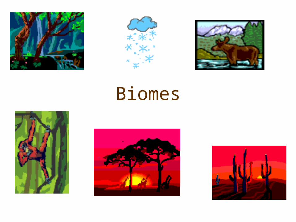
Biomes

Understanding the general characteristics of each biome leads to a global view, in which one gains a general understanding of the range of biodiversity on the earth and how it is distributed. All of the biomes play a role in global cycles, such as the carbon cycle. Although the greatest concentration of biodiversity lies in the tropics, all of the biomes have their own unique sets of species that must be understood and protected. All biomes are connected! Adapted from:Living in the Environment, 11 edition, G. Tyler Miller Jr.
Understanding the general characteristics of each biome leads to a global view, in which one gains a general understanding of the range of biodiversity on the earth and how it is distributed. All of the biomes play a role in global cycles, such as the carbon cycle. Although the greatest concentration of biodiversity lies in the tropics, all of the biomes have their own unique sets of species that must be understood and protected. All biomes are connected! Adapted from:Living in the Environment, 11 edition, G. Tyler Miller Jr.
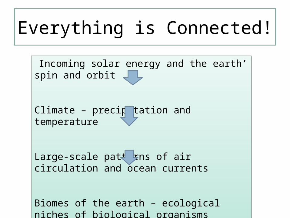
Everything is Connected!
Incoming solar energy and the earth’ spin and orbit
Climate – precipitation and temperature
Large-scale patterns of air circulation and ocean currents
Biomes of the earth – ecological niches of biological organisms
Incoming solar energy and the earth’ spin and orbit
Climate – precipitation and temperature
Large-scale patterns of air circulation and ocean currents
Biomes of the earth – ecological niches of biological organisms
biome
• Has a distinct climate• Has specific types of plants and animals• Abiotic factors: temperature, precipitation, humidity, wind, sunlight
• Biotic factors: plants, animals
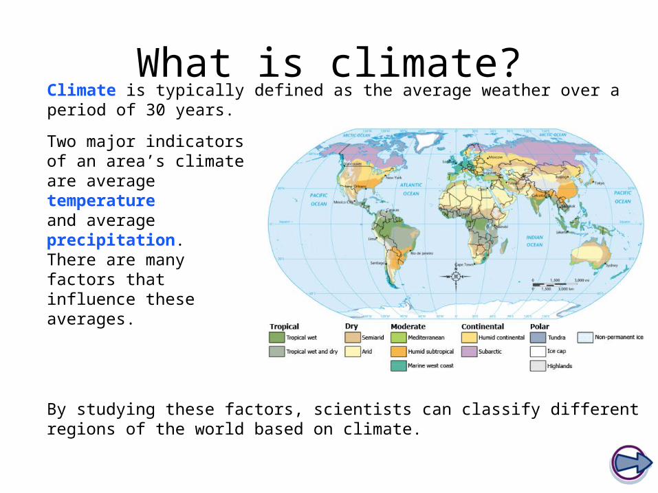
What is climate?Climate is typically defined as the average weather over a period of 30 years.
Two major indicators of an area’s climate are average temperature and average precipitation. There are many factors that influence these averages.
By studying these factors, scientists can classify different regions of the world based on climate.
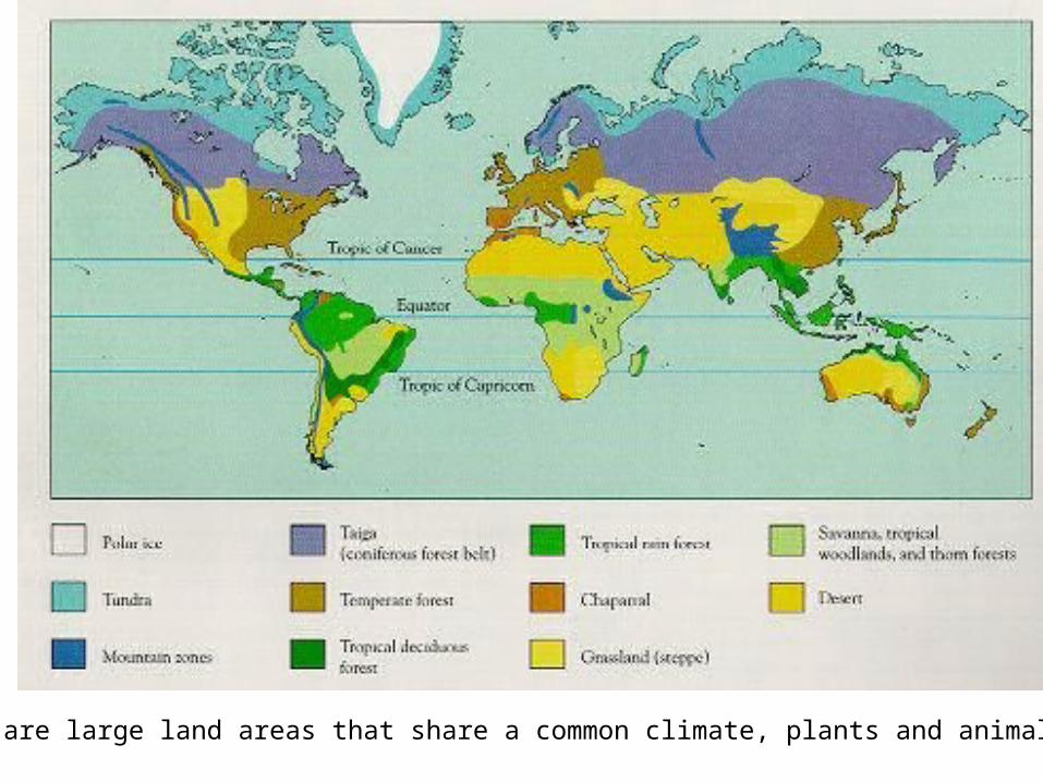
Biomes are large land areas that share a common climate, plants and animals.
Climate graphs
Plot your own climate graph

Factors affecting climateFactors affecting climate include:
Latitude
Elevation
Nearby water
Ocean currents
Topography
Prevailing winds
Vegetative cover
No one factor single-handedly determines the climate of a particular area. Instead, each factor plays an integral part in influencing climate.
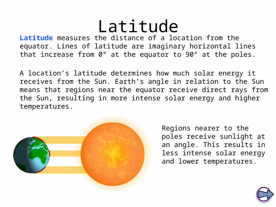
LatitudeLatitude measures the distance of a location from the equator. Lines of latitude are imaginary horizontal lines that increase from 0° at the equator to 90° at the poles.
A location’s latitude determines how much solar energy it receives from the Sun. Earth’s angle in relation to the Sun means that regions near the equator receive direct rays from the Sun, resulting in more intense solar energy and higher temperatures.
Regions nearer to the poles receive sunlight at an angle. This results in less intense solar energy and lower temperatures.

ElevationElevation describes the distance of a location from sea level.
As elevation increases, air molecules become less densely packed and air pressure decreases. Because less dense air cannot hold as much heat energy as dense air, temperatures are lower at higher elevations.
A good example of this phenomenon is Mount Kilimanjaro in Africa. The base of the 19,340 ft. mountain is covered by rainforests, while the peak is glacial, despite the mountain’s location near the equator.

Nearby waterCoastal regions tend to have milder temperatures than areas further inland.
During the summer, large bodies of water act as heat sinks, absorbing some of the Sun’s heat energy.
In winter months, water holds its heat better than land, releasing energy into the air. This warm air heats coastal regions, keeping them warmer than areas further inland.
Deeper, colder water keeps the overall temperature of the water low, cooling the air above it. This cool air then moves ashore, lowering the land temperature.
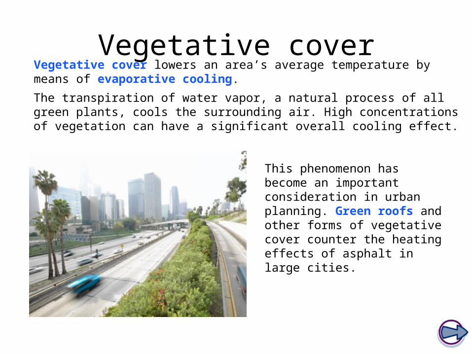
Vegetative coverVegetative cover lowers an area’s average temperature by means of evaporative cooling.
The transpiration of water vapor, a natural process of all green plants, cools the surrounding air. High concentrations of vegetation can have a significant overall cooling effect.
This phenomenon has become an important consideration in urban planning. Green roofs and other forms of vegetative cover counter the heating effects of asphalt in large cities.

Prevailing windsPrevailing winds are winds that blow more often from one direction than any other.
Winds that blow inland from the ocean bring moist air to the surrounding land, increasing precipitation, while winds that come from landlocked areas carry drier air.
Therefore, if a region’s prevailing winds come from the ocean, the region will most likely be mild and damp. If a region’s prevailing winds come from a body of land, that region will likely be dry, and might be colder or warmer based on the temperature at the wind’s origin.

Vegetation and temperature
Look at these two maps of New York City. The map on the left is a thermal map, while the map on the right shows vegetative cover.
Is there a correlation between the two maps?

Latitude and PrecipitationLatitude and Precipitation
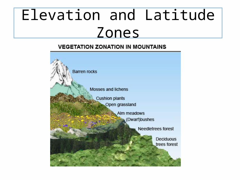
Elevation and Latitude Zones

Words to Know
1. Resilience – the ability of a living system to restore itself to original condition after being exposed to an outside disturbance that is not too drastic
2. Inertia – the ability of a living system to resists being disturbed or altered.
3. Which biomes have the greatest resilience? 4. Which biomes have the least resilience?
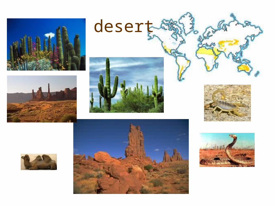
desert

Succulent Plants•Vertical orientation of most surfaces, no leaves, and the ability to store water and synthesize food in their expandable, fleshy tissue. •The plant’s shape and lack of leaves prevent water loss. •They reduce water loss by opening their pores (stomata) to take up carbon dioxide (CO2) only at night. •The carbon is stored as acids in the plant tissue and used for photosynthesis during the day.
•Vertical orientation of most surfaces, no leaves, and the ability to store water and synthesize food in their expandable, fleshy tissue. •The plant’s shape and lack of leaves prevent water loss. •They reduce water loss by opening their pores (stomata) to take up carbon dioxide (CO2) only at night. •The carbon is stored as acids in the plant tissue and used for photosynthesis during the day.
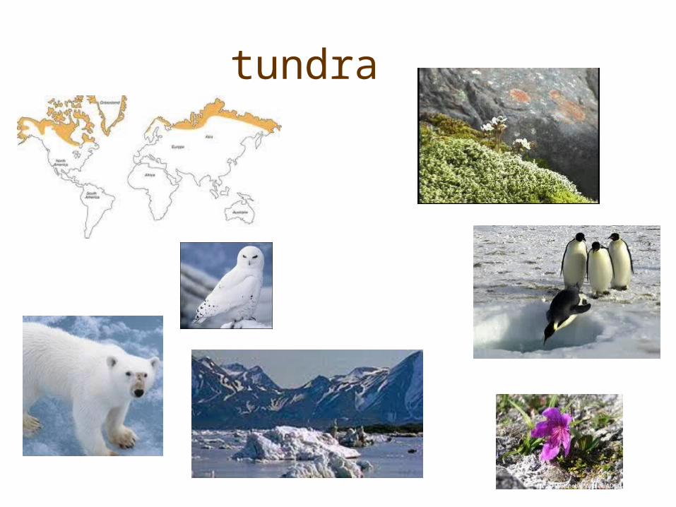
tundra

Temperate grassland
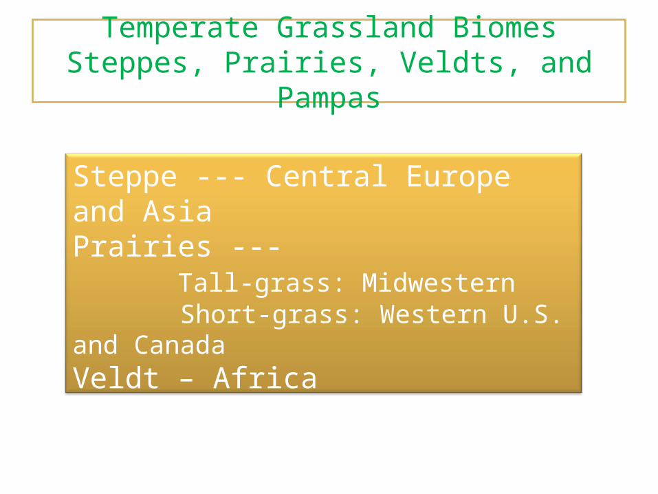
Temperate Grassland BiomesSteppes, Prairies, Veldts, and Pampas
Steppe --- Central Europe and AsiaPrairies --- Tall-grass: Midwestern Short-grass: Western U.S. and CanadaVeldt – AfricaPampas – South American
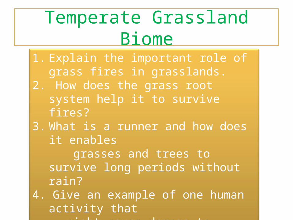
Temperate Grassland Biome
1. Explain the important role of grass fires in grasslands.
2. How does the grass root system help it to survive fires?
3. What is a runner and how does it enables grasses and trees to survive long periods
without rain? 4. Give an example of one human activity that might cause damage to grassland biomes.5. Why aren’t there many trees in the grasslands?

The Savannah
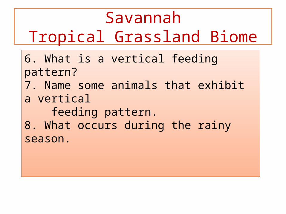
SavannahTropical Grassland Biome
6. What is a vertical feeding pattern?7. Name some animals that exhibit a vertical feeding pattern.8. What occurs during the rainy season.
6. What is a vertical feeding pattern?7. Name some animals that exhibit a vertical feeding pattern.8. What occurs during the rainy season.
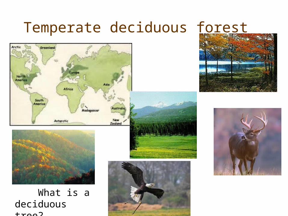
Temperate deciduous forest
What is a deciduous tree?
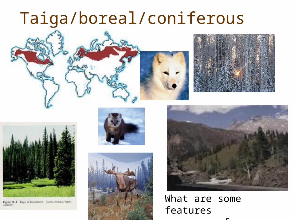
Taiga/boreal/coniferous
What are some features of conifers?
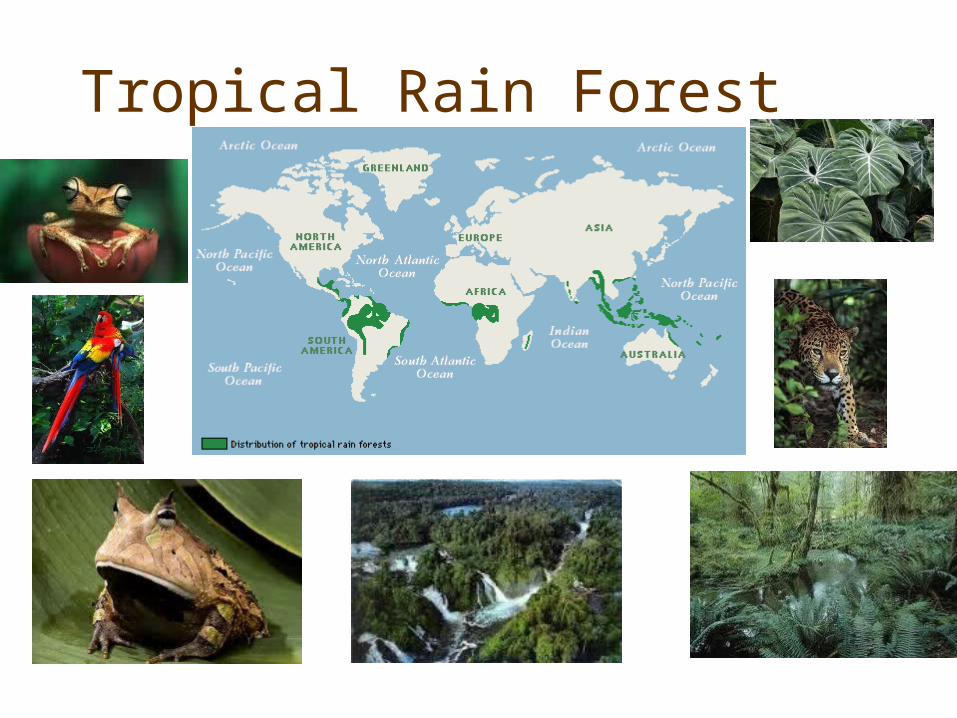
Tropical Rain Forest

Tropical Rainforest
1. What are the layers of the rainforest called beginning with the ground level?
2. Orchids and bromeliads are examples of _______________ because they attach themselves to the trunks and branches of canopy trees.
3. The most limiting factors in the tropical rainforest is ___________.
4. Most nutrients of the rainforest are found ____________.5. What type of leaves are predominant in the tropical
rainforest? Why?6. What are buttresses?7. What are lianas?
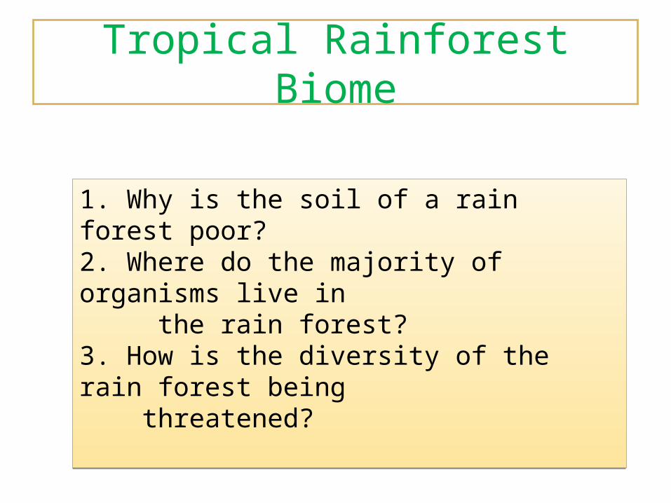
Tropical Rainforest Biome
1. Why is the soil of a rain forest poor?2. Where do the majority of organisms live in the rain forest?3. How is the diversity of the rain forest being threatened?
1. Why is the soil of a rain forest poor?2. Where do the majority of organisms live in the rain forest?3. How is the diversity of the rain forest being threatened?