bracebridge walk leaflet -...
TRANSCRIPT
Lincolnshire WalksBe a responsible walker
Bracebridge
Walk Location: Bracebridge is situated 1.6 km(1mile) south of Lincoln city centre.
Starting point: The Priory Centre, at the junctionof St Catherine’s and Colegrave Street. Grid reference : SK 971 694.
Parking: Please park responsibly near the Priory Centre.Alternatively park in The Plough pub car park (grid ref: SK 965 682)on Newark Road and start the walk from point 8.
Public Transport: Buses run regularly from the City Centre. Forfurther information and times call the Traveline on 0870 6082608or visit www.lincolnshire.gov.uk/busrailtravel.
Ordnance Survey maps for the area: Explorer 272 Lincoln.Landranger 121 Lincoln & Newark on Trent.
Walk length: 5 km (3 miles).
At a leisurely pace the walk will take approxiamtely 11/2 hours tocomplete.
Type of walk: This mostly level walk uses roadside paths, fieldpaths and tracks and may be muddy in places. There are no stiles.The path beside the river has a hard surface but is narrow anduneven in places.
Refreshments: There is a selection of shops and pubs along thewalk route including a cafe in the Priory Centre and The Plough.
These walks and leaflet have been put together with assistance from Mrs J L Smith and other Bracebridge residents and LCDP.
Please remember the countryside is a place where people liveand work and where wildlife makes its home. To protect theLincolnshire countryside for other visitors please respect it andon every visit follow the Countryside Code. Thank you.
• Be safe - plan ahead and follow any signs• Leave gates and property as you find them• Protect plants and animals, and take litter home• Keep dogs under close control• Consider other people
Most of all enjoy your visit to the Lincolnshire countryside
This leaflet is one in a series of walk leaflets produced byLincolnshire County Council’s Conservation ServicesSection to help you explore and enjoy the County’scountryside. If you have enjoyed these walks andwould like information on other walking routes inLincolnshire then please visit our website.
If you encounter any problems whilst on these walks, suchas an overgrown path or a broken sign post, please let usknow so they can be corrected.
We would also welcome your comments and suggestions on thewalk and leaflet to help improve future editions.
Lincolnshire County CouncilConservation Services
Tel: 01522 782070 Minicom: 01522 552055Email: [email protected]
Website: www.lincolnshire.gov.uk/countryside
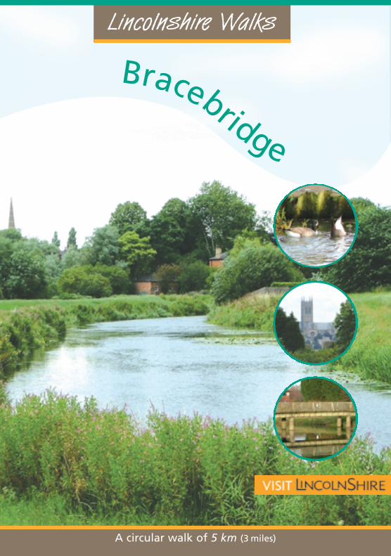
A circular walk of 5 km (3 miles)
Explore the ancient parish ofBracebridge on this walk throughtown and country on the edge ofLincoln.
Once a small parish, Bracebridgestarted to expand with theindustrial revolution anddeveloped into a suburb ofLincoln. The city’s only tramlineterminated in Bracebridge andoperated between 1883 and 1929,initially drawn by horses until1905 when it was electrified.
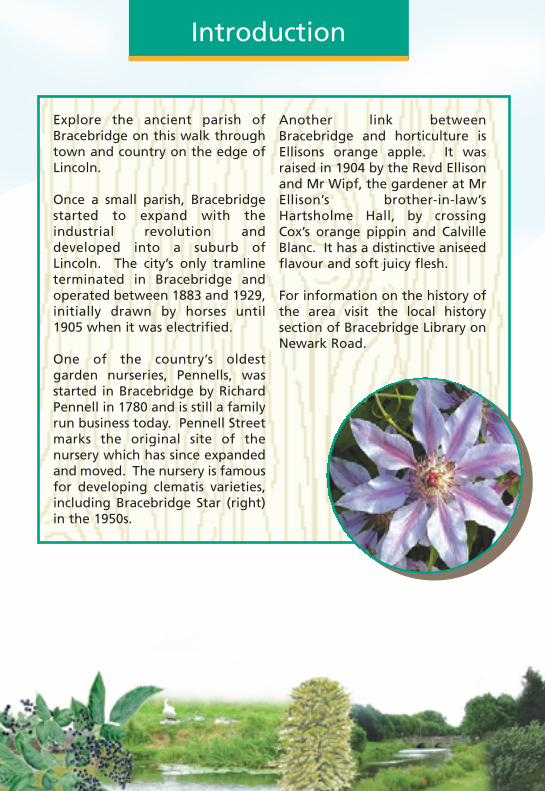
One of the country’s oldestgarden nurseries, Pennells, wasstarted in Bracebridge by RichardPennell in 1780 and is still a familyrun business today. Pennell Streetmarks the original site of thenursery which has since expandedand moved. The nursery is famousfor developing clematis varieties,including Bracebridge Star (right)in the 1950s.
Another link betweenBracebridge and horticulture isEllisons orange apple. It wasraised in 1904 by the Revd Ellisonand Mr Wipf, the gardener at MrEllison’s brother-in-law’sHartsholme Hall, by crossingCox’s orange pippin and CalvilleBlanc. It has a distinctive aniseedflavour and soft juicy flesh.
For information on the history ofthe area visit the local historysection of Bracebridge Library onNewark Road.
IntroductionWalk Information
Published June 2006
If this leaflet is not in a format that meets your needsplease contact Conservation Services
Bracebridge Leaflet 18/7/06 15:12 Page 1
Lincolnshire WalksBe a responsible walker
Bracebridge
Walk Location: Bracebridge is situated 1.6 km(1mile) south of Lincoln city centre.
Starting point: The Priory Centre, at the junctionof St Catherine’s and Colegrave Street. Grid reference : SK 971 694.
Parking: Please park responsibly near the Priory Centre.Alternatively park in The Plough pub car park (grid ref: SK 965 682)on Newark Road and start the walk from point 8.
Public Transport: Buses run regularly from the City Centre. Forfurther information and times call the Traveline on 0870 6082608or visit www.lincolnshire.gov.uk/busrailtravel.
Ordnance Survey maps for the area: Explorer 272 Lincoln.Landranger 121 Lincoln & Newark on Trent.
Walk length: 5 km (3 miles).
At a leisurely pace the walk will take approxiamtely 11/2 hours tocomplete.
Type of walk: This mostly level walk uses roadside paths, fieldpaths and tracks and may be muddy in places. There are no stiles.The path beside the river has a hard surface but is narrow anduneven in places.
Refreshments: There is a selection of shops and pubs along thewalk route including a cafe in the Priory Centre and The Plough.
These walks and leaflet have been put together with assistance from Mrs J L Smith and other Bracebridge residents and LCDP.
Please remember the countryside is a place where people liveand work and where wildlife makes its home. To protect theLincolnshire countryside for other visitors please respect it andon every visit follow the Countryside Code. Thank you.
• Be safe - plan ahead and follow any signs• Leave gates and property as you find them• Protect plants and animals, and take litter home• Keep dogs under close control• Consider other people
Most of all enjoy your visit to the Lincolnshire countryside
This leaflet is one in a series of walk leaflets produced byLincolnshire County Council’s Conservation ServicesSection to help you explore and enjoy the County’scountryside. If you have enjoyed these walks andwould like information on other walking routes inLincolnshire then please visit our website.
If you encounter any problems whilst on these walks, suchas an overgrown path or a broken sign post, please let usknow so they can be corrected.
We would also welcome your comments and suggestions on thewalk and leaflet to help improve future editions.
Lincolnshire County CouncilConservation Services
Tel: 01522 782070 Minicom: 01522 552055Email: [email protected]
Website: www.lincolnshire.gov.uk/countryside
A circular walk of 5 km (3 miles)
Explore the ancient parish ofBracebridge on this walk throughtown and country on the edge ofLincoln.
Once a small parish, Bracebridgestarted to expand with theindustrial revolution anddeveloped into a suburb ofLincoln. The city’s only tramlineterminated in Bracebridge andoperated between 1883 and 1929,initially drawn by horses until1905 when it was electrified.
One of the country’s oldestgarden nurseries, Pennells, wasstarted in Bracebridge by RichardPennell in 1780 and is still a familyrun business today. Pennell Streetmarks the original site of thenursery which has since expandedand moved. The nursery is famousfor developing clematis varieties,including Bracebridge Star (right)in the 1950s.
Another link betweenBracebridge and horticulture isEllisons orange apple. It wasraised in 1904 by the Revd Ellisonand Mr Wipf, the gardener at MrEllison’s brother-in-law’sHartsholme Hall, by crossingCox’s orange pippin and CalvilleBlanc. It has a distinctive aniseedflavour and soft juicy flesh.
For information on the history ofthe area visit the local historysection of Bracebridge Library onNewark Road.
IntroductionWalk Information
Published June 2006
If this leaflet is not in a format that meets your needsplease contact Conservation Services
Bracebridge Leaflet 18/7/06 15:12 Page 1
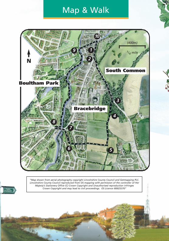
The Walk The Walk The Walk
1 Leave the Priory Centre and turnright along St Catherine’s.
2 Cross the road at the pedestriancrossing outside the UpperWitham Internal Drainage Boardand walk up Cross O’ Cliff Hill.
Walk over the bridge that crossesthe old Honington railway line.
Continue up Cross O’ Cliff Hillpast the Priory School entrance.It is worth taking a short detourinto Cross O’ Cliff Orchard (itsentrance is marked by aninformation board), a LocalNature Reserve and old orchard.
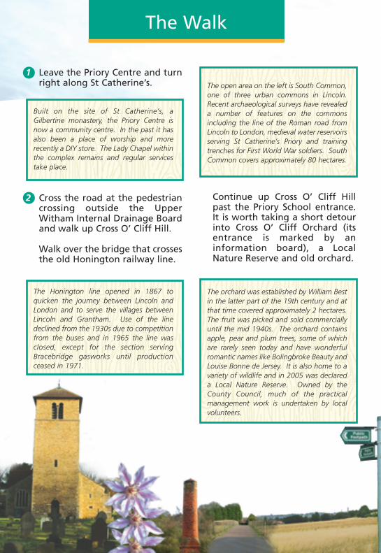
Built on the site of St Catherine’s, aGilbertine monastery, the Priory Centre isnow a community centre. In the past it hasalso been a place of worship and morerecently a DIY store. The Lady Chapel withinthe complex remains and regular servicestake place.
The Honington line opened in 1867 toquicken the journey between Lincoln andLondon and to serve the villages betweenLincoln and Grantham. Use of the linedeclined from the 1930s due to competitionfrom the buses and in 1965 the line wasclosed, except for the section servingBracebridge gasworks until productionceased in 1971.
The open area on the left is South Common,one of three urban commons in Lincoln.Recent archaeological surveys have revealeda number of features on the commonsincluding the line of the Roman road fromLincoln to London, medieval water reservoirsserving St Catherine’s Priory and trainingtrenches for First World War soldiers. SouthCommon covers approximately 80 hectares.
The orchard was established by William Bestin the latter part of the 19th century and atthat time covered approximately 2 hectares.The fruit was picked and sold commerciallyuntil the mid 1940s. The orchard containsapple, pear and plum trees, some of whichare rarely seen today and have wonderfulromantic names like Bolingbroke Beauty andLouise Bonne de Jersey. It is also home to avariety of wildlife and in 2005 was declareda Local Nature Reserve. Owned by theCounty Council, much of the practicalmanagement work is undertaken by localvolunteers.
Continue up the hill forapproximately 100m.
3 Turn right along a publicfootpath, past some new houses.Follow the path straight on andthrough a copse.
As you approach the houses youwill cross the old railway lineagain. Follow the road straighton past a line of mature trees,including horse chestnut andlime, to a junction withBrant Road, with AllSaints church on theleft.
6 At the junction turn right andcontinue to the traffic lights atthe junction with Newark Road.
7 Turn left and cross Brant Roadusing the pedestrian crossing.Cross the river and then crossNewark Road at the next set oftraffic lights, and turn backtowards The Plough.
8 Just before the pub turn leftonto the public footpath andcycleway and afterapproximately 50m turn right tofollow the path along the banksof the River Witham. As youfollow the river enjoy thechanging views of Lincolncathedral and castle on theskyline.
Map & Walk
“Map drawn from aerial photography copyright Lincolnshire County Council and Getmapping PLC.Lincolnshire County Council reproduced from OS mapping with permission of the controller of Her
Majesty’s Stationery Office (C) Crown Copyright and Unauthorised reproduction infringes Crown Copyright and may lead to civil proceedings. OS Licence I00025370”
6
7
3
2
1
8
9
5
4
Boultham Park
Bracebridge
South Common
1/4 mile
(400m)
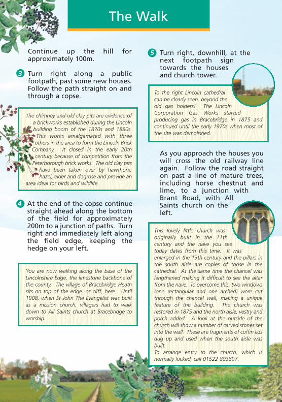
NTo the right Lincoln cathedralcan be clearly seen, beyond theold gas holders! The LincolnCorporation Gas Works startedproducing gas in Bracebridge in 1875 andcontinued until the early 1970s when most ofthe site was demolished.
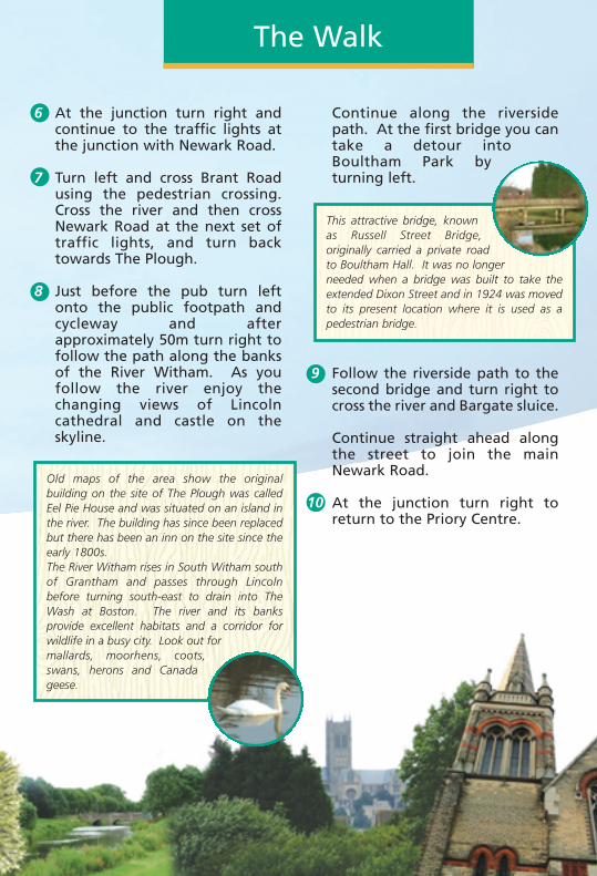
Old maps of the area show the originalbuilding on the site of The Plough was calledEel Pie House and was situated on an island inthe river. The building has since been replacedbut there has been an inn on the site since theearly 1800s.The River Witham rises in South Witham southof Grantham and passes through Lincolnbefore turning south-east to drain into TheWash at Boston. The river and its banksprovide excellent habitats and a corridor forwildlife in a busy city. Look out formallards, moorhens, coots,swans, herons and Canadageese.
This lovely little church wasoriginally built in the 11thcentury and the nave you seetoday dates from this time. It wasenlarged in the 13th century and the pillars inthe south aisle are copies of those in thecathedral. At the same time the chancel waslengthened making it difficult to see the altarfrom the nave. To overcome this, two windows(one rectangular and one arched) were cutthrough the chancel wall, making a uniquefeature of the building. The church wasrestored in 1875 and the north aisle, vestry andporch added. A look at the outside of thechurch will show a number of carved stones setinto the wall. These are fragments of coffin lidsdug up and used when the south aisle wasbuilt.To arrange entry to the church, which isnormally locked, call 01522 803897.
The chimney and old clay pits are evidence ofa brickworks established during the Lincolnbuilding boom of the 1870s and 1880s.This works amalgamated with threeothers in the area to form the Lincoln Brick
Company. It closed in the early 20thcentury because of competition from the
Peterborough brick works. The old clay pitshave been taken over by hawthorn,hazel, elder and dogrose and provide an
area ideal for birds and wildlife.
You are now walking along the base of theLincolnshire Edge, the limestone backbone ofthe county. The village of Bracebridge Heathsits on top of the edge, or cliff, here. Until1908, when St John The Evangelist was builtas a mission church, villagers had to walkdown to All Saints church at Bracebridge toworship.
4 At the end of the copse continuestraight ahead along the bottomof the field for approximately200m to a junction of paths. Turnright and immediately left alongthe field edge, keeping thehedge on your left.
5 Turn right, downhill, at thenext footpath signtowards the housesand church tower.
Continue along the riversidepath. At the first bridge you cantake a detour intoBoultham Park byturning left.
9 Follow the riverside path to thesecond bridge and turn right tocross the river and Bargate sluice.
Continue straight ahead alongthe street to join the mainNewark Road.
At the junction turn right toreturn to the Priory Centre.
This attractive bridge, knownas Russell Street Bridge,originally carried a private roadto Boultham Hall. It was no longerneeded when a bridge was built to take theextended Dixon Street and in 1924 was movedto its present location where it is used as apedestrian bridge.
10
10
Bracebridge Leaflet 18/7/06 15:12 Page 2
The Walk The Walk The Walk
1 Leave the Priory Centre and turnright along St Catherine’s.
2 Cross the road at the pedestriancrossing outside the UpperWitham Internal Drainage Boardand walk up Cross O’ Cliff Hill.
Walk over the bridge that crossesthe old Honington railway line.
Continue up Cross O’ Cliff Hillpast the Priory School entrance.It is worth taking a short detourinto Cross O’ Cliff Orchard (itsentrance is marked by aninformation board), a LocalNature Reserve and old orchard.
Built on the site of St Catherine’s, aGilbertine monastery, the Priory Centre isnow a community centre. In the past it hasalso been a place of worship and morerecently a DIY store. The Lady Chapel withinthe complex remains and regular servicestake place.
The Honington line opened in 1867 toquicken the journey between Lincoln andLondon and to serve the villages betweenLincoln and Grantham. Use of the linedeclined from the 1930s due to competitionfrom the buses and in 1965 the line wasclosed, except for the section servingBracebridge gasworks until productionceased in 1971.
The open area on the left is South Common,one of three urban commons in Lincoln.Recent archaeological surveys have revealeda number of features on the commonsincluding the line of the Roman road fromLincoln to London, medieval water reservoirsserving St Catherine’s Priory and trainingtrenches for First World War soldiers. SouthCommon covers approximately 80 hectares.
The orchard was established by William Bestin the latter part of the 19th century and atthat time covered approximately 2 hectares.The fruit was picked and sold commerciallyuntil the mid 1940s. The orchard containsapple, pear and plum trees, some of whichare rarely seen today and have wonderfulromantic names like Bolingbroke Beauty andLouise Bonne de Jersey. It is also home to avariety of wildlife and in 2005 was declareda Local Nature Reserve. Owned by theCounty Council, much of the practicalmanagement work is undertaken by localvolunteers.
Continue up the hill forapproximately 100m.
3 Turn right along a publicfootpath, past some new houses.Follow the path straight on andthrough a copse.
As you approach the houses youwill cross the old railway lineagain. Follow the road straighton past a line of mature trees,including horse chestnut andlime, to a junction withBrant Road, with AllSaints church on theleft.
6 At the junction turn right andcontinue to the traffic lights atthe junction with Newark Road.
7 Turn left and cross Brant Roadusing the pedestrian crossing.Cross the river and then crossNewark Road at the next set oftraffic lights, and turn backtowards The Plough.
8 Just before the pub turn leftonto the public footpath andcycleway and afterapproximately 50m turn right tofollow the path along the banksof the River Witham. As youfollow the river enjoy thechanging views of Lincolncathedral and castle on theskyline.
Map & Walk
“Map drawn from aerial photography copyright Lincolnshire County Council and Getmapping PLC.Lincolnshire County Council reproduced from OS mapping with permission of the controller of Her
Majesty’s Stationery Office (C) Crown Copyright and Unauthorised reproduction infringes Crown Copyright and may lead to civil proceedings. OS Licence I00025370”
6
7
3
2
1
8
9
5
4
Boultham Park
Bracebridge
South Common
1/4 mile
(400m)
NTo the right Lincoln cathedralcan be clearly seen, beyond theold gas holders! The LincolnCorporation Gas Works startedproducing gas in Bracebridge in 1875 andcontinued until the early 1970s when most ofthe site was demolished.
Old maps of the area show the originalbuilding on the site of The Plough was calledEel Pie House and was situated on an island inthe river. The building has since been replacedbut there has been an inn on the site since theearly 1800s.The River Witham rises in South Witham southof Grantham and passes through Lincolnbefore turning south-east to drain into TheWash at Boston. The river and its banksprovide excellent habitats and a corridor forwildlife in a busy city. Look out formallards, moorhens, coots,swans, herons and Canadageese.
This lovely little church wasoriginally built in the 11thcentury and the nave you seetoday dates from this time. It wasenlarged in the 13th century and the pillars inthe south aisle are copies of those in thecathedral. At the same time the chancel waslengthened making it difficult to see the altarfrom the nave. To overcome this, two windows(one rectangular and one arched) were cutthrough the chancel wall, making a uniquefeature of the building. The church wasrestored in 1875 and the north aisle, vestry andporch added. A look at the outside of thechurch will show a number of carved stones setinto the wall. These are fragments of coffin lidsdug up and used when the south aisle wasbuilt.To arrange entry to the church, which isnormally locked, call 01522 803897.
The chimney and old clay pits are evidence ofa brickworks established during the Lincolnbuilding boom of the 1870s and 1880s.This works amalgamated with threeothers in the area to form the Lincoln Brick
Company. It closed in the early 20thcentury because of competition from the
Peterborough brick works. The old clay pitshave been taken over by hawthorn,hazel, elder and dogrose and provide an
area ideal for birds and wildlife.
You are now walking along the base of theLincolnshire Edge, the limestone backbone ofthe county. The village of Bracebridge Heathsits on top of the edge, or cliff, here. Until1908, when St John The Evangelist was builtas a mission church, villagers had to walkdown to All Saints church at Bracebridge toworship.
4 At the end of the copse continuestraight ahead along the bottomof the field for approximately200m to a junction of paths. Turnright and immediately left alongthe field edge, keeping thehedge on your left.
5 Turn right, downhill, at thenext footpath signtowards the housesand church tower.
Continue along the riversidepath. At the first bridge you cantake a detour intoBoultham Park byturning left.
9 Follow the riverside path to thesecond bridge and turn right tocross the river and Bargate sluice.
Continue straight ahead alongthe street to join the mainNewark Road.
At the junction turn right toreturn to the Priory Centre.
This attractive bridge, knownas Russell Street Bridge,originally carried a private roadto Boultham Hall. It was no longerneeded when a bridge was built to take theextended Dixon Street and in 1924 was movedto its present location where it is used as apedestrian bridge.
10
10
Bracebridge Leaflet 18/7/06 15:12 Page 2
Lincolnshire WalksBe a responsible walker
Bracebridge
Walk Location: Bracebridge is situated 1.6 km(1mile) south of Lincoln city centre.
Starting point: The Priory Centre, at the junctionof St Catherine’s and Colegrave Street. Grid reference : SK 971 694.
Parking: Please park responsibly near the Priory Centre.Alternatively park in The Plough pub car park (grid ref: SK 965 682)on Newark Road and start the walk from point 8.
Public Transport: Buses run regularly from the City Centre. Forfurther information and times call the Traveline on 0870 6082608or visit www.lincolnshire.gov.uk/busrailtravel.
Ordnance Survey maps for the area: Explorer 272 Lincoln.Landranger 121 Lincoln & Newark on Trent.
Walk length: 5 km (3 miles).
At a leisurely pace the walk will take approxiamtely 11/2 hours tocomplete.
Type of walk: This mostly level walk uses roadside paths, fieldpaths and tracks and may be muddy in places. There are no stiles.The path beside the river has a hard surface but is narrow anduneven in places.
Refreshments: There is a selection of shops and pubs along thewalk route including a cafe in the Priory Centre and The Plough.
These walks and leaflet have been put together with assistance from Mrs J L Smith and other Bracebridge residents and LCDP.
Please remember the countryside is a place where people liveand work and where wildlife makes its home. To protect theLincolnshire countryside for other visitors please respect it andon every visit follow the Countryside Code. Thank you.
• Be safe - plan ahead and follow any signs• Leave gates and property as you find them• Protect plants and animals, and take litter home• Keep dogs under close control• Consider other people
Most of all enjoy your visit to the Lincolnshire countryside
This leaflet is one in a series of walk leaflets produced byLincolnshire County Council’s Conservation ServicesSection to help you explore and enjoy the County’scountryside. If you have enjoyed these walks andwould like information on other walking routes inLincolnshire then please visit our website.
If you encounter any problems whilst on these walks, suchas an overgrown path or a broken sign post, please let usknow so they can be corrected.
We would also welcome your comments and suggestions on thewalk and leaflet to help improve future editions.
Lincolnshire County CouncilConservation Services
Tel: 01522 782070 Minicom: 01522 552055Email: [email protected]
Website: www.lincolnshire.gov.uk/countryside
A circular walk of 5 km (3 miles)
Explore the ancient parish ofBracebridge on this walk throughtown and country on the edge ofLincoln.
Once a small parish, Bracebridgestarted to expand with theindustrial revolution anddeveloped into a suburb ofLincoln. The city’s only tramlineterminated in Bracebridge andoperated between 1883 and 1929,initially drawn by horses until1905 when it was electrified.
One of the country’s oldestgarden nurseries, Pennells, wasstarted in Bracebridge by RichardPennell in 1780 and is still a familyrun business today. Pennell Streetmarks the original site of thenursery which has since expandedand moved. The nursery is famousfor developing clematis varieties,including Bracebridge Star (right)in the 1950s.
Another link betweenBracebridge and horticulture isEllisons orange apple. It wasraised in 1904 by the Revd Ellisonand Mr Wipf, the gardener at MrEllison’s brother-in-law’sHartsholme Hall, by crossingCox’s orange pippin and CalvilleBlanc. It has a distinctive aniseedflavour and soft juicy flesh.
For information on the history ofthe area visit the local historysection of Bracebridge Library onNewark Road.
IntroductionWalk Information
Published June 2006
If this leaflet is not in a format that meets your needsplease contact Conservation Services
Bracebridge Leaflet 18/7/06 15:12 Page 1