bristol local flood risk management strategy
TRANSCRIPT

Bristol Local Flood Risk Management Strategy
21‐Feb Scrutiny (above: River Avon overtopping into Floating Harbour during Jan‐14 surge)

Citywide Flood Strategy
• First published in 2014, formal update in 2017
• Delivery plan with specific actions
• Covers all activities from large flood schemes to emergency response
• Strong partnership working
• Raise awareness of wider resilience

Summary of Work Completed

Surface Water Flooding – A Natural Streets Approach
• Mayor and One City Plan support• Wider benefits – traffic calming, biodiversity
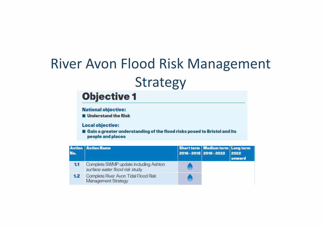
River Avon Flood Risk Management Strategy

Timeline
6
Workstream Cost/ funder
Decisions
2010 to 2013
Flood risk in central area of Bristol assessed. £0.3M EA Study endorsed by EA and informs UK flood mapping
2013 Pre‐feasibility study to recommend way forward
£73k BCC Jul‐14 Key Decision to make tidal flood strategy
2014 to 2017
Appraised strategic options to manage tidal risk to Bristol – modelling, environmental assessment, outline design and costing.
£0.5M BCC £50k EA
EA and Oct‐17 Exec Board supported outcome.
2018…
Refine strategy inc. fluvial modelling, consult and maximise wider benefits. To date: refined baseline flood risk modelling.
£0.3M EA£75k BCC
Aug‐18 – additional work to explore further options
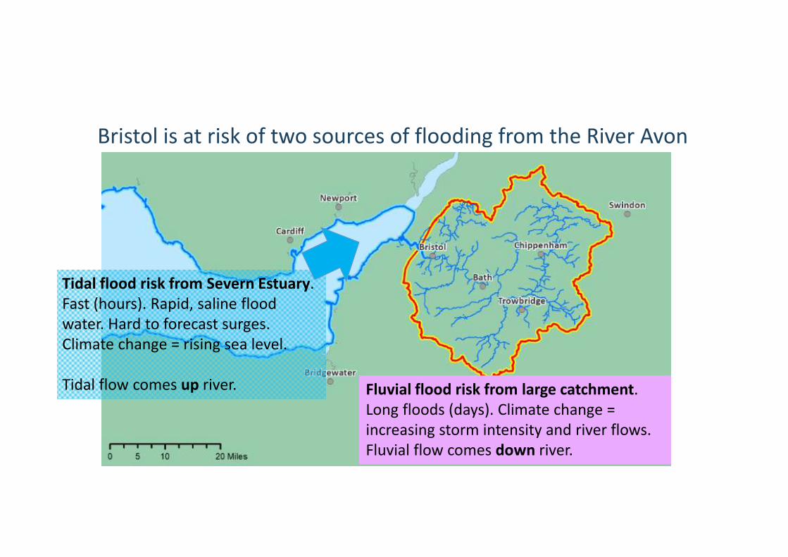
Bristol is at risk of two sources of flooding from the River Avon
7
Tidal flood risk from Severn Estuary. Fast (hours). Rapid, saline flood water. Hard to forecast surges. Climate change = rising sea level.
Tidal flow comes up river. Fluvial flood risk from large catchment. Long floods (days). Climate change = increasing storm intensity and river flows. Fluvial flow comes down river.

A4 Portway
Temple Meads
What could a flood be like, tomorrow? ‐ 1,000 homes & businesses at tidal risk today (assumes harbour flood gates closed).
‐ Hazardous fast/deep flood water is a risk to life.
‐ Overtopping directly from river and also from harbour.
‐ Lasting, widespread impact. Contaminated water will damage property, disrupt firms & sever road network.
‐ West of Temple Meads predominantly tidal risk. East of TM risk more fluvial.
8
FluvialTidal Both
Harbourside Roads
Properties next to
New Cut
Roads adjacent to
New Cut
St Philips Marsh
Properties at Netham

Jan 2014 tidal near‐missExamples: 1968 fluvial floods
heavy rainfall7 people killed805 homes flooded
‐ High tide with minor surge (+0.8m). ‐ Flood barrier used. ‐ Flooded roads & several harbourside properties. ‐ Damaged river walls. ‐ Peak levels 0.1m lower than Dec‐1981.

Threat increases significantly with continuing sea level rise ‐ 2,300 homes & 1,350
businesses (existing) at tidal risk by 2115
‐ £1.6bn flood damage to UK over 100years
‐ Impact on local economy ~£4bn due to commerce, tourism & planned development.
‐ New developments must prove safe from flooding (with climate change) and not increase risk to others.
10
FluvialTidal Both
A4 Portway
Temple MeadsHarbourside
Roads
Properties next to
New Cut
Roads adjacent to
New Cut
St Philips Marsh
Properties at Netham
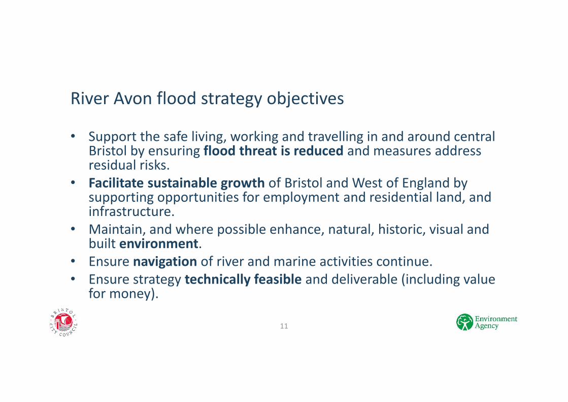
River Avon flood strategy objectives
11
• Support the safe living, working and travelling in and around central Bristol by ensuring flood threat is reduced and measures address residual risks.
• Facilitate sustainable growth of Bristol and West of England by supporting opportunities for employment and residential land, and infrastructure.
• Maintain, and where possible enhance, natural, historic, visual and built environment.
• Ensure navigation of river and marine activities continue.• Ensure strategy technically feasible and deliverable (including value
for money).

Measures discounted (infeasible)
12
• Enhancing harbour operation• Holding back upstream river flow• Increasing river capacity by dredging, constructing a flood relief
channel / tunnel.• Do‐nothing
Measures discounted (significant challenges and dis‐benefits):• Property‐level resilience measures• Tidal barrage• Area mitigation

Measures under further consideration as part of strategy
13
• Tidal barrier
• Riverfront defences and public realm

Discussion