broads authority planning committee · appendix 1 . oulton broad conservation area appraisal ....
TRANSCRIPT
Broads Authority Planning Committee 15 August 2014 Agenda Item No 10
Proposed Oulton Broad Conservation Area Public Consultation Report by Historic Environment Manager
Summary: Members will be aware that the Authority has a responsibility to review its current Conservation Areas and from time to time consider the designation of new ones. This includes the publication of these Appraisals and Management Proposals.
The purpose of this report is to give members the opportunity to comment on detailed re-appraisal work that has been carried out on the Oulton Broad Conservation Area prior to a public consultation exercise.
Recommendation: That
(i) Members consider the Oulton Broad Conservation Area draft re-appraisal; and
(ii) Subject to members’ comments, endorse it for public consultation. 1 Introduction 1.1 Members have previously agreed to assessment work being carried out on
the phased re-appraisal of existing areas, taking into account the duty of the Authority to identify, and maintain up to date appraisals of existing Conservation Areas and, as appropriate designate new areas.
1.2 Members will be aware that an informal agreement has been reached with the
Districts’ Conservation Officers whereby areas that fell mainly within the Broads Authority area would have the appraisal work carried out by the Broads Authority and areas that fell mainly outside the Broads Authority area would have the appraisal work carried out by the relevant district.
1.3 The Oulton Broad Conservation Area falls mainly within the Broads Authority
executive boundary. So in this case, the initial appraisal work has been carried out by the Broads Authority.
1.4 The Broads Authority will organise and fund the public consultation. The
details of the proposed public consultation process are outlined below. 1.5 A copy of the Oulton Broad draft appraisal and draft proposed boundary is
appended. (Appendix 1)
BH/RG/rpt/pc150814/page1of25/050814

2 Public Consultation Exercise 2.1 Once members have considered the draft Conservation Area appraisal and
proposed boundary the next stage of the process is to undergo a public consultation exercise in line with best practice and the Broads Authority Statement of Community Involvement. This will give residents within the Conservation Area and other stakeholders the chance to comment on any issues or options arising from the detailed appraisal work.
2.2 In this instance the consultation is proposed to take the form of a summary
leaflet distributed to all households in the Conservation Area and other stakeholders including Parish Council within the Conservation Area. The leaflet will include a summary of the appraisal and a map indicating the boundary revisions. The leaflet will also give consultees the opportunity to feedback to the Authority regarding the proposals. It is also proposed where practical to advertise the re-appraisal in Parish magazines or newsletters.
2.3 During the six week consultation period the Authority will host an exhibition in
Oulton Broad where Officers from both the Broads Authority and Waveney District Council will be in attendance to answer questions and receive feedback from the Public. In addition, it is intended that this will coincide with the next Parish Forum event planned to be held in the Waveney sometime at a date to be confirmed in September.
2.4. Following the public consultation exercise a further report will be brought
before the Broads Authority Planning Committee setting out the feedback from the public and stakeholder consultation and proposed actions as a result of the consultation.
2.5 Taking into account the duty of the Authority to maintain up to date appraisals
of existing Conservation Areas, formally designate areas which are considered worthy of designation and other policy issues, the Committee will at that stage consider whether or not to formally adopt the re-appraisal of the Oulton Broad Conservation Area.
3 Financial Implications 3.1 There are financial implications of a continuing appraisal programme for
existing and proposed Conservation Areas within the Broads in terms of initial assessment and if required more detailed appraisal work.
3.2 The Authority has a Cultural Heritage Budget of £30 000 part of which has
been allocated for carrying out this continuing appraisal programme. The Historic Environment Manager will continue to identify and carry out initial assessment work in house. The existing budget will be used where considered appropriate to fund the detailed appraisal work.
3.3 The Oulton Broad Conservation Area boundary is proposed to be altered as a
result of the re-appraisal, therefore potentially there will be additional financial
BH/RG/rpt/pc150814/page2of25/050814

implications for its administration in terms of the consideration of development management proposals, works to trees applications and any future re-appraisal work. Within the Broads Authority part of the Area the extensions are significant, and consequently will result in some increase to workload although this will be relatively minor and will have a correspondingly minimal impact on resources.
4.4 As regards the landowners within the proposed extensions there is the added
implication of the need to prepare heritage statements as part of any development management application and submit works to trees applications for any tree works within the area. These additional implications are also considered minimal given the area of the extension.
4.5 It is considered that the minor financial implications of the proposed boundary
changes are outweighed by the statutory duty placed on the Broads Authority to designate Conservation Areas.
5 Conclusions 5.1 The Authority has a statutory duty to consider areas which are worthy of
designation as Conservation Areas. 5.2 It is considered that the area identified by the draft boundary map and
described in the draft appraisal at Oulton Broad is worthy of Conservation Area designation following a detailed assessment, and that public and stakeholder consultation is required.
Background papers: None Author: Ben Hogg Date of report: 30 July 2014. Appendices: APPENDIX 1 - Oulton Broad draft appraisal and draft proposed
boundary Appendix can be accessed by this link:
http://www.broads-authority.gov.uk/broads-authority/committees/planning-committee/planning-committee-15-august-2014
BH/RG/rpt/pc150814/page3of25/050814
APPENDIX 1 Oulton Broad Conservation Area Appraisal Introduction Why have Conservation Areas? A review of policies relating to the historic environment carried out by English heritage on behalf of the Secretary of States for Culture Media and Sport and the Environment Transport and the Regions was published in December 2000 under the heading ‘Power of Place’. The Report which reflected views now held generally by the population at large, confirmed 5 main messages
i Most people place a high value on the historic environment and think it right there should be public funding to preserve it.
ii Because people care about their environment they want to be involved in decisions affecting it.
iii The historic environment is seen by most people as a totality. They care about the whole of their environment.
iv Everyone has a part to play caring for the historic environment. More will be achieved if we work together.
v Everything rests in sound knowledge and understanding and takes account of the values people place on their surroundings.
In summary we must balance the need to care for the historic environment with the need for change. We need to understand the character of places and the significance people ascribe to them. The concept of conservation areas was first introduced in the Civic Amenities Act 1967, in which local planning authorities were encouraged to determine which parts of their area could be defined as “Areas of Special Architectural or Historic Interest, the character or appearance of which it is desirable to preserve or enhance”. The importance of the 1967 Act was for the first time recognition was given to the architectural or historic interest, not only of individual buildings but also to groups of buildings: the relationship of one building to another and the quality and the character of the spaces between them. The duty of local planning authorities to designate conservation areas was embodied in the Town and Country Planning Act 1971, Section 277. Since then further legislation has sought to strengthen and protect these areas by reinforcing already established measures of planning control in the Planning (Listed Buildings and Conservation Areas) Act 1990, and now consolidated in the National Planning Policy Framework (NPPF). Unlike listed buildings, which are selected on national standards, the designation of Conservation Areas in the main is carried out at District level based upon criteria of local distinctiveness and the historic interest of an area as a whole. However, in the past, the criteria adopted by different local authorities in determining what constitutes a special area have tended to vary widely. For example, although public opinion seems to be overwhelmingly in favour of conserving and enhancing the familiar and cherished local scene, what is familiar to many, may only be cherished by some. Over the last 30 years this approach has changed significantly. Much greater emphasis is now placed on involving the local community in evaluating ‘what makes an area special’, whether it should be designated and where boundaries should be drawn. It is now recognised that the historical combination of local architectural style and the use of indigenous materials within the wider local landscape creates what has been termed ‘local distinctiveness’. Distinctiveness varies within the relatively restricted confines of individual counties, which in turn are distinct in terms of the country as a whole.
BH/RG/rpt/pc150814/page4of25/050814

Conservation Area designation for settlements and wider areas which embody this local distinctiveness may afford them protection against development which bears no relation to the locality either in terms of the buildings within it or landscape surrounding it. The historical development of such settlements and their surrounding landscape are the ‘journals’ through which the social and economic development of the locality can be traced. The pattern of agricultural and industrial progress of settlements (their social history) is by definition expressed in the architecture and landscape of any area. It is not intended (nor would it be desirable) to use Conservation Area designation as a way of preventing or restricting development, the expansion of a settlement or preventing contemporary innovative design. Logically in the future new development should add to, rather than detract from the character of an area and will in turn help to chart historical development. However, all development should seek to preserve and enhance the character and appearance of the area. Aims and objectives The conservation area at Oulton Broad was originally designated in 1990. This appraisal examines the historic settlement and special character of Oulton Broad, reviews the boundaries of the conservation area and suggests areas for change. If adopted, the appraisal will provide a sound basis for development management and encourage development initiatives which endeavour to improve and protect the conservation area as well as stimulating local interest and awareness of both problems and opportunities. Planning policy context Although all the land and buildings in the existing conservation area are within the Broads Authority area, the document suggests extending the boundaries which would include a small area within Waveney District Council area to on the east side of Bridge Street as indicated on the map. The Broads Authority is responsible for all Planning related matters in the majority of the area, and Waveney District for the east side of Bridge Street. There are a range of policies which affect Conservation Areas both within the Broads Authority and Waveney District Council areas, originating from both national and local sources. The latest national documents in respect of historic buildings and conservation areas are The Government’s Statement on the Historic Environment for England 2010. The National Planning Policy Framework published in March 2012, and Planning Practice Guidance for the NPPF 2014, published by the Department for Communities and Local Government. The Broads Authority and Waveney District Council endorse the contents of these documents and decisions made will reflect the various provisions contained in them. Locally, in line with government policy, the Broads Authority and Waveney District Council are currently reviewing and revising local policies which will be published in the Local Plan (formerly the Local Development Framework (LDF)). The Broads Authority has an adopted Core Strategy (2007) and Development Management Policies DPD (2011) and is progressing its Sites Specifics DPD. The Broads Authority has some saved Local Plan (2003 and 1997 respectively) Policies in place To support these policies, the Broads Authority and Waveney District Council provide further advice in a series of leaflets, which are currently being reviewed and expanded as part of the Local Plan process. A list of those currently available is attached in Appendix 5. Preamble The existing conservation area is based on the larger scale residential development in the western area of the north bank. Having re-examined the area it is proposed to extend the conservation area boundary to include Mutford Lock at the eastern end of the Broad, Nicholas Everitt Park and part of Bridge Road to the south with the remaining area of Broad itself bounded by these areas. The reasons for this are set out in the remainder of the document. The following sections cover the whole of the proposed area and the spatial analysis divided into three character areas:
BH/RG/rpt/pc150814/page5of25/050814
• the residential area north of the Broad - already in the conservation area • the Wherry Hotel, Mutford Lock to the east of the Broad and the small area of former
industrial land on the north-east bank • Nicholas Everitt Park and part of Bridge Road south of the Broad
Summary of Special Interest Located in a low lying flood plain in the Waveney valley, Oulton Broad is the most southern area of open water in the network of man-made bodies of water known as the Broads. The northern and eastern shores of the Broad are built up, while the west and south-west are quiet and natural. Substantial tree planting to the north and south provide backdrops to the development around the Broad. Oulton Broad is a busy tourist and sporting centre, the Broad itself used for an array of water sports and as a base for boat hire. The variety of leisure, domestic and commercial uses and activities around the Broad, have produced differing forms of development, from urban to rural, giving the area a diverse and vibrant environment. Location and context Located two miles (3 km) west of the centre of Lowestoft, the settlement of Oulton Broad includes both the large area of open water and the settlement around the Broad, which is now effectively a suburb of Lowestoft. The Broad is an expanse of water and marsh linked by a lock to the east to Lake Lothing which passes through the centre of Lowestoft and onto the North Sea. It is linked to the River Waveney by Oulton Dyke to the west. Due to the low lying nature of the land around the Broad, access by road is only from the east. General settlement character and plan form The area around Oulton Broad contains diverse elements – a large, busy broad, bordered by nature reserves (outside the conservation area) and significant built development with intensity of use. Oulton Broad is one of the few broads flanked by residential areas. The existing conservation area on the northern perimeter of the Broad, is mainly residential with substantial houses set in linear plots at right angles to the Broad running down to the water’s edge, roads generally following the line of the banks of the Broad. To the east of the existing conservation area, the pattern of development changes to flats and smaller houses on former industrial or boatyard land. The former industrial history of the area is evident in maltings buildings, now converted to residential use, and vacant plots of former boatyards and other water-based uses. Behind the railway line to the north, the suburban development fringe of Lowestoft is largely hidden by substantial mature tree planting at a higher level. To the east of the Broad, commercial development is more apparent, with The Wherry Hotel being the dominant element, and Mutford Lock giving access to Lake Lothing, the busy conurbation of Lowestoft and the sea beyond. The uses of the Broad itself are more varied and intense than in much of the Broads Area with power boat racing and water skiing permitted. On the south bank of the Broad, Nicholas Everitt Park provides a range of leisure and amenity uses with an open aspect bordering the water, framed by mixed tree planting. To the south-east of the park a short stretch of Bridge Road is of small scale development with a mixture of residential and commercial uses. The busy A1117 road on the eastern edge of the proposed conservation area contributes traffic noise and constant movement as it passes close to the Broad making it one of the few broads that can be seen by passing motorists. In contrast beyond the settlement fringe, the marshes to the north-west and south-west are calm and tranquil. Landscape setting Oulton Broad situated in the low-lying Waveney valley floodplain, contains some of lowest lying land in the Waveney valley, the topographical data indicating that it is between –1m and -2m OD in places. Outside the conservation area to the south and west of the Broad, marshland in arable, grazing and amenity use provides some breathing space around the expanding urban areas of Lowestoft to the north, east and south. Substantial tree planting to the north and south of the conservation area provides backdrops to the development around the Broad. Long views into and out of the conservation area are most apparent from the water, those from land restricted by the low-lying
BH/RG/rpt/pc150814/page6of25/050814

nature of the landscape, although the proximity of the main road (A1117) to the Broad allows good views of the open expanse of water of the Broad. Geological background. Chalk beds underlie the whole of East Anglia and although most of the Suffolk landscape is dominated by Chalk, it is not at an accessible depth near Oulton Broad, being approximately 120 metres below the surface. As the Chalk was subjected to smoothing glacial action, it provides a much more subdued topography than in other areas of Britain. The Chalk deposits were subsequently overlain in Pleistocene times by a series of sand, muds and gravels, and these shelly sand deposits are known as ‘Norwich Crags’. They bore the first brunt of the Ice Age as large glaciers moved into East Anglia from the north; the action of the ice moving over the loose deposits contorted the underlying material into complex thrust-type folds, known as ‘contorted drift’ and locally these outcrop along the coast at Covehithe, south of Lowestoft. The alluvium of the Broads overlies the Drift. The deposits which make up the Drift include the terraced gravels laid down by ancient rivers and beneath that, the beds of boulder clay and sands were bulldozed and dumped here by melting glaciers during the Ice Age. Apart from the shingle beaches and blown sands along the coast, the Broads are the youngest geological formations in the area. They comprise of shallow basins of alluvium sediment deposited by flowing water, especially soil formed in river valleys and deltas from material washed down by the river which were been formed within the last 8 – 10,000 years. Alluvium is the commonest material found around Oulton Broad, although some small pockets of peat remain to the north of the conservation area. Historic development Archaeology The discovery of flint tools in the cliffs at Pakefield in south Lowestoft in 2005, tracing the human habitation of the Lowestoft area back 700,000 years establishes the Lowestoft area as one of the earliest known sites for human habitation in Britain. No such early evidence of human activity has been established in the conservation area at Oulton Broad area probably due to changes in sea levels and the extraction of peat between the twelfth and fourteenth centuries. The Archaeological Service at Suffolk County Council records known archaeological sites, finds, monuments, buildings and historic landscape in the county, in the Suffolk Historic Environment Record (SHER). The SHER can be accessed through The Heritage Gateway website at www.heritagegateway.org.uk. Although the SHER contains three records for the parish of Oulton, only one is in the conservation area, that for Oulton Broad which is recorded as “probably a remnant of a medieval turbary” – the ancient right to cut peat in a particular area. In addition there are three buildings in the conservation area included in the national list of Buildings of Special Architectural and Historic Interest. (Appendix 1) Early development Before about 7000BC Britain was attached to mainland Europe and one of the last land bridges was East Anglia, the area around the valley of Oulton Broad being covered with large forests. The area between Oulton Broad and Gorleston became an island as the temperature rose after the last Ice Age with the southern and western edges being a shallow river, the now River Waveney. The river reached the sea at Lowestoft via Oulton Broad and Lake Lothing and also at Burgh Castle. As the climate became cooler in the 13th century and the ice caps grew, the water fell to its present level exposing the lakebed. This change in climate led to an increased demand for fuel for heating and the peat laid down on the lakebed from the prehistoric forest was dug up. By the end of the 14th century, the peat was exhausted and the shallow pit filled with water creating Oulton Broad. The exact origin of the name of Oulton is not known. Early records indicate a Saxon Manor, called Dunestuna or Dunston, which is believed to have been located somewhere within the area occupied by the present day parish. The name Dunestuna is from the Anglo Saxon (Old English) words - 'dun'
BH/RG/rpt/pc150814/page7of25/050814

(a hill) and 'tun or ton' (a house/settlement/enclosure). Oulton appears on a map dated 1575 as ‘Olton’ and as ‘Oldton’ on a map of Norfolk of a similar date. However, as Oulton, or any variant, does not appear in the Domesday Survey, it is thought that the area occupied by the present settlement was at one time more associated with the nearby parish of Flixton. A manor named Houghton (in some documents spelt ‘Houton’) existed in the locality between the 13th and 15th centuries. Houghton means ‘high’ or ‘hill’ farm/enclosure/settlement, and thus it is thought that the name Oulton may have derived from Houghton. The interpretation of the village in Norfolk named Houghton is thought to be from the Anglo Saxon ‘hoh’ meaning a hill farm and ‘tun’, a house or settlement. In both cases, Dunston and Houghton mean roughly the same thing – a house or farm set upon a hill. The word Broad is derived from the Anglo Saxon Braedon (to spread out or broaden) and is the word commonly used in Norfolk and Suffolk to describe the parts of rivers which have expanded to great width and locally formed small lakes. Oulton Broad was in the Mutford and Lothingland Hundred of Suffolk, which is a term dating from the 10th century for an area of land in a shire containing approximately 100 families, or 10 tithings. The Hundreds remained the accepted units of administration and taxation until 1834. The formation of the Norfolk and Suffolk Broads Originally believed to have been the result of natural processes, it was not until the 1950s that Dr J M Lambert presented research to bear out the theory that the Norfolk and Suffolk Broads were a man-made phenomenon. Her research showed that the sides of the deep lakes were vertical and not gently sloping as would be found in a naturally formed lake, and this coupled with historical evidence of a peat demand, supported her theory. In the twelfth century, the population of this part of East Anglia was growing rapidly and the area was documented to be the most densely populated in Britain. Many of the woodland areas had been cleared for fuel and peat proved a suitable fuel alternative. The ancient right to cut peat (or turf) from a particular area is known as ‘turbary’ and this right was particularly important where firewood was scarce. The extraction of peat was a prosperous industry, with the majority of it being sold to individual families and manors to provide fuel for cooking and domestic heating, and also for commercial purposes such as evaporating brine to produce salt. Account-rolls for Flixton-by-Lowestoft (1355/7), from which Oulton was formed, show 31% of the manorial income at Flixton was derived from ‘turbary', and much of the peat from what was to become the broad at Oulton was taken to the Abbey at St Benets. Peat digging continued throughout this area until the fourteenth century, when the massive holes that had gradually been created filled with water as the sea levels rose, forming what we now know of as the Broads. Over 200 km of navigable Broads and rivers were created by peat digging and these provided essential channels of communication and commerce throughout the sixteenth century. At this time, Norwich was the second largest city in England after London and its trade-able goods of wool, weaving and agricultural produce were exported all over the world from Great Yarmouth and other smaller ports on the east coast. Mutford Crossing (Not in current Conservation Area) The river crossing at Oulton Broad dates from at least the Roman occupation of the area, as it was on the major route south between the Roman fort at Burgh Castle (then on the sea shore) and Colchester. It is thought that the name Mutford, which shares the name with a nearby village, may mean 'ford near the meeting of streams’ from the Anglo Saxon ‘mutha’ meaning the mouth of a river. The first Mutford Bridge, shown on a map by Saxton in 1576, was built by Katherin Mayde in 1554 but was swept away several times. In 1660 when a new breakwater was built at Lowestoft to prevent Lake Lothing from flooding with salt water, a ‘Commission of Sewers’ was set up to decide whether to repair or rebuild Mutford Bridge and £10 allocated for its rebuilding. Sir Cornelius Vermuyden, a Dutch engineer who had worked on the drainage of the Fens, was appointed to design and build the bridge, which was the only way into Lowestoft from the south for wheeled vehicles. This was replaced in 1760 with the first brick structure which allowed small trading and fishing boats, with masts lowered, to pass under it. When this was washed away by a tidal flood in 1791, a new bridge was constructed which lasted until 1827.
BH/RG/rpt/pc150814/page8of25/050814

In 1827, the ‘Company of Proprietors of the Lowestoft Navigation’ was incorporated by Act of Parliament with powers to make and maintain a navigable waterway between Lowestoft and Norwich, thus avoiding high toll costs at Great Yarmouth, which was then the only navigable entry to Norwich, an important inland port. William Cubitt was engaged to survey the route, make recommendations and manage the work. He proposed a channel to the sea at Lowestoft and a lock at Mutford Bridge to divide Lake Lothing into two, together with the enlargement of the then inadequate Oulton Dyke which connects to the River Waveney. At this time, there being no harbour at Lowestoft, boats and ships were launched off the north beach. Opening up Lake Lothing to the sea and providing a lock at Mutford meant that the tide from Lowestoft would oppose the tide from Yarmouth which came to Oulton Broad through Oulton Dyke and the Rivers Yare and Waveney. The solution was an unusual design of lock with double gates at each end to resist the tide in each direction and because of this, Oulton Broad is fresh water (hence once known as Freshwater) and Lake Lothing is salt (Saltside). Despite several facelifts, the current lock is essentially as it was built by Cubitt. It was 23 feet wide and over 60 feet long between the gates accommodating vessels of up to 150 tons. Although there many other works planned between the coast and Norwich, the improvements only got as far as the New Cut at Haddiscoe, as the arrival of the railways proved faster and cheaper than water transport. Fish landed at Lowestoft could be on sale in London the same day, whereas a boat could take a week to reach the capital. Because taller vessels were to use the lock, it was necessary to have a bridge that could move out of their way. The first moving bridge was a retracting type, which was replaced in 1894 by the first swing bridge, a single-track wooden structure. Both of these bridges crossed over the lock, setting the line for the road. This line is now used for the pedestrian lifting bridge, installed in 1992. As the single track bridge of 1894 proved to be a bottle neck for motorised traffic, a new swing bridge was opened in 1939 - old Mr Jones of the Ivy Farm Dairy claims that his milk float was the first public vehicle to cross the bridge early on the morning of the public opening. The bridge was sited to the east of the lock so that traffic did not have to wait for the lock to fill or empty. However, following the collapse of the lock wall in 1964, the lock ceased to be used with any regularity, as the cost of rebuilding it was passed onto users in the form of higher tolls. This meant that it was cheaper for hire-cruiser owners to take their boats up the coast to Yarmouth, via the Yare and the Waveney and so to Oulton Broad. The situation changed in 1992 when the swing bridge was replaced with a bascule bridge to its east, work that involved a completely new road layout (again to alleviate traffic congestion), a rebuilt lock, a new pedestrian bridge and substantial re-shaping of the western end of Lake Lothing. Ever vulnerable to the powers of nature, the lock gates were damaged once again in the autumn of 2013 by a severe storm surge along the east coast of England. At the time of writing this document, repairs to the gates were being put in hand using funds from the Broads Authority and DEFRA (Department of Environment, Food and Rural Affairs). The coming of the railways and later development The arrival of the first railway line in Norfolk between Norwich and Great Yarmouth in 1844 was a major event in the history of the area as not only did it create opportunities for increased trade and employment, it also enabled easy access to the Broads to be a popular destination for holidays. Mr Samuel Morton Peto (later Sir Morton Peto) was a prime mover in this as he came to Lowestoft to improve the harbour and ‘enrich’ the town by constructing a railway from Lowestoft to Reedham. But this proposal was not universally popular. The renowned 19th century writer and traveller George Borrow, who moved to Oulton Broad in 1840, protested bitterly about the plans to build a railway through Oulton as he felt it would disturb the peaceful character of the area. However, authorised by an Act of Parliament in 1845, the line was opened in 1847 and this led to much of the built development to the north of the Broad. In 1859 Peto constructed Mutford Railway Bridge to carry the track from Lowestoft to Beccles and Ipswich across the western end of Lake Lothing, and by the 1880s a network connected the Norfolk Broads and the coast to London and the Midlands with Wroxham station being a popular alighting point which led to Wroxham being known as the Capital of the Broads. There are still two stations in use today at Oulton Broad, neither of which is in the conservation area; Oulton Broad North to Norwich, opened in 1847 and Oulton Broad South to Ipswich via Mutford
BH/RG/rpt/pc150814/page9of25/050814

Bridge with view of Lake Lothing to east & the Broad to the west. The two lines merge to the east of Oulton Broad to continue on to Lowestoft. The construction of the railway line connecting Lowestoft to Norwich was fundamental to the development of the area. Before then, there were few buildings of note around the Broad, (Oulton Cottage and Oulton Hall being the exceptions) and the first large scale building took place in Victorian times, when Lowestoft, a thriving seaside resort and fishing port, expanded west to join Oulton Broad. The shops in Bridge Road established to cater for the holiday trade, including those sailing on the Broad and boat building and hiring trades were set up on the water’s edge. Maltings Malting was an important industry in Oulton Broad in the late 19th and early 20th centuries, taking advantage of good transport links by water to the large grain growing areas of this part of East Anglia and a number of maltings were constructed on the north bank of the Broad. Surveys of Lowestoft in the early 1880s recorded a malthouse on the site occupied by Truman’s boatyard and a further maltings at the edge of the Broad near the junction of Commodore Road and Caldecott Road. These were demolished after the First World War to make way for boatyard buildings, which were in turn demolished for the construction of flats. Swonnell’s Maltings survive; they were built on land purchased from George Borrow and his wife, Mary by the Norfolk Railway Company, and subsequently sold to Swonnells in the early 1900s, so that they could move their malting business from Nine Elms in London to the centre of the barley growing area. By the 1920s the operation was an extensive one and it continued until 1968, when the traditional malt house was largely phased out in favour of more mechanised production. The remaining buildings were converted to residential use between 1983 and 1984. They were granted listed status, but subsequently de-listed as being too altered from original designs. The Free Quay The area beside Mutford Lock was common land until 1803. As this land was being developed, the ancient rights of free access to Oulton Broad were in danger of being lost. By the 1870s the land was owned by Great Eastern Railway Company, and George Edwards of Oulton Broad was instrumental in establishing the freedom of the site in 1881 by taking action against them to prevent the blocking of public access to the Broad over this piece of land. The Great Eastern Railway Company settled out of court and the land was dedicated as public highway by an Act of Parliament. Boat building and boating, yacht racing and motor boat racing on Oulton Broad The Broads had long been used for recreation, but the arrival of the railway in the mid 1880s saw increasing numbers of visitors from outside the area arriving to enjoy a holiday on or near the water, prompting the start of the boat building and hiring businesses which became a mainstay of the economy of the Broads. Oulton Broad was a major centre for boat building and boat hire and the 1891 edition of “Handbook of The Rivers & Broads of Norfolk and Suffolk” by George Christopher Davies, contained a list of around a dozen places at Oulton Broad where you could hire cabin yachts, wherries, fishing boats and steam launches. Well known boat building and boat hiring businesses that started in Oulton Broad, include Richardson, Hoseason, Hampton, Robinson, Fowler, Truman, Newson and Collins. By the mid 1960s, as the interest and affordability of boating holidays on the Broads brought ever increasing numbers of holidaymakers to the area, there were over 20 boatyards operating hire fleets on Oulton Broad. Many of these firms were affiliated to agencies such as Blakes, Hoseasons and Bradbeers. By the 1970s the number of yards hiring out boats in Oulton Broad had almost halved and during the 1980s and 1990s others closed or moved away to places such as Horning and Wroxham – amongst the last were Broadsway Cruisers 1987, F. Newson 1990 and A.D. Truman 1995. One of the last boat building businesses on the Broad, Pegasus Yachts closed their site on the north-east bank in 2006. In 1895 residents formed their own yacht club and by 1902, the Waveney Sailing Club had over 200 members and regattas were being held at all major Broadland villages. Professional crews were hired to race the boats as wealthy owners strived to have the sleekest and fastest yachts, often purpose built in local boatyards. The lateener (a yacht with a rig more usually found on Mediterranean vessels) and cutter yachts were in evidence at this time, and many fine, large racing
BH/RG/rpt/pc150814/page10of25/050814
yachts were built during the Edwardian period; by the mid 1930s Oulton Broad was a renowned and popular sailing centre on the Southern Broads. Smaller, open racing dinghies started to be developed, some of which continue to be raced at regattas today. Broads One Designs, known as “brown boats”, made their debut at Oulton Broad on Whit Monday in 1901. In August 1903, during Oulton Broad Regatta week, an inaugural steam launch race was organised, enthusiastically supported by Howard Hollingsworth (who donated Nicholas Everitt Park to the local council) and the local firm of Brooke Marine. This led to the formation in 1933 of the original Lowestoft and Oulton Broad Motor Boat Club by local dentist Charlie Nichols with support from the influential American Treglown family who owned a convenient Broadside property. In the 1950’s Daily Mail Director, Guy Bartholomew became interested in the sport whilst on holiday and commissioned a fleet of hydroplanes which were hired out to local business men. The club is still in the forefront of the sport, holding regular meetings during the summer and attracting competitors from all over the world to compete in major events in front of large crowds. Development history of Oulton Broad In comparison with most of East Anglia, the development in the Oulton Broad area is comparatively recent. Prior to the nineteenth century, the area was almost exclusively agricultural apart from the ancient river crossing at Mutford Bridge, with no substantial buildings recorded in the area, apart from one dated 1685 of a building on the site of Broad House, although there may have been small hovels for fishermen and farm labourers. The modern shape of Oulton Broad began with the construction of Mutford Lock in 1827 which helped to stabilise the water levels in the Broad, allowing it and the connected waterways to be used for regular commercial traffic. The opening of the Lowestoft to Reedham branch of the Great Eastern Railway in the middle of the 19th century was the next significant development; this severed the north-eastern neck of the Broad, and although most parts of the higher parts of this severed area are developed today, a strip of land between the railway and Hall Road remains as reminder of the meadows that covered the area until the turn of the century. The first large scale development took place in Victorian times when Lowestoft, a thriving seaside resort and fishing port, expanded west to join Oulton Broad. Bridge Road north of Mutford Bridge was mostly developed by the 1880s, but to the south the built area extended as far as Victoria Road only on the eastern side of the road, with no development to the west. Between the Broad and the railway on the northern side of the Broad, the land was largely undeveloped by the late 1880s. ‘A lone house’ as described by the owner, author George Borrow and Truman’s Maltings being the only buildings of note. However, by 1905 contemporary ordnance survey sheets illustrate a series of comparatively rapid changes; to the west, Boathouse Lane had been established with a number of narrow plots fronting the Broad and Swonnells Maltings had been constructed; a boathouse and other waterside buildings to the north of Mutford Lock had also been completed and in 1899 the Wherry Hotel, built on the site of an earlier and smaller inn to satisfy the increasing demands of the leisure industry of boating and holidays on the Broads. The Commodore Public House was also redeveloped around this time. A Trade Directory from 1904 records that the Civil Parish of Oulton Broad was formed from detached portions of Carlton Colville and Oulton adjacent to the Broad and the River Waveney, under Local Government Act of 1898. Prior to this the village was known as Mutford Bridge Village. In 1904 Oulton Broad was granted its own council and by 1929 it had been ‘incorporated’ in the borough of Lowestoft, of which it forms a ward today. The conservation area falls into two wards - Oulton Broad Ward to the north of Mutford crossing and Whitton Ward to the south By the early twentieth century the structure of the substantial area of housing to the north of the Broad was set out, bounded by Oulton Broad, the Lowestoft to Norwich Railway and Caldicott Road, forming what became known as the Park Estate. In 1933 Lowestoft Town Council confirmed the names of the roads, the main ones being Broadview Road, Romany Road and Borrow Road, leading westwards to the already established residences of Mancroft Towers, Waveney Hill and Lavengro (built on the site of George Borrow’s house, Oulton Cottage). Later development followed in the 1950s with a further tranche of housing, the Rock Estate, to the north (outside the proposed conservation area).
BH/RG/rpt/pc150814/page11of25/050814

While the eastern and north shores of the Broad are built up, the west and south-west remain undeveloped; White Cast Marshes and Carlton Marshes nature reserve have not changed substantially over the last two centuries are well preserved, natural areas that can be reached from Nicholas Everitt Park by public footpaths. The 1990s saw a dramatic change in the way traffic relates to Oulton Broad when the dual carriage way Saltwater Way, was constructed to relieve congestion around the Mutford river crossing and the southern part of Bridge Road and traffic flow was restricted in part of Bridge Road. Nicholas Everitt Park. Nicholas Everitt Park occupies a prominent position on the south shore of the Broad. It was presented to the Borough of Lowestoft in 1929 by Howard Hollingsworth and named in memory of his friend Nicholas Everitt, a previous owner (see Appendix 4). The development of Broad House and its grounds into a public park took place in the 20th century; the Lowestoft Journal records that £13,000 was spent on the park in 1938, a considerable sum in those days. Broad House is now The Lowestoft Museum, but was used by the Bowls Club until 1984 when a new pavilion was built. The leisure complex including the swimming pool (now disused), Yacht Station, sailing club buildings, and extensive moorings are all mid to late 20th century constructions. Conservation area spatial analysis The existing conservation area - residential area on the north shore In 1990, the Broads Authority commissioned a study of the Oulton Broad area to provide a detailed framework for the implementation of Local and Structure Plan policies. This document, the Oulton Broad Study, identified the residential area on the north shore as suitable to be a conservation area which was declared as such in 1990. To the west, the area is bounded by Fisher Row, a low level track adjoining Oulton Marshes and leading down to the Oulton Dyke. The northern boundary runs along the railway embankment and follows the south side of Borrow Road and Broad View Road and a short stretch east of Caldecott Road to turn east between 20th century housing development and then south to connect with the shore of the Broad. The north eastern part of this area from Fisher Row and including Boathouse Lane, is essentially rural in character, providing a transition between open marshland and the residential development of most of the north bank of the Broad. The ground rises from Oulton Dyke and the Broad to Waveney Hill and the railway embankment, with development mostly confined to the higher ground. The houses, set in large grounds, are in the main 20th century in origin, although the late nineteenth century Mancroft Towers (Listed Grade II) with its lodge house, occupies a commanding position on Waveney Hill. Mancroft Towers was built between 1891 and 1893 by P.E. Back, a member of a well known family of wine and spirits merchants in the city centre of Norwich, which probably explains the name of the house. It was designed by renowned Edwardian architect, George John Skipper. The lower level ground adjacent to Oulton Dyke and the Broad is marshy and therefore undeveloped, the area south east of Boathouse Lane characterised by numerous landing stages, some with boat houses. Planning policies protect the special character of this area. At a slightly higher level is Lavengro Lodge and Lavengro itself. The existing house was built by the Powell family in the late19th century on the site of the earlier Oulton Cottage, which was the home of the author George Borrow.Borrow’s thatched, timber clad summerhouse, built around 1830 (listed Grade II) survives in the garden which is where he is reputed to have spent many happy hours writing, overlooking Oulton Broad. Lavengro is still occupied by a member of the Powell family, and it is a very peaceful place with a wonderful view.
BH/RG/rpt/pc150814/page12of25/050814
There is extensive mature tree cover here, which is important to the character of the whole area, as it and the rising ground provide a dramatic backdrop to the whole of the development on the north shore. The remainder of the north shore was developed in the early 20th century and is exclusively residential, although some of the older, larger houses have been converted to flats and others to residential care homes. The earlier properties are set back from the Broad on the higher land with boathouses at the water’s edge being prominent features. This is in contrast to the inter-war and post-war development in between and this gradation of scale forms the tightly knit pattern of housing which is characteristic of the area and is particularly obvious when viewed from the south bank and particularly the Broad itself. As might be expected, Borrow Road and Broad View Road were laid out to run roughly parallel to the edge of the Broad, thereby making the most of plots with frontages to the water’s edge. The roads themselves are surfaced with asphalt with concrete kerbs to the pavements, the scale, layout and materials typical of early 20th century highway design, which whilst contemporary with the development of the area does not contribute favourably to the character of the conservation area. Boundary treatments are a mixture of low brick walls, fences and hedges, most low enough to allow a view of the properties behind and occasional glimpses of the Broad beyond. Mature trees within the gardens and on the roadsides make a positive contribution to the character of the area, providing a backdrop to unify the contrasting styles and scales of development on the north shore, particularly when viewed from the south, although the character from the road side is somewhat fragmented. Proposed extensions to the conservation area. The north-eastern and west shores including Mutford Lock This area is important in the history of the development of Oulton Broad from early times until the present day. The existing conservation area boundary, drawn tightly around the late 19th/early 20th centuries plot layout on the north bank, excludes the former boatyard land to the west of the ‘neck’ of Oulton Broad. The former boatyard area is important in the history of development in Oulton Broad as, together with sites on the north-west bank, it contained a number of the companies that made Oulton Broad a major centre for boat building and boat hiring during the early and mid 20th century. By the 1990s, many of the firms had closed down or moved away to other centres and part of this area has since been developed for medium density housing. As commercial use by Pegasus Yachts ceased in 2006, therewas a planning application granted for housing on the site in 2013.. The area is clearly visible from the south shore and, of course, the water and its inclusion in the conservation area is considered justified.. The proposed boundary excludes the housing development of Pegasus Mews built in the late 20th century, as whilst attractive in its own way, it does not make a particular visual or historic contribution to the character of the conservation area. It is not proposed to include the new development on the north-east corner (backing onto Commodore Road), but to follow the edge of the Broad and then include the 19th century Commodore Public House and The Wherry Hotel to Mutford Bridge. Extensive views of the Broad can be seen from The Commodore Public House, its garden and car park, after which Commodore Road slopes down to the junction with the A1117, Bridge Road. The Wherry Hotel is the largest single building in this part of Oulton Broad and although much extended in the 20th century the original late 19th century building (on the site of an earlier hostelry) can still be discerned. It has recently been refurbished and is an imposing presence on the east bank of the Broad. The Wherry Hotel was important in the development of the tourist industry in the late 19th and early 20th century and is still popular today, affording open views right down the Broad. It is here that vehicles and pedestrians can also appreciate the extent of the Broad from the public highway. The hotel car park is somewhat bleak but could be improved with well chosen surfacing and judicious planting without affecting the open aspect of the views across the water.
BH/RG/rpt/pc150814/page13of25/050814

The pedestrian lifting bridge across the ancient crossing and lock at Mutford is attractive and its design makes reference to similar bridges found in the Low Countries – until the mid 1990s, Lowestoft was twinned with the Dutch town of Katwijk. The bridge is accessed from the north via a shared pedestrian and cycle path fenced appropriately with unobtrusive open metal railings, but the open grassed area south of the lock adjacent to the A1117 (Saltwater Way) and bounded by grey safety railing on the road side is rather austere and could be improved with careful planting. The Free Quay is opposite beside the Broad, and until recent years a mooring jetty projected into the water. A plaque records that the jetty was constructed in the early 20th century as a memorial to Nicholas Everitt; but the jetty was removed by Waveney District Council after it was deemed to have deteriorated beyond repair. Local residents have petitioned for the jetty be rebuilt. Interpretation of the Quay and Mutford Lock would assist the appreciation of the history of the area. The pedestrian path continues to the junction of the Boulevard, with its thatched pavilions, and south to part of Bridge Road. Bridge Road. As part of the traffic scheme to relieve vehicle congestion implemented in the 1990s, Saltwater Way was constructed to take the A1117 to the east of part of Bridge Road. In the past, Bridge Road had been a local shopping street, but in more recent times businesses have tended to cater for visitors to the Broad and Nicholas Everitt Park. Approaching from the north, traffic enters Bridge Road via a ‘switch back’ road from Saltwater Way, just after the vehicle bridge. Pedestrians can approach by a more direct route from Mutford Lock along the water front. This path and the grassed areas beside it would be improved with some rationalisation, sympathetic planting and improved ground surface finishes. To the west of Bridge Road attention is draw to the open aspect of the Broad via The Boulevard and beyond to Nicholas Everitt Park itself. On the west side of the road, development is intermittent with commercial and residential premises, mainly dating from the late 19th and early 20th centuries. Beyond a small car park for The Boulevard, the first building is the Ivy Farm Dairy which included a restaurant and convenience store trading under the name D. O. Jones, a descendant of ‘old Mr Jones’ who claimed that his milk float was the first public vehicle across the new Mutford swing bridge in 1939. The building has an Arts & Crafts feel to it, especially to its south elevation where steeply pitched gables are partly clad in waney edged boarding. It is regrettable that this attractive and unusual building appeared unused at the time of the survey. Beyond the garden to Ivy Farm Dairy an early 20th century brick building houses a restaurant and small shops catering for the tourist trade. The building has a presence in the street, being taller than most at three storeys, and above ground floor level the original window configuration is mainly of the original design. The shop fronts share a common design, including the original surrounds and facias, but the larger part containing the restaurant would be improved if the stained timberwork had a painted finish. A lower level flat roofed, single storey shop attached to the south of this block is out of character with the rest of the building and its removal or improvements to the design would be advantageous. Railings in front of neatly cut grass and specimen trees herald the main pedestrian entrance to Nicholas Everitt Park which is reached via a semicircular area currently used for short term parking. Recent improvements have been carried out to this area by the Friends of Nicholas Everitt Park, with new gates and railings. However, the area is dominated by cars and could be improved, by restricting the amount of short term parking or relocating it, to enable a better relationship with Bridge Road. Beyond this, flanking the entrance to the park, is a detached mid 20th century house of quietly confident design set in a suburban garden with neatly clipped hedges over a low brick wall. The house was built for the Park Keeper, one of whom was a Mr Campbell who was well known for his care of the trees in the park. The next building, housing a convenience store is two storey, brick and slate with stucco surrounds to the upper floor windows and semicircular headed door way to the upper floor, former living accommodation. Part of a late 19th century or early 20th century sign advertising the Co-op Society painted on the brickwork of the north gable is a reminder of a past occupant. The original pilasters on the shop front remain and it’s possible that the original facia is under the more recent one. However, the new shop front is undistinguished and the whole marred by indiscriminate use of corporate signage which could be improve whilst still retaining distinctive
BH/RG/rpt/pc150814/page14of25/050814
branding. Next to this, Everitt Road s no longer a road, being used for turning and car parking with a pair of modest villas at its end. Trees and mown grass frame a view down to the Broad across part of the main car park for Everitt Park, which is neatly laid out with bound gravel roadways and grassed parking areas interspersed with trees. Beyond Everitt Road is a block of 19th or early 20th century properties containing a fish and chip shop and three terraced houses with colour washed brickwork and double height bays, only one of which retains the original window configuration. The boundary of the conservation area is at the end of this group of buildings. The northern side of the road is more continuously developed, again with a mixture of residential and commercial uses, the latter mainly in buildings converted from dwellings. At the northern entrance to Bridge Street, a mid 20th century two storey block, the main part of which is flat roofed, houses several restaurants. It is prominent in the street scene in this ‘gateway’ position and would benefit from improvements to its signage and a pitched roof would improve the scale and better integrate it with its surroundings. Beyond, the 19th century Lady of the Lake Public House is colour washed render under a traditional red pantile roof and retains the original sash windows. A small draught lobby on the pavement has been carefully designed and constructed. Overall the buildings are late 19th century or early 20th century, two storey and domestic in scale. Some still have traditional sash windows, at least to the upper floors, which add to the character of the area. There is a mixture of residential and commercial use, with businesses tending to cater for visitors, including The Lady of the Lake and The Waveney Pubs, cafes, take-away food and ship’s chandlers. The Waveney has attractive 19th century stucco detailing at first floor level, but the ground floor lean-to extension does not add to the building’s character. Alleyways and former carriage arches on this side of the road allow views to gardens and land beyond with evidence of previous boundaries in walls constructed of red brick and flintwork. At the extreme south end of the road a late 20th century residential block is designed to turn the corner. Materials are a mixture of red brick and colour washed render and overall the street has a lively, if fragmented feel. To the rear of the development on the east of Bridge Road, rear gardens are enclosed with a brick and flint wall, (presumably constructed during the road improvements) with a wide, mainly grassed verge beside the Saltwater Way, the appearance of which would be improved with increased planting. The road forms the boundary of this part of the proposed extension to the conservation area. Through traffic is restricted southbound to join Saltwater Way, but this part of Bridge Road is two way to allow access and egress from the car parking areas. On street parking is allowed on both sides of the street and this could be rationalised or the whole street be made pedestrian priority to improve pedestrian safety and allow some of the businesses to utilise widened pavements. Nicholas Everitt Park The Park occupies an area of land of approximately 6.3 hectares, to the south east of the Broad projecting into it with extensive frontages onto the water to the west and north. The Park is well used throughout the year for all kinds of water based activities, but particularly so in the summer months and when the power boat races are held. It also offers a wide variety of other activities, from Punch and Judy shows and play facilities for children to concerts on the bandstand, tennis, bowls and quiet nature walks through the wooded areas to local nature reserves. The Park is bounded to the east by Bridge Road, giving access for pedestrians and vehicles via The Boulevard and The Crescent, a semi-circular entrance area about half way up Bridge Road. From this entrance the Park is approached via a generous open pathway, either side of which are slightly sunken beds in a semi-formal arrangement with small dark stained timber seating pavilions facing Bridge Road. Beyond this the path crosses a small stream or dyke and runs through mature trees, past the former open air swimming pool and the children’s play area on the right hand side and on the left tennis courts, then a bowling green and single storey hipped roof pavilion, all flanked by established trees. The contrast between the open approach and the tree cover is marked and the shade welcome on a hot day. The view then opens up to Broad House and its associated buildings which are roughly in the centre of the Park. Dating from the 18th century, but with large early 19th century additions, Broad House is series of structures, the earliest of which are flint faced with brick dressings and slate roofs behind
BH/RG/rpt/pc150814/page15of25/050814

crenallated parapets, all in a Gothick style. The side wings have later brick upper storeys with pitched roofs. Further buildings adjoin the right hand side of the main entrance the largest of which may have been a coach house and stables, is used as a tea rooms. Broad House was the family home of Nicholas Everitt until the 1920s, and now houses a local history museum. There are some small areas of planting around Broad House and The Crescent entrance, but overall the Park has little of the ‘municipal’ bedding planting found in many public parks, relying on more robust tree planting and hedges to give it variety and form. In recent years perennial planting, structural shrubs and wild flowers have been adopted to create a more ecological approach to planting in the Park. To the south of Broad House is a large area of specimen tree planting through which informal pathways lead round either behind the bowling green and tennis courts or further west beside the waterfront to the Oulton Broad Water Sports Centre sailing school run by the Suffolk Water Sports Association, a voluntary organisation that works with Suffolk County Council offering a range of water sports activities to adults and children of all ages and abilities. The sailing school boat house is a long low building running roughly west to east, single storey, part of which has rooms in the loft space, clad in black stained boarding with a thatched roof. Behind this and parallel to it is an associated building, similarly clad in boarding with a tiled roof enclosing a storage area for canoes. Both buildings contribute to the character of the park in form and materials. To the south of these buildings, trees and open grassed areas give access to boat storage areas and moorings on the Broad. In contrast to the wooded parts of the southern area of the Park, the character is quite different to the west and north of Broad House. The Park projects into the Broad in a gentle arc allowing views of the water in all directions, across to the residential area on the north shore with its wooded backdrop and to The Wherry Hotel and Mutford Lock to the east. A broad concrete path with seats and shallow steps follows the edge of the Broad to the club house of the Waveney and Oulton Broad Yacht Club, a two storey flat roofed building the design of which is rather utilitarian for its prominent position in the conservation area. The Yacht Club holds regular race days and a regatta in the summer. A notable feature near the clubhouse is a square, early 20th century clock mounted on a timber post with metal framing protected by a small pitched roof. It is inscribed with the initials of the Lowestoft and Oulton Broad Motor Boat Club, a reminder of the early days of motor boat racing on the Broad. The boundary of the Yacht Club is marked by a chain link fence and a low timber and metal rail at the water’s edge running along the remainder of the promenade with, set back from the Broad, permanently erected ‘temporary’ metal barriers which retain spectators on speed boat racing days. All these barriers are unsightly and the area would be greatly improved with more sympathetic and permanent boundary solutions and resurfacing of the concrete walkway. Turning eastwards, the traditional timber bandstand, octagonal in plan and with a plain tiled roof provides a focus for a variety of activities, and although it appears to be rather isolated in a large area of grass, it accommodates large crowds when popular events are held in the Park. The waterside pathway follows the curve of the shore line eastwards to a set of robust brick piers between which are very attractive black painted iron gates depicting a sunrise and typical Broads icons of a trading wherry and a sailing yacht. The gates lead to The Boulevard, which is as the name suggests, a broad pedestrian avenue with parallel rows of ornamental trees, interspersed with timber planting boxes. Behind the Boulevard, the yacht station buildings are very a distinctive feature, sited in a line parallel to the water’s edge, albeit in a rather regimented manner. With dark stained timber boarding and white rendered walls under thatched roofs, these single storey buildings are reminiscent of traditional boathouses found throughout the Broads area. Renovations in recent years by Waveney District Council included re-thatching the roofs, retaining their special contribution to the character of the area. They house the Harbour Masters Office, toilet facilities and shop, behind which are a car park and a children’s boating pool which, from the water are largely hidden from view. The quay adjacent to the Boulevard is the main area for the mooring of visiting boats and the first place that water borne and other visitors see. This and the Boulevard could be made more inviting with a reordering of the hard landscaping and an improved design of planting containers With its extensive water frontage and open views across the Broad, Nicholas Everitt Park is a very attractive and well used public resource and its large range of facilities and activities for adults and children makes it a very popular recreational area not only for the residents of Oulton Broad but also
BH/RG/rpt/pc150814/page16of25/050814

for those from surrounding towns and villages, as well as water borne tourists. Car access is generally restricted to the fringes of the Park improving safety for pedestrians, and in despite being a man-made landscape, it has a very natural feel. Archtectural styles and materials Three buildings within the conservation area boundary are included in the Secretary of State’s list of buildings of special architectural or historic interest. These are listed in Appendix 1. There are also a number of buildings which are considered to make a positive contribution to the character of the conservation area which are noted in Appendix 2. As noted earlier in this document there was little development before the 19th century despite the fact that the crossing at Mutford was important for communications during earlier centuries. The arrival of the railways and the subsequent growth of the water related tourist industry meant that the settlement began to grow gradually in the late 19th century followed by more rapid development in the 20th century. , With no prevalent architectural style, as would be found for example in planned suburban areas, there is a variety of building designs; on the north bank, large 19th century residences in generous plots, often making reference to the Arts and Crafts style of design, interspersed with smaller, later houses of more mixed 20th century styles, and the remnants of the larger scale commercial development of the maltings; on the east shore, The Wherry Hotel is a particularly large and complex design for the area; the smaller scale terraced dwellings and hostelries in Bridge Road and the picturesque park buildings in Nicholas Everitt Park. However, despite this variety there are unifying factors in the scale of the domestic buildings, which are generally two or two and half storeys with pitched roofs, and the use of traditional materials of red brick, render and red or black pantiles, although there is some thatch and timber boarding on some of the smaller buildings, such as boathouses and the pavilions in the Park. In Bridge Road, the buildings relate closely to the road with roofs running parallel to it, mainly built on the back of the pavement, (early photographs show some former front gardens which have been used to provide the footway). In the Park, Broad House stands out as an individual building, its former use as house, coach house etc is obvious, although now utilised for other activities. The flintwork on the main building is an unusual material in the conservation area. Other structures in the Park are sited and designed for their use, such as seating pavilions, boating pool and the former swimming pool buildings. Ground surface materials, street furniture and the public realm Almost all of the public roads and footways are finished in asphalt, Boat house Lane is an exception as it is stll an unfinished rural lane. There is more variety in Nicholas Everitt Park with concrete, bound gravel and some brick paviours used here. The replacement of the concrete paths with a more sympathetic material would be of benefit to the character of the conservation area. On private land, gravel and brick paviours are prevelant. It is suggested elsewhere in this document that changes in materials on Bridge Road and the entrances to the Park could visually unify the area. Trees, hedges and significant open spaces Trees are a significant element in the character of the conservation area, in particular those to the north of the Broad, which provide a backdrop to the development, some of which, beyond the railway line, are outside the conservation area boundary. Particularly important groups of trees are around Fisher Row, Boathouse Lane and in private gardens on Waveney Hill. To the south of the Broad, the specimen trees and hedges in the Park are an inherent part of its attraction. Issues, pressures, threats and opportunities for improvements; Generally the buildings and gardens in the conservation area are well maintained and there are no structures that would qualify to be on the Buildings at Risk Register.
BH/RG/rpt/pc150814/page17of25/050814

However, the special character of conservation areas can easily be eroded by seemingly minor, and well intentioned, home improvements such as the insertion of replacement windows and doors with ones of an inappropriate design or material, (for example hinged opening lights in lieu of sash windows and UPVC instead of painted timber). This can be a particular issue with unlisted buildings that have been identified as contributing to the character of the conservation area. In line with current legislation, all complete window replacements are required to achieve minimum insulation values, but recognising the affect that inappropriate replacements can have, Local Authorities can relax that requirement when considering the restoration or conversion of certain buildings within conservation areas, and advice should be sought from the Local Authority at an early stage. Suggested areas for improvement Bridge Road Since the construction of the new road scheme around Mutford Bridge in the 1990s, and the restriction of traffic to a south bound direction of travel there is an opportunity to bring back a ‘local’ feel to southern part of Bridge Road adjacent to Nicholas Everitt Park and better link the entrances to the Park.
• A visual gateway into Bridge Road could be provided by extending the paving of the eastern end of The Boulevard into the street. This would also allow a better connection between Bridge Road and the Broad.
• Nicholas Everitt Park - The main semi-circular entrance to Nicholas Everitt Park could be given more prominence and integrated with Bridge Road through sympathetic landscaping such as changes to the texture and materials of the road surface and pavements and extending these into or across the road, tree planting etc.
• The short term car parking in the semi-circular entrance area is visually intrusive and inappropriate if this entrance to the park is given more prominence. Consideration should be given to relocating the short-term parking into an area in the main Nicholas Everitt car park. This would provide opportunities for other activities such as occasional street markets etc.
• On-street parking – the layout of the street could be improved to restrict the on-street parking to allow space for local businesses to spill out onto the pavement. Whilst the existing traffic access arrangements could be maintained, the road could be designated as a pedestrian priority area, making it a more attractive area for local residents and visitors and opening up opportunities for local businesses.
• General enhancement of the street – widening of pavements and sympathetic planting • Improvements in the design of some of the shopfronts and facia signs • Improvements to the design and facia signs of the block at the northern end of the east side.
Saltwater Way • Additional planting to the verge on the west side
Nicholas Everitt Park
• Improved design for the timber low kick/safety rails adjacent to the Broad • Improved design for safety rails around the north of the Broad • Improved design of enclosure to the Yacht club • Improved surface material along the north edge of the Broad • Improvements to the hard landscaping and planting of the Boulevard
Commodore Road/Saltwater Road
• The Commodore PH – improvements and additional planting to the car parking area • The Wherry PH – improvements and additional planting to the car parking area • Additional landscaping to the grassed areas between A1117 & the Broad • Interpretation of the histories of Mutford Lock and the Free Quay • Work with landowners regarding the mooring jetty at Free Quay
Conclusions The Oulton Broad Study in 1990 identified the character of the 19th century development to the north of the Broad as being suitable as a conservation area. This document evaluates areas to the east and south of the Broad and proposes that the boundaries be extended to include these areas which,
BH/RG/rpt/pc150814/page18of25/050814

whilst having different characteristics, none-the-less make positive contributions to the area as a whole and are important in the history of later development of the settlement. The conservation area boundary The boundaries to the conservation area are as illustrated on the accompanying map and as described in the text. It is suggested that the conservation area boundaries are extended to include the following areas;
Area Reasons 1. The Wherry Hotel, Mutford Lock and the
former industrial land on the nothe east bank of Oulton Broad, together with the area of the Broad in between
a. An important area in the historical development of the settlement in relation to former industries, the growth of the tourist trade and the historic crossing at Mutford Lock
b. To protect the character of development on the shores of the Broad
2. Nicholas Everitt Park and part of Bridge Road south of the Broad
a. An important area in the historical development of the settlement in relation to recreational facilities in a significant public open space and the related commercial and residential street
Public consultation Consultation with interested parties and organisations will be carried out in accordance with the Broads Authority ‘Statement of Community Involvement’ and that of Waveney District Council. Appendix 1 Listed Buildings in the conservation area Broad House, Nicholas Everitt Park, Oulton Broad. Grade II Mancroft Towers, Prospect Road, Oulton Broad. Grade II Summerhouse, Lavengro, Boathouse Lane, Oulton Broad. Grade II Appendix 2 Unlisted buildings that make a positive contribution to the character of the conservation area (within the Broads Authority Executive Area) Whilst the following buildings, boundary walls and railings within the present conservation area and the proposed extensions to it do not merit full statutory protection, they are considered to be of local architectural or historic interest, and every effort should be made to maintain their contribution to the character of the conservation area. Boathouse Lane Lavengro The Cottage Boat house adjacent to Alongside Boathouse at No. 19A Boathouse at No. 23 Waveney Hill Borrowsdale
BH/RG/rpt/pc150814/page19of25/050814
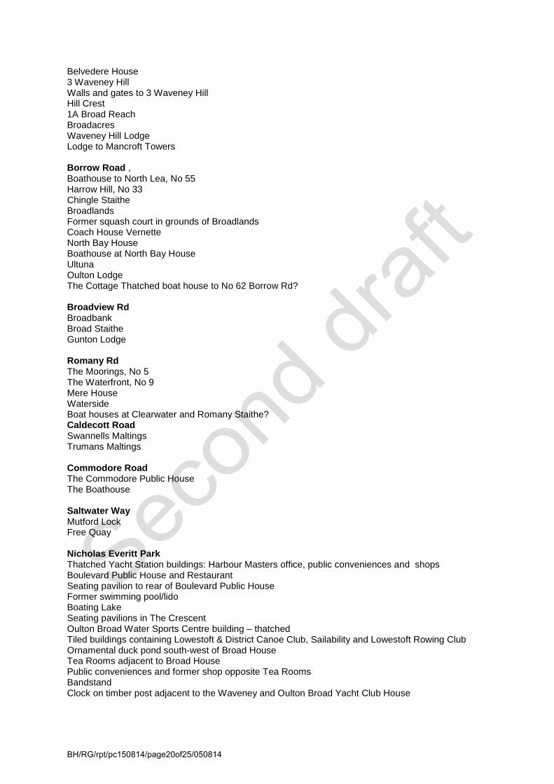
Belvedere House 3 Waveney Hill Walls and gates to 3 Waveney Hill Hill Crest 1A Broad Reach Broadacres Waveney Hill Lodge Lodge to Mancroft Towers Borrow Road , Boathouse to North Lea, No 55 Harrow Hill, No 33 Chingle Staithe Broadlands Former squash court in grounds of Broadlands Coach House Vernette North Bay House Boathouse at North Bay House Ultuna Oulton Lodge The Cottage Thatched boat house to No 62 Borrow Rd? Broadview Rd Broadbank Broad Staithe Gunton Lodge Romany Rd The Moorings, No 5 The Waterfront, No 9 Mere House Waterside Boat houses at Clearwater and Romany Staithe? Caldecott Road Swannells Maltings Trumans Maltings Commodore Road The Commodore Public House The Boathouse Saltwater Way Mutford Lock Free Quay Nicholas Everitt Park Thatched Yacht Station buildings: Harbour Masters office, public conveniences and shops Boulevard Public House and Restaurant Seating pavilion to rear of Boulevard Public House Former swimming pool/lido Boating Lake Seating pavilions in The Crescent Oulton Broad Water Sports Centre building – thatched Tiled buildings containing Lowestoft & District Canoe Club, Sailability and Lowestoft Rowing Club Ornamental duck pond south-west of Broad House Tea Rooms adjacent to Broad House Public conveniences and former shop opposite Tea Rooms Bandstand Clock on timber post adjacent to the Waveney and Oulton Broad Yacht Club House
BH/RG/rpt/pc150814/page20of25/050814

Bridge Road (west side) The Wherry Hotel Ivy Farm Dairy former restaurant, shop and house, No. 111 Nos. 113 – 119 No. 121 No. 123 Everitt Road Nos 1 and 2 Appendix 3 Buildings suggested for the (Waveney District Council Local List) Bridge Road (east side) The Lady of the Lake Public House, The Waveney Public House, Jeckels shop, No. 128 The Red Herring Restaurant Appendix 4 Well known people associated with Oulton Broad
• George Borrow (1803 – 1881) – distinguished 19th century writer and traveller, lived at Oulton Cottage on the north shore of Oulton Broad. Oulton Cottage was demolished in the late 19th century and the present house erected. The summer house (Listed Grade II) overlooking the Broad still stands, where Borrow wrote ‘Lavengro’, one of his best known books. He was greatly upset by the construction of the railway by Samuel Morton Peto, which ran through the whole length of Borrow’s estate at Oulton, cutting a swathe through the fields between the Hall and Oulton Cottage. To add insult to injury, it was said that Peto boasted that he made more money out of the gravel he extracted from Borrow’s land than he paid for it.
• George Edwards (1804 – 1893) – Landowner, entrepreneur and philanthropist – a commemorative plaque on the former Branch Library in Bridge Road records that “among his many generous gifts was the ‘Coffee Pot’, built as a meeting place for disadvantaged children”. Prior to its use as a library, the Coffee Pot was offices for the Oulton Broad Urban District Council. He was the civil engineer in charge of the construction of Lowestoft Harbour, and instrumental in the development of the standard diving dress, which revolutionised diving, making the underwater worker an essential part of both salvage and civil engineering, without which many of the great building projects of the Victorian era that exist today, such as bridges, lighthouses and tunnels, could not have been built. His unusual gravestone in St Michael’s Church, is a large glacial granite stone or ‘ice boulder’ which he requested be placed on his grave, when it was dredged up from the bed of Lake Lothing during excavations for the new Lowestoft Harbour,
• Samuel Morton Peto (1809 -1889) – an eminent and influential entrepreneur, social reformer and radical thinker of the mid 19th century. After involvement with many major public buildings and monuments in London, in 1844 he purchased Somerleyton Hall and estate, where he set about improving the life of his employees and tenants, including constructing a ‘model village’. Whilst not a resident of Oulton, Peto opened up the area to trade and tourism as he was instrumental in the construction of the Lowestoft to Reedham railway line connecting it to the rest of the system, in order to realise his ambition to turn Lowestoft from a small fishing village into one of the main ports of the country and a flourishing seaside holiday resort.
• T. F. Goodall (1856 – 1944) – a well known 19th century landscape painter. He lived just north of the library at The Homestead on Bridge Road, which is just outside the conservation area. He published ‘The Life and Landscape of the Norfolk Broads’ jointly with the renowned writer and photographer, P. H. Emerson
• Henry Reeve Everitt (usually know by his the pen name, Nicholas Everitt) (1867 – 1927) - a solicitor and public notary of Norwich and Lowestoft who brought up at North Cove Hall before
BH/RG/rpt/pc150814/page21of25/050814

the family moved to Broad House on Oulton Broad in 1874. Everitt was a keen sportsman, traveller and author of a series of popular books including one about his experiences as a British secret service agent during the First World War. In the early 1920s Nicholas Everitt fell out with the Borough in a squabble over the free quay and closed ‘The Green’ which fronted the Broad.
• Howard Hollingsworth (1871 – 1938) – philanthropist and joint founder of Bourne and Hollingsworth store of Oxford Street. After the death of his close friend Nicholas Everitt, Hollingsworth purchased the Broad House and the park and in 1929 presented it to the Borough in memory of its previous owner, on condition that it must be open free on Sundays when bands should be permitted to play. The park was opened on 20 June 1929 and in 1985 the relocated Lowestoft Museum opened in Broad House. Howard Hollingsworth was a keen yachtsman and built the Yacht Club in the Park and is reputed to have started power boat racing on Oulton Broad.
• Robert Kemp – established his boatyard off Commodore Road around 1869 and also owned and ran the Lady of the Lake Public House. He hired out a variety of cabin yachts and the pleasure wherry “British Queen“ and thus formed one of the earliest hire fleets on the Broads. By the 189os many others had set up business on the broad and the 1891 edition of George Christopher Davies “Handbook of The Rivers & Broads of Norfolk and Suffolk” contained a list of around a dozen places where you could hire cabin yachts, wherries, fishing boats and steam launches at Oulton Broad. One of the main holiday boat hire companies still operating on the Broads, although no longer based at Oulton Broad, was founded by Robert Richardson, Robert Kemp’s great, great grandson.
• William Ballantyne Hoseason started as harbour master at Oulton Broad for the Lowestoft Corporation in the early 1930s. In 1944 he began to act as an agent for boat owners, leasing out their craft to be used as houseboats by families who had been evacuated from London during the war. His first holiday brochure, covering just four pages, was produced in 1946, but the agency soon began to expand to grow into the household name known today. Hoseasons had their head office at Oulton Broad for many years.
Appendix 5 Broads Authority Guidance leaflets
• Keeping the Broads Special • Do I need Planning Permission? • How do I apply for Planning Permission? • Building at the Waterside – A guide to design of waterside buildings in the Broads Authority
area • Environment and Landscape – How do I plan and manage trees and scrub alongside rivers? • Development and Flood Risk in the Broads • Riverbank Protection Works – A guide for riparian landowners • Sustainability Guide – Sustainable development in the Broads
Waveney District Council Guidance leaflets To be completed by WDC. Appendix 6 Contact details and further information The Broads Authority Yare House 62 – 64 Thorpe Road Norwich NR1 1RY Tel: 01603 610734 Website: www.broads-authority.gov.uk Waveney District Council Marina Centre
BH/RG/rpt/pc150814/page22of25/050814

Lowestoft Suffolk NR32 1 HH Tel: 01502 562111 Website: www.waveney.gov.uk Suffolk County Council Archaeological Service 9 & 10 The Churchyard Shire Hall Bury St Edmunds Suffolk IP33 1RX Sources and references: Whites Directory 1874
Kelly’s Directory of Suffolk 1904 & 1929
East Suffolk Illustrated 1909
English Heritage: Guidance on conservation area appraisals, 2006
English Heritage: Guidance on the management of conservation areas, 2006
Understanding Place: Conservation area designation, appraisal and management. English Heritage 2010
The Buildings of England, Suffolk, Nikolaus Pevsner
The Norfolk Broads, A Landscape History, Tom Williamson
Oulton Broad Study, Broads Authority 1991
George Borrow’s Oulton, Ivan Bunn
The Story of Oulton Broad from Ancient Times, Jon Read
Broad House, The home of Lowestoft Museum & Nicholas Everitt, Jon Read
Sir Samuael Morton Peto, Tricia Cuming
Suffolk Heritage Environment Record
The Place Names of Suffolk, Walter Skeat (1913).
Broads Landscape Character Assessment
Websites consulted include; A Walk around Oulton Parish
Lowestoft Heritage
Broadland Memories
Vision of Britain
BH/RG/rpt/pc150814/page23of25/050814

BH/RG/rpt/pc150814/page24of25/050814

BH/RG/rpt/pc150814/page25of25/050814