building a developer community with containers
TRANSCRIPT

1
Building a developer community with containers
https://about.me/chihchun
SoTM Asia 2016 @ National Institute of Physics Auditorium, University of the Philippines Diliman
2016-10-02

2
Rex Tsai
+15 years expereicne on Open source software development and community
Join the first OpenStreetMap Mapping party in Kaohsiung at 2008. Participatng OSM community in free time as habit.
http://about.me/chihchun/http://www.openstreetmap.org/user/chihchun

3
Mountains on the island● 78% of island are rugged
forest-covered mountains
● 3310 natural=peaks node in Taiwan
● 268 peaks with elevations of over 3,000 m (9,800 ft)
Taiwan is mostly mountainous in the east, with gently sloping plains in the west. https://en.wikipedia.org/wiki/Geography_of_Taiwan

4
What's the issue of maps● There is no official maintained
relief map. The latest one is 10 years ago.
● There are too many paths, surveyed and built by different expedition teams.
● After Typhoon season every year, the path can be damaged and too danger for hikers.
5
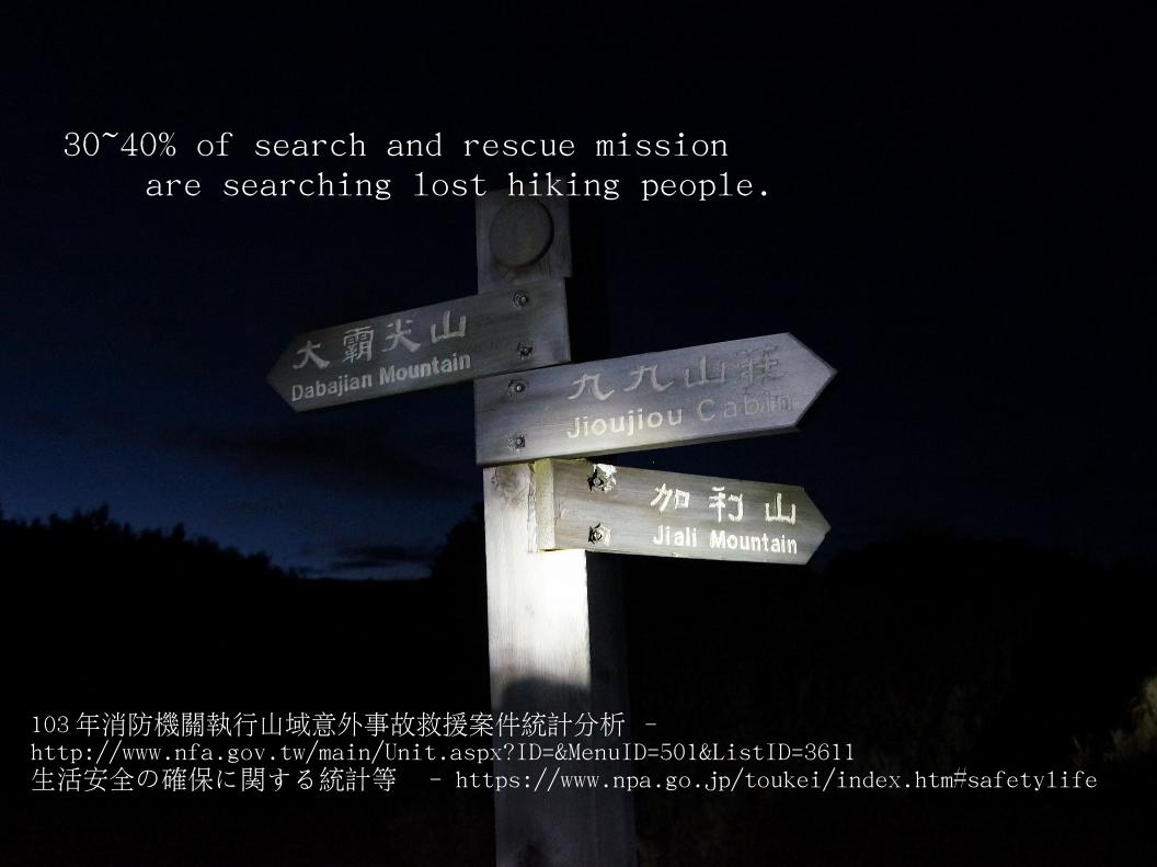
103年消防機關執行山域意外事故救援案件統計分析 - http://www.nfa.gov.tw/main/Unit.aspx?ID=&MenuID=501&ListID=3611生活安全の確保に関する統計等 - https://www.npa.go.jp/toukei/index.htm#safetylife
30~40% of search and rescue mission are searching lost hiking people.

6
Community● Around 5 million citizen participated in hiking
activities● Several user groups
● Building online tutorial and offline training on using OruxMap/Locus map and OSM in MapsForge format.
● Developer community ● Customized style with countour line in
mapsforge and Garmin map format.● Building customized android app using
mapsforge.● A new association will be focus on prevent
hiking risk by teching people use osm on phone.
7
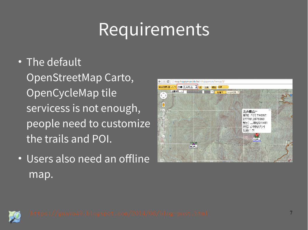
Requirements● The default
OpenStreetMap Carto, OpenCycleMap tile servicess is not enough, people need to customize the trails and POI.
● Users also need an offline map.
https://guava49.blogspot.com/2014/08/blog-post.html

8
Challanges
https://wiki.openstreetmap.org/wiki/Component_overview
● Complexity software stacks.
● Too many configs during the process – fonts, styles,
● Compatibility issues on different versions● mapnk2/mapnik3,
python2/phthon3, etc..

9
Enviroment for DevOPs Community
● Software stacks with different version are split in small docker images, no dependency issue.
● Services can be shipped as docker compose config.
● Allow developer to quickly try out and build a prototype
10
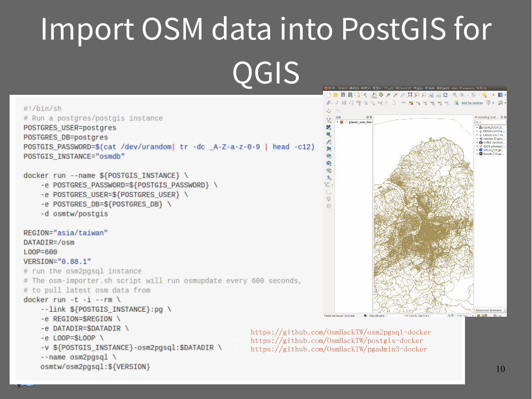
Import OSM data into PostGIS for QGIS
https://github.com/OsmHackTW/osm2pgsql-docker ● https://github.com/OsmHackTW/postgis-docker ● https://github.com/OsmHackTW/pgadmin3-docker

11
Ship a tile server in 10 mins$ git clone [email protected]:OsmHackTW/osm-tiles-docker.git
$ cd osm-tiles-docker$ docker-compose up
- Postgis database to store OpenStreetMap data.
- osm2pgsql, Convert OSM planet snapshot data to SQL suitable for loading into a PostgreSQL database with PostGIS geospatial extensions.
- mapnik
- Cascadenik
- mod_tile + renderd
- carto & millstone
- leaflet
https://github.com/OsmHackTW/osm-tiles-dockerhttps://github.com/OsmHackTW/modtile-docker

12
Ghost Island (GD) Tiles● Tile server aiming to
highlight special criminal case, illegal incidents
https://github.com/OsmHackTW/gdtile-dockerhttps://github.com/OsmHackTW/tilestache-docker

13
Customzied tile style● Magnacarto is a CartoCSS map
style processor that generates Mapnik XML and MapServer map files.
● One command to get it running in local machinedocker run -t -i --rm -p 8080:8080 osmtw/magnacarto magnaserv -listen 0.0.0.0:8080
https://github.com/OsmHackTW/magnacarto-docker

14
Taiwan gov MOI – 20M DEM ● Resource of SRTM/ASTER DEM
data is not enough for rescue mission or expedition.
● After two yeas negotiation and engagement with public sectors, Taiwan government released 20M DTM in GeoTIFF and ASCII gridded XYZ raster at 9 Sep 2016.

15
Converting DTM data
http://blog.nutsfactory.net/2016/09/14/taiwan-moi-20m-dtm/

16
gdal/phyghtmap● Convert from
GeoTIFF to● Shapefile● Postgres/PostGIS SQL● SRTM HGT● OSM PBF

17
Tools for building relief map● osmosis build mapsforge data -
https://github.com/OsmHackTW/osmosis-docker● phyghtmap – convert shape file to OSM format -
https://github.com/OsmHackTW/phyghtmap-docker● qmapshakc – to redner garmin map on deksto
https://github.com/OsmHackTW/qmapshack-docker● gdal - https://github.com/OsmHackTW/gdal-docker

18
Visualized Geo data with tile server● Export Drinking water POI into GeoJSON – faster for browsing with other tile server
● http://drinking.teia.tw/● https://github.com/OsmHackTW/drinking-vector-til
e-docker●Build a tile server of New Taipei City bus stops dataw, which can be used with josm for data vadliation.
● https://github.com/OsmHackTW/ntpc-bus-stop-tile●

19
TODO
● Vector based map server● GeoR● QA tool – osmose, to-fix● Taginfo● Overpass

20
OpenStreetMap Taiwan● https://github.com/OsmHackTW?query=docker● https://hub.docker.com/u/osmtw/
Related works● http://geocontainers.org/
References