by paul r. eyre u.s. geological survey - usgs facilities engineering command pearl harbor, hawaii...
TRANSCRIPT

THE EFFECTS OF PUMPAGE, IRRIGATION RETURN,
AND REGIONAL GROUND-WATER FLOW ON THE WATER
QUALITY AT WAIAWA WATER TUNNEL, OAHU, HAWAII
By Paul R. Eyre
U.S. GEOLOGICAL SURVEY
Water-Resources Investigations Report 83-^097
Prepared in cooperation with the
U.S. DEPARTMENT OF THE NAVY
PACIFIC DIVISION
NAVAL FACILITIES ENGINEERING COMMAND
Pearl Harbor, Hawaii
Honolulu, Hawai i
1983

UNITED STATES DEPARTMENT OF THE INTERIOR
JAMES G. WATT, Secretary
GEOLOGICAL SURVEY
Dallas S. Peck, Director
For additional information
write to:
District Chief
U.S. Geological Survey, WRD
Rm. 6110, 300 Ala Moana Blvd
Honolulu, Hawaii 96813
Copies of this report
may be purchased from:
Open-File Services Section
Western Distribution Branch
U.S. Geological Survey
Box 25425, Federal Center
Lakewood, Colorado 80225
(Telephone: [303] 23^-5888)

CONTENTS
PageCross references of well identification ----- ------------------------- v
Executive summary ------- -_-______-__--_--__-__-_____-___--_--_----- -j
Introduction ------------------------------------------------ __-_-_--_ 4
Acknowledgments --------------------------------------------------- ^
Background information -------------------------------------------- ^
Regional hydrology --------------------------------------------------- 3
Methods of study -------------- ______---__-__ -_-_________-_ _____ -\ ]
Review of existing records and reports ---------------------------- 14
Pumping tests ----------------------------------------------------- 15
Additional activities --------------------------------------------- 16
Evaluation of data ------ -------- ______ ____ ____ ___________ 1$
Review of existing records and reports ---------------------------- 16
Data from Oahu Sugar Company --------- _----_--_--__-_--_---_---_- 20
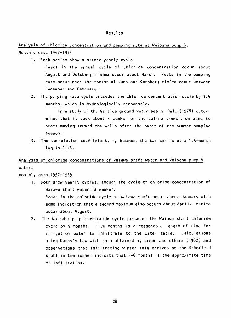
Time-series analysis of pumpage and chloride data ----------------- 23
Resul ts ------------ ---- ---- -- --__- _ 28
Analysis of pumping and chloride concentration,
Waiawa shaft, 1978 through 1979 ----- -- ---- - 31
Pumping tests -- ------------------------------------------------- 32
Medium-rate pumping test -------- -----_--_--___--_--_--_---- 32
Recovery and low-rate pumping tests -------------------------- 34
High-rate pumping test --------------------------------------- 37
Decline in chloride concentration at Pearl City I and II wells
and an analogy to Waiawa shaft -------- -------- _______ ___--__ 37
Conclus ions ------------------------------------------------------------ ^1
Recommendat ions --------- ______________________________________ ___ 42
References ----------_----------------_--_--_--__-_-__-_--__-_--_____- 43
i i i

ILLUSTRATIONS
Figure Page
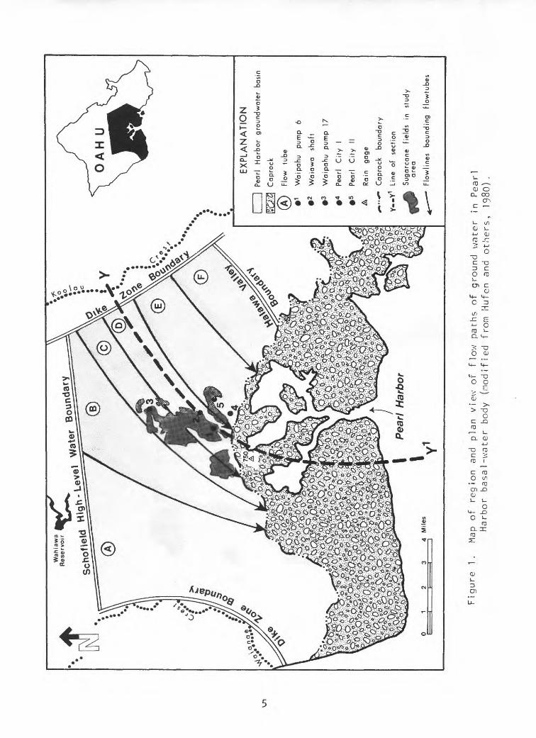
1. Map of region and plan view of flow paths of ground waterin the Pearl Harbor ground-water basin ------------------ 5
2. Map of the study area ---------------------------------------- 7
3. Map showing head contours in the Pearl Harborground-water basin ----- -------------------------------- 9
4. Longitudinal section showing flow lines of ground
water in the Pearl Harbor ground-water basin ------ ---- 10
5. A schematic drawing showing the distribution of rechargein a Ghyben-Herzberg lens --------------------------------- 12
6. Drawing showing the schematic distribution ofchloride ions underlying Waiawa shaft ------------------- 13
7. Graph showing annual rainfall at Waipahu rain gage 750, 1950-80 19
8. Graph showing monthly pumpage at Waipahu pump 6,January 19^7-June 1981 24
9. Graph showing average monthly chloride concentration atWaipahu pump 6, January 19^7-June 1981 -- ----------- - 25
10. Graph showing monthly pumpage at Waiawa shaft,January 1952-June 1981 26
11. Graph showing average monthly chloride concentration atWaiawa shaft, January 1952-June 1981 - 27
12. Graph showing weekly average of daily pumpage
and daily chloride concentration at Waiawa shaft,
July 11, 1980-July 4, 1981 33
13- Graph showing discharge versus distance along the tunnel,
Waiawa shaft (March 9-19, 1951) 36
14. Graph showing Pearl City I pumpage and chloride
concentration, February 1965-December 1972 - -- --- 38
15. Graph showing Pearl City II pumpage and chloride
concentration, February 1965-December 1971 - 39
i v

TABLES
Table
1.
2.
Chloride and nitrogen concentrations of Waipahu pump 6 water in 1980 -
Chloride concentration at well T-40 ------- .
Page
21
22
CONVERSION TABLE
The following table may be used to convert measurements in the inch-pound
system to the International System of Units (SI).
Multiply inch-pound units
foot (ft)
mile (mi) ----- ---------
million gallons per day
(10 gal/d or Mgal/d)
gallon per minute (gal/min)
0.3048
1.609
0.04381 0.06309 --
To obtain SI units
meter (m)
kilometer (km)
cubic meter per second (m /s)
liter per second (L/s)
CROSS REFERENCES OF WELL IDENTIFICATION
Name
Waiawa shaft
Waipahu pump 6
Waipahu pump 17
Pearl City 1
Pearl City IIT-39
T-40
State of Hawa i i Wel 1 Number
2558-10
2459-01 to -14
2658-01, -02
2458-03, -04
2457-01 to -03
2558-08
2558-09
Old Well Number
239 A to N
250 3A, 3B
202 1A, IB
202 2A-2C

THE EFFECTS OF PUMPAGE, IRRIGATION RETURN,
AND REGIONAL GROUND-WATER FLOW ON THE WATER
QUALITY AT WAIAWA WATER TUNNEL, OAHU, HAWAII
By Paul R. Eyre
EXECUTIVE SUMMARY
The water sources used to supply water to the Pearl Harbor Naval Base
complex and Hickam Air Force Base consist of three water tunnels (shafts) located
at Waiawa, Red Hill, and Halawa, which are owned and operated by the United
States Navy. Average water use within the Pearl Harbor-Hickam complex is about
20 Mgal/d (million gallons per day). The Waiawa shaft supplies about 70 to 90
percent (Ik to 18 Mgal/d) of this demand. The shaft at Red Hill serves as a
secondary source. The Halawa tunnel is used largely as a standby source. The
Navy must rely on Waiawa shaft for most of its water supply, because the Red Hill
and Halawa sources do not have the sustained capacity needed to supply the Pearl
Harbor-Hickam complex without serious degradation of these sources.
Since 1970 the salinity of Waiawa shaft water has increased from about 125
mg/L Cl (milligrams per liter of chloride) to a high of 290 mg/L in April of 1979.
The National Secondary Drinking Water Regulations (U.S. Environmental Protection
Agency, 1977) recommend that the maximum chloride concentration in potable water
not exceed 250 mg/L for aesthetic reasons; that is, many people can detect a
salty taste if the chloride concentration exceeds that value.
Studies of the salinity problem at Waiawa shaft by the Public Works Center,
Fourteenth Naval District, Pearl Harbor, have indicated that the increasing
salinity is due to contamination from irrigation-return water or seawater intru
sion. Because of the concern over the continuing deterioration of their princi
pal source of water, the Pacific Division, Naval Facilities Engineering Command
requested the U.S. Geological Survey to undertake this study.

Waiawa shaft is designed to skim large quantities of water from the surface
of the freshwater lens that composes the Pearl Harbor basal-water body. The
Ghyben-Herzberg principle states that a freshwater lens, floating on seawater,
will have a thickness equal to ^1 times the head (water-table elevation) of
freshwater above sea level. Freshwater and seawater are actually separated by a
transition zone where chloride concentrations increase sigmoidally with depth.
At Waiawa shaft the lens thickness is about 800 feet.
By skimming water from a large area near the surface of the lens, the
possibility of drawing underlying seawater into the shaft is reduced. Soroos and
Ewart (1979) showed that pumping from the aquifer is causing the lens to shrink,
probably causing seawater to move closer to the shaft.
Another source of salt in the water produced from Waiawa shaft is irriga
tion-return water. This water results from irrigation water (chloride concen
tration about 1,000 mg/L), which is drawn, in part, from the saline transition
zone by deep wells and applied to sugarcane fields that overlie the shaft. A
significant fraction of this water infiltrates through the ground and degrades
the upper portion of the ground-water lens. This study was designed to determine
the extent that the irrigation-return water and seawater affect the water at
Waiawa shaft.
Historic and recent chloride and pumpage data, water-chemistry data, and
pumping tests support the conclusion that nearly all the salts in Waiawa shaft
water result from irrigation-return water. Water from many wells in the Pearl
Harbor ground-water basin contains some fraction of irrigation-return water
(Tenorio and others, 1969; Hufen and others, 1980). A continued shrinking of the
freshwater lens will increase the potential for seawater contamination of water
from Waiawa shaft in the future.
The quality of water produced from the shaft results from complex relation
ships among the ambient ground-water flow system, the pumping rate at Waiawa
shaft, irrigation water quality and quantity, and the climactic fluctuations
which affect ground-water recharge. When Waiawa shaft is pumped, the degraded
water, which occurs near the top of the lens, is removed and diluted with
freshwater that comes from deeper in the lens. At lower pumping rates there is
less dilution. Although the water quality at the shaft can be controlled to some
extent by changing the pumping rate, in general, the quality also will be subject
to fluctuations or trends in irrigation, climate, and the regional ground-water
flow system.

If high-salinity water continues to be used for irrigation, the chloride
concentration of Waiawa shaft water will probably be about 200 to 220 mg/L in
years of normal rainfall. In dry years, when more irrigation water of lower
quality is applied, the chloride concentration of the shaft water will probably
increase. The chloride concentration of the irrigation water used in the
vicinity of Waiawa shaft has historically increased in steps, principally in
response to local and regional increases in pumping. Presently, the chloride
concentration appears to have stabilized. However, if it increases further, so
will the chloride concentration of Waiawa shaft water.
If the application of high-chloride irrigation water is discontinued, the
chloride concentration of the shaft water is likely to decline to about 100 mg/L
within five years. This conclusion is based on ground-water flow rates and
analogy with other wells in the Pearl Harbor basin.
A deep monitor well located near Waiawa shaft would provide the clearest
understanding of the source of salts in the shaft water. Such a well would
become even more useful if the lens continues to shrink and seawater encroaches
farther into the lens.

INTRODUCTION
Acknowledgments
The author wishes to thank Maurice Kaya, Gordon Matsushita, and Tony Dilullo
of the U.S. Navy Public Works Center at Pearl Harbor for their assistance in
obtaining and compiling data on Waiawa shaft. Mr. Oilullo's management and
knowledge of Waiawa shaft contributed greatly to the success of the pumping
tests. David Morrel1 and Charles Farr of the Engineering Division of Oahu Sugar
Co. were most helpful in providing data on Waipahu pump 6, the irrigation system,
field locations, and in arranging access to Oahu Sugar land for field
i nvest igations.
Background Information
The U.S. Navy water tunnel and pumping station in Waiawa Valley on the
Island of Oahu, withdraws water from the Pearl Harbor basal-water body
(figure 1). Basal water refers to a lens shaped body of fresh ground water
floating on underlying seawater. This basal-water body is the most Heavily
pumped water body in the State. It provides about 65 percent of the total ground
water used on Oahu. In 1977» ground-water levels dropped to an all-time low in
the Pearl Harbor area. This, coupled with prolonged periods of dry weather on
Oahu, caused widespread concern over the adequacy of water supplies.
Acting in response to this concern, the Governor appointed a State Water
Commission composed of scientists, state officials, and citizens, and charged
them to assess the water situation throughout the State and to recommend appro
priate administrative and legislative actions. One of the priority recommenda
tions of the Commission report (1979) concerned the ground-water situation in the
Pearl Harbor ground-water basin, expressed as follows:
"Control further development of ground water from the Pearl Harbor basin and
tributary sources by the application of the Ground Water Use Act (Chapter 177
HRS). As an immediate interim measure, impose a moratorium on increased export
of water from the Pearl Harbor area."
In September 1979, the State of Hawaii, Soard of Land and Natural Resources
designated the Pearl Harbor area as a ground-water control area.
&&
&p̂
^»
& <
?JM
5°^1
S$&£
SO
AH
u
c
EX
PL
AN
AT
ION
[ |
Pearl
Harb
or
gro
undw
ate
r b
asi
n
[>ffi
'.'5j
C
ap
rock
(A)
Flo
w
tube
1
Waip
ahu
pum
p
6
2
Wa
iaw
a
sha
ft
3
Waip
ahu
pu
mp
17
*
Pea
rl C
ity
I
5
Pea
rl C
ity
II
A
Ra
in
ga
ge
,*»
*»
" C
apro
ck
bo
un
da
ry
Y«»Y
L
ine
o
f se
ctio
n
Su
ga
rca
ne
field
s
in
study
are
a
Flo
wlin
es
bo
un
din
g
flow
tubes
Figure
1.
Map
of re
gion
an
d plan view of fl
ow pa
ths
of ground
wa
ter
in Pearl
Harb
or basal-water
body (modified
from
Hu
fen
and
others,
1980).

A U.S. Geological Survey report (Soroos and Ewart, 1979) on the status of
the ground-water situation in Pearl Harbor provided much of the information upon
which the Board of Land and Natural Resources based their decision. The report
documented historical trends in water-level decline, increased salinity, and
pumpage over the 68-year period, 1910-77, and estimated the annual release of
water from storage over this same period. Freshwater heads of the Pearl Harbor
basal-water body have declined at a rate of about 0.1 foot per year (ft/yr) since
1910. This decline is equivalent to a reduction in storage of about 25 Mgal/d.
Total annual basal-water discharge from the basin (springflow and pumpage) has
been remarkably steady since 1910, averaging 275 Mgal/d according to Soroos and
Ewart (1979). However, annual pumping from drilled wells and shafts has
increased from about 104 Mgal/d in 1910 to about 240 Mgal/d in 1977. The
greatest increase in pumping has occurred since I960 and a large part of that
increase has occurred in the vicinity of Waiawa shaft. Correspondingly, the
discharge from the Pearl Harbor springs has declined from about 140 Mgal/d in
1910 to about 50 Mgal/d in 1977- Many sources of water have shown large
increases in chloride concentration over the same period (1910-77) including the
Navy's Waiawa shaft and Oahu Sugar Co.'s Waipahu pump 6 wells which supply
irrigation water for sugarcane fields upgradient from and overlying the infil
tration tunnel of the Navy's Waiawa shaft. Waipahu pump 6 wells are deep and
draw water from the saline transition zone. The locations of Waiawa shaft,
Waipahu pump 6 and the irrigated fields are shown in figures 1 and 2.
After the designation of the Pearl Harbor area as a Ground Water Control
Area, the Board of Land and Natural Resources appointed a Hydrologic Advisory
Committee to recommend criteria for ground-water management. Among the major
issues considered by this Committee was the determination of the sustainable
yield of basal ground water from the Pearl Harbor ground-water basin. The
sustainable yield recommended by the Committee and subsequently adopted by the
Board of Land and Natural Resources was 225 Mgal/d. The process by which this
value was obtained, along with the other recommendations of the Committee, can be
found in a report by the Hydrologic Advisory Committee (1980).

Sugarcane field irrigated with Waipahu pump 6 water
Test hole
^ Pumping station
«- >. Intermittent stream
Base from U.S. Geological Survey 1:2*4,000 Waipahu 1968
Figure 2. Map of study area

REGIONAL HYDROLOGY
The Pearl Harbor ground-water basin is bounded on the southeast by a rela
tively abrupt head drop across Halawa Valley, on the northeast by the dike zone
of the Koolau mountains, on the north by a barrier of unknown origin which
impounds ground water to an elevation of about 200 feet beneath the Schofield
Plateau, on the west by the dike zone of the Waianae mountains, and on the south
by the sediments of the Ewa coastal plain (the caprock). The principal source of
ground water is rainfall in the highlands of the Koolau Range.
Contours of ground-water head, figure 3> as well as flow paths determined by
a water-budget/flow-net analysis (Hufen and others, 1980), indicate that ground
water generally flows through the basin according to the flow paths shown in
figure 1. The flux through each flow tube is about 30-40 Mgal/d. These flow
paths present only a generalized picture of ground-water flow owing to uncertain
ties and variabilities in the' distribution of recharge, discharge, and aquifer
characteristics throughout the basin. Along section Y-Y 1 of figure 1, flow
through the lens can be visualized as in figure 4.
Chloride data from deep observation wells are in approximate agreement with
the Ghyben-Herzberg prediction that the thickness of the lens is about 41 times
the freshwater head. The velocity of flow through the lens is about 1 to 5 ft/d
(feet per day), calculated from a form of Darcy's Law:
- = K dh/dl
6-
where: v = average flow velocity;
K = aquifer hydraulic conductivity = 1,000 to 2,000 ft/d; (Soroos,
1973);
dh/dl = gradient of the water table = 0.5 to 2 ft/mi (feet per mile);
0- = effective porosity = 0.10. (Mink, 1980).

Boundary of Pearl Harbor ground-water basin
Figure 3- Head contours in the Pearl Harbor ground-water basin, in feet, based on measurements on May 31, 1958 (from Visher and Mink, 1964).

Vertical exaggeration = 10X
Waiawa /shaft
Waipahu V pump
2000
Mean osea
level
-2000O
I
--4000
40 36 * 20 16 12 8
DISTANCE FROM KOOLAU SUMMIT AT POINT Y, IN MILES
Figure 4. Longitudinal section showing flow lines of ground water in the Pearl Harbor ground-water basin (modified from Hufen and others, 1980).
10

Recharge to the lens also occurs from rainfall and irrigation-return water
in the mid-to-low elevations of the region. Irrigation-return water generally
contains a relatively high concentration of dissolved chemicals as does the
rainfall-percolate when it leaches residual chemicals from irrigated fields.
This recharge infiltrates through unsaturated soil, weathered basalt, and un-
weathered basalt. Data from infiltration tests on Wahiawa soils (Green and
others, 1982) indicate a vertical infiltration rate of about 5 ft/d, although
variations in rate are large owing to the nonhomogeneous nature of the vertical
section. Upon reaching the water table, the recharge enters the ambient flow
stream of the ground water. Ground-water flow is essentially horizontal through
the basin, with hydraulic gradients from 0.5 to 2 ft/mi.
Because of the horizontal flow, mid-to-low elevation recharge tends to
remain at the top of the lens, as shown in figure 5 and degrade the water
there. Water-quality, fluid conductivity, and temperature profiles obtained by
Tenor io and others (1969) and by Lao and others (19&9) show that this more saline
zone can be as much as 300 feet thick. Hufen and others (1980) showed that this
zone becomes thinner and/or more dilute with distance inland (upgradient) from
the basin's southern boundary. A schematic representation of the chloride ion
distribution in the Pearl Harbor ground-water lens is presented in figure 6.
METHODS OF STUDY
The study undertaken by the Geological Survey was designed to evaluate the
impact of four factors on the resultant chloride concentration of the water
pumped from Waiawa shaft: (l) the ambient flow and water quality of the ground
water of the Pearl Harbor ground-water basin; (2) the quantity and quality of the
irrigation water applied to fields in the vicinity of Waiawa shaft; (3) the depth
to the transition zone which underlies the fresh basal water; and (4) the rate of
pumping at Waiawa shaft which determines the extent of mixing and removal of
these waters of different chemical compositions. The following activities were
performed to obtain the information required for this study.
11

\
Transition zoneX
i>\
Fresh Groundwater Lens
Seawater - '
Figure 5- A schematic drawing showing the distribution of recharg( in a Ghyben-Herzberg lens (modified from Mink, 1976).
12

Ver
tical
ex
agge
ratio
n =
20X
Co
nce
ntr
atio
n
of
dots
is
ap
pro
xim
ate
ly
pro
po
rtio
na
l tc
co
ncen
trat
ion
of
chlo
rid
e
ions
.
500
mg/
L re
fers
to
a
pp
roxi
ma
te
chlo
ride
con
cen
tra
tion
30
00
1250
1000
75
0
500
250
-
Mea
n
0 se
a ^
leve
l >
- -
250
-500
-750
1000
1413
1211
DIS
TA
NC
E
FRO
M
KO
OLA
U
SU
MM
IT,
IN
MIL
ES
Fig
ure
6
. S
ch
em
atic d
istr
ibu
tio
n of
chlo
ride
ion
s
un
de
rlyin
g
V/a
iaw
a shaft.

Review of Existing Records and Reports
Several reports provide regional descriptions of the hydrology of the Pearl
Harbor ground-water basin. These reports include:
(1) Geology and Ground-Water Resources of the Honolulu-Pearl Harbor Area,
Oahu, Hawaii (Wentworth, 1951);
(2) Ground-Water Resources of Southern Oahu (Visher and Mink, 196A);
(3) Ground-Water Status Report, Pearl Harbor Area, Hawaii, 1978 (Soroos and
Ewart, 1979); and
(A) State of the Groundwater Resources of Southern Oahu (Mink, 1980).
Several other reports address the changes in water quality resulting from irriga
tion and increased development of water from the Pearl Harbor ground-water basin.
These reports include:
(1) Land Use and Its Effect on the Basal-Water Supply, Pearl Harbor Area,
Oahu, Hawaii, 1931-65 (Dale, 1967);
(2) Identification of Return Irrigation Water in the Subsurface: Water
Quality (Tenorio and others, 1969);
(3) A Model Describing the Effects of Irrigation on Groundwater Quality:
Pearl Harbor Region, Oahu, Hawaii (Mink and Kumagai, 1971); and
(k) Underground Residence Times and Chemical Quality of Basal Groundwater
in Pearl Harbor and Honolulu Aquifers, Oahu, Hawaii, (Hufen and
others, 1980).
Existing data used for this report included monthly records of pumpage and
chloride concentration at Oahu Sugar Co.'s Waipahu pump 6 from 1898 until 1978,
monthly records of the pumpage and chloride concentration and occasional mea
surements of water levels at Waiawa shaft from 1950 until the present, monthly
records of pumpage and chloride concentration at the Board of Water Supply's
wells, Pearl City I and II, from 1965 to 1973, and rainfall data from Waipahu
rain gage 750 from 1950 to 1980. The locations of these sites are shown in
figure 1.

Pumping Tests
Constant-rate pumping tests were designed and monitored for Waiawa shaft.
These tests were designed to identify the cause of the change in chloride concen
tration at Waiawa shaft. For these tests the water level at Waiawa shaft was
monitored continuously, samples to be analyzed for chloride concentration were
obtained once or twice daily, and a sample for nitrate analysis was obtained
weekly. Most of the samples were obtained and analyzed by Navy personnel.
Replicate samples analyzed by the Geological Survey and the Navy laboratories
were in agreement.
Three pumping tests were performed. For the first test, an average daily
pumping rate of 14 Mgal/d was maintained from July 1, 1980 until March 15, 1981.
This was considered a medium-rate pumping test. The second test, a recovery and
low-rate test, was performed in two parts.
For the first part, from March 17 until March 31, 1981, Waiawa shaft pumps
were completely shut down. Samples for chloride analyses were obtained daily
from the shaft's sump. The second part, from March 31 through April 13, 1981,
entailed pumping at a daily average rate of 5 Mgal/d from Waiawa shaft.
From April 14 through June 13, a high-rate pump test was performed. A rate
of approximately 19 Mgal/d was maintained almost constantly during this period.
15

Additional Activities
Additional activities included:
(1) Discussions with Oahu Sugar Co. personnel detailing the irrigation
pattern of Waipahu pump 6 water.
(2) Sampling of Waipahu pump 6 water for chloride and nitrate concentra
tions on approximately a monthly basis from January through June
1981. Water levels were also recorded.
(3) Sampling of Oahu Sugar Co. reservoir water to verify the chloride
and nitrate concentrations of the irrigation water.
(4) Performing statistical and spectral time-series analyses on monthly
data for Waipahu pump 6 and Waiawa shaft for the period from 1947
through 1979- This analysis included auto-correlations, and
cross-correlations at different lag times between the variables.
(5) Sampling the water quality at the surface of the water table at test
wells near Waiawa shaft.
EVALUATION OF DATA
Review of Existing Records and Reports
With an understanding of the hydrology of the Pearl Harbor aquifer as
described in the Introduction and Regional Hydrology section, a history of the
hydrology of the area in which Waiawa shaft is located can be formulated from
existing records and reports. Prior to the late 1800's, ground water in the area
of Waiawa shaft had a head of about 34 feet above mean sea level (Visher and Mink,
1964) and probably had a chloride concentration of about 10-20 mg/L as indicated
by recent analyses of water from an uncontaminated source, Waipahu pump 17
(fig. 1).
16

In 1898, drilling began for the 14 wells at the Waipahu pump 6 station.
Excavations were made from the ground elevation, 40 feet above sea level, to
about 7 feet above sea level where drilling commenced. The wells were drilled to
depths of 500 to 700 feet below sea level. Because the tops of the wells were
below the water table (the elevation of the water table was approximately 34 feet
in 1898 and was 17.5 feet in 1980), water flowed freely from the wells. A header
system connected all the wells and transmitted the water to pumps 6A and 68. The
pumps then raised the water to the fields which were at elevations of more than
400 feet.
The earliest recorded chloride concentration of Waipahu pump 6A water was 46
mg/L on October 24, 1898 (Stearns and Vaksvik, 1938). From 1902 (when records
were available again) until about 1951, the chloride concentration over a year's
cycle generally ranged from 200 to 400 mg/L. Fluctuations in chloride concentra
tion show a positive correlation with fluctuations in pumpage during this and
subsequent periods. The maximum recorded chloride concentration, prior to 1953,
was 716 mg/L in October 1912 when pumpage from Waipahu pump 6 was exceptionally
high, 510 Mgal (million gallons) for the month. In October 1953 when the
chloride concentration again reached more than 700 mg/L, the pumpage for the
month was only 190 Mgal. A monthly pumpage in March 1978 of 299 Mgal, had a
corresponding chloride concentration of 1700 mg/L. Because the wells at Waipahu
pump 6 penetrate from 500 to 700 feet below sea level, they draw water from near
the bottom of the basal lens where the chloride concentration is high. Because
chloride concentration of Waipahu pump 6 water was many times greater in 1981
than it was in 1900 without a corresponding increase in pumpage, it is evident
that the decline in freshwater heads experienced at Waipahu pump 6 has been
accompanied by a rise in the bottom of the lens which has brought saltier water
within the radius of influence of the wells.
The ground water in the vicinity of Waiawa shaft had become degraded to a
point when, in 1950, the first water pumped from the shaft had a chloride
concentration of more than 300 mg/L. However, pumpage from the shaft removed
some of the more saline water and caused mixing with subjacent fresher water,
such that the average chloride concentration of Waiawa shaft water was 80 mg/L
until 1961, with only small annual variations.
17

From 1898 until 1950, the chloride concentration of Waipahu pump 6 water
ranged from about 200 to 400 mg/L and fluctuated annually owing to variation in
pumping and rainfall but with no long-term trend of increasing chloride concen
tration. However, from 1950, when construction required Waiawa shaft to be
dewatered at a rate of about 30 Mgal/d, until 19^8, the chloride concentration of
the water from Waipahu pump 6 ranged from about 300 to 500 mg/L. This rise in the
chloride concentration of Waipahu pump 6 water occurred because of regional and
local shrinking of the freshwater lens in part caused by pumping from Waiawa
shaft. The low rainfall of the early 1950's was not the major cause of the rise
in the chloride concentration of Waipahu pump 6 water because the chloride
concentration did not decline to its previous levels when the rainfall increased
in themid-50's. Accompanying this rise in the chloride concentration of Waipahu
pump 6 water was a slight rise in the chloride concentration of the water from
Waiawa shaft, which reached 110 mg/L in 1968.
The preceding chain of events set the stage for the significant changes in
the chloride concentrations of water from both Waipahu pump 6 and Waiawa shaft
that were to follow. Rainfall in the area decreased from 1968 to 1977, with an
exceptional low in 1973 (fig* 7). The increased pumping from Waipahu pump 6
required to supply increased irrigation needs, in combination with the rising
transition zone, caused the yearly average of the chloride concentration of
Waipahu pump 6 water to rise from 510 mg/L in 1968 to 1300 mg/L in 1977.
Consequently, the yearly average of the chloride concentration of the water from
Waiawa shaft rose from 110 mg/L in 1968 to 188 mg/L in 1977.
In 1978 the chloride concentration of Waiawa shaft water rose to 290 mg/L as
a result of low pumpage from Waiawa shaft drawing water mostly from the upper
degraded portion of the lens and as a result of increased rainfall leaching
residual salts from the soil. Presently (1978-1981) Waiawa shaft water ranges
from 220 to 290 mg/L Cl , depending on the time of year and the pumpage.
Much of the previous description of the hydrology of the Waiawa shaft area
was taken from existing records. However, some of the description was based on
hypotheses which must be verified and quantified by the evaluation of data
obtained specifically for this investigation.
18

ANNU
AL RAINFALL AT WA
IPAH
U ST
ATIO
N 750
o U_ <c
ce:
20-
10-
TIME,
IN YE
ARS
Figu
re 7.
Annual rainfall at
Wa
ipah
u rain gage 75
0, 19
50-8
0,

Data from Oahu Sugar Company
Discussions were held with Oahu Sugar Company personnel to determine the
quantity and quality of irrigation water applied to fields in the vicinity of
Waiawa shaft and the temporal and spatial distribution of irrigation. This
information was intended to provide data for the determination of the mass
balance of water and chloride in the area. However, it became clear that the
situation is too complex and data are insufficient to perform a meaningful mass
balance. The following generalized description of the irrigation distribution
in the vicinity of Waiawa shaft did result from the discussions.
From the early 1900's until the mid-1960's, the following sugarcane fields
were irrigated by water from Waipahu pumps 6A and 68, and from Waiahole and
Ahrens ditches: Nos. 500, 501, 505, 510, 515, 520, 525, 530, and possibly 417,
and 420. These sources and sugarcane fields are shown in figure 2.
In the mid-1960's the routing of Waiahole and Ahrens ditch water (10 mg/L
Cl ) to sugarcane fields 515 and below was discontinued. In December 1978, the
use of Waipahu pump 68 was virtually discontinued. Sugarcane is grown on a 23-
month cycle, and irrigation is withheld for 2 to 3 months prior to harvest.
About half the sugarcane fields in the 500-series fields are harvested in odd
years (for example, 1979) from February through October and about half are
harvested in even years.
Irrigation during periods of high evapotranspirat ion (the summer months) is
insufficient to meet the sugarcane's water needs; thus, soil moisture is lower
and the proportion of irrigation which infiltrates past the root zone is less
than during periods when irrigation is in excess of plant requirements (the
winter months). Therefore, during the summer, salts from the irrigation water
accumulate in the soil. During the winter, irrigation and rainfall in excess of
plant requirements dissolve the accumulated salts from the soil and produce
ground-water recharge containing a fairly high concentration of salts. Neither
Oahu Sugar Co. nor Hawaiian Sugar Planter's Association could provide soil water
data for fields irrigated by Waipahu pump 6 water, but their experience in other
fields indicates that there is no long-term trend of rising soil chloride.
20

Work by Green and others (1982) indicates that the flow rate of water
through the unsaturated section may average about 5 feet per day. The vertical
distance that irrigation-return water must travel to arrive at the water table is
about 400 feet in the vicinity of Waiawa shaft, which indicates a travel time of
about 3 months. Therefore, within a year of the time that irrigation with high-
chloride water is discontinued Waiawa shaft water quality will start to improve.
Eight field trips to Waipahu pump 6 and the re servo i r which it suppl ies were
made from June to October 1980 to determine the quality of water applied to the
sugarcane fields. The irrigation water comes directly from the pipeline fed by
Waipahu pump 6 or the reservoir fed by Waipahu pump 6. Water samples from the two
sources were analyzed for specific conductance, chloride, and nitrogen. Partial
results of these analyses are shown in table 1.
Table 1. Chloride and nitrogen concentrations of Waipahu pump 6 water
Date of
col lection
1980
June 12
June 19
June 29
July 9
July 24
July 30
Aug. 14
Oct. 9
(Concentrations, in mill
Waipahu pump 6
Total
Chloride nitrogen
900 2.2
840
1000
1100 1.8
1200
1200
1200
1300
igrams per 1
Chlor i
920
840
860
880
1000
1100
1300
1300
i ter)
Reservoi r
Di ssol ved
de nitrogen
2.1
These data show that the quality of irrigation water is almost the
same as that of water being pumped from Waipahu pump 6.
21

Also, a number of field trips were made to test holes T-39 and T-40,
which are located in fields 510 and 515, respectively (fig. 2). These wells
were drilled to approximately 20 feet below sea level to provide hydrologic
and geologic data for the construction of Waiawa shaft. The initial chloride
concentration from T-39 was 176 mg/L in 1949 and ranged from about 100 to
200 mg/L from 19^9 to 1953. A water sample obtained for this study on July
25, 1980, had a chloride concentration of 470 mg/L and 2.8 mg/L total nitrogen
Samples from T-40, which initially had a chloride concentration of 203 mg/L
in 19^9? are presented in table 2.
Table 2. Chloride concentration at well T-40
Date
col lect
Mar. 19
Mar. 23
Mar. 25
Mar. 26
Apr. 2,
June 23
of
ion
, 1981
, 1981
, 1981
, 1981
1981
, 1981
in mi 1 1 igrams per 1 i ter
Date of
Chloride
350
430
460
500
680
760
col lection
Aug.
Sept
Oct.
Nov.
Dec.
Feb.
25,
. 30,
30,
25,
29,
26,
1981
1981
1981
1981
1981
1982
Chloride
550
460
340
670
980
500
The data indicate that, in the vicinity of Waiawa shaft, the upper part of the
basal lens has chloride concentrations ranging from about 300 to 1,000 mg/L. The
thickness of this degraded layer was not determined from field work for this
study. However, as stated earlier, work by Mink and Kumagai (1971) and Tenorio
and others (1969) indicates that this layer was from 200 to 300 feet thick in
1969. The layer may presently be thicker, owing to continued irrigation with
water of higher chloride concentration.
22

Time-Series Analysis
The Stanford Biomedical statistical computer package, BMD-02T, was used to
make statistical and spectral time-series analyses on the chloride concentration
of Waiawa shaft water versus the pumping rate of Waiawa shaft, the chloride
concentration of Waiawa shaft water versus the chloride concentration of Waipahu
pump 6 water, and the chloride concentration of Waipahu pump 6 water versus the
pumping rate of Waipahu pump 6, in order to investigate the statistical and phase
relationships among these variables. Specifically, the time-series analysis was
made to determine whether or not the data support the hypotheses that (1) the
chloride concentration of Waipahu pump 6 water is derived from the underlying
transition zone; (2) the chloride concentration of Waiawa shaft water is derived
from high-chloride irrigation water from Waipahu pump 6; and (3) the chloride
concentration in water at Waiawa shaft can be reduced if pumping at Waiawa shaft
is increased to its pre-19?8 levels.
If the data support these hypotheses, then the time-series analysis would
show that the pumping rate of Waipahu pump 6 and the chloride concentration of
Waipahu pump 6 water are positively correlated (when the pumping rate of Waipahu
pump 6 increases, the chloride concentration of the water from Waipahu pump 6
generally increases); that the chloride concentrations of the water from Waiawa
shaft and Waipahu pump 6 are positively correlated, and that the chloride concen
tration of the water from Waiawa shaft and the pumping rate of Waiawa shaft are
negatively correlated (when the pumping rate of Waiawa shaft increases, the
chloride concentration of the water from Waiawa shaft generally decreases).
In addition, the time-series analysis should show that the time delay
between a change in one variable and a corresponding change in a related variable
is consistent with hydrologic data. The time lag which produced the highest
correlation coefficient is the time lag between the two series.
Graphs of the pumping rate of Waipahu pump 6, the chloride concentration of
Waipahu pump 6 water, the pumping rate of Waiawa shaft, and the chloride concen
tration of Waiawa shaft water are presented in figures 8 through 11.
23

PU
MP
AG
E,
IN
MIL
LIO
N
GA
LL
ON
S
PE
R
MO
NT
H
6-7
0
'
IQ C. n> oo Q;
TD ON B
O -C- i O
O
6-8
1
H s jn z O H
O)
1-70

CH
LOR
IDE
C
ON
CE
NT
RA
TIO
N,
IN
MIL
LIG
RA
MS
P
ER
LIT
ER
ro
\J-\
(JO c.
D
0)
C.
ITQ;
c. c.
-»
B
J O
N
I CU
<
c-
(D O>(D UD
3
OO
O O Z
T Q-
(D
6-7
0
-
88
6-5
8
1-5
9
6-5
9
1-6
0
6-6
0
1-6
1
6-6
1
1-6
2
6-6
2
1-6
3
6-6
3
1-6
4
1-7
0
m
81-4
7
6-4
7
1-4
8
6-4
8
1-4
9
6-4
9
1-5
0
6-5
O
1-5
1
6-5
1
1-5
2
_
6-5
2
z gj
1-5
3
O Z
6-5
3H (/
) 1
-54
6-5
4
1-5
5
6-5
5
1-5
6
6-5
6
1-5
7
6-5
7
1-5
8

PU
MP
AG
E,
IN
MIL
LIO
N
GA
LL
ON
S
PE
R
MO
NT
H
cu (£5 -t- I
2
m H
I
6-5
8
m H
I
i
H i m
1-5
8
-

4UU
200
I3W
100
50r*
DC UJt-
-T-(O '"(O ^ (0 '"(O '"(O '-<O '-(O ^<O »~(O ^<O '"(O
TIME, IN MONTHS
cc 30° g_J 250
« 200
150
100
50
Z UJ O
O OUJ9DC
3O
0> 0>m mA (O
S o to S (O (O
TIME, IN MONTHS
TIME, IN MONTHS
Figure 11. Waiawa shaft average monthly chloride concentration, January 19^7 - June 1981.
27
Results
Analysis of chloride concentration and pumping rate at Waipahu pump 6.
Monthly data 19^7-1959
1. Both series show a strong yearly cycle.
Peaks in the annual cycle of chloride concentration occur about
August and October; minima occur about March. Peaks in the pumping
rate occur near the months of June and October; minima occur between
December and February.
2. The pumping rate cycle precedes the chloride concentration cycle by 1.5
months, which is hydrologically reasonable.
In a study of the Waialua ground-water basin, Dale (1978) deter
mined that it took about 5 weeks for the saline transition zone to
start moving toward the wells after the onset of the summer pumping
season.
3. The correlation coefficient, r, between the two series at a 1.5-month
lag is 0.46.
Analysis of chloride concentrations of Waiawa shaft water and Waipahu pump 6
water.
Monthly data 1952-1959
1. Both show yearly cycles, though the cycle of chloride concentration of
Waiawa shaft water is weaker.
Peaks in the chloride cycle at Waiawa shaft occur about January with
some indication that a second maximum also occurs about April. Minima
occur about August.
2. The Waipahu pump 6 chloride cycle precedes the Waiawa shaft chloride
cycle by 5 months. Five months is a reasonable length of time for
irrigation water to infiltrate to the water table. Calculations
using Darcy's Law with data obtained by Green and others (1982) and
observations that infiltrating winter rain arrives at the Schofield
shaft in the summer indicate that 3-6 months is the approximate time
of i nfi1tration.
28

3. The correlation coefficient, r, between the two series is 0.13 at a 5-
month lag. Although the r value is low, indicating only weak correla
tion between the two series, a t-test showed that the value was
statistically significant within 95-percent confidence limits. From
1952-1959 the chloride concentrations at Waiawa shaft and Waipahu
pump 6 were relatively low, thus other factors, such as var iabi 1 i ty in
rainfall, could easily obscure the effect that irrigation water had
on groundwater. Because the correlation coefficient between the two
series was greatest at a 5 month lag, the physical process of irriga
tion-return water percolating through the over burden then mixing
with the groundwater appears to be reflected in this data.
Analysis of chloride concentration and pumping rate at Waiawa shaft.
Monthly data 1952-1960
1. Both series show a yearly cycle:
The pumping rate cycle is strong and the chloride concentration cycle
is weaker.
Peaks in the pumping rate cycle occur about July and minima occur
about January.
2. Peaks in the pumping rate cycle precede minima in the concentration
cycle by about a month. The actual lag time is probably less than a
month; however, such a lag time would be difficult to resolve in an
analysis of monthly data.
3. The correlation coefficient, r, between the two series lagged by 1 month
is -0.27.
29

Analysis of chloride concentration and the pumping rate at Waiawa shaft.
Monthly data 1972-1976
1. The chloride concentration of the water from Waiawa shaft shows a strong
2-year cycle and a weaker 1-year cycle.
The pumping rate at Waiawa shaft shows a strong 1-year cycle.
The 2-year cycle in the chloride concentration may be due to the
sugarcane harvesting schedule for field 515> which overlies the nor
thern end of the shaft. This field was harvested in the summers of
1972, 197^, and 1976. Irrigation was withheld from this field 2-3
months prior to harvesting. The decreased amount of irrigation-
return water may explain the lack of high-chloride water at Waiawa
shaft in the winters of 1972 and 1974.
2. Maxima in the pumping rate of Waiawa shaft's 1-year cycle and minima in
the chloride concentration of the water from Waiawa shaft's 1-year
cycle are concurrent.
3. The correlation coefficient, r, between the two series is -0.29 at 0-
month lag time.
Although the correlation coefficients (r) between these pairs of time
series are numerically low, t-tests showed that they are statistically signifi
cant within 95-percent confidence limits. Such low r values indicate that the
prediction of the chloride concentration of the water from Waiawa shaft by a
multiple regression equation would have a large standard error and would not be
very useful. However, the fact that the correlation between Waiawa shaft pumping
rate and chloride concentration is negative whereas the correlation between the
other pairs of variables is positive supports the hypotheses that (1) the
chloride concentration in water from Waipahu pump 6 is derived from the
underlying transition zone; (2) the chloride concentration in water at Waiawa
shaft is derived from high-chloride irrigation water from Waipahu pump 6; and (3)
the chloride concentration in water at Waiawa shaft can be reduced if pumping at
Waiawa shaft is increased to its pre-1978 levels. The reasonable lag times
determined for pairs of related variables lend additional support to the
hypotheses.
30

Analysis of Pumping and Chloride Concentration, Waiawa Shaft
1978 through 1979
Although the previous analysis supports the hypotheses concerning the pro
cesses which affect the chloride concentration of the water from Waiawa shaft,
the analysis does not indicate the relative extents to which the chloride concen
tration of the water from Waipahu pump 6 or the pumping rate of Waiawa shaft
controls the chloride concentration of Waiawa shaft water. Fortunately, the
manner in which Waiawa shaft was pumped in 1978 and 1979 produced some evidence
indicating that an increase of the Waiawa shaft pumping rate to its pre-1978
level, will help maintain the chloride concentration below 250 mg/L.
Specifically, from January through December 1978, pumpage from Waiawa shaft
followed a pattern almost opposite to its ordinary pattern, as disclosed by the
time-series analysis. Ordinarily, pumpage from the shaft was minimum around
January, increased through July, then decreased through the following January.
However, in January 1978 pumpage increased to a yearly maximum, then steadily
decreased to a yearly minimum in May-June, then steadily increased through
December 1978. These patterns are shown in figure 10.
In 1978 the low pumpage at Waiawa shaft resulted in an accumulation of
degraded water in the upper layer of the lens. Irrigation water having the
highest annual average chloride concentration on record (1400 mg/L) contributed
significantly to the degradation of the upper part of the lens. By April 1979
the chloride concentration of Waiawa shaft water was 290 mg/L. Continued pumping
at medium rates removed some of the accumulation of degraded water and brought
deeper, fresher water to the shaft, resulting in a chloride concentration of 230
mg/L at Waiawa shaft in December 1979.
The amount of high chloride irrigation-return water that recharged the
groundwater may have been enhanced by the increased rainfall in 1978, relative to
the rainfall in 1977 (fig. 7). Salts probably accumulated in the soil in 1977
owing to the low rainfall and high-chloride irrigation water. These salts,
leached by the 1978 rainfall, may have created a brackish slug of ground-water
recharge. This brackish slug of recharge, in combination with the low pumpage at
Waiawa shaft, could explain the sharp rise in chloride concentration in 1979.
31

Pumping Tests
The pumpage and chloride values at Waiawa shaft, which were obtained daily
for some parts of the year-long test and twice daily for other parts of the test,
were averaged and analyzed on a weekly basis. Graphs of the weekly values are
presented in figure 12.
Medium-Rate Pumping Test, 14 Mgal/d,
July 11, 1980 - February 28, 1981
Two rates of pumping, 10,420 gal/min (gallons per minute) for 20 hours and
6,250 gal/min for 4 hours, were maintained each day so that the daily average
rate was about 14 Mgal/d. The pumpage value of 14 Mgal/d was chosen because it
was the lowest rate that could be practically maintained for an extended period
of time. A low rate was desired to maximize the effects of irrigation-return
water.
The average weekly chloride concentration at 6,250 gal/min exceeded the
average weekly concentration at 10,420 gal/min for 27 of the 34 weeks of this
test. For the remaining 7 weeks, the concentrations were the same. Although the
difference in chloride concentrations ranged from only 1 to 5 rng/L, it seems
clear that even if a daily time scale is used (the weekly values are averages of
daily values), the pumping rate at Waiawa shaft has a negative correlation with
the chloride concentration of the water from Waiawa shaft.
The pumpage at Waiawa shaft was relatively constant from July 1980 until
March 1981 yet the chloride concentration rose from 225 to 255 mg/L. The data
obtained from this pumping test are in agreement with the trend revealed by the
time-series analysis. Chloride concentration is low in the summer and high in
the winter.
32

PUMPAGE, IN MILLIONS OF GALLONS PER DAY
' QJ ' < (D
-1 ' QJ U3 UD OO (D O
o
C_ Q. C QJ
-c-- TJ
C- 3 VjD TJ OO QJ
QJ 3 Q.
O
Q.(D
£ m
3m m7sCO
7/11/80
8/01
9/05
10/03
11/07
12/os *-;
1/02/81 '**
6/06
7/04
2/06
3/07 *:
4/06
5/02 ~:
CHLORIDE CONCENTRATION, IN MG/L

Recovery and Low-Rate Pumping Tests of Waiawa Shaft
0 Mgal/d from March 17-30, 1981
5 Mgal/d from March 31-April 14, 1981
To further refine the analysis of the hydrologic system at Waiawa shaft, the
pumps were completely shut down for two weeks from March 17-30, 1981, and samples
for chloride analyses were taken daily from the pump sump. Data are presented in
figure 12.
In the first week of shutdown, the chloride concentration of the water from
Waiawa shaft rose from 25^ to 268 mg/L. During the second week of the test, the
chloride concentration of the water from Waiawa shaft remained constant at 268
mg/L. These data can be explained by the following sequence of events.
1. Pumping at 14 Mgal/d mixes deep fresher water with shallow water that
had a chloride concentration of about 380 mg/L (chloride
concentration at well T-40, March 19, 1981) resulting in the chloride
concentration of 25^ mg/L.
2. At shutdown, the water in the sump remains there and is augmented by
more sali ne water that fills the cone of depress!on in the water table
created by the previous pumping. The inflow of the water results in
an admixture with a chloride concentration of 268 mg/L.
3. The process described above was completed within the first week of
shutdown, thus the chloride concentration of the admixture remained
constant at 268 mg/L during the second week of shutdown.
On March 31 > 1981, pumping commenced at Waiawa shaft at an average rate of 5
Mgal/d, which was maintained by operating one pump for approximately 13 hours and
then shutting it down for the remainder of the day. A conductivity probe had
been placed in the sump and a continuous-reading strip chart recorded the conduc
tivity of the water as it started to flow through the sump.
The following description supports the hydrogeologic understanding of
Waiawa shaft derived from flow-rate data obtained along the length of the tunnel
in 1951- These data, presented in figure 13> show that nearly half the flow from
the tunnel originates from a 400-foot zone at the northern end of the 1,700-foot
tunnel.

At 8 a.m., March 31, 1981, the pump was turned on. For the next hour, while
water in the tunnel was removed, the conductivity of water remained constant and
a water sample had a chloride concentration of 270 mg/L. From 9 a.m. until 12 m.
(noon), the conductivity increased as water from the northern end of the tunnel,
which underlies the sugarcane fields, arrived at the sump. At 12 m., the
conductivity leveled off and a water sample had a chloride concentration of 290
mg/L. For the next two weeks of pumping at a daily average rate of 5 Mgal/d, the
chloride concentration of the water from Waiawa shaft remained constant at 285
mg/L.
Figure 13 also illustrates the effects of anisotropy and chemical weather
ing on the permeability of the aquifer. The tunnel was excavated approximately
20 feet below the water table and yet, relatively little water entered the tunnel
in the 600-feet length near the sump. The geologic log shows the presence of
weathered basalt, which has low permeabi1 i ty, and the absence of clinker zones of
aa lava flows (aa clinker), which have high permeability. From 600 to 850 foot
from the sump, the specific flow rate (flow rate per foot of tunnel) greatly
increased and the geologic log shows the presence of aa clinker. From about 850
to 1,050 feet from the sump, the specific flow rate became relatively small and
the geologic log indicates only massive lava, probably the central core of an aa
lava flow. From about 1,050 feet to the northern end of the tunnel at 1,700 feet,
the specific flow rate was again relatively high and the geologic log shows the
continuous presence of an aa clinker layer.
Evidently the poor yield from 0 to 600 feet from the sump is due to chemical
weathering of basalt. In the valley a weathered rind probably extends several
hundred feet below the ground, (R. M. Towill Corp, 1978) and possibly 100 feet
laterally from the valley walls. The poor yield from 850 to 1,050 feet from the
sump is caused by the location of the tunnel within massive lava; probably the
yield could be increased in this section by drilling vertically until aa clinker
is encountered.
The specific flow rates of the tunnel in aa clinker and in massive rock are
0.05 and 0.005 Mgal/d respectively. The ratio of these rates is 10:1. Because
vertical flow through the aquifer is limited by the hydraulic conductivity of the
massive layers, the ratio, of horizontal to vertical hydraulic conductivity of
this aquifer is on the order of 10:1.
35

0 1700
1500
1300
1100
900
70
05
00
30
0
DISTANCE FROM PUMP SUMP AT SOUTHERN END OF TUNNEL, I
N FEET
100
0 Pump
sump
Figure 13
. Discharge
versus distance al
ong
the
tunnel,
Waiawa sh
aft
(Mar
ch 9-19,
1951).

High-Rate Pumping Test
Pumping rate of Waiawa shaft = Approximately 19 Mgal/d
From April 14 to June 20, 198l
From April 14 to June 20, 1981, the pumping rate of Waiawa shaft averaged 19
Mgal/d and the chloride concentration of the water from Waiawa shaft decreased
steadily from 285 mg/L to 235 rng/L (fig. 12). The decrease in the chloride
concentration of the water from Waiawa shaft resulted from the removal of accumu
lated irrigation-return water from the upper layer and from the contribution of
fresher, deeper water drawn to the sump. Extrapolation of the chloride concen
tration versus time graph (fig. 12) suggests that the chloride concentration of
the water from Waiawa shaft would reach 200 mg/L in a few more months if the 19
Mgal/d rate is maintained. However, pumping Waiawa shaft at this rate for
extended periods of time could cause Waipahu pump 6 water to become more
brackish, which in turn would have an adverse effect on the water quality at the
shaft.
DECLINE IN CHLORIDE CONCENTRATION AT
PEARL CITY I AND II WELLS AND AN ANALOGY TO WAIAWA SHAFT
Figures 14 and 15 show the changes in chloride concentration and pumpage at
the Board of Water Supply's Pearl City I and II wells from 1965 through 1973.
These wells and the fields that they once irrigated are shown in figure 1. These
sugarcane fields were also irrigated with water from the Hawaiian Electric Co.
springs which contained chloride at a concentration of several hundred mg/L.
From 1967 to 1969 the Honolulu Board of Water Supply was preparing to go into
full production and the sugar company was phasing out its activities in the area.
The figures clearly show a decline in chloride concentration of the well water
after irrigation with brackish water had ceased. The chloride concentration of
Waiawa shaft water would decline in a similar manner if the fields in the
vicinity of the shaft were no longer irrigated.
37

PUMPAGE, IN MILLION GALLONS PER MONTH
-a c 3 o OJ to
CDD CL
O3"
onQ.
ofD O (T» 3 cr 0)
2/65
2/66
2/67
2/68 ^i
mSJ
z
O
H X O)
2/69 ^
2/70
2/71
2/72
12/72
CHLORIDE CONCENTRATION, IN MG/L

PUMPAGE, IN MILLION GALLONS PER MONTH
UDC -s
C3
X3QJ
UD0)
Q- 0)
~n0)
O0) 3 cr 0)
2/65
2/66
2/67
m̂
z
X C/)
2/68
2/69
2/70
2/71
12/71
CHLORIDE CONCENTRATION, IN MG/L

The following calculations, based on the removal rate of degraded water from
the vicinity of the Pearl City wells, produce ground-water flow rates of about 5
ft/d. About 3 years were required for the degraded zone to disappear from the
Pearl City I wells and 2 years to disappear from the Pearl City II wells. Pearl
City I and II are 6,500 feet and 4,000 feet, respectively, from the upgradient
extent of the irrigated fields. Flow rates for these times and distances are;
6,500 ft/3 yrs = 5.9 ft/d for Pearl City I, and
4,000 ft/2 yrs = 5.4 ft/d for Pearl City II.
Waiawa shaft is about 5,000 feet from the upgradient extent of fields
irrigated with brackish water. Assuming a flow rate of 5 ft/d, the degraded zone
should be washed away in about 3 years from the time the fields are no longer
irrigated with brackish water. The leaching of residual salts from the soil
might extend that time somewhat.
40

CONCLUSIONS
Virtually all chloride ions in water pumped from Waiawa shaft can be attri
buted to irrigation-return water. From 1978 through 1980 the chloride concentra
tion of Waiawa shaft water rose at an alarming rate. This rise resulted from the
combined effects of brackish irrigation-return water and from the very low
pumpage from Waiawa shaft during this time. If the higher average pumping rates
that were maintained prior to 1978 (15 Mgal/d) are maintained in the future, it
is estimated that the average chloride concentration of Waiawa shaft water will
be about 220 mg/L, if irrigation with brackish water continues. This prediction
may apply to the next 5 to 10 years only. Natural and man-made changes make it
impossible to predict over a longer term. Fluctuations in precipitation and
irrigation may cause the chloride concentration at Waiawa shaft to exceed 250
mg/L occasi onally.
If irrigation with brackish water in the vicinity of Waiawa shaft is discon
tinued, the salinity of the ground water in the area should begin to decrease
within a year and should reach an average chloride concentration of about 100
mg/L within 5 years.
A deep monitor well located near Waiawa shaft would provide the clearest
understanding of the source of salts in the shaft's water. Such a well would
become even more useful if the lens continues to shrink and seawater encroaches
farther into the lens.

RECOMMENDATIONS
In order to maintain the chloride concentration of the water from Waiawa
shaft below 250 mg/L, it is recommended that the average pumping rate of Waiawa
shaft be 15 Mgal/d. Secondarily, if the annual variation in pumpage could be
reduced so that pumpage ranged from 13 to 17 Mgal/d rather than the present range
of approximately 10 to 20 Mgal/d, a more efficient removal of the more saline
water could be accomplished. A rate of about 13 rather than 10 Mgal/d,
maintained from approximately November through February, would reduce the accu
mulation of irrigation-return water in the degraded layer that generally occurs
during those months.
If the static ground-water level were to decline to such a level that a
pumping rate of 15 Mgal/d could not be maintained (because of cavitation in the
pump sump), a degradation of Waiawa shaft's water quality similar to that which
occurred in 1978-1979 would result; 6 feet is a rough approximation of that
critical static level. Presently, the static level ranges from about 17 feet in
the summer to 20 feet in the winter.
The recommended pumping schedule will reduce the average annual chloride
concentration of Waiawa shaft water to about 220 mg/L. This solution to the
chloride problem at Waiawa shaft should suffice for several years. Available
data do not allow long-term predictions to be made. However, if the Pearl Harbor
basal lens continues to shrink, the chloride concentration of Waipahu pump 6
water and possibly seawater intrusion or upconing could become perpetual
problems to Waiawa shaft. It is recommended that pumpage and chloride data
continue to be collected at Waiawa shaft. After about 5 years the data can be
analyzed to determine whether the problem is under control or whether other
actions need to be implemented.
If the recommended pumping rates are not able, in the long run, to maintain
the chloride concentration of Waiawa shaft water below 250 mg/L, then vertical
wells could be drilled in the tunnel. Wells drilled through the floor of the
infiltration tunnel, through the upper degraded layer of ground water, and into
the underlying fresh basal water should produce water of acceptable quality.
These wells should be drilled to a depth of approximately 400 feet below sea
level. A review of existing data and additional testing would be required for a
more complete appraisal of this alternative.

REFERENCES
Dale, R. H., 1967, Land use and its effect on the basal-water supply, Pearl
Harbor area, Oahu, Hawaii, 1931-1965: U.S. Geological Survey Hydrologic
Investigations Atlas HA-267.
--- 1978, A ground-water inventory of the Waialua basal-water body, island of
Oahu, Hawaii: U.S. Geological Survey Open-File Report 78-24, 71 p.
Green, R. E., Ahuja, L. R., Chong, S. K., and Lau, L. S., 1982, Characterization
of water conducting and water storage properties of Hawaii's watershed
soils for watershed modeling: Water Resources Research Center, University
of Hawaii, Technical Report No. 143 / in press 7.
Hufen, T. H., Eyre, Paul, and McConachie, William, 1980, Underground residence
times and chemical quality of basal groundwater in Pearl Harbor and Honolulu
aquifers, O'ahu, Hawai'i: Water Resources Research Center, University of
Hawaii, Technical Report No. 129, 75 p.
Hydrologic Advisory Committee, 1980, Recommendations for ground water use regu
lation; A report to the Department of Land and Natural Resources, State of
Hawaii: Hawaii Division of Water and Land Development Circular C80, 33p«
Lao, Chester, Peterson, F. L., and Cox, D. C., 1969, Application of electric well
logging and other well logging methods in Hawaii: Water Resources Research
Center, University of Hawaii, Technical Report No. 21, 108 p.
Mink, J. F., 1976, Groundwater Resources of Guam: Occurrence and Development:
Water Resource Research Center, University of Guam, Technical Report No. 1,
276 p.
- 1980, State of the groundwater resources of southern Oahu: Board of Water
Supply, City and County of Honolulu, Honolulu, Hawaii, 83 p.
Mink, J. F., and Kumagai, J. S., 1971, A model describing the effects of irriga
tion on groundwater quality: Pearl Harbor region, Oahu, Hawaii:
Unpublished processed report, U.S. Geological Survey, Honolulu, Hawaii,
29 p.
Soroos, R. L., 1973, Determination of hydraulic conductivity of some Oahu
aquifers with step-drawdown data: Master of Science Thesis in Geology and
Geophysics. University of Hawaii, Honolulu, Hawaii, 47 p.
Soroos, R. L., and Ewart, C. J., 1979, Ground-water status report, Pearl Harbor
area, Hawaii, 1978: U.S. Geological Survey Water-Resources Investigations
79-1542, 3 sheets.
43

State Water Commission, 1979? Hawaii's water resources; Directions for the
future: A report to the Governor of the State of Hawaii, Honolulu, Hawaii,
40 p.
Stearns, H. T., and Vaksvik, K. N., 1935? Geology and ground-water resources of
the island of Oahu, Hawaii: Hawaii Division of Hydrography Bulletin 1, 479
P-
--- 1938, Records of the drilled wells on Oahu, Hawaii: Hawaii Division of
Hydrography Bulletin 4, 213 p.
Tenorio, P. A., Young, R. H. F., and Whitehead, H. C., 19&9) Identification of
return irrigation water in the subsurface: Water Quality: Water Resources
Research Center, University of Hawaii, Technical Report No. 33> 90 P-
R. M. Towill Corporation, 1978, Feasibility study, Surface Water Impoundment/
Recharge Pearl Harbor Basin: conducted under U.S. Army Corps of Engineers
contract no. DACW-84-78-C-0016.
U.S. Environmental Protection Agency, 1977, National secondary drinking water
regulations: Federal Register, v. 42, no. 62, p. 17143-17147.
Visher, F. N., and Mink, J. F., 19&4, Ground-water resources in southern Oahu,
Hawaii, U.S. Geological Survey Water-Supply Paper 1778, 133 p.
Wentworth, C. K., 1951 > Geology and ground-water resources of the Honolulu-Pearl
Harbor area, Oahu, Hawaii: Board of Water Supply, City and County of
Honolulu, Honolulu, Hawaii, 111 p.
44