by tam ward 2016.217.199.187.196/biggararchaeology.org.uk/wp-content/uploads/2017/... · black...
TRANSCRIPT

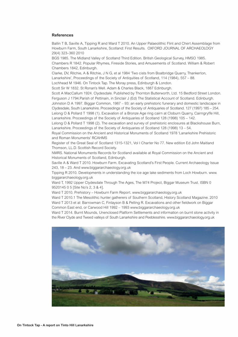
On Tintock Tap - A report on Tinto Hill Lanarkshire
On Tintock Tap– A report on Tinto Hill Lanarkshire
by Tam Ward 2016.

On Tintock Tap - A report on Tinto Hill Lanarkshire
Introduction
The massive isolated dome of Tinto Hill (Fig’s 1 & 2) sits in a
crook of the River Clyde and overlooks the area formerly known
politically as The Upperward of Lanarkshire, later Clydesdale and
now part of South Lanarkshire. It is a favourite haunt for walkers –
and runners, but how many know of the fascinating story behind
the hill, its surroundings and its history? This essay is designed to
help visitors to Tinto Hill to obtain more than just exercise, maybe
adding to the pleasure of being on a familiar landmark, but with an
unfamiliar story.
Both Tinto and its cairn can be traced back to 1315 when the
‘Karyn de Tintou’ (Cairn of Tinto) is mentioned in The Register
of the Great Seal of Scotland (RGSS) in a land charter to James
Douglas. Timothy Pont gives it as ‘Tintoc Hil’ on his manuscript
map of Clydesdale dated 1596 and that is probably the earliest
cartographic depiction of the hill.
Tinto Hill - Plate 22
A good modern map for the area is the OS Landranger No 72, Upper Clyde Valley, Scale 1:50 000.

On Tintock Tap - A report on Tinto Hill Lanarkshire
Geology and topography.
Tinto was formed as an igneous intrusion in the Permian era (BGS 1985), and is composed of acid rocks of pink felsite which formed as a hypabyssal intrusion cutting through Lower Devonian sandstones, the huge dome of magma known as a laccolith tried but did not succeed to push its way through the crust, it solidified as a dome shaped structure and was eventually exposed after softer strata encompassing it was eroded. Contrary to popular belief, it was never a volcano.
On the southern face of Tinto is a prominent protrusion called Pap Craig, it is composed of black basaltic rock and the distinction between the later black basalt and the pink felsite is immediately recognisable (Pl 22).
Pink felsite chips, quarried at Cairngryffe Hill to the north of Tinto and part of the same geological strata, were characteristic of the once famous but now almost absent ‘Red Roads’ of Lanarkshire. Felsite is no longer used as road surfacing because the rock apparently polishes too easily with modern traffic; however the felsite is still quarried for ornamental purposes such as pathways and decorating roundabouts and as mortar aggregate, it is often seen on railways as ballast supporting the tracks.
Fig 1

On Tintock Tap - A report on Tinto Hill Lanarkshire
The summit of Tinto is 707m above sea level however the River Clyde which flows around its southern, eastern and northern sides is c200m OD, therefore the hill is really only c500m high. The hill measures c9km E/W and c5km N/S and is composed of several sub summits; Scaut Hill to the east, Totherin Hill on the north side and Lochlyock Hill, Howgate Hill and Tinto End on the west side.
The hill was described thus; “Its architecture is of the Norman rather than the Gothic variety” (Scott 1924), alluding to the gently rounded top as opposed to the more rugged mountains of the north. From the summit the rolling uniformity of the Southern Uplands can be appreciated, the round top hills and adjacent valleys were gently eroded by successive glacial periods.
Fig 2

On Tintock Tap - A report on Tinto Hill Lanarkshire
The summit is generally approached by a path from Thankerton on the north side and where there is a car park and interpretation panel, the path is 3km long and it can take between 1 and 2 hours of leisurely walking to reach the summit. Other paths (Fig 2) lead from Symington on the east and the steepest ascent is from Wiston on the south, the latter path zig zags over Pap Craig. For the most part Tinto is a heather clad hill with rough and improved pasture surrounding the base on all sides. Various plantations strips are on the lower east and southern sides but a major commercial forest was planted over Howgate Hill on the west, this extends to Rigside village there.
Tinto is crowned by a massive cairn (Pl 1) of which more below, and the rounded hill has often been analogously compared to a female breast with nipple. Whether this semantic notion was perceived in more ancient times is unknown, but it is a credible theory since the shape is quite unambiguous, especially when seen from a distance of only a few miles, and ideas of fertility conjured up by a notional resemblance to human features are often ascribed to mountains, horizons and natural landscapes.
Plate 1
Plate 2

On Tintock Tap - A report on Tinto Hill Lanarkshire
The views (Pl’s 2-6) from the summit are spectacular on a clear day since Tinto has an uninterrupted vista to the north and west while that to the east it is blocked somewhat by the high Peeblesshire hills, especially Cardon and neighbouring Coulter Fell, the latter is 40m higher above sea level than Tinto.
“Twixt Tintock tap and Culter fellThere is just one third part of an ell”. Anon.
Not quite accurate, as a Scots ell equalled 37inches, less than 1metre!
Looking in a southern direction (Pl 6) the rolling glacially rounded Southern Uplands of Scotland extend into the distance.
Tinto is therefore more conspicuous from the north and west, fine views of it being had from the Pentland Hills which extend to Edinburgh, however, looking all the way down the Clyde valley from Tinto one can see very prominently Ben Lomond overlooking the Campsie Hills while slightly to the left, the Arrochar Alps with the Cobbler, or Ben Arthur is visible. Tinto can be seen from Gallow Hill on the southern tip of Rosneath Peninsula and it is also clearly visible from building rooftops in central and northern Glasgow and from Cathkin Braes on the south side of the city. Plates 27 and 28 show the views from Cairn Table some 25km to the SW and where another impressive pre-historic hill top cairn survives, and from Neilston Hills near Barrhead over 100km away in the west.
Plate 3 Plate 5
Plate 4 Plate 6

On Tintock Tap - A report on Tinto Hill Lanarkshire
Goat Fell in Arran and, it is said, parts of Ireland and Cumbria, may be seen from Tinto’s elevated position just north of the Southern Uplands Boundary Fault Line. The Clyde valley may be followed from Abington in the upper reaches, past Glasgow to the estuary at Greenock; numerous towns including Glasgow are visible en route. A directional finder is on the cairn summit and will assist in finding prominent landmarks and places.
The conspicuous hill is therefore well known to travellers across the central belt of Scotland and also for locals in the Biggar area; especially on the golf course, as it acts as a very effective weather indicator, since the summit when obscured by low cloud, is often a warning of imminent rain coming from the west. On finer days the summit is often shrouded in a localised cloud or mist, giving it an added attraction.
Tinto is often referred to as ‘The Hill of Fire’ (Pl 7) since spectacular sunsets can be seen from the north and east when the sun dips behind the isolated hill in its perpetual journey westwards.
The cairn was used as a Bronze Age indicator of mid winter, since a burial site of that period was aligned to the spectacular event of midwinter sunset (Pl 7), which is seen exactly behind the summit cairn as viewed from the Blackmount site near Elsrickle.
Plate 7
Plate 27 Plate 28

On Tintock Tap - A report on Tinto Hill Lanarkshire
Sir Walter Scot alludes to Tintock casually in his work (Scott 1832) and gives the first two lines of an anonymous poem in a letter regarding the Scottish Regalia, the full poem is repeated by Chambers slightly later (Chambers 1842);
On Tintock-Tap there is a mist, And in that mist there is a kist,And in that kist there is a caup, And in that caup there is a drap;Tak up the caup, and drink the drap, And set in back on Tintock-Tap.
It is an intriguing thought as to when and by whom this poem originated, since it clearly alludes to a vessel in a cist, exactly what one finds in a Bronze Age burial, of which many have been found in the vicinity of Tinto Hill.
The present writer has conceived a short poetic story from the above:On Tintock Tap, paraphrased by Tam Ward 2012, inspired by Tinto Hill.
On Tintok Tap there is a mistA magic whispering veilThis watches over all this landThis land we call ClydesdaleAnd in that mist there is a cistA box of mysteryWhere secrets can reveal the truthA Clydesdale historyAnd in that cist there is a cupA cup of joy or woeA cup which separates all menAll men from friend or foeAnd in that cup there is a drapA quaff of blood red wineThe one who drinks of that pure sapIn paradise will dineTake up the cup and drink the drapAnd pray your wish come trueThe knowledge of the past revealedAnd the misty cloud turns blueAnd set it back on Tintok TapTo work another dayThe sun shines down on the famous cairnAnd you’ve been shown the way
A children’s short story by Marion Lochhead (Lochhead 1946) has a young boy finding the cist and meeting fairies who live below the ground.
The prospect from the summit can occupy hours of fascinating viewing, especially if an OS map and binoculars (and perhaps this essay) are present. Four parishes meet at the top of Tinto; they are Covington (north), Symington (east), Wiston (south) and Carmichael (west). The various villages are visible along with the larger towns of Biggar and Lanark, taken with smaller hills and parts of the River Clyde they all provide a quite majestic overview of what used to be called the Upperward of Lanarkshire.

On Tintock Tap - A report on Tinto Hill Lanarkshire
Antiquity
The most conspicuous object of interest on Tinto is the enormous summit cairn which measures about 45m in diameter by 6m high (RCAHMS 1978 No 107). It is arguably one of the most conspicuous archaeological sites in Scotland, being seen for over twenty miles away and undoubtedly and completely put there by the hands of people over 4000 years ago. The limited area of the summit must have been totally devoid of any form of cover after the last Ice Age swept over it; however gullies and steep scree slopes around the hill would have provided pre historic hands the material required to form the huge pile. The undertaking, given that the hill had to be climbed by the builders on each trip to the site, was immense.
Either dating to the Neolithic Period (c6000-4500 years ago) or the Bronze Age (c4500-2500 years ago) or perhaps to both times, it is almost certain that the cairn contains a burial or burials in a chamber or cist, of some very important people from the ancient past. One can only speculate on the contents of the Scheduled Ancient Monument but it is likely that quite spectacular grave goods may lie below the stones. Clearly, to build such a monument on this conspicuous summit was a community effort; however, there must have been powerful leadership to ensure the work was done.
Neolithic chambered tombs are found in many places in Britain, the nearest example, and within sight of Tinto, is on the southern Pentland Hills just north of Carnwath where the large cairn still lies with the chamber exposed in its side (RCAHMS op. cit, No 1). The landscape surrounding Tinto Hill has numerous sites dating to this period of the first settlers and farmers in the country; these are settlement, burial and ritual places and Upper Clydesdale can boast the largest collections of Early Neolithic pottery in Scotland from settlement sites on Biggar Common (Johnston 1997 & Ward 2013). The locations of several henges and cursus monuments and possibly several other Neolithic burial cairns are all within sight of Tinto summit (RCAHMS 1978 & NMRS).
It does not take a huge leap of imagination to fit all these places into the same context and time frame as the cairn of Tinto Hill. However, given the legal status of the cairn and the current philosophy on nationally important monuments, it is unlikely to be investigated.
Several other but smaller cairns also exist on minor summits such as Scaut Hill (RCAHMS op. cit, No 99), Totherin Hill, Howgate Hill (RCAHMS op. cit, No’s 65 & 66) and Tinto End (RCAHMS op. cit, No 108), and several small but as yet unrecorded small cairns can be seen beside the path leading up Tinto from the Thankerton car parking area. The isolated cairns on Scaut & Howgate Hills and Tinto End are probably funerary sites while no antiquity is ascribed to that on Totherin Hill. However a group of eight small cairns at Howgate and those alluded to above (beside the path) may be more likely the product of field clearance in pre historic times, although burials within any of them cannot be ruled out in the absence of further investigation.

On Tintock Tap - A report on Tinto Hill Lanarkshire
Cremation and inhumation burials of the Bronze Age have been found in the area surrounding Tinto, most especially to the north. These have been discovered below cairns and possible barrows (RCAHMS op. cit, No’s 54, 142 & 158). In some cases pottery which was found near Tinto has not survived, but several vessels such as cinerary urns, food vessel, beakers and accessory vessels are still preserved in the National Museums of Scotland. To the south of Tinto one particular cairn was excavated (RCAHMS op. cit, No 77) at Limefield and where at least twelve individuals had been interred either as cremations (9of) or inhumations in three cist like structures. Pottery of beaker, food vessel and cinerary urn were all found with a single jet button and several flints.
An impressive stone axe (Pl 8) was found near Lochlyoch on Tinto (now displayed at Biggar Museum) and it is just one of many spectacular objects from the ancient past to be found within sight of Tinto, many of these will be illustrated in a forthcoming report by the writer entitled ‘Treasures of Clydesdale’ (Ward, in prep 2016)
Another important Bronze Age cemetery (Lelong & Pollard 1998/1) was found at Cairngryffe Hill to the north and excavated in advance of quarrying operations; a number of jet disc beads (Pl 9) and a button of the same material were found here along with numerous sherds of mostly food vessels, again, on display at Biggar.
Plate 8 Plate 11
Plate 12
Plate 9

On Tintock Tap - A report on Tinto Hill Lanarkshire
On the southern slopes of Tinto and on Greenhill Farm there are ‘ring enclosures’ and ‘unenclosed platform settlements’ (Ward 1992) The circular enclosures form a group of four, and debate exists as to what age and purpose these features fit into, only archaeological investigation can show whether they are simple sheep folds or Bronze Age burial sites. The platforms are however well understood and these are Bronze Age undefended house sites (Ward 2014).
Many further Bronze Age burial sites with important grave goods (Pl 10) have been discovered within sight of Tinto (Johnston op cit), and some of the earliest settlement sites in Scotland have also been found in Tinto’s neighbourhood, for example at nearby Biggar Common (Pl 11) and Coulter (Pl 12) where huge collections of Scotland’s earliest pottery have been found (Pl 13) (Johnston & Ward op cit), these merely serve to indicate the density of such sites in Upper Clydesdale, and perhaps give even greater significance to the hill top cairn which overlooks all. One particular Bronze Age burial of three people in two cists was found below Tinto in the sand and gravel quarry at Thankerton (Clarke, Ritchie & Ritchie, et al 1984). Recently a facial re-construction has been done from the skull of a youth (Pl’s14 & 14a) and this is now on display in the new Museum in Biggar, here one can literally look upon a face from the ancient past.
Plate 13
Plate 14 Plate 14a
Plate 10

On Tintock Tap - A report on Tinto Hill Lanarkshire
On the lower northern summit of Park Knowe (Pl 15) there is a most perplexing monument (RCAHMS op. cit, No 314); it consists of two circuits of low banks with an irregular sized space between them of 3m – 16m, the banks enclose an area of 50m by 60m and are kerbed with upright stones on both faces and entrances at opposing sides are slightly staggered. A large mound within the monument was reported to have existed in the 18th century but of which there is no longer any trace. The enigmatic site has no parallels and could conceivable date to any pre historic period and without recourse to archaeological investigation, it must remain a mystery.
Because of its proximity to Tinto the extraordinary enclosure of Blackshouse Burn (Fig 2) (RCAHMS op. cit, No 171) must be given. The huge enclosure with 11m wide banks surrounds an area of c16acres. Limited excavation (Lelong & Pollard 1998/2) secured a Late Neolithic date from surviving oak post stumps, and earlier reports (Ferguson 1794) mention Bronze Age burials being interred within the bank. The site is difficult to find parallels with in Scottish pre-history, but taken along with local henges, cursus monuments and other Early and Late Neolithic evidence which now abounds in the district (www.biggararchaeology.org.uk), Blackshouse Burn may have been a major regional gathering place at that time, although interestingly it lies within an amphitheatre like space surrounded by Cairngryffe, Swaites and Chester Hills, and Tinto is obscured from its view by the latter. Both Cairngryffe and Swaites Hills had Bronze Age burials on their summits (Lelong & Pollard 1998/1 op cit and (RCAHMS op. cit, No 106)) and it is possible that the same applied to Chester Hill, but was removed by the occupation of the spectacular hill fort (RCAHMS op. cit, No 224) which now lies there.
Found on the lower slopes of Tinto and indeed on numerous neighbouring but lower hill tops are a series of putative Iron Age forts and settlements. The most conspicuous and well known is Fallburn (Pl’s 16 & 17) (RCAHMS op. cit, No 231) since it lies directly on the main path route to the summit of Tinto. Circular in shape it has the most impressive double ditches and ramparts, and has two entrances. No house sites are visible within the interior which has a later turf bank forming a circular enclosure.
Plate 15

On Tintock Tap - A report on Tinto Hill Lanarkshire
Two small forts (RCAHMS op. cit, No’s 210 & 237) are located near St John’s Kirk farm while a plethora of hill top forts and other settlements can be found on the east and north sides of Tinto Hill. The number of these seriously defended sites indicates that warfare must have been endemic among neighbouring groups or tribes, during the years before and after the Roman incursions into the area in the 1st and 2nd centuries AD.
Many Roman sites are located along the River Clyde for its entire length all the way to Old Kirkpatrick where the fort there was the western terminus of the Antonine Wall. A more direct northerly Roman road from the Roberton area and towards the major Roman fort at Carstairs (RCAHMS op. cit, No 266 & 252) and cutting through the natural pass at Howgate Mouth on Tinto has long been speculated, but no proof has yet been found.
The earliest known inhabitants who passed through Scotland periodically camped a few miles from Tinto at Howburn Farm to the north of Biggar. 14,000 years ago in the Late Upper Palaeolithic period, hunters, having walked across the then landscape of the North Sea from the Denmark region, were probably following migrating reindeer herds, perhaps en route to their calving grounds in what is now western Scotland. The unique site remains the only one of its type in Britain where the distinctive flint and chert tools of the so called Hamburgian Culture have been found (Pl 18), the discovery was made by local archaeologists (Ballin, Saville, Tipping & Ward 2010, Tipping 2010, Saville and Ward 2010, Ward 2010). The site dates to immediately after the last main Ice Age; however, the landscape of northern Britain soon became uninhabitable again but for a shorter period in the so called Loch Lomond Re-Advance mini Ice Age.
Plate 16
Plate 17

On Tintock Tap - A report on Tinto Hill Lanarkshire
About 11,000 years ago the landscape once more became friendly to re-colonization by plants, animals and people in that order. A different type of hunter gatherer people now occupied the landscape; the frozen Tundra wastes were replaced with lush forests and taken with river and coastal food resources, provided a good living for the Mesolithic people of Scotland beginning over 10,000 years ago until about 6000 when they were somehow replaced by the first farmers and permanent settlers of the Early Neolithic period. Evidence of these early travellers has been found on numerous sites to the north and south of Tinto Hill (Ward 2010.1) making the area one of the most important for studying the earliest occupants in Scotland and their unique stone tool technology (Pl 19).
Such is the pre historic interest on and around Tinto Hill, but from the summit a fascinating and unique medieval history may be grasped by looking down at the various existing settlements below (Fig 2).
Nowhere else in Scotland is there such a group of villages which take their names from Norman and Flemish settlers, invited to Scotland in the early 12th century under the patronage of King David I and his grandson Malcolm IV. The village’s names all end in ‘ton’ (town) with the prefix of a persons name; thus we have Thankerton (town of Tancard), Symington (town of Symon), Lamington (town of Lambin), Roberton (town of Robert), Wiston (town of Wicius) and Abington (the town of Albin). To which may be added Edmonston, Covington (Colban) and Dolphinton, all nearby hamlets but further to the north. The people are all named in early 12th century charters and it is known that Lambin and Robert were brothers.
Plate 18
Plate 19

On Tintock Tap - A report on Tinto Hill Lanarkshire
It is interesting to note that some pre existing place names were probably adopted, unlike those above, thus we have perhaps the most important man of all; Baldwin Flamingus (Fleming) De Bigre, the first Sherriff of Lanarkshire having his caput on the motte site in Biggar.
These incomers were the first to create parishes in Scotland making the country more akin to the feudal administrative systems David had observed during his captivity in England. They were also the first people to build castles, presumably for their own defence against the locals, whom they had usurped for control of the countryside; the castles were the motte and (sometimes) bailey castles, of which Biggar, Crawford, Abington, Carnwath and Lanark have outstanding examples still to be seen. Furthermore the names of more prominent guests of David in the district reflect their ancestry; The Flemings of Biggar, Somerville’s of Carnwath, Lindsay’s of Crawford, Lockhart’s, Douglas’s and Hamilton’s, and so on.
The nearby castle of the Lindsay’s of Covington and its 16th century doocot (Pl 20) are worth a visit, as is the 16th century tower of Fatlips Castle (Pl 21) on the eastern slopes of Tinto.
Plate 20
Plate 21

On Tintock Tap - A report on Tinto Hill Lanarkshire
So it is that a single hill (Pl 23) in southern Scotland can tell of an amazing past in its own landscape setting. Extending back millions of years to its geological beginnings, one gazes south to Leadhills; a land still rich in lead and gold, and to the north and west to the places where the ‘black gold’; coal, was mined, but of which little trace now remains to tell of Scotland’s industrial legacy to the world. The current mineral wealth being exploited is sand and gravel - and most importantly of all - water! Upper Clydesdale supplies much of both to the central belt of Scotland, all courtesy of the famous river which gives the area an unprecedented story.
One gazes down on an astounding legacy of the pre-historic past, with medieval tales of Scottish monarchs and our great Scottish patriot; William Wallace, and the story of the Wars of Independence against the might of Edward’s I and II. Although no great churches were established in this area, the vital records of Kelso Abbey and other places still preserve the details of Clydesdale’s past. It was the Monks of Newbattle who are first recorded as having worked the mines at Leadhills.
Later, Covenanters such as Donald Cargill were captured in the shadow of Tinto at Thankerton (Pl 24) (and soon brutally executed in Edinburgh), a lonely gravestone on Dunsyre Hills to the north remembers a wounded and dying Covenanter trying to return to his native Ayrshire after the Battle of Rullion Green near Edinburgh. It was in Douglas that the Cameronian Regiment was first raised by the Earl of Angus (a Douglas), the regiment commemorating the name of another martyr. No religious tolerance in those days.
Plate 22
Plate 24

On Tintock Tap - A report on Tinto Hill Lanarkshire
Many famous people in British and World history have their roots within sight of Tinto as various cemeteries will testify. One must not forget to mention a famous animal breed which originated here; the Clydesdale horse (Pl’s 25-26), although seldom seen nowadays, it is still bred and showed from a few farms by stalwarts of animal heritage.
Tinto stands, along with its neighbours on the east of Coulter Fell and Cardon as the sentinels of the northern part of the Southern Uplands, with the River Clyde escaping to the west through the gateway the hills appear to form, in geological times the upper Clyde actually flowed past Cardon, through the Biggar Gap and made its way via the River Tweed to the North Sea, rather than the Irish Sea where it now ends its journey.
This report is intended merely as an introduction to that past and in the hope that it may add some interest to the hill walker visiting Tinto Hill, who makes the easy ascent to its summit and soak up the extensive views and history from the famous cairn.
Repeat visits to Tinto summit also offer visitors the seasonal delights of the modern landscapes of changing colours and patterns of the hills, fields and forests below, and always with the blue/grey sinuous Clyde patrolling round the valley floor. At one time the evocative steam trains puffed up and down on the Caledonian line from Glasgow to London, stopping at every village, now the colourful but silent trains zoom through the country in their hurry to fewer destinations (Pl 29).
A visit to Biggar, Lanark and Hamilton museums will reward anyone wishing more information on Tinto and its landscape, and for archaeological reports; visit www.biggararchaeology.org.uk.
Plate 25
Plate 26 Plate 29
On Tintock Tap - A report on Tinto Hill Lanarkshire
References
Ballin T B, Saville A, Tipping R and Ward T 2010. An Upper Palaeolithic Flint and Chert Assemblage from Howburn Farm, South Lanarkshire, Scotland: First Results. OXFORD JOURNAL OF ARCHAEOLOGY 29(4) 323–360 2010BGS 1985. The Midland Valley of Scotland Third Edition. British Geological Survey, HMSO 1985.Chambers R 1842. Popular Rhymes, Fireside Stories, and Amusements of Scotland. William & Robert Chambers 1842, Edinburgh.Clarke, DV, Ritchie, A & Ritchie, J N G, et al 1984 ‘Two cists from Boatbridge Quarry, Thankerton, Lanarkshire’, Proceedings of the Society of Antiquities of Scotland, 114 (1984), 557 – 88.Lochhead M 1946. On Tintock Tap. The Moray press, Edinburgh & London.Scott Sir W 1832. St Ronan’s Well. Adam & Charles Black, 1887 Edinburgh. Scott A MacCallum 1924. Clydesdale. Published by Thornton Butterworth, Ltd. 15 Bedford Street London.Ferguson J 1794.Parish of Pettinain, in Sinclair J (Ed) The Statistical Account of Scotland. Edinburgh. Johnston D A 1997. Biggar Common, 1987 – 93: an early prehistoric funerary and domestic landscape in Clydesdale, South Lanarkshire. Proceedings of the Society of Antiquaries of Scotland. 127 (1997) 185 – 254. Lelong O & Pollard T 1998 (1). Excavation of a Bronze Age ring cairn at Cloburn Quarry, Cairngryffe Hill, Lanarkshire. Proceedings of the Society of Antiquaries of Scotland 128 (1998) 105 – 142.Lelong O & Pollard T 1998 (2). The excavation and survey of prehistoric enclosures at Blackshouse Burn, Lanarkshire. Proceedings of the Society of Antiquaries of Scotland 128 (1998) 13 – 54.Royal Commission on the Ancient and Historical Monuments of Scotland 1978 ‘Lanarkshire Prehistoric and Roman Monuments’ RCAHMSRegister of the Great Seal of Scotland 1315-1321, Vol I Charter No 77. New edition Ed John Maitland Thomson, LL.D. Scottish Record Society.NMRS. National Monuments Records for Scotland available at Royal Commission on the Ancient and Historical Monuments of Scotland, Edinburgh.Saville A & Ward T 2010. Howburn Farm. Excavating Scotland’s First People. Current Archaeology Issue 243, 18 – 23. And www.biggararchaeology.org.ukTipping R 2010. Developments in understanding the ice age lake sediments from Loch Howburn. www.biggararchaeology.org.ukWard T, 1992 Upper Clydesdale Through The Ages, The M74 Project, Biggar Museum Trust. ISBN 0 9520145 0 5 [Site No’s 2, 3 & 4].Ward T 2010. Prehistory – Howburn Farm Report. www.biggararchaeology.org.ukWard T 2010.1 The Mesolithic hunter gatherers of Southern Scotland, History Scotland Magazine. 2010Ward T 2013 et al: Barrowman C, Finlayson B & Pelling R. Excavations and other fieldwork on Biggar Common East end, or Carwood Hill 1992 – 1993 www.biggararchaeology.org.ukWard T 2014. Burnt Mounds, Unenclosed Platform Settlements and information on burnt stone activity in the River Clyde and Tweed valleys of South Lanarkshire and Peeblesshire. www.biggararchaeology.org.uk