capacity building in the region - iho 1-11.5 iic... · multibeam surveying surveying & mapping...
TRANSCRIPT
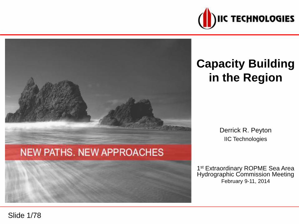
Capacity Building
in the Region
Derrick R. Peyton
IIC Technologies
1st Extraordinary ROPME Sea Area Hydrographic Commission Meeting
February 9-11, 2014
Slide 1/78
NEW PATHS, NEW APPROACHES
Capacity Building: What it means
Issues & Challenges + Trends
IIC Technologies: Hydrographic Data Value Chain
IIC Academy: Capacity Building
Nautical Cartography
Multibeam Surveying
Surveying & Mapping
Individual Hydrographic Certification
Take Home Message
Overview
NEW PATHS, NEW APPROACHES
Capacity Building: What it Means
NEW PATHS, NEW APPROACHES
The IHO has an active program to create capacities, which helps countries to
develop and improve their hydrographic capabilities. The capacity-building
projects are carried out, very often, in cooperation with other international
organizations and the growing involvement of the industry.
Capacity Building is defined as the process by which the Organization
assesses and assists in sustainable development and improvement of
the States, to meet the objectives of the IHO and the Hydrography,
Cartography and Maritime Safety obligations and recommendations
described in UNCLOS, SOLAS V and other international instruments.
Capacity Building: What it Means
NEW PATHS, NEW APPROACHES
Issues & Challenges + Trends
NEW PATHS, NEW APPROACHES
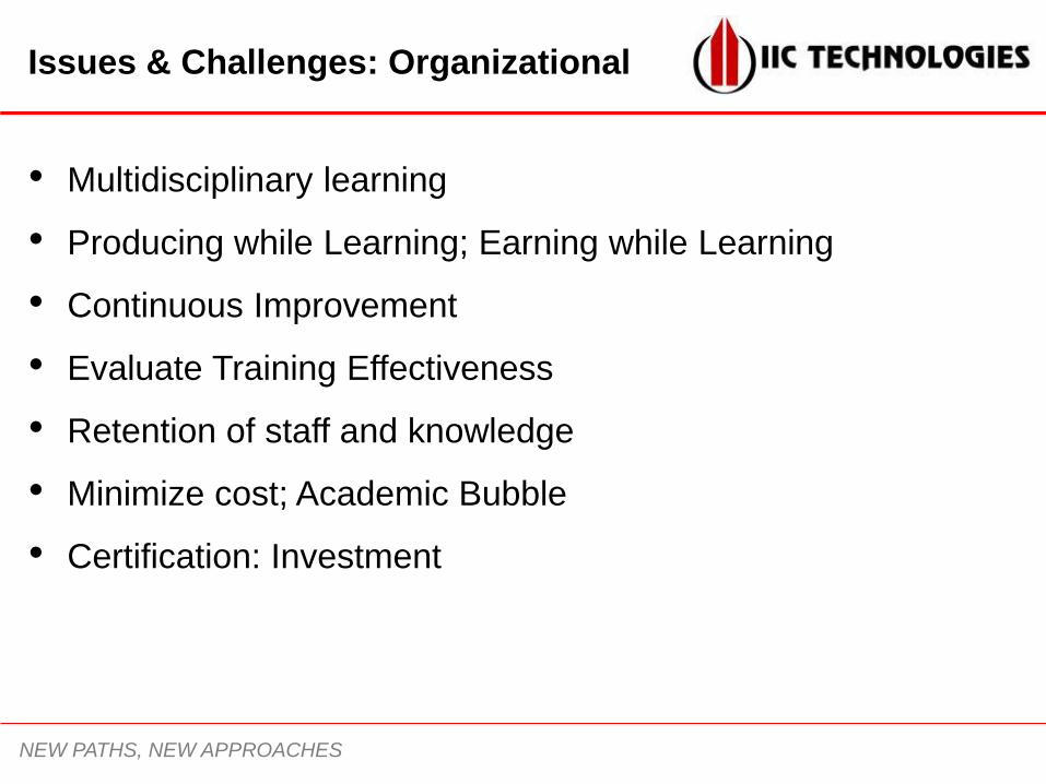
• Multidisciplinary learning
• Producing while Learning; Earning while Learning
• Continuous Improvement
• Evaluate Training Effectiveness
• Retention of staff and knowledge
• Minimize cost; Academic Bubble
• Certification: Investment
Issues & Challenges: Organizational
NEW PATHS, NEW APPROACHES
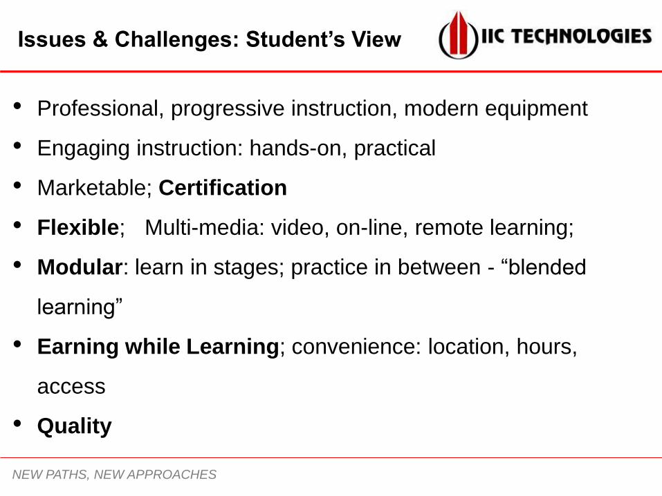
• Professional, progressive instruction, modern equipment
• Engaging instruction: hands-on, practical
• Marketable; Certification
• Flexible; Multi-media: video, on-line, remote learning;
• Modular: learn in stages; practice in between - “blended
learning”
• Earning while Learning; convenience: location, hours,
access
• Quality
Issues & Challenges: Student’s View
NEW PATHS, NEW APPROACHES
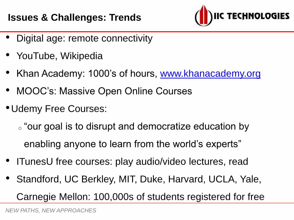
• Digital age: remote connectivity
• YouTube, Wikipedia
• Khan Academy: 1000’s of hours, www.khanacademy.org
• MOOC’s: Massive Open Online Courses
•Udemy Free Courses:
o “our goal is to disrupt and democratize education by
enabling anyone to learn from the world’s experts”
• ITunesU free courses: play audio/video lectures, read
• Standford, UC Berkley, MIT, Duke, Harvard, UCLA, Yale,
Carnegie Mellon: 100,000s of students registered for free
Issues & Challenges: Trends
NEW PATHS, NEW APPROACHES
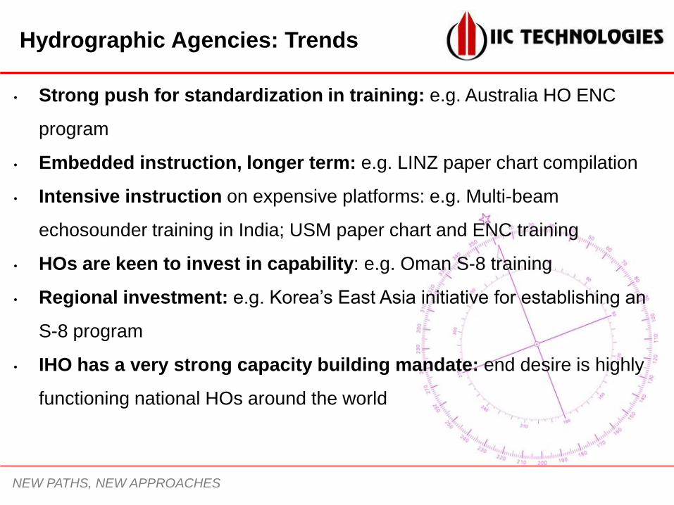
• Strong push for standardization in training: e.g. Australia HO ENC
program
• Embedded instruction, longer term: e.g. LINZ paper chart compilation
• Intensive instruction on expensive platforms: e.g. Multi-beam
echosounder training in India; USM paper chart and ENC training
• HOs are keen to invest in capability: e.g. Oman S-8 training
• Regional investment: e.g. Korea’s East Asia initiative for establishing an
S-8 program
• IHO has a very strong capacity building mandate: end desire is highly
functioning national HOs around the world
Hydrographic Agencies: Trends
NEW PATHS, NEW APPROACHES
IIC Technologies
Hydrographic Data Value Chain
NEW PATHS, NEW APPROACHES
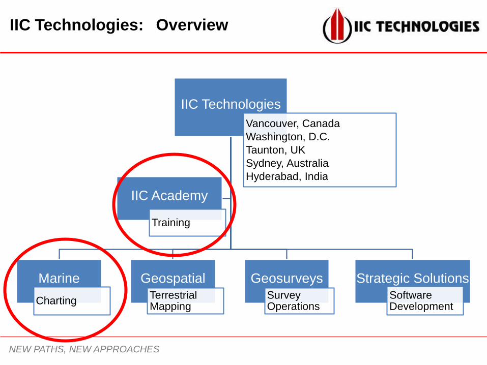
IIC Technologies
Vancouver, Canada
Washington, D.C.
Taunton, UK
Sydney, Australia
Hyderabad, India
Marine
Charting
Geospatial Terrestrial Mapping
Geosurveys Survey Operations
Strategic Solutions Software Development
IIC Academy
Training
IIC Technologies: Overview
NEW PATHS, NEW APPROACHES
Hydrographic Data Value Chain
Marine
Products
Verification &
Validation
Survey Data
Processing Updating &
Maintenance
Data Value Chain
• Bathy Data Cleaning
• Surface Modeling
• Image processing
• Deconfliction
• ENCs / IENCs
• Military Overlays
• Paper Charts
• Geophysical
Products
• Spatial Accuracy
• Feature Verification
• Logical Consistency
• 3rd Party Checks
• Vertical/Horizontal
Consistency
• Database maintenance
• Data Assessment
• Data critical updates
• Data management
• Data warehousing
Data
Acquisition
• Hydrographic
• Geophysical
• Oceanographic
• Airborne Lidar
• Satellite
Capacity Building
NEW PATHS, NEW APPROACHES
IIC Academy
NEW PATHS, NEW APPROACHES
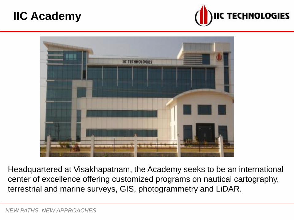
IIC Academy
Headquartered at Visakhapatnam, the Academy seeks to be an international
center of excellence offering customized programs on nautical cartography,
terrestrial and marine surveys, GIS, photogrammetry and LiDAR.
NEW PATHS, NEW APPROACHES
IIC Academy Overview
Foundation: “learning by doing and reflection”
Industry Ready: practice component is executed in the production floor
using realistic case studies. Employable and productive
Scalability & Modular: The development of course content is highly
modular. This enables customization of courses to meet the specific
requirements of the end-users.
Flexible: The delivery of programs are highly flexible, delivered anytime,
anywhere.
Results: Employable and productive.
Recognized Programs: The Academy has made positive impact on
capacity building in geospatial related areas, which has been recognized by
international bodies.
NEW PATHS, NEW APPROACHES
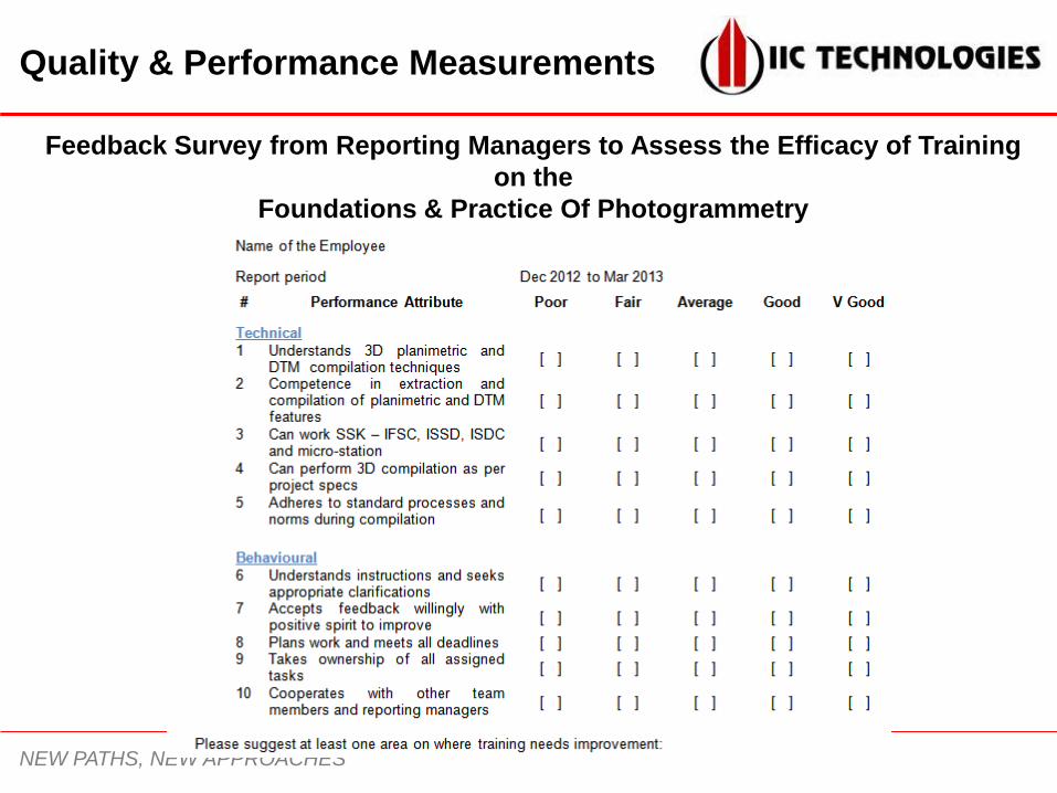
Feedback Survey from Reporting Managers to Assess the Efficacy of Training
on the
Foundations & Practice Of Photogrammetry
Quality & Performance Measurements

NEW PATHS, NEW APPROACHES
IIC Academy
2011 – 2013 Progress Report
Trained over 1200 participants, in areas related to marine
and land survey, nautical cartography, GIS,
photogrammetry, and LiDAR, both in India and abroad.
NEW PATHS, NEW APPROACHES
IHO Cat B S8 (Nautical Cartography)
NEW PATHS, NEW APPROACHES
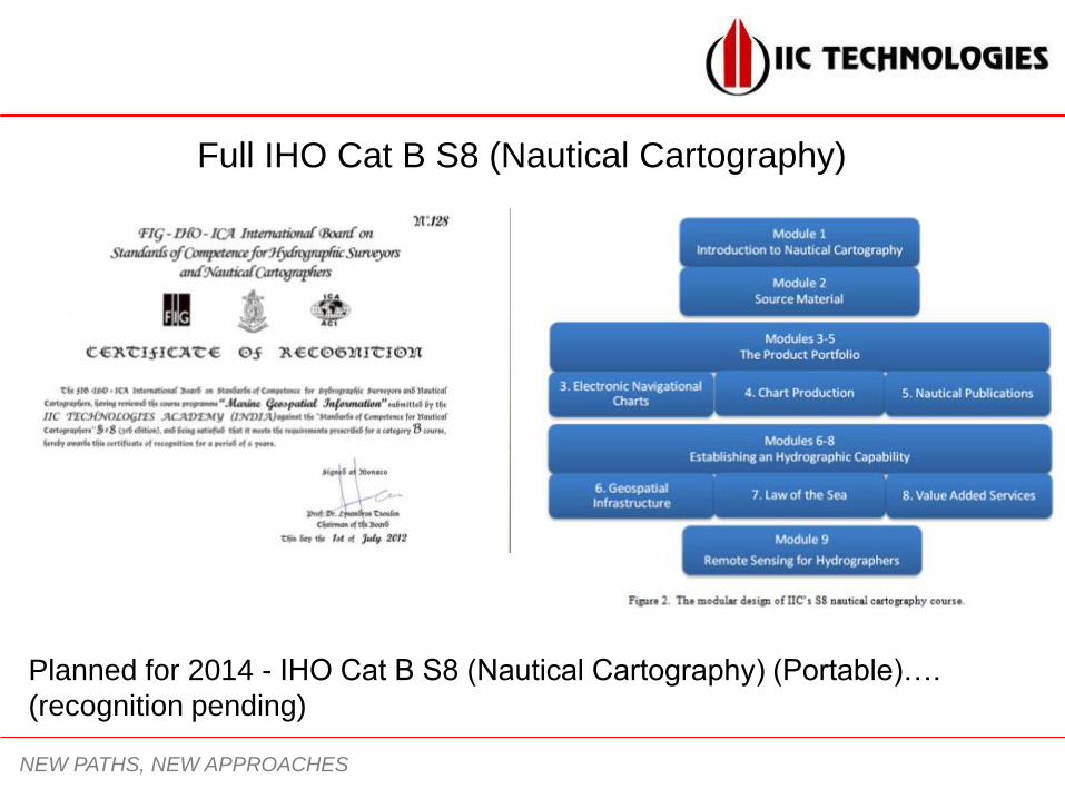
Full IHO Cat B S8 (Nautical Cartography)
Planned for 2014 - IHO Cat B S8 (Nautical Cartography) (Portable)….
(recognition pending)
NEW PATHS, NEW APPROACHES
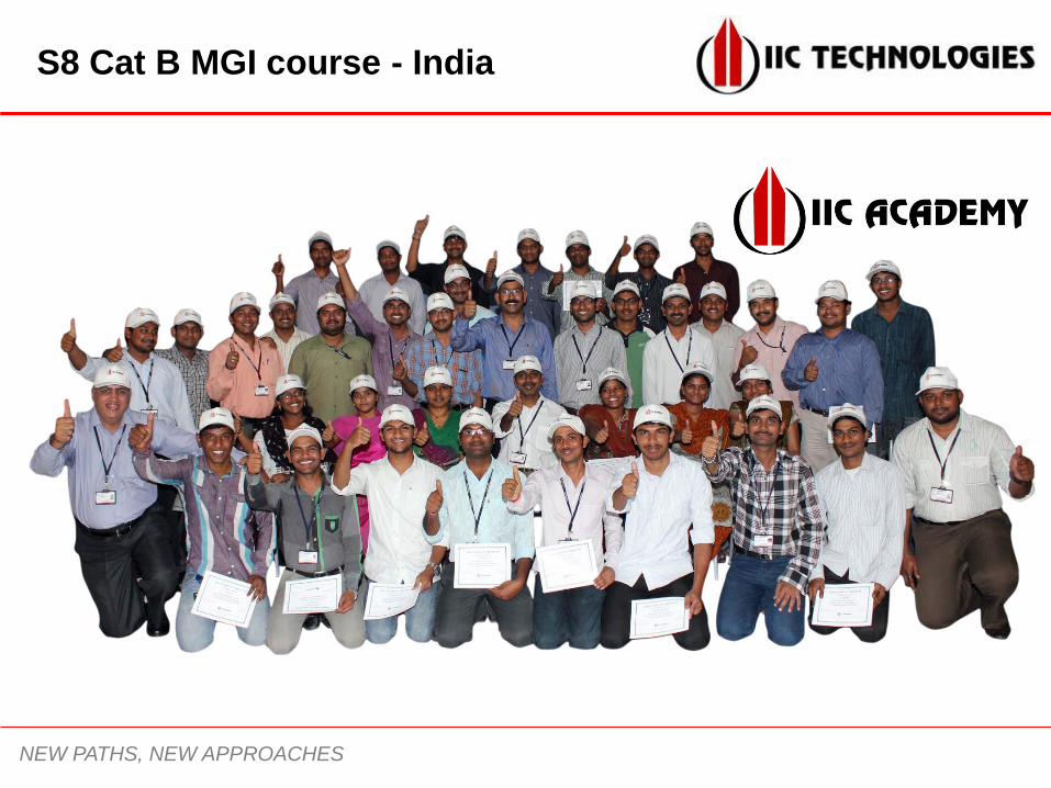
S8 Cat B MGI course - India
NEW PATHS, NEW APPROACHES
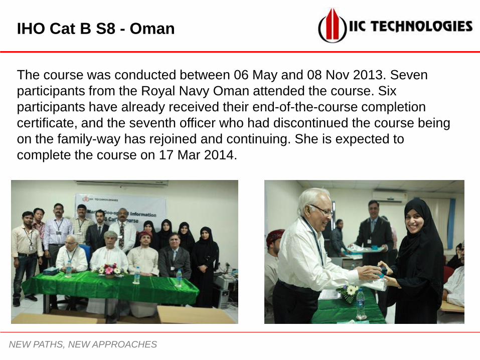
IHO Cat B S8 - Oman
The course was conducted between 06 May and 08 Nov 2013. Seven
participants from the Royal Navy Oman attended the course. Six
participants have already received their end-of-the-course completion
certificate, and the seventh officer who had discontinued the course being
on the family-way has rejoined and continuing. She is expected to
complete the course on 17 Mar 2014.

NEW PATHS, NEW APPROACHES
Training & Modular Courses Abroad

NEW PATHS, NEW APPROACHES
Nautical Cartography course - KSA
Ten participants from the GCS attended the course. The faculty and course
content support was provided by the Academy to facilitate GCS complete
their first S8 Cat B course on Nautical Cartography.
NEW PATHS, NEW APPROACHES
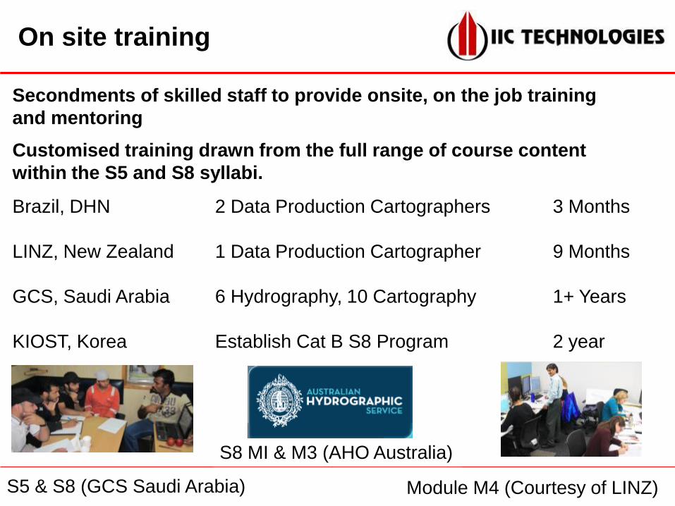
Secondments of skilled staff to provide onsite, on the job training
and mentoring
On site training
Module M4 (Courtesy of LINZ) S5 & S8 (GCS Saudi Arabia)
Customised training drawn from the full range of course content
within the S5 and S8 syllabi.
Brazil, DHN 2 Data Production Cartographers 3 Months
LINZ, New Zealand 1 Data Production Cartographer 9 Months
GCS, Saudi Arabia 6 Hydrography, 10 Cartography 1+ Years
KIOST, Korea Establish Cat B S8 Program 2 year
S8 MI & M3 (AHO Australia)
NEW PATHS, NEW APPROACHES
Hydrographic Operations
NEW PATHS, NEW APPROACHES
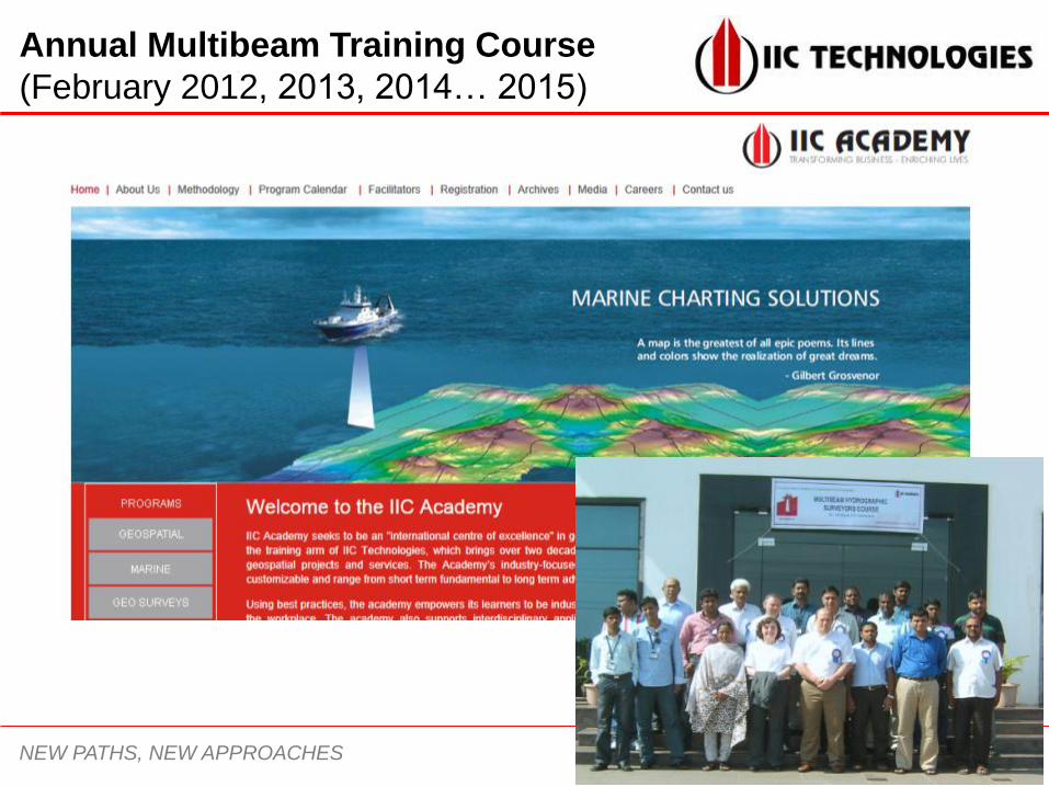
Annual Multibeam Training Course
(February 2012, 2013, 2014… 2015)
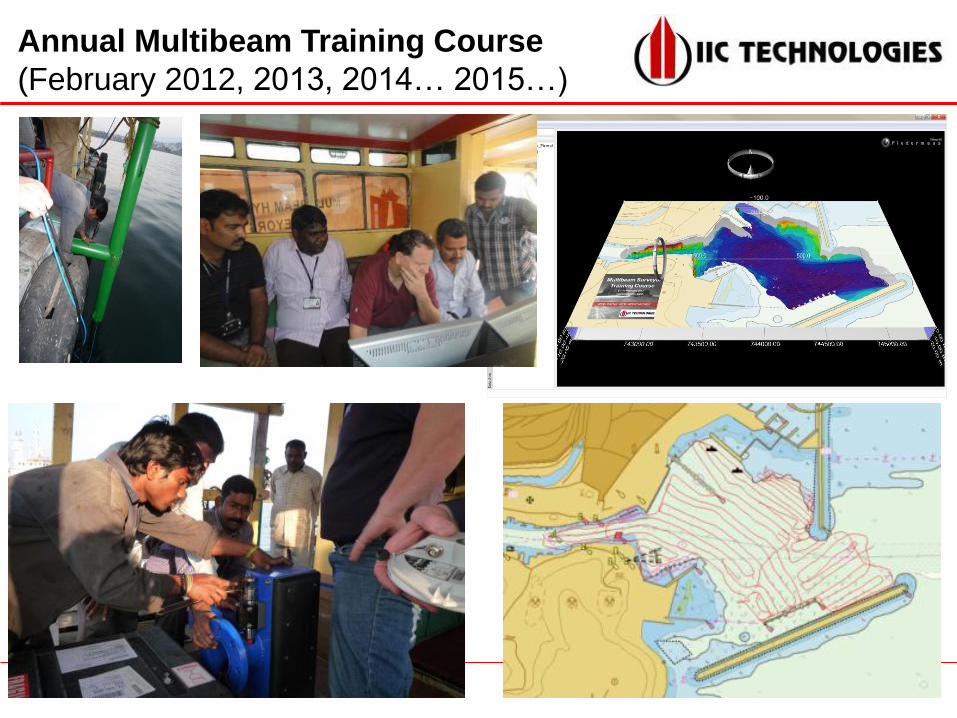
NEW PATHS, NEW APPROACHES
Annual Multibeam Training Course
(February 2012, 2013, 2014… 2015…)
NEW PATHS, NEW APPROACHES
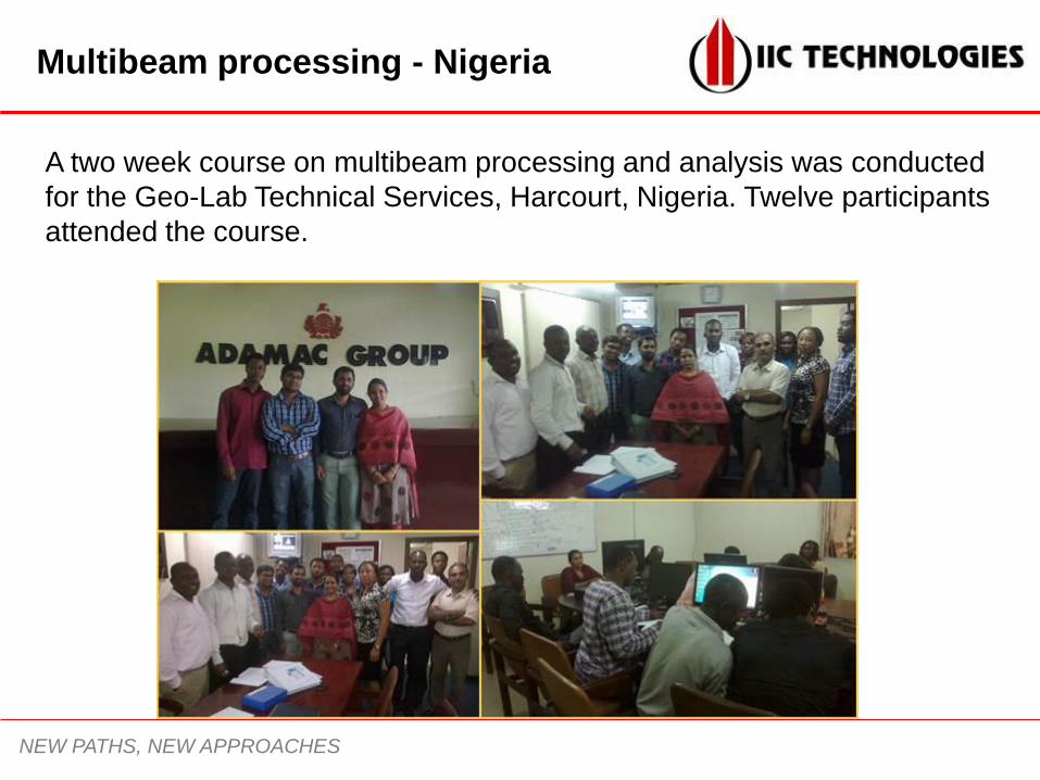
A two week course on multibeam processing and analysis was conducted
for the Geo-Lab Technical Services, Harcourt, Nigeria. Twelve participants
attended the course.
Multibeam processing - Nigeria
NEW PATHS, NEW APPROACHES
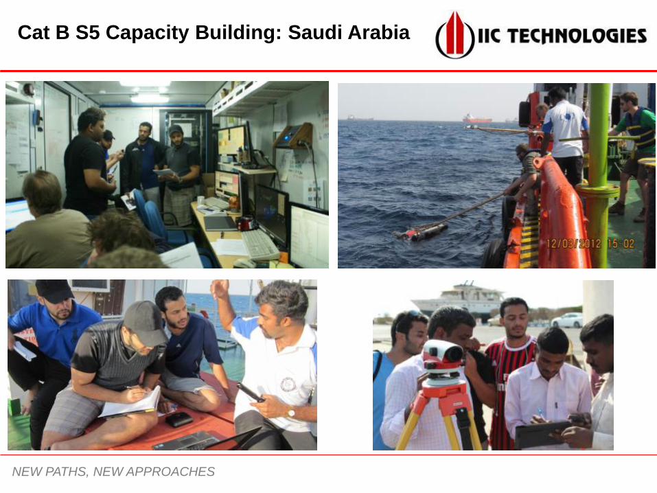
Cat B S5 Capacity Building: Saudi Arabia
NEW PATHS, NEW APPROACHES
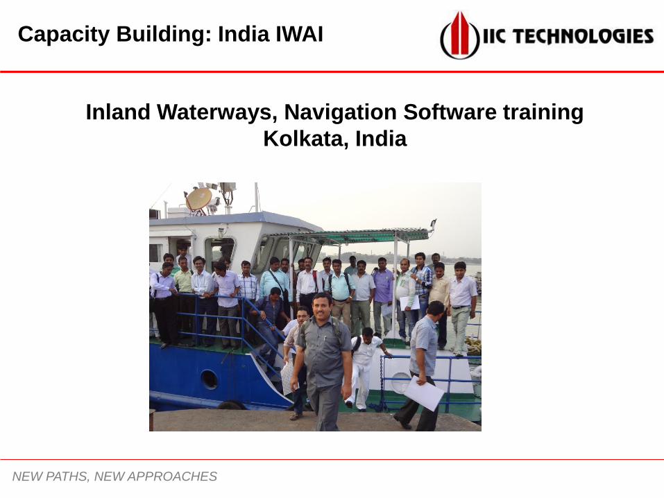
Inland Waterways, Navigation Software training
Kolkata, India
Capacity Building: India IWAI
NEW PATHS, NEW APPROACHES
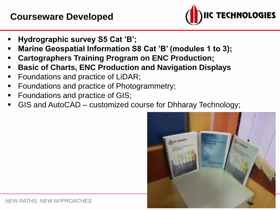
Hydrographic survey S5 Cat ’B’;
Marine Geospatial Information S8 Cat ’B’ (modules 1 to 3);
Cartographers Training Program on ENC Production;
Basic of Charts, ENC Production and Navigation Displays
Foundations and practice of LiDAR;
Foundations and practice of Photogrammetry;
Foundations and practice of GIS;
GIS and AutoCAD – customized course for Dhharay Technology;
Courseware Developed
NEW PATHS, NEW APPROACHES 32
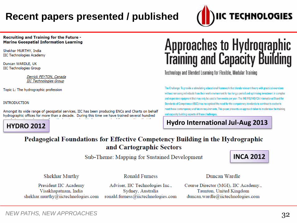
HYDRO 2012 Hydro International Jul-Aug 2013
INCA 2012
Recent papers presented / published
NEW PATHS, NEW APPROACHES
Surveying & Mapping Programs
NEW PATHS, NEW APPROACHES
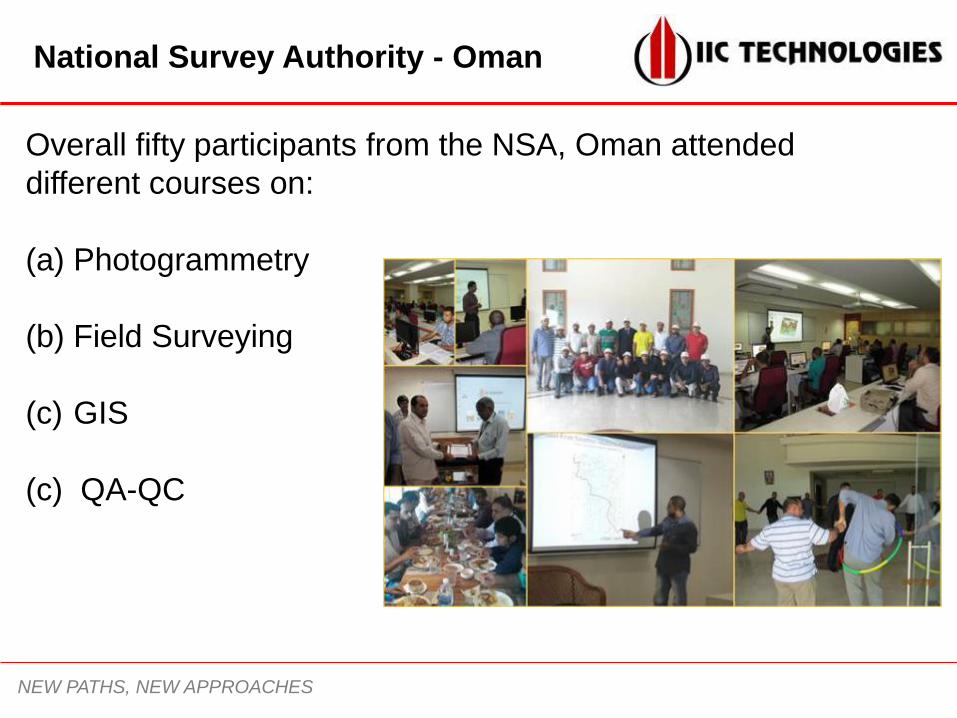
Overall fifty participants from the NSA, Oman attended
different courses on:
(a) Photogrammetry
(b) Field Surveying
(c) GIS
(c) QA-QC
National Survey Authority - Oman
NEW PATHS, NEW APPROACHES
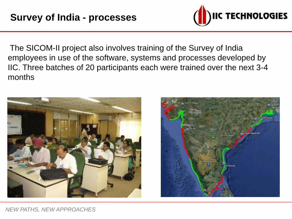
The SICOM-II project also involves training of the Survey of India
employees in use of the software, systems and processes developed by
IIC. Three batches of 20 participants each were trained over the next 3-4
months
Survey of India - processes
NEW PATHS, NEW APPROACHES
Hydrographic Certification

NEW PATHS, NEW APPROACHES
Australia
NEW PATHS, NEW APPROACHES
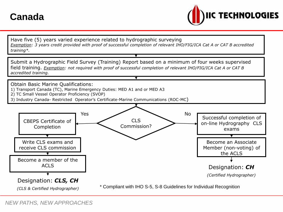
Canada
NEW PATHS, NEW APPROACHES
Obtain Basic Marine Qualifications: 1) Transport Canada (TC), Marine Emergency Duties: MED A1 and or MED A3 2) TC Small Vessel Operator Proficiency (SVOP)
3) Industry Canada- Restricted Operator’s Certificate-Marine Communications (ROC-MC)
Have five (5) years varied experience related to hydrographic surveying Exemption: 3 years credit provided with proof of successful completion of relevant IHO/FIG/ICA Cat A or CAT B accredited
training*.
Submit a Hydrographic Field Survey (Training) Report based on a minimum of four weeks supervised field training. Exemption: not required with proof of successful completion of relevant IHO/FIG/ICA Cat A or CAT B
accredited training.
CLS Commission?
CBEPS Certificate of Completion
Yes
Write CLS exams and receive CLS commission
Become a member of the ACLS
Designation: CLS, CH
(CLS & Certified Hydrographer)
Successful completion of on-line Hydrography CLS
exams
No
Become an Associate Member (non-voting) of
the ACLS
Designation: CH
(Certified Hydrographer)
* Compliant with IHO S-5, S-8 Guidelines for Individual Recognition
Canada
NEW PATHS, NEW APPROACHES
Take Home Message
Capacity Building is;
- training of hydrographers and cartographers
- enhanced capacity of data collection and production
- embedded assistance and training
- modular, flexible, blended
Capacity Building involve more than training. It should be a
strategy that involves a long time vision towards the
enhanced production, modernization, and development of
human resources leading to overall organizational objectives.
There are various forms of capacity building frameworks
available within the ROPME region
NEW PATHS, NEW APPROACHES
Thank You
www.iictechnologies.com