carlsbad caverns ational park canyons & caves
TRANSCRIPT
Canyons & Caves 43(2) 2017 1Carlsbad Caverns National Park
Canyons & CavesNewsletter of the Resources Stewardship & Science Division
Vol. 43, No. 2 December, 2017
National Park ServiceU.S. Department of the Interior
Carlsbad Caverns National Park
Carlsbad Caverns national Park
2 Canyons & Caves Vol. 43 (2) 2017 Carlsbad Caverns National Park
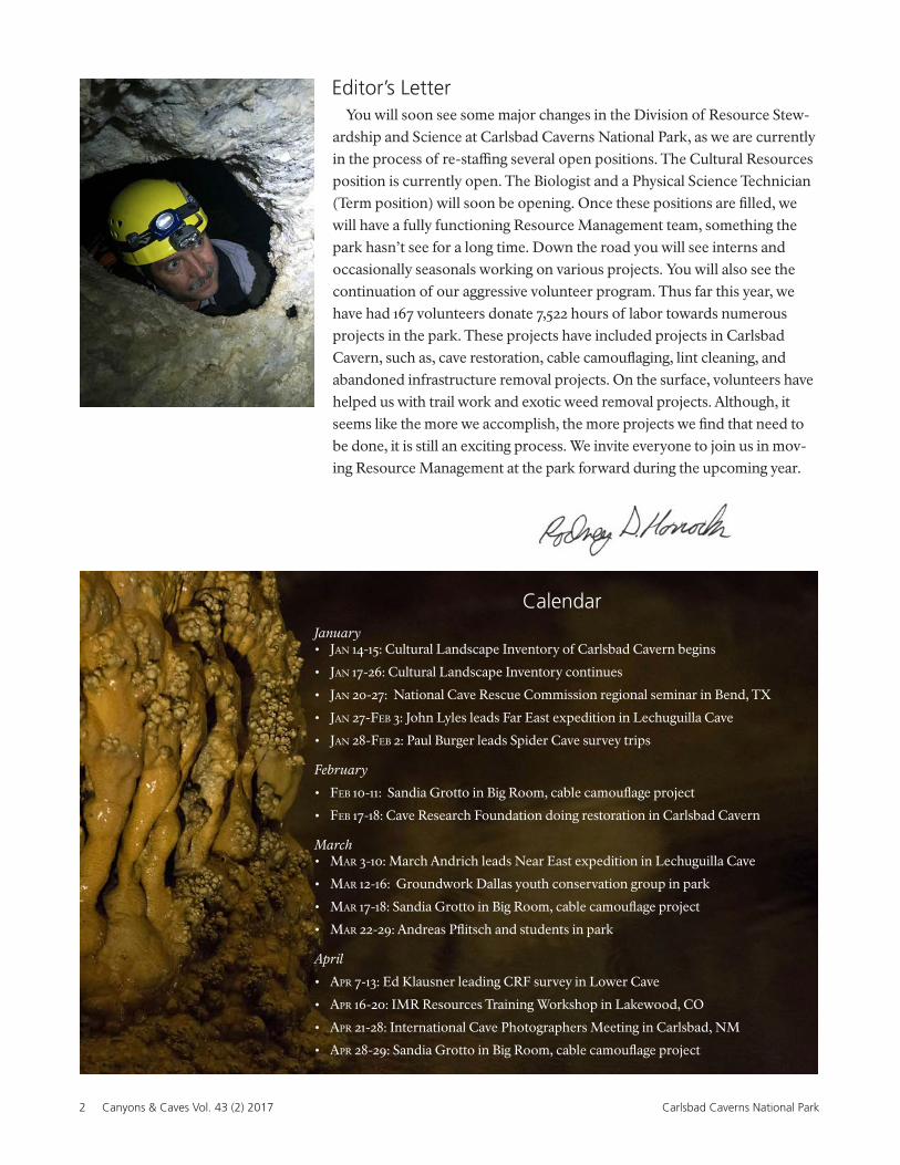
Editor’s Letter
CalendarJanuary• Jan 14-15: Cultural Landscape Inventory of Carlsbad Cavern begins
• Jan 17-26: Cultural Landscape Inventory continues
• Jan 20-27: National Cave Rescue Commission regional seminar in Bend, TX
• Jan 27-Feb 3: John Lyles leads Far East expedition in Lechuguilla Cave
• Jan 28-Feb 2: Paul Burger leads Spider Cave survey trips
February
• Feb 10-11: Sandia Grotto in Big Room, cable camouflage project
• Feb 17-18: Cave Research Foundation doing restoration in Carlsbad Cavern
March• Mar 3-10: March Andrich leads Near East expedition in Lechuguilla Cave
• Mar 12-16: Groundwork Dallas youth conservation group in park
• Mar 17-18: Sandia Grotto in Big Room, cable camouflage project
• Mar 22-29: Andreas Pflitsch and students in park
April
• apr 7-13: Ed Klausner leading CRF survey in Lower Cave
• apr 16-20: IMR Resources Training Workshop in Lakewood, CO
• apr 21-28: International Cave Photographers Meeting in Carlsbad, NM
• apr 28-29: Sandia Grotto in Big Room, cable camouflage project
You will soon see some major changes in the Division of Resource Stew-ardship and Science at Carlsbad Caverns National Park, as we are currently in the process of re-staffing several open positions. The Cultural Resources position is currently open. The Biologist and a Physical Science Technician (Term position) will soon be opening. Once these positions are filled, we will have a fully functioning Resource Management team, something the park hasn’t see for a long time. Down the road you will see interns and occasionally seasonals working on various projects. You will also see the continuation of our aggressive volunteer program. Thus far this year, we have had 167 volunteers donate 7,522 hours of labor towards numerous projects in the park. These projects have included projects in Carlsbad Cavern, such as, cave restoration, cable camouflaging, lint cleaning, and abandoned infrastructure removal projects. On the surface, volunteers have helped us with trail work and exotic weed removal projects. Although, it seems like the more we accomplish, the more projects we find that need to be done, it is still an exciting process. We invite everyone to join us in mov-ing Resource Management at the park forward during the upcoming year.
Canyons & Caves 43(2) 2017 3Carlsbad Caverns National Park
Canyons & Caves
Newsletter of the Resources Stewardship & Science Division
Vol. 43, Issue 2 December 2017
PARK SUPERINTENDENT
Douglas Neighbor
EDITORIAL
Rod Horrocks Editor
Ellen Trautner Associate Editor
Cathryn Hoyt Production Editor
CONTRIBUTING AUTHORSPaul Burger
Rod Horrocks
Erin Lynch
Tim Pine
Megan Podolinksy
Ken Stella
Ellen Trautner
PHOTOGRAPHERS & ARTWORK
Chris Amidon
Peter Bosted
Paul Burger
Yvonne Droms
Art Fortini
Rod Horrocks
Kelli Housley
Cathryn Hoyt
Kenneth Ingham
Brian Kendrick
Jean Krejca
Daniel Leifheit
Art Palmer
Charlie Reed
Robbie Shone
Nick Socky
Shawn Thomas
EDITORIAL ENQUIRIESResources Stewardship & Sciences Division3225 National Parks HighwayCarlsbad, NM [email protected]
www.nps.gov/cave
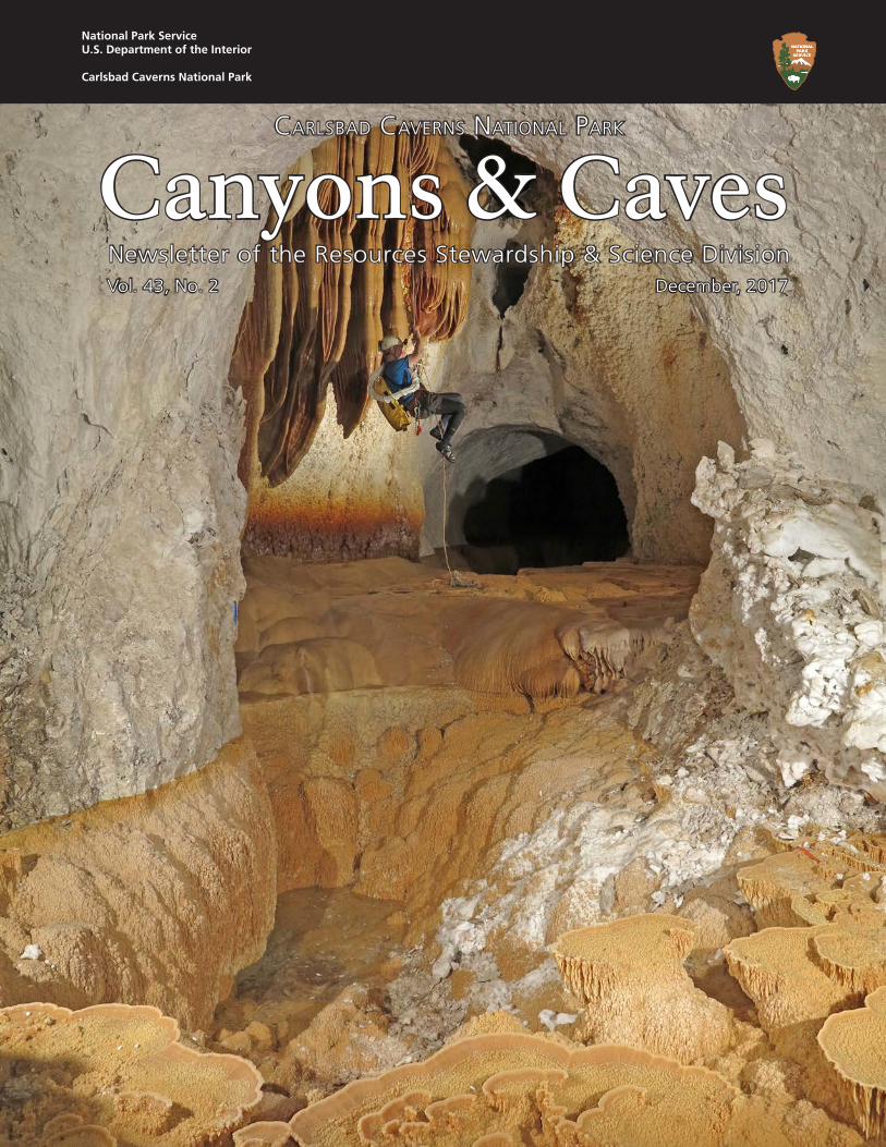
Image Front Cover: Ron Miller ascending the rope into the Tree House. Photo by P. Bosted.
Above right: Decaying bat found in Mys-
tery Room area. Photo by Y. Droms.
Contents
Editor’s Letter 2
Gilead Discovery in Spider Cave 4
The Squeeze: Resource Notes & News 12
Physcial Sciences
Biology
Staff News 32
Recent Publications 34
4 Canyons & Caves Vol. 43 (2) 2017 Carlsbad Caverns National Park
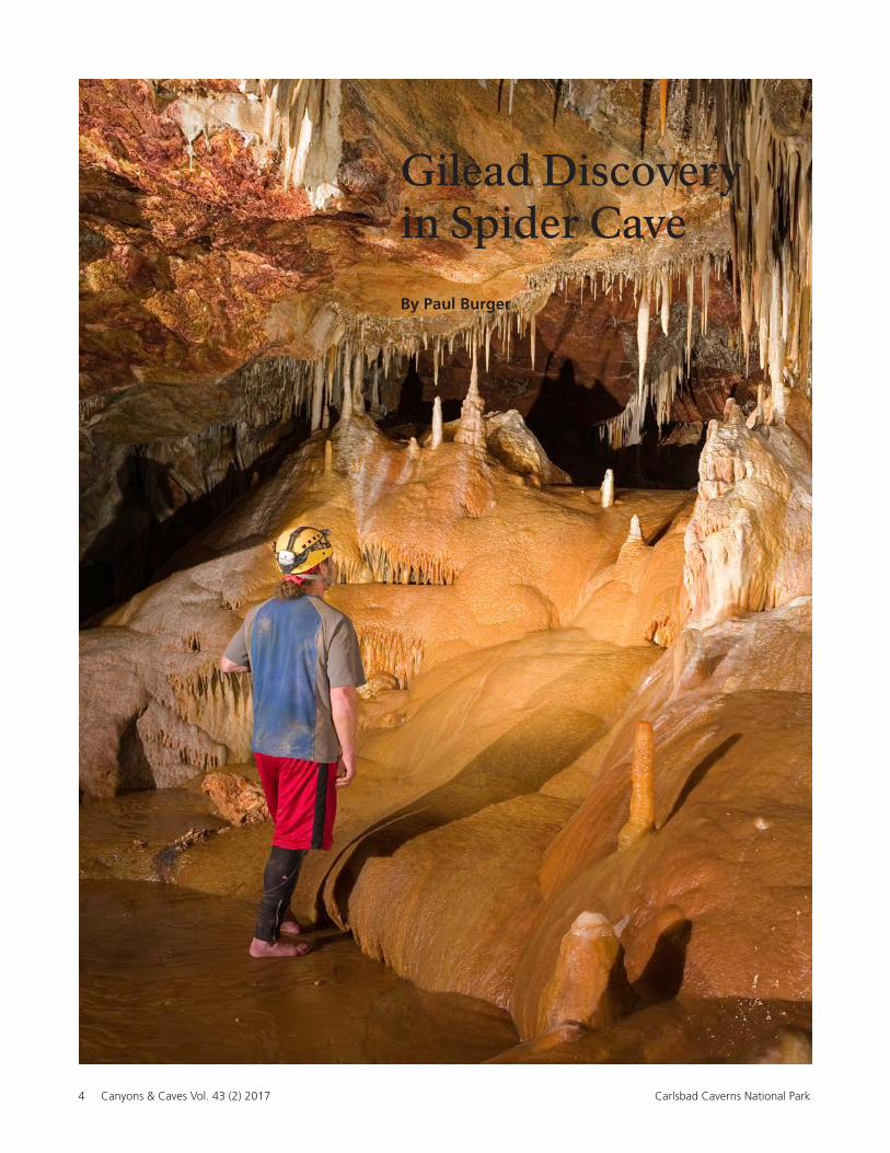
Gilead Discovery in Spider Cave
By Paul Burger
Canyons & Caves 43(2) 2017 5Carlsbad Caverns National Park
Numerous local explorers visited the cave until
a flood covered the entrance in 1941. In 1958, a
group—including future park superintendent—
Bob Crisman, relocated the cave entrance and
began digging it back open. On November 6,
they worked their way through the entrance crawl
series and into the larger cave passages beyond.
In April, 1967 explorers associated with the Gua-
dalupe Cave Survey pushed into the maze beyond
the Mace Room. This area had undoubtedly been
looked at before, but no one had found the key
climbdown into the low, mud and moonmilk-cov-
ered crawlway that leads to the back section of
the cave. On May 20, 1967 Jerry Trout led a group
back into the new discovery to begin mapping it.
They pushed all the way into the Third Parallel and
mapped most of the larger parts of that passage.
At that time, they noted that the earlier map was
not very good and suggested a complete resurvey
of the historic cave. In 1971, the Guadalupe Cave
Survey became part of the Cave Research Foun-
dation and continued to conduct surveys in the
cave through the early 1990s. Even though quite a
bit of survey was completed, the map hadn’t been
updated since around 1978.
Rich Knapp, an active caver from the now-de-
funct Air Force Academy Student Grotto in Colo-
rado, moved to Lubbock and participated on one
of the CRF trips with Dave Belski, a local caver
who had done many trips into the cave. On that
trip, they realized that not only was there a lot
of passage missing from the map, but that much
of the passage had been sketched with too little
detail.
Starting in 1990, Rich spearheaded the systematic
survey of the cave and resurveys of areas that either
had poor data or poor sketches. I joined the project
in 1993 during a time when the emphasis was on
exploring and mapping the far southeast section of
the cave where it was relatively close (~1,500 feet)
to Chocolate High off of the New Mexico Room in
Carlsbad Cavern. We pushed the southeast part of
the cave pretty hard, including resurveying some
poorly drawn older areas, but to no avail. Not only
did we not find a way on, we never felt the kind
of airflow that we had coming from the forma-
tion-choked passages in Chocolate High.
We continued resurveying and pushing into
1994, but after more than 70 surveys and 2.3 miles
of cave resurveyed, Rich moved away and the
mapping stopped. Rich had started drafting a new
map of the cave even after he was no longer able to
make trips, but he soon found a major survey bust
that rotated the entire back section of the cave.
This was before the era of digital cartography, so it
would have taken a lot of effort to fix it. Disheart-
ened, the working map was rolled up and stored
away for many years.
From 1994 to 2003, the only surveys that took
place were in support of scientific studies and
no new exploration was going on. In 2006, while
working on maps for the updated Cave and Karst
Management Plan, we realized how inadequate
the map was for accurately showing the trails and
for scientific studies. So, I decided to take on the
daunting task of drafting the map of Spider Cave.
Spider Cave has been known since at least the late 1920s. In 1933, Jim White, the principal explorer of Carls-
bad Cavern, told Robert Nymeyer about Garden Grove Canyon Cave in a small tributary of Walnut
Canyon. Nymeyer and a small group visited the cave on July 16, 1933 and documented the exploration in his
book Carlsbad, Caves, and a Camera. He renamed the cave Spider Cave for all of the harvestman in the
entrance crawl and it has been known by that name ever since.
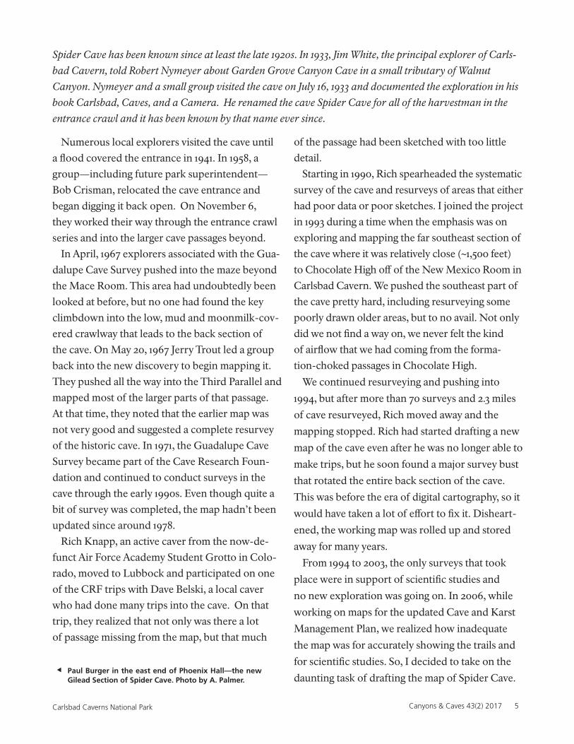
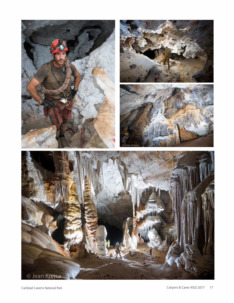
Paul Burger in the east end of Phoenix Hall—the new Gilead Section of Spider Cave. Photo by A. Palmer.
6 Canyons & Caves Vol. 43 (2) 2017 Carlsbad Caverns National Park
I began to work on the map and quickly realized
that there was no way to do it right without fixing
the bad loops first. When I started, there were
more than 30 very bad loops, and many others too
far off for an accurate map. So in 2006, I started
with the worst loop and began knocking them off
one by one. At the same time, I contacted Rich
who dug out his old map and sent it to me so I
could use as much of it as possible.
By the summer of 2007, the data was down to
only a handful of minor bad loops and I re-regis-
tered Rich’s map to the improved data and began
drafting. From 2007 to 2010, with the help of vol-
unteers and park staff on their off days, we had a
good working map of the section beyond the Mace
Room and had started adding detail and mapping
passages that had been explored over the years but
not surveyed. Chris Amidon, one of the Interpre-
tive supervisors at the park, started to help me after
getting bitten by the bug to explore Spider Cave.
In the fall of 2010, I took a new job in Alaska
and during the winter offseason, I was able to put
together a working draft of the rest of the cave.
Fortunately, Chris continued to run trips with the
help of other park staff, fixing loops and resurvey-
ing areas where needed. Chris ran trips in October
and December of 2010 and another in March, 2011.
It was easy to add new survey to the areas beyond
the Mace Room; most of the existing surveys had
been fixed or redone. The Historic Section was a
different matter entirely.
After much discussion with the park, we decided
it would be best to redo the older surveys of the
cave. So, in September 2011, Chris started from
the entrance and began a new survey. Rather than
repeat the old way of running a long baseline
through the main route, Chris started to systemat-
ically survey the very crawly area north and east of
the entrance.
In early 2012, Chris accepted a job at Voyageurs
National Park and wanted to get one last trip in
before he left. On March 19, he led Erin Cubbon
and Jen Evans to resurvey the NB/NC north of the
entrance towards the Cumulonimbus Room, an
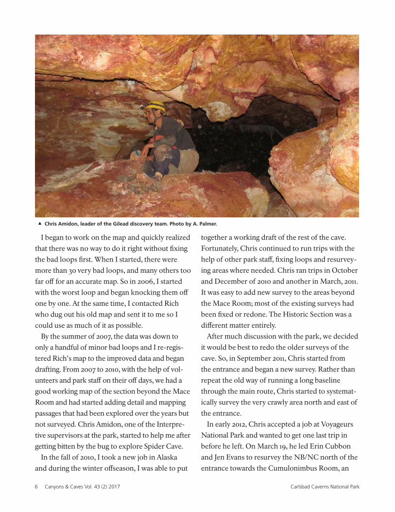
Chris Amidon, leader of the Gilead discovery team. Photo by A. Palmer.
Canyons & Caves 43(2) 2017 7Carlsbad Caverns National Park
area of tight boneyard that Rich Knapp had ini-
tially surveyed in April, 1993. Ironically, I had been
on a follow up survey to that area in May, 1993
where we pushed some tight boneyard northwest
of the Cumulonimbus Room, the last trip to this
area before Chris started the resurvey.
They followed the old NC survey, replacing it
with the continuation of the B survey first through
decent-sized stooping passage and then into dif-
ficult boneyard. They mopped up a good deal of
boneyard and worked their way into a small room
with gypsum and thick calcite crusts on the wall.
This had to be the Cumulonimbus Room, the last
named passage to the north, but the way on was
not completely obvious.
While waiting for Erin to check a crawlway,
Chris poked his head into a small hole a couple
of feet off the floor. He momentarily debated
whether it would be worth getting scraped up even
more, especially since it had no airflow and did
not look like it got bigger. As he was debating out
loud whether or not to give the squeeze a try, Jen
reminded him that this could be his last trip into
the cave for a long time, so he pushed on.
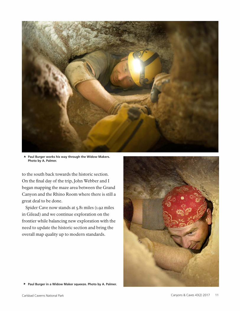
Beyond three more constrictions (Widow Mak-
ers), he found a climb upward that led through
a hands-and-knees crawl to an east-west fissure
passage. They pushed east to a shallow pool and
then only fifty feet to the west, enough to see that
the cave continued.
.
40
N
0
Feet
80
HellaciousBoneyard
Third JointPassage
PhlegmPhlam
low
2 x 1
?
?sharplead
?
?
dig
low
tight
?
?
?
?
lower leveloffset
PlumbersNightmare
MedusaRoom
MaceRoom
downsmall
goessmall
MaroonMaze
?
?
EntranceRhinoRoom
?
?
upper levelboneyardCumulonimbus
Room
delicate
?
?
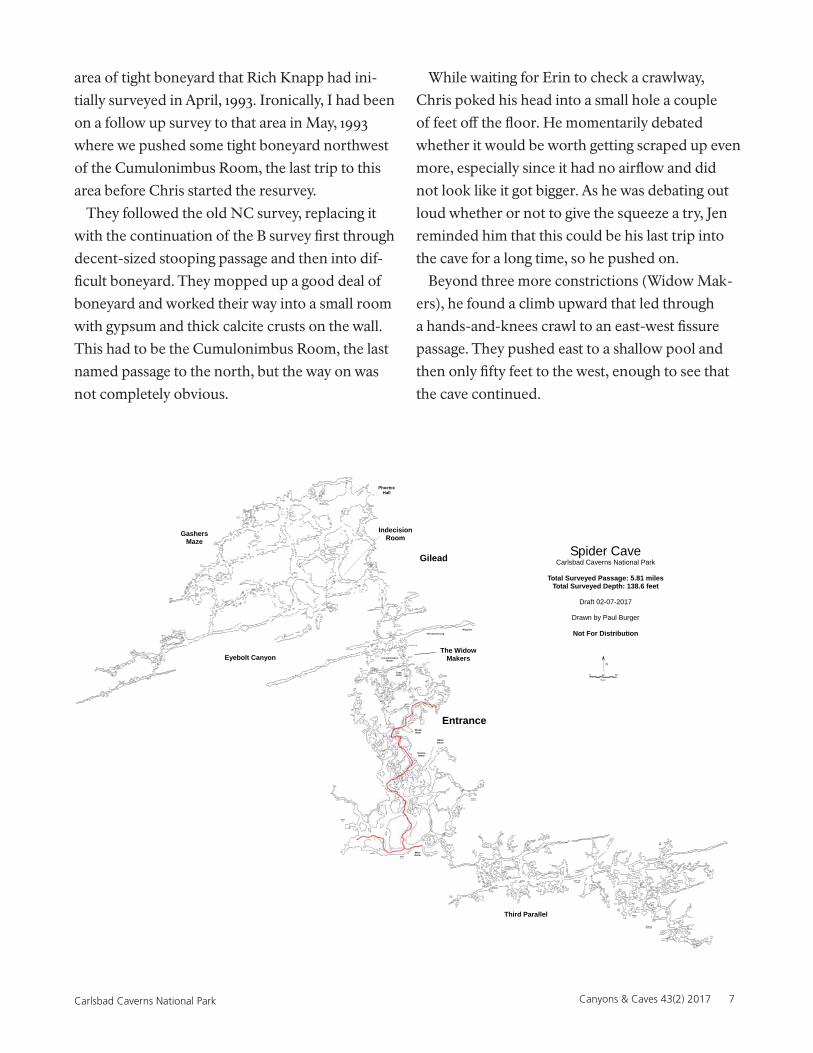
Spider CaveCarlsbad Caverns National Park
Total Surveyed Passage: 5.81 milesTotal Surveyed Depth: 138.6 feet
Draft 02-07-2017
Drawn by Paul Burger
Not For Distribution
?
?
Goodhammerleads
?
mop-up surveyneeded
? goodhammer lead
? goodhammer lead
? dome@H23
?
?
tt?
tt?
tt
HalflingHall
HotFuzz
very tight pitinteresting
?
?
?
?
?
??
TheER
tt?
tt?
?
?
?
DrusyDome
from ceilinghole
goes~50 ft?
??
?
?
?
? The WidowMakers
The Second Leg
Requiem
small?
yuk?
upperlead
aqua socklead
tt
lowerlevelleadstoo
? pastdry pool
IndecisionRoom
Gilead
The First Leg
tighttight
gypsum tubegoes @ lowerlevel
Delicate gypsum floors
tt
can see 20+ feetinto 3x3 tube
tt
tt
tt
tt
tt
tightholedown
tt
tt
squeeze upinto tight leadheading SW - yuk
tt
tt
tt
tttt
tttt
tt
tt
?
?
dryflowstone
upperleads
limit travel in this areabad mix of CR and flowstone
delicateleads
??
2'x5'dig lowsparkly
down tolower level
gyp squeeze
?
?
Eyebolt Canyon
FattyFilter
PhoenixHall
?lowerlevel
lowleadshere
?
?
?
?
tt
GashersMaze ?
tt?
leadsin
breakdown
?
??
?
?
tt tt
?low & high
grim
tt
?
tt
tt
tt
tt?
?
at mult.levels
?
?high/low
?
?
??
?at twolevels
high leadsin fissure
?
? ?
lower
lower levelmaze has leadsgoing east
slopesdown
to crystallevel below
B191
gyp needlesmeas @ 2.6 ft
?
tt
tt
allsmall
?
tt tt
tt
tttt
tt
?
?
tt
tt tt
tt
tt
tt
tt
tt
tt
??
?
?
? toBL3
?
tt tt
?
?
??
?
tt
tt
tt tt
tt
tt
tt
lowerlevel
tight?
tt
?tight ?
too delic.appears term.
tt
tt
tt
tt
Third Parallel
8 Canyons & Caves Vol. 43 (2) 2017 Carlsbad Caverns National Park
September 2012
We waited until Chris Amidon could escape his
new duties at Voyageurs to continue exploring. On
September 19, 2012 we mapped beyond the pool
Chris had found and then started to map the main
fissure to the west. The fissure ended after a few
hundred feet, but we mopped up the majority of
the side leads and netted almost 800 feet of new
cave.
The next day, while Stan and I spent the first part
of the trip photographing “The Requiem” flow-
stone area to the east, Chris followed a gritty crawl
to the north into another parallel fissure. The
east ended in dripstone formations and the west-
ern end went into gritty boneyard. Stan pushed
through another north-trending passage, through
another tight squeeze, that opened up into more
typical Spider Cave maze, but with more areas of
dried pools and calcite rafts than is seen in other
parts of the cave. The cave continued to get bigger
with more obvious leads at multiple levels. We
eventually had to stop at a major junction room to
figure out where to go; it was no longer clear which
way was best. We named this junction “The Inde-
cision Room.” We opted to push west and began
to encounter gypsum needles and other features
that looked more like Lechuguilla Cave than what
we expected from Spider. We stopped the survey
in a 30-foot fissure passage (Eyebolt Canyon) with
abundant tyuyamymite, and so many gypsum
formations that it was nerve racking to move. We
finished the day with over 800 feet of new cave.
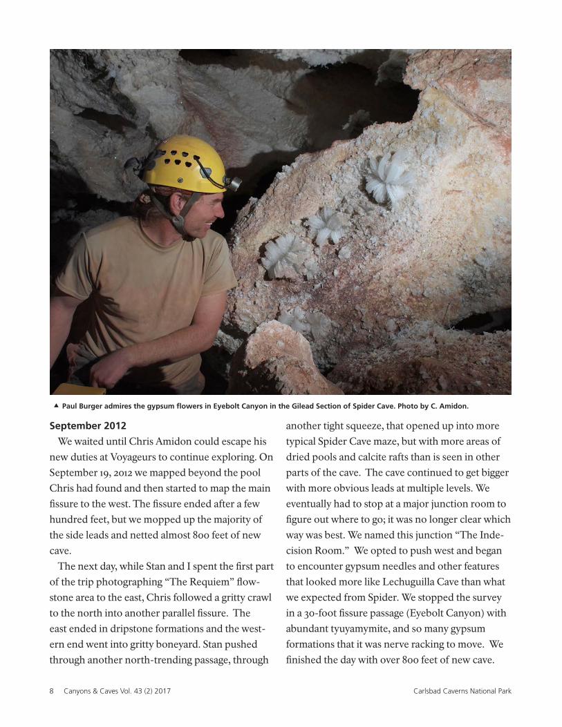
Paul Burger admires the gypsum flowers in Eyebolt Canyon in the Gilead Section of Spider Cave. Photo by C. Amidon.
Canyons & Caves 43(2) 2017 9Carlsbad Caverns National Park
The following day, we decided to push the north
lead instead of returning to Eyebolt. The passage
was much tighter and we descended into an old
pool basin with thick, cracked calcite floors and
walls. After much more squirreling around, the
passage opened to stooping size and then broke
open into a room 200-feet long, 40-feet wide, and
15 to 20 feet tall, which we named Phoenix Hall.
On the east side of the chamber, active flowstone
cascaded down a slope forming small pools. To the
west, the passage continued into a large, walking
fissure, but we were out of time even though we
had only mapped a mere 700 feet of new cave.
After much discussion, we decided to name the
new area Gilead, after the fictional land of the
Gunslinger from Stephen King’s novels.
March 2013
Chris, Stan, and I were able to return to Gilead
in March, 2013 and we immediately headed to
the walking lead in Phoenix Hall. The main pas-
sage ended in smaller maze passage so we backed
up and mapped the next larger lead going to the
south. This trend continued as we mapped west
until the passage got small and we retreated to
more comfortable maze cave. We surveyed three
parallel western fissures with north-south connec-
tions and dozens of side leads. We established the
structure of Gasher’s Maze on that trip with dense
maze passages on at least three levels, setting the
stage for a lot of future mop up. We left the cave
on the first day with nearly 1,100 feet of passage.
The following day, Shawn Thomas replaced Stan
and we mapped westward from the Indecision
Room into the maze once again. We mapped west
until the passage got smaller and then mapped
back to the north, picking up several east-west par-
allels as we went and eventually connecting into
the Phoenix Hall area to the north. We mapped
over 550 feet of nice maze passage.
The next day, I had to take care of a knee issue,
but Stan, Chris, and Shawn returned to Gilead to
continue the epic push. Heading west from the
Indecision Room, they pushed into Eyebolt Can-
yon to continue following that trend. The passage
went west for several hundred feet and a lack of
side leads allowed for numerous 30-40 foot shots
with ceiling heights in excess of 20 feet. The walls,
ceiling, and floor were covered in gypsum needles,
hair, and flowers, often several feet long that made
for nerve-wracking survey. Eventually the fissure
fizzled out with no obvious way on to the west.
The team went back east to where the first decent
lead was heading back north, and reconnected it to
previous surveys in Gasher’s Maze. They finished
the day with over 800 feet.
Chris and I returned to Phoenix Hall the next
day and mapped nearly 600 feet of cave in Gash-
er’s Maze, including a shortcut that bypasses the
old pool area on the discovery route, cutting off
some travel time and allowing us to avoid some
delicate aragonite.
On the final day of our spring trip, Stan, Chris,
and I pushed the flowstone leads along the east-
ern edge of the cave, starting from Phoenix Hall
and working our way back towards the Indecision
Room. The passages were beautiful but delicate
and we had to keep changing from regular caving
suits to Tyvek and aquasocks to keep from tracking
clay. We did not break out of the eastern edge, but
still mapped nearly 700 feet of cave, bringing the
total cave length to over 5 miles.
September 2013
Stan Allison, Shawn Thomas and I spent three
days pushing and mapping along the western
fringe of Gilead hoping to find a breakout. We
were unsuccessful. Nearly everything got too tight
or reconnected to other surveys. Still, we mapped
several hundred feet of passage.
10 Canyons & Caves Vol. 43 (2) 2017 Carlsbad Caverns National Park
April 2014
For the first trip of the New Year, Shawn and I
mapped more of the maze just north of Eyebolt
Canyon, spending most of the day in passages
less than 1-foot high. On the second trip Stan and
I mapped some passage south of Eyebolt, into a
parallel that ended solidly to the west and east, but
still resulted in nearly 500 feet of new cave. On the
last trip, Stan and I mopped up 350 feet more of the
maze between Eyebolt and the Indecision Room.
September 17, 2014
Stan, Stuart Marlatt, and I pushed the area near
the end of Eyebolt and the area where we had
found the parallel fissure to the south on the previ-
ous trip, but all of the passages got too tight.
January 2016
After an unplanned hiatus from Spider and
Gilead in 2015, Stan and I went to the upper level
maze near the end of Eyebolt to see if we could
find a way west. On the first trip, everything we
pushed ended solidly or in unpromising chipping
leads. In a pattern that continues to today, I began
alternating trips between Gilead and the Historic
Section in an effort to complete the survey of the
older parts of the cave to modern standards.
Charlie Reed and Nathaniel Gilbert helped me
remap the route from the entrance crawl to just
east of Blood River. We then tied the new survey
into the old VB survey area just to the north. On
the next trip Foz Trautner and John Davis joined
me to remap from Blood River to just past the
Rabbit Ears and the passage heading north out of
the Decision Room.
April 2016
A fortuitous conference got me back to Carlsbad
and allowed me to do some evening survey after
the talks were over. On the first trip, Joel Despain
and Ellen Trautner helped me resurvey from the
Rabbit Ears to the Gnome Dome and then some
of the side leads off the old VB (now E survey).
Two days later, Joel and I went into Gilead to
continue cleaning up leads in Gasher’s Maze and
mapped several hundred feet near Phoenix Hall.
On the final day of this trip, Joel, Jon Mackey, and
I continued to mop up side leads on the E survey,
including the long, crawly connection between
the E survey and the B survey just north of the
entrance area.
January 2017
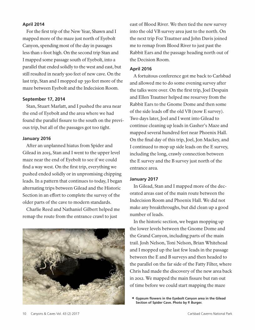
In Gilead, Stan and I mapped more of the dec-
orated areas east of the main route between the
Indecision Room and Phoenix Hall. We did not
make any breakthroughs, but did clean up a good
number of leads.
In the historic section, we began mopping up
the lower levels between the Gnome Dome and
the Grand Canyon, including parts of the main
trail. Josh Nelson, Toni Nelson, Brian Whitehead
and I mopped up the last few leads in the passage
between the E and B surveys and then headed to
the parallel on the far side of the Fatty Filter, where
Chris had made the discovery of the new area back
in 2012. We mapped the main fissure but ran out
of time before we could start mapping the maze
Gypsum flowers in the Eyebolt Canyon area in the Gilead Section of Spider Cave. Photo by P. Burger.
Canyons & Caves 43(2) 2017 11Carlsbad Caverns National Park
to the south back towards the historic section.
On the final day of the trip, John Webber and I
began mapping the maze area between the Grand
Canyon and the Rhino Room where there is still a
great deal to be done.
Spider Cave now stands at 5.81 miles (1.92 miles
in Gilead) and we continue exploration on the
frontier while balancing new exploration with the
need to update the historic section and bring the
overall map quality up to modern standards.
Paul Burger in a Widow Maker squeeze. Photo by A. Palmer.
Paul Burger works his way through the Widow Makers. Photo by A. Palmer.
12 Canyons & Caves Vol. 43 (2) 2017 Carlsbad Caverns National Park
The SqueezeResource Notes & News
Canyons & Caves 43(2) 2017 13Carlsbad Caverns National Park
Lechuguilla Cave Expedition Summaries, January to June, 2017
Thirty-one years after a group of explorers dug their way through breakdown into Lechuguilla Cave, the
cave still surprises us. Set aside for research, explorers continue to find new passages and researchers learn
more about the diversity of life within this pristine cave system.
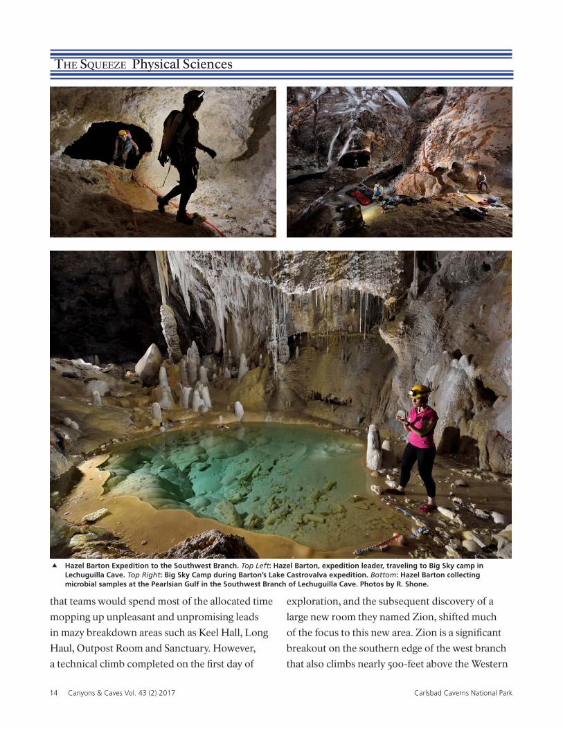
Paul Burger conducts typical Gashers Maze survey. Photo by S. Thomas.
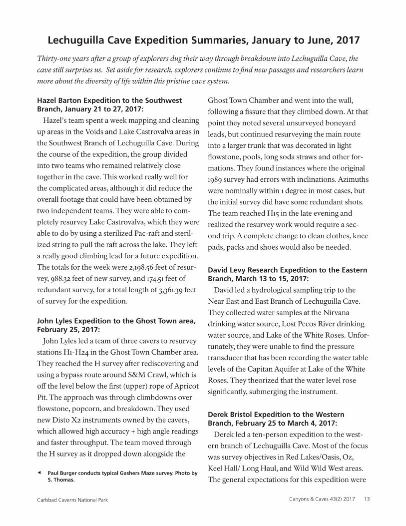
Hazel Barton Expedition to the Southwest Branch, January 21 to 27, 2017:
Hazel’s team spent a week mapping and cleaning
up areas in the Voids and Lake Castrovalva areas in
the Southwest Branch of Lechuguilla Cave. During
the course of the expedition, the group divided
into two teams who remained relatively close
together in the cave. This worked really well for
the complicated areas, although it did reduce the
overall footage that could have been obtained by
two independent teams. They were able to com-
pletely resurvey Lake Castrovalva, which they were
able to do by using a sterilized Pac-raft and steril-
ized string to pull the raft across the lake. They left
a really good climbing lead for a future expedition.
The totals for the week were 2,198.56 feet of resur-
vey, 988.32 feet of new survey, and 174.51 feet of
redundant survey, for a total length of 3,361.39 feet
of survey for the expedition.
John Lyles Expedition to the Ghost Town area, February 25, 2017:
John Lyles led a team of three cavers to resurvey
stations H1-H24 in the Ghost Town Chamber area.
They reached the H survey after rediscovering and
using a bypass route around S&M Crawl, which is
off the level below the first (upper) rope of Apricot
Pit. The approach was through climbdowns over
flowstone, popcorn, and breakdown. They used
new Disto X2 instruments owned by the cavers,
which allowed high accuracy + high angle readings
and faster throughput. The team moved through
the H survey as it dropped down alongside the
Ghost Town Chamber and went into the wall,
following a fissure that they climbed down. At that
point they noted several unsurveyed boneyard
leads, but continued resurveying the main route
into a larger trunk that was decorated in light
flowstone, pools, long soda straws and other for-
mations. They found instances where the original
1989 survey had errors with inclinations. Azimuths
were nominally within 1 degree in most cases, but
the initial survey did have some redundant shots.
The team reached H15 in the late evening and
realized the resurvey work would require a sec-
ond trip. A complete change to clean clothes, knee
pads, packs and shoes would also be needed.
David Levy Research Expedition to the Eastern Branch, March 13 to 15, 2017:
David led a hydrological sampling trip to the
Near East and East Branch of Lechuguilla Cave.
They collected water samples at the Nirvana
drinking water source, Lost Pecos River drinking
water source, and Lake of the White Roses. Unfor-
tunately, they were unable to find the pressure
transducer that has been recording the water table
levels of the Capitan Aquifer at Lake of the White
Roses. They theorized that the water level rose
significantly, submerging the instrument.
Derek Bristol Expedition to the Western Branch, February 25 to March 4, 2017:
Derek led a ten-person expedition to the west-
ern branch of Lechuguilla Cave. Most of the focus
was survey objectives in Red Lakes/Oasis, Oz,
Keel Hall/ Long Haul, and Wild Wild West areas.
The general expectations for this expedition were
14 Canyons & Caves Vol. 43 (2) 2017 Carlsbad Caverns National Park
that teams would spend most of the allocated time
mopping up unpleasant and unpromising leads
in mazy breakdown areas such as Keel Hall, Long
Haul, Outpost Room and Sanctuary. However,
a technical climb completed on the first day of
Hazel Barton Expedition to the Southwest Branch. Top Left: Hazel Barton, expedition leader, traveling to Big Sky camp in Lechuguilla Cave. Top Right: Big Sky Camp during Barton’s Lake Castrovalva expedition. Bottom: Hazel Barton collecting microbial samples at the Pearlsian Gulf in the Southwest Branch of Lechuguilla Cave. Photos by R. Shone.
exploration, and the subsequent discovery of a
large new room they named Zion, shifted much
of the focus to this new area. Zion is a significant
breakout on the southern edge of the west branch
that also climbs nearly 500-feet above the Western
The Squeeze Physical Sciences
Canyons & Caves 43(2) 2017 15Carlsbad Caverns National Park
they were able to shoot a 105 feet shot with a Dis-
toX down to the lowest part of the fissure. Abun-
dant white popcorn covered the entire walls and
the whole floor was nice flowstone. The only way
down was a too-tight popcorn slot that remained
too tight for a long time, and it didn’t move much
air. James named this pit Tango Pit. They were able
to survey 1,334 feet for the two-day expedition,
which included 122 feet of resurvey and 1,112 feet of
new survey.
Borehole. The main room in Zion is 600-feet long,
175-feet wide, with spectacular 80-foot columns
throughout. They left numerous leads for a future
expedition. Additionally, a re-sketch of Oasis
on the first survey day revealed many previously
undocumented leads that led to an extensive
boneyard maze under this large room that occu-
pied teams for several days with many leads left to
explore. Progress was made in completing some
of the remaining leads in Keel Hall, Long Hall and
the Wild Wild West. The results of the expedition
included 6,160.7 feet of total survey; with 5,887.5 feet
of new survey, 230.7 feet of resurvey, and 42.5 feet of
redundant survey. The expedition added 1.12 miles
to the length of Lechuguilla Cave, raising the length
of the Lechuguilla Cave survey to 141.94 miles.
John Lyles Expedition to the Rift andNorth Rift areas, March 24 to 25, 2017:
John Lyles led a team of four cavers on two day
trips to the North Rift area in Lechuguilla Cave.
During the first trip, they mapped leads off the
Nautiloid Pass in the Lower Rift area. The leads
included a 50’ pit. They found more leads via
resurvey than they started with, including a nice
virgin pool with green minerals on the walls. There
was air in the area and they left leads for a future
trip. All the air seemed to be coming from the
downward direction in the Rift, going up towards
Sugarlands. During their second day trip, they
investigated the North Rift route to the CG survey.
They found a narrow popcorn lined slot blowing
air, but it was very tight. After this, they went back
to the D12 area to descend the pit below D11 in
the Main Rift. James Hunter rigged to two flow-
stone-encased boulders on the floor with an 80’
rope, which was sufficient. The pit could only be
descended with clean shoes. Rick Bridges’ notes
from the original D survey showed a question
mark on the profile down there. From this station,
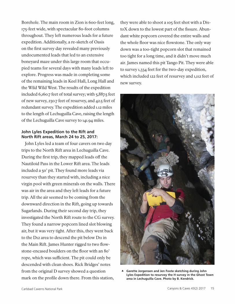
Garette Jorgensen and Jen Foote sketching during John Lyles Expedition to resurvey the H survey in the Ghost Town area in Lechuguilla Cave. Photo by B. Kendrick.
16 Canyons & Caves Vol. 43 (2) 2017 Carlsbad Caverns National Park
Hazel Barton Expedition to the Chandelier Graveyard, May 20-27, 2017:
Hazel led five cavers—including Agusto Auler from Brazil —to the Deep Seas camp, cleaning up areas on the Chandelier Grave-yard Quads, with a goal of completing quads H36/37 and I37/36. They surveyed 27 leads, many of which went farther than expected and completed most of the climbing leads that had been identified. One climb by Derek Bris-tol and Phil Cunniham led to the PhD Room, providing a second access point, should that ever be needed. The expedition resurveyed 918.5 feet, 2,212.2 feet of new survey, and 95.0 feet of redundant survey, for a total of 3,130.6 feet of total survey for the expedition.
Art Fortini’s Expedition to the Never Never Land, June 11-17, 2017:
Art led a return expedition to his December 2016
discovery of Never Never Land, which is located
at the top of the 500-foot high, multi-pitch climb
known as the Treehouse in the Western Branch of
Lechuguilla Cave. This unique area is unusually
flat and dips slightly to the southeast at 9 degrees.
The room and pillar maze, which is covered with
The Squeeze Physical Sciences
(Clockwise from top left): Derek Bristol, the Expedition Leader for the February trip to the Far West in the Western Borehole. Photo by J. Krejca.
David Lambert in the boneyard underneath the Western Borehole. Photo by J. Krejca.
Tammy Otten in the Red Tides Room ascending the rope climb that originally led to the Zion discovery. Photo by J. Krejca.
Zion, the large new room discovered off of Red Tides near the end of the Western Borehole of Lechuguilla Cave. Photo by J. Krejca.
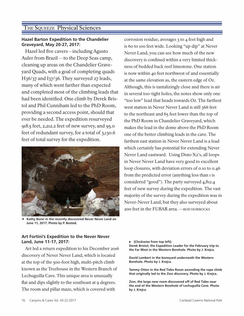
Kathy Borer in the recently discovered Never Never Land on June 11, 2017. Photo by P. Bosted.
corrosion residue, averages 3 to 4 feet high and
is 60 to 100 feet wide. Looking “up dip” at Never
Never Land, you can see how much of the new
discovery is confined within a very limited thick-
ness of bedded back reef limestone. One station
is now within 40 feet northwest of and essentially
at the same elevation as, the eastern edge of Oz.
Although, this is tantalizingly close and there is air
in several too-tight holes, the notes show only one
“too low” lead that heads towards Oz. The farthest
west station in Never Never Land is still 366 feet
to the northeast and 65 feet lower than the top of
the PhD Room in Chandelier Graveyard, which
makes the lead in the dome above the PhD Room
one of the better climbing leads in the cave. The
farthest east station in Never Never Land is a lead
which certainly has potential for extending Never
Never Land eastward. Using Disto X2’s, all loops
in Never Never Land have very good to excellent
loop closures, with deviation errors of 0.10 to 0.46
from the predicted error (anything less than 1 is
considered “good”). The party surveyed 4,812.4
feet of new survey during the expedition. The vast
majority of the survey during the expedition was in
Never-Never Land, but they also surveyed about
200 feet in the FUBAR area. —ROD HORROCKS
Canyons & Caves 43(2) 2017 17Carlsbad Caverns National Park
18 Canyons & Caves Vol. 43 (2) 2017 Carlsbad Caverns National Park
The Squeeze Physical Sciences
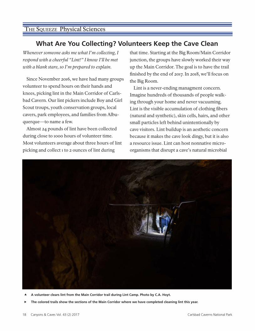
What Are You Collecting? Volunteers Keep the Cave CleanWhenever someone asks me what I’m collecting, I
respond with a cheerful “Lint!” I know I’ll be met
with a blank stare, so I’m prepared to explain.
Since November 2016, we have had many groups
volunteer to spend hours on their hands and
knees, picking lint in the Main Corridor of Carls-
bad Cavern. Our lint pickers include Boy and Girl
Scout troups, youth conservation groups, local
cavers, park employees, and families from Albu-
querque—to name a few.
Almost 24 pounds of lint have been collected
during close to 1000 hours of volunteer time.
Most volunteers average about three hours of lint
picking and collect 1 to 2 ounces of lint during
that time. Starting at the Big Room/Main Corridor
junction, the groups have slowly worked their way
up the Main Corridor. The goal is to have the trail
finished by the end of 2017. In 2018, we’ll focus on
the Big Room.Lint is a never-ending managment concern.
Imagine hundreds of thousands of people walk-ing through your home and never vacuuming. Lint is the visible accumulation of clothing fibers (natural and synthetic), skin cells, hairs, and other small particles left behind unintentionally by cave visitors. Lint buildup is an aesthetic concern because it makes the cave look dingy, but it is also a resource issue. Lint can host nonnative micro-organisms that disrupt a cave’s natural microbial
A volunteer clears lint from the Main Corridor trail during Lint Camp. Photo by C.A. Hoyt.
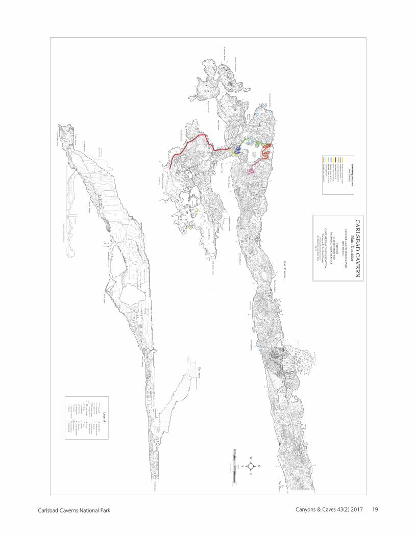
The colored trails show the sections of the Main Corridor where we have completed cleaning lint this year.
Canyons & Caves 43(2) 2017 19Carlsbad Caverns National Park
S u
r f a c e d e t a i l
S u
r f a c e i n
f r a s t r u c t u
r e o m
m i t t e d
Q
Q '
Q
Q '
P P '
M '
M
M
M '
D '
D
D
D '
S '
S
S
S '
O '
O
O
O '
K
K '
K
K '
P
P '
B
B
B ' B
'
A
A '
W '
W
W '
W
I
I '
I c e b e r g R
o c k
I ' I
L o o k i n g t o w
a r d e n t r a n
c e
E '
E
E E '
3 8 2 0
3 8 6 0
3 7 8 0 3 6 4 0 3 8 4 0
4 1 0 0
4 2 8 0
S C
A L E
d i m e n s i o n s g i v e n i n f e e t
0 5 0
1 0 0 2 0 0 f e e t
0 1 0
2 0 4 0
6 0 m e t e r s
A n
a s t a m o s e s
L e g e n d
C e i l i n
g c h a n
g e
F l o o r c h a n
g e
3 6
F l o w s t o n
e
S e d i m
e n t o r m
u d
C o l u
m n
B e d r o c k
S l o p e d f l o o r
S t a l a c t i t e s
S t a l a g m
i t e s
S u
m p
P o o l
H e l e c t i t e s
B r i d g e
S m
a l l b r e a k d o w n
C e i l i n
g c h a n
n e l
S t r e a m
1 2 3 E l e v a t i o n
a b o v e m
e a n s e a l e v e l
L i m e s t o n
e
G y p s u
m c r s y t a l s
C a v e w
a l l
U p p e r l e v e l
L o w e r l e v e l
P o p c o r n
S e d i m
e n t f i l l
M a i n
C o r r i d o r
T h e D
e v i l ' s D e n
D e v i l ' s S
p r i n g
E n
t r a n c e
T o B
a t C a v e
A p p e t i t e H
i l l
T h e B
o n e y a r d
P a p o o s e R o o m
K i n
g ' s P a l a c e
Q u
e e n ' s C
h a m
b e r
T o M y s t e r y R
o o m
I c e b e r g R
o c k
G r e e n
L a k e R o o m
T o N e w
M e x i c o R
o o m
B a s h
f u l
E l e p h
a n t
W i t c h
' s F i n g e r
D e v i l ' s M
o u n
d
C A
R L S
B A
D C
A V
E R
N
M a i n
C o r r i d o r
C a r l s b a d C
a v e r n s N
a t i o n a l P a r k
N e w
M e x i c o
S u
r v e y e d i n
c o o p e r a t i o n w
i t h
N A
T I O N
A L P A
R K
S E
R V
I C E
C A
V E
R E
S E
A R
C H
F O U
N D
A T I O
N
C a r t o g r a p h
y b y S c o t t H
o u s e
w i t h
m a j o r c o n
t r i b u t i o n
s b y E
d K l a u
s n e r a n
d D a v e W
e s t 2 0 1 5
L e f t H a n
d T u n
n e l
L u n
c h R
o o m
B i g R
o o m J u
n c t i o n
( t o B i g R
o o m )
S e c o n
d a r y S t r e a m
?
I c e b e r g R o c k
G r e e n
L a k e R o o m
W i t c h
' s F i n g e r
D e v i l ' s D
e n
D e v i l ' s S
p r i n g
O u
t l i n e o f L u
n c h
R o o m
O u
t l i n e o f
A p p e t i t e H
i l l
T o B a t C
a v e
E l e v a t o r s
A p p e t i t e H
i l l
V e i l e d S
t a t u e
W h
a l e ' s M o u
t h
T h e D
e v i l ' s D e n
E n
t r a n c e
W i t c h
' s F i n g e r
E l e v a t o r s
R e l a t i o n s h i p b e t w
e e n e n t r a n c e a n d
M a i n C
o r r i d o r
E n t r a n c e l o o k i n g o u t
M a i n C
o r r i d o r
P a p o o s e R o o m
Q u
e e n ' s C
h a m
b e r
K i n
g ' s P a l a c e
E n
t r a n c e t o
B a t C
a v e
Lint P
ickin
g 2
01
6/2
01
7
Reed
& Sco
uts 3/20, 27/16
Jablo
nsky 3/22/16
Main
Co
rrido
r
Reed
and
Scou
ts 2/13, 20/16
Reed
and
Scou
ts 12/17/16
Bem
is and
Scou
ts 12/3/16
Lint C
amp
11/8-10/16
Trautn
er, Cap
arelli 2/22/17
Lint C
amp
2/25/2017G
rou
nd
wo
rk Dallas 3/17/2017
20 Canyons & Caves Vol. 43 (2) 2017 Carlsbad Caverns National Park
The Squeeze Physical Sciences
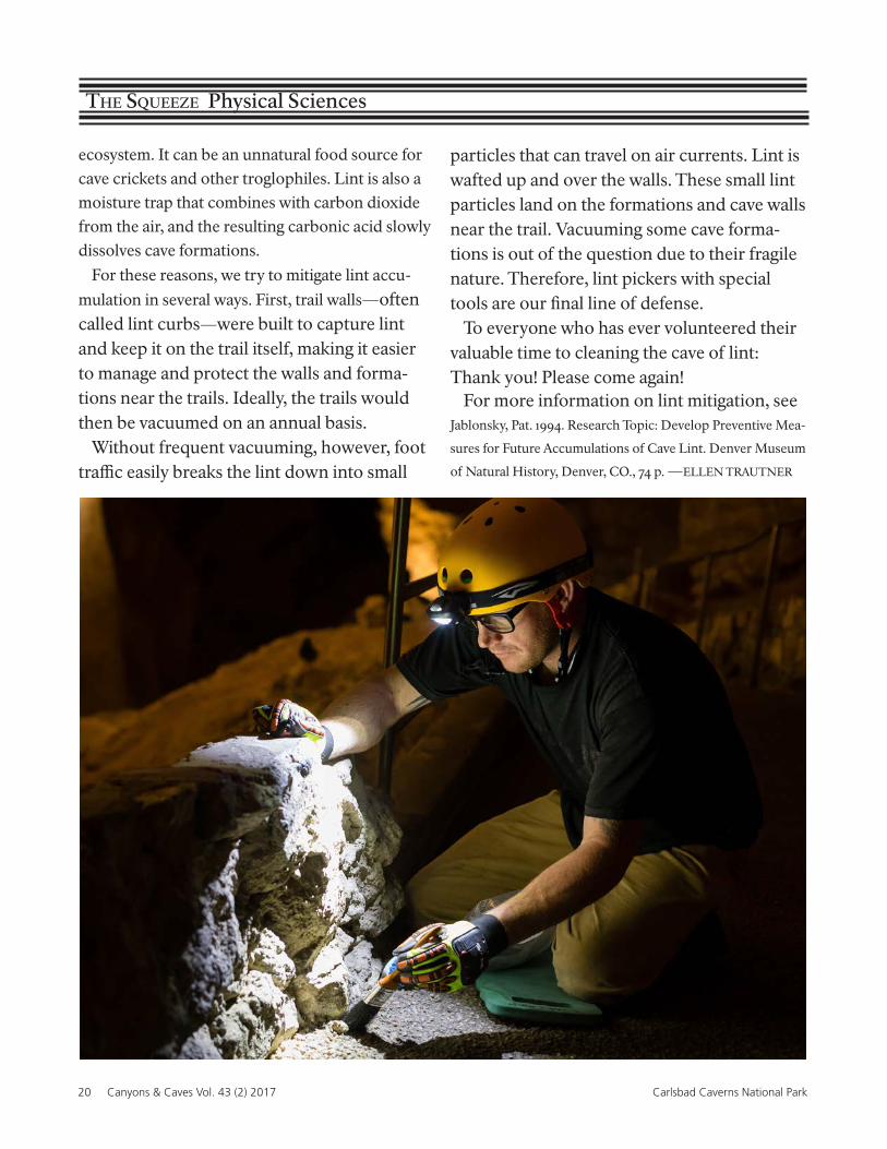
ecosystem. It can be an unnatural food source for cave crickets and other troglophiles. Lint is also a moisture trap that combines with carbon dioxide from the air, and the resulting carbonic acid slowly dissolves cave formations.
For these reasons, we try to mitigate lint accu-
mulation in several ways. First, trail walls—often called lint curbs—were built to capture lint and keep it on the trail itself, making it easier to manage and protect the walls and forma-tions near the trails. Ideally, the trails would then be vacuumed on an annual basis.
Without frequent vacuuming, however, foot traffic easily breaks the lint down into small
particles that can travel on air currents. Lint is wafted up and over the walls. These small lint particles land on the formations and cave walls near the trail. Vacuuming some cave forma-tions is out of the question due to their fragile nature. Therefore, lint pickers with special tools are our final line of defense.
To everyone who has ever volunteered their valuable time to cleaning the cave of lint: Thank you! Please come again!
For more information on lint mitigation, see Jablonsky, Pat. 1994. Research Topic: Develop Preventive Mea-
sures for Future Accumulations of Cave Lint. Denver Museum
of Natural History, Denver, CO., 74 p. —ELLEN TRAUTNER
Canyons & Caves 43(2) 2017 21Carlsbad Caverns National Park
Carlsbad Cavern Survey Project
In June, Ed Klasner led a six-day CRF expedi-
tion to the Lower Cave in Carlsbad Cavern. They
were able to mop up 37 leads for a total of 597 feet
of new survey. Eighteen of their other leads ended
immediately and just required a sketch update.
Ed estimates that it will probably take two more
expeditions to finish all leads that don’t have to be
bolted in Lower Cave.
In June, Dave West led a CRF expedition to the
Music Room in Carlsbad Cavern to work on a sec-
tion map of that area. They resurveyed 694 feet of
problem surveys as well as 471 feet of new survey.
They left numerous leads for a future expedition.
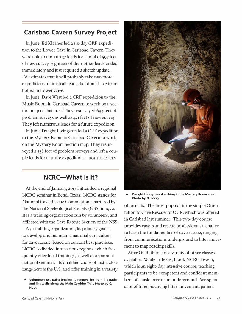
In June, Dwight Livingston led a CRF expedition
to the Mystery Room in Carlsbad Cavern to work
on the Mystery Room Section map. They resur-
veyed 2,258 feet of problem surveys and left a cou-
ple leads for a future expedition. —ROD HORROCKS
NCRC—What Is It?
At the end of January, 2017 I attended a regional
NCRC seminar in Bend, Texas. NCRC stands for
National Cave Rescue Commission, chartered by
the National Speleological Society (NSS) in 1979.
It is a training organization run by volunteers, and
affiliated with the Cave Rescue Section of the NSS.
As a training organization, its primary goal is
to develop and maintain a national curriculum
for cave rescue, based on current best practices.
NCRC is divided into various regions, which fre-
quently offer local trainings, as well as an annual
national seminar. Its qualified cadre of instructors
range across the U.S. and offer training in a variety
of formats. The most popular is the simple Orien-
tation to Cave Rescue, or OCR, which was offered
in Carlsbad last summer. This two-day course
provides cavers and rescue professionals a chance
to learn the fundamentals of cave rescue, ranging
from communications underground to litter move-
ment to map reading skills.
After OCR, there are a variety of other classes
available. While in Texas, I took NCRC Level 1,
which is an eight-day intensive course, teaching
participants to be competent and confident mem-
bers of a task force team underground. We spent
a lot of time practicing litter movement, patient
Dwight Livingston sketching in the Mystery Room area. Photo by N. Socky.
Volunteers use paint brushes to remove lint from the paths and lint walls along the Main Corridor Trail. Photo by C. Hoyt.
22 Canyons & Caves Vol. 43 (2) 2017 Carlsbad Caverns National Park
packaging, rigging and rope skills, and communi-
cation strategies. Although tiring (most days went
until 9:00 pm), it was also really fun. More impor-
tantly, it was valuable training that emphasized
safety and skill mastery.
I encourage anyone interested in expanding their
caving skill set to attend at least one NCRC class.
OCR is a great place to start. There’s also Small
Party Assisted Rescue (SPAR), which focuses on
groups self-rescuing with limited equipment. The
weeklong classes range from Levels 1 to 3. For
more information, visit ncrc.info.—ELLEN TRAUTNER
The Squeeze Physical Sciences
Winter is the Season to Cave!
Carlsbad Caverns National Park has eight per-
mitted back country caves. As part of my duties as
Cave Technician at the park, I issue recreational
permits to these caves, as well as monitor them for
impact. I enjoy visiting these caves in the winter, as
cooler surface temperatures make for more pleas-
ant hikes.
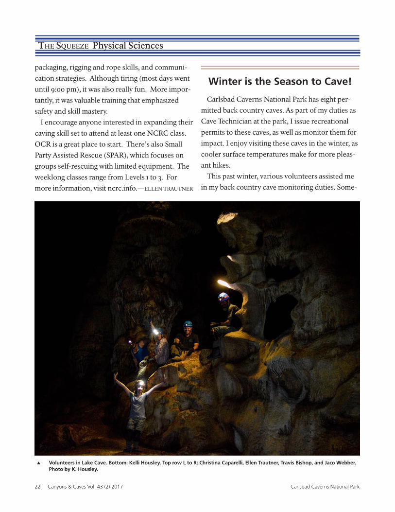
This past winter, various volunteers assisted me
in my back country cave monitoring duties. Some-
Volunteers in Lake Cave. Bottom: Kelli Housley. Top row L to R: Christina Caparelli, Ellen Trautner, Travis Bishop, and Jaco Webber. Photo by K. Housley.
Canyons & Caves 43(2) 2017 23Carlsbad Caverns National Park
times, this involved reflagging routes through the
cave, or flagging off delicate areas. It also included
collecting trash, sometimes using tweezers to
gather tiny pieces of old flagging tape. We also
looked for signs of off-trail travel, use by animals,
and vandalism. Thankfully, we don’t usually find
much vandalism to our caves! For the gated caves,
I changed the lock combinations. For all caves, I
pulled the oldest register pages and replaced them
with new ones.
I enjoy taking volunteers with me to these caves,
as they help me accomplish my goals quickly and
safely. The volunteers get to see a cool cave—
sometimes a cave they’ve never seen—in the bar-
gain. Contact me if you are interested in helping
with these projects.
Thanks to those that helped me last winter,
including: Foz Trautner, Jaco Webber, Kelli Hous-
ley, Christina Caparelli, Toni Nelson, Josh Nelson,
Charlie Reed, and Travis Bishop.—ELLEN TRAUTNER
A team of UK cavers, Tim and Jane Allen, Andy
Eavis, and Richard “Roo” Walters, visited Carls-
bad Cavern in order to make a detailed 3D map of
the Big Room. They used the latest laser imaging
instruments, so that the first accurate measure-
ment of the volume of the chamber could be
ascertained. Andy first went to Carlsbad Cavern in
the 1970’s. At that time, the Big Room was consid-
ered to be the largest cave room in the world. Roo,
who has been heavily involved in the current proj-
ect, said, “We’re trying to find the true nature of
the biggest caves in the world. They are enormous
black spaces when you’re standing there with your
… scanner in the middle of the night. The only
thing you can see around you is the floor… until
you get results from a scan.” Roo is excited about
laser scanning because the technology can capture
what the human eye cannot see.
Roo used a Riegl VZ-400, which his team was
the first to use in a cave. He said it is light enough
to carry, at about 21 pounds, and has enough
range (400 meters) for what they need to do. It
also works with a range of software tools to pro-
cess their information. “A man named Kevin
Dixon introduced us to laser scanning in 2010,”
Andy said. “He came with us on one of our trips
Largest Cave Chambers in the Western Hemisphere
to Borneo with a scanner and we very slowly
and laboriously scanned Deer Cave and Sarawak
Chamber in Malaysia. That really got us on to the
project of laser scanning. We’ve now embarked on
an ongoing voluntary project to laser scan these
chambers.” It is part of a 3-year project to visit
all the world’s largest chambers so that the first
detailed comparison can be made between them,
not only to truly assess which is the largest cham-
ber but also to find out more about their structure
and how they were formed. Previously, large cave
chambers were listed by their floor space. Roo,
who is responsible for collating the data into 3D
models from which measurements can be made,
explained, “Previous estimates of size are largely
informed guesswork… but this equipment allows
us to measure down to each square centimeter of
the cave walls … which means a highly detailed
and accurate model can be built.”
Their actual calculation for the Big Room was
0.93 million cubic meters, which is 10% larger than
the chamber previously thought to be the largest in
the Americas, the Belize Chamber in the Chiquibul
Cave System in Belize. However, the team heard
about another large chamber, this one in Mexico,
that no one had been back to since it was first
24 Canyons & Caves Vol. 43 (2) 2017 Carlsbad Caverns National Park
The Squeeze Physical Sciences
discovered in 1989. When the team recently visited
that chamber, which is called La Muneca and is in
Sistema Tepepan Zaragosa, Puebla, Mexico, they
were surprised to learn that that chamber was the
largest in the whole western hemisphere, and by
a significant margin. La Muneca turned out to
be the fourth largest chamber in the world with a
ceiling height over 600-feet tall.
Andy was asked how they determine the bound-
aries of the chambers they scan since caves are
irregularly shaped. Andy said, “It can be difficult
[to know] where to draw the boundary lines and
what constitutes a cave chamber, but that is one
of the issues that 3D scanning can help resolve.”
Roo observed that, “The Big Room is a fascinating
chamber and its complexity will test evolving ideas
across the speleological world about what actually
constitutes a cave chamber or passage and as yet
there is no firm consensus, but the team hopes that
this will be resolved by June 2017 at an interna-
tional conference in Sydney [Australia].”
“What we discovered during this project,” Tim
said, “is that until we measure it we just don’t
know.”—ROD HORROCKS
Chamber Cave/State Volume1) La Muneca Chamber Sistema Tepepan Zaragosa, Puebla, Mexico 5.9 million cubic meters
2) Big Room Carlsbad Cavern, NM 0.93 million cubic meters
3) Belize Chamber Chiquibul Cave System, Belize ~0.85 million cubic meters
Largest Cave Chambers in the Western Hemisphere
Visitors explore the Big Room—the second largest cave chamber in the Western hemisphere. Photo by C. Hoyt.
Canyons & Caves 43(2) 2017 25Carlsbad Caverns National Park
Phot
o by
Cat
hryn
Hoy
t
The Squeeze Biological Sciences
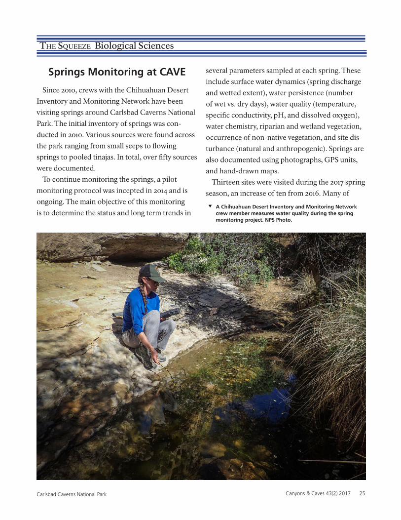
Springs Monitoring at CAVE
Since 2010, crews with the Chihuahuan Desert
Inventory and Monitoring Network have been
visiting springs around Carlsbad Caverns National
Park. The initial inventory of springs was con-
ducted in 2010. Various sources were found across
the park ranging from small seeps to flowing
springs to pooled tinajas. In total, over fifty sources
were documented.
To continue monitoring the springs, a pilot
monitoring protocol was incepted in 2014 and is
ongoing. The main objective of this monitoring
is to determine the status and long term trends in
several parameters sampled at each spring. These
include surface water dynamics (spring discharge
and wetted extent), water persistence (number
of wet vs. dry days), water quality (temperature,
specific conductivity, pH, and dissolved oxygen),
water chemistry, riparian and wetland vegetation,
occurrence of non-native vegetation, and site dis-
turbance (natural and anthropogenic). Springs are
also documented using photographs, GPS units,
and hand-drawn maps.
Thirteen sites were visited during the 2017 spring
season, an increase of ten from 2016. Many of
A Chihuahuan Desert Inventory and Monitoring Network crew member measures water quality during the spring monitoring project. NPS Photo.
26 Canyons & Caves Vol. 43 (2) 2017 Carlsbad Caverns National Park
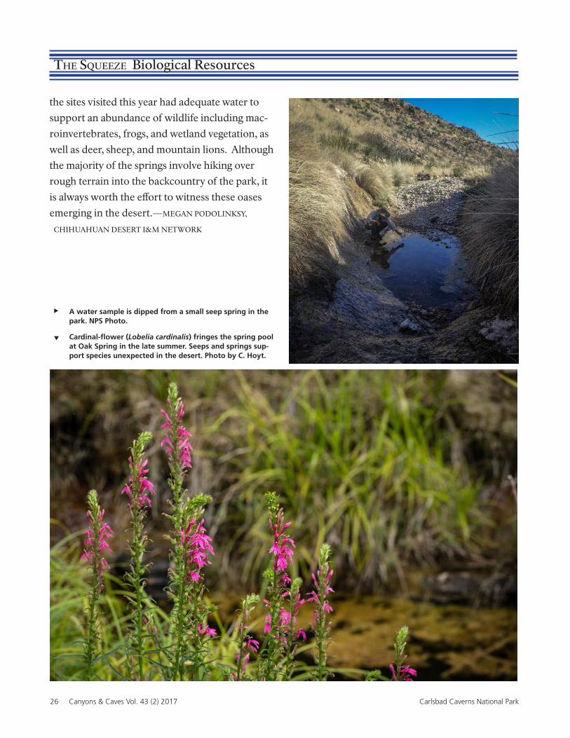
The Squeeze Biological Resources
the sites visited this year had adequate water to
support an abundance of wildlife including mac-
roinvertebrates, frogs, and wetland vegetation, as
well as deer, sheep, and mountain lions. Although
the majority of the springs involve hiking over
rough terrain into the backcountry of the park, it
is always worth the effort to witness these oases
emerging in the desert.—MEGAN PODOLINKSY,
CHIHUAHUAN DESERT I&M NETWORK
A water sample is dipped from a small seep spring in the park. NPS Photo.
Cardinal-flower (Lobelia cardinalis) fringes the spring pool at Oak Spring in the late summer. Seeps and springs sup-port species unexpected in the desert. Photo by C. Hoyt.
Canyons & Caves 43(2) 2017 27Carlsbad Caverns National Park
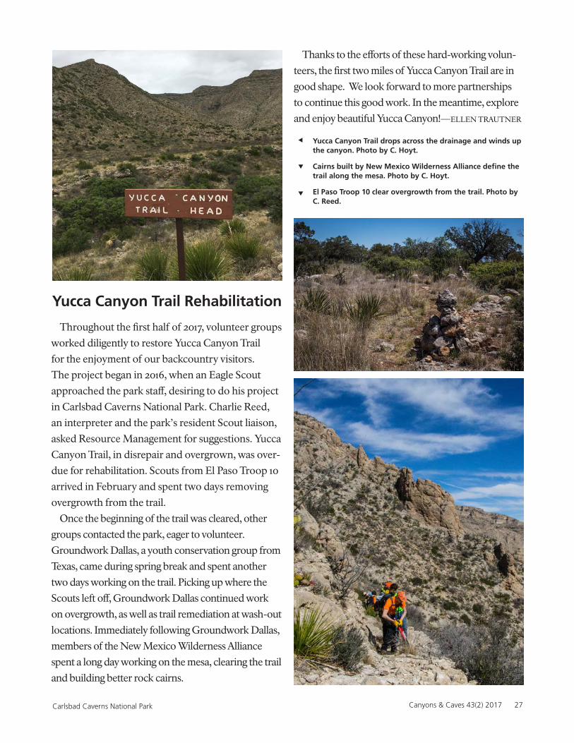
Yucca Canyon Trail Rehabilitation
Throughout the first half of 2017, volunteer groups
worked diligently to restore Yucca Canyon Trail
for the enjoyment of our backcountry visitors.
The project began in 2016, when an Eagle Scout
approached the park staff, desiring to do his project
in Carlsbad Caverns National Park. Charlie Reed,
an interpreter and the park’s resident Scout liaison,
asked Resource Management for suggestions. Yucca
Canyon Trail, in disrepair and overgrown, was over-
due for rehabilitation. Scouts from El Paso Troop 10
arrived in February and spent two days removing
overgrowth from the trail.
Once the beginning of the trail was cleared, other
groups contacted the park, eager to volunteer.
Groundwork Dallas, a youth conservation group from
Texas, came during spring break and spent another
two days working on the trail. Picking up where the
Scouts left off, Groundwork Dallas continued work
on overgrowth, as well as trail remediation at wash-out
locations. Immediately following Groundwork Dallas,
members of the New Mexico Wilderness Alliance
spent a long day working on the mesa, clearing the trail
and building better rock cairns.
Thanks to the efforts of these hard-working volun-
teers, the first two miles of Yucca Canyon Trail are in
good shape. We look forward to more partnerships
to continue this good work. In the meantime, explore
and enjoy beautiful Yucca Canyon!—ELLEN TRAUTNER
Yucca Canyon Trail drops across the drainage and winds up the canyon. Photo by C. Hoyt.
Cairns built by New Mexico Wilderness Alliance define the trail along the mesa. Photo by C. Hoyt.
El Paso Troop 10 clear overgrowth from the trail. Photo by C. Reed.
28 Canyons & Caves Vol. 43 (2) 2017 Carlsbad Caverns National Park
The Squeeze Biological Resources
Natural Defenses against White Nose Syndrome
Dr. Diana Northup and eight co-authors1 recently published their final report2 about the microbiota on bats at Carlsbad Caverns National Park. They wanted to determine if the bats had any natural defenses against the White-nose syndrome (WNS), which is caused by the fungus Pseud-
ogymnoascus destructans (Pd). They used next generation sequencing and microbial culturing techniques to analyze bat microbiota on seven spe-cies of bats and then isolated Actinobacteria and tested their anti-fungal properties against Pd. They netted bats in Carlsbad Cavern, the Indian Shelter in Walnut Canyon, and Rattlesnake Springs. They swabbed each bat they netted, both for species likely to develop WNS and for species unlikely to develop WNS. Not surprisingly, they found that next gen sequencing performed on DNA collected from swabs suggested that there were different microbial communities on the bats caught on the surface versus those caught in the cave. They were able to sub-culture 648 species of purified isolates from the 147 parent cultural plates they generated. Nearly 57.5% belonged to the genus Streptomyces, a well-known antibiotic producer. Some species of bats had many Actinobacteria present. They were able to identify 18 isolates that showed signif-icant inhibition of P. destructans and an additional five possible inhibitors, which were identified by Dr. Andrea Porras-Alfaro’s lab at Western Illi-nois University. Additionally, one of these isolates appears to be a new species of Streptomyces and it is in the process of being formally described. In order to learn about the microclimate of the bats’ roosts and if they were appropriate for the growth of Pd, they installed temperature/relative
humidity loggers to gather data in roosting areas of Carlsbad Cavern and three backcountry caves that previously tested positive for the presence of close relatives of P. destructans. Kenneth Ingham, from Science-in-Action Photography, was able to photodocument the whole study, producing some stunning images. —ROD HORROCKS
1Diana E. Northup, Ph.D., P.I.Debbie Buecher, M.S., Buecher Biological ConsultingNicole Caimi, B.S., UNM Masters’ Student, UNMParis Hamm, B.S., Graduate Student, WIUKenneth L. Ingham, Ph.D., Kenneth Ingham PhotographyPatrick Lewis, Senior, UNMAndreas Pflitsch, Ph.D., Ruhr-Universität BochumAndrea Porras-Alfaro, Ph.D., WIUAra Winter, Ph.D., Postdoctoral Fellow, UNM
2Establishing a Baseline for Bat Microbiota and Discovering Clues to Natural Defenses against WNS in Bat Microbiota in Carlsbad Caverns National Park (CAVE) Period of Perfor-mance: 15 April 2015-31 December, 2016.
New Butterfly Sighting at CAVE
On April 18, 2017, Interpretive Ranger Dan
Leifheit spotted an unusual butterfly at the Nat-
ural Entrance shade structure. Dan noticed the
butterfly nectaring at an Apache Plume flower and
was able to take a quick photo with his cell phone.
The butterfly turned out to be an Banded Orange
Heliconian (Dryadula phaetusa).
This is the first time that this species of subtropi-
cal butterfly has been reported in the state of New
Mexico. In fact, this is the first time this species has
been observed north of the Rio Grande Valley in
south Texas. Although this individual was classified
as a stray, it may be evidence of species moving
north due to warming trends in the climate. Steve
Cary from Butterflies and Moths of North Amer-
Canyons & Caves 43(2) 2017 29Carlsbad Caverns National Park
ica (BAMONA) verified the first sighting record
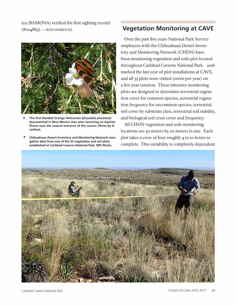
(#1114865). —ROD HORROCKS Vegetation Monitoring at CAVE
Over the past five years National Park Service
employees with the Chihuahuan Desert Inven-
tory and Monitoring Network (CHDN) have
been monitoring vegetation and soils plot located
throughout Carlsbad Caverns National Park. 2016
marked the last year of plot installations at CAVE,
and all 35 plots were visited (seven per year) on
a five year rotation. These intensive monitoring
plots are designed to determine terrestrial vegeta-
tion cover for common species, terrestrial vegeta-
tion frequency for uncommon species, terrestrial
soil cover by substrate class, terrestrial soil stability,
and biological soil crust cover and frequency.
All CHDN vegetation and soils monitoring
locations are 50 meters by 20 meters in size. Each
plot takes a crew of four roughly 4 to 10 hours to
complete. This variability is completely dependent
Chihuahuan Desert Inventory and Monitoring Network crew gather data from one of the 35 vegetation and soil plots established at Carlsbad Caverns National Park. NPS Photo.
The first Banded Orange Heliconian (Dryadula phaetusa) documented in New Mexico was seen nectaring on Apache Plume near the natural entrance of the cavern. Photo by D. Leifheit.
30 Canyons & Caves Vol. 43 (2) 2017 Carlsbad Caverns National Park
Phot
o by
Gos
ia A
lliso
n-K
osio
r
The Squeeze Biological Resources
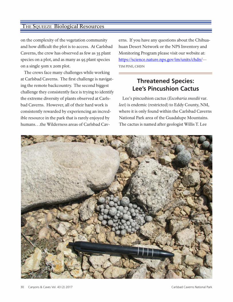
Threatened Species:Lee’s Pincushion Cactus
Lee’s pincushion cactus (Escobaria sneedii var.
leei) is endemic (restricted) to Eddy County, NM,
where it is only found within the Carlsbad Caverns
National Park area of the Guadalupe Mountains.
The cactus is named after geologist Willis T. Lee
on the complexity of the vegetation community
and how difficult the plot is to access. At Carlsbad
Caverns, the crew has observed as few as 35 plant
species on a plot, and as many as 95 plant species
on a single 50m x 20m plot.
The crews face many challenges while working
at Carlsbad Caverns. The first challenge is navigat-
ing the remote backcountry. The second biggest
challenge they consistently face is trying to identify
the extreme diversity of plants observed at Carls-
bad Caverns. However, all of their hard work is
consistently rewarded by experiencing an incred-
ible resource in the park that is rarely enjoyed by
humans…the Wilderness areas of Carlsbad Cav-
erns. If you have any questions about the Chihua-
huan Desert Network or the NPS Inventory and
Monitoring Program please visit our website at:
https://science.nature.nps.gov/im/units/chdn/—
TIM PINE, CHDN
Canyons & Caves 43(2) 2017 31Carlsbad Caverns National Park
who collected it in the 1920s while assessing the
area for national park status. The species was listed
as threatened by the US Fish and Wildlife Service
on October 25, 1979. The cactus was originally
listed because of the threat from road construction
and illegal collecting. It typically only grows on
top of limestone ridges between 4,000-5,000 feet
elevation, often growing in cracks in the exposed
bedrock. The plants are identified by their pro-
fusely branching stems (200 to 250 stems in some
individuals) and their conspicuously hairy spines.
While the species has a very restricted distribu-
tion in southeastern New Mexico, it can be locally
common. Currently, the species doesn’t appear to
be threatened by illegal collecting (as commercial-
ly-grown specimens are readily available), but fires
and climate change (including drought) could be a
threat to the species’ survival. In late April, Daniela
Roth from New Mexico’s Energy, Minerals, and
Natural Resources Department (EMNRD) came
A 2011 to 2012 road improvement project impacted vegetation along the Walnut Canyon Desert Drive,
the Visitor Center (VC), and the VC parking lots. The roadside along the Walnut Canyon Desert Drive
and the VC parking lot islands were hydro-seeded with native genetically appropriate seed material.
Following the seeding effort, several aggressive non-native species were identified in the project areas.
Annually since 2013, a contractor has chemically treated the roadsides and VC parking lot islands to
remove all non-native species. The final treatment occurred in 2017. The four most common species
treated were:
Lehman Love grass (Eragrostis lehmanniana)
Field Bindweed (Convolvulus arvensis)
to the park to monitor the 60 plots that she estab-
lished in the burned and unburned areas within
the 2011 Loop Fire. Daniela’s monitoring will doc-
ument the recovery of the population and it may
document how long it will take the population to
recover full reproductive capacity. —ROD HORROCKS
Lee’s pincushion cactus (Escobaria sneedii var. leei) is a tiny cactus endemic to the limestone hills of Carlsbad Caverns National Park. NPS Photo.
Wildfires could be a threat to the survival of the Lee’s pin-cushion cactus. Photo by C. Hoyt.
Exotic Plant Treatment Project Completed
Bermuda Grass (Cynodon dactylon)
Malta starthistle (Centaurea melitensis)
—KEN STELLA, BIOLOGIST, DENVER SERVICE CENTER
32 Canyons & Caves Vol. 43 (2) 2017 Carlsbad Caverns National Park
Staff News
Erin Lynch Joins Resources Staff
Erin Lynch recently joined the Resources office
as the Lead Physical Science Technician. Her
specialties are cave cartography and data manage-
ment, rigging, cave rescue, and GIS.
Erin started caving in the UK and can still occa-
sionally be heard talking about “spanners” and
“tackle sacks” when rigging. Prior to coming to
Carlsbad, Erin spent 16 years in China. She worked
at the Institute of Karst Geology in Guilin—a
job that took her to karst World Heritage sites,
National Geoparks, and show caves throughout
southwest China. She also founded Hong Meigui
Cave Exploration Society and led dozens of
expeditions with cavers from around the world.
Highlights include exploration of the 1,020m-deep
Tianxing System, Miao Keng’s 500m vertical shaft,
two of the largest cave rooms in the world, and
more than 400 km of passage. In 2015 she received
the Lew Bicking Award from the National Speleo-
logical Society in recognition of her contributions
to cave exploration.
Erin says that she is excited to be back in the U.S.
and have the opportunity to be part of a world-
class cave management team.
Farewell and Best Wishes to Our Friend Luis Florez
The Resources Stewardship and Science Divi-
sion is bidding a fond farewell to its biologist and
compliance officer, Luis Florez. After thirty-seven
years in federal service, Luis hung up his flat hat on
March 31, 2017.
Luis first came to Carlsbad Caverns National
Park in 2000 as the Chihuahuan Desert-Exotic
Plant Management Team (CD-EPMT) coordina-
tor. While based at Carlsbad, his team traveled to
sixteen different parks in the Southwest to conduct
treatments. Getting to visit those parks over the
next two years was a special time in his career, he
said.
After his time with the CD-EPMT, he went to
the regional office as Director of the International
Conservation Program. This job required him to
travel to several border parks, where he met with
folks on both sides of the border and enjoyed
wonderfully scenic vistas. During his stint there,
Luis remarked that he repeatedly thought, “Pinch
me, I must be dreaming.” He was able to fund
international projects ranging from bat and bear
studies, to binational rock art documentation, to
adobe structures restoration workshops.
Being from southeastern New Mexico origi-
nally, eventually he returned home and came to
Canyons & Caves 43(2) 2017 33Carlsbad Caverns National Park
work again at Carlsbad Caverns National Park.
His position as biologist and compliance officer
enabled him to see this World Heritage Site up
close. Luis mentioned the bat flights and darting
swallows as particularly spectacular phenomena
to study. He enjoyed spending many hours under-
ground with fellow Resources staff, preparing for
the new Cavern Lighting System, which protects
the cave while showing off incredible formations.
Luis also worked heavily on compliance for the
Waterline Replacement project and supported
that project in many ways. Now that the waterline
is buried, it will be protected from the elements
and will provide water to staff and visitors for
hopefully the next 75 years. Finally, Luis reminds
us of the special resource we have at Rattlesnake
Springs. He loves its cultural resources as well it
being a premiere migratory bird habitat.
When asked for any advice he can give to pres-
ent and future employees, Luis offered this: “My
advice to folks just starting their career: Do some-
thing that you really, really enjoy doing or are good
at. You will never have to worry about having the
energy to go work every day. The pay will come
with each year’s experience and progress; just put
in the time to learn, to share, and to volunteer.
Leave the place just a little better than you found it.
You will never regret it. “
Sam Denman Moves On
The Resources Stewardship and Science Divi-
sion recently bid a fond farewell to it s Museum
Technician, Samuel Denman, who accepted a job
at his dream park, Mesa Verde National Park. Sam
first came to the park in 2008 as a law enforcement
ranger. By 2010 his job duties changed and he
became a museum technician. That job prepared
him for his current job at Mesa Verde. The projects
that Sam enjoyed the most while working here
were guiding the archaeological technicians doing
inventories of the Park’s back country. Sam said he
enjoyed his stay at Carlsbad Caverns National Park
very much and especially enjoyed working with
the great staff here.
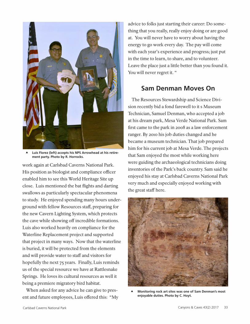
Luis Florez (left) accepts his NPS Arrowhead at his retire-ment party. Photo by R. Horrocks.
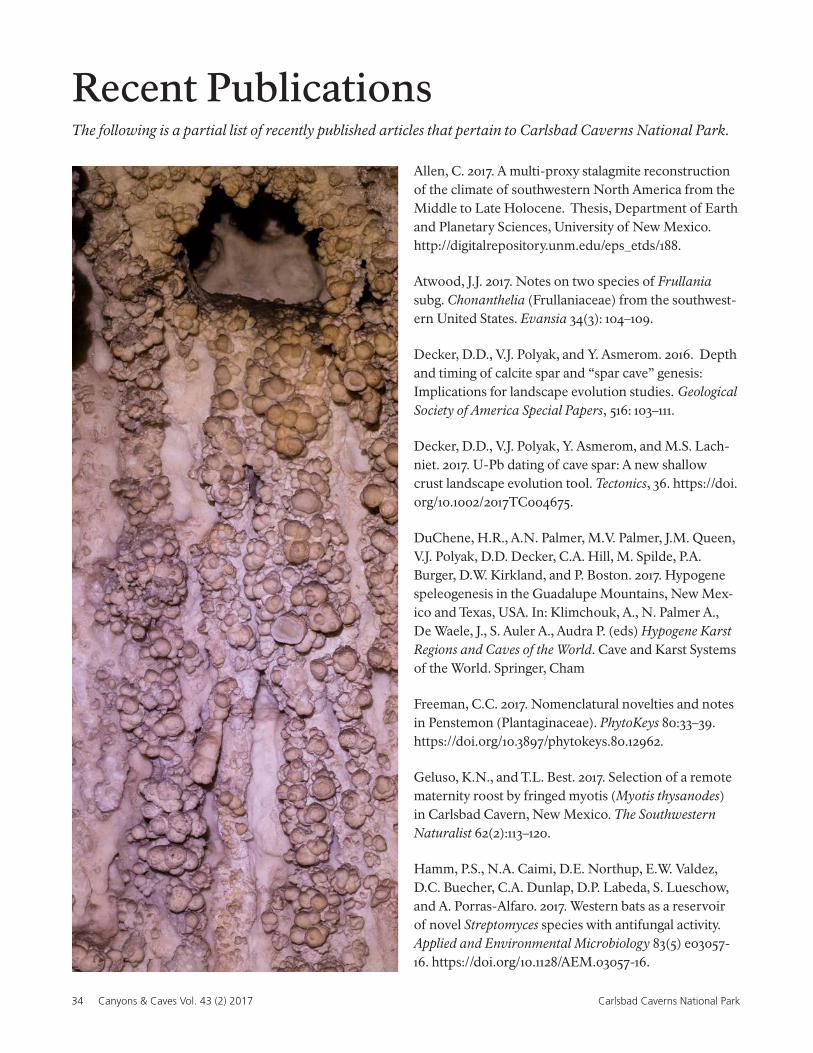
Monitoring rock art sites was one of Sam Denman’s most enjoyable duties. Photo by C. Hoyt.
34 Canyons & Caves Vol. 43 (2) 2017 Carlsbad Caverns National Park
Recent PublicationsThe following is a partial list of recently published articles that pertain to Carlsbad Caverns National Park.
Allen, C. 2017. A multi-proxy stalagmite reconstruction of the climate of southwestern North America from the Middle to Late Holocene. Thesis, Department of Earth and Planetary Sciences, University of New Mexico. http://digitalrepository.unm.edu/eps_etds/188.
Atwood, J.J. 2017. Notes on two species of Frullania subg. Chonanthelia (Frullaniaceae) from the southwest-ern United States. Evansia 34(3): 104–109.
Decker, D.D., V.J. Polyak, and Y. Asmerom. 2016. Depth and timing of calcite spar and “spar cave” genesis: Implications for landscape evolution studies. Geological Society of America Special Papers, 516: 103–111.
Decker, D.D., V.J. Polyak, Y. Asmerom, and M.S. Lach-niet. 2017. U-Pb dating of cave spar: A new shallow crust landscape evolution tool. Tectonics, 36. https://doi.org/10.1002/2017TC004675.
DuChene, H.R., A.N. Palmer, M.V. Palmer, J.M. Queen, V.J. Polyak, D.D. Decker, C.A. Hill, M. Spilde, P.A. Burger, D.W. Kirkland, and P. Boston. 2017. Hypogene speleogenesis in the Guadalupe Mountains, New Mex-ico and Texas, USA. In: Klimchouk, A., N. Palmer A., De Waele, J., S. Auler A., Audra P. (eds) Hypogene Karst Regions and Caves of the World. Cave and Karst Systems of the World. Springer, Cham
Freeman, C.C. 2017. Nomenclatural novelties and notes in Penstemon (Plantaginaceae). PhytoKeys 80:33–39. https://doi.org/10.3897/phytokeys.80.12962.
Geluso, K.N., and T.L. Best. 2017. Selection of a remote maternity roost by fringed myotis (Myotis thysanodes) in Carlsbad Cavern, New Mexico. The Southwestern Naturalist 62(2):113–120.
Hamm, P.S., N.A. Caimi, D.E. Northup, E.W. Valdez, D.C. Buecher, C.A. Dunlap, D.P. Labeda, S. Lueschow, and A. Porras-Alfaro. 2017. Western bats as a reservoir of novel Streptomyces species with antifungal activity. Applied and Environmental Microbiology 83(5) e03057-16. https://doi.org/10.1128/AEM.03057-16.
Canyons & Caves 43(2) 2017 35Carlsbad Caverns National Park
Jouves, J., S. Viseur, B. Arfib, C. Baudement, H. Camus, P. Collon, and Y. Guglielmi. 2017. Speleogenesis, geom-etry, and topology of caves: A quantitative study of 3D karst conduits. Geomorphology. 298:86–106.
Kerans, C., C. Zahm, B. Garcia-Fresca, and P. Harris. 2017. Guadalupe Mountains, West Texas and New Mex-ico: Key Excursions. AAPG Bulletin 101(4):465–474.
Kumar, H., S. Kumar, H. Ming Gan, M. Hua Tan, W. Wei Han Eng, H.A. Barton, A. O. Hudson, and M.A. Savka. 2017. Genomic characterization of eight Ensifer strains isolated from pristine cave and a whole genome phy-logeny of Ensifer (Sinorhizobium). Journal of Genomics 5:12–15.
Mali, I. 2017. Phase II: Demography of Western River Cooter (Pseudemys gorzugi) population within the Black River drainage. 2017 Interim Report. Submitted to Share with Wildlife Program, New Mexico Department of Game and Fish.
Mali, I., and M.R.J. Forstner. 2017. Survey of Western River Cooter (Pseudemys gorzugi) in New Mexico within the Black River drainage. Final Report. Submit-ted to New Mexico Department of Game and Fish, 10 March 2017. Bison-m.org/documents/48947_Mali2017_WesternRiverCooter.pdf
Marino, E.B. 2017. Isolating lithologic controls on landscape morphology in the Guadalupe Mountains, New Mexico and Texas. Thesis, Department of Geolog-ical Sciences, University of Texas at Austin. http://hdl.handle.net/2152/61568.
Medellin, R.A., R. Wiederholt, and L. Lopez-Hoffman. 2017. Conservation relevance of bat caves for biodiver-sity and ecosystem services. Biological Conservation 211(B):45–50.
Muller, C.T., M.J. Moore, Z. Feder, H. Tiley, and R.E. Drenovsky. 2017. Phylogenetic patterns of foliar mineral nutrient accumulation among gypsophiles and their relatives in the Chihuahuan Desert. American Journal of Botany. 104(10):1442–1450.
Pate, D.L., and R.C. Kerbo. 2017. Understanding and preserving caves and karst landscapes. Earth Sciences History 36(2):318–336.
Polyak, V.J., Y. Asmerom, and M.S. Lachniet. 2017. Rapid speleothem δ 13C change in southwestern North Amer-
ica coincident with Greenland stadial 20 and the Toba (Indonesia) supereruption. Geology 45(9):843–846.
Powell, A.M., S.A. Powell, and Chris Jackson. 2017. Doc-umented chromosome numbers 2017:1. Miscellaneous counts mostly from Western Texas (U.S.A.), one each from New Mexico (U.S.A.), and Mexico. Journal of the Botanical Research Institute of Texas. 11(1):143–146.
Reynolds, J.W. 2017. Earthworms (Oligochaeta: Acan-throdrilidae, Lumbricidae, and Sparganophilidae) in the Southwestern Tablelands Ecoregion (26), USA. Mega-drilogica 21(11):225–230.
Shear, W.A., and J.M. Reddell. 2017. Cave millipedes of the United States. XIV. Revalidation of the genus Speor-thus Chamberlin, 1952 (Diplopoda, Polydesmida, Mac-rosternodesmidae), with a description of a new species from Texas and remarks on the families Polydesmidae and Macrosternodesmidae in North America. Insecta Mundi 0529:1–13.
Winter, A.S., J.J.M. Hathaway, J.C. Kimble, D.C. Buec-her, E.W. Valdez, A. Porras-Alfaro, J.M. Young, K.J.H. Read, and D.E. Northup. 2017. Skin and fur bacte-rial diversity and community structure on American southwestern bats: effects of habitat, geography, and bat traits. PeerJ: 5:33944. https://doi.org/10.7717/peerj:3944
Western River Cooters (Pseudemys gorzugi) bask on a log during a warm winter day. Photo by C. Hoyt.
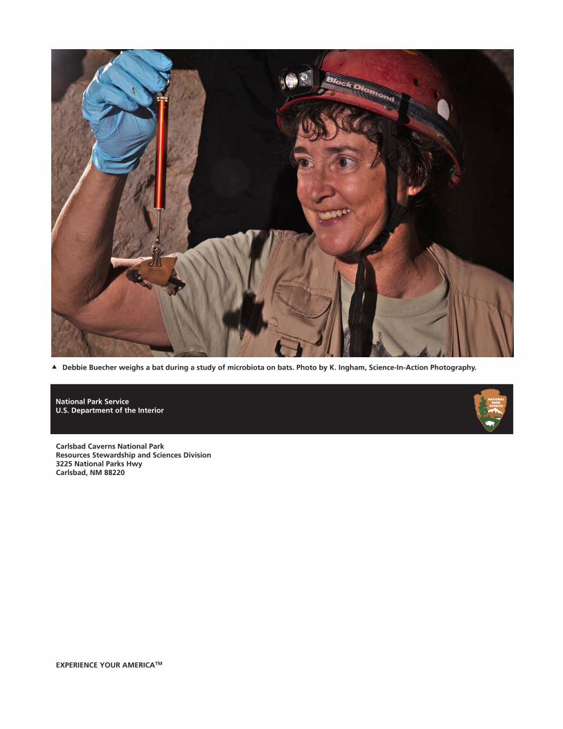
EXPERIENCE YOUR AMERICATM
National Park ServiceU.S. Department of the Interior
Debbie Buecher weighs a bat during a study of microbiota on bats. Photo by K. Ingham, Science-In-Action Photography.
Carlsbad Caverns National ParkResources Stewardship and Sciences Division3225 National Parks HwyCarlsbad, NM 88220