cartographie et participation: que change le...
TRANSCRIPT
Cartographie et
participation: que
change le
numérique ? Thierry Joliveau
UMR EVS Isthme
Séminaire Com’Eau Labo
29/05/2013

La cartographie participative
Les SIG participatifs
Applications en France
Le Géoweb participatif
Applications au Québec
Conclusions et pistes

Openstreet map
http://www.openstreetmap.fr/

5
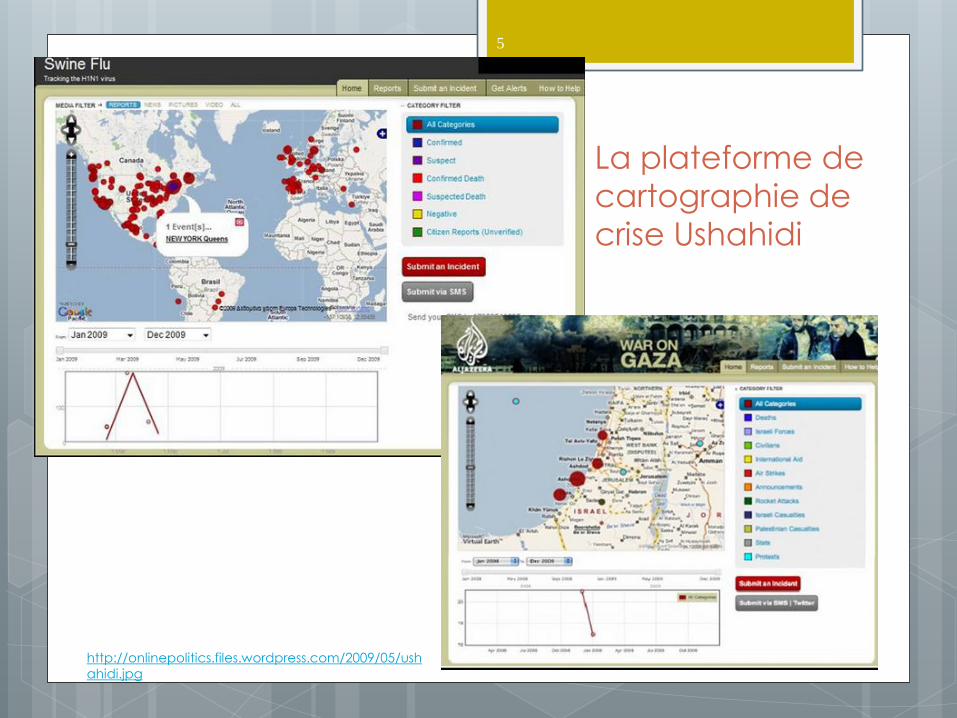
La plateforme de
cartographie de
crise Ushahidi
http://onlinepolitics.files.wordpress.com/2009/05/ush
ahidi.jpg

Maquettes
6
(Rambaldi 2004)

7
7
(Rambaldi 2004)

Thau 8
(Maurel 2008)
9
9
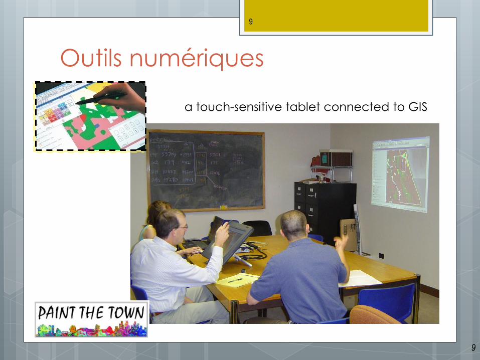
Outils numériques
a touch-sensitive tablet connected to GIS
10
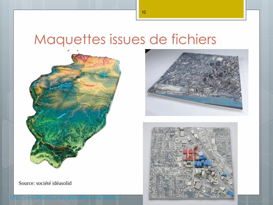
Maquettes issues de fichiers
numériques
http://www.ideasolid.com/applications.php?idapp=1
Source: société idéasolid

11
DiamondTouch
http://www.circletwelve.com/
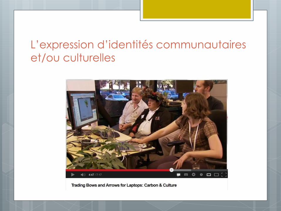
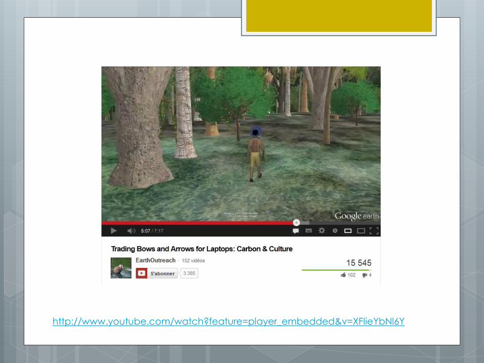
L’expression d’identités communautaires
et/ou culturelles
L’universalisation géonumérique

L’universalisation géonumérique
L’universalisation géonumérique
http://www.youtube.com/watch?feature=player_embedded&v=XFIieYbNl6Y
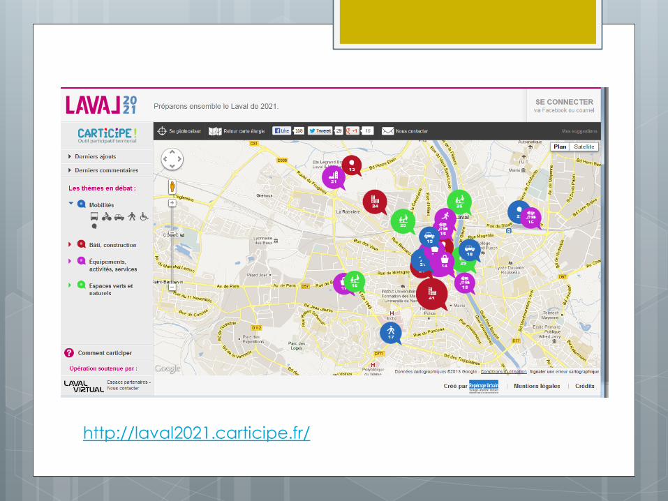


http://document.bcmetiscitizen.ca/
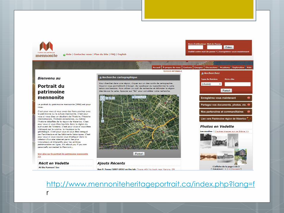
http://www.mennoniteheritageportrait.ca/index.php?lang=f
r
références Abbot J., R. C., et al. ., 1998, Participatory GIS: opportunity or oxymoron?, Particip. Learn. Action, 1998,
p. 27-33. D’ Aquino P., 2002, Le territoire entre espace et pouvoir : pour une planification territoriale
ascendante, Espace Géographique, 2002, n°2002-1, p. 3-23.
Boutinot L., Viau A., Leclerc G., 2009, Questions sur la neutralité des outils de type jeux de rôle et cartographie participative dans une expérience de gouvernance foncière au Sénégal, Norois, 15 mars 2009, vol. 209, n°2008/4, p. 73-89.
Certeau M. de, 1980, Invention du quotidien, (10-18, ISSN 0240-2300, 1363) Paris, France, Union générale d’édition, 379 p.
Chambers P., 2006, Cartographie participative et systèmes d’information géographique : à qui appartiennent les cartes ? Qui en ressort renforcé, qui en ressort affaibli ? Qui gagne et qui perd ?, Electron. J. Inf. Syst. Dev. Ctries. Traduit Publié Par Cent. Tech. Coopération Agric. Rurale Cta, 2006, vol. 25,
Corbett J., Evans M., Romano Z., 2012, ANU - Digital Collections: Memory, placelessness and the Geoweb: exploring the role of locational social-networking in reimagining community, in Digital Humanities Australasia 2012 : Building, Mapping, Connecting, Canberra, < https://digitalcollections.anu.edu.au/handle/1885/8991 > (consultation le 11 mars 2013)
Elwood S., 2006, Beyond Cooptation or Resistance: Urban Spatial Politics, Community Organizations, and GIS-Based Spatial Narratives, Ann. Assoc. Am. Geogr., 2006, vol. 96, n°2, p. 323-341.
Goodchild M. F., 2007, Citizens as sensors ; the world of volounteered geography, GeoJournal, 2007, vol. 69, n°4, p. 211-221.
Hirt I., 2009, Cartographies autochtones. Éléments pour une analyse critique, Espace Géographique, 5 juin 2009, vol. 38, n°2, p. 171-186.
Lin W., 2013, Situating performative neogeography: tracing, mapping, and performing « Everyone’s East Lake », Environ. Plan., 2013, vol. 45, n°1, p. 37 – 54. < http://dx.doi.org/10.1068/a45161 > (consultation le 15 avril 2013)
McGarry F., Cowan D., McCarthy D., 2009, Collaborative Geomatics for Social Innovation, in Casti E. (éd.), Cartogr. Challenges Mov. Particip. Risk, Bergamo. April 23rd-24th 2009, p. 19 p.
Méricskay B., 2012, Cartographie en ligne et planification participative. Analyse des usages du geoweb et d’Internet dans le débat public à travers le cas de la ville de Québec., PhD en Sciences géographique, Laval, Québec, Université Laval, 393 p. p.
Peribois C., 2008, Usages de l’information géographique dans la gestion participative du territoire. Regards croisés en France, en Belgique et au Québec, Angers, Université d’Angers, Centre Angevin de Recherche sur les Territoires et l’Aménagement (CARTA),
Schuurman N., 2000, Trouble in the heartland : GIS and its critics in the 1990s, Prog. Hum. Geogr., 2000, vol. 24, 4, p. 569-590.
Sieber R., 2006, Public Participation Geographic Information Systems: A Literature Review and Framework, Ann. Assoc. Am. Geogr., 2006, vol. Vol. 96, n°Issue 3, p. 491–507.
2012, Trading Bows and Arrows for Laptops: Carbon & Culture, < http://www.youtube.com/watch?v=XFIieYbNl6Y&feature=youtube_gdata_player > (consultation le 19 mai 2013)