cascadia subduction zone earthquakes: a magnitude 9.0
TRANSCRIPT

A ls o p u b l i sh e d a s O - 05 - 05 b y t he O re g o n D e p a r t m e nt o f G e o l o g y a n d M i n e ral I n d u st r i e s

Cascadia Region Earthquake Workgroupc/o Bob Freitag, Executive Director
3110 Portage Bay Pl E Slip G, Seattle, WA 98102(206) 328-2533
[email protected] find out about earthquake preparation or for additional information on earthquakes, go to
http://crew.org
CREW (Cascadia Region Earthquake Workgroup)This Scenario was prepared by the Cascadia Region Earthquake Workgroup (CREW). We are a partnership of the private and publicsectors, created to help our area prepare for earthquakes. We know that magnitude (M) 8 to 9 earthquakes have occured in our regionand will occur again, on average, every 500 years.
This report is the result of many years of research, discussion, and debate. It is based on computer modeling funded by CREW and onother research about earthquakes in the region. We are providing the information in this report to help government agencies,businesses, and families understand the potential effects of a subduction earthquake. It is only a general assessment of how we mightfare in a M9.0 earthquake. Because there are so many variables in earthquakes, the actual event will undoubtedly be different than thedamage illustrated in these pages. Statements made in the text are for general planning purposes only. But the information here can beused to help our region set priorities among the many steps we can take to make us safer.
Special thanks to the many people who worked on this document and those who offered invaluable insights and comments, especiallyBob Freitag and the Board of Directors of CREW. Thanks to Linda Noson (Noson and Associates) and Ron Langhelm (FEMA Region X) foradapting HAZUS software to better represent a Cascadia subduction zone event, and to Art Frankel and Mark Petersen (both with theUS Geologic Survey in Golden, Colorado) who did the ground motion calculations. Finally, thanks to James Roddey and Lou Clark(Oregon Department of Geology and Mineral Industries)� for the graphic design and writing of the report.
The Cascadia Region Earthquake WorkgroupRobert Zimmerman The Boeing Company President
Gail Dreckman Bonneville Power Administration Vice President
Timothy Walsh Washington State Dept. of Natural Resources Treasurer
Stacy Bartoletti Degenkolb Engineers Secretary
Bob Freitag Cascadia Region Earthquake Workgroup Executive Director
Farshad Amiri Small Business Owner
Ben Barton Seattle Mariners
Steve Charvat University of Washington
George Crawford Washington Emergency Management Division
Tim D'Acci Washington State Dept. of Transportation
Chris Jonientz-Trisler DHS, Region 10
Andre LeDuc University of Oregon - Hazards Center
Vaughan Mason WorkSafe Technologies
Frank Mazurkiewicz U.S. Army Corps of Engineers, Northwestern Division
Michael Park Intel Corporation
Ines Pearce Seattle Emergency Management
Garry Rodgers Geoscience Center, Canada
Woody Savage U.S. Geological Survey
Fredrick Savaglio Virginia Mason Hospital
Joan Scofield Washington Office of the Insurance Commissioner
Mark Seemann Provincial Emergency Program, British Columbia
Dave Spicer U.S. Army Corps of Engineers, Seattle District
William Steele U.W. Pacific Northwest Seismograph Network
Dave Swanson Reid Middleton Structural Engineers
Craig Weaver U.S. Geological Survey
William White Public Safety and Emergency Preparedness Canada
Jay Wilson Oregon Emergency Management
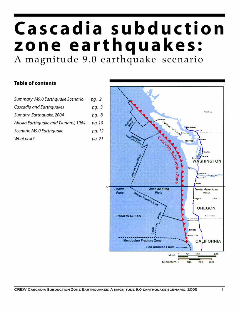
Ca s c a d i a s u b d u c t i o nz o n e e a r t h q u a k e s :A magnitude 9.0 earthquake s c e n a r i o
Table of contents
Summary: M9.0 Earthquake Scenario pg. 2
Cascadia and Earthquakes pg. 3
Sumatra Earthquake, 2004 pg. 8
Alaska Earthquake and Tsunami, 1964 pg. 10
Scenario M9.0 Earthquake pg. 12
What next ? pg. 2 1
CREW Cascadia Subduction Zone Earthquakes: A magnitude 9.0 earthquake scenario, 2005 1

2 CREW Cascadia Subduction Zone Earthquakes: A magnitude 9.0 earthquake scenario, 2005
rom the Brooks Peninsula on Vancouver Island toCape Mendocino in northern California, theCascadia subduction zone is where the Juan deFuca plate meets the North American plate. This
meeting has created an 800 mile (1,300 kilometers) longearthquake fault called the Cascadia subduction zone.Earthquakes generated here have far more widespreadeffects than other types of quakes in the region.When a magnitude (M) 8 to 9 subduction earthquakeoccurs, it will cause many fatalities and much damageunless we prepare for it. These quakes have occurred any-where from 200 to 1,000 years apart, with an average of500 years between them. Our last one was on January 26,1700. We can look to the 2004 Sumatra and 1964 Alaskaearthquakes and tsunamis for some guidance as to what toexpect.Groundshaking, landslides, liquefaction, tsunamis, fires,hazardous material spills, and building damage are someof the hazards we face from a Cascadia subduction zoneearthquake. The ground could shake for four minutes,even more in some places. This will create unprecedenteddamage and potentially thousands of casualties.D i fferent parts of Cascadia will have diff e r e n texperiences.
• Coastal communities will be subjected to stro n gshaking, landslides, and tsunamis. Buildings, roads,bridges and utility lines will suffer varying amounts ofdamage. Some will be destroyed. Extensive injuriesand fatalities are likely. Within minutes, a tsunami willarrive, making it essential that residents and visitorsunderstand the need to head for higher ground orinland as soon as the shaking stops. Coastal Highway101 will be impassable over large stretches, andlandslides through the Coast Range will sever highwaytravel between the coast and inland areas. Destructionof roads, runways, ports, and rail lines will leaveindividual cities isolated. Residents and visitors willhave to do much of the work of rescuing those trappedin the rubble and will be responsible for the immediateclean-up and organization to distribute relief supplies.
• Along the I-5/Hwy 99 corridor, utilities andtransportation lines in some areas could be disrupted,perhaps for months. This particular type of earthquakeis especially hazardous to tall buildings, which couldlead to significant fatalities in downtown are a s .Buildings that would be unscathed in a more typical30-second quake might be severely damaged afterseveral minutes of shaking. Long bridges and utility
lines are also at risk, which could create serious long-term economic losses. Landslides could block east-west travel through the Cascades. As the the center ofour regional transportation network, closures at anypoint here could have far-reaching consequences.
• East of the Cascades, communities can expect a lowerlevel of shaking. Even so, they will feel economiceffects from the regional damage and will be importantstaging points for recovery efforts in Cascadia.
The more we plan now, the easier it will be to use this eventas a way to transform our region and our economy, ratherthan simply become victims of a natural disaster. Importantsteps include:• Educating residents and visitors about the dangers and
encouraging individual pre p a re d n e s s ;
• Reducing the risk for essential public facilities, such ashospitals, schools, and police, and fire stations;
• Retrofitting high risk buildings such as unreinforcedmasonry, tilt-up structures, and some tall buildings;
• Upgrading transportation infrastructure
A Cascadia earthquake will seriously affect our region, butit won't destroy us. We will rebuild our cities, ourneighborhoods, and our businesses. The time it takes us torecover will depend depend largely on what preparationswe make before the earthquake.
M9.0 Ea rt h q u a ke Sce n a ri oFExecutive Summary
The most serious effe ct for theregion could be the disruption ofutilities and tra n s po rt at i o ns ys te m s.
In 1964, the co nt rol tower at An c h o ra g e, Al a s kaInternational Airport fell during the M9.2 earthquake. Itwas a split-level structure that was seven stories high onone side and built of reinforced concrete. Photo: USGS

t retching from Bro o k sPeninsula on VancouverIsland to Cape Men-doci-no, the Cascadia subduc-
tion zone is where the Juan deFuca Plate meets the NorthAmerican Plate along an 800 mile(1,300 kilometers) long line off thePacific coast. The Juan de Fuca Plateis the seafloor and is made up of heav-ier rocks than the continental mass ofthe North American Plate. These twopieces of the Earth’s crust constantly pushagainst each other, and the seafloor subducts,or sinks, below North America. This process isresponsible for much of the scenery of Cascadia,including the development of the Cascade Range.
As we’ve seen in south Asia, a subduction zoneearthquake will affect an entire region. Because of thewidespread area that will feel the shaking, even areaswithout great building damage will be affected by outages inutilities, transportation, and other systems.Ea rt h q u a kes in Ca s ca d i aSouthwestern British Columbia, western Washington andOregon, and northwestern California make up Cascadia —an area that is periodically shaken by three different types ofearthquakes.
All types of earthquakes can trigger landslides andliquefaction (when soil liquifies during shaking). Each type,however, starts at a different depth underground and hasdifferent characteristics.
S h a l l ow / Cr u s t a l — Most earthquakes are a result of faultmovement in the crust, a relatively thin layer on the Earth’ssurface. • Shallow quakes are usually less than magnitude (M) 7.5. • The strongest shaking in crustal earthquakes typically
occurs near the rupture plane of the fault on which theearthquake occurs.
• Most Cascadia quakes are shallow, such as the quakescentered at Vancouver Island, British Columbia in 1946(M7.3) and Scotts Mills, Oregon in 1993 (M5.6).
• Small, shallow earthquakes are recorded every day inCascadia; damaging quakes occur every few decades.
• Strong shaking generally lasts 20-60 seconds, although itcould be longer in localized areas.
Ca s cadia and Ea rt h q u a ke sS
Shallow (or crustal), deep (or intraplate), and subductionzone earthquakes are each initiated in a different sectionof the Ea rt h’s inte ri o r. The general locations of thesubduction and deep intraplate zones are noted in theabove graphic. Shallow crustal earthquakes can occurwidely in the North American and Juan de Fuca Plates.
In the 1983 Coalinga, California earthquake, this firestation was badly damaged (note the skewed door). Ifrescue equipment can’t get out of the station, it can’t beused when needed after an earthquake. Photo: M.G.Hopper, USGS
CREW Cascadia Subduction Zone Earthquakes: A magnitude 9.0 earthquake scenario, 2005 3

4 CREW Cascadia Subduction Zone Earthquakes: A magnitude 9.0 earthquake scenario, 2005
Liquefaction can destroy roads, as the 2001 Nisqually,Wa s h i n g ton eart h q u a ke did to this street outsideOlympia. Many stretches of Highway 101 and othercoastal roads in Cascadia are vulnerable to this type ofdestruction. Photo: T. Walsh, Washington Division ofGeology and Earth Resources
• Damage is most likely to occur in vulnerable structureslocated relatively close to the fault on which theearthquake occurs, where the shaking is strongest.
• Aftershocks are common and may cause furtherdisruption.
• There could be a local tsunamis from landslides, or fromshallow earthquakes occurring under Puget Sound, theStrait of Georgia, or other bodies of water including lakesand rivers.
De e p / I n t ra p l a te — There is a zone of earthquakes occurringbelow 18 miles (30 kilometers) in depth on fractures in thesubducting Juan de Fuca plate.
• Deep quakes are usually less than M7.5.
• The 2001 Nisqually, Washington quake (M6.8) and 1949Olympia quake (originally measured M7.1, now revisedto M6.8) were deep earthquakes.
• Damaging deep earthquakes occur every 10-30 years.
• Because the original earth movement is so deep, theseismic energy disperses over a much larger area than ina shallow quake. The shaking is felt over a large area andis less intense near the epicenter. Damage is less than in asimilar-sized shallow quake.
• Few, if any, aftershocks occur.
• No tsunami is expected, although landslides couldtrigger local tsunamis.
Su bd u ction zo n e — The subducting seafloor of the Juan deFuca plate is being pushed beneath the continental NorthAmerican plate. The contact between these two platesperiodically ruptures in large, subduction zone earthquakes.
• Earthquakes centered along the Cascadia subduction zone
• The last Cascadia earthquake was January 26, 1700.Previous quakes were in the years (approximately) 900,750, and 400 AD.
• Geological evidence suggests an average of 500 yearsbetween events.
• Depending on location, strong shaking might be felt forseveral minutes.
• Injuries and fatalities could number in the thousands, andhundreds of buildings could be destroyed.
• A destructive tsunami will quickly hit the Cascadia coastand travel across the Pacific Ocean.
• Aftershocks up to M7 are common, creating the potentialfor additional damage.
This area on the Kenai Peninsula permanently dropped,or subsided, 3 feet during the 1964 Alaska earthquake.The shallow roots of these spruce trees were then belowhigh tide and they were killed by repeated inundation insalt water. Photo: USGS
can be M9.

CREW Cascadia Subduction Zone Earthquakes: A magnitude 9.0 earthquake scenario, 2005 5
Hazards in a subduction zone earthquake
G round re s po n s e — Earthquakes release energy that travelsthrough the earth in waves. Subduction quakes are richer inlong-period waves, which are most dangerous for tall build-ings, long bridges or long, above-ground pipelines. This is adifferent pattern than in a typical shallow quake, where thegreatest effect is on short buildings.
Some soil types cause earthquake waves to amplify, causingincreased shaking and damage. The risk of amplificationincreases when you are on deep, soft soils, especially onvalley bottoms and areas of artificial fill.
These soils can be identified before an earthquake, as onemeasure of the risk a community might face. Most areas atrisk are already identified with soil studies in land useplanning and development.
Following a large subduction quake, there will be months ofaftershocks, some perhaps as large as M7. Some of theseaftershocks could cause significant new damage.
G round failure — Sandy soils saturated with water canliquefy, or behave like a liquid, during an earthquake. Majorearthquake destruction is often found on these soils that areprevalent along rivers, streams, and lakes. Liquefaction canseriously damage buildings, bridges, pipelines, and roads byundermining their foundations and supports.
Earthquakes can also trigger landslides. The last earthquake–related death in Oregon was in 1993, when falling rocksmashed a truck in Klamath Falls. A subduction zoneearthquake will probably triggerlandslides and rockfalls on the steep slopesof the Coast and Cascade Ranges. Otherareas might also be at risk.
Ts u n a m i — A subduction zone earthquakewould generate a tsunami, which isactually a series of waves. The number oflarge waves and their height will dependon local conditions. In some cases, wavesmay be up to 30 feet (10 meters) high,flooding everything in their path. Thesequence of the waves sweeping inland,then out again, could last 10 to 12 hours.The first wave could arrive a few minutesafter the earthquake, again depending onlocal conditions.
Casualties and damage from tsunamis maybe high. Deaths can be minimized if peopleevacuate to higher ground or sufficientlyfar inland immediately after the groundstops shaking.
The 1964 Alaskan subduction zone earthquake weakened many buildings inSeward, then a tsunami swept much of the debris away.Thirteen people diedhere. Photo: USGS
Ground response at different locations means there canbe dramatically different levels of damage in the sameq u a ke. This ca r, c rushed in the 1989 Loma Pri e t a ,California earthquake, was in an area where there was agreat deal of building failure. Falling bricks or parapetscan cause injuries and damage on the streets andsidewalks below. Photo: C. E. Meyer, USGS

6 CREW Cascadia Subduction Zone Earthquakes: A magnitude 9.0 earthquake scenario, 2005
Se co n d a ry hazard s
Fi re — Fire often destroys property after an earthquake.Ruptured gas lines may provide fuel, and broken water lineshinder firefighters’ efforts. Gas lines turned off to prevent firemay not be restored for days, causing other hardships.
Ha z a rdous mate r i a l s — Hazardous materials may be spilledfrom commercial or industrial sources, but they can also bereleased in households. Serious problems can happen if thecontents of several containers mix—such as ammonia andchlorine bleach.
Building vulnera b i l i t i e s — Building vulnerability is onefactor we can control. As we’ve learned more about theearthquake danger in Cascadia, building codes have beenupgraded. We also can now analyze which buildings will bemost vulnerable in an earthquake. The American Society ofCivil Engineers has published ASCE 31-02, Seismic Evaluationof Existing Buildings, to help assess building risk. TheNational Research Council of Canada has published NRCC-36941, Guidelines for the Seismic Evaluation of ExistingBuildings.
In a subduction zone quake, many buildings are at some risk.In particular, unre i n f o rced masonry buildings (URMs),generally with brick walls and wood or concrete floors, maybe dangerous. There are thousands of these buildingsthroughout Cascadia. Even though most URMs are one tofive stories, they may not be able to withstand the durationof shaking. However, even these buildings can be retrofittedto better withstand strong ground shaking.
The amount of damage to a building in anyty pe of eart h q u a ke will depend on:❏ I n te n s i ty and duration of shaki n g
❏ Di s t a n ce from the fault
❏ Local soil co n d i t i o n s
❏ Amount of wa ter in the soil
❏ Sl o pe of hillsides
❏ Building co n s t ru ct i o n
In genera l , the soil ty pes most affected in ane a rt h q u a ke are :❏ Loo s e, s a n dy, s a t u ra ted soils that may liquefy
❏ Artificial fill (not engineered to withstand shaki n g )
❏ So ft soils that can amplify eart h q u a ke shaki n g
The ground re s ponse to eart h q u a ke waves can re s u l tin ru p t u red gas mains, which can start fire s, a n db ro ken water mains, which makes it hard to fightf i re s. These smoldering remains are from the 1989Loma Pri e t a , Ca l i fo rnia eart h q u a ke. Ph o to : J . K .Na kat a , U S G S
The inte ra ction of building ty pe and gro u n dre s ponse can be seen in how these two buildingswe re affe cted by the 1964 Al a s ka quake. The HillsideAp a rt m e nt Building had exte n s i ve damage, w h i l ethe adjace nt thre e - s to ry wood - f rame dwelling withthe tall chimney had almost none. In genera l , w h e nwood frame buildings in An c h o rage we re damaged,it was from some ty pe of ground failure. Ph o to : U S G S

CREW Cascadia Subduction Zone Earthquakes: A magnitude 9.0 earthquake scenario, 2005 7
Single-family wood-frame homes rarely collapse andgenerally fare well in earthquakes, although pro l o n g e dshaking may increase their level of damage. Chimneys andbrick facings can collapse and windows can break. If notsecurely fastened together, a house may separate from itsfoundation, disconnecting utility lines and making the houseunlivable.
The design of buildings, as well as construction material, isimportant. The more square or rectangular a building shape,the more likely it can withstand shaking. Structures that havehad several additions often have irregular shapes, and thevarious parts of the building may pound against each other.Pounding can also occur when buildings that are built closetogether knock against each other. Another common cause ofdamage is a soft story — a floor with insufficient strengthrelative to the floors above. Often the problem is a garage oropen retail space located at ground (or street) level thatmakes up the bottom story of a building.
All buildings can suffer nonstructural damage, resulting ininjuries and economic losses. Falling debris like bookshelves,light fixtures, and computers can be dangerous, even athome. Furniture moving across a floor, pipes breaking andspilling contents, and parapets falling from buildings are justa few things that have caused injuries in pre v i o u searthquakes.
Building damage is not always readily appare nt.These re s i d e nts ca m ped in their own fro nt ya rd fo rte m po ra ry housing. The house was in the re s t ri cte da rea of heavily damaged dow ntown Coalinga in1 9 8 3 . Ph o to : H . G . Wi l s h i re, USGS
Th e re is no stru ct u ral damage in this be d room afte rbeing shaken by the 1989 Loma Pri e t a , Ca l i fo rn i ae a rt h q u a ke, but seve ral of the items that fell could havecaused injuri e s. Ph o to : C . E. Meye r, U S G S
In the 1964 Al a s ka eart h q u a ke, this fo u rte e n - s to ryre i n fo rced co n c re te apart m e nt building inAn c h o rage was seve rely damaged by the gro u n ds h a king it endure d. Ph o to : U S G S

8 CREW Cascadia Subduction Zone Earthquakes: A magnitude 9.0 earthquake scenario, 2005
he tsunami that devastated the Indian Ocean basinin December 2004 was triggered by a magnitude 9.0earthquake about 60 miles (100 kilometers) off thecoast — a quake similar in some respects to what we
expect along the Cascadia subduction zone. More than amillion people lost their homes, and more than 300,000 diedor remain missing. Although there are major differencesbetween the geology, buildings, and city sizes of Sumatraand Cascadia, there are some important lessons we can takefrom this tragedy.Victims of a distant tsunamiIndia, Sri Lanka, Thailand, and other countries suffered whatscientists call a distant tsunami. People in these countriesdidn’t feel the earthquake: the shaking was either minimal ornonexistent. The effects of the tsunami waves were stilldevastating. In Sri Lanka, it is estimated that 66% of thefishing fleet was destroyed.Cascadia coasts can also experience distant tsunamis. The1964 Alaska earthquake produced the most recent distanttsunami that damaged ports and towns along our coastline.Even without a warning system, it caused fewer than 20deaths in Cascadia. An important new tool for protection from future distanttsunamis is the West Coast/Alaska Tsunami Warning Center.Its mission is to rapidly locate and size major earthquakes inthe Pacific basin, determine their tsunami potential, predicttsunami arrival times and, when possible, runup on thecoast, and provide timely and effective tsunami informationand warning bulletins for the Pacific coastal populations ofCalifornia, Oregon, Washington, British Columbia, andAlaska.Since 1980, the Warning Center has issued 11 tsunamiwarnings. The time to issue these warning has ranged from 8to 14 minutes. With a distant tsunami, this givesgovernments, businesses, and people time to prepare for theexpected waves.Earthquake and near-tsunami victimsThe island of Sumatra, Indonesia bore the brunt of the initialearthquake and local tsunami in December. The actualrupture that caused the initial earthquake lasted 3 to 4minutes, although the shaking was felt longer in areas withsoft soils. But the truly terrifying event was the tsunami thathit Indonesia minutes after the earthquake. Along thecoastline closest to the epicenter of the quake, the tsunamiwaves were devastating. Both structures and vegetationwere swept away.
Ca s cadia is served by theWest Co a s t / Al a s ka Ts u n a m iWa rning Ce nte r. It monito r spo te ntial tsunami act i v i tyin the Pacific Ocean so wewill not be surp rised bydamaging tsunamis fro md i s t a nt eart h q u a ke s.
Su m at ra Ea rt h q u a ke,2 0 0 4T
Most of the afte r s h ocks from theSumatra earthquake have been locat-ed west and north of the island. After aCa s cadia subd u ction zone eart h-quake, aftershocks will be generatedfor months directly along our coast-line. These will create the potential foradditional significant damage. Map:USGS

CREW Cascadia Subduction Zone Earthquakes: A magnitude 9.0 earthquake scenario, 2005 9
As expected in an event of this size, there was a great deal ofdamage to infrastru c t u re and many buildings weredestroyed, leading to a large number of casualties and longdelays in getting emergency supplies to the hardest-hit areas.Runways at airports were damaged and roads weredisrupted, which continues to make the relief effort difficultand frustrating. Hundreds of thousands of people will needfood, water, and shelter to be supplied for the foreseeablefuture.T h ree hours after the quake, there was an aftershockmeasuring M7.1. There have been at least 13 aftershocks ofM6.0 or larger. Each aftershock carries some risk of causingmore damage, and each one further disturbs whatever peaceof mind Sumatrans have been able to regain.On a positive note, children were able to go back to school inBanda Aceh a month after the earthquake, even as water andfood were still being flown in. Even though school buildingsand supplies had been destroyed, the symbolism of the actwas crucial; the community proved that it will have a future.
We are better preparedOur building codes require buildings to be much moreresilient to earthquakes than those in Indonesia. Ourschoolchildren are taught how top rotect themselves in earth-quakes. Many communities haveearthquake maps that delineatepotential hazard areas. With thisi n f o r m a t i o n , c o m m u n i t i e s ,individuals, and businesses cantake steps to prepare for majorquakes. We are also much more able todeal with what scientists call alocal tsunami — one that reachesthe coastline within minutes of asubduction earthquake. Federal, state, provincial, andlocal governments work togetherto map tsunami evacuationroutes, pre p a re educationalmaterials for schools, andcoordinate information that goesto the public. We can minimizeloss of life by being aware of thedanger and knowing what to do. Our challenge now is to build onthe groundwork we’ve alre a d ylaid, to continue to reduce thedanger from earthquakes andtsunamis along Cascadia.
This map of damage in Banda Ace h , the city most affe cted by the eart h q u a keand tsunami, s h ows that even in areas of major destru ct i o n , tsunamis can beavoided by going uphill or sufficiently far inland. Ed u cating people to startm oving as soon as the shaking stops can save live s. In Ca s ca d i a , m a nycommunities have eva c u ation ro u te s, co m p l e te with published maps and ro a dsigns to guide re s i d e nts and visitors to safe ty.
In Ca s ca d i a , we have spe ntmore than a decade preparingfor a subd u ction eart h q u a keand tsunami.
We are more prepared inland,but the most ex posed andvulnerable areas of our coastwill still be devastated.

10 CREW Cascadia Subduction Zone Earthquakes: A magnitude 9.0 earthquake scenario, 2005
o estimate what damage a Cascadia subductionquake might wreak, we can review the 1964 GoodFriday earthquake in Alaska. This quake measuredM9.2 and the strong shaking lasted 4 to 6 minutes,
depending on local conditions. Most damage on land camefrom ground failure. A devastating tsunami followed theearthquake, causing far more loss of life than the earthquakeitself. Twelve people died from the quake; 119 people diedfrom the tsunami.
Wood - f rame houses and other short buildings — Mosthomes were not damaged and in many areas, books didn’teven fall off shelves. However, the Turnagain neighborhoodin Anchorage lost many homes because of a landslide thatstretched along the coast for more than a mile (almost twokilometers).
Most short buildings had little damage, unless they were inan area of landslides, liquefaction, or other ground failure.Fourth Street in downtown Anchorage dropped 20 feet (6meters), destroying a number of buildings.
Tall struct u re s — Most multi-story buildings suffered somestructural damage. The control tower at Anchorage airportcollapsed, but the one-story terminal building wasundamaged.
Tra n s po rt a t i o n — Most highways, rail lines, and airportrunways could be used after the quake, except in areas wheresoils liquefied. In some of these cases, damage was extreme.
B r i d g e s — More than 250 bridges in Alaska were damaged;50 partly or completed collapsed. In areas where the bridgefootings were in gravels rather than sand or silt, there was
little damage.
Po rt s — Anchorage, Kodiak, Valdez, and Sewardsuffered major deformation of docks and pipesupports, largely from landslides or landsubsidence.
Ut i l i t i e s — Electric transmission lines andpipelines in areas with liquefaction or groundfailure were seriously damaged.
Ts u n a m i — Alberni and Port Alberni onVancouver Island suffered over $10 million US indamage.
The 30 foot (10 meter) high tsunami dealt the deathblow to the city and harbor of Valdez. Thedestruction caused by liquefaction and the tsunamiled residents to rebuild their community four miles(six kilometers) away.
Alaska Earthquake, 1964T
Ep i ce nter M9.2
Be fo re the eart h q u a ke, the sidewalk in fro nt of theseAn c h o rage sto res on the ri g ht was at the level of thes t reet on the left. No te that buildings and pave m e ntnot invo l ved in the 11 foot (3 meter) landslide showlittle damage. Ph o to : U S G S

CREW Cascadia Subduction Zone Earthquakes: A magnitude 9.0 earthquake scenario, 2005 11
The first wave in a tsunami is not always the mostdestructive. In Crescent City, California, it was the fourthwave that resulted in 10 deaths. Another four people died onan Oregon beach. The coasts of British Columbia,Washington, and Hawaii suff e red damage, but had nofatalities.
Millions of dollars of property damage were caused by thewaves. Port facilities were particularly hard hit. Docks thatwere detached and twisted by the earthquake were thenbattered by the debris that was flung on land by the waves.
Seward, Kodiak, and Whittier lost structures that withstoodthe earthquake, but could not stand up to the force of thetsunami waves.
Ground deformation — In many places, the shoreline waspermanently changed. Kodiak Naval Station sank almost 6feet (2 meters), while much of the Prince William Sounduplifted an average of 6 feet (2 meters).
The Al be rni Va l l ey on Va n co u ver Island in Bri t i s hColumbia had 350 homes and buildings damagedf rom the tsunami generated by the Al a s kae a rt h q u a ke 1,100 miles (1,800 ki l o m e ters) away.Ph o to : Po rt Al be rni Online.
1964 Al a s ka Good Fri d ay quake damageand possible Ca s cadia para l l e l sValdez
Similar effects expected along Cascadia coast/Hwy 101 corridorDamage primarily from tsunami80% of the homes destroyed Hospital and school leveledWater and sewer lines damagedTsunami waves brought debris into the cityHarbor destroyedCity evacuated
Anchorage Similar effects expected along I-5/Hwy 99 corridor
Damage from ground shaking and ground failure30 block area in downtown destroyed by landsliding2 schools destroyedAirport control tower collapsedCity sewer system destroyed2,000 people left homeless (from a population of 55,000)9 people killed Most wood frame homes undamaged
FairbanksSimilar effects expected east of the Cascades
Damage from ground shakingWindows broken and chimneys fell
Crescent City, CaliforniaSimilar effects possible in US and Canada outside of Cascadia
Damage from tsunami300 buildings destroyed and 10 people died
JapanSimilar effects across the Pacific expected after a Cascadia quake
Damage from tsunamiOyster and pearl harvest disrupted
Sh a ki n g, t s u n a m i , f i re, and a submarine landslide allco nt ri b u ted to the damage of ra i l road and po rtfacilities at Wh i t t i e r, Al a s ka . Ph o to : US Army.

12 CREW Cascadia Subduction Zone Earthquakes: A magnitude 9.0 earthquake scenario, 2005
hat follows is a scenario of how a gre a tsubduction zone earthquake could aff e c tCascadia. It is important to pick a specific date,because the effects of an earthquake in cold,
rainy December will be diff e rent than in dry, summermonths. The time is important because the highest number ofcasualties would probably happen in the afternoon whenpeople are at work,and when there are more people on thebeach.
For this scenario, assume there has been:• A M9.0 earthquake • On the second Tuesday in July • At 4 PM.
This earthquake could be catastrophic. It will certainly belarger than local or regional resources can respond to. Helpfrom the national level, in both the US and Canada, will beneeded. Other Pacific Rim countries may be affected bytsunami damage or trade disruptions. It will be a long-termevent, affecting the economies of the US, Canada, otherPacific countries, and their trading partners for years tocome.
Di f fe re nt locat i o n s, d i f fe re nt ex pe ri e n ce sIn the following pages are descriptions of one possibleaftermath of a subduction earthquake. The damage will bedramatically different going from west to east. There are somany variables that firm predictions cannot be made, but wecan estimate likely effects. Nothing in this section should betaken as a specific forecast for any particular area.
This earthquake will affect every business, governmentagency, nonprofit organization, and individual in the region.
Cascadia includes the land from the ocean shore to theeastern foothills of the Cascades, from Brooks Peninsula inthe north to Cape Mendocino in the south. This earthquakewill affect far more area than that. In this report we areincluding only Cascadia and the land directly east of us, butthere will be widespread effects across the US and aroundthe Pacific Rim.
The widespread physical damage from a great subductionearthquake will result in unprecedented economic losses. Itwill be critical to get businesses running as soon as possibleto provide materials needed for recovery, and to provide thejobs necessary for the long-term economic health ofCascadia.
S ce n a rio M9.0 Ea rt h q u a keA regional disaster
W
Each blue dot represents a bridge that is out of servicet h ree days after the eart h q u a ke. This is only onepossible outcome, not a listing of all bridges that will bedamaged.The effects of liquefaction or tsunamis, eitherof which could create more damage at a specific site,were not included. Segments shown in green wouldlikely be functional.
The importance of the map is in recognizing the patternof widespread damage along the major transportationcorridors of Hwy 101, I-5/Hwy 99, and across the CoastRange. This pattern can be applied to other types ofstructures in those areas, including tall buildings andlong power lines and pipelines.
Information from the shaking map on page 13 has beenincorporated into this map.
The HAZUS model used to produce this information wasdeveloped by the Department of Homeland SecurityFe d e ral Em e rg e n cy Ma n a g e m e nt Ag e n cy (FEMA) toforecast earthquake damage.
Bridge information was not available for Canada.

CREW Cascadia Subduction Zone Earthquakes: A magnitude 9.0 earthquake scenario, 2005 13
This map shows Peak Ground Accelerations (PGAs). PGA is one measure of the strength of shaking.Higher PGAs generally result in more damage. Because this map shows average expected PGAs inan area, specific locations may have higher or lower PGAs, and significantly more or less damage.Site conditions such as soil and building type will affect the type and amount of damage at anygiven place.
14 CREW Cascadia Subduction Zone Earthquakes: A magnitude 9.0 earthquake scenario, 2005
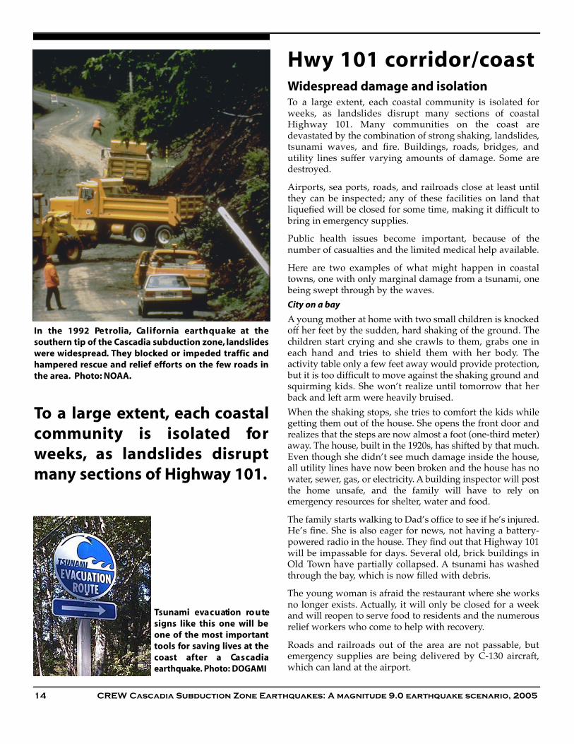
H wy 101 co rri d o r / co a s tWidespread damage and isolationTo a large extent, each coastal community is isolated forweeks, as landslides disrupt many sections of coastalHighway 101. Many communities on the coast aredevastated by the combination of strong shaking, landslides,tsunami waves, and fire. Buildings, roads, bridges, andutility lines suffer varying amounts of damage. Some aredestroyed.
Airports, sea ports, roads, and railroads close at least untilthey can be inspected; any of these facilities on land thatliquefied will be closed for some time, making it difficult tobring in emergency supplies.
Public health issues become important, because of thenumber of casualties and the limited medical help available.
Here are two examples of what might happen in coastaltowns, one with only marginal damage from a tsunami, onebeing swept through by the waves.City on a bay
A young mother at home with two small children is knockedoff her feet by the sudden, hard shaking of the ground. Thechildren start crying and she crawls to them, grabs one ineach hand and tries to shield them with her body. Theactivity table only a few feet away would provide protection,but it is too difficult to move against the shaking ground andsquirming kids. She won’t realize until tomorrow that herback and left arm were heavily bruised. When the shaking stops, she tries to comfort the kids whilegetting them out of the house. She opens the front door andrealizes that the steps are now almost a foot (one-third meter)away. The house, built in the 1920s, has shifted by that much.Even though she didn’t see much damage inside the house,all utility lines have now been broken and the house has nowater, sewer, gas, or electricity. A building inspector will postthe home unsafe, and the family will have to rely onemergency resources for shelter, water and food.
The family starts walking to Dad’s office to see if he’s injured.He’s fine. She is also eager for news, not having a battery-powered radio in the house. They find out that Highway 101will be impassable for days. Several old, brick buildings inOld Town have partially collapsed. A tsunami has washedthrough the bay, which is now filled with debris.
The young woman is afraid the restaurant where she worksno longer exists. Actually, it will only be closed for a weekand will reopen to serve food to residents and the numerousrelief workers who come to help with recovery.
Roads and railroads out of the area are not passable, butemergency supplies are being delivered by C-130 aircraft,which can land at the airport.
To a large extent, each coastalco m m u n i ty is isolated fo rwe e k s, as landslides disru p tmany sections of Highway 101.
In the 1992 Pe t ro l i a , Ca l i fo rnia eart h q u a ke at thesouthern tip of the Cascadia subduction zone, landslideswere widespread. They blocked or impeded traffic andhampered rescue and relief efforts on the few roads inthe area. Photo: NOAA.
Tsunami eva c u ation ro u tesigns like this one will beone of the most importanttools for saving lives at thecoast after a Ca s ca d i aearthquake. Photo: DOGAMI

CREW Cascadia Subduction Zone Earthquakes: A magnitude 9.0 earthquake scenario, 2005 15
City on the seashore
The owner of a motel realizes at once what the shakingmeans and remembers to drop, cover, and hold under thefront desk. After the shaking stops, staff and guests streaminto the office. The NOAA weather radio broadcasts atsunami warning. The motel staff have walkie-talkies tocommunicate, and the owner now uses that system to getdamage reports from staff. Part of a second story wallcollapsed, but everyone is able to get down the stairs andoutside.
Many people have cuts, bruises, sprains, possibly brokenbones, but there is time only for emergency first aid beforetaking the tsunami evacuation route. The owner knows theyare in the inundation zone and it is critical to quickly getuphill to safety. He tells staff and guests to start moving,making sure that everyone hears his warning. There isn’tenough time to convince those who argue with him, andwith a mixture of determination to save lives, and guilt forthe people staying behind, he picks up the registration listbefore leaving.
The crowd stays calm as they walk the evacuation route, aquarter-mile (half kilometer) uphill to the school that hasbeen designated an emergency assembly area. Along theway, the group passes downed power lines, collapsed walls,and streets with deep cracks. Shortly after getting to theschool yard, they watch water flood the town, tearinghouses off their foundation and easily moving parked cars.After nearly an hour the water recedes, taking with it thewood, plaster, and metal it claimed. The outgoing waterbrings down a few buildings that withstood the incomingwave. Some people try to leave, thinking the danger is over,but they are convinced to wait until danger from all thetsunami waves has passed.
Residents in nearby houses take in elderly guests andfamilies with children, making sure they are kept warmthrough the night. They also share food and water. Everyoneeats and drinks sparingly, concerned about when newsupplies will be available, since Hwy 101 is obviouslyunusable. Aftershocks disturb them through the night.
Of the original 100 registered guests, 45 make it to theassembly area. Later, 30 others who were in other placescome back to the motel, leaving 25 dead or unaccounted for.
Until highways and the local airfield re-open a few weekslater, temporary shelter for residents and tourists and mostrescue and recovery work must be provided for by people inthe area, supplemented by military helicopter drops andboat landings.
As a permanent reminder of the power of the earthquake,the beach has permanently dropped three feet (one meter),leaving part of the original town under water.
In the 1971 San Fe rn a n d o, e a rt h q u a ke, the south stairtower (above) fe l l , and there was other stru ct u ra ldamage at Ol i ve V i ew Ho s p i t a l . Th ree people diedand the building was eva c u ate d. It is impe rat i ve toh ave hospitals and other essential facilities ava i l a b l ed u ring the crisis of a subd u ction zone eart h q u a ke.Ph o to : R . Ka c h a d oo ri a n , U S G S
Escaping a tsunamiWhen you’re at the coast, take just a moment to locate highground you could get to after a big earthquake
Many cities have evacuation route signs posted and brochuresprinted. Some have designated assembly areas at the end ofevacuation routes.
You can be in danger near the mouth of a coastal river, even ifyou can’t see the ocean
Try to move to high ground and inland
Go on foot, don’t drive
Stay at high ground until you get an official all-clear. A tsunami,which is actually a series of waves, can last many hours.

16 CREW Cascadia Subduction Zone Earthquakes: A magnitude 9.0 earthquake scenario, 2005
Much of the re s ponse andrescue after a large earthquakeis done by untrained neighborsand volunteers.
I-5/Hwy 99 CorridorU t i l t i e s,t ra n s po rt at i o n ,other sys tems disru p te dT h roughout most of the area, electricity and telephoneservice — both traditional and cellular — are inoperable forat least a day. Some water, sewer, and natural gas services areinterrupted because of broken pipelines. Even buildings withno structural damage have to close because they do not haveadequate utilities. This results in lost wages and lost profits.
The resident of a wood-frame home is amazed that he canfind no damage after such a long earthquake. His house wasanchored to its foundation, the chimney had been reinforced,and internal shelves were anchored.
His children were playing at a neighbor’s house and he runsto get them. The family spends an anxious night worriedabout Mom, who works across the river. She arrives homethe next morning.
Neighbors meet together and plan to systematically checkeach house to see if anyone is trapped or injured. They alsoagree to pool their food and bottled water supplies. Severalpeople volunteer to heat food on their barbecues. Otherpeople with battery-operated radios offer to open theirhouses at specific times so everyone can hear the latest news.Where they exist, trained neighborhood emergency teamsare activated to help their communities and coordinate withfire and police rescue activities.
In commercial areas, damage ranges from slight tosubstantial. In downtown areas of large cities, some old brickbuildings and tall buildings suffer extensive damage.
Parapets fall from several buildings, causinginjury and clogging streets with debris. One tall,older, concrete-frame building collapses, causingmany fatalities. Most buildings, however, do nothave substantial structural damage.
Injuries are also concentrated in this area, but arefound throughout the community. Many of themare people who work in buildings that have littlestructural damage, but who were hit by itemsfalling off shelves in their offices.
Even in smaller cities, response to some areas isdifficult because fallen bricks and other buildingdebris has blocked roads. Some older fire stations,police stations, and hospitals are inoperable.
Several tilt-up warehouses have walls thatpartially collapse. Firefighters and police officersare overwhelmed and cannot respond, so peoplespend hours rescuing and giving first aid to theirco-workers.
De b ris from fallen buildings will trap people and make stre e t si m p a s s a b l e. After the 1989 Loma Pri e t a , Ca l i fo rnia eart h q u a ke,this group in Sa nta Cruz wo rked to rescue pe o p l e. Ph o to : C . E.Meye r, U S G S
Tra n s po rt ation sys tems like ra i l roads are fra g i l ebe cause a break in any spot can affe ct all traffic onthe line. Ground re s ponse of loo s e, water-filled soilsb u c kled this ra i l road bridge in the 1964 Al a s kae a rt h q u a ke. Ph o to : U S G S

CREW Cascadia Subduction Zone Earthquakes: A magnitude 9.0 earthquake scenario, 2005 17
Because of the extent of damage across the region, manyutility repairs that would normally take only a few hoursnow take days. The highest priorities for power restorationa re utility stations, emergency re s o u rces (hospitals, firestations), and high-density population areas (whetherresidential, commercial, or industrial). Until electricity isrestored to water treatment facilities, there is no water.
For a few days, some cities, communities, or neighborhoodsare isolated for a variety of reasons. Many cities in this areaare accessed by roads that span one or more bridges. In someplaces, bridge damage closes roads, making it difficult orimpossible to drive in or out of the city. In other areas,isolated landslides block roads.
On a larger scale, it is difficult to immediately bring in rescueworkers and emergency supplies because of problems in theregional transportation corridors.
The I-5/Hwy 99 passage is the backbone of the area’s transit.Even though there is debris and damage only in localizedstretches, those few spots effectively shut down the ability totravel long distances on the north-south route. Bridges mustbe inspected, debris removed, and damage re p a i red ordetours set up, before the corridor is open again.
Most of the ports in this region suffer some damage and areof limited use anyway, because shipping lanes need to beresurveyed before rivers are again navigable.
Cracked runways at airports built on areas of artificial fill oron liquefying soils are inoperable until inspection and repairwork is completed. This could take hours, days, or weeks,depending on the amount of damage. Small airports may notbe high on a priority list for repair.
Docks are damaged from liquefaction, and ferry service isdisrupted throughout Puget Sound and British Columbia.Many islands are isolated, and communities on each side ofthe Sound are effectively separated.
Individuals, businesses, and governments across the worldoffer money, supplies, and personnel to help. In some areas,food, water, and temporary shelter are needed at first, butwithin a few days most people are back in their own homes.
In this zone, the economic centers of Portland, Seattle, andVancouver are the highest priorities for outside rescue andrecovery activities. Given the breaks in transportation andutility services, even some high priority areas don’t get theresources they need until days after the quake. Communitiesin lower priority areas will need to be self-sustaining untilemergency resources can be delivered, possibly for weeks.
Communities that fare the best are those who know whatresources are available and have response plans that assumethey will be isolated for a while.
Even without stru ct u ral damage, o f f i ces like this onea fter the 1989 Loma Pri e t a , Ca l i fo rnia eart h q u a kem ay be a mess with ove rt u rned boo k ca s e s, f i l i n gcabinets and desks. The safest way to pro te ct yo u r s e l fis get under a desk or table. D O N OT stand in ad oo rway. Ph o to : J . K . Na kat a , U S G S
Communities that fare the besta re those who kn ow whatre s o u rces are available andh ave re s ponse plans thatassume they will be isolated fora while.
Houses don’t need to collapse to be eva c u ate d. Th i shouse shifted off its fo u n d ation in the 1989 Lo m aPri e t a , Ca l i fo rnia quake and now all the utilities ared i s co n n e cte d. Ph o to : H . G . Wi l s h i re, U S G S

18 CREW Cascadia Subduction Zone Earthquakes: A magnitude 9.0 earthquake scenario, 2005
East of the Ca s ca d e sIndirect economic effectsSome residents in the area feel the ground shake, but it isonly a very weak version of the earthquake felt at the coast.In a city like Spokane, 300 miles (500 kilometers) east of thesubduction zone, the community is affected, even for thosewho don’t feel the ground shake.
Much of the area has little or no damage. Any seriousdamage is limited to relatively small pockets, generally thosewith soft, deep soils. Some tall buildings may havenonstructural damage, which could result in injuries.
Utilities and transportation systems are disrupted in someplaces, where supplies first come through pipelines west ofthe Cascades. East-west corridors through the mountainsexperience several rockfalls, which close highways andrailroads lines. Connections to cities in the I-5/Hwy 99corridor are lost for some period of time, depending on localconditions.
Emergency responders are overloaded from a combinationof appropriate calls and others who are asking whathappened.
Cities in this area are needed as coordination centers for therescue, response, and recovery needed to the west. Especiallyin the first weeks after the quake, cities like Kamloops,Spokane, Bend, and Sacramento are important stagingpoints. Businesses and government agencies that cannotoperate their Cascadia offices set up temporary offices hereto take advantage of the transportation corridors throughthese eastern cities.
Economic losses to both pro fits and wages may occur.Business effects include difficulty shipping grain and otherproducts to markets. Sea ports and some river ports close tothe Pacific Ocean are damaged, some severely. Shippinglanes in the lower Columbia and in other affected rivers mustbe resurveyed before ship traffic can resume. In addition, raillines, trucking, and air traffic are overburdened by extrademands for products needed to rebuild western BritishColumbia, Oregon and Washington, and northern California.
To balance those challenges, these economies benefit to someextent from becoming hubs for transportation, commercial,and government operations supporting the recovery ofCascadia.
However, tourism to the region dramatically declines in theyears following the earthquake, as news outlets focus onnegative information about Cascadia.
Businesses throughout Ca s cadia will be seve re l ya f fe cted if they depend on coastal po rts or ri ver po rt st h at are damaged (like those on the lower Co l u m b i aRi ve r ) . Ph o to co u rtesy CRIS, I n c.
To some exte nt, cities east of theCa s cades be n e fit from be co m i n ga hub for tra n s po rt at i o n ,co m m e rc i a l , and gove rn m e nto pe rations suppo rting there cove ry of Ca s ca d i a .
In a city like Spo ka n e, 300 miles(500 kilometers) east of thes u bd u ction zo n e,the co m m u n i tyis affe cted even for those whod o n’t feel the ground shake.

CREW Cascadia Subduction Zone Earthquakes: A magnitude 9.0 earthquake scenario, 2005 19
Long-term recoveryTransformation after destructionWe cannot ignore or negate the power of a subduction zoneearthquake. However, with planning, we can use the event totransform our region. For example, Hwy 101 can be rebuiltto current engineering standards, rather than continuing tobe pieced together every winter after damage fro mrainstorms and landslides. This will give the coast adependable transportation backbone on which to rebuild thefuture.
For a few months
Isolated coastal communities will have to deal with thedestruction of much of their building stock, roads andutilities. Thousands of families may need temporary shelterfor months, even years. Ports will be destroyed. Tourism,timber, and fishing industries will all be severely reducedafter this quake.
Along the I-5/Hwy 99 corridor, many of the old, unsafe brickstructures will be shaken down. Although this gives us anopportunity to build safer, energ y - e fficient, modernbuildings, it also creates a problem. Older buildings are oftenused for low- or moderate-income housing, cheap officerentals, and warehouse space. Those needs will still exist,and it will take coordination to replace structures that servethe needs of working families and small businesses.
In July 2002, the US Army Co rps of Engineers (USACE) inv i ted nearly 200 people from fe d e ra l , s t ate, p rov i n c i a l , a n dl ocal gove rn m e nts to a Ca s cadia subd u ction zone eart h q u a ke tabletop exe rc i s e. Their fo re cast of long-te rm needsi n c l u d e d :
Pri o rities for the first 72 hours:
Save live s, by emerg e n cy personnel and neighbo r h ood re s i d e n t s. Establish co m m u n i cations when telephone and elect ri ca ls y s tems are seri o u s ly damaged. Assess bri d g e s, ro a d s, buildings and assess and repair infra s t ru ct u re (powe r, wa te r, s ewe r, g a s,t ra n s po rt a t i o n ) . Re m ove debris to improve access for re s po n d e r s.
Pri o rities for the first 30 days :
Provide te m po ra ry shelte r, food, wa te r, and medical ca re. Re s to re elect ri cal powe r, p a rt i c u l a rly to wa ter treatment facilities,h o s p i t a l s, e m e rg e n cy facilities. Re m ove debri s, find appro p ri a te locations for dumping mate ri a l . I n s pe ct buildings, i n c l u d i n gs h o ring unsafe buildings, and re evaluations after afte r s h oc k s. Repair tra n s po rtation ro u te s. Begin managing inve n to ry co n t ro land distri b u t i o n .
Pri o rities for 30 days to 6 mont h s :
Continue damage inspe ct i o n , a fte r s h ock re eva l u a t i o n , and inspe ct new co n s t ru ct i o n . Continue rebuilding infra s t ru ct u re.Continue te m po ra ry shelte r, food, wa te r, and medical ca re. M ove those in te m po ra ry shelters to more permanent housing,s t reamline resulting permit and land use planning proce s s e s. Manage debri s, including sorting and re cyc l i n g, p reve n t / t reat healthand env i ronmental pro b l e m s.
Stages of re s ponse and re cove ry
Using helico p te r s, the US Navy bro u g ht re l i e fsupplies to areas on Su m at ra that could not bereached by road or airp l a n e. Similar effo rts will ben e ce s s a ry along the Ca s cadia co a s t. Ph o to : J . J . Ki rk ,US Navy

20 CREW Cascadia Subduction Zone Earthquakes: A magnitude 9.0 earthquake scenario, 2005
East of the Cascades, small cities may become overwhelmedby becoming hubs for increased air, rail, and truck traffic.Shipping down the Columbia will be disrupted until thechannel can be resurveyed and port facilities rebuilt.
Restoration of infrastru c t u re critical to modern life(communications, potable water, fuel, sewage treatment) willtake days, weeks, or months, depending on the amount ofdamage and access to the damaged area. For example, itmight take weeks to reopen a damaged water treatmentfacility in a coastal town, because electricity and roads needto function before repairs can take place. In the Puget Soundarea, a similar problem might be fixed in a few days becauseroads and utilities suffered less damage and there are morepeople and resources available for repairs.
With many deaths expected from this event, there arepolitical and public health issues that will need to bea d d ressed. And, debris management will be a centrala c t i v i t y. Massive amounts of material from damagedbuildings will need to be disposed of to allow reconstruction.To adequately address recycling and enviro n m e n t a lconcerns, sites for debris collection need to be identifiedbefore the quake.
This event will overwhelm the ability of state, provincial,and local governments to provide traditional services, fromfighting fires to issuing building permits. Many city halls, fireor police stations, jails, and schools will need significantrepair or rebuilding. Emergency funding, supplies, andpersonnel will be needed for months or years.
Rebuilding for the future
With massive amounts of damage to our infrastructure,many businesses will have to close, denying their services tothe community and leaving people without incomes. Afterother natural disasters, most businesses that closed haven’treopened.
We will have unexpected economic ripples. It’s easy topredict that some businesses will move out of the area. It’smore difficult to foresee the new opportunities that will onlyexist after the earthquake, in our rebuilt communities. Butthey will exist, and entirely new industries could spring fromthis massive shift in our landscape.
It will take years to recover from a Cascadia subduction zoneearthquake. The tsunami that follows may damage not justus, but Alaska, Hawaii, Japan, and other Pacific Rimeconomic powers. The resources of the US, Canada, Japan,and other nations will be used to rebuild damaged areas,affecting the world economy.
After other disasters like hurricanes, communities have usedthe event to embark on a new plan for the future. We canprepare for this earthquake, recover from it, and build afuture Cascadia that is still the place in which we want tolive, work, and play.
Mod e rn , e f f i c i e nt tra n s po rt at i o nand utility lines can be built,m a king the area more at t ra ct i vefor business inve s t m e nt, to u ri s t s,and re s i d e nt s.
Businesses and local gove rn m e nt sneed to have employees makefamily emerg e n cy plans.Th at way,people can check on their families,then re t u rn to wo rk for emerg e n cyor re cove ry act i v i t i e s.
De b ris management and re m oval will be ane n o rmous job. For ex a m p l e, d e b ris from the co l l a p s eof the Wo rld Trade towers amounted to 1.8 millionto n s. Ph o to : US Env i ro n m e ntal Pro te ction Ag e n cy

CREW Cascadia Subduction Zone Earthquakes: A magnitude 9.0 earthquake scenario, 2005 21
he 3 Ds of disaster — deaths, dollars, andd o w n t i m e — for a subduction zoneearthquake could overwhelm Cascadia.Earthquake and tsunami hazard maps, drills
for schools and businesses, and a tsunami warningsystem are just a few of the ways we’ve begun toprepare. But what should we do next?
Important considerations include:
• Reducing the risk for critical public facilities,such as hospitals, schools, police, and fire — Ifour essential facilities are not usable after anearthquake, there will be more deaths, lesscapacity to handle casualties and people madehomeless, and an increase in response andrecovery times. Funding, and possibly legislation,will be re q u i red to upgrade these essentialservices.
• Retrofitting high risk buildings, such asunreinforced masonry (URM), tilt-up structures, andtall buildings not built to modern codes — In mostearthquakes, URMs and tilt-up structures are the leadingcause of casualties. In Cascadia, they are often built onpoor soils, increasing their risk, and a disproportionatenumber of schools and some other essential facilities areURMs. In a subduction zone earthquake, we must alsoconsider the risk to tall buildings that are not engineeredto resist long duration shaking damage.
• Protecting transportation infrastructure — Roads andbridges badly damaged by an earthquake will delayemergency response in the hours after the event, andrestrict the movement of people and goods for months.Unusable airports, water ports, and railroads could slowdown response and recovery efforts for months or years.If our ports closed for an extended time, shippers couldpermanently move to other ports, reducing our economicopportunities.
• Continue public education efforts — Most people wholive in Cascadia know something about the earthquakerisk, but they may not know how to prepare. Or they maynot know what to do to protect themselves from atsunami. Educating both residents and visitors will helpprevent loss of life when the quake strikes.
A Cascadia earthquake will seriously affect our region, but itwon't destroy us. We will rebuild our cities, ourneighborhoods, and our businesses. The time it takes us torecover will depend largely on what precautions we takebefore the earthquake.
Wh at next ?
Ca l i fo rnia has led the way
Cr i t i cal facilities:
The Al q u i s t - Priolo Act was enacted following the 1971Sylmar eart h q u a ke, which re s u l ted in the destruct i o nof two major hospitals and the loss of 65 live s. Itestablished a statewide seismic safety buildings t a n d a rds prog ra m . Amendments to the Alquist Actmade after the 1994 No rthridge eart h q u a ke re q u i reall acute - ca re hospitals to remain ope rational afte ran eart h q u a ke. This prog ram re s u l ted in acute - ca rehospitals in California being ope rational immediate lya fter re cent eart h q u a ke s.
URM inve n to ry and upg ra d e :
In 1986, California enacted a law requiring loca lg overnments in high seismic zones to inve n to ryu n re i n f o rced masonry (URM) buildings, establish aloss re d u ction prog ra m , and re po rt prog ress to thes t a te by 1990. The level of co m p l i a n ce with this law isq u i te high, with about 98 pe rcent of the 25,500 URMbuildings in California now in some sort of loss-re d u ction prog ra m .
T
Wa rehouses at the toe of the Fo u rth Avenue landslide inAn c h o rage in 1964 we re destroyed by co m p ressional buckl i n gand fo re s h o rte n i n g. Much of the supply of food and drink fo rthe city was sto red in these buildings. Ph o to : U S G S

Cascadia Region Earthquake Workgroupc/o Bob Freitag, Executive Director
3110 Portage Bay Pl E Slip G, Seattle, WA 98102(206) 328-2533http://crew.org
This map shows the travel time (in hours) of the tsunami generated by the 1964 Alaska and the 1960 Chileearthquakes. A tsunami generated from a Cascadia subduction earthquake will have similar travel times across thePacific.Trade across the Pacific basin could be disrupted if ports or manufacturing plants are damaged in Japan, Chinaand other countries. Map: USGS.