casitas tenorio driving directions (to be a pdf) · cordillera de guanacaste and of these,...
TRANSCRIPT

www.casitastenorio.com
1
Driving Instructions
Casitas Tenorio Donald Varela Soto and Pip Kelly +506 83121248 / 83499084 [email protected] www.casitastenorio.com
GPS Co-ordinates: +10° 43' 11.93", -85° 2' 31.92"
Street address: 2.5 km South-east of the high School, Bijagua Alajulea, Costa Rica (2.5km sureste del liceo, Bijagua) Please view our Google Map here:
https://www.google.com/maps/d/u/0/viewer?mid=zPgN5AifGclI.kAnCI3KMUOWA&usp=sharing
Approximate travel times Juan Santa Maria Airport in Alajuela 3.5hrs Liberia International Airport 1.15hrs Tamarindo beach 2.5hrs Cañas 40mins Monteverde 3hrs La Fortuna (Volcano Areanal) 2.5hrs Caño Negro 1.5hrs Upala 30mins
Please Note: There are no petrol/gas stations in Bijagua. The closes petrol station is in Upala about 25km away.

www.casitastenorio.com
2
From Juan Santa Maria Airport, Alajuela
Driving from San Jose (and Cañas) There are two ways to depart from San Jose and Alajuela. You can take the InterAmerican Highway Route#1 towards the direction of Palmares and Liberia or take the on Route #27 going towards Orotina and Puntarenus and Caldera. We recommend taking the Route #27. It’s a newer toll road and can have less traffic. • Take the Route #27 and travel towards Puntarenas (but do not enter
Puntarenas) • As you approach Puntarenas, bypass it and turn and go towards Route #1.
Exit and take Route #1 north towards Liberia. • Follow Route #1 until you reach Cañas • About 6 km north of Cañas, turnoff onto Route #6 towards Upala on the
right. • There is a large overpass here, make sure you don’t go over the overpass,
but rather turn right here. • Follow this road for about 38 km to the town of Bijagua. A good stopping point is at the community of Limonal where you will find a large gas station and a couple of restaurants. At one of the restaurants on the right -- Mi Finca -- there is a house behind the restaurant where some Scarlet Macaws live. They are not in cages but just stay around the house. A great photo opportunity! Next to Mi Finca is a snack bar where you can get quick items such as baked goods or sandwiches and drinks. Once you turn onto the Route #6: It's a beautiful drive on a smooth highway and just under 13 km from the turnoff, you will go over a little rise and at that point, you will be able to see six volcanoes, if it's a clear day. From right to left: Tenorio, Miravalles, Santa Maria, Rincon de la Vieja, Cacao and Orosi. These volcanoes form the Cordillera de Guanacaste and of these, Miravalles is the highest at 2028 meters (6286 feet) .
www.casitastenorio.com
3
From Liberia International Airport (Daniel Oduber Quiros Airport)
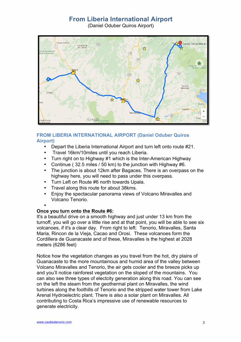
FROM LIBERIA INTERNATIONAL AIRPORT (Daniel Oduber Quiros Airport)
• Depart the Liberia International Airport and turn left onto route #21. • Travel 16km/10miles until you reach Liberia. • Turn right on to Highway #1 which is the Inter-American Highway • Continue ( 32.5 miles / 50 km) to the junction with Highway #6. • The junction is about 12km after Bagaces. There is an overpass on the
highway here, you will need to pass under this overpass. • Turn Left on Route #6 north towards Upala. • Travel along this route for about 38kms. • Enjoy the spectacular panorama views of Volcano Miravalles and
Volcano Tenorio. •
Once you turn onto the Route #6: It's a beautiful drive on a smooth highway and just under 13 km from the turnoff, you will go over a little rise and at that point, you will be able to see six volcanoes, if it's a clear day. From right to left: Tenorio, Miravalles, Santa Maria, Rincon de la Vieja, Cacao and Orosi. These volcanoes form the Cordillera de Guanacaste and of these, Miravalles is the highest at 2028 meters (6286 feet) Notice how the vegetation changes as you travel from the hot, dry plains of Guanacaste to the more mountainous and humid area of the valley between Volcano Miravalles and Tenorio, the air gets cooler and the breeze picks up and you’ll notice rainforest vegetation on the sloped of the mountains. You can also see three types of electcity generation along this road. You can see on the left the steam from the geothermal plant on Miravalles, the wind turbines along the foothills of Tenorio and the stripped water tower from Lake Arenal Hydroelectric plant. There is also a solar plant on Miravalles. All contributing to Costa Rica’s impressive use of renewable resources to generate electricity.
www.casitastenorio.com
4
From La Fortuna
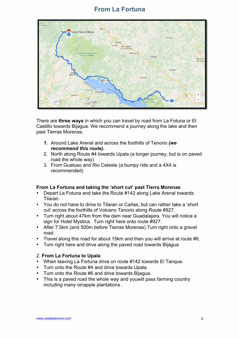
There are three ways in which you can travel by road from La Fotuna or El Castillo towards Bijagua. We recommend a journey along the lake and then past Tierras Morenas.
1. Around Lake Arenal and across the foothills of Tenorio (we recommend this route).
2. North along Route #4 towards Upala (a longer journey, but is on paved road the whole way)
3. From Guatuso and Rio Celeste (a bumpy ride and a 4X4 is recommended)
From La Fortuna and taking the ‘short cut’ past Tierra Morenas • Depart La Fotuna and take the Route #142 along Lake Arenal towards
Tilaran. • You do not have to drive to Tilaran or Cañas, but can rather take a ‘short
cut’ across the foothills of Volcano Tenorio along Route #927. • Turn right about 47km from the dam near Guadalajara. You will notice a
sign for Hotel Mystica. Turn right here onto route #927. • After 7.5km (and 500m before Tierras Morenas) Turn right onto a gravel
road. • Travel along this road for about 15km and then you will arrive at route #6. • Turn right here and drive along the paved road towards Bijagua 2. From La Fortuna to Upala • When leaving La Fortuna drive on route #142 towards El Tanque. • Turn onto the Route #4 and drive towards Upala. • Turn onto the Route #6 and drive towards Bijagua. • This is a paved road the whole way and youwill pass farming country
including many oinapple plantations .
www.casitastenorio.com
5
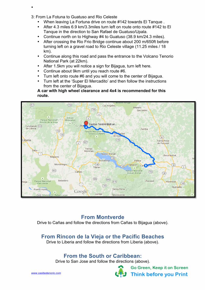
• 3: From La Fotuna to Guatuso and Rio Celeste
• When leaving La Fortuna drive on route #142 towards El Tanque . • After 4.3 miles 6.9 km/3.3miles turn left on route onto route #142 to El
Tanque in the direction to San Rafael de Guatuso/Upala. • Continue north on to Highway #4 to Guatuso (38.9 km/24.3 miles). • After crossing the Rio Frio Bridge continue about 200 m/650ft before
turning left on a gravel road to Rio Celeste village (11.25 miles / 18 km).
• Continue along this road and pass the entrance to the Volcano Tenorio National Park (at 22km).
• After 1.5km you will notice a sign for Bijagua, turn left here. • Continue about 9km until you reach route #6. • Turn left onto route #6 and you will come to the center of Bijagua. • Turn left at the ‘Super El Mercadito’ and then follow the instructions
from the center of Bijagua. A car with high wheel clearance and 4x4 is recommended for this route.
From Montverde Drive to Cañas and follow the directions from Cañas to Bijagua (above).
From Rincon de la Vieja or the Pacific Beaches Drive to Liberia and follow the directions from Liberia (above).
From the South or Caribbean: Drive to San Jose and follow the directions (above).