census geography & chass - carleton university
TRANSCRIPT
CENSUS GEOGRAPHY & CHASS
Atlantic DLI Regional Training
Sandra Sawchuk, Mount Saint Vincent University
2019-05-09
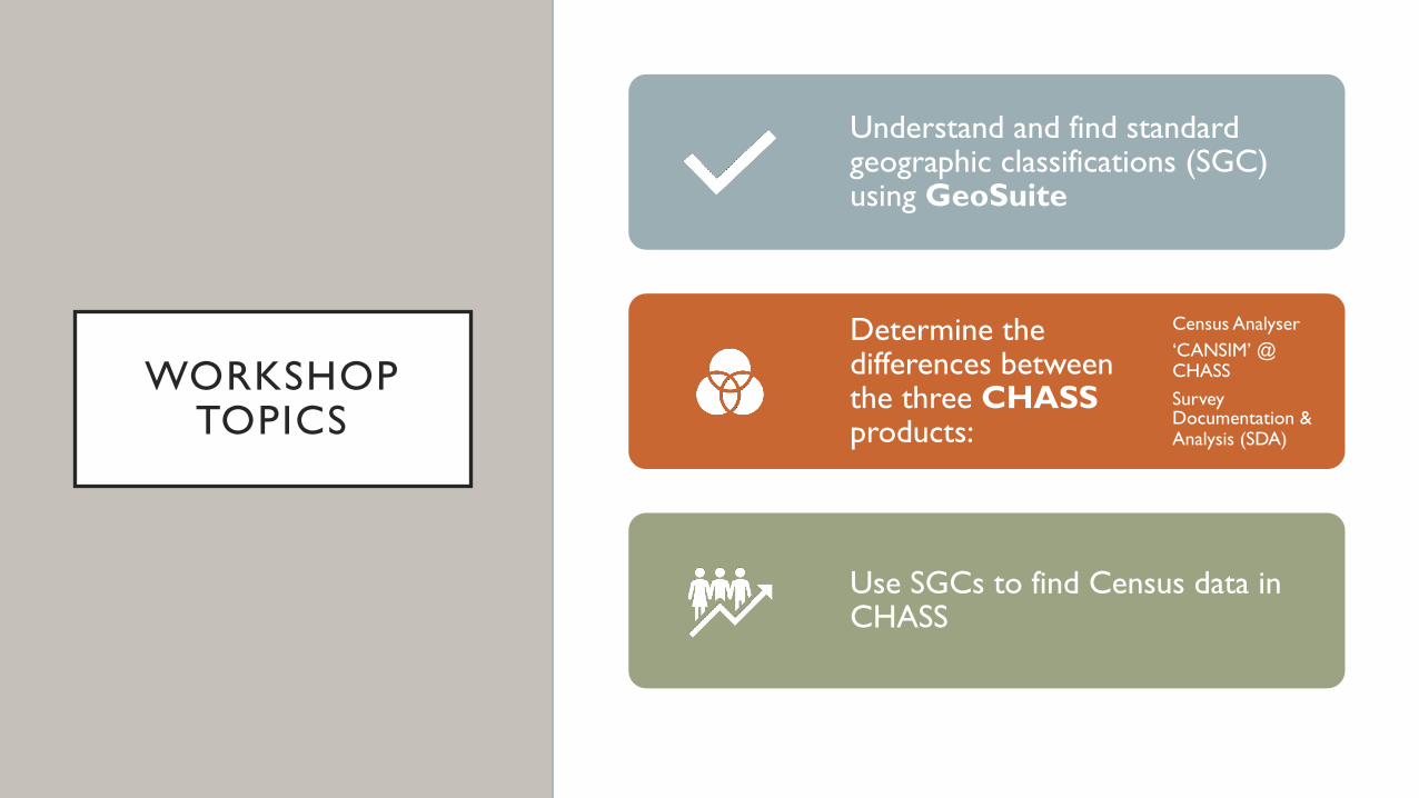
WORKSHOP TOPICS
Understand and find standard geographic classifications (SGC) using GeoSuite
Determine the differences between the three CHASSproducts:
Census Analyser‘CANSIM’ @ CHASSSurvey Documentation & Analysis (SDA)
Use SGCs to find Census data in CHASS
CENSUS GEOGRAPHY
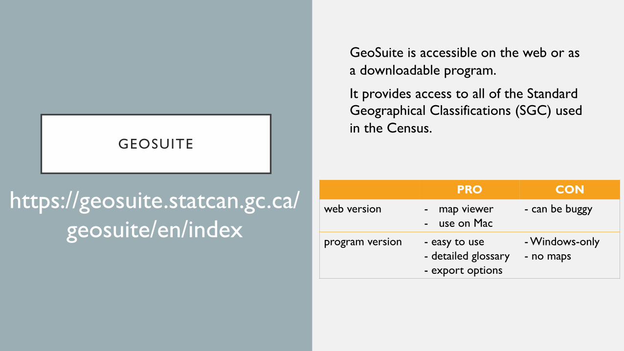
GEOSUITE
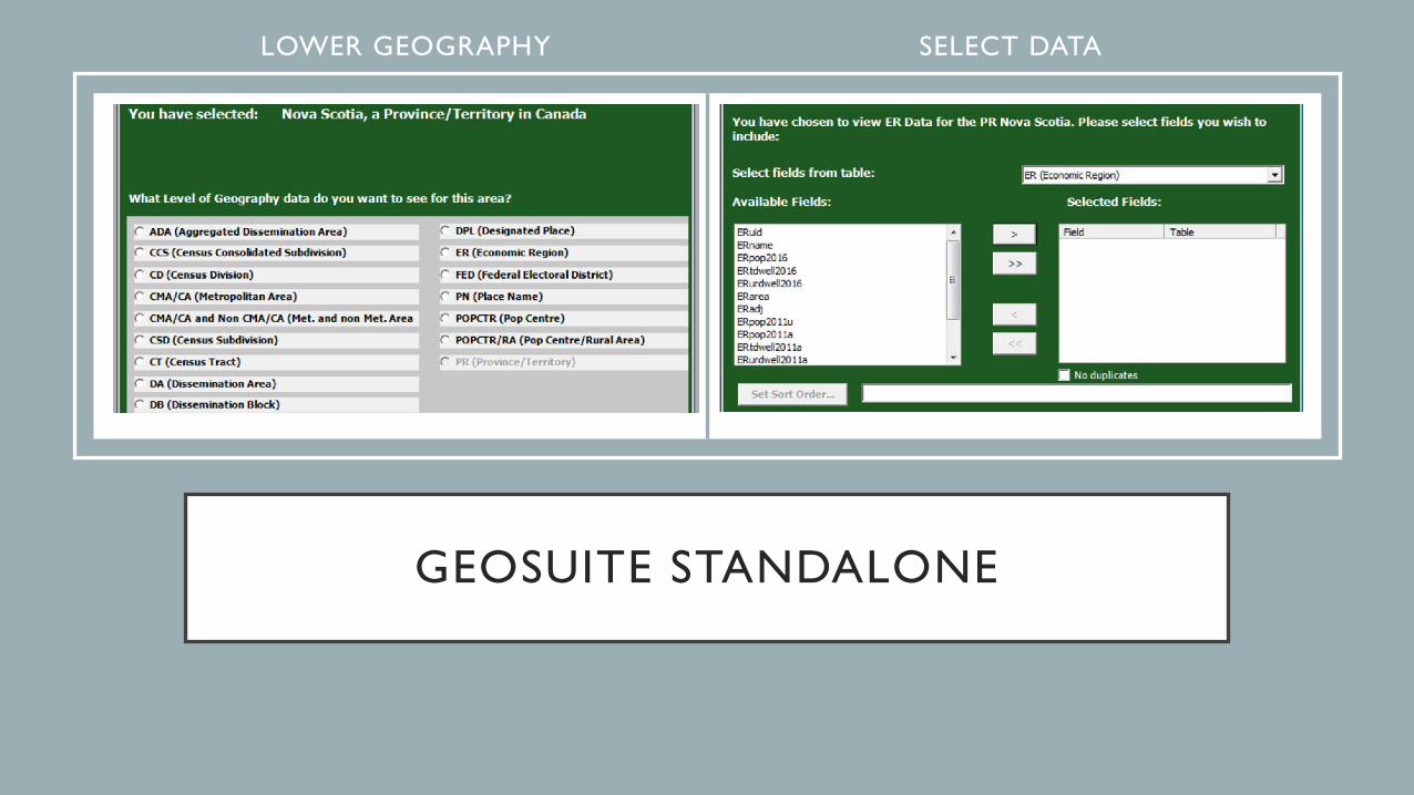
GeoSuite is accessible on the web or as a downloadable program.
It provides access to all of the Standard Geographical Classifications (SGC) used in the Census.
https://geosuite.statcan.gc.ca/geosuite/en/index
PRO CON
web version - map viewer- use on Mac
- can be buggy
program version - easy to use- detailed glossary- export options
- Windows-only- no maps
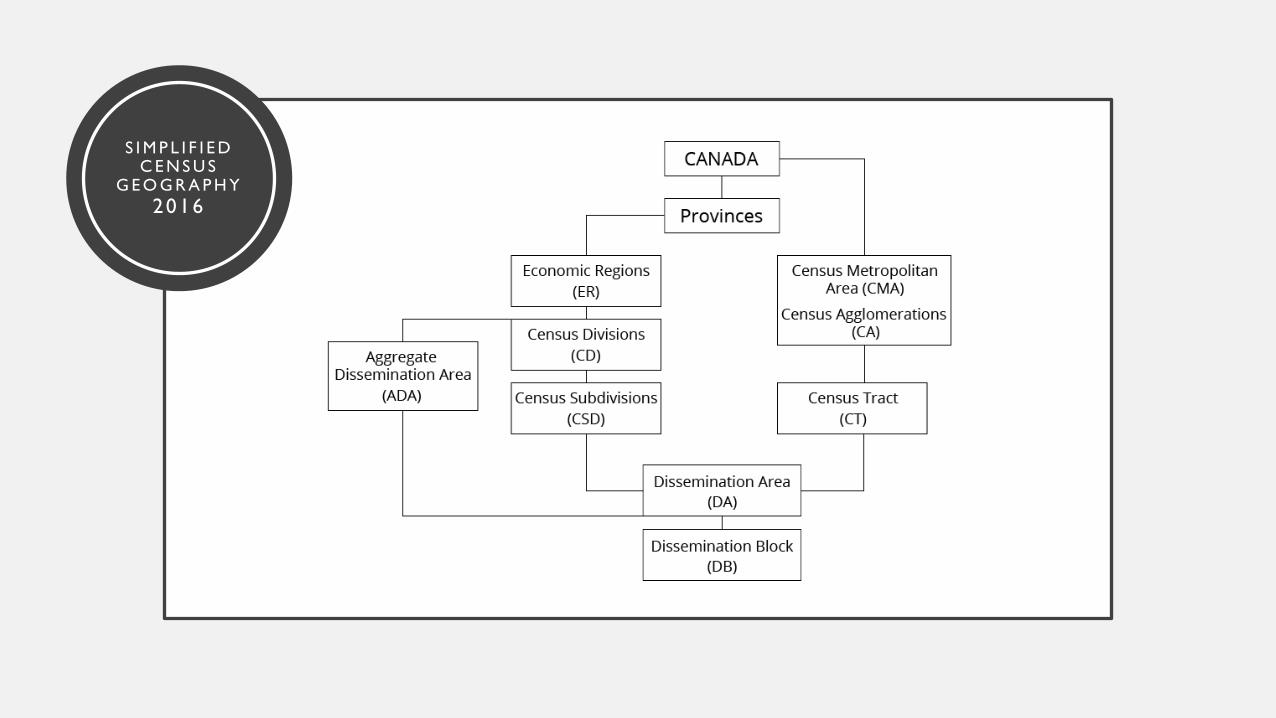
S I M P L I F I E D C E N S U S
G E O G R A P H Y2016
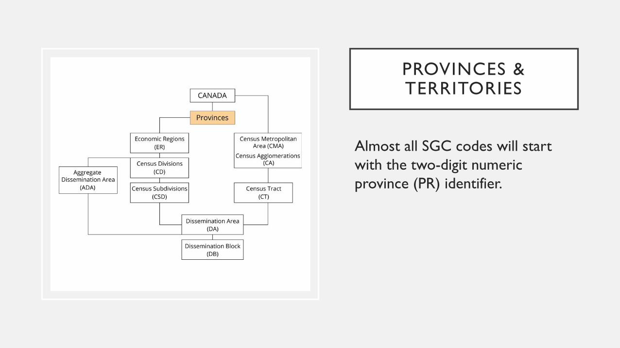
PROVINCES & TERRITORIES
Almost all SGC codes will start with the two-digit numeric province (PR) identifier.
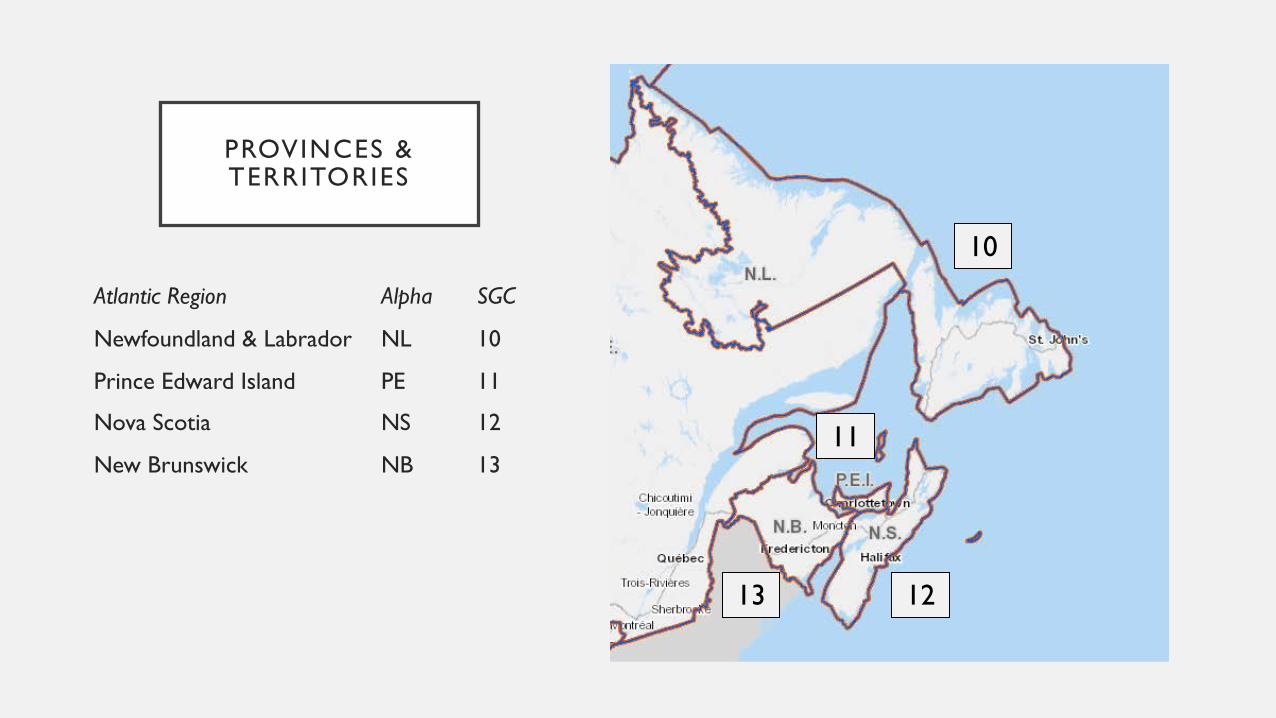
PROVINCES & TERRITORIES
Atlantic Region Alpha SGC
Newfoundland & Labrador NL 10
Prince Edward Island PE 11
Nova Scotia NS 12
New Brunswick NB 13
10
12
11
13
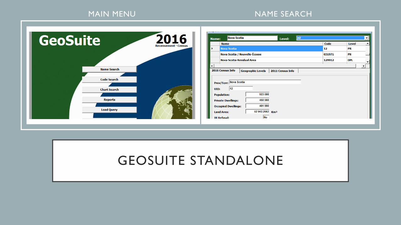
GEOSUITE STANDALONE
MAIN MENU NAME SEARCH
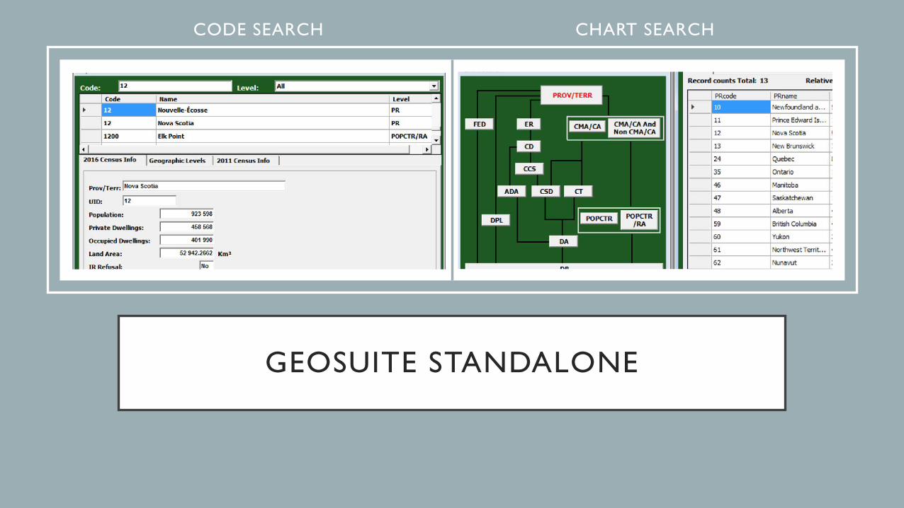
GEOSUITE STANDALONE
CODE SEARCH CHART SEARCH
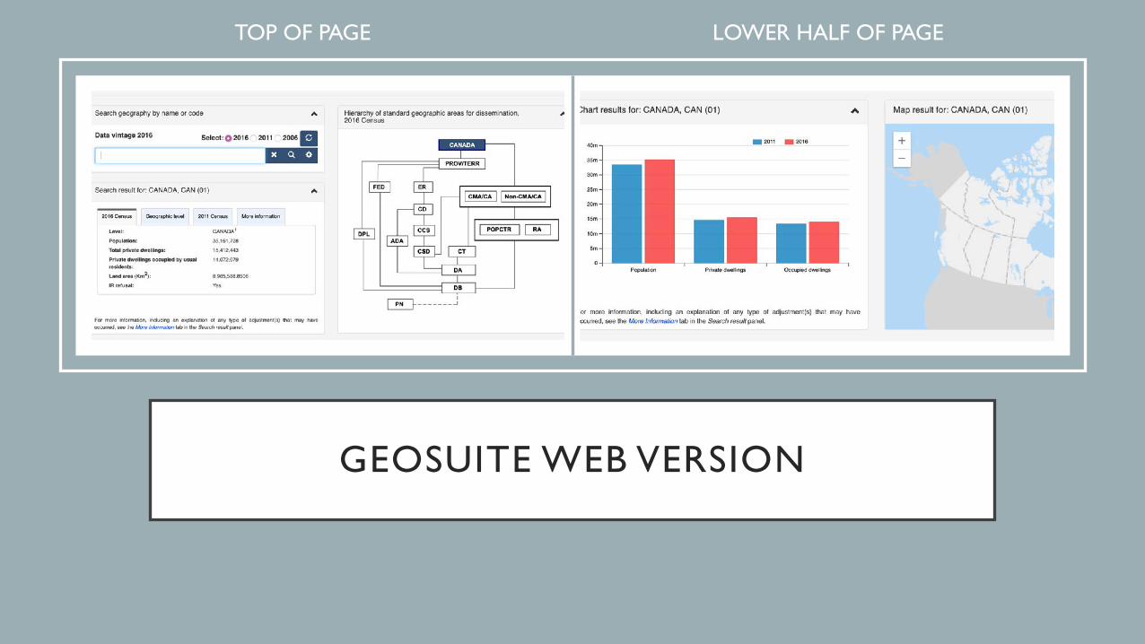
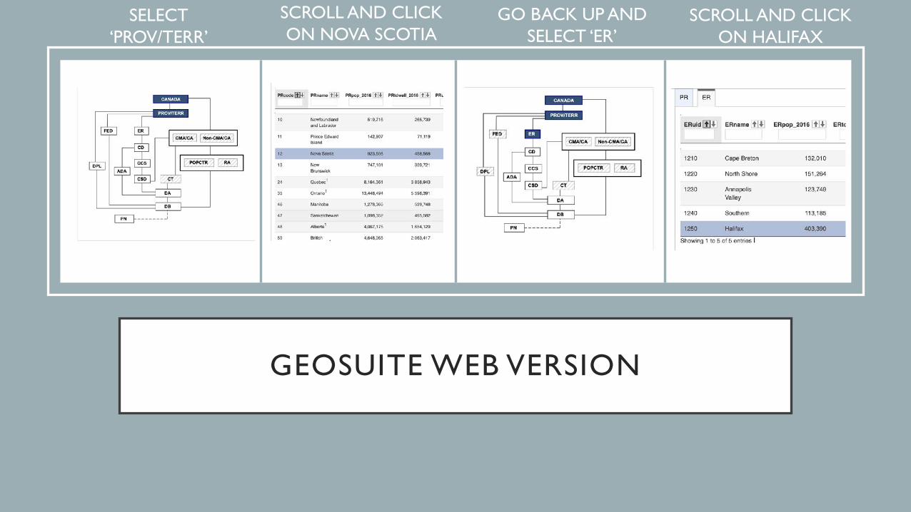
GEOSUITE WEB VERSION
• TOP OF PAGE • LOWER HALF OF PAGE
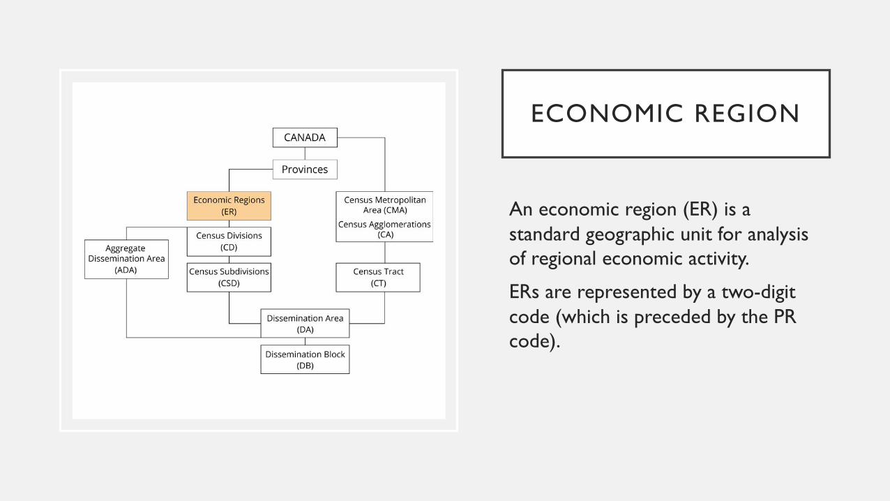
ECONOMIC REGION
An economic region (ER) is a standard geographic unit for analysis of regional economic activity.
ERs are represented by a two-digit code (which is preceded by the PR code).
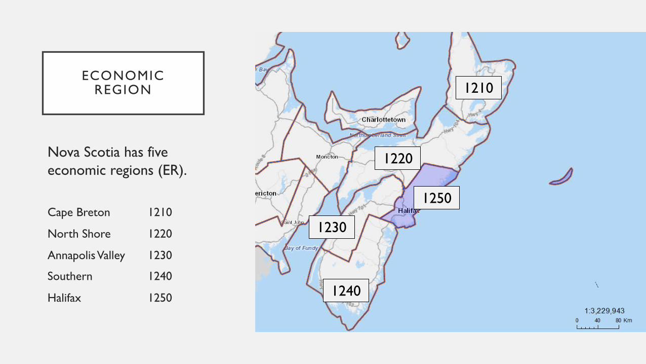
ECONOMIC REGION
Nova Scotia has five economic regions (ER).
Cape Breton 1210
North Shore 1220
Annapolis Valley 1230
Southern 1240
Halifax 1250
1210
1240
1220
1250
1230
GEOSUITE STANDALONE
LOWER GEOGRAPHY SELECT DATA
GEOSUITE WEB VERSION
• SELECT‘PROV/TERR’
• SCROLL AND CLICK ON HALIFAX
• SCROLL AND CLICK ON NOVA SCOTIA
• GO BACK UP AND SELECT ‘ER’
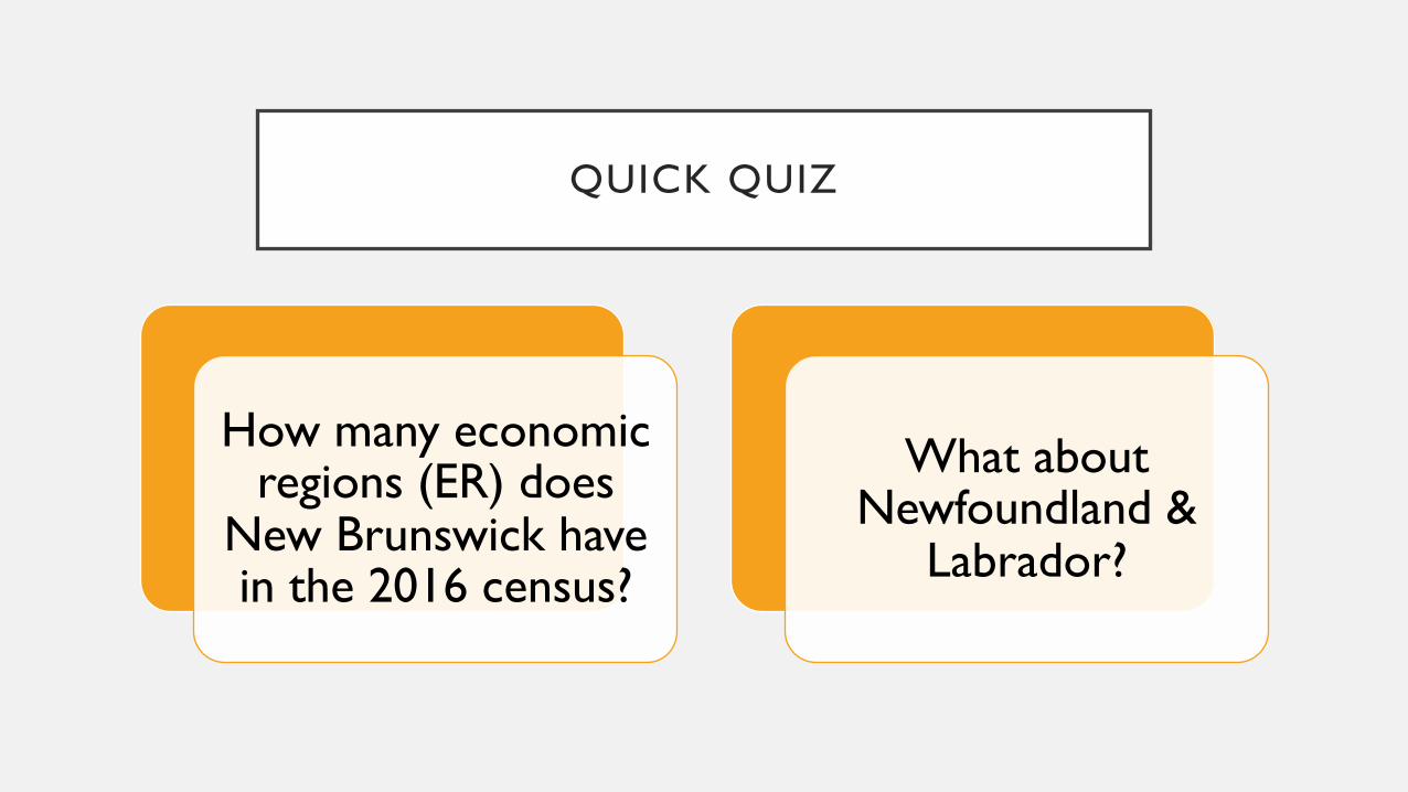
QUICK QUIZ
How many economic regions (ER) does
New Brunswick have in the 2016 census?
What about Newfoundland &
Labrador?
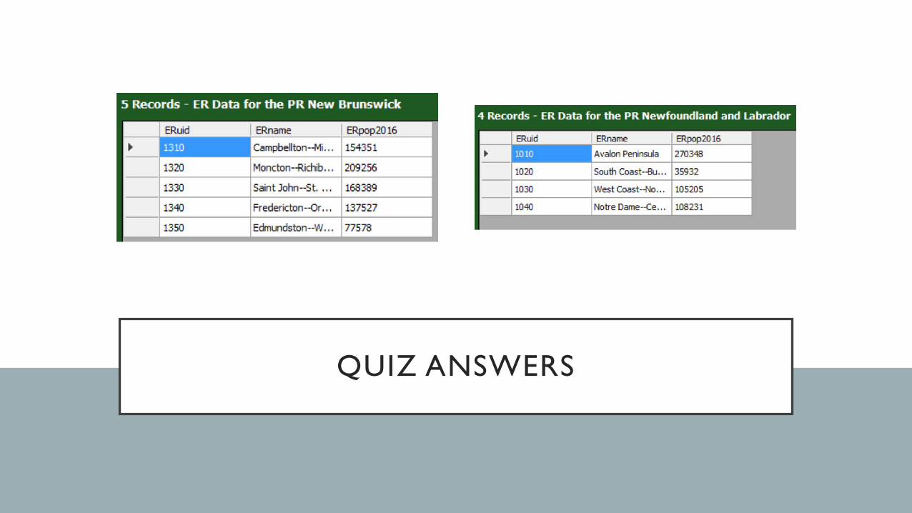
QUIZ ANSWERS
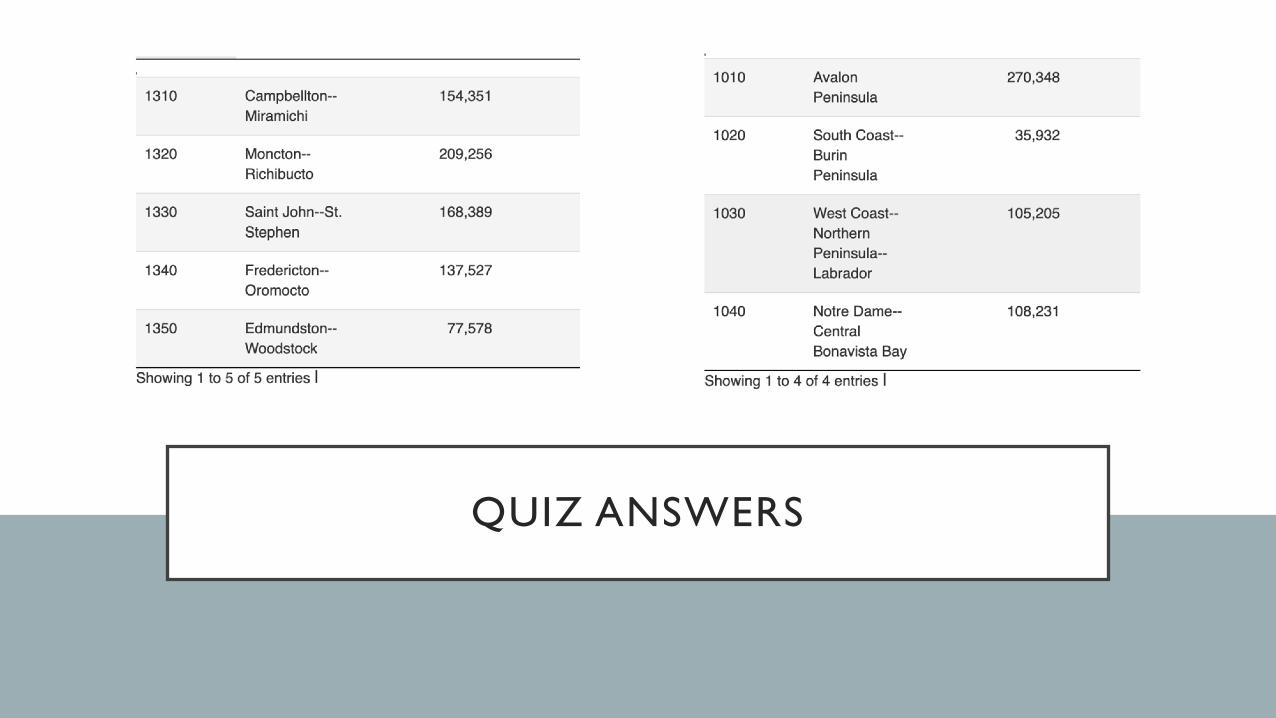
QUIZ ANSWERS
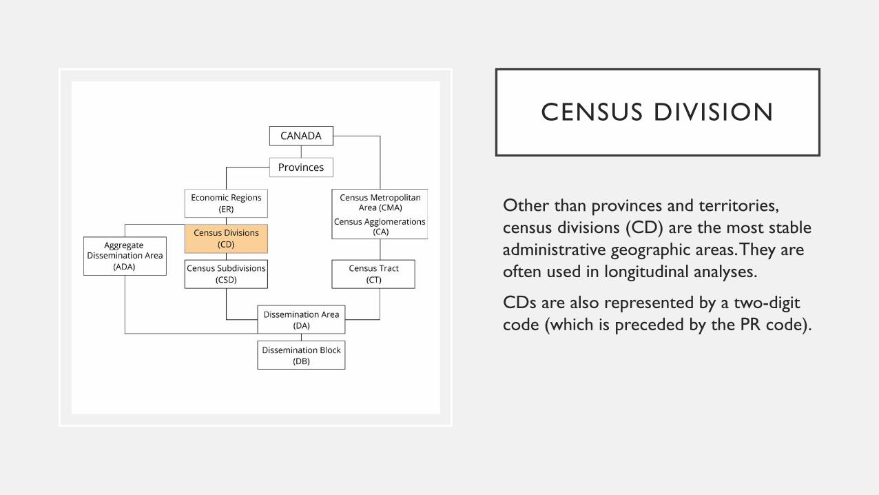
CENSUS DIVISION
Other than provinces and territories, census divisions (CD) are the most stable administrative geographic areas. They are often used in longitudinal analyses.
CDs are also represented by a two-digit code (which is preceded by the PR code).
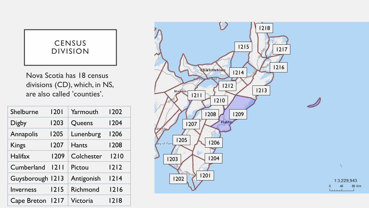
CENSUS DIVISION
Nova Scotia has 18 census divisions (CD), which, in NS, are also called ’counties’.
1209Shelburne 1201 Yarmouth 1202
Digby 1203 Queens 1204
Annapolis 1205 Lunenburg 1206
Kings 1207 Hants 1208
Halifax 1209 Colchester 1210
Cumberland 1211 Pictou 1212
Guysborough 1213 Antigonish 1214
Inverness 1215 Richmond 1216
Cape Breton 1217 Victoria 1218
1213
12101211
1206
1204
1212
1214
1218
1217
1216
1215
1208
1207
1205
1203
1202 1201
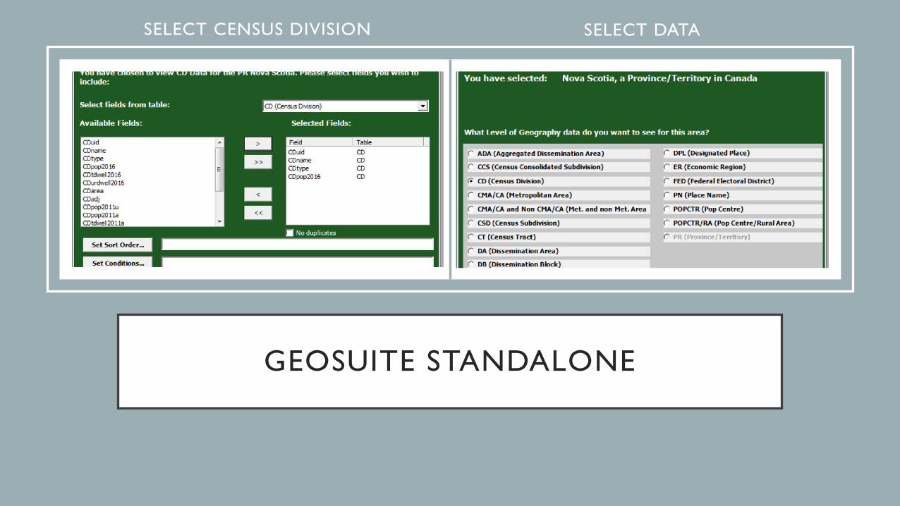
GEOSUITE STANDALONE
SELECT CENSUS DIVISION SELECT DATA
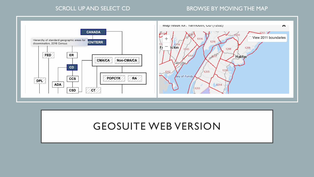
GEOSUITE WEB VERSION
• SCROLL UP AND SELECT CD • BROWSE BY MOVING THE MAP
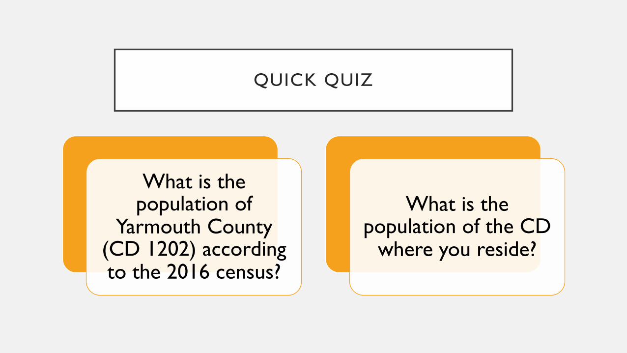
QUICK QUIZ
What is the population of
Yarmouth County (CD 1202) according to the 2016 census?
What is the population of the CD
where you reside?
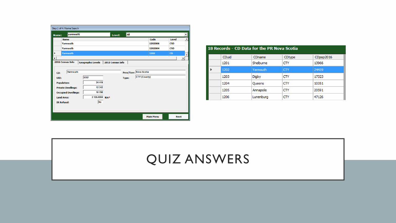
QUIZ ANSWERS
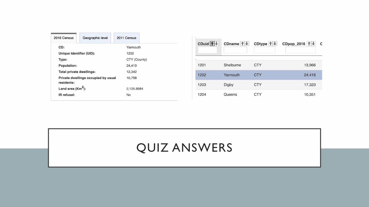
QUIZ ANSWERS
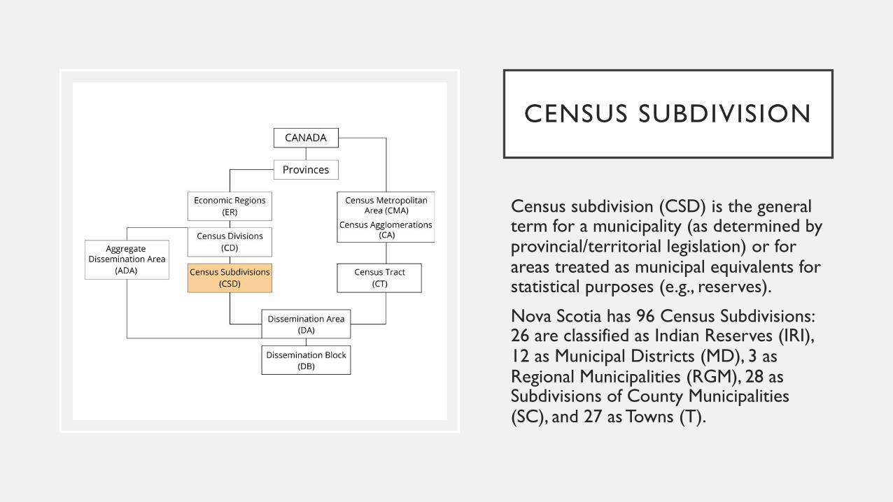
CENSUS SUBDIVISION
Census subdivision (CSD) is the general term for a municipality (as determined by provincial/territorial legislation) or for areas treated as municipal equivalents for statistical purposes (e.g., reserves).
Nova Scotia has 96 Census Subdivisions:26 are classified as Indian Reserves (IRI), 12 as Municipal Districts (MD), 3 as Regional Municipalities (RGM), 28 as Subdivisions of County Municipalities (SC), and 27 as Towns (T).
CENSUS SUBDIVISION
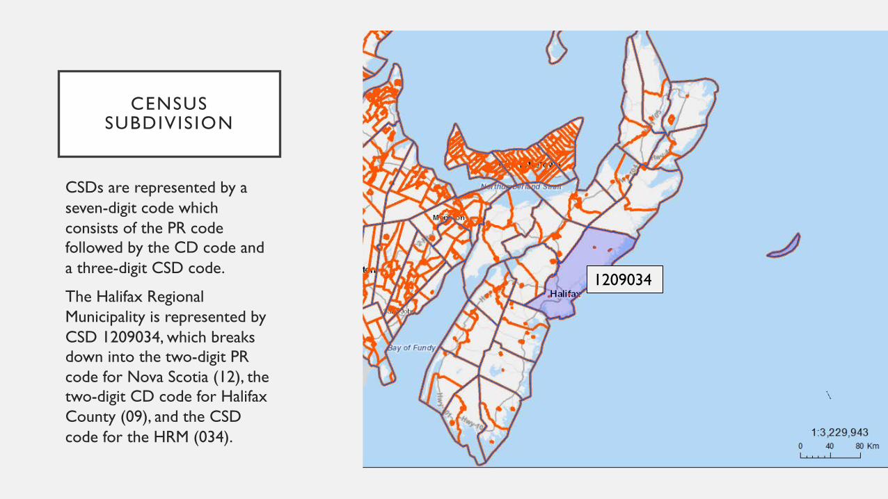
CSDs are represented by a seven-digit code which consists of the PR code followed by the CD code and a three-digit CSD code.
The Halifax Regional Municipality is represented by CSD 1209034, which breaks down into the two-digit PR code for Nova Scotia (12), the two-digit CD code for Halifax County (09), and the CSD code for the HRM (034).
1209034
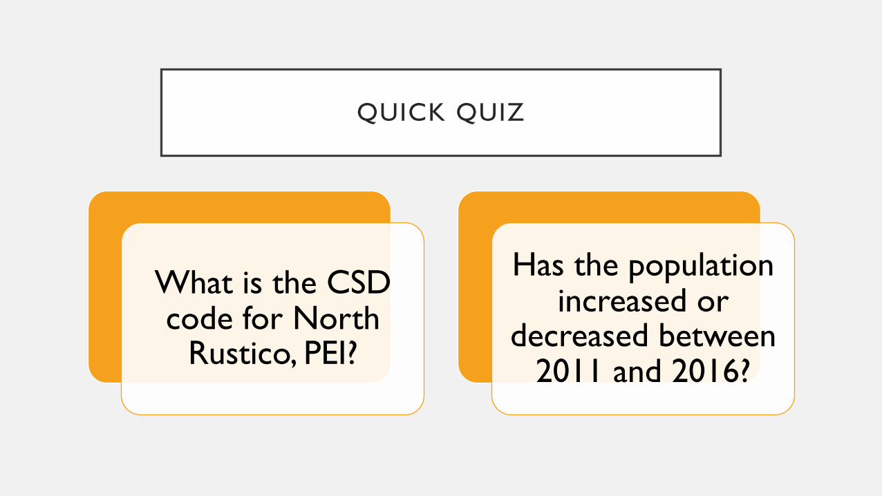
QUICK QUIZ
What is the CSD code for North
Rustico, PEI?
Has the population increased or
decreased between 2011 and 2016?
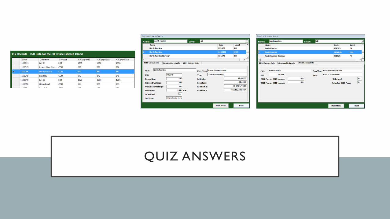
QUIZ ANSWERS
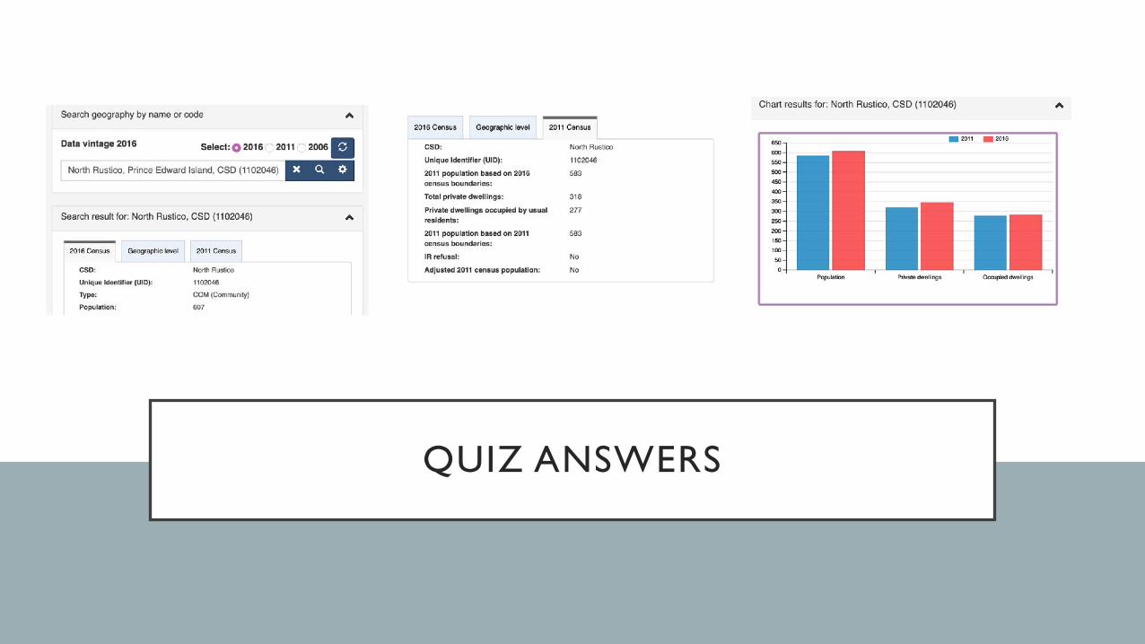
QUIZ ANSWERS

AGGREGATE DISSEMINATION AREA
New in 2016: Aggregate dissemination areas (ADA) cover the entire country and, where possible, have a population between 5,000 and 15,000 based on the previous census population counts.
ADAs are represented by an eight-digit code which consists of the PR code followed by the CD code and a four-digit ADA code.

AGGREGATE DISSEMINATION
AREA
Halifax County has 57 ADAs.
Mount Saint Vincent University is located in ADA 12090057, which breaks down into the two-digit PR code for Nova Scotia (12), the two-digit CD code for Halifax County (09), and the ADA code for the area in which MSVU is located (0057).
12090057
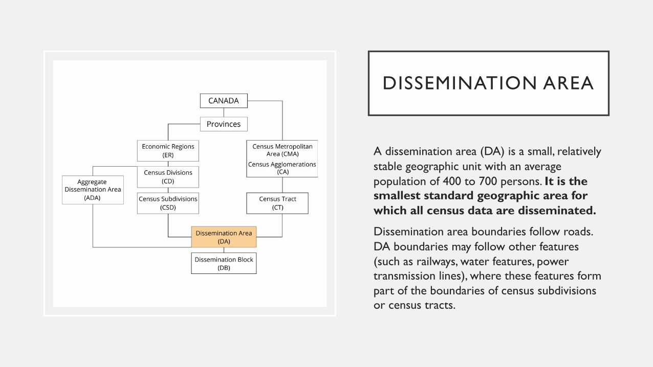
DISSEMINATION AREA
A dissemination area (DA) is a small, relatively stable geographic unit with an average population of 400 to 700 persons. It is the smallest standard geographic area for which all census data are disseminated.
Dissemination area boundaries follow roads. DA boundaries may follow other features (such as railways, water features, power transmission lines), where these features form part of the boundaries of census subdivisions or census tracts.
DISSEMINATION AREA
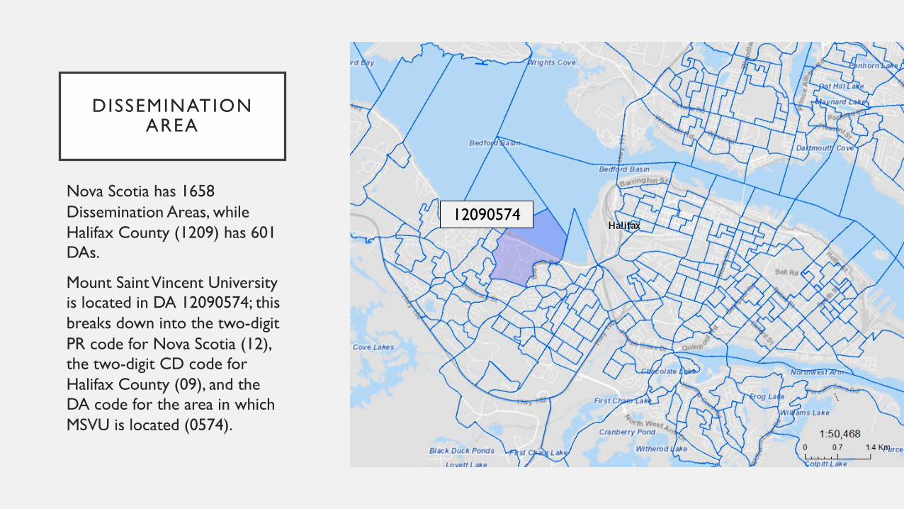
Nova Scotia has 1658 Dissemination Areas, while Halifax County (1209) has 601 DAs.
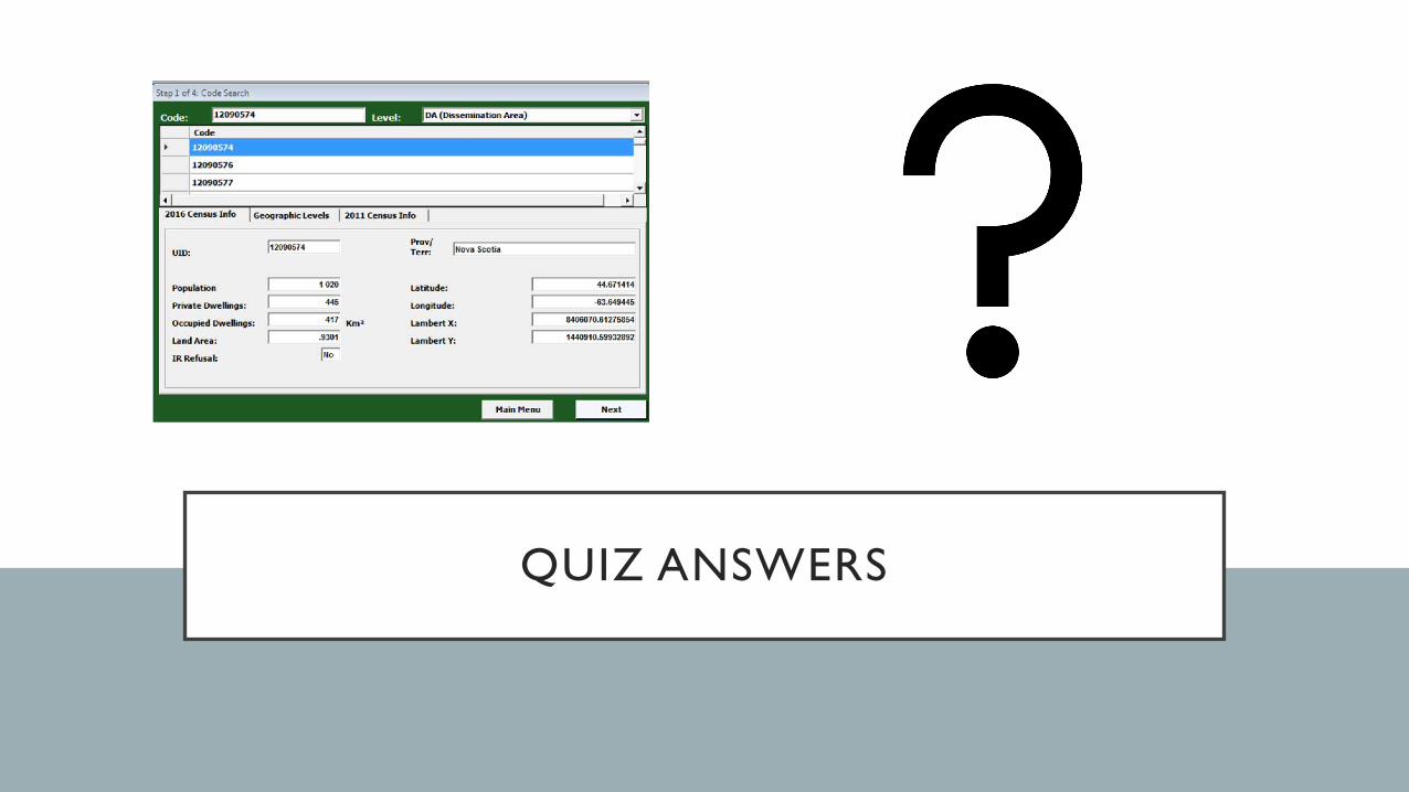
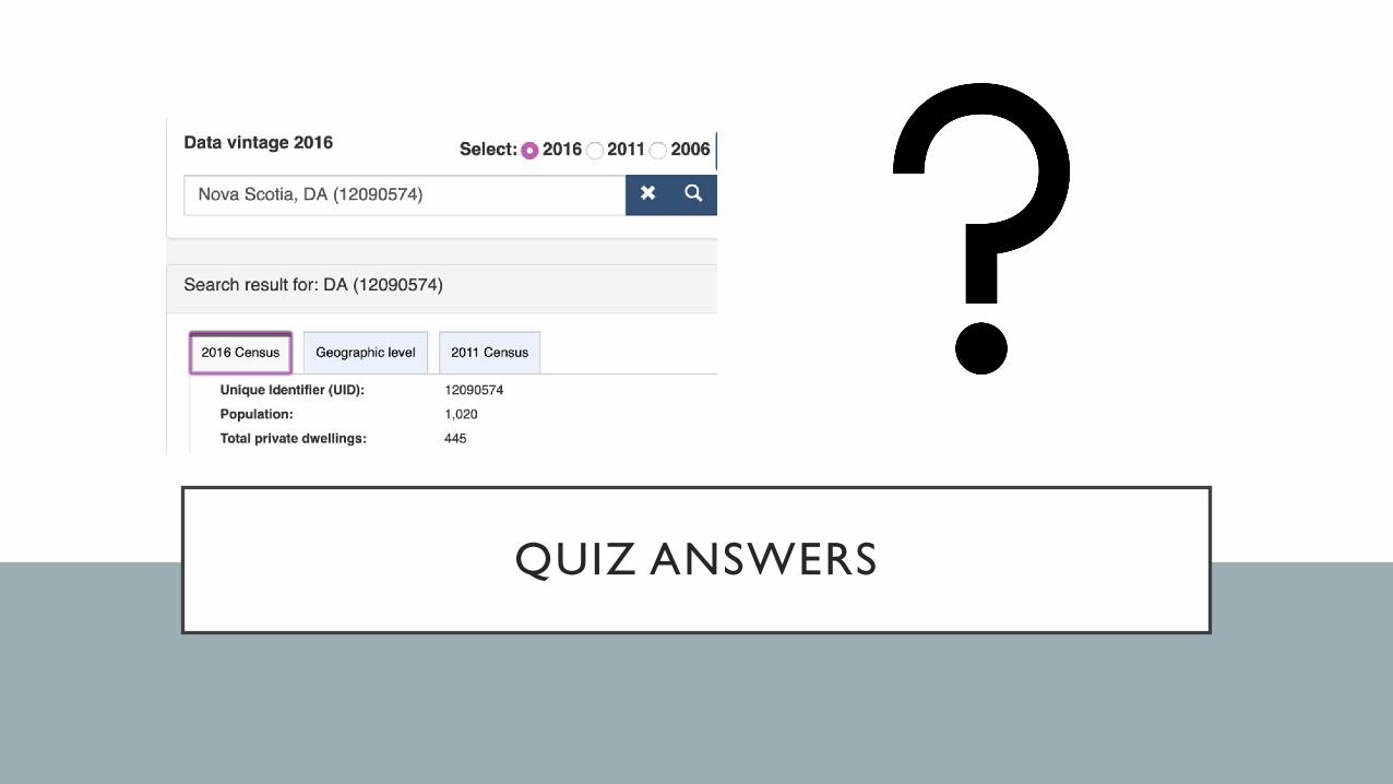
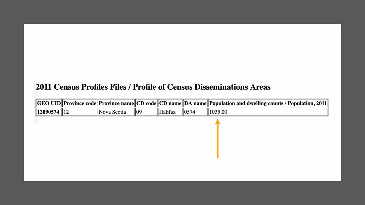
Mount Saint Vincent University is located in DA 12090574; this breaks down into the two-digit PR code for Nova Scotia (12), the two-digit CD code for Halifax County (09), and the DA code for the area in which MSVU is located (0574).
12090574
QUICK QUIZ
What is the 2016 population of DA
12090574?
Why is there no data for 2011?
QUIZ ANSWERS
QUIZ ANSWERS
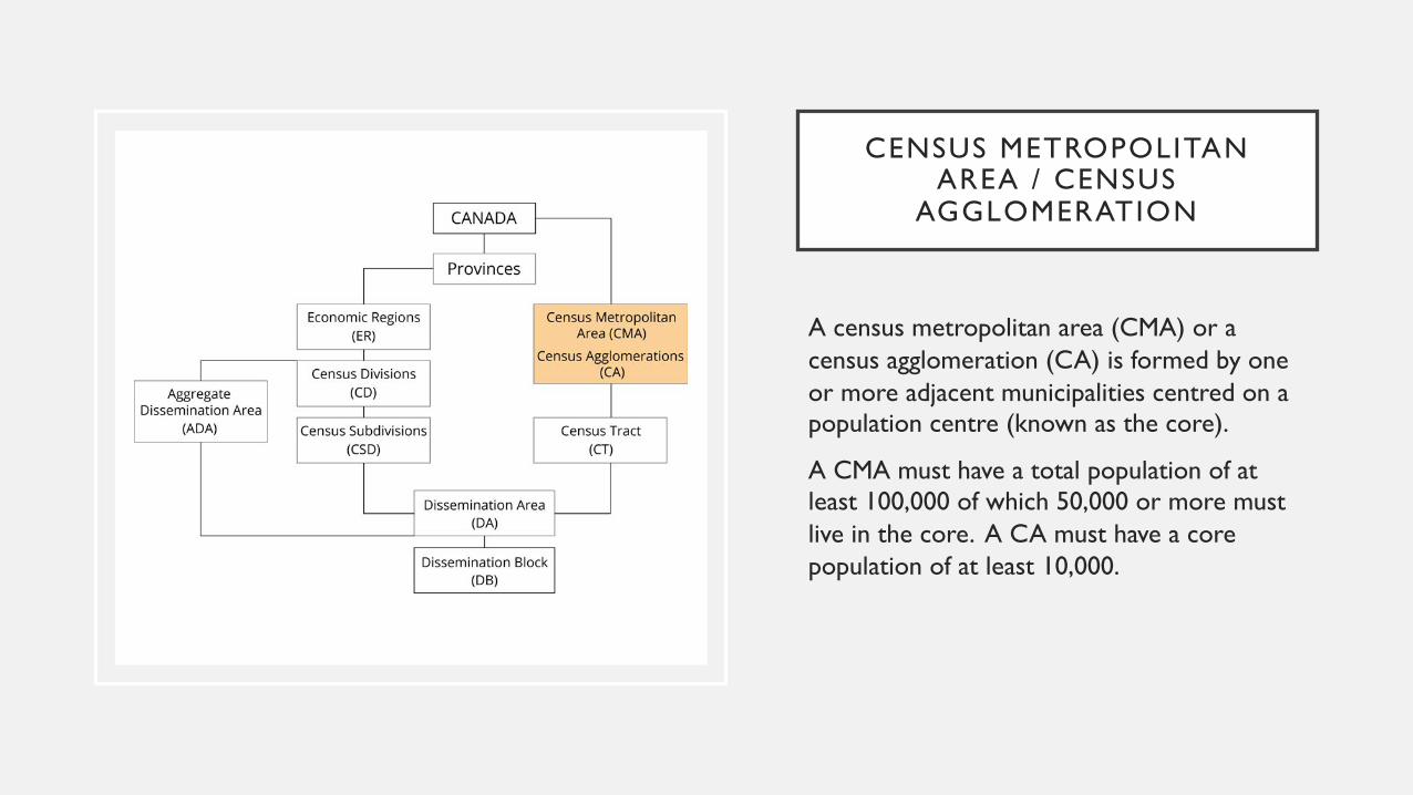
CENSUS METROPOLITAN AREA / CENSUS
AGGLOMERATION
A census metropolitan area (CMA) or a census agglomeration (CA) is formed by one or more adjacent municipalities centred on a population centre (known as the core).
A CMA must have a total population of at least 100,000 of which 50,000 or more must live in the core. A CA must have a core population of at least 10,000.
CENSUS METROPOLITAN AREA / CENSUS
AGGLOMERATION
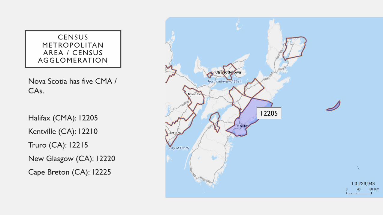
Nova Scotia has five CMA / CAs.
Halifax (CMA): 12205
Kentville (CA): 12210
Truro (CA): 12215
New Glasgow (CA): 12220
Cape Breton (CA): 12225
12205
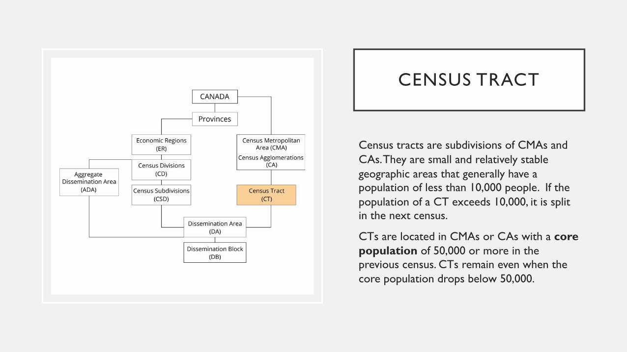
CENSUS TRACT
Census tracts are subdivisions of CMAs and CAs. They are small and relatively stable geographic areas that generally have a population of less than 10,000 people. If the population of a CT exceeds 10,000, it is split in the next census.
CTs are located in CMAs or CAs with a core population of 50,000 or more in the previous census. CTs remain even when thecore population drops below 50,000.
CENSUS TRACT
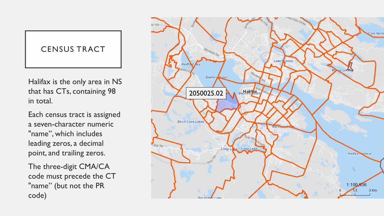
Halifax is the only area in NS that has CTs, containing 98 in total.
Each census tract is assigned a seven-character numeric "name”, which includes leading zeros, a decimal point, and trailing zeros.
The three-digit CMA/CA code must precede the CT "name” (but not the PR code)
2050025.02
WHAT IS CHASS?
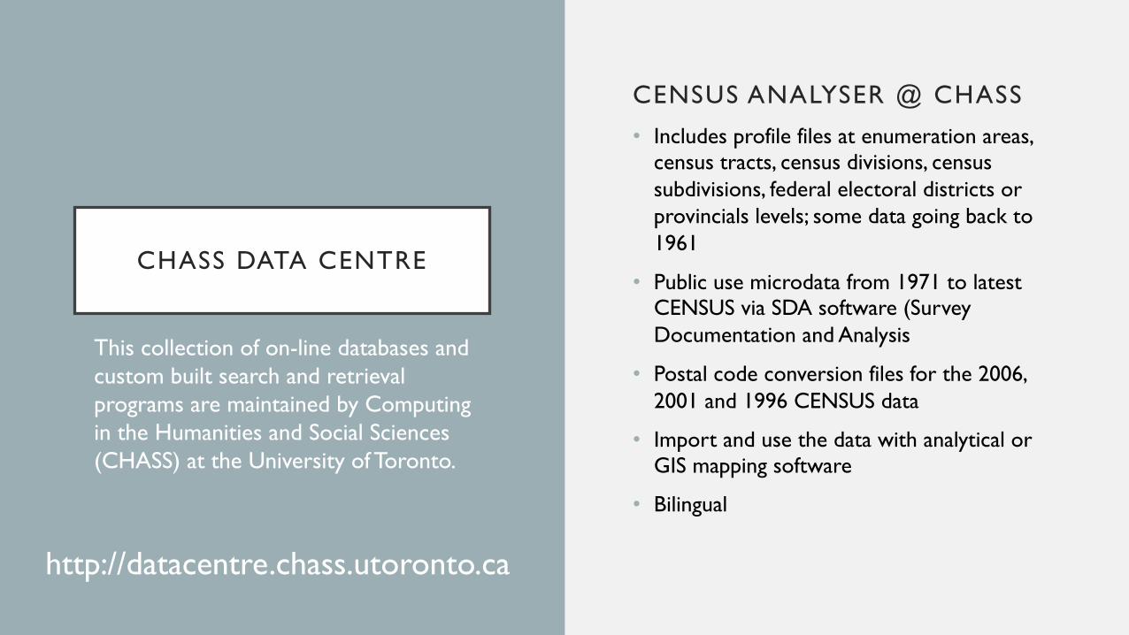
CHASS DATA CENTRE
CENSUS ANALYSER @ CHASS
• Includes profile files at enumeration areas, census tracts, census divisions, census subdivisions, federal electoral districts or provincials levels; some data going back to 1961
• Public use microdata from 1971 to latest CENSUS via SDA software (Survey Documentation and Analysis
• Postal code conversion files for the 2006, 2001 and 1996 CENSUS data
• Import and use the data with analytical or GIS mapping software
• Bilingual
This collection of on-line databases and custom built search and retrieval programs are maintained by Computing in the Humanities and Social Sciences (CHASS) at the University of Toronto.
http://datacentre.chass.utoronto.ca
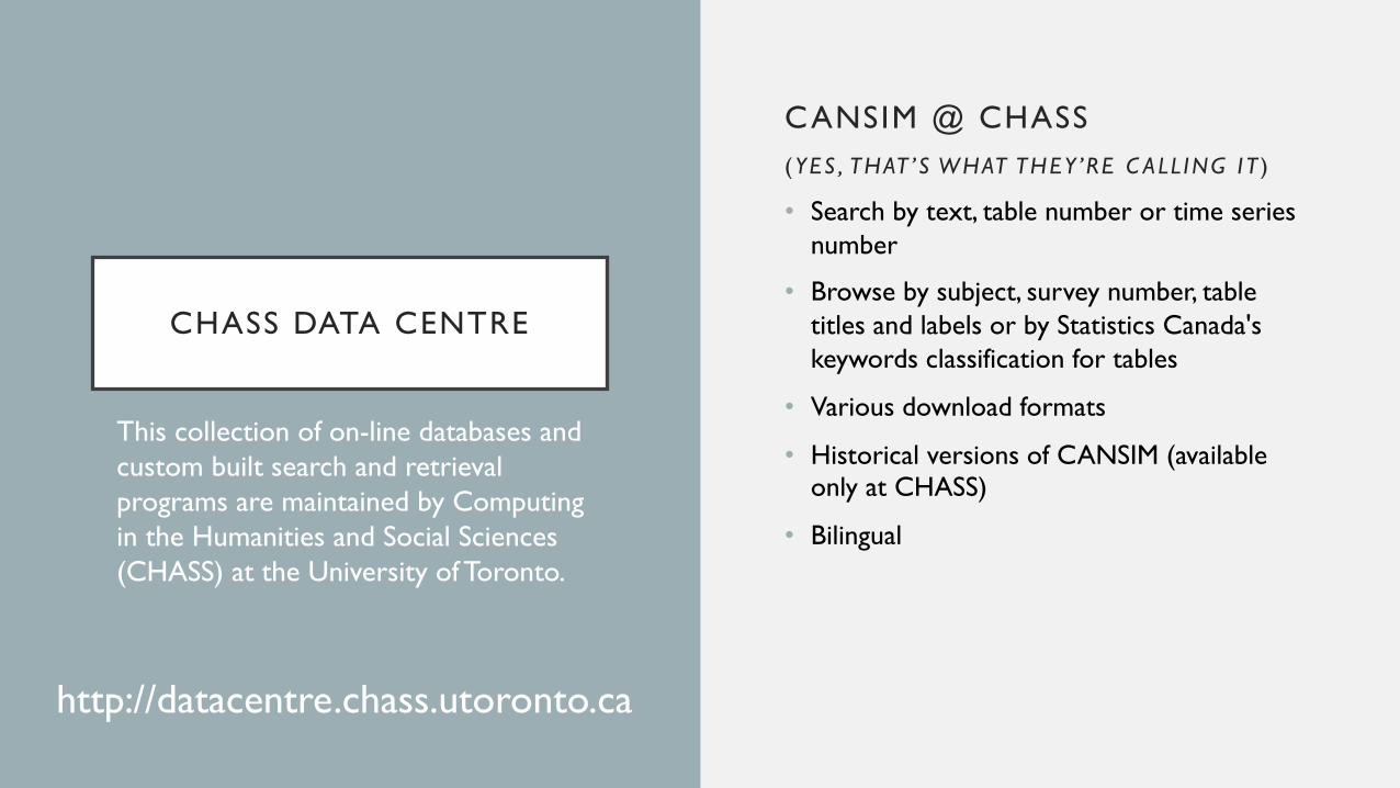
CHASS DATA CENTRE
CANSIM @ CHASS(YES , THAT ’S WHAT THEY ’RE C ALL ING I T )
• Search by text, table number or time series number
• Browse by subject, survey number, table titles and labels or by Statistics Canada's keywords classification for tables
• Various download formats
• Historical versions of CANSIM (available only at CHASS)
• Bilingual
This collection of on-line databases and custom built search and retrieval programs are maintained by Computing in the Humanities and Social Sciences (CHASS) at the University of Toronto.
http://datacentre.chass.utoronto.ca
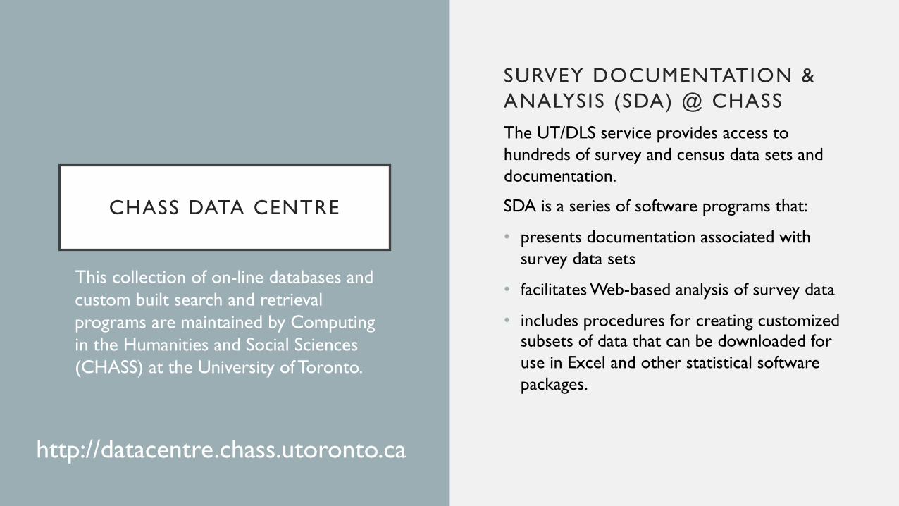
CHASS DATA CENTRE
SURVEY DOCUMENTATION & ANALYSIS (SDA) @ CHASSThe UT/DLS service provides access to hundreds of survey and census data sets and documentation.
SDA is a series of software programs that:
• presents documentation associated with survey data sets
• facilitates Web-based analysis of survey data
• includes procedures for creating customized subsets of data that can be downloaded for use in Excel and other statistical software packages.
This collection of on-line databases and custom built search and retrieval programs are maintained by Computing in the Humanities and Social Sciences (CHASS) at the University of Toronto.
http://datacentre.chass.utoronto.ca
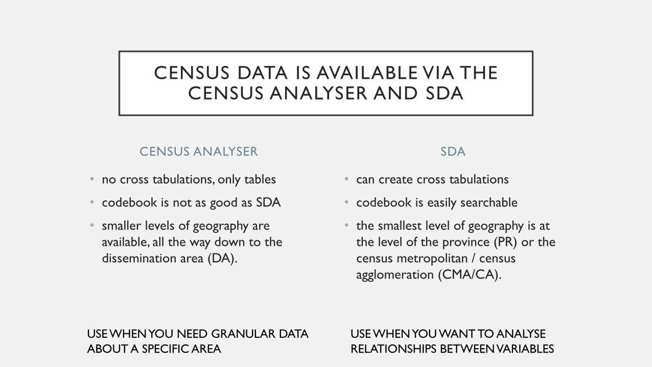
CENSUS ANALYSER
• no cross tabulations, only tables
• codebook is not as good as SDA
• smaller levels of geography are available, all the way down to the dissemination area (DA).
• can create cross tabulations
• codebook is easily searchable
• the smallest level of geography is at the level of the province (PR) or the census metropolitan / census agglomeration (CMA/CA).
SDA
CENSUS DATA IS AVAILABLE VIA THE CENSUS ANALYSER AND SDA
USE WHEN YOU NEED GRANULAR DATAABOUT A SPECIFIC AREA
USE WHEN YOU WANT TO ANALYSERELATIONSHIPS BETWEEN VARIABLES
FINDING CENSUS DATA
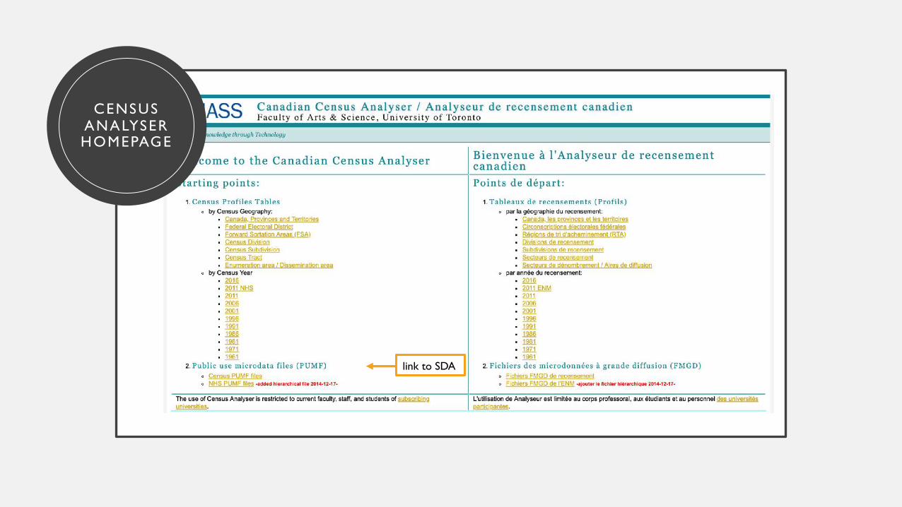
CENSUS ANALYSERHOMEPAGE
link to SDA
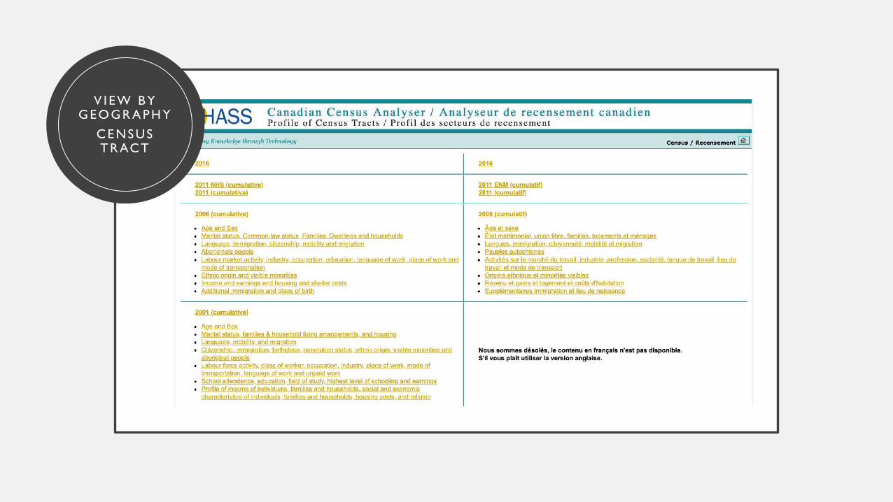
V I E W B Y G E O G R A P H Y
C E NS U ST R AC T
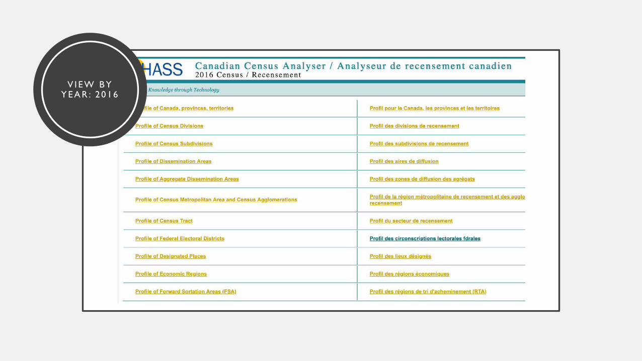
V I E W B Y Y E A R : 2 0 1 6
LET’S FIND OUT WHAT THE 2011 POPULATION OF DA 12090574 WAS!

HOW TO FIND THE 2011 POPULATION OF DA 12090574
select census 2011
1click on ‘Profile of Dissemination Areas’
2click ‘Select All’ for Name
3click ‘Nova Scotia’ for Province
4
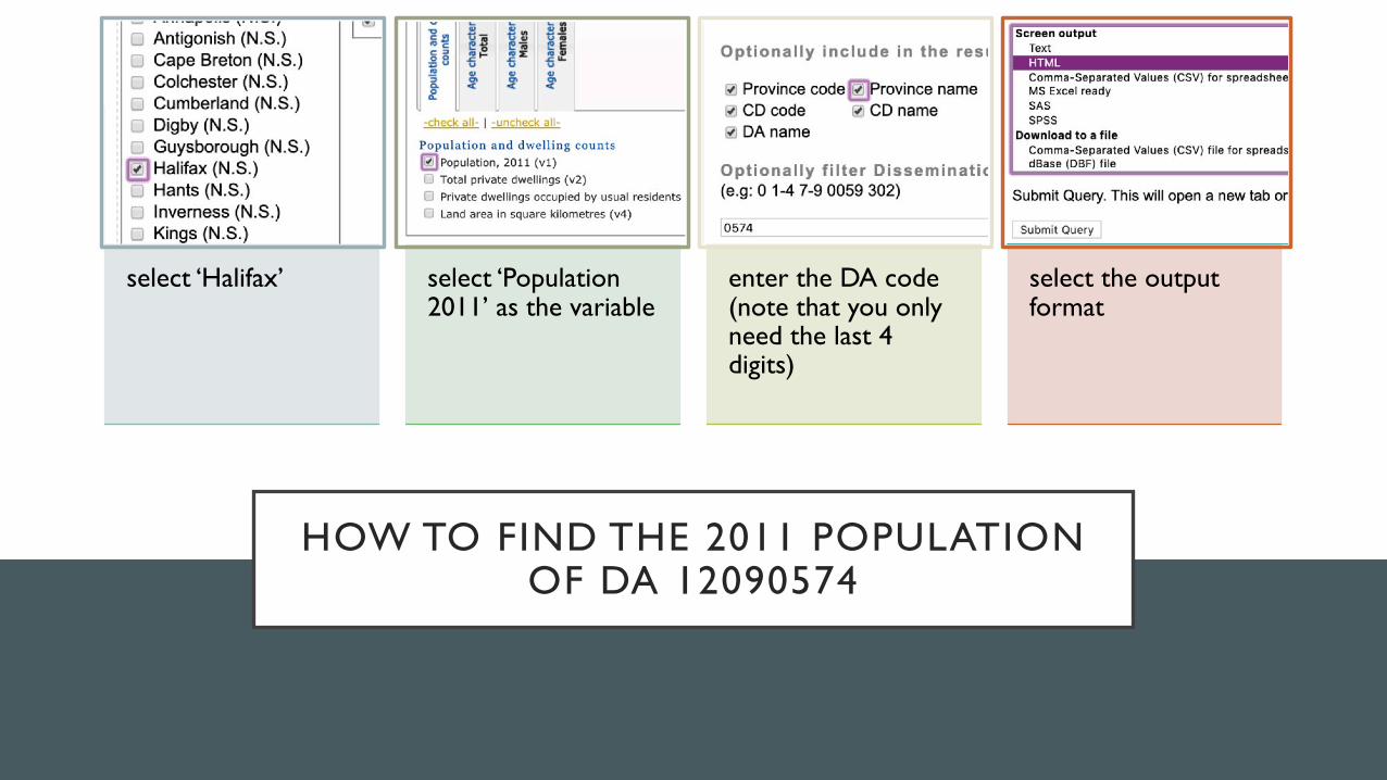
HOW TO FIND THE 2011 POPULATION OF DA 12090574
select ‘Halifax’
1select ‘Population 2011’ as the variable
2enter the DA code (note that you only need the last 4 digits)
3select the output format
4
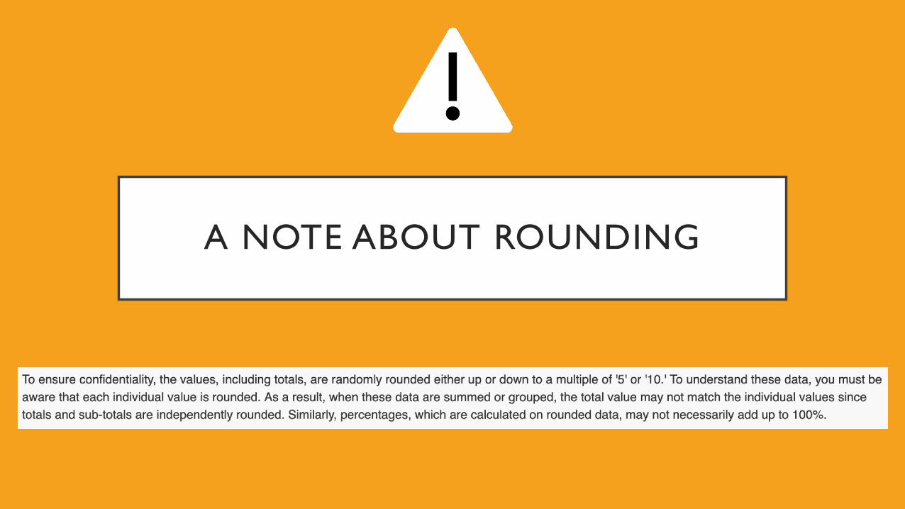
A NOTE ABOUT ROUNDING
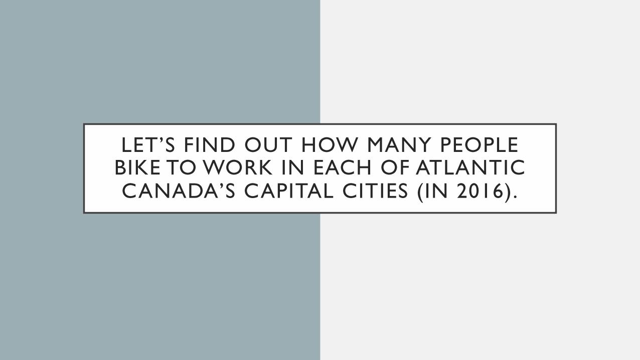
LET’S FIND OUT HOW MANY PEOPLE BIKE TO WORK IN EACH OF ATLANTIC CANADA’S CAPITAL CITIES (IN 2016).
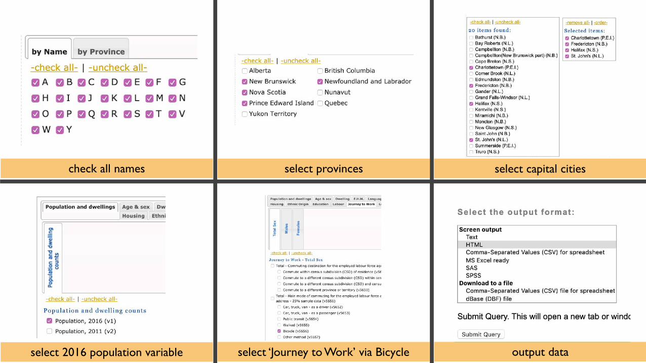
check all names select provinces select capital cities
select 2016 population variable select ‘Journey to Work’ via Bicycle output data
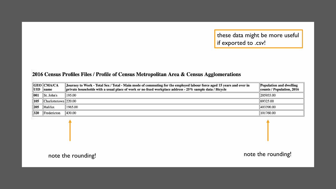
note the rounding!note the rounding!
these data might be more usefulif exported to .csv!

BONUS: HOW MANY FRENCH SPEAKERS ARE IN YOUR DA FOR 2016?
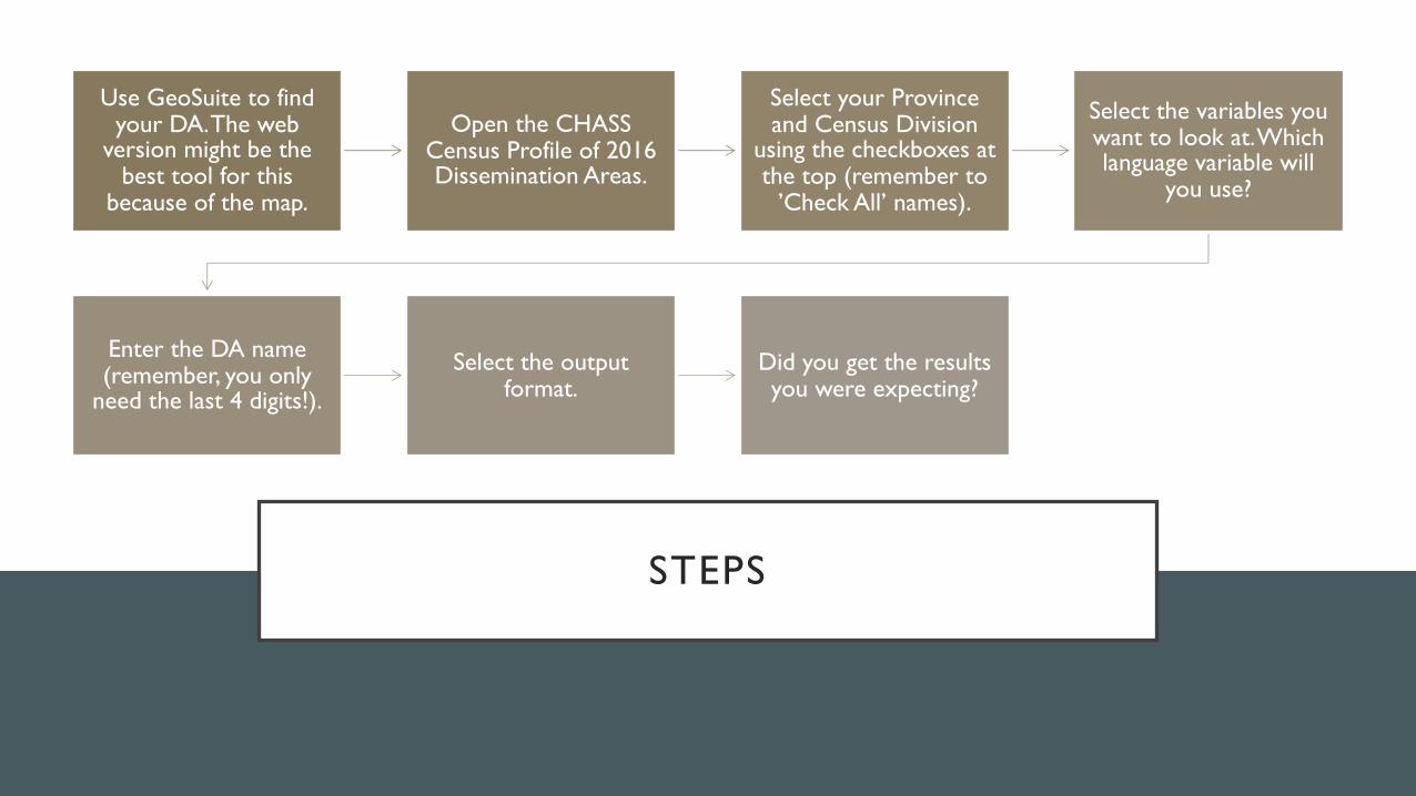
STEPS
Use GeoSuite to find your DA. The web
version might be the best tool for this
because of the map.
Open the CHASS Census Profile of 2016 Dissemination Areas.
Select your Province and Census Division
using the checkboxes at the top (remember to
’Check All’ names).
Select the variables you want to look at. Which language variable will
you use?
Enter the DA name (remember, you only
need the last 4 digits!).
Select the output format.
Did you get the results you were expecting?

QUESTIONS?
Don’t be afraid to ask a question on the ListServ!