central africa
TRANSCRIPT

Africa

Central African Republic
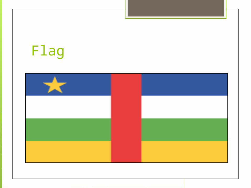
Flag

Capital: Bangui
Government: Republic
Currency: CFA Franc
Population (2012 est.): 5,057,208
Demonym: Central African

Geography
Situated about 500 mi (805 km) north of the equator, the Central African Republic is a landlocked nation bordered by Cameroon, Chad, the Sudan, the Democratic Republic of the Congo, and the Republic of Congo. The Ubangi and the Shari are the largest of many rivers.

Area of conflict:Background
The Central African Republic (CAR) has been unstable since its independence from France in 1960, and is one of the least developed countries in the world, coming in at 159 out of 169 in the 2010 Human Development Index.
Situated in the midst of other failed states including Chad, the Democratic Republic of Congo, and Sudan, it has been seriously affected by other conflicts in the region, with several military and rebel groups spilling over into the country’s borders.

Who is fighting who?
The government of CAR, headed by president Bozizé, is quite weak, and only really has control of the capital, Bangui. Three main rebel groups have been operating in CAR over the last few decades: the Convention of Patriots for Justice and Peace (CPJP); the Union of Democratic Forces for Unity (UFDR); and the Popular Army for the Restoration of Democracy (APRD).
There are also other smaller rebel groups operating in the country, and particularly in the north. The situation is further complicated by a long history of neighbouring militias entering CAR territory, most notably Uganda’s Lord’s Resistance Army (LRA), which is notorious for brutal attacks against civilians, and is often pursued by the Ugandan Peoples Defence Force (UPDF).
When did it all start?Without going back too far... In
1960, France granted independence to Oubangui-Chari, which was renamed the Central African Republic. The years following independence were troubled and violent, with military leaders staging coup after coup against one another to take power over the country.

Eventually, after more than 30 years of military rule, the first fair and democratic elections were held. Ange-Felix Patasse was elected president in 1993, but his terms in office were troubled, with several mutinies against him and a series of riots by civil servants and soldiers over the non-payment of salaries. In 2003, Francois Bozizé, backed by the UFDR, took control of Bangui and ousted Patasse.

This coup, as well as an overspill of fighting from the Sudan, sparked a civil war involving the UFDR, who took control of several towns in northern CAR. Fighting between the UFDR and CPJP in northern parts of the country intensified, and Bozizé lost control of parts of the territory. During this fighting, which continued well into 2007, close to 300,000 citizens were displaced.

And now? In 2008, the UFDR and APRD signed
a peace agreement with Bozizé’s government, and promised to begin disarming and demobilising rebel fighters. However, the CPJP has remained active, especially in the north of the country where it has been responsible for attacks against the Central African Army, as well as civilians in the region.
Despite peace agreements and cease-fires being signed by most rebel groups in the country, clashes between government forces and rebels continue. The LRA has also led insurgencies into CAR territory, and continues to terrorise much of the area. The Presidential Guard and the Central African Army have also been accused of violations against the citizens of CAR, reportedly burning schools and homes. In January 2011, Bozizé was elected for a second term in office.

Due to the ongoing conflict and years of political instability, the economy of CAR has been adversely affected, and thousands have been displaced. CAR relies heavily on international aid and NGOs for money, and for services which the government fails to provide for its population.
Central African Republic: a silent crisis crying out for help One of the world’s poorest countries, CAR is a cauldron of turbulence that threatens to undermine peace efforts in Central Africa.
In a continent beset with bloody conflicts often triggering banner headlines, the Central African Republic (CAR), located in an unstable triangle bordering the Democratic Republic of the Congo, southern Sudan and Chad, is a silent crisis crying out for increased international donor support and media attention.
Conflict in the Central African Republic: Negotiations for a politically inclusive transition respectful of human rights, including the right to justice by victims

While the Seleka rebels still threaten Bangui, FIDH calls upon all parties to the conflict to end human rights violations, to protect civilians, and for the negotiation and establishment of better governance for the Central African Republic, in particular for a genuine fight against impunity for the authors of the most serious crimes.
Tourist Spots Bangui
The capital of the Central African Republic, Bangui is a major trade and transport hub that sits alongside the Oubangui River, a welcome waterway in this landlocked country. While the conveniences of a capital city make Bangui an essential stop for visitors on their way to see the country's natural wonders, it also has attractions of its own. Founded by the French in 1880, the old town of Bangui features a typical colonial design with wide boulevards leading out from a central market square.

Dzanga-Sangha National Park

Dzanga-Sangha National Park, in remote southwest C.A.R. near the borders with Cameroon and the Republic of Congo, protects the rain forest habitats of forest elephants, western lowland gorillas, chimpanzees, bongos, leopards and hippos, among more than 100 mammal species. The village of Bayanga serves as a hub for park visitors, offering basic guesthouses and one luxury lodge. It is served by charter airlines, offering a considerably more convenient alternative to reaching the park by road.

Attractions include a gorilla research station and a clearing where herds of as many as 100 elephants converge to feed. A limited number of tourists are permitted to participate in gorilla tracking expeditions that depart from Bai Hokou camp. Other activities include river cruises in traditional dug-out canoes, net hunting or collecting medicinal plants with the BaAka pygmy people and hiking through the rain forest in the company of a troupe of habituated mangabeys, an agile and vocal monkey species.

Manovo-Gounda St. Floris National Park
Manovo-Gounda St. Floris National Park is C.A.R.'s only UNESCO World Heritage Site. Located in the north near the border with Chad, the park encompasses three types of landscape: the flood plain around the Bahr Aouk and Bahr Kameur rivers, the mountainous south and the lowland plains in between.

Numerous rivers flowing through the park support many animal species, including large mammals such as lions, giraffes, hippos and buffalo, as well as some 320 bird species. The development of tourism in the park has been significantly curtailed by illegal poaching, which has decimated mammal populations and threatens the safety of visitors. Intrepid travelers will find the southern part of the park the easiest to access.

Les Chutes de la Mbi

Les Chutes de la Mbi, which are on the tentative UNESCO World Heritage Site list, drop 656 feet from a tributary of the Upper Mpoko River into the basin of the Oubangui. The falls are known for their natural beauty and are easy to see from a bridge.

Chutes de Boali

Another significant waterfall in C.A.R. is the Chutes de Boali, a 164-foot cascade not far from Les Chutes de la Mbi. These falls really are worth a visit only in the rainy season, when the cascades reach full volume. The closest major town to these waterfalls is Bossembele, about 160 miles from Bangui off the main road to Cameroon.

Nigeria

flag

Capital: Abuja
Government: Multiparty government transitioning from military to civilian rule.
Population: (2010 est.)152,217,341
Demonym: Nigerian
Currency: Naira

Geography Nigeria, one-third larger than Texas and
the most populous country in Africa, is situated on the Gulf of Guinea in West Africa. Its neighbors are Benin, Niger, Cameroon, and Chad. The lower course of the Niger River flows south through the western part of the country into the Gulf of Guinea. Swamps and mangrove forests border the southern coast; inland are hardwood forests.

Area of conflict Religious conflicts in Nigeria
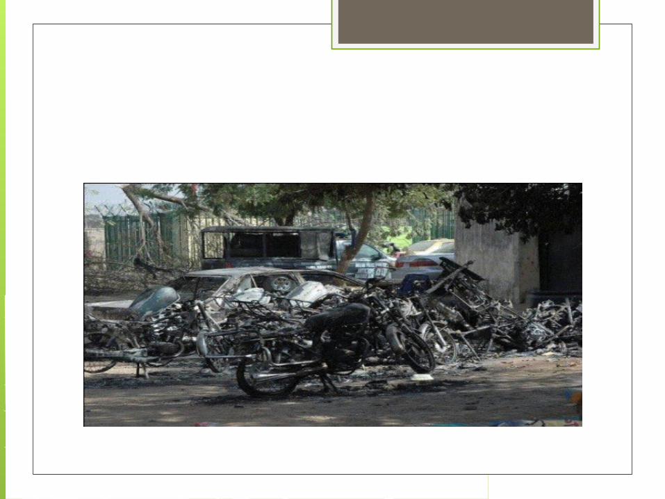
Violent religious clashes broke out in the city of Kaduna in northern Nigeria on February 21 and have continued throughout the week. Kaduna is the second largest city in the north. The clashes followed a march by tens of thousands of Christians to protest the proposal to introduce Muslim sharia law as the criminal code throughout Kaduna state.
Nigeria Christian / Muslim Conflict Nigeria's two major religions, Islam and
Christianity, are sometimes depicted as monolithic entities that confront each other in pitched battles, with formal implementation of the criminal aspects of the Muslim shari'a legal code (or the likelihood of implementation) providing the spark that touches off violence. Riots based (at least ostensibly) on religious affiliation and religious policies have indeed occurred, the worst such being the two confrontations that took place in Kaduna between February and May 2000.

Death, oil and religion: the origins of conflict in Nigeria run deep The coming of the new year was not
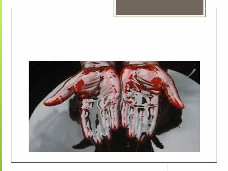
auspicious for Nigeria. Despite being rich in oil, the country is overwhelmed by corruption and violence.
The north of the country has been torn apart by terrorist attacks that saw police stations bombed, cars torched and the streets littered with bodies.

Deep fracturesNigeria is riven by corruption at every level, from the policeman at the roadblock demanding a “fee” from a lorry driver to the most senior politicians – albeit the latter are able to wrap much of their largess in the cloak of legality.
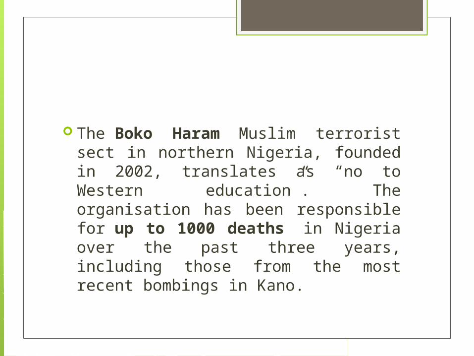
The Boko Haram Muslim terrorist sect in northern Nigeria, founded in 2002, translates as “no to Western education”. The organisation has been responsible for up to 1000 deaths in Nigeria over the past three years, including those from the most recent bombings in Kano.


Delta blues Northern Muslims' resentment at
perceived discrimination and disadvantage has led to repeated clashes in the fifty years following independence, especially in northern cities such as Kano and Kaduna, with their large Christian populations. There have also been sectarian Muslim vs Muslim conflicts, often sparked by local charismatic religious leaders.
The religious and ethnic became the main vehicles for political mobilisation in the post-colonial era, threatening to tear the nation apart. In 1966, a coup sparked riots across the north, the massacre of thousands of non-Muslim Igbo and, ultimately, secession of Igbo-dominated Biafra and the Nigerian civil war.

The military sought to diffuse ethnic tensions by creating 12 states, each with a share in the newly discovered oil bonanza, but this only fuelled minority demands for the creation of even more states. Today there are 36 states and 774 local government areas based on ethnicity and religion.

Revenues from oil production were divided among the states, ostensibly to enable the resource-poor to maintain social services. But successive military strongmen, politicians, corrupt bureaucrats and businessmen swindled much of the money. The people of the oil-producing areas of the Niger Delta, who bore the brunt of ecological degradation by the oil industry and human-rights abuses of the military, eventually took up arms.

Divide and rule

When the military eventually handed over power to a newly-elected civilian government in 1999 there was a general feeling of hope and renewal, often couched in terms of a romanticised history of the tribal-ethnic society.

Twelve northern states introduced various forms of Sharia law between 1999 and 2002, with Muslim politicians extolling a “return” to traditional values. The non-Muslim minority feared loss of human rights and civil liberties. But in non-Muslim areas, ethnicity and religion played no less a role in defining “community”, exclusion of “outsiders”, and notions of rights and morality.

One of the first acts of the new civilian government was to grant the oil-producing areas first call on 13% of locally-derived oil revenue, in addition to their share of revenue. While a long-overdue compensation for decades of neglect, this further enraged the poor and unemployed in other parts of Nigeria, especially in the Islamic North.

No end in sight

The 2011 elections were marked by violence, with more than a thousand killed. But despite widespread electoral fraud, these elections were more creditable than the preceding three. Some 72 of the 109 incumbent senators lost their seats, while only 100 of the 360 members of the House held their seats. PresidentGoodluck Jonathan , a southern Christian, held on but violence escalated.
Jonathan is being urged by colleagues and the media alike to take control of the rapidly-deteriorating situation in Nigeria. The president, meanwhile, has vowed to focus on the economy.
But sadly, unless Nigeria’s political leaders are prepared to address problems of inequality, corruption, and a more socially equitable redistribution of oil revenue (worth US$59 billion in 2010), Nigeria faces a grim future.

Tourist spots Azumini Blue River Rose

Azurnini Blue River is located in Abia State towards its boundary with Akwa lbom State. The River has become a resort for tourists because of the pleasantness it offers. The attractive features of the River include its crystal-clear blue water; canoe rides; sandy beaches with such relaxation facilities as chairs and tables. At the beach also, BBQ grill are delicacies provided for picnickers

The Long JuJu Shrine of Arochukwu

Arochukwu is a famous tourist destination with the cave of the famous long juju oracle as a particular attraction.
The cave is believed to hold the long metal pipe through which the gods speak to the people. A traditional religionist would find the oracle quite an attraction. It is, first and foremost, a religious centre with a well-laid down administrative structure headed by a Chief Priest.
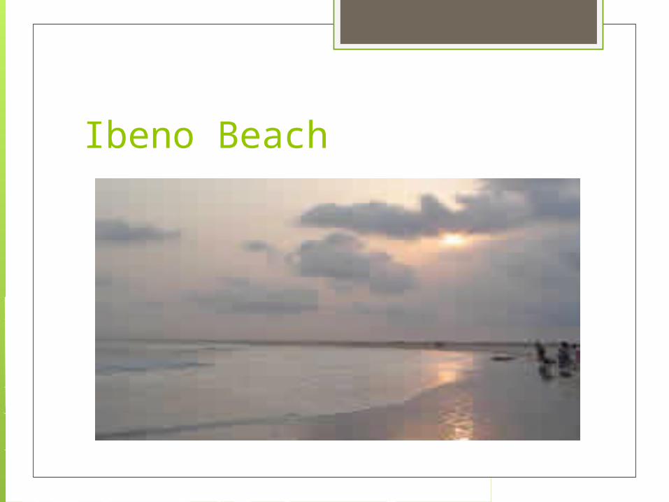
Ibeno Beach

One of the numerous fine beaches in Nigeria is the Ibeno Beach in Akwa lbom State. A lover of water sport finds the Beach which stretches to James town on the Atlantic most inviting.

Yankari National Park

Yankari National Park has become the most developed Wildlife park in Nigeria with a lot of attractions for visitors. The park is famous for its variety of animals available for viewing round the year, though the animals are better watched between November and May period of the dry season when the animals converge around the Gaji River, Baboons, Waterbucks, Elephants, Crocodiles, Bushbucks, Duikers, Warthogs, Hippopotamus are among the anirnals commonly seen at the park

Erin Ijesha waterfalls
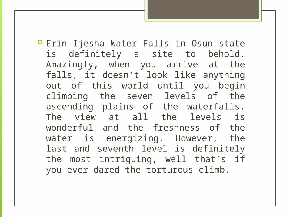
Erin Ijesha Water Falls in Osun state is definitely a site to behold. Amazingly, when you arrive at the falls, it doesn’t look like anything out of this world until you begin climbing the seven levels of the ascending plains of the waterfalls. The view at all the levels is wonderful and the freshness of the water is energizing. However, the last and seventh level is definitely the most intriguing, well that’s if you ever dared the torturous climb.

Agbokim waterfalls

Agbokim Waterfalls, Etung Local Government Area – Magnificent waterfall with 7 separate rivulets. Most spectacular during the rainy season when on a lucky day you have a chance to see the rainbow across the face of the waterfall. Its proximity to neighbouring Cameroon offers a unique opportunity for cross-border experience

Chad

Flag

Capital: N'Djamena
Government: Republic.
Currency: CFA Franc
Demonym: Chadian
Population (2012): 10,758,945
Geography A landlocked country in north-central
Africa, Chad is about 85% the size of Alaska. Its neighbors are Niger, Libya, the Sudan, the Central African Republic, Cameroon, and Nigeria. Lake Chad, from which the country gets its name, lies on the western border with Niger and Nigeria. In the north is a desert that runs into the Sahara.

Area of conflict Current conflicts An armed conflict persists in Chad. In May
2007, Chad and Sudan agreed to stop conflict spilling across their borders by not supporting non-state armed groups in their territory. However, cross-border attacks continued in 2007 resulting in the death and displacement of Chadian citizens as well as of Sudanese refugees living in Chad.
Despite the signing of a ceasefire agreement by the Government and four non-state armed groups, no lasting peace has been reached and armed resistance to President Idriss Deby's leadership has continued to intensify.
In February 2008, a coalition of non-state armed groups launched an offensive against the Government, reaching the streets of the capital N'Djamena and coming close to the presidential palace, with France sending extra troops to support the Chadian army. The armed groups responsible were pushed back to Chad's eastern border with Sudan.

In March 2008, the Presidents of Chad and Sudan signed a peace accord in Senegal aiming to halt five years of hostilities between the two countries. As the crisis in the Darfur region of Sudan has raged for the past five years, it has also engulfed Chad. About 200,000 refugees have fled into the borderlands, chased by Arab militia and Government attacks, leading to conflict in Chad

Conflict continued in 2009. In May, the Chadian government claimed that its troops had defeated an attack by the Union of Resistance Forces, a recently formed non-state armed group, in the volatile east but acknowledged that some areas were still not under its control. Chad and Sudan have continued to accused each other of supporting non-state armed groups operating on their respective territories.

The relationship between Chad and Sudan has soured again in recent months. In May 2008, violence between Chadian and Sudanese armed groups flared up, leading Sudan to cut diplomatic relations with Chad responding by closing its border and cutting economic ties.

Zakouma National Park

located between Sarh and Am Timan, in the south of Chad. Created in 1963, it was Chad's first national park, and has an area of almost 3,000 square kilometres (1,200 sq mi). It is entirely surrounded by the Bahr Salamat Faunal ReserveZakouma was neglected during the period of civil conflict, but a restoration programme, supported by the European Union, began in 1989 and is continuing in 2006. The area in and near the Park has seen significant reduction in certain wildlife species in recent decades

N'Djaména
N'Djaména, Chad's capital city, is finally making a comeback after decades of civil war decimated its streets and buildings. The nightlife is raucous in certain quarters, with plenty of bars and local music. The historic quarter features an active daily market, where tourists can pick up colorful rugs and jewelry made by the friendly residents. Visit the National Museum for a look back into Sarh culture, with some collections dating to the ninth century.

Sudan
Flag

Capital: Khartoum
Demonym: Sudanese
Population: 34.3 million
Currency: Sudanese Pound
Government: Provisional Government

Geography Location: North-eastern Africa, south of
Egypt, bordering the Red Sea, between Egypt and Eritrea.
Terrain: Generally flat with mountains in east and west. The southern regions are inundated during the annual floods of the Nile River system.
Climate: Desert and savanna in the north and central regions and tropical in the south.

Area of conflict The 2012 South Sudan–Sudan border
war was an armed conflict between the states of Sudan and the South Sudan in 2012 over oil-rich regions between the South Sudan's Unity and the Sudan's South Kordofan. The oil rich region Heglig is well under the control of the Republic of Sudan. Certain areas involved, notably Abyei, are claimed by both sides as part of their sovereign territory.

The conflict in Sudan has many faces, the best known are a ‘North-South’ conflict, ‘that problem in Darfur’ or an ‘Arab-African’ conflict. The reality is that Sudan is deeply complex with many isolated but often overlapping conflicts that blur common perceptions.

Local realities The fragile Comprehensive Peace
Agreement (CPA) which was reached in 2005, in one way or another, affects almost every state in the North and South of Sudan. Beneath that numerous tribal differences that continue to be politicised, and bitter oil related conflicts, exacerbate problems further. Such complexities make it almost impossible for outsiders to fully understand, once again highlighting just how indispensable local peacebuilders are. There are fears that the conflicts in Sudan have the potential to trigger a regional war, drawing in neighbouring countries.

Since the referendum As the question of South Sudan’s
(in)dependence is one of the major disputes dividing North and South, a Referendum, conducted in response to the 2005 Naivasha Agreement (Comprehensive Peace Agreement) between the NCP and SPLM, was held on the 9th January 2011 to decide whether South Sudan should remain part of Sudan or become autonomous. A similar referendum was to be held in Abyei to decide whether it joined the North or South, but was postponed due to complications.

Significant problems predicted before the Referendum have since surfaced. Darfur has reemerged as conflict region, with a sharp rise in violent clashes being reported. New splinter rebel groups have taken shape and are contesting fresh demands in the South and East. The fate of the oil rich border states are still undecided, with the possibility of renewed violence. Thousands of refugees have fled conflict areas. And logistics over citizenship and the splitting of the national debt have yet to be worked out. These problems threaten to derail the entire process.

Yet steps are being taken towards resolving these issues facing the creation of the world’s newest nation. Peace talks over a planned referendum in Darfur are under way, ex-combatant reintegration is taking a foothold and South Sudan’s draft constitution has successfully been completed. It has yet to be seen in how long and with how much difficulty the secession is to be instated.

What has been happening to cause conflict in Sudan?
The civil war in Sudan began in 1983. During the course of the war, which ended in 2005, two million people were killed and four million were made homeless. The war was mostly fought between the government and the SPLA (Sudanese People's Liberation Army) who wanted control of Southern Sudan.

The discovery of oil in the south caused further problems as the government did not want the south to take all the wealth from the oil. The Murahaleen - Arab fighters on horseback from the north of the country also assisted the government. Many homes were burnt down and entire villages destroyed. Women and girls were raped, children - especially boys - were kidnapped and put to work either as slaves or child soldiers.

The SPLA could also be accused of similar atrocities. Many orphaned boys formed large walking groups and walked across the country to apparent safety in Ethiopia. For some this involved walks of up to several months. There was little food and water and many children died of thirst, starvation or by being taken by lions. Many refugees ended up in refugee camps in Ethiopia where conditions were not much better at first. Eventually, overseas aid arrived and food, clothes, medical aid and education were provided.

What are the impacts of civil war on people in Sudan? Many Sudanese have never returned
home since the peace treaty in 2005. There are many reasons for this. Some refugees know nothing other than the life they have had in the camps as they were young children at the start of the war. For some of them, they no longer speak the local dialect of the area they came from as, being orphans, there were no family members to keep the languages alive.

Many people cannot afford to return home as they have nothing to go back to. Their homes were destroyed and any wealth they had (mostly in the form of cattle) was taken by the Murahaleen raiders. Not speaking the local dialect will make finding employment difficult.

Khartoum
This city is the capital of the country of Sudan. This exotic city is located at the meeting point of White Nile and Blue Nile. To get to this city, you can avail the Khartoum International Airport. This city is also connected by various bridges as well. Khartoum offers a number of places of interest. Some of the major attractions are National Museum of Sudan, Palace Museum, Botanical Gardens, Ethnographical Museum, St. Matthew’s Catholic Church and Sayeda El Bushara Church, Khartoum Mogran, Mosques in Khartoum, The War Cemetery and others.
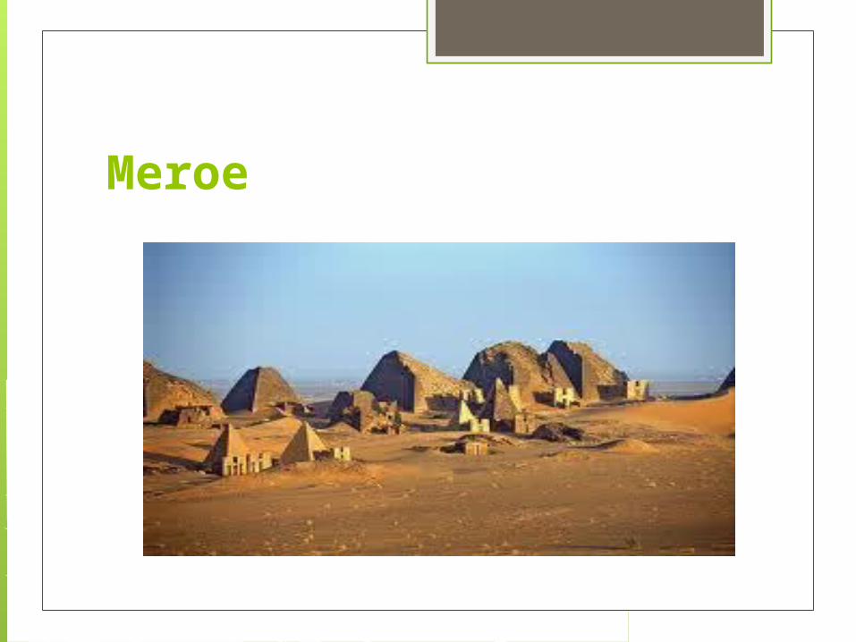
Meroe
This is another important Tourist Destinations of Sudan. This ancient city is located at the eastern bank of the Nile River. You can site this city at 200 kilometer north of Khartoum. Meroe is dotted with about two hundred pyramids. The railways are the most important mode of transportation to reach the city. You can also avail buses and lorries to get to this place. Some of the major attractions of the place are Temple of the God Amun, Great Enclosure and pyramids.

Port Sudan

It is the capital city of the Red Sea State in Sudan. This port city is also used as an exit point to cross the Red Sea to Jeddah. This city is facilitated by the presence of the Port Sudan New International Airport. The harbor at the mouth of the gulf also helps in the easy transportation. The Red Sea coast in Port Sudan is a major attraction of the place.

Eritrea

Flag
Capital: Asmara
Currency: 1 Nakfa
Demonym: Eritrean
Population: 5.4 million (UN, 2011)
Government: transitional government

Geography Eastern Africa, bordering the Red Sea,
between Djibouti and Sudan. hot, dry desert strip along Red Sea coast;
cooler and wetter in the central highlands (up to 61 cm of rainfall annually, heaviest June to September); semiarid in western hills and lowlands.
dominated by extension of Ethiopian north-south trending highlands, descending on the east to a coastal desert plain, on the northwest to hilly terrain and on the southwest to flat-to-rolling plains

Area of conflict Ethiopia and Eritrea were involved in a
major border conflict in 1998 - 2000. A peace agreement was signed in Algiers in December 2000 between the leaders of the two countries. A fragile truce has since existed between the two nations. In late 2007, both sides began to remilitarise border areas.
Eritrea accuses Ethiopia of refusing to withdraw from the village of Badme, where the war began, despite a Boundary Commission 2002 ruling stating that it belonged to Eritrea. Eritrea has repeatedly called on the international community to enforce the Commission's ruling, while Ethiopia has insisted that further border talks are needed.
On 15 March 2012, Ethiopian forces launched a military assault on positions inside Eritrea, claiming that the latter was training "subversive groups" to carry out attacks inside Ethiopia. The raid was the first attack by Ethiopian troops inside Eritrean territory since the end of the war in 2000 and targeted three camps where rebels belonging to a faction of the Afar Revolutionary Democratic Unity Front (Arduf) were allegedly trained. The Ethiopian Government spokesperson warned of potential future such actions.

"As long as Eritrea remains a launching pad for attacks against Ethiopia, similar measures will continue to be taken." On 16 March 2012, Eritrea announced that it would not retaliate, seeking instead to use the "appropriate diplomatic channels" to resolve the issue and denying that it was harbouring rebels. Border skirmishes in the past year have observers worried that they might spark conflict anew, particularly given Ethiopia's reported plans to develop potash mines in the Danakil region close to the border with Eritrea, which it does not want endangered by rebel attacks.

After months of tension, serious clashes erupted between 10 and 12 June 2008 between the Djibouti Armed Forces (DAF) and the Eritrean Defence Forces (EDF) along the disputed border between the two Horn of Africa countries, in Ras Doumeira and Doumeira Island. Although the fighting was brief, Djibouti reported that more than 35 of its troops were killed and that many more were wounded. On 23 October 2008, Djibouti President Omar Guelleh told the UN Security Council that war was the only option unless the UN took action on its border dispute with Eritrea.

Eritrea denied occupying Djibouti's territory. In June 2008, the UN Security Council appealed for negotiations and called on the two countries to reach a ceasefire and withdraw their troops from the border area. Subsequently, in Resolution 1862 (2009), the Security Council welcomed the fact that Djibouti had withdrawn its forces to the status quo ante and condemned Eritrea's refusal to do so. In Resolution 1907 (2009) adopted under Chapter VII of the UN Charter, the Council imposed sanctions on Eritrea over its destabilising role in Somalia and for refusing to withdraw its troops from the border with Djibouti.

The Council reiterated its calls on Eritrea to stop destabilising its neighbours in Resolution 2023 (2011), which also called for the implementation of the 2010-adopted mediation agreement between Eritrea and Djibouti. (See Peace treaties and UN resolutions and reports sections) According to Human Rights Watch, despite the withdrawal of its troops, Eritrea was still holding 19 Djiboutian prisoners of war in 2011.
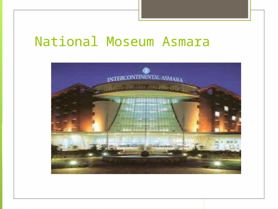
National Moseum Asmara

National Museum Asmara is one of the most visited tourist attraction in the Asmara, the capital of Eritrea. The National Museum Asmara is located in the close proximity of the Selam Hotel. Asmara has a long and interesting historical background not only in the recent context but also in ancient context. The recent history of Asmara dates back to the period of Italian rule from the late 19th century, followed by the era of British imperialism. When the British left, Eritrea was divides between Sudan and Ethiopia.
The final war with Ethiopia for independence concluded a little over a decade ago. All these years of struggle has given the nation a unique identity, the gist of which is neatly synchronized in the National Museum of Asmara. Among other kinds of exhibits in the National Museum Asmara, the tombstones from Dalak islands, findings from Adulis, and Sabean material and scrolls in Ge'ez are the chief attractions.

Nda Mariam Othodox Church
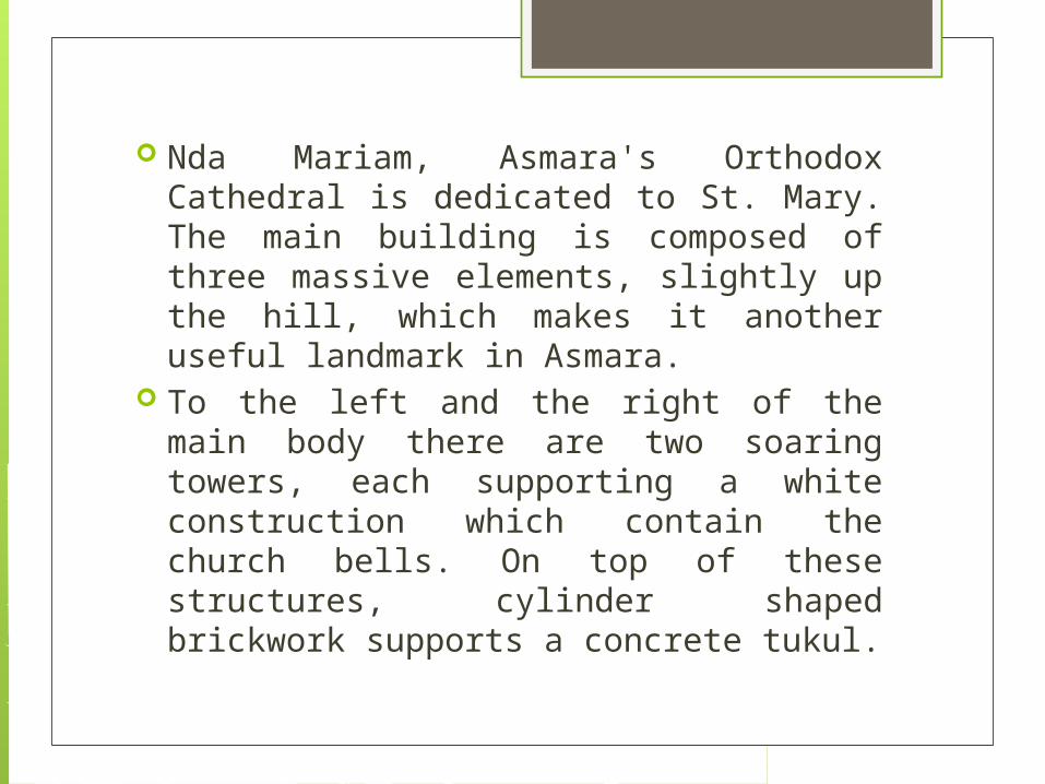
Nda Mariam, Asmara's Orthodox Cathedral is dedicated to St. Mary.The main building is composed of three massive elements, slightly up the hill, which makes it another useful landmark in Asmara.
To the left and the right of the main body there are two soaring towers, each supporting a white construction which contain the church bells. On top of these structures, cylinder shaped brickwork supports a concrete tukul.

Above the two wooden doors, which have frames of red ceramic tesserae, there is an impressive mosaic structure showing religious scenes done by the Italian painter Nenne Sanguineti Poggi, on request of the clergy, in the 1950s. She is also the creator of several mosaics and frescos around Asmara -- see the ones on the front of the old "Liceo" School, those at the Agasien school, and the mosaics in the tabernacle of the Church to St. Mary in Axum.
In front of the church are traditional stones which were used as bells

The Dahlak Marine National Park

This marine park is located in the water body adjoining the Dahlak Marine archipelago. This area had been abandoned during the Eritrea-Ethiopia conflict. During this time, the marine life in the region had prospered undisturbed, as fishing was not allowed. Realizing the tourist prospect in the region, the Eritrea government declared the region a national park. Scuba diving is a daily activity in the area and is conducted by a trained group of divers who were previously freedom fighters. There are more than 350 varieties of fish and divers can even catch a glimpse of wrecked ships in the waters. Entry to the area is allowed with permission under special supervision.

The Semenawi National Park

This park is located at the foothills of a mountain range in Eritrea, the average height of which varies from 900 meters to 2400 meters. Leopards, klipspringers, bushbucks, warthog and greater kudum duiker are the common animals inhabiting this national park. There are also a large number of birds in the region.
The national parks of Eritrea have been attracting a large number of tourists ever since they were opened up for public after the conclusion of the war.

Massawa Islands

The Massawa Islands include the two islands of Taulud and Massawa as well as another main island, which houses several residential buildings. These islands are popular tourists attractions in Eritrea, the uniquely designed buildings being the focus of all attractions. The buildings either belong to the Ottoman style architecture or the coral block buildings. Significantly, coral used to be a major material for building houses.
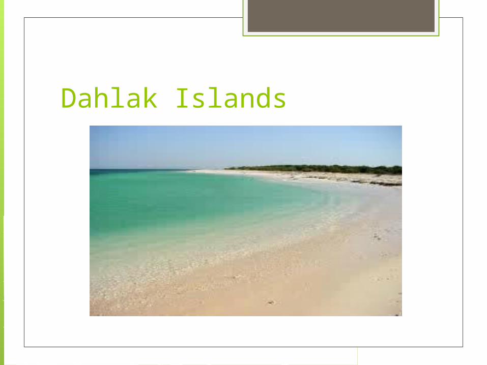
Dahlak Islands

The residents of Dahlak Islands earn their living by animal husbandry and fishing. Lifestyles of these inhabitants are very simple. Tourists in Dahlak Islands will get to see the mangrove trees and coral reefs submerged in coastal waters. Travelers can reach these islands from Massawa. They can consult the Eritrea travel guide before visiting the country. The favorite tourist destination in Dahlak Islands is Dekemhare.
In Dahlak Islands, tourists will love to spend time fishing or go for a sail in the blue waters. These islands are ideal location for scuba diving. In theses islands tourists will get to see the varied marine species like sharks, dolphins, turtles and varied species of sea fishes.
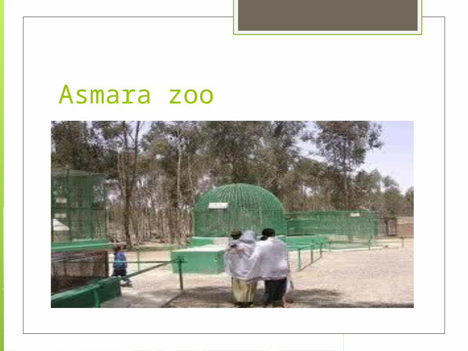
Asmara zoo

Asmara zoo is an interesting place for fun and enjoyment in the city of Asmara. The zoo is located on the road leading to Masawa. The zoo is located at an accessible distance from different parts of Asmara. This area is known as Biet Ghiorgis. Tourists can reach the zoo by a public bus of route number 1.To enter the zoo visitors has to pay 2 Nakfa, which is equivalent to 15 cents. This small zoo is a centre of attraction for tourists visiting the city of Asmara.

The road leading to the Asmara zoo is a clean and clear. The road is surrounded with lush green trees. On the entrance of the zoo, a board with several instructions meant for visitors is visible. The animals found in the zoo are hyenas, baboons, snakes, lions, ostriches and several colorful birds.
The zoo in Asmara is full of herbs, plants and variety of cactuses. The surrounding area of the zoo overlooking the valleys and gorges is a nice place for loitering and walking. There is a British Cemetery just at the entrance of the zoo. The zoo has a playground for kids as well. Asmara zoo has a nice restaurant and bar that serves a variety of foods and snacks to the guests. This food joint is a nice place to spend time with friends and relatives.
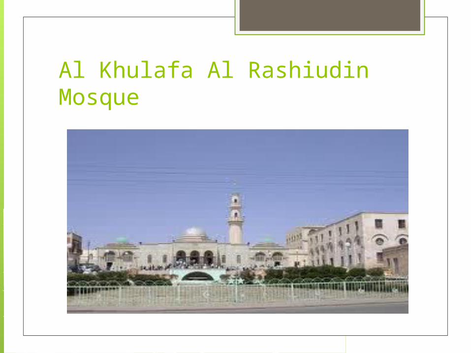
Al Khulafa Al Rashiudin Mosque
Al Khulafa Al Rashiudin Mosque is one of the major tourist attractions and religious places in the city of Asmara, the capital of Eritrea. The Al Khulafa Al Rashiudin Mosque is located in the Peace Street of Asmara in the close proximity of the covered markets. The palatial mosque was built some sixty-nine years ago in the year 1938. The building structure is majestic and though most of the daily visitors are worshipers, there are also a large number of tourists.

Somalia

Flag

Capital: Mogadishu
Demonym: Somali (85%), Bantu, Arabs
Population: 9.36 million (2010 UN estimate)
Currency: Somali shilling
Government: in the process of building a federated parliamentary republic

Geography Eastern Africa, bordering the Gulf of
Aden and the Indian Ocean, east of Ethiopia
principally desert; northeast monsoon (December to February), moderate temperatures in north and hot in south; southwest monsoon (May to October), torrid in the north and hot in the south, irregular rainfall, hot and humid periods (tangambili) between monsoons

Area of conflict
Somalia has experienced almost constant conflict since the collapse of its central government in 1991.
It was hoped the election of moderate Islamist Sheikh Sharif Sheikh Ahmad as president of a transitional government in January and the departure of Ethiopian troops would stop the violence, but Islamist insurgents are keeping up their almost daily attacks.

Who are the insurgents?
The main fighters are from al-Shabab, a radical faction that emerged from the remnants of the Union of Islamic Courts, routed by the Ethiopian forces that invaded Somalia in 2006.
The group, which is on the US terror list and is said to have links with al-Qaeda, now controls much of southern and central Somalia and has imposed strict Sharia law in those areas.

They see President Sheikh Sharif Sheikh Ahmed, a former UIC leader, as having sold out for agreeing to head a government backed by the international community.
This view is shared by another group of Islamist fighters - Hisbul-Islam - formed after Mr Ahmed become president in January.
One of its main leaders is Sheikh Hassan Dahir Aweys, who together with Mr Ahmed headed the UIC in 2006.

Unlike previous divisions in Somalia, these groups are not based on the clan system.
So what do they want? Power - so that Somalia is ruled by
Sharia. President Ahmed's recent introduction of
Islamic law has not appeased them. They are followers of the Wahhabi
school of Islam, which is based on a more rigid and literal interpretation of Islamic texts, rather than mainstream Sunni schools followed by most Somalis.

The Islamists also want the African Union peacekeepers, based in Mogadishu, to leave.
Mr Aweys, who recently returned from exile, says he will not enter peace talks with the government and his former ally until these "invaders" have gone.

Will the government survive?
Not necessarily. Military and intelligence sources say many government troops have defected to the insurgents.
One assessment reckons the government can only rely on some 4,000 fighters against 6,000 from al-Shabab.
Meanwhile, the AU peacekeepers, in the capital to bolster the government, do not have the mandate to pursue the insurgents.
Only 4,300 troops of a planned 8,000 strong force have deployed.

What is the international response? There is little appetite for international
intervention given Ethiopia's recent experience, which gave rise to the current insurgency.
Ethiopia initially intervened in late 2006 to save the interim government and to prevent the spread of fundamentalist Islam in Africa, a concern shared by America.

But they suffered daily attacks - and at the worst of the fighting the bodies of dead Ethiopian soldiers were dragged through Mogadishu, bringing to mind similar events when the US intervened in the 1990s - made famous by the film Black Hawk Down.
The UN backed the peace process which led to the election of Sheikh Sharif Sheikh Ahmed as president.
In April, the international community pledged more than $200m to Somalia to beef up its security.
Most of this is for the embattled AU to help them with equipment and the training of Somali forces.
They are intended to oversee the creation of 10,000-strong police force and the training of 6,000 soldiers.

How are ordinary people coping? The latest fighting is said to have forced
about 20,000 people from residential areas of the capital, where the battles are being played out by pro-government forces and insurgent groups.
And over the years hundreds of thousands of Somalis have fled to neighbouring countries.
More than one million people, in a nation the UN estimates to be of nine million, are internally displaced.

Drought is further exacerbating the situation, with more than one third of the population reliant on food aid.
Many Somalis depend for their survival on money sent home by their relatives abroad.

Hadaftimo

Hadaftimo is an historic town in the northern Sanaag region of Somalia. It is home to many archaeological sites and ancient buildings. Hadaftimo was previously a part of Maakhir state. In January 2009, the territory was officially incorporated into the autonomous Puntland region in the northeastern part of the country

Somaliland

Somaliland is an unrecognised self-declared de facto sovereign state that is internationally recognised as an autonomous region of Somalia. The government of Somaliland regards itself as the successor state to the British Somaliland protectorate, which was independent in 1960 as the State of Somaliland, before uniting with the Trust Territory of Somalia (the former Italian Somaliland) later to form the Somali Republic.

Galgala

Galgala is a growing town in Bari region of Somalia. The town has ancient markings of religious symbols and crosses and ancient remains of a cairns which commonly found in Sanaag and Bari, Somalia regions.[citation needed] The town has a population nearing 20,000.

Ethiopia

Flag

Capital: Addis Ababa
Demonym: Ethiopian
Population: 84,734,262 (2011 est.)
Currency: Addis Ababa
Government: Federal Democratic Republic of Ethiopia

Geography
Eastern Africa, west of Somalia tropical monsoon with wide topographic-
induced variation high plateau with central mountain
range divided by Great Rift Valley small reserves of gold, platinum,
copper, potash, natural gas, hydropower

Area of conflict Conflict between Ethiopia and Eritrea
Africa in general, has suffered from artificial borders drawn by former imperial and colonial rulers, akin to what is usually attributed to Imperial Britain as the "divide and conquer" policy, but practiced by almost all power brokers throughout history, ancient and modern. A combination of Italy drawing the maps in this region and later, Cold War support for dictators, has been part of the historical contributary factors, amongst others, that have led to troubles today.

Ethiopia's Haile Selassie was supported for decades by the United States for geopolitical and Cold War reasons. The Soviet Union had supported Somalia in their claim that parts of Ethiopia and Kenya were part of Somalia. There was actually a reversal of support by the two superpowers in the 1970s as well.
For the US's unrestricted use of a military base, Selassie was given "aid" (i.e. military aid). This unfortunately was used against Eritrean secessionists and Ethopian guerillas in brutal wars.
Italy, the former colonial ruler of Eritrea, left in 1952. Ethiopia annexed it in 1962. (Not too unlike the case between Indonesia and East Timor.)
30 years of war and conflict continued as Eritrea attempted to gain independence, joined by Ethiopian guerilla forces that were also fighting against the harsh dictatorship. In an April 1993 internationally monitored referendum, where 98.5% of the registered voters voted, and 99.8% of these voted for independence, although the borders were not defined clearly.
For a while, the two nations seemed to get on fairly well. However, relations further deteriorated into war a couple of years after Eritrea introduced its own currency in 1997. War again resulted over what the BBC mention as a minor border dispute in May 1998, and over differences on ethnicity and economic progress approaches. The May 1998 - June 2000 war alone resulted in 100,000 deaths and millions of dollars diverted from much needed development into military activities and weapons procurements.
However, the major reason for the recent conflict is the fact that Ethiopia no longer has a border along the Red Sea and therefore relies on going through other countries such as Eritrea in order to ship and trade goods along that line. (Ethiopian propaganda has then meant it says to its people that one of the things it wants to do is ensure a more amenable government is in place -- of course, one that agrees with Ethiopian interests.)
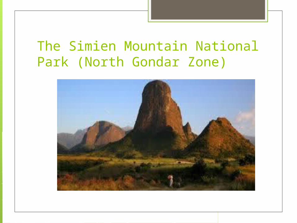
The Simien Mountain National Park (North Gondar Zone)

The Simien Mountain is the most fascinating highlands in Africa, its highest peak Ras Dejen has a height of 4620m which is acknowledged to be the fourth in the continent.Simien is located in Africa and close to the Equator but surprisingly it gets snow and ice on its highest peak.During the night, temeperatures drop to zero degrees.

The rock-hewn churches of Lalibela (North Wollo Zone)

Lalibela covers an area of about 642 kilometers from Addis Ababa. It’s famous for its rock-hewn churches that are at times known as the Eighth Wonder of the World. They were carved within the rock and these monolithic churches were established in the 12th century during the supremacy of King Lalibela.However among these have been acknowledged to be built in the 10th century.

The Castles of Gondar and other monuments (Gondar)

Gondar is popular for its well designed decorated churches and the numerous medieval castles. The first castle was built by Fasilidas and this still stands and in good shape. Even after all these years, it’s still simple to climb and get to the roof. It has a wonderful view of the entire scenery of the city.

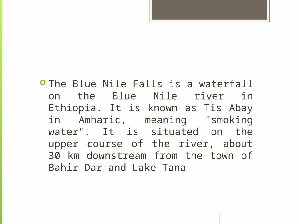
Blue Nile Falls
The Blue Nile Falls is a waterfall on the Blue Nile river in Ethiopia. It is known as Tis Abay in Amharic, meaning "smoking water". It is situated on the upper course of the river, about 30 km downstream from the town of Bahir Dar and Lake Tana

Lake Tana

Lake Tana is the source of the Blue Nile River which begins right from Khartoum to the Mediterranean. It’s the largest lake in Ethiopia. A Nile cuisine on Lake Tana is the best moment to all tourists that visit Ethiopia; you get a chance to see big concentration of wildlife cooling off the heat. If you want to hire a boat, this can be done at the Marine Transport Authority located in Bahir Dar. For bird watchers, Lake Tana is a home to many bird species which include both migratory and local birds. Furthermore Fasilidas Island is one place to visit because it’s a popular wetland that harbors different kinds of bird species.

Cameroon

Flag

Capital: Yaounde
Demonym: Cameroonian
Population: 20,129,878 (July 2012 est.)
Currency: CFA Franc
Government: republic; multiparty presidential regime

Geography Central Africa, bordering the Bight of
Biafra, between Equatorial Guinea and Nigeria
slightly larger than California varies with terrain, from tropical along
coast to semiarid and hot in north diverse, with coastal plain in southwest,
dissected plateau in center, mountains in west, plains in north

Area of conflict Land Ownership Conflicts in Cameroon
For nearly a century, up until the 1960s, Africa was colonised by Europe. During this period the coloniser's laws replaced many traditionally enforced regulations. After independence the new African states instituted laws that often mixed customary practices and colonial rules. Using his home country of Cameroon as a case, the author illustrates how land-ownership conflicts in Africa arose through this problematic mix of tradition and modernity.
In 2011, WWF produced a map of the protected areas of Cameroon at the request of the government. Simultaneously, observations had been made by conservation groups that mining permits were being granted inside of Cameroon’s protected areas, though the origin and credibility of the data was unclear.

Also in 2011, several mining companies presented their credentials to the conservators of the Campo Ma’an and Nki National Parks to inform them that they would begin mining exploration activities inside these protected areas. This propelled WWF, CED, and RELUFA to make an official request to the Ministry of Mines in Cameroon for all valid mining permits.
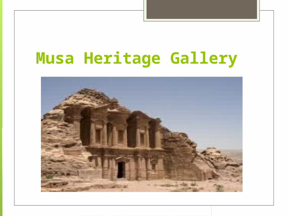
Musa Heritage Gallery

also known as the Mus'Art Gallery focuses on the preserving and promoting of the arts and crafts of Cameroon's Western Grass fields. An internationally renowned gallery, it's widely recognized for having produced masterpieces of the Arts and Crafts of Cameroon. One of the popular places to visit in Cameroon tourists flock out here for a taste and also to better appreciate the material culture of the people of the Cameroon Grass fields as expressed by their wide-ranging and diverse art forms. The museum is handled by the Musa family, the proprietors of the Musa Heritage Gallery and is open to visitors who come for a trip to Cameroon.

Waza National Park
situated in the Far North Province of Cameroon was founded in 1934. The Park covers a total area of 1,700 sq km and when was discovered was a used as a hunting reserve. A famous hunt for adventure seekers, one can go for long tracking through the jungle and enjoy its green beauty. Managed by the Conservation Service of the Waza National Park, protection of the environment and the nature is safeguarded here.

Campo Ma'an National Park

with a hectare of 264,064 is located in the South of Cameroon. The entire area of the Park consists of four logging concessions, an agro-forestry zone, and an agro-industrial zone with rubber and palms as the main plant. Tourists visiting can camp out here for the day in the midst of various plants and animals. Elephants, lowland gorillas, giant pangolins, chimpanzees, hippos, mandrills and black colobus are all found here and if one is lucky enough then a site of the leopard is also not unusual. The park is also home to numerous number of plant and flower species and well-known for its rich biodiversity.

Mount Cameroon

the highest mountain in Central and West Africa in the city of Buea making it on of the most sort after tourist's destination in Cameroon. One of the important places to visit in Cameroon, it's a place more apt for adventures like hikers and climbers. Guides are available from the city and the right equipment can be hired if one does not have what's needed. Trecking in this mountain is an amazing experience that travelers cherish throughout their life. Tin roofed huts are present at intervals for hikers to rest and stay. The famous volcano of Cameroon known locally as Mount Faka and the "Chariot of the Gods" is also one of Cameroon's main tourist attractions.

Tanzania

Flag
Capital: Dar es Salaam
Demonym: Tanzanian
Population: 46,912,768 (July 2012 est.)
Currency: Tanzanian Shilling (TSh)
Government: republic

Geography Eastern Africa, bordering the Indian
Ocean, between Kenya and Mozambique plains along coast; central plateau;
highlands in north, south
Area of conflict Who Owns Lake Nyasa?
Oil exploration in Lake Nyasa has rekindled disputes between Malawi and Tanzania over who owns the lake.

President Jakaya Kikwete of Tanzania has insisted that war with Malawi is not a feasible outcome of ongoing disputes between the two countries over the ownership of the lake which borders the two countries.
Lake Nyasa, known as Lake Malawi by Malawians, has been the source of disagreements since colonial times, which were rekindled recently when Malawi allowed gas and oil exploration to begin around the lake’s border. Rhetoric has escalated over the past few months although it seems both sides are now attempting to calm tensions.

Zanzibar

At dawn, the natural scenery of the island of Zanzibar, Tanzania is so wonderful. Zanzibar is one of Tanzania's top destinations because of its fascinating past and its incredible beaches. Zanzibar's location in the Indian Ocean has made it a natural trading center throughout its history. Zanzibar has many beautiful beaches, that can be enjoyed on any budget. Some of the surrounding islands offer total paradise for the luxury traveler, Mnemba island is absolutely idyllic for a romantic vacation.
Zanzibar is great for scuba diving, snorkeling, and swimming with dolphins. Other attractions include spice tours and the Jozani Forest, which shelters a small population of red Colobus monkeys.


Ngorongoro Conservation Area also home an abundance of wildlife, particularly in the Ngorongoro crater. Formed by the same volcanic activity that generated Kilimanjaro and the Great Rift Valley, Ngorongoro consists of the highlands around the crater (rich in elephants) and the crater itself (similar animals to Serengeti, but at higher densities and with a small population of black rhino).
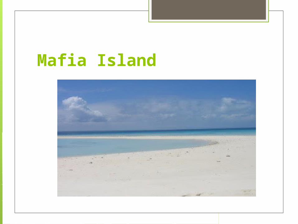
Mafia Island
Mafia Island is an undiscovered Tanzanian gem. It has a rich history, and a strong Swahili culture unspoilt by tourism. Much of the isalnd and its beautiful beaches have been designated as a marine park. It is one of the best places to deep-sea fish, dive and snorkel in Africa. You can watch whale sharks, turtles and many other interesting species of wildlife. Mafia Island offers some fantastic scuba diving and snorkeling. You may also get to swim with whale sharks, as this is one of the few areas in the world where they congregate annually.

Liberia

Flag

Capital: Monrovia
Demonym: Liberian
Population: 3,887,886 (July 2012 est.)
Currency: Liberian Dollar (LRD)
Government: republic

Geography Western Africa, bordering the North
Atlantic Ocean, between Cote d'Ivoire and Sierra Leone
tropical; hot, humid; dry winters with hot days and cool to cold nights; wet, cloudy summers with frequent heavy showers
tropical rain forest deforestation; soil erosion; loss of biodiversity; pollution of coastal waters from oil residue and raw sewage

The Sapo National Park

The Sapo National Park is situated at the county of Sinoe. This is one of the relaxing places in the country because it is considered as the top national park in Liberia. The place features different animal species like the Giant Forest Hog, the African Civet, the Great Blue Turaco and the White-Necked Rockfowl. In addition to these, the other species that can be featured in the site are the bee-eaters, leopards, crocodiles as well as the kingfishers.

Buchanan

One of the coastal towns in the country is Buchanan. This place features one of the largest ports in the area. The town is very popular because fighting were held in the place during the Liberian Civil War. Aside from the port, people can also find iron ore mines in the town.

Firestone Plantation

The Firestone Plantation in Liberia is one of the historic places in the country. This place is very controversial because the workers at the plantation were allegedly forced to work. In addition, there are also reports regarding child labor in the plantation in the early 1900s.

Monrovia

Another nice site to see in the country is Monrovia. This city features numerous beaches where people can enjoy various water activities like snorkeling and swimming. Aside from the beaches, people can also visit the restaurants that offer delicious local dishes.

Zwedru

If you want to relax, you can enjoy the nature by visiting the City of Zwedru. The place is popular for featuring numerous tropical forests as well as the anteater creek. Different animal species are also present in the place. The city is also known for its wood products sector.

Guinea

Flag

Capital: Conakry
Demonym: Guinean
Population: 10,884,958 (July 2012 est.)
Currency: Guinea Bissau
Government: republic

Geography Western Africa, bordering the North
Atlantic Ocean, between Guinea-Bissau and Sierra Leone
generally hot and humid; monsoonal-type rainy season (June to November) with southwesterly winds; dry season (December to May) with northeasterly harmattan winds

Tourist spots

Ghana

Flag

Capital: Accra
Demonym: Ghanaian
Population: 24,652,402 (July 2012 est.)
Currency: Ghanian Cedi
Government: constitutional democracy

Geography
Western Africa, bordering the Gulf of Guinea, between Cote d'Ivoire and Togo
tropical; warm and comparatively dry along southeast coast; hot and humid in southwest; hot and dry in north
mostly low plains with dissected plateau in south-central area
Area of conflict Chieftaincy is becoming a major source
of conflict in Ghana
The National Security Advisor, Brigadier Nunoo Mensah has told CitiFM that the Chieftaincy institution in Ghana is gradually turning into a major source of conflict and tension in the country and should therefore be modernized to make it more beneficial for the people of Ghana.

His comments follows recent controversies and tensions arising from the utterances of two of Ghana’s most promonent chiefs – the Asantehene Otumfuo Osei Tutu II and the Ga Mantse King Tackie Tawiah III.
The Ga Mantse recently slammed President Mills for refusing to give him the recognitions he deserves because of perceptions that he was enstolled by the erstwhile NPP government, a statement that rekindled the controversy surrounding his legitimacy as the King of the people of Ga Mashie.
The Asantehene, Otumfuor Osei Tutu, on Monday, March 15, threatened to cause the arrest of the Techiman chief if government failed to do so.
The Techiman chief had allegedly used some macho men to arrest and humiliate the Tuobodom Chief who owes allegiance to the Ashanti golden stool.
The situation has generated a lot of confusion and clashes between some youth of Kumasi and Techiman.
On Tuesday, March 14, some Macho men, belonging to a group calling itself Ashanti Freedom fighters besieged the Kejetia lorry station in Kumasi and threatened to prevent passengers from travelling to Techiman because, according to them, the Chief of Techiman had disrespected the Asantehene. One person was severly injured in the process.

General Nunoo Mensah believes that Ghana cannot sit aloof as these unfortunate developments rage on.
“I am of the view that Chieftancy is becoming a major problem in this country. From the national security point of view it is a major source of conflict and tension in this country and the earlier we look at the institution and modernize it and make it more useful for our development, the better it will be for all of us.” He told Citi Breakfast Show host Bernard Avle.

Meanwhile, Brigadier General Nunoo Mensah (retired) says Government is committed to resolving the current impasse and tension between the Asanteman council and the Techiman council of chiefs before it degenerates into a bigger problem.
According to him, the Government is fully in charge and will not look unconcerned as tensions rise in the two regions.
Speaking to Citi news Wednesday morning after an emergency meeting with Asantehene Otumfour Osei Tutu in Manyhia, the security adviser urged all the parties to exercise restraint and be assured that the law will take its course against any individual or group of persons found breaching the law.
He said the Government will take a decision on the matter as soon as it meets with the Techiman chief who has been accused for causing the kidnapping of a Tuobodom chief who pays allegiance to the Asantehene.

“…It may look like a little problem but if we don’t handle it properly, it can get nasty so the government wants to react to whatever is happening very quickly and assure everybody that the government is in charge and the government wants to make sure that the law takes it cause. If anybody has offended anybody, the law is there to deal with that person but we appeal to Otumfuor and the Asanteman that peace should reign and no one should do anything to disturb the peace of country and that the government will act as soon as the facts are brought before the president sometime today.” He said

Tourist spots