centre for science and environment watershed...four steps to water security recycle and reuse...
TRANSCRIPT

Wise Water Use in Gurgaon
An action plan for HUDA, MCG and
residents
Centre for Science and Environment

Four Steps to Water Security
� Recycle and reuse sewage: Badshahpur drain
� Maximise large-scale rainwater harvesting
� Create reserved areas for water conservation aka water
sanctuaries
� Maximise protection of Ghata Jheel

• Sewage recycling can save 55 million litres per day
• Restored Ghata Jheel can have a spread of around 12 hectares and
water storage potential of 12 billion litres if catchment is treated
and encroachments are prevented
• Rainwater harvesting potential in village ponds identified is about
90 million litres
• Water sanctuary can harness 21.6 billion litres
Gurgaon can meet about 50% of its current water needs from these
measures
Water summary
In-situ sewage treatment
Badshahpur Drain

Badshahpur Drain
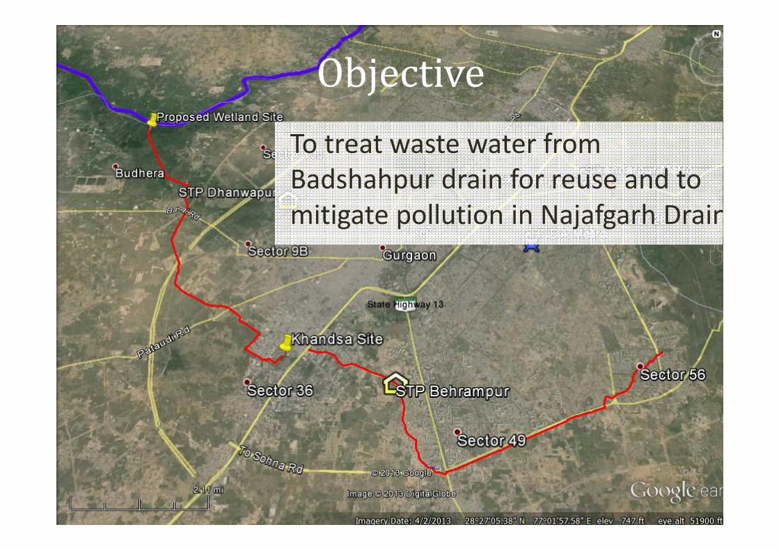
Objective
To treat waste water from
Badshahpur drain for reuse and to
mitigate pollution in Najafgarh Drain.
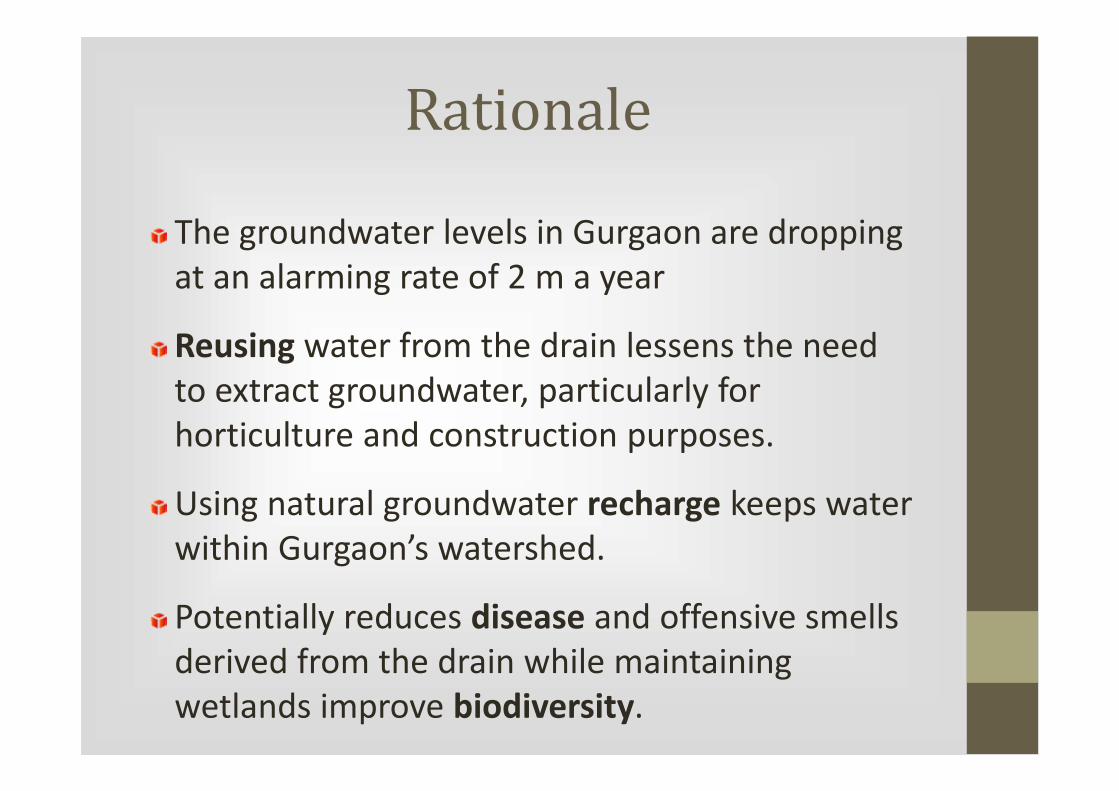
Rationale
The groundwater levels in Gurgaon are dropping
at an alarming rate of 2 m a year
Reusing water from the drain lessens the need
to extract groundwater, particularly for
horticulture and construction purposes.
Using natural groundwater recharge keeps water
within Gurgaon’s watershed.
Potentially reduces disease and offensive smells
derived from the drain while maintaining
wetlands improve biodiversity.

Current Situation
The Badshahpur Drain runs from southeastern
Gurgaon toward the northwest, flowing into the
Najafgarh Drain.
Exposed areas of the drain from beginning to
end emit offensive odors and contain floating
globules of sludge, along with solid waste
(plastics).

Current Situation: STPs
HUDA’s Sewage Treatment Plants (STPs)
Between the 2 STPs, approximately 35 million gallons per
month of treated sewage water is supplied through
tankers to construction and other uses
Behrampur STP effluent discharges directly into the
drain. There is no visible difference in quality before and
after the outfall.
STP Location Capacity (MLD) Type Status
Dhanwapur (1) 68 ASP Operational since 2000
(2) 100 (25 Tertiary) ASP Due June 2014
Behrampur (1) 50 (10 Tertiary) ASP Operational since 2010
(2) 120 (30 Tertiary) SBR Due June 2014
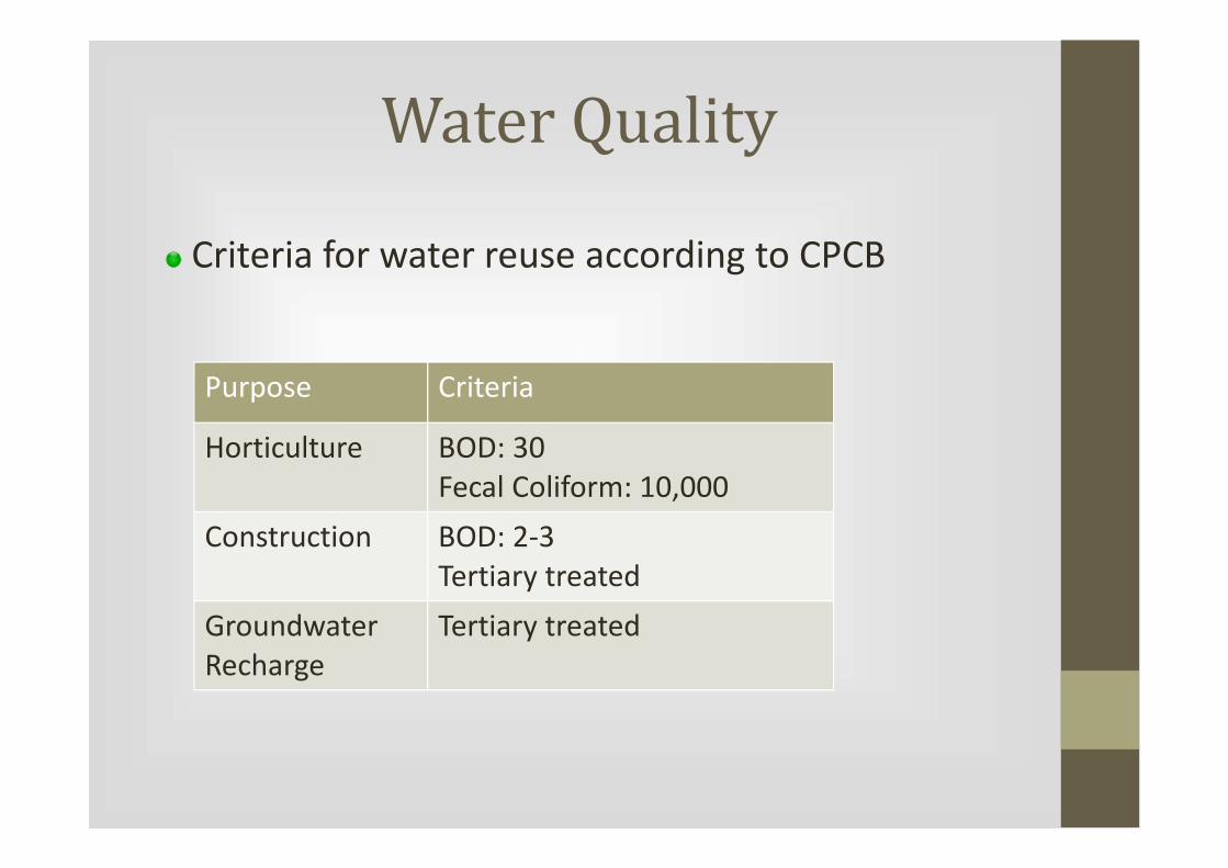
Water Quality
Criteria for water reuse according to CPCB
Purpose Criteria
Horticulture BOD: 30
Fecal Coliform: 10,000
Construction BOD: 2-3
Tertiary treated
Groundwater
Recharge
Tertiary treated

Proposal for in-situ
treatment
3 Treatment Sites
Badshahpur Jheel
Khandasa (Sector 37)
Bhudera (at Najafgarh Drain)

Badshahpur JheelProposed Constructed Wetland Site
� Approximate area: 23,200 sq m
� Situated in Dhani village in Sector 48
� Bordering Park View City 1 Housing Complex and Sohna Road
� 2.25 km upstream of Behrampur STP

Badshahpur Jheel
� A relatively flat area, with an elevated section in the center
� Presently used for dumping earth, making land uneven
� Large electric towers line the north side of the jheel
� Semi-encroached area
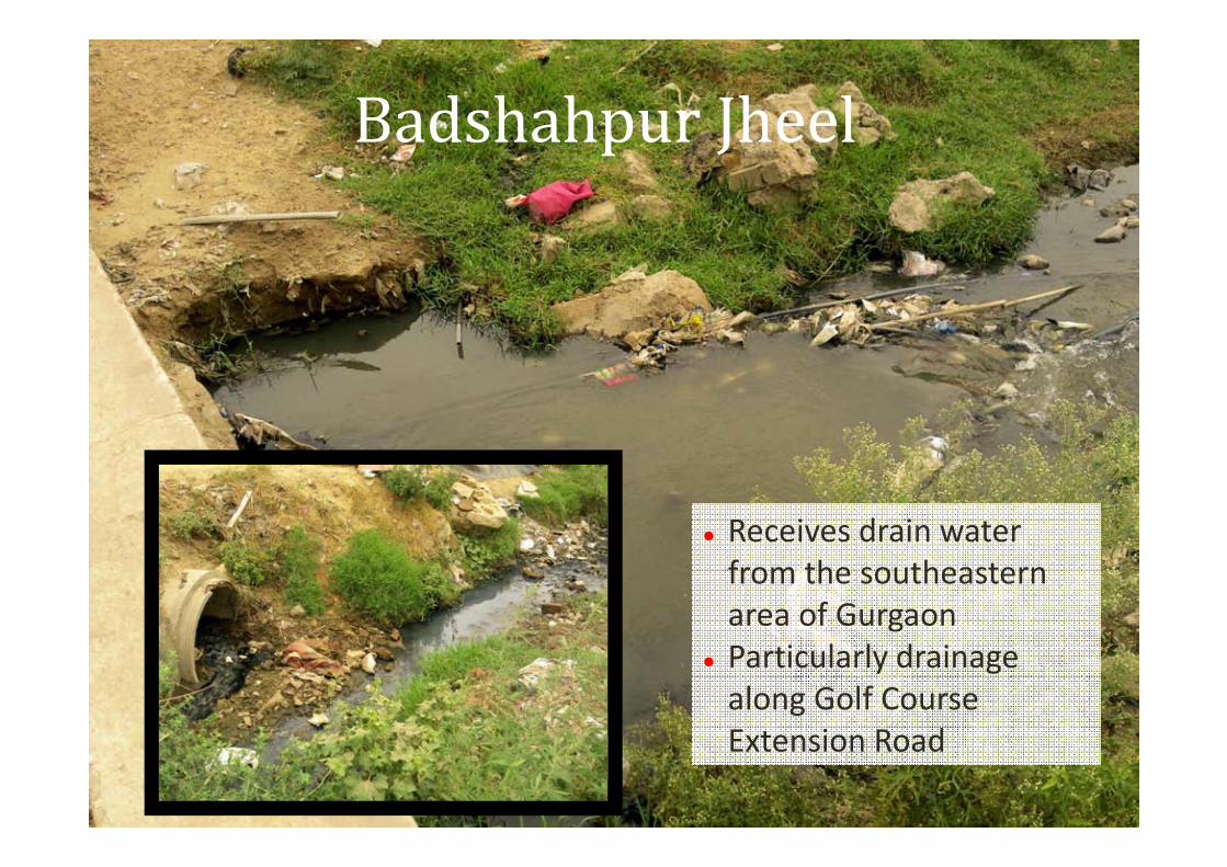
Badshahpur Jheel
� Receives drain water
from the southeastern
area of Gurgaon
� Particularly drainage
along Golf Course
Extension Road
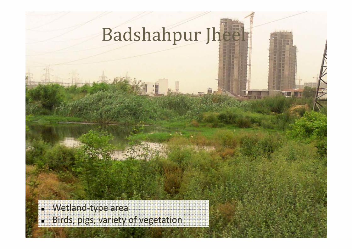
� Wetland-type area
� Birds, pigs, variety of vegetation
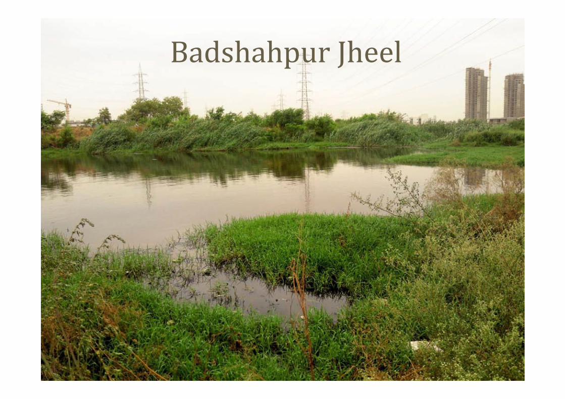
Badshahpur Jheel

Badshahpur Jheel
Proposal
� Revive the jheel as per Sikandarpur pond
� Create a constructed wetland to improve the water quality
� Prevent dumping by surrounding population by demarcating the
pond and mass awareness
� Deepen the jheel, if needed
� Connect treated water to proposed recycling pipeline
Badshahpur Jheel

Schematic of proposed plan
The water body is depicted in blue, tree plantation area in
green and the proposed walkway around the pond in grey.
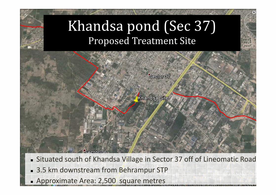
Khandsa pond (Sec 37)Proposed Treatment Site
� Situated south of Khandsa Village in Sector 37 off of Lineomatic Road
� 3.5 km downstream from Behrampur STP
� Approximate Area: 2,500 square metres

Khandsa (Sec 37)
Proposed Treatment Site
Proposal
� Intercept sewage
� Create a constructed
wetland to improve the
water quality
� Prevent dumping
� Deepen the water body,
if needed
� Connect treated water
to recycling pipeline
(none proposed at
present in the area)
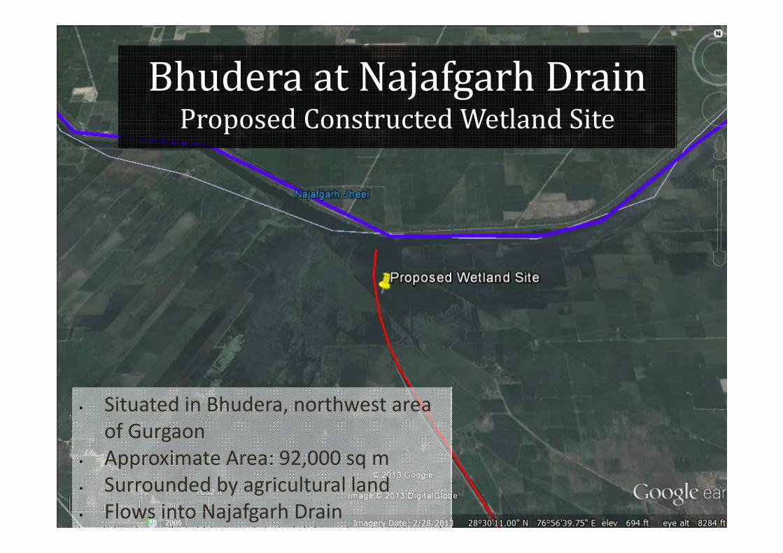
Bhudera at Najafgarh DrainProposed Constructed Wetland Site
• Situated in Bhudera, northwest area
of Gurgaon
• Approximate Area: 92,000 sq m
• Surrounded by agricultural land
• Flows into Najafgarh Drain

Bhudera at Najafgarh DrainProposed Constructed Wetland Site
Proposal
� Use biological means to improve the water quality
� Prevent dumping by surrounding population by demarcating the pond
and mass awareness
� Deepen the waterbody, if needed
� Connect treated water to proposed recycling pipeline

Schematic of proposed plan
The water body is depicted in blue and tree plantation area in green
Rainwater Harvesting
Ghata Jheel
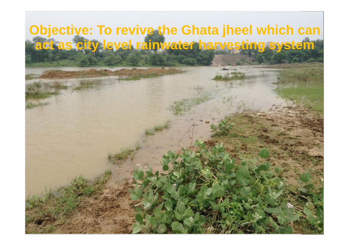
Objective: To revive the Ghata jheel which can act as city level rainwater harvesting system
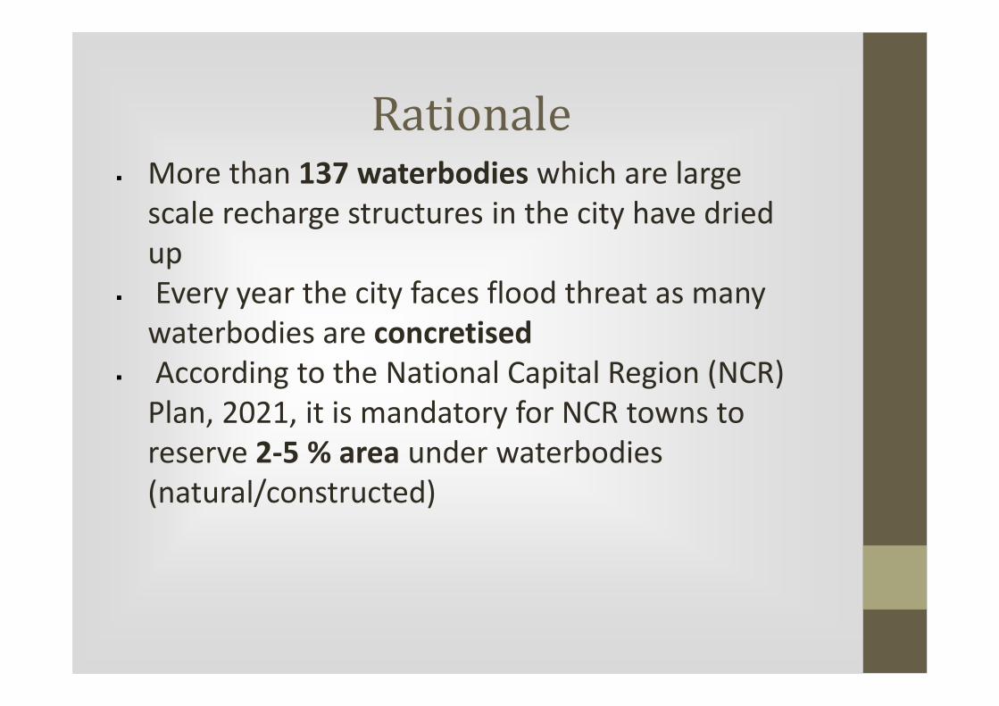
Rationale� More than 137 waterbodies which are large
scale recharge structures in the city have dried
up
� Every year the city faces flood threat as many
waterbodies are concretised
� According to the National Capital Region (NCR)
Plan, 2021, it is mandatory for NCR towns to
reserve 2-5 % area under waterbodies
(natural/constructed)
� The jheel will act as large groundwater recharge
structure in the area
� Development of the jheel will also help in
creation a sponge in the area which will absorb
flood in the area
� The jheel will also act as surface water reservoir
which can provide water security to the
agricultural activities in the surrounding area
Rationale

• The jheel occurs in Sector 58, Gurgaon
• It has been marked as seasonal lake in the
Indian Gazeteer (1893)
• The jheel holds water from monsoon to middle
of October
• The feeder channels and the catchment area
has been blocked/concretised by new
development and construction of road
• Only one such feeder channel can be revived
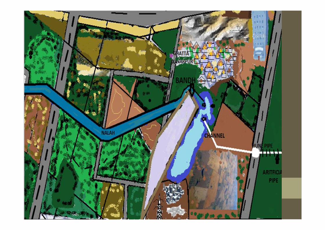
Ghata jheel: Current situation

Current status of Ghata jheel
Ghata jheel
Bandh
Residential area
Roads

Sector 58Ghata jheel

Nullah
Channel to be revived
Ghata jheel
Encroached channels
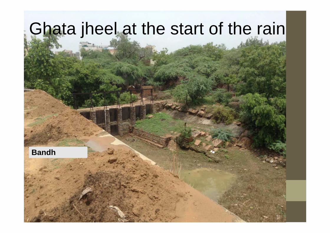
Ghata jheel at the start of the rain
Bandh

Ghata jheel after first spell of rain
Bandh
Silted feeder channel
Residential area blocking the flow of rainwater into the jheel
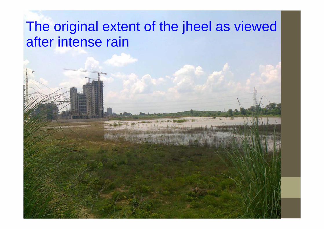
The original extent of the jheel as viewed after intense rain

Ghata jheel after intense spell of rain

Channel to be revived
Ghata jheel
``
Channel to be revivedGhata jheel
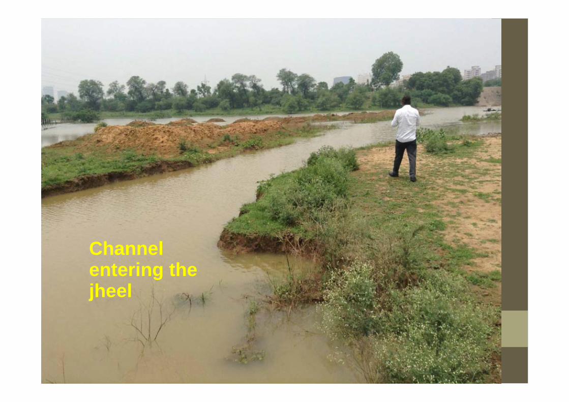
Channel entering the jheel

Channel after peak intense rainfall
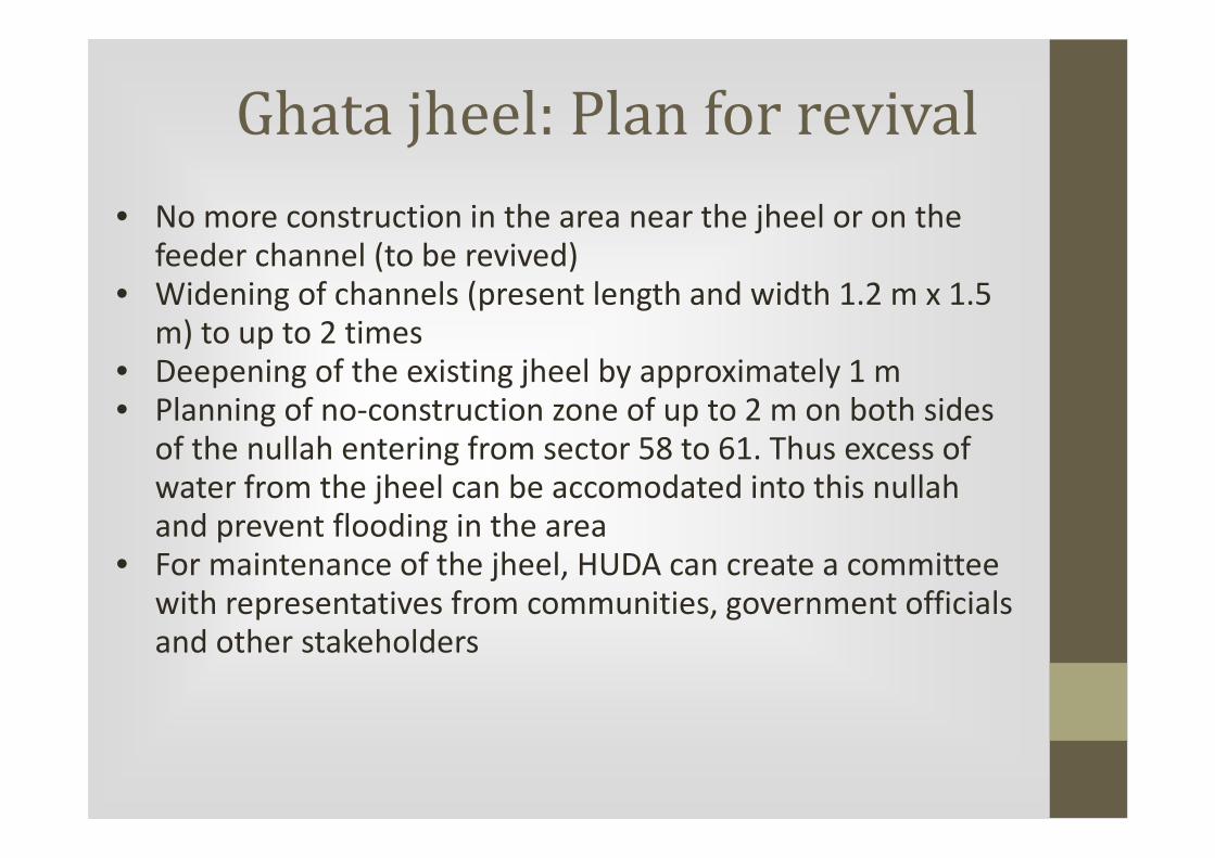
Ghata jheel: Plan for revival
• No more construction in the area near the jheel or on the
feeder channel (to be revived)• Widening of channels (present length and width 1.2 m x 1.5
m) to up to 2 times• Deepening of the existing jheel by approximately 1 m• Planning of no-construction zone of up to 2 m on both sides
of the nullah entering from sector 58 to 61. Thus excess of water from the jheel can be accomodated into this nullahand prevent flooding in the area
• For maintenance of the jheel, HUDA can create a committee
with representatives from communities, government officials and other stakeholders

Ghata jheel: Further activities for detailed revival plan
Survey of the following:A) Physiography, Soil and Drainage patternB) Geological, Geophysical and HydrogeologicalC) Land useD) Flood dataE) GIS and remote sensing data
Data can be collected from:I. Research and newspaper articlesII. Government departmentsIII. Pre-independence and post independence gazeteerIV. National Remote Sensing Centre
Time frame: Six months� Data collection and compilation : Two months� Analyses and inference drawing : Four months
Revival of village ponds
Rainwater Harvesting
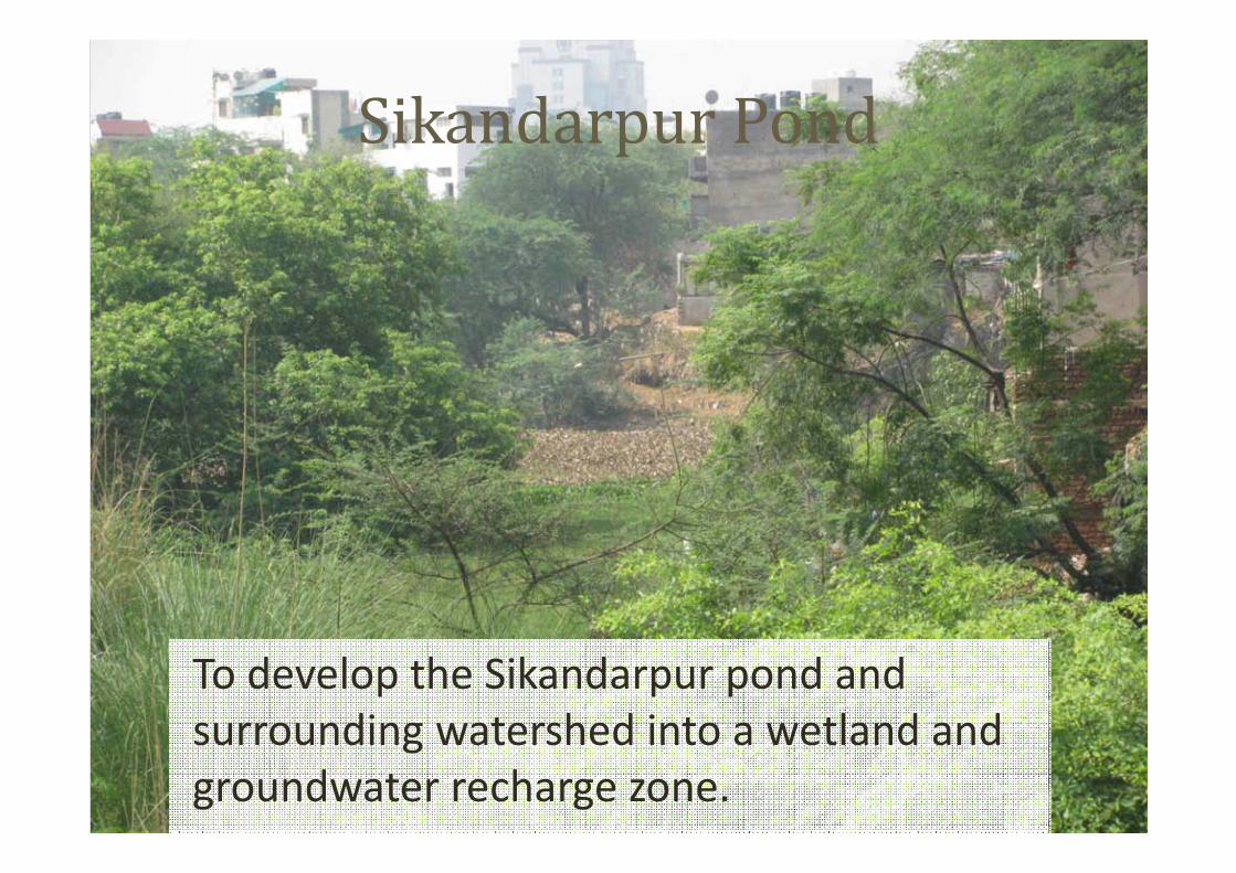
Sikandarpur Pond
To develop the Sikandarpur pond and
surrounding watershed into a wetland and
groundwater recharge zone.

Rationale
• This pond and watershed are critical for
maintaining the groundwater levels in
surrounding areas that are heavily populated.
• Improving the watershed will improve water
security.
• Cleaning the wetland will improve the ecology of
the area and reduce diseases.
• It will become a recreation centre for the local
people.

Rationale
These show what is possible
once the pond is restored. This
lake in Bangalore was a in bad
condition as it was encroached,
full of sewage and weeds (you
can see some on the lower
right corner). The lake is now
managed by a company.
Sewage from surrounding
colonies is treated before being
allowed to enter the lake, and
this provides a steady flow of
water into the lake.
Rationale
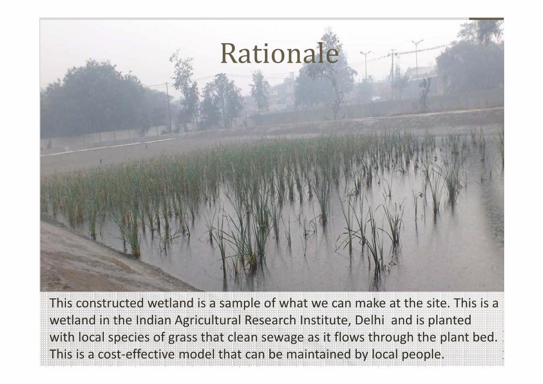
This constructed wetland is a sample of what we can make at the site. This is a
wetland in the Indian Agricultural Research Institute, Delhi and is planted
with local species of grass that clean sewage as it flows through the plant bed.
This is a cost-effective model that can be maintained by local people.

Sikandarpur is a historical village on the Delhi-
Gurgaon border next to which is a large pond,
created by the blockage of a seasonal stream
that originates in the hills behind Silver Oaks.
Current situation
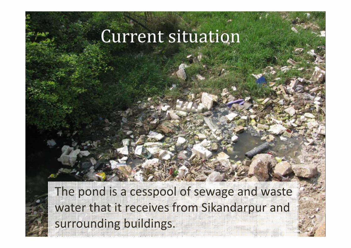
The pond is a cesspool of sewage and waste
water that it receives from Sikandarpur and
surrounding buildings.
Current situation

The pond's watershed stretches up to the
Gurgaon-Faridabad road and is covered with
vilayati babul.
Current situation


Proposal to restore wetland1. Improve the quality and quantity of water in the pond
Intercept all sewage entering the pond, construct reed
beds/constructed wetlands
Use biological means to improve the water quality in the pond
Remove water hyacinth on on-going basis
Prevent dumping by surrounding population by demarcating
the pond and fencing if needed and mass contact programme
with residents
Deepen the pond, if needed
Creation of irrigation infrastructure
Constructing check-dams, contour bunding and gully-plugs
Rainwater harvesting in surrounding areas
Proposal to restore wetland2. Improve the local biodiversity of plants and avi-fauna
Identify local specifies of trees and shrubs and develop a
nursery.
Conduct an extensive replantation of the watershed to replace
the invasive species with native plants.
Provide facilities for watering the plantation from the existing
pond and using treated waste water from the Global Business
Park.
Ensure the plantation is protected from grazing and cutting for
a period of 5-7 years till the trees mature to ensure their
survival.

The water body is depicted in blue, tree plantation area in
green and the proposed walkway around the pond in grey.
Schematic of proposed plan
Activities
Demarcate the area and mark the boundary with posts.
Include a ground survey that will identify locations for
different activities.
Demarcate and construct sewage interception zones.
Create reed beds.
De-weed the pond
Conduct community education and awareness drive.
Introduce cultured bacteria/enzymes. Requires aeration
methods.

Activities
Construct watershed structures on the entire watershed
area.
Develop nursery for local plants
Plantation of local plants in the entire watershed
Develop recreation zones, include unpaved walking tracks,
benches, sit-outs
Develop irrigation infrastructure
Develop a management committee, comprising of people
from Sikandarpur, local residents from DLF and the
authorities for long-term maintenance of the area

Preliminary Survey
A preliminary survey of the area is required to establish
the area, and the following parameters:
Physical size of the area and main physical features
Geophysical investigations of the project site
Depth to water level, Water fluctuations, Water quality test
Hydro-geological investigations
Soil and rock test, Mapping aquifer, Terrain mapping
Watershed mapping
Vegetation mapping
Preparing a water balance
Demarcation of land use
Residential, institutional, forest, water, etc.
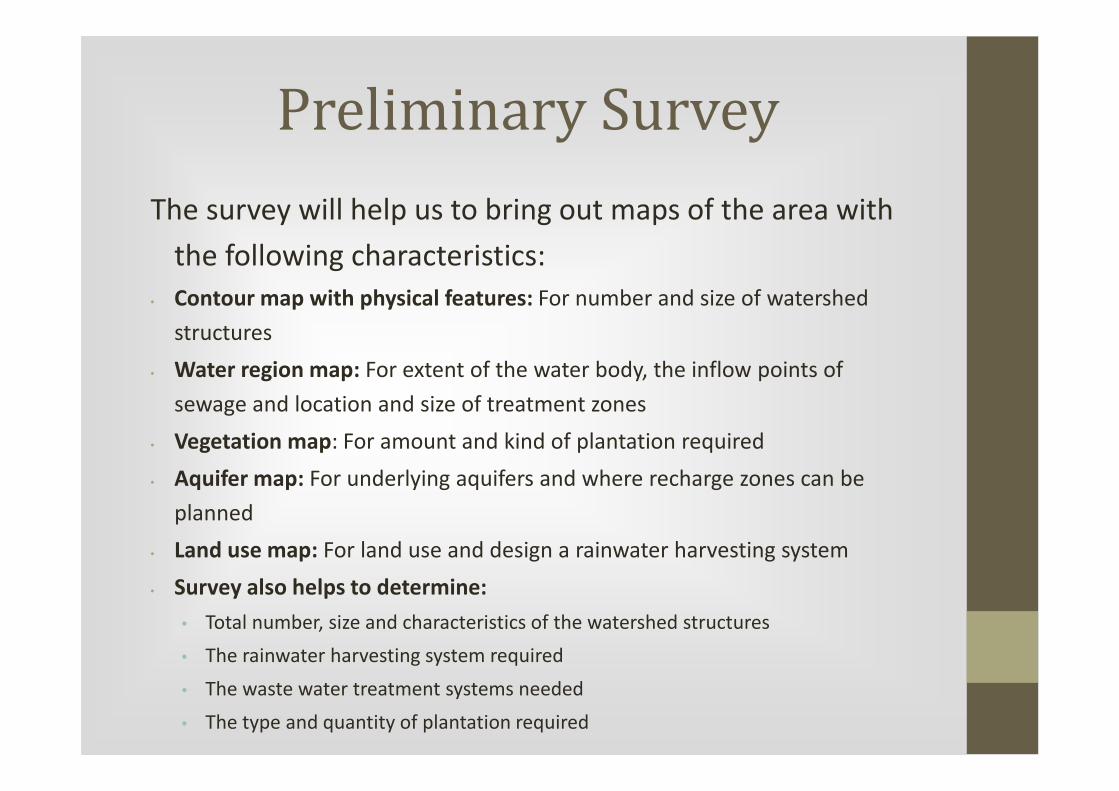
Preliminary Survey
The survey will help us to bring out maps of the area with
the following characteristics:
• Contour map with physical features: For number and size of watershed
structures
• Water region map: For extent of the water body, the inflow points of
sewage and location and size of treatment zones
• Vegetation map: For amount and kind of plantation required
• Aquifer map: For underlying aquifers and where recharge zones can be
planned
• Land use map: For land use and design a rainwater harvesting system
• Survey also helps to determine:
• Total number, size and characteristics of the watershed structures
• The rainwater harvesting system required
• The waste water treatment systems needed
• The type and quantity of plantation required
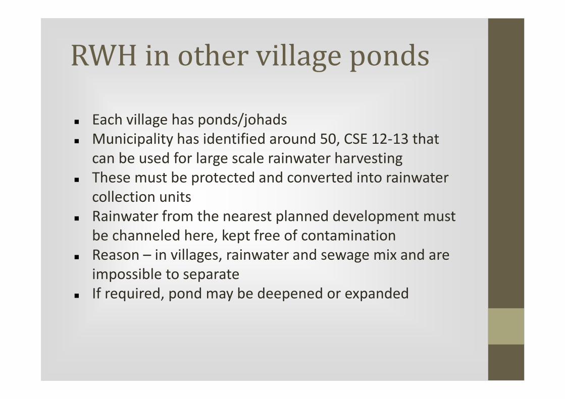
RWH in other village ponds
� Each village has ponds/johads
� Municipality has identified around 50, CSE 12-13 that
can be used for large scale rainwater harvesting
� These must be protected and converted into rainwater
collection units
� Rainwater from the nearest planned development must
be channeled here, kept free of contamination
� Reason – in villages, rainwater and sewage mix and are
impossible to separate
� If required, pond may be deepened or expanded
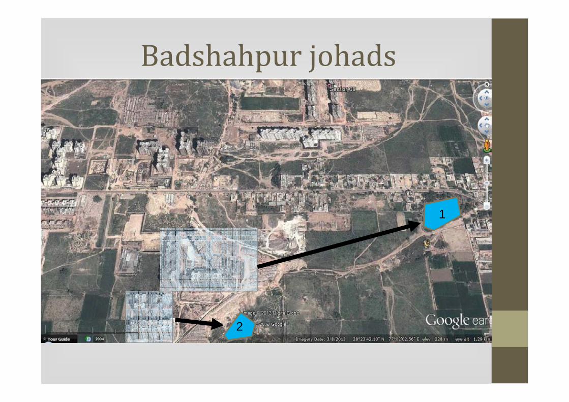
Badshahpur johads
1
2

Badshahpur johads� Johad 1:
− 60X100 m
− Approx depth 1.5 m
− Storage capacity 9000 cubic metres
− Construct pipeline of 550 m from apartment complex to
Johad
� Johad 2
− 40X65 m
− Approx depth 1.5 m
− Storage capacity 4,000 cubic metres
− Construct pipeline of 130 m to Johad

� Rooftop area approximately 9648 sq m
� 0.6 m annual rainfall
� Collection efficiency 80%
� Potential for RWH = 4631 cubic metres
Badshahpur johads
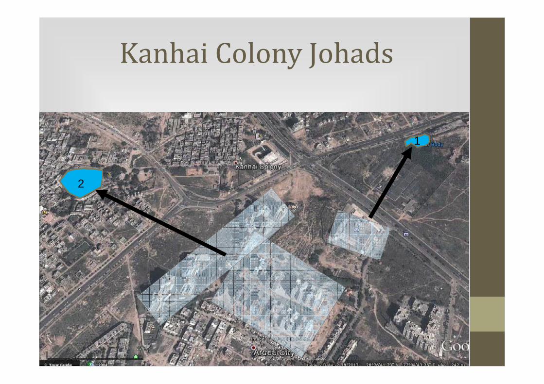
Kanhai Colony Johads
2
1
Kanhai Colony
� Johad 1
− Size 50X90 m, approx depth 1 m, storage capacity 4500 cubic m
− Ardee Mall rainwater collection potential 4000 cu m
− Pipeline length 320 m
� Johad 2
− Size 7000 sq m, approx depth 1 m, storage capacity 7000 cu m
− Ardee City multistoreyed apts collection potential 6000 cu
− Pipeline length 400 m, may need to be stored above ground as johad
is at higher altitude than apartments

Sector 43
Pond
Rooftop rainwater harvesting area
Sector 43
� Pond size 1750 sq m, average depth 2 m, capacity 3500 cu m
� Rooftop rainwater harvesting potential from multistorey
apartments is about 3,800 cubic metres
� Pipeline length about 300 m
� Recommend overground storage
� Recommend development of alternate pond in area marked in red
as that is lower than apartment complex, will solve waterlogging
and flooding. Larger capacity and can collect water from other
developments
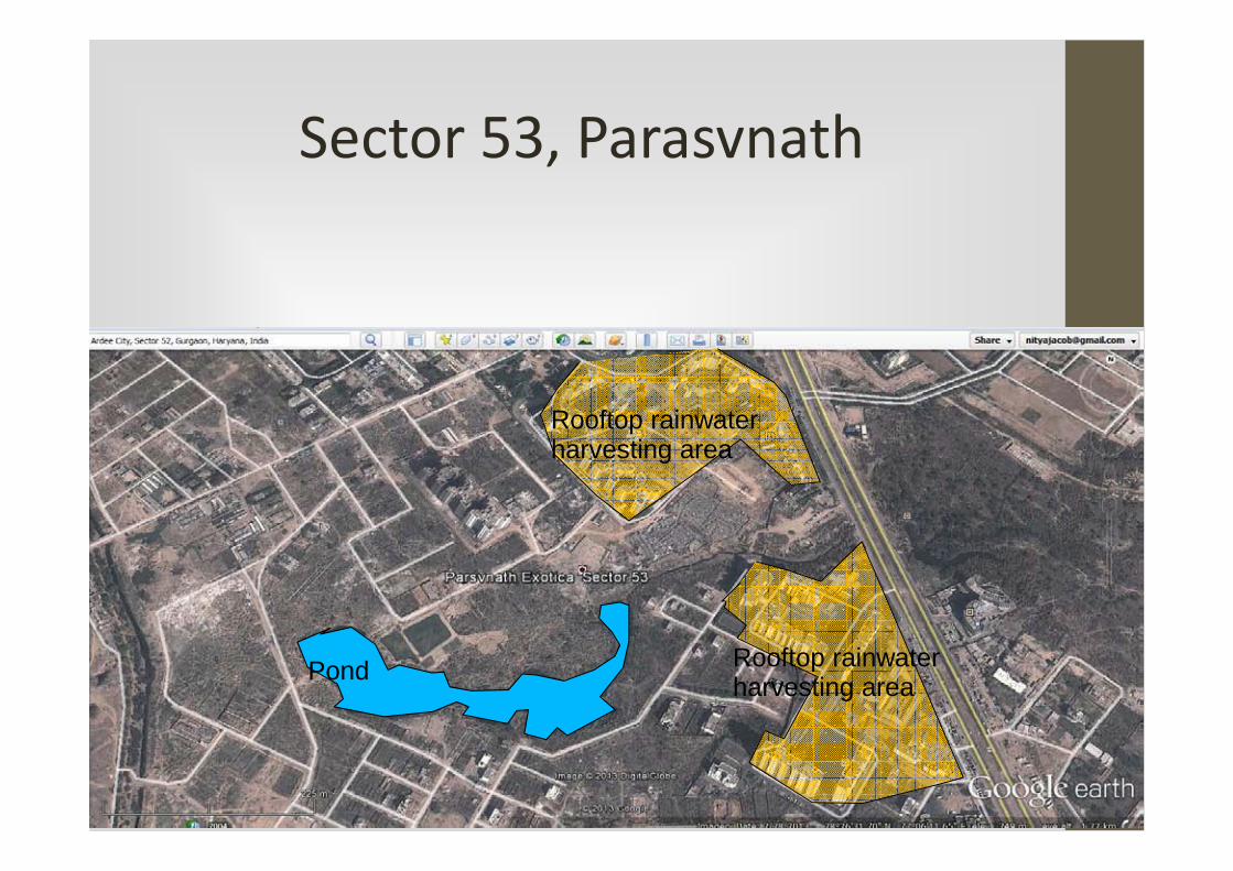
Sector 53, Parasvnath
Pond
Rooftop rainwater harvesting area
Rooftop rainwater harvesting area
Sector 53, Parasvnath
� Size of pond 21640 sq m, average depth 1 m, storage 21640 cu m
� RWH potential 6791 cu m from multistorey developments
� Several short pipelines needed to carry rainwater to ponds

Tigra johads
1
2
Rooftop rainw
ater harvesting areaRooftop rainwater harvesting area
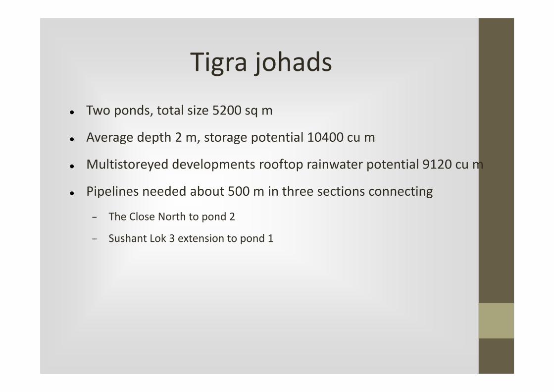
Tigra johads
� Two ponds, total size 5200 sq m
� Average depth 2 m, storage potential 10400 cu m
� Multistoreyed developments rooftop rainwater potential 9120 cu m
� Pipelines needed about 500 m in three sections connecting
− The Close North to pond 2
− Sushant Lok 3 extension to pond 1

Tigra South johads
Water body in blue, roofs of multistoreyed developments in yellow

Tigra South johads
� Water storage potential in pond is 10,000 cu m, that can be
enhanced to 15,000 cu m by restoring dried parts of the pond to the
west
� Rainwater harvesting potential from marked areas is 7,400 cu m
� Pipeline length needed to convey water is 580 m in three pieces

Sukhrali, Sector 17 johad

Sukhrali, Sector 17 johad
� Capacity of jheel = 15,000 cubic metres
� Rainwater harvesting potential from IFFCO Colony = 37,000 cubic
metres
� Length of pipeline = 400 m
� Natural gradient is present, storage can be on the surface or at grade

Samaspur johad
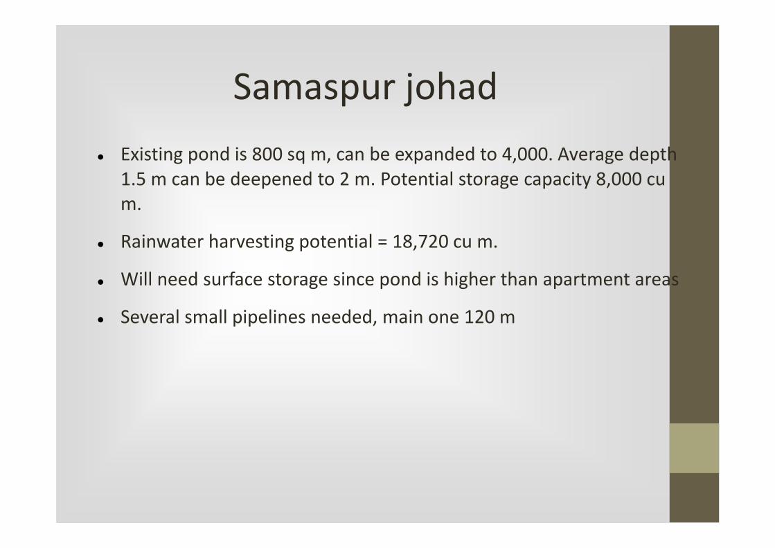
Samaspur johad
� Existing pond is 800 sq m, can be expanded to 4,000. Average depth
1.5 m can be deepened to 2 m. Potential storage capacity 8,000 cu
m.
� Rainwater harvesting potential = 18,720 cu m.
� Will need surface storage since pond is higher than apartment areas
� Several small pipelines needed, main one 120 m
Water Sanctuary

Water Sanctuary
Water sanctuary� Purpose is to provide dedicated rainwater harvesting and
groundwater recharge zones. Approx area is 90 sq km of Aravalihill areas
� Rationale: Land slopes from south and east towards the north and west, that is the populated part. Protecting this will ensure a good measure of groundwater security
� Method is to maximise water retention through intensive watershed improvement
− Construction of check dams, gully plugs, gabion structures, contour bundingand trenching
− Plantation of native species and phased replacement of vilaiti babul from these areas
− Prevention of lopping, felling trees; permit grazing and collection of minor forest produce
− No land use change: protection from future conversion as residential, commercial, institutional, agricultural, etc

Water sanctuary
� Rainwater harvesting potential is approx 21,600,000,000,000 litres
per year (or 60 MLD)
� That is about 1/3 daily water demand of Gurgaon at present

Thank you
We hope you take these up on a
war footing and seriously