chapter 1 cover - bureau of reclamation · chapter 1 purpose and ... shortage guidelines and...
TRANSCRIPT

Chapter One


Chapter 1 Purpose and Need
Final EIS – Colorado River Interim Guidelines for Lower Basin Shortages and Coordinated Operations for Lake Powell and Lake Mead
1-1 October 2007
1.1 Introduction
During the period from 2000 to 2007, the Colorado River has experienced the worst drought conditions in approximately one hundred years of recorded history. During this period, storage in Colorado River reservoirs has dropped from nearly full to less than 55 percent of capacity as of September 30, 2007. Currently, the Department of the Interior (Department) does not have specific operational guidelines in place to address the operations of Lake Powell and Lake Mead during drought and low reservoir conditions.
Accordingly, the Secretary of the Department of the Interior (Secretary), acting through the Bureau of Reclamation (Reclamation), proposes adoption of specific Colorado River Lower Basin (Lower Basin) shortage guidelines and coordinated reservoir management strategies to address operations of Lake Powell and Lake Mead, particularly under drought and low reservoir conditions. This action is proposed in order to provide a greater degree of certainty to United States Colorado River water users and managers of the Colorado River Basin by providing detailed, and objective guidelines for the operations of Lake Powell and Lake Mead, thereby allowing water users in the Lower Basin to know when, and by how much, water deliveries will be reduced in drought and other low reservoir conditions. The environmental impact statement (EIS) process provides the opportunity to develop the information needed to analyze and consider trade-offs between the frequency and magnitude of shortages, and to describe potential effects on water storage in Lake Powell and Lake Mead, and on water supplies, power production, recreation, and other environmental resources.
The Secretary proposes that these guidelines be interim in duration and extend through 2026. Adoption of these new guidelines, along with modification of existing operational guidelines for a consistent interim period through 2026, will provide the opportunity to gain valuable operating experience for the management of Lake Powell and Lake Mead under modified operations and improve the basis for making additional future operational decisions, whether during the interim period or thereafter.
The Secretary intends to consider, adopt and implement the proposed federal action1 consistent with applicable federal law and judicial decisions, and, further, in a manner that will not require any additional statutory authorization. In addition, the proposed federal action would be implemented consistent with the Colorado River Compact of 1922 (Compact), the Consolidated Decree entered by the United States Supreme Court in the case of Arizona v. California, 547 U.S. 150 (2006) (Consolidated Decree), and other provisions of applicable federal law. The proposed federal action will be implemented through the adoption of interim guidelines that would be used each year by the Department in implementing the Criteria for Coordinated Long-Range Operation of Colorado River Reservoirs Pursuant to the Colorado River Basin Project Act of September 30, 1968 (Long-Range Operating Criteria or LROC) through issuance of the Annual Operating Plan for Colorado River Reservoirs (AOP).
1 The phrase “proposed federal action” is used herein to refer to the action that the Secretary may take to meet the purpose and need. A range of alternatives, including the Preferred Alternative, are considered and analyzed in this Final EIS.

Purpose and Need Chapter 1
October 2007 1-2 Final EIS – Colorado River Interim Guidelines for
Lower Basin Shortages and Coordinated Operations for Lake Powell and Lake Mead
This Final Environmental Impact Statement (Final EIS) has been prepared pursuant to the National Environmental Policy Act of 1969 (NEPA), as amended, and the Council on Environmental Quality’s (CEQ) Regulations for Implementing the Procedural Provisions of NEPA (40 Code of Federal Regulations (C.F.R.) part (pt.) 1500 through 1508). This Final EIS has been prepared to address the formulation and evaluation of the proposed federal action and to identify the potential environmental effects of implementing the proposed federal action.
This Final EIS identifies the potentially relevant environmental issues associated with, and analyzes the environmental consequences of, alternatives for implementing the proposed federal action. The alternatives addressed in this Final EIS are those Reclamation has determined would meet the purpose and need for the proposed federal action and represent a broad range of reasonable alternatives.
1.2 Proposed Federal Action
The proposed federal action includes the adoption of specific interim guidelines for Lower Basin shortages and coordinated operations of Lake Powell and Lake Mead. These interim guidelines would remain in effect for determinations to be made through 2025 regarding water supply and reservoir operating decisions through 2026 and would provide guidance each year in development of the AOP. This proposed federal action considers four operational elements that collectively are designed to address the purpose and need for the proposed federal action; these elements are addressed in each of the alternatives described in Chapter 2.
The interim guidelines would be used by the Secretary to:
1) determine those circumstances under which the Secretary would reduce the annual amount of water available for consumptive use from Lake Mead to the Colorado River Lower Division states (Arizona, California, and Nevada) below 7.5 million acre-feet (maf) (a ‘‘Shortage’’) pursuant to Article II(B)(3) of the Consolidated Decree;
2) define the coordinated operations of Lake Powell and Lake Mead to provide improved operation of these two reservoirs, particularly under low reservoir conditions;
3) allow for the storage and delivery, pursuant to applicable federal law, of conserved Colorado River system and non-system water in Lake Mead to increase the flexibility of meeting water use needs from Lake Mead, particularly under drought and low reservoir conditions; and
4) determine those conditions under which the Secretary may declare the availability of surplus water for use within the Lower Division states. The proposed federal action would modify the substance of the existing Interim Surplus Guidelines (ISG), published in the Federal Register (Fed. Reg.) on January 25, 2001 (66 Fed. Reg. 7772), and the term of the ISG from 2016 through 2026.

Chapter 1 Purpose and Need
Final EIS – Colorado River Interim Guidelines for Lower Basin Shortages and Coordinated Operations for Lake Powell and Lake Mead
1-3 October 2007
1.3 Purpose of and Need for Action
The purpose of the proposed federal action is to: 1) improve Reclamation’s management of the Colorado River by considering the trade-offs between the frequency and magnitude of reductions of water deliveries, and considering the effects on water storage in Lake Powell and Lake Mead, water supply, power production, recreation, and other environmental resources; 2) provide mainstream United States users of Colorado River water, particularly those in the Lower Division states, a greater degree of predictability with respect to the amount of annual water deliveries in future years, particularly under drought and low reservoir conditions; and, 3) provide additional mechanisms for the storage and delivery of water supplies in Lake Mead.
The proposed federal action is needed for the following reasons:
♦ the Colorado River is of unique and strategic importance in the southwestern United States for water supply, hydropower production, flood control, recreation, fish and wildlife habitat, and other benefits. In addition, the United States has a delivery obligation to the United Mexican States (Mexico) for certain waters of the Colorado River pursuant to the February 3, 1944 Treaty between the United States and Mexico Relating to the Utilization of the Waters of the Colorado and Tijuana Rivers and of the Rio Grande (1944 Treaty);
♦ the eight-year period from 2000 through 2007 was the driest eight-year period in the 100-year historical record of the Colorado River; this drought in the Colorado River Basin has reduced Colorado River system storage, while demands for Colorado River water supplies have continued to increase. From October 1, 1999 through September 30, 2007, storage in Colorado River reservoirs fell from 55.8 maf (approximately 94 percent of capacity) to 32.1 maf (approximately 54 percent of capacity), and was as low as 29.7 maf (approximately 52 percent of capacity) in 2004. This drought was the first sustained drought experienced in the Colorado River Basin at a time when all major storage facilities were in place, and when use by the Lower Division states met or exceeded the annual “normal” apportionment of 7.5 maf pursuant to Article II(B)(1) of the Consolidated Decree. These conditions, among other factors, led the Department to conclude that additional management guidelines are necessary and desirable for the efficient management of the major mainstream Colorado River reservoirs;
♦ in the future, low reservoir conditions may occur more frequently due to drought periods and anticipated future demands on Colorado River water supplies;
♦ as a result of actual operating experience and through reviews of the LROC and preparation of AOPs, particularly during recent drought years, the Secretary has determined a need for more specific guidelines, consistent with the Consolidated Decree and other applicable provisions of federal law to assist in the Secretary's determination of annual water supply conditions in the Lower Basin under low reservoir conditions. This increased level of predictability is needed by water managers and the entities that receive Colorado River water to better plan for and manage available water

Purpose and Need Chapter 1
October 2007 1-4 Final EIS – Colorado River Interim Guidelines for
Lower Basin Shortages and Coordinated Operations for Lake Powell and Lake Mead
supplies, and to better integrate the use of Colorado River water with other water supplies that they rely on;
♦ to date, storage of water and flows in the Colorado River has been sufficient so that it has not been necessary to reduce Lake Mead annual releases below 7.5 maf; that is, the Secretary has never reduced deliveries by declaring a “shortage” on the lower Colorado River. Without operational guidelines in place, water users in the Lower Division states who rely on Colorado River water are not currently able to identify particular reservoir conditions under which the Secretary would reduce the annual amount of water available for consumptive use from Lake Mead to the Lower Division states below 7.5 maf. Nor are these water users able to identify the frequency or magnitude of any potential future annual reductions in their water deliveries;
♦ subsequent to the public consultation meetings held in the summer of 2005, the Secretary has also determined the desirability of developing additional operational guidelines that will provide for releases greater than or less than 8.23 maf from Lake Powell; and
♦ to further enhance this coordinated reservoir approach, the Secretary has also determined a need for guidelines that provide water users in the Lower Division states the opportunity to conserve, store, and take delivery of water in and from Lake Mead for the purposes of enhancing existing water supplies, particularly under low reservoir conditions. The Secretary has determined the need to modify and extend the ISG to coincide with the duration of the proposed new guidelines. This will provide an integrated approach for reservoir management and more predictability for future Lower Division water supplies.
1.4 Lead and Cooperating Agencies
The Secretary is responsible for the operation of Glen Canyon Dam and Hoover Dam pursuant to applicable federal law. The Secretary is also vested with the responsibility of managing the mainstream waters of the lower Colorado River pursuant to federal law. This responsibility is carried out consistent with the Law of the River.2 Reclamation, as the agency that is designated to act on the Secretary’s behalf with respect to these matters, is the lead federal agency for the purposes of NEPA compliance for the development and implementation of the proposed interim guidelines.
2 The treaties, compacts, decrees, statutes, regulations, contracts and other legal documents and agreements applicable to the allocation, appropriation, development, exportation and management of the waters of the Colorado River Basin are often referred to as the Law of the River. There is no single, universally agreed upon definition of the Law of the River, but it is useful as a shorthand reference to describe this longstanding and complex body of legal agreements governing the Colorado River.

Chapter 1 Purpose and Need
Final EIS – Colorado River Interim Guidelines for Lower Basin Shortages and Coordinated Operations for Lake Powell and Lake Mead
1-5 October 2007
Five federal agencies are cooperating for purposes of assisting with environmental analysis and preparation of this Final EIS. These cooperating agencies are the Bureau of Indian Affairs (BIA), the United States Fish and Wildlife Service (FWS), the National Park Service (NPS), Western Area Power Administration (Western), and the United States Section of the International Boundary and Water Commission (USIBWC).
The BIA has responsibility for the administration and management of lands held in trust by the United States for American Indians (Indian) and Indian tribes located within the Colorado River Basin (a list of these Indian tribes is provided in Chapter 6). Developing forestlands, leasing assets on these lands, directing agricultural programs, protecting water and land rights, developing and maintaining infrastructure and economic development are all part of the BIA’s responsibility.
The FWS is involved in the conservation, protection and enhancement of fish, wildlife, and plants and their habitats for the continuing benefit of the American people. FWS manages four national wildlife refuges along the Colorado River. Among its many other key functions, the FWS administers and implements federal wildlife laws, protects endangered species, manages migratory birds, restores nationally significant fisheries, conserves and restores wildlife habitat such as wetlands, and assists foreign governments with international conservation efforts. It also oversees the federal aid program that distributes hundreds of millions of dollars in excise taxes on fishing and hunting equipment to state fish and wildlife agencies.
The NPS administers areas of national significance along the Colorado River, including Glen Canyon National Recreation Area (GCNRA), Grand Canyon National Park, and Lake Mead National Recreation Area (LMNRA). The NPS administers visitor use (including recreation) of cultural and natural resources in these areas from offices located at Page, Arizona; Grand Canyon National Park, Arizona; and Boulder City, Nevada, respectively. The NPS also grants and administers concessions for the operation of marinas and other recreation facilities at Lake Powell and Lake Mead, as well as concessions’ operations along the Colorado River between Glen Canyon Dam and Lake Mead.
Western markets and distributes hydroelectric power and related services within a 15-state region of the central and western United States and it is one of four power marketing administrations within the Department of Energy. Its role is to market and transmit electricity from multi-use water projects. Western markets and transmits power generated from the various hydropower plants located within the Colorado River Basin and operated by Reclamation. Western customers include municipalities, cooperatives, public utility and irrigation districts, federal and state agencies, investor-owned utilities (only one of which purchases firm power from Western), and Indian tribes located throughout the Colorado River Basin. The wholesale customers, in turn, provide retail electric service to millions of consumers within the seven Colorado River Basin States (Basin States).
The USIBWC is the United States component of a bi-national organization responsible for administration of the provisions of the 1944 Treaty, which includes the Colorado River waters allotted to Mexico, protection of lands along the Colorado River from floods by levee and floodway construction projects, resolution of international boundary water sanitation and other water quality problems, and preservation of the Colorado River as the international boundary.

Purpose and Need Chapter 1
October 2007 1-6 Final EIS – Colorado River Interim Guidelines for
Lower Basin Shortages and Coordinated Operations for Lake Powell and Lake Mead
The International Boundary and Water Commission (IBWC) consists of the United States Section and the Mexican Section, which have their headquarters in the adjoining cities of El Paso, Texas and Ciudad Juarez, Chihuahua, respectively.
1.5 Scope of the EIS
In a May 2, 2005 letter to the Governors of the Basin States, issued to complete the 2005 AOP mid-year review, the Secretary directed Reclamation to develop additional strategies for improving coordinated management of the reservoirs of the Colorado River system. Pursuant to that direction, Reclamation conducted a public consultation workshop on May 26, 2005, in Henderson, Nevada; issued a Federal Register notice on June 15, 2005 soliciting public comments; and conducted public meetings on July 26 and July 28, 2005, in Henderson, Nevada, and Salt Lake City, Utah, respectively. Reclamation received a broad range of public comments and suggestions from these discussions. Based in part on comments received from the public, Reclamation determined that the appropriate level of NEPA documentation for the development of Lower Basin shortage guidelines and coordinated management strategies for the operations of Lake Powell and Lake Mead under low reservoir conditions would be in the form of an EIS.
Consequently, on September 30, 2005, Reclamation published a Notice of Intent (NOI) (70 Fed. Reg. 57322) to prepare an EIS. The NOI described the proposed federal action as having two major elements: 1) adoption of specific Lower Basin shortage guidelines; and 2) developing coordinated reservoir management strategies to address operations of Lake Powell and Lake Mead under low reservoir conditions. The NOI also initiated a public process for determining the scope of specific shortage guidelines and coordinated reservoir management strategies and the issues and alternatives to be considered and analyzed in the preparation of the EIS.
Reclamation conducted public scoping meetings on November 1, 2, 3, and 8, 2005, in Salt Lake City, Utah; Denver, Colorado; Phoenix, Arizona; and Henderson, Nevada, respectively. Reclamation also consulted with representatives from the Basin States, Indian tribes, non-governmental organizations (NGO), and other interested parties. Reclamation provided a 62-day comment period consistent with the Public Notice issued on September 30, 2005. The public comment period ended on November 30, 2005.
On March 31, 2006, Reclamation published a Scoping Summary Report on the development of Lower Basin shortage guidelines and coordinated management strategies for the operations of Lake Powell and Lake Mead and issued a Notice of Availability (NOA) (71 Fed. Reg. 16341). The report summarized the comments received and the issues raised through the scoping process and provided an assessment of the proposed scope of the environmental analysis to be included in the EIS.
A total of 1,153 written comment letters were received during the scoping process. The comment letters were submitted by a wide range of interested parties that included federal, state, and local agencies; Indian tribes; businesses; special interest groups; and individuals.

Chapter 1 Purpose and Need
Final EIS – Colorado River Interim Guidelines for Lower Basin Shortages and Coordinated Operations for Lake Powell and Lake Mead
1-7 October 2007
On February 28, 2007, Reclamation published a NOA (72 Fed. Reg. 9026) for the Draft EIS which commenced a 61-day public review period that ended on April 30, 2007. As part of this review process, Reclamation conducted three public hearings on April 3, 4, and 5, 2007. The hearings took place in Henderson, Nevada; Phoenix, Arizona; and Salt Lake City, Utah, respectively, to invite public input on the Draft EIS. Additionally, a Modeling Workshop was held on March 6, 2007 in Henderson, Nevada to provide the public with information on the modeling performed and used in the Draft EIS to analyze the potential impacts of hydrologic resources and water deliveries. A total of 78 written comment letters were received during the scoping process and two individuals provided oral comments during the public hearings. The comment letters were submitted by a wide-range of interested parties that included businesses; federal, state and local agencies; Indian tribes; special interest groups; and individuals. Volume IV contains reproductions of letters received from the public and transcripts of the three public hearings held in connection with the public review of the Draft EIS and Reclamation’s responses to the comments received.
1.5.1 Affected Region and Interests The geographic region that would be affected by the proposed federal action begins with Lake Powell and extends downstream along the Colorado River floodplain to the Southerly International Boundary (SIB) with Mexico. This proposed federal action would also potentially affect interests of organizations and individuals, whose geographic distribution extends beyond the Colorado River floodplain into the service areas of certain water agencies in the Lower Basin states.
1.5.2 Relevant Issues The results of the scoping process resulted in Reclamation considering the issues listed in Table 1.5-1. Those issues considered to be potentially significant are addressed in this Final EIS. Those that were not considered potentially significant are not analyzed in this Final EIS.
1.6 Summary of Contents of this Final EIS
Following is a brief description of the topics presented in the four volumes that comprise this Final EIS.
Volume I of this Final EIS (this volume) describes the proposed federal action, the alternatives considered, the analysis of the potential effects of these alternatives on Colorado River operations and associated resources, and environmental commitments associated with the alternatives. The contents of the chapters in this volume are as follows:
♦ Chapter 1, Purpose and Need, includes the following: identification of the purpose of and need for Lower Basin shortage guidelines and coordinated reservoir management strategies of Lake Powell and Lake Mead being considered in the proposed federal action; background information concerning the apportionment of Colorado River waters and the physical facilities associated with the Colorado River Basin; and, discussion of the institutional framework within which the Colorado River Basin is managed. Chapter 1 also discusses previous and ongoing actions that have a relationship to the proposed federal action.

Purpose and Need Chapter 1
October 2007 1-8 Final EIS – Colorado River Interim Guidelines for
Lower Basin Shortages and Coordinated Operations for Lake Powell and Lake Mead
Table 1.5-1 Relevant Issues
Resource Potentially Significant Issue Areas
Physical Geology and soils No No potential for effect Climate No No potential for effect Minerals No No potential for effect Visual Yes Calcium carbonate ring in reservoirs, attraction features, sediment deltas Unique characteristics Yes Wilderness, wild and scenic rivers, park units Water resources Yes Hydrology, water deliveries, groundwater, operations, water quality Air quality Yes Fugitive dust and exposure of reservoir shoreline Noise No No potential for effect Biological Resource Aquatic resources Yes Foodbase, fish Vegetation Yes Riparian, wetlands, weeds Wildlife Yes Amphibians, reptiles, raptors, mammals, waterfowl Special-status species Yes Threatened and endangered species, state and tribal sensitive Socioeconomic Environmental justice Yes Disproportionate effects on minority and low income populations Land use Yes Relationship to local and state planning documents; agriculture, fallowing, prime farmland Cultural resources Yes Historic properties Indian Trust Assets Yes Water rights and trust lands Energy and hydropower Yes Economic analysis and capacity Population and housing No No potential for effect Recreation Yes Marinas, boating, fishing, camping Transportation, traffic Yes Ferries in Lake Powell, Lake Mohave
Water rights No The proposed federal action does not affect water rights. The EIS evaluates potential reductions in water deliveries pursuant to the existing framework of water rights and statutes.
♦ Chapter 2, Description of Alternatives, describes the process of formulating alternatives and presents a range of reservoir operation strategies and guidelines considered under each alternative. A summary table of potential environmental consequences of these alternatives is provided at the end of Chapter 2.
♦ Chapter 3, Affected Environment, describes the affected environment for the proposed federal action.
♦ Chapter 4, Environmental Consequences, presents evaluations of potential impacts that could result from implementation of the alternatives under consideration. The discussion also addresses environmental consequences, i.e., potential effects of the action alternatives that could occur as compared to the No Action Alternative.
Chapter 1 Purpose and Need
Final EIS – Colorado River Interim Guidelines for Lower Basin Shortages and Coordinated Operations for Lake Powell and Lake Mead
1-9 October 2007
♦ Chapter 5, Other Considerations and Cumulative Impacts, discusses cumulative impacts, the relationship between short-term uses and long-term productivity, and irreversible and irretrievable commitments of resources affected by the reservoir operation strategies and guidelines under consideration.
♦ Chapter 6, Consultation and Coordination, describes the public involvement process, including public notices, scoping meetings, and hearings. This chapter also describes the coordination with federal and state agencies, Indian tribes, and Mexico (through the IBWC) during the preparation of this document and any permitting or approvals that may be necessary for implementation of the proposed federal action.
In addition to the above, Volume I includes a list of acronyms used throughout this document, a glossary of commonly used terms, a list of references cited in the Final EIS, a list of persons contributing to the preparation of the Final EIS, a distribution list of agencies, organizations and persons receiving copies of the document, and an index.
Volumes II and III contain appendices which are comprised of documents and other supporting material that provide detailed historical background and/or technical information concerning the proposed federal action.
Volume IV contains reproductions of letters received from the public review of the Draft EIS and Reclamation’s responses to the comments received. Volume IV also contains copies of the transcripts of three public hearings.
1.7 Water Supply Management and Allocation
This section summarizes the water supply available in the Colorado River Basin from natural runoff, distribution of this water under the Law of the River, and the reservoirs and diversion facilities through which the water supply is administered from mainstream Colorado River reservoirs and associated facilities.
1.7.1 Colorado River System Water Supply The Colorado River Basin is located in the southwestern United States, as shown on Figure 1.7-1, and occupies an area of approximately 250,000 square miles. The Colorado River is approximately 1,400 miles in length and originates along the Continental Divide in Rocky Mountain National Park in Colorado. Elevations in the Colorado River Basin range from sea level to over 14,000 feet above mean sea level (msl) in the mountainous headwaters.
Climate varies significantly throughout the Colorado River Basin. Most of the Colorado River Basin is arid and semi-arid, and generally receives less than ten inches of precipitation per year. In contrast, many of the mountainous areas that rim the northern portion of the Colorado River Basin receive, on average, over 40 inches of precipitation per year.

Purpose and Need Chapter 1
October 2007 1-10 Final EIS – Colorado River Interim Guidelines for
Lower Basin Shortages and Coordinated Operations for Lake Powell and Lake Mead
Most of the total annual flow in the Colorado River Basin is a result of natural runoff from mountain snowmelt. Because of this, natural flow is very high in the late spring and early summer, diminishing rapidly by mid-summer. While flows in late summer through autumn sometimes increase following rain events, natural flow in the late summer through winter is generally low. Major tributaries to the Colorado River include the Green River, San Juan River, Yampa River, Gunnison River, and Gila River.
Figure 1.7-1 The Colorado River Basin

Chapter 1 Purpose and Need
Final EIS – Colorado River Interim Guidelines for Lower Basin Shortages and Coordinated Operations for Lake Powell and Lake Mead
1-11 October 2007
The annual flow of the Colorado River and its tributaries varies considerably from year to year. The natural flow at the Lees Ferry Gaging Station in Arizona (Figure 1.7-2) located 15.9 river miles (RMs) downstream of Glen Canyon Dam, has varied annually from 5 maf to 23 maf. Natural flow represents an estimate of flows that would exist without human intervention.
The average annual natural flow at Lees Ferry Gaging Station is approximately 15.1 maf. In the Lower Basin, the average annual natural flow from the Little Colorado River, Virgin River, and Bill Williams River is approximately 1.4 maf.
1.7.2 Apportionment of Water Supply This section summarizes the Law of the River, Colorado River apportionments of the Basin States, and the allotment to Mexico pursuant to the 1944 Treaty.
1.7.2.1 The Law of the River The Secretary is vested with the responsibility to manage the mainstream waters of the Lower Basin pursuant to applicable federal law. This responsibility is carried out
Figure 1.7-2 Lees Ferry Gaging Station and Lee Ferry Compact Point
Purpose and Need Chapter 1
October 2007 1-12 Final EIS – Colorado River Interim Guidelines for
Lower Basin Shortages and Coordinated Operations for Lake Powell and Lake Mead
consistent with a body of documents referred to as the Law of the River. The Law of the River comprises numerous operating criteria, regulations, and administrative decisions included in federal and state statutes, interstate compacts, court decisions and decrees, an international treaty, and contracts with the Secretary.
Particularly notable among these documents are:
1) the Colorado River Compact of 1922, which apportioned beneficial consumptive use of water between the Colorado River Upper Basin and Lower Basin;
2) the Boulder Canyon Project Act of 1928 (BCPA), which authorized construction of Hoover Dam and the All-American Canal (AAC), required that water users in the Lower Basin have a contract with the Secretary, and established the responsibilities of the Secretary to direct, manage, and coordinate the operation of Colorado River dams and related works in the Lower Basin;
3) the California Seven Party Agreement of 1931, which, through regulations adopted by the Secretary, established the relative priorities of rights among major users of Colorado River water in California;
4) the 1944 Treaty (and subsequent minutes of the IBWC) related to the quantity and quality of Colorado River water delivered to Mexico;
5) the Upper Colorado River Basin Compact of 1948, which apportioned the Upper Basin water supply among the Upper Basin states;
6) the Colorado River Storage Project Act of 1956 (CRSPA), which authorized a comprehensive water development plan for the Upper Basin that included the construction of Glen Canyon Dam and other facilities;
7) the 1963 United States Supreme Court Decision in Arizona v. California which confirmed that the apportionment of the Lower Basin tributaries was reserved for the exclusive use of the states in which the tributaries are located; confirmed the Lower Basin mainstream apportionments of 2.8 maf for use in Arizona, 4.4 maf for use in California, and 0.3 maf for use in Nevada; provided water for Indian reservations and other federal reservations in Arizona, California, and Nevada; and confirmed the significant role of the Secretary in managing the mainstream Colorado River within the Lower Basin;
8) the 1964 United States Supreme Court Decree (Decree) in Arizona v. California which implemented the Supreme Court’s 1963 decision; the Decree was supplemented over time after its adoption and the Supreme Court entered a Consolidated Decree in 2006 which incorporates all applicable provisions of the earlier-issued Decrees;
9) the Colorado River Basin Project Act of 1968 (CRBPA), which authorized construction of a number of water development projects including the Central

Chapter 1 Purpose and Need
Final EIS – Colorado River Interim Guidelines for Lower Basin Shortages and Coordinated Operations for Lake Powell and Lake Mead
1-13 October 2007
Arizona Project (CAP) and required the Secretary to develop the LROC and issue an AOP for mainstream reservoirs;
10) the Colorado River Basin Salinity Control Act of 1974, which authorized a number of salinity control projects and provided a framework to improve and meet salinity standards for the Colorado River in the United States and Mexico; and
11) the Grand Canyon Protection Act of 1992, which addressed the protection of resources in Grand Canyon National Park and in GCNRA, consistent with applicable federal law.
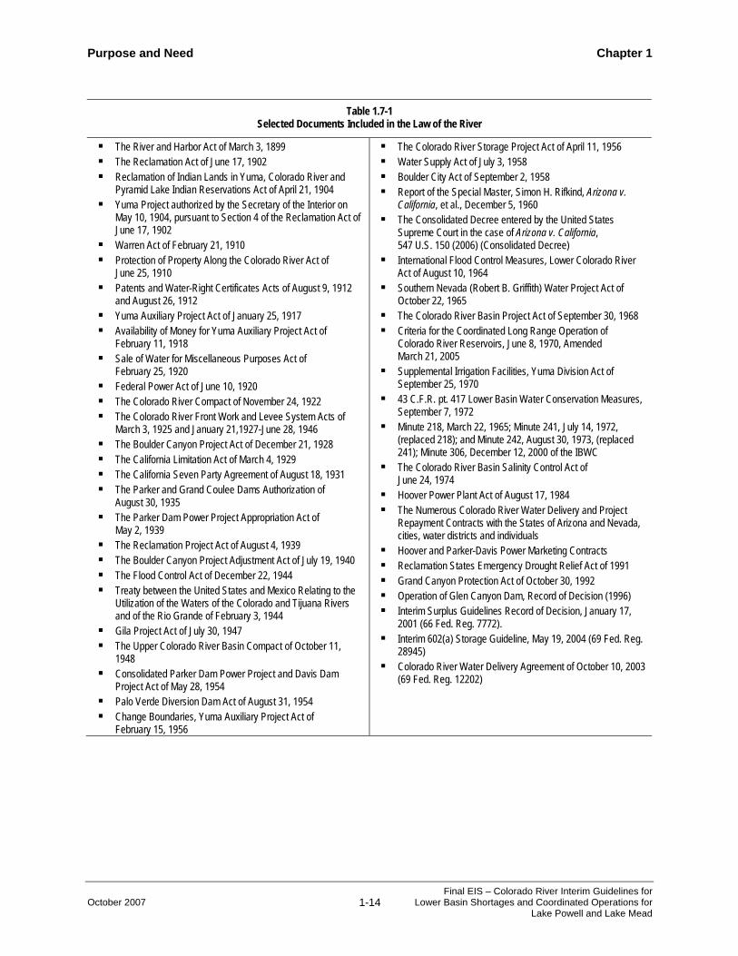
Documents which are generally considered as part of the Law of the River include, but are not limited to, those listed in Table 1.7-1. Among other provisions of applicable federal law, NEPA and the Endangered Species Act of 1973 (ESA), as amended, provide a statutory overlay on certain actions taken by the Secretary. For example, as noted in Section 1.1, preparation of this Final EIS has been undertaken pursuant to NEPA.
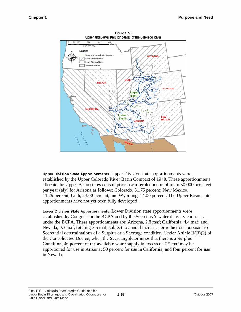
1.7.2.2 Apportionment to the Basin States The initial apportionment of water from the Colorado River was determined as part of the Compact, which divided the Colorado River system into two sub-basins, the Upper Basin and the Lower Basin (Figure 1.7-1). The Upper Basin includes those parts of the states of Arizona, Colorado, New Mexico, Utah, and Wyoming within and from which waters drain naturally into the Colorado River above the Lee Ferry Compact Point in Arizona. The Lower Basin includes those parts of the states of Arizona, California, Nevada, New Mexico, and Utah within and from which waters drain naturally into the Colorado River below the Lee Ferry Compact Point. The Compact also divided the seven Basin States into the Upper Division and the Lower Division states (Figure 1.7-3). The Upper Division states are Colorado, New Mexico, Utah and Wyoming. The Lower Division states are Arizona, California, and Nevada.
The Compact apportioned to the Lower Basin states and the Upper Basin states, in perpetuity, the exclusive beneficial consumptive use of 7.5 maf of water per year (mafy). In addition to this apportionment, Article III(b) of the Compact gives the Lower Basin states the right to increase their beneficial consumptive use by 1.0 mafy. The Compact also stipulates in Article III(d) that the Upper Division states will not cause the flow of the river at the Lee Ferry Compact Point to be depleted below an aggregate of 75 maf for any period of ten consecutive years.
The Compact, in Article VII, states that nothing in the Compact shall be construed as affecting the obligations of the United States to Indian tribes. While the rights of most Indian tribes to Colorado River water were subsequently adjudicated, some Tribal rights remain unadjudicated. To the extent that Indian tribes consumptively use water from the Colorado River, such uses are included in the apportionment of the appropriate Basin State.
Purpose and Need Chapter 1
October 2007 1-14 Final EIS – Colorado River Interim Guidelines for
Lower Basin Shortages and Coordinated Operations for Lake Powell and Lake Mead
Table 1.7-1 Selected Documents Included in the Law of the River
The River and Harbor Act of March 3, 1899 The Reclamation Act of June 17, 1902 Reclamation of Indian Lands in Yuma, Colorado River and
Pyramid Lake Indian Reservations Act of April 21, 1904 Yuma Project authorized by the Secretary of the Interior on
May 10, 1904, pursuant to Section 4 of the Reclamation Act of June 17, 1902
Warren Act of February 21, 1910 Protection of Property Along the Colorado River Act of
June 25, 1910 Patents and Water-Right Certificates Acts of August 9, 1912
and August 26, 1912 Yuma Auxiliary Project Act of January 25, 1917 Availability of Money for Yuma Auxiliary Project Act of
February 11, 1918 Sale of Water for Miscellaneous Purposes Act of
February 25, 1920 Federal Power Act of June 10, 1920 The Colorado River Compact of November 24, 1922 The Colorado River Front Work and Levee System Acts of
March 3, 1925 and January 21,1927-June 28, 1946 The Boulder Canyon Project Act of December 21, 1928 The California Limitation Act of March 4, 1929 The California Seven Party Agreement of August 18, 1931 The Parker and Grand Coulee Dams Authorization of
August 30, 1935 The Parker Dam Power Project Appropriation Act of
May 2, 1939 The Reclamation Project Act of August 4, 1939 The Boulder Canyon Project Adjustment Act of July 19, 1940 The Flood Control Act of December 22, 1944 Treaty between the United States and Mexico Relating to the
Utilization of the Waters of the Colorado and Tijuana Rivers and of the Rio Grande of February 3, 1944
Gila Project Act of July 30, 1947 The Upper Colorado River Basin Compact of October 11,
1948 Consolidated Parker Dam Power Project and Davis Dam
Project Act of May 28, 1954 Palo Verde Diversion Dam Act of August 31, 1954 Change Boundaries, Yuma Auxiliary Project Act of
February 15, 1956
The Colorado River Storage Project Act of April 11, 1956 Water Supply Act of July 3, 1958 Boulder City Act of September 2, 1958 Report of the Special Master, Simon H. Rifkind, Arizona v.
California, et al., December 5, 1960 The Consolidated Decree entered by the United States
Supreme Court in the case of Arizona v. California, 547 U.S. 150 (2006) (Consolidated Decree)
International Flood Control Measures, Lower Colorado River Act of August 10, 1964
Southern Nevada (Robert B. Griffith) Water Project Act of October 22, 1965
The Colorado River Basin Project Act of September 30, 1968 Criteria for the Coordinated Long Range Operation of
Colorado River Reservoirs, June 8, 1970, Amended March 21, 2005
Supplemental Irrigation Facilities, Yuma Division Act of September 25, 1970
43 C.F.R. pt. 417 Lower Basin Water Conservation Measures, September 7, 1972
Minute 218, March 22, 1965; Minute 241, July 14, 1972, (replaced 218); and Minute 242, August 30, 1973, (replaced 241); Minute 306, December 12, 2000 of the IBWC
The Colorado River Basin Salinity Control Act of June 24, 1974
Hoover Power Plant Act of August 17, 1984 The Numerous Colorado River Water Delivery and Project
Repayment Contracts with the States of Arizona and Nevada, cities, water districts and individuals
Hoover and Parker-Davis Power Marketing Contracts Reclamation States Emergency Drought Relief Act of 1991 Grand Canyon Protection Act of October 30, 1992 Operation of Glen Canyon Dam, Record of Decision (1996) Interim Surplus Guidelines Record of Decision, January 17,
2001 (66 Fed. Reg. 7772). Interim 602(a) Storage Guideline, May 19, 2004 (69 Fed. Reg.
28945) Colorado River Water Delivery Agreement of October 10, 2003
(69 Fed. Reg. 12202)
Chapter 1 Purpose and Need
Final EIS – Colorado River Interim Guidelines for Lower Basin Shortages and Coordinated Operations for Lake Powell and Lake Mead
1-15 October 2007
Upper Division State Apportionments. Upper Division state apportionments were established by the Upper Colorado River Basin Compact of 1948. These apportionments allocate the Upper Basin states consumptive use after deduction of up to 50,000 acre-feet per year (afy) for Arizona as follows: Colorado, 51.75 percent; New Mexico, 11.25 percent; Utah, 23.00 percent; and Wyoming, 14.00 percent. The Upper Basin state apportionments have not yet been fully developed.
Lower Division State Apportionments. Lower Division state apportionments were established by Congress in the BCPA and by the Secretary’s water delivery contracts under the BCPA. These apportionments are: Arizona, 2.8 maf; California, 4.4 maf; and Nevada, 0.3 maf; totaling 7.5 maf, subject to annual increases or reductions pursuant to Secretarial determinations of a Surplus or a Shortage condition. Under Article II(B)(2) of the Consolidated Decree, when the Secretary determines that there is a Surplus Condition, 46 percent of the available water supply in excess of 7.5 maf may be apportioned for use in Arizona; 50 percent for use in California; and four percent for use in Nevada.
Figure 1.7-3 Upper and Lower Division States of the Colorado River

Purpose and Need Chapter 1
October 2007 1-16 Final EIS – Colorado River Interim Guidelines for
Lower Basin Shortages and Coordinated Operations for Lake Powell and Lake Mead
Figure 1.7-4 presents a schematic of the operation of the Colorado River, primarily in the Lower Basin. The Consolidated Decree confirms the apportionments to the Lower Division states established by the BCPA and guides the Secretary’s operation of facilities, including Hoover Dam, on the lower Colorado River. If water apportioned for use in a Lower Division state is not consumed by that state in any year, the Secretary may release the unused water for use in another Lower Division state. Water that is stored off-stream by a Lower Division state (for future use by that state or by another Lower Division state) is accounted as consumptive use to the state that stored the water in the year it was stored.
All mainstream Colorado River waters apportioned to the Lower Basin, except for a few thousand acre-feet (af) apportioned for use in Arizona, have been fully allocated to specific entities and, except for certain federal establishments, placed under permanent water delivery contracts with the Secretary for irrigation or domestic use. These entities include irrigation districts, water districts, municipalities, Indian tribes, public institutions, private water companies, and individuals. Federal establishments with federal reserved rights established pursuant to Article II(D) of the Consolidated Decree are not required to have a contract with the Secretary, but the water allocated to a federal establishment is included within the apportionment of the Lower Division state in which the federal establishment is located; e.g., Fort Mojave Indian Reservation in California and the Havasu National Wildlife Refuge in Arizona.
The highest priority lower Colorado River water rights are present perfected rights (PPRs), which the Consolidated Decree defines as those perfected rights existing on June 25, 1929, the effective date of the BCPA. The Consolidated Decree also recognizes federal Indian reserved rights for the quantity of water necessary to irrigate all the practicably irrigable acreage (lands considered suitable for irrigation) on five Indian reservations along the lower Colorado River. The Consolidated Decree defines the rights of Indian and other federal reservations to be federal establishment PPRs. PPRs are important because in any year in which less than 7.5 maf of Colorado River water is available for consumptive use in the Lower Division states, PPRs will be satisfied first, in the order of their priority without regard to state lines.
Waters available to a Lower Division state within its apportionment, but having a priority date later than June 25, 1929, have been allocated by the Secretary through execution of water delivery contracts to water users within that state as required by Section 5 of the BCPA.
1.7.2.3 Allotment to Mexico (Pursuant to the 1944 Treaty) Allocation of Colorado River water to Mexico is governed by the 1944 Treaty. Article 10(a) of the 1944 Treaty states:
“(a) A guaranteed annual quantity of 1,500,000 acre-feet (1,850,234,000 cubic meters) to be delivered in accordance with the provisions of Article 15 of this Treaty”

Chapter 1 Purpose and Need
Final EIS – Colorado River Interim Guidelines for Lower Basin Shortages and Coordinated Operations for Lake Powell and Lake Mead
1-17 October 2007
Figure 1.7-4 Colorado River Reservoirs and Diversions
Imperial Dam
Parker Dam
Davis Dam
Hoover Dam
Glen Canyon Dam
Evaporation
Evaporation
Evaporation
Evaporation
Evaporation
Central Arizona Project Service Area
Bullhead City Area Arizona Users
Lower Basin Users Upstream of Hoover Dam
Upper Basin Users Upstream of Glen Canyon Dam
Transbasin Diversions
Tributary Gains Upstream of Hoover Dam
Tributary Gains Downstream of Hoover Dam
Southern Nevada Users
Laughlin Area Nevada Users
Metropolitan Water District of Southern California Service Area
Northerly International Boundary
Southerly International Boundary
Lake Havasu
Upper Basin Reservoirs
Lake Powell
Lake Mead
Lake Mohave
Other Arizona UsersCalifornia Irrigation Districts and Other Users
Deliveries to Mexico Morelos Diversion Dam
Purpose and Need Chapter 1
October 2007 1-18 Final EIS – Colorado River Interim Guidelines for
Lower Basin Shortages and Coordinated Operations for Lake Powell and Lake Mead
Further, Article 10(b) of the 1944 Treaty provides:
“(b) Any other quantities arriving at the Mexican points of diversion, with the understanding that in any year in which, as determined by the United States Section, there exists a surplus of waters of the Colorado River in excess of the amount necessary to supply uses in the United States and the guaranteed quantity of 1,500,000 acre-feet (1,850,234,000 cubic meters) annually to Mexico, the United States undertakes to deliver to Mexico, in the manner set out in Article 15 of this Treaty, additional waters of the Colorado River system to provide a total quantity not to exceed 1,700,000 acre-feet (2,096,931,000 cubic meters) a year. Mexico shall acquire no right beyond that provided by this subparagraph by the use of waters of the Colorado River system, for any purpose whatsoever, in excess of 1,500,000 acre-feet (1,850,234,000 cubic meters) annually.”
Additionally, Article 10 of the 1944 Treaty provides:
“In the event of extraordinary drought or serious accident to the irrigation system in the United States, thereby making it difficult for the United States to deliver the guaranteed quantity of 1,500,000 acre-feet (1,850,234,000 cubic meters) a year, the water allotted to Mexico under subparagraph (a) of this Article will be reduced in the same proportion as consumptive uses in the United States are reduced.”
The proposed federal action is for the purpose of adopting additional operational guidelines to improve the Department’s annual management and operation of key Colorado River reservoirs for an interim period through 2026. However, in order to assess the potential effects of the proposed federal action in this Final EIS, certain modeling assumptions (discussed in Chapter 2) are used that display projected water deliveries to Mexico. Reclamation’s modeling assumptions are not intended to constitute an interpretation or application of the 1944 Treaty or to represent current United States policy or a determination of future United States policy regarding deliveries to Mexico.
The United States will conduct all necessary and appropriate discussions regarding the proposed federal action and implementation of the 1944 Treaty with Mexico through the IBWC in consultation with the Department of State.

Chapter 1 Purpose and Need
Final EIS – Colorado River Interim Guidelines for Lower Basin Shortages and Coordinated Operations for Lake Powell and Lake Mead
1-19 October 2007
1.7.3 System Reservoirs and Diversion Facilities The Colorado River system contains numerous reservoirs that provide an aggregate of approximately 60 maf of storage (or roughly the same amount of four years’ of average flow of the Colorado River). Of these reservoirs, Lake Powell and Lake Mead provide approximately 85 percent of this storage. Lake Powell provides 24.3 maf of this storage.
The Lower Basin dams and reservoirs include Hoover Dam, Davis Dam, and Parker Dam (Figure 1.7-5). Hoover Dam created Lake Mead and can store up to 26.2 maf. Davis Dam was constructed by Reclamation to re-regulate Hoover Dam’s releases and to aid in the annual delivery of 1.5 maf to Mexico. Davis Dam created Lake Mohave and provides 1.8 maf of storage. Parker Dam forms Lake Havasu (0.65 maf of storage) from which water is pumped by both Metropolitan Water District of Southern California (MWD) and the CAP. Parker Dam re-regulates releases from Davis Dam and from the United States Army Corps of Engineers’ (USACE) Alamo Dam on the Bill Williams River, and in turn releases water for downstream use in the United States and Mexico. Other Lower Basin mainstream reservoirs, shown on Figure 1.7-5, are operated primarily for the purpose of river flow regulation to facilitate diversion of water to Arizona, California and Mexico. Diversion facilities of the Lower Division states typically serve multiple entities.
There are several points of diversion in Arizona. Arizona can use up to 50,000 afy of water under its Upper Basin apportionment. In the Lower Basin, the largest diversion for Arizona is the CAP pumping plant on Lake Havasu downstream of the confluence of the Bill Williams River. Irrigation water for the Fort Mojave Indian Reservation, near Needles, California, is pumped from wells. There are also several other municipal, industrial and agricultural water users located along the Colorado River that pump their water from wells. Irrigation water for the Colorado River Indian Reservation near Parker, Arizona, is diverted at Headgate Rock Dam, which was constructed for that purpose. A river pumping plant in the Cibola area provides water to irrigate lands adjacent to the Colorado River. The last major diversion for Arizona occurs at Imperial Dam, where water is diverted into the Gila Gravity Main Canal for irrigation for the Gila and Wellton-Mohawk projects and into the AAC for subsequent release into the Yuma Main Canal for the Yuma Project and the City of Yuma.
California receives most of its Colorado River water at three diversion points: MWD’s pumping plant on Lake Havasu; the Palo Verde Irrigation District’s diversion at the Palo Verde Diversion Dam near Blythe, California; and the AAC diversion at Imperial Dam (Figure 1.7-5).
In Nevada, the state’s consumptive use apportionment of Colorado River water is used almost exclusively for municipal and industrial (M&I) purposes. About 90 percent of this water is diverted from Lake Mead at a point approximately five miles northwest of Hoover Dam at Saddle Island by the Southern Nevada Water Authority (SNWA) facilities. The remainder of Nevada’s diversion occurs downstream of Davis Dam in the Laughlin, Nevada area and on the Fort Mojave Indian Reservation.

Purpose and Need Chapter 1
October 2007 1-20 Final EIS – Colorado River Interim Guidelines for
Lower Basin Shortages and Coordinated Operations for Lake Powell and Lake Mead
Figure 1.7-5 Lower Basin Dams and Reservoirs

Chapter 1 Purpose and Need
Final EIS – Colorado River Interim Guidelines for Lower Basin Shortages and Coordinated Operations for Lake Powell and Lake Mead
1-21 October 2007
1.7.4 Flood Control Operation Under the BCPA, flood control is specified as the project purpose having first priority for the operation of Hoover Dam. Subsequently, Section 7 of the Flood Control Act of 1944 established that the Secretary of War (now the United States Army Corps of Engineers) will prescribe regulations for flood control for projects authorized wholly or partially for such purposes.
The Los Angeles District of the USACE published the current flood control regulations in its Water Control Manual for Flood Control, Hoover Dam and Lake Mead, Colorado River, Nevada and Arizona (Water Control Manual) dated December 1982. The Field Working Agreement between the USACE and Reclamation for the flood control operation of Hoover Dam and Lake Mead, as prescribed by the Water Control Manual, was signed on February 8, 1984. The flood control plan is the result of a coordinated effort between the USACE and Reclamation; however, the USACE is responsible for providing the flood control regulations and has authority for final approval. The Secretary is responsible for operating Hoover Dam in accordance with these regulations. Deviation from the flood control operating criteria must be authorized by the USACE.
1.7.5 Hydropower Generation Reclamation is authorized by legislation to produce electric power at Glen Canyon Dam, Hoover Dam, Davis Dam, Parker Dam, and other smaller facilities. While Reclamation is the federal agency authorized to produce power at the major Colorado River system dams, Western is the federal agency authorized to market and deliver this power. Western enters into electric service contracts on behalf of the United States with public and private utility systems for distribution of hydroelectric power produced at Reclamation facilities in excess of project demand.
1.7.6 Annual Operating Plan and Long Range Operating Criteria The CRBPA required the Secretary to adopt operating criteria for the Colorado River by January 1, 1970. The LROC, adopted in 1970 address operation of the Colorado River reservoirs in compliance with requirements set forth in the Compact, the CRSPA, the BCPA, the 1944 Treaty, and other applicable federal laws. Section 602 of the CRBPA, as amended, provides that the LROC can only be modified after correspondence with the governors of the Basin States and appropriate consultation with such state representatives as each governor may designate. The LROC calls for formal reviews at least every five years. The reviews are conducted as a public involvement process and are attended by representatives of federal agencies, the seven Basin States, Indian tribes, the general public including representatives of the academic and scientific communities, environmental organizations, the recreation industry, and contractors for the purchase of federal power produced at federal hydropower plants in the Colorado River Basin.
Under the applicable provisions of the CRBPA, the Secretary makes annual determinations in the AOP regarding the availability of Colorado River water for deliveries to the Lower Division states. A requirement to equalize storage between Lake Powell and Lake Mead when there is sufficient storage in the Upper Basin is also included in the LROC, as required by the CRBPA. Equalization releases are made if: 1) the end of the water year storage forecast for Lake Powell is greater than that of Lake Mead; and 2) the storage forecast for the

Purpose and Need Chapter 1
October 2007 1-22 Final EIS – Colorado River Interim Guidelines for
Lower Basin Shortages and Coordinated Operations for Lake Powell and Lake Mead
end of the water year in the Upper Basin reservoirs is greater than the quantity of storage required by Section 602(a) of the CRBPA (602(a) storage) for that same date.
The 602(a) storage quantity is the storage in the Upper Basin necessary to assure Lower Basin delivery obligations without impairing consumptive use requirements in the Upper Basin. The LROC offers factors to be considered to determine 602(a) storage, but does not present a set formula. The factors to be considered include the historic stream flows, the most critical period of record, probability of available waters, and estimated future depletions in the Upper Basin.
In 2004, Reclamation adopted an interim 602(a) storage guideline, in effect through 2016, which establishes that Lake Powell’s elevation must be above 3,630 feet msl (which corresponds to storage of approximately 14.85 maf) for equalization releases to occur (Reclamation 2004f). In the event that the elevation of Lake Powell is below the 602(a) storage guideline, and equalization is not required, the LROC provide that “the objective shall be to maintain a minimum release of water from Lake Powell of 8.23 million acre-feet for that year.”
In the AOP, the Secretary is required to determine when Normal, Surplus, or Shortage conditions occur in the lower Colorado River, based on various factors including storage and hydrologic conditions in the Colorado River Basin.
1.7.6.1 Normal Water Supply Condition A Normal Condition exists when the Secretary determines that sufficient mainstream water is available to satisfy 7.5 maf of annual consumptive use in the Lower Division states. If a state will not use all of its apportioned water for the year, the Secretary may allow other states of the Lower Division to use the unused apportionment, provided that the use is authorized by a water delivery contract with the Secretary.
1.7.6.2 Surplus Water Supply Condition A Surplus Condition exists when the Secretary determines that sufficient mainstream water is available for release to satisfy consumptive use in the Lower Division states in excess of 7.5 maf annually. This excess consumptive use is surplus and is distributed for use in Arizona, California, and Nevada pursuant to the terms and conditions provided in the ISG, adopted in 2001. The current provisions of the ISG are scheduled to terminate in 2016.
In general terms, the ISG link the availability of surplus water to the elevation of Lake Mead. When Lake Mead is full and Reclamation is making flood control releases, surplus supplies are unlimited. As Lake Mead’s elevation drops, surplus water amounts are reduced, and ultimately eliminated. The ISG also link surplus availability to continued progress by California in reducing its agricultural use of water to benchmarks established in the ISG.
If a state does not use all of its apportioned water for the year, the Secretary may allow other Lower Division states to use the unused apportionment, provided that the use is authorized by a water delivery contract with the Secretary.

Chapter 1 Purpose and Need
Final EIS – Colorado River Interim Guidelines for Lower Basin Shortages and Coordinated Operations for Lake Powell and Lake Mead
1-23 October 2007
1.7.6.3 Shortage Water Supply Condition A Shortage Condition exists when the Secretary determines that insufficient mainstream water is available to satisfy 7.5 maf of annual consumptive use in the Lower Division states. To date, the Secretary has never made such a determination. When making a shortage determination, the Secretary must consult with various parties as set forth in the Consolidated Decree and consider all relevant factors as specified in the LROC, including 1944 Treaty obligations, the priorities set forth in the Consolidated Decree, and the reasonable consumptive use requirements of mainstream water users in the Lower Division states.
Pursuant to the Consolidated Decree, the Secretary is required to first provide for the satisfaction of the PPRs in the order of their priorities without regard to state lines. Pursuant to the CRBPA, water contract holders in Arizona with contracts dated September 30, 1968 (when the CAP was authorized) or later, have a lower priority than California’s 4.4 maf apportionment. Beyond these two requirements, the Department does not have detailed guidelines in place that define the circumstances under which the Secretary would reduce the annual amount of water available for consumptive use from Lake Mead, i.e., when water supplies would be reduced, by how much, or who would experience specified reductions.
In the absence of specific shortage criteria, a shortage determination would most likely be made on an annual basis through the AOP process. This is a process by which the interests of the different stakeholders are addressed through consultation. Water users who rely on the Colorado River in the Lower Division states are not currently able to identify particular reservoir conditions under which the Secretary would reduce the annual amount of water available for consumptive use from Lake Mead, nor are these water users able to identify the frequency or magnitude of any potential future annual reductions in their water deliveries.
1.8 Related Actions
The alternatives considered in this Final EIS address operation and storage of water in Lake Powell and Lake Mead. While there are many actions related to the operation of the Colorado River with respect to the proposed federal action analyzed in this Final EIS, Reclamation has identified five primary documents that are related to, or would assist the reader in understanding the issues analyzed in this process:
♦ Operation of Glen Canyon Dam - Final EIS (1995) and Record of Decision (ROD) (1996) (Reclamation 1995, 1996a);
♦ Off-stream Storage of Colorado River Water and Development and Release of Intentionally Created Unused Apportionment in the Lower Division States - 43 C.F.R. pt. 414 (1999);
♦ Interim Surplus Criteria - Final EIS (2000) and ROD - Colorado River Interim Surplus Guidelines (2001) (Reclamation 2000, 2001);

Purpose and Need Chapter 1
October 2007 1-24 Final EIS – Colorado River Interim Guidelines for
Lower Basin Shortages and Coordinated Operations for Lake Powell and Lake Mead
♦ Implementation Agreement, Inadvertent Overrun and Payback Policy, and Related Federal Actions - Final EIS (2002) and ROD - Colorado River Water Delivery Agreement (2003) (Reclamation 2002a, 2003); and
♦ Lower Colorado River Multi-Species Conservation Program (LCR MSCP) - Final Programmatic EIS/Environmental Impact Report (EIR) and ROD - Lower Colorado River Multi-Species Conservation Plan (2005) (Reclamation 2005b).
Chapter 5 of this Final EIS provides an extensive review of these and other related actions that may have a cumulative impact on the resources affected by the alternatives presented herein.
The efforts documented in the references listed above are summarized below.
1.8.1 Operation of Glen Canyon Dam - Final EIS and ROD The 1995 Operation of Glen Canyon Dam Final EIS was prepared in response to the 1992 Grand Canyon Protection Act, and analyzed alternative operation scenarios that met statutory responsibilities for protecting downstream resources and achieving other authorized purposes. The 1996 Glen Canyon Dam ROD describes detailed criteria and operating plans for dam operations and includes other management actions to accomplish this objective; among these are the Glen Canyon Dam Adaptive Management Program (AMP) of scientific monitoring and experimentation, beach/habitat-building flows (BHBF), and further study of temperature control.
The AMP provides a process for assessing the effects of Glen Canyon Dam operations on downstream resources and project benefits. The results of that assessment are used to develop recommendations for modifying Glen Canyon Dam operations and other resource management actions. This is accomplished through the Adaptive Management Work Group (AMWG), a federal advisory committee. The AMWG consists of stakeholders that include federal and state agencies, representatives of the seven Basin States, Indian tribes, hydroelectric power customers, environmental and conservation organizations, and recreational and other interest groups.
The BHBF releases are scheduled high releases of short duration that are in excess of power plant capacity in accordance with hydrologic triggering criteria. These BHBFs are designed to rebuild high elevation sandbars, deposit nutrients, restore backwater channels, and provide some of the dynamics of a natural system. The first test of a BHBF was conducted in spring of 1996, and a subsequent test of a BHBF was conducted in November 2004.
Evaluating the feasibility of increasing the temperature of water released from Glen Canyon Dam was a common element in the Glen Canyon Dam EIS and one of the elements of the reasonable and prudent alternative in the Biological Opinion (BO) of that document. In 1999, Reclamation issued an environmental assessment regarding potential modification of Glen Canyon Dam to construct a selective withdrawal structure, and has subsequently continued to investigate various structural designs. Reclamation has initiated a NEPA process that, among other elements, will consider construction of a selective withdrawal structure as part of a long-term experimental plan.

Chapter 1 Purpose and Need
Final EIS – Colorado River Interim Guidelines for Lower Basin Shortages and Coordinated Operations for Lake Powell and Lake Mead
1-25 October 2007
1.8.2 Off-stream Storage of Colorado River Water and Development and Release of Intentionally Created Unused Apportionment in the Lower Division States
In 1999, the Department adopted a rule to facilitate off-stream storage of Colorado River water and development and release of “Intentionally Created Unused Apportionment” (ICUA) for the Lower Division states. Reclamation prepared an Environmental Assessment (EA) to assess the environmental impacts of the rule, and a Finding of No Significant Impact (FONSI) was issued on October 1, 1999. The final rule was published in the Federal Register on November 1, 1999 and is codified at 43 C.F.R. pt. 414.
This rule establishes a procedural framework within the Lower Basin states for an authorized entity in one state to enter into storage agreements with authorized entities in another state for the off-stream storage (and future recovery) of Colorado River water. Under the agreements, the storing state will use water it stores under an interstate agreement and, in return, at a future date, decrease its consumptive use of Colorado River water, thereby developing the ICUA that the Secretary will release for consumptive use in the consuming state. Under this rule, two Storage and Interstate Release Agreements (SIRA) have been executed to date.
1.8.3 Interim Surplus Criteria - Final EIS and ROD - Colorado River Interim Surplus Guidelines
On January 17, 2001, the Secretary, through a ROD, adopted specific ISG that identify the conditions under which the Secretary will authorize the release of water from Lake Mead, for use in the Lower Basin, in excess of 7.5 maf. As adopted, the term of the ISG is through 2016. The ISG are applied by the Secretary each year through the AOP.
The ISG provide mainstream users of Colorado River water, particularly those in California, a greater degree of predictability with respect to the likely existence, or lack thereof, of a surplus determination in a given year for the interim period (i.e., through 2016). Prior to adoption of the ISG, availability of surplus was limited to periods when Lake Mead was nearly full and expected to make additional releases to avoid future spills. Conversely, under the ISG, as Lake Mead’s elevation drops, surplus water amounts are reduced, and ultimately eliminated. Surplus determinations under the AOP are further discussed in Section 1.7 of this Final EIS.
The ISG, as adopted in the 2001 ROD, provide for certain benchmarks for reduction of California’s agricultural use of Colorado River water and other actions; as long as the benchmarks are met, the more permissive determinations of surplus under the ISG are permitted. In the event that the benchmarks are not met, surplus determinations revert to a more conservative water management approach (i.e., surplus water is only made available when reservoirs are nearly full).
1.8.4 Implementation Agreement, Inadvertent Overrun and Payback Policy, and Related Federal Actions - Final EIS and ROD - Colorado River Water Delivery Agreement
California’s Colorado River Water Use Plan (CA Plan) calls for conservation measures to be put in place that will reduce California’s historic dependency on Colorado River water in

Purpose and Need Chapter 1
October 2007 1-26 Final EIS – Colorado River Interim Guidelines for
Lower Basin Shortages and Coordinated Operations for Lake Powell and Lake Mead
excess of the state’s 4.4 maf apportionment. The Colorado River Water Delivery Agreement, signed by the Secretary on October 10, 2003, provides for implementation of major components of the CA Plan and incorporates contractual agreements that facilitate California’s sharing and distribution of Colorado River water within its 4.4 mafy entitlement.
The Colorado River Water Delivery Agreement is the Secretary’s agreement to make those Colorado River water deliveries specified in the agreements with the relevant California entities. These agreements provide for the conservation and transfer of about 400 kaf of water annually among the Imperial Irrigation District, Coachella Valley Water District, MWD, and San Diego County Water Authority.
1.8.5 Lower Colorado River Multi-Species Conservation Program - Final Programmatic EIS/EIR and ROD - Lower Colorado River Multi-Species Conservation Plan
The LCR MSCP is a 50-year cooperative effort between federal and non-federal entities, approved by the Secretary in April 2005, that:
♦ conserves habitat and works towards the recovery of threatened and endangered species, as well as reducing the likelihood of additional species being listed;
♦ accommodates present water diversions and power production and optimizing opportunities for future water and power development, to the extent consistent with the law; and
♦ provides the basis for incidental take authorizations.
The LCR MSCP provides ESA compliance for specific covered federal actions and non-federal activities under ESA Sections 7 and 10. The LCR MSCP provides ESA coverage for non-federal actions that are related to the use and management of the lower Colorado River (from Lake Mead to the SIB).
In addition to the covered activities of the non-federal LCR MSCP entities, specific present and potential future actions of six federal agencies on the lower Colorado River are also included in the LCR MSCP. Those federal agencies are Reclamation, BIA, NPS, Bureau of Land Management (BLM), Western, and the FWS. These federal agencies and non-federal entities are collectively referred to as the LCR MSCP participants. The covered actions and activities for the LCR MSCP participants occur along the lower Colorado River in Imperial, Riverside, and San Bernardino counties, California; La Paz, Mohave, and Yuma counties, Arizona; and Clark County, Nevada. The duration of the Section 10 permit and the associated formal ESA Section 7 consultation for the federal agencies is 50 years (2005 to 2055).
The Conservation Plan was designed to fully mitigate adverse effects to species included within the LCR MSCP resulting from federal covered actions and non-federal covered activities, and to meet the ESA Section 10 standard to minimize and mitigate the impacts of the covered activities on covered species to the maximum extent practicable. While the LCR MSCP is geared toward special status species, it is important to understand that all species

Chapter 1 Purpose and Need
Final EIS – Colorado River Interim Guidelines for Lower Basin Shortages and Coordinated Operations for Lake Powell and Lake Mead
1-27 October 2007
that use the habitats impacted by LCR MSCP-covered activities benefit from the conservation actions currently being carried out under the LCR MSCP.
Federal covered actions included in the LCR MSCP and covered under the LCR MSCP BO (FWS 2005) include the adoption and application of specific surplus and shortage guidelines that would allow for the release of water (excluding 1944 Treaty water) in excess of the 7.5 maf of entitlement waters in surplus years or less than the 7.5 maf in shortage years and approval and implementation of various administrative actions that could result in changes in the storage and delivery of Lower Division state entitlement waters at different points on the Colorado River. The LCR MSCP BO covered the effects of covered actions for a reduction of Lake Mead reservoir elevations to 950 feet msl and Colorado River flow reductions of up to 0.845 maf from Hoover Dam to Davis Dam, 0.860 maf from Davis Dam to Parker Dam, and 1.574 maf from Parker Dam to Imperial Dam. The LCR MSCP identified, and is mitigating impacts to, the covered species and their habitats from the river flow reductions described above.
Reclamation has reviewed the effects of the Preferred Alternative in this Final EIS and has determined that all potential effects to listed species and their habitats along the Colorado River from the full pool elevation of Lake Mead to the SIB are covered by the LCR MSCP. The LCR MSCP coverage also includes the conveyance of conserved Virgin River and Muddy River (tributary) flows through Lake Mead and the Overton Arm. This determination is documented in the Biological Assessment (BA) for the proposed federal action which is the subject of this EIS (Appendix R). Accordingly, the BA for the proposed federal action analyzes potential effects to listed species for areas outside the geographic coverage of the LCR MSCP – from Lake Powell to the inflow to Lake Mead, and for the interrelated/interdependent effects of the Lake Mead storage and delivery mechanism on the Virgin River and the Muddy River.

Purpose and Need Chapter 1
October 2007 1-28 Final EIS – Colorado River Interim Guidelines for
Lower Basin Shortages and Coordinated Operations for Lake Powell and Lake Mead
This page intentionally left blank.