chapter 11 subdivision - wickenburg az
TRANSCRIPT

CHAPTER 11 SUBDIVISION
ARTICLE 11-1 PURPOSE; SUBDIVISION ADMINISTRATION
The purpose of this Chapter is to provide for the orderly growth and harmonious development of the Town of
Wickenburg; to secure adequate traffic circulation through coordinated street systems with relation to the major
thoroughfares, adjoining subdivisions, and public facilities; to achieve individual property lots having optimum utility
and livability; to secure adequate provisions for water supply and distribution, drainage and flood control, sanitary
sewerage, and other health requirements; to ensure and facilitate provision of sites for schools, recreation and other
public proposes; to promote conveyance of land by accurate legal description; and to establish logical procedures for
the achievement of this purpose. The Wickenburg Planning and Zoning Advisory Commission and Wickenburg
Town Council are hereby designated and authorized to receive and process and otherwise act upon preliminary and
final subdivision plats in accordance with these regulations. The Subdivision Committee is hereby designated as
Advisory Agent to the Commission and Council. Where this Chapter imposes a greater restriction upon land
improvement or development, and land use that is imposed or required by existing provisions of law, ordinance,
contract, or deed, this Chapter shall control.
ARTICLE 11-2 DEFINITIONS
In this Chapter, unless the context requires otherwise:
A. ADEQ: Arizona Department of Environmental Quality.
B. ADOT: Arizona Department of Transportation.
C. ADWR: Arizona Department of Water Resources.
D. ALL WEATHER CROSSING: A hard surface of concrete and self-cleaning paved area extending across or
through a water course.
E. ALLEY: A public way providing secondary vehicular access and service to properties that also abuts upon a
street.
F. BEDROCK: The solid, undisturbed bedrock in place either at the ground surface or beneath surficial deposits of
gravel, sand or soil.
G. BLOCK: A piece or parcel of land or group of lots entirely surrounded by public streets, water courses,
railroads or packs or a combination thereof.
H. BUILDING OFFICIAL: The Building Official for the Town of Wickenburg.
I. BUILDING PERMIT: A Permit issued by the Building Official for the construction of a new or remodeled
residential, industrial or commercial structure or for modifications to the use of an existing structure.
J. CHD: County Health Department.
K. CFCD: County Flood Control District.
L. CLEARING OR GRUBBING: The removal, relocating or addition of any plant, bush, tree, cacti, or six inches
(6”) of top soil or rock.
M. CLOMR: Conditional Letter of Map Revision.
-132-
Ord.1046/9-09

11-2 SUBDIVISIONS 11-2
N. COE: U.S. Army Corps of Engineers.
O. CONDITIONAL APPROVAL: An affirmative action by the Planning Agency and the Town Council indicating
that approval of the Preliminary Plat will be forthcoming upon satisfaction of certain specified stipulations.
P. CONTRACTOR: Party responsible for carrying out the contract per plans and specifications.
Q. DEVELOPER: A person or individual, developer or his/her agent, firm, partnership, association, corporation,
municipality or agent of the aforementioned groups or its agencies or political subdivisions acting as a unit as
well as an individual.
R. DEVELOPMENT: Any manmade change to improved or unimproved real estate, including but not limited to
buildings, or other structures, mining dredging, filling, grading, paving, excavation or drilling operations or
storage of equipment or materials.
S. DRAINAGE ADMINISTRATOR: A Town appointed Public Official that oversees the effects of development on
future drainage patterns with the power to enforce this ordinance.
T. EASEMENT: A grant by the owner of the use of a strip of land to the public, a corporation or persons for
specific uses and purposes as so designated.
U. ENGINEERING PLANS: Plans, profiles, cross-sections, specifications and other details of construction of public
improvements, prepared by a Registered Engineer in accordance with the approved Preliminary Plat and in
compliance with public improvement standards.
V. EPA: U.S. Environmental Protection Agency that issued the regulations to control pollutants in stormwater
runoff discharges (The Clean Water Act and NPDES Permit Requirements).
W. EXCAVATION: Any act which earth, sand, gravel, rock or other earthen material is cut into, dug, uncovered,
displaced or relocated, and shall include the conditions resulting therefrom.
X. EXCEPTION: Any parcel of land located within the boundaries of a subdivision that is not included in the Plat.
Y. EXISTING GRADE: The grade or elevation of the existing ground surface prior to excavation or filling.
Z. FEMA: Federal Emergency Management Agency.
AA. FILL: The deposits of soil, rock, or other materials placed by humans.
BB. FINAL APPROVAL: The unconditional approval of a Final Plat by the Town Council as evidence by certification
thereon by the Town Clerk.
CC. FINISH GRADE: The final grade or elevation of the ground surface after grading is completed.
DD. GENERAL PERMIT: A General Permit for stormwater runoff discharges associated with industrial or
construction activity issued by the EPA or a delegated State under the NPDES Stormwater Regulations.
-133-
Ord.1046/9-09

11-2 SUBDIVISIONS 11-2
EE. GENERAL PLAN: The Wickenburg General Plan.
FF. GRADING: Any excavation or filling or combination thereof and shall include the conditions resulting from
any excavation or fill including the natural drainage pattern.
GG. GRADING PERMIT: A Permit issued by the Town to perform earthwork such as grading, filling, excavating,
cutting or other site earthwork, and prior to obtaining a Building Permit.
HH. ITE: Institute of Transportation Engineers.
II. LOMR: Letter of Map Revision.
JJ. LOT: A piece or parcel of land separated from other pieces or parcels by description, as in a subdivision or
on a record survey map or by metes and bounds, for purposes of lease, transfer of ownership or separate
use.
1. CORNER LOT: A lot abutting on two (2) or more intersecting streets having an interior angle of
intersection not exceeding one hundred thirty-five (135) degrees.
2. DOUBLE FRONTAGE LOT: An interior lot, one (1) side of which is contiguous with the rear line of a
corner lot.
3. KEY LOT: An interior lot, one (1) side of which is contiguous with the rear line of a corner lot.
KK. LOT DEPTH: The distance, measured on a line parallel to the axis of the lot, between a point on the front
lot line and a point on the rear lot line which is closest to the proposed or existing dwelling or principal
building or any part thereof.
LL. LOT LINE: A line bounding a lot:
1. FRONT LOT LINE: The lot line coinciding with the street line; or, in the case of a corner lot, the
shortest of two (2) lot lines coinciding with street lines; or, in the case of a double frontage lot, both
lot lines coinciding with street lines
2. SIDE LOT LINE: Any lot line other than a front or rear lot line; in case of a corner lot, the lot line
abutting the side street is termed an exterior side lot line; all other side lot lines are termed interior
side lot lines.
3. REAR LOT LINE: The lot line opposite and farthest from the front lot line; for a pointed or irregular
lot, the rear lot line shall be an imaginary line, parallel to and farthest from the front lot line, not less
than ten feet (10’) long and wholly within the lot.
MM. LOT WIDTH:
1. In the case of a rectangular lot or a lot abutting on the outside of a street curve, the distance between
side lot lines, measured at the minimum front setback line parallel to the street or street chord.
2. In the case of a lot abutting in the inside of a street curve, the distance between side lot lines measured
at the rear line of the dwelling, or when there is no dwelling, thirty feet (30’) behind the minimum front
setback line, parallel to the street or street chord.
NN. MAG: Maricopa Association of Governments.
OO. MAJOR STREETS AND THOROUGHFARES PLAN: That part of the General Plan, which provides for
development of the major streets and highways system of the Town.
PP. NFIP: National Flood Insurance Program.
-133.1-
Ord.1046/9-09

11-2 SUBDIVISIONS 11-2
QQ. NPDES: National Pollution Discharge Elimination System is the requirement of federal law pursuant to 33
United States Code Section 1342 requiring a developer, public or private, to control or eliminate erosion
and other forms of water pollution from a site.
RR. ON-LOT DETENTION: The detaining of stormwater on an individual lot for a given design frequency, said
area of lot being exclusive of public streets, alleys, or other land dedicated for public use.
SS. ONSITE RETENTION: The retention of stormwater volume that falls on the site for a given design
frequency storm, said site being exclusive of public streets, alleys, or other land dedicated for public use.
TT. OUTFALL: The lowest point of the lot (when final grading and improvements are complete) that will
provide for continuity of drain water disposal to the street, alley, drainage channel or easement.
UU. OWNER: The person, corporation, or other legal entity, holding title to land by deed, or as vendees under
land contract, or holding other title of record.
VV. PLANNING AGENCY: The Planning and Zoning Advisory Commission of the Town of Wickenburg.
WW. PLAT: A map of a subdivision.
1. PRELIMINARY PLAT: A map, including supporting data, of a proposed subdivision prepared in
accordance with Section 11-3-4 (E) of this Chapter.
2. FINAL PLAT: A map of a subdivision prepared in accordance with Section 11-3-5 (E) of this Chapter.
XX. PRELIMINARY APPROVAL: Unconditional approval of a Preliminary Plat by the Subdivision Committee, as
evidenced by meeting minutes and noted upon copies of the Plat.
YY. PUBLIC IMPROVEMENT STANDARDS: A set of regulations establishing specifications and instructions to
be followed in planning, design and construction of certain public improvements, formulated and enforced
by the Town Engineer and duly approved by the Town Council.
ZZ. PUBLIC UTILITY: Underground, above ground or overhead facilities furnishing to the public under State or
Municipal regulations, electricity, gas, steam, communications, water, drainage, flood control, irrigation,
garbage or trash disposal and sewage disposal; also, such person, firm, corporation, or municipal
department or board, as the context indicates.
AAA. RE-SUBDIVISION: The redesign or recombination of a group of lots or record, or of an entire recorded
subdivision, not involving a new street and not creating any additional lots; or, the division into more than
two (2) parts of any lot, tract or parcel of land, the boundaries of which have been fixed by a recorded plat,
whether or not a new street is involved; provided, however, that the transfer of ownership of parcels or
strips of land to or between adjoining property owners where such transfer does not create additional lots,
shall not be deemed re-subdivision.
BBB. RETAINING WALL: A wall that supports earth higher on one side than the other side (measured from the
top of the footing to the top of the retaining wall); a retaining wall over three feet (3’) shall be designed by a
civil or structural engineer and approved by the Town prior to construction.
CCC. ROUGH GRADE: An approximate elevation of the ground surface conforming to the proposed design.
-133.2-
Ord.1046/9-09

11-2 SUBDIVISIONS 11-2
DDD. SITE: Any lot or parcel of the land or contiguous combination thereof, under the same ownership, where
grading is performed or permitted.
EEE. SOIL: All earth material of whatever origin overlies bedrock.
FFF. STREET: Any street, avenue, boulevard, road, lane, parkway, place, drive or right-of-way which is an existing
state, county or municipal roadway; or a vehicular access way shown on a plat which has been approved by
the elected body or agency given the statutory authority to do so, and duly recorded in the Office of the
Maricopa County Recorder. A street includes all land within the right-of-way whether improved or
unimproved, pavement, shoulders, curbs, gutters, sidewalks, parking space, bridges, viaducts and
landscaping.
1. ARTERIAL ROUTE: A general term including freeways, expressways, major arterial streets and
interstate, state or county highways and usually section line roads.
2. COLLECTOR STREET: A street with limited continuity serving the primary function of carrying traffic
from local streets to arterial routes, and the secondary function of providing access to abutting
properties.
3. LOCAL STREET: A street serving the primary function of providing access to abutting property.
4. CUL-DE-SAC: A short local street having one end permanently terminating in and including a vehicular
turning area.
GGG. STREET LINE: A line describing the boundaries of a street right-of-way.
HHH. SUBDIVIDER: The person, firm, corporation, partnership, association, syndicate, trust or other legal entity
that makes application and initiates proceedings for the subdivision of land in accordance with these
regulations; provided, that an individual serving as agent for such legal entity shall be deemed the subdivider.
III. SUBDIVISION: The division or lease, transfer of ownership, or building development of a tract or parcel of
land into four (4) or more lots, tracts or parcels; or in a new street in involved, any division of a parcel of
land; or, resubdivision of land heretofore divided or platted into lots, tracts or parcels; provided that the
partitioning of land in accordance with state statutes regulating partitioning of land held on common
ownership, shall not be deemed a subdivision.
JJJ. SUBDIVISION COMMITTEE: That Committee established pursuant to Section 11-3-3A of this Chapter and
shall consist of the Town Engineer, the Director of Public Works and the Director of the Planning
Department.
KKK. SWPPP: Stormwater Pollution Prevention Plan required by Stormwater Regulations or Permits that
includes site map(s), an identification of construction/contractor activities that could cause pollutants in the
stormwater and a description of measures or practices to control these pollutants.
LLL. TOWN: The Town of Wickenburg, in the counties of Maricopa and Yavapai and in the State of Arizona,
except as otherwise provided.
MMM. TOWN ENGINEER: An engineer who is licensed by the State of Arizona and who has been employed to
design or oversee work regulated by this ordinance.
NNN. USEABLE LOT AREA: That portion of a lot useable for or reasonably adaptable to the normal use for
which the lot is intended, and not including area which is covered by water, is excessively steep or has its
normal use restricted by certain types of easements.
-133.3-
Ord.1046/9-09

11-3 SUBDIVISIONS 11-3-4
ARTICLE 11-3 PLATTING PROCEDURES AND REQUIREMENTS
11-3-1 Plat Required
11-3-2 Outline of Procedures
11-3-3 Pre-application Stage
11-3-4 Preliminary Plat Stage
11-3-5 Final Plat Stage
Section 11-3-1 Plat Required
No person, firm, corporation or other legal entity shall, for the purpose of circumventing this Chapter, hereafter
sell, offer to sell or divide any lot, piece or parcel of land which constitutes a subdivision or part thereof, as refined
herein, without first having recorded a plat in accordance with this Chapter.
Section 11-3-2 Outline of Procedures
The preparation, submissions, review, and official action concerning all subdivision plats located within the Town of
Wickenburg shall proceed through the following progressive stages:
A. Pre-application State
B. Preliminary Plat Stage
C. Final Plat Stage
Section 11-3-3 Pre-Application Stage
This stage of subdivision planning comprises an investigatory period preceding preparation of the Preliminary Plat. If,
during this stage, it is determined that a charge in zoning will be proposed for all or part of the tract, the subdivider
should prepare to initiate an application for zoning amendment simultaneously with submission of a Preliminary Plat.
A. A Subdivision Committee composed of the Town Engineer, Director of Public Works and Director of Planning
is hereby established and shall review all applications for Preliminary Plat approval in the Town. The Planner
shall serve as Chairperson of the Subdivision Committee.
B. The subdivider shall confer with the Subdivision Committee and present informally a general outline of his
proposal, including but not limited to:
1. Sketch plans and ideas regarding land use, street and lot arrangement and tentative lot sizes;
2. Tentative proposals regarding utility and street improvements.
C. The Subdivision Committee shall advise the subdivider of procedures, design and improvement standards and
platting requirements. The Committee shall investigate the following aspects of the proposal and report its
recommendations to the subdivider:
1. Existing zoning or proposed zoning amendment;
2. Adequacy of existing and proposed school, recreation and other public sites;
3. Sufficiency of existing and proposed street and utility systems, existing and proposed uses of adjoining lands,
and any special problems such as topography, drainage and flooding.
Section 11-3-4 Preliminary Plat Stage
This stage includes preparation, submission, review and approval of the Preliminary Plat. Processing will be expedited
by submission of all information essential to determining the intended character and general acceptability of the
proposal.
A. Preliminary Plat Submission
1. Filing and Meeting Dates. An application for plat approval, together with fifteen (15) copies of the
Preliminary Plat and required supporting data, prepared in accordance with Section 11-3-4(E) of this
Chapter, shall be filed with the Planner at least fourteen (14) days prior to his initial meeting with the
Subdivision Committee.
2. Zoning Amendment. The Preliminary Plat shall be designed to meet all requirements of the zoning district
in which it is located; however, in the event that an amendment of zoning is deemed necessary, such
application shall accompany submission of the Preliminary Plat.
3. Filing Fees. Application for plat approval shall include payment to the Town Clerk of a filing fee, the amount
of which shall be established by council resolution. The filing fee shall also cover filing of an amended or
revised Preliminary Plat when processed as the same case. * Ord. 1140
*Ord. 1140/6-14
-134-
11-3-4 SUBDIVISIONS 11-3-4
4. If it meets all requirements of Section 11-3-4 (E), the application shall be assigned a case number; otherwise,
it shall be rejected and the subdivider notified as to the deficiencies.
B. Preliminary Plat Review
1. It shall be the duty of the Subdivision Committee to review the Preliminary Plat for technical and
engineering compliance with this Chapter and to review the plat for compliance with good planning
principles.
2. On receipt of the Preliminary Plat, the Planner shall distribute copies to:
a. The Subdivision Committee to determine compliance with provisions of this Chapter.
b. The Town Engineer for the review of street plans and compliance with Town road and street
standards, compliance with Flood Plain Regulations, and for tentative determination of street and
drainage improvement requirements.
c. The Director of Public Works for review of water and sewage disposal.
d. The Superintendent of the Wickenburg School District for his/her information.
e. Where the land abuts a State highway, to the Arizona Department of Transportation for
recommendations regarding rights-of-way and intersection design.
f. The Town Planner shall review the Preliminary Plat for compliance with public objectives, giving special
attention to design principles and standards as set forth in Article 11-4 of this Chapter, to utility
methods and systems, to existing and proposed zoning and land use of the tract and environs, and to
land required for schools, parks and other public facilities.
g. Affected electric and telephone utilities.
h. Fire, Police and Ambulance Departments.
i. The Trails Advisory Commission for review of locations for non-motorized trail easements.
3. The reviewing offices shall transmit their recommendations in writing to the Planner.
C. Subdivision Committee Meeting and Actions
1. If all requirements of this Chapter have been met, the Subdivision Committee shall meet with the
subdivider and review the plan.
-135- Rev. 6-92

11- 3-4 SUBDIVISIONS 11-3-4
2. If it appears to the Subdivision Committee that the requirements of this Chapter have been met, the
Subdivision Committee shall submit its recommendations to the Planning Agency for Preliminary Plat
approval.
3. If satisfied that all objectives of these regulations have been met, the Planning Agency shall recommend
approval of the Preliminary Plat to the Council.
4. If the plat is generally acceptable but requires minor revision before preparation of the Final Plat, the
Planning Agency shall recommend conditional approval and specify the recommended revisions in its
meeting minutes.
5. If the Planning Agency determines that the plat contains major deficiencies, and if the subdivider agrees to
correct such deficiencies, the case may be held over pending revision, resubmission and reprocessing;
otherwise, the Planning Agency shall recommend rejection. If the Planning Agency recommends rejection of
the plat, reasons for the recommendation shall be recorded in the minutes. Thereafter, any new filing of a
plat for the same tract, or any part thereof, shall follow normal procedures and be subject to a new filing
fee.
6. The Preliminary Plat and the Planning Agency’s recommendation shall be forwarded to the Council for final
action. If the Council rejects the plat, the reasons for rejection shall be recorded in the minutes. Any new
filing of a plat for the same tract, or any part thereof, shall follow normal procedures and be subject to a
new filing fee. If the plat is generally acceptable but requires minor revision before preparation of the Final
Plat, the Council shall find conditional approval and specify the required revision on its minutes. The
Council may empower the planner to review and approve the plat when so revised.
7. Any zoning change required may be heard by the Planning Agency at the same time as Preliminary Plat
approval, but shall be acted on separately.
D. Significance of Approval Ord. 1010/8-08
1. Approval of a Preliminary Plat constitutes authorization for the subdivider to proceed with the preparation
of the Final Plat and engineering plans. Preliminary approval is valid for a period of twelve (12) months and
may be extended once for six (6) months at the discretion of the Zoning Administrator if he/she
determines that the subdivision has not been abandoned. The subdivider may submit the Final Plat, or any
part thereof, on or before the expiration date. If approval expires prior to filing of Final Plat, the Preliminary
Plat shall be resubmitted for approval as a new case, and a new fee paid.
2. If the Planner’s review of a resubmitted plat reveals no substantial change from the previously approved
Preliminary Plat and that conditions under which previous approval was granted have not changed, the filing
fee shall be refunded and the resubmitted plat rescheduled for hearing by the Planning Agency.
E. Information Required for Preliminary Submission
1. Form and Scale. Preliminary Plat information shall be presented on one (1) or more plan sheets with
written data entered directly thereon or contained in letters attached thereto. All mapped data for the
same plat shall be drawn at the same standard engineering scale, said scale have not more than one hundred
feet (100’) to the inch.
136-
Ord. 1043/7-09

11-3-4 SUBDIVISIONS 11-3-5
2. Identification Data
a. Proposed subdivision name; location by section, township and range; reference by dimension and
bearing to a section corner or one-quarter section corner
b. Name, address and phone number of subdivider
c. Name, address and phone number of person preparing plat
d. Scale, north point and date of preparation including any revision dates.
3. Existing Conditions Data
a. Topography by contours, related to USGS survey datum or other datum approved by the Town
Engineer, shown on same sheet as the subdivision layout. Contour interval shall usually be: two feet
(2’) for grades up to five percent (5%); five feet (5’) for grades of five percent (5%) to ten percent
(10%), and ten feet (10’) for grades over ten percent (10%).
b. Precise location of water wells; washes and drainage ditches, including direction of flow; location and
extent of areas subject to inundation and data regarding frequency of inundation, and the delineation of
the 100-Year Flood Boundary and indicating its’ elevation.
c. Location, widths and names of all platted streets, alleys, utility rights-of-way of public record; public
areas and permanent structures to be retained within or adjacent to tract.
d. Name, book and page numbers of recorded plats abutting the tract or across a boundary street
e. Dimensions of tract boundaries and acreage of tract.
4. Proposed Conditions Data
a. Street layout, including location and width of all streets, alleys, crosswalks and easements and proposed
names of streets
b. Lot layout, including scaled dimensions of typical lots; minimum and maximum size lots; number of lots;
width and depth of all corner lots and lots on street curves; each lot numbered consecutively and total
number of lots; total acreage; proposed density.
c. Location, width and proposed use of easements
d. Location, extent and proposed use of all land to be dedicated or reserved for public use
e. Location and boundaries of all existing and proposed zoning classifications
f. Draft of proposed deed restrictions.
5. Proposed utilities. The Preliminary Plat shall include the layout of all proposed utilities. Preliminary drainage
calculations and layout o proposed storm drainage system shall be submitted, including location of outlets.
Section 11-3-5 Final Plat Stage
This stage includes final design of the subdivision, final engineering of public improvements, submittal of plat and
plans by the subdivider, plat review by the Planner and Planning Agency and final hearing by the Council. No plat
shall be submitted for final approval by the Council until plans for all off-site improvements have been approved by
the Town Engineer.
-137- Rev. 6/92
Ord. 1010/8-08

11-3-5 SUBDIVISIONS 11-3-5
A. Presubmission Requirements.
1. Zoning. The Final Plat shall meet all requirements of the zoning district in which it is located; and necessary
zoning amendments shall have been adopted by the Council prior to filing of the Final Plat.
2. Preparation of Final Plat. The Final Plat shall be in substantial conformance to the approved Preliminary Plat
and be prepared in accordance with Section 11-3-4 (E) of this Chapter.
3. Easements. Final Plat submission shall include letters signifying approval of utility easements by the public
utilities.
B. Final Plat Submission. The Final Plat and four (4) true copies thereof, together with the recordation fee, shall be
filed with the Town Clerk at least twenty-one (21) days prior to the Council meeting at which the case is to be
heard. The Clerk shall record the date of filing and immediately transmit the submittal to the Planner. At the
time of submission for Final Plat approval, a filing fee shall be paid the amount of which shall be established by
council resolution: *Ord. 1140
C. Final Plat Review.
1. The Planner shall check the submittal for completeness: If incomplete, it shall be returned to the Clerk, the
filing date shall be voided and the subdivider so notified. If complete and if the Final Plat substantially
conforms to the approved Preliminary Plat, the Planner shall summarize recommendations for presentation
to the Town Council. ( Ord. 933/11/04)
2. If, in the opinion of the Planner, the Final Plat does not substantially conform to the approved Preliminary
Plat, the plat shall be presented to the Subdivision Committee for its recommendation to the Planning
Agency.
D. Final Plat Approval & Recordation. Ord. 1028/2-09
1. Upon notification from the Planner that the plat is in order, the Town Clerk shall enter the case on the
agenda of the next regular meeting of the Town Council whereupon the Council shall approve or reject the
plat. If the Council rejects the plat for any reason whatsoever, the reasons shall be recorded in the minutes.
If Council approves the plat, the Town Clerk shall transcribe a Certificate of Approval upon the plat, first
making sure that the other certificates required in Section 11-3-4-(E) of this Chapter have been duly
executed. ( Ord. 933/11/04)
2. If the plat is approved, the Town Clerk shall then record the plat in the Maricopa County Recorder’s office.
The subdivider shall pay the recordation fees. Two (2) copies of the recorded plat shall be retained in the
Subdivision Committee’s file.
3. All rights-of-way and improvements intended to be dedicated to the Town for maintenance and operation
shall be constructed and/or installed within the time period agreed upon pursuant to an agreement to install
improvements as required by Section 11-5-9. Dedications and improvements shall not be considered
complete until the Town Council, upon recommendation of the Town Engineer and Public Works Director
accepts such dedications and improvements into the Town’s street and utility system. If accepted, the Town
Clerk shall then record such dedications and improvements in the Maricopa County Recorder’s office.
Engineering plans for required improvements must be submitted within 90 days after approval of the final
plat, pursuant to section 11-5-7.
-138-
Rev. 6/92
Ord. 933/11-04 Ord. 1028/2-09
*Ord. 1140/6-14
11-3-5 SUBDIVISIONS 11-3-5
E. Information Required for Final Plat Submission.
1. Medium of Presentation.
a. The Final Plat shall be drawn in India ink on linen, plastic or other non-shrinking material on a sheet or
sheets of twenty-four inches (24”) by thirty-six inches (36”) proportions.
b. The plat shall be drawn to an accurate scale having not more than one hundred feet (100’) to an inch.
c. Copies of the Final Plat shall be reproduced in the form of blueline or black ink prints on a white
background.
2. Identification Data.
a. Name of subdivision and location by section, township, range and county
b. Name, address and registration number or seal of the registered professional engineer or registered
land surveyor preparing the plat
c. Scale, north point and date of plat preparation.
3. Survey Data.
a. Boundaries of the tract fully balanced and closed, showing all bearings and distances, determined by an
accurate survey in the field; all dimensions expressed in feet and decimals thereof
b. Any exceptions within the plat boundaries located by bearings and distances expressed in feet and
decimals thereof, determined by an accurate survey in the field
c. Location and description of cardinal points to which all dimensions, angles, bearings and similar data on
the plat are referenced; two (2) corners of the subdivision traverse shall be tied by course and distance
to separate section corners or quarter section corners
d. Location and description of all physical encroachments upon the boundaries of the tract.
e. Establish and permanently set a minimum of one (1) elevation monument for every twenty (20) acres in
the proposed subdivision.
4. Descriptive Data.
a. Name, right-of-way lines, courses, lengths, width of all public streets, alleys, crosswalks, and utility
easements; radii points of tangency, and central angles of all curvilinear streets and alleys and radii of all
rounded street intersections
b. All drainage ways, designated as such and dedicated to the public
c. All utility and public service easements, including any limitations of easements; construction within such
easements shall be limited to utilities, landscaping and wood, wire or removable section type fences
d. Location and all dimensions of all lots
e. All lots numbered consecutively throughout the plat; exceptions and tracts shall be dimensioned and
identified by letter or number
f. Location of all adjoining subdivisions with date, book and page number of recordation noted, or if
unrecorded, so marked.
g. Any private deed restrictions to be imposed upon the plat or any part thereof, typewritten and
attached to the plat and to each copy thereof.
h. The Flood Zone as established by the Federal Emergency Management Agency shall be indicated for
each lot or parcel within the proposed Subdivision.
i. Existing and approved future improvements. Required improvements to be shown on the plat may
include streets, utilities, stormwater drainage and retention, recreation and open space facilities, survey
monuments, landscaping, streetlights, street and traffic control signs, and fencing. Ord. 1028/2-09
5. Dedication and Acknowledge Ord. 1028/2-09
a. Streets, Rights-Of-Way and Public Easements. Statement of dedication of all streets, alleys, crosswalks,
drainage ways and easements for public purposes by the owners and spouses of the owners; if land to
be dedicated are mortgaged, the mortgagee shall also sign the plat. Dedication shall include a written
description by section, township and range of the tract. If the plat contains private streets, public
utilities shall be reserved the right to install and maintain utilities in the street rights-of-way. The Town
Engineer shall establish required dedication language.
b. Private Utility Easements. All easements required to be dedicated to a private utility shall be identified
on the plat. The Final Plat shall contain an offer of dedication for all such easements to the appropriate
utility company. Acceptance of such offers shall be the responsibility of the utility company.
-139-
Ord. 1028/2-09

11-3-5 SUBDIVISIONS 11-4-4
6. Certifications.
a. Certification by the registered professional engineer or registered land surveyor making the plat that it
is correct and accurate, and that the monuments described in it have been located as described.
b. Certificates of approval by Planning Agency.
c. Certificate of approval of the Council by the Town Clerk.
d. Certification of recordation by the Maricopa County Recorder.
ARTICLE 11-4 SUBDIVISION DESIGN PRINCIPLES AND STANDARDS
11-4-1 Conform to Requirements
11-4-2 Public Sites
11-4-3 Land Unsuitable for Proposed Use
11-4-4 Street Location and Arrangement
11-4-5 Street Design
11-4-6 Construction Standards and Specifications
11-4-7 Lot Planning
11-4-8 Easement Planning
11-4-9 Street Names
11-4-10 Street Lights
Section 11-4-1 Conform to Requirements
Every subdivision shall conform to requirements and objectives of the General Plan, or any parts thereof, as adopted
by the Council, to the Wickenburg Zoning Code, to other ordinances and regulations of the Town, and the Arizona
Revised Statutes, as amended.
Section 11-4-2 Public Sites
Where the tract contains all or any part of the site of a school, park or other public site, as shown on the General
Plan or as recommended by the Council, such site shall either be dedicated to the public or reserved for acquisition
by the public within a specified period of time. An agreement shall be reached between the subdivider and the
appropriate public agency regarding time, method and cost of such acquisition. In the event of failure to reach such
agreement within a reasonable period of time for reasons satisfactory to the Council, the Council may determine
that requirements of this section have been met.
Section 11-4-3 Land Unsuitable for Proposed Use
Land subject to periodic flooding or land which cannot be properly drained or land which, in the opinion of the
Subdivision Committee, is unsuitable for the proposed use, shall not be subdivided; however, upon recommendation
of the Subdivision Committee, the Council may approve subdivision of such land upon receipt of evidence from a
registered civil engineer, that the construction of specific improvements can be expected to render the land useable,
in which event construction upon such land shall be prohibited until the specified improvements have been planned
in an acceptable manner and construction has been planned in an acceptable manner and construction has been
guaranteed. All requirements of the Town’s Floodplain Chapter shall be met.
Section 11-4-4 Street Location and Arrangement
A. Whenever the tract embraces any part of a street designated in the adopted major streets and thoroughfares
plan, such street shall be platted in conformity therewith.
B. Street layout shall provide for the continuation of existing collector streets in adjacent areas and such other
streets as the Subdivision Committee may designate.
-139.1-
Ord. 1028/2-09

11-4-4 SUBDIVISIONS 11-4-5
C. Whenever the tract is located within an area for which a neighborhood plan has been approved by the Planning
Agency, the street arrangement shall conform substantially to that plan.
D. Certain proposed streets, as designated by the Subdivision Committee, shall be extended to the tract boundary
to provide future connections with adjoining unplatted lands. In general, these extensions should not be farther
apart than the maximum permitted length of a block. (See Section 11-4-5 (E).)
E. Local streets shall be so arranged as to discourage their use by traffic originating outside the immediate area.
F. When a proposed subdivision abuts or contains an existing or proposed arterial route, the Subdivision
Committee may require marginal access streets or reverse frontage with non-access easements along the
arterial route or such other treatment as may be justified for protection of properties from the nuisance and
hazard of high volume traffic and for preservation of the traffic function of the arterial route.
G. When a residential subdivision abut the right-of-way of a railroad or limited access highway or abuts a
commercial or industrial land use, the Subdivision Committee may recommend location of a street
approximately parallel to such right-of-way or use at a distance suitable for appropriate use of intervening land,
such distance being determined with due regard for approach grades, drainage, bridges or future grade
separations.
H. Streets shall be so arranged in relation to existing topography as to produce desirable lots of maximum utility
and streets of reasonable gradient, and to facilitate adequate drainage.
I. Except where alleys are justified by special conditions, they are not considered appropriate in residential
subdivisions; however continuation to a logical outlet of an existing dead end alley in an adjoining subdivision and
the extension of an existing alley pattern where underground utilities are located in alleys shall be considered
justifying conditions. When alleys are platted, the alley alignment and arrangement shall be such as to provide
optimum convenience for truck service circulation and to avoid alley openings opposite fronts of residential lots.
Alleys shall be required at the rear of multi-family residential, commercial or industrial developments; except
where, in the opinion of the Subdivision Committee, other provision is made for adequate permanent access for
proposes of fire protection, parking and loading.
J. Half streets are discouraged except where necessary to provide rights-of-way required by the major streets and
thoroughfares plan, to complete a street pattern already begun or to ensure reasonable development of an
adjoining unplatted parcel. Where a half street exists abutting the tract and said half street furnishes the sole
access to residential lots, the remaining half street shall be platted within the tract.
Section 11-4-5 Street Design
A. Minimum Required Right-of-Way Widths
1. Principal and major arterial rights-of-way shall be determined by the Town Engineer prior to submittal of a
Preliminary Plat. The right-of-way requirement shall be based on the standards set forth in the General Plan
as mitigated by existing conditions of topography, traffic volume and traffic flow.
2. Collector streets. Sixty feet (60’)
-140-
Rev. 6/95
Ord. 1028/2-09

11-4-5 SUBDIVISIONS 11-4-5
3. Local streets
a. Local streets serving single-family residences only. Fifty feet (50’)
b. Local streets serving multi-family, commercial or industrial frontages. Sixty feet (60’)
c. Cul-de-sac streets shall terminate in a circular right-of-way fifty feet (50’) radius with an improved
traffic turning circle at least forty feet (40’) in radius, or Council may approve an alternate, yet equally
convenient turn around configuration justified by unique or extraordinary conditions.
4. Maximum Length of Cul-De-Sac Streets
Four hundred feet (400’) measured along the street centerline from the intersection of right-of-way lines to
the extreme depth of the turning circle.
5. Alleys
Sixteen feet (16’) when there is residential property on both sides or twenty feet (20’) when abutting
commercial or industrial districts.
a. Alley intersections and sharp changes in alignment shall be avoided, but, where necessary, corners shall
be cut off ten feet (10’) on each side to permit safe vehicular movement.
b. Dead end alleys shall be prohibited.
c. All “half” alleys shall have a minimum width of twelve feet (12’).
6. Dead End Streets
Dead end streets shall not be approved except in locations designated by the Planning Commission as
necessary for connection to adjacent unplatted lands. In any case, a dead-end street serving more than four
(4) lots shall provide by easement a temporary turning circle with a forty-foot (40’) radius or other
acceptable design to accomplish the same purpose.
B. Grades
1. Maximum Grades
a. Collector streets – seven percent (7%)
b. Local streets – ten percent (10%).
C. Vertical Curves
Collector and local streets minimum length – one hundred feet (100’).
-141- Rev. 5/89

11-4-5 SUBDIVISIONS 11-4-8
D. Horizontal Alignment
1. When tangent centerlines deflect from each other more than ten (10) degrees and less than ninety (90)
degrees, they shall be connected by a curve with a minimum centerline radius of five hundred feet (500’) for
collector streets, or one hundred fifty feet (150’) for local streets.
2. Between reverse curves there shall be a tangent section of centerline not less than one hundred feet (100’)
long.
3. Streets intersecting an arterial route shall do so at a ninety (90) degree angle; local streets shall typically
intersect at right angles, but in no case at less than seventy-five (75) degrees.
4. Street jogs with centerline offsets of less than one hundred twenty-five feet (125’) shall be avoided, except
where unique or extraordinary conditions may justify modification as approved by the Planning
Commission.
5. Local streets intersecting a collector street or arterial route shall have a tangent section of centerline at
least one hundred fifty feet (150’) in length measured from the right-of-way line of the major street; except
that no such tangent is required when the local street curve has a centerline radius greater than four
hundred feet (400’) measured from a center located on the major street right-of-way line.
6. Street intersections with more than four (4) legs and Y-type intersection with legs meeting at acute angles
shall be prohibited.
7. Street line intersections shall be rounded by a circular arc having a minimum tangent length of twelve feet
(12’).
E. Maximum Block Length
Fifteen hundred feet (1500’) measured along the centerline of the street and between intersecting street
centerlines; except in subdivisions where lot areas average one half (1/2) acre or more, this maximum may be
exceeded by five hundred feet (500’).
Section 11-4-6 Construction Standards and Specifications
All construction within the public right-of-way shall conform to the latest edition of the Uniform Standard Details
for Public Works Construction and the Uniform Standard Specifications for Public Works Construction published by
the Maricopa Association of Governments (MAG).
Section 11-4-7 Lot Planning
A. Lot Width, Depth and Area.
1. Lot width, depth and area shall comply with the minimum requirements of the Zoning Code; however,
where drainage problems exist or prevail, the Subdivision Committee may require special lot width, depth
and area exceeding minimum requirements of the zoning district.
2. Depth to width ratio of the useable area of a lot shall usually be not greater than three (3) to one (1).
B. Side lot lines shall be substantially at right angles or radial to street lines, except where other treatment can be
justified.
C. Every lot shall abut upon a public street furnishing satisfactory access to another existing public street; except
that where special circumstances justify, private streets may be permitted provided that they are constructed to
standards acceptable to the Subdivision Committee, are contained in a permanent private easement and
responsibility for continued maintenance in vested in a corporation of lot owners.
D. Single-family residential lots extending through the block and having frontage on two (2) non-intersecting streets
shall be prohibited. Reverse frontage along any street shall be prohibited except where expressly permitted in
accordance with Section 11-4-4 (F) of this Code or where otherwise justified in the opinion of the Subdivision
Committee.
Section 11-4-8 Easement Planning
A. UTILITY EASEMENTS. Easements for utilities shall be provided as follows:
-142- Rev. 5/89

11-4-8 SUBDIVISIONS 11-5-1
1. GENERAL. Ord. 1043/7-09
a. Where alleys are provided – four feet (4’) for aerial overhang on each side of alley, provided for by
dedication but not delineated on plat.
b. Where no alley in provided – six feet (6’) on each side of rear lot lines.
c. Along side lot lines – six feet (6’) on each side of lot lines for distribution facilities and, when
determined necessary by the public utility, one foot (1’) on each side of lot lines for street lighting.
d. Guy and anchor easements – one foot (1’) on each side of a lot line and approximately thirty-five feet
(35’) in length measured from the rear lot line in locations designated by the public utility.
2. EASEMENT DESIGN. For lots facing on curvilinear streets, utility easements or alleys shall usually consist
of a series of straight lines with points of deflection not less than one hundred twenty feet (120’) apart, said
paints of deflection always occurring at the junction of side and rear lot lines on the side of the exterior
angle; however, curvilinear easements or alleys may be employed, providing that the minimum radii of
centerlines are not less that eight hundred feet (800’).
3. DRAINAGE. Where an important surface drainage course abuts or crosses the tract, dedication of a public
drainage way of a width sufficient to permit widening, deepening, relocating, or protecting such drainage
course shall be required.
4. USABLE LOT AREA. Land within a public street or drainage way, or land within an easement for major
power transmission (tower) lines or pipelines shall not be considered a part of the usable lot area except
where lots exceed one-half (1/2) acre in area; provided that this shall not be applicable to land included in
utility easements for distribution or service purposes.
5. NON-ACCESS EASEMENTS. Lots arranged to back to major streets, railroads or commercial or industrial
districts, as provided in Section 11-4-4 (F), shall have a recorded non-access private easement one foot (1’)
wide along the rear lot line.
B. TRAIL EASEMENTS. Easements for trails shall be provided as follows:
1. GENERAL. Non-motorized trail easements shall be dedicated for non-motorized public use.
2. REQUIREMENTS. Trail easements shall be required only in existing washes and suitable terrain.
Section 11-4-9 Street Names
Street names shall be consistent with the natural alignment and extension of existing named streets; new street
names shall not duplicate or be closely similar to any existing street name.
Section 11-4-10 Street Lights
Street lights are required in all subdivisions in accordance with the adopted Street Light Policy of the Town and as
specified in the Schedule of Improvements charted in Article 11-5 or as required by the Town Engineer for vehicular
or pedestrian safety and at all intersections which involve arterial or collector streets.
ARTICLE 11-5 STREET AND UTILITY IMPROVEMENT REQUIREMENTS
11-5-1 Purpose
11-5-2 Responsibility for Improvements
11-5-3 Engineering Plans
11-5-4 Construction and Inspection
11-5-5 Required Improvements
11-5-6 Lift Stations, Septic Tanks and Water Supply
11-5-7 Submittal, Review and Approval of Engineering Plans
11-5-8 Schedule of Improvement Requirements
11-5-9 Agreement to Install Improvements
11-5-10 Final Acceptance and Dedication of Street, Utility and Public Improvements Ord. 1028/2-09
Section 11-5-1 Purpose
It is the purpose of this Article to establish in outline the minimum acceptable standards for improvement of public
streets and utilities, to define the responsibility of the subdivider in the planning, construction and financing of public
improvements and to establish procedures for review and approval of engineering plans.
-143- Rev. 12/92
Ord. 1028/2-09
Ord. 1043/7-09

11-5-2 SUBDIVISIONS 11-5-6
Section 11-5-2 Responsibility for Improvements
A. The planning, construction and financing of all required sidewalks, curbs, gutters, pavement, sanitary sewers,
storm sewers, water mains, fire hydrants, drainage structures, trail easements and street lights shall be the
responsibility of the subdivider and shall comply with public improvement standards approved by the Town. The
Town will not consider allowing a subdivider to meet the requirements for this Section by participation in a
Town Improvement District.
B. Schedule of Required Improvements: Improvements required by this Section shall be set forth according to the
schedules in Section 11-5-8 of this Chapter.
C. Ribbon curbs shall be allowed in subdivisions having a minimum lot size of 21,500 square feet when, in the
opinion of the Subdivision Committee, they are the preferable curb system in terms of drainage and the use of
ribbon curbs will not compromise the function or structural integrity of the roadway, nor unnecessarily create
additional maintenance costs for the Town. The subdivider shall be responsible for providing the necessary
engineering documentation to support the use of ribbon curbs.
Section 11-5-3 Engineering Plans Ord. 1010/8-08
A. The subdivider shall be responsible for having a registered engineer prepare a complete set of engineering plans,
satisfactory to the Town Engineer, for construction of required improvements. Such plans shall be based on the
approved Preliminary Plat and be prepared in conjunction with the Final Plat. The engineer shall not be the
Town Engineer nor any engineer retained by or operating as an independent contractor of behalf of the Town.
Engineering plans shall have been approved by the Town Engineer prior to approval of the Final Plat and shall be
within specifications of the Town and in accordance with good engineering practices.
B. The subdivider shall pay a Plan Review Fee as established by Resolution of the Town Council. Said fees shall be
paid upon submittal of the plans. Ord. 1010/8-08
Section 11-5-4 Construction and Inspection
A. All improvements in the public right-of-way shall be constructed under inspection and approval of the Town
Engineer. Construction shall not commence until a Permit has been issued for such construction, and if work
has been discontinued for any reason, it shall not be resumed until after notifying the Town Engineer in advance.
B. All underground utilities to be installed in streets shall be constructed prior to the surfacing of such streets.
Service stubs to platted lots within the subdivision for underground utilities shall be placed to such length as to
avoid disturbance of street improvements when service connections are made.
Section 11-5-5 Required Improvements
Street and utility improvements shall be designed and constructed in compliance with adopted public improvements
standards and in accordance with the adopted schedule of improvement requirements.
Section 11-5-6 Lift Stations, Septic Tanks and Water Supply
A. The use of lift stations in approved sewer systems may be allowed in accordance with the following standards
and requirements:
1. All lift stations shall be Gorman-Rupp or equivalent as approved by the Town Engineer and Public Works
Director.
2. Lift stations shall be designed and sized to serve the sewer service area defined by the Master Sewer Plan or
as otherwise required by the Public Works Director and the Town Engineer.
3. All lift station installations shall be covered by a comprehensive warranty by the developer or the
manufacturer for a minimum period of one (1) year.
-144- Ord. 1010/8-08
Ord. 1043/7-09
11-5-6 SUBDIVISIONS 11-5-7
4. The developer shall provide the Town with a back up motor and pump prior the final sign off by the Town
for the Arizona State Department of Real Estate
B. The septic tanks may be utilized in subdivisions consisting of lots with a minimum size of one (1) acre in
accordance with the following:
1. When the cost of extending the sewer to the project site is four (4) times the cost of installing septic and
dry sewer systems.
2. A Hydro-Geologic Study has been completed and sealed by a registered hydro-geologist or other qualified
professional registrant which finds that the area to be subdivided can accommodate septic systems without
posing a threat to the groundwater.
3. That the installation of a septic system is prohibited within the area delineated by the Well Head Protection
Program as a Well Head Protection Zone.
4. That all requirements of the Maricopa County Health Department regarding the installation of septic tanks
shall be complied with.
5. That in any subdivision with a minimum lot size of one (1) acre which utilizes septic systems, a dry sewer
shall also be installed. Upon approval of the Town’s Public Works Director and Engineer, Polyvinyl Chloride
(PVC) pipe may be utilized in conformance with Maricopa Association of Governments (MAG) Standard
Details and Specifications for Public Works Construction.
6. Subdivisions with a minimum lot size as restricted by zoning to 175,000 square feet may utilize septic
systems in accordance with Paragraphs 2 though 4 of this Subsection.
C. All subdivisions, except those having a minimum lot size of 175,000 square feet as restricted by zoning shall be
served by the Town’s water system. Subdivisions that are restricted by zoning to a minimum lot area of 175,000
square feet may utilize shared private wells upon approval of a Fire Protection Plan as recommended to the
Town Council by the Wickenburg Fire Chief.
The subdivider shall provide facilities for an adequate water supply for fire flow to the subdivision in accordance
with the Town’s Fire Code. If the facilities are not directly connected to the Town Water System, such facilities
shall be adequate to deliver throughout the subdivision a minimum 1,000 gallons per minute for a thirty (30)
minute duration and shall include a backup power source. Fire flow requirements may be decreased by fifty
percent (50%) if an approved automatic fire sprinkler system is installed in all units in the subdivision.
Section 11-5-7 Final Plat Submittal
Two (2) sets of engineering plans and specifications for the installation of required streets, sewer, electric and water
utilities; drainage; streetlights; flood control; adequacy of water and improvements shall be filed with the Town
Engineer simultaneously with filing of the Final Plat. Plans shall be reviewed by the Town Engineer and a Certificate
of Approval filed with the Town Clerk prior to recordation of the plat. If engineering plans have not been approved
within ninety (90) days after approval of the Final Plat, the Council may require that the Final Plat be resubmitted.
-145- Rev. 12/92/
Rev.6/02-Ord. 882
Ord. 1020/12-08

11-5-8 SUBDIVISIONS 11-5-8
Section 11-5-8 Schedule of Improvement Requirements for Subdivisions
A. Type “A” Development. All multi-family residential developments and motels, which constitute, or are located
in, a subdivision.
TYPE "A" DEVELOPMENT
A. All multi-family residential developments and motels, which constitute, or are located in, a subdivision.
REQUIRED STREET IMPROVEMENTS
1. COLLECTOR STREETS
a. Sixty (60) foot right-of-way; forty (40) foot pavement measured back to back of curb; twenty-four (24) inch
vertical curb and gutter.
b. Five (5) foot concrete sidewalks.
2. MINOR STREETS
a. Sixty (60) foot right-of-way; forty (40) foot pavement measured back to back of curb; twenty-four (24) inch
vertical curb and gutter.
b. Four (4) foot concrete sidewalks.
3. CUL-DE-SAC STREETS (Rev.8/03/Ord.903)
a. Fifty-foot (50’) right-of-way radius with a paved turning circle having a radius of thirty-seven- and one-half feet
(37.5’) to face of curb for a curb face to curb face diameter of seventy-five feet (75’). Twenty-four inch (24”)
vertical curb and gutter.
b. Four (4) foot concrete sidewalks.
4. ALLEYS
a. Sixteen (16) foot right-of-way; sixteen (16) foot pavement width with normal or inverted crown depending on
drainage needs.
5. STREET AND LOT GRADING; CURB & GUTTER; PAVEMENT; SIDEWALKS: all per adopted standard details and
specifications.
6. STREET SIGNS to be placed at all intersections upon completion of pavement; per adopted standard details and
specifications.
7. MONUMENTS: permanent monuments shall be installed at all corners, angle points, points of curve, and street
intersections. After installation of all improvements, subdivider shall have registered engineer or land surveyor check
location of monuments and certify as to their accuracy.
8. CORNER MARKERS: iron pipe shall be set at all corners, angle points and points of curve for each lot prior to plot
recordation.
9. STREET LIGHTING: in accordance with Section 11-4-10
REQUIRED UTILITY IMPROVEMENTS
1. SEWAGE DISPOSAL: Public system per adopted standard details and specifications
2. WATER SUPPLY: Public system per adopted standard details and specifications
3. STORM DRAINAGE:
a. Underground collection system discharging into dedicated surface drainage ways or underground drains; per
adopted standards and specifications as determined appropriate for the individual development by the Town
Engineer.
b. All existing streets within or abutting the plat shall be drained to acceptable outlet; all drains shall be within
dedicated public easements.
-146- Rev. 6/96

11-5-8 SUBDIVISIONS 11-5-8
TYPE "B" DEVELOPMENT
B. All single-family developments having a lot area less than 21,500 square feet; all two-family developments and
mobile home subdivisions.
REQUIRED STREET IMPROVEMENTS
1. COLLECTOR STREETS
a. Sixty (60) foot right-of-way; forty (40) foot pavement measured back to back of curb; twenty-four (24) inch
vertical curb and gutter.
b. Five (5) foot concrete sidewalks.
2. MINOR STREETS
a. Fifty (50) foot right-of-way; thirty-two (32) foot pavement measured back to back of curb; twenty-four (24) inch
vertical curb and gutter.
b. Four (4) foot concrete sidewalks.
3. CUL-DE-SAC STREETS (Rev.8/03/Ord.903)
a. Fifty-foot (50’) right-of-way radius with a paved turning circle having a radius of thirty-seven- and one-half feet
(37.5’) to face of curb for a curb face to curb face diameter of seventy-five feet (75’). Twenty-four inch (24”)
vertical curb and gutter.
b. Four (4) foot concrete sidewalks.
4. ALLEYS - Prohibited
5. STREET AND LOT GRADING; CURB & GUTTER; PAVEMENT; SIDEWALKS: all per adopted standard details and
specifications.
6. STREET SIGNS to be placed at all intersections upon completion of pavement; per adopted standard details and
specifications.
7. MONUMENTS: permanent monuments shall be installed at all corners, angle points, points of curve, and street
intersections. After installation of all improvements, subdivider shall have registered engineer or land surveyor check
location of monuments and certify as to their accuracy.
8. CORNER MARKERS: iron pipe shall be set at all corners, angle points and points of curve for each lot prior to plot
recordation.
9. STREET LIGHTING: in accordance with Section 11-4-10
REQUIRED UTILITY IMPROVEMENTS
1. SEWAGE DISPOSAL: Public system per adopted standard details and specifications
2. WATER SUPPLY: Public system per adopted standard details and specifications
3. STORM DRAINAGE:
a. Underground collection system discharging into dedicated surface drainage ways or underground drains; per
adopted standards and specifications as determined appropriate for the individual development by the Town
Engineer.
b. Surface collection system discharging into dedicated surface drainage ways per adopted standards and
specifications.
c. All existing streets within or abutting the plat shall be drained to acceptable outlet; all drains shall be within
dedicated public easements.
-147 Rev. 6/96

11-5-8 SUBDIVISIONS 11-5-8
TYPE "C" DEVELOPMENT
C. All single-family residential developments having a minimum lot area exceeding 21,500 square feet.
REQUIRED STREET IMPROVEMENTS
1. COLLECTOR STREETS
a. Sixty (60) foot right-of-way; forty (40) foot pavement measured back to back of curb; twenty-four (24) inch vertical
curb and gutter.
b. Five (5) foot concrete sidewalks.
2. MINOR STREETS
a. Fifty (50) foot right-of-way; thirty-two (32) foot pavement measured back to back of curb; twenty-four (24) inch
vertical curb and gutter, or Ribbon Curb in accordance with Section 11-5-2,C.
3. CUL-DE-SAC STREETS (Rev.8/03/Ord.903)
a. Fifty-foot (50’) right-of-way radius with a paved turning circle having a radius of thirty-seven- and one-half feet (37.5)
to face of curb for a curb face to curb face diameter of seventy-five feet (75’). Twenty-four inch (24”) vertical curb
and gutter or ribbon curb in accordance with Section 11-5-2-C.
4. ALLEYS - Prohibited
5. STREET AND LOT GRADING; CURB; OR CURB & GUTTER; PAVEMENT all per adopted standard details and
specifications.
6. SIDEWALKS: required for all Collector Streets; optional for minor streets and cul-de-sac streets.
7. STREET SIGNS to be placed at all intersections upon completion of pavement; per adopted standard details and
specifications.
8. MONUMENTS: permanent monuments shall be installed at all corners, angle points, points of curve, and street intersections.
After installation of all improvements, subdivider shall have registered engineer or land surveyor check location of
monuments and certify as to their accuracy.
9. CORNER MARKERS: iron pipe shall be set at all corners, angle points and points of curve for each lot prior to plot
recordation.
10. STREET LIGHTING: in accordance with Section 11-4-10
REQUIRED UTILITY IMPROVEMENTS
1. SEWAGE DISPOSAL: Public system per adopted standard details and specifications
2. WATER SUPPLY: Public system per adopted standard details and specifications
3. STORM DRAINAGE:
a. Surface collection system discharging into dedicated surface drainage ways per adopted standards and specifications.
b. All existing streets within or abutting the plat shall be drained to acceptable outlet; all drains shall be within
dedicated public easements.
-148 Rev. 6/96

11-5-8 SUBDIVISIONS 11-5-8
TYPE "D" DEVELOPMENT
D. All single-family residential developments having a minimum lot area of 35,000 square feet and zoned R1-35.
REQUIRED STREET IMPROVEMENTS
1. COLLECTOR STREETS
a. Sixty (60) foot right-of-way; forty (40) foot pavement measured back to back of curb; twenty-four (24) inch vertical
curb and gutter.
b. Five (5) foot concrete sidewalks.
2. MINOR STREETS
a. Fifty (50) foot right-of-way; thirty-two (32) foot pavement width measured back to back of curb; twenty-four (24)
inch vertical curb and gutter, or Ribbon Curb in accordance with Section 11-5-2,C.
3. CUL-DE-SAC STREETS (Rev.8/03/Ord.903)
a. Fifty-foot (50’) right-of-way radius with a paved turning circle having a radius of thirty-seven- and one-half feet (37.5)
to face of curb for a curb face to curb face diameter of seventy-five feet (75’). Twenty-four inch (24”) vertical curb
and gutter or ribbon curb in accordance with Section 11-5-2-C.
4. ALLEYS - Prohibited
5. STREET AND LOT GRADING; CURB; OR CURB & GUTTER; PAVEMENT all per adopted standard details and
specifications.
6. SIDEWALKS: required for all Collector Streets; optional for minor streets and cul-de-sacs
7. STREET SIGNS to be placed at all intersections upon completion of pavement; per adopted standard details and
specifications.
8. MONUMENTS: permanent monuments shall be installed at all corners, angle points, points of curve, and street intersections.
After installation of all improvements, subdivider shall have registered engineer or land surveyor check location of
monuments and certify as to their accuracy.
9. CORNER MARKERS: iron pipe shall be set at all corners, angle points and points of curve for each lot prior to plot
recordation.
10. STREET LIGHTING: not required
REQUIRED UTILITY IMPROVEMENTS
1. SEWAGE DISPOSAL: Public system per adopted standard details and specifications or as otherwise stipulated in Section 11-
5-6,B., for lots having a minimum area of 43,560 square feet.
2. WATER SUPPLY: Public system per adopted standard details and specifications
3. STORM DRAINAGE:
a. Surface collection system discharging into dedicated surface drainage ways per adopted standards and specifications.
b. All existing streets within or abutting the plat shall be drained to acceptable outlet; all drains shall be within
dedicated public easements.
-149 Rev. 6/96

11-5-8 SUBDIVISIONS 11-5-8
TYPE "E" DEVELOPMENT
E. All single-family residential subdivisions having a minimum lot area of five (5) acres or more, but not restricted to said area
by zoning.
REQUIRED STREET IMPROVEMENTS
1. COLLECTOR STREETS
a. Sixty (60) foot right-of-way; forty (40) foot pavement measured back to back of curb; twenty-four (24) inch
vertical curb and gutter.
2. MINOR STREETS
a. Fifty (50) foot right-of-way; thirty-two (32) foot pavement measured back to back of curb; twenty-four (24) inch
vertical curb and gutter, or Ribbon Curb in accordance with Section 11-5-2,C.
3. CUL-DE-SAC STREETS (Rev.8/03/Ord.903)
a. Fifty-foot (50’) right-of-way radius with a paved turning circle having a radius of thirty-seven- and one-half feet
(37.5) to face of curb for a curb face to curb face diameter of seventy-five feet (75’). Twenty-four inch (24”)
vertical curb and gutter or ribbon curb in accordance with Section 11-5-2-C.
4. ALLEYS - Prohibited
5. STREET AND LOT GRADING; CURB; OR CURB & GUTTER; PAVEMENT all per adopted standard details and
specifications. Ribbon curb may be used as approved by Town Engineer.
6. SIDEWALKS: required for all Collector Streets; optional for minor streets and cul-de-sacs.
7. STREET SIGNS to be placed at all intersections upon completion of pavement; per adopted standard details and
specifications.
8. MONUMENTS: permanent monuments shall be installed at all corners, angle points, points of curve, and street
intersections. After installation of all improvements, subdivider shall have registered engineer or land surveyor check
location of monuments and certify as to their accuracy.
9. CORNER MARKERS: iron pipe shall be set at all corners, angle points and points of curve for each lot prior to plot
recordation.
10. STREET LIGHTING: not required
REQUIRED UTILITY IMPROVEMENTS
1. SEWAGE DISPOSAL: Public system per adopted standard details and specifications or as otherwise stipulated in Section
11-5-6.
2. WATER SUPPLY: Public system per adopted standard details and specifications
3. STORM DRAINAGE:
a. Surface collection system discharging into dedicated surface drainage ways per adopted standards and
specifications.
b. All existing streets within or abutting the plat shall be drained to acceptable outlet; all drains shall be within
dedicated public easements.
-150- Rev. 6/96
11-5-8 SUBDIVISIONS 11-5-8
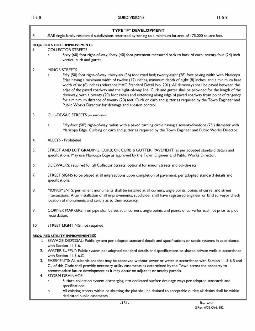
TYPE "F" DEVELOPMENT
F. All single-family residential subdivisions restricted by zoning to a minimum lot area of 175,000 square feet.
REQUIRED STREET IMPROVEMENTS
1. COLLECTOR STREETS
a. Sixty (60) foot right-of-way; forty (40) foot pavement measured back to back of curb; twenty-four (24) inch
vertical curb and gutter.
2. MINOR STREETS
a. Fifty (50) foot right-of-way; thirty-six (36) foot road bed; twenty-eight (28) foot paving width with Maricopa
Edge having a minimum width of twelve (12) inches, minimum depth of eight (8) inches, and a minimum base
width of six (6) inches (reference MAG Standard Detail No. 201). All driveways shall be paved between the
edge of the paved roadway and the right-of-way line. Curb and gutter shall be provided for the length of the
driveway, with a twenty (20) foot radius and extending along edge of paved roadway from point of tangency
for a minimum distance of twenty (20) feet. Curb or curb and gutter as required by the Town Engineer and
Public Works Director for drainage and erosion control.
3. CUL-DE-SAC STREETS (Rev.8/03/Ord.903)
a. Fifty-foot (50’) right-of-way radius with a paved turning circle having a seventy-five-foot (75’) diameter with
Maricopa Edge. Curbing or curb and gutter as required by the Town Engineer and Public Works Director.
4. ALLEYS - Prohibited
5. STREET AND LOT GRADING; CURB; OR CURB & GUTTER; PAVEMENT: as per adopted standard details and
specifications. May use Maricopa Edge as approved by the Town Engineer and Public Works Director.
6. SIDEWALKS: required for all Collector Streets; optional for minor streets and cul-de-sacs.
7. STREET SIGNS to be placed at all intersections upon completion of pavement; per adopted standard details and
specifications.
8. MONUMENTS: permanent monuments shall be installed at all corners, angle points, points of curve, and street
intersections. After installation of all improvements, subdivider shall have registered engineer or land surveyor check
location of monuments and certify as to their accuracy.
9. CORNER MARKERS: iron pipe shall be set at all corners, angle points and points of curve for each lot prior to plot
recordation.
10. STREET LIGHTING: not required
REQUIRED UTILITY IMPROVEMENTS
1. SEWAGE DISPOSAL: Public system per adopted standard details and specifications or septic systems in accordance
with Section 11-5-6.
2. WATER SUPPLY: Public system per adopted standard details and specifications or shared private wells in accordance
with Section 11-5-6.C.
3. EASEMENTS: All subdivisions that may be approved without sewer or water in accordance with Section 11-5-6.B and
C., of this Code shall provide necessary utility easements as determined by the Town across the property to
accommodate future development as it may occur on adjacent or nearby parcels.
4. STORM DRAINAGE:
a. Surface collection system discharging into dedicated surface drainage ways per adopted standards and
specifications.
b. All existing streets within or abutting the plat shall be drained to acceptable outlet; all drains shall be within
dedicated public easements.
-151- Rev. 6/96
Rev. 6/02-Ord. 882

11-5-9 SUBDIVISIONS 11-6-1
Section 11-5-9 Agreement to Install Improvements
A. Upon approval of the Final Plat by the Council, the subdivider shall execute and file an agreement between
himself and the Town specifying the period within which he or his agent or contractor will complete all required
improvements to the satisfaction of the Town Engineer. The agreement shall provide for inspection of all
improvements by the Town Engineer and payment by the subdivider of the actual cost of such inspections. The
subdivider shall deposit with the Town an amount of money equal to the estimated actual cost of making the
required inspections. If the actual cost of making the inspections is less than the amount deposited by the
subdivider, the balance shall be returned to the subdivider. If the actual cost of making the inspections is greater
than the estimated cost of making the inspections, the subdivider agrees to pay to the Town the balance of the
actual cost of making the inspections.
B. The agreement may also provide for construction of improvements and units and for an extension of time
under specified conditions; provided the subdivider shall post a performance bond, assurance or other security
as may be appropriate and necessary to insure installation of the required street, sewer, electric and water
utility; drainage; street lighting; flood control and improvements meeting established minimum standards of
design and construction.
Section 11-5-10 Final Acceptance and Dedication of Street, Utility and Public Improvements Ord. 1028/2-09
A. All street, utility and public improvements intended to be dedicated to the Town for maintenance and operation
shall not be considered complete until the Town Council, upon recommendation of the Town Engineer and
Public Works Director, accepts such dedications and improvements into the Town’s street and utility system. If
accepted, the Town Clerk shall then record such dedications and improvements in the Maricopa County
Recorder’s office. Engineering plans for required improvements must be submitted within ninety (90) days after
approval of the Final Plat, pursuant to Section 11-5-7.
B. A one (1) year warranty period exists from the date of final acceptance, during which the developer/owner is
responsible for making any repairs or replacement at its expense. A maintenance bond in the amount of ten
percent (10%) of the cost of the street, utility and public improvements shall be submitted by the
developer/contractor prior to issuance of the final acceptance letter. Upon completion of the warranty period,
assuming there is no outstanding warranty claim, the maintenance bond will be released.
ARTICLE 11-6 GRADING AND DRAINAGE REQUIREMENTS
Section 11-6-1 Purpose
Section 11-6-2 General
Section 11-6-3 Permits Required and Exceptions
Section 11-6-4 Grading Permit Limitations and Conditions
Section 11-6-5 Engineering Review Fees
Section 11-6-6 Discharge Report
Section 11-6-7 Construction Details
Section 11-6-8 Inspection and Supervision
Section 11-6-9 Design Standards
Section 11-6-10 Responsibility of Permittee
Section 11-6-11 Modification of Approved Plans
Section 11-6-12 Completion of Work
Section 11-6-1 Purpose
The purposes of this Article are:
A. To provide for the public health, safety and general welfare of the residents of the Town by setting forth
procedures to obtain permits for grading and drainage in subdivisions in the Town.
B. To protect the environment by regulating excavation and grading on property.
-152-
Ord.1046/9-09
11-6-1 SUBDIVISIONS 11-6-2
C. To reduce aggradations of waterways and siltation of flood control structures while preserving and enhancing
the natural environment including, but not limited to, the natural landforms and vegetation in the Town.
D. To minimize loss of life and property through the careful regulation of development.
E. To protect existing watersheds, natural waterways, and minimize soil erosion.
F. To ensure that all new development is free from adverse drainage conditions.
G. To encourage the preservation of the existing landscape by maximum retention of natural topographic features
and to minimize the scarring of hillside construction
Section 11-6-2. General
A. Scope and Application
1. All excavation and grading in subdivisions in the Town shall be performed in accordance with the provisions
of this Article, provided however that nothing in this Article shall prevent the enforcement of other laws
which prescribe more restrictive limitations, nor shall the provisions of this Article waive any limitations
imposed by other statutes or ordinances.
2. This Article shall be used with the Drainage Design Manuals for Maricopa County - Hydrology, Hydraulics
and Erosion Control; and the Yavapai County Drainage Criteria Manual. The objective of the Drainage
Design Manuals for Maricopa and Yavapai County is to provide technical guidance for storm drainage
facilities. In case of conflict, the requirements of this Article shall govern.
3. A grading permit shall be obtained prior to the issuance of a building permit for all physical improvements
associated with single-phased projects or for the first phase of multi-phased projects issued by the Town in
accordance with applicable Town standards. Complete development and site plan approval on proposed
projects in their entirety is required. The Town Engineer or Flood Plain Manager will make the
determination that the grading will not adversely impact the natural conveyance of the drainage system or
adjoining property if no application is required.
B. Permit Requirements
Except as provided in Section 11-6-3, Subsection C Exceptions, no person shall commence grading, excavations or
fills without first obtaining a grading permit from the Community Development Department/Planning and Building
Department.
1. Plans and Specifications:
Each application for a grading permit shall be accompanied by two (2) sets of plans and specifications
prepared and signed by an Arizona Registered Civil Engineer and shall include supporting data consisting of
a soil engineering report prepared and signed by an Arizona Registered Civil Engineer.
2. Information on Plans and Specifications:
Plans shall be drawn to scale and supplemented with a bar-graph to preclude changes via enlargements or
reductions upon substantial paper or Mylar, and stored on computer diskettes as specified by the Town.
Plans shall be of sufficient clarity to indicate the nature and extent of work proposed and show in detail that
it will conform to the provisions of this Article and all relevant laws, codes, rules and regulations. The first
sheet of each set of plans shall give the location of the work, the name and address of the property owner,
and the person by whom they were prepared. The Town shall not accept plans that are excessively
smudged or poorly printed or drawn. The plans shall include, at a minimum, the following information:
a. Specific location, assessor tax parcel number(s) and zoning district classification.
-152.1-
Ord.1046/9-09

11-6-2 SUBDIVISIONS 11-6-2
b. Property limits and two-foot contour intervals of existing ground or as determined by the Town
Engineer; and details of terrain and area drainage with a north indicating arrow.
c. Limiting dimensions, elevations, slopes and finish contours or elevations to be achieved by the grading
and proposed drainage channels and related construction.
d. Detailed plans of all surface and subsurface drainage devices, walls, cribbing, dams and other protective
devices to be constructed with, or as a part of, the proposed work together with a map showing the
drainage area and the estimated runoff of the area served by any drainage system.
e. Location and floor elevations of any buildings or structures on the property where the work is to be
performed and the location of any buildings or structures on land of adjacent property owners, which
are within fifty feet (50’) of the property or which may be affected by the proposed grading operation.
f. Location and specification of temporary traffic and parking surfaces complying with the dust control
permit of the county.
g. A site plan in map view with perpendicular cross sections reflecting, center line of street, gutter, curb,
lot, pad, finished floor, basement, garage, fencing and drainage swales and/or openings in fence.
3. Soil Engineering Report:
The soil engineering report, when required by Section 11-6-2, Subsection B shall include data regarding the:
1. Nature, distribution and strength of existing soil and rock; 2. Geologic factors affecting stability and
safety; and 3. Conclusions and recommendations for grading requirements and design criteria for corrective
measures of weak and/or unstable conditions including buttress fills when necessary, opinions and
recommendations, covering adequacy of sites to be developed by the proposed grading, including stability of
slopes.
4. Storm Drainage Precautions:
All applications for a grading permit shall include a safety plan to provide adequate erosion control as per
the National Pollution Discharge Elimination System (NPDES) program and/or drainage devices, debris
basins or other safety devices to protect the life, limb, health, property and welfare; and private and public
property of others from damage of any kind. No permit shall issue without Town approval of a Storm
Drainage Safety plan.
5. Modification of Proposed Work:
The Town may require grading operations and project designs to be modified if weather-generated
problems occur that were not considered at the time the grading permit was issued.
6. Storm Drainage Requirements:
All development within subdivisions in the Town shall provide engineered storm drainage improvements
necessary to insure that the development is safe from inundation from the design storm, and that adjoining
properties are not adversely impacted by the proposed development. Peak runoff flow from a 100-year, 2-
hour storm shall not exceed pre-development runoff. Any site that ultimately drains to a flood control
structure that is currently owned and operated by the Flood Control District of Maricopa County shall not
have the peak flow and total volume of runoff exceed pre-development conditions.
-152.2-
Ord.1046/9-09
11-6-2 SUBDIVISIONS 11-6-3
C. Minor Modifications
The Town Engineer may grant minor modifications to the provisions of this Article and amendments relating
thereto when there exists an unnecessary hardship substantially limiting the preservation and enjoyment of
property rights and resulting from a literal interpretation of this Article and amendments relating thereto.
Minor modifications shall not be authorized unless it is found that:
1. Special circumstances or conditions apply to the property; and
2. Authorizing of the minor modification is necessary for the preservation and enjoyment of substantial
property rights; and
3. Authorizing of the minor modification will not be materially detrimental to the persons residing or working
in the vicinity, to adjacent property, to the neighborhood or to the public welfare in general; and
4. Authorizing the minor modification will not have a detrimental effect on any Flood Control system or
structure as established by the Town of Wickenburg, Maricopa County or Yavapai County; and
5. Granting of the minor modification will be in harmony with the purposes sought to be attained by this
Article and amendments relating thereto.
If in the opinion of the Town Engineer, the modification is not justified, the applicant may appeal the decision to
the Board of Adjustment. In order to reverse the determination by the Town Engineer, the Board shall make a
finding that includes 1 through 5 above and includes the technical and factual detail upon which the reversal is
based.
D. Hazardous Conditions
Whenever the Town determines that any existing excavation, embankment or fill has become a hazard to life
and limb, endangers property, or adversely affects the safety, use or stability of a public way or drainageway,
such condition shall be deemed a nuisance and the owner of the property upon which the excavation or fill is
located, or other person or agent in control of said property, upon receipt of notice in writing from the Town
shall, within the period specified, therein repair or eliminate such excavation or embankment so as to eliminate
the hazard and be in conformance with the requirements of this Article.
If the person or agent in control of the property fails to repair or eliminate such nuisance within the time
specified in the notice from the Town, the Town is authorized to abate such nuisance by following the
procedures set forth in Article 10-4 of the Town Code.
Section 11-6-3. Permits Required and Exceptions
A. Drainage
1. Any alterations to existing natural drainage systems shall meet the requirements of the Drainage Design
Manuals for Maricopa County - Hydrology, Hydraulics and Erosion Control; and the Yavapai County
Drainage Criteria Manual. The Town may determine if it is necessary to reinforce the stability of such
drainage if in the opinion of the Town Engineer or Building Official there are signs of erosion or where the
proposed development may add water runoff greater than current levels.
2. Except in cases of bedrock-bottomed drainage, the slope of a new or relocated drainageway shall be a
minimum of one (1) foot in one hundred (100) feet (1 percent slope). Side slopes of new or relocated
drainage shall not exceed a ratio of three (3) horizontal to one (1) vertical.
3. New drainage or relocated drainage shall be designed with slope rounding to blend with natural contours.
New or relocated drainage shall be designed to blend with the natural terrain. In most cases, this shall
mean a curvilinear watercourse. New or relocated drainage shall be designed to vary in width or depth
similar to natural drainages.
-152.3-

Ord.1046/9-09
11-6-3 SUBDIVISIONS 11-6-3
B. Filling and Excavation
1. No person shall do any grading, filling, excavating, cutting or other site earthwork without first having
obtained a grading permit. To obtain a grading permit, the applicant shall submit plans; drawings;
engineering studies; supporting data, including the quantity of cut and the quantity of fill; and such other
information as required by the Town. The information and documentation shall clearly indicate the extent
and nature of the work proposed, and the location of any temporary construction envelope fences required
to be erected. All submitted documentation must meet Town requirements and be approved by Town
staff before a permit is issued by the Town, (except where a building permit may be issued and a grading
permit is not required).
2. A grading permit issued for grading, filling, excavating, cutting or other site earthwork shall comply with the
requirements of this Article.
3. Upon issuance of a grading permit, all earthwork shall be completed within six (6) months or diligently
pursued. Two additional extensions of six (6) months may be applied for with the permission of the Zoning
Administrator, as per Section 11-6-4, Subsection C.
C. Exceptions
1. The following activities may be conducted without formal issuance of a grading permit:
a. A fill less than two (2) feet in depth and placed on natural terrain with a slope flatter than five (5) feet
horizontal to one (1) foot vertical and not intended to support structures and which, in either case,
shall not obstruct a drainage course.
b. Grading by a Public Utility Company in private easements that do not obstruct a natural water course.
c. Sanitary landfills and refuse disposal areas which are regulated by the Maricopa and Yavapai County
Health Departments.
d. Excavations performed in drilling water supply wells and septic systems.
e. An excavation which does not exceed fifty (50) cubic yards, does not obstruct a drainage course, and:
1) Is less than two (2) feet in depth, or
2) Which does not create a cut slope greater than five (5) feet in height and steeper than three (3)
horizontal to one (1) vertical.
2. Unless otherwise expressly provided herein, a grading permit shall not be required for the following:
a. Existing legal uses of property or the right to continuation of such legal use. However, if a
nonconforming use of land or building or structure is discontinued for twelve months, or is destroyed
to the extent of fifty percent of its value, as determined by a competent appraiser, any further use shall
comply with this Article.
b. Reasonable repair or alteration of property for the purposes for which the property was legally used
on (date of adoption) except that any alteration, addition or repair to a nonconforming building or
structure which would result in increasing its flood damage potential shall be either flood proofed or
elevated to or above the regulatory flood elevation.
c. Reasonable repair of structures constructed with the written authorization required by A.R.S. §48-
3613.
-152.4-
Ord.1046/9-09

11-6-3 SUBDIVISIONS 11-6-4
d. Facilities constructed or installed pursuant to a certificate of environmental compatibility issued
pursuant to A.R.S. Title 40, Chapter 2, Article 6.2 (Power Plant and Transmission Line Siting
Committee).
3. The Town may issue a building permit without a grading permit for additions to, or enlarging an existing
building or for a new single family residence in a drainageway or floodplain in a subdivision recorded prior
to November 1, 1977, provided the building floor elevation is set not less than fourteen inches (14”) above
the outfall of the lot and the minimum height necessary for floodplain management, provided such permit
has been approved by the Town.
a. Written authorization shall not be required, nor shall the Town prohibit:
1) The construction of bridges, culverts, dikes and other structures necessary to the construction
of public highways, public roads and any streets intersecting a watercourse.
2) Any flood control district, county, town or other political subdivision from exercising powers
granted to it under A.R.S. Title 48, Chapter 21 (Flood Control Districts).
3) The construction of streams, waterways, lakes and other auxiliary facilities in conjunction with
the development of public parks and recreation facilities by a federal or state public agency or a
political subdivision of the State of Arizona.
b. Before any construction authorized by this subsection may begin, construction plans shall be approved
by the Town Engineer and as appropriate the Maricopa and Yavapai County Flood Control Districts.
These exceptions do not preclude any person and/or agency from liability if their actions increase flood
hazards to any other person or property.
c. Neither the issuance of a building permit under the provisions of this Article, nor compliance with the
provisions hereof, or with any conditions imposed in the building permit, shall relieve any person from
responsibility for damage to other persons or property, nor impose any liability upon the Town for
damage to other persons or property.
Section 11-6-4 Grading Permit Limitations and Conditions
A. Authorization
1. The issuance of a grading permit shall constitute authorization to do only that work, which is described or
illustrated on the application for the permit or on the site, plans and specifications approved by the Town.
The Town may revoke a permit if the site is not being developed in compliance with the approved site plan.
2. The issuance of a permit or the approval of drawings and specifications shall not be construed to be a
permit for, nor the approval of, any violation of, or deviation from the provisions of this Article or any
other ordinance, code, law, rule or regulation. A permit shall be considered invalid if, a violation of this
Article or deviation there from, has occurred upon completion of work. When such violation occurs, the
permit shall be deemed to be canceled and the ground shall be restored to the condition it was in prior to
the start of the grading work.
3. The issuance of a permit, based upon drawings and specifications, shall not prevent the Town from
thereafter requiring the correction of errors in said drawings and specifications or from stopping unlawful
construction operations being carried on hereunder.
4. It shall be required that all work performed within public right-of-way shall be licensed, insured and a
bonded Contractor.
-152.5-
Ord.1046/9-09

11-6-4 SUBDIVISIONS 11-6-4
B. Jurisdiction of Other Agencies
Permits issued under the requirements of this Article shall not relieve the owner of the responsibility for
securing required permits for work to be done that is regulated by other ordinances, departments or divisions
of the Town or other governing agencies. A Grading Permit shall not be issued until all required permits are
obtained from the Arizona Department of Environmental Quality (ADEQ), the County Health Departments
(CHD), the County Flood Control District (CFCD), potential 404 permit and other agencies.
C. Time Limits
The permittee shall fully perform and complete all of the work required to be done pursuant to the grading
permit within the time limit specified. If no time limit is specified, the permittee shall complete the work within
one hundred eighty (180) days after the date of issuance of the grading permit. If the permittee is unable to
complete the work within the specified time, a letter shall be submitted to the Zoning Administrator prior to
the expiration of the permit requesting an extension of time and setting forth the reasons for the requested
extension. If, in the opinion of the Zoning Administrator, such an extension is warranted, up to an additional 6
months can be granted for the completion of the work. The permittee shall only be allowed two (2) extensions
or 6 months each.
D. Conditions of Approval
In granting any permit under this Article, the Town may attach such conditions as may be reasonably necessary
to prevent creation of a nuisance or hazard to public or private property. Such conditions may include, but shall
not be limited to:
1. Compliance with dust control requirements of the county and the State Department of Environmental
Quality (ADEQ). Vehicles carrying loads should have them covered with a secure tarpaulin, netting or
other covering to prevent the load from spilling or blowing from the vehicle.
2. Requirements for fencing of excavations or fills, which would otherwise be hazardous.
3. Improvement of any existing site condition to bring it up to standards of this chapter.
4. A landscaping plan shall be required. The landscaping plan shall consist of the preservation of mature native
vegetation or the relocation of new native vegetation, all of which shall be placed along the edges of the
proposed rights-of-ways or streets as part of an approved streetscape plan.
5. Requirement for submittal of a Storm Water Pollution Prevention Plan (SWPPP)
E. Bonds
1. Requirements:
A permit shall not be issued for more than ten thousand cubic yards (10,000 C.Y.) of grading unless the
permittee shall first post with the Town a cash bond or a bond executed by the owner and a corporate
surety authorized to do business in Arizona as a surety in an amount sufficient to cover the cost of the
project, including corrective work necessary to remove and eliminate geological hazards, all as determined
by the Developer.
2. Conditions:
Every bond shall include the conditions that the permittee shall:
a. Comply with all of the provisions of this Article, applicable laws and ordinances;
b. Comply with all of the terms and conditions of the permit for excavation or fill to the satisfaction of the
Town Engineer.
c. Complete all of the work contemplated under the permit within the time limit specified in the permit or in
Section 2.B.3. If the Town extends the time specified in the permit, no such extension shall release the
surety upon the bond.
-152.6-
Ord.1046/9-09

11-6-4 SUBDIVISIONS 11-6-4
3. Failure to Complete Work:
The term of each bond shall begin upon the date of filing and shall remain in effect until the completion of
the work to the satisfaction of the Town. At the beginning of the project the Contractor shall estimate the
cost of the bond. In the event of failure to complete the work and failure to comply with all of the
conditions and terms of the permit, the Town may order the work required by the permit to be
completed to his satisfaction. The surety executing such bond or deposit shall continue to be firmly bound
under a continuing obligation for the payment of all necessary costs and expenses that may be incurred or
expended by the governing agency in causing any and all such required work to be done. In the case of a
cash deposit, said deposit or any unused portion thereof shall be refunded to the permittee. In the event
where development of the property does not immediately commence, a maintenance bond in the amount
of 10 percent of the value of the grading shall be provided to ensure that the graded property is properly
maintained and does not become a nuisance. In the event a bond or approved assurance for the proposed
work is provided through some other ordinance or stipulation, a second assurance to fulfill this Article
shall not be required.
4. Assurance of Construction Through Loan Commitment:
In lieu of providing assurance of construction in the manner provided above in this section, the permittee
may provide assurance of construction for grading improvements by delivering to the Town, prior to the
issuance of a permit, an agreement in a form approved by the Town Attorney between an approved lending
institution and the permittee, stating that funds sufficient to cover the entire cost of performing the
proposed work, including engineering and inspection costs, in an amount approved by the Town, have been
deposited with such approved lending institution. Such agreement shall provide that such funds in the
stated amount are specifically allocated and will be used by the permittee, or on his behalf, only for the
purpose of performing the grading improvements. The Town shall be the beneficiary of such agreement or
the permittee’s rights thereunder shall be assigned to the Town and shall approve each disbursement of any
such funds. The agreement may also contain terms, conditions and provisions normally included by such
lending institutions in loan commitments for construction funds, or as may be necessary to comply with
statutes, codes and rules applicable to such lending institutions.
F. Liability
Neither the issuance of a permit under the provisions of this Article nor the compliance with the provisions
hereof, or with any conditions imposed in the permit issued hereunder, shall relieve any person from
responsibility for damage to other persons or property, nor impose any liability upon the Town for damage to
other persons or property.
G. Revocation
If the Town determines that the work authorized under any permit issued under this Article is not proceeding
in accordance with the approved application, or is proceeding in violation of this Article or any other ordinance
of the Town, or if it determines that there has been any false statement or misrepresentation as to a material
fact in the application or payment for said permit or plans on which the permit was based, the Town shall notify
the person obtaining the permit and the owner that such work fails to conform to said permit, or that the
permit was obtained by false representations and that such failure in obtaining the permit be corrected without
delay. If the owner or person obtaining the permit fails or refuses to make such correction within the time
specified in said notice, the Town shall issue a stop work order. Such notice shall be in writing and signed by
the Town. It is unlawful for any person to proceed with any part of such work after such notice is served.
When necessary, law enforcement personnel shall be employed to insure compliance.
-152.7-
Ord.1046/9-09
11-6-4 SUBDIVISIONS 11-6-6
H. Streets and Driveways
All grading for streets and driveways shall be done in accordance with the recommendations and guidelines in
accordance with MAG Standards and the approved grading plans.
I. Denial of Permit
1. Geological or Flood Hazard:
If, in the opinion of the Town, the land area for which grading is proposed is subject to geological or flood
hazard to the extent that the proposed corrective work will not eliminate or sufficiently reduce the hazard
to human life or property, the grading permit and the building permits for habitable structures shall be
denied.
2. Unlawful Grading:
The Town shall not issue a permit in any case where it finds that the work as proposed by the applicant will
endanger any private property or result in the depositing of debris or soils on any public way or seriously
interfere with any existing drainage course. However, if it can be shown to the satisfaction of the Town
that the hazard would be essentially eliminated by the construction of retaining structures, buttress fills,
drainage devices or by other means, the Town may issue the permit.
Section 11-6-5 Engineering Review Fees
Applicant shall pay all Engineering Review Fees for permit application review as set by the Town Council as per
adopted resolution.
Section 11-6-6 Drainage Report
A drainage report shall be submitted at the time of the preliminary plat review or when determined by the Town
Engineer. The application will not be accepted and a preliminary plat review will not be scheduled without the
drainage report. The report shall be prepared by an Arizona Registered Civil Engineer. The following information
shall be covered in the report:
A. Hydrology
1. Study Requirements:
A hydrology study shall be performed for each development in a subdivision within the Town. The study
shall define the overall and sub-drainage areas. It shall also determine appropriate hydrologic data for the
following:
a. Off-Project Areas: The peak flows, time of concentration, and other hydrologic data, for each off-
project drainage area tributary to the project shall be computed and submitted in summary form.
Storm runoff exiting on property under development and flowing onto an Arizona Department of
Transportation (ADOT) right-of-way, shall be subject to ADOT’s review and approval process.
b. Project Sub-Basins: The project shall be divided into tributary sub-basins contributing to appropriate
design points. The pertinent hydrologic data shall be computed for each and submitted in summary
form.
2. Basis of Design:
The basis of design shall be the Drainage Design Manuals for Maricopa County - Hydrology, Hydraulics and
Erosion Control or if in Yavapai County the Yavapai County Drainage Criteria Manual, as prepared and
published by the Flood Control District of Maricopa County and Yavapai County Flood Control District,
respectively; and the Arizona Department of Water Resources (ADWR).
-152.8-
Ord.1046/9-09

11-6-6 SUBDIVISIONS 11-6-6
3. Floodplain Administration:
The Engineer shall comply with the requirements of the Town of Wickenburg, Federal Emergency
Management Agency (FEMA), U.S. Environmental Protection Agency (EPA) and Army Corps of Engineers
(COE) requirements. CLOMR, LOMR, COE 404 and EPA 401 applications and/or permits may be required
by these other agencies.
B. Hydraulics
1. Basis of Design:
The basis of design shall be the Drainage Design Manuals for Maricopa County – Hydrology, Hydraulics and
Erosion Control and if in Yavapai County the Yavapai County Drainage Criteria Manual. The Design
Engineer is responsible for evaluating the specific design conditions to determine the appropriate design
criteria in evaluating the hydraulic design and anticipated operation and maintenance conditions. The
following provisions shall not relieve the Design Engineer, Consultant, Developer or Owner of the
responsibility to apply generally accepted design practices and professional conduct.
2. Street Drainage:
The basis of design for local streets shall be the ten-year storm being contained within the pavement
section with a maximum depth of six inches (6”) at the gutter or where there is no gutter, then it shall be
measured at the crown line.
a. Streets shall be designed to carry the following minimum flows:
1) Major and minor arterial streets are to carry a ten-year (10-yr) flow between the curbs and
maintain a twelve-foot (12’) dry lane in each direction; and carry the one hundred-year (100-yr)
flow within the right-of-way with a maximum depth of six inches (6”) over the crown of the street,
for emergency vehicles and evacuation purposes.
2) Collectors and local streets are to carry ten-year (10-yr) flows between the curbs, the fifty-year
(50-yr) flows within the right-of-way.
3) Underground storm drains are required when the above street capacity or maximum depth is
exceeded.
4) Streets shall have a crowned section for drainage. Exceptions may be submitted with specific
written request to the Town Engineer and written acknowledgment by the Town.
b. In general, dip crossing of open channels shall be avoided.
c. All storm drains and channels shall be constructed in public rights-of-way or dedicated easements. The
minimum width of the right-of-way or easement shall be adequate to allow a minimum continuous
twelve foot (12’) wide maintenance road, but in no case less than ten feet (10’) wide.
d. Where access to a new development requires crossing of a channel or wash, an all-weather crossing
must be provided. Additional all-weather crossings may be required by the Town.
e. Depth of flow within drainage easements shall not exceed twelve inches (12”), excluding the area of the
channel structure.
-152.9-
Ord.1046/9-09

11-6-6 SUBDIVISIONS 11-6-6
3. Drainage Between Lots:
a. Routing of drainageways between lots or buildings is discouraged and will be allowed only upon written
request from the developer and written approval of the Town and are recommended to be buried,
culvert grated or ditched.
b. The ends of the right-of-way or easement shall be treated in such a manner as to prevent non-
maintenance vehicular access without diminishing the hydraulic capacity of the channel. Removable
bollards, railings or barricades or gates shall be installed.
c. A minimum of 25% of the up-stream opening shall be assumed to be clogged with debris, when
considering design capacity.
d. Fencing or railing may be required by the Town Engineer if an open channel is used.
e. Headwalls, wing walls, retaining walls, grated and trash racks are required in the design of channels and
storm drains.
4. Retention/Detention Facilities & Areas:
a. The design engineer shall determine and present calculations on each retention/detention facility
required for their project. The retention/detention volume for the one hundred-year (100-yr), two-
hour (2 hr) storm, shall be provided. Basin volume which exceeds the contribution from the sub-area
it serves will not be considered as volume provided.
b. A Drainage easement shall be recorded over each retention/detention area within the project for both
“public” and “private” basins.
c. All retention/detention facilities shall be sized to retain 100% of the required volume of the one
hundred-year, two-hour storm falling over the entire project (gross area including streets) required to
meet post-development criteria.
d. Freeboard – there shall be a one-foot freeboard from the basin emergency overflow level to the lowest
building elevation. This overflow level is the basin design level above the outfall elevation designed for
the one-hundred-year (100-yr) event. This design would allow ponding to occur in excess of the design
level should outlet clogging or extreme/successive flow events occur. The outfall elevation shall be
lower than the emergency overflow level.
e. The outfall elevation and overflow elevation shall be shown on the plans.
f. Retention/Detention facilities located within a drainageway, channel way, or floodway are prohibited.
g. Grading
1) Depths:
The overall depth shall not exceed three feet (3’) without authorization of the Town. If granted,
the side slopes shall be flattened. At the Town’s option, the basin may be fenced to allow steeper
side slopes or greater depths. In no case shall the depth exceed one foot (1’) without a positive
means of disposing of accumulated runoff.
-152.10-
Ord.1046/9-09
11-6-6 SUBDIVISIONS 11-6-8
2) Side Slopes and Bottom:
a) Side Slopes:
i. Side slopes adjacent to public right-of-way, or when there is pedestrian type access to
that portion of the basin, shall have a side slope of 6:1 or flatter. There shall be at least
two feet of level ground between the back of the sidewalk and the beginning of the side
slope grading.
ii. Side slopes adjacent to walls, fences, hedges, etc. (i.e., no or limited pedestrian type access
in that area) may have side slopes up to 4:1 adjacent to public right-of-way or easement
and 4:1 adjacent to private property. There shall be at least two feet of level ground
adjacent from any wall or vertical obstruction to the top of the side slope grading.
b) Bottom: The bottom of all basins shall be sloped towards the discharge points. The
minimum bottom slope shall be 0.1%.
h. Parking Lots – Retention/Detention of runoff in parking lots of developments is allowed subject to the
following guidelines:
1. No storage volume of a ten-year – 2-hour storm or less may be retained/detained on a parking lot.
The balance shall be retained/detained in landscaped areas and/or retention/detention facilities.
2. Parking spaces shall provide one dry access with no point of the space to exceed 0.50 feet deep.
3. Handicapped parking and loading spaces shall be free from ponding.
i. Disposal/Discharge:
1. A bleed-off discharge to an existing storm drain or drainage channel of sufficient capacity to convey
the anticipated flows from the tributary drainage areas after the storm.
2. Shallow pit percolation tests shall be performed in retention areas to determine natural
percolation. The test shall be performed at the same depth as the bottom of the proposed basin,
or 3 feet below the natural ground surface, whichever is lower. Tests shall be submitted prior to
approval of the drainage plans. All retained or detained runoff shall be dissipated within 36 hours
following each storm.
Section 11-6-7 Construction Details
All development shall be constructed in compliance with the Maricopa Association of Governments (“MAG”)
Standard Details and Specifications as modified by the Town and in accordance with all federal, state and local laws
regulating such development.
Section 11-6-8 Inspection and Supervision
All grading operations for which a grading permit is required shall be subject to inspection by the Town. When
required by the Town, special inspection of grading operations and special testing shall be performed in accordance
with the provisions of this Section.
A. Standard Grading Requirements
The Town may inspect the work and may require adequate inspection and compaction control by a certified soil
testing agency. The testing agency responsibility shall include, but need not be limited to, certification
concerning the inspection of cleared areas and benches to receive fill, and the compaction of fills. When the
Town has cause to believe that geologic factors may be involved, the grading operation shall be required to
conform to engineered grading requirements.
-152.11-
Ord.1046/9-09

11-6-8 SUBDIVISIONS 11-6-9
B. Notification of Non-Compliance
Work, as described under this Article, is performed at a sub-standard level or not in conformance to the
guidelines and stipulations of this ordinance, the Civil Engineer and/or its designated and qualified designee shall
stop order all work until corrective measures are taken. Recommendations for corrective measures, if deemed
necessary by the Town, shall be submitted. Recommendations for corrective measures, if deemed necessary by
the Town, shall be submitted.
C. Transfer of Responsibility by Permittee
If the Civil Engineer or the testing agency of record listed in the grading permit are changed or replaced during
the course of the work, the permittee is responsible for the replacement of a registered or certified
professional to supervise the project through completion and notification shall be given to the Town.
Section 11-6-9 Design Standards
A. Cuts
1. General: On all lots or parcels, development, design and construction techniques should blend scale, form
and visual character into the natural land forms, and minimize exposed scars. Cuts shall conform to the
provisions of this Section.
2. Substructure Protection: The Permittee shall determine any utilities or other substructures that exist in the
location to be excavated no less than two (2) working days prior to the commencement of any work by
calling the Blue Stake Center. Excavation shall be undertaken with sufficient care not to interrupt the utility
service function or to disturb the utility or other substructure physical supports.
3. Drainage Design and Treatment: Any alterations to existing natural drainage systems shall meet
requirements pursuant to Section 5.B.
4. Safety: Cuts shall be adequately fenced to preclude unauthorized access, as determined by the Town.
5. Natural Contours: All buildings, structures, driveways and roads shall, to the greatest extent practicable,
utilize the natural contours of the land so as to minimize disturbed area.
6. Blending: At the intersections of cuts and fills, slopes shall be adjusted and warped to flow into each other
or into the natural ground surfaces without noticeable break.
7. Cut Slopes: Concrete and masonry decorative walls, and retaining walls used in association with cut slopes
shall be color treated or veneered to blend in with the surrounding natural colors of the native rock and
soils at the site. The surfaces shall be rough textured with heavy shadow patterns.
8. Driveways: Where justified by topographic conditions, the maximum slope of a driveway may exceed fifteen
percent (15%), provided that minimum standards for break overs are maintained as determined and applied
by the Town. However, the Wickenburg Fire Department has indicated that for fire protection services,
driveways exceeding seventy-five feet (75’) in length with a grade of eight percent (8%) or greater, or any
driveway with a grade in excess of twelve percent (12%) do not constitute reasonable access for fire
apparatus and therefore, in such cases, the Town is relieved of any and all liability.
-152.12-
Ord.1046/9-09

11-6-9 SUBDIVISIONS 11-6-9
B. Fills
1. General: Development, design and construction techniques on all lots or parcels shall blend with the natural
land forms, minimizing exposed scars. Fills shall conform to the provisions of this Section. In the absence of
an approved Soil Engineering Report, these provisions may be waived by the Town for minor fills not
intended to support structures.
2. Fill Location: Fill slopes shall not be constructed on natural slopes steeper than two (2) to one (1).
3. Preparation of Ground:
a. The ground surface shall be cleared and grubbed to receive fill by removing vegetation, roots one and
one-half (1-1/2) inches in diameter and larger, non-complying fill, topsoil and other unsuitable materials;
by scarifying to provide a bond with the new fill and, where the slope is steeper than five (5) to one (1)
and the height is greater than five (5) feet, by benching into sound bedrock or other competent
material. This information should be specified in the Soil Engineering Report.
b. The bench under the toe of a fill, on a slope steeper than five (5) to one (1), shall be no less than ten
(10) feet wide. The area beyond the toe of fill shall be sloped for sheet overflow, or a paved drain shall
be provided.
c. When fill is to be placed over a cut, the bench under the toe of fill shall be no less than ten (10) feet
wide. The cut shall be made before placing the fill and accepted as a suitable foundation for the fill by a
Soil Engineer.
4. Compaction: All fills shall be compacted to a minimum of ninety-five percent (95%) under, and within five
(5) feet of structures, and within traffic areas. Compaction within existing or proposed right-of-way or
streets shall be per MAG Specifications. For all other areas, compaction shall be to a minimum of ninety
percent (90%) of maximum density as determined by MAG specifications.
5. Slope: The slope of fill surfaces shall be no steeper than is safe for the intended use. In no cases shall fill
slopes be steeper than two (2) horizontal to one (1) vertical. Slopes shall be designed to blend with the
natural terrain according to Section 2 of this Article.
6. Drainage and Terracing: Drainage and terracing shall be provided. The area above fill slopes and the
surfaces of terraces shall be graded as required by Section 5. – Inspection and Supervision of this Article.
7. Blending: At the intersections of cuts and fills, slopes shall be adjusted and warped to flow into each other
or into the natural ground surfaces without noticeable break.
8. Walls: Concrete and masonry decorative walls, and retaining walls used in association with fill slopes shall
be color treated or veneered to blend in with the surrounding natural colors of the native rock and soils at
the site. The surfaces shall be rough textured with heavy shadow patterns. An Arizona Registered Civil
Engineer shall design the retaining walls for fills greater than five feet (5’).
-152.13-
Ord.1046/9-09

11-6-9 SUBDIVISIONS 11-6-9
9. Fill Material; Exceptions:
a. Organic materials are not authorized. No rock or similar irreducible material with a maximum
dimension greater than eight (8) inches in maximum dimension shall be buried or placed in fills.
b. Rocks greater than eight (8) inches in maximum dimension may be authorized by the Town only when
a Soil Engineer devises a proper method of placement, continuously inspects their placement and
approves the fill stability. When so authorized, the following three (3) conditions shall be complied
with:
1) Prior to issuance of the Grading Permit, potential rock disposal areas shall be delineated in the
grading plan;
2) Rock sizes greater than eight (8) inches in maximum dimension shall be no less than ten (10) feet
below grade as measured vertically;
3) Rocks shall be placed so as to fill all voids with fines.
C. Cut and Fill Slopes Greater Than 20%
All portions of a lot or parcel having a natural slope of 20% or greater within any horizontal distance with a five-
foot elevation change shall be subject to an engineering solution acceptable to the Town Engineer. Such slopes
shall be identified on subdivision plats and this requirement noticed in the public. In all rural and residential
zoning districts, the extent of grading on that portion of a lot which has a natural slope of 20% or greater within
any horizontal distance with a five-foot (5’) elevation change shall be limited to a total area not to exceed 20% of
the lot.
D. Drainage
1. Existing Drainage Facilities: No person shall alter any natural drainage course or existing drainage facility in
such a way as to damage or endanger by flooding, erosion, or any other means, any public or private
property or improvements.
2. Disposal. All drainage facilities shall be designed to carry surface waters to the nearest practical street
storm drain or natural watercourse approved by the Town and/or any other jurisdictional Flood Control
District as a safe place to deposit such waters.
3. Erosion Prevention. Adequate provision shall be made to prevent surface waters from damaging the face of
an excavation or fill. All slopes shall be protected from surface water runoff from above by berms or
swales.
4. Terrace Drains. All swales or ditches on drainage terraces shall be graded to provide suitable drainage and
designed to prevent erosion and provide durability.
E. Re-Vegetation of Cut and Fill Slopes
Cut and fill slopes shall be seeded or otherwise re-vegetated within one month of completion or as soon as the
planting season allows as determined by the Town. Re-vegetation of cut slopes shall include a mix of plant types
indigenous to the area and similar to surrounding plant life, with size and species to provide for variation in
color, texture and mass. This may range from trees to low wildflower groundcovers. Irrigation and
maintenance adequate for the survival of the plant species, as determined by the Town, shall be provided until
mature enough to survive without programmed care by the legal owners of the cut slope. For cuts greater than
5,000 cubic yards, the re-vegetation plan shall be submitted by a Registered Landscape Architect or Engineer. In
all cases the slope shall be finished and re-vegetated with natural rock and plant material in quantities consistent
with the area and in a manner that substantially reduces the potential for erosion.
-152.14-
Ord.1046/9-09
11-6-9 SUBDIVISIONS 11-6-10
F. Setbacks
1. General: Cut and fill slopes shall be setback from site boundaries in accordance with this section. Setback
dimensions shall be horizontal distances measured perpendicular to the site boundary.
2. Top of Cut Slope: The top of cut slopes shall be made not nearer to a site boundary line than one fifth (1/5)
of the vertical height of cut with a minimum of two feet (2’) and a maximum of ten feet (10’). The setback
may need to be increased for any required interceptor drains.
3. Top of Fill Slope: The top of fill slope shall be made not nearer to the site boundary line than one-half the
height of the slope with a minimum of two (2) feet and a maximum of twenty (20) feet. Where a fill slope
is to be located near the site boundary and the adjacent off-site property is developed, special precautions
shall be incorporated into the work as the Town of Wickenburg deems necessary to protect the adjoining
property from damage as a result of such grading. These precautions may include, but are not limited to:
a. Additional setbacks
b. Provision for retaining or slough walls
c. Mechanical or chemical treatment of the fill slope surface to minimize erosion
d. Provisions for the control of surface waters
4. Modification of Slope Location: The Town may approve alternate setbacks. The Town may require an
investigation and recommendation by a Civil Engineer to demonstrate that the intent of this Section has
been satisfied.
G. Exceptions for Design Cuts and Fills
Improvements to existing streets or highways, or improvements to existing cut slopes which do not conform to
this Article may be excepted. Any exception shall be authorized by the Town.
Section 11-6-10 Responsibility of Permittee
A. Compliance with Plans and Requirements
All permits issued hereunder shall be presumed to include the provision that the applicant, his agent, contractor
or employees shall carry out the proposed work in accordance with the approved plans and specifications and in
compliance with all the requirements of this Article.
B. Protection of Utilities
During the grading operations, the permittee shall be responsible for the prevention of damage to any street or
drainage facilities or to any public utilities or services. This responsibility applies within the limits of grading and
along any routes of travel of equipment.
C. Protection of Adjacent Property
The permittee is responsible for the prevention of damage to adjacent property, and no person shall excavate
on land sufficiently close to the property line to endanger any adjoining public street, sidewalk, alley or other
public or private property prior to supporting and protecting such property from settling, cracking or other
damage which might result. Restoration of adjacent property shall include re-vegetation, when necessary.
D. Surplus Material
All surplus excavated material shall be removed from the lot or parcel prior to final inspection by the Town.
-152.15-
Ord.1046/9-09

11-6-11 SUBDIVISIONS 11-7-2
Section 11-6-11 Modification of Approved Plans
No modification of the approved grading plans may be made without the approval of the Town. All necessary
revisions to soils and geological reports shall be submitted with the revised plans.
Section 11-6-12 Completion of Work
A. Final Reports
Upon completion of the construction work, the Town may require the following reports, drawings and
supplements thereto covering the following subjects:
1. An As-Graded grading plan prepared by the Civil Engineer, including original ground surface elevations, as-
graded ground surface elevations, lot and parcel drainage patterns, and locations and elevations of all
surface and subsurface drainage facilities. The Civil Engineer shall provide certification that the work was
accomplished in accordance with the approved final grading plan.
2. As and when required by Section 11-6-2, Subsection B, a Soil Engineering Report shall include the locations
and elevations of field density tests, summaries of field and laboratory tests, and other substantiating data
and comments on any changes made during the engineering field grading and their effect made in the
engineering investigative report. The Civil Engineer shall assemble this report or have assigned the task of
completing this report through his designated and certified designee. The report shall contain a final
description of the geology of the site, any new information disclosed during the grading, and the effect of
these facts on the recommendations incorporated in the approved grading plan.
B. Notification of Completion
The permittee or his agent shall notify the Town when the grading operation is ready for final inspection. Final
approval shall not be given until all work, including installation of all drainage facilities and their protective
devices and all erosion control measures, have been completed and the final reports have been submitted and
accepted by the Town.
ARTICLE 11-7 MODIFICATION
11-7-1 Extraordinary Conditions
11-7-2 Appeal and Hearing
11-7-3 Additional Requirements
Section 11-7-1 Extraordinary Conditions
Where there exists extraordinary conditions of topography, land ownership, adjacent development, or other similar
circumstances not provided for in this Chapter, the Subdivision Committee may, upon request of the subdivider,
recommend modification of the enforcement of this Chapter in such manner and to such extent as it deems
appropriate to the public interest. Any such recommendation or modification of the provisions of this Chapter shall
be clearly noted in the Subdivision Committee’s report regarding both the Preliminary Plat and Final Plat.
Section 11-7-2 Appeal and Hearing
In the event that an appeal for modification of enforcement of this Chapter does not receive affirmative action by
the Subdivision Committee, the subdivider may file such appeal with the Town Clerk and, upon hearing, the Council
may make such modifications, as it deems proper. The Subdivision Committee shall be represented at such hearing
and make known to the Council its recommendations and reasons for denial of the appeal.
-152.16-
Ord.1046/9-09

11-7-3 SUBDIVISIONS 11-9
Section 11-7-3 Additional Requirements
In modifying the standards or requirements set forth in this Chapter, as provided above, the Subdivision Committee,
the Planning Agency and the Council may make such additional requirements as are deemed necessary to secure
substantially the objectives of the standards or requirements so modified.
ARTICLE 11-8 LAND SPLITS
A. “Land Splits” means the division of improved or unimproved land the area of which is two and one-half (2½)
acres or less into two (2) or three (3) tracts or parcels of land for the purpose of sale or lease.
B. Prior to the division of any land by a land split as defined in Subsection A of this Article, the person proposing
such a land split shall submit to the Town Council a plat showing such land split. The plat shall indicate the
reservation of all necessary street and utility easements for the tract or parcel created by such land split.
ARTICLE 11-9 LOT SPLITS
A. Of Record: Any lot, which has been surveyed, deeded and provided perfected access and recorded with the
office of the Maricopa County Recorder prior to December 7, 1994, will be considered a legal lot of record.
B. Any lot, which is hereafter created, shall conform in all respects to the zoning ordinance, and as such applicable
the subdivision regulations of the Town. Each lot shall be surveyed and filed with the Town. Lots, which are
found to be in compliance with the applicable sections, will be issued a certificate of compliance and are thereby
eligible to apply for a building permit.
-153-
Ord. 1028/2-09

PAGE 154 – 157 -- RESERVED FOR FUTURE USE