chapter 2 (cont)
DESCRIPTION
TraversingTRANSCRIPT

TRAVERSING
NUR HIDAYAH BT ISHAK HIZAMSCHOOL OF CIVIL ENGINEERINGLINTON COLLEGE UNIVERSITY

LECTURE CONTENTS
DEFINITION TYPES OF TRAVERSE
OPEN TRAVERSE CLOSED TRAVERSE
DATUM IN CADASTRAL SURVEY TRAVERSE BOOKING TRAVERSE DATA ADJUSTMENT
‘C’ CORRECTION

LECTURE OUTCOME
• STUDENT ARE ABLE TO:
• Understand the meaning of traverse.• Identify types of datum in survey and why datum is
needed in survey.• Book the observed survey data.• Perform traverse data adjustment.

TRAVERSEINTRODUCTION

TRAVERSE
A traverse consist of consecutive lines related by horizontal angle (bearing) and length (distance).
Traverse can be classified as:i. Closed traverse.ii. Open traverse

CLOSED TRAVERSEWhen complete cycle is made and consequently the
work can be checked and adjusted.
A closed traverse begin and end on the same point (polygon traverse) or begin with known point and end at another known point (link traverse).

CLOSED TRAVERSE

CLOSED TRAVERSE
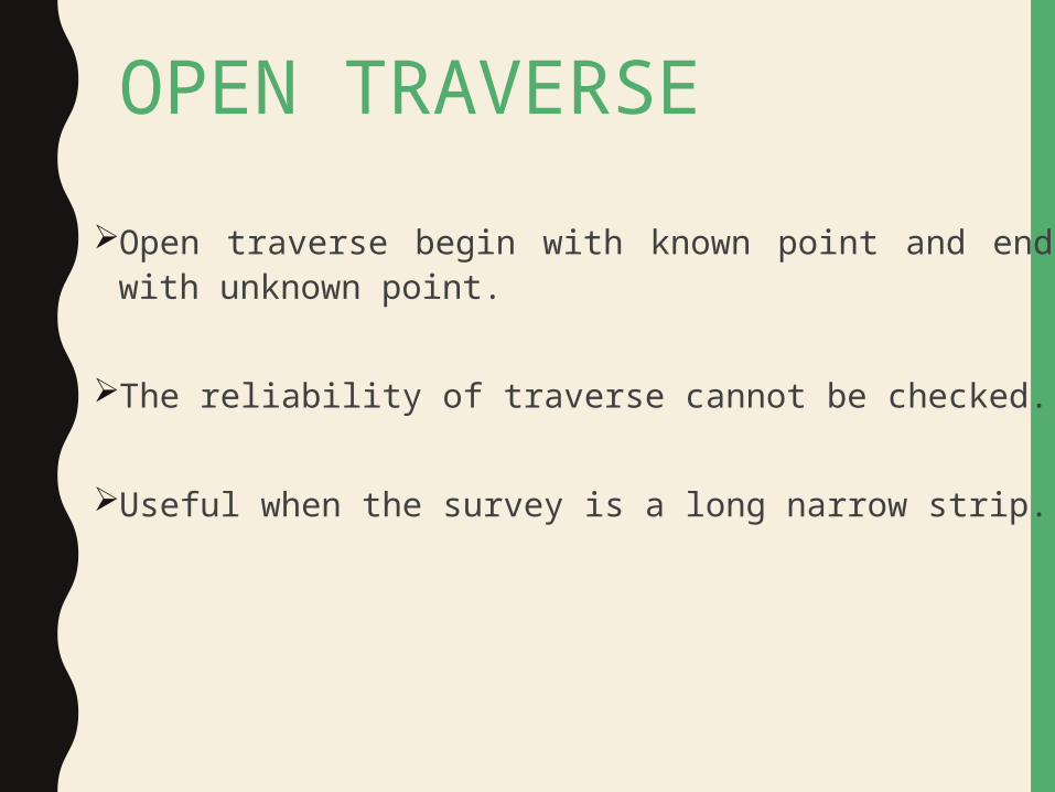
OPEN TRAVERSEOpen traverse begin with known point and end with
unknown point.
The reliability of traverse cannot be checked.
Useful when the survey is a long narrow strip.

OPEN TRAVERSE

MAXIMUM MISCLOSURE(SURVEY REGULATION 2002)
Bearing misclosure1’ 15” and 10” for each station.
Linear misclosurei. 1:8000 for all new survey.ii. > 1:4000 for minimum survey.
GPS misclosure< 10mm
Levelling misclosure0.012√K meter ( K= total distances in km)
• Precise Levelling misclosure0.003 √K meter ( K= total distances in km)

DATUM
A datum is a reference from which measurements are made.
In survey and geodesy, a datum is a reference point on the earth's surface against which position measurements are made, and an associated model for the shape of the earth for computing positions.
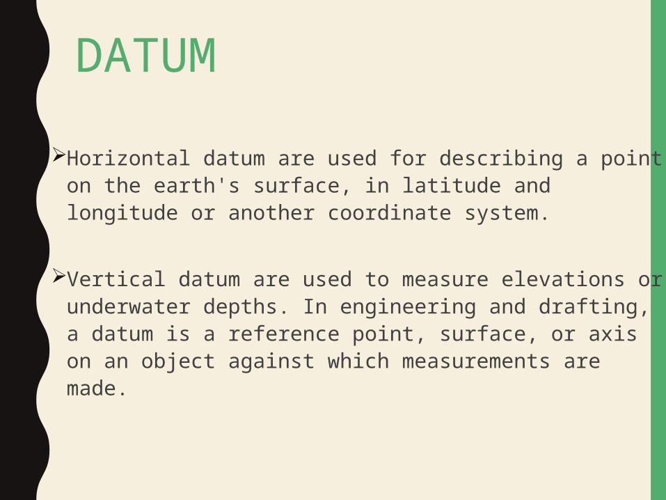
DATUMHorizontal datum are used for describing a point on
the earth's surface, in latitude and longitude or another coordinate system.
Vertical datum are used to measure elevations or underwater depths. In engineering and drafting, a datum is a reference point, surface, or axis on an object against which measurements are made.
DATUM IN SURVEYING
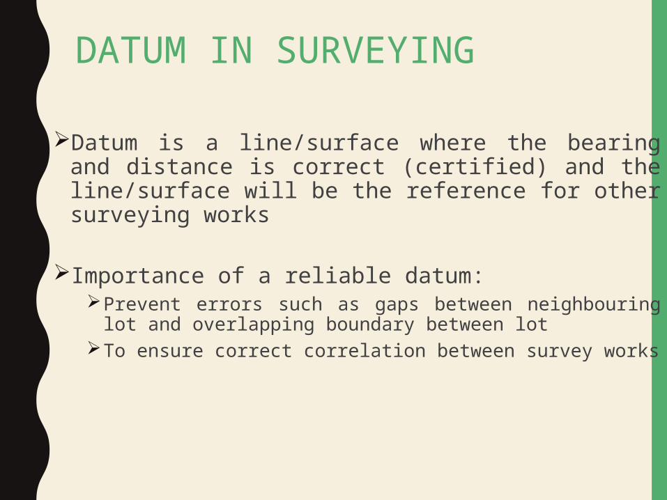
Datum is a line/surface where the bearing and distance is correct (certified) and the line/surface will be the reference for other surveying works
Importance of a reliable datum: Prevent errors such as gaps between neighbouring lot and
overlapping boundary between lotTo ensure correct correlation between survey works
REQUIREMENTS
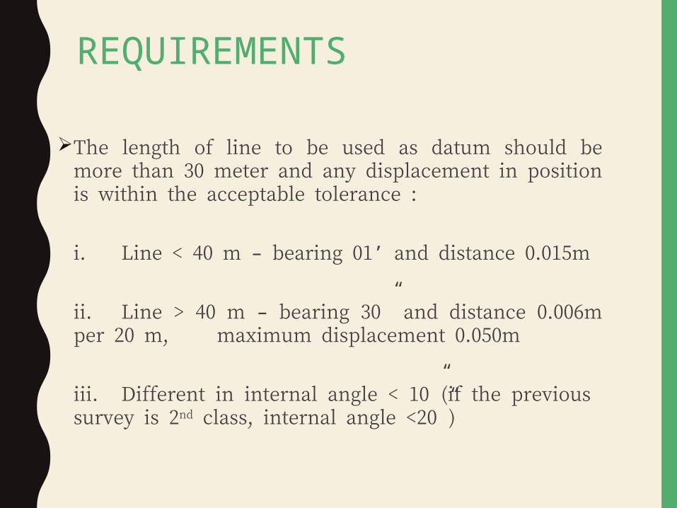
The length of line to be used as datum should be more than 30 meter and any displacement in position is within the acceptable tolerance :
i. Line < 40 m – bearing 01’ and distance 0.015m
ii. Line > 40 m – bearing 30” and distance 0.006m per 20 m, maximum displacement 0.050m
iii. Different in internal angle < 10”(if the previous survey is 2nd class, internal angle <20”)

TRAVERSEBOOKING AND ADJUSTMENT

TRAVERSE CALCULATION CONSISTS OF: BEARING ADJUSTMENTS
C correction M correction
LATITUDE & DEPARTURE Adjusted L & D
Bowditch Method LINEAR MISCLOSURE COORDINATES AREA

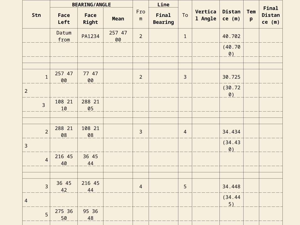
FIELD BOOKINGStn
BEARING/ANGLE F r o m
Line
T o
Vertical Angle
Distance(m) Temp
Final Distance (m) Face Left Face Right Mean Final Bearing
Datum from PA2345 112 58 00 1 2 H 66.123 66.124(66.125)
2 112 58 00 292 58 00 26 09 10 1 3 H 57.349 57.348
1 (57.347)
3 26 09 10 206 09 10
1 206 09 10 26 09 10 104 34 10 3 4 H 122.808 122.8073 (122.805)
4 104 34 20 284 34 00
3 284 34 10 104 34 10 195 29 20 4 5 H 144.939 144.9404 (144.940)
5 195 29 20 15 29 20

SAMPLE TRAVERSE

BEARING ADJUSTMENT
All observed bearing must be adjusted to get the Final bearing
Two types of adjustment1. ‘C’ correction (Closure correction)2. ‘M’ correction (Meridian correction)

CLOSURE CORRECTION (C) Need to be applied to bearing observation in
case there’s error in the bearing observation (bearing misclosure)
Can be applied to any closed traverse. Maximum value for bearing misclosure is 1’
15”, or 10” per station.
Bearing Misclosure= Observed Bearing – True Bearing

CLOSURE CORRECTION (C)
Bearing misclosure is calculated and recorded at the end of the observation as follows:
C correction is applied to each station. If the value is positive (+), thus, the correction is negative(-),
and vice versa.
Line 1 – 2 read as 90° 30’ 50”Should be read as 90° 30’ 20”Misclosure + 30” in 6 station, 2, 3, 4, 5, 6 & 1Correction ‘C’ = 30” = - 5” per station 6

MERIDIAN CORRECTION (M)Shall be applied if there’s different between the orientation
of the traverse and the true orientation. This happens when the bearing used as the datum is an assumed value or
obtained from perismatic compass where the value is differ from the true value (may be obtained from PA or solar observations).
Applied after c correction is applied.
If the value is positive (+), thus, the correction is negative(-), and vice versa.
The value for M correction is constant for each station.
Meridian (M) = Assumed Bearing – True Bearing

LATITUDE & DEPARTURE• Latitude is the north-south component of a line;
departure the east-west. North latitudes are positive, South are negative; similarly East departures are positive, West are negative.
The latitude of line AB is North (+), its departure is East (+).
The latitude of line CD is South (-), its departure is West (-).

LATITUDE & DEPARTURE
WhereL = Distance of the lineϴ = Bearing of the line

BOWDITCH’S METHOD
• Named after the distinguished American navigator Nathaniel Bowditch (1773-1838)
• Based on the assumption that: 1. All lengths are measured with equal care 2. All angles are taken with approximately the same precision 3. Errors are accidental 4. Total error in any side is directly proportional to the length of the traverse

BOWDITCH’S METHODWhere
clat = Correction to latitude cdep= Correction to departure CL= Total closure in lat = ∑Lat CD= Total closure in dep= ∑Dep d = Length of any course D = Total length of the traverse

TRAVERSE ADJUSTMENTS(EXAMPLE)Line Bearing Distance
AB 185˚ 11’ 10” 85.874BC 100˚ 11’ 10” 131.308CD 50˚ 00’ 10” 60.367DE 00˚ 36’ 00” 57.482EF 291˚ 05’ 40” 105.344FA 250˚ 00’ 00” 74.496
Compute for: 1. Latitude and Departure of each line.2. Adjust the traverse using Bowditch’s method.3. Linear misclosure of the traverse.4. Compute for the coordinates of traverse stations given the coordinates for station A are N500.000 m and E350.000 m.4. Compute the area of the traverse using cross coordinate method.5. Provide a sketch of the traverse.
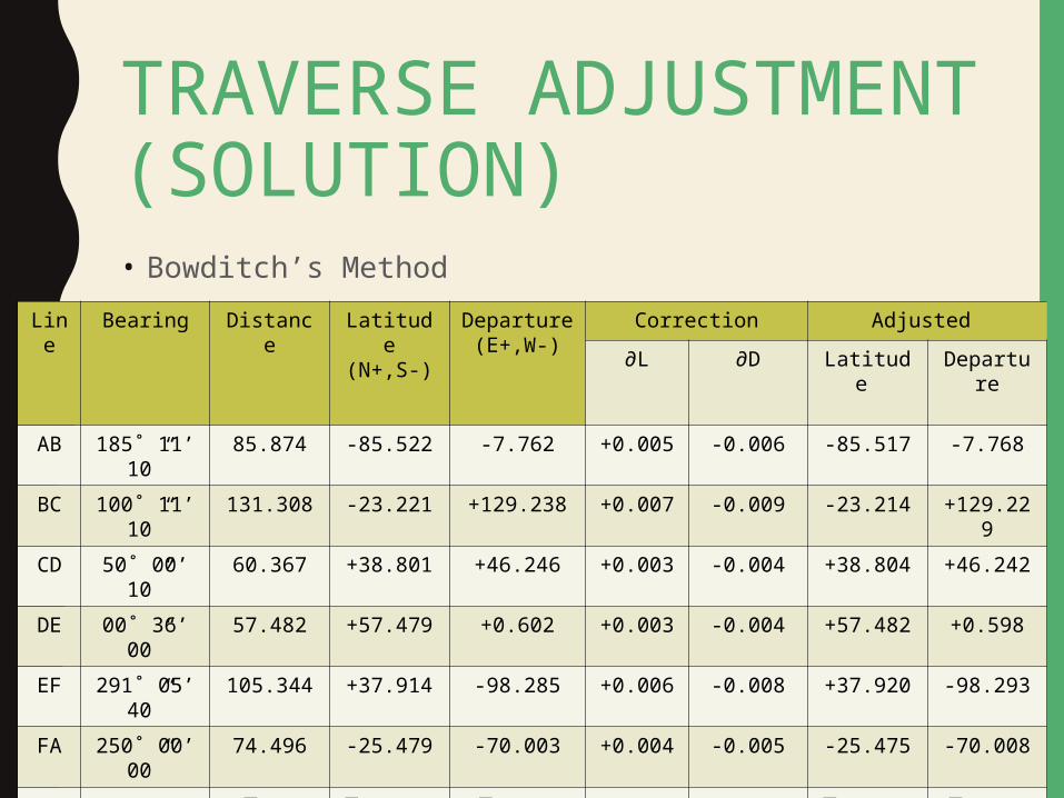
TRAVERSE ADJUSTMENT (SOLUTION)• Bowditch’s Method
Line
Bearing Distance Latitude(N+,S-)
Departure(E+,W-)
Correction Adjusted ∂L ∂D Latitude Departur
eAB 185˚ 11’
10”85.874 -85.522 -7.762 +0.005 -0.006 -85.517 -7.768
BC 100˚ 11’ 10”
131.308 -23.221 +129.238 +0.007 -0.009 -23.214 +129.229
CD 50˚ 00’ 10”
60.367 +38.801 +46.246 +0.003 -0.004 +38.804 +46.242
DE 00˚ 36’ 00”
57.482 +57.479 +0.602 +0.003 -0.004 +57.482 +0.598
EF 291˚ 05’ 40”
105.344 +37.914 -98.285 +0.006 -0.008 +37.920 -98.293
FA 250˚ 00’ 00”
74.496 -25.479 -70.003 +0.004 -0.005 -25.475 -70.008
∑D = 514.871
∑Lat = -0.028
∑Dep = +0.036
∑Lat = 0.000
∑Dep = 0.000

TRAVERSE ADJUSTMENT (SOLUTION)• Calculations of coordinates
Line
Bearing Distance Latitude(N+,S-)
Departure(E+,W-)
Adjusted CoordinatesLatitud
e Departur
eN/S E/W
AB 185˚ 11’ 10”
85.874 -85.522 -7.762 -85.517 -7.768 414.483 342.232
BC 100˚ 11’ 10”
131.308 -23.221 +129.238 -23.214 +129.229
391.269 471.461
CD 50˚ 00’ 10”
60.367 +38.801 +46.246 +38.804
+46.242 430.073 517.703
DE 00˚ 36’ 00”
57.482 +57.479 +0.602 +57.482
+0.598 487.555 518.301
EF 291˚ 05’ 40”
105.344 +37.914 -98.285 +37.920
-98.293 525.475 420.008
FA 250˚ 00’ 00”
74.496 -25.479 -70.003 -25.475 -70.008 500.000 350.000
∑D = 514.871
∑Lat = -0.028
∑Dep = +0.036
∑Lat = 0.000
∑Dep = 0.000

TRAVERSE ADJUSTMENT (SOLUTION)• Linear misclosure of the traverse
Formula = 1 / (L2 + D2) ∑ Distance
where L = -0.028; D= 0.036; ∑ Distance = 514.871So,Linear misclosure = 1 / ((-0.028)2 + ((0.036)2)
514.871 = 1/ 0.046
514.871 = 1 / 8.858 x 10-5
= 11 289Linear misclosure of the traverse is 1:11289

TRAVERSE ADJUSTMENT (SOLUTION)• Area of the traverse
Formula = ∑A = NAEB * NBEC * NCEA
∑B = EANB * EBNC * ECNA Area = ½ | ∑A - ∑B| ;
Unit in m2
Coordinate
N/S E/W
B 414.483 342.232
C 391.269 471.461
D 430.073 517.703
E 487.555 518.301
F 525.475 420.008
A 500.000 350.000
B 414.483 342.232

TRAVERSE ADJUSTMENT (SOLUTION)∑A = 414.483 (471.461) + 391.269 (517.703) + 430.073 (518.301) +
487.555 (420.008) + 525.475 (350.000) + 414.483 (342.232) = 195412.57 + 202561.135 + 222907.27 + 204777.0 + 183916.25 +
141849.35 = 946646.575∑B = 342.232 (391.269) + 471.461 (430.073) + 517.703 (487.555) + 518.301 (525.475) + 420.008 (500.000) + 350.000 (414.483) = 133904.77 + 202762.65 + 252408.69 + 272354.22 + 210004 + 145069.05 = 1216503.38

TRAVERSE ADJUSTMENT (SOLUTION)Area = ½ |946646.575 - 1216503.38|
= ½ |-269856.805| = |-134928.403| = 13, 4928.403 m2
So, the area of the traverse is 13, 4928.403 m2.Hectare = 13.493 haAcre = 33.342 acre

TRAVERSE ADJUSTMENT (SOLUTION)Sketch of the traverse

FIELD BOOKINGStn
BEARING/ANGLE F r o m
Line
T o
Vertical
Angle Distance
(m) Temp Final Distance (m) Face Left Face Right Mean Final Bearing
Datum from PA2345 112 58 00 1 112 59 00 2 H 66.123 66.124
M + 01’ 00” Az Ak dgn Mh (66.125)
2 112 58 00 292 58 00 26 09 10 1 26 10 10 3 H 57.349 57.348
1 C - 05” (57.347)
3 26 09 10 206 09 10 M + 01’ 00”
1 206 09 10 26 09 10 104 34 10 3 104 35 00 4 H 122.808 122.807
3 C - 10” (122.805)
4 104 34 20 284 34 00 M + 01’ 00”
3 284 34 10 104 34 10 195 29 20 4 195 30 10 5 H 144.939 144.940
4 C - 15” (144.940)
5 195 29 20 15 29 20 M + 01’ 00”

FIELD BOOKING4 15 29 20 195 29 20 358 17 30 5 358 18 10 6 H 40.843 40.843
5 C - 20” (40.843)
6 358 17 35 178 17 25 M + 01’ 00”
5 178 17 30 358 17 30 320 28 00 6 320 28 40 2 H 68.020 68.021
6 C - 25” (68.021)
2 320 27 50 140 28 10 M + 01’ 00”
6 140 28 00 320 28 00 292 58 30 2 292 59 00 1 H Seperti di Ruangan 1
2 C - 30” Bg. tutup
1 292 58 30 112 58 30 M + 01’ 00”
Garisan 2-1 dibaca 292 58 30 Lihat Ruangan 7
Sepatutnya dibaca 292 58 00 Lihat Ruangan 2
Tikaian + 30” Dalam 6 stn. iaitu 3,4,5,6,2 dan 1
Pembetulan - 05” Perstn.
Stn
BEARING/ANGLE
From
Line
ToVertical Angle
Distance (m)
Temp
Final Distance
(m)Face Left Face Right Mean
Final Bearing
Datum from
PA1234 257 47 00 2 1 40.702
(40.700)
1 257 47 00 77 47 00 2 3 30.7252 (30.720)
3 108 21 10 288 21 05
2 288 21 08 108 21 08 3 4 34.4343 (34.430)
4 216 45 40 36 45 44
3 36 45 42 216 45 44 4 5 34.4484 (34.445)
5 275 36 50 95 36 48
4 95 36 49 275 36 49 4 5 28.9925 (28.920)
1 330 56 00 150 56 04
5 150 56 02 330 56 02 1 2 Refer to 1st Row1
2 77 45 50 257 45 52

Stn
BEARING/ANGLE
From
Line
ToVertical Angle
Distance (m)
Temp
Final Distance
(m)Face Left Face Right Mean
Final Bearing
Datum from
PA1234 257 47 00 2 1 40.702
(40.700)
1 257 47 00 77 47 00 108 21 10 2 3 30.7252 C + 14.8” (30.720)
3 108 21 10 288 21 05
2 288 21 08 108 21 08 216 45 42 3 4 34.4343 C + 29.6” (34.430)
4 216 45 40 36 45 44
3 36 45 42 216 45 44 275 36 49 4 5 34.4484 C + 44.4” (34.445)
5 275 36 50 95 36 48
4 95 36 49 275 36 49 330 56 02 4 5 28.9925 C + 59.2” (28.920)
1 330 56 00 150 56 04
5 150 56 02 330 56 02 77 45 46 1 2 Refer to 1st Row1 C + 01’ 14”
2 77 45 50 257 45 52
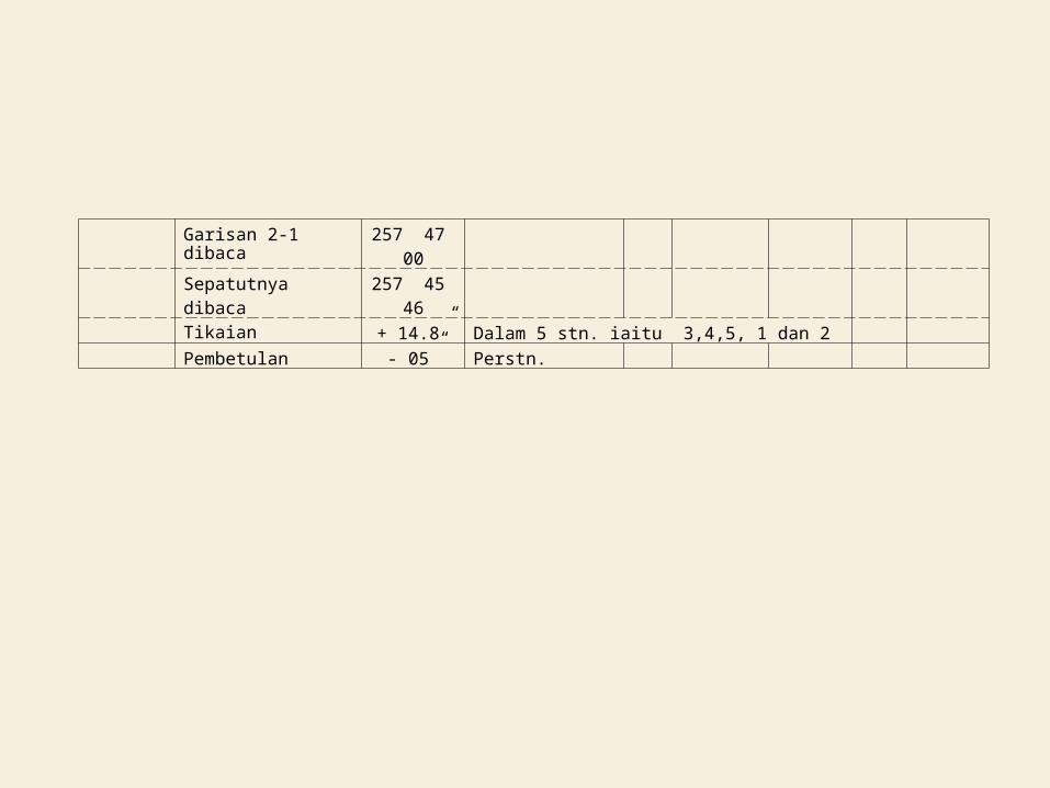
Garisan 2-1 dibaca 257 47 00
Sepatutnya dibaca 257 45 46Tikaian + 14.8” Dalam 5 stn. iaitu 3,4,5, 1 dan 2Pembetulan - 05” Perstn.

THE ENDTHANK YOU