chapter 7 circulation element - city of newport beach element 7-4 newport beach general plan outside...
TRANSCRIPT
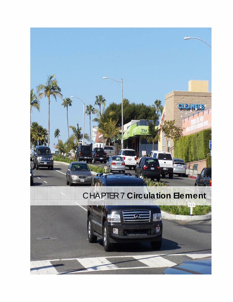
CHAPTER 7 Circulation Element
C i r c u l a t i o n E l e m e n t
N e w p o r t B e a c h G e n e r a l P l a n 7-2
CIRCULATION A Safe and Convenient Transportation System
Introduction
The ability to move people and goods throughout Newport Beach and beyond is important to residents and businesses. Local roadways are the most important element for mobility in Newport Beach, but transit, shuttles, the trail system, and the harbor provide opportunities for alternative modes of travel that could relieve pressure on roadways. The Circulation Element governs the long term mobility system of the City of Newport Beach. The goals and policies in this element are closely correlated with the Land Use Element and are intended to provide the best possible balance between the City’s future growth and land use development, roadway size, traffic service levels and community character. The Element is also consistent with the Transportation Demand Management Ordinance and the Local Coastal Program.
Context
SETTING Since Newport Beach fronts on the Pacific Ocean, the City has access from only three directions. Upper Newport Bay acts as a barrier, resulting in only two east/west routes through Newport Beach (Coast Highway and the Bristol Street/SR 73 corridor) and high traffic volumes on these two routes, which results in congestion. John Wayne Airport (JWA) also acts as a barrier to circulation on the City’s northern border, and adds traffic on Airport Area streets.

C i r c u l a t i o n E l e m e n t
N e w p o r t B e a c h G e n e r a l P l a n 7-3
At the same time, Newport Harbor creates a unique opportunity for transportation solutions. Examples of existing water transportation services in Newport Beach include the Santa Catalina Ferry (providing access from the Balboa Pavilion to Santa Catalina Island), and the Balboa Ferry (connecting Balboa Island to the Balboa Peninsula). In conjunction with policies in the Harbor and Bay Element encouraging the development of more public docks in Newport Harbor, more water transportation services (such as shuttles and taxis) could be established, as well as increased use of private vessels for transportation around the Bay.
Newport Beach’s location along the coast, development in neighboring cities and regional imbalances in housing and employment opportunities contribute to the use of Newport Beach’s arterial roadways by through traffic (traffic that does not have at least one end of the trip within the City of Newport Beach). During the morning and evening peak hours when traffic is heaviest, a substantial percentage of vehicles traveling on Coast Highway, MacArthur Boulevard and Newport Coast Drive are making
through trips. County-wide, trip generation is expected to increase by approximately 18 percent from 2000 to 2025. Studies done in conjunction with this Circulation Element show that more than half of future traffic growth and future unsatisfactory intersection performance in Newport Beach will result from growth in the surrounding region, regardless of any future growth and development in Newport Beach. The location of JWA along Newport Beach’s boundary also contributes to regional traffic through the City. JWA users access the freeway system as well as nearby destinations through the Newport Beach roadway system. The additional JWA activity generated by the recently approved increases in passenger service levels and passenger loading bridges will increase traffic volume on Airport Area roads such as MacArthur Boulevard, Campus Drive, Jamboree Road, and the Bristol Street couplet.
Summertime beach traffic has been a challenge for Newport Beach since the 1920’s. During June, July and August, weekend traffic near the beach and harbor is substantially higher than typical spring/fall (“shoulder season”) or winter conditions. Volumes on impacted roadways generally increase by almost 30 percent, but summertime beach traffic occurs at different times than the typical weekday business or school related traffic during most of the year. The two locations with weekend volume increases of more than 30 percent during the summer are Newport Boulevard south of Coast Highway (75 percent) and Balboa Boulevard east of 20th Street (75 percent) on the Peninsula.
This Circulation Element continues longstanding Newport Beach policies of using the shoulder season for transportation planning, sizing the circulation system to meet the needs of City residents and businesses, and maintaining the character of the community. While these policies may prevent the City from achieving a desired level of service at all locations at all hours, they also protect Newport Beach from building oversized roads to serve weekend summer beach traffic or traffic generated
ELEMENT That Is Friendly to Pedestrians and Bicycles
C i r c u l a t i o n E l e m e n t
N e w p o r t B e a c h G e n e r a l P l a n 7-4
outside of our borders and our control. Instead, policies in this Element encourage improvements to the regional system that will provide more capacity outside Newport Beach and reduce the number of through travelers that drive on our local streets.
LOCAL ROADWAY SYSTEM The roadway system serves primarily vehicular traffic in Newport Beach. The roadway system is of particular interest to the citizens of Newport Beach, as the majority of them use it for primary travel needs.
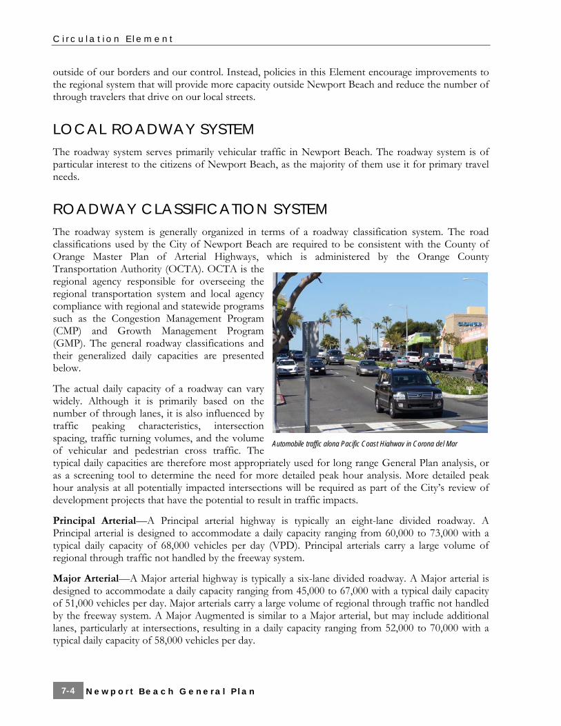
ROADWAY CLASSIFICATION SYSTEM The roadway system is generally organized in terms of a roadway classification system. The road classifications used by the City of Newport Beach are required to be consistent with the County of Orange Master Plan of Arterial Highways, which is administered by the Orange County Transportation Authority (OCTA). OCTA is the regional agency responsible for overseeing the regional transportation system and local agency compliance with regional and statewide programs such as the Congestion Management Program (CMP) and Growth Management Program (GMP). The general roadway classifications and their generalized daily capacities are presented below.
The actual daily capacity of a roadway can vary widely. Although it is primarily based on the number of through lanes, it is also influenced by traffic peaking characteristics, intersection spacing, traffic turning volumes, and the volume of vehicular and pedestrian cross traffic. The typical daily capacities are therefore most appropriately used for long range General Plan analysis, or as a screening tool to determine the need for more detailed peak hour analysis. More detailed peak hour analysis at all potentially impacted intersections will be required as part of the City’s review of development projects that have the potential to result in traffic impacts.
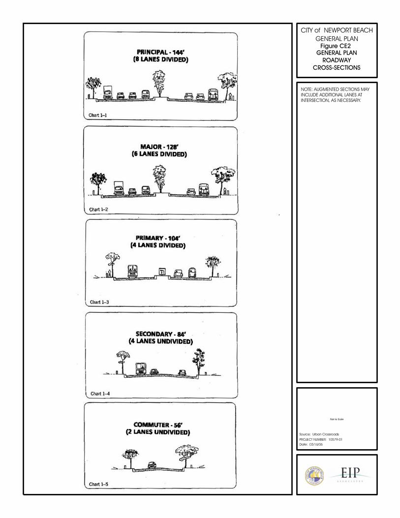
Principal Arterial—A Principal arterial highway is typically an eight-lane divided roadway. A Principal arterial is designed to accommodate a daily capacity ranging from 60,000 to 73,000 with a typical daily capacity of 68,000 vehicles per day (VPD). Principal arterials carry a large volume of regional through traffic not handled by the freeway system.
Major Arterial—A Major arterial highway is typically a six-lane divided roadway. A Major arterial is designed to accommodate a daily capacity ranging from 45,000 to 67,000 with a typical daily capacity of 51,000 vehicles per day. Major arterials carry a large volume of regional through traffic not handled by the freeway system. A Major Augmented is similar to a Major arterial, but may include additional lanes, particularly at intersections, resulting in a daily capacity ranging from 52,000 to 70,000 with a typical daily capacity of 58,000 vehicles per day.
Automobile traffic along Pacific Coast Highway in Corona del Mar
C i r c u l a t i o n E l e m e n t
N e w p o r t B e a c h G e n e r a l P l a n 7-5
Primary Arterial—A Primary arterial highway is usually a four-lane divided roadway. A Primary arterial is designed to accommodate a daily capacity ranging from 30,000 to 45,000 with a typical daily capacity of 34,000 VPD. A Primary arterial’s function is similar to that of a Principal or Major arterial. The chief difference is capacity. A Primary Augmented is similar to a Primary arterial, but may include additional lanes, particularly at intersections, resulting in a daily capacity ranging from 35,000 to 50,000 with a typical daily capacity of 40,000 vehicles per day.
Secondary Arterial—A Secondary arterial highway is a four-lane roadway (often undivided). A Secondary arterial distributes traffic between local streets and Major or Primary arterials. Although some Secondary arterials serve as through routes, most provide more direct access to surrounding land uses than Principal, Major, or Primary arterials. Secondary arterials carry a daily capacity ranging from 20,000 to 30,000 with a typical daily capacity of 23,000 VPD.
Commuter Roadway—A commuter roadway is a two-to-four-lane, unrestricted
access roadway with a daily capacity ranging from 7,000 to 11,000 with a typical daily capacity of 10,000 VPD. It differs from a local street in its ability to handle through traffic movements between arterials.
In addition to these basic classifications, this Circulation Element provides for roadways that can carry traffic above the typical capacity level for the classification, if the standard section is augmented. Examples of augmented sections include additional through and/or turning lanes at some locations and additional turning lanes at signalized street intersections with heavy turning movements. This may be accomplished by adding right-of-way or by reducing the widths of sidewalk areas, medians, travel lanes, and emergency shoulder lanes.
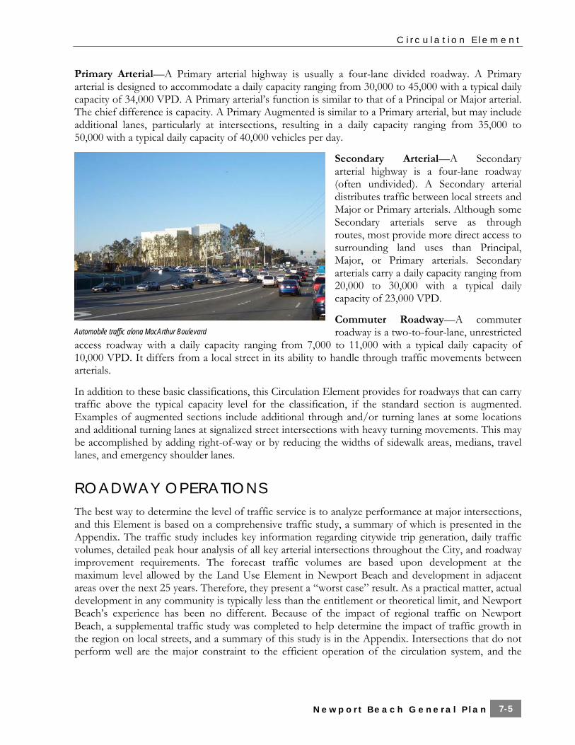
ROADWAY OPERATIONS The best way to determine the level of traffic service is to analyze performance at major intersections, and this Element is based on a comprehensive traffic study, a summary of which is presented in the Appendix. The traffic study includes key information regarding citywide trip generation, daily traffic volumes, detailed peak hour analysis of all key arterial intersections throughout the City, and roadway improvement requirements. The forecast traffic volumes are based upon development at the maximum level allowed by the Land Use Element in Newport Beach and development in adjacent areas over the next 25 years. Therefore, they present a “worst case” result. As a practical matter, actual development in any community is typically less than the entitlement or theoretical limit, and Newport Beach’s experience has been no different. Because of the impact of regional traffic on Newport Beach, a supplemental traffic study was completed to help determine the impact of traffic growth in the region on local streets, and a summary of this study is in the Appendix. Intersections that do not perform well are the major constraint to the efficient operation of the circulation system, and the
Automobile traffic along MacArthur Boulevard
C i r c u l a t i o n E l e m e n t
N e w p o r t B e a c h G e n e r a l P l a n 7-6
traffic study focuses on the level of service at primary intersections in Newport Beach. Generalized definitions of level of service are as follows:
■ LOS “A”—Minimal delay (less than 10 seconds on average) is experienced. ■ LOS “B”—Vehicles at signalized intersections experience between 10 and 20 seconds of delay
on average, while vehicles on the side street STOP controlled approaches at unsignalized intersections experience between 10 and 15 seconds of average delay.
■ LOS “C”—Delays at signalized intersections range from 20 to 35 seconds and from 15 to 25 seconds for side street / STOP controlled traffic at unsignalized intersections.
■ LOS “D”—Delays at signalized intersections range from 35 to 55 seconds and from 25 to 35 seconds for side street / STOP controlled approaches at unsignalized intersections.
■ LOS “E”—Delays at signalized intersections range from 55 to 80 seconds on average, while delays for side street / STOP controlled traffic at unsignalized intersections range from 35 to 50 seconds.
■ LOS “F”—All vehicles at signalized intersections can be expected to wait through more than a single signal cycle with average delays in excess of 80 seconds, while delays to side street / STOP controlled approaches at unsignalized intersections will exceed 50 seconds on average.
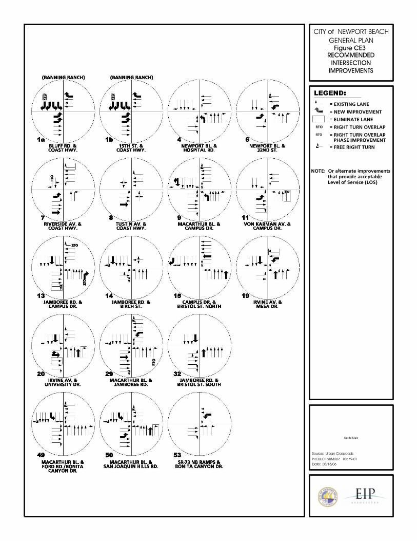
This Element includes intersection improvements that will reduce congestion at major arterial intersections and links. These improvements, shown in Exhibits CE-1 and CE-2 and listed in the Appendix, have been developed to meet the level of service standard adopted in Circulation Element policies, based upon analysis using the computerized traffic model with traffic projections to the year 2030. Improvements included in this Element are those that require the least additional right-of-way and cause the least environmental impacts. Because this analysis is long-term, some of the intersection improvements listed may not be constructed exactly as described herein, or a particular improvement may be shown to be unnecessary over the course of the next 25 years.
The City of Newport Beach has traditionally set LOS “D” as its goal for intersection performance, whenever possible. At the same time, the City has recognized that achieving this goal in every case would require a circulation system with oversized elements to accommodate summer beach traffic or regional through traffic. The City has chosen to provide a circulation system that is sized to meet the needs of residents and local businesses and respects the character of Newport Beach. This Circulation Element continues that longstanding practice. The vast majority of intersections in Newport Beach will continue to function at or better than LOS “D” with implementation of the improvements included in this Element, and policy establishes LOS “D” as the standard for most intersections. LOS “E” is the established standard for a limited number of intersections discussed below.
The Airport Area is heavily impacted by through traffic accessing JWA, and intense development in the Irvine Business Complex. The circulation improvements that would be necessary to accommodate traffic from these sources and achieve LOS “D” would be extremely expensive, and would be contrary to the desires of Newport Beach residents expressed during the Visioning Process for this General Plan. For these reasons, LOS “E” is the standard for any intersection in the Airport Area shared with the City of Irvine (which has established LOS “E” as its standard in the adjacent Irvine Business Complex).
Coast Highway through Mariners’ Mile is significantly impacted by through traffic and summer beach traffic, and also experiences considerable pedestrian and bicycle activity. The improvements that would be necessary to achieve LOS “D” at the Dover Drive intersection would require the
C i r c u l a t i o n E l e m e n t
N e w p o r t B e a c h G e n e r a l P l a n 7-7
elimination of sidewalk that could compromise bicycle and pedestrian safety, and would have adverse impacts on adjacent residential neighborhoods and the local business community. Therefore, LOS “E” is the established standard for this intersection.
Corona del Mar is a pedestrian oriented, neighborhood serving commercial area that is being upgraded consistent with the Corona del Mar Vision Plan that has received overwhelming community support. The goal of this plan is to create a more pedestrian friendly commercial area with improved aesthetics and an attractive streetscape. Coast Highway, the primary route through Corona del Mar, carries a large amount of through traffic during the morning and evening peak hour periods. The improvements that would be necessary to achieve LOS “D” at the intersections of Marguerite Avenue and Goldenrod Avenue would be contrary to the goals and efforts of the Corona del Mar community. For these intersections, LOS “E” is the standard set by policy in the Circulation Element.
In addition to specific intersection improvements that can be identified at this time, future operational issues may arise in the vicinity of closely spaced intersections or other locations where analysis of isolated intersections does not accurately depict the quality of traffic flow. Potential examples include the Bristol Street couplet, freeway interchanges, or the intersections of San Miguel Drive at Avocado Avenue and at MacArthur Boulevard. The Circulation element includes policy for the City to monitor these locations and make adjustments as appropriate in the future.
TRUCK TRAFFIC Trucks are needed to provide delivery of heavy goods to residences and commercial areas, and for other purposes such as pick up of refuse throughout the City. However, the City needs to control and limit truck traffic to minimize the noise and other impacts on residents, avoid undue damage to infrastructure and minimize the potential for traffic congestion. Commercial vehicles are generally permitted on City of Newport Beach roads. Commercial vehicles weighing in excess of 3 tons (6,000 pounds) are prohibited from certain roadways, as signed.
REGIONAL FACILITIES Regional transportation facilities serve the needs of travelers through Newport Beach, and residents and workers that travel between Newport Beach and other locations. Major roadway system features such as freeways, airports, and marine terminals serve regional traffic.
The facilities that provide regional access to Newport Beach include the I-405 Freeway, SR-55 Freeway, SR-73 freeway/tollway and Coast Highway (Highway 1). Coast Highway is owned and operated by Caltrans with the exception of the segment between Jamboree Road and Newport Coast Drive. Newport Boulevard from Finley Street to the northerly city limits at Industrial Way is also under Caltrans jurisdiction. Caltrans controls the signal timing and coordination along these roadways, and the City needs to work with Caltrans to meet Newport Beach’s needs and desires to provide a coordinated and efficient circulation system.
Regional traffic interacting with Newport Beach generally accesses the City roadway system through Coast Highway or other connections from the 405, 55 and 73 freeways/tollway. Ramp intersections are maintained and controlled by Caltrans. Ramp capacity constraints can sometimes (during peak hours) slow access to the freeway system, potentially resulting in a back-up of freeway traffic onto the
C i r c u l a t i o n E l e m e n t
N e w p o r t B e a c h G e n e r a l P l a n 7-8
local roadway system. Conversely, traffic exiting the freeway system can sometimes cause congestion that affects the freeway mainline.
Air travel for residents, workers, and visitors in Orange County is served by JWA (located just northwest of Campus Drive along the City boundary), which is owned and operated by the County of Orange. JWA is a part of the regional system of airports. JWA is presently authorized to serve 10.3 million annual passengers (MAP), which increases to 10.8 MAP on January 1, 2011.
PUBLIC TRANSPORTATION Transit services are provided by OCTA and through paratransit programs, such as the one provided by the Oasis Senior Center and/or OCTA. The program at the Oasis Senior Center provides local transportation for a nominal fee to seniors.
An established network of bus routes provides access to employment centers, shopping and recreational areas within the City. OCTA periodically updates a Countywide Bus Service Implementation Program (BSIP), which includes changes to service levels and route configurations. OCTA also provides enhanced service during the summer months to serve the beach oriented traffic destined for Newport Beach. The Newport Transportation Center and Park-and-Ride facility is located at MacArthur Boulevard and San Joaquin Hills Road in Newport Center.
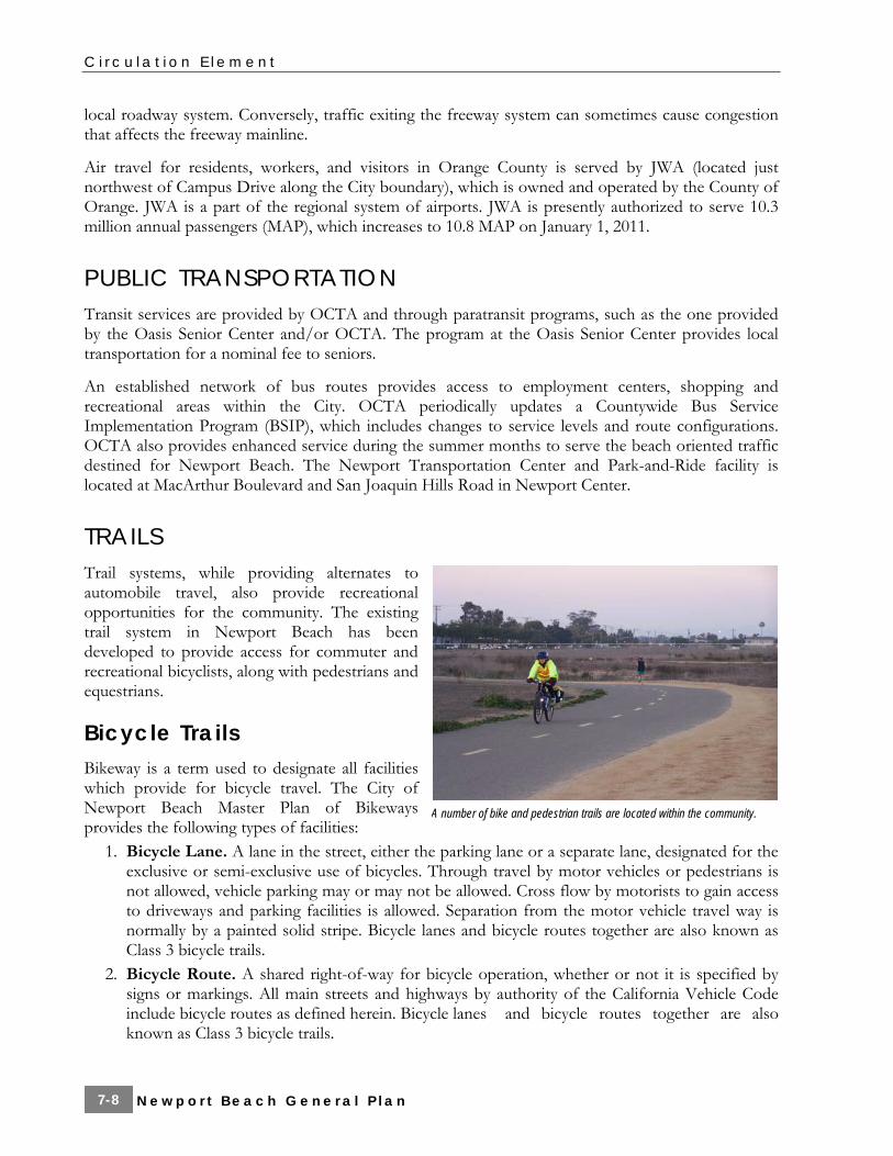
TRAILS Trail systems, while providing alternates to automobile travel, also provide recreational opportunities for the community. The existing trail system in Newport Beach has been developed to provide access for commuter and recreational bicyclists, along with pedestrians and equestrians.
Bicycle Trails Bikeway is a term used to designate all facilities which provide for bicycle travel. The City of Newport Beach Master Plan of Bikeways provides the following types of facilities:
1. Bicycle Lane. A lane in the street, either the parking lane or a separate lane, designated for the exclusive or semi-exclusive use of bicycles. Through travel by motor vehicles or pedestrians is not allowed, vehicle parking may or may not be allowed. Cross flow by motorists to gain access to driveways and parking facilities is allowed. Separation from the motor vehicle travel way is normally by a painted solid stripe. Bicycle lanes and bicycle routes together are also known as Class 3 bicycle trails.
2. Bicycle Route. A shared right-of-way for bicycle operation, whether or not it is specified by signs or markings. All main streets and highways by authority of the California Vehicle Code include bicycle routes as defined herein. Bicycle lanes and bicycle routes together are also known as Class 3 bicycle trails.
A number of bike and pedestrian trails are located within the community.

C i r c u l a t i o n E l e m e n t
N e w p o r t B e a c h G e n e r a l P l a n 7-9
3. Bicycle Trail. A pathway designated for the use of bicycles which is physically separated from motor vehicle traffic. Pedestrian traffic may or may not be excluded. Bicycle trails are also known as Class 1 bicycle trails.
4. Backbone Bikeway. Backbone bikeways are major through bikeways, as shown on the Master Plan of Bikeways. They are primarily on major roads. Backbone bikeways may connect to regional trails, as shown in the Master Plan.
5. Secondary Bikeway. Secondary bikeways connect to backbone trails and serve cyclists and children riding to and from school. Secondary bikeways may also be a bicycle lane, route, or trail.
The city has designated additional off road facilities in the form of sidewalk bikeways which provide improved bike safety for recreational riders and children within high use corridors in the vicinity of schools, beaches, and residential neighborhoods.
The needs of bicyclists will vary with the function of the trip and the speed and skill level of the rider. Those residents who use bicycles daily for their primary means of transportation are concerned with utilizing the most convenient and direct route available to reach their destination. These bicyclists normally will select a route along a primary or a major highway. In contrast, the recreational rider might choose a route for its scenic interest such as a ride on a bike trail separated from vehicular traffic. Thus, it is necessary to provide bikeways for bicyclists along major transportation corridors as well as residential and scenic areas. It is also necessary to provide bikeways which separate faster cyclists from pedestrian travel and slower cyclists, integrating bicycle travel more closely with vehicular traffic, and bikeways which separate slower cyclists from motor vehicle traffic.
The Circulation Element considers additional bikeways that could be developed in the Newport Beach area, as well as the safety of bicyclists in Newport Beach.
Pedestrian Corridors Newport Beach has a variety of pedestrian facilities. These include sidewalks in developed areas, the oceanfront boardwalk on Balboa Peninsula, bayfront walkways on Balboa Island and parts of Balboa Peninsula and Mariners’ Mile, and trails along Upper Newport Bay and in open space areas. Pedestrian activity is high in coastal areas such as Balboa Island, Balboa Peninsula, and Corona del Mar, with high numbers of pedestrians crossing Coast Highway through Mariners’ Mile.
Newport Beach has opportunities to provide more pedestrian walkways along the bayfront on Balboa Peninsula and Mariners’ Mile. As properties in these areas are developed pursuant to the Land Use Element, there will be opportunities to enhance and increase pedestrian activity and reduce driving.
Equestrian Trails Equestrian trails are primarily located in the Santa Ana Heights portion of the City. These trails, and other equestrian facilities, are highly valued by residents of this area and provide regional recreation opportunities as well.
C i r c u l a t i o n E l e m e n t
N e w p o r t B e a c h G e n e r a l P l a n 7-10
TRANSPORTATION SYSTEMS MANAGEMENT/TRAVEL DEMAND MANAGEMENT With the exception of summer beach traffic, Newport Beach roads are most heavily traveled during the morning and evening commutes. Implementation of Transportation Systems Management (TSM) or Travel Demand Management (TDM) measures can reduce peak hour traffic and possibly result in intersection service levels better than those forecast in this Element and the General Plan Traffic Study. In some jurisdictions, transportation demand management (TDM) plans/programs have reduced peak hour traffic by 10 to 15 percent.
TSM techniques involve enhancing capacity without physical roadway widening, and can help to retain the community character and limit the impact of the roadway system on the environment. Examples of TSM improvements include traffic signal timing improvements, traffic signal coordination along a route and improvements to roadway signage, especially for tourist destinations.
The City’s TDM Ordinance requires projects to reduce the number of peak-period vehicle trips by promoting and encouraging the use of alternative transportation modes, such as ridesharing, carpools, vanpools, public transit, bicycles and walking; and provide facilities that support such alternate modes. TDM methods are enhanced by incorporating employment near residential uses, providing incentives for alternative/multi-user modes, etc. Employers with large work forces can utilize all of these techniques, while smaller companies are typically limited to ridesharing and flextime programs.
PARKING Parking availability is limited in the coastal portions of Newport Beach, especially during the peak summer months. Balboa Peninsula, Balboa Island, Mariners’ Mile, Corona Del Mar, and West Newport are areas of particular concern. The Balboa Peninsula Parking Management Plan included parking surveys/studies and recommendations, which the City has begun to implement, as follows: meter time limits (ongoing), visitor parking guide, bus layover area (completed), additional red curbing to improve intersection visibility (completed), increased meter fees (ongoing), business permit program, consolidating public parking, monitoring of lot utilization (ongoing), Balboa Pier lot validation program, and a shared parking program. Valet services have also been suggested for both the Balboa Peninsula and Mariners’ Mile.
TRANSPORTATION FUNDING Newport Beach receives funding from gasoline tax apportionment, county, state, and federal funds and the Traffic Phasing Ordinance, Fair Share Ordinance, and the General Fund. The City’s Traffic Phasing Ordinance has been in effect since 1978. It requires developer funding of a proportional share of intersection improvements when a proposed project has a direct negative impact on the level of service at that intersection. This ordinance phases intersection improvements with development to maintain the City’s standards for level of traffic service. The City’s Fair Share Ordinance, which was adopted in 1984, establishes a fee, based upon the unfunded cost to implement the Master Plan of Streets and Highways, to be paid in conjunction with the issuance of a building permit.
C i r c u l a t i o n E l e m e n t
N e w p o r t B e a c h G e n e r a l P l a n 7-11
Goals and Policies
Mobility
Goal
CE 1.1 An overall transportation system that facilitates the movement of people and goods within and through the City of Newport Beach and accommodates conservative growth within the City of Newport Beach, but is not expanded primarily to accommodate growth in the surrounding region.
Policies
CE 1.1.1 Comprehensive Transportation System
Provide a diverse transportation system that provides mobility options for the community. (Imp 16.8, 16.11)
CE 1.1.2 Integrated System of Multiple Modes
Provide an integrated transportation system that supports the land use plan set forth in the Land Use Element. (Imp 2.1)
CE 1.1.3 Levels of Service Related to Community Character
Establish level of service standards that reflect the character of the various unique districts and neighborhoods of Newport Beach. (Imp 16.2, 16.4, 16.6, 16.7)
Goal
CE 1.2 Reduced summertime visitor traffic impacts.
Policies
CE 1.2.1 Wayfinding
Implement way-finding signs, especially for tourist destinations. (Imp 16.7)
CE 1.2.2 Shuttle Service
Encourage remote visitor parking and shuttle services. (Imp 14.4)
CE 1.2.3 Traffic System Management
Identify and implement measures, such as special traffic signal timing, to reduce the impact of high volume summer traffic on persons living along and around the beach and bay, as well as visitors. (Imp 16.7)

C i r c u l a t i o n E l e m e n t
N e w p o r t B e a c h G e n e r a l P l a n 7-12
CE 1.2.4 Public Transit
Support and encourage OCTA efforts to provide / fund summertime expanded bus service and/or local shuttle services to reduce visitor traffic. (Imp 16.8)
Goal
CE 1.3 Truck routes that support goods movement to and from land use in the City while minimizing adverse impacts to residents or businesses.
Policies
CE 1.3.1 Truck Routes
Allow truck use of City streets except selected residential and arterial streets adjacent to residential areas necessary to minimize impacts of truck traffic on residential areas. (Imp 16.9)
CE 1.3.2 Impacts of Trucks
Provide appropriately designed and maintained roadways to safely accommodate truck travel and minimize noise and vibration. (Imp 16.9)
CE 1.3.3 Management of Truck Activities
Actively manage trucking activities related to oversize loads such as large boats and comparable characteristics. (Imp 16.9)
Roadway System
Goal
CE 2.1 A roadway system that provides for the efficient movement of goods and people in the City of Newport Beach, while maintaining the community’s character and its residents’ quality of life.
Policies
CE 2.1.1 Level of Service Standards
Plan the arterial roadway system to accommodate projected traffic at the following level of service standards: A. Level of Service (LOS) “D” throughout the City, unless otherwise noted B. LOS “E” at any intersection in the Airport Area shared with Irvine C. LOS “E” at Coast Highway (EW) and Dover Drive (NS) due to right-of-way
limitations
C i r c u l a t i o n E l e m e n t
N e w p o r t B e a c h G e n e r a l P l a n 7-13
D. LOS “E” at Marguerite Avenue (NS) and Coast Highway (EW) in the pedestrian oriented area of Corona del Mar
E. LOS “E” at Goldenrod Avenue (NS) and Coast Highway (EW) in the pedestrian oriented area of in Corona del Mar (Imp 16.3)
CE 2.1.2 Street and Highway Network
Construct the circulation system described on the map entitled Newport Beach Circulation Element-Master Plan of Streets and Highways shown in Figure CE1 and Figure CE2 (cross-section). (Imp 14.9, 16.3)
CE 2.1.3 Current Traffic Data
Monitor traffic conditions on an ongoing basis and update Master Plan as necessary. (Imp 16.4)
CE 2.1.4 Roadway Improvements
Pursue construction of intersection improvements shown on Figure CE3 or alternate improvements that achieve an acceptable level of service. (Imp 16.3)
CE 2.1.5 MacArthur Boulevard Widening
Plan the addition of lanes to MacArthur Boulevard between Harbor View Drive and the prolongation of Crown Drive so that more than four lanes are constructed only when the daily volume to capacity ratio equals 1.0 in that section of MacArthur Boulevard, not counting trips generated by the MacArthur Boulevard access drive to Corona del mar Plaza, and after public hearings before the Planning Commission and City Council, and only by narrowing the median. (Imp 16.3)
CE 2.1.6 Protection of Right-of-Way
Protect right-of-way for designated future streets and highways through all practicable means. (Imp 2.1)
Goal
CE 2.2 A safe and efficient roadway system.
Policies
CE 2.2.1 Safe Roadways
Provide for safe roadway conditions by adhering to nationally recognized improvement standards and uniform construction and maintenance practices. (Imp 16.4, 16.6)
C i r c u l a t i o n E l e m e n t
N e w p o r t B e a c h G e n e r a l P l a n 7-14
CE 2.2.2 Up-to-Date Standards
Periodically review and update street standards to current capacity and safety practices. (Imp 16.4, 16.6)
CE 2.2.3 Traffic Control
Design traffic control measures to ensure City streets and roads function with safety and efficiency. (Imp 16.7)
CE 2.2.4 Driveway and Access Limitations
Limit driveway and local street access on arterial streets to maintain a desired quality of traffic flow. Wherever possible, consolidate driveways and implement access controls during redevelopment of adjacent parcels. (Imp 16.1)
CE 2.2.5 Neighborhood Traffic Calming
Balance safety, quality of life, and efficiency when considering traffic calming improvements to local neighborhood streets. (Imp 16.6)
CE 2.2.6 Emergency Access
Provide all residential, commercial, and industrial areas with efficient and safe access for emergency vehicles. (Imp 16.6)
CE 2.2.7 Alleys
Alleys in new developments shall be 20’ wide to facilitate circulation. (Imp 8.1)
Goal
CE 2.3 Optimal roadway system operation.
Policies
CE 2.3.1 Coast Highway Ownership
Pursue ownership of Coast Highway throughout Newport Beach, as opportunities arise, so that Coast Highway can be improved to its ultimate width in Mariners’ Mile consistent with the City’s vision and to provide the City with more opportunities to increase operational efficiencies. (Imp 2.1, 14.9)
CE 2.3.2 Roadway Maintenance
Support roadway maintenance programs that inspect, repair, and rehabilitate pavement surfaces in order to preserve the high quality of City streets and thoroughfares. (Imp 16.4)
C i r c u l a t i o n E l e m e n t
N e w p o r t B e a c h G e n e r a l P l a n 7-15
Figure CE1 Master Plan of Streets and Highways Pg 1—11x17 color

C i r c u l a t i o n E l e m e n t
N e w p o r t B e a c h G e n e r a l P l a n 7-16
Pg 2—11x17 color
CITY of NEWPORT BEACHGENERAL PLAN
PROJECT NUMBER: 10579-01
Source: Urban Crossroads
Date: 03/16/06
Figure CE2
Not to Scale
N
GENERAL PLANROADWAY
CROSS-SECTIONS
NOTE: AUGMENTED SECTIONS MAY INCLUDE ADDITIONAL LANES AT INTERSECTION, AS NECESSARY.
CITY of NEWPORT BEACHGENERAL PLAN
PROJECT NUMBER: 10579-01
Source: Urban Crossroads
Date: 03/16/06
Figure CE3
Not to Scale
N
RECOMMENDEDINTERSECTION
IMPROVEMENTS
C i r c u l a t i o n E l e m e n t
N e w p o r t B e a c h G e n e r a l P l a n 7-19
CE 2.3.3 Traffic Conditions Data Base
Monitor traffic conditions and optimize traffic signal operations and coordination on an ongoing basis. (Imp 16.2)
CE 2.3.4 Improvements to Reflect Changing Traffic Conditions
Based on the monitoring of traffic conditions, consider additional improvements in areas with operations issues, such as intersections with heavy turn volumes (e.g. additional turn lanes, traffic signal progression, etc.). (Imp 16.2)
Regional Transportation
Goal
CE 3.1 A network of regional facilities which ensures the safe and efficient movement of people and goods from within the City to areas outside its boundaries, and minimizes the use of City streets by regional through traffic.
Policies
CE 3.1.1 Freeway System
Encourage ongoing regional investment in the freeway system. (Imp 14.1, 14.3, 14.9, 14.10)
CE 3.1.2 Integration of Transportation Systems with Adjoining Communities and the Region
Interface with regional and surrounding local agencies, such as Caltrans, OCTA, the County of Orange, John Wayne Airport, the Cities of Irvine, Costa Mesa, and Huntington Beach, and the University of California, Irvine to implement systems that serve the needs of regional travelers in a way that minimizes impacts on Newport Beach residents. (Imp 14.9, 14.10, 16.5)
CE 3.1.3 Regional Consistency
The City of Newport Beach Master Plan of Streets and Highways (shown on Figure CE1) shall be consistent with the Orange County Master Plan of Arterial Highways. (Imp 16.5)
CE 3.1.4 Regional Traffic Mitigation
Participate in programs (Congestion Management Program, Growth Management Program, etc.) to mitigate regional traffic congestion. (Imp 14.1, 14.3, 16.5)

C i r c u l a t i o n E l e m e n t
N e w p o r t B e a c h G e n e r a l P l a n 7-20
CE 3.1.5 19th Street Bridge
Advocate for the implementation of needed regional Master Plan improvements, and be a strong advocate for construction of the 19th Street Bridge across the Santa Ana River, or alternative improvements that achieve the same improvements in regional traffic flow, without disproportionate impacts on Newport Beach, consistent with all environmental review requirements. (Imp 16.5)
Public Transportation
Goal
CE 4.1 A public transportation system that provides mobility for residents and encourages use of public transportation as an alternative to automobile travel.
Policies
CE 4.1.1 Public Transit Efficiency
Support efforts by OCTA and other agencies to increase the effectiveness and productivity of transit services, possibly including local shuttle services. (Imp 14.4)
CE 4.1.2 Transit Services for Special Need Populations
Support efforts to increase accessible transit services and facilities for the elderly, disabled, and other transportation disadvantaged persons. (Imp 16.8)
CE 4.1.3 Seasonal Public Transit
Coordinate with OCTA to provide seasonal, recreational, and special events shuttles. (Imp 14.4, 16.8)
CE 4.1.4 Land Use Densities Supporting Public Transit
Accommodate residential densities sufficient to support transit patronage, especially in mixed use areas such as the Airport Area. (Imp 2.1)
CE 4.1.5 John Wayne Airport Shuttles
Encourage the use of airport shuttle services to minimize the impacts of air travelers on the local roadway system. (Imp 14.4, 16.8)
C i r c u l a t i o n E l e m e n t
N e w p o r t B e a c h G e n e r a l P l a n 7-21
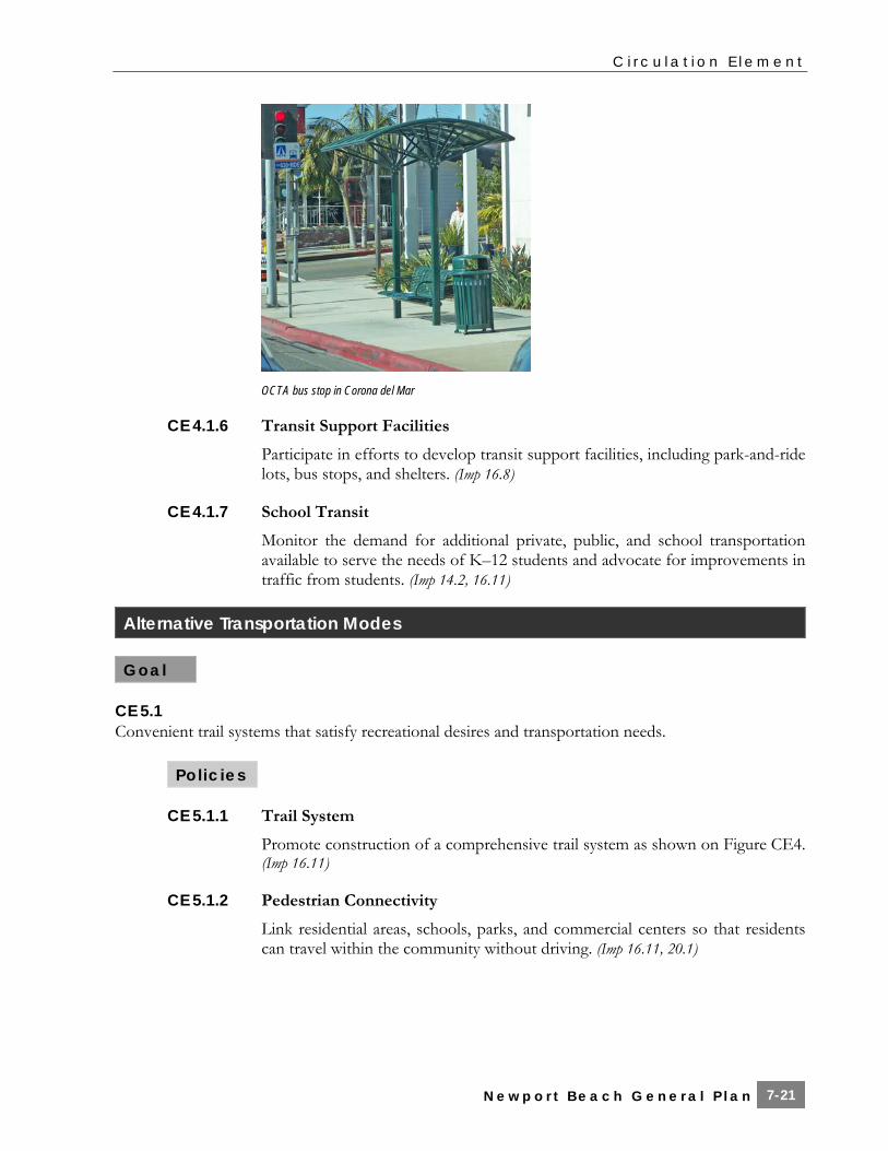
OCTA bus stop in Corona del Mar
CE 4.1.6 Transit Support Facilities
Participate in efforts to develop transit support facilities, including park-and-ride lots, bus stops, and shelters. (Imp 16.8)
CE 4.1.7 School Transit
Monitor the demand for additional private, public, and school transportation available to serve the needs of K–12 students and advocate for improvements in traffic from students. (Imp 14.2, 16.11)
Alternative Transportation Modes
Goal
CE 5.1 Convenient trail systems that satisfy recreational desires and transportation needs.
Policies
CE 5.1.1 Trail System
Promote construction of a comprehensive trail system as shown on Figure CE4. (Imp 16.11)
CE 5.1.2 Pedestrian Connectivity
Link residential areas, schools, parks, and commercial centers so that residents can travel within the community without driving. (Imp 16.11, 20.1)

C i r c u l a t i o n E l e m e n t
N e w p o r t B e a c h G e n e r a l P l a n 7-22
CE 5.1.3 Pedestrian Improvements in New Development Projects
Require new development projects to include safe and attractive sidewalks, walkways, and bike lanes in accordance with the Master Plan, and, if feasible, trails. (Imp 16.11)
CE 5.1.4 Linkages to Citywide Trail System and Neighborhoods
Require developers to construct links to the planned trail system, adjacent areas, and communities where appropriate. (Imp 16.11)
CE 5.1.5 Bikeway System
Cooperate with state, federal, county, and local agencies to coordinate bikeways and trails throughout the region. (Imp 16.11)
CE 5.1.6 Bicycle Supporting Facilities
Incorporate bicycle and pedestrian facilities in the design plans for new streets and highways and, where feasible, in the plans for improving existing roads. (Imp 16.11)
CE 5.1.7 Bicycle Safety
Provide for safety of bicyclists, equestrians, and pedestrians by adhering to current national standards and uniform practices. (Imp 16.11)
CE 5.1.8 Bicycle Conflicts with Vehicles and Pedestrians
Minimize conflict points among motorized traffic, pedestrians, and bicycle traffic. (Imp 16.11)
CE 5.1.9 Integrated Bicycle Improvements
Coordinate community bicycle and pedestrian facilities in a citywide network for continuity of travel. (Imp 16.11)
CE 5.1.10 Bicycle Trail Signage
Develop and implement a uniform signing program to assist the public in locating, recognizing, and utilizing public bikeways and trails. (Imp 16.11)
CE 5.1.11 School Access
Work with schools to promote walking, biking, safe drop-off, and other improvements. (Imp 14.2, 16.11)
CE 5.1.12 Pedestrian Street Crossings
Implement improved pedestrian crossings in key high volume areas such as Corona Del Mar, Mariners’ Mile, West Newport, Airport Area, Newport Center/Fashion Island, and the Balboa Peninsula. (Imp 16.11)

C i r c u l a t i o n E l e m e n t
N e w p o r t B e a c h G e n e r a l P l a n 7-23
Figure CE4 Bikeways Master Plan Pg 1—11x17 color

C i r c u l a t i o n E l e m e n t
N e w p o r t B e a c h G e n e r a l P l a n 7-24
Pg 2—11x17 color

C i r c u l a t i o n E l e m e n t
N e w p o r t B e a c h G e n e r a l P l a n 7-25
CE 5.1.13 Overhead Pedestrian Street Crossings
Consider overhead pedestrian crossings in areas where pedestrian use limits the efficiency of the roadway or signalized intersection. (Imp 16.11)
CE 5.1.14 Newport Harbor Trails and Walkways
Develop and implement a long-range plan for public trails and walkways to access all appropriate commercial areas of the harbor, as determined to be physically and economically feasible including the following: a. Extension of the Lido Marina Village boardwalk across all of the waterfront
commercial properties in Lido Village b. Provide a continuous waterfront walkway along the Rhine Channel,
connecting Cannery Village and McFadden Square waterfront commercial areas with Las Arenas Beach at 19th Street
c. Provide a walkway connecting the Lido Village area with Mariners’ Mile d. Provide a continuous walkway along the Mariners’ Mile waterfront from the
Coast Highway/Newport Boulevard Bridge to the Balboa Bay Club (Policy HB 6.2) (Imp 16.11)
CE 5.1.15 Equestrian Trails
Maintain the existing equestrian trail system in Santa Ana Heights (Figure CE5). (Imp 16.11)
CE 5.1.16 Bicycle and Pedestrian Safety
Provide for the safety of bicyclists and pedestrians through provision of adequate facilities, including maintenance of extra sidewalk width where feasible. (Imp 16.11)
Goal
CE 5.2 Enhanced and maintained public water transportation services and expanded public water transportation uses and land support facilities. (Policy HB 6.5)
Policies
CE 5.2.1 Marine Terminals
Coordinate the location of marine terminals with other components of the transportation system to ensure convenient multi-modal access and adequate parking. (Policy HB 6.6) (Imp 16.12)
CE 5.2.2 Expanded Water Transportation Modes
Promote opportunities to expand water transportation modes, such as water based shuttle services and water taxis. (Policy HB 6.7) (Imp 16.12)

C i r c u l a t i o n E l e m e n t
N e w p o r t B e a c h G e n e r a l P l a n 7-26
Ferry service to Balboa Island and Newport Beach Peninsula
Transportation Systems Management (TSM)/Travel Demand Management (TDM)
Goal
CE 6.1 An efficient circulation system through the use of transportation systems management.
Policies
CE 6.1.1 Traffic Signals
Improve traffic signal operations by optimizing signal timing, interconnecting signalized intersections along arterial streets, and installing computerized master traffic signal control systems in intensively utilized areas. (Imp 16.7)
CE 6.1.2 Intelligent Transportation Systems
Explore and implement intelligent transportation system and infrastructure improvements which will reduce peak hour traffic from that forecast in this Element. (Imp16.4, 16.7
CE 6.1.3 Coordination with Adjacent Jurisdictions
Coordinate operations with adjacent jurisdictions to enhance the efficiency of inter-jurisdictional roadway system operations. (Imp 14.1, 14.3)
Goal
CE 6.2 Reduced automobile travel through the use of travel demand management strategies.

C i r c u l a t i o n E l e m e n t
N e w p o r t B e a c h G e n e r a l P l a n 7-27
Figure CE5 Equestrian and Hiking Trails Master Plan Pg 1—11x17 color

C i r c u l a t i o n E l e m e n t
N e w p o r t B e a c h G e n e r a l P l a n 7-28
Pg 2—11x17 color
C i r c u l a t i o n E l e m e n t
N e w p o r t B e a c h G e n e r a l P l a n 7-29
Policies
CE 6.2.1 Alternative Transportation Modes
Promote and encourage the use of alternative transportation modes, such as ridesharing, carpools, vanpools, public transit, bicycles, and walking; and provide facilities that support such alternate modes. (Imp 16.8, 16.11)
CE 6.2.2 Support Facilities for Alternative Modes
Require new development projects to provide facilities commensurate with development type and intensity to support alternative modes, such as preferential parking for carpools, bicycle lockers, showers, commuter information areas, rideshare vehicle loading areas, water transportation docks, and bus stop improvements. (Imp 16.8, 16.11)
CE 6.2.3 Project Site Design Supporting Alternative Modes
Encourage increased use of public transportation by requiring project site designs that facilitate the use of public transportation and walking. (Imp 16.8, 16.11)
Parking
Goal
CE 7.1 An adequate supply of convenient parking throughout the City.
Policies
CE 7.1.1 Required Parking
Require that new development provide adequate, convenient parking for residents, guests, business patrons, and visitors. (Imp 16.10)
CE 7.1.2 Parking In-Lieu Fees
Establish an in-lieu parking fee that the City may require to be paid when a development is not able to provide required parking. (Imp 16.10)
CE 7.1.3 Funding of Shared Parking Facilities
Use in-lieu fees and other funds to develop public shared parking facilities in areas with inadequate parking supply. Priority shall be given to spending fees in areas that will benefit those who contributed the fees. (Imp 16.10)
C i r c u l a t i o n E l e m e n t
N e w p o r t B e a c h G e n e r a l P l a n 7-30
CE 7.1.4 Expanded Parking in Corona del Mar
Permit conversion of Corona Del Mar residential lots adjacent to commercial areas and commercial lots for parking to support commercial uses. Encourage continued use of existing parking on residential zoned lots, as well as existing shared parking lots. (Imp 2.1, 8.1, 8.2, 24.1)
CE 7.1.5 Avon Street Municipal Parking Lot Relocation
Consider relocation of the Avon Street municipal lot to better serve commercial uses in Mariners’ Mile. (Imp 2.1, 16.10)
CE 7.1.6 Public Use of Private Parking Facilities
Encourage the use of commercial, office, and institutional parking areas for use as public parking to serve coastal recreational areas during weekends and holidays, in conjunction with public transit or shuttles where appropriate. (Imp 8.1, 8.2, 16.10)
CE 7.1.7 Shared Parking Facilities
Consider allowing shared parking in mixed use and pedestrian oriented areas throughout the City. (Imp 2.1, 8.1, 8.2, 16.10)
CE 7.1.8 Parking Configuration
Site and design new development to avoid use of parking configurations or management programs that are difficult to maintain and enforce. (Imp 2.1, 7.1, 8.1)
CE 7.1.9 Parking Requirements for Pedestrian-Oriented and Local-Serving Uses
Consider revised parking requirements for small scale neighborhood serving commercial uses in areas that derive most of their trade from walk-in business, especially where on-street or other public parking is available. (Imp 2.1, 8.1, 8.2)
CE 7.1.10 Parking for Marine Recreational Users
Provide adequate parking as necessary in the vicinity of visitor serving marine uses, including marinas, water transportation terminals, boat ramps, as well as parking suitable for service vehicles in commercial marinas and berthing areas. (Imp 16.12)
CE 7.1.11 Curb Cuts
Require new development to minimize curb cuts to protect on-street parking spaces. Close curb cuts to create on street parking spaces wherever feasible. (Imp 2.1, 7.1, 8.1)
CE 7.1.12 Alley Access
Require alley access to parking areas for all new development in areas where alley access exists. (Imp 2.1, 8.1)

C i r c u l a t i o n E l e m e n t
N e w p o r t B e a c h G e n e r a l P l a n 7-31
CE 7.1.13 Up-to-Date Parking Requirements
Periodically review and update off-street parking requirements to ensure that new development provides off-street parking sufficient to serve approved uses. (Imp 8.1, 8.2)
Goal
CE 7.2 An efficiently operated parking system.
Policies
CE 7.2.1 Parking Management
Develop parking management programs for areas with inadequate parking. (Imp 16.10)
CE 7.2.2 Parking Signage
Provide improved parking information and signage. (Imp 16.10)
CE 7.2.3 Shared Valet Service
Explore the feasibility of shared valet parking programs in areas with high parking demand and less conveniently located parking facilities, such as Mariners’ Mile and McFadden Square. (Imp 16.10)
Transportation Funding
Goal
CE 8.1 Adequate funding for needed transportation infrastructure and operations.
Policies
CE 8.1.1 Transportation User and Benefit Fees
Support legislation to increase transportation user and benefit fees, and to index such fees to keep pace with inflation, in order to provide the additional revenues for needed transportation facilities and services. (Imp 7.3)
CE 8.1.2 State Highway Revenues
Support legislation to increase state highway revenues as needed to maintain and rehabilitate the existing state highway system and to match all available federal highway funding. (Imp 14.9)
C i r c u l a t i o n E l e m e n t
N e w p o r t B e a c h G e n e r a l P l a n 7-32
CE 8.1.3 Innovative Transportation Funding
Support the evaluation and implementation of innovative transportation financing mechanisms such as local tax increment districts, benefit assessment districts, and joint development and use of transportation centers. (Imp 31.1)
CE 8.1.4 Local Street and Highway Revenues
Support measures to increase local street and highway revenues as needed to fund all road reconstruction, operation, and maintenance cost. (Imp 7.3, 20.1)
CE 8.1.5 Comprehensive Funding Program
Support measures to develop and implement a continuing funding program, including private sector participation and an equitable fare structure, to fund the construction, operation, and maintenance of transit facilities and services. (Imp 7.2, 7.3, 20.1)
CE 8.1.6 Annual Budgeting for Improvements
Annually review and consider budgeting for projects contributing to completion of the Master Plan of Streets and Highways. (Imp 7.3, 30.1)
CE 8.1.7 Fair Share Fee Ordinance
Periodically review the Fair Share Fee Ordinance, reassess the unfunded cost of required improvements, and adjust the required Fair Share Fees as appropriate. (Imp 7.2)
CE 8.1.8 Roadway Improvements Funding
Fund costs of major roadway facility and intersection improvements through gas tax revenues, federal, state, and county grants, and City ordinances to avoid burdening the General Fund to the extent that this is possible. (Imp 7.2, 7.3, 30.2)
CE 8.1.9 Right-of-Way Dedication
Require the dedication of needed right-of-way in conjunction with approval of subdivision maps or other discretionary approvals. (Imp 1.1)
CE 8.1.10 Development Requirements
Require development to provide the needed roadway improvements adjacent to a site, commensurate with project impact and in accordance with the Master Plan of Streets and Highways. (Imp 16.3)
CE 8.1.11 Joint Funding with Adjoining Jurisdictions
Pursue joint funding of improvements in areas (such as the Airport Area) where traffic growth and/or needed improvements are demonstrably based upon traffic contributions or improvements that are a joint responsibility of Newport Beach and one or more adjacent jurisdictions/agencies. (Imp 14.1)
C i r c u l a t i o n E l e m e n t
N e w p o r t B e a c h G e n e r a l P l a n 7-33
CE 8.1.12 Measure M Restrictions
Measure M sales tax revenues shall not be used to replace private developer funding that has been committed for any project or normal subdivision obligations. (Imp 16.2)
CE 8.1.13 Transportation Improvement or Special Assessment District
Establish a transportation improvement or special assessment district to fund improvements needed in the Airport Area. (Imp 31.1)
