circa research projects · circa research projects: ... bruce hyde, extension, uconn clear ......
TRANSCRIPT
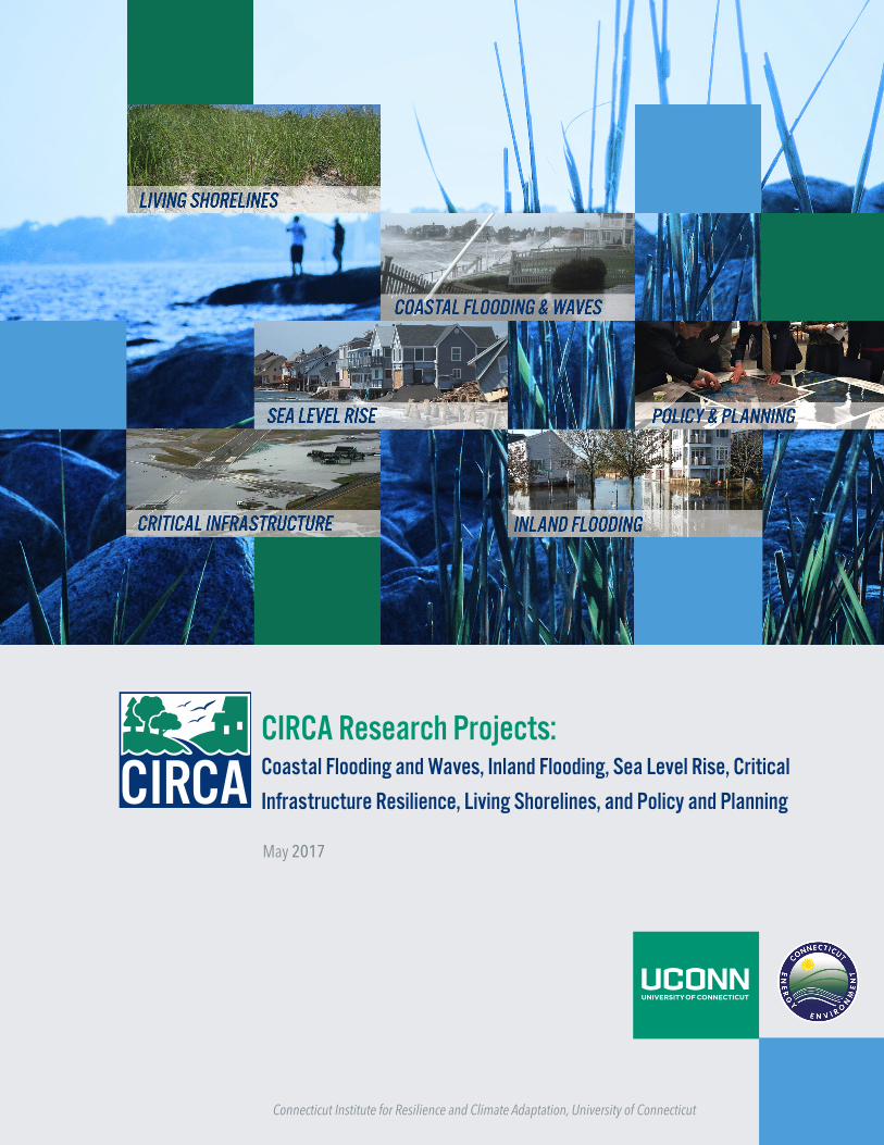
CIRCA Research Projects:Coastal Flooding and Waves, Inland Flooding, Sea Level Rise, Critical
Infrastructure Resilience, Living Shorelines, and Policy and Planning
May 2017
Connecticut Institute for Resilience and Climate Adaptation, University of Connecticut

2
Acknowledgements The development of this report was funded by a Project Agreement between the Connecticut Department of Energy and Environmental Protection and the University of Connecticut Cooperative Projects for the project entitled, “Creation of the Connecticut Institute for Resilience and Climate Adaptation.” This report should be cited as: CIRCA Research Projects: Coastal Flooding and Waves, Inland Flooding, Sea Level Rise, Critical Infrastructure Resilience, Living Shorelines, and Policy and Planning. March 2017. Connecticut Institute for Resilience and Climate Adaptation, University of Connecticut.
3
Preface This report provides an update on completed and ongoing projects that are supported by CIRCA funding or involve collaborations with CIRCA-affiliated faculty and staff. The completed projects contain links to products that can be used by Connecticut’s communities as they plan for and adapt to the impacts of climate change and severe weather. Projects that are in progress may have tools and findings that can be used by a community once they are completed or provide an opportunity to collaborate with an ongoing project. Furthermore, most projects will have updates and presentations with information that can be used by communities before the end date of the project. For these reasons, we encourage communities to review all of the ongoing projects to look for opportunities to utilize CIRCA’s work. Projects cover the CIRCA research and engagement focus areas of coastal flooding and waves, inland flooding, sea level rise, critical infrastructure resilience, living shorelines, and policy and planning. For regular updates on CIRCA projects please refer to the CIRCA website: circa.uconn.edu.
About CIRCA CIRCA is a multi‐disciplinary, center of excellence that brings together experts in the natural sciences, engineering, economics, political science, finance, and law to provide practical solutions to problems arising as a result of a changing climate. The Institute helps coastal and inland floodplain communities in Connecticut and throughout the Northeast better adapt to changes in climate and also make their human‐built infrastructure more resilient while protecting valuable ecosystems, and the services they offer to human society (food, clean air and water, and energy). The Institute combines the world‐class research capabilities of the University of Connecticut and the progressive policies and practical regulatory experience of the Connecticut Department of Energy and Environmental Protection (CT DEEP) to translate sound scientific research to actions that can ensure the resilience and sustainability of both the built and natural environments of the coast and watersheds of Connecticut. In collaboration with local, regional, and national partners, the Institute’s multi‐disciplinary research, outreach, and education programs will strive to:
Improve scientific understanding of the changing climate system and its local and regional impacts on coastal and inland floodplain communities;
Develop and deploy natural science, engineering, legal, financial, and policy best practices for climate resilience;
Undertake or oversee pilot projects designed to improve resilience and sustainability of the natural and built environment along Connecticut’s coast and inland waterways;
Create a climate‐literate public that understands its vulnerabilities to a changing

4
climate and which uses that knowledge to make scientifically informed, environmentally sound decisions;
Foster resilient and sustainable communities – particularly along the Connecticut coastline and inland waterways – that can adapt to the impacts and hazards of climate change; and
Reduce the loss of life and property, natural system and ecological damage, and social disruption from high‐impact events.

5
Table of Contents Completed Projects ……………………………………………………………………………………………………..6-8
NOAA Coastal Resilience Networks: “Enhancing Coastal Resilience in Connecticut”……………………………………………………………………………………………………..6-7 SAFR Connecticut Connections Vulnerability Assessment and Resilience Concept – National Disaster Resilience Competition ……………………………………………………………..7 Financing Resilience in Connecticut: Current Programs, National Models, and New Opportunities: Fact Sheet …………………………………………………………………………………….8
In Progress Projects ………………………………………………………………………………………………….9-12
Jarvis Creek Sea Level and Flooding Variability……………………………………………………..9 Real‐time Flood Prediction and Vulnerability Analysis of Connecticut’s Inland River Network ………………………………………………………………………………………………………..........9 Road Flooding in Coastal Connecticut………………………………………………………………….10 Municipal Resilience Planning Assistance for Sea Level Rise, Coastal Flooding, Wastewater Treatment Infrastructure, and Policy……………………………………………………………………………………………………………10-11 Scoping of Dredge Material Islands and Wetlands for Green Infrastructure Resiliency Projects Along the Connecticut Shoreline in Fairfield and New Haven Counties…………………………………………………………………………………………………………….12 Drinking Water Vulnerability Assessment and Resilience Plan………………………..12-13 Advancing High Resolution Coastal Forecasting and Living Shorelines Approaches in the Northeast …………………………………………………………………………………………………………13-14
Matching Funds for Research Projects supported by UConn CIRCA…………………………………….15
Resilient Coastal Communities under Wind and Flood Hazards ………………………………15 Public Support for Adaptation to Sea Level Rise ………………………………………………….15-16
Stratford Point Living Shoreline: Restoring Coastal Habitats to Maintain Resiliency and Function ……………………………………………………………………………………………………………...16
How Will Sea Level Rise-Driven Shifts in Wetland Vegetation Alter Ecosystem Services? ……………………………………………………………………………………………………………….16-17
6
Completed Research Projects NOAA Coastal Resilience Networks: “Enhancing Coastal Resilience in Connecticut” UConn CIRCA ‘What We Do’ Areas:
Coastal Flooding and Waves Living Shorelines
The CREST Project, “Enhancing Coastal Resilience in Connecticut,” was funded by a two-year grant from the National Oceanic and Atmospheric Administration (NOAA) to the University of Connecticut. A team of research and extension faculty and staff from the departments of Civil and Environmental Engineering, Extension and UConn Marine Sciences, along with Connecticut Sea Grant, the Center for Land Use Education and Research and the Connecticut Department of Energy and Environmental Projection’s Office of Long Island Sound Programs worked on the following objectives.
• An assessment of existing patterns of coastal erosion; • Identification of shoreline character and coastal protection approaches in-place; • Determination of storm wave characteristics at the shoreline to provide information
needed to create design guidelines for assessment of protection alternatives under current and likely future climate states;
• Review of available design guidelines for the deployment of “living shoreline” shore protection strategies and the development of a research agenda to enhance understanding of the effectiveness of the approach in Connecticut;
• Development of an online Map Viewer; • Incorporation of the knowledge developed in the project in both coast-wide and in-
depth community-level educational programs, targeted at local land use officials. The website developed for the project contains a map viewer (http://circa.uconn.edu/crest/maps/) for site suitability for living shorelines, a description of the wave research model and findings (http://circa.uconn.edu/crest/wave-research/), and the results of a wave model (http://circa.uconn.edu/crest/points/) at five locations in Long Island Sound. Researchers Supported on Project:
James O’Donnell, UConn Marine Sciences, UConn CIRCA Manos Anagnostou, Civil and Environmental Engineering, UConn CIRCA Sylvain De Guise, Pathobiology & Veterinary Science, CT Sea Grant Brian Thompson, CT DEEP Office of Long Island Sound Programs Chet Arnold, UConn CLEAR Emily Wilson, UConn CLEAR
7
Joel Stocker, Extension, UConn CLEAR Juliana Barrett, Extension, CT Sea Grant, UConn CLEAR Bruce Hyde, Extension, UConn CLEAR Jennifer O’Donnell, UConn Marine Sciences Alejandro Cifuentes-Lorenzen, Postdoctoral Fellow, UConn Marine Sciences Jason Zylberman, Graduate Student, Dept of Natural Resources and the
Environment SAFR Connecticut Connections Vulnerability Assessment and Resilience Concept – National Disaster Resilience Competition (NDRC) UConn CIRCA ‘What We Do’ Areas:
Policy and Planning CIRCA led the research, outreach, and collaborative efforts of several state agencies to develop a regional vulnerability assessment and conceptual framing of coastal resilience for the NDRC, a billion-dollar competition sponsored by the U.S. Department of Housing and Urban Development. The concept of connecting adapted coastal communities, through safe resilience corridors, to resilient transit-oriented development along Metro-North advanced the State to the current design phase of the competition. In January 2016, Connecticut was announced as the winner of $54.3 million to implement a pilot project in Bridgeport based on the concept and funds to develop a regional Connecticut Connections Coastal Resilience Plan for New Haven and Fairfield Counties. The vulnerability assessment that includes maps of flood risk and social vulnerability and the conceptual resilience framework for the Connecticut coast are included here: http://web9.uits.uconn.edu/circa/ndrc/pubs/FinalSAFRConnecticutConnectionsJune22.pdf. Funding to develop the proposal was provided by a grant from the Connecticut DEEP. Researchers and Staff Supported on Project:
Rebecca French, UConn CIRCA Jessica LeClair, UConn CIRCA Peg Van Patten, CT Sea Grant Kara Bonsack, UConn CLEAR Kevin Joy, UConn Northeast Underwater Research, Technology, & Education
Center Todd Fake, UConn Marine Sciences Ralph Lewis, UConn Marine Sciences Katherine Hagemann, UConn CIRCA Beth Greenleaf, UConn CIRCA Alex Felson, Yale UED Lab

8
Financing Resilience in Connecticut: Current Programs, National Models, and New Opportunities: Fact Sheet UConn CIRCA ‘What We Do’ Areas:
Policy and Planning CIRCA developed a fact sheet that reviews existing resilience financing programs in Connecticut, as well as model programs that can be applied in the State. It aims to educate Connecticut’s municipalities, regulators, policymakers, and legislators on the need to collaborate on developing financing methods for resiliency, including innovative public-private partnership models, and adaption of existing public and private finance models for resiliency. These actions will proactively address flood insurance affordability and promote voluntary climate adaptation measures to reduce and avoid future losses (to life, property/casualty, property tax, critical infrastructure and business continuity). Most importantly, Connecticut needs these financing methods in place prior to the next natural disaster when motivation to rebuild resiliently is high. Developing effective financing methods for resiliency now will benefit vulnerable residents, natural ecosystems, businesses, and government (local, state, and federal). Investments in the short-term will create taxpayer savings for disaster recovery costs and lead to more affordable flood insurance over the long-term. Fact sheet: http://web9.uits.uconn.edu/circa/library/Final_ResilienceFinanceFactSheet.pdf The fact sheet contains reviews of Shore Up Connecticut, Microgrids Program and Green Bank, Clean Water Revolving Loan Funds, Tax Increment Financing Districts, Connecticut Green Bank C-PACE and R-PACE, New Jersey Energy Resilience Bank, Energy Savings Performance Contracts (ESPCs) and Resilience Bonds. Researchers and Staff Supported on Project:
Rebecca French, UConn CIRCA supported Jessica LeClair, UConn CIRCA supported
Co-Authors: Wayne Cobleigh, CPSM Vice President,GZA Yi Shi, Graduate Student, Yale School of Forestry and Environmental Studies

9
In Progress (For regular project updates check the UConn CIRCA website: circa.uconn.edu)
Jarvis Creek Sea Level and Flooding Variability (final report in preparation) UConn CIRCA ‘What We Do’ Areas:
Coastal Flooding and Waves UConn CIRCA is performing an assessment of the effects of engineered tidal flow constrictions on the variability of the sea level in salt marshes and the frequency of flooding in upstream areas. The study is focused on Jarvis Creek (Branford). Researchers and Staff Supported on Project:
James O’Donnell, UConn Marine Sciences, UConn CIRCA Michael Whitney, UConn Marine Sciences Kay Howard-Strobel, UConn Marine Sciences Christina Menniti, Graduate Student, UConn Marine Sciences
Real‐time Flood Prediction and Vulnerability Analysis of Connecticut’s Inland River Network (anticipated completion date: January 2017) UConn CIRCA ‘What We Do’ Areas:
Inland Flooding Critical Infrastructure
UConn CIRCA researchers are developing an integrative hydrologic and flood inundation modeling system for Connecticut’s inland river network, and using the system for conducting flood vulnerability analyses statewide to identify critical areas/infrastructures (e.g. bridges, road network, power stations, waste water treatment facilities) and issues related to flooding and erosion from extreme precipitation (1% annual chance storms) in current and end‐of‐century climate. Researchers and Staff Supported on Project:
Manos Anagnostou, UConn Civil & Environmental Engineering, UConn CIRCA Xinyi Shen, Postdoctoral Fellow, UConn Civil & Environmental Engineering Yagmur Derin, Graduate Student, UConn Civil & Environmental Engineering Jason Parent, Uconn Natural Resources and the Environment

10
Road Flooding in Coastal Connecticut (anticipated completion date June 30, 2017) The coastline of Connecticut is characterized by numerous inlets where the rivers and streams carrying runoff from land towards the ocean and the saline tidal waters of Long Island Sound intrude into the channels. Salt marshes have formed in many of these inlets and have become critical habitat for numerous species of insects, birds and fish. Routes between coastal settlements have generally skirted the northern boundaries of these marshes and many bridges and culverts have been constructed to allow the water and roadways to co-exist. Rising sea levels, and some marsh restoration projects, have made segments of roadways more vulnerable to flooding. This project will assess the most cost effective and appropriate adaptation strategy to reduce the frequency of flooding to an acceptable level, requiring the analysis of the flow of water through the inlets. A demonstration project will be conducted to provide estimates of the frequency of flooding at two sites on RT 146 in Guilford and two sites in Branford. The model to be employed will require the analysis of observations, LIDAR surface elevations, GPS surveys and water level observations. The end goal is to have the model and data provide:
a) current flooding frequency statistics; b) future flooding frequency statistics; and c) the effectiveness of road elevation options on reducing the flooding frequency (or
risk). Researchers and Staff Supported on Project:
James O’Donnell, UConn CIRCA and Department of Marine Sciences Michael Whitney, UConn Department of Marine Sciences
Municipal Resilience Planning Assistance for Sea Level Rise, Coastal Flooding, Wastewater Treatment Infrastructure, and Policy (anticipated completion date: September 2017) UConn CIRCA ‘What We Do’ Areas:
Coastal Flooding and Waves Inland Flooding Sea Level Rise Critical Infrastructure Living Shorelines Policy and Planning

11
With a grant from the Connecticut DEEP, UConn CIRCA will develop tools (methodologies and data) for municipalities in counties affected by Superstorm Sandy for the assessment of vulnerability of infrastructure (including waste water treatment plants, pump stations, roads, and public safety assets), to inundation by river flow and storm surge, now, and in the next 25 to 50 years, when it is likely that sea levels will be higher and precipitation statistics different; and provide policy and financing options for resilience projects for Connecticut’s municipalities. Additionally, the use of these products will be piloted in communities. UConn CIRCA will produce the following products as a result of this project:
Sea level rise projections for Long Island Sound Models and maps of the combined impacts of riverine flooding and storm surge Models and maps of inland flooding under current future climates
20%, 10%, 5%, 2%, and 1% annual chance flood inundation from storms Evaluation of extreme future climate storm scenarios (category II hurricane)
against the current 1% (100-year) and 0.2% (500-year) flood inundation levels
Vulnerability assessment process for wastewater treatment plants Policy and financing options for resilience projects that may be effective in
Connecticut based on a survey of municipal needs Researchers and Staff Supported on Project:
James O’Donnell, UConn Marine Sciences, UConn CIRCA Manos Anagnostou, Civil & Environmental Engineering, UConn CIRCA Christine Kirchhoff, UConn Civil & Environmental Engineering Amy Burnicki, UConn Civil & Environmental Engineering Joe MacDougald, Law School, UConn CIRCA, Center for Energy and Environmental
Law Juliana Barrett, Extension, CT Sea Grant, UConn CLEAR Bruce Hyde, Extension, UConn CLEAR Jessica LeClair, UConn CIRCA Sage Hardesty, Graduate Student, UConn Civil & Environmental Engineering Xinyi Shen, Postdoctoral Fellow, UConn Civil & Environmental Engineering Peter Watson, Graduate Student, UConn Civil & Environmental Engineering Claire Szymanski, Graduate Student, Education Psychology Alejandro Cifuentes-Lorenzen, Postdoctoral Fellow, UConn Marine Sciences Grant McCardell, Postdoctoral Fellow, UConn Marine Sciences Berdakh Utemuratov, PhD Candidate, UConn Civil & Environmental Engineering Rebecca A French, UConn CIRCA Kay Howard-Strobel, Research Associate, UConn Marine Sciences

12
Scoping of Dredge Material Islands and Wetlands for Green Infrastructure Resiliency Projects Along the Connecticut Shoreline in Fairfield and New Haven Counties (anticipated completion date: September 2017) UConn CIRCA ‘What We Do’ Areas:
Critical Infrastructure Living Shorelines Policy and Planning
The shorelines of Fairfield and New Haven Counties were among the most heavily impacted by Superstorm Sandy. If Connecticut had more marshland along its coast, it is possible that some of those impacts could have been avoided; studies show that wetland habitats act as natural buffers against waves and powerful storm surges. With funds from the Connecticut Department of Housing CDBG-DR Sandy Recovery Program, this project aims to determine the feasibility of the process of utilizing dredge materials to construct artificial marshes and islands to decrease erosion and improve drainage. Creating marshes along shorelines may increase an area’s resilience to sea level rise and severe storms, and has a dual benefit of providing public access to natural amenities and maintaining or increasing ecosystem services. This project will result in a feasibility assessment, design parameters, a regulatory framework, and an evaluation of the impact of the creation of wetlands on the health and safety of vulnerable populations. Researchers and Staff Supported on Project:
Jennifer O’Donnell, UConn Marine Sciences Jamie Vaudrey, UConn Marine Sciences Craig Tobias, UConn Marine Sciences Rebecca French, UConn CIRCA Carolyn Lin, UConn Communications Paula Schenck, UConn Health
Drinking Water Vulnerability Assessment and Resilience Plan (anticipated completion date: September 2017) Project Summary The Connecticut Department of Public Health (DPH) and the Connecticut Institute for Resilience and Climate Adaptation (CIRCA) will work together for the purpose of preparing a Drinking Water Vulnerability Assessment and Resilience Plan to assess, identify, and address vulnerabilities for community water systems in Fairfield, New Haven, New London, and Middlesex counties. The Plan will utilize spatial data, flood risk, climate information, surveys and interviews with water utilities to ensure preparedness and resiliency of

13
community water systems before, during, and after future storms and hazards, including the impacts of climate change and drought. Project Description The project consists of four overall tasks:
Vulnerability assessment of Connecticut community water systems in the four counties impacted by Super Storm Sandy to identify options and alternatives to mitigate the vulnerabilities identified and to improve resiliency and to compile the assessment into a comprehensive Public Water Systems resiliency plan.
Review current practices, procedures, and requirements for emergency response at DPH and develop an emergency response plan, in collaboration with the Department.
Use available GIS data layers and information from local health directors to assess the vulnerability of private wells and recommend actions to improve resiliency.
Prepare a high-level comprehensive implementation plan that addresses identified community water systems’ vulnerabilities and provides options and alternatives to improve resiliency.
Researchers, Staff and Contractors Supported on Project
James O’Donnell, UConn CIRCA and Department of Marine Sciences Christine Kirchoff, UConn Department of Civil and Environmental Engineering Rebecca French, UConn CIRCA Guiling Wang, UConn Department of Civil and Environmental Engineering Amy Burnicki, UConn Department of Civil and Environmental Engineering David Murphy, Milone & MacBroom
Advancing High Resolution Coastal Forecasting and Living Shorelines Approaches in the Northeast (anticipated completion date: May 2018) UConn CIRCA ‘What We Do’ Areas:
Coastal Flooding and Waves Sea Level Rise Critical Infrastructure Resilience Living Shorelines Policy and Planning
Advancing High Resolution Coastal Forecasting. UConn CIRCA faculty are partnering with researchers from across New England to advance the development and implementation of a comprehensive, regional coastal and riverine inundation observation and modeling system. This project will result in the creation of a real-time inundation forecast system that will be

14
housed with the Northeast Regional Association of Coastal and Ocean Observing Systems (NERACOOS) and 100-year return interval (1% annual chance) online maps. Advancing Living Shorelines Approaches. UConn CIRCA, working in conjunction with five New England states and several regional organizations, will collaboratively analyze living shorelines application in Connecticut and the Northeast region. New England has a varied coastline and dually varied utilization rates for living shorelines projects. Under this cooperative effort, UConn CIRCA will assist the region as it develops a ‘state-of-the-science’ analysis of living shorelines and coastal green infrastructure, identify barriers and potential solutions to increase the deployment of living shorelines, and develop and disseminate educational materials and workshops for the public regarding living shorelines and coastal green infrastructure. Funding for this project is provided by the NOAA Regional Coastal Resilience Grants under the NOAA Office for Coastal Management. Researchers and Staff Supported on Project:
James O’Donnell, UConn Marine Sciences Rebecca French, UConn CIRCA Alejandro Cifuentes-Lorenzen, Postdoctoral Fellow, UConn Marine Sciences Todd Fake, Research Associate, UConn Marine Sciences

15
Matching Funds for Research Projects Supported by UConn CIRCA
UConn CIRCA provides matching funds to projects that advance the goals and mission of UConn CIRCA and that are supported by a primary sponsor..
Resilient Coastal Communities under Wind and Flood Hazards (anticipated completion date: January 2018) UConn CIRCA ‘What We Do’ Areas:
Coastal Flooding and Waves Policy and Planning
Wei Zhang and Christine Kirchhoff of the University of Connecticut Department of Civil and Environmental Engineering will evaluate and compare trade-offs in residential home building designs to reduce risk of wind and flood damage in order to reduce coastal community vulnerabilities. The towns of Fairfield and Milford are participating in the study. Primary Funding: Connecticut Sea Grant Researchers and Staff Supported on Project:
Wei Zhang, UConn Civil & Environmental Engineering (Project Lead) Christine Kirchhoff, UConn Civil & Environmental Engineering Juliana Barrett, CT Sea Grant, Extension
Public Support for Adaptation to Sea Level Rise (anticipated completion date: January 2018) UConn CIRCA ‘What We Do’ Areas:
Policy and Planning Stephen Swallow of the UConn Department of Agricultural and Resource Economics will lead a team of investigators who will survey Connecticut coastal residents to examine their preferences and values with respect to various measures to preserve coastal areas and resources in the face of sea level rise. Primary Funding: Connecticut Sea Grant Researchers and Staff Supported on Project:
16
Stephen Swallow, Agricultural and Resource Economics and Center for Environmental Sciences and Engineering (Project Lead)
Christopher Elphick, Ecology and Evolutionary Biology James O’Donnell, UConn Marine Sciences Eric Schultz, Ecology and Evolutionary Biology Jennifer O’Donnell, UConn Marine Sciences Juliana Barrett, CT Sea Grant, Extension
Stratford Point Living Shoreline: Restoring Coastal Habitats to Maintain Resiliency and Function (anticipated completion date: July 2017) Led by researchers at Sacred Heart University, this project expands an existing living shoreline project at Stratford Point, Fairfield County, Connecticut. On-going coastal restoration efforts and research at the site consist of an artificial reef, smooth cordgrass (Spartina alterniflora) marsh, high marsh, coastal dune and upland woody/grassland mosaics. In total, the project will provide an additional 750 feet of coastal erosion control, 4.5 acres of intertidal habitat, 1.5 acres of coastal dune habitat and 25 acres of woodland/meadow mix. Subsequent monitoring will provide additional understanding regarding the potential effectiveness of living shorelines as a means to increase coastal resilience and will inform future designs/guidelines for Connecticut and coastal communities in New England. UConn CIRCA ‘What We Do’ Areas:
Living Shorelines Sea Level Rise Coastal Flooding and Waves
Primary Funding: U.S. Army Corps of Engineers Connecticut In-Lieu Fee Program Researchers and Staff Supported on Project:
Jennifer Mattei, Sacred Heart University Department of Biology (Project Lead) How Will Sea Level Rise-Driven Shifts in Wetland Vegetation Alter Ecosystem Services? (anticipated completion date: February 2019) This project examines how sea level rise (SLR) - induced shifts in vegetation will mediate ecosystem service provision by LIS coastal wetlands. Specifically, the project will: 1)

17
quantify the delivery of ecosystem services associated with dominant tidal wetland plant species of the LIS; 2) examine impacts of SLR and interactions; 3) forecast how shifts in dominant tidal wetland species will alter ecosystem service provision of LIS coastal wetlands; 4) promote understanding of the complex interactions among SLR, coastal wetlands, and ecosystem services among diverse audiences in the LIS region. UConn CIRCA ‘What We Do’ Areas:
Living Shorelines Sea Level Rise Coastal Flooding and Waves
Primary Funding: Long Island Sound Study – CT Sea Grant Researchers and Staff Supported on Project:
Beth Lawrence, UConn Natural Resources and the Environment (Project Lead) Christopher Elphick, UConn Ecology and Evolutionary Biology Ashley Helton, UConn Natural Resources and the Environment