class: v sub: maths chapter: mapping your way
TRANSCRIPT
Class: V Sub: Maths Chapter: Mapping your way
Map:
A map is a drawing of all or parts of a particular place.
Its basic purpose is to show where things are.
Maps may show rivers, forests, buildings and roads in the form of symbols in its
drawings.
e.g :Building School
Road Hospital
How to read a map?
There are 4 directions. North, South, East and West
How to use a scale in a map?
When we show a big area on a paper, we have to reduce it by a fixed ratio
everywhere, so that the distance and position remain the same.

NCERT TEXT BOOK Page. No 113
Q.1. After matching the map1 with the photo, find out where the
position of India gate is and draw it on the map.
Q.3.Name the roads that you will cross on your way from Rastrapathi
Bhawan to India Gate.
1. Rafi marg 2. Janpath 3. Mansingh road
NCERT TEXT BOOK Page. No 114
The Central Hexagon
This picture looks like a hexagon(i.e, six sided polygon). So this place is called
Central hexagon.
Q.1. If you are walking on Rajpath then after India gate on which side
would Children’s Park be?
Ans: Right side
Q.2. Which of these roads make the biggest angle between them?
Ans: Ashoka road and Man Singh Road
Q.3. Which of the above pairs of roads cut at right angles?
Ans: Janpath and Rajpath
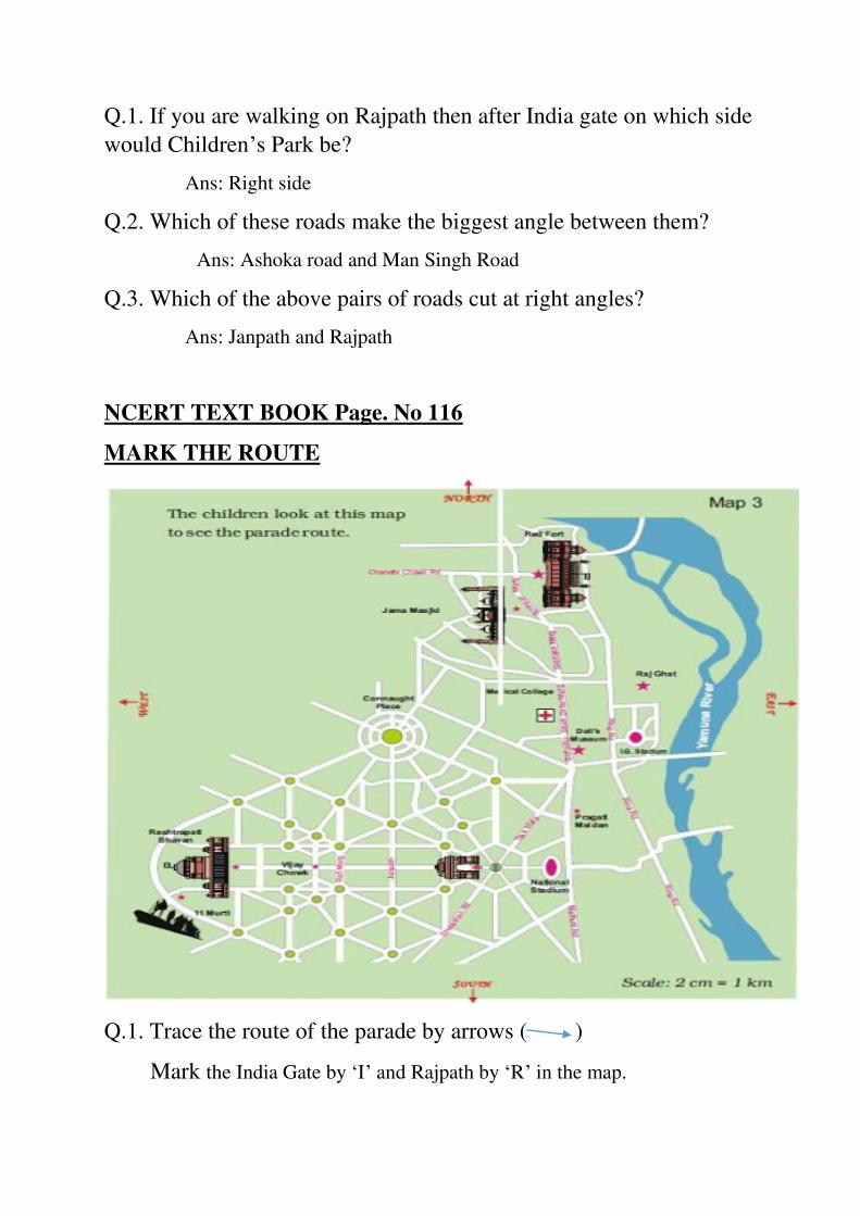
NCERT TEXT BOOK Page. No 116
MARK THE ROUTE
Q.1. Trace the route of the parade by arrows ( )
Mark the India Gate by ‘I’ and Rajpath by ‘R’ in the map.

Q.2. a) Which of these is a longest road?
Ans: Tilak marg (from the given options)
b) If Rubia is coming from Jama Masjid to join the parade, guess
about how far she will have to walk?
Ans: She has to walk about 1 km to join the parade. Because from the
scale given in the map. 2cm = 1km
c) The total route of the parade is about how long?
Ans: About 16 km long
NCERT TEXT BOOK Page. No 118
Find out from Map 4
Q. a) Which of these is nearer to river Yamuna?
Ans: The Diwan-e-Khaas (from the given option )
Q. b) Between which two buildings is Aaram Gah?
Ans: Between the Diwan –e- Khaas and Rang Mahal
Q. c)Which buildings do you pass while going from Rang Mahal to
the Hammam?
Ans: Aram gah, the Diwan-e- Khaas and Moti Masjid.
Q.d) Which buildind on this map is farthest from Meena Bazar?
Ans: Hammam
Q. e) About how far is Lahori Gate from Diwan-e-Khaas?
Ans: Lahori gate is about 600 m from Diwan-e-Khaas.
Scale 1cm = 100 m. So, 6cm = 600m
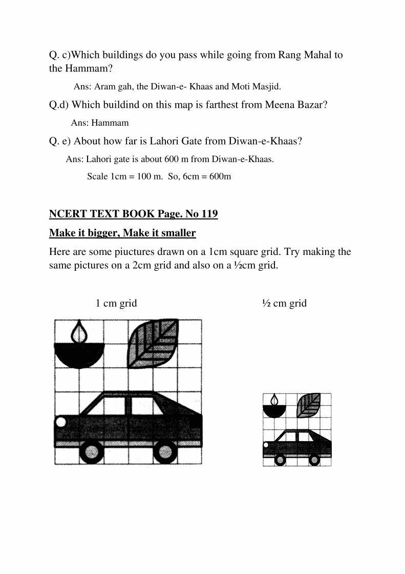
NCERT TEXT BOOK Page. No 119
Make it bigger, Make it smaller
Here are some piuctures drawn on a 1cm square grid. Try making the
same pictures on a 2cm grid and also on a ½cm grid.
1 cm grid ½ cm grid
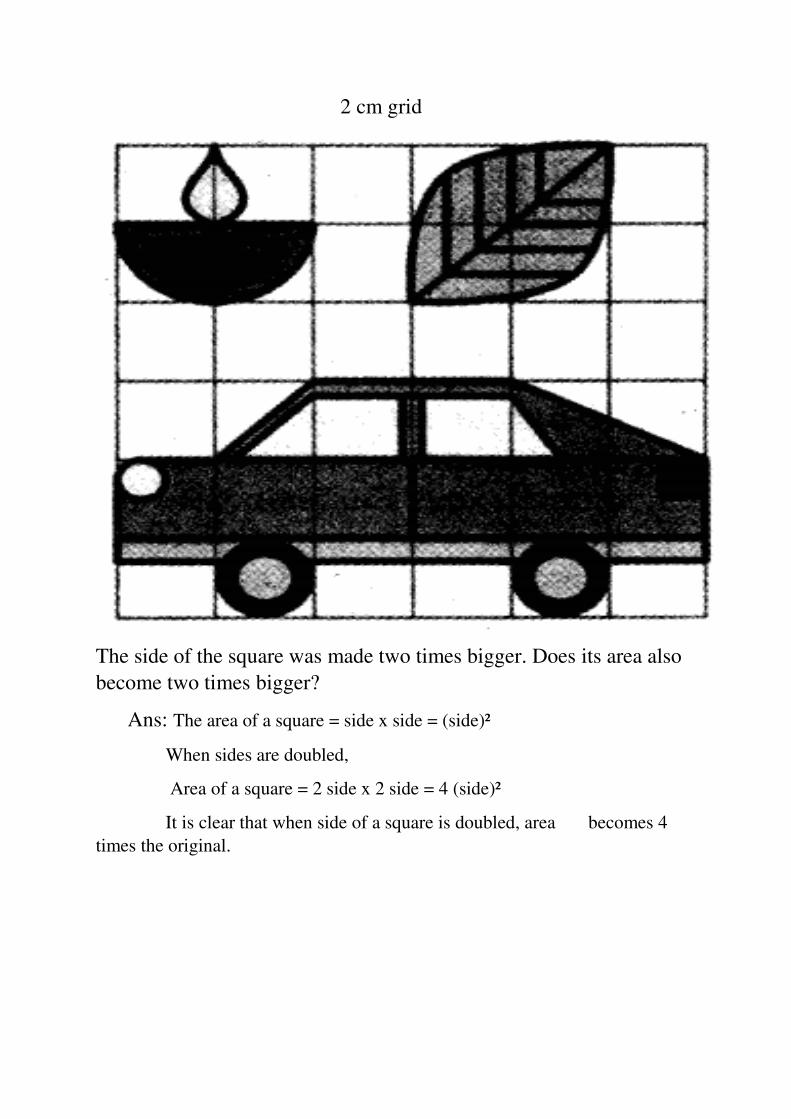
2 cm grid
The side of the square was made two times bigger. Does its area also
become two times bigger?
Ans: The area of a square = side x side = (side)²
When sides are doubled,
Area of a square = 2 side x 2 side = 4 (side)²
It is clear that when side of a square is doubled, area becomes 4
times the original.
NCERT TEXT BOOK Page. No: 120
Now try this:
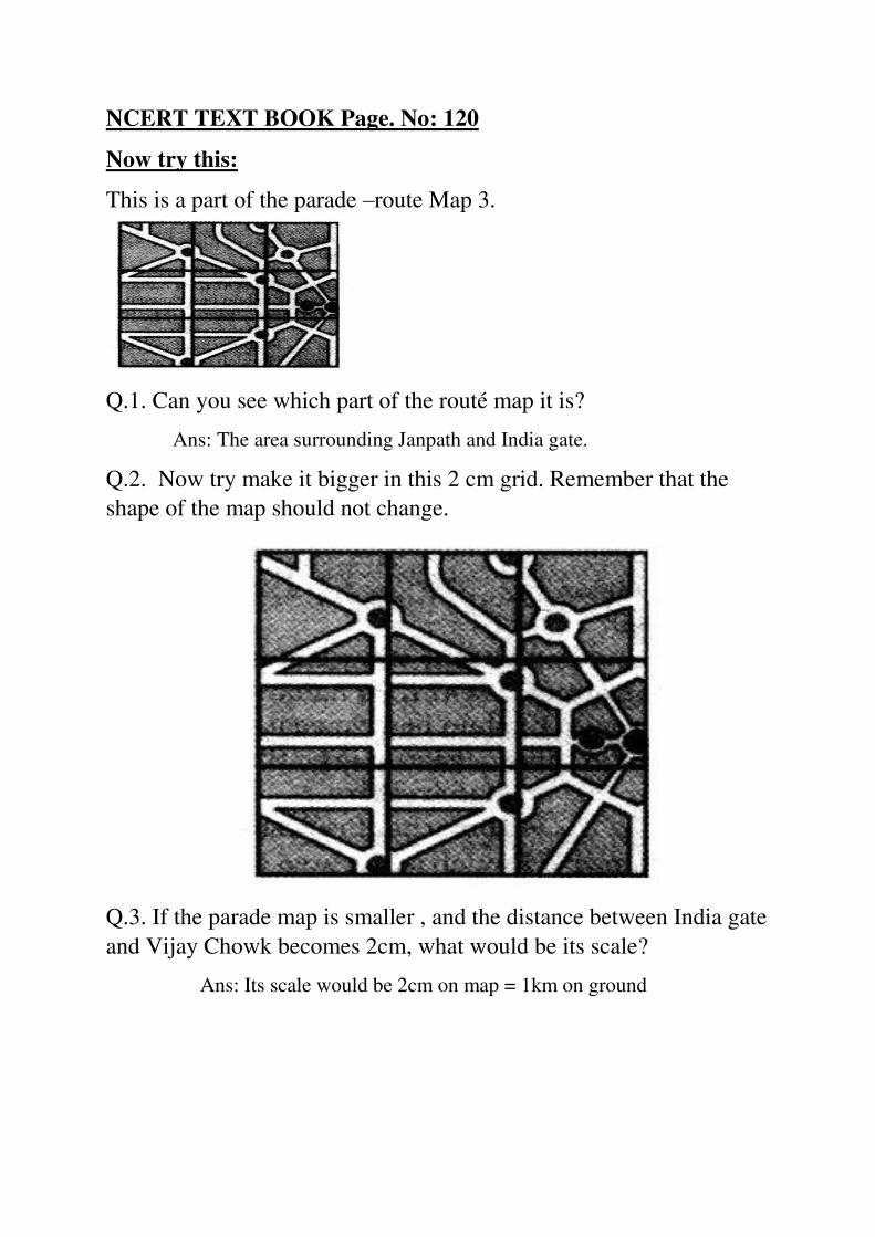
This is a part of the parade –route Map 3.
Q.1. Can you see which part of the routé map it is?
Ans: The area surrounding Janpath and India gate.
Q.2. Now try make it bigger in this 2 cm grid. Remember that the
shape of the map should not change.
Q.3. If the parade map is smaller , and the distance between India gate
and Vijay Chowk becomes 2cm, what would be its scale?
Ans: Its scale would be 2cm on map = 1km on ground
NCERT TEXT BOOK Page. No 121
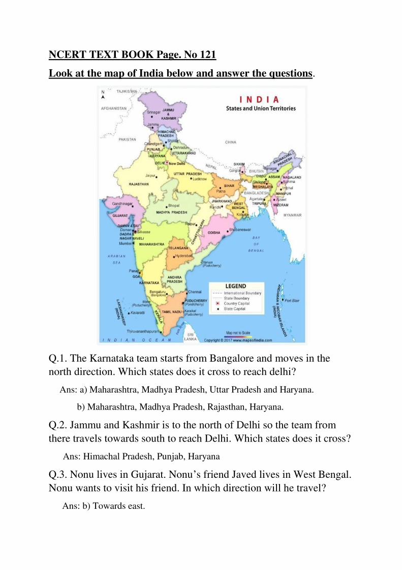
Look at the map of India below and answer the questions.
Q.1. The Karnataka team starts from Bangalore and moves in the
north direction. Which states does it cross to reach delhi?
Ans: a) Maharashtra, Madhya Pradesh, Uttar Pradesh and Haryana.
b) Maharashtra, Madhya Pradesh, Rajasthan, Haryana.
Q.2. Jammu and Kashmir is to the north of Delhi so the team from
there travels towards south to reach Delhi. Which states does it cross?
Ans: Himachal Pradesh, Punjab, Haryana
Q.3. Nonu lives in Gujarat. Nonu’s friend Javed lives in West Bengal.
Nonu wants to visit his friend. In which direction will he travel?
Ans: b) Towards east.
Q.4. Is there any state which is to the north of Jammu and Kashmir?
Ans: No
Q.5. Is there any state which is to the west of Gujarat?
Ans: No
Q.6. If 1cm on the map shows 200km on the ground, use this scale to
find out:
A) About how far is Delhi from Jaipur?
Ans: c) 250 km
B) Estimate how far is Jaipur from Bhopal?
On the map = 2 cm
On the ground = 400 km
Q.7. Look at the and tell:
a) Which state is surrounded by four other states.
Ans: Madhya Pradesh
b) Which state has the largest area?
Ans: Rajasthan
c) Which state is about 8 times bigger in area than Sikkim?
Ans: Himachal Pradesh
d) About how many times of Punjab is the area of Rajasthan?
Ans: Rajasthan is about 7 timesthe area of Punjab.
NCERT TEXT BOOK Page. No 123
The sea
*Name some states which have sea on one side.
Ans: Gujarat, Goa, Maharashtra, Karnataka, Kerala, Tamil nadu,
Andhra Pradesh, Orissa, West Bengal

*Name some states which does not have the sea on any side.
Ans: Madhya Pradesh, Chattishgarh, Jharkhand, Haryana
*Name some Northern states of India.
Ans: Jammu and Kashmir, Himachal Pradesh, Punjab, Uttarkhand, Haryana
*Name some Eastern states of India.
Ans: Arunachal Pradesh, Assam, Manipur, Meghalaya, Mizoram,
Nagaland, Sikkim, Tripura
*Name some Western states of India.
Ans: Rajasthan, Gujarat, Maharashtra
*Name some Southern states of India.
Ans: Tamil nadu, Kerala, Karnataka, Andhra Pradesh
NCERT TEXT BOOK Page. No:124
Distances between Towns:
These are five towns. Find out:
Ans: Chholaghat, Bhelpur, Dhoklabad, Idlipur, Barfinagar
Q.1. How many cm away is Idlipur from Barfinagar on the map?
Ans: 5.2 cm
Q.2.How many kilometers will you have to travel if you go from
Idlipur to Barfinagar?
Ans:52 kms (from scale 1cm = 10km)

Q.3. There is a place called Thukpagram midway between Idlipur and
Barfinagar. Mark it with a ‘T’
Q.4. A town called Jalebipur is 35 kms away from both Chholaghat
and Dhoklabad. Mark ‘J’ for it.
Q.5. Measure the length of the route between Bhelpur and Chollaghat.
Hint: Use a thread and measure the length.
NCERT TEXT BOOK Page. No:124
Ashi’s School
Ashi’s school looks like this from the top.
Use the squares to find out:
Q.1. How many times bigger is the area of the Assembly ground than
that of the office?
Ans:5 times
Q.2. How much is the length and width of each classroom?
Ans:Length 5m, width 4m.
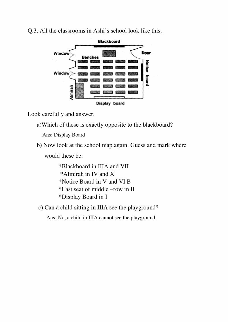
Q.3. All the classrooms in Ashi’s school look like this.
Look carefully and answer.
a)Which of these is exactly opposite to the blackboard?
Ans: Display Board
b) Now look at the school map again. Guess and mark where
would these be:
*Blackboard in IIIA and VII
*Almirah in IV and X
*Notice Board in V and VI B
*Last seat of middle –row in II
*Display Board in I
c) Can a child sitting in IIIA see the playground?
Ans: No, a child in IIIA cannot see the playground.