climate change and bc parks; conservation and recreation
DESCRIPTION
ESTC 2008: Climate Change and BC Parks; Conservation and Recreation - Dr. Victoria Stevens, BC Protected Areas ProgramTRANSCRIPT

Recreation Values and Climate change
Ecotourism and Sustainable Tourism Conference October 27-29, 2008
Vancouver, BC
Victoria Stevens and Doug Biffard

Dual Mandate
Conservation Recreation
•Protected Areas system is cornerstone of biodiversity conservation in BC.
•People are more likely to want to recreate where the natural world is intact
•Recreation should be constrained by the carrying capacity of the natural and the built system
•Climate change is affecting both

Four Case Studies
• Rathtrevor Park – coastal ecosystems• Tetrahedron Park – old growth forest• Churn Creek Protected Area – grassland• Mt. Robson Park – alpine ecosystems

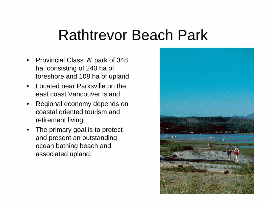
Rathtrevor Beach Park• Provincial Class 'A' park of 348
ha, consisting of 240 ha of foreshore and 108 ha of upland
• Located near Parksville on the east coast Vancouver Island
• Regional economy depends on coastal oriented tourism and retirement living
• The primary goal is to protect and present an outstanding ocean bathing beach and associated upland.

Rathtrevor Beach Park

Recreation• Average 135 thousand visitors
per year both camping and day use
• Nature Programs feature beach ecology including seagrass meadows and annual herring spawn
• Annual Brant Wildlife Festival attracts international tourism to view 20,000 migrating Brant Geese
ConservationMixed sand & gravel beach is
critical for: • Spawning Sandlance a
keystone fish • Seagrass meadows are both
nursery habitat for many marine species and the main food for Brant Geese
• Many species of clams • Feeding habitat for shorebirds• Stepping stone for migrating
shorebirds
Rathtrevor Beach Park

Rathtrevor Beach Park
Background:
• Seawall installed in 1971 to protect beach and improve recreation values
• Failed to meet objectives

Rathtrevor Beach ParkFuture: • Climate change predictions:
– Sea level rise 0.5 to 1.4 m this century
– Increase storm frequency and intensity
• The combined affect of the sea wall, sea level rise and more severe storms will increase erosion and decrease recreation and conservation values.

Rathtrevor Beach Park - options
Allows beach and dune to recover and adapt to current sea level and storms
Recontour to natural beach
Adaptive strategy that will support shoreline process associated ecosystems. Provides the best chances for the conservation and recreation values to be retained.
Plan for an adaptive shoreline -remove infrastructure from the inundation zone-Restore coastal forest landward of future shoreline
Maintains current shoreline until an extreme storm causes catastrophic failure
Reconstruct seawall
Predicted resultResponse

Sea wall
Natural shoreline
Future shoreline?
Future
tree lin
e?
Tree line
Rathtrevor Beach Park

Tetrahedron Park
• 6000 ha of mid-elevation forest and mountain peaks
• Contains the water supply for the Sunshine Coast

0
500
1000
1500
2000
2500
2005 2006 2007 2008
visi
tors
?
Sunshine Coast Regional District Water Supply
• SCRD has water rights to 2 lakes in Tetrahedron Park– Water rights predate park
designation– Small dams control level of
water• Issues are outside the park
– Logging within the watershed– Access to recreation in the
park• Climate change is already
affecting the amount of winter precipitation– Timing of spring flows– Magnitude of summer flows
1161977-2008
201945 -1976
Years with less than 1000 mm of water
Years with less than 500 mm of water

Options for SCRD/Tetrahedron Park
• Water consumption is increasing at about 3%/year
• More water from 3 options– Raising dams (conservation concern)– Build another reservoir (conservation concern)– Find an additional watershed
• WATER CONSERVATION!• Protect current watersheds by limiting use of
access road

Churn Creek Protected Area• 36,747 ha of grasslands and dry forests• Working ranch• Rare ecosystems and wildlife• Regional tourism features horseback riding

Churn Creek Protected Area
• Objectives – Conservation Primary– Conserve and restore nationally significant
grasslands and wildlife– Provide low impact recreation opportunities
(wildlife viewing and hunting, horseback riding, hiking, mountain biking on roads)
– First Nations still use area for traditional cultural practices

Climate Change
• Current condition includes ingrowth and invasion of grasslands by trees
• Anticipated increase in grasslands• Treatments to increase resilience and
resistance of grasslands – Tree removal– Prescribed burning– Monitoring for invasive plants
Churn Creek Protected Area

Churn Creek Protected Area

Before2000 stems/ha
No bunch grasses
After120 stems/ha
Pine grasses
Bunch grass potential

Mount Robson Park• Provincial Class 'A' park that
together with 7 other parks forms the 2.3 million hectare Canadian Rocky Mountains World Heritage Site
• Located adjacent to Jasper National Park along the Yellowhead Highway
• Road based touring and wilderness adventure recreation diversifies a largely resource based local economy

Mount Robson ParkConservation• Maintain a large undisturbed
natural landscape for wilderness conservation
Recreation• Provide significant outdoor
recreation opportunities for both remote backcountry and readily accessible facility oriented uses,
• Support a nationally significant transportation and travel route through the Rocky Mountains.

Mount Robson Park
Climate Change predictions:
• Overall warmer wetter climate with season considerations
• Winter minimum temps will increase the most
• Less rainfall in summer• Reduced soil moisture• Loss of glaciers

Adaptation Strategies
• Ecosystem management to assist adaptation and build resiliency
• Communicate – show visitors the changes and explain the causes
• Support green recreation trends
• Respond to increased risk to visitors– Slides, rock fall, avalanche,
danger trees, fire, flood
Mt. Robson Park

Conclusion
• Change WILL happen• Each park has unique management issues
related to ecosystem, human use, visitor trends, regional climate changes, economic context
• BCParks must tailor management to each set of circumstances
• Anticipation and adaptation will improve chances of functioning ecosystems and successful tourism opportunities