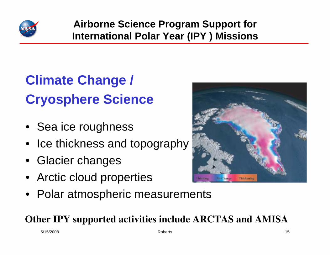
climate change / cryosphere science
TRANSCRIPT
5/15/2008 Roberts 15
Airborne Science Program Support for International Polar Year (IPY ) Missions
Climate Change / Cryosphere Science
• Sea ice roughness• Ice thickness and topography• Glacier changes• Arctic cloud properties• Polar atmospheric measurements
Other IPY supported activities include ARCTAS and AMISA
5/15/2008 Roberts 16
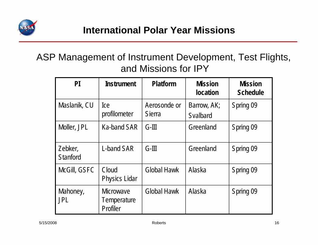
Spring 09AlaskaGlobal HawkMicrowave Temperature Profiler
Mahoney, JPL
Spring 09AlaskaGlobal HawkCloud Physics Lidar
McGill, GSFC
Spring 09GreenlandG-IIIL-band SARZebker, Stanford
Spring 09GreenlandG-IIIKa-band SARMoller, JPL
Spring 09Barrow, AK;Svalbard
Aerosonde or Sierra
Ice profilometer
Maslanik, CU
Mission Schedule
Mission location
PlatformInstrumentPI
ASP Management of Instrument Development, Test Flights, and Missions for IPY
International Polar Year Missions
5/15/2008 Roberts 17
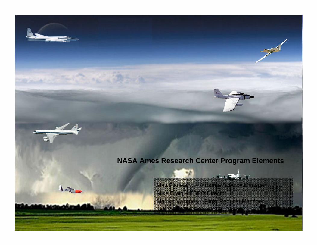
NASA Ames Research Center Program Elements
Matt Fladeland – Airborne Science ManagerMike Craig – ESPO DirectorMarilyn Vasques – Flight Request ManagerJeff Myers (UCSC) – ASTL Director
5/15/2008 Roberts 18
NASA Ames ASP Program Elements
Earth Science Projects OfficeMission managementFlight request managementLesson’s learned
Airborne Science OfficeRequirements AnalysisStrategic PlanningProgram Development
Payloads and Instrumentation elementUpgrades and operations of MAS & MASTERCalibration facility (NIST traceable)Next generation Navigation data recorders
New TechnologySIERRA UASCDE/RTMM mission tool development (ARC/MSFC/DFRC)SBIR instrument development
5/15/2008 Roberts 19
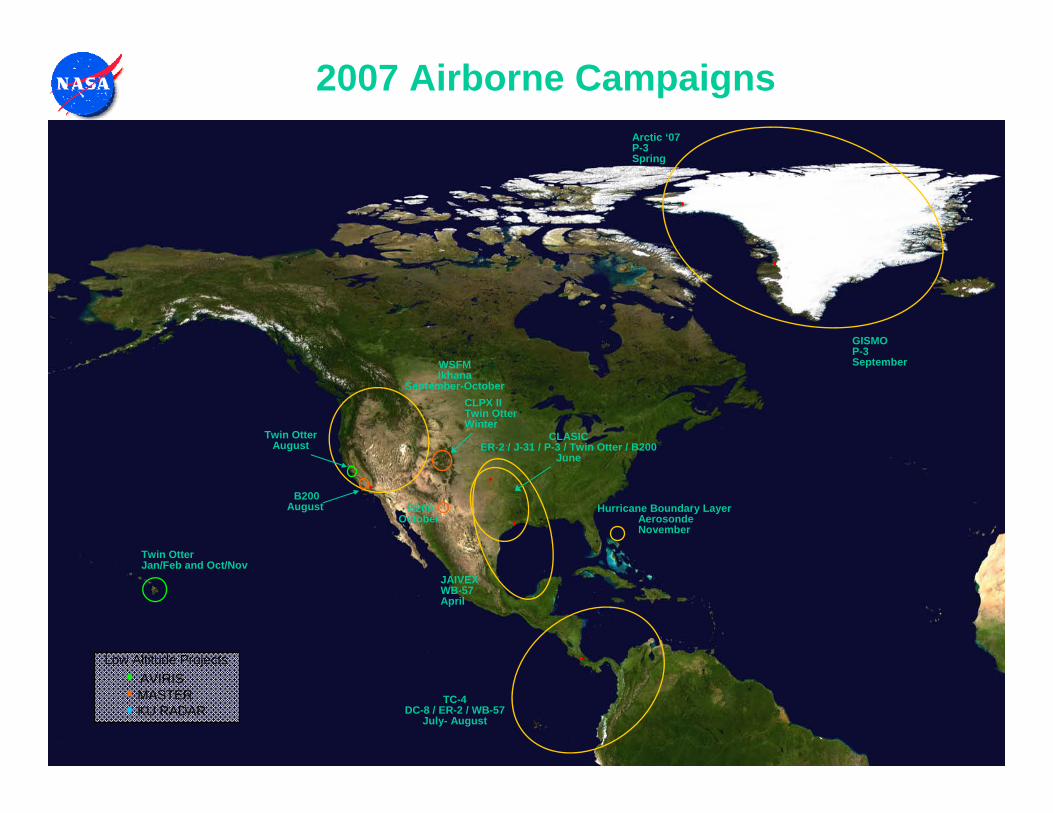
2007 Airborne Campaigns
JAIVEXWB-57April
Twin OtterJan/Feb and Oct/Nov
TC-4DC-8 / ER-2 / WB-57
July- August
•
•
•
WSFMIkhana
September-October
•
CLASICER-2 / J-31 / P-3 / Twin Otter / B200
June
B200August
Twin OtterAugust
Low Altitude ProjectsAVIRISMASTERKU RADAR
B200October
Hurricane Boundary LayerAerosondeNovember
GISMOP-3September
•
•
Arctic ‘07P-3Spring
CLPX IITwin OtterWinter
5/15/2008 Roberts 20
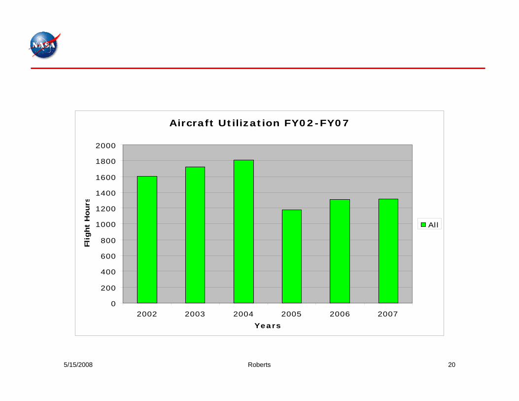
Aircraft Utilization FY02-FY07
0
200
400
600
800
1000
1200
1400
1600
1800
2000
2002 2003 2004 2005 2006 2007Years
Flig
ht
Hours
All
Flight hour statistics
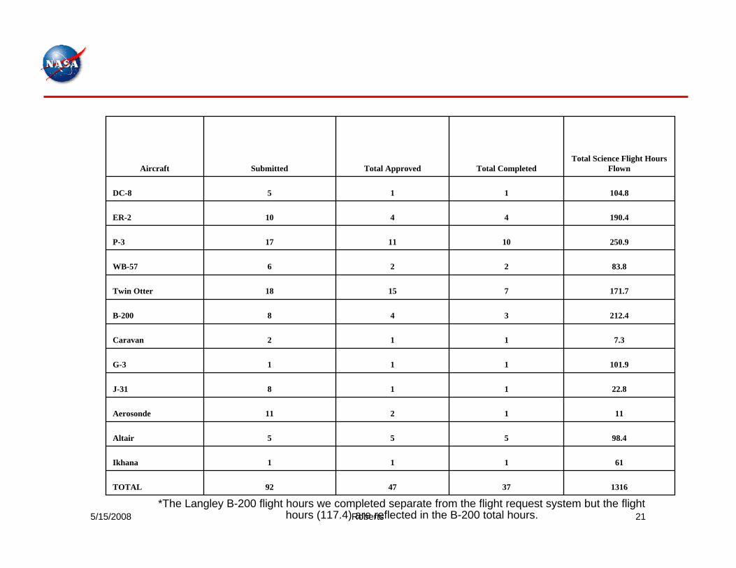
5/15/2008 Roberts 21
1316374792TOTAL
61111Ikhana
98.4555Altair
111211Aerosonde
22.8118J-31
101.9111G-3
7.3112Caravan
212.4348B-200
171.771518Twin Otter
83.8226WB-57
250.9101117P-3
190.44410ER-2
104.8115DC-8
Total Science Flight Hours FlownTotal CompletedTotal ApprovedSubmittedAircraft
*The Langley B-200 flight hours we completed separate from the flight request system but the flight hours (117.4) are reflected in the B-200 total hours.
Flight Request Summary FY2007
5/15/2008 Roberts 22
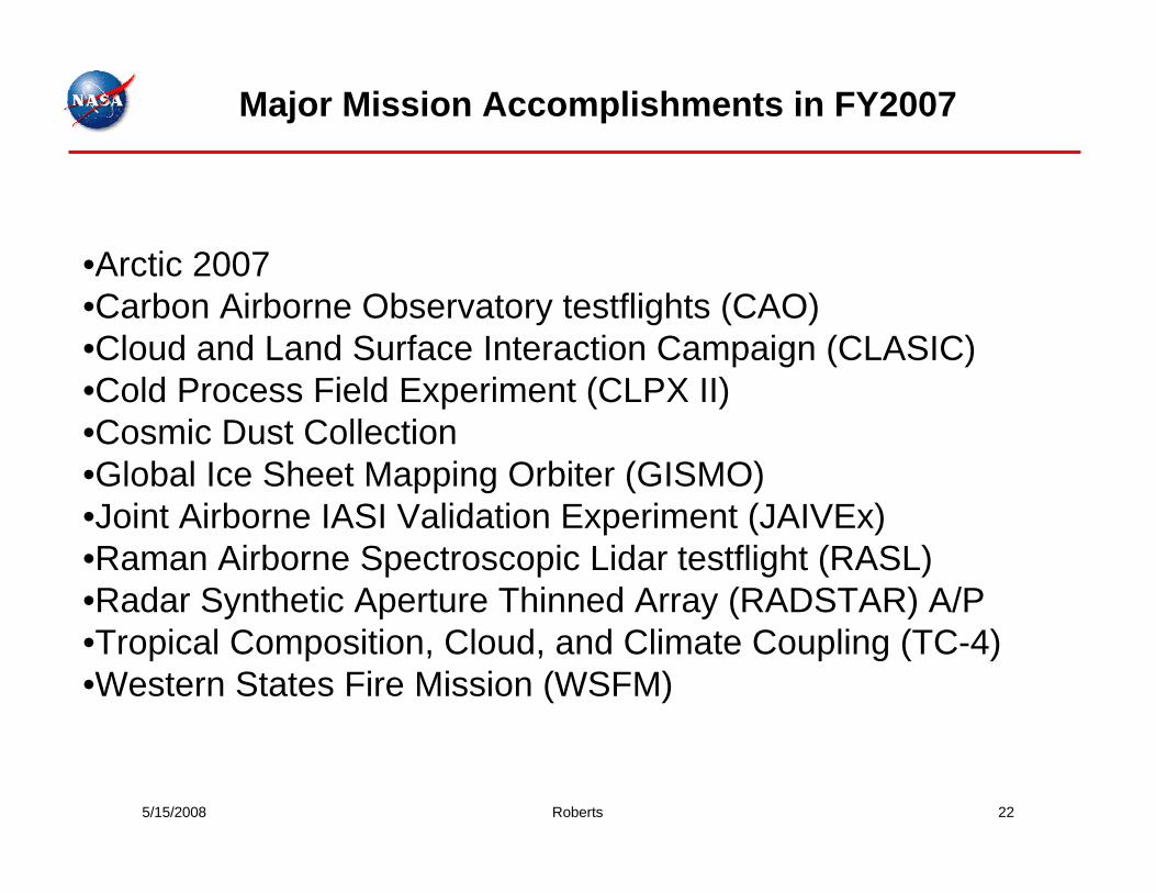
•Arctic 2007•Carbon Airborne Observatory testflights (CAO)•Cloud and Land Surface Interaction Campaign (CLASIC)•Cold Process Field Experiment (CLPX II)•Cosmic Dust Collection•Global Ice Sheet Mapping Orbiter (GISMO)•Joint Airborne IASI Validation Experiment (JAIVEx)•Raman Airborne Spectroscopic Lidar testflight (RASL) •Radar Synthetic Aperture Thinned Array (RADSTAR) A/P•Tropical Composition, Cloud, and Climate Coupling (TC-4)•Western States Fire Mission (WSFM)
Major Mission Accomplishments in FY2007
5/15/2008 Roberts 23
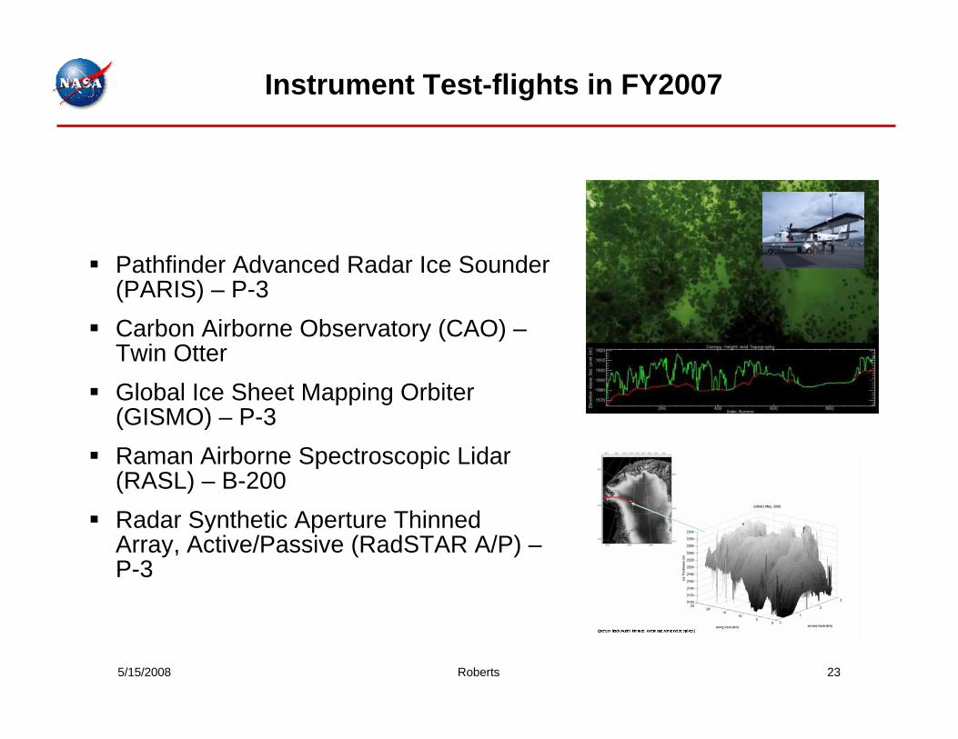
Pathfinder Advanced Radar Ice Sounder (PARIS) – P-3Carbon Airborne Observatory (CAO) –Twin OtterGlobal Ice Sheet Mapping Orbiter (GISMO) – P-3Raman Airborne Spectroscopic Lidar(RASL) – B-200Radar Synthetic Aperture Thinned Array, Active/Passive (RadSTAR A/P) –P-3
Instrument Test-flights in FY2007
5/15/2008 Roberts 24
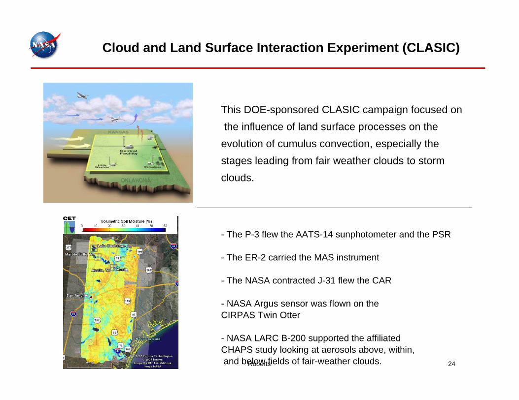
- The P-3 flew the AATS-14 sunphotometer and the PSR
- The ER-2 carried the MAS instrument
- The NASA contracted J-31 flew the CAR
- NASA Argus sensor was flown on the CIRPAS Twin Otter
- NASA LARC B-200 supported the affiliated CHAPS study looking at aerosols above, within,and below fields of fair-weather clouds.
This DOE-sponsored CLASIC campaign focused onthe influence of land surface processes on the
evolution of cumulus convection, especially the stages leading from fair weather clouds to storm clouds.
Cloud and Land Surface Interaction Experiment (CLASIC)
5/15/2008 Roberts 25
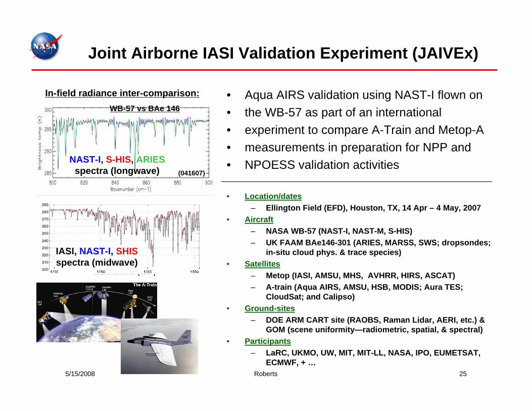
• Aqua AIRS validation using NAST-I flown on• the WB-57 as part of an international • experiment to compare A-Train and Metop-A • measurements in preparation for NPP and • NPOESS validation activities
• Location/dates– Ellington Field (EFD), Houston, TX, 14 Apr – 4 May, 2007
• Aircraft– NASA WB-57 (NAST-I, NAST-M, S-HIS)– UK FAAM BAe146-301 (ARIES, MARSS, SWS; dropsondes;
in-situ cloud phys. & trace species)• Satellites
– Metop (IASI, AMSU, MHS, AVHRR, HIRS, ASCAT)– A-train (Aqua AIRS, AMSU, HSB, MODIS; Aura TES;
CloudSat; and Calipso)• Ground-sites
– DOE ARM CART site (RAOBS, Raman Lidar, AERI, etc.) & GOM (scene uniformity—radiometric, spatial, & spectral)
• Participants– LaRC, UKMO, UW, MIT, MIT-LL, NASA, IPO, EUMETSAT,
ECMWF, + …
(041607)
NAST-I, S-HIS, ARIESspectra (longwave)
BT
(K)
Wavenumber (cm-1)
IASI, NAST-I, SHISspectra (midwave)
In-field radiance inter-comparison:WB-57 vs BAe 146
Joint Airborne IASI Validation Experiment (JAIVEx)
5/15/2008 Roberts 26
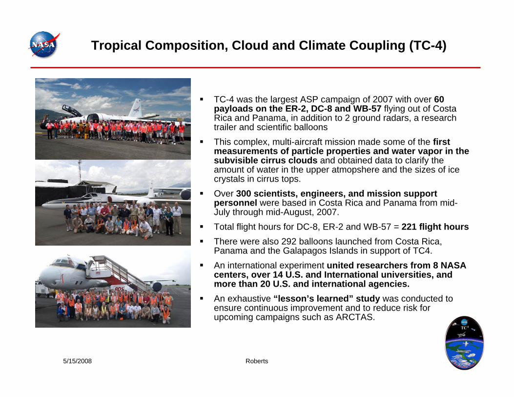
TC-4 was the largest ASP campaign of 2007 with over 60 payloads on the ER-2, DC-8 and WB-57 flying out of Costa Rica and Panama, in addition to 2 ground radars, a research trailer and scientific balloonsThis complex, multi-aircraft mission made some of the first measurements of particle properties and water vapor in the subvisible cirrus clouds and obtained data to clarify the amount of water in the upper atmopshere and the sizes of ice crystals in cirrus tops.Over 300 scientists, engineers, and mission support personnel were based in Costa Rica and Panama from mid-July through mid-August, 2007.Total flight hours for DC-8, ER-2 and WB-57 = 221 flight hoursThere were also 292 balloons launched from Costa Rica, Panama and the Galapagos Islands in support of TC4.An international experiment united researchers from 8 NASA centers, over 14 U.S. and International universities, and more than 20 U.S. and international agencies.An exhaustive “lesson’s learned” study was conducted to ensure continuous improvement and to reduce risk for upcoming campaigns such as ARCTAS.
Tropical Composition, Cloud and Climate Coupling (TC-4)
5/15/2008 Roberts 27
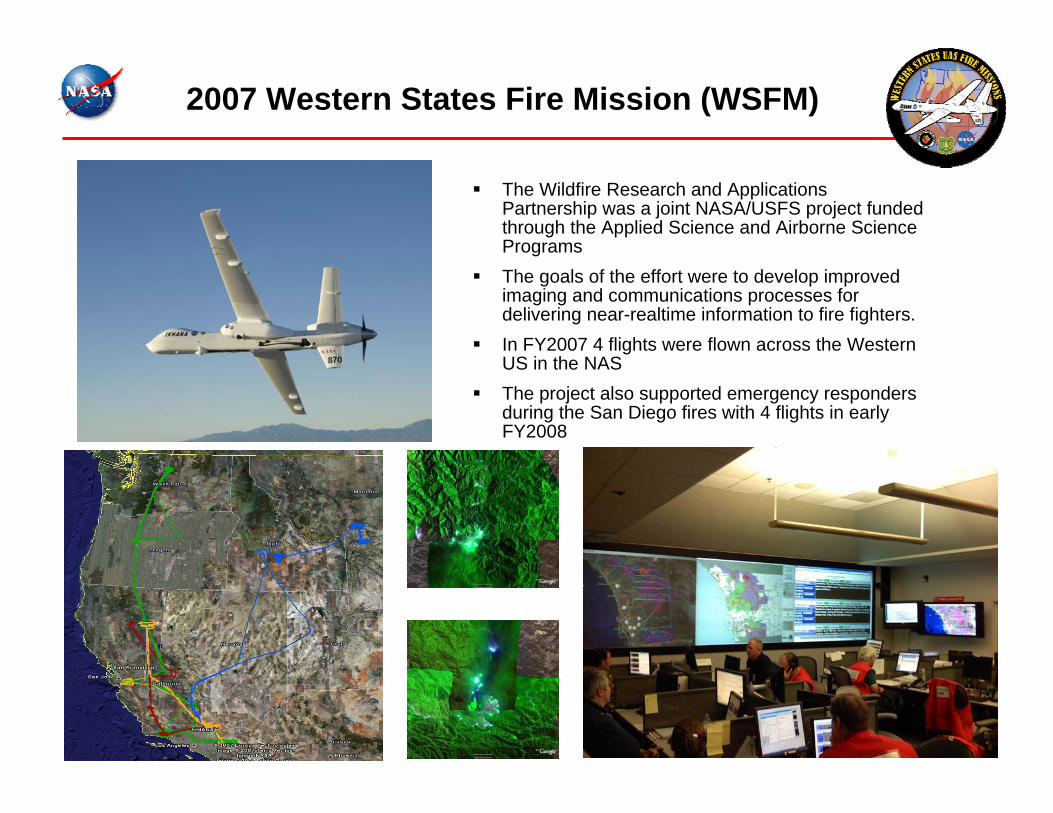
The Wildfire Research and Applications Partnership was a joint NASA/USFS project funded through the Applied Science and Airborne Science ProgramsThe goals of the effort were to develop improved imaging and communications processes for delivering near-realtime information to fire fighters.In FY2007 4 flights were flown across the Western US in the NASThe project also supported emergency responders during the San Diego fires with 4 flights in early FY2008
2007 Western States Fire Mission (WSFM)
5/15/2008 Roberts 28
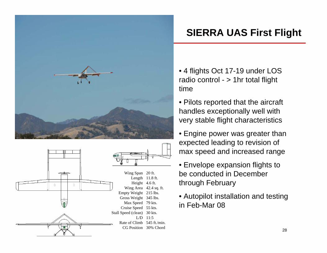
SIERRA UAS First Flight
• 4 flights Oct 17-19 under LOS radio control - > 1hr total flight time
• Pilots reported that the aircraft handles exceptionally well with very stable flight characteristics
• Engine power was greater than expected leading to revision of max speed and increased range
• Envelope expansion flights to be conducted in December through February
• Autopilot installation and testing in Feb-Mar 08
Wing SpanLengthHeight
Wing AreaEmpty WeightGross Weight
Max SpeedCruise Speed
Stall Speed (clean)L/D
Rate of ClimbCG Position
20 ft.11.8 ft.4.6 ft.42.4 sq. ft.215 lbs.345 lbs.79 kts.55 kts.30 kts.11:5545 ft./min.30% Chord
5/15/2008 Roberts 29
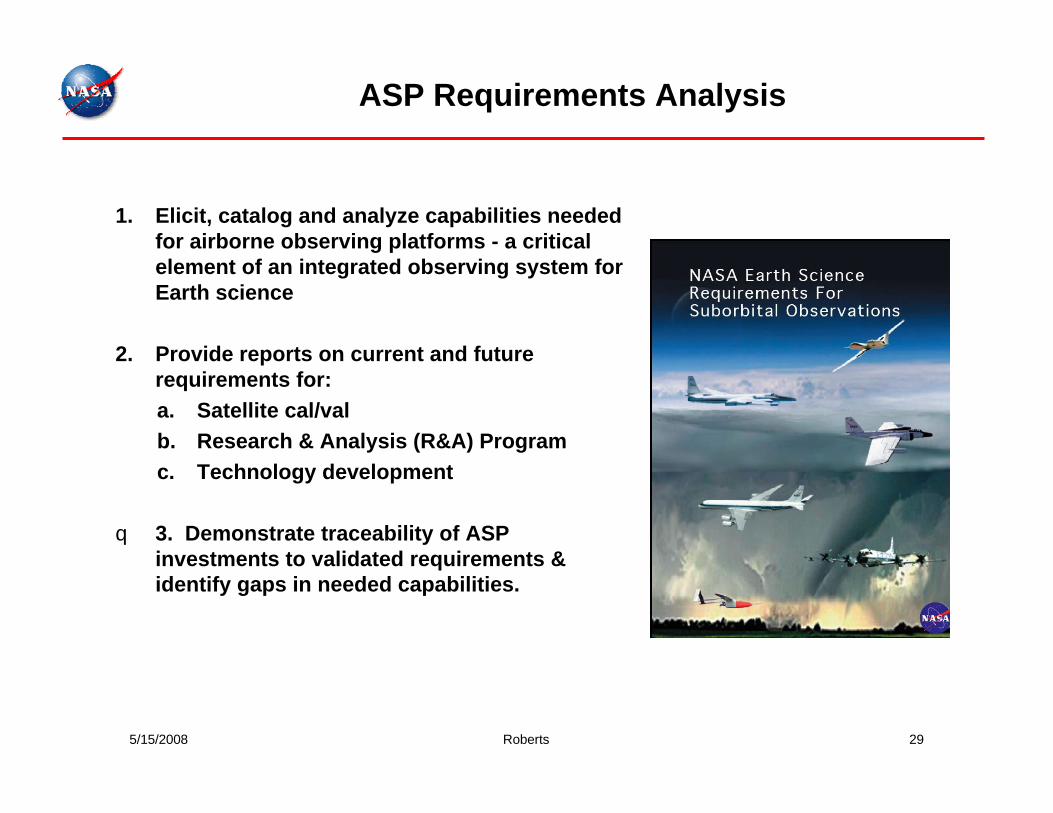
ASP Requirements Analysis
1. Elicit, catalog and analyze capabilities needed for airborne observing platforms - a critical element of an integrated observing system for Earth science
2. Provide reports on current and future requirements for: a. Satellite cal/valb. Research & Analysis (R&A) Programc. Technology development
q 3. Demonstrate traceability of ASP investments to validated requirements & identify gaps in needed capabilities.
5/15/2008 Roberts 30
Technology Working Group Roadmaps
Purpose: Assess the state of technologies required to provide airborne science capabilities based upon requirements analysis
Approach: Technology working groups consisting of SMEschartered to review capabilities, identify technology solutions and potential partners, and provide a development pathway to access the capability
Scope: No ASP resources expended; contributions from ARC, DFRC, GRC, WFF, and universities
Schedule: work began late 2006, roadmaps delivered Sept. 2007, proposals delivered Nov. 2007, review meeting Dec. 2007
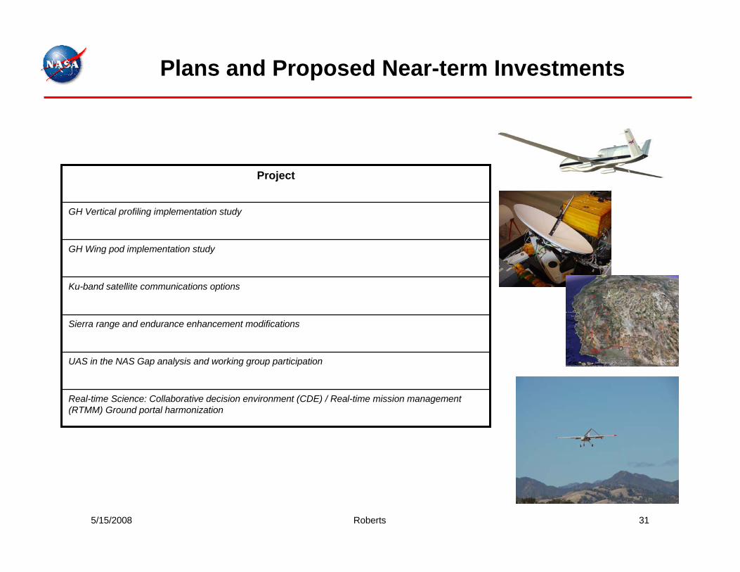
5/15/2008 Roberts 31
Plans and Proposed Near-term Investments
Real-time Science: Collaborative decision environment (CDE) / Real-time mission management (RTMM) Ground portal harmonization
UAS in the NAS Gap analysis and working group participation
Sierra range and endurance enhancement modifications
Ku-band satellite communications options
GH Wing pod implementation study
GH Vertical profiling implementation study
Project
5/15/2008 Roberts 32
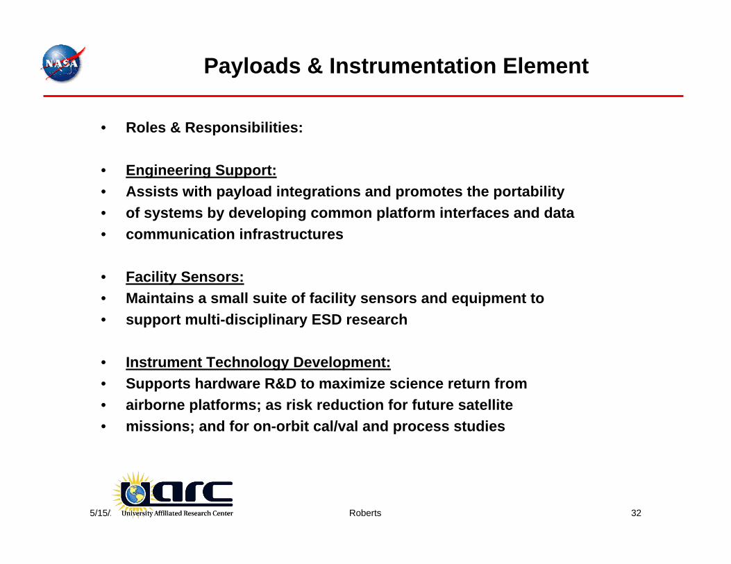
Payloads & Instrumentation Element
• Roles & Responsibilities:
• Engineering Support:• Assists with payload integrations and promotes the portability• of systems by developing common platform interfaces and data• communication infrastructures
• Facility Sensors:• Maintains a small suite of facility sensors and equipment to• support multi-disciplinary ESD research
• Instrument Technology Development:• Supports hardware R&D to maximize science return from• airborne platforms; as risk reduction for future satellite • missions; and for on-orbit cal/val and process studies
5/15/2008 Roberts 33
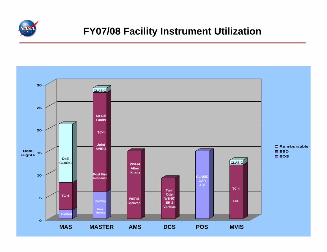
0
5
10
15
20
25
30
Data Flights
ReimbursableESDEOS
FY07/08 Facility Instrument Utilization
DoECLASIC
TC-4Cal/Val
NewMexico
So Cal Faults
TC-4
Joint AVIRIS
TwinOtter
WB-57ER-2
Various
CLASICCARJ-31
WSFMAltair
Ikhana
MAS MASTER DCS POSAMS
CLASIC
Cal/Val
Post FireResponse
WSFMCaravan
CLASIC
MVIS
TC-4
FCF
5/15/2008 Roberts 34
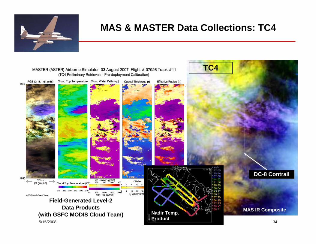
MAS & MASTER Data Collections: TC4
DC-8 Contrail
Field-Generated Level-2 Data Products
(with GSFC MODIS Cloud Team)MAS IR Composite
TC4
Nadir Temp. Product
5/15/2008 Roberts 35
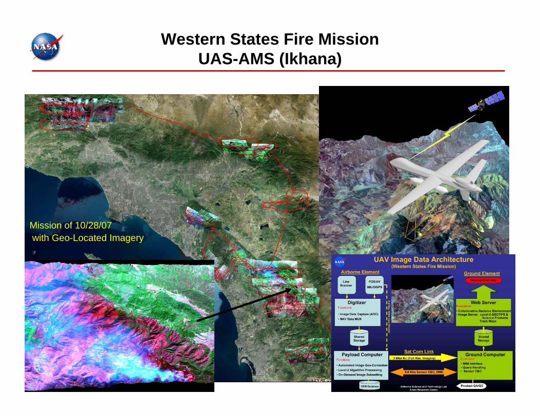
Western States Fire MissionUAS-AMS (Ikhana)
Mission of 10/28/07with Geo-Located Imagery
5/15/2008 Roberts 36
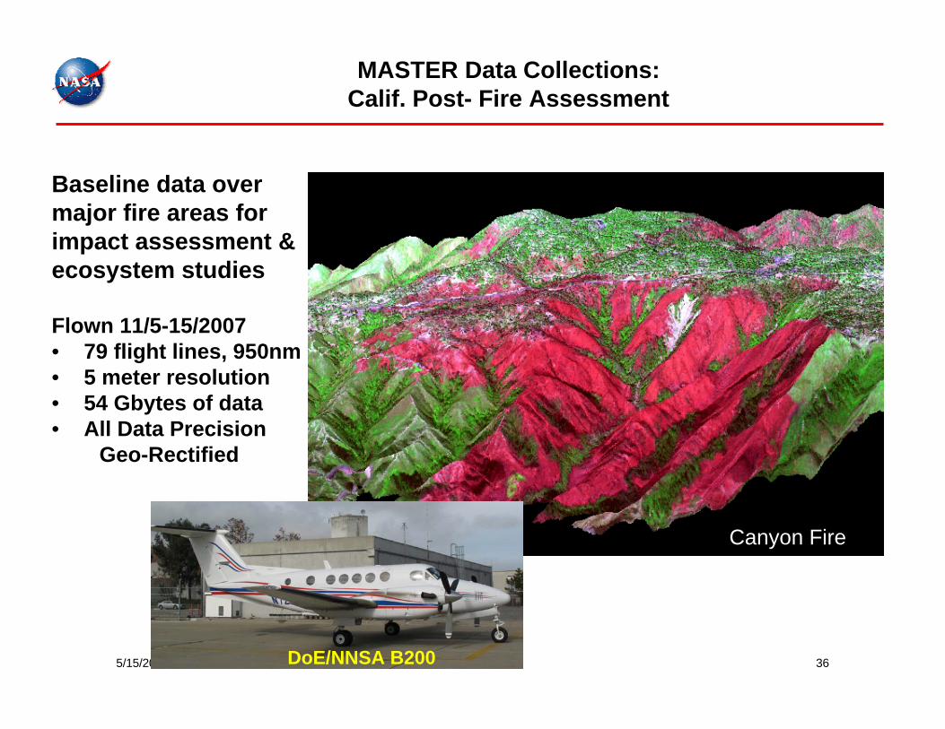
MASTER Data Collections: Calif. Post- Fire Assessment
Baseline data over major fire areas for impact assessment & ecosystem studies
Flown 11/5-15/2007• 79 flight lines, 950nm• 5 meter resolution • 54 Gbytes of data• All Data Precision
Geo-Rectified
DoE/NNSA B200
Canyon Fire
5/15/2008 Roberts 37
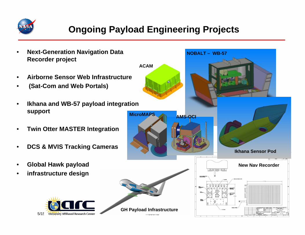
Ongoing Payload Engineering Projects
• Next-Generation Navigation Data Recorder project
• Airborne Sensor Web Infrastructure• (Sat-Com and Web Portals)
• Ikhana and WB-57 payload integration support
• Twin Otter MASTER Integration
• DCS & MVIS Tracking Cameras
• Global Hawk payload • infrastructure design
NOBALT – WB-57
New Nav Recorder
ACAM
MicroMAPS
GH Payload Infrastructure
Ikhana Sensor Pod
AMS-OCI