co-ops contribution to noaa’s · 3 center for operational oceanographic products and services...
TRANSCRIPT

1 U.S. Department of Commerce
National Oceanic and Atmospheric AdministrationNational Ocean Service
Center for Operational Oceanographic Products and Services
Center for Operational Oceanographic Products and Services
CO-OPS Contribution to NOAA’s Response to the 2005 Hurricane Season

2
As shown above, Dauphin Island, Alabama was devastated by Hurricane Katrina. The NOAA Dauphin Island tide gauge shown on the front cover continued to operate and provide critical real-time storm tide information throughout the hurricane.

3
Center for Operational Oceanographic Products and Services
CO-OPS Contribution to NOAA’s Response to the 2005 Hurricane Season
“Protecting Lives and Livelihoods”
NOAA’s Core Values
People, Integrity, Excellence, Teamwork, and IngenuityScience, Service and Stewardship
An informed society that uses a
comprehensive understanding
of the role of the oceans, coast,
and atmosphere in the global
ecosystem to make the best
social and economic decisions.
A Nation where everyone has
ready access to tide, current,
water level, and other coastal
oceanographic products and
services required for informed
decision-making.
CO-OPS’ VisionNOAA’s Vision

4 4
FOREWORD
NOAA plays a vital role during the hurricane season by compiling
satellite observations, meteorological and oceanographic data, and
numerical modeling results in order to provide critical information
to stakeholders; including citizens and federal, state, and local deci-
sion makers. Each hurricane season presents an increased challenge
for the National Oceanic and Atmospheric Administration (NOAA).
The 2005 hurricane season proved to be not only an extremely busy
season, but also a destructive one. Hurricane Katrina produced par-
ticularly large areas of devastation, overwhelming Federal, State, and
local agencies, as well as residents of the Gulf Coast.
The National Ocean Service (NOS) Center for Operational Oceano-
graphic Products and Services (CO-OPS) is one office that contrib-
utes to the NOAA effort by providing critical water level information.
During the 2005 hurricane season CO-OPS personnel played a key
role in providing real-time information on storm tide and in assisting
the ports and industries within the Gulf Coast region to resume their
operations as quickly as possible. Through their planning, observa-
tion, and response efforts, these dedicated folks gave far beyond what
is normally required to maintain high quality products and services.
This document is a tribute to those individuals and teams who played
a vital role in our preparation for and response to the hurricanes of the
season, especially Hurricanes Katrina, Rita, and Wilma. The 2005
season proved to be a challenge for many—from CO-OPS personnel
to Gulf Coast residents—all of whose lives were forever changed.
As time passes, the details of the 2005 season may become a distant
memory. So that we will always remember some of the extraordinary
efforts of those who “went the second mile”, we have highlighted the
experiences of these personnel during the unusually active 2005 sea-
son. This document is based on a series of interviews with those who
were involved in tracking storm tide, supporting hydrographic surveys,
and restoring vital services. Several other sources were used to pro-

5 5
vide historical perspective and information concerning the impact of the
hurricanes, particularly Katrina. These sources of information, combined
with personal interviews, tell the story of the energy, professionalism, and
dedication of those who contribute so much to NOAA’s success.
Thanks to all CO-OPS personnel for a job well done and for the
following employees for sharing their observations.
Chris Parish
William Popovich
Jason Standridge
Allison Stolz
Joe Taylor
Cary Wong
Darren Wright
Brad Wynn
Warren Krug
Mark Bushnell
Richard Edwing
David MacFarland
Mike O’Hargan
John Abbitt
Carl Cecere
Monica Cisternelli
Virginia Dentler
Mark Erickson
Lori Fenstermacher
Anthony Godette
Gerald Hovis
Rick James
Heidi Keller
Carolyn Lindley
Craig Martin
Sarah Mrozek
DirectorCenter for Operational Oceanographic Products & Services
6 6
INTRODUCTION
What a difference 105 years makes! If only Isaac Cline had had our present-day obser-
vation capabilities back in 1900, more than 6,000 (some say 8,000) Galveston residents
might not have perished in one of the deadliest storms in our nation’s history. Galves-
ton residents still refer to “the storm” when describing the weather event that devas-
tated Galveston Island on the evening of 8 September 1900. Cline, who was Chief of
the U.S. Weather Service Bureau in Galveston when “the storm” hit the Gulf Coast,
began to realize the danger during the same afternoon that the storm made landfall.
Higher than normal tides, dropping barometric pressures, and steady increases in wind
velocity were his only clues of the impending danger. However, by this time, there was
little opportunity for Galveston’s 37,000 residents to evacuate safely.
A center of commerce, Galveston’s highest ground in 1900 was only 8-9 feet above
sea level. There were no seawalls or levees to protect the city from the storm surge
produced by “the storm”, which was estimated at over 15 feet. Galveston’s population
had never experienced a hurricane (or tropical cyclone), and most residents were quite
secure without investments in such infrastructure, even though the idea had been dis-
cussed. After the horrific event, meteorologist Cline estimated that the wind reached
speeds of 120 miles-per-hour (mph) during “the storm”, and most now agree that winds
of 120-140 mph would have been required to produce that kind of extreme tide and
storm surge.
Since that time, hurricanes have continued to be the bane of coastal living. With our
burgeoning coastal populations, people are more vulnerable than ever to the whims of
nature – especially from early June through late November. Inland populations are also
vulnerable to damage from wind and flood. However, the risk of losing human lives
is mitigated by sophisticated and extensive observation tools that we now have at our
disposal. Today, the many instruments placed strategically along the coastal U.S. and
Great Lakes, provide data that serve as the backbone for our weather observations and
predictions, giving us the time to prepare for impending hurricanes—time that Isaac
Cline did not have.
We have been in a period of high hurricane activity since 1995. The 2005 hurricane
season was particularly active, with 28 named storms and 15 hurricanes (7 major ones).
Six hurricanes (Cindy, Dennis, Katrina, Ophelia, Rita, and Wilma) struck the U.S., but
Katrina was by far the most devastating. There were at least 1,300 casualties, with dam-
age estimates exceeding $80 billion. The NOAA National Hurricane Center (NHC)
forecasted that Katrina would hit the New Orleans/Gulf Coast area approximately 60
hours before the storm actually came ashore, and the predicted track was stunningly ac-

7 7
curate. Hurricane Katrina made her first landfall as a Category 1 hurricane on 25 August
2005 near Miami, Florida. A slow-moving storm, Katrina dumped about 16 inches of
rain on Florida, causing several deaths, flooding, and widespread power outages.
Katrina made her second landfall at Grand Isle, Louisiana, located in the southeastern
part of the state in Southern Plaquemines Parish, on 29 August 2005, with sustained
winds of 135-145 mph and gusts of over 165 mph. The huge storm ravaged a multi-state
area resulting in major damage to over 93,000 square miles in Louisiana, Mississippi,
and Alabama.
Less then a month later, the second Category 5 hurricane of the 2005 season began brew-
ing. Hurricane Rita began as the 18th tropical depression of the 2005 season, forming on
17 September east of Turks and Caicos Islands. Rita moved west, sideswiped the Florida
Keys, moved into the Gulf of Mexico, and on 24 September made landfall near the
Texas/Louisiana border at Sabine, Texas as a Category 3 hurricane. The storm brought
125-mph sustained winds and a 15-foot storm surge. Although Rita’s path tracked south-
west of where Katrina had been, the paths of the two expansive storms overlapped, hit-
ting some vulnerable areas twice. In the path of many storms lie the very instruments
that collect the oceanographic and meteorological data that form the basis of NOAA’s
products and services. The Gulf Coast region has 32 tide stations that are part of the
187-station National Water Level Observation Network (NWLON or the network). To
supplement these 32 tide stations, CO-OPS personnel added another 31 partner stations
to the network before Hurricane Rita to increase the number of water level sensors avail-
able to use during emergencies. Some were reactivated stations belonging to private and
public sector partners with whom CO-OPS interacts; other stations were relocated from
areas on the East Coast where projects had previously been completed.
In addition to producing the real-time data that the National Weather Service (NWS)
uses for forecasting, the network also helps to provide decision-support for marine trans-
portation, emergency response and evacuation. The users of these data products and
services that are derived from the network encompass the entire U.S. marine transporta-
tion system, including commercial vessel operators using U.S. ports, the fishing industry,
coastal zone managers, public and private sector hydrographic surveyors, recreational
mariners, and many others.
With the intensity of these storms, it is not surprising that CO-OPS’ extensive network
of tide stations, exposed to the harsh environment of the Gulf Coast, would be impacted
by the hurricanes’ wrath. Katrina completely destroyed four tide stations and a GPS tide

8 8
station buoy, and damaged another four stations. Rita destroyed two tide stations and
damaged four, one of which had already been damaged in Katrina.
All six hurricanes that affected the U.S. made a significant impact on both the users
of data and those who maintain that critical data stream. Users of CO-OPS data de-
pend on the products and services generated from these data, and those products and
services help to ensure safe navigation and economic growth and commerce. Those
who maintain the critical data stream that comprises the network are accustomed to
increased workloads during and after hurricane seasons. However, 2005 was a season
to remember for those who are part of the CO-OPS teams that made efforts far beyond
the normal duty requirements.
Let us take a closer look at the experiences of some of those who worked tirelessly
during the 2005 season to ensure that CO-OPS products and services were available.

9 9
Calcasieu Pass: Ground zero for Hurricane Rita

10 10
Their Stories
The chronicle of Hurricane Katrina’s impact on CO-OPS
personnel begins with the realization of the magnitude and
track of the storm and ends with restoration of tide stations
to their full functionality. First we’ll glimpse the Quick-
look Team, who facilitated storm tracking by providing
a Web page “Quicklook” at the storm status. Then we’ll
examine how the Hydrographic Planning Team provided
critical support to hydrographic survey teams so that ports
and harbors could re-open safely after the hurricanes.
We’ll go out to the field with personnel who repaired and
replaced instruments, as well as those who helped hurri-
cane survivors on a more personal level.
CO-OPS PERSONNEL AND STAKEHOLDERS
Bridges destroyed in Ocean Springs, Mississippi

11 11
All of them, whether as a team or individually, exem-
plify what it means to care deeply about the quality of
CO-OPS products and services, as well as those whose
lives have been disrupted by nature’s wrath. These
CO-OPS personnel, putting aside the “individual” in
favor of the “team”, remind us that the whole is
indeed often greater than the sum of its parts. They have
valuable insights and wisdom to share about their experi-
ences that serve as superb examples for coping with future
hurricane seasons.
Bridges destroyed in Ocean Springs, Mississippi

12
QUICKLOOK TEAM
Hurricane Isabel in September 2003 served as a catalyst for Bill Popovich to expand his
idea for a product that would bring together data from a variety of sources, offering users a
snapshot of any hurricane likely to hit the U.S. This product, Quicklook, was used for the
first time in the 2004 hurricane season and provides a storm alert Web page that coincides
with the six-hour NWS hurricane advisory cycle. It also integrates information from Na-
tional Environmental Satellite Data and Information Services (NESDIS) satellites, CO-
OPS water level gauges, and NWS data. In the busy 2005 season, Quicklook provided
storm tide analysis that helped the NWS, port managers, and others users of CO-OPS
data track storms around the clock, including Hurricanes Katrina, Rita and Wilma.
Popovich (an oceanographer) worked with Darren Wright (a meteorologist) to develop
requirements, and with the information services personnel to create the tools that provide
snapshots of a storm progression. During the 2005 season, Quicklook enabled the team
to offer up-to-the-minute storm tide analysis by providing an accurate survey of what was
happening at the gauges at the 12 long-term monitoring stations along the Gulf Coast.
Quicklook will eventually be integrated into the NOAA Storm Page, NOAA Watch, as a
one-stop shop for monitoring all hazards, including hurricanes.
The Quicklook team is a hybrid group—volunteers from the Datums and Hydrographic
Team—consisting of oceanographers Jerry Hovis, Virginia Dentler, Lori Fenstermacher,
Heidi Keller, Carolyn Lindley and Kathleen Fisher. The team tracks every hurricane that
the NHC predicts will come ashore, and begins posting Quicklook reports every six hours
around the clock approximately three days before storm makes landfall. Postings are
made at 0500, 1100, 1700, and 2300 each day. This 24/7 schedule demanded a particu-
larly intense commitment during the active 2005 season.
Aside from the technical skills and the time commitment required, the ability to function
effectively as a part of the team is an individual’s most important quality. Each team
member had the chance to develop leadership and technical skills by serving as the “team
leader” and performing detailed analysis work. Team members rotated the leadership
responsibilities, not only to provide everyone the opportunity to be a leader, but also as
insurance against “burnout”. The team is also responsible for interacting with others,
such as the NOAA Navigational Response Team, the Office of Coast Survey’s (OCS) Hy-
drographic Survey Team, CO-OPS Field Office and Information Systems Divisions.
In the 2005 hurricane season, the team experienced a 50% increase in their normal work-
load. “The 2004 hurricane season was challenging with the flurry of storms striking
Florida, and seemed like the ultimate storm tide workload. The 2005 season surprised us

13
all with both the volume and intensity of landfalling tropical cyclones. It definitely stretched the Quick-
look team to its maximum limits,” noted Popovich.
In addition to the toll of intense and heavy workloads, the team witnessed dramatic destruction of a va-
riety of instruments and even entire shorelines during the 2005 hurricane season. In fact, 5 of the 12 tide
stations on the Gulf Coast were either damaged or destroyed during Hurricane Katrina. As Quicklook
team member Lori Fenstermacher notes, “I had just been to New Orleans for the first time only months
before Katrina, and saw with my own eyes the city below sea level. It was hard not to imagine the same
streets I had walked on covered with battering waves, as I analyzed which stations were getting the greatest
impacts. It was disturbing to see water levels start rising when the hurricane was still hundreds of miles
from the coastline, practically in the middle of the Gulf! It was even more disturbing when we estimated
that Katrina’s landfall was forecasted during the high tide. Katrina hit during high tide, for even greater
impacts. And then we watched as the water still kept rising, hours after landfall, near the heart of New
Orleans, at East Bank, Louisiana.”
All told, the Quicklook team radiates a satisfaction that comes from knowing that they’ve put forth their
best efforts—they’ve mastered the software, fine-tuned their storm tide analysis skills, and have done their
best teamwork ensure that Quicklook reaches its full potential as a tool to assist in planning for extreme
events such as Hurricanes Katrina and Rita.
Quicklook team members (l-r) Jerry Hovis, Heidi
Keller, Lori Fenstermacher, Kathleen Fisher,
Virginia Dentler, and Carolyn Lindley.

14
HYDROGRAPHIC PLANNING TEAM
When CO-OPS refers to a “team”, it does not use the term lightly.
Effective teamwork is essential to CO-OPS’ success, and the Hydrographic Planning
Team (HPT) is a stunning example of how the right people make the sum of its parts
greater than its whole. The HPT supports the Field Operations Division (FOD), Office
of Coast Survey (OCS), and others, by laying the groundwork for them to perform their
own vital missions.
The oceanographers on the HPT—Cary Wong, Monica Cisternelli, Carolyn Lindley,
Craig Martin, and Allison Stolz—laid the foundation for OCS by supporting hydro-
graphic survey platforms through crucial planning and data application. CO-OPS
network of water level stations in the Gulf of Mexico were used to create areas of
similar tidal characteristics, or Discrete Tidal Zones. This tidal zoning uses water level
information derived from datum calculations to reduce bathymetric data to chart da-
tum (Mean Lower Low Water or MLLW). This tide corrected sounding data must be
provided for the areas of commerce that may have been affected by the storms, such as
obstructions blocking a channel for commercial traffic or even shoaling that occurred
as a result of the storm. Without this corrected data, ports could only be opened to a
certain depth; therefore, they could not accommodate the large container ships that are
so vital to the U.S. economy.
Team members make decisions based on many pieces of information that can change
rapidly, depending upon the storm track line, its intensity, and other factors. Knowing
which areas need correction, and prioritizing those areas properly require experience
and finesse are a major challenge under the best of conditions—not to mention the extra
burden created by these super storms of 2005. For example, there was a large influx of
information during Hurricane Katrina (sometimes every 10 minutes) that resulted in the
ever-changing priorities. The HPT made decisions about where people and equipment
would be needed based on this information. The accuracy of assumptions made by the
team depended greatly on staying on top of all this almost unmanageable volume of
information. Additionally, everyone on the team worked an average of 25% overtime
as a result of Katrina, Rita, and Wilma. During August and September 2005, the team
put aside their regular operations to support the demands the particularly active hur-
ricane season.
Much of the team’s effort goes to support other groups. For example, the HPT pro-
vides information to six National Response Teams (NRT) that are part of the Office
of Coast Survey, to the CO-OPS Field Office in Chesapeake, and to the NOAA vessels
THOMAS JEFFERSON and NANCY FOSTER, as well as the Time Charter (a vessel
operated by the contractor Science Applications International Corporation or SAIC).

15
Data quality is another big concern for the HPT. With the stress of shifting priorities, long hours, and
the number of platforms requiring critical information, the team members have developed specific qual-
ity control procedures for ensuring data accuracy. Each team member is responsible for checking the
calculations of other team members before the data are released. The HPT also takes pride in seam-
less communication with each other, which is an important factor not only in data quality but also for
resolving many issues before they become major problems.
When asked about their work during the 2005 hurricane events, the HPT members recall the chaotic
nature of the meetings and the different directions in which they were pulled both during and after the
storms. Says Cary Wong, who lead the HPT during Hurricane Katrina, “The thing that I remember
most about the hurricane response was how fast things developed. As I sat in the teleconference meet-
ings with the folks in the field and in the command centers or in transit to the affected area, our priority
areas changed by the minute based on need, logistics, infrastructure, personnel requirements and safety
issues.” The reason for the chaos is tied directly to the critical and basic role that the HPT plays in
promoting safe navigation. The ports within the Gulf Coast region could not re-open until the hydro-
graphic surveys (by OCS) were completed. Each group depends upon the efforts of others to ensure
that the NOAA mission is fulfilled. “It’s amazing the extra effort the Hydrographic Planning Team put
in when we knew the information we provided could help get basic necessities like food and water to
those impacted by Hurricane Katrina,” according to Craig Martin, who currently leads the team.
The HPT members agree that the word “no” is not in their vocabulary. They always find a way to
respond to the requests from the field. “In the end the Hydro Planning Team managed to provide all
the zoning required for each survey in a timely fashion and direct the CO-OPS and other field teams to
install or repair the critical water level gauges where they would have the most impact in support of the
hurricane response,” reflects Wong. Team members are also very aware that the entire mission does not
depend solely on them, but upon a large network of people. No one team, office, or agency can do the
job alone. Each person has his or her specific responsibilities that help to ensure the successful support
of the users of CO-OPS products and services.
Hydrographic Planning Team members (l-r) Cary Wong, Craig Martin, Allison Stolz, and Carolyn Lindley.

16
CO-OPS FIELD RESPONSE
The aftermath of the destruction left by Hurricanes Katrina and Rita required response
from a multitude of organizations—some to provide humanitarian aid, others to deal with
destroyed and damaged infrastructure. CO-OPS personnel who provided field response
had a significant amount of work waiting for them. Their primary objectives were to
perform reconnaissance and damage assessments of the network, support hydrographic
survey operations, and repair/replace equipment that was damaged or lost as a result of
the storms.
Personnel who regularly perform field work travel extensively to discharge those duties.
Some spend as much as four months (or even more) out of the year performing mainte-
nance, repairs, and other tasks associated with the network of 187 National Water Level
Observation Network (NWLON) stations around the U.S. coastal and Great Lake areas.
The extensive travel requirements of field response personnel alone make their jobs chal-
lenging even under normal circumstances; however, when you factor in the lack of basic
amenities—such as reasonable hotel accommodations, electrical power, the availability of
food and water, and the ability to purchase any equipment or components required—you
begin to imagine how difficult this was for personnel who deployed into the Gulf Coast
region.
Nine personnel based at the Chesapeake, Virginia facility deployed to the Gulf Coast after
Hurricanes Katrina and Rita. Eight of those performed work on various tide stations in
the region, and one was part of the Federal Disaster Volunteer Program. Others worked
hard to support field personnel by ensuring that they had the proper equipment to perform
their field tasks.
These personnel, sometimes working alone, but often times functioning as a team, were
challenged during their deployment to the region in ways not generally encountered. One
of the first dilemmas was obvious before they even left Chesapeake: what supplies would
be needed? They had no way to know for sure what kinds of repairs or replacements
would be required until a damage assessment was performed. They knew which stations
had ceased transmitting data, but did not know why, or whether those stations would have
to be replaced or repaired, or what kind of repairs would be necessary.
Once in the Gulf Coast, teams were pulled in a multitude of directions. Calls were con-
stantly flowing in from the wide geographic area that had been devastated by both Katrina
and Rita. The large volume of requests from long distances away made the prioritizing of
projects difficult. “Where do we go next?” was a question often asked by field response
personnel. “Where is the greatest need?” was the next question, the answer to which was
not immediately apparent.
Transporting and storing equipment at secure sites were also common obstacles that had to

17
be overcome. Security was an issue both for equipment
storage and for personal concern. In some areas like
Waveland, Mississippi, there were simply no physical
structures left for secure storage. Personnel found some
pretty creative ways of working around these impedi-
ments—from packing everything into a sport utility
vehicle for long commutes to working with the crew
of the NOAA Ship THOMAS JEFFERSON to secure
equipment.
Personnel faced many other challenges in their
efforts to repair and replace tide stations, but one of
the largest was the sheer distance between the jobs. Be-
cause of these long commutes from lodging to the work
sites, completion of repairs or replacements took much
longer than they ordinarily would have. Pensacola,
Florida was one of the closest areas where reliable food and lodging were available, but it was not
particularly close to any of the damaged and/or destroyed tide stations. Commuting time from Pen-
sacola to Gulfport was approximately two hours each way.
Several common themes emerged as CO-OPS personnel told their individual and collective stories.
They revealed strikingly similar observations about the whole experience—how the lack of things
that most of us take for granted made their jobs more difficult and time-consuming. Some of the
lodging lacked what most of us consider essential—hot, running water; food; cleanliness; adequate
equipment and supplies to ensure quality work; telephones; e-mail; and personal security. None of
these “necessities” were guaranteed, or even likely to be available, especially in the first few weeks
after Katrina and Rita hit.
Personnel overcame several daunting obstacles to successfully perform their mission. Their efforts
were enhanced by the cooperation of many individuals and agencies, but none was mentioned more
often than Tim Osborn. Tim, a navigation manager for Gulf of Mexico Region, and his family
opened their home to field personnel, not only providing a safe place to stay, but also as “logistics
managers” of sorts—arranging for rental cars, transportation to/from the airport, and helping CO-
OPS field response personnel find lodging as close as possible to various work sites. Those who
performed many of the field operations expressed sincere gratitude to Tim for his dedication and
commitment.
Personnel traveled to the Gulf Coast region in a variety of ways: by air, by water, and by highway.
Some traveled alone; others went in pairs. None had ever experienced such devastation, and all were
touched in some way by the toll that Katrina and Rita took on the residents of the Gulf Coast. Their
stories offer a glimpse of how planning and perseverance helped them cope with this devastation.
This NOAA helicopter greatly assisted CO-OPS person-nel in performing damage assessments along the Gulf
Coast after Hurricane Katrina.

18
CO-OPS FIELD RESPONSE: PERSONAL STORIES
Warren Krug
When talking with Warren Krug, you get a sense that all of the work during the
2005 hurricane season was business as usual. “We have routine conference calls
with CO-OPS headquarters to discuss the status of instruments in the field,” says
Krug. In addition to the constant monitoring, personnel perform a communication
analysis before every hurricane season to ensure that equipment is working properly,
and they almost always find things that must be replaced or repaired. As each storm
approaches landfall, the frequency of conference calls increases. Communication
within the entire CO-OPS organization, as well as with other agencies, is critical for
every organizational function, whether it is a Category 5 hurricane bearing down on
the coast or routine maintenance to ensure that instruments are transmitting data
properly.
According to Krug, a weekly operations meeting is held to discuss each station,
especially those that may need maintenance. One of the challenges the team faced
after Hurricane Katrina was that, because they were (and are) in the process of
upgrading the network with equipment that can transmit larger amounts of data,
there were three or four different systems to support – many with very different parts.
After the storm, there were daily calls to assess the network and make decisions about
how to respond, identifying specific equipment and components for each response.
Everyone’s first priority was to ensure that all the ports and harbors were open to
navigation. Krug cited his contact with Texas A & M, a NOAA partner who plays an
important role in the Houston/Galveston PORTS® network . Krug sent equipment to
help ensure that PORTS® was up and running. They did lose some phone lines, but
otherwise fared well in Houston.
Some stations, like Morgan City, Louisiana, simply had no electrical power, so Krug
and those supporting field personnel ensured that generators were shipped to that
area. In some cases, auxiliary tanks were required to keep the generators running for
longer periods of time.
The logistics required to ensure that instruments are on the shelf, in good working
order, with the most up-to-date software installed, are pretty extensive. According

19
to Krug, the whole culture is one of not entertaining failure. “On Saturday morning
(the day after Katrina hit) there were ten people in the warehouse preparing equipment
to be shipped to the Gulf Coast. Nobody asked anyone to be there – they just came
because they don’t like to fail. We do this all the time.”
Krug clearly articulates that everyone inherently understands that how they do their
job affects others both inside and outside of CO-OPS. “NRT (National Response
Teams) couldn’t do their surveys unless we did our job. Everybody did what they were
supposed to do.”
The CO-OPS field party approaches a National Guard checkpoint, their vehicle loaded with instruments that have been carefully inspected, calibrated, and packed for transport to the field.

20
LT Sarah Mrozek and Mark Erickson
Hydrographic Survey Coordinator LT Sarah Mrozek and environmental technician Mark
Erickson were among the first to leave for the Gulf Coast, departing from Norfolk, Virginia
aboard the NOAA Ship THOMAS JEFFERSON on Saturday, 3 September, arriving on
Friday, 9 September in Pascagoula, Mississippi. The lack of communications coming out
of the Gulf Coast immediately after the hurricane created uncertainty about the conditions
there. Field response personnel were concerned about the rumors of “martial law”, and
that concern was a major factor in the decision to travel by sea. Mrozek and Erickson were
initially tasked to support emergency hydrographic survey operations. The crew of NOAA
Ship THOMAS JEFFERSON provided assistance in the field, as well as other important
logistical support, such as land transportation.
Their first critical mission was the installation of two tide stations: one in Gulfport and the
other in Pascagoula, both of which were totally destroyed by Hurricane Katrina. The logis-
tical challenges were numerous. In order to get to the shore from the ship, Mrozek and Er-
ickson spent 1.5 hours traveling on a small boat (similar to a Zodiac) each way. Transporting
the equipment necessary for these station installations was not particularly easy. However,
in some ways it was easier than being constantly surrounded by
Mrozek, Erickson, and crew from NOAA ship THOMAS JEFFERSON work to restore the station at Pascagoula
21
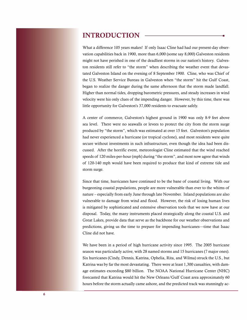
I felt like I was just one member of a team
who was just there doing my job ...
Mark Erickson
total destruction. Both Gulfport and Pascagoula communities and their infrastructure were
essentially destroyed. Often the lone pilings were the only clues that remained where a pier
had once stood.
After performing the installations in Gulfport and Pascagoula, Mrozek and Erickson de-
tached from NOAA Ship THOMAS JEFFERSON and stayed in Pensacola, where they
formed another CO-OPS team with Brad Wynn, Anthony Godette and Jason Standridge.
Their next mission was to support the hydrographic survey team by completing repairs and
surveys in Gulfport, Mississippi. This involved a two-hour commute (one way) from Pen-
sacola to Gulfport. Mrozek, reflecting on the trip, says, “Though the commutes and travel
made long days longer, we were fortunate to have a place to stay. Many people had lost their
homes, their cars and their lives.”
The lack of lodging made the commute a necessary, albeit an energy-draining evil. It wasn’t
always so much about the commute itself as it was the unpredictability of it all. Because
many bridges were closed or destroyed, Mrozek and others often had to find alternate routes
to worksites.
After installations at Gulfport, the team proceeded to Biloxi, Mississippi, Dauphin Island,
Alabama, and Port Fourchon, Louisiana for more repair and survey work. Although
Mrozek and Erickson performed their work under more challenging conditions than usual,
they found that this made them pull together even more. “I felt like I was just one member
of a team who was just there doing my job and helping out as much as we could,” says Er-
ickson. They journeyed home on 19 September out of Lafayette Louisiana.

22
Brad Wynn
Brad Wynn, an engineering technician with the Chesapeake Facility, departed on 8 September
to perform a damage assessment of the Gulf Coast water level measuring stations. His task was
to investigate the condition of each station, and to determine the reliability of the data being
received from the surviving stations.
Of his 16 days in the region, Wynn spent the first week on NOAA’s Bell 212 helicopter perform-
ing low-level aerial reconnaissance along 300 miles of coastline—from the coast of Pensacola,
west to Baton Rouge, and south through the Mississippi Delta to Grand Isle, Louisiana. The
helicopter was operated by NOAA’s Marine and Aviation Operations - Aircraft Operations Cen-
ter and arranged for by Richard Edwing at CO-OPS Headquarters. Its use enabled Wynn to
visit nine stations—assessing damage, prioritizing station repairs, and determining the resources
needed to initiate those repairs.
Aboard the NOAA helicopter, Wynn also captured over 20 hours of video, which documents
the aftermath of the storm that destroyed fishing fleets in Alabama, quiet vacation communities
along the Mississippi coast, major gambling and entertainment industries in Biloxi, commerce
and industry in New Orleans, and petrochemical industries in the Mississippi Delta. He has
compiled and edited the video into a documentary of the Gulf Coast devastation.
After his reconnaissance of the coast, Wynn joined other field response personnel dispatched
to the area—Anthony Godette and Jason Standridge in the Mississippi Delta, and then Sarah
Mrozek and Mark Erickson from the NOAA Ship THOMAS JEFFERSON in Pascagoula. Af-
ter responding to separate emergency needs the previous week, the individual teams came to-
gether to address the remaining issues. Wynn served as the team point of contact and worked
with them (based on the coastal reconnaissance and other available information) to formulate
a comprehensive plan to repair or replace the remaining stations in the region. Wynn observes
that, although the teams were exhausted and still faced formidable challenges, joining resources
provided a much needed morale boost that raised everyone’s spirits. Working in desolate areas
that were devoid of inhabitants had taken its toll. The beaches were eerily silent, and there was
an uncomfortable stillness amid the vast destruction. Working together proved to be productive
and beneficial for all.
Another issue that had an overreaching impact on the team’s mission was the coinciding launch
of the CO-OPS Indefinite Delivery Indefinite Quantity (IDIQ) Environmental Field Services
contract. Negotiations had been in progress for over a year; the contract was within days of being
awarded when Katrina hit. The fact that an unknown number of stations had been damaged or
destroyed greatly increased the scope and urgency of the post-hurricane response. Getting sta-
tions operational was paramount; therefore, there was significant pressure on the team to quickly
document the stations, identify problems, and find creative solutions. Contract modifications
had to be considered and requirement changes written—all of which affected the team’s daily
movements and activities. The NWLON stations along the Florida and Gulf Coast were among

23
the first task orders awarded
under this new contract.
At the end of his trip, Wynn
reflected on the human side
of the disaster and volun-
teered to spend a couple of
days as a relief worker assist-
ing storm victims. He worked
with Operation Blessing pre-
paring and distributing meals
at a temporary relief center in
Slidell, Louisiana. After an intense two weeks focused on technical and logistical challenges, he felt
compelled to connect to the people upon whom the storm had inflicted such great damage.
“The scale of human suffering was enormous and the need was great. Although the details were
unique, the same story was repeated often. Families from all walks of life were displaced and living
in cars. Many had lost loved ones. Most were confused and uncertain. All were overwhelmed and
worn out,” Wynn reflects.
As basic services and utilities were slowly being restored, the realities for the victims began to settle
in. Stores were opening, but many victims had no money. Personal and financial records were gone.
Homes were destroyed and their workplaces no longer existed. Even prescriptions could not be filled,
as medical records had been destroyed along with pharmacies and doctors’ offices. Recovery would
be a slow, difficult process.
Contrary to the negative news centered on New Orleans during the weeks following the storm, Wynn
observed an exceptional (yet under reported) response by dedicated relief workers and volunteers who
had come from all over the nation. He assumed that working as a volunteer would allow him to slow
down and process the experience before departing the area. This could not have been further from
the truth. The volunteers worked tirelessly around the clock. They cheerfully pushed on despite op-
pressive heat, humidity and austere accommodations. They were there because they cared, and they
made a significant difference in a way that no government program could ever do.
Wynn notes, “When you go into an area after a hurricane, the expectations are tied to your
frame of reference. My past experience with post-hurricane assessment was that the sig-
nificant or extraordinary damage was limited to small pockets within specific geographic ar-
eas. This storm was different. I was amazed at the sheer magnitude of the storm, and aston-
ished at the path of destruction it left behind”. There’s really no way to capture the extent;
however, Wynn’s video footage shows what the written word cannot. He headed home on
24 September.
I was amazed at the sheer magnitude of the storm ...
Brad Wynn

24
Sarah Mrozek, Joe Taylor, and John Abbitt
John Abbitt, a field technician from the Chesapeake Facility, and Mrozek returned to the
area at the end of October to perform reconnaissance work at New Canal (New Orleans),
Bay Waveland, Mississippi, and the Atchafalaya River Basin, in Louisiana. These areas,
already damaged by Hurricane Katrina, had also sustained damage from Hurricane Rita.
The work at New Canal required a full installation of new tide stations and was a high
priority. The Army Corps of Engineers had requested this installation to support their
work rebuilding the levees. Bay Waveland, a 1.5-hour commute (from New Orleans) was
generally destroyed. Abbitt and Mrozek note that the area was laden with debris – every
bridge and house was gone, and there were clothes strewn in the trees that were left. They
installed a tide gauge and surveyed during their visit to this forlorn place.
Part of Louisiana’s charm centers around the large network of islands, bridges, and wet-
lands. While somewhat isolated even before the storm, many areas were almost impossi-
ble to access afterward because of the destruction of so many bridges. Abbitt describes the
challenge of getting to the Louisiana Wildlife Management Area (LWMA) headquarters
in the Atchafalaya Delta, where he and others needed to travel to perform the necessary
survey and/or repairs. The wildlife management personnel kindly provided rides from the
I was just glad to do my part in getting the Gulf Coast up and running.
Joe Taylor

25
Berwick Boat Ramp, located at the end of the Atchafalaya River. They would then launch
a small boat from the boat ramp to travel to the wildlife management area, located about
19 miles south of Morgan City, Louisiana.
During November, Abbitt and Mrozek again traveled to the Gulf Coast to install gauges
for New Canal, Bay Waveland, and LWMA—this time joined by Joe Taylor, a field tech-
nician from the Chesapeake facility. They noted that, although the building supplies were
still scarce in the Gulf Coast region, the availability of food and lodging became easier
than it had been in September. Abbitt stayed in New Orleans, which was close to his
work, during this time, and departed just before Thanksgiving.
In the end, those from the CO-OPS Chesapeake facility who responded to the disaster
expressed many of the same thoughts about their post-hurricane experience. Mrozek’s
comment was representative of those thoughts. “The sense of teamwork and selflessness
that came about post-Katrina will always stand out in my mind; the personnel from my of-
fice 1,000 miles away, the NOAA Pascagoula Lab, the NOAA Ships and, of course, from
the hotels and restaurants across the Gulf Coast. Each group was being pulled in every
direction and yet was so kind and willing to assist us”.
The sense of teamwork and selflessness that came about post-Katrina will always stand out in my mind ...
Sarah Mrozek

26
Anthony Godette and Jason Standridge
Godette and Standridge both electronics technicians, left the Chesapeake Facility for Lafay-
ette, Louisiana on 10 September. Their mission was to repair or replace tide gauges at Port
Fourchon, Grand Isle, Gulf Shores, Louisiana, and Pascagoula, Mississippi. Generally,
their work needed to be completed before the hydrographic survey personnel arrived.
As they packed equipment in preparation for the trip, Godette remembers the challenges
involved with packing – not knowing exactly what the requirements would be – and knowing
that, once they arrived, they may not be able to locate a forgotten item, given the destruction
they knew awaited them. They prepared for every scenario that they could anticipate and,
looking back on their trip, were pleased with their preparations.
Upon arrival, the first stop was Port Fourchon, Louisiana. For the first three days of their
stay, they had very unusual accommodations—they bunked at the local jail. Because this
was so soon after Hurricane Katrina, there was literally no place else to stay, so Tim Osborn
had arranged for them to stay at the Port Fourchon jail. The good news was that they did
not have to share the cells with anyone else. The tide gauge at the Port Fourchon station
had been ripped out of the bracket, so Godette and Standridge replaced the gauge and it was
operational the same day.
Godette and Standridge were complimentary of the accommodations and hospitality of-
fered by Port Fourchon law enforcement personnel. According to Godette, the cells were
clean and there were showers available. The biggest inconvenience was travel time (more
than one hour) required to obtain food. However, the hospitality also included an escort to
the next stop, Grand Isle. There were extreme safety concerns at this point, so this courtesy
was much appreciated. It took two days to perform the necessary work at Grand Isle, where
they rebuilt the housing for that gauge, put a blue tarp on it, repaired the gauge, replaced the
solar panels, and reinforced the roof with plywood.
For the next two days, Godette and Standridge joined Sarah Mrozek and Mark Erickson to
visit the tide station at Dauphin Island, Alabama, so they moved out of the jail and went to
Pensacola. The water levels here had been extremely high, and the team wanted to ensure
that everything was still intact. Even though the station was still returning data, there was
no precise way to know if there was damage, so the team decided it was wise to conduct
reconnaissance. They replaced the battery, not realizing that nature had more excitement
(Hurricane Rita) in store for Dauphin Island.
The following day the team headed to Gulfport, Mississippi to replace water level gauge.
This area was the west side of the storm and sustained catastrophic damage. Godette recalls
seeing the church steeple and the four outside walls left standing, with everything inside
washed away. The aquarium was also destroyed; however, the dolphins swam close by, and
people would come out to feed them.

27
The next two days were spent checking levels in Gulfport and Pascagoula. After follow-up work at these
locations, Godette and Standridge returned home on 19 September.
Godette made two additional trips on 3-10 December and 21-24 January. During December, he repaired
three gauges on the New Orleans Canal, repaired a gauge on Big Island. At New Canal, Anthony re-
paired the program on the Xpert 9210, which was not transmitting properly and arranged for a contractor
to repair the Dauphin Island station before departing on 10 December.
The next trip Godette revisited Dauphin Island, replacing the Vitel with an Xpert 9210 and making sure that
the gauges were transmitting properly. This area had sustained extensive damage in a storm before Hurri-
cane Katrina, and the area was covered with sand approximately three feet deep. The solar panels on the
primary gauge were destroyed, and the platform was knocked 30 feet off the water. He returned home on
24 January 2006.
Anthony Godette points to the I-95 bridge, connecting Biloxi to Ocean Springs Mississippi, which was destroyed by Hurricane Katrina.

28
Rick James and John Abbitt
Rick James and John Abbitt departed from Chesapeake on 26 September, the Monday after
Hurricane Rita made landfall. Upon arrival, they were fortunate for the hospitality of Tim
Osborn and his family, where they stayed for several days. Osborn also helped set them up
with a rental car and supplies needed for their journey.
James and Abbitt performed various tasks in the area—driving 2,000 miles during their ten-
day deployment— from Gulfport, Lake Charles /Calcasieu Pass, and New Iberia, Louisiana
to Dauphin Island, Alabama. At Lake Charles, they performed their first installation—a
temporary water level station to replace the original station, which was completely destroyed.
They noticed a strong U.S. Coast Guard presence at Lake Charles, and made it a point to chat
with them. James and Abbitt learned that the unit was out of Miami, Florida.
“I have to give the U.S. Coast Guard a big thank-you for helping us complete our mission,”
says James. The Coast Guard, there to secure and protect the harbor at Lake Charles, agreed
to transport James and Abbitt up Lake Charles to reach Calcasieu Pass, which was ground
zero for Hurricane Rita. The Coast Guard had small inflatable launches that were ideal for
the 25-mile trip to transport them to the tide station.
Upon arrival, they found that the concrete pier containing the well was heavily damaged.
Because a large section of the pier near the shoreline was missing, James and Abbitt found
that they could not perform the leveling from the well to the benchmarks. Here is where the
creativity and “can do” teamwork makes all the difference. “We were all looking at the size
of the opening that was missing and thought the boat would just fit in between the two sec-
tions. So the captain of the small boat very carefully steered the boat between the opening in
the pier, avoiding the rocks on shore. With the boat tied up in between the missing section,
we were able to cross over from one side to the other on the roof of the boat,” recalls James.
Once they inspected the damage, they found that the gauge shelter and stand were destroyed,
Damaged pier at Calcasieu Pass

29
as well as the mast for the wind bird. Part of the AquaTrak well remained, so they replaced the
top section of the well that had been destroyed, reusing what remained. They installed a new
shelter with gauges and surveyed the well.
Their original plan had been to install the two stations at Lake Charles and Calcasieu Pass. After
completing this work, they also visited six additional stations where they identified equipment
that they needed but didn’t have. These stations were located at Morgan City (St. Mary Parish),
Tesoro Marine, and LeBranche Bayou, which was the only one that survived Hurricane Katrina.
At LeBranche Bayou, the only repair required was changing the batteries in the inside box. Even
though water had infiltrated the box, the data collection platform had an abundance of histori-
cal data, which they were able to download. This data was later used to assess the extent of the
storm tide in Lake Pontchartrain in connection with the U.S. Army Corps of Engineers’ study
of the New Orleans levees.
As he reflects on his response to Hurricane Rita, James says, “The one thing that sticks out in my
mind about the whole experience is this: a disaster brings everyone together to help each other,
no matter how rich or poor, or what color or creed”.
I have to give the U.S. Coast Guard a big thank-you for helping us complete our mission.
Rick James
People really just came together to help each other.
John Abbitt

30
Chris Parish
Chris Parish was actually the first employee to leave for the Gulf Coast region; however he
did not go in an official capacity initially. Parish, an engineering technician and diver, had not
been able to reach his elderly parents in Hattiesburg, Mississippi, and he was worried about
how they had weathered Hurricane Katrina. He took annual leave and left on 31 August, with
his truck packed to the hilt with chain saws, food, water, and other supplies that he thought
his parents and others might need. He returned on 13 September exhausted after working 14
18-hour days and spending approximately $8,000 of his own money to help others. About 10
days of that time was spent working with local law enforcement (he was actually deputized
by the Hattiesburg Police Department) carrying out numerous enforcement activities. He
was thrilled at the prospect of returning to the area as part of the Federal Disaster Volunteer
Program (DVP).
After a month of recuperation from the Hattiesburg experience, Parish, activated by FEMA,
became a volunteer with the DVP on loan from CO-OPS, first reporting to the processing cen-
ter in Atlanta on 10 October, then to the Joint Field Office (JFO) Operations Center in Baton
Rouge, Louisiana. Parish spent from mid-October until just before Christmas in this role.
His Hattiesburg experience left him feeling that FEMA may have been stretched beyond its
operational limits as it tried to respond to the needs of a huge geographic area. Even as he
was preparing to leave the Hattiesburg area, he was painfully aware that Hattiesburg and other
areas far beyond New Orleans still had received no attention from FEMA or the Red Cross.
With 15 years of operations experience, Parish felt confident that he could help FEMA and
contribute to the relief effort as part of the DVP.
Many of the DVP personnel were as-
signed to jobs at the JFO based on where
the most help was needed – not based
upon the individual’s skill sets. Howev-
er, both of the Operations Chiefs had re-
quested Parish by name (called a “name
request”) because of his extensive op-
erations experience. This enabled him
to function within his area of expertise.
He became the Liaison Officer (LNO)
for the St. Charles Parish and later also
became the LNO for St. James and St.
John the Baptist Parishes as well.
As the LNO, Parish spent his time at the
Chris Parish with Hattiesburg public offi cials

31
Mobile Disaster Recovery Center, which was a large motor coach parked behind the
Disaster Recovery Center (also known as the Bingo Hall). He “hit the ground running”
with little time to shadow his predecessor. He received a two-inch high stack of reports
and a handshake as an orientation; therefore, his operations experience was critical to
his ability to function effectively. As the LNO and Division Supervisor, he became re-
sponsible for hundreds of people the same day he arrived. As he absorbed the reports’
content and began to understand the complexity of the operation, the FEMA personnel
turnover problem (people rotating in/out every 30 days) became apparent. It was dif-
ficult to plan/budget without knowing what your resources would be.
Providing another big challenge was the rampant rumor mill. With no access to media
or reliable communications, many people received their “news” at the local bar or res-
taurant, which may not have always produced the most accurate information. Many of
the rumors involved alleged violence that made people fear for their personal safety.
Parish attended one or two scheduled meetings each day, which “could morph into
five or six on any given day”. Even so, these meetings were valuable and necessary to
address the major issues at hand, which were mostly related to debris removal and hous-
ing. More than 50 people generally attended staff meetings, which involved about 12
different programs coordinating through FEMA in St. Charles Parish.
Parish also received a commission to a local law enforcement agency while working in
this area. In fact, security played a vital role in returning to a “normal” society, mak-
ing demands on everyone, but especially those, like Parish, who were responsible on so
many different levels. He notes, “I never knew that I had the strength or the courage
to do what I did. You can’t help by just feeling bad—you have to act and do so quickly.
Never let others talk you out of doing what is right and never stop believing in yourself
in being able to carry those convictions out. We are all stronger than we think.”
Before leaving the area, Parish helped to orchestrate a festive holiday celebration for
500 families in Jefferson Parish. Santa came to the local high school via a Black Hawk
helicopter that Parish arranged for, followed by 18-wheelers full of toys. Each family,
in addition to toys for the children, received a Toys-R-Us gift certificate and a cooked
ham. A local railroad company and representatives from the St. Charles Parish business
community sponsored the event. This certainly helped to prepare Parish for the holiday
season as he headed home on Tuesday, 20 December.

32
Carl Cecere: U.S. Public Health Service Officer
As a program management officer for information systems, Carl Cecere plays a role in ensur-
ing that users can access CO-OPS products and services with the support of the latest infor-
mation technology. However, he is also a U.S. Public Health Service (PHS) officer detailed to
NOAA. It was in this role that Cecere deployed to the Gulf Coast from 27 December 2005 un-
til 20 January 2006 as Chief of Finance and Administration for Emergency Support Function
(ESF) 8 Health and Medical Services at the JFO in Baton Rouge, Louisiana. He was among
the approximately 15 PHS officers serving at the JFO, supporting nearly 60 PHS clinicians and
federalized volunteers serving at the network of PHS clinics in Louisiana at that time.
After the Gulf hurricanes, the PHS clinics served as a lifeline back to civilization for the people
of Louisiana and Mississippi. Cecere recalls that hundreds of people came to the clinics every
day. The PHS clinics dealt with a diverse caseload, since they were the only medical facility
available in some locations. Everything from life-threatening emergencies, broken bones, and
severe lacerations to requests for prescription refills, pediatric checkups, routine immuniza-
tions, and “Katrina cough” – a common respiratory ailment that likely resulted from the air
polluted with mold, mildew, and other toxins. Some folks would come by just to chat with the
staff and get news of what was happening outside their world.
CDR Carl Cecere is greeted by CAPT Ron Berry at the PHS clinic in Cameron, Louisiana.

33
Trained as an electrical engineer, Cecere’s problem-solving skills served him well as
he arranged for the procurement of supplies, from paper towels to pharmaceuticals.
Although this may not sound exciting, he found that the process required more than a
solid knowledge of logistics and procurement procedures. The lack of basic infrastruc-
ture and services—electric power, water, sewer, security, and food—forced Cecere to
focus on the people who desperately needed the supplies and those with whom he could
connect to obtain them.
Procuring controlled substances posed special challenges. For example, DEA numbers,
typically associated with a facility or an individual provider, are required to purchase
these substances. However, the PHS was in temporary quarters, and most of the indi-
vidual providers were from out of state, rendering their DEA numbers useless. The JFO
staff researched Federal policy and found an exception for uniformed service members,
solving this problem but uncovering another. Most of the pharmaceutical vendor’s soft-
ware would not accommodate the format of the temporary DEA numbers. The JFO
staff then contacted pharmaceutical executives, urging them to expedite upgrades to
their software systems. While this was being done, PHS clinics continued to serve pa-
tients by supply swapping—one clinic using another’s excess supplies.
Procuring high demand items, such as paper towels, toner cartridges, hand sanitizer,
and medical records jackets (those little special color-coded file folders unique to medi-
cal records) posed a different set of issues. Cecere found ways to locate these items,
which sometimes required thinking “outside the box”. For example, some critical sup-
plies could not be delivered to PHS clinic locations, so volunteers (sometimes living in
other states) would have the supplies shipped to their homes and drive them to the PHS
clinics.
Although the “red tape” was not excessive, some barriers resulted because there was no
standard system for communication from various clinics to the JFO and no standard
format for either requesting supplies or describing what was needed. To meet this chal-
lenge, the JFO staff obtained copies of the pharmaceutical supply lists that FEMA used
to restock supply caches for emergency operations. These lists were then forwarded to
both ends of the logistics chain—the providers ordering supplies and the vendors pro-
cessing those orders. Providers verified that they could use supplies from the list and
vendors verified that they could use those lists to fill orders. These supply lists became
standard templates for ordering pharmaceutical and medical supplies.
34
Although Cecere spent most of his time in Baton Rouge, he also visited several clinics
in other areas. The Wal-Mart parking lot in St. Bernard Parish served as the host for
this clinic, the only one serving that geographic area. All private sector medical facili-
ties in St. Bernard Parish had been destroyed. A new clinic was being built with Federal
dollars, with the hope that, in partnership with the Federal and state agencies, the local
community would gradually assume operational responsibility.
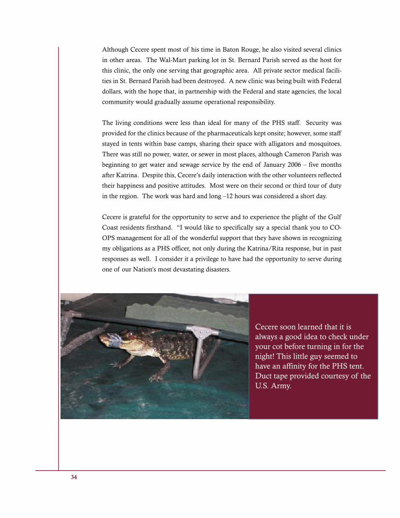
The living conditions were less than ideal for many of the PHS staff. Security was
provided for the clinics because of the pharmaceuticals kept onsite; however, some staff
stayed in tents within base camps, sharing their space with alligators and mosquitoes.
There was still no power, water, or sewer in most places, although Cameron Parish was
beginning to get water and sewage service by the end of January 2006 – five months
after Katrina. Despite this, Cecere’s daily interaction with the other volunteers reflected
their happiness and positive attitudes. Most were on their second or third tour of duty
in the region. The work was hard and long –12 hours was considered a short day.
Cecere is grateful for the opportunity to serve and to experience the plight of the Gulf
Coast residents firsthand. “I would like to specifically say a special thank you to CO-
OPS management for all of the wonderful support that they have shown in recognizing
my obligations as a PHS officer, not only during the Katrina/Rita response, but in past
responses as well. I consider it a privilege to have had the opportunity to serve during
one of our Nation’s most devastating disasters.
Cecere soon learned that it is always a good idea to check under your cot before turning in for the night! This little guy seemed to have an affinity for the PHS tent. Duct tape provided courtesy of the U.S. Army.

35
The structure in the foreground is what was left of the elementary school in Cameron, Louisiana after Katrina. It was also
one of the few buildings that was left standing where it was originally located.

36 36
CO-OPS USERS/STAKEHOLDERS FEEDBACK
The experiences of CO-OPS personnel tell an awesome story of how
individuals and teams worked for a common good, whether for safe and efficient com-
merce within the Gulf Coast region or for humanitarian causes. In personal interviews,
most CO-OPS personnel recognized the importance of their work in supporting the work
of others. There is a true interdependence among CO-OPS and its partners; the work of
one individual or team supports the work of others until the final product is generated.
Those who use CO-OPS final products and services are represented on the Hydrographic
Services Federal Advisory Committee, a 15-member panel consisting of experts in tides
and currents, hydrographic surveying, port administration, vessel piloting, and other
marine transportation areas. At a meeting held on January 2006, several committee
members spoke highly of the Physical Oceanographic Real-Time System (PORTS®)
and its value to mariners and praised CO-OPS personnel for the excellent work during
Hurricane Katrina.
Captain Mike Morris of the Houston Pilot’s Association, in his public statements at the
January 2006 meeting said, “Today, PORTS® is a great safety tool for pilots in our area.
We use the system and monitor the data from both our dispatch office and our pilot
boats continuously. ...Having real-time measurements enriched by forecast are critical

37 37
requirements for safe navigation for us. Knowing when we’re going to have low water is
important. So accurate and timely water level and current information certainly results
in safer and more efficient port operation for us.”
Captain Sherri Hickman, also of the Houston Pilots Association, describes situations
where PORTS data was critical to safe passage. “But I can’t tell you how many times
we’ve had close-calls. ....If the current is coming in and they’re inbound, they can’t turn.
They’re going to come right across the channel in front of me. And that’s where they use
that PORTS system so much.”
Mr. Jim Robinson, the Director of Navigation and Security for the Lake Charles Harbor
and Terminal District stated, “Our survival and rapid reconstitution of Calcasieu Riv-
er Waterway navigation were enabled thanks to valued contributions and professional
NOAA and NOAA-contracted support.”
Katrina’s devastating effects served as a reminder to those who depend upon the con-
scientious work that all of our personnel do every day to help ensure safe and efficient
navigation. These users and stakeholders, and others as well, seemed ever mindful of
how many people are required to ensure marine safety.

38 38
EPILOGUENOAA is a successful organization because of quality products and services that meet the needs of those who require them; however, products and services do not sustain themselves. People drive products and services—the teams and individuals who develop and maintain our products as well as the users/consumers of those products. There are no individuals or teams within NOAA who can single-handedly accomplish all that is required for organi-zational success. It takes the combined skill and commitment of everyone who is part of CO-OPS to support NOAA’s mission. Those individuals and teams highlighted in this document clearly demon-strate the attributes needed to meet and exceed expectations for qual-ity work under normal as well as less-than-ideal conditions.
The perilous storms of 2005 compelled us to reflect on our core business practices, discovering fresh approaches to recurring issues, while reaffirming the important role of alliances with those both in and outside of our agency. Evidence of the influence of this reflec-tion can be seen in our approach to pre-storm planning. There is a heightened emphasis on anticipation of the requirements for tidal corrector data, equipment to support rapid repair of water level and PORTS® stations likely to be damaged, and personnel required to accomplish these tasks. This approach has raised the standard for response time from weeks to hours, enabling the OCS Hydrographic Survey Team to begin surveys immediately after the storm so that ports and harbors can be quickly opened.
Alliances with other agencies and organizations helped to enhance available resources, allowing the nation to accomplish goals that a single organization could not. An effective partnership of NOAA offices emerged from this effort. The National Weather Service, Ma-rine and Aviation Operations, and NOS supported each other in ways that they never had before. Each office had a separate and distinct mission, but each also took advantage of the opportunity to better

39 39
understand the others’ missions and work together toward a com-mon goal: helping the Gulf Coast recover from the worst natural disaster in modern memory. The U.S. Coast Guard, the Louisiana Wildlife Management Area, and others worked in concert with NOAA to support common goals.
Such an example of interagency cooperation was the establishment of the Interagency Performance Evaluation Task Force (IPET) in response to Hurricane Katrina on 19 October 2005 by the U.S. Army Corps of Engineers (USACE). NOAA’s National Geodetic Survey (NGS) and CO-OPS were asked to provide critical information and expertise for this report. The mission of this combined effort was to present credible, objective scientific and engineering answers to fundamental questions about the performance of the hurricane protection and flood damage reduction system in the New Orleans metropolitan area.
One of the results of NOAA’s participation in this effort was the es-tablishment of a water level gauge at Lake Pontchartrain. This station will become the point of reference for determining sea level in New Orleans and will also serve as a critical source of information for re-designing the levees. In addition, this report made the recommenda-tion that all geodetic and tidal datums need to meet NOAA standards. By using NOAA standards we will help ensure that the levees are adequately designed for future storms.
The fundamental element driving our results, whether it is our re-sponse to the Gulf Coast crisis or some other event, is each indi-vidual who makes up the NOAA organization. Individuals thrive on the teamwork and the ensuing synergy that develops when there is a problem waiting to be solved. In the end, it is the people who make things happen. The human spirit triumphs in good and bad times alike.

40 40
References:
Hurricane Katrina A Climatological Perspective Preliminary Report NOAA’s National Climatic Data Center Technical Report 2005-01,
The Federal Response to Hurricane Katrina Lessons Learned, February 2005
NOS Preliminary Report HURRICANE KATRINA Storm Tide Summary, Revised 25 September, 2005

41 41
Center for Operational Oceanographic Products and Services1305 East West HighwayStation 6633Silver Spring, MD 20910-3281
http://tidesandcurrents.noaa.gov
