coastal 30000 a2web - new forest district
TRANSCRIPT
NFDC
NFDC
NFDC
NFDC
NFDC
NFDC
NFDC
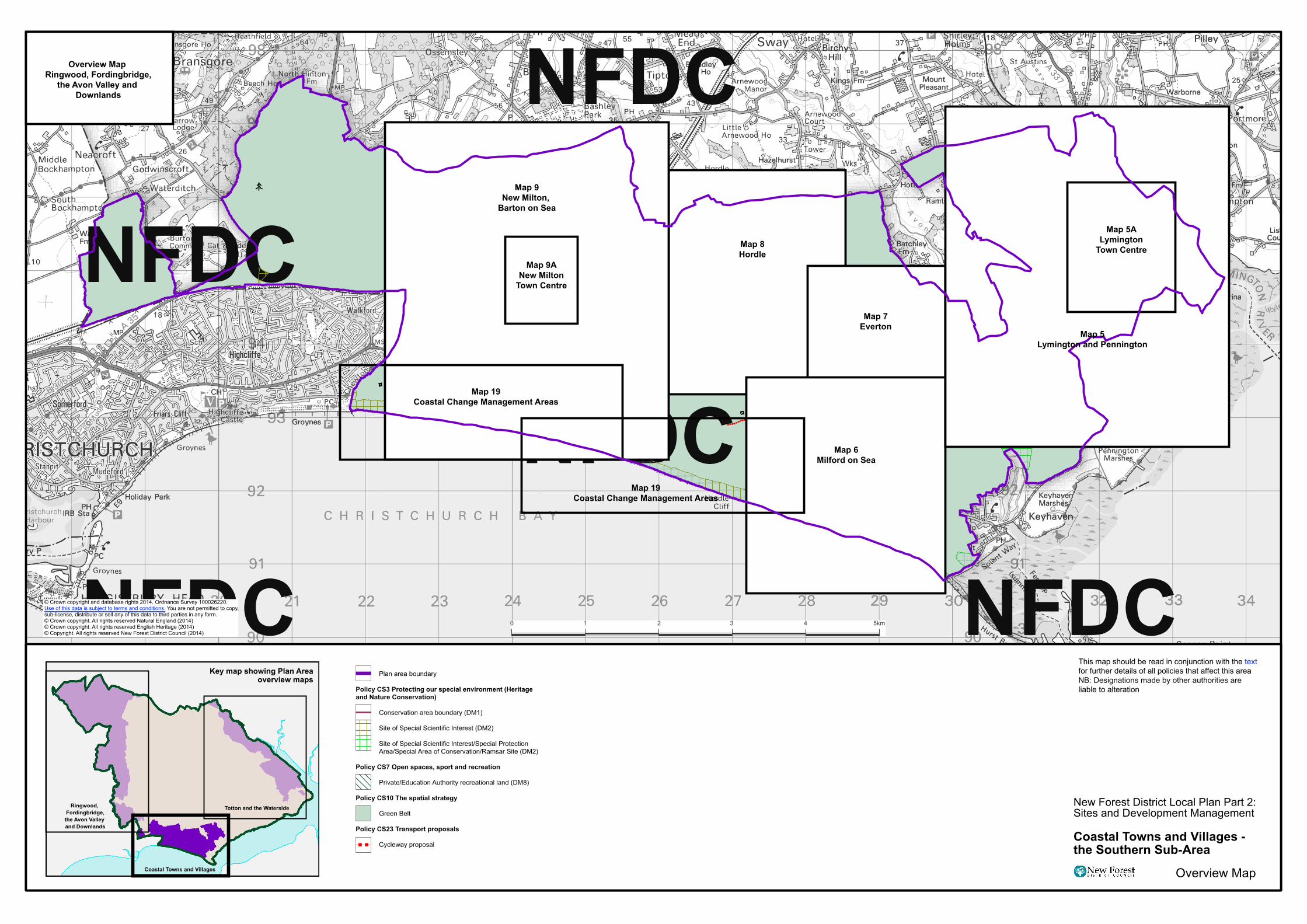
Map 9New Milton,
Barton on Sea
Map 9ANew Milton
Town Centre
Map 19Coastal Change Management Areas
Map 19Coastal Change Management Areas
Map 8Hordle
Map 7Everton
Map 6Milford on Sea
Map 5ALymington
Town Centre
Overview Map Ringwood, Fordingbridge,
the Avon Valley and Downlands
1 2 3 40 5km
Plan area boundary
Policy CS3 Protecting our special environment (Heritage and Nature Conservation)
Conservation area boundary (DM1)
Site of Special Scientific Interest (DM2)
Site of Special Scientific Interest/Special Protection Area/Special Area of Conservation/Ramsar Site (DM2)
Policy CS7 Open spaces, sport and recreation
Private/Education Authority recreational land (DM8)
Policy CS10 The spatial strategy
Green Belt
Policy CS23 Transport proposals
Cycleway proposal
New Forest District Local Plan Part 2:Sites and Development Management
Coastal Towns and Villages - the Southern Sub-Area
Overview Map
This map should be read in conjunction with the text for further details of all policies that affect this areaNB: Designations made by other authorities are liable to alteration
© Crown copyright and database rights 2014. Ordnance Survey 100026220. Use of this data is subject to terms and conditions. You are not permitted to copy, sub-license, distribute or sell any of this data to third parties in any form.© Crown copyright. All rights reserved Natural England (2014)© Crown copyright. All rights reserved English Heritage (2014)© Copyright. All rights reserved New Forest District Council (2014)
Ringwood, Fordingbridge,the Avon Valley and Downlands
Totton and the Waterside
Coastal Towns and Villages
Key map showing Plan Area overview maps
Map 5Lymington and Pennington