coastal map reading higher geography. describing a coastline - checklist direction of trend of...
TRANSCRIPT
Coastal Map ReadingCoastal Map Reading
Higher GeographyHigher Geography
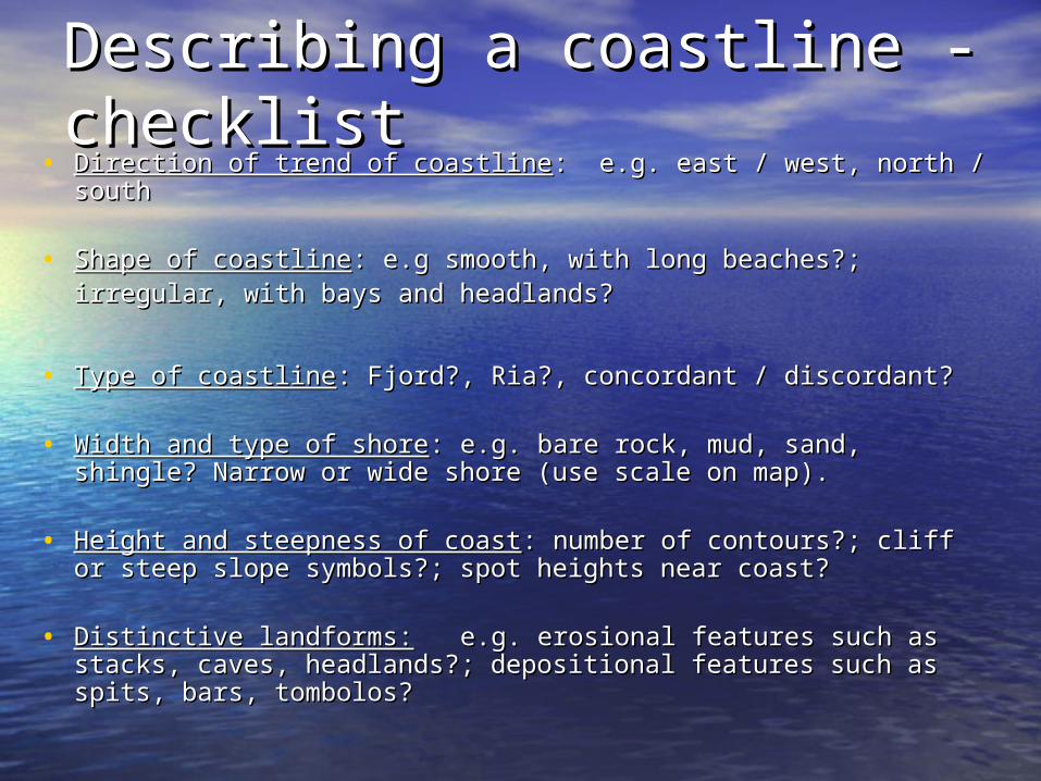
Describing a coastline - Describing a coastline - checklistchecklist
• Direction of trend of coastlineDirection of trend of coastline: e.g. east / west, north / south: e.g. east / west, north / south
• Shape of coastlineShape of coastline: e.g smooth, with long beaches?;: e.g smooth, with long beaches?;irregular, with bays and headlands?irregular, with bays and headlands?
• Type of coastlineType of coastline: Fjord?, Ria?, concordant / discordant?: Fjord?, Ria?, concordant / discordant?
• Width and type of shoreWidth and type of shore: e.g. bare rock, mud, sand, shingle? : e.g. bare rock, mud, sand, shingle? Narrow or wide shore (use scale on map).Narrow or wide shore (use scale on map).
• Height and steepness of coastHeight and steepness of coast: number of contours?; cliff or : number of contours?; cliff or steep slope symbols?; spot heights near coast?steep slope symbols?; spot heights near coast?
• Distinctive landforms:Distinctive landforms: e.g. erosional features such as stacks, e.g. erosional features such as stacks, caves, headlands?; depositional features such as spits, bars, caves, headlands?; depositional features such as spits, bars, tombolos?tombolos?

Conditions and ProcessesConditions and Processes• An exam question may ask about the An exam question may ask about the conditions and conditions and
processesprocesses which influence coastal landscapes: these are which influence coastal landscapes: these are often badly answered.often badly answered.
• ConditionsConditions include (i) the include (i) the geologygeology of the area: hard and of the area: hard and softer rocks will erode at different rates, leading to the softer rocks will erode at different rates, leading to the development of different features and coastlines. Do you development of different features and coastlines. Do you know what know what concordant concordant and and discordantdiscordant coastlines are? coastlines are?(ii) the (ii) the fetchfetch and common and common weather and sea conditionsweather and sea conditions are are also important. Remember the fetch is the distance of open also important. Remember the fetch is the distance of open water over which wind blows. The longer the fetch, the water over which wind blows. The longer the fetch, the stronger the winds and the longer they blow, the greater stronger the winds and the longer they blow, the greater the erosion – and also the greater the action of longshore the erosion – and also the greater the action of longshore drift.drift.(iii) the (iii) the depth of the waterdepth of the water is also relevant. Deep water is also relevant. Deep water tends to have more powerful wave action, so more erosion: tends to have more powerful wave action, so more erosion: shallow water areas more deposition.shallow water areas more deposition.
• ProcessesProcesses are the processes of erosion (i.e. Hydraulic are the processes of erosion (i.e. Hydraulic Action, Corrasion, Corrosion and Attrition) and deposition Action, Corrasion, Corrosion and Attrition) and deposition (Longshore Drift)(Longshore Drift)
Coastlines of ErosionCoastlines of Erosion
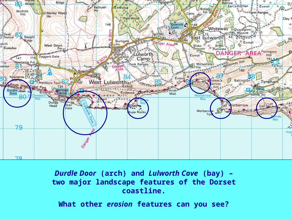
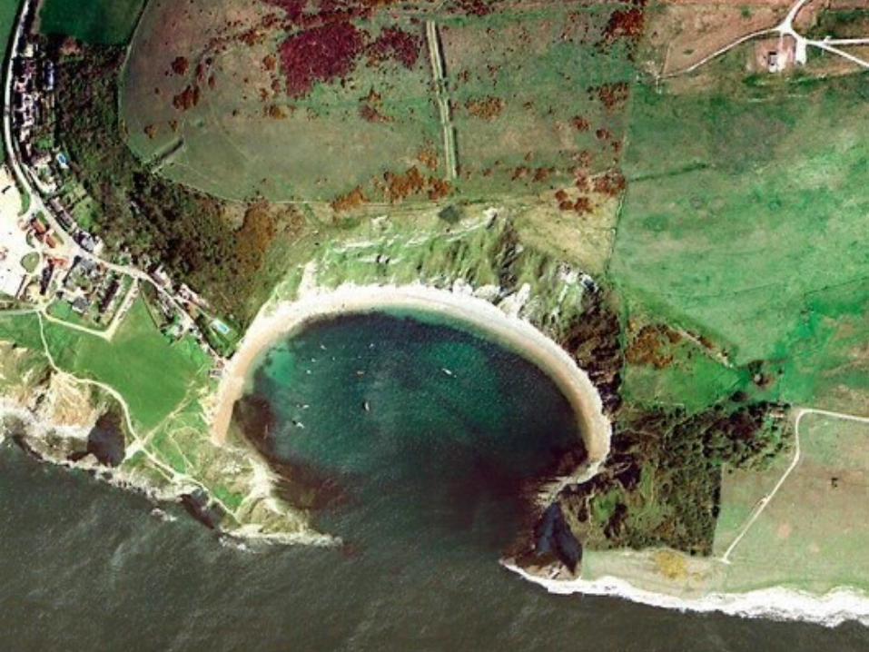
Durdle Door (arch) and Lulworth Cove (bay) – two major landscape features of the Dorset
coastline.
What other erosion features can you see?
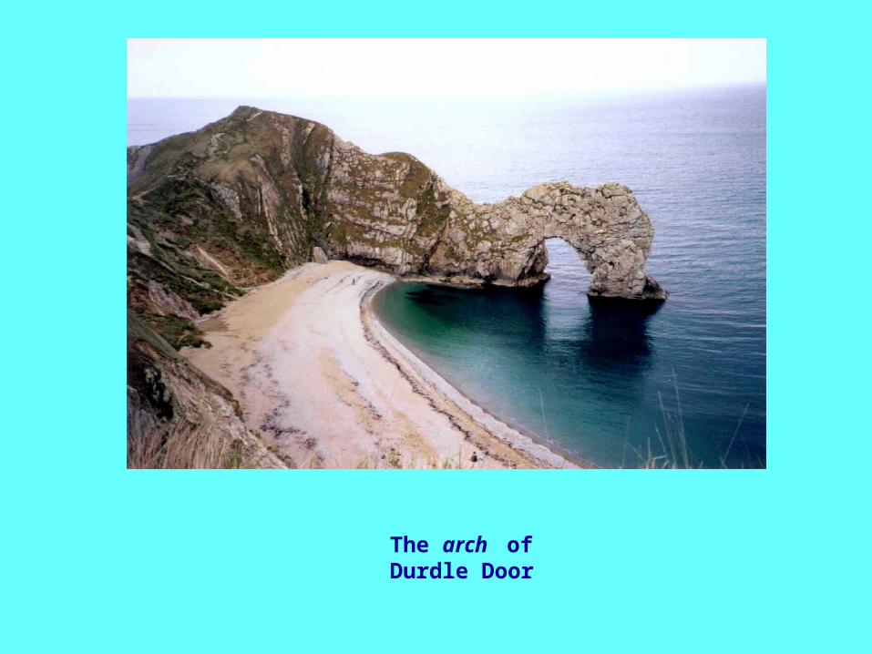
The arch of Durdle Door
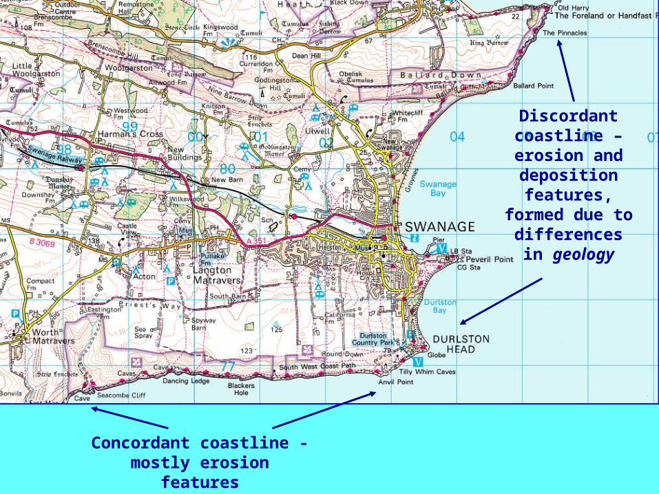
Concordant coastline - mostly erosion features
Discordant coastline – erosion and deposition features,
formed due to differences in
geology
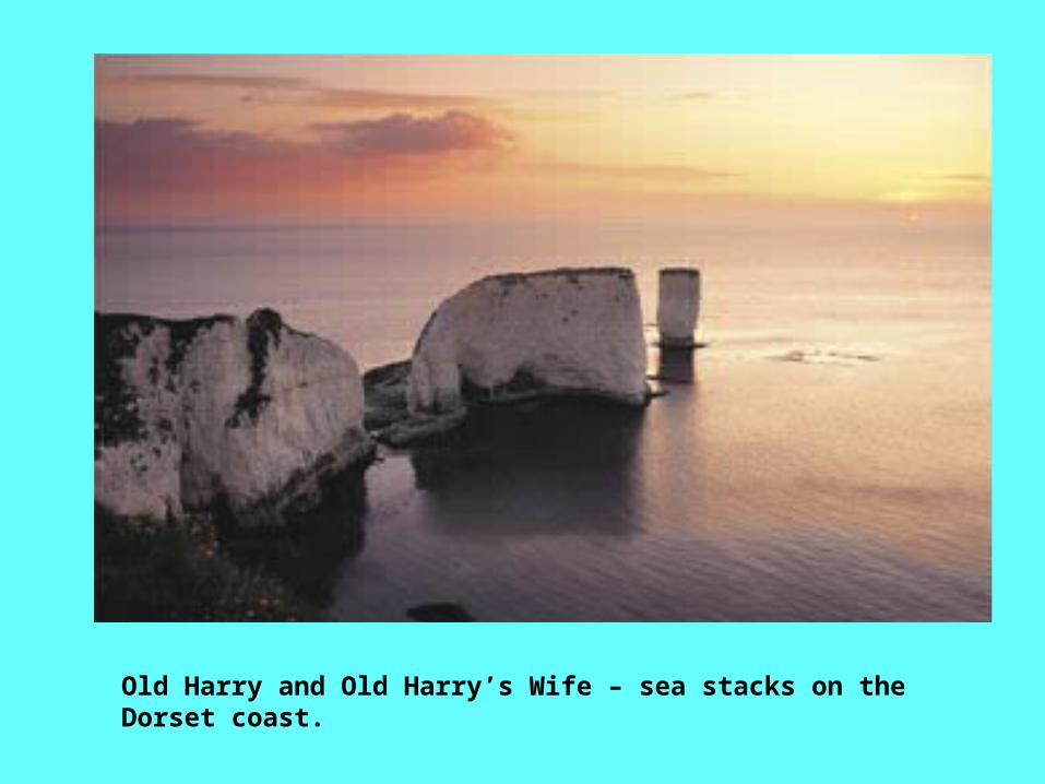
Old Harry and Old Harry’s Wife – sea stacks on the Dorset coast.
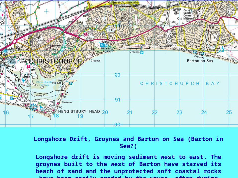
Longshore Drift, Groynes and Barton on Sea (Barton in Sea?)
Longshore drift is moving sediment west to east. The groynes built to the west of Barton have starved its
beach of sand and the unprotected soft coastal rocks have been easily eroded by the waves, often during
periods of heavy rain.
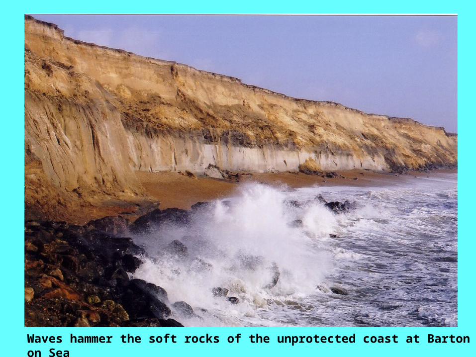
Waves hammer the soft rocks of the unprotected coast at Barton on Sea
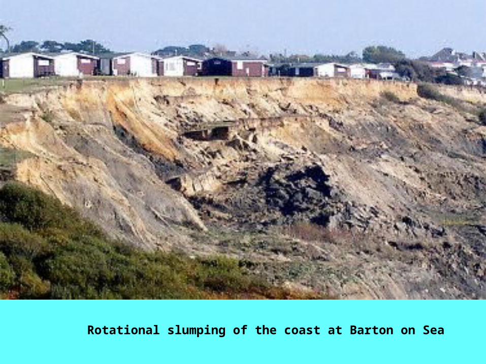
Rotational slumping of the coast at Barton on Sea
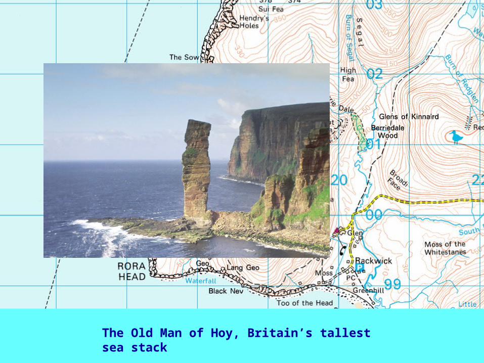
The Old Man of Hoy, Britain’s tallest sea stack

Coastlines of DepositionCoastlines of Deposition
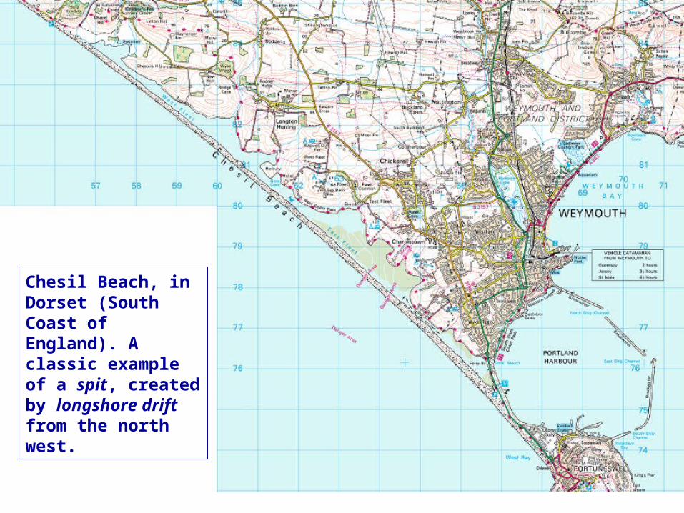
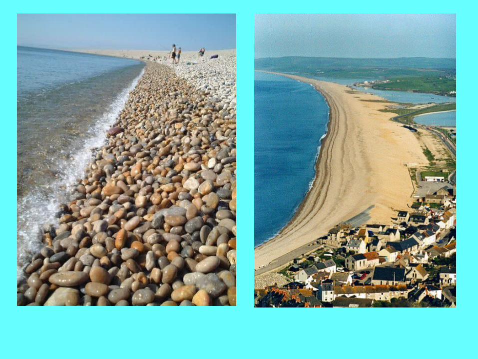
Chesil Beach, in Dorset (South Coast of England). A classic example of a spit, created by longshore drift from the north west.
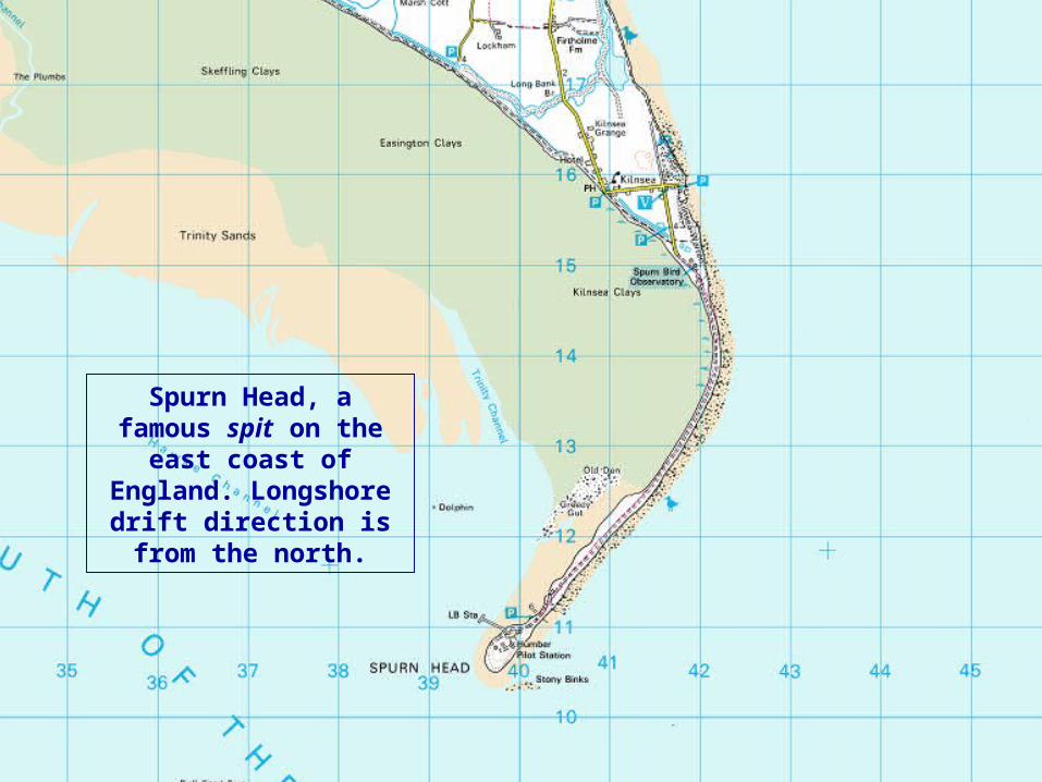
Spurn Head, a famous spit on the
east coast of England. Longshore
drift direction is from the north.

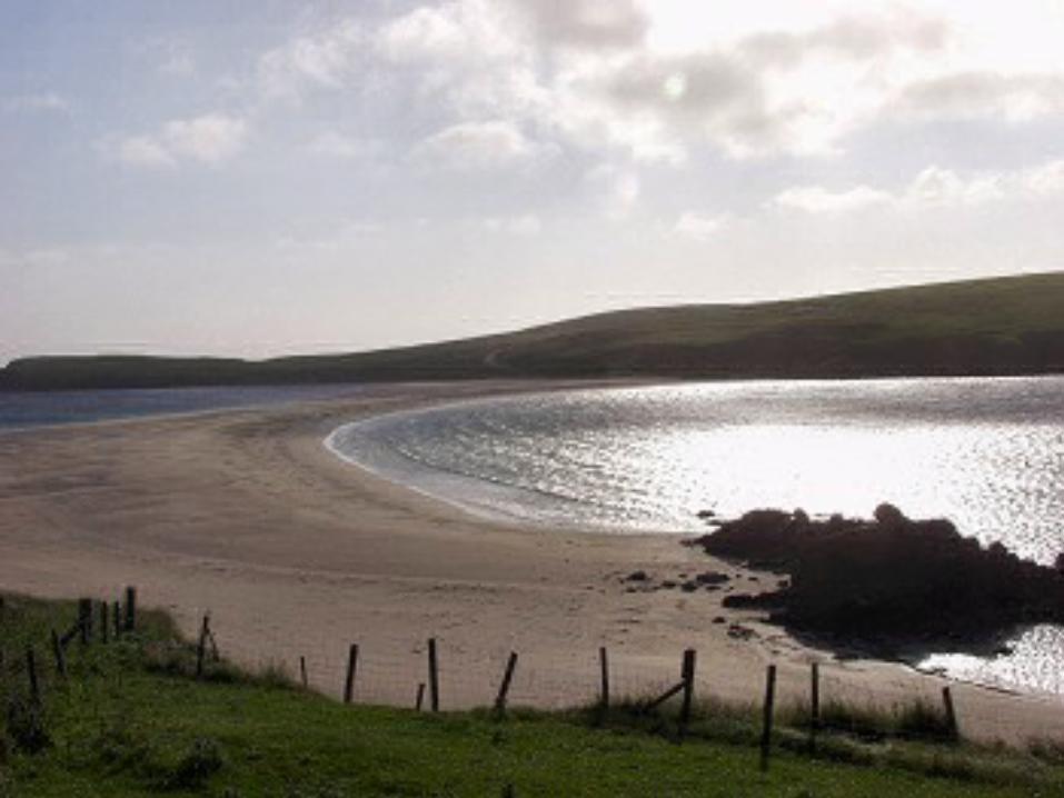
Tombolo, linking St Ninian’s Isle with the Shetland mainland.
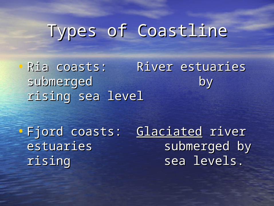
Types of CoastlineTypes of Coastline
• Ria coasts: River estuaries Ria coasts: River estuaries submerged submerged by rising by rising sea levelsea level
• Fjord coasts: Fjord coasts: GlaciatedGlaciated river river estuaries estuaries submerged by submerged by rising rising sea levels.sea levels.
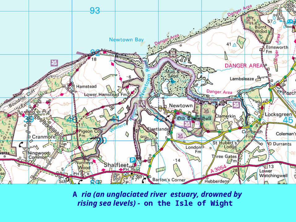
A ria (an unglaciated river estuary, drowned by rising sea levels) - on the Isle of
Wight
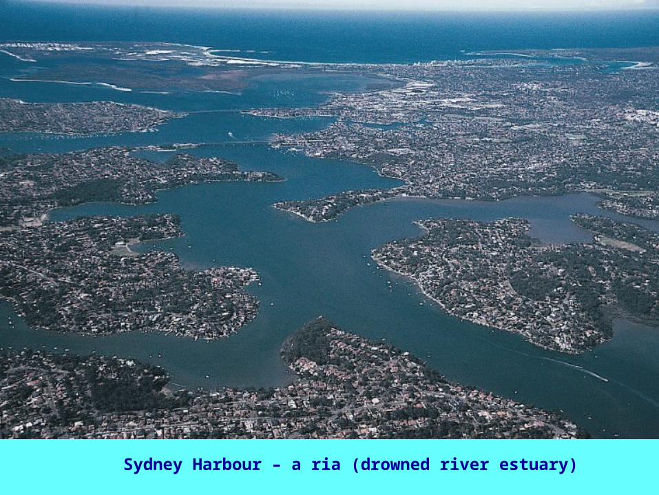
Sydney Harbour – a ria (drowned river estuary)
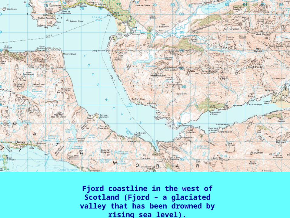
Fjord coastline in the west of Scotland (Fjord – a glaciated valley
that has been drowned by rising sea level).
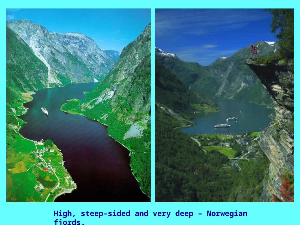
High, steep-sided and very deep – Norwegian fjords.