cognitively ergonomic route directions
DESCRIPTION
Cognitively Ergonomic Route Directions. A Potential Basis for the OpenLS Navigation Service?. Stefan Hansen, Alexander Klippel, Kai-Florian Richter. Overview. Background Aspect of cognitively ergonomic route directions Landmarks Direction concepts Granularities and hierarchies Conclusions - PowerPoint PPT PresentationTRANSCRIPT
Cognitively Ergonomic Route Directions
A Potential Basis for theOpenLS Navigation Service?
Stefan Hansen, Alexander Klippel, Kai-Florian Richter
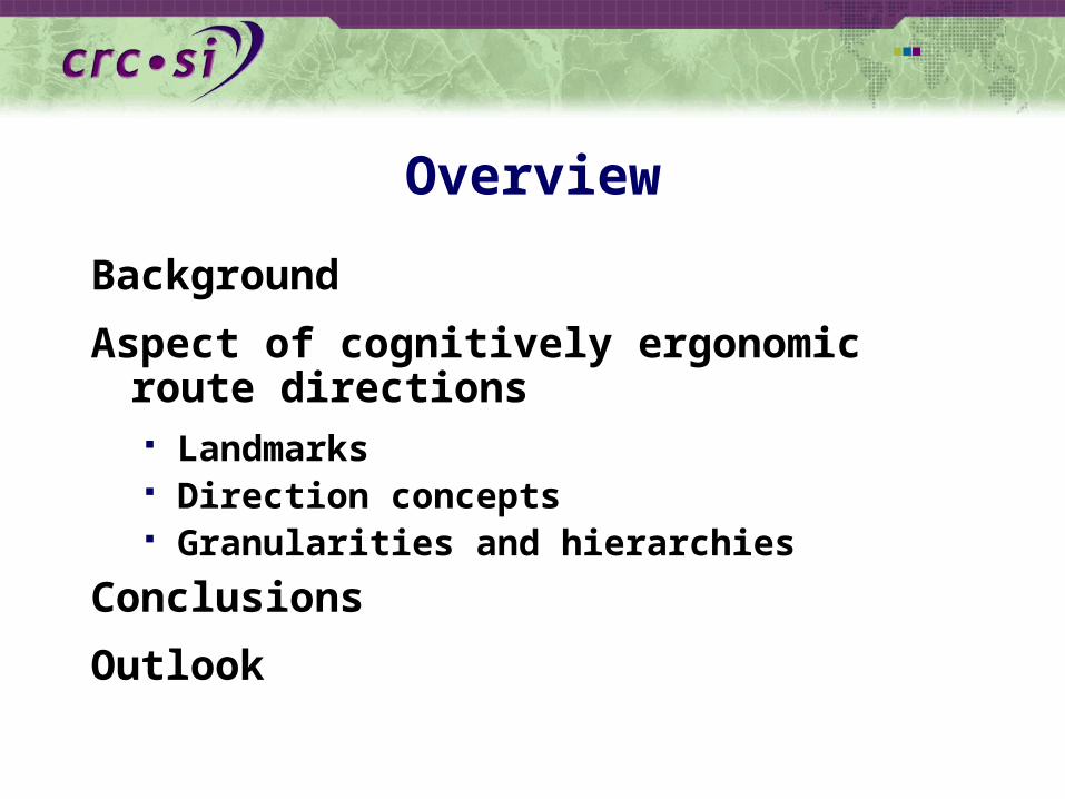
Overview
Background
Aspect of cognitively ergonomic route directions Landmarks Direction concepts Granularities and hierarchies
Conclusions
Outlook

Background
Human beings are poorly equipped with spatial abilities (compared to other species)
bad sense of direction poor eye sight useless sense of smell
One approach to overcome our limitations is the use of information technology
On the other hand, evolution adapted us as all-rounders Human beings suffice in their environments The 007 principle (Clark 1989)
The other approach therefore is to learn from human abilities to cope with their deficiencies
Learning efficiency from deficiency
Requirement for information technology Ontologies and cognitive modelling (cognitive engineering)

Aspects of Cognitively Ergonomic Route Directions
Landmarks
Direction Concepts
Granularities / Hierarchies / Chunking
Landmarks
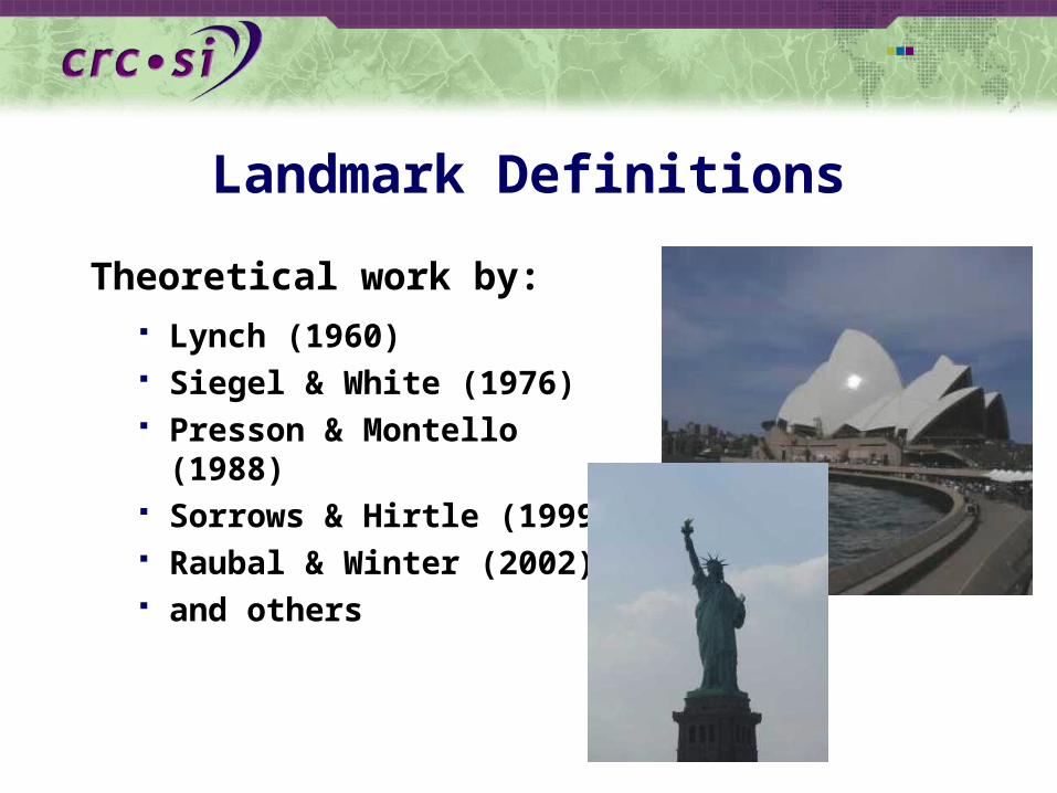
Landmark Definitions
Theoretical work by: Lynch (1960) Siegel & White (1976) Presson & Montello (1988) Sorrows & Hirtle (1999) Raubal & Winter (2002) and others

General Question Addressed
How to integrate landmarks (automatically) into route directions to achieve cognitive ergonomics?
For example:
short
easy to understand
low cognitive load
failsafe
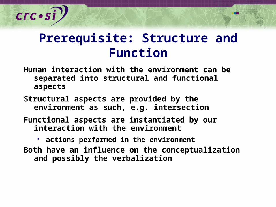
Prerequisite: Structure and Function
Human interaction with the environment can be separated into structural and functional aspects
Structural aspects are provided by the environment as such, e.g. intersection
Functional aspects are instantiated by our interaction with the environment actions performed in the environment
Both have an influence on the conceptualization and possibly the verbalization
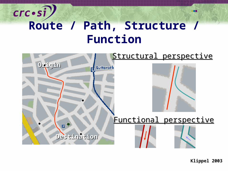
Route / Path, Structure / Function
Functional perspectiveFunctional perspective
Structural perspectiveStructural perspectiveOriginOrigin
DestinationDestination
Klippel 2003

Movement / Event PerspectiveWayfinding / route following is movement in constraining networks
How are these events organized through the presence of a “landmark”?
The primitives (events) of this movements are actions at decision points
nonDP

Some Examples
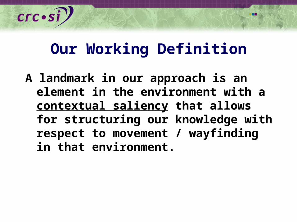
Our Working Definition
A landmark in our approach is an element in the environment with a contextual saliency that allows for structuring our knowledge with respect to movement / wayfinding in that environment.
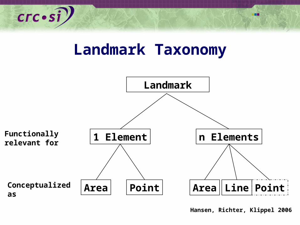
Landmark Taxonomy
Landmark
1 Element n ElementsFunctionally relevant for
AreaConceptualizedas
Point Area Line Point
Hansen, Richter, Klippel 2006

Point
nonDP DPIdentified Elements Level

Point
Object class level
nonDPDP
Street Name GSO Structure
Turn level DP+ DP- DP+ DP- DP+ DP-
Geometriclevel Point-LikeLinear-LikeArea-Like
Spatialrelational level
before afterat

Point
nonDPDP
Turn Level
Geometriclevel Point-LikeLinear-LikeArea-Like
Spatialrelational level
through (a)cross pass cross pass

Why is a Fine Grained Distinction Important?
Applicability of projective terms and spatial prepositions
Relating modalities (language and graphics)
left right
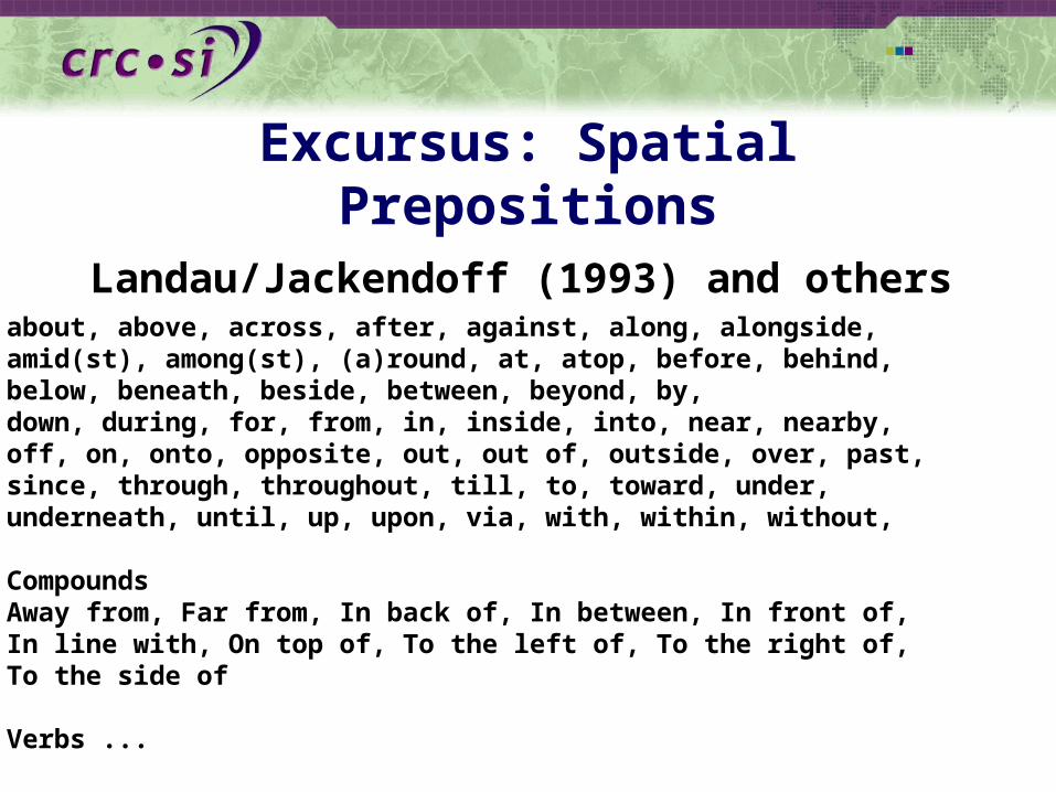
Excursus: Spatial Prepositions
Landau/Jackendoff (1993) and othersabout, above, across, after, against, along, alongside,amid(st), among(st), (a)round, at, atop, before, behind,below, beneath, beside, between, beyond, by,down, during, for, from, in, inside, into, near, nearby,off, on, onto, opposite, out, out of, outside, over, past,since, through, throughout, till, to, toward, under, underneath, until, up, upon, via, with, within, without,
CompoundsAway from, Far from, In back of, In between, In front of,In line with, On top of, To the left of, To the right of,To the side of
Verbs ...

n Elements
Main distinction Whether or not the last element of a chunk is
identified

Line
not identifyinglast DP
Area-Like Linear-LikeGeometriclevel
Spatialrelational level
identifyinglast DP
Area-Like Linear-Like
along along after after
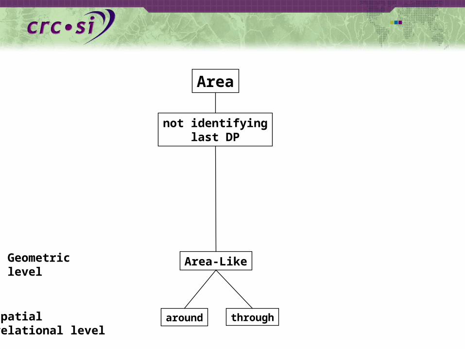
Area
not identifyinglast DP
Area-LikeGeometriclevel
Spatialrelational level
around through
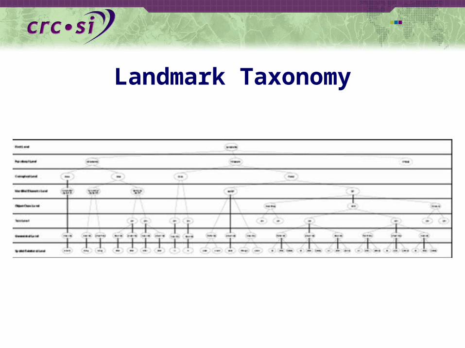
Landmark Taxonomy

The Data Model
All types of landmarks defined in our data model are derived from an abstract parent type comprising all basic information about a landmark
Different types of landmarks are used in a polymorphic way
Any type of landmark at the same place in an instruction can be used without the need of specifying which concrete type of landmark to use beforehand
Based on the abstract parent type, all other types are developed according to thetaxonomy of landmarks
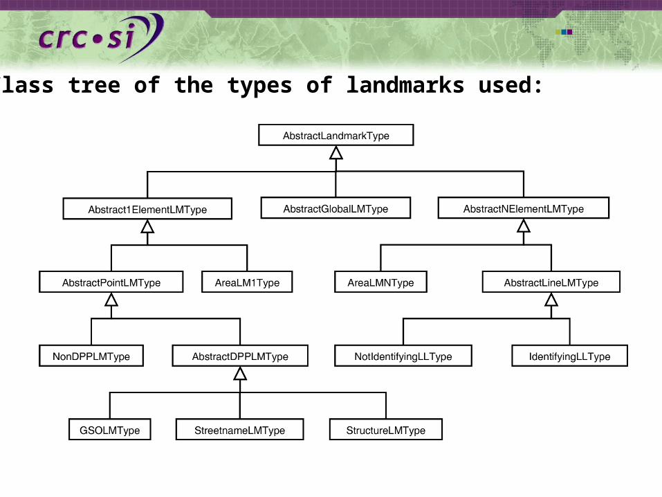
Class tree of the types of landmarks used:

XLS Example
To Summarize
Contextually salient route elements (aka landmarks) organize route knowledge
It is important to characterize landmarks in a specific context such as movements in networks
An extended Lynchonian approach seems to be fruitful
A detailed taxonomy is the basis for a data model that captures aspects of cognitively ergonomic route directions
Direction Concepts
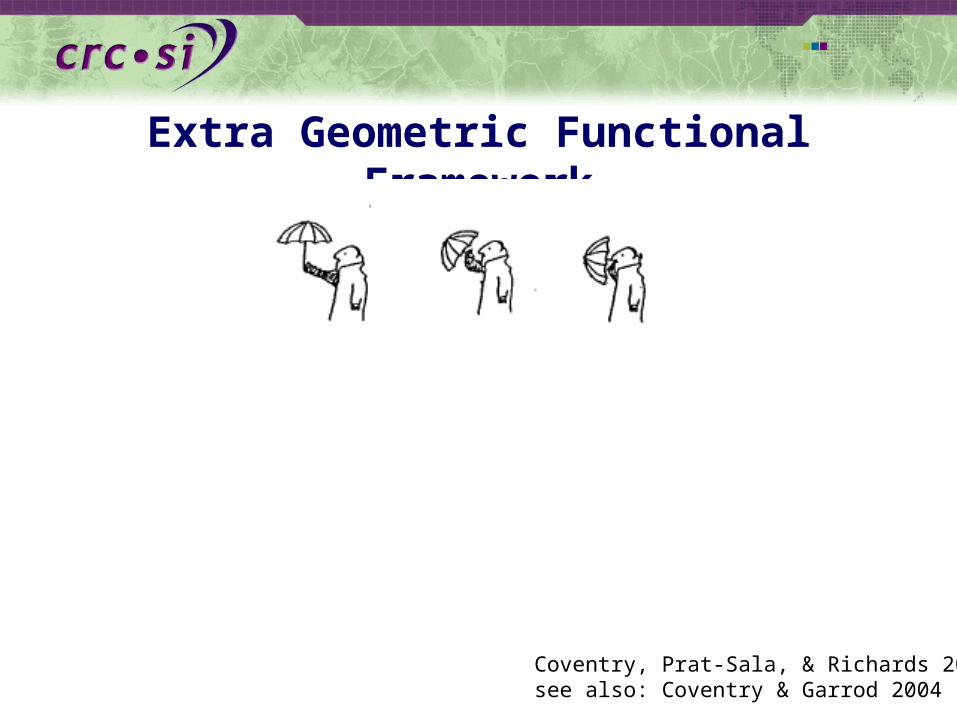
Extra Geometric Functional Framework
Coventry, Prat-Sala, & Richards 2001see also: Coventry & Garrod 2004
Structure and Function
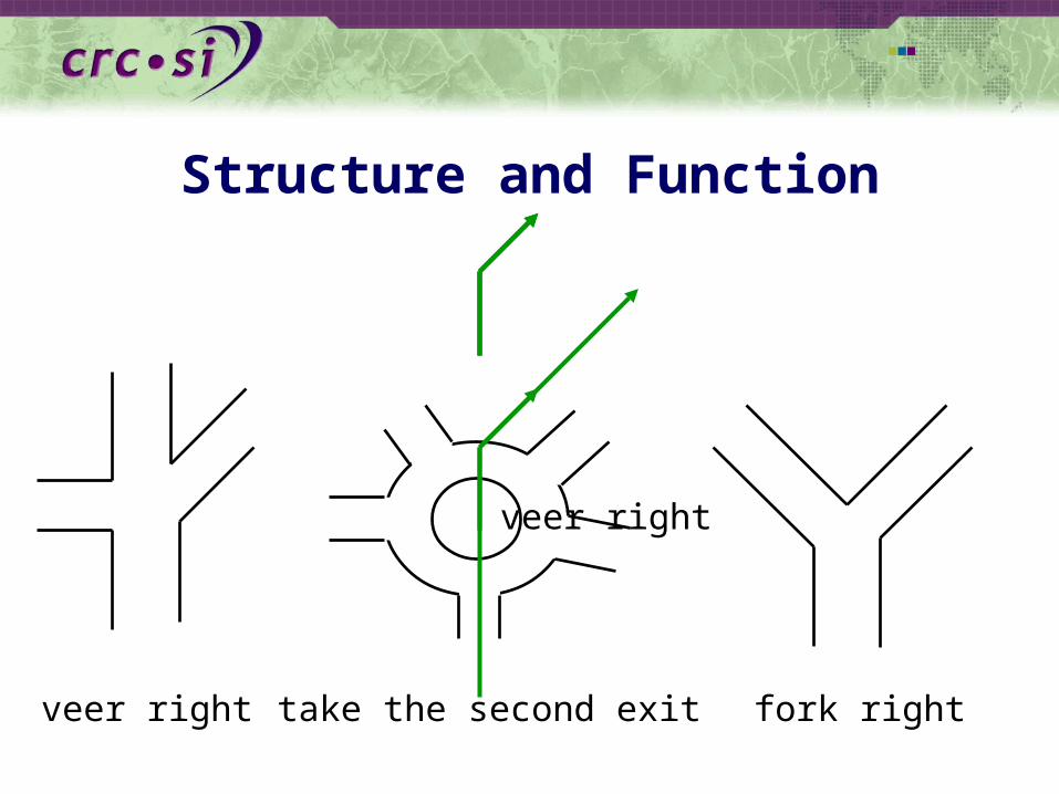
veer right take the second exit fork right
veer right
Structure and Function
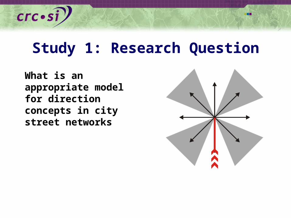
Study 1: Research Question
What is an appropriate model for direction concepts in city street networks

Answer7 direction concepts (plus ‘back’ sector)
combination of sectors and axes
sectors have different size
‘front’ and ‘back’ plane are asymmetric
90 degree ‘left’ and ‘right’ demarcate ‘front’ from ‘back’ (Franklin et al. 1995)
‘left’ and ‘right’ are symmetric0
90
180
270
135225
31545
67.5
112.5
157.5202.5
247.5
292.5
337.5 22.5
Klippel et al. 2004
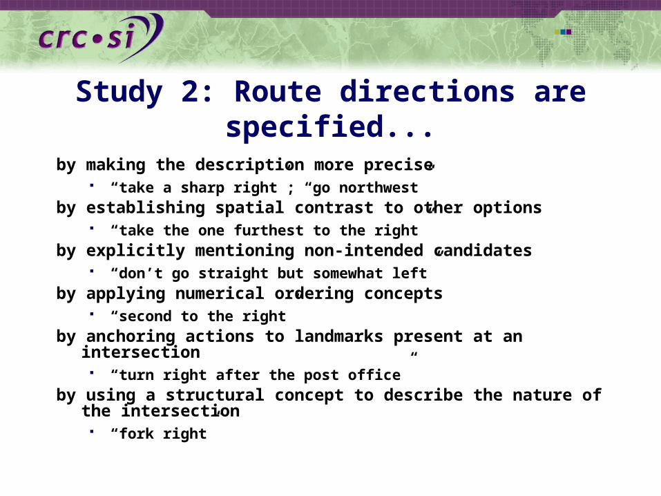
Study 2: Route directions are specified...
by making the description more precise “take a sharp right”; “go northwest”
by establishing spatial contrast to other options “take the one furthest to the right”
by explicitly mentioning non-intended candidates “don’t go straight but somewhat left”
by applying numerical ordering concepts “second to the right”
by anchoring actions to landmarks present at an intersection “turn right after the post office”
by using a structural concept to describe the nature of the intersection
“fork right”
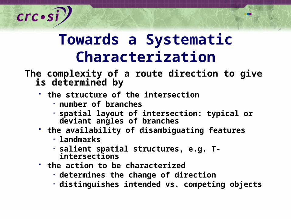
Towards a Systematic Characterization
The complexity of a route direction to give is determined by the structure of the intersection
• number of branches• spatial layout of intersection: typical or deviant
angles of branches the availability of disambiguating features
• landmarks• salient spatial structures, e.g. T-intersections
the action to be characterized• determines the change of direction• distinguishes intended vs. competing objects

Empirical Study: Route Directions
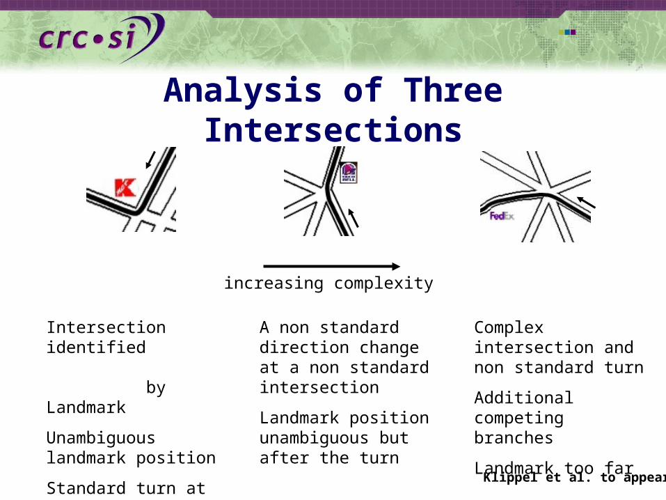
Analysis of Three Intersections
increasing complexity
Intersection identified by Landmark
Unambiguous landmark position
Standard turn at standard intersection
A non standard direction change at a non standard intersection
Landmark position unambiguous but after the turn
Complex intersection and non standard turn
Additional competing branches
Landmark too far
Klippel et al. to appear

Structure and Function
A CB D
Summary
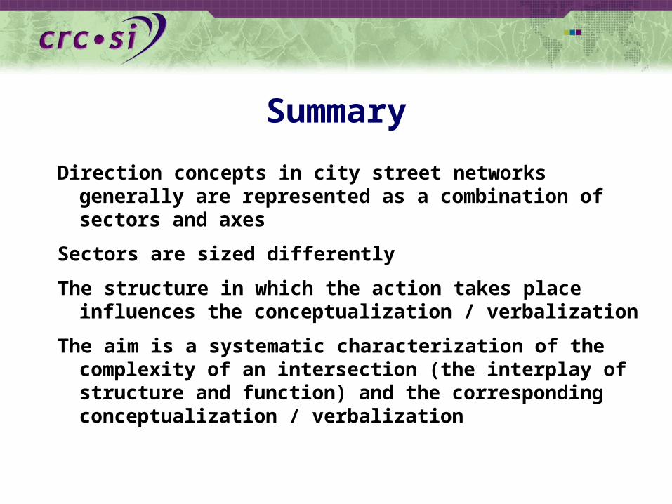
Direction concepts in city street networks generally are represented as a combination of sectors and axes
Sectors are sized differently
The structure in which the action takes place influences the conceptualization / verbalization
The aim is a systematic characterization of the complexity of an intersection (the interplay of structure and function) and the corresponding conceptualization / verbalization
Granularities and Hierarchies
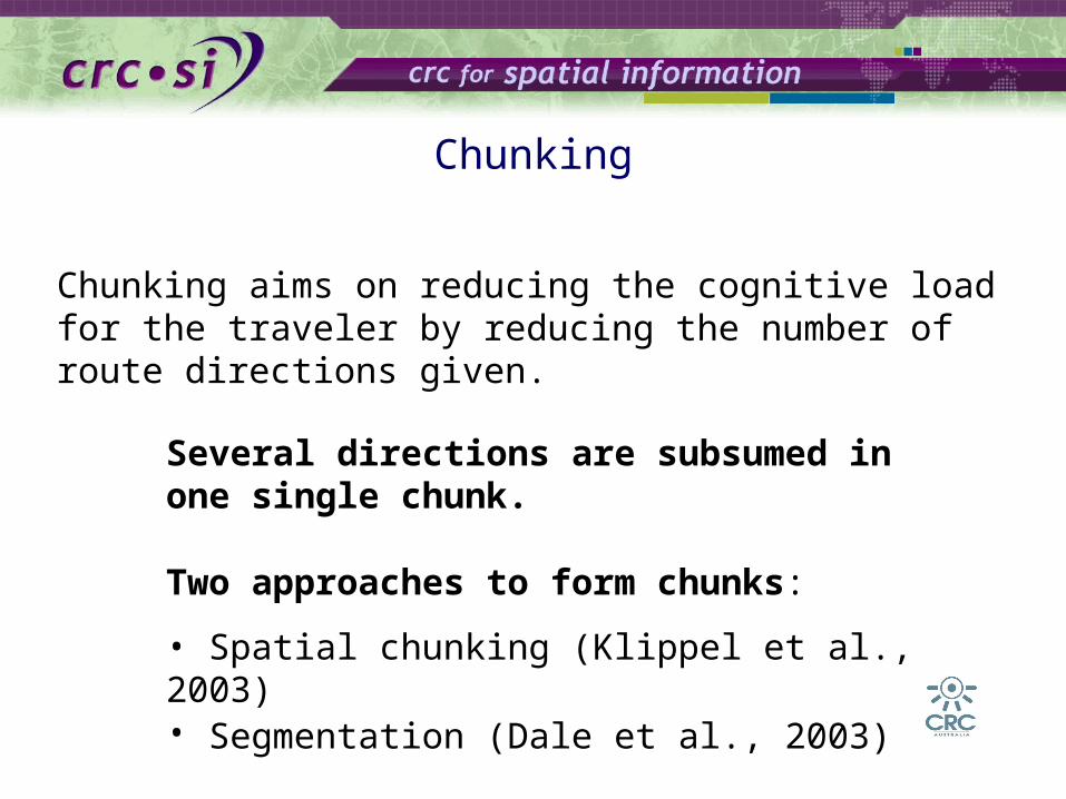
Chunking aims on reducing the cognitive load for the traveler by reducing the number of route directions given.
Chunking
Several directions are subsumed in one single chunk.
Two approaches to form chunks:
• Spatial chunking (Klippel et al., 2003)• Segmentation (Dale et al., 2003)
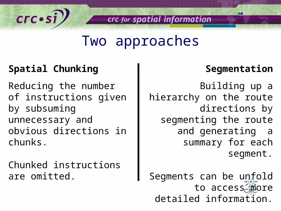
Two approaches
Spatial Chunking
Reducing the number of instructions given by subsuming unnecessary and obvious directions in chunks.
Chunked instructions are omitted.
Segmentation
Building up a hierarchy on the route directions by
segmenting the route and generating a summary for
each segment.
Segments can be unfold to access more detailed
information.
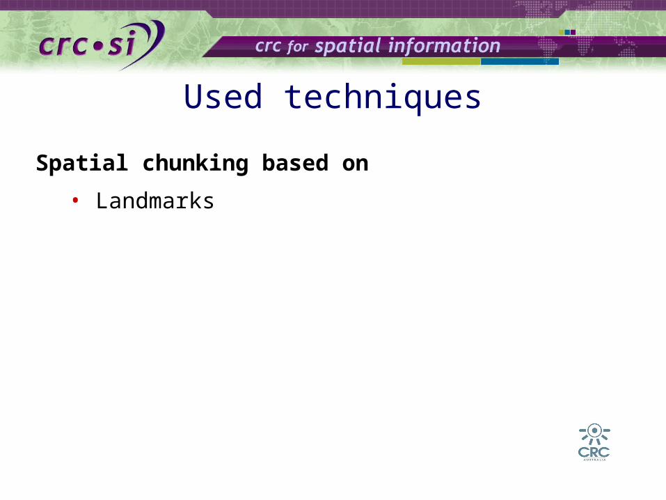
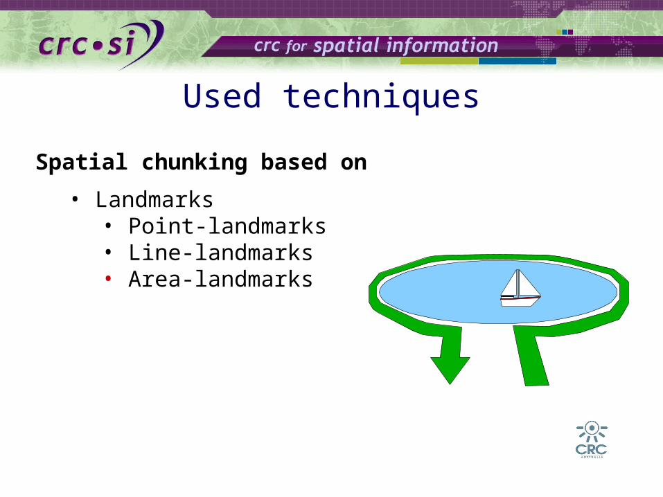
Spatial chunking based on
• Landmarks
Used techniques
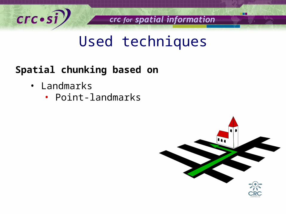
Spatial chunking based on
• Landmarks• Point-landmarks
Used techniques
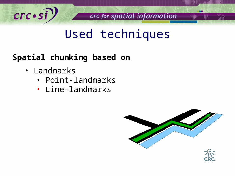
Spatial chunking based on
• Landmarks• Point-landmarks• Line-landmarks
Used techniques
Used techniques
Spatial chunking based on
• Landmarks• Point-landmarks• Line-landmarks• Area-landmarks

Used techniques
Spatial chunking based on
• Landmarks• Point-landmarks• Line-landmarks• Area-landmarks
• Number of chunked DPs
Cognitive OpenLS
Used techniques
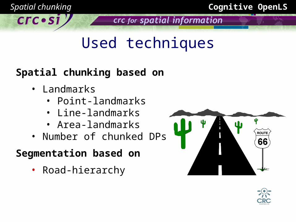
Spatial chunking based on
• Landmarks• Point-landmarks• Line-landmarks• Area-landmarks
• Number of chunked DPs
Segmentation based on
• Road-hierarchy
Spatial chunking
Used techniques
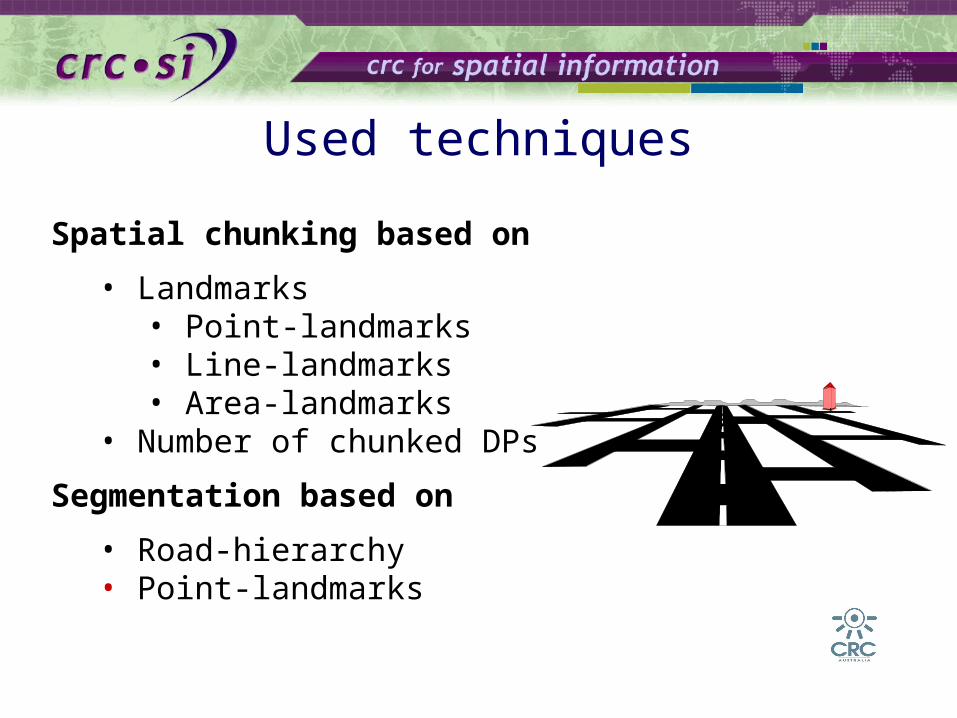
Spatial chunking based on
• Landmarks• Point-landmarks• Line-landmarks• Area-landmarks
• Number of chunked DPs
Segmentation based on
• Road-hierarchy• Point-landmarks
Combination of both approaches
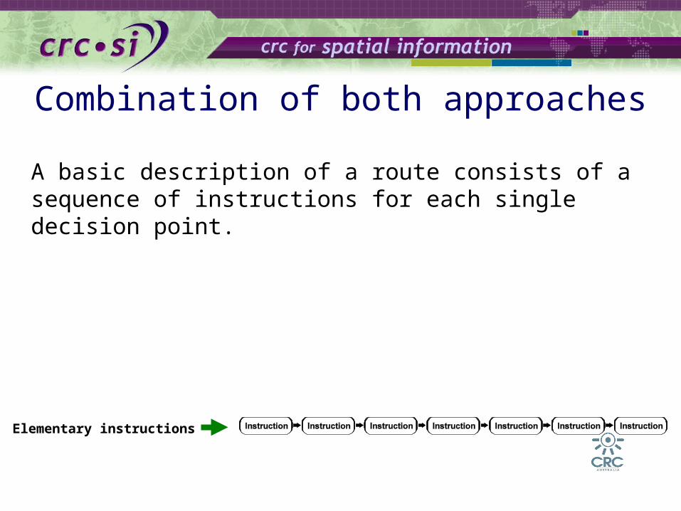
A basic description of a route consists of a sequence of instructions for each single decision point.
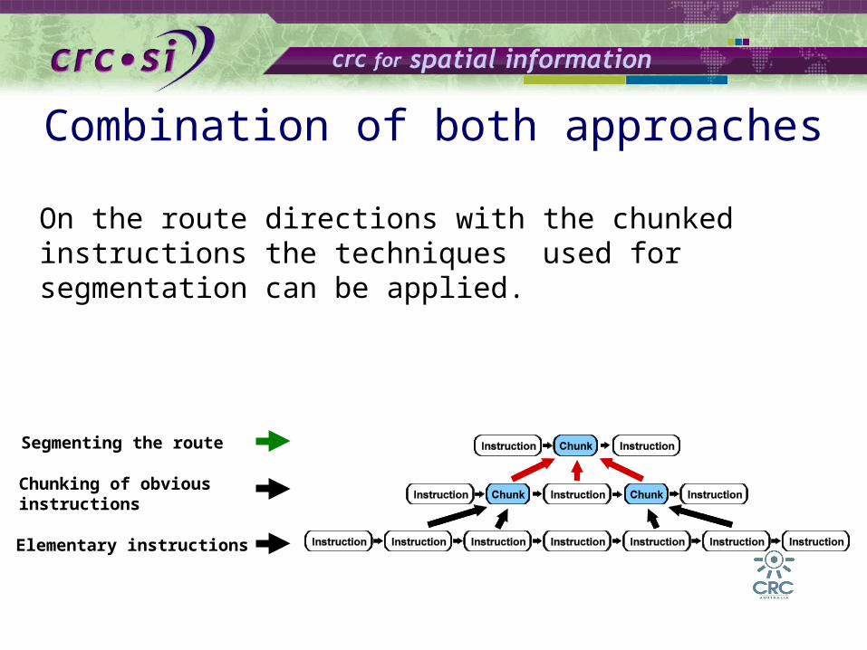
Elementary instructions

Combination of both approaches
The amount of the instructions given can be reduced by applying the techniques used for spatial chunking.
Elementary instructions
Chunking of obvious instructions
Combination of both approaches
On the route directions with the chunked instructions the techniques used for segmentation can be applied.
Elementary instructions
Chunking of obvious instructions
Segmenting the route

Combination of both approaches
The result are directions structuredhierarchically with levels of different granularity.
Elementary instructions
Chunking of obvious instructions
Segmenting the route
What is required to chunk automatically route directions?
Requirements
What is required to chunk automatically route directions?
Requirements
This depends on the chunking technique used.

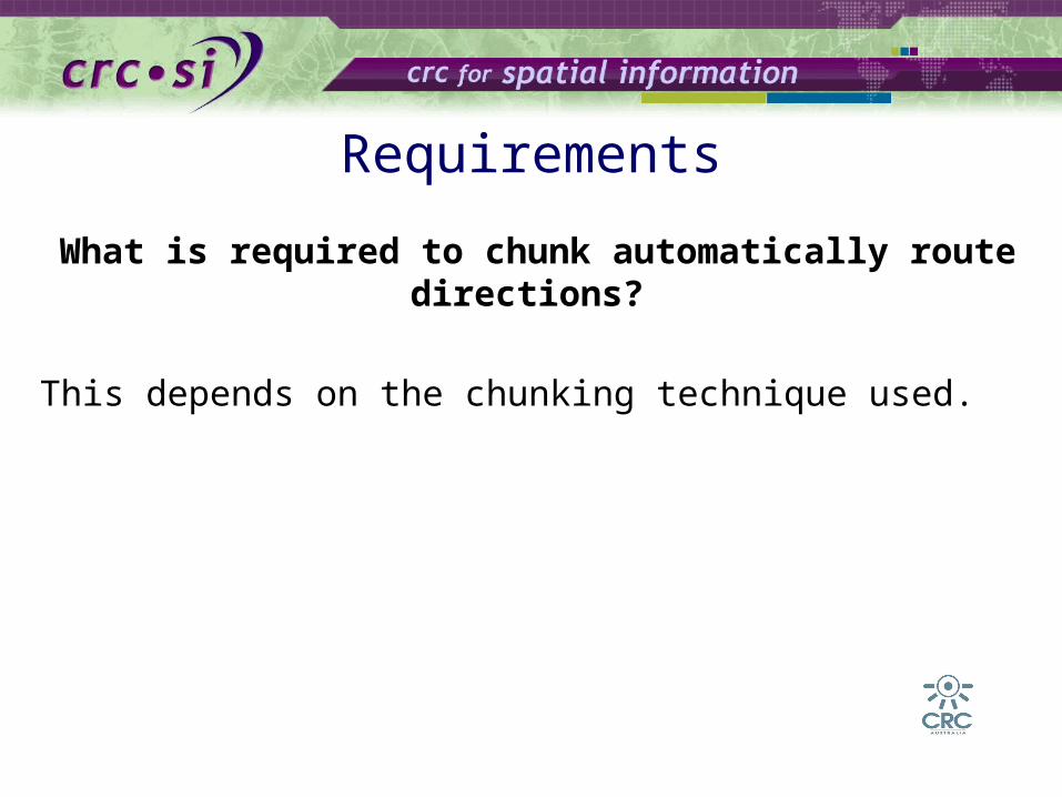
What is required to chunk automatically route directions?
Requirements
This depends on the chunking technique used.
But in general the underlying data model must
• provide information about the end of the chunk,• provide the subsumed information and• allow for building up a hierarchical structure.
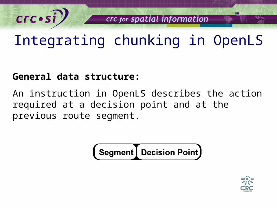
Integrating chunking in OpenLS
General data structure:
An instruction in OpenLS describes the action required at a decision point and at the previous route segment.

General data structure:
A route consists of a sequence of instructions.
Integrating chunking in OpenLS
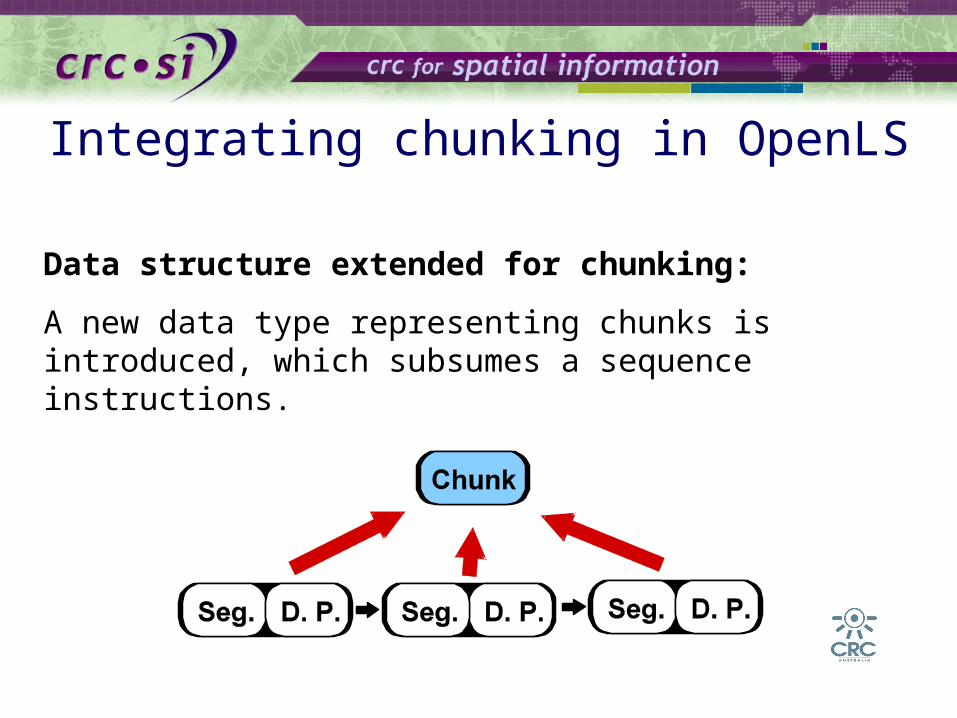
Data structure extended for chunking:
A new data type representing chunks is introduced, which subsumes a sequence instructions.
Integrating chunking in OpenLS
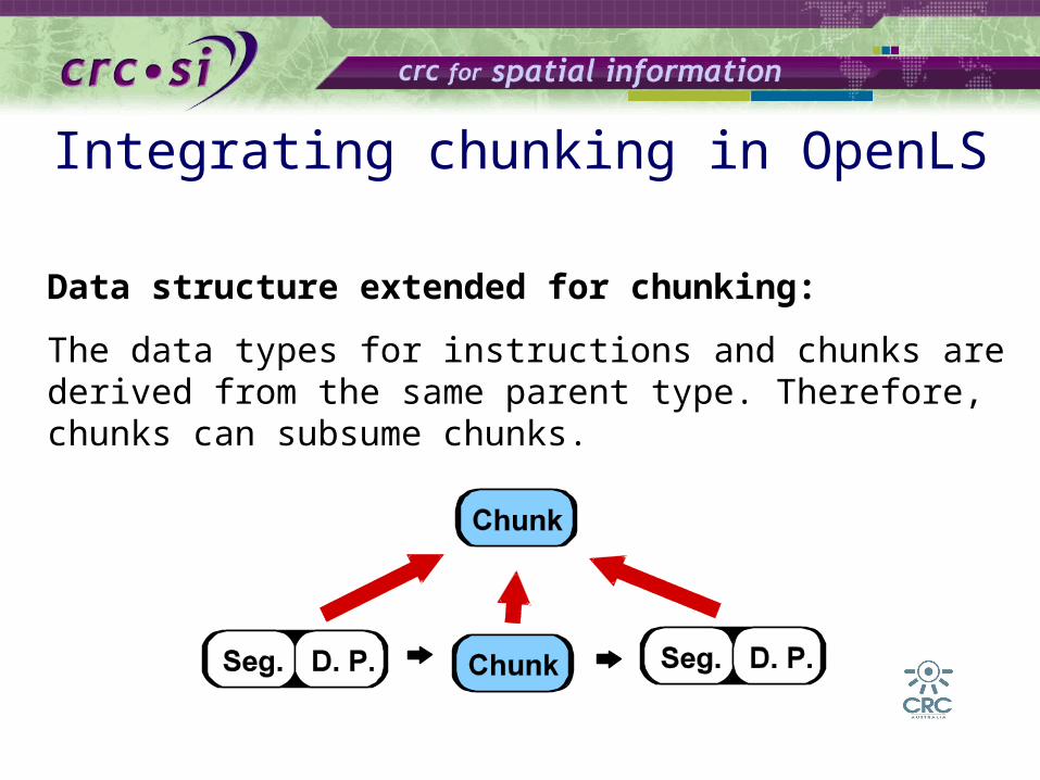
Data structure extended for chunking:
The data types for instructions and chunks are derived from the same parent type. Therefore, chunks can subsume chunks.
Integrating chunking in OpenLS

Data structure extended for chunking:
To describe a chunk sufficiently additional information about the end (e.g., a landmark) of the chunk is necessary.
Integrating chunking in OpenLS

Data structure extended for chunking:
Route consists now on the lowest level of a sequence of instructions and on all higher levels of a sequence of instructions and chunks.
Integrating chunking in OpenLS

Data structure extended for chunking:
On the higher levels even chunks are subsumed.
Integrating chunking in OpenLS

Overall Summary
Three aspects make route direction cognitive adequate Landmarks Direction concepts Granularities and hierarchies (chunking)
Results from behavioral (cognitive) studies can be used as a basis for a data model
This data model is a prerequisite to cognitively ergonomic route directions
Ongoing Work
Proof of concept implementation based on data model
From a landmark taxonomy to a landmark ontology with an extensive treatment of linguistics concepts
Technical Report (available next week) that details the complete specification
Integrate this work into a framework for hierarchies and levels of granularity in route directions where landmarks are not necessarily present at every route element / decision point
Outlook
Personalization
Familiarity
A framework for chunking / hierarchies / levels of granularity
Multimodality Different means of transportation Different means of communication

Thank you!
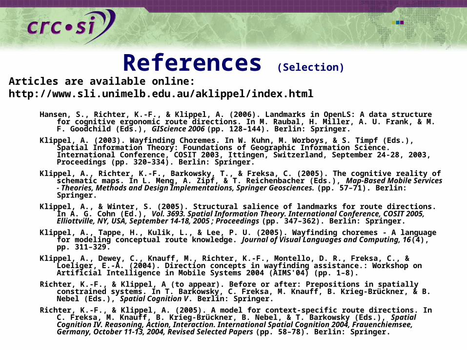
References (Selection)
Hansen, S., Richter, K.-F., & Klippel, A. (2006). Landmarks in OpenLS: A data structure for cognitive ergonomic route directions. In M. Raubal, H. Miller, A. U. Frank, & M. F. Goodchild (Eds.), GIScience 2006 (pp. 128–144). Berlin: Springer.
Klippel, A. (2003). Wayfinding Choremes. In W. Kuhn, M. Worboys, & S. Timpf (Eds.), Spatial Information Theory: Foundations of Geographic Information Science. International Conference, COSIT 2003, Ittingen, Switzerland, September 24-28, 2003, Proceedings (pp. 320–334). Berlin: Springer.
Klippel, A., Richter, K.-F., Barkowsky, T., & Freksa, C. (2005). The cognitive reality of schematic maps. In L. Meng, A. Zipf, & T. Reichenbacher (Eds.), Map-Based Mobile Services - Theories, Methods and Design Implementations, Springer Geosciences. (pp. 57–71). Berlin: Springer.
Klippel, A., & Winter, S. (2005). Structural salience of landmarks for route directions. In A. G. Cohn (Ed.), Vol. 3693. Spatial Information Theory. International Conference, COSIT 2005, Elliottville, NY, USA, September 14-18, 2005 ; Proceedings (pp. 347–362). Berlin: Springer.
Klippel, A., Tappe, H., Kulik, L., & Lee, P. U. (2005). Wayfinding choremes - A language for modeling conceptual route knowledge. Journal of Visual Languages and Computing, 16(4), pp. 311–329.
Klippel, A., Dewey, C., Knauff, M., Richter, K.-F., Montello, D. R., Freksa, C., & Loeliger, E.-A. (2004). Direction concepts in wayfinding assistance.: Workshop on Artificial Intelligence in Mobile Systems 2004 (AIMS'04) (pp. 1–8).
Richter, K.-F., & Klippel, A (to appear). Before or after: Prepositions in spatially constrained systems. In T. Barkowsky, C. Freksa, M. Knauff, B. Krieg-Brückner, & B. Nebel (Eds.), Spatial Cognition V. Berlin: Springer.
Richter, K.-F., & Klippel, A. (2005). A model for context-specific route directions. In C. Freksa, M. Knauff, B. Krieg-Brückner, B. Nebel, & T. Barkowsky (Eds.), Spatial Cognition IV. Reasoning, Action, Interaction. International Spatial Cognition 2004, Frauenchiemsee, Germany, October 11-13, 2004, Revised Selected Papers (pp. 58–78). Berlin: Springer.
Articles are available online:http://www.sli.unimelb.edu.au/aklippel/index.html

New Affiliation (01/2007) of Dr. Alexander Klippel
GeoVISTA Center, Department of Geography302 Walker, Penn State University
University Park, PA 16802, USA