colony - history walk - customs house to millers point · eigh st beth st y rd ork st e st ork ln...
TRANSCRIPT

Colony History Walk Customs House to Millers Point —
BILLYARD
AVENUE
ITHA
CA
RO
AD
M4 WESTERN DISTRIBUTOR FREEWAY
Geo
rge
St
Har
ringt
on S
t
Glo
uces
ter S
tCum
berla
nd S
t
Pitt
St
Pitt
St
Bligh
St
Cas
telg
eigh
St
Eliz
abet
h St
Art galle
ry rd
Geo
rge
St
York
St
York
LnKe
nt S
t
Cla
renc
e St
Kent
St
Hig
h St
Car
ringt
on S
t
Suss
ex S
t
Hic
kson
Rd
Hickso
n Rd
Hickson Rd
George St
Spring S
t
O’conn
ell S
t
Phill
ip S
t
Youn
g St
Loftu
s St
Mac
quar
ie S
t
Phill
ip L
n
Bridge StDalley St
Park st
William st
William st
Kings cross rd
Roslyn st
Ros
lyn
gard
ens
New south head rd
Oce
an s
t
Gle
nmor
e rd
Cas
cade
st
Glenmore rd
Gurner st
Paddington st
Oxford st
Renny st
Gordon st
Moore park rd
Gre
ens
rd
Oxford st
Willi
am st
Oat
ley
rd
Reg
ent s
t
Driv
er a
ve
Anzac pde
Anzac pde
Alison rd
Alison rd
Alison rd
Cook
rd
Robe
rtson
rd
Lang
rd
Lang rd
Orm
ond
st
Glenm
ore
rd
Brow
n st
Niel
d av
e
Boundary st
Barcom aveMcla
chlan
ave
Eliza
beth
st
Craigend st
Liverpool st
Liverpool st
Wentw
orth av
e
Fost
er s
t
Bathurst st
Wilmot st
Central stAlbion pl
Goulburn st
Goulburn st
Campbell stHay st
Hay st
Barlow st
Park
er s
t
Eddy ave
Valentine st
Campbell st
Ann st
Reservoir st
Fitzroy st
Foveaux st
Devonshire st
Kippax st
Cooper st
Arthur stDavies st
Arthur st
Rainford st
Phelps st
Bennett stProspect st
Albion ave
Napier st
Josephson st
Church st
Selw
yn s
t
Burton st
Macdonals st
Seale st
Francis st
Stanley st
Cathedral st
Bou
rke
st
Clapton
pl
Farrell ave
Forb
es st
Darlin
ghur
st rd
Darlin
ghur
st rd
Mac
leay
st
Vict
oria
st
Bou
rke
st
Forb
es s
t
Greenknowe aveElizabeth bay road
Challis ave
Mcdonald ln
St neot ave
Rockwall cres
Rockwall ln
Orwell st
Earl
stHughes st
Tusc
ulum
st
Manning st
Wylde st
Cow
per w
harf
rdw
y
War
d av
e
Victor
ia st
Vict
oria
st
Palm
er s
t
ts remlaP
Cro
wn
st
Bap
tist s
t
Nic
hols
st
Hut
chin
son
Mar
shal
l st
Sout
h do
wlin
g st
Sout
h do
wlin
g st
Sout
h do
wlin
g st
Rile
y st
ts htimS
Brisb
ane
st
Bou
rke
st
Bou
rke
st
Cro
wn
st
Cro
wn
st
Col
lege
st
Albion st
Taylor st
Suss
ex s
t
Suss
ex s
t
Dix
on s
t
Har
bour
st
Cas
tlere
agh
st
Pitt
st
Kent
st
Eliz
abet
h st
Nith
sdal
e st
Eliz
abet
h st
Com
mon
wea
lth s
t
Belm
ore
st
Lace
y st
ts tl oH
Randle s
t
Cor
ben
st
Mar
y st
Belle
vue
st
Wat
erlo
o st
Rile
y st
Rile
y st
Yuro
ng s
t
Rile
y st
Flin
ders
st
Chi
shol
m s
t
Eliz
abet
h st
Eliz
abet
h st
Elizabeth st
Clis
dell
st
Buc
king
ham
st
Cha
lmer
s st
Gre
at b
ucki
ngha
m s
t
Cha
lmer
s st
Bea
umon
t st
Wal
ker
st
Dou
glas
st
Geo
rge
st
George
st
adway
Thomas st
Mary ann st
Macarthur st
William henry s
t
Quarry st
Fig st
Allen st
Mur
ray
st
Wentworth park rd
Parramatta rd
Catherine st
Arundel st
Carillon ave
Mis
send
en rd
Wellington
Oconnor st
Queen st
Meagher st
Cleveland st
Cleveland st
Cleveland st
Cleveland st
Knox st Grafton st
Glebe point rd
Campbell st
Glebe st
Broughton st
Phillip st
Wentworth st
Mt vernon st
Westmoreland st
Derwent st Bay
st
Wattle st
Wattle st
Aber
crom
bie
st
Buck
land
st
Pine
st
Shep
herd
st
Rose
st
Bal
four
st
Glebe point rd
Talfourd stG
ottenham st
Colbourne ave
Darling stDarghan st
Bellevue st
Burton stBayview st
Lombard st
Taylor st
Glebe point rd
Mansfield st
Maxwell road
Bell stAllen st
Ave rd
Alexandra
Ross st Forest st
Lodge st
Jarocin ave
Minogue cres
Bridge rd
Bridge
rd
Pyrm
ont b
ridge
rd
Miller st
Bowman st
Edw
ard
st
John st
Harvey st
Wigram rdBoyce
st
Toxteth rd
Arcadia r
d
Forsyth st
Cook st
Ferry rd
Victoria
rd
Eglinton rd
Hereford st
Marlborough
St johns rd
St johns rd
Lyndhurst st
Mitc
hell s
t
Cow
per
st
Boundary st
James st
James st
Wells st
Redfern st
Turner st
Albert st
Phillip st
Raglan st
Kellick st
Reeve st
Henderson rd
Railway pde
Locomotive st
Central ave
Wellington st
Mcevoy st
Allen st
Mandible st
Powell st
Lachlan st
Dacey ave
Bourke st
Joyn
ton
ave
Link r
d
O’dea ave
Todman ave
O’dea ave
Epsom rd
Epsom rd
Lenhalt st
Anza
c pd
e Don
cast
er a
ve
Anza
c pd
e
Todman ave
Collins st
Huntley st
Huntley st
Coulson st
Macdonald st
Victoria stAshmore st El
liot a
ve
Eve
st
Roc
hfor
d st
Flor
a st
Geo
rge
stC
harle
s st
Brid
ge s
tBu
rren
st
Mal
colm
st
Concord st
Sydney park rd
Prin
ces
hwy
King
st
Maddox st
Morely ave
Gardeners rd
Gardeners rd
Burrows rd
Burro
ws rd
Belm
ont s
t
Lawr
ence
stEu
ston
lane
Eusto
n ro
ad
Eust
on ro
ad
Campbell rd
Bour
ke rd
Bourke rd
Ricketty st Kent
rd
Harcourt pde
Rot
hsch
ild a
ve
Ros
eber
ry a
veD
alm
eny
ave
eva yneml a
D
Dal
men
y av
e
John st
Power ave
Park
rd
Cla
ra s
t
Park
st New
ton
st
King
scle
ar rd
Alex
ande
r st
Harley st
Ashmore st
Copeland st
Fountain st
Bowden st
Jennings stSwanson st
Albert st
Erskinville rd
Renwick st
Mitc
hell r
d
Sutto
r stDi
bbs s
t
Allen ave
Fox a
ve
Belm
ont s
tLa
wren
ce st
Mcevoy s
t
Hudson st
Dangar pl
Myrtle st
Vine st
Ivy s
t
Cod
ringt
on s
t
Ivy ln
Vine st
Aber
crom
bie
st
Abercrombie st
Wilson st
Lander st
Darlington rd
King st
City rd
Maze cres
Blackwattle
Evel
eigh
st
Ren
wic
k st
Geo
rge
st
Will
iam
st
Geo
rge
st
Cop
e st
Cop
e st
Geo
rge
st
Pitt
stPi
tt st
Pitt
stB
urne
tt
Hugo
st
Lewi
s st
Reg
ent s
t
Rege
nt s
t
Gib
bons
st
Bota
ny rd
dr ynat oB
O’riord
an st
O’ri
orda
n st
Botan
y rd
Phill
ips
st
Love
ridge
Bren
nan
st
Ger
ard
st
Gar
den
stC
ornw
allis
st
Ros
ehill
st
Wyn
dham
st
Shep
herd
st
Edwa
rd st
Calder rd
Caroline stLawson st
Lawson sq
Margaret
Pitt st
Lee
st
Regen
t st
Thom
as s
tQua
y st
Dar
ling
dr
Harris st
Harris st
Bulwara rdH
ackett st
Pyrmont st
Mount st
Jones st
Darli
ng h
arbo
ur is
lPirrama rd
Pirrama rd
Jones st
Jones st
Kens
ingt
on s
t
Harbour st
Ultimo rd
Pier stOxford st
Poplar
Waine st
Druitt st
Market St
Alfred St
Bent St
Hunter St
Martin Pl
King St
Grosvenor St
Margaret St
Bond St
Curtin Pl
Reiby Pl
Erskine St
Barrack St
Argyle St
Windmill St Lower
Fort
St
Towns Pl
Mcc
aule
y st
Stok
es a
ve
Ons
low
pl
Onslow
avenue
Womerah avenueSurre
y street
Nim
rod
stB
roug
ham
st
Mce
lhon
e st
Dow
ling
st
Pyrmont bridge
Union st
Qua
rry m
aster dr
Little pier st
Wes
tern
Dis
tribu
tor
Jamison St
Argyle Pl
Po
ttinr St
SydneyCove
BennelongPoint
DawesPoint
WalshBay
DarlingHarbour
RoyalBotanicGardens
The Domain
Hyde Park
Beare Park
DarlingHarbour
Moore park
Belmore park
Wentworth Park
Harold park
Jubileepark
Victoriapark
Centennial park
Royal randwick racecourse
Cockle Bay
Blackwattle Bay
Rozelle bay
Johnstons Bay
Farm Cove
Woolloomooloo Bay
Elizabeth Bay
Rushcutters B ay
Sydney park
TaylorSquare
Sydney university
Observatory Hill
MartinPlace
Philli
p St
CircularQuay
Wynyard
Dalgety Rd
Suss
ex S
t
Essex St
Mer
riman
St
Rod
ens
Ln
ge
1
2
3
67 89
1012 11
1314
16
15
17
18
2023
22
21
26
30
34
28
31
29
27
32
35
36
38
24
33
19
37 39
5
25
4
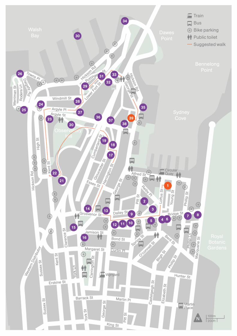
200ft100m
N
Train Bus Bike parking Public toilet Suggested walk
ColonyHistory WalkCustoms House to Millers Point—
ColonyHistory WalkCustoms House to Millers Point
—
Customs House was where shipping was cleared and goods passing through the port of Sydney were taxed and cleared for sale or export. When the port was busy the House was crowded and noisy, a scene of raised tempers, delays and disputed dealings. Customs House was surrounded by public houses,shipping companies and general maritime activities.
Walk down Loftus Street alongside the House. A flag flies permanently on the site where the first British flag was raised.For some Australians, this is the site of invasion. In the little lane behind Customs House you can still see the old Hinchcliffs Woolstore with its loft pulleys. Now cross over Loftus Street and head for Macquarie Place. Opposite the park, through an archway, is Bulletin Place (2).
2
Bulletin Place —This rare historic streetscape provides a glimpse of some of the early warehousing which used to dominate this precinct. Bulletin Place was where J F Archibald’s famous weekly The Bulletinwas published from 1880. This area, as a haunt for journalists and newspaper men, is regularly featured in late 19th century literature about Sydney.
Retrace your steps to Macquarie Place (3).
3
Macquarie Place —
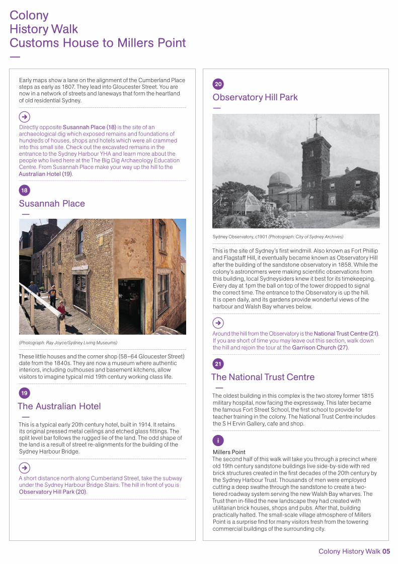
Macquarie Place in 1932 (Photograph: City of Sydney Archives)
Originally swampy mangrove land on the banks of the TankStream, the colony’s first water supply, this small piece of land is awash with historic relics. The Obelisk marks the point from which distances to all places in the colony were measured. This sandstone monument was designed by Francis Greenway, whowas sent to the colony for forgery and became Sydney’sfirst Colonial Architect. His legacy is visible in many of Sydney’s best–loved convict buildings. The imposing statue of Thomas Sutcliffe Mort (whose many achievements are listed on the plinth) looks out over Bridge Street, the premier financial street.
4
Bridge Street —
View along Bridge Street in the 1890s (Photograph: City of Sydney Archives)
Bridge Street was named for the wooden footbridge that crossed the Tank Stream. From the start, the town was both physically and socially divided by the Tank Stream. On the eastern side were the Governor’s house and the tents of the civil establishment. To the west were the makeshift barracks of the military and the convicts. Many signs of this social division remain today.
5 to 12
On Bridge Street the impressive sandstone Lands DepartmentBuilding (5) is directly opposite Macquarie Place. Othergovernment buildings to the east include the EducationDepartment (6), the Museum of Sydney set back on the site of the first Government House (7) and the Chief Secretary’sBuilding (8). Turn right and head for George Street. On your way you will pass the ASX/Australian Stock Exchange (9), the former Exchange Hotel (10), the headquarters of Burns Philp (11)which was once one of the major shipping companies in the Pacific, and the Metropolitan Hotel (12) on the corner.
Lands Department Building, 1963 (Photograph: City of Sydney Archives)
13
Grosvenor Place Towers —
Before you leave the Metropolitan Hotel corner, notice its architectural similarity to the buildings diagonally across GeorgeStreet. The old redbrick Johnsons Corner and Brooklyn Hotel weredesigned in about 1910 by Walter Liberty Vernon. Grosvenor Placetowers behind these old buildings. A condition for building this tower (designed by Harry Seidler and constructed between 1982 and 1987) was that Johnsons Corner and The Brooklynbe retained.
Walk up Grosvenor Street past some fine old late 19th century façades to St Patrick’s Church (14).
14
St Patrick’s Church —This simple Gothic sandstone church was designed by J F Hilly and built in the 1840s on land donated by William Davis, a convict, who took part in the Irish Rebellion in 1798. The church has been the traditional heartland of Sydney’s Irish working class Roman Catholics. Many inner city children were educated at St Patrick’s school. A visit to this recently restored church and associated buildings is a worthwhile detour.
15 & 16
This area was dedicated by Governor Hunter as a church precinct and is still known as Church Hill. After convicts burnt down the firstchurch near Sydney Cove, St Philip’s Anglican Church was built here in 1798–1807. The current St Philip’s (15) which you can seedates from 1848. The former Scots Presbyterian Church (16)was built to replace an older one demolished to make way for the approaches to the Sydney Harbour Bridge. Continue walking for a while down Harrington Street, pass under the Cahill Expressway and take the old worn steps on your left up to Cumberland Place(17) and Susannah Place (18).
17
Cumberland Place —
Cumberland Place in 1901 (Photograph: State Records of NSW)
Early maps show a lane on the alignment of the Cumberland Place steps as early as 1807. They lead into Gloucester Street. You are now in a network of streets and laneways that form the heartland of old residential Sydney.
Directly opposite Susannah Place (18) is the site of anarchaeological dig which exposed remains and foundations ofhundreds of houses, shops and hotels which were all crammedinto this small site. Check out the excavated remains in the entrance to the Sydney Harbour YHA and learn more about the people who lived here at the The Big Dig Archaeology Education Centre. From Susannah Place make your way up the hill to the Australian Hotel (19).
18
Susannah Place —
(Photograph: Ray Joyce/Sydney Living Museums)
These little houses and the corner shop (58–64 Gloucester Street)date from the 1840s. They are now a museum where authentic interiors, including outhouses and basement kitchens, allow visitors to imagine typical mid 19th century working class life.
19
The Australian Hotel —This is a typical early 20th century hotel, built in 1914. It retains its original pressed metal ceilings and etched glass fittings. The split level bar follows the rugged lie of the land. The odd shape of the land is a result of street re-alignments for the building of the Sydney Harbour Bridge.
A short distance north along Cumberland Street, take the subway under the Sydney Harbour Bridge Stairs. The hill in front of you is Observatory Hill Park (20).
ColonyHistoryWalkCustoms HousetoMillersPoint—
ColonyHistoryWalkCustoms House to Millers Point—
Stop, Look, Listen, Think.Look both ways before you step off the kerb.
Please reuse or recycle this guide.
Prepared by the City of Sydney’s History Program.8th edition, October 2014.
Discover historic Sydney with more walking tours in the series at cityofsydney.nsw.gov.au/history or requesta copy by contacting the City of Sydney on 9265 9333.
—Download the free Sydney Culture Walks app.Enjoy walks and historical points of interest direct to your mobile.
“Discover our city’s pastby foot and explore the many stories of Sydney.”
Lord Mayor Clover Moore
8572_FA1_Historical Walking Tours – Colony.indd 1-4 9/10/2014 2:40 pm
ColonyHistory WalkCustoms House to Millers Point
—The earliest European Sydneysiders, convicts, soldiers, whalers and sailors, all walked this route. Later came the shipping magnates, wharf labourers and traders. The Rocks and MillersPoint have been overlaid by generations of change. But amongst the bustling modern city streets, remnants and traces of these early times can be found. Pubs and churches, archaeological digs and houses all evoke memories of past lives, past ways.
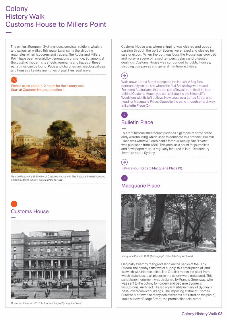
Please allow about 1–2 hours for the history walk. Start at Customs House, Location 1
George Peacock’s 1845 view of Customs House with The Rocks in the background (Image: Mitchell Library, State Library of NSW)
1
Customs House —
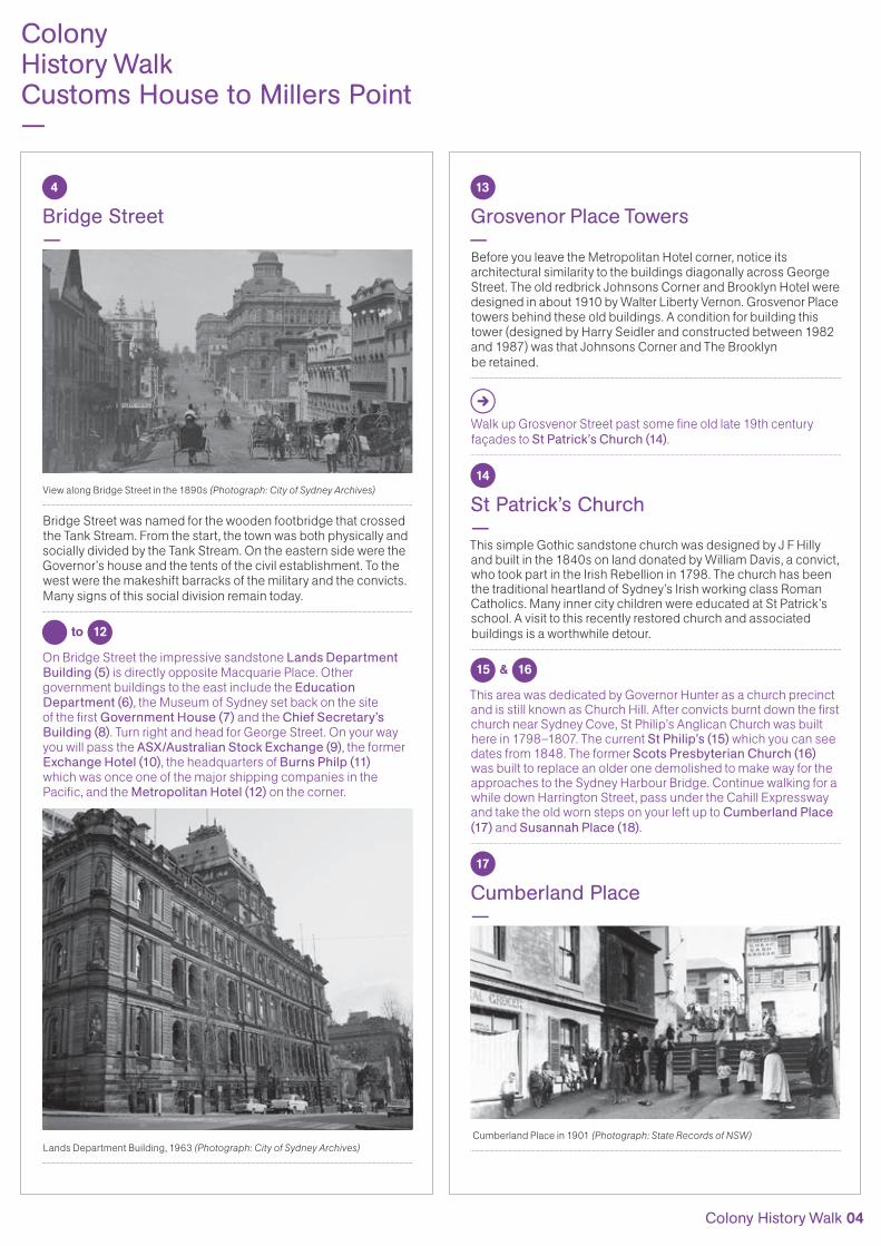
Customs House in 1928 (Photograph: City of Sydney Archives)
3
Macquarie Place —
Macquarie Place in 1932 (Photograph: City of Sydney Archives)
Originally swampy mangrove land on the banks of the TankStream, the colony’s first water supply, this small piece of land is awash with historic relics. The Obelisk marks the point from which distances to all places in the colony were measured. This sandstone monument was designed by Francis Greenway, whowas sent to the colony for forgery and became Sydney’sfirst Colonial Architect. His legacy is visible in many of Sydney’s best–loved convict buildings. The imposing statue of Thomas Sutcliffe Mort (whose many achievements are listed on the plinth) looks out over Bridge Street, the premier financial street.
4
Bridge Street —
View along Bridge Street in the 1890s (Photograph: City of Sydney Archives)
Bridge Street was named for the wooden footbridge that crossed the Tank Stream. From the start, the town was both physically and socially divided by the Tank Stream. On the eastern side were the Governor’s house and the tents of the civil establishment. To the west were the makeshift barracks of the military and the convicts. Many signs of this social division remain today.
5 to 12
On Bridge Street the impressive sandstone Lands DepartmentBuilding (5) is directly opposite Macquarie Place. Othergovernment buildings to the east include the EducationDepartment (6), the Museum of Sydney set back on the site of the first Government House (7) and the Chief Secretary’sBuilding (8). Turn right and head for George Street. On your way you will pass the ASX/Australian Stock Exchange (9), the former Exchange Hotel (10), the headquarters of Burns Philp (11)which was once one of the major shipping companies in the Pacific, and the Metropolitan Hotel (12) on the corner.
Lands Department Building, 1963 (Photograph: City of Sydney Archives)
13
Grosvenor Place Towers —
Before you leave the Metropolitan Hotel corner, notice its architectural similarity to the buildings diagonally across GeorgeStreet. The old redbrick Johnsons Corner and Brooklyn Hotel weredesigned in about 1910 by Walter Liberty Vernon. Grosvenor Placetowers behind these old buildings. A condition for building this tower (designed by Harry Seidler and constructed between 1982 and 1987) was that Johnsons Corner and The Brooklynbe retained.
Walk up Grosvenor Street past some fine old late 19th century façades to St Patrick’s Church (14).
14
St Patrick’s Church —This simple Gothic sandstone church was designed by J F Hilly and built in the 1840s on land donated by William Davis, a convict, who took part in the Irish Rebellion in 1798. The church has been the traditional heartland of Sydney’s Irish working class Roman Catholics. Many inner city children were educated at St Patrick’s school. A visit to this recently restored church and associated buildings is a worthwhile detour.
15 & 16
This area was dedicated by Governor Hunter as a church precinct and is still known as Church Hill. After convicts burnt down the firstchurch near Sydney Cove, St Philip’s Anglican Church was built here in 1798–1807. The current St Philip’s (15) which you can seedates from 1848. The former Scots Presbyterian Church (16)was built to replace an older one demolished to make way for the approaches to the Sydney Harbour Bridge. Continue walking for a while down Harrington Street, pass under the Cahill Expressway and take the old worn steps on your left up to Cumberland Place(17) and Susannah Place (18).
17
Cumberland Place —
Cumberland Place in 1901 (Photograph: State Records of NSW)
Early maps show a lane on the alignment of the Cumberland Place steps as early as 1807. They lead into Gloucester Street. You are now in a network of streets and laneways that form the heartland of old residential Sydney.
Directly opposite Susannah Place (18) is the site of anarchaeological dig which exposed remains and foundations ofhundreds of houses, shops and hotels which were all crammedinto this small site. Check out the excavated remains in the entrance to the Sydney Harbour YHA and learn more about the people who lived here at the The Big Dig Archaeology Education Centre. From Susannah Place make your way up the hill to the Australian Hotel (19).
18
Susannah Place —
(Photograph: Ray Joyce/Sydney Living Museums)
These little houses and the corner shop (58–64 Gloucester Street)date from the 1840s. They are now a museum where authentic interiors, including outhouses and basement kitchens, allow visitors to imagine typical mid 19th century working class life.
19
The Australian Hotel —This is a typical early 20th century hotel, built in 1914. It retains its original pressed metal ceilings and etched glass fittings. The split level bar follows the rugged lie of the land. The odd shape of the land is a result of street re-alignments for the building of the Sydney Harbour Bridge.
A short distance north along Cumberland Street, take the subway under the Sydney Harbour Bridge Stairs. The hill in front of you is Observatory Hill Park (20).
ColonyHistoryWalkCustoms HousetoMillersPoint—
ColonyHistoryWalkCustoms House to Millers Point—
Stop, Look, Listen, Think.Look both ways before you step off the kerb.
Please reuse or recycle this guide.
Prepared by the City of Sydney’s History Program.8th edition, October 2014.
Discover historic Sydney with more walking tours in the series at cityofsydney.nsw.gov.au/history or requesta copy by contacting the City of Sydney on 9265 9333.
—Download the free Sydney Culture Walks app.Enjoy walks and historical points of interest direct to your mobile.
“Discover our city’s pastby foot and explore the many stories of Sydney.”
Lord Mayor Clover Moore
8572_FA1_Historical Walking Tours – Colony.indd 1-4 9/10/2014 2:40 pmColonyHistory WalkCustoms House to Millers Point
—The earliest European Sydneysiders, convicts, soldiers, whalers and sailors, all walked this route. Later came the shipping magnates, wharf labourers and traders. The Rocks and MillersPoint have been overlaid by generations of change. But amongst the bustling modern city streets, remnants and traces of these early times can be found. Pubs and churches, archaeological digs and houses all evoke memories of past lives, past ways.
Please allow about 1–2 hours for the history walk. Start at Customs House, Location 1
George Peacock’s 1845 view of Customs House with The Rocks in the background (Image: Mitchell Library, State Library of NSW)
1
Customs House —
Customs House in 1928 (Photograph: City of Sydney Archives)
Customs House was where shipping was cleared and goods passing through the port of Sydney were taxed and cleared for sale or export. When the port was busy the House was crowded and noisy, a scene of raised tempers, delays and disputed dealings. Customs House was surrounded by public houses,shipping companies and general maritime activities.
Walk down Loftus Street alongside the House. A flag flies permanently on the site where the first British flag was raised.For some Australians, this is the site of invasion. In the little lane behind Customs House you can still see the old Hinchcliffs Woolstore with its loft pulleys. Now cross over Loftus Street and head for Macquarie Place. Opposite the park, through an archway, is Bulletin Place (2).
2
Bulletin Place —This rare historic streetscape provides a glimpse of some of the early warehousing which used to dominate this precinct. Bulletin Place was where J F Archibald’s famous weekly The Bulletinwas published from 1880. This area, as a haunt for journalists and newspaper men, is regularly featured in late 19th century literature about Sydney.
Retrace your steps to Macquarie Place (3).
4
Bridge Street —
View along Bridge Street in the 1890s (Photograph: City of Sydney Archives)
Bridge Street was named for the wooden footbridge that crossed the Tank Stream. From the start, the town was both physically and socially divided by the Tank Stream. On the eastern side were the Governor’s house and the tents of the civil establishment. To the west were the makeshift barracks of the military and the convicts. Many signs of this social division remain today.
5 to 12
On Bridge Street the impressive sandstone Lands DepartmentBuilding (5) is directly opposite Macquarie Place. Othergovernment buildings to the east include the EducationDepartment (6), the Museum of Sydney set back on the site of the first Government House (7) and the Chief Secretary’sBuilding (8). Turn right and head for George Street. On your way you will pass the ASX/Australian Stock Exchange (9), the former Exchange Hotel (10), the headquarters of Burns Philp (11)which was once one of the major shipping companies in the Pacific, and the Metropolitan Hotel (12) on the corner.
Lands Department Building, 1963 (Photograph: City of Sydney Archives)
13
Grosvenor Place Towers —
Before you leave the Metropolitan Hotel corner, notice its architectural similarity to the buildings diagonally across GeorgeStreet. The old redbrick Johnsons Corner and Brooklyn Hotel weredesigned in about 1910 by Walter Liberty Vernon. Grosvenor Placetowers behind these old buildings. A condition for building this tower (designed by Harry Seidler and constructed between 1982 and 1987) was that Johnsons Corner and The Brooklynbe retained.
Walk up Grosvenor Street past some fine old late 19th century façades to St Patrick’s Church (14).
14
St Patrick’s Church —This simple Gothic sandstone church was designed by J F Hilly and built in the 1840s on land donated by William Davis, a convict, who took part in the Irish Rebellion in 1798. The church has been the traditional heartland of Sydney’s Irish working class Roman Catholics. Many inner city children were educated at St Patrick’s school. A visit to this recently restored church and associated buildings is a worthwhile detour.
15 & 16
This area was dedicated by Governor Hunter as a church precinct and is still known as Church Hill. After convicts burnt down the firstchurch near Sydney Cove, St Philip’s Anglican Church was built here in 1798–1807. The current St Philip’s (15) which you can seedates from 1848. The former Scots Presbyterian Church (16)was built to replace an older one demolished to make way for the approaches to the Sydney Harbour Bridge. Continue walking for a while down Harrington Street, pass under the Cahill Expressway and take the old worn steps on your left up to Cumberland Place(17) and Susannah Place (18).
17
Cumberland Place —
Cumberland Place in 1901 (Photograph: State Records of NSW)
Early maps show a lane on the alignment of the Cumberland Place steps as early as 1807. They lead into Gloucester Street. You are now in a network of streets and laneways that form the heartland of old residential Sydney.
Directly opposite Susannah Place (18) is the site of anarchaeological dig which exposed remains and foundations ofhundreds of houses, shops and hotels which were all crammedinto this small site. Check out the excavated remains in the entrance to the Sydney Harbour YHA and learn more about the people who lived here at the The Big Dig Archaeology Education Centre. From Susannah Place make your way up the hill to the Australian Hotel (19).
18
Susannah Place —
(Photograph: Ray Joyce/Sydney Living Museums)
These little houses and the corner shop (58–64 Gloucester Street)date from the 1840s. They are now a museum where authentic interiors, including outhouses and basement kitchens, allow visitors to imagine typical mid 19th century working class life.
19
The Australian Hotel —This is a typical early 20th century hotel, built in 1914. It retains its original pressed metal ceilings and etched glass fittings. The split level bar follows the rugged lie of the land. The odd shape of the land is a result of street re-alignments for the building of the Sydney Harbour Bridge.
A short distance north along Cumberland Street, take the subway under the Sydney Harbour Bridge Stairs. The hill in front of you is Observatory Hill Park (20).
ColonyHistoryWalkCustoms HousetoMillersPoint—
ColonyHistoryWalkCustoms House to Millers Point—
Stop, Look, Listen, Think.Look both ways before you step off the kerb.
Please reuse or recycle this guide.
Prepared by the City of Sydney’s History Program.8th edition, October 2014.
Discover historic Sydney with more walking tours in the series at cityofsydney.nsw.gov.au/history or requesta copy by contacting the City of Sydney on 9265 9333.
—Download the free Sydney Culture Walks app.Enjoy walks and historical points of interest direct to your mobile.
“Discover our city’s pastby foot and explore the many stories of Sydney.”
Lord Mayor Clover Moore
8572_FA1_Historical Walking Tours – Colony.indd 1-4 9/10/2014 2:40 pm
1
The earliest European Sydneysiders, convicts, soldiers, whalers and sailors, all walked this route. Later came the shipping magnates, wharf labourers and traders. The Rocks and Millers Point have been overlaid by generations of change. But amongst the bustling modern city streets, remnants and traces of these early times can be found. Pubs and churches, archaeological digs and houses all evoke memories of past lives, past ways.
Customs House was where shipping was cleared and goods passing through the port of Sydney were taxed and cleared for sale or export. When the port was busy the House was crowded and noisy, a scene of raised tempers, delays and disputed dealings. Customs House was surrounded by public houses, shipping companies and general maritime activities.
Please allow about 1–2 hours for the history walk. Start at Customs House, Location 1
George Peacock’s 1845 view of Customs House with The Rocks in the background (Image: Mitchell Library, State Library of NSW)
Customs House —
Walk down Loftus Street alongside the House. A flag flies permanently on the site where the first British flag was raised. For some Australians, this is the site of invasion. In the little lane behind Customs House you can still see the old Hinchcliffs Woolstore with its loft pulleys. Now cross over Loftus Street and head for Macquarie Place. Opposite the park, through an archway, is Bulletin Place (2).
2
Bulletin Place — This rare historic streetscape provides a glimpse of some of the early warehousing which used to dominate this precinct. Bulletin Place was where J F Archibald’s famous weekly The Bulletin was published from 1880. This area, as a haunt for journalists and newspaper men, is regularly featured in late 19th century literature about Sydney.
Retrace your steps to Macquarie Place (3).
3
Macquarie Place —
Macquarie Place in 1932 (Photograph: City of Sydney Archives)
Originally swampy mangrove land on the banks of the Tank Stream, the colony’s first water supply, this small piece of land is awash with historic relics. The Obelisk marks the point from which distances to all places in the colony were measured. This sandstone monument was designed by Francis Greenway, who was sent to the colony for forgery and became Sydney’s first Colonial Architect. His legacy is visible in many of Sydney’s best–loved convict buildings. The imposing statue of Thomas Sutcliffe Mort (whose many achievements are listed on the plinth) looks out over Bridge Street, the premier financial street.
Customs House in 1928 (Photograph: City of Sydney Archives)
Colony History Walk 03
ColonyHistory WalkCustoms House to Millers Point—
ColonyHistory WalkCustoms House to Millers Point
—The earliest European Sydneysiders, convicts, soldiers, whalers and sailors, all walked this route. Later came the shipping magnates, wharf labourers and traders. The Rocks and MillersPoint have been overlaid by generations of change. But amongst the bustling modern city streets, remnants and traces of these early times can be found. Pubs and churches, archaeological digs and houses all evoke memories of past lives, past ways.
Please allow about 1–2 hours for the history walk. Start at Customs House, Location 1
George Peacock’s 1845 view of Customs House with The Rocks in the background (Image: Mitchell Library, State Library of NSW)
1
Customs House —
Customs House in 1928 (Photograph: City of Sydney Archives)
Customs House was where shipping was cleared and goods passing through the port of Sydney were taxed and cleared for sale or export. When the port was busy the House was crowded and noisy, a scene of raised tempers, delays and disputed dealings. Customs House was surrounded by public houses,shipping companies and general maritime activities.
Walk down Loftus Street alongside the House. A flag flies permanently on the site where the first British flag was raised.For some Australians, this is the site of invasion. In the little lane behind Customs House you can still see the old Hinchcliffs Woolstore with its loft pulleys. Now cross over Loftus Street and head for Macquarie Place. Opposite the park, through an archway, is Bulletin Place (2).
2
Bulletin Place —This rare historic streetscape provides a glimpse of some of the early warehousing which used to dominate this precinct. Bulletin Place was where J F Archibald’s famous weekly The Bulletinwas published from 1880. This area, as a haunt for journalists and newspaper men, is regularly featured in late 19th century literature about Sydney.
Retrace your steps to Macquarie Place (3).
3
Macquarie Place —
Macquarie Place in 1932 (Photograph: City of Sydney Archives)
Originally swampy mangrove land on the banks of the TankStream, the colony’s first water supply, this small piece of land is awash with historic relics. The Obelisk marks the point from which distances to all places in the colony were measured. This sandstone monument was designed by Francis Greenway, whowas sent to the colony for forgery and became Sydney’sfirst Colonial Architect. His legacy is visible in many of Sydney’s best–loved convict buildings. The imposing statue of Thomas Sutcliffe Mort (whose many achievements are listed on the plinth) looks out over Bridge Street, the premier financial street.
13
Grosvenor Place Towers —
Before you leave the Metropolitan Hotel corner, notice its architectural similarity to the buildings diagonally across GeorgeStreet. The old redbrick Johnsons Corner and Brooklyn Hotel weredesigned in about 1910 by Walter Liberty Vernon. Grosvenor Placetowers behind these old buildings. A condition for building this tower (designed by Harry Seidler and constructed between 1982 and 1987) was that Johnsons Corner and The Brooklynbe retained.
Walk up Grosvenor Street past some fine old late 19th century façades to St Patrick’s Church (14).
14
St Patrick’s Church —This simple Gothic sandstone church was designed by J F Hilly and built in the 1840s on land donated by William Davis, a convict, who took part in the Irish Rebellion in 1798. The church has been the traditional heartland of Sydney’s Irish working class Roman Catholics. Many inner city children were educated at St Patrick’s school. A visit to this recently restored church and associated buildings is a worthwhile detour.
15 & 16
This area was dedicated by Governor Hunter as a church precinct and is still known as Church Hill. After convicts burnt down the firstchurch near Sydney Cove, St Philip’s Anglican Church was built here in 1798–1807. The current St Philip’s (15) which you can seedates from 1848. The former Scots Presbyterian Church (16)was built to replace an older one demolished to make way for the approaches to the Sydney Harbour Bridge. Continue walking for a while down Harrington Street, pass under the Cahill Expressway and take the old worn steps on your left up to Cumberland Place(17) and Susannah Place (18).
17
Cumberland Place —
Cumberland Place in 1901 (Photograph: State Records of NSW)
Early maps show a lane on the alignment of the Cumberland Place steps as early as 1807. They lead into Gloucester Street. You are now in a network of streets and laneways that form the heartland of old residential Sydney.
Directly opposite Susannah Place (18) is the site of anarchaeological dig which exposed remains and foundations ofhundreds of houses, shops and hotels which were all crammedinto this small site. Check out the excavated remains in the entrance to the Sydney Harbour YHA and learn more about the people who lived here at the The Big Dig Archaeology Education Centre. From Susannah Place make your way up the hill to the Australian Hotel (19).
18
Susannah Place —
(Photograph: Ray Joyce/Sydney Living Museums)
These little houses and the corner shop (58–64 Gloucester Street)date from the 1840s. They are now a museum where authentic interiors, including outhouses and basement kitchens, allow visitors to imagine typical mid 19th century working class life.
19
The Australian Hotel —This is a typical early 20th century hotel, built in 1914. It retains its original pressed metal ceilings and etched glass fittings. The split level bar follows the rugged lie of the land. The odd shape of the land is a result of street re-alignments for the building of the Sydney Harbour Bridge.
A short distance north along Cumberland Street, take the subway under the Sydney Harbour Bridge Stairs. The hill in front of you is Observatory Hill Park (20).
ColonyHistoryWalkCustoms HousetoMillersPoint—
ColonyHistoryWalkCustoms House to Millers Point—
Stop, Look, Listen, Think.Look both ways before you step off the kerb.
Please reuse or recycle this guide.
Prepared by the City of Sydney’s History Program.8th edition, October 2014.
Discover historic Sydney with more walking tours in the series at cityofsydney.nsw.gov.au/history or requesta copy by contacting the City of Sydney on 9265 9333.
—Download the free Sydney Culture Walks app.Enjoy walks and historical points of interest direct to your mobile.
“Discover our city’s pastby foot and explore the many stories of Sydney.”
Lord Mayor Clover Moore
8572_FA1_Historical Walking Tours – Colony.indd 1-4 9/10/2014 2:40 pm
ColonyHistory WalkCustoms House to Millers Point
—The earliest European Sydneysiders, convicts, soldiers, whalers and sailors, all walked this route. Later came the shipping magnates, wharf labourers and traders. The Rocks and MillersPoint have been overlaid by generations of change. But amongst the bustling modern city streets, remnants and traces of these early times can be found. Pubs and churches, archaeological digs and houses all evoke memories of past lives, past ways.
Please allow about 1–2 hours for the history walk. Start at Customs House, Location 1
George Peacock’s 1845 view of Customs House with The Rocks in the background (Image: Mitchell Library, State Library of NSW)
1
Customs House —
Customs House in 1928 (Photograph: City of Sydney Archives)
Customs House was where shipping was cleared and goods passing through the port of Sydney were taxed and cleared for sale or export. When the port was busy the House was crowded and noisy, a scene of raised tempers, delays and disputed dealings. Customs House was surrounded by public houses,shipping companies and general maritime activities.
Walk down Loftus Street alongside the House. A flag flies permanently on the site where the first British flag was raised.For some Australians, this is the site of invasion. In the little lane behind Customs House you can still see the old Hinchcliffs Woolstore with its loft pulleys. Now cross over Loftus Street and head for Macquarie Place. Opposite the park, through an archway, is Bulletin Place (2).
2
Bulletin Place —This rare historic streetscape provides a glimpse of some of the early warehousing which used to dominate this precinct. Bulletin Place was where J F Archibald’s famous weekly The Bulletinwas published from 1880. This area, as a haunt for journalists and newspaper men, is regularly featured in late 19th century literature about Sydney.
Retrace your steps to Macquarie Place (3).
3
Macquarie Place —
Macquarie Place in 1932 (Photograph: City of Sydney Archives)
Originally swampy mangrove land on the banks of the TankStream, the colony’s first water supply, this small piece of land is awash with historic relics. The Obelisk marks the point from which distances to all places in the colony were measured. This sandstone monument was designed by Francis Greenway, whowas sent to the colony for forgery and became Sydney’sfirst Colonial Architect. His legacy is visible in many of Sydney’s best–loved convict buildings. The imposing statue of Thomas Sutcliffe Mort (whose many achievements are listed on the plinth) looks out over Bridge Street, the premier financial street.
4
Bridge Street —
View along Bridge Street in the 1890s (Photograph: City of Sydney Archives)
Bridge Street was named for the wooden footbridge that crossed the Tank Stream. From the start, the town was both physically and socially divided by the Tank Stream. On the eastern side were the Governor’s house and the tents of the civil establishment. To the west were the makeshift barracks of the military and the convicts. Many signs of this social division remain today.
5 to 12
On Bridge Street the impressive sandstone Lands DepartmentBuilding (5) is directly opposite Macquarie Place. Othergovernment buildings to the east include the EducationDepartment (6), the Museum of Sydney set back on the site of the first Government House (7) and the Chief Secretary’sBuilding (8). Turn right and head for George Street. On your way you will pass the ASX/Australian Stock Exchange (9), the former Exchange Hotel (10), the headquarters of Burns Philp (11)which was once one of the major shipping companies in the Pacific, and the Metropolitan Hotel (12) on the corner.
Lands Department Building, 1963 (Photograph: City of Sydney Archives)
Walk up Grosvenor Street past some fine old late 19th century façades to St Patrick’s Church (14).
14
St Patrick’s Church —This simple Gothic sandstone church was designed by J F Hilly and built in the 1840s on land donated by William Davis, a convict, who took part in the Irish Rebellion in 1798. The church has been the traditional heartland of Sydney’s Irish working class Roman Catholics. Many inner city children were educated at St Patrick’s school. A visit to this recently restored church and associated buildings is a worthwhile detour.
15 & 16
This area was dedicated by Governor Hunter as a church precinct and is still known as Church Hill. After convicts burnt down the firstchurch near Sydney Cove, St Philip’s Anglican Church was built here in 1798–1807. The current St Philip’s (15) which you can seedates from 1848. The former Scots Presbyterian Church (16)was built to replace an older one demolished to make way for the approaches to the Sydney Harbour Bridge. Continue walking for a while down Harrington Street, pass under the Cahill Expressway and take the old worn steps on your left up to Cumberland Place(17) and Susannah Place (18).
17
Cumberland Place —
Cumberland Place in 1901 (Photograph: State Records of NSW)
Early maps show a lane on the alignment of the Cumberland Place steps as early as 1807. They lead into Gloucester Street. You are now in a network of streets and laneways that form the heartland of old residential Sydney.
Directly opposite Susannah Place (18) is the site of anarchaeological dig which exposed remains and foundations ofhundreds of houses, shops and hotels which were all crammedinto this small site. Check out the excavated remains in the entrance to the Sydney Harbour YHA and learn more about the people who lived here at the The Big Dig Archaeology Education Centre. From Susannah Place make your way up the hill to the Australian Hotel (19).
18
Susannah Place —
(Photograph: Ray Joyce/Sydney Living Museums)
These little houses and the corner shop (58–64 Gloucester Street)date from the 1840s. They are now a museum where authentic interiors, including outhouses and basement kitchens, allow visitors to imagine typical mid 19th century working class life.
19
The Australian Hotel —This is a typical early 20th century hotel, built in 1914. It retains its original pressed metal ceilings and etched glass fittings. The split level bar follows the rugged lie of the land. The odd shape of the land is a result of street re-alignments for the building of the Sydney Harbour Bridge.
A short distance north along Cumberland Street, take the subway under the Sydney Harbour Bridge Stairs. The hill in front of you is Observatory Hill Park (20).
ColonyHistoryWalkCustoms HousetoMillersPoint—
ColonyHistoryWalkCustoms House to Millers Point—
Stop, Look, Listen, Think.Look both ways before you step off the kerb.
Please reuse or recycle this guide.
Prepared by the City of Sydney’s History Program.8th edition, October 2014.
Discover historic Sydney with more walking tours in the series at cityofsydney.nsw.gov.au/history or requesta copy by contacting the City of Sydney on 9265 9333.
—Download the free Sydney Culture Walks app.Enjoy walks and historical points of interest direct to your mobile.
“Discover our city’s pastby foot and explore the many stories of Sydney.”
Lord Mayor Clover Moore
8572_FA1_Historical Walking Tours – Colony.indd 1-4 9/10/2014 2:40 pmColonyHistory WalkCustoms House to Millers Point
—The earliest European Sydneysiders, convicts, soldiers, whalers and sailors, all walked this route. Later came the shipping magnates, wharf labourers and traders. The Rocks and MillersPoint have been overlaid by generations of change. But amongst the bustling modern city streets, remnants and traces of these early times can be found. Pubs and churches, archaeological digs and houses all evoke memories of past lives, past ways.
Please allow about 1–2 hours for the history walk. Start at Customs House, Location 1
George Peacock’s 1845 view of Customs House with The Rocks in the background (Image: Mitchell Library, State Library of NSW)
1
Customs House —
Customs House in 1928 (Photograph: City of Sydney Archives)
Customs House was where shipping was cleared and goods passing through the port of Sydney were taxed and cleared for sale or export. When the port was busy the House was crowded and noisy, a scene of raised tempers, delays and disputed dealings. Customs House was surrounded by public houses,shipping companies and general maritime activities.
Walk down Loftus Street alongside the House. A flag flies permanently on the site where the first British flag was raised.For some Australians, this is the site of invasion. In the little lane behind Customs House you can still see the old Hinchcliffs Woolstore with its loft pulleys. Now cross over Loftus Street and head for Macquarie Place. Opposite the park, through an archway, is Bulletin Place (2).
2
Bulletin Place —This rare historic streetscape provides a glimpse of some of the early warehousing which used to dominate this precinct. Bulletin Place was where J F Archibald’s famous weekly The Bulletinwas published from 1880. This area, as a haunt for journalists and newspaper men, is regularly featured in late 19th century literature about Sydney.
Retrace your steps to Macquarie Place (3).
3
Macquarie Place —
Macquarie Place in 1932 (Photograph: City of Sydney Archives)
Originally swampy mangrove land on the banks of the TankStream, the colony’s first water supply, this small piece of land is awash with historic relics. The Obelisk marks the point from which distances to all places in the colony were measured. This sandstone monument was designed by Francis Greenway, whowas sent to the colony for forgery and became Sydney’sfirst Colonial Architect. His legacy is visible in many of Sydney’s best–loved convict buildings. The imposing statue of Thomas Sutcliffe Mort (whose many achievements are listed on the plinth) looks out over Bridge Street, the premier financial street.
4
Bridge Street —
View along Bridge Street in the 1890s (Photograph: City of Sydney Archives)
Bridge Street was named for the wooden footbridge that crossed the Tank Stream. From the start, the town was both physically and socially divided by the Tank Stream. On the eastern side were the Governor’s house and the tents of the civil establishment. To the west were the makeshift barracks of the military and the convicts. Many signs of this social division remain today.
5 to 12
On Bridge Street the impressive sandstone Lands DepartmentBuilding (5) is directly opposite Macquarie Place. Othergovernment buildings to the east include the EducationDepartment (6), the Museum of Sydney set back on the site of the first Government House (7) and the Chief Secretary’sBuilding (8). Turn right and head for George Street. On your way you will pass the ASX/Australian Stock Exchange (9), the former Exchange Hotel (10), the headquarters of Burns Philp (11)which was once one of the major shipping companies in the Pacific, and the Metropolitan Hotel (12) on the corner.
Lands Department Building, 1963 (Photograph: City of Sydney Archives)
13
Grosvenor Place Towers —
Before you leave the Metropolitan Hotel corner, notice its architectural similarity to the buildings diagonally across GeorgeStreet. The old redbrick Johnsons Corner and Brooklyn Hotel weredesigned in about 1910 by Walter Liberty Vernon. Grosvenor Placetowers behind these old buildings. A condition for building this tower (designed by Harry Seidler and constructed between 1982 and 1987) was that Johnsons Corner and The Brooklynbe retained.
Early maps show a lane on the alignment of the Cumberland Place steps as early as 1807. They lead into Gloucester Street. You are now in a network of streets and laneways that form the heartland of old residential Sydney.
Directly opposite Susannah Place (18) is the site of anarchaeological dig which exposed remains and foundations ofhundreds of houses, shops and hotels which were all crammedinto this small site. Check out the excavated remains in the entrance to the Sydney Harbour YHA and learn more about the people who lived here at the The Big Dig Archaeology Education Centre. From Susannah Place make your way up the hill to the Australian Hotel (19).
18
Susannah Place —
(Photograph: Ray Joyce/Sydney Living Museums)
These little houses and the corner shop (58–64 Gloucester Street)date from the 1840s. They are now a museum where authentic interiors, including outhouses and basement kitchens, allow visitors to imagine typical mid 19th century working class life.
19
The Australian Hotel —This is a typical early 20th century hotel, built in 1914. It retains its original pressed metal ceilings and etched glass fittings. The split level bar follows the rugged lie of the land. The odd shape of the land is a result of street re-alignments for the building of the Sydney Harbour Bridge.
A short distance north along Cumberland Street, take the subway under the Sydney Harbour Bridge Stairs. The hill in front of you is Observatory Hill Park (20).
ColonyHistoryWalkCustoms HousetoMillersPoint—
ColonyHistoryWalkCustoms House to Millers Point—
Stop, Look, Listen, Think.Look both ways before you step off the kerb.
Please reuse or recycle this guide.
Prepared by the City of Sydney’s History Program.8th edition, October 2014.
Discover historic Sydney with more walking tours in the series at cityofsydney.nsw.gov.au/history or requesta copy by contacting the City of Sydney on 9265 9333.
—Download the free Sydney Culture Walks app.Enjoy walks and historical points of interest direct to your mobile.
“Discover our city’s pastby foot and explore the many stories of Sydney.”
Lord Mayor Clover Moore
8572_FA1_Historical Walking Tours – Colony.indd 1-4 9/10/2014 2:40 pm
5
4 13
Bridge Street —
Grosvenor Place Towers —
Before you leave the Metropolitan Hotel corner, notice its architectural similarity to the buildings diagonally across George Street. The old redbrick Johnsons Corner and Brooklyn Hotel were designed in about 1910 by Walter Liberty Vernon. Grosvenor Place towers behind these old buildings. A condition for building this tower (designed by Harry Seidler and constructed between 1982 and 1987) was that Johnsons Corner and The Brooklyn be retained.
Walk up Grosvenor Street past some fine old late 19th century façades to St Patrick’s Church (14).
14 View along Bridge Street in the 1890s (Photograph: City of Sydney Archives)
Bridge Street was named for the wooden footbridge that crossed the Tank Stream. From the start, the town was both physically and socially divided by the Tank Stream. On the eastern side were the Governor’s house and the tents of the civil establishment. To the west were the makeshift barracks of the military and the convicts. Many signs of this social division remain today.
to 12
On Bridge Street the impressive sandstone Lands Department Building (5) is directly opposite Macquarie Place. Other government buildings to the east include the Education Department (6), the Museum of Sydney set back on the site of the first Government House (7) and the Chief Secretary’s Building (8). Turn right and head for George Street. On your way you will pass the ASX/Australian Stock Exchange (9), the former Exchange Hotel (10), the headquarters of Burns Philp (11) which was once one of the major shipping companies in the Pacific, and the Metropolitan Hotel (12) on the corner.
St Patrick’s Church — This simple Gothic sandstone church was designed by J F Hilly and built in the 1840s on land donated by William Davis, a convict, who took part in the Irish Rebellion in 1798. The church has been the traditional heartland of Sydney’s Irish working class Roman Catholics. Many inner city children were educated at St Patrick’s school. A visit to this recently restored church and associated buildings is a worthwhile detour.
15 & 16
This area was dedicated by Governor Hunter as a church precinct and is still known as Church Hill. After convicts burnt down the first church near Sydney Cove, St Philip’s Anglican Church was built here in 1798–1807. The current St Philip’s (15) which you can see dates from 1848. The former Scots Presbyterian Church (16) was built to replace an older one demolished to make way for the approaches to the Sydney Harbour Bridge. Continue walking for a while down Harrington Street, pass under the Cahill Expressway and take the old worn steps on your left up to Cumberland Place (17) and Susannah Place (18).
17
Cumberland Place —
Lands Department Building, 1963 (Photograph: City of Sydney Archives) Cumberland Place in 1901 (Photograph: State Records of NSW)
Colony History Walk 04
ColonyHistory WalkCustoms House to Millers Point—
Sydney Observatory, c1901 (Photograph: City of Sydney Archives)
This is the site of Sydney’s first windmill. Also known as Fort Phillip and Flagstaff Hill, it eventually became known as Observatory Hill after the building of the sandstone observatory in 1858. While the colony’s astronomers were making scientific observations from this building, local Sydneysiders knew it best for its timekeeping. Every day at 1pm the ball on top of the tower dropped to signal the correct time. The entrance to the Observatory is up the hill. It is open daily, and its gardens provide wonderful views of the harbour and Walsh Bay wharves below.
Around the hill from the Observatory is the National Trust Centre (21). If you are short of time you may leave out this section, walk down the hill and rejoin the tour at the Garrison Church (27).
21
The National Trust Centre —The oldest building in this complex is the two storey former 1815 military hospital, now facing the expressway. This later became the famous Fort Street School, the first school to provide for teacher training in the colony. The National Trust Centre includes the S H Ervin Gallery, cafe and shop.
i
Millers Point The second half of this walk will take you through a precinct where old 19th century sandstone buildings live side-by-side with red brick structures created in the first decades of the 20th century by the Sydney Harbour Trust. Thousands of men were employed cutting a deep swathe through the sandstone to create a two-tiered roadway system serving the new Walsh Bay wharves. The Trust then in-filled the new landscape they had created with utilitarian brick houses, shops and pubs. After that, building practically halted. The small-scale village atmosphere of Millers Point is a surprise find for many visitors fresh from the towering commercial buildings of the surrounding city.
Millers Point 1882 (Photograph: City of Sydney Archives)
22 to 23
Backtrack down the Agar Steps (22) on your left to a little row of terrace houses and then to Kent Street. Opposite the Agar Steps along High Street are early 20th century houses built by the Sydney Harbour Trust. Turn right and head down Kent Street to Argyle Place. Just before the corner, on your right, is the little St Brigid’s Church School (23), Australia’s oldest Roman Catholic building constructed 1834–35. On the corner is the post office.Diagonally opposite is the Lord Nelson Hotel (24), one of the oldest pubs in Sydney.
24
Lord Nelson Hotel —Built in 1836 by former plasterer William Wells as his home, the Lord Nelson obtained its liquor licence in 1841, one year before the town of Sydney was proclaimed a city. This makes it one of the oldest pubs in Sydney.
25 to 26
From here head right along Argyle Place. Or you may take a detour left, past the village shops built by the Sydney Harbour Trust to the old red brick Pallisade Hotel (25). Then track past the hotel and into Merriman Street, down to Clyne Reserve (26) at the end, and back along the walkway in front of the fine old townhouses perched high on the rocks overlooking Barangaroo and back to the Lord Nelson (24). Walk along Argyle Place past the village green to Garrison Church (27).
27
Garrison Church (Holy Trinity) —
(Photograph: Gary Deirmendjian collection, City of Sydney Archives)
This was the first official military church in NSW and serviced the military garrison at Dawes Point. Imagine the spectacle of the redcoats marching up Lower Fort Street from the artillery barracks to attend morning prayer. Although the church was officially called the Holy Trinity Church, it continues to be known as the Garrison Church. Military flags still adorn the church’s interior.
Make your way down Lower Fort Street to the Hero of Waterloo (28) on the corner of Windmill Street.
28
Hero of Waterloo —
Hero of Waterloo c.1907 (Photograph: City of Sydney Archives)
The rough-cut sandstone walls and heavy timber beams of the interior of the Hero of Waterloo evoke an atmosphere of the rough mariner’s life. This hotel was built by George Paton, a stonemason, in 1843. The Hero of Waterloo is the source of many local stories of concealed trapdoors, shanghaied sailors and rum smuggling.
Cross Windmill Street to Ferry Lane (29).
29
Ferry Lane and the Paddock —
Walsh Bay wharves, 1932 (Photograph: Adam Forrest Grant/City of Sydney Archives)
This flagstone laneway once led to the waterfront. The history of the area is told in the plaques and signs in the lane and in the reserve below, called The Paddock.
Follow Ferry Lane to Pottinger Street, looking out for the interpretive signs along the way. Either cross Pottinger Street to a walkway that takes you to the upper level of Wharves 6/7 or turn right and follow Pottinger Street to Hickson Road. There are a number of restaurants, cafes and bars along this road and on the waterfront.
30
Walsh Bay Wharves —
Hickson Road, 1952 (Photograph: City of Sydney Archives)
These huge two–storey timber wharves were part of the massive reconstruction generated by the Sydney Harbour Trust (later the Maritime Services Board), set up by the government in 1901 to “modernise” Sydney’s chaotic and inefficient waterfront. The wharves were intended to be built using concrete, but due to shortages of materials after World War I, timber was used. The wharves and their associated shore sheds form a rare group of industrial buildings and were built over a number of years after 1910. They were refurbished in 2003.
31 to 32
Retrace your steps to The Paddock, then take the path leading off Ferry Lane that runs along the rear of the fine Georgian houses on Lower Fort Street. At the end of the lane take the steps up to Lower Fort Street. On the corner is the Georgian house Clyde Bank (31). Almost directly opposite you is the Harbour View Hotel (32), which was built by the Sydney Harbour Trust. Head down into George Street (North) back towards The Rocks passing the Cast Iron Urinal (33).
33
Cast Iron Urinal —This is the last remaining cast iron urinal in the city. Public conveniences and urinals (or pissoirs) were common streetscape elements in early 20th century Sydney.
On the opposite side of the road is Dawes Point/Tar-ra (34).
34
Dawes Point/Tar-ra —Tar-ra is the name that Aboriginal people gave to this point. Now it carries the name of the astronomer sent by the British Board of Longitude to establish an observatory in the new colony. Lieutenant William Dawes was also a linguist. His friendship with Patyegarang has resulted in one of the earliest dictionaries of Aboriginal words. Dawes Point Park has archaeological excavations and interpretation relating to the early fortification built here to deter England’s international enemies. The fort was demolished in 1925 to make way for the Sydney Harbour Bridge.
Continue down along George Street (North). You are now returning to The Rocks. You may wish to end your tour here and leave exploring The Rocks until another time. The Sydney Visitor Centre (38) offers information and brochures, while nearby in Kendall Lane, The Rocks Discovery Museum (39) tells the history and archaeology of The Rocks.
i
The Rocks The higgledy-piggledy streets and narrow laneways which still define The Rocks record the first places the convicts and ex-convicts made their own. The vision of the convicts living in barracks weighed down by ball-and-chain is overstated. Many more convicts simply worked for the government during the day and worked for themselves the rest of the time, building houses, opening shops, running pubs and creating a new life. Today The Rocks is a living museum and practically every place has a story to tell.
The Rocks viewed from the eastern side of Circular Quay, 1880s (Photograph: Mitchell Library, State Library of NSW)
Not to be missed: Mariners Church (35), Argyle Cut (36), and Argyle Stores (37).
BILLYARD
AVENUE
ITHA
CA
RO
AD
M4 WESTERN DISTRIBUTOR FREEWAY
Geo
rge
St
Har
ringt
on S
t
Glo
uces
ter S
tCum
berla
nd S
t
Pitt
St
Pitt
St
Bligh
St
Cas
telg
eigh
St
Eliz
abet
h St
Art galle
ry rd
Geo
rge
St
York
St
York
LnKe
nt S
t
Cla
renc
e St
Kent
St
Hig
h St
Car
ringt
on S
t
Suss
ex S
t
Hic
kson
Rd
Hickso
n Rd
Hickson Rd
George St
Spring S
t
O’conn
ell S
t
Phill
ip S
t
Youn
g St
Loftu
s St
Mac
quar
ie S
t
Phill
ip L
n
Bridge StDalley St
Park st
William st
William st
Kings cross rd
Roslyn st
Ros
lyn
gard
ens
New south head rd
Oce
an s
t
Gle
nmor
e rd
Cas
cade
st
Glenmore rd
Gurner st
Paddington st
Oxford st
Renny st
Gordon st
Moore park rd
Gre
ens
rd
Oxford st
Willi
am st
Oat
ley
rd
Reg
ent s
t
Driv
er a
ve
Anzac pde
Anzac pde
Alison rd
Alison rd
Alison rd
Cook
rd
Robe
rtson
rd
Lang
rd
Lang rd
Orm
ond
st
Glenm
ore
rd
Brow
n st
Niel
d av
e
Boundary st
Barcom aveMcla
chlan
ave
Eliza
beth
st
Craigend st
Liverpool st
Liverpool st
Wentw
orth av
eFo
ster
st
Bathurst st
Wilmot st
Central stAlbion pl
Goulburn st
Goulburn st
Campbell stHay st
Hay st
Barlow st
Park
er s
t
Eddy ave
Valentine st
Campbell st
Ann st
Reservoir st
Fitzroy st
Foveaux st
Devonshire st
Kippax st
Cooper st
Arthur stDavies st
Arthur st
Rainford st
Phelps st
Bennett stProspect st
Albion ave
Napier st
Josephson st
Church st
Selw
yn s
t
Burton st
Macdonals st
Seale st
Francis st
Stanley st
Cathedral st
Bou
rke
st
Clapton
pl
Farrell ave
Forb
es st
Darlin
ghur
st rd
Darlin
ghur
st rd
Mac
leay
st
Vict
oria
st
Bou
rke
st
Forb
es s
t
Greenknowe aveElizabeth bay road
Challis ave
Mcdonald ln
St neot ave
Rockwall cres
Rockwall ln
Orwell st
Earl
st
Hughes st
Tusc
ulum
st
Manning st
Wylde st
Cow
per w
harf
rdw
y
War
d av
e
Victor
ia st
Vict
oria
st
Palm
er s
t
ts remlaP
Cro
wn
st
Bap
tist s
t
Nic
hols
st
Hut
chin
son
Mar
shal
l st
Sout
h do
wlin
g st
Sout
h do
wlin
g st
Sout
h do
wlin
g st
Rile
y st
ts htimS
Brisb
ane
st
Bou
rke
st
Bou
rke
st
Cro
wn
st
Cro
wn
st
Col
lege
st
Albion st
Taylor st
Suss
ex s
t
Suss
ex s
t
Dix
on s
t
Har
bour
st
Cas
tlere
agh
st
Pitt
st
Kent
st
Eliz
abet
h st
Nith
sdal
e st
Eliz
abet
h st
Com
mon
wea
lth s
t
Belm
ore
st
Lace
y st
ts tl oH
Randle s
t
Cor
ben
st
Mar
y st
Belle
vue
st
Wat
erlo
o st
Rile
y st
Rile
y st
Yuro
ng s
t
Rile
y st
Flin
ders
st
Chi
shol
m s
t
Eliz
abet
h st
Eliz
abet
h st
Elizabeth st
Clis
dell
st
Buc
king
ham
st
Cha
lmer
s st
Gre
at b
ucki
ngha
m s
t
Cha
lmer
s st
Bea
umon
t st
Wal
ker
st
Dou
glas
st
Geo
rge
st
George
st
adway
Thomas st
Mary ann st
Macarthur st
William henry s
t
Quarry st
Fig st
Allen st
Mur
ray
st
Wentworth park rd
Parramatta rd
Catherine st
Arundel st
Carillon ave
Mis
send
en rd
Wellington
Oconnor st
Queen st
Meagher st
Cleveland st
Cleveland st
Cleveland st
Cleveland st
Knox st Grafton st
Glebe point rd
Campbell st
Glebe st
Broughton st
Phillip st
Wentworth st
Mt vernon st
Westmoreland st
Derwent st Bay
st
Wattle st
Wattle st
Aber
crom
bie
st
Buck
land
st
Pine
st
Shep
herd
st
Rose
st
Bal
four
st
Glebe point rd
Talfourd stG
ottenham st
Colbourne ave
Darling stDarghan st
Bellevue st
Burton stBayview st
Lombard st
Taylor st
Glebe point rd
Mansfield st
Maxwell road
Bell stAllen st
Ave rd
Alexandra
Ross st Forest st
Lodge st
Jarocin ave
Minogue cres
Bridge rd
Bridge
rd
Pyrm
ont b
ridge
rd
Miller st
Bowman st
Edw
ard
stJohn st
Harvey st
Wigram rdBoyce
st
Toxteth rd
Arcadia r
d
Forsyth st
Cook st
Ferry rd
Victoria
rd
Eglinton rd
Hereford st
Marlborough
St johns rd
St johns rd
Lyndhurst st
Mitc
hell s
t
Cow
per
st
Boundary st
James st
James st
Wells st
Redfern st
Turner st
Albert st
Phillip st
Raglan st
Kellick st
Reeve st
Henderson rd
Railway pde
Locomotive st
Central ave
Wellington st
Mcevoy st
Allen st
Mandible st
Powell st
Lachlan st
Dacey ave
Bourke st
Joyn
ton
ave
Link r
d
O’dea ave
Todman ave
O’dea ave
Epsom rd
Epsom rd
Lenhalt st
Anza
c pd
e Don
cast
er a
ve
Anza
c pd
e
Todman ave
Collins st
Huntley st
Huntley st
Coulson st
Macdonald st
Victoria stAshmore st El
liot a
ve
Eve
st
Roc
hfor
d st
Flor
a st
Geo
rge
stC
harle
s st
Brid
ge s
tBu
rren
st
Mal
colm
st
Concord st
Sydney park rd
Prin
ces
hwy
King
st
Maddox st
Morely ave
Gardeners rd
Gardeners rd
Burrows rd
Burro
ws rd
Belm
ont s
t
Lawr
ence
stEu
ston
lane
Eusto
n ro
ad
Eust
on ro
ad
Campbell rd
Bour
ke rd
Bourke rd
Ricketty st Kent
rd
Harcourt pde
Rot
hsch
ild a
ve
Ros
eber
ry a
veD
alm
eny
ave
eva yneml a
D
Dal
men
y av
e
John st
Power ave
Park
rd
Cla
ra s
t
Park
st New
ton
st
King
scle
ar rd
Alex
ande
r st
Harley st
Ashmore st
Copeland st
Fountain st
Bowden st
Jennings stSwanson st
Albert st
Erskinville rd
Renwick st
Mitc
hell r
d
Sutto
r stDi
bbs s
t
Allen ave
Fox a
ve
Belm
ont s
tLa
wren
ce st
Mcevoy s
t
Hudson st
Dangar pl
Myrtle st
Vine st
Ivy s
t
Cod
ringt
on s
t
Ivy ln
Vine st
Aber
crom
bie
st
Abercrombie st
Wilson st
Lander st
Darlington rd
King st
City rd
Maze cres
Blackwattle
Evel
eigh
st
Ren
wic
k st
Geo
rge
st
Will
iam
st
Geo
rge
st
Cop
e st
Cop
e st
Geo
rge
st
Pitt
stPi
tt st
Pitt
stB
urne
tt
Hugo
st
Lewi
s st
Reg
ent s
t
Rege
nt s
t
Gib
bons
st
Bota
ny rd
dr ynat oB
O’riord
an st
O’ri
orda
n st
Botan
y rd
Phill
ips
st
Love
ridge
Bren
nan
st
Ger
ard
st
Gar
den
stC
ornw
allis
st
Ros
ehill
st
Wyn
dham
st
Shep
herd
st
Edwa
rd st
Calder rd
Caroline stLawson st
Lawson sq
Margaret
Pitt st
Lee
st
Regen
t st
Thom
as s
tQua
y st
Dar
ling
dr
Harris st
Harris st
Bulwara rdH
ackett st
Pyrmont st
Mount st
Jones st
Darli
ng h
arbo
ur is
lPirrama rd
Pirrama rd
Jones st
Jones st
Kens
ingt
on s
t
Harbour st
Ultimo rd
Pier stOxford st
Poplar
Waine st
Druitt st
Market St
Alfred St
Bent St
Hunter St
Martin Pl
King St
Grosvenor St
Margaret St
Bond St
Curtin Pl
Reiby Pl
Erskine St
Barrack St
Argyle St
Windmill St Lower
Fort
St
Towns Pl
Mcc
aule
y st
Stok
es a
ve
Ons
low
pl
Onslow
avenue
Womerah avenueSurre
y street
Nim
rod
stB
roug
ham
st
Mce
lhon
e st
Dow
ling
st
Pyrmont bridge
Union st
Qua
rry m
aster dr
Little pier st
Wes
tern
Dis
tribu
tor
Jamison St
Argyle Pl
Po
ttinr St
Sydney Cove
Bennelong Point
Dawes PointWalsh Bay
Darling Harbour
RoyalBotanicGardens
The Domain
Hyde Park
Beare Park
DarlingHarbour
Moore park
Belmore park
Wentworth Park
Harold park
Jubileepark
Victoriapark
Centennial park
Royal randwick racecourse
Cockle Bay
Blackwattle Bay
Rozelle bay
Johnstons Bay
Farm Cove
Woolloomooloo Bay
Elizabeth Bay
Rushcutters B ay
Sydney park
TaylorSquare
Sydney university
Observatory Hill
MartinPlace
Philli
p St
CircularQuay
Wynyard
Dalgety Rd
Suss
ex S
t
Essex St
Mer
riman
St
Rod
ents
Ln
ge
1
2
3
67 89
1012 11
1314
16
15
17
18
2023
22
21
26
30
34
28
31
29
27
32
35
36
38
24
33
19
37 39
5
25
4
200ft100m
N
Train Bus Bike parking Public toilet Suggested walk
8572_FA1_Historical Walking Tours – Colony.indd 5-8 9/10/2014 2:40 pm
20
Observatory Hill Park —
Millers Point 1882 (Photograph: City of Sydney Archives)
22 to 23
Backtrack down the Agar Steps (22) on your left to a little row of terrace houses and then to Kent Street. Opposite the Agar Steps along High Street are early 20th century houses built by the Sydney Harbour Trust. Turn right and head down Kent Street to Argyle Place. Just before the corner, on your right, is the little St Brigid’s Church School (23), Australia’s oldest Roman Catholic building constructed 1834–35. On the corner is the post office.Diagonally opposite is the Lord Nelson Hotel (24), one of the oldest pubs in Sydney.
24
Lord Nelson Hotel —Built in 1836 by former plasterer William Wells as his home, the Lord Nelson obtained its liquor licence in 1841, one year before the town of Sydney was proclaimed a city. This makes it one of the oldest pubs in Sydney.
25 to 26
From here head right along Argyle Place. Or you may take a detour left, past the village shops built by the Sydney Harbour Trust to the old red brick Pallisade Hotel (25). Then track past the hotel and into Merriman Street, down to Clyne Reserve (26) at the end, and back along the walkway in front of the fine old townhouses perched high on the rocks overlooking Barangaroo and back to the Lord Nelson (24). Walk along Argyle Place past the village green to Garrison Church (27).
27
Garrison Church (Holy Trinity) —
(Photograph: Gary Deirmendjian collection, City of Sydney Archives)
This was the first official military church in NSW and serviced the military garrison at Dawes Point. Imagine the spectacle of the redcoats marching up Lower Fort Street from the artillery barracks to attend morning prayer. Although the church was officially called the Holy Trinity Church, it continues to be known as the Garrison Church. Military flags still adorn the church’s interior.
Make your way down Lower Fort Street to the Hero of Waterloo (28) on the corner of Windmill Street.
28
Hero of Waterloo —
Hero of Waterloo c.1907 (Photograph: City of Sydney Archives)
The rough-cut sandstone walls and heavy timber beams of the interior of the Hero of Waterloo evoke an atmosphere of the rough mariner’s life. This hotel was built by George Paton, a stonemason, in 1843. The Hero of Waterloo is the source of many local stories of concealed trapdoors, shanghaied sailors and rum smuggling.
Cross Windmill Street to Ferry Lane (29).
29
Ferry Lane and the Paddock —
Walsh Bay wharves, 1932 (Photograph: Adam Forrest Grant/City of Sydney Archives)
This flagstone laneway once led to the waterfront. The history of the area is told in the plaques and signs in the lane and in the reserve below, called The Paddock.
Follow Ferry Lane to Pottinger Street, looking out for the interpretive signs along the way. Either cross Pottinger Street to a walkway that takes you to the upper level of Wharves 6/7 or turn right and follow Pottinger Street to Hickson Road. There are a number of restaurants, cafes and bars along this road and on the waterfront.
30
Walsh Bay Wharves —
Hickson Road, 1952 (Photograph: City of Sydney Archives)
These huge two–storey timber wharves were part of the massive reconstruction generated by the Sydney Harbour Trust (later the Maritime Services Board), set up by the government in 1901 to “modernise” Sydney’s chaotic and inefficient waterfront. The wharves were intended to be built using concrete, but due to shortages of materials after World War I, timber was used. The wharves and their associated shore sheds form a rare group of industrial buildings and were built over a number of years after 1910. They were refurbished in 2003.
31 to 32
Retrace your steps to The Paddock, then take the path leading off Ferry Lane that runs along the rear of the fine Georgian houses on Lower Fort Street. At the end of the lane take the steps up to Lower Fort Street. On the corner is the Georgian house Clyde Bank (31). Almost directly opposite you is the Harbour View Hotel (32), which was built by the Sydney Harbour Trust. Head down into George Street (North) back towards The Rocks passing the Cast Iron Urinal (33).
33
Cast Iron Urinal —This is the last remaining cast iron urinal in the city. Public conveniences and urinals (or pissoirs) were common streetscape elements in early 20th century Sydney.
On the opposite side of the road is Dawes Point/Tar-ra (34).
34
Dawes Point/Tar-ra —Tar-ra is the name that Aboriginal people gave to this point. Now it carries the name of the astronomer sent by the British Board of Longitude to establish an observatory in the new colony. Lieutenant William Dawes was also a linguist. His friendship with Patyegarang has resulted in one of the earliest dictionaries of Aboriginal words. Dawes Point Park has archaeological excavations and interpretation relating to the early fortification built here to deter England’s international enemies. The fort was demolished in 1925 to make way for the Sydney Harbour Bridge.
Continue down along George Street (North). You are now returning to The Rocks. You may wish to end your tour here and leave exploring The Rocks until another time. The Sydney Visitor Centre (38) offers information and brochures, while nearby in Kendall Lane, The Rocks Discovery Museum (39) tells the history and archaeology of The Rocks.
i
The Rocks The higgledy-piggledy streets and narrow laneways which still define The Rocks record the first places the convicts and ex-convicts made their own. The vision of the convicts living in barracks weighed down by ball-and-chain is overstated. Many more convicts simply worked for the government during the day and worked for themselves the rest of the time, building houses, opening shops, running pubs and creating a new life. Today The Rocks is a living museum and practically every place has a story to tell.
The Rocks viewed from the eastern side of Circular Quay, 1880s (Photograph: Mitchell Library, State Library of NSW)
Not to be missed: Mariners Church (35), Argyle Cut (36), and Argyle Stores (37).
BILLYARD
AVENUE
ITHA
CA
RO
AD
N DISTRIBUTOR FREEWAY
Geo
rge
St
Har
ringt
on S
t
Glo
uces
ter S
tCum
berla
nd S
t
Pitt
St
Pitt
St
Bligh
St
Cas
telg
eigh
St
Eliz
abet
h St
Art galle
ry rd
Geo
rge
St
York
St
York
LnKe
nt S
t
Cla
renc
e St
Kent
St
Hig
h St
Car
ringt
on S
t
Suss
ex S
t
Hic
kson
Rd
Hickso
n Rd
Hickson Rd
George St
Spring S
t
O’conn
ell S
t
Phill
ip S
t
Youn
g St
Loftu
s St
Mac
quar
ie S
t
Phill
ip L
n
Bridge StDalley St
Park st
William st
William st
Kings cross rd
Roslyn st
Ros
lyn
gard
ens
New south head rd
Oce
an s
t
Gle
nmor
e rd
Cas
cade
st
Glenmore rd
Gurner st
Paddington st
Oxford st
Renny st
Gordon st
Moore park rd
Gre
ens
rd
Oxford st
Willi
am st
Oat
ley
rd
Reg
ent s
t
Driv
er a
ve
Anzac pde
Anzac pde
Alison rd
Alison rd
Alison rd
Cook
rd
Robe
rtson
rd
Lang
rd
Lang rd
Orm
ond
st
Glenm
ore
rd
Brow
n st
Niel
d av
e
Boundary st
Barcom aveMcla
chlan
ave
Eliza
beth
st
Craigend st
Liverpool st
Liverpool st
Wentw
orth av
e
Fost
er s
t
Bathurst st
Wilmot st
Central stAlbion pl
Goulburn st
Goulburn st
Campbell stHay st
Hay st
Barlow st
Park
er s
t
Eddy ave
Valentine st
Campbell st
Ann st
Reservoir st
Fitzroy st
Foveaux st
Devonshire st
Kippax st
Cooper st
Arthur stDavies st
Arthur st
Rainford st
Phelps st
Bennett stProspect st
Albion ave
Napier st
Josephson st
Church st
Selw
yn s
t
Burton st
Macdonals st
Seale st
Francis st
Stanley st
Cathedral st
Bou
rke
st
Clapton
pl
Farrell ave
Forb
es st
Darlin
ghur
st rd
Darlin
ghur
st rd
Mac
leay
st
Vict
oria
st
Bou
rke
st
Forb
es s
t
Greenknowe aveElizabeth bay road
Challis ave
Mcdonald ln
St neot ave
Rockwall cres
Rockwall ln
Orwell st
Earl
st
Hughes st
Tusc
ulum
st
Manning st
Wylde st
Cow
per w
harf
rdw
y
War
d av
e
Victor
ia st
Vict
oria
st
Palm
er s
t
ts remlaP
Cro
wn
st
Bap
tist s
t
Nic
hols
st
Hut
chin
son
Mar
shal
l st
Sout
h do
wlin
g st
Sout
h do
wlin
g st
Sout
h do
wlin
g st
Rile
y st
ts htimS
Brisb
ane
st
Bou
rke
st
Bou
rke
st
Cro
wn
st
Cro
wn
st
Col
lege
st
Albion st
Taylor st
Suss
ex s
t
Suss
ex s
t
Dix
on s
t
Har
bour
st
Cas
tlere
agh
st
Pitt
st
Kent
st
Eliz
abet
h st
Nith
sdal
e st
Eliz
abet
h st
Com
mon
wea
lth s
t
Belm
ore
st
Lace
y st
ts tl oH
Randle s
t
Cor
ben
st
Mar
y st
Belle
vue
st
Wat
erlo
o st
Rile
y st
Rile
y st
Yuro
ng s
t
Rile
y st
Flin
ders
st
Chi
shol
m s
t
Eliz
abet
h st
Eliz
abet
h st
Elizabeth st
Clis
dell
st
Buc
king
ham
st
Cha
lmer
s st
Gre
at b
ucki
ngha
m s
t
Cha
lmer
s st
Bea
umon
t st
Wal
ker
st
Dou
glas
st
Geo
rge
st
George
st
adway
Thomas st
Mary ann st
Macarthur st
William henry s
t
Quarry st
Fig st
Allen st
Mur
ray
st
Wentworth park rd
Parramatta rd
Catherine st
Arundel st
Carillon ave
Mis
send
en rd
Wellington
Oconnor st
Queen st
Meagher st
Cleveland st
Cleveland st
Cleveland st
Cleveland st
Knox st Grafton st
Glebe point rd
Campbell st
Glebe st
Broughton st
Phillip st
Wentworth st
Mt vernon st
Westmoreland st
Derwent st Bay
st
Wattle st
Wattle st
Aber
crom
bie
st
Buck
land
st
Pine
st
Shep
herd
st
Rose
st
Bal
four
st
Glebe point rd
Talfourd stG
ottenham st
Colbourne ave
Darling stDarghan st
Bellevue st
Burton stBayview st
Lombard st
Taylor st
Glebe point rd
Mansfield st
Maxwell road
Bell stAllen st
Ave rd
Alexandra
Ross st Forest st
Lodge st
Jarocin ave
Minogue cres
Bridge rd
Bridge
rd
Pyrm
ont b
ridge
rd
Miller st Edw
ard
st
Harvey st
Wigram rdBoyce
st
Toxteth rd
Arcadia r
d
Forsyth st
Cook st
Ferry rd
Victoria
rd
Eglinton rd
Hereford st
Marlborough
St johns rd
St johns rd
Lyndhurst st
Mitc
hell s
t
Cow
per
st
Boundary st
James st
James st
Wells st
Redfern st
Turner st
Albert st
Phillip st
Raglan st
Kellick st
Reeve st
Henderson rd
Railway pde
Locomotive st
Central ave
Wellington st
Mcevoy st
Allen st
Mandible st
Powell st
Lachlan st
Dacey ave
Bourke st
Joyn
ton
ave
Link r
d
O’dea ave
Todman ave
O’dea ave
Epsom rd
Epsom rd
Lenhalt st
Anza
c pd
e Don
cast
er a
ve
Anza
c pd
e
Todman ave
Collins st
Huntley st
Huntley st
Coulson st
Macdonald st
Victoria stAshmore st El
liot a
ve
Eve
st
Roc
hfor
d st
Flor
a st
Geo
rge
stC
harle
s st
Brid
ge s
tBu
rren
st
Mal
colm
st
Concord st
Sydney park rd
Prin
ces
hwy
King
st
Maddox st
Morely ave
Gardeners rd
Gardeners rd
Burrows rd
Burro
ws rd
Belm
ont s
t
Lawr
ence
stEu
ston
lane
Eusto
n ro
ad
Eust
on ro
ad
Campbell rd
Bour
ke rd
Bourke rd
Ricketty st Kent
rd
Harcourt pde
Rot
hsch
ild a
ve
Ros
eber
ry a
veD
alm
eny
ave
eva yneml a
D
Dal
men
y av
e
John st
Power ave
Park
rd
Cla
ra s
t
Park
st New
ton
st
King
scle
ar rd
Alex
ande
r st
Harley st
Ashmore st
Copeland st
Fountain st
Bowden st
Jennings stSwanson st
Albert st
Erskinville rd
Renwick st
Mitc
hell r
d
Sutto
r stDi
bbs s
t
Allen ave
Fox a
ve
Belm
ont s
tLa
wren
ce st
Mcevoy s
t
Hudson st
Dangar pl
Myrtle st
Vine st
Ivy s
t
Cod
ringt
on s
t
Ivy ln
Vine st
Aber
crom
bie
st
Abercrombie st
Wilson st
Lander st
Darlington rd
King st
City rd
Maze cres
Blackwattle
Evel
eigh
st
Ren
wic
k st
Geo
rge
st
Will
iam
st
Geo
rge
st
Cop
e st
Cop
e st
Geo
rge
st
Pitt
stPi
tt st
Pitt
stB
urne
tt
Hugo
st
Lewi
s st
Reg
ent s
t
Rege
nt s
t
Gib
bons
st
Bota
ny rd
dr ynat oB
O’riord
an st
O’ri
orda
n st
Botan
y rd
Phill
ips
st
Love
ridge
Bren
nan
st
Ger
ard
st
Gar
den
stC
ornw
allis
st
Ros
ehill
st
Wyn
dham
st
Shep
herd
st
Edwa
rd st
Calder rd
Caroline stLawson st
Lawson sq
Margaret
Pitt st
Lee
st
Regen
t st
Thom
as s
tQua
y st
Dar
ling
dr
Harris st
Harris st
Bulwara rdH
ackett st
Pyrmont st
Mount st
Jones st
Darli
ng h
arbo
ur is
lPirrama rd
Pirrama rd
Jones st
Jones st
Kens
ingt
on s
t
Harbour st
Ultimo rd
Pier stOxford st
Poplar
Waine st
Druitt st
Market St
Alfred St
Bent St
Hunter St
Martin Pl
King St
Grosvenor St
Margaret St
Bond St
Curtin Pl
Reiby Pl
Erskine St
Barrack St
Argyle St
Windmill St Lower
Fort
St
Towns Pl
Mcc
aule
y st
Stok
es a
ve
Ons
low
pl
Onslow
avenue
Womerah avenueSurre
y street
Nim
rod
stB
roug
ham
st
Mce
lhon
e st
Dow
ling
st
Pyrmont bridge
Union st
Little pier st
Wes
tern
Dis
tribu
tor
Jamison St
Argyle Pl
Po
ttinr St
Sydney Cove
Bennelong Point
Dawes PointWalsh Bay
Darling Harbour
RoyalBotanicGardens
The Domain
Hyde Park
Beare Park
DarlingHarbour
Moore park
Belmore park
Wentworth Park
Harold park
Jubileepark
Victoriapark
Centennial park
Royal randwick racecourse
Cockle Bay
Blackwattle Bay
Rozelle bay
Farm Cove
Woolloomooloo Bay
Elizabeth Bay
Rushcutters B ay
Sydney park
TaylorSquare
Sydney university
Observatory Hill
MartinPlace
Philli
p St
CircularQuay
Wynyard
Dalgety Rd
Suss
ex S
t
Essex St
Mer
riman
St
Rod
ents
Ln
ge
1
2
3
67 89
1012 11
1314
16
15
17
18
2023
22
21
26
30
34
28
31
29
27
32
35
36
38
24
33
19
37 39
5
25
4
200ft100m
N
Train Bus Bike parking Public toilet Suggested walk
8572_FA1_Historical Walking Tours – Colony.indd 5-8 9/10/2014 2:40 pm
Colony History WalkCustoms House to Millers Point
— The earliest European Sydneysiders, convicts, soldiers, whalers and sailors, all walked this route. Later came the shipping magnates, wharf labourers and traders. The Rocks and Millers Point have been overlaid by generations of change. But amongst the bustling modern city streets, remnants and traces of these early times can be found. Pubs and churches, archaeological digs and houses all evoke memories of past lives, past ways.
Please allow about 1–2 hours for the history walk. Start at Customs House, Location 1
George Peacock’s 1845 view of Customs House with The Rocks in the background (Image: Mitchell Library, State Library of NSW)
1
Customs House —
Customs House in 1928 (Photograph: City of Sydney Archives)
Customs House was where shipping was cleared and goods passing through the port of Sydney were taxed and cleared for sale or export. When the port was busy the House was crowded and noisy, a scene of raised tempers, delays and disputed dealings. Customs House was surrounded by public houses,shipping companies and general maritime activities.
Walk down Loftus Street alongside the House. A flag flies permanently on the site where the first British flag was raised. For some Australians, this is the site of invasion. In the little lane behind Customs House you can still see the old Hinchcliffs Woolstore with its loft pulleys. Now cross over Loftus Street and head for Macquarie Place. Opposite the park, through an archway, is Bulletin Place (2).
2
Bulletin Place —This rare historic streetscape provides a glimpse of some of the early warehousing which used to dominate this precinct. Bulletin Place was where J F Archibald’s famous weekly The Bulletin was published from 1880. This area, as a haunt for journalists and newspaper men, is regularly featured in late 19th century literature about Sydney.
Retrace your steps to Macquarie Place (3).
3
Macquarie Place —
Macquarie Place in 1932 (Photograph: City of Sydney Archives)
Originally swampy mangrove land on the banks of the Tank Stream, the colony’s first water supply, this small piece of land is awash with historic relics. The Obelisk marks the point from which distances to all places in the colony were measured. This sandstone monument was designed by Francis Greenway, who was sent to the colony for forgery and became Sydney’s first Colonial Architect. His legacy is visible in many of Sydney’s best–loved convict buildings. The imposing statue of Thomas Sutcliffe Mort (whose many achievements are listed on the plinth) looks out over Bridge Street, the premier financial street.
4
Bridge Street —
View along Bridge Street in the 1890s (Photograph: City of Sydney Archives)
Bridge Street was named for the wooden footbridge that crossed the Tank Stream. From the start, the town was both physically and socially divided by the Tank Stream. On the eastern side were the Governor’s house and the tents of the civil establishment. To the west were the makeshift barracks of the military and the convicts. Many signs of this social division remain today.
5 to 12
On Bridge Street the impressive sandstone Lands Department Building (5) is directly opposite Macquarie Place. Other government buildings to the east include the Education Department (6), the Museum of Sydney set back on the site of the first Government House (7) and the Chief Secretary’s Building (8). Turn right and head for George Street. On your way you will pass the ASX/Australian Stock Exchange (9), the former Exchange Hotel (10), the headquarters of Burns Philp (11) which was once one of the major shipping companies in the Pacific, and the Metropolitan Hotel (12) on the corner.
Lands Department Building, 1963 (Photograph: City of Sydney Archives)
13
Grosvenor Place Towers —
Before you leave the Metropolitan Hotel corner, notice its architectural similarity to the buildings diagonally across George Street. The old redbrick Johnsons Corner and Brooklyn Hotel were designed in about 1910 by Walter Liberty Vernon. Grosvenor Place towers behind these old buildings. A condition for building this tower (designed by Harry Seidler and constructed between 1982 and 1987) was that Johnsons Corner and The Brooklyn be retained.
Walk up Grosvenor Street past some fine old late 19th century façades to St Patrick’s Church (14).
14
St Patrick’s Church —This simple Gothic sandstone church was designed by J F Hilly and built in the 1840s on land donated by William Davis, a convict, who took part in the Irish Rebellion in 1798. The church has been the traditional heartland of Sydney’s Irish working class Roman Catholics. Many inner city children were educated at St Patrick’s school. A visit to this recently restored church and associated buildings is a worthwhile detour.
15 & 16
This area was dedicated by Governor Hunter as a church precinct and is still known as Church Hill. After convicts burnt down the first church near Sydney Cove, St Philip’s Anglican Church was built here in 1798–1807. The current St Philip’s (15) which you can see dates from 1848. The former Scots Presbyterian Church (16) was built to replace an older one demolished to make way for the approaches to the Sydney Harbour Bridge. Continue walking for a while down Harrington Street, pass under the Cahill Expressway and take the old worn steps on your left up to Cumberland Place (17) and Susannah Place (18).
17
Cumberland Place —
Cumberland Place in 1901 (Photograph: State Records of NSW)
ColonyHistory WalkCustoms House to Millers Point—
ColonyHistory WalkCustoms House to Millers Point—
Stop, Look, Listen, Think. Look both ways before you step off the kerb.
Please reuse or recycle this guide.
Prepared by the City of Sydney’s History Program. 8th edition, October 2014.
Discover historic Sydney with more walking tours in the series at cityofsydney.nsw.gov.au/history or request a copy by contacting the City of Sydney on 9265 9333.
—Download the free Sydney Culture Walks app. Enjoy walks and historical points of interest direct to your mobile.
“ Discover our city’s past by foot and explore the many stories of Sydney.”
Lord Mayor Clover Moore
8572_FA1_Historical Walking Tours – Colony.indd 1-4 9/10/2014 2:40 pmM4 WESTER
Bowman st
John st
Qua
rry m
aster dr
Early maps show a lane on the alignment of the Cumberland Place steps as early as 1807. They lead into Gloucester Street. You are now in a network of streets and laneways that form the heartland of old residential Sydney.
Directly opposite Susannah Place (18) is the site of an archaeological dig which exposed remains and foundations of hundreds of houses, shops and hotels which were all crammed into this small site. Check out the excavated remains in the entrance to the Sydney Harbour YHA and learn more about the people who lived here at the The Big Dig Archaeology Education Centre. From Susannah Place make your way up the hill to the Australian Hotel (19).
18
Susannah Place —
(Photograph: Ray Joyce/Sydney Living Museums)
These little houses and the corner shop (58–64 Gloucester Street) date from the 1840s. They are now a museum where authentic interiors, including outhouses and basement kitchens, allow visitors to imagine typical mid 19th century working class life.
19
The Australian Hotel —
This is a typical early 20th century hotel, built in 1914. It retains its original pressed metal ceilings and etched glass fittings. The split level bar follows the rugged lie of the land. The odd shape of the land is a result of street re-alignments for the building of the
20
Observatory Hill Park —
Sydney Observatory, c1901 (Photograph: City of Sydney Archives)
This is the site of Sydney’s first windmill. Also known as Fort Phillip and Flagstaff Hill, it eventually became known as Observatory Hill after the building of the sandstone observatory in 1858. While the colony’s astronomers were making scientific observations from this building, local Sydneysiders knew it best for its timekeeping. Every day at 1pm the ball on top of the tower dropped to signal the correct time. The entrance to the Observatory is up the hill. It is open daily, and its gardens provide wonderful views of the harbour and Walsh Bay wharves below.
Around the hill from the Observatory is the National Trust Centre (21). If you are short of time you may leave out this section, walk down the hill and rejoin the tour at the Garrison Church (27).
21
The National Trust CentreJohnstons Bay —
The oldest building in this complex is the two storey former 1815 military hospital, now facing the expressway. This later became the famous Fort Street School, the first school to provide for teacher training in the colony. The National Trust Centre includes the S H Ervin Gallery, cafe and shop.
i
Sydney Harbour Bridge. Millers Point The second half of this walk will take you through a precinct where old 19th century sandstone buildings live side-by-side with red
A short distance north along Cumberland Street, take the subway
brick structures created in the first decades of the 20th century by the Sydney Harbour Trust. Thousands of men were employed
under the Sydney Harbour Bridge Stairs. The hill in front of you is ing a deep swathe through the sandstone to create a two-cuttObservatory Hill Park (20). tiered roadway system serving the new Walsh Bay wharves. The
Trust then in-filled the new landscape they had created with utilitarian brick houses, shops and pubs. After that, building practically halted. The small-scale village atmosphere of Millers Point is a surprise find for many visitors fresh from the towering commercial buildings of the surrounding city.
Colony History Walk 05

ColonyHistory WalkCustoms House to Millers Point—
20
Observatory Hill Park —
Sydney Observatory, c1901 (Photograph: City of Sydney Archives)
This is the site of Sydney’s first windmill. Also known as Fort Phillip and Flagstaff Hill, it eventually became known as Observatory Hill after the building of the sandstone observatory in 1858. While the colony’s astronomers were making scientific observations from this building, local Sydneysiders knew it best for its timekeeping. Every day at 1pm the ball on top of the tower dropped to signal the correct time. The entrance to the Observatory is up the hill. It is open daily, and its gardens provide wonderful views of the harbour and Walsh Bay wharves below.
Around the hill from the Observatory is the National Trust Centre (21). If you are short of time you may leave out this section, walk down the hill and rejoin the tour at the Garrison Church (27).
21
The National Trust Centre —The oldest building in this complex is the two storey former 1815 military hospital, now facing the expressway. This later became the famous Fort Street School, the first school to provide for teacher training in the colony. The National Trust Centre includes the S H Ervin Gallery, cafe and shop.
i
Millers Point The second half of this walk will take you through a precinct where old 19th century sandstone buildings live side-by-side with red brick structures created in the first decades of the 20th century by the Sydney Harbour Trust. Thousands of men were employed cutting a deep swathe through the sandstone to create a two-tiered roadway system serving the new Walsh Bay wharves. The Trust then in-filled the new landscape they had created with utilitarian brick houses, shops and pubs. After that, building practically halted. The small-scale village atmosphere of Millers Point is a surprise find for many visitors fresh from the towering commercial buildings of the surrounding city.
25 to 26
From here head right along Argyle Place. Or you may take a detour left, past the village shops built by the Sydney Harbour Trust to the old red brick Pallisade Hotel (25). Then track past the hotel and into Merriman Street, down to Clyne Reserve (26) at the end, and back along the walkway in front of the fine old townhouses perched high on the rocks overlooking Barangaroo and back to the Lord Nelson (24). Walk along Argyle Place past the village green to Garrison Church (27).
27
Garrison Church (Holy Trinity) —
(Photograph: Gary Deirmendjian collection, City of Sydney Archives)
This was the first official military church in NSW and serviced the military garrison at Dawes Point. Imagine the spectacle of the redcoats marching up Lower Fort Street from the artillery barracks to attend morning prayer. Although the church was officially called the Holy Trinity Church, it continues to be known as the Garrison Church. Military flags still adorn the church’s interior.
Make your way down Lower Fort Street to the Hero of Waterloo (28) on the corner of Windmill Street.
28
Hero of Waterloo —
Hero of Waterloo c.1907 (Photograph: City of Sydney Archives)
The rough-cut sandstone walls and heavy timber beams of the interior of the Hero of Waterloo evoke an atmosphere of the rough mariner’s life. This hotel was built by George Paton, a stonemason, in 1843. The Hero of Waterloo is the source of many local stories of concealed trapdoors, shanghaied sailors and rum smuggling.
Cross Windmill Street to Ferry Lane (29).
29
Ferry Lane and the Paddock —
Walsh Bay wharves, 1932 (Photograph: Adam Forrest Grant/City of Sydney Archives)
This flagstone laneway once led to the waterfront. The history of the area is told in the plaques and signs in the lane and in the reserve below, called The Paddock.
Follow Ferry Lane to Pottinger Street, looking out for the interpretive signs along the way. Either cross Pottinger Street to a walkway that takes you to the upper level of Wharves 6/7 or turn right and follow Pottinger Street to Hickson Road. There are a number of restaurants, cafes and bars along this road and on the waterfront.
30
Walsh Bay Wharves —
Hickson Road, 1952 (Photograph: City of Sydney Archives)
These huge two–storey timber wharves were part of the massive reconstruction generated by the Sydney Harbour Trust (later the Maritime Services Board), set up by the government in 1901 to “modernise” Sydney’s chaotic and inefficient waterfront. The wharves were intended to be built using concrete, but due to shortages of materials after World War I, timber was used. The wharves and their associated shore sheds form a rare group of industrial buildings and were built over a number of years after 1910. They were refurbished in 2003.
31 to 32
Retrace your steps to The Paddock, then take the path leading off Ferry Lane that runs along the rear of the fine Georgian houses on Lower Fort Street. At the end of the lane take the steps up to Lower Fort Street. On the corner is the Georgian house Clyde Bank (31). Almost directly opposite you is the Harbour View Hotel (32), which was built by the Sydney Harbour Trust. Head down into George Street (North) back towards The Rocks passing the Cast Iron Urinal (33).
33
Cast Iron Urinal —This is the last remaining cast iron urinal in the city. Public conveniences and urinals (or pissoirs) were common streetscape elements in early 20th century Sydney.
On the opposite side of the road is Dawes Point/Tar-ra (34).
34
Dawes Point/Tar-ra —Tar-ra is the name that Aboriginal people gave to this point. Now it carries the name of the astronomer sent by the British Board of Longitude to establish an observatory in the new colony. Lieutenant William Dawes was also a linguist. His friendship with Patyegarang has resulted in one of the earliest dictionaries of Aboriginal words. Dawes Point Park has archaeological excavations and interpretation relating to the early fortification built here to deter England’s international enemies. The fort was demolished in 1925 to make way for the Sydney Harbour Bridge.
Continue down along George Street (North). You are now returning to The Rocks. You may wish to end your tour here and leave exploring The Rocks until another time. The Sydney Visitor Centre (38) offers information and brochures, while nearby in Kendall Lane, The Rocks Discovery Museum (39) tells the history and archaeology of The Rocks.
i
The Rocks The higgledy-piggledy streets and narrow laneways which still define The Rocks record the first places the convicts and ex-convicts made their own. The vision of the convicts living in barracks weighed down by ball-and-chain is overstated. Many more convicts simply worked for the government during the day and worked for themselves the rest of the time, building houses, opening shops, running pubs and creating a new life. Today The Rocks is a living museum and practically every place has a story to tell.
The Rocks viewed from the eastern side of Circular Quay, 1880s (Photograph: Mitchell Library, State Library of NSW)
Not to be missed: Mariners Church (35), Argyle Cut (36), and Argyle Stores (37).
BILLYARD
AVENUE
ITHA
CA
RO
AD
M4 WES
TOR FREEWAY
Geo
rge
St
Har
ringt
on S
t
Glo
uces
ter S
tCum
berla
nd S
t
Pitt
St
Pitt
St
Bligh
St
Cas
telg
eigh
St
Eliz
abet
h St
Art galle
ry rd
Geo
rge
St
York
St
York
LnKe
nt S
t
Cla
renc
e St
Kent
St
Hig
h St
Car
ringt
on S
t
Suss
ex S
t
Hic
kson
Rd
Hickso
n Rd
Hickson Rd
George St
Spring S
t
O’conn
ell S
t
Phill
ip S
t
Youn
g St
Loftu
s St
Mac
quar
ie S
t
Phill
ip L
n
Bridge StDalley St
Park st
William st
William st
Kings cross rd
Roslyn st
Ros
lyn
gard
ens
New south head rd
Oce
an s
t
Gle
nmor
e rd
Cas
cade
st
Glenmore rd
Gurner st
Paddington st
Oxford st
Renny st
Gordon st
Moore park rd
Gre
ens
rd
Oxford st
Willi
am st
Oat
ley
rd
Reg
ent s
t
Driv
er a
ve
Anzac pde
Anzac pde
Alison rd
Alison rd
Alison rd
Cook
rd
Robe
rtson
rd
Lang
rd
Lang rd
Orm
ond
st
Glenm
ore
rd
Brow
n st
Niel
d av
e
Boundary st
Barcom aveMcla
chlan
ave
Eliza
beth
st
Craigend st
Liverpool st
Liverpool st
Wentw
orth av
e
Fost
er s
t
Bathurst st
Wilmot st
Central stAlbion pl
Goulburn st
Goulburn st
Campbell stHay st
Hay st
Barlow st
Park
er s
t
Eddy ave
Valentine st
Campbell st
Ann st
Reservoir st
Fitzroy st
Foveaux st
Devonshire st
Kippax st
Cooper st
Arthur stDavies st
Arthur st
Rainford st
Phelps st
Bennett stProspect st
Albion ave
Napier st
Josephson st
Church st
Selw
yn s
t
Burton st
Macdonals st
Seale st
Francis st
Stanley st
Cathedral st
Bou
rke
st
Clapton
pl
Farrell ave
Forb
es st
Darlin
ghur
st rd
Darlin
ghur
st rd
Mac
leay
st
Vict
oria
st
Bou
rke
st
Forb
es s
t
Greenknowe aveElizabeth bay road
Challis ave
Mcdonald ln
St neot ave
Rockwall cres
Rockwall ln
Orwell st
Earl
st
Hughes st
Tusc
ulum
st
Manning st
Wylde st
Cow
per w
harf
rdw
y
War
d av
e
Victor
ia st
Vict
oria
st
Palm
er s
t
ts remlaP
Cro
wn
st
Bap
tist s
t
Nic
hols
st
Hut
chin
son
Mar
shal
l st
Sout
h do
wlin
g st
Sout
h do
wlin
g st
Sout
h do
wlin
g st
Rile
y st
ts htimS
Brisb
ane
st
Bou
rke
st
Bou
rke
st
Cro
wn
st
Cro
wn
st
Col
lege
st
Albion st
Taylor st
Suss
ex s
t
Suss
ex s
t
Dix
on s
t
Har
bour
st
Cas
tlere
agh
st
Pitt
st
Kent
st
Eliz
abet
h st
Nith
sdal
e st
Eliz
abet
h st
Com
mon
wea
lth s
t
Belm
ore
st
Lace
y st
ts tl oH
Randle s
t
Cor
ben
st
Mar
y st
Belle
vue
st
Wat
erlo
o st
Rile
y st
Rile
y st
Yuro
ng s
t
Rile
y st
Flin
ders
st
Chi
shol
m s
t
Eliz
abet
h st
Eliz
abet
h st
Elizabeth st
Clis
dell
st
Buc
king
ham
st
Cha
lmer
s st
Gre
at b
ucki
ngha
m s
t
Cha
lmer
s st
Bea
umon
t st
Wal
ker
st
Dou
glas
st
Geo
rge
st
George
st
adway
Thomas st
Mary ann st
Macarthur st
William henry s
t
Quarry st
Fig st
Allen st
Mur
ray
st
rth park rd
Parramatta rd
Catherine st
Arundel st
Carillon ave
Mis
send
en rd
Wellington
Oconnor st
Queen st
Meagher st
Cleveland st
Cleveland st
Cleveland st
Cleveland st
Knox st Grafton st
Glebe point rd
Campbell st
ebe st
Wentworth st
Mt vernon st
Westmoreland st
Derwent st Bay
st
Wattle st
Wattle st
Aber
crom
bie
st
Buck
land
st
Pine
st
Shep
herd
st
Rose
st
Bal
four
st
Glebe point rd
Mansfield st
Maxwell road
Bell stAllen st
Ave rd
Alexandra
Ross st Forest st
Lodge st
Jarocin ave
Minogue cres
Bridge rd
Pyrm
ont b
ridge
rd
Miller st
Bowman st
Edw
ard
st
John st
Harvey st
Wigram rdBoyce
st
Toxteth rd
Arcadia r
d
Victoria
rd
Eglinton rd
Hereford st
St johns rd C
owpe
r st
Boundary st
James st
James st
Wells st
Redfern st
Turner st
Albert st
Phillip st
Raglan st
Kellick st
Reeve st
Henderson rd
Railway pde
Locomotive st
Central ave
Wellington st
Mcevoy st
Allen st
Mandible st
Powell st
Lachlan st
Dacey ave
Bourke st
Joyn
ton
ave
Link r
d
O’dea ave
Todman ave
O’dea ave
Epsom rd
Epsom rd
Lenhalt st
Anza
c pd
e Don
cast
er a
ve
Anza
c pd
e
Todman ave
Collins st
Huntley st
Huntley st
Coulson st
Macdonald st
Victoria stAshmore st El
liot a
ve
Eve
st
Roc
hfor
d st
Flor
a st
Geo
rge
stC
harle
s st
Brid
ge s
tBu
rren
st
Mal
colm
st
Concord st
Sydney park rd
Prin
ces
hwy
King
st
Maddox st
Morely ave
Gardeners rd
Gardeners rd
Burrows rd
Burro
ws rd
Belm
ont s
t
Lawr
ence
stEu
ston
lane
Eusto
n ro
ad
Eust
on ro
ad
Campbell rd
Bour
ke rd
Bourke rd
Ricketty st Kent
rd
Harcourt pde
Rot
hsch
ild a
ve
Ros
eber
ry a
veD
alm
eny
ave
eva yneml a
D
Dal
men
y av
e
John st
Power ave
Park
rd
Cla
ra s
t
Park
st New
ton
st
King
scle
ar rd
Alex
ande
r st
Harley st
Ashmore st
Copeland st
Fountain st
Bowden st
Jennings stSwanson st
Albert st
Erskinville rd
Renwick st
Mitc
hell r
d
Sutto
r stDi
bbs s
t
Allen ave
Fox a
ve
Belm
ont s
tLa
wren
ce st
Mcevoy s
t
Hudson st
Dangar pl
Myrtle st
Vine st
Ivy s
t
Cod
ringt
on s
t
Ivy ln
Vine st
Aber
crom
bie
st
Abercrombie st
Wilson st
Lander st
Darlington rd
King st
City rd
Maze cres
Blackwattle
Evel
eigh
st
Ren
wic
k st
Geo
rge
st
Will
iam
st
Geo
rge
st
Cop
e st
Cop
e st
Geo
rge
st
Pitt
stPi
tt st
Pitt
stB
urne
tt
Hugo
st
Lewi
s st
Reg
ent s
t
Rege
nt s
t
Gib
bons
st
Bota
ny rd
dr ynat oB
O’riord
an st
O’ri
orda
n st
Botan
y rd
Phill
ips
st
Love
ridge
Bren
nan
st
Ger
ard
st
Gar
den
stC
ornw
allis
st
Ros
ehill
st
Wyn
dham
st
Shep
herd
st
Edwa
rd st
Calder rd
Caroline stLawson st
Lawson sq
Margaret
Pitt st
Lee
st
Regen
t st
Thom
as s
tQua
y st
Dar
ling
dr
Harris st
Harris st
Bulwara rdH
ackett st
Pyrmont st
Mount st
Jones st
Darli
ng h
arbo
ur is
lPirrama rd
Pirrama rd
Jones st
Jones st
Kens
ingt
on s
t
Harbour st
Ultimo rd
Pier stOxford st
Poplar
Waine st
Druitt st
Market St
Alfred St
Bent St
Hunter St
Martin Pl
King St
Grosvenor St
Margaret St
Bond St
Curtin Pl
Reiby Pl
Erskine St
Barrack St
Argyle St
Windmill St Lower
Fort
St
Towns Pl
Mcc
aule
y st
Stok
es a
ve
Ons
low
pl
Onslow
avenue
Womerah avenueSurre
y street
Nim
rod
stB
roug
ham
st
Mce
lhon
e st
Dow
ling
st
Pyrmont bridge
Union st
Qua
rry m
aster dr
Little pier st
Wes
tern
Dis
tribu
tor
Jamison St
Argyle Pl
Po
ttinr St
Sydney Cove
Bennelong Point
Dawes PointWalsh Bay
Darling Harbour
RoyalBotanicGardens
The Domain
Hyde Park
Beare Park
DarlingHarbour
Moore park
Belmore park
rth Park
Harold park
Jubileepark
Victoriapark
Centennial park
Royal randwick racecourse
Cockle BayRozelle bay
Johnstons Bay
Farm Cove
Woolloomooloo Bay
Elizabeth Bay
Rushcutters B ay
Sydney park
TaylorSquare
Sydney university
Observatory Hill
MartinPlace
Philli
p St
CircularQuay
Wynyard
Dalgety Rd
Suss
ex S
t
Essex St
Mer
riman
St
Rod
ents
Ln
ge
1
2
3
67 89
1012 11
1314
16
15
17
18
2023
22
21
26
30
34
28
31
29
27
32
35
36
38
24
33
19
37 39
5
25
4
200ft100m
N
Train Bus Bike parking Public toilet Suggested walk
8572_FA1_Historical Walking Tours – Colony.indd 5-8 9/10/2014 2:40 pm
20
Observatory Hill Park —
Sydney Observatory, c1901 (Photograph: City of Sydney Archives)
This is the site of Sydney’s first windmill. Also known as Fort Phillip and Flagstaff Hill, it eventually became known as Observatory Hill after the building of the sandstone observatory in 1858. While the colony’s astronomers were making scientific observations from this building, local Sydneysiders knew it best for its timekeeping. Every day at 1pm the ball on top of the tower dropped to signal the correct time. The entrance to the Observatory is up the hill. It is open daily, and its gardens provide wonderful views of the harbour and Walsh Bay wharves below.
Around the hill from the Observatory is the National Trust Centre (21). If you are short of time you may leave out this section, walk down the hill and rejoin the tour at the Garrison Church (27).
21
The National Trust Centre —The oldest building in this complex is the two storey former 1815 military hospital, now facing the expressway. This later became the famous Fort Street School, the first school to provide for teacher training in the colony. The National Trust Centre includes the S H Ervin Gallery, cafe and shop.
i
Millers Point The second half of this walk will take you through a precinct where old 19th century sandstone buildings live side-by-side with red brick structures created in the first decades of the 20th century by the Sydney Harbour Trust. Thousands of men were employed cutting a deep swathe through the sandstone to create a two-tiered roadway system serving the new Walsh Bay wharves. The Trust then in-filled the new landscape they had created with utilitarian brick houses, shops and pubs. After that, building practically halted. The small-scale village atmosphere of Millers Point is a surprise find for many visitors fresh from the towering commercial buildings of the surrounding city.
Millers Point 1882 (Photograph: City of Sydney Archives)
22 to 23
Backtrack down the Agar Steps (22) on your left to a little row of terrace houses and then to Kent Street. Opposite the Agar Steps along High Street are early 20th century houses built by the Sydney Harbour Trust. Turn right and head down Kent Street to Argyle Place. Just before the corner, on your right, is the little St Brigid’s Church School (23), Australia’s oldest Roman Catholic building constructed 1834–35. On the corner is the post office.Diagonally opposite is the Lord Nelson Hotel (24), one of the oldest pubs in Sydney.
24
Lord Nelson Hotel —Built in 1836 by former plasterer William Wells as his home, the Lord Nelson obtained its liquor licence in 1841, one year before the town of Sydney was proclaimed a city. This makes it one of the oldest pubs in Sydney.
27
Garrison Church (Holy Trinity) —
(Photograph: Gary Deirmendjian collection, City of Sydney Archives)
This was the first official military church in NSW and serviced the military garrison at Dawes Point. Imagine the spectacle of the redcoats marching up Lower Fort Street from the artillery barracks to attend morning prayer. Although the church was officially called the Holy Trinity Church, it continues to be known as the Garrison Church. Military flags still adorn the church’s interior.
Make your way down Lower Fort Street to the Hero of Waterloo (28) on the corner of Windmill Street.
28
Hero of Waterloo —
Hero of Waterloo c.1907 (Photograph: City of Sydney Archives)
The rough-cut sandstone walls and heavy timber beams of the interior of the Hero of Waterloo evoke an atmosphere of the rough mariner’s life. This hotel was built by George Paton, a stonemason, in 1843. The Hero of Waterloo is the source of many local stories of concealed trapdoors, shanghaied sailors and rum smuggling.
Cross Windmill Street to Ferry Lane (29).
29
Ferry Lane and the Paddock —
Walsh Bay wharves, 1932 (Photograph: Adam Forrest Grant/City of Sydney Archives)
This flagstone laneway once led to the waterfront. The history of the area is told in the plaques and signs in the lane and in the reserve below, called The Paddock.
Follow Ferry Lane to Pottinger Street, looking out for the interpretive signs along the way. Either cross Pottinger Street to a walkway that takes you to the upper level of Wharves 6/7 or turn right and follow Pottinger Street to Hickson Road. There are a number of restaurants, cafes and bars along this road and on the waterfront.
30
Walsh Bay Wharves —
Hickson Road, 1952 (Photograph: City of Sydney Archives)
These huge two–storey timber wharves were part of the massive reconstruction generated by the Sydney Harbour Trust (later the Maritime Services Board), set up by the government in 1901 to “modernise” Sydney’s chaotic and inefficient waterfront. The wharves were intended to be built using concrete, but due to shortages of materials after World War I, timber was used. The wharves and their associated shore sheds form a rare group of industrial buildings and were built over a number of years after 1910. They were refurbished in 2003.
31 to 32
Retrace your steps to The Paddock, then take the path leading off Ferry Lane that runs along the rear of the fine Georgian houses on Lower Fort Street. At the end of the lane take the steps up to Lower Fort Street. On the corner is the Georgian house Clyde Bank (31). Almost directly opposite you is the Harbour View Hotel (32), which was built by the Sydney Harbour Trust. Head down into George Street (North) back towards The Rocks passing the Cast Iron Urinal (33).
33
Cast Iron Urinal —This is the last remaining cast iron urinal in the city. Public conveniences and urinals (or pissoirs) were common streetscape elements in early 20th century Sydney.
On the opposite side of the road is Dawes Point/Tar-ra (34).
34
Dawes Point/Tar-ra —Tar-ra is the name that Aboriginal people gave to this point. Now it carries the name of the astronomer sent by the British Board of Longitude to establish an observatory in the new colony. Lieutenant William Dawes was also a linguist. His friendship with Patyegarang has resulted in one of the earliest dictionaries of Aboriginal words. Dawes Point Park has archaeological excavations and interpretation relating to the early fortification built here to deter England’s international enemies. The fort was demolished in 1925 to make way for the Sydney Harbour Bridge.
Continue down along George Street (North). You are now returning to The Rocks. You may wish to end your tour here and leave exploring The Rocks until another time. The Sydney Visitor Centre (38) offers information and brochures, while nearby in Kendall Lane, The Rocks Discovery Museum (39) tells the history and archaeology of The Rocks.
i
The Rocks The higgledy-piggledy streets and narrow laneways which still define The Rocks record the first places the convicts and ex-convicts made their own. The vision of the convicts living in barracks weighed down by ball-and-chain is overstated. Many more convicts simply worked for the government during the day and worked for themselves the rest of the time, building houses, opening shops, running pubs and creating a new life. Today The Rocks is a living museum and practically every place has a story to tell.
The Rocks viewed from the eastern side of Circular Quay, 1880s (Photograph: Mitchell Library, State Library of NSW)
Not to be missed: Mariners Church (35), Argyle Cut (36), and Argyle Stores (37).
BILLYARD
AVENUE
ITHA
CA
RO
AD
M4 WESTERN DISTRIBUTOR FREEWAY
Geo
rge
St
Har
ringt
on S
t
Glo
uces
ter S
tCum
berla
nd S
t
Pitt
St
Pitt
St
Bligh
St
Cas
telg
eigh
St
Eliz
abet
h St
Art galle
ry rd
Geo
rge
St
York
St
York
LnKe
nt S
t
Cla
renc
e St
Kent
St
Hig
h St
Car
ringt
on S
t
Suss
ex S
t
Hic
kson
Rd
Hickso
n Rd
Hickson Rd
George St
Spring S
t
O’conn
ell S
t
Phill
ip S
t
Youn
g St
Loftu
s St
Mac
quar
ie S
t
Phill
ip L
n
Bridge StDalley St
Park st
William st
William st
Kings cross rd
Roslyn st
Ros
lyn
gard
ens
New south head rd
Oce
an s
t
Gle
nmor
e rd
Cas
cade
st
Glenmore rd
Gurner st
Paddington st
Oxford st
Renny st
Gordon st
Moore park rd
Gre
ens
rd
Oxford st
Willi
am st
Oat
ley
rd
Reg
ent s
t
Driv
er a
ve
Anzac pde
Anzac pde
Alison rd
Alison rd
Alison rd
Cook
rd
Robe
rtson
rd
Lang
rd
Lang rd
Orm
ond
st
Glenm
ore
rd
Brow
n st
Niel
d av
e
Boundary st
Barcom aveMcla
chlan
ave
Eliza
beth
st
Craigend st
Liverpool st
Liverpool st
Wentw
orth av
e
Fost
er s
t
Bathurst st
Wilmot st
Central stAlbion pl
Goulburn st
Goulburn st
Campbell stHay st
Hay st
Barlow st
Park
er s
t
Eddy ave
Valentine st
Campbell st
Ann st
Reservoir st
Fitzroy st
Foveaux st
Devonshire st
Kippax st
Cooper st
Arthur stDavies st
Arthur st
Rainford st
Phelps st
Bennett stProspect st
Albion ave
Napier st
Josephson st
Church st
Selw
yn s
t
Burton st
Macdonals st
Seale st
Francis st
Stanley st
Cathedral st
Bou
rke
st
Clapton
pl
Farrell ave
Forb
es st
Darlin
ghur
st rd
Darlin
ghur
st rd
Mac
leay
st
Vict
oria
st
Bou
rke
st
Forb
es s
t
Greenknowe aveElizabeth bay road
Challis ave
Mcdonald ln
St neot ave
Rockwall cres
Rockwall ln
Orwell st
Earl
st
Hughes st
Tusc
ulum
st
Manning st
Wylde st
Cow
per w
harf
rdw
y
War
d av
e
Victor
ia st
Vict
oria
st
Palm
er s
t
ts remlaP
Cro
wn
st
Bap
tist s
t
Nic
hols
st
Hut
chin
son
Mar
shal
l st
Sout
h do
wlin
g st
Sout
h do
wlin
g st
Sout
h do
wlin
g st
Rile
y st
ts htimS
Brisb
ane
st
Bou
rke
st
Bou
rke
st
Cro
wn
st
Cro
wn
st
Col
lege
st
Albion st
Taylor st
Suss
ex s
t
Suss
ex s
t
Dix
on s
t
Har
bour
st
Cas
tlere
agh
st
Pitt
st
Kent
st
Eliz
abet
h st
Nith
sdal
e st
Eliz
abet
h st
Com
mon
wea
lth s
t
Belm
ore
st
Lace
y st
ts tl oH
Randle s
t
Cor
ben
st
Mar
y st
Belle
vue
st
Wat
erlo
o st
Rile
y st
Rile
y st
Yuro
ng s
t
Rile
y st
Flin
ders
st
Chi
shol
m s
t
Eliz
abet
h st
Eliz
abet
h st
Elizabeth st
Clis
dell
st
Buc
king
ham
st
Cha
lmer
s st
Gre
at b
ucki
ngha
m s
t
Cha
lmer
s st
Bea
umon
t st
Wal
ker
st
Dou
glas
st
Geo
rge
st
George
st
adway
Thomas st
Mary ann st
Macarthur st
William henry s
t
Quarry st
Fig st
Allen st
Mur
ray
st
Wentworth park rd
Parramatta rd
Catherine st
Arundel st
Carillon ave
Mis
send
en rd
Wellington
Oconnor st
Queen st
Meagher st
Cleveland st
Cleveland st
Cleveland st
Cleveland st
Knox st Grafton st
Glebe point rd
Campbell st
Glebe st
Broughton st
Phillip st
Wentworth st
Mt vernon st
Westmoreland st
Derwent st Bay
st
Wattle st
Wattle st
Aber
crom
bie
st
Buck
land
st
Pine
st
Shep
herd
st
Rose
st
Bal
four
st
Glebe point rd
Talfourd stG
ottenham st
Colbourne ave
Darling stDarghan st
Bellevue st
Burton stBayview st
Lombard st
Taylor st
Glebe point rd
Mansfield st
Maxwell road
Bell stAllen st
Ave rd
Alexandra
Ross st Forest st
Lodge st
Jarocin ave
Minogue cres
Bridge rd
Bridge
rd
Pyrm
ont b
ridge
rd
Miller st
Bowman st
Edw
ard
st
John st
Harvey st
Wigram rdBoyce
st
Toxteth rd
Arcadia r
d
Forsyth st
Cook st
Ferry rd
Victoria
rd
Eglinton rd
Hereford st
Marlborough
St johns rd
St johns rd
Lyndhurst st
Mitc
hell s
t
Cow
per
st
Boundary st
James st
James st
Wells st
Redfern st
Turner st
Albert st
Phillip st
Raglan st
Kellick st
Reeve st
Henderson rd
Railway pde
Locomotive st
Central ave
Wellington st
Mcevoy st
Allen st
Mandible st
Powell st
Lachlan st
Dacey ave
Bourke st
Joyn
ton
ave
Link r
d
O’dea ave
Todman ave
O’dea ave
Epsom rd
Epsom rd
Lenhalt st
Anza
c pd
e Don
cast
er a
ve
Anza
c pd
e
Todman ave
Collins st
Huntley st
Huntley st
Coulson st
Macdonald st
Victoria stAshmore st El
liot a
ve
Eve
st
Roc
hfor
d st
Flor
a st
Geo
rge
stC
harle
s st
Brid
ge s
tBu
rren
st
Mal
colm
st
Concord st
Sydney park rd
Prin
ces
hwy
King
st
Maddox st
Morely ave
Gardeners rd
Gardeners rd
Burrows rd
Burro
ws rd
Belm
ont s
t
Lawr
ence
stEu
ston
lane
Eusto
n ro
ad
Eust
on ro
ad
Campbell rd
Bour
ke rd
Bourke rd
Ricketty st Kent
rd
Harcourt pde
Rot
hsch
ild a
ve
Ros
eber
ry a
veD
alm
eny
ave
eva yneml a
D
Dal
men
y av
e
John st
Power ave
Park
rd
Cla
ra s
t
Park
st New
ton
st
King
scle
ar rd
Alex
ande
r st
Harley st
Ashmore st
Copeland st
Fountain st
Bowden st
Jennings stSwanson st
Albert st
Erskinville rd
Renwick st
Mitc
hell r
d
Sutto
r stDi
bbs s
t
Allen ave
Fox a
ve
Belm
ont s
tLa
wren
ce st
Mcevoy s
t
Hudson st
Dangar pl
Myrtle st
Vine st
Ivy s
t
Cod
ringt
on s
t
Ivy ln
Vine st
Aber
crom
bie
st
Abercrombie st
Wilson st
Lander st
Darlington rd
King st
City rd
Maze cres
Blackwattle
Evel
eigh
st
Ren
wic
k st
Geo
rge
st
Will
iam
st
Geo
rge
st
Cop
e st
Cop
e st
Geo
rge
st
Pitt
stPi
tt st
Pitt
stB
urne
tt
Hugo
st
Lewi
s st
Reg
ent s
t
Rege
nt s
t
Gib
bons
st
Bota
ny rd
dr ynat oB
O’riord
an st
O’ri
orda
n st
Botan
y rd
Phill
ips
st
Love
ridge
Bren
nan
st
Ger
ard
st
Gar
den
stC
ornw
allis
st
Ros
ehill
st
Wyn
dham
st
Shep
herd
st
Edwa
rd st
Calder rd
Caroline stLawson st
Lawson sq
Margaret
Pitt st
Lee
st
Regen
t st
Thom
as s
tQua
y st
Dar
ling
dr
Harris st
Harris st
Bulwara rdH
ackett st
Pyrmont st
Mount st
Jones st
Darli
ng h
arbo
ur is
lPirrama rd
Pirrama rd
Jones st
Jones st
Kens
ingt
on s
t
Harbour st
Ultimo rd
Pier stOxford st
Poplar
Waine st
Druitt st
Market St
Alfred St
Bent St
Hunter St
Martin Pl
King St
Grosvenor St
Margaret St
Bond St
Curtin Pl
Reiby Pl
Erskine St
Barrack St
Argyle St
Windmill St Lower
Fort
St
Towns Pl
Mcc
aule
y st
Stok
es a
ve
Ons
low
pl
Onslow
avenue
Womerah avenueSurre
y street
Nim
rod
stB
roug
ham
st
Mce
lhon
e st
Dow
ling
st
Pyrmont bridge
Union st
Qua
rry m
aster dr
Little pier st
Wes
tern
Dis
tribu
tor
Jamison St
Argyle Pl
Po
ttinr St
Sydney Cove
Bennelong Point
Dawes PointWalsh Bay
Darling Harbour
RoyalBotanicGardens
The Domain
Hyde Park
Beare Park
DarlingHarbour
Moore park
Belmore park
Wentworth Park
Harold park
Jubileepark
Victoriapark
Centennial park
Royal randwick racecourse
Cockle Bay
Blackwattle Bay
Rozelle bay
Johnstons Bay
Farm Cove
Woolloomooloo Bay
Elizabeth Bay
Rushcutters B ay
Sydney park
TaylorSquare
Sydney university
Observatory Hill
MartinPlace
Philli
p St
CircularQuay
Wynyard
Dalgety Rd
Suss
ex S
t
Essex St
Mer
riman
St
Rod
ents
Ln
ge
1
2
3
67 89
1012 11
1314
16
15
17
18
2023
22
21
26
30
34
28
31
29
27
32
35
36
38
24
33
19
37 39
5
25
4
200ft100m
N
Train Bus Bike parking Public toilet Suggested walk
8572_FA1_Historical Walking Tours – Colony.indd 5-8 9/10/2014 2:40 pm
20
Observatory Hill Park —
Sydney Observatory, c1901 (Photograph: City of Sydney Archives)
This is the site of Sydney’s first windmill. Also known as Fort Phillip and Flagstaff Hill, it eventually became known as Observatory Hill after the building of the sandstone observatory in 1858. While the colony’s astronomers were making scientific observations from this building, local Sydneysiders knew it best for its timekeeping. Every day at 1pm the ball on top of the tower dropped to signal the correct time. The entrance to the Observatory is up the hill. It is open daily, and its gardens provide wonderful views of the harbour and Walsh Bay wharves below.
Around the hill from the Observatory is the National Trust Centre (21). If you are short of time you may leave out this section, walk down the hill and rejoin the tour at the Garrison Church (27).
21
The National Trust Centre —The oldest building in this complex is the two storey former 1815 military hospital, now facing the expressway. This later became the famous Fort Street School, the first school to provide for teacher training in the colony. The National Trust Centre includes the S H Ervin Gallery, cafe and shop.
i
Millers Point The second half of this walk will take you through a precinct where old 19th century sandstone buildings live side-by-side with red brick structures created in the first decades of the 20th century by the Sydney Harbour Trust. Thousands of men were employed cutting a deep swathe through the sandstone to create a two-tiered roadway system serving the new Walsh Bay wharves. The Trust then in-filled the new landscape they had created with utilitarian brick houses, shops and pubs. After that, building practically halted. The small-scale village atmosphere of Millers Point is a surprise find for many visitors fresh from the towering commercial buildings of the surrounding city.
Millers Point 1882 (Photograph: City of Sydney Archives)
22 to 23
Backtrack down the Agar Steps (22) on your left to a little row of terrace houses and then to Kent Street. Opposite the Agar Steps along High Street are early 20th century houses built by the Sydney Harbour Trust. Turn right and head down Kent Street to Argyle Place. Just before the corner, on your right, is the little St Brigid’s Church School (23), Australia’s oldest Roman Catholic building constructed 1834–35. On the corner is the post office.Diagonally opposite is the Lord Nelson Hotel (24), one of the oldest pubs in Sydney.
24
Lord Nelson Hotel —Built in 1836 by former plasterer William Wells as his home, the Lord Nelson obtained its liquor licence in 1841, one year before the town of Sydney was proclaimed a city. This makes it one of the oldest pubs in Sydney.
25 to 26
From here head right along Argyle Place. Or you may take a detour left, past the village shops built by the Sydney Harbour Trust to the old red brick Pallisade Hotel (25). Then track past the hotel and into Merriman Street, down to Clyne Reserve (26) at the end, and back along the walkway in front of the fine old townhouses perched high on the rocks overlooking Barangaroo and back to the Lord Nelson (24). Walk along Argyle Place past the village green to Garrison Church (27).
27
Garrison Church (Holy Trinity) —
Cross Windmill Street to Ferry Lane (29).
29
Ferry Lane and the Paddock —
Walsh Bay wharves, 1932 (Photograph: Adam Forrest Grant/City of Sydney Archives)
This flagstone laneway once led to the waterfront. The history of the area is told in the plaques and signs in the lane and in the reserve below, called The Paddock.
Follow Ferry Lane to Pottinger Street, looking out for the interpretive signs along the way. Either cross Pottinger Street to a walkway that takes you to the upper level of Wharves 6/7 or turn right and follow Pottinger Street to Hickson Road. There are a number of restaurants, cafes and bars along this road and on the waterfront.
30
Walsh Bay Wharves —
Hickson Road, 1952 (Photograph: City of Sydney Archives)
These huge two–storey timber wharves were part of the massive reconstruction generated by the Sydney Harbour Trust (later the Maritime Services Board), set up by the government in 1901 to “modernise” Sydney’s chaotic and inefficient waterfront. The wharves were intended to be built using concrete, but due to shortages of materials after World War I, timber was used. The wharves and their associated shore sheds form a rare group of industrial buildings and were built over a number of years after 1910. They were refurbished in 2003.
31 to 32
Retrace your steps to The Paddock, then take the path leading off Ferry Lane that runs along the rear of the fine Georgian houses on Lower Fort Street. At the end of the lane take the steps up to Lower Fort Street. On the corner is the Georgian house Clyde Bank (31). Almost directly opposite you is the Harbour View Hotel (32), which was built by the Sydney Harbour Trust. Head down into George Street (North) back towards The Rocks passing the Cast Iron Urinal (33).
33
Cast Iron Urinal —This is the last remaining cast iron urinal in the city. Public conveniences and urinals (or pissoirs) were common streetscape elements in early 20th century Sydney.
On the opposite side of the road is Dawes Point/Tar-ra (34).
34
Dawes Point/Tar-ra —Tar-ra is the name that Aboriginal people gave to this point. Now it carries the name of the astronomer sent by the British Board of Longitude to establish an observatory in the new colony. Lieutenant William Dawes was also a linguist. His friendship with Patyegarang has resulted in one of the earliest dictionaries of Aboriginal words. Dawes Point Park has archaeological excavations and interpretation relating to the early fortification built here to deter England’s international enemies. The fort was demolished in 1925 to make way for the Sydney Harbour Bridge.
Continue down along George Street (North). You are now returning to The Rocks. You may wish to end your tour here and leave exploring The Rocks until another time. The Sydney Visitor Centre (38) offers information and brochures, while nearby in Kendall Lane, The Rocks Discovery Museum (39) tells the history and archaeology of The Rocks.
i
The Rocks The higgledy-piggledy streets and narrow laneways which still define The Rocks record the first places the convicts and ex-convicts made their own. The vision of the convicts living in barracks weighed down by ball-and-chain is overstated. Many more convicts simply worked for the government during the day and worked for themselves the rest of the time, building houses, opening shops, running pubs and creating a new life. Today The Rocks is a living museum and practically every place has a story to tell.
The Rocks viewed from the eastern side of Circular Quay, 1880s (Photograph: Mitchell Library, State Library of NSW)
Not to be missed: Mariners Church (35), Argyle Cut (36), and Argyle Stores (37).
BILLYARD
AVENUE
ITHA
CA
RO
AD
M4 WESTERN DISTRIBUTO
Geo
rge
St
Har
ringt
on S
t
Glo
uces
ter S
tCum
berla
nd S
t
Pitt
St
Pitt
St
Bligh
St
Cas
telg
eigh
St
Eliz
abet
h St
Art galle
ry rd
Geo
rge
St
York
St
York
LnKe
nt S
t
Cla
renc
e St
Kent
St
Hig
h St
Car
ringt
on S
t
Suss
ex S
t
Hic
kson
Rd
Hickso
n Rd
Hickson Rd
George St
Spring S
t
O’conn
ell S
t
Phill
ip S
t
Youn
g St
Loftu
s St
Mac
quar
ie S
t
Phill
ip L
n
Bridge StDalley St
Park st
William st
William st
Kings cross rd
Roslyn st
Ros
lyn
gard
ens
New south head rd
Oce
an s
t
Gle
nmor
e rd
Cas
cade
st
Glenmore rd
Gurner st
Paddington st
Oxford st
Renny st
Gordon st
Moore park rd
Gre
ens
rd
Oxford st
Willi
am st
Oat
ley
rd
Reg
ent s
t
Driv
er a
ve
Anzac pde
Anzac pde
Alison rd
Alison rd
Alison rd
Cook
rd
Robe
rtson
rd
Lang
rd
Lang rd
Orm
ond
st
Glenm
ore
rd
Brow
n st
Niel
d av
e
Boundary st
Barcom aveMcla
chlan
ave
Eliza
beth
st
Craigend st
Liverpool st
Liverpool st
Wentw
orth av
e
Fost
er s
t
Bathurst st
Wilmot st
Central stAlbion pl
Goulburn st
Goulburn st
Campbell stHay st
Hay st
Barlow st
Park
er s
t
Eddy ave
Valentine st
Campbell st
Ann st
Reservoir st
Fitzroy st
Foveaux st
Devonshire st
Kippax st
Cooper st
Arthur stDavies st
Arthur st
Rainford st
Phelps st
Bennett stProspect st
Albion ave
Napier st
Josephson st
Church st
Selw
yn s
t
Burton st
Macdonals st
Seale st
Francis st
Stanley st
Cathedral st
Bou
rke
st
Clapton
pl
Farrell ave
Forb
es st
Darlin
ghur
st rd
Darlin
ghur
st rd
Mac
leay
st
Vict
oria
st
Bou
rke
st
Forb
es s
t
Greenknowe aveElizabeth bay road
Challis ave
Mcdonald ln
St neot ave
Rockwall cres
Rockwall ln
Orwell st
Earl
st
Hughes st
Tusc
ulum
st
Manning st
Wylde st
Cow
per w
harf
rdw
y
War
d av
e
Victor
ia st
Vict
oria
st
Palm
er s
t
ts remlaP
Cro
wn
st
Bap
tist s
t
Nic
hols
st
Hut
chin
son
Mar
shal
l st
Sout
h do
wlin
g st
Sout
h do
wlin
g st
Sout
h do
wlin
g st
Rile
y st
ts htimS
Brisb
ane
st
Bou
rke
st
Bou
rke
st
Cro
wn
st
Cro
wn
st
Col
lege
st
Albion st
Taylor st
Suss
ex s
t
Suss
ex s
t
Dix
on s
t
Har
bour
st
Cas
tlere
agh
st
Pitt
st
Kent
st
Eliz
abet
h st
Nith
sdal
e st
Eliz
abet
h st
Com
mon
wea
lth s
t
Belm
ore
st
Lace
y st
ts tl oH
Randle s
t
Cor
ben
st
Mar
y st
Belle
vue
st
Wat
erlo
o st
Rile
y st
Rile
y st
Yuro
ng s
t
Rile
y st
Flin
ders
st
Chi
shol
m s
t
Eliz
abet
h st
Eliz
abet
h st
Elizabeth st
Clis
dell
st
Buc
king
ham
st
Cha
lmer
s st
Gre
at b
ucki
ngha
m s
t
Cha
lmer
s st
Bea
umon
t st
Wal
ker
st
Dou
glas
st
Geo
rge
st
George
st
adway
Thomas st
Mary ann st
Macarthur st
William henry s
t
Quarry st
Fig st
Allen st
Wentworth park rd
Parramatta rd
Catherine st
Arundel st
Carillon ave
Mis
send
en rd
Wellington
Oconnor st
Queen st
Meagher st
Cleveland st
Cleveland st
Cleveland st
Cleveland st
Knox st Grafton st
Glebe point rd
Campbell st
Glebe st
Broughton st
Phillip st
Wentworth st
Mt vernon st
Westmoreland st
Derwent st Bay
st
Wattle st
Wattle st
Aber
crom
bie
st
Buck
land
st
Pine
st
Shep
herd
st
Rose
st
Bal
four
st
Glebe point rd
Talfourd stG
ottenham st
Colbourne ave
Darling stDarghan st
Bellevue st
Burton stBayview st
Lombard st
Taylor st
Glebe point rd
Mansfield st
Maxwell road
Bell stAllen st
Ave rd
Alexandra
Ross st Forest st
Lodge st
Jarocin ave
Minogue cres
Bridge rd
Bridge
rd
Pyrm
ont b
rid
Bowman st
John st
Har
Wigram rdBoyce
st
Toxteth rd
Arcadia r
d
Forsyth st
Cook st
Ferry rd
Victoria
rd
Eglinton rd
Hereford st
Marlborough
St johns rd
St johns rd
Lyndhurst st
Mitc
hell s
t
Cow
per
st
Boundary st
James st
James st
Wells st
Redfern st
Turner st
Albert st
Phillip st
Raglan st
Kellick st
Reeve st
Henderson rd
Railway pde
Locomotive st
Central ave
Wellington st
Mcevoy st
Allen st
Mandible st
Powell st
Lachlan st
Dacey ave
Bourke st
Joyn
ton
ave
Link r
d
O’dea ave
Todman ave
O’dea ave
Epsom rd
Epsom rd
Lenhalt st
Anza
c pd
e Don
cast
er a
ve
Anza
c pd
e
Todman ave
Collins st
Huntley st
Huntley st
Coulson st
Macdonald st
Victoria stAshmore st El
liot a
ve
Eve
st
Roc
hfor
d st
Flor
a st
Geo
rge
stC
harle
s st
Brid
ge s
tBu
rren
st
Mal
colm
st
Concord st
Sydney park rd
Prin
ces
hwy
King
st
Maddox st
Morely ave
Gardeners rd
Gardeners rd
Burrows rd
Burro
ws rd
Belm
ont s
t
Lawr
ence
stEu
ston
lane
Eusto
n ro
ad
Eust
on ro
ad
Campbell rd
Bour
ke rd
Bourke rd
Ricketty st Kent
rd
Harcourt pde
Rot
hsch
ild a
ve
Ros
eber
ry a
veD
alm
eny
ave
eva yneml a
D
Dal
men
y av
e
John st
Power ave
Park
rd
Cla
ra s
t
Park
st New
ton
st
King
scle
ar rd
Alex
ande
r st
Harley st
Ashmore st
Copeland st
Fountain st
Bowden st
Jennings stSwanson st
Albert st
Erskinville rd
Renwick st
Mitc
hell r
d
Sutto
r stDi
bbs s
t
Allen ave
Fox a
ve
Belm
ont s
tLa
wren
ce st
Mcevoy s
t
Hudson st
Dangar pl
Myrtle st
Vine st
Ivy s
t
Cod
ringt
on s
t
Ivy ln
Vine st
Aber
crom
bie
st
Abercrombie st
Wilson st
Lander st
Darlington rd
King st
City rd
Maze cres
Blackwattle
Evel
eigh
st
Ren
wic
k st
Geo
rge
st
Will
iam
st
Geo
rge
st
Cop
e st
Cop
e st
Geo
rge
st
Pitt
stPi
tt st
Pitt
stB
urne
tt
Hugo
st
Lewi
s st
Reg
ent s
t
Rege
nt s
t
Gib
bons
st
Bota
ny rd
dr ynat oB
O’riord
an st
O’ri
orda
n st
Botan
y rd
Phill
ips
st
Love
ridge
Bren
nan
st
Ger
ard
st
Gar
den
stC
ornw
allis
st
Ros
ehill
st
Wyn
dham
st
Shep
herd
st
Edwa
rd st
Calder rd
Caroline stLawson st
Lawson sq
Margaret
Pitt st
Lee
st
Regen
t st
Thom
as s
tQua
y st
Dar
ling
dr
Harris st
Bulwara rdH
ackett st
J
Jones st
Jones st
Kens
ingt
on s
t
Harbour st
Ultimo rd
Pier stOxford st
Poplar
Waine st
Druitt st
Market St
Alfred St
Bent St
Hunter St
Martin Pl
King St
Grosvenor St
Margaret St
Bond St
Curtin Pl
Reiby Pl
Erskine St
Barrack St
Argyle St
Windmill St Lower
Fort
St
Towns Pl
Mcc
aule
y st
Stok
es a
ve
Ons
low
pl
Onslow
avenue
Womerah avenueSurre
y street
Nim
rod
stB
roug
ham
st
Mce
lhon
e st
Dow
ling
st
Pyrmont bridge
Qua
rry m
aster dr
Little pier st
Wes
tern
Dis
tribu
tor
Jamison St
Argyle Pl
Po
ttinr St
Sydney Cove
Bennelong Point
Dawes PointWalsh Bay
RoyalBotanicGardens
The Domain
Hyde Park
Beare Park
DarlingHarbour
Moore park
Belmore park
Wentworth Park
Harold park
Jubileepark
Victoriapark
Centennial park
Royal randwick racecourse
Cockle Bay
Blackwattle Bay
Rozelle bay
Johnstons Bay
Farm Cove
Woolloomooloo Bay
Elizabeth Bay
Rushcutters B ay
Sydney park
TaylorSquare
Sydney university
Observatory Hill
MartinPlace
Philli
p St
CircularQuay
Wynyard
Dalgety Rd
Suss
ex S
t
Essex St
Mer
riman
St
Rod
ents
Ln
ge
1
2
3
67 89
1012 11
1314
16
15
17
18
2023
22
21
26
30
34
28
31
29
27
32
35
36
38
24
33
19
37 39
5
25
4
200ft100m
N
Train Bus Bike parking Public toilet Suggested walk
8572_FA1_Historical Walking Tours – Colony.indd 5-8 9/10/2014 2:40 pm
20
Observatory Hill Park —
Sydney Observatory, c1901 (Photograph: City of Sydney Archives)
This is the site of Sydney’s first windmill. Also known as Fort Phillip and Flagstaff Hill, it eventually became known as Observatory Hill after the building of the sandstone observatory in 1858. While the colony’s astronomers were making scientific observations from this building, local Sydneysiders knew it best for its timekeeping. Every day at 1pm the ball on top of the tower dropped to signal the correct time. The entrance to the Observatory is up the hill. It is open daily, and its gardens provide wonderful views of the harbour and Walsh Bay wharves below.
Around the hill from the Observatory is the National Trust Centre (21). If you are short of time you may leave out this section, walk down the hill and rejoin the tour at the Garrison Church (27).
21
The National Trust Centre —The oldest building in this complex is the two storey former 1815 military hospital, now facing the expressway. This later became the famous Fort Street School, the first school to provide for teacher training in the colony. The National Trust Centre includes the S H Ervin Gallery, cafe and shop.
i
Millers Point The second half of this walk will take you through a precinct where old 19th century sandstone buildings live side-by-side with red brick structures created in the first decades of the 20th century by the Sydney Harbour Trust. Thousands of men were employed cutting a deep swathe through the sandstone to create a two-tiered roadway system serving the new Walsh Bay wharves. The Trust then in-filled the new landscape they had created with utilitarian brick houses, shops and pubs. After that, building practically halted. The small-scale village atmosphere of Millers Point is a surprise find for many visitors fresh from the towering commercial buildings of the surrounding city.
Millers Point 1882 (Photograph: City of Sydney Archives)
22 to 23
Backtrack down the Agar Steps (22) on your left to a little row of terrace houses and then to Kent Street. Opposite the Agar Steps along High Street are early 20th century houses built by the Sydney Harbour Trust. Turn right and head down Kent Street to Argyle Place. Just before the corner, on your right, is the little St Brigid’s Church School (23), Australia’s oldest Roman Catholic building constructed 1834–35. On the corner is the post office.Diagonally opposite is the Lord Nelson Hotel (24), one of the oldest pubs in Sydney.
24
Lord Nelson Hotel —Built in 1836 by former plasterer William Wells as his home, the Lord Nelson obtained its liquor licence in 1841, one year before the town of Sydney was proclaimed a city. This makes it one of the oldest pubs in Sydney.
25 to 26
From here head right along Argyle Place. Or you may take a detour left, past the village shops built by the Sydney Harbour Trust to the old red brick Pallisade Hotel (25). Then track past the hotel and into Merriman Street, down to Clyne Reserve (26) at the end, and back along the walkway in front of the fine old townhouses perched high on the rocks overlooking Barangaroo and back to the Lord Nelson (24). Walk along Argyle Place past the village green to Garrison Church (27).
27
Garrison Church (Holy Trinity) —
(Photograph: Gary Deirmendjian collection, City of Sydney Archives)
This was the first official military church in NSW and serviced the military garrison at Dawes Point. Imagine the spectacle of the redcoats marching up Lower Fort Street from the artillery barracks to attend morning prayer. Although the church was officially called the Holy Trinity Church, it continues to be known as the Garrison Church. Military flags still adorn the church’s interior.
Make your way down Lower Fort Street to the Hero of Waterloo (28) on the corner of Windmill Street.
28
Hero of Waterloo —
Hero of Waterloo c.1907 (Photograph: City of Sydney Archives)
The rough-cut sandstone walls and heavy timber beams of the interior of the Hero of Waterloo evoke an atmosphere of the rough mariner’s life. This hotel was built by George Paton, a stonemason, in 1843. The Hero of Waterloo is the source of many local stories of concealed trapdoors, shanghaied sailors and rum smuggling.
Cross Windmill Street to Ferry Lane (29).
29
Ferry Lane and the Paddock —
Walsh Bay wharves, 1932 (Photograph: Adam Forrest Grant/City of Sydney Archives)
This flagstone laneway once led to the waterfront. The history of the area is told in the plaques and signs in the lane and in the reserve below, called The Paddock.
Follow Ferry Lane to Pottinger Street, looking out for the interpretive signs along the way. Either cross Pottinger Street to a walkway that takes you to the upper level of Wharves 6/7 or turn right and follow Pottinger Street to Hickson Road. There are a number of restaurants, cafes and bars along this road and on the waterfront.
30
Walsh Bay Wharves —
Hickson Road, 1952 (Photograph: City of Sydney Archives)
These huge two–storey timber wharves were part of the massive reconstruction generated by the Sydney Harbour Trust (later the Maritime Services Board), set up by the government in 1901 to “modernise” Sydney’s chaotic and inefficient waterfront. The wharves were intended to be built using concrete, but due to shortages of materials after World War I, timber was used. The wharves and their associated shore sheds form a rare group of industrial buildings and were built over a number of years after 1910. They were refurbished in 2003.
31 to 32
Retrace your steps to The Paddock, then take the path leading off Ferry Lane that runs along the rear of the fine Georgian houses on Lower Fort Street. At the end of the lane take the steps up to Lower Fort Street. On the corner is the Georgian house Clyde Bank (31). Almost directly opposite you is the Harbour View Hotel (32), which was built by the Sydney Harbour Trust. Head down into George Street (North) back towards The Rocks passing the Cast Iron Urinal (33).
33
Cast Iron Urinal —This is the last remaining cast iron urinal in the city. Public conveniences and urinals (or pissoirs) were common streetscape elements in early 20th century Sydney.
On the opposite side of the road is Dawes Point/Tar-ra (34).
34
Dawes Point/Tar-ra —Tar-ra is the name that Aboriginal people gave to this point. Now it carries the name of the astronomer sent by the British Board of Longitude to establish an observatory in the new colony. Lieutenant William Dawes was also a linguist. His friendship with Patyegarang has resulted in one of the earliest dictionaries of Aboriginal words. Dawes Point Park has archaeological excavations and interpretation relating to the early fortification built here to deter England’s international enemies. The fort was demolished in 1925 to make way for the Sydney Harbour Bridge.
Continue down along George Street (North). You are now returning to The Rocks. You may wish to end your tour here and leave exploring The Rocks until another time. The Sydney Visitor Centre (38) offers information and brochures, while nearby in Kendall Lane, The Rocks Discovery Museum (39) tells the history and archaeology of The Rocks.
i
The Rocks The higgledy-piggledy streets and narrow laneways which still define The Rocks record the first places the convicts and ex-convicts made their own. The vision of the convicts living in barracks weighed down by ball-and-chain is overstated. Many more convicts simply worked for the government during the day and worked for themselves the rest of the time, building houses, opening shops, running pubs and creating a new life. Today The Rocks is a living museum and practically every place has a story to tell.
The Rocks viewed from the eastern side of Circular Quay, 1880s (Photograph: Mitchell Library, State Library of NSW)
Not to be missed: Mariners Church (35), Argyle Cut (36), and Argyle Stores (37).
BILLYARD
AVENUE
ITHA
CA
RO
AD
M4 WESTERN DISTRIBUTOR FREEWAY
Geo
rge
St
Har
ringt
on S
t
Glo
uces
ter S
tCum
berla
nd S
t
Pitt
St
Pitt
St
Bligh
St
Cas
telg
eigh
St
Eliz
abet
h St
Art galle
ry rd
Geo
rge
St
York
St
York
LnKe
nt S
t
Cla
renc
e St
Kent
St
Hig
h St
Car
ringt
on S
t
Suss
ex S
t
Hic
kson
Rd
Hickso
n Rd
Hickson Rd
George St
Spring S
t
O’conn
ell S
t
Phill
ip S
t
Youn
g St
Loftu
s St
Mac
quar
ie S
t
Phill
ip L
n
Bridge StDalley St
Park st
William st
William st
Kings cross rd
Roslyn st
Ros
lyn
gard
ens
New south head rd
Oce
an s
t
Gle
nmor
e rd
Cas
cade
st
Glenmore rd
Gurner st
Paddington st
Oxford st
Renny st
Gordon st
Moore park rd
Gre
ens
rd
Oxford st
Willi
am st
Oat
ley
rd
Reg
ent s
t
Driv
er a
ve
Anzac pde
Anzac pde
Alison rd
Alison rd
Alison rd
Cook
rd
Robe
rtson
rd
Lang
rd
Lang rd
Orm
ond
st
Glenm
ore
rd
Brow
n st
Niel
d av
e
Boundary st
Barcom aveMcla
chlan
ave
Eliza
beth
st
Craigend st
Liverpool st
Liverpool st
Wentw
orth av
e
Fost
er s
t
Bathurst st
Wilmot st
Central stAlbion pl
Goulburn st
Goulburn st
Campbell stHay st
Hay st
Barlow st
Park
er s
t
Eddy ave
Valentine st
Campbell st
Ann st
Reservoir st
Fitzroy st
Foveaux st
Devonshire st
Kippax st
Cooper st
Arthur stDavies st
Arthur st
Rainford st
Phelps st
Bennett stProspect st
Albion ave
Napier st
Josephson st
Church st
Selw
yn s
t
Burton st
Macdonals st
Seale st
Francis st
Stanley st
Cathedral st
Bou
rke
st
Clapton
pl
Farrell ave
Forb
es st
Darlin
ghur
st rd
Darlin
ghur
st rd
Mac
leay
st
Vict
oria
st
Bou
rke
st
Forb
es s
t
Greenknowe aveElizabeth bay road
Challis ave
Mcdonald ln
St neot ave
Rockwall cres
Rockwall ln
Orwell st
Earl
st
Hughes st
Tusc
ulum
st
Manning st
Wylde st
Cow
per w
harf
rdw
y
War
d av
e
Victor
ia st
Vict
oria
st
Palm
er s
t
ts remlaP
Cro
wn
st
Bap
tist s
t
Nic
hols
st
Hut
chin
son
Mar
shal
l st
Sout
h do
wlin
g st
Sout
h do
wlin
g st
Sout
h do
wlin
g st
Rile
y st
ts htimS
Brisb
ane
st
Bou
rke
st
Bou
rke
st
Cro
wn
st
Cro
wn
st
Col
lege
st
Albion st
Taylor st
Suss
ex s
t
Suss
ex s
t
Dix
on s
t
Har
bour
st
Cas
tlere
agh
st
Pitt
st
Kent
st
Eliz
abet
h st
Nith
sdal
e st
Eliz
abet
h st
Com
mon
wea
lth s
t
Belm
ore
st
Lace
y st
ts tl oH
Randle s
t
Cor
ben
st
Mar
y st
Belle
vue
st
Wat
erlo
o st
Rile
y st
Rile
y st
Yuro
ng s
t
Rile
y st
Flin
ders
st
Chi
shol
m s
t
Eliz
abet
h st
Eliz
abet
h st
Elizabeth st
Clis
dell
st
Buc
king
ham
st
Cha
lmer
s st
Gre
at b
ucki
ngha
m s
t
Cha
lmer
s st
Bea
umon
t st
Wal
ker
st
Dou
glas
st
Geo
rge
st
George
st
adway
Thomas st
Mary ann st
Macarthur st
William henry s
t
Quarry st
Fig st
Allen st
Mur
ray
st
Wentworth park rd
Parramatta rd
Catherine st
Arundel st
Carillon ave
Mis
send
en rd
Wellington
Oconnor st
Queen st
Meagher st
Cleveland st
Cleveland st
Cleveland st
Cleveland st
Knox st Grafton st
Glebe point rd
Campbell st
Glebe st
Broughton st
Phillip st
Wentworth st
Mt vernon st
Westmoreland st
Derwent st Bay
st
Wattle st
Wattle st
Aber
crom
bie
st
Buck
land
st
Pine
st
Shep
herd
st
Rose
st
Bal
four
st
Glebe point rd
Talfourd stG
ottenham st
Colbourne ave
Darling stDarghan st
Bellevue st
Burton stBayview st
Lombard st
Taylor st
Glebe point rd
Mansfield st
Maxwell road
Bell stAllen st
Ave rd
Alexandra
Ross st Forest st
Lodge st
Jarocin ave
Minogue cres
Bridge rd
Bridge
rd
Pyrm
ont b
ridge
rd
Miller st
Bowman st
Edw
ard
st
John st
Harvey st
Wigram rdBoyce
st
Toxteth rd
Arcadia r
d
Forsyth st
Cook st
Ferry rd
Victoria
rd
Eglinton rd
Hereford st
Marlborough
St johns rd
St johns rd
Lyndhurst st
Mitc
hell s
t
Cow
per
st
Boundary st
James st
James st
Wells st
Redfern st
Turner st
Albert st
Phillip st
Raglan st
Kellick st
Reeve st
Henderson rd
Railway pde
Locomotive st
Central ave
Wellington st
Mcevoy st
Allen st
Mandible st
Powell st
Lachlan st
Dacey ave
Bourke st
Joyn
ton
ave
Link r
d
O’dea ave
Todman ave
O’dea ave
Epsom rd
Epsom rd
Lenhalt st
Anza
c pd
e Don
cast
er a
ve
Anza
c pd
e
Todman ave
Collins st
Huntley st
Huntley st
Coulson st
Macdonald st
Victoria stAshmore st El
liot a
ve
Eve
st
Roc
hfor
d st
Flor
a st
Geo
rge
stC
harle
s st
Brid
ge s
tBu
rren
st
Mal
colm
st
Concord st
Sydney park rd
Prin
ces
hwy
King
st
Maddox st
Morely ave
Gardeners rd
Gardeners rd
Burrows rd
Burro
ws rd
Belm
ont s
t
Lawr
ence
stEu
ston
lane
Eusto
n ro
ad
Eust
on ro
ad
Campbell rd
Bour
ke rd
Bourke rd
Ricketty st Kent
rd
Harcourt pde
Rot
hsch
ild a
ve
Ros
eber
ry a
veD
alm
eny
ave
eva yneml a
D
Dal
men
y av
e
John st
Power ave
Park
rd
Cla
ra s
t
Park
st New
ton
st
King
scle
ar rd
Alex
ande
r st
Harley st
Ashmore st
Copeland st
Fountain st
Bowden st
Jennings stSwanson st
Albert st
Erskinville rd
Renwick st
Mitc
hell r
d
Sutto
r stDi
bbs s
t
Allen ave
Fox a
ve
Belm
ont s
tLa
wren
ce st
Mcevoy s
t
Hudson st
Dangar pl
Myrtle st
Vine st
Ivy s
t
Cod
ringt
on s
t
Ivy ln
Vine st
Aber
crom
bie
st
Abercrombie st
Wilson st
Lander st
Darlington rd
King st
City rd
Maze cres
Blackwattle
Evel
eigh
st
Ren
wic
k st
Geo
rge
st
Will
iam
st
Geo
rge
st
Cop
e st
Cop
e st
Geo
rge
st
Pitt
stPi
tt st
Pitt
stB
urne
tt
Hugo
st
Lewi
s st
Reg
ent s
t
Rege
nt s
t
Gib
bons
st
Bota
ny rd
dr ynat oB
O’riord
an st
O’ri
orda
n st
Botan
y rd
Phill
ips
st
Love
ridge
Bren
nan
st
Ger
ard
st
Gar
den
stC
ornw
allis
st
Ros
ehill
st
Wyn
dham
st
Shep
herd
st
Edwa
rd st
Calder rd
Caroline stLawson st
Lawson sq
Margaret
Pitt st
Lee
st
Regen
t st
Thom
as s
tQua
y st
Dar
ling
dr
Harris st
Harris st
Bulwara rdH
ackett st
Pyrmont st
Mount st
Jones st
Darli
ng h
arbo
ur is
lPirrama rd
Pirrama rd
Jones st
Jones st
Kens
ingt
on s
t
Harbour st
Ultimo rd
Pier stOxford st
Poplar
Waine st
Druitt st
Market St
Alfred St
Bent St
Hunter St
Martin Pl
King St
Grosvenor St
Margaret St
Bond St
Curtin Pl
Reiby Pl
Erskine St
Barrack St
Argyle St
Windmill St Lower
Fort
St
Towns Pl
Mcc
aule
y st
Stok
es a
ve
Ons
low
pl
Onslow
avenue
Womerah avenueSurre
y street
Nim
rod
stB
roug
ham
st
Mce
lhon
e st
Dow
ling
st
Pyrmont bridge
Union st
Qua
rry m
aster dr
Little pier st
Wes
tern
Dis
tribu
tor
Jamison St
Argyle Pl
Po
ttinr St
Sydney Cove
Bennelong Point
Dawes PointWalsh Bay
Darling Harbour
RoyalBotanicGardens
The Domain
Hyde Park
Beare Park
DarlingHarbour
Moore park
Belmore park
Wentworth Park
Harold park
Jubileepark
Victoriapark
Centennial park
Royal randwick racecourse
Cockle Bay
Blackwattle Bay
Rozelle bay
Johnstons Bay
Farm Cove
Woolloomooloo Bay
Elizabeth Bay
Rushcutters B ay
Sydney park
TaylorSquare
Sydney university
Observatory Hill
MartinPlace
Philli
p St
CircularQuay
Wynyard
Dalgety Rd
Suss
ex S
t
Essex St
Mer
riman
St
Rod
ents
Ln
ge
1
2
3
67 89
1012 11
1314
16
15
17
18
2023
22
21
26
30
34
28
31
29
27
32
35
36
38
24
33
19
37 39
5
25
4
200ft100m
N
Train Bus Bike parking Public toilet Suggested walk
8572_FA1_Historical Walking Tours – Colony.indd 5-8 9/10/2014 2:40 pm
24
TERN DISTRIBU W
entwo
Gl
Broughton st
Phillip st Glebe point rd
Talfourd st G
ottenham st
Darling st
Colbourne ave Darghan st
Bellevue st
Burton st Bayview st
Lombard st
Taylor st
Bridge
rd
Forsyth st
Cook st
Ferry rd
Marlborough
St johns rd
Lyndhurst
st
Mitc
hell s
t
R FREEWAY
Mur
ray
st
g e rd
Miller st Edw
ard
st
vey st
Harris st
Pyrmont st
Mount st
ones st
Darli
ng h
arbo
ur is
l Pirrama rd
Pirrama rd
Union st
27
Garrison Church (Holy Trinity) —
Blackwattle Bay
(Photograph: Gary Deirmendjian collection, City of Sydney Archives) Millers Point 1882 (Photograph: C
22 to
ity of Sydney Archives)
This was the first official military church in NSW and serviced the Wentwo 23 military garrison at Dawes Point. Imagine the spectacle of the Backtrack down the Agar Steps (22) on yourof terrace houses and then to Kent Street. Opposite the Agar Steps along High Street are early 20th century houses built by
redcoats marching up Lower Fort Street from the artillery barracks left to a little row to attend morning prayer. Although the church was officially called the Holy Trinity Church, it continues to be known as the Garrison Darling HarbourChurch. Military flags still adorn the church’s interior. the Sydney Harbour Trust. Turn right and head down Kent Street
to Argyle Place. Just before the corner, on your right, is the little St Brigid’s Church School (23), Australia’s oldest Roman Catholic building constructed 1834–35. On the corner is the post office.
Make your way down Lower Fort Street to the Hero of Waterloo (28) on the corner of Windmill Street.
Diagonally opposite is the Lord Nelson Hotel (24), one of the oldest pubs in Sydney.
Lord Nelson Hotel 28
asterer William Wells as his home,
Hero of Waterloo —� —�Built in 1836 by former plthe Lord Nelson obtained its liquor licence in 1841, one year before the town of Sydney was proclaimed a city. This makes it one of the oldest pubs in Sydney.
25 to 26 From here head right along Argyle Place. Or you may take a detour left, past the village shops built by the Sydney Harbour Trust to the old red brick Pallisade Hotel (25). Then track past the hotel and into Merriman Street, down to Clyne Reserve (26) at the end, and back along the walkway in front of the fine old townhouses perched high on the rocks overlooking Barangaroo and back to the Lord Nelson (24). Walk along Argyle Place past the village green to Garrison Church (27).
oo c.1907 (Photograph: City of Sydney Archives) Hero of Waterl
The rough-cut sandstone walls and heavy timber beams of the interior of the Hero of Waterloo evoke an atmosphere of the rough mariner’s life. This hotel was built by George Paton, a stonemason, in 1843. The Hero of Waterloo is the source of many locaof concealed trapdoors, shanghaied sailors and rum smuggling.
l stories
Colony History Walk 06

ColonyHistory WalkCustoms House to Millers Point—
20
Observatory Hill Park —
Sydney Observatory, c1901 (Photograph: City of Sydney Archives)
This is the site of Sydney’s first windmill. Also known as Fort Phillip and Flagstaff Hill, it eventually became known as Observatory Hill after the building of the sandstone observatory in 1858. While the colony’s astronomers were making scientific observations from this building, local Sydneysiders knew it best for its timekeeping. Every day at 1pm the ball on top of the tower dropped to signal the correct time. The entrance to the Observatory is up the hill. It is open daily, and its gardens provide wonderful views of the harbour and Walsh Bay wharves below.
Around the hill from the Observatory is the National Trust Centre (21). If you are short of time you may leave out this section, walk down the hill and rejoin the tour at the Garrison Church (27).
21
The National Trust Centre —The oldest building in this complex is the two storey former 1815 military hospital, now facing the expressway. This later became the famous Fort Street School, the first school to provide for teacher training in the colony. The National Trust Centre includes the S H Ervin Gallery, cafe and shop.
i
Millers Point The second half of this walk will take you through a precinct where old 19th century sandstone buildings live side-by-side with red brick structures created in the first decades of the 20th century by the Sydney Harbour Trust. Thousands of men were employed cutting a deep swathe through the sandstone to create a two-tiered roadway system serving the new Walsh Bay wharves. The Trust then in-filled the new landscape they had created with utilitarian brick houses, shops and pubs. After that, building practically halted. The small-scale village atmosphere of Millers Point is a surprise find for many visitors fresh from the towering commercial buildings of the surrounding city.
Millers Point 1882 (Photograph: City of Sydney Archives)
22 to 23
Backtrack down the Agar Steps (22) on your left to a little row of terrace houses and then to Kent Street. Opposite the Agar Steps along High Street are early 20th century houses built by the Sydney Harbour Trust. Turn right and head down Kent Street to Argyle Place. Just before the corner, on your right, is the little St Brigid’s Church School (23), Australia’s oldest Roman Catholic building constructed 1834–35. On the corner is the post office.Diagonally opposite is the Lord Nelson Hotel (24), one of the oldest pubs in Sydney.
24
Lord Nelson Hotel —Built in 1836 by former plasterer William Wells as his home, the Lord Nelson obtained its liquor licence in 1841, one year before the town of Sydney was proclaimed a city. This makes it one of the oldest pubs in Sydney.
25 to 26
From here head right along Argyle Place. Or you may take a detour left, past the village shops built by the Sydney Harbour Trust to the old red brick Pallisade Hotel (25). Then track past the hotel and into Merriman Street, down to Clyne Reserve (26) at the end, and back along the walkway in front of the fine old townhouses perched high on the rocks overlooking Barangaroo and back to the Lord Nelson (24). Walk along Argyle Place past the village green to Garrison Church (27).
27
Garrison Church (Holy Trinity) —
(Photograph: Gary Deirmendjian collection, City of Sydney Archives)
This was the first official military church in NSW and serviced the military garrison at Dawes Point. Imagine the spectacle of the redcoats marching up Lower Fort Street from the artillery barracks to attend morning prayer. Although the church was officially called the Holy Trinity Church, it continues to be known as the Garrison Church. Military flags still adorn the church’s interior.
Make your way down Lower Fort Street to the Hero of Waterloo (28) on the corner of Windmill Street.
28
Hero of Waterloo —
Hero of Waterloo c.1907 (Photograph: City of Sydney Archives)
The rough-cut sandstone walls and heavy timber beams of the interior of the Hero of Waterloo evoke an atmosphere of the rough mariner’s life. This hotel was built by George Paton, a stonemason, in 1843. The Hero of Waterloo is the source of many local stories of concealed trapdoors, shanghaied sailors and rum smuggling.
Walsh Bay wharves, 1932 (Photograph: Adam Forrest Grant/City of Sydney Archives)
This flagstone laneway once led to the waterfront. The history of the area is told in the plaques and signs in the lane and in the reserve below, called The Paddock.
Follow Ferry Lane to Pottinger Street, looking out for the interpretive signs along the way. Either cross Pottinger Street to a walkway that takes you to the upper level of Wharves 6/7 or turn right and follow Pottinger Street to Hickson Road. There are a number of restaurants, cafes and bars along this road and on the waterfront.
30
Walsh Bay Wharves —
Hickson Road, 1952 (Photograph: City of Sydney Archives)
These huge two–storey timber wharves were part of the massive reconstruction generated by the Sydney Harbour Trust (later the Maritime Services Board), set up by the government in 1901 to “modernise” Sydney’s chaotic and inefficient waterfront. The wharves were intended to be built using concrete, but due to shortages of materials after World War I, timber was used. The wharves and their associated shore sheds form a rare group of industrial buildings and were built over a number of years after 1910. They were refurbished in 2003.
31 to 32
Retrace your steps to The Paddock, then take the path leading off Ferry Lane that runs along the rear of the fine Georgian houses on Lower Fort Street. At the end of the lane take the steps up to Lower Fort Street. On the corner is the Georgian house Clyde Bank (31). Almost directly opposite you is the Harbour View Hotel (32), which was built by the Sydney Harbour Trust. Head down into George Street (North) back towards The Rocks passing the Cast Iron Urinal (33).
33
Cast Iron Urinal —This is the last remaining cast iron urinal in the city. Public conveniences and urinals (or pissoirs) were common streetscape elements in early 20th century Sydney.
On the opposite side of the road is Dawes Point/Tar-ra (34).
34
Dawes Point/Tar-ra —Tar-ra is the name that Aboriginal people gave to this point. Now it carries the name of the astronomer sent by the British Board of Longitude to establish an observatory in the new colony. Lieutenant William Dawes was also a linguist. His friendship with Patyegarang has resulted in one of the earliest dictionaries of Aboriginal words. Dawes Point Park has archaeological excavations and interpretation relating to the early fortification built here to deter England’s international enemies. The fort was demolished in 1925 to make way for the Sydney Harbour Bridge.
Continue down along George Street (North). You are now returning to The Rocks. You may wish to end your tour here and leave exploring The Rocks until another time. The Sydney Visitor Centre (38) offers information and brochures, while nearby in Kendall Lane, The Rocks Discovery Museum (39) tells the history and archaeology of The Rocks.
i
The Rocks The higgledy-piggledy streets and narrow laneways which still define The Rocks record the first places the convicts and ex-convicts made their own. The vision of the convicts living in barracks weighed down by ball-and-chain is overstated. Many more convicts simply worked for the government during the day and worked for themselves the rest of the time, building houses, opening shops, running pubs and creating a new life. Today The Rocks is a living museum and practically every place has a story to tell.
The Rocks viewed from the eastern side of Circular Quay, 1880s (Photograph: Mitchell Library, State Library of NSW)
Not to be missed: Mariners Church (35), Argyle Cut (36), and Argyle Stores (37).
BILLYARD
AVENUE
ITHA
CA
RO
AD
M4 WESTERN DISTRIBUTOR FREEWAY
Geo
rge
St
Har
ringt
on S
t
Glo
uces
ter S
tCum
berla
nd S
t
Pitt
St
Pitt
St
Bligh
St
Cas
telg
eigh
St
Eliz
abet
h St
Art galle
ry rd
Geo
rge
St
York
St
York
LnKe
nt S
t
Cla
renc
e St
Kent
St
Hig
h St
Car
ringt
on S
t
Suss
ex S
t
Hic
kson
Rd
Hickso
n Rd
Hickson Rd
George St
Spring S
t
O’conn
ell S
t
Phill
ip S
t
Youn
g St
Loftu
s St
Mac
quar
ie S
t
Phill
ip L
n
Bridge StDalley St
Park st
William st
William st
Kings cross rd
Roslyn st
Ros
lyn
gard
ens
New south head rd
Oce
an s
t
Gle
nmor
e rd
Cas
cade
st
Glenmore rd
Gurner st
Paddington st
Oxford st
Renny st
Gordon st
Moore park rd
Gre
ens
rd
Oxford st
Willi
am st
Oat
ley
rd
Reg
ent s
t
Driv
er a
ve
Anzac pde
Anzac pde
Alison rd
Alison rd
Alison rd
Cook
rd
Robe
rtson
rd
Lang
rd
Lang rd
Orm
ond
st
Glenm
ore
rd
Brow
n st
Niel
d av
e
Boundary st
Barcom aveMcla
chlan
ave
Eliza
beth
st
Craigend st
Liverpool st
Liverpool st
Wentw
orth av
e
Fost
er s
t
Bathurst st
Wilmot st
Central stAlbion pl
Goulburn st
Goulburn st
Campbell stHay st
Hay st
Barlow st
Park
er s
tEddy ave
Valentine st
Campbell st
Ann st
Reservoir st
Fitzroy st
Foveaux st
Devonshire st
Kippax st
Cooper st
Arthur stDavies st
Arthur st
Rainford st
Phelps st
Bennett stProspect st
Albion ave
Napier st
Josephson st
Church st
Selw
yn s
t
Burton st
Macdonals st
Seale st
Francis st
Stanley st
Cathedral st
Bou
rke
st
Clapton
pl
Farrell ave
Forb
es st
Darlin
ghur
st rd
Darlin
ghur
st rd
Mac
leay
st
Vict
oria
st
Bou
rke
st
Forb
es s
t
Greenknowe aveElizabeth bay road
Challis ave
Mcdonald ln
St neot ave
Rockwall cres
Rockwall ln
Orwell st
Earl
st
Hughes st
Tusc
ulum
st
Manning st
Wylde st
Cow
per w
harf
rdw
y
War
d av
e
Victor
ia st
Vict
oria
st
Palm
er s
t
ts remlaP
Cro
wn
st
Bap
tist s
t
Nic
hols
st
Hut
chin
son
Mar
shal
l st
Sout
h do
wlin
g st
Sout
h do
wlin
g st
Sout
h do
wlin
g st
Rile
y st
ts htimS
Brisb
ane
st
Bou
rke
st
Bou
rke
st
Cro
wn
st
Cro
wn
st
Col
lege
st
Albion st
Taylor st
Suss
ex s
t
Suss
ex s
t
Dix
on s
t
Har
bour
st
Cas
tlere
agh
st
Pitt
st
Kent
st
Eliz
abet
h st
Nith
sdal
e st
Eliz
abet
h st
Com
mon
wea
lth s
t
Belm
ore
st
Lace
y st
ts tl oH
Randle s
t
Cor
ben
st
Mar
y st
Belle
vue
st
Wat
erlo
o st
Rile
y st
Rile
y st
Yuro
ng s
t
Rile
y st
Flin
ders
st
Chi
shol
m s
t
Eliz
abet
h st
Eliz
abet
h st
Elizabeth st
Clis
dell
st
Buc
king
ham
st
Cha
lmer
s st
Gre
at b
ucki
ngha
m s
t
Cha
lmer
s st
Bea
umon
t st
Wal
ker
st
Dou
glas
st
Geo
rge
st
George
st
adway
Thomas st
Mary ann st
Macarthur st
William henry s
t
Quarry st
Fig st
Wentworth park rd
Parramatta rd
Catherine st
Arundel st
Carillon ave
Mis
send
en rd
Wellington
Oconnor st
Queen st
Meagher st
Cleveland st
Cleveland st
Cleveland st
Cleveland st
Knox st Grafton st
Glebe point rd
Campbell st
Glebe st
Broughton st
Phillip st
Wentworth st
Mt vernon st
Westmoreland st
Derwent st Bay
st
Wattle st
Wattle st
Aber
crom
bie
st
Buck
land
st
Pine
st
Shep
herd
st
Rose
st
Bal
four
st
Glebe point rd
Talfourd stG
ottenham st
Colbourne ave
Darling stDarghan st
Bellevue st
Burton stBayview st
Lombard st
Taylor st
Glebe point rd
Mansfield st
Maxwell road
Bell stAllen st
Ave rd
Alexandra
Ross st Forest st
Lodge st
Jarocin ave
Minogue cres
Bridge rd
Bridge
rd
Miller st
Bowman st
Edw
ard
st
John st
Harvey st
Wigram rdBoyce
st
Toxteth rd
Arcadia r
d
Forsyth st
Cook st
Ferry rd
Victoria
rd
Eglinton rd
Hereford st
Marlborough
St johns rd
St johns rd
Lyndhurst st
Mitc
hell s
t
Cow
per
st
Boundary st
James st
James st
Wells st
Redfern st
Turner st
Albert st
Phillip st
Raglan st
Kellick st
Reeve st
Henderson rd
Railway pde
Locomotive st
Central ave
Wellington st
Mcevoy st
Allen st
Mandible st
Powell st
Lachlan st
Dacey ave
Bourke st
Joyn
ton
ave
Link r
d
O’dea ave
Todman ave
O’dea ave
Epsom rd
Epsom rd
Lenhalt st
Anza
c pd
e Don
cast
er a
ve
Anza
c pd
e
Todman ave
Collins st
Huntley st
Huntley st
Coulson st
Macdonald st
Victoria stAshmore st El
liot a
ve
Eve
st
Roc
hfor
d st
Flor
a st
Geo
rge
stC
harle
s st
Brid
ge s
tBu
rren
st
Mal
colm
st
Concord st
Sydney park rd
Prin
ces
hwy
King
st
Maddox st
Morely ave
Gardeners rd
Gardeners rd
Burrows rd
Burro
ws rd
Belm
ont s
t
Lawr
ence
stEu
ston
lane
Eusto
n ro
ad
Eust
on ro
ad
Campbell rd
Bour
ke rd
Bourke rd
Ricketty st Kent
rd
Harcourt pde
Rot
hsch
ild a
ve
Ros
eber
ry a
veD
alm
eny
ave
eva yneml a
D
Dal
men
y av
e
John st
Power ave
Park
rd
Cla
ra s
t
Park
st New
ton
st
King
scle
ar rd
Alex
ande
r st
Harley st
Ashmore st
Copeland st
Fountain st
Bowden st
Jennings stSwanson st
Albert st
Erskinville rd
Renwick st
Mitc
hell r
d
Sutto
r stDi
bbs s
t
Allen ave
Fox a
ve
Belm
ont s
tLa
wren
ce st
Mcevoy s
t
Hudson st
Dangar pl
Myrtle st
Vine st
Ivy s
t
Cod
ringt
on s
t
Ivy ln
Vine st
Aber
crom
bie
st
Abercrombie st
Wilson st
Lander st
Darlington rd
King st
City rd
Maze cres
Blackwattle
Evel
eigh
st
Ren
wic
k st
Geo
rge
st
Will
iam
st
Geo
rge
st
Cop
e st
Cop
e st
Geo
rge
st
Pitt
stPi
tt st
Pitt
stB
urne
tt
Hugo
st
Lewi
s st
Reg
ent s
t
Rege
nt s
t
Gib
bons
st
Bota
ny rd
dr ynat oB
O’riord
an st
O’ri
orda
n st
Botan
y rd
Phill
ips
st
Love
ridge
Bren
nan
st
Ger
ard
st
Gar
den
stC
ornw
allis
st
Ros
ehill
st
Wyn
dham
st
Shep
herd
st
Edwa
rd st
Calder rd
Caroline stLawson st
Lawson sq
Margaret
Pitt st
Lee
st
Regen
t st
Thom
as s
tQua
y st
Dar
ling
dr
Harris st
Harris st
Bulwara rdH
ackett st
Pyrmont st
Mount st
Jones st
Darli
ng h
arbo
ur is
lPirrama rd
Pirrama rd
Jones st
Jones st
Kens
ingt
on s
t
Harbour st
Ultimo rd
Pier stOxford st
Poplar
Waine st
Druitt st
Market St
Alfred St
Bent St
Hunter St
Martin Pl
King St
Grosvenor St
Margaret St
Bond St
Curtin Pl
Reiby Pl
Erskine St
Barrack St
Argyle St
Windmill St Lower
Fort
St
Towns Pl
Mcc
aule
y st
Stok
es a
ve
Ons
low
pl
Onslow
avenue
Womerah avenueSurre
y street
Nim
rod
stB
roug
ham
st
Mce
lhon
e st
Dow
ling
st
Pyrmont bridge
Union st
Qua
rry m
aster dr
Little pier st
Wes
tern
Dis
tribu
tor
Jamison St
Argyle Pl
Po
ttinr St
Sydney Cove
Bennelong Point
Dawes PointWalsh Bay
Darling Harbour
RoyalBotanicGardens
The Domain
Hyde Park
Beare Park
DarlingHarbour
Moore park
Belmore park
Wentworth Park
Harold park
Jubileepark
Victoriapark
Centennial park
Royal randwick racecourse
Cockle Bay
Blackwattle Bay
Rozelle bay
Johnstons Bay
Farm Cove
Woolloomooloo Bay
Elizabeth Bay
Rushcutters B ay
Sydney park
TaylorSquare
Sydney university
Observatory Hill
MartinPlace
Philli
p St
CircularQuay
Wynyard
Dalgety Rd
Suss
ex S
t
Essex St
Mer
riman
St
Rod
ents
Ln
ge
1
2
3
67 89
1012 11
1314
16
15
17
18
2023
22
21
26
30
34
28
31
29
27
32
35
36
38
24
33
19
37 39
5
25
4
200ft100m
N
Train Bus Bike parking Public toilet Suggested walk
8572_FA1_Historical Walking Tours – Colony.indd 5-8 9/10/2014 2:40 pm
20
Observatory Hill Park —
Sydney Observatory, c1901 (Photograph: City of Sydney Archives)
This is the site of Sydney’s first windmill. Also known as Fort Phillip and Flagstaff Hill, it eventually became known as Observatory Hill after the building of the sandstone observatory in 1858. While the colony’s astronomers were making scientific observations from this building, local Sydneysiders knew it best for its timekeeping. Every day at 1pm the ball on top of the tower dropped to signal the correct time. The entrance to the Observatory is up the hill. It is open daily, and its gardens provide wonderful views of the harbour and Walsh Bay wharves below.
Around the hill from the Observatory is the National Trust Centre (21). If you are short of time you may leave out this section, walk down the hill and rejoin the tour at the Garrison Church (27).
21
The National Trust Centre —The oldest building in this complex is the two storey former 1815 military hospital, now facing the expressway. This later became the famous Fort Street School, the first school to provide for teacher training in the colony. The National Trust Centre includes the S H Ervin Gallery, cafe and shop.
i
Millers Point The second half of this walk will take you through a precinct where old 19th century sandstone buildings live side-by-side with red brick structures created in the first decades of the 20th century by the Sydney Harbour Trust. Thousands of men were employed cutting a deep swathe through the sandstone to create a two-tiered roadway system serving the new Walsh Bay wharves. The Trust then in-filled the new landscape they had created with utilitarian brick houses, shops and pubs. After that, building practically halted. The small-scale village atmosphere of Millers Point is a surprise find for many visitors fresh from the towering commercial buildings of the surrounding city.
Millers Point 1882 (Photograph: City of Sydney Archives)
22 to 23
Backtrack down the Agar Steps (22) on your left to a little row of terrace houses and then to Kent Street. Opposite the Agar Steps along High Street are early 20th century houses built by the Sydney Harbour Trust. Turn right and head down Kent Street to Argyle Place. Just before the corner, on your right, is the little St Brigid’s Church School (23), Australia’s oldest Roman Catholic building constructed 1834–35. On the corner is the post office.Diagonally opposite is the Lord Nelson Hotel (24), one of the oldest pubs in Sydney.
24
Lord Nelson Hotel —Built in 1836 by former plasterer William Wells as his home, the Lord Nelson obtained its liquor licence in 1841, one year before the town of Sydney was proclaimed a city. This makes it one of the oldest pubs in Sydney.
25 to 26
From here head right along Argyle Place. Or you may take a detour left, past the village shops built by the Sydney Harbour Trust to the old red brick Pallisade Hotel (25). Then track past the hotel and into Merriman Street, down to Clyne Reserve (26) at the end, and back along the walkway in front of the fine old townhouses perched high on the rocks overlooking Barangaroo and back to the Lord Nelson (24). Walk along Argyle Place past the village green to Garrison Church (27).
27
Garrison Church (Holy Trinity) —
(Photograph: Gary Deirmendjian collection, City of Sydney Archives)
This was the first official military church in NSW and serviced the military garrison at Dawes Point. Imagine the spectacle of the redcoats marching up Lower Fort Street from the artillery barracks to attend morning prayer. Although the church was officially called the Holy Trinity Church, it continues to be known as the Garrison Church. Military flags still adorn the church’s interior.
Make your way down Lower Fort Street to the Hero of Waterloo (28) on the corner of Windmill Street.
28
Hero of Waterloo —
Hero of Waterloo c.1907 (Photograph: City of Sydney Archives)
The rough-cut sandstone walls and heavy timber beams of the interior of the Hero of Waterloo evoke an atmosphere of the rough mariner’s life. This hotel was built by George Paton, a stonemason, in 1843. The Hero of Waterloo is the source of many local stories of concealed trapdoors, shanghaied sailors and rum smuggling.
Cross Windmill Street to Ferry Lane (29).
29
Ferry Lane and the Paddock —
Walsh Bay wharves, 1932 (Photograph: Adam Forrest Grant/City of Sydney Archives)
30
Walsh Bay Wharves —
Hickson Road, 1952 (Photograph: City of Sydney Archives)
These huge two–storey timber wharves were part of the massive reconstruction generated by the Sydney Harbour Trust (later the Maritime Services Board), set up by the government in 1901 to “modernise” Sydney’s chaotic and inefficient waterfront. The wharves were intended to be built using concrete, but due to shortages of materials after World War I, timber was used. The wharves and their associated shore sheds form a rare group of industrial buildings and were built over a number of years after 1910. They were refurbished in 2003.
31 to 32
Retrace your steps to The Paddock, then take the path leading off Ferry Lane that runs along the rear of the fine Georgian houses on Lower Fort Street. At the end of the lane take the steps up to Lower Fort Street. On the corner is the Georgian house Clyde Bank (31). Almost directly opposite you is the Harbour View Hotel (32), which was built by the Sydney Harbour Trust. Head down into George Street (North) back towards The Rocks passing the Cast Iron Urinal (33).
33
Cast Iron Urinal —This is the last remaining cast iron urinal in the city. Public conveniences and urinals (or pissoirs) were common streetscape elements in early 20th century Sydney.
On the opposite side of the road is Dawes Point/Tar-ra (34).
34
Dawes Point/Tar-ra —Tar-ra is the name that Aboriginal people gave to this point. Now it carries the name of the astronomer sent by the British Board of Longitude to establish an observatory in the new colony. Lieutenant William Dawes was also a linguist. His friendship with Patyegarang has resulted in one of the earliest dictionaries of Aboriginal words. Dawes Point Park has archaeological excavations and interpretation relating to the early fortification built here to deter England’s international enemies. The fort was demolished in 1925 to make way for the Sydney Harbour Bridge.
Continue down along George Street (North). You are now returning to The Rocks. You may wish to end your tour here and leave exploring The Rocks until another time. The Sydney Visitor Centre (38) offers information and brochures, while nearby in Kendall Lane, The Rocks Discovery Museum (39) tells the history and archaeology of The Rocks.
i
The Rocks The higgledy-piggledy streets and narrow laneways which still define The Rocks record the first places the convicts and ex-convicts made their own. The vision of the convicts living in barracks weighed down by ball-and-chain is overstated. Many more convicts simply worked for the government during the day and worked for themselves the rest of the time, building houses, opening shops, running pubs and creating a new life. Today The Rocks is a living museum and practically every place has a story to tell.
The Rocks viewed from the eastern side of Circular Quay, 1880s (Photograph: Mitchell Library, State Library of NSW)
Not to be missed: Mariners Church (35), Argyle Cut (36), and Argyle Stores (37).
BILLYARD
AVENUE
ITHA
CA
RO
AD
M4 WESTERN DISTRIBUTOR FREEWAY
Geo
rge
St
Har
ringt
on S
t
Glo
uces
ter S
tCum
berla
nd S
t
Pitt
St
Pitt
St
Bligh
St
Cas
telg
eigh
St
Eliz
abet
h St
Art galle
ry rd
Geo
rge
St
York
St
York
LnKe
nt S
t
Cla
renc
e St
Kent
St
Hig
h St
Car
ringt
on S
t
Suss
ex S
t
Hic
kson
Rd
Hickso
n Rd
Hickson Rd
George St
Spring S
t
O’conn
ell S
t
Phill
ip S
t
Youn
g St
Loftu
s St
Mac
quar
ie S
t
Phill
ip L
n
Bridge StDalley St
Park st
William st
William st
Kings cross rd
Roslyn st
Ros
lyn
gard
ens
New south head rd
Oce
an s
t
Gle
nmor
e rd
Cas
cade
st
Glenmore rd
Gurner st
Paddington st
Oxford st
Renny st
Gordon st
Moore park rd
Gre
ens
rd
Oxford st
Willi
am st
Oat
ley
rd
Reg
ent s
t
Driv
er a
ve
Anzac pde
Anzac pde
Alison rd
Alison rd
Alison rd
Cook
rd
Robe
rtson
rd
Lang
rd
Lang rd
Orm
ond
st
Glenm
ore
rd
Brow
n st
Niel
d av
e
Boundary st
Barcom aveMcla
chlan
ave
Eliza
beth
st
Craigend st
Liverpool st
Liverpool st
Wentw
orth av
e
Fost
er s
t
Bathurst st
Wilmot st
Central stAlbion pl
Goulburn st
Goulburn st
Campbell stHay st
Hay st
Barlow st
Park
er s
t
Eddy ave
Valentine st
Campbell st
Ann st
Reservoir st
Fitzroy st
Foveaux st
Devonshire st
Kippax st
Cooper st
Arthur stDavies st
Arthur st
Rainford st
Phelps st
Bennett stProspect st
Albion ave
Napier st
Josephson st
Church st
Selw
yn s
t
Burton st
Macdonals st
Seale st
Francis st
Stanley st
Cathedral st
Bou
rke
st
Clapton
pl
Farrell ave
Forb
es st
Darlin
ghur
st rd
Darlin
ghur
st rd
Mac
leay
st
Vict
oria
st
Bou
rke
st
Forb
es s
t
Greenknowe aveElizabeth bay road
Challis ave
Mcdonald ln
St neot ave
Rockwall cres
Rockwall ln
Orwell st
Earl
st
Hughes st
Tusc
ulum
st
Manning st
Wylde st
Cow
per w
harf
rdw
y
War
d av
e
Victor
ia st
Vict
oria
st
Palm
er s
t
ts remlaP
Cro
wn
st
Bap
tist s
t
Nic
hols
st
Hut
chin
son
Mar
shal
l st
Sout
h do
wlin
g st
Sout
h do
wlin
g st
Sout
h do
wlin
g st
Rile
y st
ts htimS
Brisb
ane
st
Bou
rke
st
Bou
rke
st
Cro
wn
st
Cro
wn
st
Col
lege
st
Albion st
Taylor st
Suss
ex s
t
Suss
ex s
t
Dix
on s
t
Har
bour
st
Cas
tlere
agh
st
Pitt
st
Kent
st
Eliz
abet
h st
Nith
sdal
e st
Eliz
abet
h st
Com
mon
wea
lth s
t
Belm
ore
st
Lace
y st
ts tl oH
Randle s
t
Cor
ben
st
Mar
y st
Belle
vue
st
Wat
erlo
o st
Rile
y st
Rile
y st
Yuro
ng s
t
Rile
y st
Flin
ders
st
Chi
shol
m s
t
Eliz
abet
h st
Eliz
abet
h st
Elizabeth st
Clis
dell
st
Buc
king
ham
st
Cha
lmer
s st
Gre
at b
ucki
ngha
m s
t
Cha
lmer
s st
Bea
umon
t st
Wal
ker
st
Dou
glas
st
Geo
rge
st
George
st
adway
Thomas st
Quarry st
Fig st
Allen st
Mur
ray
st
Wentwor
Parramatta rd
Catherine st
Arundel st
Carillon ave
Mis
send
en rd
Wellington
Oconnor st
Queen st
Meagher st
Cleveland st
Cleveland st
Cleveland st
Cleveland st
Knox st Grafton st
Glebe point rd
Campbell st
Glebe st
Broughton st
W
Mt vernon st
Westmoreland st
Derwent st Bay
st
Wattle st
Wattle st
Aber
crom
bie
st
Buck
land
st
Pine
st
Shep
herd
st
Rose
st
Bal
four
st
Glebe point rd
Talfourd stG
ottenham st
Colbourne ave
Darling stDarghan st
Bellevue st
Burton stBayview st
Lombard st
Taylor st
Glebe point rd
Mansfield st
Maxwell road
Bell stAllen st
Ave rd
Alexandra
Ross st Forest st
Lodge st
Jarocin ave
Minogue cres
Bridge rd
Bridge
rd
Pyrm
ont b
ridge
rd
Miller st
Bowman st
Edw
ard
st
John st
Harvey st
Wigram rdBoyce
st
Toxteth rd
Arcadia r
d
Forsyth st
Cook st
Ferry rd
Victoria
rd
Eglinton rd
Hereford st
Marlborough
St johns rd
St johns rd
Lyndhurst st
Mitc
hell s
t
Boundary st
James st
James st
Wells st
Redfern st
Turner st
Albert st
Phillip st
Raglan st
Kellick st
Reeve st
Henderson rd
Railway pde
Locomotive st
Central ave
Wellington st
Mcevoy st
Allen st
Mandible st
Powell st
Lachlan st
Dacey ave
Bourke st
Joyn
ton
ave
Link r
d
O’dea ave
Todman ave
O’dea ave
Epsom rd
Epsom rd
Lenhalt st
Anza
c pd
e Don
cast
er a
ve
Anza
c pd
e
Todman ave
Collins st
Huntley st
Huntley st
Coulson st
Macdonald st
Victoria stAshmore st El
liot a
ve
Eve
st
Roc
hfor
d st
Flor
a st
Geo
rge
stC
harle
s st
Brid
ge s
tBu
rren
st
Mal
colm
st
Concord st
Sydney park rd
Prin
ces
hwy
King
st
Maddox st
Morely ave
Gardeners rd
Gardeners rd
Burrows rd
Burro
ws rd
Belm
ont s
t
Lawr
ence
stEu
ston
lane
Eusto
n ro
ad
Eust
on ro
ad
Campbell rd
Bour
ke rd
Bourke rd
Ricketty st Kent
rd
Harcourt pde
Rot
hsch
ild a
ve
Ros
eber
ry a
veD
alm
eny
ave
eva yneml a
D
Dal
men
y av
e
John st
Power ave
Park
rd
Cla
ra s
t
Park
st New
ton
st
King
scle
ar rd
Alex
ande
r st
Harley st
Ashmore st
Copeland st
Fountain st
Bowden st
Jennings stSwanson st
Albert st
Erskinville rd
Renwick st
Mitc
hell r
d
Sutto
r stDi
bbs s
t
Allen ave
Fox a
ve
Belm
ont s
tLa
wren
ce st
Mcevoy s
t
Hudson st
Dangar pl
Myrtle st
Vine st
Ivy s
t
Cod
ringt
on s
t
Ivy ln
Vine st
Aber
crom
bie
st
Abercrombie st
Wilson st
Lander st
Darlington rd
King st
City rd
Maze cres
Blackwattle
Evel
eigh
st
Ren
wic
k st
Geo
rge
st
Will
iam
st
Geo
rge
st
Cop
e st
Cop
e st
Geo
rge
st
Pitt
stPi
tt st
Pitt
stB
urne
tt
Hugo
st
Lewi
s st
Reg
ent s
t
Rege
nt s
t
Gib
bons
st
Bota
ny rd
dr ynat oB
O’riord
an st
O’ri
orda
n st
Botan
y rd
Phill
ips
st
Love
ridge
Bren
nan
st
Ger
ard
st
Gar
den
stC
ornw
allis
st
Ros
ehill
st
Wyn
dham
st
Shep
herd
st
Edwa
rd st
Calder rd
Caroline stLawson st
Lawson sq
Margaret
Pitt st
Lee
st
Regen
t st
Thom
as s
tQua
y st
Dar
ling
dr
Harris st
Harris st
Pyrmont st
Mount st
Jones st
Darli
ng h
arbo
ur is
lPirrama rd
Pirrama rd
ones st
J
Kens
ingt
on s
t
Harbour st
Ultimo rd
Pier stOxford st
Poplar
Waine st
Druitt st
Market St
Alfred St
Bent St
Hunter St
Martin Pl
King St
Grosvenor St
Margaret St
Bond St
Curtin Pl
Reiby Pl
Erskine St
Barrack St
Argyle St
Windmill St Lower
Fort
St
Towns Pl
Mcc
aule
y st
Stok
es a
ve
Ons
low
pl
Onslow
avenue
Womerah avenueSurre
y street
Nim
rod
stB
roug
ham
st
Mce
lhon
e st
Dow
ling
st
Pyrmont bridge
Union st
Qua
rry m
aster dr
Little pier st
Wes
tern
Dis
tribu
tor
Jamison St
Argyle Pl
Po
ttinr St
Sydney Cove
Bennelong Point
Dawes PointWalsh Bay
Darling Harbour
RoyalBotanicGardens
The Domain
Hyde Park
Beare Park
DarlingHarbour
Moore park
Belmore park
Wentworth Park
Harold park
Jubileepark
Victoriapark
Centennial park
Royal randwick racecourse
Cockle Bay
Blackwattle Bay
Rozelle bay
Johnstons Bay
Farm Cove
Woolloomooloo Bay
Elizabeth Bay
Rushcutters B ay
Sydney park
TaylorSquare
Sydney university
Observatory Hill
MartinPlace
Philli
p St
CircularQuay
Wynyard
Dalgety Rd
Suss
ex S
t
Essex St
Mer
riman
St
Rod
ents
Ln
ge
1
2
3
67 89
1012 11
1314
16
15
17
18
2023
22
21
26
30
34
28
31
29
27
32
35
36
38
24
33
19
37 39
5
25
4
200ft100m
N
Train Bus Bike parking Public toilet Suggested walk
8572_FA1_Historical Walking Tours – Colony.indd 5-8 9/10/2014 2:40 pm
20
Observatory Hill Park —
Sydney Observatory, c1901 (Photograph: City of Sydney Archives)
This is the site of Sydney’s first windmill. Also known as Fort Phillip and Flagstaff Hill, it eventually became known as Observatory Hill after the building of the sandstone observatory in 1858. While the colony’s astronomers were making scientific observations from this building, local Sydneysiders knew it best for its timekeeping. Every day at 1pm the ball on top of the tower dropped to signal the correct time. The entrance to the Observatory is up the hill. It is open daily, and its gardens provide wonderful views of the harbour and Walsh Bay wharves below.
Around the hill from the Observatory is the National Trust Centre (21). If you are short of time you may leave out this section, walk down the hill and rejoin the tour at the Garrison Church (27).
21
The National Trust Centre —The oldest building in this complex is the two storey former 1815 military hospital, now facing the expressway. This later became the famous Fort Street School, the first school to provide for teacher training in the colony. The National Trust Centre includes the S H Ervin Gallery, cafe and shop.
i
Millers Point The second half of this walk will take you through a precinct where old 19th century sandstone buildings live side-by-side with red brick structures created in the first decades of the 20th century by the Sydney Harbour Trust. Thousands of men were employed cutting a deep swathe through the sandstone to create a two-tiered roadway system serving the new Walsh Bay wharves. The Trust then in-filled the new landscape they had created with utilitarian brick houses, shops and pubs. After that, building practically halted. The small-scale village atmosphere of Millers Point is a surprise find for many visitors fresh from the towering commercial buildings of the surrounding city.
Millers Point 1882 (Photograph: City of Sydney Archives)
22 to 23
Backtrack down the Agar Steps (22) on your left to a little row of terrace houses and then to Kent Street. Opposite the Agar Steps along High Street are early 20th century houses built by the Sydney Harbour Trust. Turn right and head down Kent Street to Argyle Place. Just before the corner, on your right, is the little St Brigid’s Church School (23), Australia’s oldest Roman Catholic building constructed 1834–35. On the corner is the post office.Diagonally opposite is the Lord Nelson Hotel (24), one of the oldest pubs in Sydney.
24
Lord Nelson Hotel —Built in 1836 by former plasterer William Wells as his home, the Lord Nelson obtained its liquor licence in 1841, one year before the town of Sydney was proclaimed a city. This makes it one of the oldest pubs in Sydney.
25 to 26
From here head right along Argyle Place. Or you may take a detour left, past the village shops built by the Sydney Harbour Trust to the old red brick Pallisade Hotel (25). Then track past the hotel and into Merriman Street, down to Clyne Reserve (26) at the end, and back along the walkway in front of the fine old townhouses perched high on the rocks overlooking Barangaroo and back to the Lord Nelson (24). Walk along Argyle Place past the village green to Garrison Church (27).
27
Garrison Church (Holy Trinity) —
(Photograph: Gary Deirmendjian collection, City of Sydney Archives)
This was the first official military church in NSW and serviced the military garrison at Dawes Point. Imagine the spectacle of the redcoats marching up Lower Fort Street from the artillery barracks to attend morning prayer. Although the church was officially called the Holy Trinity Church, it continues to be known as the Garrison Church. Military flags still adorn the church’s interior.
Make your way down Lower Fort Street to the Hero of Waterloo (28) on the corner of Windmill Street.
28
Hero of Waterloo —
Hero of Waterloo c.1907 (Photograph: City of Sydney Archives)
The rough-cut sandstone walls and heavy timber beams of the interior of the Hero of Waterloo evoke an atmosphere of the rough mariner’s life. This hotel was built by George Paton, a stonemason, in 1843. The Hero of Waterloo is the source of many local stories of concealed trapdoors, shanghaied sailors and rum smuggling.
Cross Windmill Street to Ferry Lane (29).
29
Ferry Lane and the Paddock —
Walsh Bay wharves, 1932 (Photograph: Adam Forrest Grant/City of Sydney Archives)
This flagstone laneway once led to the waterfront. The history of the area is told in the plaques and signs in the lane and in the reserve below, called The Paddock.
Follow Ferry Lane to Pottinger Street, looking out for the interpretive signs along the way. Either cross Pottinger Street to a walkway that takes you to the upper level of Wharves 6/7 or turn right and follow Pottinger Street to Hickson Road. There are a number of restaurants, cafes and bars along this road and on the waterfront.
33
Cast Iron Urinal —This is the last remaining cast iron urinal in the city. Public conveniences and urinals (or pissoirs) were common streetscape elements in early 20th century Sydney.
On the opposite side of the road is Dawes Point/Tar-ra (34).
34
Dawes Point/Tar-ra —Tar-ra is the name that Aboriginal people gave to this point. Now it carries the name of the astronomer sent by the British Board of Longitude to establish an observatory in the new colony. Lieutenant William Dawes was also a linguist. His friendship with Patyegarang has resulted in one of the earliest dictionaries of Aboriginal words. Dawes Point Park has archaeological excavations and interpretation relating to the early fortification built here to deter England’s international enemies. The fort was demolished in 1925 to make way for the Sydney Harbour Bridge.
Continue down along George Street (North). You are now returning to The Rocks. You may wish to end your tour here and leave exploring The Rocks until another time. The Sydney Visitor Centre (38) offers information and brochures, while nearby in Kendall Lane, The Rocks Discovery Museum (39) tells the history and archaeology of The Rocks.
i
The Rocks The higgledy-piggledy streets and narrow laneways which still define The Rocks record the first places the convicts and ex-convicts made their own. The vision of the convicts living in barracks weighed down by ball-and-chain is overstated. Many more convicts simply worked for the government during the day and worked for themselves the rest of the time, building houses, opening shops, running pubs and creating a new life. Today The Rocks is a living museum and practically every place has a story to tell.
The Rocks viewed from the eastern side of Circular Quay, 1880s (Photograph: Mitchell Library, State Library of NSW)
Not to be missed: Mariners Church (35), Argyle Cut (36), and Argyle Stores (37).
BILLYARD
AVENUE
ITHA
CA
RO
AD
M4 WESTERN DISTRIBUTOR FREEWAY
Geo
rge
St
Har
ringt
on S
t
Glo
uces
ter S
tCum
berla
nd S
t
Pitt
St
Pitt
St
Bligh
St
Cas
telg
eigh
St
Eliz
abet
h St
Art galle
ry rd
York
LnKe
nt S
t
Cla
renc
e St
Kent
St
Hig
h St
Car
ringt
on S
t
Hic
kson
Rd
Hickso
n Rd
Hickson Rd
George St
Spring S
t
O’conn
ell S
t
Phill
ip S
t
Youn
g St
Loftu
s St
Mac
quar
ie S
t
Phill
ip L
n
Bridge StDalley St
Park st
William st
William st
Kings cross rd
Roslyn st
Ros
lyn
gard
ens
New south head rd
Oce
an s
t
Gle
nmor
e rd
Cas
cade
st
Glenmore rd
Gurner st
Paddington st
Oxford st
Renny st
Gordon st
Moore park rd
Gre
ens
rd
Oxford st
Willi
am st
Oat
ley
rd
Reg
ent s
t
Driv
er a
ve
Anzac pde
Anzac pde
Alison rd
Alison rd
Alison rd
Cook
rd
Robe
rtson
rd
Lang
rd
Lang rd
Orm
ond
st
Glenm
ore
rd
Brow
n st
Niel
d av
e
Boundary st
Barcom aveMcla
chlan
ave
Eliza
beth
st
Craigend st
Liverpool st
Wentw
orth av
e
Fost
er s
t
burn st
Goulburn st
Campbell stHay st
Hay st
Barlow st
Park
er s
t
Eddy ave
Valentine st
Campbell st
Ann st
Reservoir st
Fitzroy st
Foveaux st
Devonshire st
Kippax st
Cooper st
Arthur stDavies st
Arthur st
Rainford st
Phelps st
Bennett stProspect st
Albion ave
Napier st
Josephson st
Church st
Selw
yn s
t
Burton st
Macdonals st
Seale st
Francis st
Stanley st
Cathedral st
Bou
rke
st
Clapton
pl
Farrell ave
Forb
es st
Darlin
ghur
st rd
Darlin
ghur
st rd
Mac
leay
st
Vict
oria
st
Bou
rke
st
Forb
es s
t
Greenknowe aveElizabeth bay road
Challis ave
Mcdonald ln
St neot ave
Rockwall cres
Rockwall ln
Orwell st
Earl
st
Hughes st
Tusc
ulum
st
Manning st
Wylde st
Cow
per w
harf
rdw
y
War
d av
eVic
toria
st
Vict
oria
st
Palm
er s
t
ts remlaP
Cro
wn
st
Bap
tist s
t
Nic
hols
st
Hut
chin
son
Mar
shal
l st
Sout
h do
wlin
g st
Sout
h do
wlin
g st
Sout
h do
wlin
g st
Rile
y st
ts htimS
Brisb
ane
st
Bou
rke
st
Bou
rke
st
Cro
wn
st
Cro
wn
st
Col
lege
st
Albion st
Taylor st
Suss
ex s
t
Dix
on s
t
Cas
tlere
agh
st
Pitt
st
Eliz
abet
h st
Nith
sdal
e st
Eliz
abet
h st
Com
mon
wea
lth s
t
Belm
ore
st
Lace
y st
ts tl oH
Randle s
t
Cor
ben
st
Mar
y st
Belle
vue
st
Wat
erlo
o st
Rile
y st
Rile
y st
Yuro
ng s
t
Rile
y st
Flin
ders
st
Chi
shol
m s
t
Eliz
abet
h st
Eliz
abet
h st
Elizabeth st
Clis
dell
st
Buc
king
ham
st
Cha
lmer
s st
Gre
at b
ucki
ngha
m s
t
Cha
lmer
s st
Bea
umon
t st
Wal
ker
st
Dou
glas
st
Geo
rge
st
George
st
adway
Thomas st
Mary ann st
Macarthur st
William henry s
t
Quarry st
Fig st
Allen st
Mur
ray
st
Wentworth park rd
Parramatta rd
Catherine st
Arundel st
Carillon ave
Mis
send
en rd
Wellington
Oconnor st
Queen st
Meagher st
Cleveland st
Cleveland st
Cleveland st
Cleveland st
Knox st Grafton st
Glebe point rd
Campbell st
Glebe st
Broughton st
Phillip st
Wentworth st
Mt vernon st
Westmoreland st
Derwent st Bay
st
Wattle st
Wattle st
Aber
crom
bie
st
Buck
land
st
Pine
st
Shep
herd
st
Rose
st
Bal
four
st
Glebe point rd
Talfourd stG
ottenham st
Colbourne ave
Darling stDarghan st
Bellevue st
Burton stBayview st
Lombard st
Taylor st
Glebe point rd
Mansfield st
Maxwell road
Bell stAllen st
Ave rd
Alexandra
Ross st Forest st
Lodge st
Jarocin ave
Minogue cres
Bridge rd
Bridge
rd
Pyrm
ont b
ridge
rd
Miller st
Bowman st
Edw
ard
st
John st
Harvey st
Wigram rdBoyce
st
Toxteth rd
Arcadia r
d
Forsyth st
Cook st
Ferry rd
Victoria
rd
Eglinton rd
Hereford st
Marlborough
St johns rd
St johns rd
Lyndhurst st
Mitc
hell s
t
Cow
per
st
Boundary st
James st
James st
Wells st
Redfern st
Turner st
Albert st
Phillip st
Raglan st
Kellick st
Reeve st
Henderson rd
Railway pde
Locomotive st
Central ave
Wellington st
Mcevoy st
Allen st
Mandible st
Powell st
Lachlan st
Dacey ave
Bourke st
Joyn
ton
ave
Link r
d
O’dea ave
Todman ave
O’dea ave
Epsom rd
Epsom rd
Lenhalt st
Anza
c pd
e Don
cast
er a
ve
Anza
c pd
e
Todman ave
Collins st
Huntley st
Huntley st
Coulson st
Macdonald st
Victoria stAshmore st El
liot a
ve
Eve
st
Roc
hfor
d st
Flor
a st
Geo
rge
stC
harle
s st
Brid
ge s
tBu
rren
st
Mal
colm
st
Concord st
Sydney park rd
Prin
ces
hwy
King
st
Maddox st
Morely ave
Gardeners rd
Gardeners rd
Burrows rd
Burro
ws rd
Belm
ont s
t
Lawr
ence
stEu
ston
lane
Eusto
n ro
ad
Eust
on ro
ad
Campbell rd
Bour
ke rd
Bourke rd
Ricketty st Kent
rd
Harcourt pde
Rot
hsch
ild a
ve
Ros
eber
ry a
veD
alm
eny
ave
eva yneml a
D
Dal
men
y av
e
John st
Power ave
Park
rd
Cla
ra s
t
Park
st New
ton
st
King
scle
ar rd
Alex
ande
r st
Harley st
Ashmore st
Copeland st
Fountain st
Bowden st
Jennings stSwanson st
Albert st
Erskinville rd
Renwick st
Mitc
hell r
d
Sutto
r stDi
bbs s
t
Allen ave
Fox a
ve
Belm
ont s
tLa
wren
ce st
Mcevoy s
t
Hudson st
Dangar pl
Myrtle st
Vine st
Ivy s
t
Cod
ringt
on s
t
Ivy ln
Vine st
Aber
crom
bie
st
Abercrombie st
Wilson st
Lander st
Darlington rd
King st
City rd
Maze cres
Blackwattle
Evel
eigh
st
Ren
wic
k st
Geo
rge
st
Will
iam
st
Geo
rge
st
Cop
e st
Cop
e st
Geo
rge
st
Pitt
stPi
tt st
Pitt
stB
urne
tt
Hugo
st
Lewi
s st
Reg
ent s
t
Rege
nt s
t
Gib
bons
st
Bota
ny rd
dr ynat oB
O’riord
an st
O’ri
orda
n st
Botan
y rd
Phill
ips
st
Love
ridge
Bren
nan
st
Ger
ard
st
Gar
den
stC
ornw
allis
st
Ros
ehill
st
Wyn
dham
st
Shep
herd
st
Edwa
rd st
Calder rd
Caroline stLawson st
Lawson sq
Margaret
Pitt st
Lee
st
Regen
t st
Thom
as s
tQua
y st
Dar
ling
dr
Harris st
Harris st
Bulwara rdH
ackett st
Pyrmont st
Mount st
Jones st
Darli
ng h
arbo
ur is
lPirrama rd
Pirrama rd
Jones st
Jones st
Kens
ingt
on s
t
Ultimo rd
Oxford st
Poplar
Waine st
Alfred St
Bent St
Hunter St
Martin Pl
Grosvenor St
Margaret St
Bond St
Curtin Pl
Reiby Pl
Argyle St
Windmill St Lower
Fort
St
Towns Pl
Mcc
aule
y st
Stok
es a
ve
Ons
low
pl
Onslow
avenue
Womerah avenueSurre
y street
Nim
rod
stB
roug
ham
st
Mce
lhon
e st
Dow
ling
st
Union st
Qua
rry m
aster dr
Wes
tern
Dis
tribu
tor
Jamison St
Argyle Pl
Po
ttinr St
Sydney Cove
Bennelong Point
Dawes PointWalsh Bay
Darling Harbour
RoyalBotanicGardens
The Domain
Hyde Park
Beare Park
Moore park
Belmore park
Wentworth Park
Harold park
Jubileepark
Victoriapark
Centennial park
Royal randwick racecourse
Blackwattle Bay
Rozelle bay
Johnstons Bay
Farm Cove
Woolloomooloo Bay
Elizabeth Bay
Rushcutters B ay
Sydney park
TaylorSquare
Sydney university
Observatory Hill
MartinPlace
Philli
p St
CircularQuay
Wynyard
Dalgety Rd
Suss
ex S
t
Essex St
Mer
riman
St
Rod
ents
Ln
ge
1
2
3
67 89
1012 11
1314
16
15
17
18
2023
22
21
26
30
34
28
31
29
27
32
35
36
38
24
33
19
37 39
5
25
4
200ft100m
N
Train Bus Bike parking Public toilet Suggested walk
8572_FA1_Historical Walking Tours – Colony.indd 5-8 9/10/2014 2:40 pm
20
Observatory Hill Park —
Sydney Observatory, c1901 (Photograph: City of Sydney Archives)
This is the site of Sydney’s first windmill. Also known as Fort Phillip and Flagstaff Hill, it eventually became known as Observatory Hill after the building of the sandstone observatory in 1858. While the colony’s astronomers were making scientific observations from this building, local Sydneysiders knew it best for its timekeeping. Every day at 1pm the ball on top of the tower dropped to signal the correct time. The entrance to the Observatory is up the hill. It is open daily, and its gardens provide wonderful views of the harbour and Walsh Bay wharves below.
Around the hill from the Observatory is the National Trust Centre (21). If you are short of time you may leave out this section, walk down the hill and rejoin the tour at the Garrison Church (27).
21
The National Trust Centre —The oldest building in this complex is the two storey former 1815 military hospital, now facing the expressway. This later became the famous Fort Street School, the first school to provide for teacher training in the colony. The National Trust Centre includes the S H Ervin Gallery, cafe and shop.
i
Millers Point The second half of this walk will take you through a precinct where old 19th century sandstone buildings live side-by-side with red brick structures created in the first decades of the 20th century by the Sydney Harbour Trust. Thousands of men were employed cutting a deep swathe through the sandstone to create a two-tiered roadway system serving the new Walsh Bay wharves. The Trust then in-filled the new landscape they had created with utilitarian brick houses, shops and pubs. After that, building practically halted. The small-scale village atmosphere of Millers Point is a surprise find for many visitors fresh from the towering commercial buildings of the surrounding city.
Millers Point 1882 (Photograph: City of Sydney Archives)
22 to 23
Backtrack down the Agar Steps (22) on your left to a little row of terrace houses and then to Kent Street. Opposite the Agar Steps along High Street are early 20th century houses built by the Sydney Harbour Trust. Turn right and head down Kent Street to Argyle Place. Just before the corner, on your right, is the little St Brigid’s Church School (23), Australia’s oldest Roman Catholic building constructed 1834–35. On the corner is the post office.Diagonally opposite is the Lord Nelson Hotel (24), one of the oldest pubs in Sydney.
24
Lord Nelson Hotel —Built in 1836 by former plasterer William Wells as his home, the Lord Nelson obtained its liquor licence in 1841, one year before the town of Sydney was proclaimed a city. This makes it one of the oldest pubs in Sydney.
25 to 26
From here head right along Argyle Place. Or you may take a detour left, past the village shops built by the Sydney Harbour Trust to the old red brick Pallisade Hotel (25). Then track past the hotel and into Merriman Street, down to Clyne Reserve (26) at the end, and back along the walkway in front of the fine old townhouses perched high on the rocks overlooking Barangaroo and back to the Lord Nelson (24). Walk along Argyle Place past the village green to Garrison Church (27).
27
Garrison Church (Holy Trinity) —
(Photograph: Gary Deirmendjian collection, City of Sydney Archives)
This was the first official military church in NSW and serviced the military garrison at Dawes Point. Imagine the spectacle of the redcoats marching up Lower Fort Street from the artillery barracks to attend morning prayer. Although the church was officially called the Holy Trinity Church, it continues to be known as the Garrison Church. Military flags still adorn the church’s interior.
Make your way down Lower Fort Street to the Hero of Waterloo (28) on the corner of Windmill Street.
28
Hero of Waterloo —
Hero of Waterloo c.1907 (Photograph: City of Sydney Archives)
The rough-cut sandstone walls and heavy timber beams of the interior of the Hero of Waterloo evoke an atmosphere of the rough mariner’s life. This hotel was built by George Paton, a stonemason, in 1843. The Hero of Waterloo is the source of many local stories of concealed trapdoors, shanghaied sailors and rum smuggling.
Cross Windmill Street to Ferry Lane (29).
29
Ferry Lane and the Paddock —
Walsh Bay wharves, 1932 (Photograph: Adam Forrest Grant/City of Sydney Archives)
This flagstone laneway once led to the waterfront. The history of the area is told in the plaques and signs in the lane and in the reserve below, called The Paddock.
Follow Ferry Lane to Pottinger Street, looking out for the interpretive signs along the way. Either cross Pottinger Street to a walkway that takes you to the upper level of Wharves 6/7 or turn right and follow Pottinger Street to Hickson Road. There are a number of restaurants, cafes and bars along this road and on the waterfront.
30
Walsh Bay Wharves —
Hickson Road, 1952 (Photograph: City of Sydney Archives)
These huge two–storey timber wharves were part of the massive reconstruction generated by the Sydney Harbour Trust (later the Maritime Services Board), set up by the government in 1901 to “modernise” Sydney’s chaotic and inefficient waterfront. The wharves were intended to be built using concrete, but due to shortages of materials after World War I, timber was used. The wharves and their associated shore sheds form a rare group of industrial buildings and were built over a number of years after 1910. They were refurbished in 2003.
31 to 32
Retrace your steps to The Paddock, then take the path leading off Ferry Lane that runs along the rear of the fine Georgian houses on Lower Fort Street. At the end of the lane take the steps up to Lower Fort Street. On the corner is the Georgian house Clyde Bank (31). Almost directly opposite you is the Harbour View Hotel (32), which was built by the Sydney Harbour Trust. Head down into George Street (North) back towards The Rocks passing the Cast Iron Urinal (33).
33
Cast Iron Urinal —This is the last remaining cast iron urinal in the city. Public conveniences and urinals (or pissoirs) were common streetscape elements in early 20th century Sydney.
34
Dawes Point/Tar-ra —Tar-ra is the name that Aboriginal people gave to this point. Now it carries the name of the astronomer sent by the British Board of Longitude to establish an observatory in the new colony. Lieutenant William Dawes was also a linguist. His friendship with Patyegarang has resulted in one of the earliest dictionaries of Aboriginal words. Dawes Point Park has archaeological excavations and interpretation relating to the early fortification built here to deter England’s international enemies. The fort was demolished in 1925 to make way for the Sydney Harbour Bridge.
Continue down along George Street (North). You are now returning to The Rocks. You may wish to end your tour here and leave exploring The Rocks until another time. The Sydney Visitor Centre (38) offers information and brochures, while nearby in Kendall Lane, The Rocks Discovery Museum (39) tells the history and archaeology of The Rocks.
i
The Rocks The higgledy-piggledy streets and narrow laneways which still define The Rocks record the first places the convicts and ex-convicts made their own. The vision of the convicts living in barracks weighed down by ball-and-chain is overstated. Many more convicts simply worked for the government during the day and worked for themselves the rest of the time, building houses, opening shops, running pubs and creating a new life. Today The Rocks is a living museum and practically every place has a story to tell.
The Rocks viewed from the eastern side of Circular Quay, 1880s (Photograph: Mitchell Library, State Library of NSW)
Not to be missed: Mariners Church (35), Argyle Cut (36), and Argyle Stores (37).
BILLYARD
AVENUE
ITHA
CA
RO
AD
M4 WESTERN DISTRIBUTOR FREEWAY
Geo
rge
St
Har
ringt
on S
t
Glo
uces
ter S
tCum
berla
nd S
t
Pitt
St
Pitt
St
Bligh
St
Cas
telg
eigh
St
Eliz
abet
h St
Art galle
ry rd
Geo
rge
St
York
St
York
LnKe
nt S
t
Cla
renc
e St
Kent
St
Hig
h St
Car
ringt
on S
t
Suss
ex S
t
Hic
kson
Rd
Hickso
n Rd
Hickson Rd
George St
Spring S
t
O’conn
ell S
t
Phill
ip S
t
Youn
g St
Loftu
s St
Mac
quar
ie S
t
Phill
ip L
n
Bridge StDalley St
Park st
William st
William st
Kings cross rd
Roslyn st
Ros
lyn
gard
ens
New south head rd
Oce
an s
t
Gle
nmor
e rd
Cas
cade
st
Glenmore rd
Gurner st
Paddington st
Oxford st
Renny st
Gordon st
Moore park rd
Gre
ens
rd
Oxford st
Willi
am st
Oat
ley
rd
Reg
ent s
t
Driv
er a
ve
Anzac pde
Anzac pde
Alison rd
Alison rd
Alison rd
Cook
rd
Robe
rtson
rd
Lang
rd
Lang rd
Orm
ond
st
Glenm
ore
rd
Brow
n st
Niel
d av
e
Boundary st
Barcom aveMcla
chlan
ave
Eliza
beth
st
Craigend st
Liverpool st
Liverpool st
Wentw
orth av
e
Fost
er s
t
Bathurst st
Wilmot st
Central stAlbion pl
Goulburn st
Goulburn st
Campbell stHay st
Eddy ave
Valentine st
Campbell st
Ann st
Reservoir st
Fitzroy st
Foveaux st
Devonshire st
Kippax st
Cooper st
Arthur stDavies st
Arthur st
Rainford st
Phelps st
Bennett stProspect st
Albion ave
Napier st
Josephson st
Church st
Selw
yn s
t
Burton st
Macdonals st
Seale st
Francis st
Stanley st
Cathedral st
Bou
rke
st
Clapton
pl
Farrell ave
Forb
es st
Darlin
ghur
st rd
Darlin
ghur
st rd
Mac
leay
st
Vict
oria
st
Bou
rke
st
Forb
es s
t
Greenknowe aveElizabeth bay road
Challis ave
Mcdonald ln
St neot ave
Rockwall cres
Rockwall ln
Orwell st
Earl
st
Hughes st
Tusc
ulum
st
Manning st
Wylde st
Cow
per w
harf
rdw
y
War
d av
e
Victor
ia st
Vict
oria
st
Palm
er s
t
ts remlaP
Cro
wn
st
Bap
tist s
t
Nic
hols
st
Hut
chin
son
Mar
shal
l st
Sout
h do
wlin
g st
Sout
h do
wlin
g st
Sout
h do
wlin
g st
Rile
y st
ts htimS
Brisb
ane
st
Bou
rke
st
Bou
rke
st
Cro
wn
st
Cro
wn
st
Col
lege
st
Albion st
Taylor st
Suss
ex s
t
Suss
ex s
t
Dix
on s
t
Har
bour
st
Cas
tlere
agh
st
Pitt
st
Kent
st
Eliz
abet
h st
Nith
sdal
e st
Eliz
abet
h st
Com
mon
wea
lth s
t
Belm
ore
st
Lace
y st
ts tl oH
Randle s
t
Cor
ben
st
Mar
y st
Belle
vue
st
Wat
erlo
o st
Rile
y st
Rile
y st
Yuro
ng s
t
Rile
y st
Flin
ders
st
Chi
shol
m s
t
Eliz
abet
h st
Eliz
abet
h st
Elizabeth st
Clis
dell
st
Buc
king
ham
st
Cha
lmer
s st
Gre
at b
ucki
ngha
m s
t
Cha
lmer
s st
Bea
umon
t st
Wal
ker
st
Dou
glas
st
Geo
rge
st
George
st
adway
Thomas st
Mary ann st
Macarthur st
William henry s
t
Quarry st
Fig st
Allen st
Mur
ray
st
Wentworth park rd
Parramatta rd
Catherine st
Arundel st
Carillon ave
Mis
send
en rd
Wellington
Oconnor st
Queen st
Meagher st
Cleveland st
Cleveland st
Cleveland st
Cleveland st
Knox st Grafton st
Glebe point rd
Campbell st
Glebe st
Broughton st
Phillip st
Wentworth st
Mt vernon st
Westmoreland st
Derwent st Bay
st
Wattle st
Wattle st
Aber
crom
bie
st
Buck
land
st
Pine
st
Shep
herd
st
Rose
st
Bal
four
st
Glebe point rd
Talfourd stG
ottenham st
Colbourne ave
Darling stDarghan st
Bellevue st
Burton stBayview st
Lombard st
Taylor st
Glebe point rd
Mansfield st
Maxwell road
Bell stAllen st
Ave rd
Alexandra
Ross st Forest st
Lodge st
Jarocin ave
Minogue cres
Bridge rd
Bridge
rd
Pyrm
ont b
ridge
rd
Miller st
Bowman st
Edw
ard
st
John st
Harvey st
Wigram rdBoyce
st
Toxteth rd
Arcadia r
d
Forsyth st
Cook st
Ferry rd
Victoria
rd
Eglinton rd
Hereford st
Marlborough
St johns rd
St johns rd
Lyndhurst st
Mitc
hell s
t
Cow
per
st
Boundary st
James st
James st
Wells st
Redfern st
Turner st
Albert st
Phillip st
Raglan st
Kellick st
Reeve st
Henderson rd
Railway pde
Locomotive st
Central ave
Wellington st
Mcevoy st
Allen st
Mandible st
Powell st
Lachlan st
Dacey ave
Bourke st
Joyn
ton
ave
Link r
d
O’dea ave
Todman ave
O’dea ave
Epsom rd
Epsom rd
Lenhalt st
Anza
c pd
e Don
cast
er a
ve
Anza
c pd
e
Todman ave
Collins st
Huntley st
Huntley st
Coulson st
Macdonald st
Victoria stAshmore st El
liot a
ve
Eve
st
Roc
hfor
d st
Flor
a st
Geo
rge
stC
harle
s st
Brid
ge s
tBu
rren
st
Mal
colm
st
Concord st
Sydney park rd
Prin
ces
hwy
King
st
Maddox st
Morely ave
Gardeners rd
Gardeners rd
Burrows rd
Burro
ws rd
Belm
ont s
t
Lawr
ence
stEu
ston
lane
Eusto
n ro
ad
Eust
on ro
ad
Campbell rd
Bour
ke rd
Bourke rd
Ricketty st Kent
rd
Harcourt pde
Rot
hsch
ild a
ve
Ros
eber
ry a
veD
alm
eny
ave
eva yneml a
D
Dal
men
y av
e
John st
Power ave
Park
rd
Cla
ra s
t
Park
st New
ton
st
King
scle
ar rd
Alex
ande
r st
Harley st
Ashmore st
Copeland st
Fountain st
Bowden st
Jennings stSwanson st
Albert st
Erskinville rd
Renwick st
Mitc
hell r
d
Sutto
r stDi
bbs s
t
Allen ave
Fox a
ve
Belm
ont s
tLa
wren
ce st
Mcevoy s
t
Hudson st
Dangar pl
Myrtle st
Vine st
Ivy s
t
Cod
ringt
on s
t
Ivy ln
Vine st
Aber
crom
bie
st
Abercrombie st
Wilson st
Lander st
Darlington rd
King st
City rd
Maze cres
Blackwattle
Evel
eigh
st
Ren
wic
k st
Geo
rge
st
Will
iam
st
Geo
rge
st
Cop
e st
Cop
e st
Geo
rge
st
Pitt
stPi
tt st
Pitt
stB
urne
tt
Hugo
st
Lewi
s st
Reg
ent s
t
Rege
nt s
t
Gib
bons
st
Bota
ny rd
dr ynat oB
O’riord
an st
O’ri
orda
n st
Botan
y rd
Phill
ips
st
Love
ridge
Bren
nan
st
Ger
ard
st
Gar
den
stC
ornw
allis
st
Ros
ehill
st
Wyn
dham
st
Shep
herd
st
Edwa
rd st
Calder rd
Caroline stLawson st
Lawson sq
Margaret
Pitt st
Lee
st
Regen
t st
Dar
ling
dr
Harris st
Harris st
Bulwara rdH
ackett st
Pyrmont st
Mount st
Jones st
Darli
ng h
arbo
ur is
lPirrama rd
Pirrama rd
Jones st
Jones st
Kens
ingt
on s
t
Harbour st
Ultimo rd
Pier stOxford st
Poplar
Waine st
Druitt st
Market St
Alfred St
Bent St
Hunter St
Martin Pl
King St
Grosvenor St
Margaret St
Bond St
Curtin Pl
Reiby Pl
Erskine St
Barrack St
Argyle St
Windmill St Lower
Fort
St
Towns Pl
Mcc
aule
y st
Stok
es a
ve
Ons
low
pl
Onslow
avenue
Womerah avenueSurre
y street
Nim
rod
stB
roug
ham
st
Mce
lhon
e st
Dow
ling
st
Pyrmont bridge
Union st
Qua
rry m
aster dr
Little pier st
Wes
tern
Dis
tribu
tor
Jamison St
Argyle Pl
Po
ttinr St
Sydney Cove
Bennelong Point
Dawes PointWalsh Bay
Darling Harbour
RoyalBotanicGardens
The Domain
Hyde Park
Beare Park
DarlingHarbour
Moore park
Belmore park
Wentworth Park
Harold park
Jubileepark
Victoriapark
Centennial park
Royal randwick racecourse
Cockle Bay
Blackwattle Bay
Rozelle bay
Johnstons Bay
Farm Cove
Woolloomooloo Bay
Elizabeth Bay
Rushcutters B ay
Sydney park
TaylorSquare
Sydney university
Observatory Hill
MartinPlace
Philli
p St
CircularQuay
Wynyard
Dalgety Rd
Suss
ex S
t
Essex St
Mer
riman
St
Rod
ents
Ln
ge
1
2
3
67 89
1012 11
1314
16
15
17
18
2023
22
21
26
30
34
28
31
29
27
32
35
36
38
24
33
19
37 39
5
25
4
200ft100m
N
Train Bus Bike parking Public toilet Suggested walk
8572_FA1_Historical Walking Tours – Colony.indd 5-8 9/10/2014 2:40 pm
20
Observatory Hill Park —
Sydney Observatory, c1901 (Photograph: City of Sydney Archives)
This is the site of Sydney’s first windmill. Also known as Fort Phillip and Flagstaff Hill, it eventually became known as Observatory Hill after the building of the sandstone observatory in 1858. While the colony’s astronomers were making scientific observations from this building, local Sydneysiders knew it best for its timekeeping. Every day at 1pm the ball on top of the tower dropped to signal the correct time. The entrance to the Observatory is up the hill. It is open daily, and its gardens provide wonderful views of the harbour and Walsh Bay wharves below.
Around the hill from the Observatory is the National Trust Centre (21). If you are short of time you may leave out this section, walk down the hill and rejoin the tour at the Garrison Church (27).
21
The National Trust Centre —The oldest building in this complex is the two storey former 1815 military hospital, now facing the expressway. This later became the famous Fort Street School, the first school to provide for teacher training in the colony. The National Trust Centre includes the S H Ervin Gallery, cafe and shop.
i
Millers Point The second half of this walk will take you through a precinct where old 19th century sandstone buildings live side-by-side with red brick structures created in the first decades of the 20th century by the Sydney Harbour Trust. Thousands of men were employed cutting a deep swathe through the sandstone to create a two-tiered roadway system serving the new Walsh Bay wharves. The Trust then in-filled the new landscape they had created with utilitarian brick houses, shops and pubs. After that, building practically halted. The small-scale village atmosphere of Millers Point is a surprise find for many visitors fresh from the towering commercial buildings of the surrounding city.
Millers Point 1882 (Photograph: City of Sydney Archives)
22 to 23
Backtrack down the Agar Steps (22) on your left to a little row of terrace houses and then to Kent Street. Opposite the Agar Steps along High Street are early 20th century houses built by the Sydney Harbour Trust. Turn right and head down Kent Street to Argyle Place. Just before the corner, on your right, is the little St Brigid’s Church School (23), Australia’s oldest Roman Catholic building constructed 1834–35. On the corner is the post office.Diagonally opposite is the Lord Nelson Hotel (24), one of the oldest pubs in Sydney.
24
Lord Nelson Hotel —Built in 1836 by former plasterer William Wells as his home, the Lord Nelson obtained its liquor licence in 1841, one year before the town of Sydney was proclaimed a city. This makes it one of the oldest pubs in Sydney.
25 to 26
From here head right along Argyle Place. Or you may take a detour left, past the village shops built by the Sydney Harbour Trust to the old red brick Pallisade Hotel (25). Then track past the hotel and into Merriman Street, down to Clyne Reserve (26) at the end, and back along the walkway in front of the fine old townhouses perched high on the rocks overlooking Barangaroo and back to the Lord Nelson (24). Walk along Argyle Place past the village green to Garrison Church (27).
27
Garrison Church (Holy Trinity) —
(Photograph: Gary Deirmendjian collection, City of Sydney Archives)
This was the first official military church in NSW and serviced the military garrison at Dawes Point. Imagine the spectacle of the redcoats marching up Lower Fort Street from the artillery barracks to attend morning prayer. Although the church was officially called the Holy Trinity Church, it continues to be known as the Garrison Church. Military flags still adorn the church’s interior.
Make your way down Lower Fort Street to the Hero of Waterloo (28) on the corner of Windmill Street.
28
Hero of Waterloo —
Hero of Waterloo c.1907 (Photograph: City of Sydney Archives)
The rough-cut sandstone walls and heavy timber beams of the interior of the Hero of Waterloo evoke an atmosphere of the rough mariner’s life. This hotel was built by George Paton, a stonemason, in 1843. The Hero of Waterloo is the source of many local stories of concealed trapdoors, shanghaied sailors and rum smuggling.
Cross Windmill Street to Ferry Lane (29).
29
Ferry Lane and the Paddock —
Walsh Bay wharves, 1932 (Photograph: Adam Forrest Grant/City of Sydney Archives)
This flagstone laneway once led to the waterfront. The history of the area is told in the plaques and signs in the lane and in the reserve below, called The Paddock.
Follow Ferry Lane to Pottinger Street, looking out for the interpretive signs along the way. Either cross Pottinger Street to a walkway that takes you to the upper level of Wharves 6/7 or turn right and follow Pottinger Street to Hickson Road. There are a number of restaurants, cafes and bars along this road and on the waterfront.
30
Walsh Bay Wharves —
Hickson Road, 1952 (Photograph: City of Sydney Archives)
These huge two–storey timber wharves were part of the massive reconstruction generated by the Sydney Harbour Trust (later the Maritime Services Board), set up by the government in 1901 to “modernise” Sydney’s chaotic and inefficient waterfront. The wharves were intended to be built using concrete, but due to shortages of materials after World War I, timber was used. The wharves and their associated shore sheds form a rare group of industrial buildings and were built over a number of years after 1910. They were refurbished in 2003.
31 to 32
Retrace your steps to The Paddock, then take the path leading off Ferry Lane that runs along the rear of the fine Georgian houses on Lower Fort Street. At the end of the lane take the steps up to Lower Fort Street. On the corner is the Georgian house Clyde Bank (31). Almost directly opposite you is the Harbour View Hotel (32), which was built by the Sydney Harbour Trust. Head down into George Street (North) back towards The Rocks passing the Cast Iron Urinal (33).
33
Cast Iron Urinal —This is the last remaining cast iron urinal in the city. Public conveniences and urinals (or pissoirs) were common streetscape elements in early 20th century Sydney.
On the opposite side of the road is Dawes Point/Tar-ra (34).
The Rocks viewed from the eastern side of Circular Quay, 1880s (Photograph: Mitchell Library, State Library of NSW)
Not to be missed: Mariners Church (35), Argyle Cut (36), and Argyle Stores (37).
BILLYARD
AVENUE
ITHA
CA
RO
AD
M4 WESTERN DISTRIBUTOR FREEWAY
Geo
rge
St
Har
ringt
on S
t
Glo
uces
ter S
tCum
berla
nd S
t
Pitt
St
Bligh
St
Geo
rge
St
York
St
York
LnKe
nt S
t
Cla
renc
e St
Kent
St
Hig
h St
Car
ringt
on S
t
Suss
ex S
t
Hic
kson
Rd
Hickso
n Rd
Hickson Rd
George St
Spring S
t
O’conn
ell S
t
Phill
ip S
t
Youn
g St
Loftu
s St
Mac
quar
ie S
t
Phill
ip L
n
Bridge StDalley St
William st
Kings cross rd
Roslyn st
Ros
lyn
gard
ens
New south head rd
Oce
an s
t
Gle
nmor
e rd
Cas
cade
st
Glenmore rd
Gurner st
Paddington st
Oxford st
Renny st
Gordon st
Moore park rd
Gre
ens
rd
Oxford st
Willi
am st
Oat
ley
rd
Reg
ent s
t
Driv
er a
ve
Anzac pde
Anzac pde
Alison rd
Alison rd
Alison rd
Cook
rd
Robe
rtson
rd
Lang
rd
Lang rd
Orm
ond
st
Glenm
ore
rd
Brow
n st
Niel
d av
e
Boundary st
Barcom aveMcla
chlan
ave
Eliza
beth
st
Craigend st
Liverpool st
Liverpool st
Wentw
orth av
e
Fost
er s
t
Wilmot st
Central stAlbion pl
Goulburn st
Goulburn st
Campbell stHay st
Hay st
Barlow st
Park
er s
t
Eddy ave
Valentine st
Campbell st
Ann st
Reservoir st
Fitzroy st
Foveaux st
Devonshire st
Kippax st
Cooper st
Arthur stDavies st
Arthur st
Rainford st
Phelps st
Bennett stProspect st
Albion ave
Napier st
Josephson st
Church st
Selw
yn s
t
Burton st
Macdonals st
Seale st
Cathedral st
Bou
rke
stClap
ton pl
Farrell aveFo
rbes
stDar
lingh
urst
rd
Darlin
ghur
st rd
Mac
leay
st
Vict
oria
st
Bou
rke
st
Forb
es s
t
Greenknowe aveElizabeth bay road
Challis ave
Mcdonald ln
St neot ave
Rockwall cres
Rockwall ln
Orwell st
Earl
st
Hughes st
Tusc
ulum
st
Manning st
Wylde st
Cow
per w
harf
rdw
y
War
d av
e
Victor
ia st
Vict
oria
st
Palm
er s
t
ts remlaP
Cro
wn
st
Bap
tist s
t
Nic
hols
st
Hut
chin
son
Mar
shal
l st
Sout
h do
wlin
g st
Sout
h do
wlin
g st
Sout
h do
wlin
g st
Rile
y st
ts htimS
Brisb
ane
st
Bou
rke
st
Bou
rke
st
Cro
wn
st
Cro
wn
st
Albion st
Taylor st
Suss
ex s
t
Suss
ex s
t
Dix
on s
t
Har
bour
st
Kent
st
Nith
sdal
e st
Eliz
abet
h st
Com
mon
wea
lth s
t
Belm
ore
st
Lace
y st
ts tl oH
Randle s
t
Cor
ben
st
Mar
y st
Belle
vue
st
Wat
erlo
o st
Rile
y st
Flin
ders
st
Chi
shol
m s
t
Eliz
abet
h st
Eliz
abet
h st
Elizabeth st
Clis
dell
st
Buc
king
ham
st
Cha
lmer
s st
Gre
at b
ucki
ngha
m s
t
Cha
lmer
s st
Bea
umon
t st
Wal
ker
st
Dou
glas
st
Geo
rge
st
George
st
adway
Thomas st
Mary ann st
Macarthur st
William henry s
t
Quarry st
Fig st
Allen st
Mur
ray
st
Wentworth park rd
Parramatta rd
Catherine st
Arundel st
Carillon ave
Mis
send
en rd
Wellington
Oconnor st
Queen st
Meagher st
Cleveland st
Cleveland st
Cleveland st
Cleveland st
Knox st Grafton st
Glebe point rd
Campbell st
Glebe st
Broughton st
Phillip st
Wentworth st
Mt vernon st
Westmoreland st
Derwent st Bay
st
Wattle st
Wattle st
Aber
crom
bie
st
Buck
land
st
Pine
st
Shep
herd
st
Rose
st
Bal
four
st
Glebe point rd
Talfourd stG
ottenham st
Colbourne ave
Darling stDarghan st
Bellevue st
Burton stBayview st
Lombard st
Taylor st
Glebe point rd
Mansfield st
Maxwell road
Bell stAllen st
Ave rd
Alexandra
Ross st Forest st
Lodge st
Jarocin ave
Minogue cres
Bridge rd
Bridge
rd
Pyrm
ont b
ridge
rd
Miller st
Bowman st
Edw
ard
st
John st
Harvey st
Wigram rdBoyce
st
Toxteth rd
Arcadia r
d
Forsyth st
Cook st
Ferry rd
Victoria
rd
Eglinton rd
Hereford st
Marlborough
St johns rd
St johns rd
Lyndhurst st
Mitc
hell s
t
Cow
per
st
Boundary st
James st
James st
Wells st
Redfern st
Turner st
Albert st
Phillip st
Raglan st
Kellick st
Reeve st
Henderson rd
Railway pde
Locomotive st
Central ave
Wellington st
Mcevoy st
Allen st
Mandible st
Powell st
Lachlan st
Dacey ave
Bourke st
Joyn
ton
ave
Link r
d
O’dea ave
Todman ave
O’dea ave
Epsom rd
Epsom rd
Lenhalt st
Anza
c pd
e Don
cast
er a
ve
Anza
c pd
e
Todman ave
Collins st
Huntley st
Huntley st
Coulson st
Macdonald st
Victoria stAshmore st El
liot a
ve
Eve
st
Roc
hfor
d st
Flor
a st
Geo
rge
stC
harle
s st
Brid
ge s
tBu
rren
st
Mal
colm
st
Concord st
Sydney park rd
Prin
ces
hwy
King
st
Maddox st
Morely ave
Gardeners rd
Gardeners rd
Burrows rd
Burro
ws rd
Belm
ont s
t
Lawr
ence
stEu
ston
lane
Eusto
n ro
ad
Eust
on ro
ad
Campbell rd
Bour
ke rd
Bourke rd
Ricketty st Kent
rd
Harcourt pde
Rot
hsch
ild a
ve
Ros
eber
ry a
veD
alm
eny
ave
eva yneml a
D
Dal
men
y av
e
John st
Power ave
Park
rd
Cla
ra s
t
Park
st New
ton
st
King
scle
ar rd
Alex
ande
r st
Harley st
Ashmore st
Copeland st
Fountain st
Bowden st
Jennings stSwanson st
Albert st
Erskinville rd
Renwick st
Mitc
hell r
d
Sutto
r stDi
bbs s
t
Allen ave
Fox a
ve
Belm
ont s
tLa
wren
ce st
Mcevoy s
t
Hudson st
Dangar pl
Myrtle st
Vine st
Ivy s
t
Cod
ringt
on s
t
Ivy ln
Vine st
Aber
crom
bie
st
Abercrombie st
Wilson st
Lander st
Darlington rd
King st
City rd
Maze cres
Blackwattle
Evel
eigh
st
Ren
wic
k st
Geo
rge
st
Will
iam
st
Geo
rge
st
Cop
e st
Cop
e st
Geo
rge
st
Pitt
stPi
tt st
Pitt
stB
urne
tt
Hugo
st
Lewi
s st
Reg
ent s
t
Rege
nt s
t
Gib
bons
st
Bota
ny rd
dr ynat oB
O’riord
an st
O’ri
orda
n st
Botan
y rd
Phill
ips
st
Love
ridge
Bren
nan
st
Ger
ard
st
Gar
den
stC
ornw
allis
st
Ros
ehill
st
Wyn
dham
st
Shep
herd
st
Edwa
rd st
Calder rd
Caroline stLawson st
Lawson sq
Margaret
Pitt st
Lee
st
Regen
t st
Thom
as s
tQua
y st
Dar
ling
dr
Harris st
Harris st
Bulwara rdH
ackett st
Pyrmont st
Mount st
Jones st
Darli
ng h
arbo
ur is
lPirrama rd
Pirrama rd
Jones st
Jones st
Kens
ingt
on s
t
Harbour st
Ultimo rd
Pier stOxford st
Poplar
Waine st
Druitt st
Market St
Alfred St
Bent St
Hunter St
Grosvenor St
Margaret St
Bond St
Curtin Pl
Reiby Pl
Erskine St
Barrack St
Argyle St
Windmill St Lower
Fort
St
Towns Pl
Mcc
aule
y st
Stok
es a
ve
Ons
low
pl
Onslow
avenue
Womerah avenueSurre
y street
Nim
rod
stB
roug
ham
st
Mce
lhon
e st
Dow
ling
st
Pyrmont bridge
Union st
Qua
rry m
aster dr
Little pier st
Wes
tern
Dis
tribu
tor
Jamison St
Argyle Pl
Po
ttinr St
Sydney Cove
Bennelong Point
Dawes PointWalsh Bay
Darling Harbour
RoyalBotanicGardens
Beare Park
DarlingHarbour
Moore park
Belmore park
Wentworth Park
Harold park
Jubileepark
Victoriapark
Centennial park
Royal randwick racecourse
Cockle Bay
Blackwattle Bay
Rozelle bay
Johnstons Bay
Farm Cove
Woolloomooloo Bay
Elizabeth Bay
Rushcutters B ay
Sydney park
TaylorSquare
Sydney university
Observatory Hill
Philli
p St
CircularQuay
Wynyard
Dalgety Rd
Suss
ex S
t
Essex St
Mer
riman
St
Rod
ents
Ln
ge
1
2
3
67 89
1012 11
1314
16
15
17
18
2023
22
21
26
30
34
28
31
29
27
32
35
36
38
24
33
19
37 39
5
25
4
200ft100m
N
Train Bus Bike parking Public toilet Suggested walk
8572_FA1_Historical Walking Tours – Colony.indd 5-8 9/10/2014 2:40 pm
20
Observatory Hill Park —
Sydney Observatory, c1901 (Photograph: City of Sydney Archives)
This is the site of Sydney’s first windmill. Also known as Fort Phillip and Flagstaff Hill, it eventually became known as Observatory Hill after the building of the sandstone observatory in 1858. While the colony’s astronomers were making scientific observations from this building, local Sydneysiders knew it best for its timekeeping. Every day at 1pm the ball on top of the tower dropped to signal the correct time. The entrance to the Observatory is up the hill. It is open daily, and its gardens provide wonderful views of the harbour and Walsh Bay wharves below.
Around the hill from the Observatory is the National Trust Centre (21). If you are short of time you may leave out this section, walk down the hill and rejoin the tour at the Garrison Church (27).
21
The National Trust Centre —The oldest building in this complex is the two storey former 1815 military hospital, now facing the expressway. This later became the famous Fort Street School, the first school to provide for teacher training in the colony. The National Trust Centre includes the S H Ervin Gallery, cafe and shop.
i
Millers Point The second half of this walk will take you through a precinct where old 19th century sandstone buildings live side-by-side with red brick structures created in the first decades of the 20th century by the Sydney Harbour Trust. Thousands of men were employed cutting a deep swathe through the sandstone to create a two-tiered roadway system serving the new Walsh Bay wharves. The Trust then in-filled the new landscape they had created with utilitarian brick houses, shops and pubs. After that, building practically halted. The small-scale village atmosphere of Millers Point is a surprise find for many visitors fresh from the towering commercial buildings of the surrounding city.
Millers Point 1882 (Photograph: City of Sydney Archives)
22 to 23
Backtrack down the Agar Steps (22) on your left to a little row of terrace houses and then to Kent Street. Opposite the Agar Steps along High Street are early 20th century houses built by the Sydney Harbour Trust. Turn right and head down Kent Street to Argyle Place. Just before the corner, on your right, is the little St Brigid’s Church School (23), Australia’s oldest Roman Catholic building constructed 1834–35. On the corner is the post office.Diagonally opposite is the Lord Nelson Hotel (24), one of the oldest pubs in Sydney.
24
Lord Nelson Hotel —Built in 1836 by former plasterer William Wells as his home, the Lord Nelson obtained its liquor licence in 1841, one year before the town of Sydney was proclaimed a city. This makes it one of the oldest pubs in Sydney.
25 to 26
From here head right along Argyle Place. Or you may take a detour left, past the village shops built by the Sydney Harbour Trust to the old red brick Pallisade Hotel (25). Then track past the hotel and into Merriman Street, down to Clyne Reserve (26) at the end, and back along the walkway in front of the fine old townhouses perched high on the rocks overlooking Barangaroo and back to the Lord Nelson (24). Walk along Argyle Place past the village green to Garrison Church (27).
27
Garrison Church (Holy Trinity) —
(Photograph: Gary Deirmendjian collection, City of Sydney Archives)
This was the first official military church in NSW and serviced the military garrison at Dawes Point. Imagine the spectacle of the redcoats marching up Lower Fort Street from the artillery barracks to attend morning prayer. Although the church was officially called the Holy Trinity Church, it continues to be known as the Garrison Church. Military flags still adorn the church’s interior.
Make your way down Lower Fort Street to the Hero of Waterloo (28) on the corner of Windmill Street.
28
Hero of Waterloo —
Hero of Waterloo c.1907 (Photograph: City of Sydney Archives)
The rough-cut sandstone walls and heavy timber beams of the interior of the Hero of Waterloo evoke an atmosphere of the rough mariner’s life. This hotel was built by George Paton, a stonemason, in 1843. The Hero of Waterloo is the source of many local stories of concealed trapdoors, shanghaied sailors and rum smuggling.
Cross Windmill Street to Ferry Lane (29).
29
Ferry Lane and the Paddock —
Walsh Bay wharves, 1932 (Photograph: Adam Forrest Grant/City of Sydney Archives)
This flagstone laneway once led to the waterfront. The history of the area is told in the plaques and signs in the lane and in the reserve below, called The Paddock.
Follow Ferry Lane to Pottinger Street, looking out for the interpretive signs along the way. Either cross Pottinger Street to a walkway that takes you to the upper level of Wharves 6/7 or turn right and follow Pottinger Street to Hickson Road. There are a number of restaurants, cafes and bars along this road and on the waterfront.
30
Walsh Bay Wharves —
Hickson Road, 1952 (Photograph: City of Sydney Archives)
These huge two–storey timber wharves were part of the massive reconstruction generated by the Sydney Harbour Trust (later the Maritime Services Board), set up by the government in 1901 to “modernise” Sydney’s chaotic and inefficient waterfront. The wharves were intended to be built using concrete, but due to shortages of materials after World War I, timber was used. The wharves and their associated shore sheds form a rare group of industrial buildings and were built over a number of years after 1910. They were refurbished in 2003.
31 to 32
Retrace your steps to The Paddock, then take the path leading off Ferry Lane that runs along the rear of the fine Georgian houses on Lower Fort Street. At the end of the lane take the steps up to Lower Fort Street. On the corner is the Georgian house Clyde Bank (31). Almost directly opposite you is the Harbour View Hotel (32), which was built by the Sydney Harbour Trust. Head down into George Street (North) back towards The Rocks passing the Cast Iron Urinal (33).
33
Cast Iron Urinal —This is the last remaining cast iron urinal in the city. Public conveniences and urinals (or pissoirs) were common streetscape elements in early 20th century Sydney.
On the opposite side of the road is Dawes Point/Tar-ra (34).
34
Dawes Point/Tar-ra —Tar-ra is the name that Aboriginal people gave to this point. Now it carries the name of the astronomer sent by the British Board of Longitude to establish an observatory in the new colony. Lieutenant William Dawes was also a linguist. His friendship with Patyegarang has resulted in one of the earliest dictionaries of Aboriginal words. Dawes Point Park has archaeological excavations and interpretation relating to the early fortification built here to deter England’s international enemies. The fort was demolished in 1925 to make way for the Sydney Harbour Bridge.
Continue down along George Street (North). You are now returning to The Rocks. You may wish to end your tour here and leave exploring The Rocks until another time. The Sydney Visitor Centre (38) offers information and brochures, while nearby in Kendall Lane, The Rocks Discovery Museum (39) tells the history and archaeology of The Rocks.
i
The Rocks The higgledy-piggledy streets and narrow laneways which still define The Rocks record the first places the convicts and ex-convicts made their own. The vision of the convicts living in barracks weighed down by ball-and-chain is overstated. Many more convicts simply worked for the government during the day and worked for themselves the rest of the time, building houses, opening shops, running pubs and creating a new life. Today The Rocks is a living museum and practically every place has a story to tell.
BILLYARD
AVENUE
ITHA
CA
RO
AD
M4 WESTERN DISTRIBUTOR FREEWAY
Geo
rge
St
Har
ringt
on S
t
Glo
uces
ter S
tCum
berla
nd S
t
Pitt
St
Pitt
St
Bligh
St
Cas
telg
eigh
St
Eliz
abet
h St
Art galle
ry rd
Geo
rge
St
York
St
York
LnKe
nt S
t
Cla
renc
e St
Kent
St
Hig
h St
Car
ringt
on S
t
Suss
ex S
t
Hic
kson
Rd
Hickso
n Rd
Hickson Rd
George St
Spring S
t
O’conn
ell S
t
Phill
ip S
t
Youn
g St
Loftu
s St
Mac
quar
ie S
t
Phill
ip L
n
Bridge StDalley St
Park st
William st
William st
Kings cross rd
Roslyn st
Ros
lyn
gard
ens
New south head rd
Oce
an s
t
Gle
nmor
e rd
Cas
cade
st
Glenmore rd
Gurner st
Paddington st
Oxford st
Renny st
Gordon st
Moore park rd
Gre
ens
rd
Oxford st
Willi
am st
Oat
ley
rd
Reg
ent s
t
Driv
er a
ve
Anzac pde
Anzac pde
Alison rd
Alison rd
Alison rd
Cook
rd
Robe
rtson
rd
Lang
rd
Lang rd
Orm
ond
st
Glenm
ore
rd
Brow
n st
Niel
d av
e
Boundary st
Barcom aveMcla
chlan
ave
Eliza
beth
st
Craigend st
Liverpool st
Liverpool st
Bathurst st
Wilmot st
Central stAlbion pl
Goulburn st
Campbell stHay st
Hay st
Barlow st
Park
er s
t
Eddy ave
Valentine stAnn st
Fitzroy st
Foveaux st
Devonshire st
Kippax st
Cooper st
Arthur stDavies st
Arthur st
Rainford st
Phelps st
Bennett stProspect st
Albion ave
Napier st
Josephson st
Church st
Selw
yn s
tBurton st
Macdonals st
Seale st
Francis st
Stanley st
Cathedral st
Bou
rke
st
Clapton
pl
Farrell ave
Forb
es st
Darlin
ghur
st rd
Darlin
ghur
st rd
Mac
leay
st
Vict
oria
st
Bou
rke
st
Forb
es s
t
Greenknowe aveElizabeth bay road
Challis ave
Mcdonald ln
St neot ave
Rockwall cres
Rockwall ln
Orwell st
Earl
st
Hughes st
Tusc
ulum
st
Manning st
Wylde st
Cow
per w
harf
rdw
y
War
d av
e
Victor
ia st
Vict
oria
st
Palm
er s
t
ts remlaP
Cro
wn
st
Bap
tist s
t
Nic
hols
st
Hut
chin
son
Mar
shal
l st
Sout
h do
wlin
g st
Sout
h do
wlin
g st
Sout
h do
wlin
g st
Rile
y st
Brisb
ane
st
Bou
rke
st
Bou
rke
st
Cro
wn
st
Cro
wn
st
Col
lege
st
Albion st
Taylor st
Suss
ex s
t
Suss
ex s
t
Dix
on s
t
Har
bour
st
Cas
tlere
agh
st
Pitt
st
Kent
st
Eliz
abet
h st
Nith
sdal
e st
Eliz
abet
h st
Belm
ore
st
Lace
y st
ts tl oH
Randle s
t
Cor
ben
st
Mar
y st
Belle
vue
st
Wat
erlo
o st
Rile
y st
Rile
y st
Yuro
ng s
t
Rile
y st
Flin
ders
st
Chi
shol
m s
t
Eliz
abet
h st
Eliz
abet
h st
Elizabeth st
Clis
dell
st
Buc
king
ham
st
Cha
lmer
s st
Gre
at b
ucki
ngha
m s
t
Cha
lmer
s st
Bea
umon
t st
Wal
ker
st
Dou
glas
st
Geo
rge
st
George
st
adway
Thomas st
Mary ann st
Macarthur st
William henry s
t
Quarry st
Fig st
Allen st
Mur
ray
st
Wentworth park rd
Parramatta rd
Catherine st
Arundel st
Carillon ave
Mis
send
en rd
Wellington
Oconnor st
Queen st
Meagher st
Cleveland st
Cleveland st
Cleveland st
Cleveland st
Knox st Grafton st
Glebe point rd
Campbell st
Glebe st
Broughton st
Phillip st
Wentworth st
Mt vernon st
Westmoreland st
Derwent st Bay
st
Wattle st
Wattle st
Aber
crom
bie
st
Buck
land
st
Pine
st
Shep
herd
st
Rose
st
Bal
four
st
Glebe point rd
Talfourd stG
ottenham st
Colbourne ave
Darling stDarghan st
Bellevue st
Burton stBayview st
Lombard st
Taylor st
Glebe point rd
Mansfield st
Maxwell road
Bell stAllen st
Ave rd
Alexandra
Ross st Forest st
Lodge st
Jarocin ave
Minogue cres
Bridge rd
Bridge
rd
Pyrm
ont b
ridge
rd
Miller st
Bowman st
Edw
ard
st
John st
Harvey st
Wigram rdBoyce
st
Toxteth rd
Arcadia r
d
Forsyth st
Cook st
Ferry rd
Victoria
rd
Eglinton rd
Hereford st
Marlborough
St johns rd
St johns rd
Lyndhurst st
Mitc
hell s
t
Cow
per
st
Boundary st
James st
James st
Wells st
Redfern st
Turner st
Albert st
Phillip st
Raglan st
Kellick st
Reeve st
Henderson rd
Railway pde
Locomotive st
Central ave
Wellington st
Mcevoy st
Allen st
Mandible st
Powell st
Lachlan st
Dacey ave
Bourke st
Joyn
ton
ave
Link r
d
O’dea ave
Todman ave
O’dea ave
Epsom rd
Epsom rd
Lenhalt st
Anza
c pd
e Don
cast
er a
ve
Anza
c pd
e
Todman ave
Collins st
Huntley st
Huntley st
Coulson st
Macdonald st
Victoria stAshmore st El
liot a
ve
Eve
st
Roc
hfor
d st
Flor
a st
Geo
rge
stC
harle
s st
Brid
ge s
tBu
rren
st
Mal
colm
st
Concord st
Sydney park rd
Prin
ces
hwy
King
st
Maddox st
Morely ave
Gardeners rd
Gardeners rd
Burrows rd
Burro
ws rd
Belm
ont s
t
Lawr
ence
stEu
ston
lane
Eusto
n ro
ad
Eust
on ro
ad
Campbell rd
Bour
ke rd
Bourke rd
Ricketty st Kent
rd
Harcourt pde
Rot
hsch
ild a
ve
Ros
eber
ry a
veD
alm
eny
ave
eva yneml a
D
Dal
men
y av
e
John st
Power ave
Park
rd
Cla
ra s
t
Park
st New
ton
st
King
scle
ar rd
Alex
ande
r st
Harley st
Ashmore st
Copeland st
Fountain st
Bowden st
Jennings stSwanson st
Albert st
Erskinville rd
Renwick st
Mitc
hell r
d
Sutto
r stDi
bbs s
t
Allen ave
Fox a
ve
Belm
ont s
tLa
wren
ce st
Mcevoy s
t
Hudson st
Dangar pl
Myrtle st
Vine st
Ivy s
t
Cod
ringt
on s
t
Ivy ln
Vine st
Aber
crom
bie
st
Abercrombie st
Wilson st
Lander st
Darlington rd
King st
City rd
Maze cres
Blackwattle
Evel
eigh
st
Ren
wic
k st
Geo
rge
st
Will
iam
st
Geo
rge
st
Cop
e st
Cop
e st
Geo
rge
st
Pitt
stPi
tt st
Pitt
stB
urne
tt
Hugo
st
Lewi
s st
Reg
ent s
t
Rege
nt s
t
Gib
bons
st
Bota
ny rd
dr ynat oB
O’riord
an st
O’ri
orda
n st
Botan
y rd
Phill
ips
st
Love
ridge
Bren
nan
st
Ger
ard
st
Gar
den
stC
ornw
allis
st
Ros
ehill
st
Wyn
dham
st
Shep
herd
st
Edwa
rd st
Calder rd
Caroline stLawson st
Lawson sq
Margaret
Pitt st
Lee
st
Regen
t st
Thom
as s
tQua
y st
Dar
ling
dr
Harris st
Harris st
Bulwara rdH
ackett st
Pyrmont st
Mount st
Jones st
Darli
ng h
arbo
ur is
lPirrama rd
Pirrama rd
Jones st
Jones st
Kens
ingt
on s
t
Harbour st
Ultimo rd
Pier stOxford st
Poplar
Druitt st
Market St
Alfred St
Bent St
Hunter St
Martin Pl
King St
Grosvenor St
Margaret St
Bond St
Curtin Pl
Reiby PlErskine St
Barrack St
Argyle St
Windmill St Lower
Fort
St
Towns Pl
Mcc
aule
y st
Stok
es a
ve
Ons
low
pl
Onslow
avenue
Womerah avenueSurre
y street
Nim
rod
stB
roug
ham
st
Mce
lhon
e st
Dow
ling
st
Pyrmont bridge
Union st
Qua
rry m
aster dr
Little pier st
Wes
tern
Dis
tribu
tor
Jamison St
Argyle Pl
Po
ttinr St
Sydney Cove
Bennelong Point
Dawes PointWalsh Bay
Darling Harbour
RoyalBotanicGardens
The Domain
Hyde Park
Beare Park
DarlingHarbour
Moore park
Belmore park
Wentworth Park
Harold park
Jubileepark
Victoriapark
Centennial park
Royal randwick racecourse
Cockle Bay
Blackwattle Bay
Rozelle bay
Johnstons Bay
Farm Cove
Woolloomooloo Bay
Elizabeth Bay
Rushcutters B ay
Sydney park
TaylorSquare
Sydney university
Observatory Hill
MartinPlace
Philli
p St
CircularQuay
Wynyard
Dalgety Rd
Suss
ex S
t
Essex St
Mer
riman
St
Rod
ents
Ln
ge
1
2
3
67 89
1012 11
1314
16
15
17
18
2023
22
21
26
30
34
28
31
29
27
32
35
36
38
24
33
19
37 39
5
25
4
200ft100m
N
Train Bus Bike parking Public toilet Suggested walk
8572_FA1_Historical Walking Tours – Colony.indd 5-8 9/10/2014 2:40 pm
20
Observatory Hill Park —
Sydney Observatory, c1901 (Photograph: City of Sydney Archives)
This is the site of Sydney’s first windmill. Also known as Fort Phillip and Flagstaff Hill, it eventually became known as Observatory Hill after the building of the sandstone observatory in 1858. While the colony’s astronomers were making scientific observations from this building, local Sydneysiders knew it best for its timekeeping. Every day at 1pm the ball on top of the tower dropped to signal the correct time. The entrance to the Observatory is up the hill. It is open daily, and its gardens provide wonderful views of the harbour and Walsh Bay wharves below.
Around the hill from the Observatory is the National Trust Centre (21). If you are short of time you may leave out this section, walk down the hill and rejoin the tour at the Garrison Church (27).
21
The National Trust Centre —The oldest building in this complex is the two storey former 1815 military hospital, now facing the expressway. This later became the famous Fort Street School, the first school to provide for teacher training in the colony. The National Trust Centre includes the S H Ervin Gallery, cafe and shop.
i
Millers Point The second half of this walk will take you through a precinct where old 19th century sandstone buildings live side-by-side with red brick structures created in the first decades of the 20th century by the Sydney Harbour Trust. Thousands of men were employed cutting a deep swathe through the sandstone to create a two-tiered roadway system serving the new Walsh Bay wharves. The Trust then in-filled the new landscape they had created with utilitarian brick houses, shops and pubs. After that, building practically halted. The small-scale village atmosphere of Millers Point is a surprise find for many visitors fresh from the towering commercial buildings of the surrounding city.
Millers Point 1882 (Photograph: City of Sydney Archives)
22 to 23
Backtrack down the Agar Steps (22) on your left to a little row of terrace houses and then to Kent Street. Opposite the Agar Steps along High Street are early 20th century houses built by the Sydney Harbour Trust. Turn right and head down Kent Street to Argyle Place. Just before the corner, on your right, is the little St Brigid’s Church School (23), Australia’s oldest Roman Catholic building constructed 1834–35. On the corner is the post office.Diagonally opposite is the Lord Nelson Hotel (24), one of the oldest pubs in Sydney.
24
Lord Nelson Hotel —Built in 1836 by former plasterer William Wells as his home, the Lord Nelson obtained its liquor licence in 1841, one year before the town of Sydney was proclaimed a city. This makes it one of the oldest pubs in Sydney.
25 to 26
From here head right along Argyle Place. Or you may take a detour left, past the village shops built by the Sydney Harbour Trust to the old red brick Pallisade Hotel (25). Then track past the hotel and into Merriman Street, down to Clyne Reserve (26) at the end, and back along the walkway in front of the fine old townhouses perched high on the rocks overlooking Barangaroo and back to the Lord Nelson (24). Walk along Argyle Place past the village green to Garrison Church (27).
27
Garrison Church (Holy Trinity) —
(Photograph: Gary Deirmendjian collection, City of Sydney Archives)
This was the first official military church in NSW and serviced the military garrison at Dawes Point. Imagine the spectacle of the redcoats marching up Lower Fort Street from the artillery barracks to attend morning prayer. Although the church was officially called the Holy Trinity Church, it continues to be known as the Garrison Church. Military flags still adorn the church’s interior.
Make your way down Lower Fort Street to the Hero of Waterloo (28) on the corner of Windmill Street.
28
Hero of Waterloo —
Hero of Waterloo c.1907 (Photograph: City of Sydney Archives)
The rough-cut sandstone walls and heavy timber beams of the interior of the Hero of Waterloo evoke an atmosphere of the rough mariner’s life. This hotel was built by George Paton, a stonemason, in 1843. The Hero of Waterloo is the source of many local stories of concealed trapdoors, shanghaied sailors and rum smuggling.
Cross Windmill Street to Ferry Lane (29).
29
Ferry Lane and the Paddock —
Walsh Bay wharves, 1932 (Photograph: Adam Forrest Grant/City of Sydney Archives)
This flagstone laneway once led to the waterfront. The history of the area is told in the plaques and signs in the lane and in the reserve below, called The Paddock.
Follow Ferry Lane to Pottinger Street, looking out for the interpretive signs along the way. Either cross Pottinger Street to a walkway that takes you to the upper level of Wharves 6/7 or turn right and follow Pottinger Street to Hickson Road. There are a number of restaurants, cafes and bars along this road and on the waterfront.
30
Walsh Bay Wharves —
Hickson Road, 1952 (Photograph: City of Sydney Archives)
These huge two–storey timber wharves were part of the massive reconstruction generated by the Sydney Harbour Trust (later the Maritime Services Board), set up by the government in 1901 to “modernise” Sydney’s chaotic and inefficient waterfront. The wharves were intended to be built using concrete, but due to shortages of materials after World War I, timber was used. The wharves and their associated shore sheds form a rare group of industrial buildings and were built over a number of years after 1910. They were refurbished in 2003.
31 to 32
Retrace your steps to The Paddock, then take the path leading off Ferry Lane that runs along the rear of the fine Georgian houses on Lower Fort Street. At the end of the lane take the steps up to Lower Fort Street. On the corner is the Georgian house Clyde Bank (31). Almost directly opposite you is the Harbour View Hotel (32), which was built by the Sydney Harbour Trust. Head down into George Street (North) back towards The Rocks passing the Cast Iron Urinal (33).
33
Cast Iron Urinal —This is the last remaining cast iron urinal in the city. Public conveniences and urinals (or pissoirs) were common streetscape elements in early 20th century Sydney.
On the opposite side of the road is Dawes Point/Tar-ra (34).
34
Dawes Point/Tar-ra —Tar-ra is the name that Aboriginal people gave to this point. Now it carries the name of the astronomer sent by the British Board of Longitude to establish an observatory in the new colony. Lieutenant William Dawes was also a linguist. His friendship with Patyegarang has resulted in one of the earliest dictionaries of Aboriginal words. Dawes Point Park has archaeological excavations and interpretation relating to the early fortification built here to deter England’s international enemies. The fort was demolished in 1925 to make way for the Sydney Harbour Bridge.
Continue down along George Street (North). You are now returning to The Rocks. You may wish to end your tour here and leave exploring The Rocks until another time. The Sydney Visitor Centre (38) offers information and brochures, while nearby in Kendall Lane, The Rocks Discovery Museum (39) tells the history and archaeology of The Rocks.
i
The Rocks The higgledy-piggledy streets and narrow laneways which still define The Rocks record the first places the convicts and ex-convicts made their own. The vision of the convicts living in barracks weighed down by ball-and-chain is overstated. Many more convicts simply worked for the government during the day and worked for themselves the rest of the time, building houses, opening shops, running pubs and creating a new life. Today The Rocks is a living museum and practically every place has a story to tell.
The Rocks viewed from the eastern side of Circular Quay, 1880s (Photograph: Mitchell Library, State Library of NSW)
Not to be missed: Mariners Church (35), Argyle Cut (36), and Argyle Stores (37).
BILLYARD
AVENUE
ITHA
CA
RO
AD
M4 WESTERN DISTRIBUTOR FREEWAY
Geo
rge
St
Har
ringt
on S
t
Glo
uces
ter S
tCum
berla
nd S
t
Pitt
St
Pitt
St
Bligh
St
Cas
telg
eigh
St
Eliz
abet
h St
Art galle
ry rd
Geo
rge
St
York
St
York
LnKe
nt S
t
Cla
renc
e St
Kent
St
Hig
h St
Car
ringt
on S
t
Suss
ex S
t
Hic
kson
Rd
Hickso
n Rd
Hickson Rd
George St
Spring S
t
O’conn
ell S
t
Phill
ip S
t
Youn
g St
Loftu
s St
Mac
quar
ie S
t
Phill
ip L
n
Bridge StDalley St
Park st
William st
William st
Kings cross rd
Roslyn st
Ros
lyn
gard
ens
New south head rd
Oce
an s
t
Gle
nmor
e rd
Cas
cade
st
Glenmore rd
Gurner st
Paddington st
Oxford st
Renny st
Gordon st
Moore park rd
Gre
ens
rd
Oxford st
Willi
am st
Oat
ley
rd
Reg
ent s
t
Driv
er a
ve
Anzac pde
Anzac pde
Alison rd
Alison rd
Alison rd
Cook
rd
Robe
rtson
rd
Lang
rd
Lang rd
Orm
ond
st
Glenm
ore
rd
Brow
n st
Niel
d av
e
Boundary st
Barcom aveMcla
chlan
ave
Eliza
beth
st
Craigend st
Liverpool st
Liverpool st
Wentw
orth av
e
Fost
er s
t
Bathurst st
Wilmot st
Central stAlbion pl
Goulburn st
Goulburn st
Campbell stHay st
Hay st
Barlow st
Park
er s
t
Eddy ave
Valentine st
Campbell st
Ann st
Reservoir st
Fitzroy st
Foveaux st
Devonshire st
Kippax st
Cooper st
Arthur stDavies st
Arthur st
Rainford st
Phelps st
Bennett stProspect st
Albion ave
Napier st
Josephson st
Church st
Selw
yn s
t
Burton st
Macdonals st
Francis st
Stanley st
Cathedral st
Bou
rke
st
Clapton
pl
Farrell ave
Forb
es st
Darlin
ghur
st rd
Darlin
ghur
st rd
Mac
leay
st
Vict
oria
st
Bou
rke
st
Forb
es s
t
Greenknowe aveElizabeth bay road
Challis ave
Mcdonald ln
St neot ave
Rockwall cres
Rockwall ln
Orwell st
Earl
st
Hughes st
Tusc
ulum
st
Manning st
Wylde st
Cow
per w
harf
rdw
y
War
d av
e
Victor
ia st
Vict
oria
st
Palm
er s
t
ts remlaP
Cro
wn
st
Bap
tist s
t
Nic
hols
st
Hut
chin
son
Mar
shal
l st
Sout
h do
wlin
g st
Sout
h do
wlin
g st
Sout
h do
wlin
g st
Rile
y st
ts htimS
Bou
rke
st
Bou
rke
st
Cro
wn
st
Col
lege
st
Albion st
Taylor st
Suss
ex s
t
Suss
ex s
t
Dix
on s
t
Har
bour
st
reag
h st
Pitt
st
Kent
st
Eliz
abet
h st
Eliz
abet
h st
Com
mon
wea
lth s
t
Belm
ore
st
Lace
y st
ts tl oH
Randle s
t
Cor
ben
st
Mar
y st
Belle
vue
st
Wat
erlo
o st
Rile
y st
Yuro
ng s
t
Rile
y st
Flin
ders
st
Chi
shol
m s
t
Eliz
abet
h st
Eliz
abet
h st
Elizabeth st
Clis
dell
st
Buc
king
ham
st
Cha
lmer
s st
Gre
at b
ucki
ngha
m s
t
Cha
lmer
s st
Bea
umon
t st
Wal
ker
st
Dou
glas
st
Geo
rge
st
George
st
adway
Thomas st
Mary ann st
Macarthur st
William henry s
t
Quarry st
Fig st
Allen st
Mur
ray
st
Wentworth park rd
Parramatta rd
Catherine st
Arundel st
Carillon ave
Mis
send
en rd
Wellington
Oconnor st
Queen st
Meagher st
Cleveland st
Cleveland st
Cleveland st
Cleveland st
Knox st Grafton st
Glebe point rd
Campbell st
Glebe st
Broughton st
Phillip st
Wentworth st
Mt vernon st
Westmoreland st
Derwent st Bay
st
Wattle st
Wattle st
Aber
crom
bie
st
Buck
land
st
Pine
st
Shep
herd
st
Rose
st
Bal
four
st
Glebe point rd
Talfourd stG
ottenham st
Colbourne ave
Darling stDarghan st
Bellevue st
Burton stBayview st
Lombard st
Taylor st
Glebe point rd
Mansfield st
Maxwell road
Bell stAllen st
Ave rd
Alexandra
Ross st Forest st
Lodge st
Jarocin ave
Minogue cres
Bridge rd
Bridge
rd
Pyrm
ont b
ridge
rd
Miller st
Bowman st
Edw
ard
st
John st
Harvey st
Wigram rdBoyce
st
Toxteth rd
Arcadia r
d
Forsyth st
Cook st
Ferry rd
Victoria
rd
Eglinton rd
Hereford st
Marlborough
St johns rd
St johns rd
Lyndhurst st
Mitc
hell s
t
Cow
per
st
Boundary st
James st
James st
Wells st
Redfern st
Turner st
Albert st
Phillip st
Raglan st
Kellick st
Reeve st
Henderson rd
Railway pde
Locomotive st
Central ave
Wellington st
Mcevoy st
Allen st
Mandible st
Powell st
Lachlan st
Dacey ave
Bourke st
Joyn
ton
ave
Link r
d
O’dea ave
Todman ave
O’dea ave
Epsom rd
Epsom rd
Lenhalt st
Anza
c pd
e Don
cast
er a
ve
Anza
c pd
e
Todman ave
Collins st
Huntley st
Huntley st
Coulson st
Macdonald st
Victoria stAshmore st El
liot a
ve
Eve
st
Roc
hfor
d st
Flor
a st
Geo
rge
stC
harle
s st
Brid
ge s
tBu
rren
st
Mal
colm
st
Concord st
Sydney park rd
Prin
ces
hwy
King
st
Maddox st
Morely ave
Gardeners rd
Gardeners rd
Burrows rd
Burro
ws rd
Belm
ont s
t
Lawr
ence
stEu
ston
lane
Eusto
n ro
ad
Eust
on ro
ad
Campbell rd
Bour
ke rd
Bourke rd
Ricketty st Kent
rd
Harcourt pde
Rot
hsch
ild a
ve
Ros
eber
ry a
veD
alm
eny
ave
eva yneml a
D
Dal
men
y av
e
John st
Power ave
Park
rd
Cla
ra s
t
Park
st New
ton
st
King
scle
ar rd
Alex
ande
r st
Harley st
Ashmore st
Copeland st
Fountain st
Bowden st
Jennings stSwanson st
Albert st
Erskinville rd
Renwick st
Mitc
hell r
d
Sutto
r stDi
bbs s
t
Allen ave
Fox a
ve
Belm
ont s
tLa
wren
ce st
Mcevoy s
t
Hudson st
Dangar pl
Myrtle st
Vine st
Ivy s
t
Cod
ringt
on s
t
Ivy ln
Vine st
Aber
crom
bie
st
Abercrombie st
Wilson st
Lander st
Darlington rd
King st
City rd
Maze cres
Blackwattle
Evel
eigh
st
Ren
wic
k st
Geo
rge
st
Will
iam
st
Geo
rge
st
Cop
e st
Cop
e st
Geo
rge
st
Pitt
stPi
tt st
Pitt
stB
urne
tt
Hugo
st
Lewi
s st
Reg
ent s
t
Rege
nt s
t
Gib
bons
st
Bota
ny rd
dr ynat oB
O’riord
an st
O’ri
orda
n st
Botan
y rd
Phill
ips
st
Love
ridge
Bren
nan
st
Ger
ard
st
Gar
den
stC
ornw
allis
st
Ros
ehill
st
Wyn
dham
st
Shep
herd
st
Edwa
rd st
Calder rd
Caroline stLawson st
Lawson sq
Margaret
Pitt st
Lee
st
Regen
t st
Thom
as s
tQua
y st
Dar
ling
dr
Harris st
Harris st
Bulwara rdH
ackett st
Pyrmont st
Mount st
Jones st
Darli
ng h
arbo
ur is
lPirrama rd
Pirrama rd
Jones st
Jones st
Kens
ingt
on s
t
Harbour st
Ultimo rd
Pier st
Waine st
Druitt st
Market St
Alfred St
Bent St
Hunter St
Martin Pl
King St
Grosvenor St
Margaret St
Bond St
Curtin Pl
Reiby Pl
Erskine St
Barrack St
Argyle St
Windmill St Lower
Fort
St
Towns Pl
Mcc
aule
y st
Stok
es a
ve
Ons
low
pl
Onslow
avenue
Womerah avenueSurre
y street
Nim
rod
stB
roug
ham
st
Mce
lhon
e st
Dow
ling
st
Pyrmont bridge
Union st
Qua
rry m
aster dr
Little pier st
Wes
tern
Dis
tribu
tor
Jamison St
Argyle Pl
Po
ttinr St
Sydney Cove
Bennelong Point
Dawes PointWalsh Bay
Darling Harbour
RoyalBotanicGardens
The Domain
Hyde Park
Beare Park
DarlingHarbour
Moore park
Belmore park
Wentworth Park
Harold park
Jubileepark
Victoriapark
Centennial park
Royal randwick racecourse
Cockle Bay
Blackwattle Bay
Rozelle bay
Johnstons Bay
Farm Cove
Woolloomooloo Bay
Elizabeth Bay
Rushcutters B ay
Sydney park
TaylorSquare
Sydney university
Observatory Hill
MartinPlace
Philli
p St
CircularQuay
Wynyard
Dalgety Rd
Suss
ex S
t
Essex St
Mer
riman
St
Rod
ents
Ln
ge
1
2
3
67 89
1012 11
1314
16
15
17
18
2023
22
21
26
30
34
28
31
29
27
32
35
36
38
24
33
19
37 39
5
25
4
200ft100m
N
Train Bus Bike parking Public toilet Suggested walk
8572_FA1_Historical Walking Tours – Colony.indd 5-8 9/10/2014 2:40 pm
20
Observatory Hill Park —
Sydney Observatory, c1901 (Photograph: City of Sydney Archives)
This is the site of Sydney’s first windmill. Also known as Fort Phillip and Flagstaff Hill, it eventually became known as Observatory Hill after the building of the sandstone observatory in 1858. While the colony’s astronomers were making scientific observations from this building, local Sydneysiders knew it best for its timekeeping. Every day at 1pm the ball on top of the tower dropped to signal the correct time. The entrance to the Observatory is up the hill. It is open daily, and its gardens provide wonderful views of the harbour and Walsh Bay wharves below.
Around the hill from the Observatory is the National Trust Centre (21). If you are short of time you may leave out this section, walk down the hill and rejoin the tour at the Garrison Church (27).
21
The National Trust Centre —The oldest building in this complex is the two storey former 1815 military hospital, now facing the expressway. This later became the famous Fort Street School, the first school to provide for teacher training in the colony. The National Trust Centre includes the S H Ervin Gallery, cafe and shop.
i
Millers Point The second half of this walk will take you through a precinct where old 19th century sandstone buildings live side-by-side with red brick structures created in the first decades of the 20th century by the Sydney Harbour Trust. Thousands of men were employed cutting a deep swathe through the sandstone to create a two-tiered roadway system serving the new Walsh Bay wharves. The Trust then in-filled the new landscape they had created with utilitarian brick houses, shops and pubs. After that, building practically halted. The small-scale village atmosphere of Millers Point is a surprise find for many visitors fresh from the towering commercial buildings of the surrounding city.
Millers Point 1882 (Photograph: City of Sydney Archives)
22 to 23
Backtrack down the Agar Steps (22) on your left to a little row of terrace houses and then to Kent Street. Opposite the Agar Steps along High Street are early 20th century houses built by the Sydney Harbour Trust. Turn right and head down Kent Street to Argyle Place. Just before the corner, on your right, is the little St Brigid’s Church School (23), Australia’s oldest Roman Catholic building constructed 1834–35. On the corner is the post office.Diagonally opposite is the Lord Nelson Hotel (24), one of the oldest pubs in Sydney.
24
Lord Nelson Hotel —Built in 1836 by former plasterer William Wells as his home, the Lord Nelson obtained its liquor licence in 1841, one year before the town of Sydney was proclaimed a city. This makes it one of the oldest pubs in Sydney.
25 to 26
From here head right along Argyle Place. Or you may take a detour left, past the village shops built by the Sydney Harbour Trust to the old red brick Pallisade Hotel (25). Then track past the hotel and into Merriman Street, down to Clyne Reserve (26) at the end, and back along the walkway in front of the fine old townhouses perched high on the rocks overlooking Barangaroo and back to the Lord Nelson (24). Walk along Argyle Place past the village green to Garrison Church (27).
27
Garrison Church (Holy Trinity) —
(Photograph: Gary Deirmendjian collection, City of Sydney Archives)
This was the first official military church in NSW and serviced the military garrison at Dawes Point. Imagine the spectacle of the redcoats marching up Lower Fort Street from the artillery barracks to attend morning prayer. Although the church was officially called the Holy Trinity Church, it continues to be known as the Garrison Church. Military flags still adorn the church’s interior.
Make your way down Lower Fort Street to the Hero of Waterloo (28) on the corner of Windmill Street.
28
Hero of Waterloo —
Hero of Waterloo c.1907 (Photograph: City of Sydney Archives)
The rough-cut sandstone walls and heavy timber beams of the interior of the Hero of Waterloo evoke an atmosphere of the rough mariner’s life. This hotel was built by George Paton, a stonemason, in 1843. The Hero of Waterloo is the source of many local stories of concealed trapdoors, shanghaied sailors and rum smuggling.
Cross Windmill Street to Ferry Lane (29).
29
Ferry Lane and the Paddock —
Walsh Bay wharves, 1932 (Photograph: Adam Forrest Grant/City of Sydney Archives)
This flagstone laneway once led to the waterfront. The history of the area is told in the plaques and signs in the lane and in the reserve below, called The Paddock.
Follow Ferry Lane to Pottinger Street, looking out for the interpretive signs along the way. Either cross Pottinger Street to a walkway that takes you to the upper level of Wharves 6/7 or turn right and follow Pottinger Street to Hickson Road. There are a number of restaurants, cafes and bars along this road and on the waterfront.
30
Walsh Bay Wharves —
Hickson Road, 1952 (Photograph: City of Sydney Archives)
These huge two–storey timber wharves were part of the massive reconstruction generated by the Sydney Harbour Trust (later the Maritime Services Board), set up by the government in 1901 to “modernise” Sydney’s chaotic and inefficient waterfront. The wharves were intended to be built using concrete, but due to shortages of materials after World War I, timber was used. The wharves and their associated shore sheds form a rare group of industrial buildings and were built over a number of years after 1910. They were refurbished in 2003.
31 to 32
Retrace your steps to The Paddock, then take the path leading off Ferry Lane that runs along the rear of the fine Georgian houses on Lower Fort Street. At the end of the lane take the steps up to Lower Fort Street. On the corner is the Georgian house Clyde Bank (31). Almost directly opposite you is the Harbour View Hotel (32), which was built by the Sydney Harbour Trust. Head down into George Street (North) back towards The Rocks passing the Cast Iron Urinal (33).
On the opposite side of the road is Dawes Point/Tar-ra (34).
34
Dawes Point/Tar-ra —Tar-ra is the name that Aboriginal people gave to this point. Now it carries the name of the astronomer sent by the British Board of Longitude to establish an observatory in the new colony. Lieutenant William Dawes was also a linguist. His friendship with Patyegarang has resulted in one of the earliest dictionaries of Aboriginal words. Dawes Point Park has archaeological excavations and interpretation relating to the early fortification built here to deter England’s international enemies. The fort was demolished in 1925 to make way for the Sydney Harbour Bridge.
Continue down along George Street (North). You are now returning to The Rocks. You may wish to end your tour here and leave exploring The Rocks until another time. The Sydney Visitor Centre (38) offers information and brochures, while nearby in Kendall Lane, The Rocks Discovery Museum (39) tells the history and archaeology of The Rocks.
i
The Rocks The higgledy-piggledy streets and narrow laneways which still define The Rocks record the first places the convicts and ex-convicts made their own. The vision of the convicts living in barracks weighed down by ball-and-chain is overstated. Many more convicts simply worked for the government during the day and worked for themselves the rest of the time, building houses, opening shops, running pubs and creating a new life. Today The Rocks is a living museum and practically every place has a story to tell.
The Rocks viewed from the eastern side of Circular Quay, 1880s (Photograph: Mitchell Library, State Library of NSW)
Not to be missed: Mariners Church (35), Argyle Cut (36), and Argyle Stores (37).
BILLYARD
AVENUE
ITHA
CA
RO
AD
M4 WESTERN DISTRIBUTOR FREEWAY
Geo
rge
St
Har
ringt
on S
t
Glo
uces
ter S
tCum
berla
nd S
t
Pitt
St
Pitt
St
Bligh
St
Cas
telg
eigh
St
Eliz
abet
h St
Art galle
ry rd
Geo
rge
St
York
St
York
LnKe
nt S
t
Cla
renc
e St
Kent
St
Hig
h St
Car
ringt
on S
t
Suss
ex S
t
Hic
kson
Rd
Hickso
n Rd
Hickson Rd
George St
Spring S
t
O’conn
ell S
t
Phill
ip S
t
Youn
g St
Loftu
s St
Mac
quar
ie S
t
Phill
ip L
n
Bridge StDalley St
Park st
William st
William st
Kings cross rd
Roslyn st
Ros
lyn
gard
ens
New south head rd
Oce
an s
t
Gle
nmor
e rd
Cas
cade
st
Glenmore rd
Gurner st
Paddington st
Oxford st
Renny st
Gordon st
Moore park rd
Gre
ens
rd
Oxford st
Willi
am st
Oat
ley
rd
Reg
ent s
t
Driv
er a
ve
Anzac pde
Anzac pde
Alison rd
Alison rd
Alison rd
Cook
rd
Robe
rtson
rd
Lang
rd
Lang rd
Orm
ond
st
Glenm
ore
rd
Brow
n st
Niel
d av
e
Boundary st
Barcom aveMcla
chlan
ave
Eliza
beth
st
Craigend st
Liverpool st
Liverpool st
Wentw
orth av
e
Fost
er s
t
Bathurst st
Wilmot st
Central stAlbion pl
Goulburn st
Barlow st
Park
er s
t
Eddy ave
Valentine st
Campbell st
Ann st
Reservoir st
Fitzroy st
Foveaux st
Devonshire st
Kippax st
Cooper st
Arthur stDavies st
Arthur st
Rainford st
Phelps st
Bennett stProspect st
Albion ave
Napier st
Josephson st
Church st
Selw
yn s
t
Burton st
Macdonals st
Seale st
Francis st
Stanley st
Cathedral st
Bou
rke
st
Clapton
pl
Farrell ave
Forb
es st
Darlin
ghur
st rd
Darlin
ghur
st rd
Mac
leay
st
Vict
oria
st
Bou
rke
st
Forb
es s
t
Greenknowe aveElizabeth bay road
Challis ave
Mcdonald ln
St neot ave
Rockwall cres
Rockwall ln
Orwell st
Earl
st
Hughes st
Tusc
ulum
st
Manning st
Wylde st
Cow
per w
harf
rdw
y
War
d av
e
Victor
ia st
Vict
oria
st
Palm
er s
t
ts remlaP
Cro
wn
st
Bap
tist s
t
Nic
hols
st
Hut
chin
son
Mar
shal
l st
Sout
h do
wlin
g st
Sout
h do
wlin
g st
Sout
h do
wlin
g st
Rile
y st
ts htimS
Brisb
ane
st
Bou
rke
st
Bou
rke
st
Cro
wn
st
Cro
wn
st
Col
lege
st
Albion st
Taylor st
Suss
ex s
t
Har
bour
st
Cas
tlere
agh
st
Pitt
st
Kent
st
Eliz
abet
h st
Nith
sdal
e st
Eliz
abet
h st
Com
mon
wea
lth s
t
Belm
ore
st
Lace
y st
ts tl oH
Randle s
t
Cor
ben
st
Mar
y st
Belle
vue
st
Wat
erlo
o st
Rile
y st
Rile
y st
Yuro
ng s
t
Rile
y st
Flin
ders
st
Chi
shol
m s
t
Eliz
abet
h st
Eliz
abet
h st
Elizabeth st
Clis
dell
st
Buc
king
ham
st
Cha
lmer
s st
Gre
at b
ucki
ngha
m s
t
Cha
lmer
s st
Bea
umon
t st
Wal
ker
st
Dou
glas
st
George
st
adway
Thomas st
Mary ann st
Macarthur st
William henry s
t
Quarry st
Fig st
Allen st
Mur
ray
st
Wentworth park rd
Parramatta rd
Catherine st
Arundel st
Carillon ave
Mis
send
en rd
Wellington
Oconnor st
Queen st
Meagher st
Cleveland st
Cleveland st
Cleveland st
Cleveland st
Knox st Grafton st
Glebe point rd
Campbell st
Glebe st
Broughton st
Phillip st
Wentworth st
Mt vernon st
Westmoreland st
Derwent st Bay
st
Wattle st
Wattle st
Aber
crom
bie
st
Buck
land
st
Pine
st
Shep
herd
st
Rose
st
Bal
four
st
Glebe point rd
Talfourd stG
ottenham st
Colbourne ave
Darling stDarghan st
Bellevue st
Burton stBayview st
Lombard st
Taylor st
Glebe point rd
Mansfield st
Maxwell road
Bell stAllen st
Ave rd
Alexandra
Ross st Forest st
Lodge st
Jarocin ave
Minogue cres
Bridge rd
Bridge
rd
Pyrm
ont b
ridge
rd
Miller st
Bowman st
Edw
ard
st
John st
Harvey st
Wigram rdBoyce
st
Toxteth rd
Arcadia r
d
Forsyth st
Cook st
Ferry rd
Victoria
rd
Eglinton rd
Hereford st
Marlborough
St johns rd
St johns rd
Lyndhurst st
Mitc
hell s
t
Cow
per
st
Boundary st
James st
James st
Wells st
Redfern st
Turner st
Albert st
Phillip st
Raglan st
Kellick st
Reeve st
Henderson rd
Railway pde
Locomotive st
Central ave
Wellington st
Mcevoy st
Allen st
Mandible st
Powell st
Lachlan st
Dacey ave
Bourke st
Joyn
ton
ave
Link r
d
O’dea ave
Todman ave
O’dea ave
Epsom rd
Epsom rd
Lenhalt st
Anza
c pd
e Don
cast
er a
ve
Anza
c pd
e
Todman ave
Collins st
Huntley st
Huntley st
Coulson st
Macdonald st
Victoria stAshmore st El
liot a
ve
Eve
st
Roc
hfor
d st
Flor
a st
Geo
rge
stC
harle
s st
Brid
ge s
tBu
rren
st
Mal
colm
st
Concord st
Sydney park rd
Prin
ces
hwy
King
st
Maddox st
Morely ave
Gardeners rd
Gardeners rd
Burrows rd
Burro
ws rd
Belm
ont s
t
Lawr
ence
stEu
ston
lane
Eusto
n ro
ad
Eust
on ro
ad
Campbell rd
Bour
ke rd
Bourke rd
Ricketty st Kent
rd
Harcourt pde
Rot
hsch
ild a
ve
Ros
eber
ry a
veD
alm
eny
ave
eva yneml a
D
Dal
men
y av
e
John st
Power ave
Park
rd
Cla
ra s
t
Park
st New
ton
st
King
scle
ar rd
Alex
ande
r st
Harley st
Ashmore st
Copeland st
Fountain st
Bowden st
Jennings stSwanson st
Albert st
Erskinville rd
Renwick st
Mitc
hell r
d
Sutto
r stDi
bbs s
t
Allen ave
Fox a
ve
Belm
ont s
tLa
wren
ce st
Mcevoy s
t
Hudson st
Dangar pl
Myrtle st
Vine st
Ivy s
t
Cod
ringt
on s
t
Ivy ln
Vine st
Aber
crom
bie
st
Abercrombie st
Wilson st
Lander st
Darlington rd
King st
City rd
Maze cres
Blackwattle
Evel
eigh
st
Ren
wic
k st
Geo
rge
st
Will
iam
st
Geo
rge
st
Cop
e st
Cop
e st
Geo
rge
st
Pitt
stPi
tt st
Pitt
stB
urne
tt
Hugo
st
Lewi
s st
Reg
ent s
t
Rege
nt s
t
Gib
bons
st
Bota
ny rd
dr ynat oB
O’riord
an st
O’ri
orda
n st
Botan
y rd
Phill
ips
st
Love
ridge
Bren
nan
st
Ger
ard
st
Gar
den
stC
ornw
allis
st
Ros
ehill
st
Wyn
dham
st
Shep
herd
st
Edwa
rd st
Calder rd
Caroline stLawson st
Lawson sq
Margaret
Pitt st
Lee
st
Regen
t st
Thom
as s
tQua
y st
Harris st
Harris st
Bulwara rdH
ackett st
Pyrmont st
Mount st
Jones st
Darli
ng h
arbo
ur is
lPirrama rd
Pirrama rd
Jones st
Jones st
Kens
ingt
on s
t
Ultimo rd
Oxford st
Poplar
Waine st
Druitt st
Market St
Alfred St
Bent St
Hunter St
Martin Pl
King St
Grosvenor St
Margaret St
Bond St
Curtin Pl
Reiby Pl
Erskine St
Barrack St
Argyle St
Windmill St Lower
Fort
St
Towns Pl
Mcc
aule
y st
Stok
es a
ve
Ons
low
pl
Onslow
avenue
Womerah avenueSurre
y street
Nim
rod
stB
roug
ham
st
Mce
lhon
e st
Dow
ling
st
Pyrmont bridge
Union st
Qua
rry m
aster dr
Wes
tern
Dis
tribu
tor
Jamison St
Argyle Pl
Po
ttinr St
Sydney Cove
Bennelong Point
Dawes PointWalsh Bay
Darling Harbour
RoyalBotanicGardens
The Domain
Hyde Park
Beare Park
DarlingHarbour
Moore park
Belmore park
Wentworth Park
Harold park
Jubileepark
Victoriapark
Centennial park
Royal randwick racecourse
Cockle Bay
Blackwattle Bay
Rozelle bay
Johnstons Bay
Farm Cove
Woolloomooloo Bay
Elizabeth Bay
Rushcutters B ay
Sydney park
TaylorSquare
Sydney university
Observatory Hill
MartinPlace
Philli
p St
CircularQuay
Wynyard
Dalgety Rd
Suss
ex S
t
Essex St
Mer
riman
St
Rod
ents
Ln
ge
1
2
3
67 89
1012 11
1314
16
15
17
18
2023
22
21
26
30
34
28
31
29
27
32
35
36
38
24
33
19
37 39
5
25
4
200ft100m
N
Train Bus Bike parking Public toilet Suggested walk
8572_FA1_Historical Walking Tours – Colony.indd 5-8 9/10/2014 2:40 pm
29 Allen st
Mur
ray
st
Pyrm
ont b
ridge
rd
Mary ann st
Macarthur st
William henry s
t
th park rd
Phillip st
entwor
Cow
per
st
Bulwara rdH
ackett st
J
ones st
Geo
rge
St
York
St
Suss
ex S
t
Liverpool st
Bathurst st
Wilmot st
Central st Albion pl
Goul
Suss
ex s
t
Har
bour
st
Kent
st
Harbour st
Pier st
Druitt st
Market St
King St
Erskine St
Barrack St
Pyrmont bridge
Little pier st
Hay st
Barlow st
Park
er s
t
Thom
as s
t Qua
y st
Pitt
St
Cas
telg
eigh
St
Eliz
abet
h St
Art galle
ry rd
Park st
William st
Bathurst st
Francis st
Stanley st
Col
lege
st
Cas
tle re
agh
st
Pitt
st
Eliz
abet
h st Rile
y st
Yuro
ng s
t
Rile
y st
Martin Pl
King St
Wentw
orth av
e
Fost
er s
t
Goulburn st
Campbell st Rese r voir st
t h
tsi
Sm Com
mon
wea
lth s
t
Waine st
Seale st
Brisb
ane
st
Cro
wn
st
Cas
tle
Nith
sdal
e st
Rile
y st
Oxford st Poplar
Goulburn st
Campbell st Hay st
Hay st
Suss
ex s
t
Dix
on s
t
Geo
rge
st
Dar
ling
dr
Harbour st
Pier st
Little pier st
33
Cross Windmill Street to Ferry Lane (29).
Cast Iron Urinal
This is the last remaining cast iron urinal in the city. Public conveniences and urinals (or pissoirs) were common streetscape
—�
elements in early 20th century Sydney.Ferry Lane and the Paddock —
This flagstone laneway once led to the waterfront. The history of
de of the road s Dawes Point/Tar-ra (34). the area is told in the plaques and signs in the lane and in the reserve below, called The Paddock.
On the opposite si i
ive Dawes Point/Tar-ra ng out for the interpretnger Street to a walkway that
34 th stFollow Ferry Lane to Pottinger Street, looki
Martin igns along the way. Either cross PottisPlace—takes you to the upper level of Wharves 6/7 or turn right and follow
Pottinger Street to Hickson Road. There are a number of restaurants, ong this road and on the waterfront.
Tar-ra is the name that Aboriginal people gave to this point. Now it carries the name of the astronomer sent by the British Board of Longitude to establish an observatory in the new colony.
cafes and bars al
Walsh Bay Wharves
Lieutenant William Dawes was also a linguist. His friendship with Patyegarang has resulted in one of the earliest dictionaries
excavations and interpretation relating to the early fortification
30
of Aboriginal words. Dawes Point Park has archaeological
The Domain—� built here to deter England’s international enemies. The fort was demolished in 1925 to make way for the Sydney Harbour Bridge.
Continue down along George Street (North). You are now returning to The Rocks. You may wish to end your tour here and leave exploring The Rocks until another time. The Sydney Visitor Centre (38) offers information and brochures, while nearby in Kendall Lane, The Rocks Discovery Museum (39) telHyde Parkarchaeology of The Rocks.
ls the history and
iCockle BayThe Rocks The higgledy-piggledy streets and narrow laneways which still
Hickson Road, 1952 (Photograph: City of Sydney Archives) define The Rocks record the first places the convicts and ex-convicts made their own. The vision of the convicts living in barracks weighed down by ball-and-chain is overstated. Many more convicts
ng the day and worked for themselves the rest of the t ng shops,
These huge two–storey timber wharves were part of the massive reconstruction generated by the Sydney Harbour Trust (later the Maritime Services Board), set up by the government in 1901 to “modernise” Sydney’s chaotic and inefficient waterfront.
imply worked for the government durisime, building houses, openi
ng pubs and creatmuseum and practically every place has a story to te
i ing a new life. Today The Rocks is a livirunn ng The wharves were intended to be built using concrete, but due to shortages of materials after World War I, timber was used. The wharves and their associated shore sheds form a rare
ll.
group of industrial buildings and were built over a number of years after 1910. They were refurbished in 2003. Darling
Harbour 31 to 32
Retrace your steps to The Paddock, then take the path leading off Ferry Lane that runs along the rear of the fine Georgian houses on Lower Fort Street. At the end of the lane take the steps up to Lower Fort Street. On the corner is the Georgian house The Rocks viewed from the eastern s de of Circular Quay, 1880s
Clyde Bank (31). Almost directly opposite you is the Harbour View Hotel (32), which was built by the Sydney Harbour Trust. Head down into George Street (North) back towards The Rocks
i(Photograph: Mitchell Library, State Library of NSW)
issed: Mariners Church (35), Argyle Cut (36),
and Argyle Stores (37). passing the Cast Iron Urinal (33). Not to be m
Colony History Walk 07
Colony History Walk Customs House to Millers Point — Discover historic Sydney with more walking tours in the series at cityofsydney.nsw.gov.au/history or request a copy by contacting the City of Sydney on 9265 9333.
— Download the free Sydney Culture Walks app. Enjoy walks and historical points of interest direct to your mobile.
“Discover our city’s past by foot and explore the many stories of Sydney.”
Lord Mayor Clover Moore
Stop, Look, Listen, Think. Look both ways before you step off the kerb.
Please reuse or recycle this guide.
Prepared by the City of Sydney’s History Program. 8th edition, October 2014.