commonwealth aerial photography and elevation data … · officials, engineers, surveyors, gis...
TRANSCRIPT
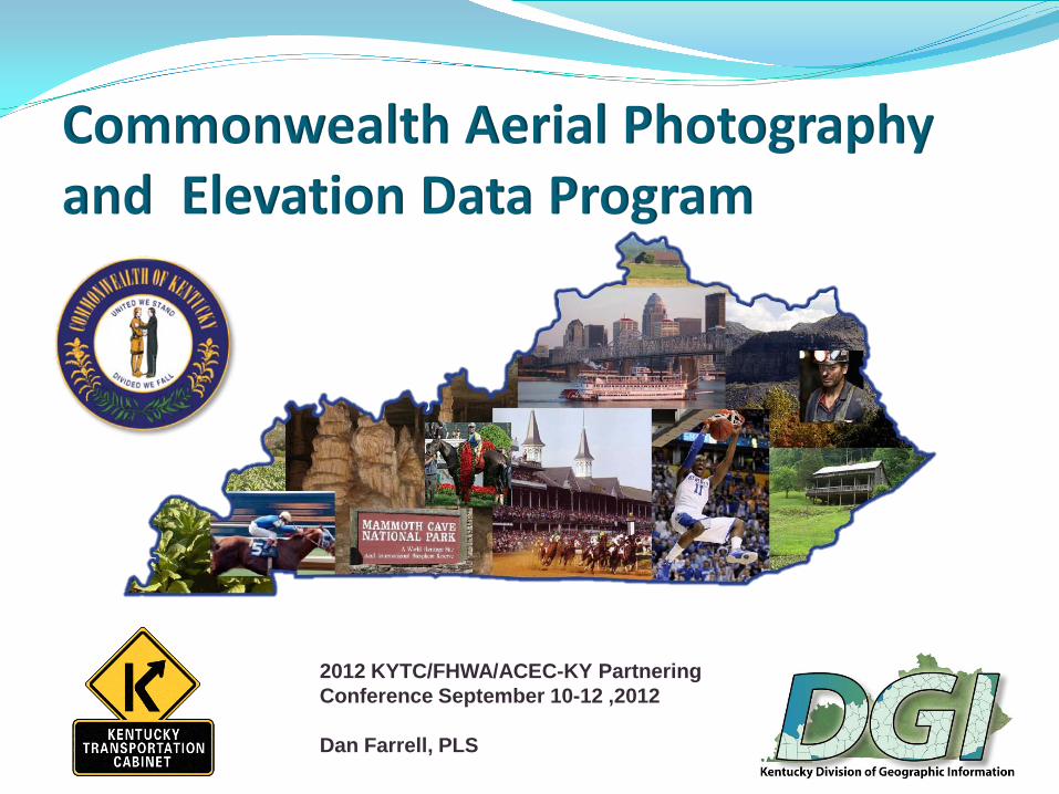
Commonwealth Aerial Photography and Elevation Data Program
2012 KYTC/FHWA/ACEC-KY Partnering Conference September 10-12 ,2012
Dan Farrell, PLS
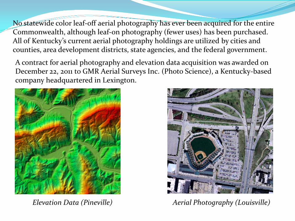
No statewide color leaf-off aerial photography has ever been acquired for the entireCommonwealth, although leaf-on photography (fewer uses) has been purchased. All of Kentucky’s current aerial photography holdings are utilized by cities and counties, area development districts, state agencies, and the federal government.
A contract for aerial photography and elevation data acquisition was awarded onDecember 22, 2011 to GMR Aerial Surveys Inc. (Photo Science), a Kentucky-basedcompany headquartered in Lexington.
Elevation Data (Pineville) Aerial Photography (Louisville)

Commonwealth Aerial Photography & Elevation Data Program InformationKentucky's Statewide Digital Aerial Photography and Elevation Data Program will provide a common digital mapping base for federal, state and local government, as well as the private sector. The digital aerial photography layer provides the foundation for other base layers as well as numerous thematic mapping programs throughout federal, state and local governments.The multi-million dollar project is expected to span a three to four year period (be spread across two biennium) beginning in 2012. Potential funding partners for this effort include federal agencies such as the Federal Emergency Management Agency (FEMA), the Department of the Interior (DOI) U.S. Geological Survey (USGS), the USDA Farm Services Administration (FSA), and the USDA Natural Resources Conservation Service (NRCS), as well as local governments and several state agencies.
This program will provide significant savings to government and the private sector by using a common basemap, avoiding duplication, and encouraging the standardization of Geographic Information Systems (GIS) assets throughout the Commonwealth.More information regarding the Digital Aerial Photography and Elevation Data Program including agency uses, partner listings, wiki definitions, specifications, and data examples can be found on the program website @: http://kygeonet.ky.gov/kyfromabove/

LET’S NOT FORGET WHY THIS ALL BEGAN“FLOOD PLAIN MANAGEMENT”PROACTIVE SINCE 2004
The Kentucky Association of Mitigation Managers (KAMM) was formed in order to promote hazard mitigation and management in Kentucky. Our members represent local floodplain coordinators, planning and zoning officials, engineers, surveyors, GIS specialists, hydrologists, public safety and emergency managers.
Kentucky Association ofMitigation ManagersP.O Box 1016Frankfort, KY 40602-1016Website: kymitigation.org
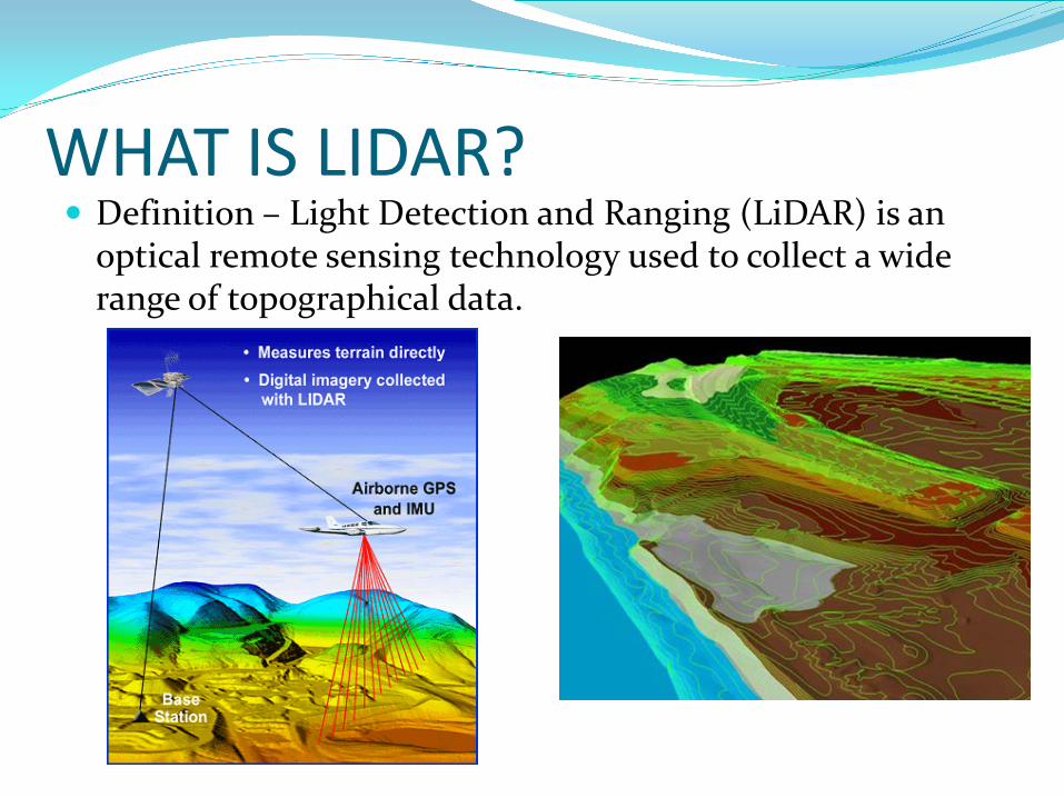
WHAT IS LIDAR? Definition – Light Detection and Ranging (LiDAR) is an
optical remote sensing technology used to collect a wide range of topographical data.

ADVANTAGES OF LIDAR OVER TRADITIONAL PHOTOGRAMMETRY AND CONVENTIONAL SURVEYING Ease of data acquisition Increased ability to determine surface elevations in difficult areas
and less time for creation of elevation data Less dependent of weather, time of year, time of day The speed and accuracy of LiDAR make it feasible to map large
areas with the kind of detail that before had only been possible with ground survey crews.
LiDAR data (point cloud) is easily used with GIS software and can be used with Microstation

TYPICAL QUESTIONS WHEN USING LIDAR DATAAccuracy and ContoursIn open, flat areas, ground contours can be recorded from an aircraft flying overhead providing accuracy within 6 inches of actual elevation. In steep, forested areas accuracy is typically in the range of 1 to 2 feet and depends on many factors, including density of canopy cover and the spacing of laser shots.
Why do contours look so jagged?data-centric contours (very jagged but also very representative of the modeled ground surface) cartographic-centric contours (smoothed to produce a more pleasing map product)
What is the difference between "raw" LIDAR data and "classified" LIDAR data?The points of the "raw" LIDAR data include elevations for the ground, buildings, highway
overpasses, forest canopy, and anything else that the laser beam encountered. In data processing, each of these points is classified into one of the LAS classification values.
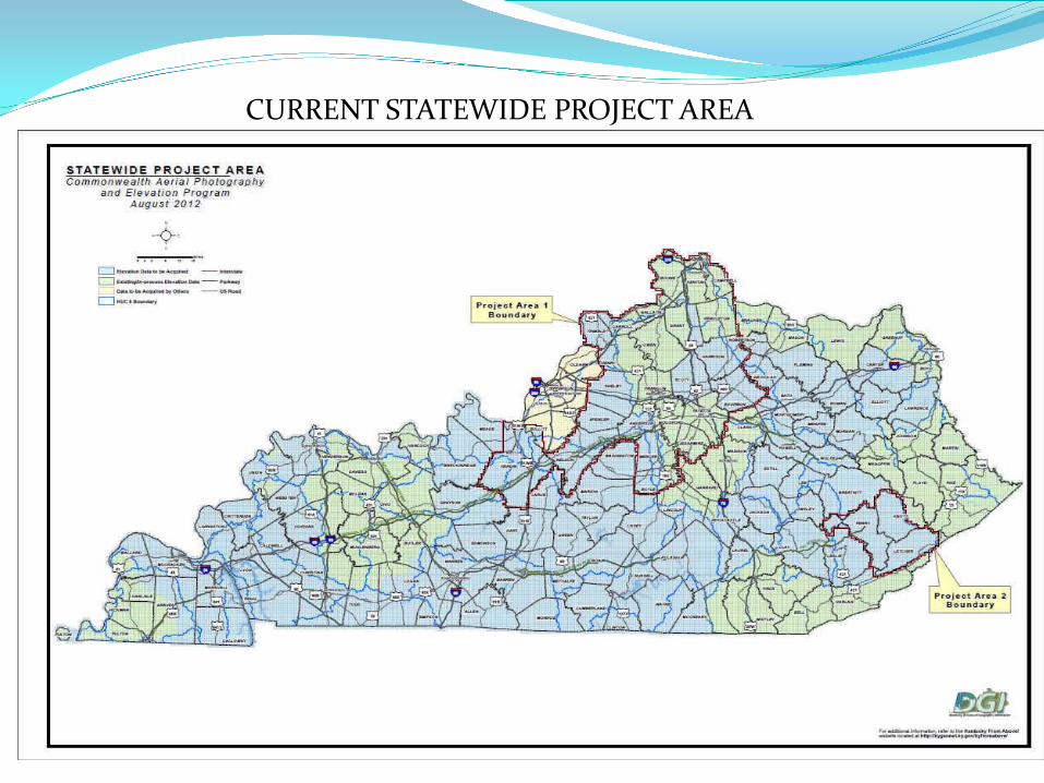
CURRENT STATEWIDE PROJECT AREA

Brief Highlights of the Digital Orthophoto ProductionTechnical Specifications
Project AreaA. GeneralThe total Project Area includes the entirety of the state of Kentucky, subdivided into two project sub-areas. The “Base Resolution” project sub-area is defined as the project region(s) for which the imagery collection will be carried out at the lowest spatial resolution (see Section II.2.a below). The “Higher Resolution” project sub-area will be defined as project region(s) encompassing cities, counties, incorporated areas, regional groupings or other administrative jurisdictions subscribing to the buy-up option for acquiring imagery at higher spatial resolution with or without other options. Image resolutions:•Ground (Spatial) Resolution:1. Vertical color aerial digital photography will be captured for the “Higher Resolution” sub-area. This photography must be captured at a scale sufficient for producing 1” = 100’ stereo photogrammetric mapping meeting the American Society for Photogrammetry and Remote Sensing (ASPRS) Class 1 Accuracy Standards for Large Scale Maps and for production of color digital orthophotography at a resolution of 0.5 feet (6 inches).

Vertical color aerial digital photography will be captured for the “Base Resolution” sub-area. This photography must be captured at a scale sufficient for producing 1” = 200’ stereo photogrammetric mapping meeting the American Society for Photogrammetryand Remote Sensing (ASPRS) Class 1 Accuracy Standards for Large Scale Maps and for production of color digital orthophotography at a resolution of 1.0 feet (12 inches).
Buy-Up OptionsThis effort supports the acquisition of more detailed, accurate, or value-added data that exceeds the base specification.
Buy-up options are those specifications that will apply to the “Higher Resolution” project sub-area, beyond the minimum requirements for one-foot baseline imagery.
http://kygeonet.ky.gov/kyfromabove/pdfs/Specs_OrthoPhoto_Production.pdf

Brief Highlights of the LiDAR Production Technical Specifications
All mapping products will be delivered in Kentucky Single Zone State Plane coordinates (parameters defined in FIPS 1600, and units of U.S. Survey Feet), NAD83* geometric datum (NSRS2007 or CORS96 adjustment), and NAVD88 vertical datum. GPS derived NAVD88 heights will use the Geoid09* model. [* Use most current adjustment and geoid model available from the National Geodetic Survey at time of data processing]
DELIVERABLES
The Kentucky Division of Geographic Information and the Commonwealth shall have unrestricted rights to all delivered data and reports, which will be placed in the public domain. This specification places no restrictions on the data provider's rights to resell data or derivative products as they see fit.

LiDAR technology, however, does not inherently collect the breaklines necessary to produce traditional DEMs. Breaklines have to be developed separately through a variety of techniques, and either used with the LiDAR points in the generation of the DEM, or applied as a correction to DEMs generated without breaklines.
Ground Control PointsThe plotted position of each control point shall lie to an accuracy of one-hundredth (1/100) of an inch of its true position, as expressed by the State Plane coordinate for that point. Control point coordinates will be submitted as a dataset.
Classified Point Cloud Note: Delivery of a classified point cloud is a standard requirement. Fully compliant LAS v1.3, Point Record Format 1, 3, 4, or 5 LAS v1.3 deliverables with waveform data are to use external ―auxiliary‖ files with the extension ―.wdp‖ for the storage of waveform packet data. See the LAS v1.3 Specification for additional information. Georeference information included in LAS header GPS times are to be recorded as Adjusted GPS Time, at a precision sufficient to allow unique timestamps for each return. Intensity values (rescaled to 8-bit) Tiled delivery, without overlap Classification Scheme (minimum):

Code Description 1 Processed, but unclassified 2 Bare-earth ground 7 Noise (low or high, manually identified, if needed) 9 Water 10 Ignored Ground (Breakline Proximity)
Note: Class 7, Noise, is included as a convenience for the data producer. It is not required that all “noise” be assigned to Class 7. Note: Class 10, Ignored Ground, is for points previously classified as bare earth but whose proximity to a subsequently added breakline requires that it be excluded during Digital Elevation Model (DEM) generation
http://kygeonet.ky.gov/kyfromabove/pdfs/Specs_LiDAR_Production.pdf

HIGHWAY DESIGN COMMENTS• LIDAR data can be used to generate an existing DTM.
• LiDAR data becomes the foundation of the project basemap by importinglayers from other GIS sources such as utilities, environmental areas and right ofway.
• As with traditional photogrammetry, specific features can be added to theDTM from field surveys such as additional break lines, utilities, UST, retainingwalls, drainage structures TG/IE, etc. These features are added as-normal byusing "survey edit" on the existing DTM. The “point cloud” inside the perimeterof the ground survey is re-triangulated to include the ground surveyfeatures. Control points utilized from original LIDAR (KY Single Zone) shouldbe the control points for the ground survey.
• Depending on the accuracy of the LIDAR data, the DTM could bemore accurate by reducing the contour interval. File sizes and RAMmay become an issue on some workstations.

CONVENTIONAL AERIAL SURVEY CONTOURS (grey)vs
CONTOURS GENERATED FROM LiDAR (yellow)


REFERENCE LINKS
http://kygeonet.ky.gov/kyfromabove/http://technology.ky.gov/gis/Pages/default.aspxftp://ftp.kymartian.ky.gov/http://www.usgs.gov/http://www.fema.gov/ftp://ftp.kymartian.ky.gov/kyaped/KYAPED%20-%20Statewide%20Project%20Area.pdf