community development department … tmp... · draft negative declaration 1 p13-0905 & p13-0906...
TRANSCRIPT

Draft Negative Declaration 1 P13-0905 & P13-0906
1. Case Number: P13-0905 & P13-0906
2. Project Title: Tentative Parcel Map Number 36604
3. Hearing Date: April 9, 2015
4. Lead Agency: City of Riverside
Community Development Department, Planning Division
3900 Main Street, 3rd
Floor
Riverside, CA 92522
5. Contact Person: Kyle Smith, AICP, Senior Planner
Phone Number: (951) 826-5220
6. Project Location: 5800 Hawarden Drive
7. Project Applicant: Keith Christainsen, Christainsen & Company
5961 Omega Street
Riverside, CA 92506
8. General Plan Designation: HR– Hillside Residential
9. Zoning: RC – Residential Conservation
10. Description of Project:
PLANNING CASES P13-0905 & P13-0906: A proposal by Keith Christiansen, Christiansen & Company on
behalf of Lofglen Family Trust to consider a Tentative Parcel Map Number 36604, and a Planned Residential
Development (PRD) Permit to subdivide an existing 12.41 acre parcel having an average natural slope of
26.4% into seven lots for the future construction of single family residences, as well as the establishment of
an approximately 5.20 acre open space area, four lettered lots, and a public cul-de-sac street; resulting in a
density of 0.56 dwellings per acre; generally situated on the northerly side of Arlington Avenue, between
Royale Place and Hawarden Drive in the RC – Residential Conversation zone in Ward 3
11. Surrounding land uses and setting: Briefly describe the project’s surroundings:
Existing Land Use General Plan Designation Zoning Designation
Project Vacant Land HR– Hillside Residential RC – Residential Conservation
North Single Family Residential HR– Hillside Residential & LDR
– Low Density Residential RC – Residential Conservation & R-1-
13000 Single Family Residential
East Single Family Residential HR– Hillside Residential RC – Residential Conservation
South Single Family Residential VLDR- Very Low Density
Residential R-1-1/2 – Single Family Residential
West Vacant Land LDR- Low Density Residential R-1-1/2 – Single Family Residential
COMMUNITY DEVELOPMENT DEPARTMENT
Planning Division
Draft Negative Declaration

Draft Negative Declaration 2 P13-0905 & P13-0906
12. Other public agencies whose approval is required (e.g., permits, financial approval, or participation
agreement.):
a. None
13. Other Environmental Reviews Incorporated by Reference in this Review:
a. General Plan 2025
b. GP 2025 FPEIR
14. Acronyms
AICUZ - Air Installation Compatible Use Zone Study
AQMP - Air Quality Management Plan
AUSD - Alvord Unified School District
CEQA - California Environmental Quality Act
CMP - Congestion Management Plan
EIR - Environmental Impact Report
EMWD - Eastern Municipal Water District
EOP - Emergency Operations Plan
FEMA - Federal Emergency Management Agency
FPEIR - GP 2025 Final Programmatic Environmental Impact Report
GIS - Geographic Information System
GhG - Green House Gas
GP 2025 - General Plan 2025
IS - Initial Study
LHMP - Local Hazard Mitigation Plan
MARB/MIP - March Air Reserve Base/March Inland Port
MJPA-JLUS - March Joint Powers Authority - Joint Land Use Study
MSHCP - Multiple-Species Habitat Conservation Plan
MVUSD - Moreno Valley Unified School District
NCCP - Natural Communities Conservation Plan
OEM - Office of Emergency Services
OPR - Office of Planning & Research, State
PEIR - Program Environmental Impact Report
PW - Public Works, Riverside
RCALUC - Riverside County Airport Land Use Commission
RCALUCP - Riverside County Airport Land Use Compatibility Plan
RCP - Regional Comprehensive Plan
RCTC - Riverside County Transportation Commission
RMC - Riverside Municipal Code
RPD - Riverside Police Department
RPU - Riverside Public Utilities
RTIP - Regional Transportation Improvement Plan
RTP - Regional Transportation Plan
RUSD - Riverside Unified School District
SCAG - Southern California Association of Governments
SCAQMD - South Coast Air Quality Management District
SCH - State Clearinghouse
SKR-HCP - Stephens’ Kangaroo Rat - Habitat Conservation Plan
SWPPP - Storm Water Pollution Prevention Plan

Draft Negative Declaration 3 P13-0905 & P13-0906
USGS - United States Geologic Survey
WMWD - Western Municipal Water District
WQMP - Water Quality Management Plan
ENVIRONMENTAL FACTORS POTENTIALLY AFFECTED:
The environmental factors checked below would be potentially affected by this project, involving at least one
impact that is a “Potentially Significant Impact” as indicated by the checklist on the following pages.
Aesthetics Agriculture & Forest Resources Air Quality
Biological Resources
Cultural Resources
Geology/Soils
Greenhouse Gas Emissions
Hazards & Hazardous Materials
Hydrology/Water Quality
Land Use/Planning
Mineral Resources
Noise
Population/Housing
Public Service
Recreation
Transportation/Traffic
Utilities/Service Systems
Mandatory Findings of
Significance
DETERMINATION: (To be completed by the Lead Agency)
On the basis of this initial evaluation which reflects the independent judgment of the City of Riverside, it is
recommended that:
The City of Riverside finds that the proposed project COULD NOT have a significant effect on the environment,
and a NEGATIVE DECLARATION will be prepared.
The City of Riverside finds that although the proposed project could have a significant effect on the environment,
there will not be a significant effect in this case because revisions in the project have been made by or agreed to
by the project proponent. A MITIGATED NEGATIVE DECLARATION will be prepared.
The City of Riverside finds that the proposed project MAY have a significant effect on the environment, and an
ENVIRONMENTAL IMPACT REPORT is required.
The City of Riverside finds that the proposed project MAY have a “potentially significant impact” or “potentially
significant unless mitigated” impact on the environment, but at least one effect 1) has been adequately analyzed in
an earlier document pursuant to applicable legal standards, and 2) has been addressed by mitigation measures
based on the earlier analysis as described on attached sheets. An ENVIRONMENTAL IMPACT REPORT is
required, but it must analyze only the effects that remain to be addressed.
The City of Riverside finds that although the proposed project could have a significant effect on the environment,
because all potentially significant effects (a) have been analyzed adequately in an earlier EIR or NEGATIVE
DECLARATION pursuant to applicable standards, and (b) have been avoided or mitigated pursuant to that earlier
EIR or NEGATIVE DECLARATION, including revisions or mitigation measures that are imposed upon the
proposed project, nothing further is required.
Signature Date
Printed Name & Title For City of Riverside

Draft Environmental Initial Study 4 P13-0905 & P13-0906
EVALUATION OF ENVIRONMENTAL IMPACTS:
1) A brief explanation is required for all answers except “No Impact” answers that are adequately supported
by the information sources a lead agency cites in the parentheses following each question. A “No
Impact” answer is adequately supported if the referenced information sources show that the impact simply
does not apply to projects like the one involved (e.g., the project falls outside a fault rupture zone). A
“No Impact” answer should be explained where it is based on project-specific factors as well as general
standards (e.g., the project will not expose sensitive receptors to pollutants, based on a project-specific
screening analysis).
2) All answers must take account of the whole action involved, including off-site as well as on-site,
cumulative as well as project-level, indirect as well as direct, and construction as well as operational
impacts.
3) Once the lead agency has determined that a particular physical impact may occur, then the checklist
answers must indicate whether the impact is potentially significant, less than significant with mitigation,
or less than significant. “Potentially Significant Impact” is appropriate if there is substantial evidence that
an effect may be significant. If there are one or more “Potentially Significant Impact” entries when the
determination is made, an EIR is required.
4) “Negative Declaration: Less Than Significant With Mitigation Incorporated” applies where the
incorporation of mitigation measures has reduced an effect from “Potentially Significant Impact” to a
“Less Than Significant Impact.” The lead agency must describe the mitigation measures, and briefly
explain how they reduce the effect to a less than significant level (mitigation measures from “Earlier
Analyses,” as described in (5) below, may be cross-referenced).
5) Earlier analyses may be used where, pursuant to the tiering, program EIR, or other CEQA process, an
effect has been adequately analyzed in an earlier EIR or negative declaration. Section 15063(c)(3)(D). In
this case, a brief discussion should identify the following:
a. Earlier Analysis Used. Identify and state where they are available for review.
b. Impacts Adequately Addressed. Identify which effects from the above checklist were with in
the scope of and adequately analyzed in an earlier document pursuant to applicable legal
standards, and state whether such effects were addressed by mitigation measures based on the
earlier analysis.
c. Mitigation Measures. For effects that are “Less than Significant with Mitigation Measures
Incorporated,” describe the mitigation measure which were incorporated or refined from the
earlier document and the extent to which they address site-specific conditions for the project.
6) Lead agencies are encouraged to incorporate into the checklist references to information sources for
potential impacts (e.g., general plans, zoning ordinances). Reference to a previously prepared or outside
document should, where appropriate, include a reference to the page or pages where the statement is
substantiated.
COMMUNITY DEVELOPMENT DEPARTMENT
Planning Division
Environmental Initial Study

Draft Environmental Initial Study 5 P13-0905 & P13-0906
7) Supporting Information Sources: A source list should be attached, and other sources used or individuals
contacted should be cited in the discussion.
8) The explanation of each issue should identify:
a. the significance criteria or threshold, if any, used to evaluate each question; and
b. the mitigation measure identified, if any, to reduce the impact to less than significance.
ISSUES (AND SUPPORTING
INFORMATION SOURCES):
Potentially
Significant
Impact
Less Than
Significant
With
Mitigation
Incorporated
Less Than
Significant
Impact
No
Impact
1. AESTHETICS. Would the project:
a. Have a substantial adverse effect on a scenic vista?
1a. Response: (Source: General Plan 2025 Figure CCM-4 – Master Plan of Roadways, General Plan 2025 FPEIR
Figure 5.1-1 – Scenic and Special Boulevards and Parkways, Table 5.1-A – Scenic and Special Boulevards, and
Table 5.1-B – Scenic Parkways)
The applicant is proposing to develop the 12.41 acre parcel having an average natural slope of 26.4% into seven lots for the
future construction of single family residences, as well as the establishment of an approximately 5.20 acre open space area,
four lettered lots, and a public cul-de-sac street; resulting in a density of 0.56 dwellings per acre. The aesthetic view of the
proposed built environment will be consistent, or conditioned to be consistent, with the Citywide Design Guidelines,
therefore the project will not have an adverse effect on a scenic vista and impacts are less than significant. Moreover, the
proposed project consists of an infill project within an urbanized area completely surrounded by existing development
where there are no scenic vistas and where direct, indirect and cumulative impacts to scenic vistas are less than significant
impacts.
b. Substantially damage scenic resources, including, but not
limited to, trees, rock outcroppings, and historic buildings
within a state scenic highway?
1b. Response: (Source: General Plan 2025 Figure CCM-4 – Master Plan of Roadways, General Plan 2025 FPEIR
Figure 5.1-1 – Scenic and Special Boulevards, Parkways, Table 5.1-A – Scenic and Special Boulevards, Table
5.1-B – Scenic Parkways, Title 20 – Cultural Resources and, Title 19 – Article V – Chapter 19.100 – Residential
Zones - RC Zone)
There are no scenic highways within the City that could potentially be impacted. Further, there are no trees, rock
outcroppings, and historic buildings which could be potentially impacted as a result of this project. The project plans have
been designed to comply with the design policies contained in the Citywide Design Guidelines, and are consistent and
compatible with the existing development of the surrounding area. The aesthetic view of the proposed built environment
will be consistent, or conditioned to be consistent, therefore the project will not have an adverse effect on a scenic vista and
impacts are less than significant.
c. Substantially degrade the existing visual character or
quality of the site and its surroundings?

Draft Environmental Initial Study 6 P13-0905 & P13-0906
ISSUES (AND SUPPORTING
INFORMATION SOURCES):
Potentially
Significant
Impact
Less Than
Significant
With
Mitigation
Incorporated
Less Than
Significant
Impact
No
Impact
1c. Response: (Source: General Plan 2025, General Plan 2025 FPEIR, Zoning Code, Citywide Design and Sign
Guidelines, and the Canyon Crest Neighborhood)
The proposed project consists of an infill project within an urbanized area completely surrounded by existing development.
The project has been designed to be compatible with the surrounding area. Therefore, it will not degrade the existing visual
character of the area and no impact directly, indirectly or cumulatively to the visual character or quality of the Planning
Area will occur.
d. Create a new source of substantial light or glare which
would adversely affect day or nighttime views in the area?
1d. Response: (Source: General Plan 2025, General Plan 2025, Title 19 – Article VIII – Chapter 19.556 – Lighting,
Citywide Design and Sign Guidelines
The project would not result in a new source of substantial light or glare which would adversely affect day or nighttime
views as the project consists of the establishment of a use within an existing building on a fully developed site where
adequate levels of lighting currently exist and no new lighting is proposed or required for the project and where no exterior
building materials are proposed that would contribute to daytime glare impacts. As such the project will have no impact
directly, indirectly or cumulatively which would adversely affect day or nighttime views.
2. AGRICULTURE AND FOREST RESOURCES:
In determining whether impacts to agricultural resources are
significant environmental effects, lead agencies may refer to the
California Agricultural Land Evaluation and Site Assessment
Model (1997) prepared by the California Dept. of Conservation
as an optional model to use in assessing impacts on agriculture
and farmland. In determining whether impacts to forest
resources, including timberland, are significant environmental
effects, lead agencies may refer to information complied by the
California Department of Forestry and Fire Protection
regarding the state’s inventory of forest land, including the
Forest and Range Assessment Project and the Forest Legacy
Assessment project; and the forest carbon measurement
methodology provided in the Forest Protocols adopted by the
California Air Resources Board. Would the project:
a. Convert Prime Farmland, Unique Farmland, or Farmland of
Statewide Importance (Farmland), as shown on the maps
prepared pursuant to the Farmland Mapping and
Monitoring Program of the California Resources Agency,
to non-agricultural use?
2a. Response: (Source: General Plan 2025 – Figure OS-2 – Agricultural Suitability & General Plan 2025 FPEIR) –
The Project is located within an urbanized area. A review of Figure OS-2 – Agricultural Suitability of the General Plan
2025 reveals that the project site is not designated as, and is not adjacent to or in proximity to any land classified as, Prime
Farmland, Unique Farmland, or Farmland of Statewide Importance, as shown on the maps prepared pursuant to the
Farmland Mapping and Monitoring Program of the California Resources Agency. Therefore, the project will have no
impact directly, indirectly or cumulatively to agricultural uses.
b. Conflict with existing zoning for agricultural use, or a
Williamson Act contract?
2b. Response: (Source: General Plan 2025 – Figure OS-3 - Williamson Act Preserves, General Plan 2025 FPEIR –
Figure 5.2-4 – Proposed Zones Permitting Agricultural Uses, and Title 19)

Draft Environmental Initial Study 7 P13-0905 & P13-0906
ISSUES (AND SUPPORTING
INFORMATION SOURCES):
Potentially
Significant
Impact
Less Than
Significant
With
Mitigation
Incorporated
Less Than
Significant
Impact
No
Impact
A review of Figure 5.2-2 – Williamson Act Preserves of the General Plan 2025 FPEIR reveals that the Project site is not
located within an area that is affected by a Williamson Act Preserve or under a Williamson Act Contract. Moreover, the
Project site is not zoned for agricultural use and is not next to land zoned for agricultural use; therefore, the Project will have
no impact directly, indirectly or cumulatively.
c. Conflict with existing zoning for, or cause rezoning of,
forest land (as defined in Public Resources Code section
12220(g)) timberland (as defined in Public Resources Code
section 4526), or timberland zoned Timberland Production
(as defined by Government Code section 51104(g))?
2c. Response: (Source: GIS Map – Forest Data)
The subject site is zoned RC – Residential Conservation and does not contain forest land. Further, the City of Riverside has
no forest land that can support 10-percent native tree cover nor does it have any timberland. Therefore, no impacts will
occur from this Project directly, indirectly or cumulatively
d. Result in the loss of forest land or conversion of forest land
to non-forest use?
2d. Response: (Source: GIS Map – Forest Data)
The City of Riverside has no forest land that can support 10-percent native tree cover nor does it have any timberland,
therefore no impacts will occur from this Project directly, indirectly or cumulatively.
e. Involve other changes in the existing environment which,
due to their location or nature, could result in conversion of
Farmland, to non-agricultural use or conversion of forest
land to non-forest use?
2e. Response: (Source: General Plan – Figure OS-2 – Agricultural Suitability, Figure OS-3 – Williamson Act
Preserves, Title 19 – Article V – Chapter 19.100 – Residential Zones – RC Zone and RA-5 Zone and GIS Map –
Forest Data)
The Project is located in an urbanized area of the City within an existing development. Additionally, the site is identified as
urban/built out land and therefore does not support agricultural resources or operations. The Project will not result in the
conversion of designated farmland to non-agricultural uses. In addition, there are no agricultural resources or operations,
including farmlands within proximity of the subject site. The City of Riverside has no forest land that can support 10-
percent native tree cover. Therefore, no impacts will occur from this Project directly, indirectly or cumulatively to
conversion of Farmland, to non-agricultural use or conversion of forest land to non-forest use.
3. AIR QUALITY.
Where available, the significance criteria established by the
applicable air quality management or air pollution control
district may be relied upon to make the following
determinations. Would the project:
a. Conflict with or obstruct implementation of the applicable
air quality plan?
3a. Response: (Source: South Coast Air Quality Management District’s 2007 Air Quality Management Plan
(AQMP))
Projects that are consistent with the projections of employment and population forecasts identified by the Southern
California Association of Governments (SCAG) are considered consistent with the AQMP growth projections, since these
forecast numbers were used by SCAG’s modeling section to forecast travel demand and air quality for planning activities
Draft Environmental Initial Study 8 P13-0905 & P13-0906
ISSUES (AND SUPPORTING
INFORMATION SOURCES):
Potentially
Significant
Impact
Less Than
Significant
With
Mitigation
Incorporated
Less Than
Significant
Impact
No
Impact
such as the Regional Transportation Plan (RTP), the SCAQMD’s AQMP, Regional Transportation Improvement Program
(TRIP), and the Regional Housing Plan. This project is consistent with the projections of employment and population
forecasts identified by the Southern California Association of Governments (SCAG) that are consistent with the General
Plan 2025 “Typical Growth Scenario.” Since the project is consistent with the General Plan 2025, it is also consistent with
the AQMP. The project will have a less than significant impact directly, indirectly and cumulatively to the
implementation of an air quality plan.
b. Violate any air quality standard or contribute substantially
to an existing or projected air quality violation?
3b. Response: (Source: General Plan 2025 FPEIR Table 5.3-B SCAQMD CEQA Regional Significance
Thresholds, South Coast Air Quality Management District’s 2007 AQMP, URBEMIS 2007 Model)
The proposed project will generate emissions far lower than the SCAQMD thresholds for significance for air quality
emissions and it was determined to be less than significant directly, indirectly and cumulatively to ambient air quality and
will not contribute to an existing air quality violation.
c. Result in a cumulatively considerable net increase of any
criteria pollutant for which the project region is non-
attainment under an applicable federal or state ambient air
quality standard (including releasing emissions which
exceed quantitative thresholds for ozone precursors)?
3c. Response: (Source: General Plan 2025 FPEIR Table 5.3-B SCAQMD CEQA Regional Significance
Thresholds, South Coast Air Quality Management District’s 2007 Air Quality Management Plan, CalEEMod
2007 Model)
Per the GP 2025 FPEIR, AQMP thresholds indicate future construction activities under the General Plan are projected to
result in significant levels of NOX and ROG, both ozone precursors, PM-10, PM-2.5, and CO. Although long-term
emissions are expected to decrease by 2025, all criteria pollutants remain above the SCAQMD thresholds.
The portion of the Basin within which the City is located is designated as a non-attainment area for ozone, PM-10 and PM-
2.5 under State standards, and as a non-attainment area for ozone, carbon monoxide, PM-10, and PM-2.5 under Federal
standards.
Because the proposed Project is consistent with the General Plan 2025, cumulative impacts related to criteria pollutants as
a result of the Project were previously evaluated as part of the cumulative analysis of build out anticipated under the
General Plan 2025 Program. As a result, the proposed Project does not result in any new significant impacts that were not
previously evaluated and for which a statement of overriding considerations was adopted as part of the General Plan 2025
FPEIR. Further per the response in 3B above, an air quality model conducted using CaLEEMod found the project
emissions (short-term and long-term) to the SCAQMD daily thresholds and shows that established thresholds will not be
exceeded. Therefore, cumulative air quality emissions impacts are less than significant.
d. Expose sensitive receptors to substantial pollutant
concentrations?
3d. Response: (Source: General Plan 2025 FPEIR Table 5.3-B SCAQMD CEQA Regional Significance
Thresholds, South Coast Air Quality Management District’s 2007 Air Quality Management Plan)
Short-term impacts associated with construction from General Plan 2025 typical build out will result in increased air
emissions from grading, earthmoving, and construction activities. Mitigation Measures of the General Plan 2025 FPEIR
requires individual development to employ construction approaches that minimize pollutant emissions (e.g., watering for
dust control, tuning of equipment, limiting truck idling times). In conformance with the General Plan 2025 FPEIR MM
AIR 1 and MM AIR 7, it can be determined that the proposed project would not exceed SCAQMD thresholds for short-term
construction and long-term operational impacts. Therefore, the project will not expose sensitive receptors to substantial
pollutant concentrations and a less than significant impact will occur directly, indirectly or cumulatively for this project.
e. Create objectionable odors affecting a substantial number
Draft Environmental Initial Study 9 P13-0905 & P13-0906
ISSUES (AND SUPPORTING
INFORMATION SOURCES):
Potentially
Significant
Impact
Less Than
Significant
With
Mitigation
Incorporated
Less Than
Significant
Impact
No
Impact
of people?
3e. Response:
While exact quantification of objectionable odors cannot be determined due to the subjective nature of what is considered
“objectionable,” the nature of the proposed project presents a potential for the generation of objectionable odors associated
with grading activities. However, the grading activities associated with the project will generate airborne odors like diesel
exhaust emissions, architectural coating applications, and on- and off-site improvement installations. However, said
emissions would occur only during daylight hours, be short-term in duration, and would be isolated to the immediate
vicinity of the construction site. Therefore, they would not expose a substantial number of people to objectionable odors
on a permanent basis. Therefore, the project will not cause objectionable odors affecting a substantial number of people
and a less than significant impact directly, indirectly and cumulatively will occur.
4. BIOLOGICAL RESOURCES. Would the project:
a. Have a substantial adverse effect, either directly or through
habitat modifications, on any species identified as a
candidate, sensitive, or special status species in local or
regional plans, policies, or regulations, or by the California
Department of Fish and Game or U.S. Fish and Wildlife
Service?
4a. Response: (Source: General Plan 2025 – Figure OS-6 – Stephen’s Kangaroo Rat (SKR) Core Reserve and Other
Habitat Conservation Plans (HCP), Figure OS-7 – MSHCP Cores and Linkages, Figure OS-8 – MSHCP Cell
Areas, General Plan 2025 FPEIR Figure 5.4-2 – MSHCP Area Plans, Figure 5.4-4 - MSHCP Criteria Cells and
Subunit Areas, Figure 5.4-6 – MSHCP Narrow Endemic Plant Species Survey Area, Figure 5.4-7 – MSHCP
Criteria Area Species Survey Area, Figure 5.4-8 – MSHCP Burrowing Owl Survey Area)
On April 3, 2014, a focused biological assessment was required due to the potential presence of sensitive biological
resources identified in the Western Riverside County Multiple Specifies Habitat Conservation Plan (MSCHP) on the
property. The purpose of the survey is to identify the presence or absence of borrowing owl on site. The survey was also
required to evaluate the presence of sensitive habitats and species such as vernal pools, and fairy shrimp, as well as
jurisdictional waters the might be present within the project area. The survey determined that no suitable habitat exists for
the burrowing owl in the project area and no birds were seen. No Riparian/ Riverine/ Vernal Pools occur on site. No fairy
shrimp habitat is present. No jurisdictional waters are present on site. There are no impacts to sensitive resources identified
in the MSCHP, and therefore, no Determination of a Biologically Equivalent or Superior Alternative Plan is required.
There are no impacts to protected corridors or other sensitive habitats designated under the MSHCP. The project site is
located within an urban built-up area and is surrounded by existing development and a search of the MSHCP database and
other appropriate databases identified no potential for candidate, sensitive or special status species, suitable habitat for such
species on site, Federal Species of Concern, California Species of Special Concern, and California Species Animal or
Plants on lists 1-4 of the California Native plant Society (CNPS) Inventory. Thus there is little chance that any Federally
endangered, threatened, or rare species or their habitats could persist in this area. Therefore, a less than significant impact
directly, indirectly and cumulatively will occur to federally endangered threatened, or rare species or their habitats.
b. Have a substantial adverse effect on any riparian habitat or
other sensitive natural community identified in local or
regional plans, policies, regulations or by the California
Department of Fish and Game or U.S. Fish and Wildlife
Service?
4b. Response: (Source: General Plan 2025 – Figure OS-6 – Stephen’s Kangaroo Rat (SKR) Core Reserve and Other
Habitat Conservation Plans (HCP), Figure OS-7 – MSHCP Cores and Linkages, Figure OS-8 – MSHCP Cell
Areas, General Plan 2025 FPEIR Figure 5.4-2 – MSHCP Area Plans, Figure 5.4-4 - MSHCP Criteria Cells and
Subunit Areas, Figure 5.4-6 – MSHCP Narrow Endemic Plant Species Survey Area, Figure 5.4-7 – MSHCP
Draft Environmental Initial Study 10 P13-0905 & P13-0906
ISSUES (AND SUPPORTING
INFORMATION SOURCES):
Potentially
Significant
Impact
Less Than
Significant
With
Mitigation
Incorporated
Less Than
Significant
Impact
No
Impact
Criteria Area Species Survey Area, Figure 5.4-8 – MSHCP Burrowing Owl Survey Area, MSHCP Section 6.1.2
- Protection of Species Associated with Riparian/Riverine Areas and Vernal Pools)
On April 3, 2014, a focused biological assessment was required due to the potential presence of sensitive biological
resources identified in the Western Riverside County Multiple Specifies Habitat Conservation Plan (MSCHP) on the
property. The project site is located within an urban built-up area and is surrounded by existing development where no
riparian habitat or other sensitive natural community exists on site or within proximity to the project site. Therefore, the
project will have no impact on any riparian habitat or other sensitive natural community identified in local or regional
plans, policies, or regulations, or by the California Department of Fish and Game or U.S. Fish and Wildlife Service
directly, indirectly and cumulatively.
c. Have a substantial adverse effect on federally protected
wetlands as defined by Section 404 of the Clean Water Act
(including, but not limited to, marsh, vernal pool, coastal,
etc.) through direct removal, filling, hydrological
interruption, or other means?
4c. Response: (Source: City of Riverside GIS/CADME USGS Quad Map Layer)
The project site is located within an urban built-up area and is surrounded by existing development where no federally
protected wetlands as defined by Section 404 of the Clean Water Act (including, but not limited to, marsh, vernal pool,
coastal, etc.) exist on site or within proximity to the project site. The project site does not contain any discernible drainage
courses, inundated areas, wetland vegetation, or hydric soils and thus does not include USACOE jurisdictional drainages or
wetlands. Therefore, the proposed project would have no impact to federally protected wetlands as defined by Section 404
of the Clean Water Act directly, indirectly and cumulatively.
d. Interfere substantially with the movement of any native
resident or migratory fish or wildlife species or with
established native resident or migratory wildlife corridors,
or impede the use of native wildlife nursery sites?
4d. Response: (Source: MSHCP, General Plan 2025 –Figure OS-7)
The project site is located within an urban built-up area and is surrounded by existing development and will not result in a
barrier to the movement of any native resident or migratory fish or wildlife species or with established native resident or
migratory wildlife corridors, or impede the use of native wildlife nursery sites. Therefore, the project will have no impact
to wildlife movement directly, indirectly and cumulatively.
e. Conflict with any local policies or ordinances protecting
biological resources, such as a tree preservation policy or
ordinance?
4e. Response: (Source: MSHCP, Title 16 Section 16.72.040 – Establishing the Western Riverside County MSHCP
Mitigation Fee, Title 16 Section 16.40.040 – Establishing a Threatened and Endangered Species Fees, City of
Riverside Urban Forest Tree Policy Manual)
Implementation of the proposed Project is subject to all applicable Federal, State, and local policies and regulations related
to the protection of biological resources and tree preservation. In addition, the Project is required to comply with Riverside
Municipal Code Section 16.72.040 establishing the MSHCP mitigation fee and Section 16.40.040 establishing the
Threatened and Endangered Species Fees.
Any Project within the City of Riverside’s boundaries that proposes planting a street tree within a City right-of-way must
follow the Urban Forest Tree Policy Manual. The Manual documents guidelines for the planting, pruning, preservation,
and removal of all trees in City rights-of-way. The specifications in the Manual are based on national standards for tree
care established by the International Society of Arboriculture, the National Arborists Association, and the American
National Standards Institute. No trees under the applicant’s project are proposed to be planted or removed from the City
Draft Environmental Initial Study 11 P13-0905 & P13-0906
ISSUES (AND SUPPORTING
INFORMATION SOURCES):
Potentially
Significant
Impact
Less Than
Significant
With
Mitigation
Incorporated
Less Than
Significant
Impact
No
Impact
right-of-way; therefore the project will have no impacts related to protecting biological resources.
f. Conflict with the provisions of an adopted Habitat
Conservation Plan, Natural Community Conservation Plan,
or other approved local, regional, or state habitat
conservation plan?
4f. Response: (Source: MSHCP, General Plan 2025 – Figure OS-6 – Stephen’s Kangaroo Rat (SKR) Core Reserve
and Other Habitat Conservation Plans (HCP), Stephens’ Kangaroo Rat Habitat Conservation Plan, Lake
Mathews Multiple Species Habitat Conservation Plan and Natural Community Conservation Plan, and El
Sobrante Landfill Habitat Conservation Plan)
The project site is located within an urbanized area and will not impact an adopted Habitat Conservation Plan, Natural
Community Conservation Plan, or other approved local, regional, or State habitat conservation plan directly, indirectly and
cumulatively. Therefore, the project will have no impact on the provisions of an adopted Habitat Conservation Plan,
Natural Community Conservation Plan, or other approved local, regional, or State habitat conservation plan.
5. CULTURAL RESOURCES. Would the project:
a. Cause a substantial adverse change in the significance of a
historical resource as defined in § 15064.5 of the CEQA
Guidelines?
5a. Response: (Source: GP 2025 FPEIR Table 5.5-A Historical Districts and Neighborhood Conservation Areas
and Appendix D, Title 20 of the Riverside Municipal Code)
Between November 2013 and January 2014, a Historical/Archaeological Cultural Resources Study was performed. The
purpose of this study was to provide the necessary information and analysis to determine whether the proposed project
would cause substantial adverse changes to any historical resources that may exist in or around the project area. Based on
findings, no historical resources exist within or adjacent to the project area, and thus the project as currently proposed will
not cause a substantial adverse change to any known historical resources. In conclusion, the project has been reviewed for
compliance with all applicable development and subdivision standards and was found to be compliant. Therefore, the
project is located on a site where no historic resources exist as defined in Section 15064.5 of the CEQA Guidelines.
Therefore, no impacts directly, indirectly and cumulatively to historical resources are expected.
b. Cause a substantial adverse change in the significance of an
archeological resource pursuant to § 15064.5 of the CEQA
Guidelines?
5b. Response: (Source: GP 2025 FPEIR Figure 5.5-1 - Archaeological Sensitivity and Figure 5.5-2 - Prehistoric
Cultural Resources Sensitivity, Appendix D – Cultural Resources Study)
The project is located within an urbanized area where no activities, such as new development involving grading/ground
disturbance, are proposed that would create potential for disturbance or archeological resources. Therefore, the project will
have no impact directly, indirectly and cumulatively to an archeological resource pursuant to Section 15064.5 of the CEQA
Guidelines.
c. Directly or indirectly destroy a unique paleontological
resource or site or unique geologic feature?
5c. Response: (Source: General Plan 2025 Policy HP-1.3)
The project is located within an urbanized area where no activities, such as new development involving grading/ground
disturbance, are proposed that would create a potential for disturbance of paleontological resources or site or unique
geologic features. Therefore, the project will have no impact directly or indirectly on a unique paleontological resource or
site or unique geologic feature.

Draft Environmental Initial Study 12 P13-0905 & P13-0906
ISSUES (AND SUPPORTING
INFORMATION SOURCES):
Potentially
Significant
Impact
Less Than
Significant
With
Mitigation
Incorporated
Less Than
Significant
Impact
No
Impact
d. Disturb any human remains, including those interred
outside of formal cemeteries?
5d. Response: (Source: GP 2025 FPEIR Figure 5.5-1 - Archaeological Sensitivity and Figure 5.5-2 - Prehistoric
Cultural Resources Sensitivity)
The project is located within an urbanized area where no activities, such as new development involving grading/ground
disturbance, are proposed that would create potential for disturbance of human remains. Therefore, the project will have no
impact directly, indirectly or cumulatively to disturb any human remains, including those interred outside of formal
cemeteries.
6. GEOLOGY AND SOILS. Would the project:
a. Expose people or structures to potential substantial adverse
effects, including the risk of loss, injury, or death
involving:
i. Rupture of a known earthquake fault, as delineated on
the most recent Alquist-Priolo Earthquake Fault Zoning
Map issued by the State Geologist for the area or based
on other substantial evidence of a known fault? Refer
to Division of Mines and Geology Special Publication
42.
6i. Response: (Source: General Plan 2025 Figure PS-1 – Regional Fault Zones & General Plan 2025 FPEIR
Appendix E – Geotechnical Report)
Seismic activity is to be expected in Southern California. In the City of Riverside, there are no Alquist-Priolo zones. The
Project site does not contain any known faults and the potential for fault rupture or seismic shaking is low. Compliance
with the California Building Code regulations will ensure that no impacts related to strong seismic ground will occur
directly, indirectly and cumulatively.
ii. Strong seismic ground shaking?
6ii. Response: (Source: General Plan 2025 FPEIR Appendix E – Geotechnical Report)
The San Jacinto Fault Zone located in the northeastern portion of the City and the Elsinore Fault Zone, located in the
southern portion of the City’s Sphere of Influence, have the potential to cause moderate to large earthquakes that would
cause intense ground shaking. Because the proposed Project complies with California Building Code regulations, impacts
associated with strong seismic ground shaking will have no impact directly, indirectly and cumulatively.
iii. Seismic-related ground failure, including liquefaction?
6iii. Response: (Source: General Plan 2025 Figure PS-1 – Regional Fault Zones, Figure PS-2 – Liquefaction
Zones, General Plan 2025 FPEIR Figure PS-3 – Soils with High Shrink-Swell Potential, and Appendix E –
Geotechnical Report)
The project site is located in an area with a low potential for liquefaction as depicted in the General Plan 2025 Liquefaction
Zones Map – Figure PS-2. Compliance with the California Building Code regulations will ensure that impacts related to
seismic-related ground failure, including liquefaction would have no impact directly, indirectly and cumulatively.
iv. Landslides?
6iv. Response: (Source: General Plan 2025 FPEIR Figure 5.6-1 – Areas Underlain by Steep Slope, Appendix E
– Geotechnical Report, Title 18 – Subdivision Code, Title 17 – Grading Code)
The project site is in an area where the possibility of unstable slope conditions could occur due to the 29.35% slope of the
subject and/or neighboring properties (see Figure 5.6-1 of the General Plan 2025 Program Final PEIR Landslides may
occur from heavy rainfall, erosion, and removal of vegetation, seismic activity or other factors. Slope stability depends on

Draft Environmental Initial Study 13 P13-0905 & P13-0906
ISSUES (AND SUPPORTING
INFORMATION SOURCES):
Potentially
Significant
Impact
Less Than
Significant
With
Mitigation
Incorporated
Less Than
Significant
Impact
No
Impact
many factors and their interrelationships.
A geotechnical study/preliminary soils report has been prepared to determine the soil properties and specific potential for
landslides based upon the proposed development. Incorporation of the recommended design measures of the geotechnical
study, compliance with the California Building Code regulations and compliance with Title 17 – Grading Code will ensure
that impacts related to strong landslides are reduced to less than significant impact levels directly, indirectly and
cumulatively.
b. Result in substantial soil erosion or the loss of topsoil?
6b. Response: (Source: General Plan 2025 FPEIR Figure 5.6-1 – Areas Underlain by Steep Slope, Figure 5.6-4 –
Soils, Table 5.6-B – Soil Types, Title 18 – Subdivision Code, Title 17 – Grading Code)
Erosion and loss of topsoil could occur as a result of the project. State and Federal requirements call for the preparation and
implementation of a Storm Water Pollution Prevention Plan (SWPPP) establishing erosion and sediment controls for
construction activities. The project must also comply with the National Pollutant Discharge Elimination System (NPDES)
regulations. In addition, with the erosion control standards for which all development activity must comply (Title 18), the
Grading Code (Title 17) also requires the implementation of measures designed to minimize soil erosion. Compliance with
State and Federal requirements as well as with Titles 18 and 17 will ensure that soil erosion or loss of topsoil will be less
than significant impact directly, indirectly and cumulatively.
c. Be located on a geologic unit or soil that is unstable, or that
would become unstable as a result of the project, and
potentially result in on- or off-site landslide, lateral
spreading, subsidence, liquefaction or collapse?
6c. Response: (Source: General Plan 2025 Figure PS-1 – Regional Fault Zones, Figure PS-2 – Liquefaction Zones,
General Plan 2025 FPEIR Figure PS-3 – Soils with High Shrink-Swell Potential, Figure 5.6-1 - Areas
Underlain by Steep Slope, Figure 5.6-4 – Soils, Table 5.6-B – Soil Types, and Appendix E – Geotechnical Report)
The general topography of the subject site has an average natural slope of 26.4 percent. Compliance with the City’s
existing codes and the policies contained in the General Plan 2025 help to ensure that impacts related to geologic
conditions are reduced to less than significant impacts level directly, indirectly and cumulatively.
d. Be located on expansive soil, as defined in Table 18-1-B of
the Uniform Building Code (1994), creating substantial
risks to life or property?
6d. Response: (Source: General Plan 2025 FPEIR Figure 5.6-4 – Soils, Figure 5.6-4 – Soils, Table 5.6-B – Soil
Types, Figure 5.6-5 – Soils with High Shrink-Swell Potential, Appendix E – Geotechnical Report, and California
Building Code as adopted by the City of Riverside and set out in Title 16 of the Riverside Municipal Code)
Expansive soil is defined under California Building Code. The soil type of the subject site is Fallbrook and Buren (See
Figure 5.6-4 – Soils of the General Plan 2025 Program Final PEIR.). Compliance with the recommendations of the soils
report and applicable provisions of the City’s Subdivision Code- Title 18 and the California Building Code with regard to
soil hazards related to the expansive soils will be reduced to a less than significant impact level for this Project directly,
indirectly and cumulatively.
e. Have soils incapable of adequately supporting the use of
septic tanks or alternative waste water disposal systems
where sewers are not available for the disposal of waste
water?
6e. Response: (Source: General Plan 2025 FPEIR Figure 5.6-4 – Soils, Table 5.6-B – Soil Types)
The proposed project will be served by sewer infrastructure. Therefore, the project will have no impact.
Draft Environmental Initial Study 14 P13-0905 & P13-0906
ISSUES (AND SUPPORTING
INFORMATION SOURCES):
Potentially
Significant
Impact
Less Than
Significant
With
Mitigation
Incorporated
Less Than
Significant
Impact
No
Impact
7. GREENHOUSE GAS EMISSIONS. Would the project:
a. Generate greenhouse gas emissions, either directly or
indirectly, that may have a significant impact on the
environment?
7a. Response:
The proposed Project involves the creation of two parcels in which buildable pad sizes are designed to be substantially
under the maximum allowed by Section 17.28.020 Hillside/Arroyo Grading of the City of Riverside Municipal Code. The
Project is consistent with the City’s General Plan 2025 policies and statewide Building Code requirements designed to
reduce GhG emissions. Since the Project will not result in a net increase in GhG emissions, it will not interfere with the
State’s goals of reducing greenhouse gas emissions to 1990 levels by the year 2020 as stated in AB 32 and an 80 percent
reduction in GhG emissions below 1990 levels by 2050 as stated in Executive Order S-3-05. Projects that are consistent
with the Projections of employment and population forecasts identified by the SCAG are considered consistent with the
AQMP growth Projections, since these forecast numbers were used by SCAG's modeling section to forecast travel demand
and air quality for planning activities such as the RTP, the SCAQMD’s AQMP, RTIP, and the Regional Housing Plan.
This Project is consistent with the Projections of employment and population forecasts identified by the SCAG that are
consistent with the General Plan 2025 “Typical Growth Scenario.” Therefore, this Project will have less than significant
impacts with respect to GhG emissions.
b. Conflict with any applicable plan, policy or regulation of an
agency adopted for the purpose of reducing the emissions of
greenhouse gases?
7b. Response:
The SCAQMD supports State, Federal and international policies to reduce levels of ozone depleting gases through its
Global Warming Policy and rules and has established an interim Greenhouse Gas (GHG) threshold. As indicated in
Question A, above, the Project would comply with the City’s General Plan 2025 policies and State Building Code
provisions designed to reduce GHG emissions. In addition, the Project would comply with all SCAQMD applicable rules
and regulations during construction and will not interfere with the State’s goals of reducing GHG emissions to 1990 levels
by the year 2020 as stated in the AB 32 and an 80 percent reduction in GHG emissions below 1990 levels by 2050 as stated
in Executive Order S-3-05. Based on the discussion above, the Project will not conflict with any applicable plan, policy or
regulation related to the reduction in the emissions of GHG and thus a less than significant impact will occur directly,
indirectly and cumulatively in this regard.
8. HAZARDS & HAZARDOUS MATERIALS. Would the project:
a. Create a significant hazard to the public or the environment
through the routine transport, use, or disposal of hazardous
materials?
8a. Response: (Source: General Plan 2025 Public Safety Element, GP 2025 FPEIR, California Health and Safety
Code, Title 49 of the Code of Federal Regulations, California Building Code, Riverside Fire Department EOP,
2002 and Riverside Operational Area – Multi-Jurisdictional LHMP, 2004 Part 1, OEM’s Strategic Plan)
Some hazardous materials will be used during construction and maintenance. However, the construction and maintenance
of equipment will not be maintained or fueled on site. Any spills related to the regular use of construction materials will be
contained through best management practices as to not create a significant hazard to the public or the environment. As
such, the Project will have a less than significant impact related to the transport, use, or disposal of any hazardous
material either directly, indirectly and cumulatively.
b. Create a significant hazard to the public or the environment
through reasonably foreseeable upset and accident
conditions involving the release of hazardous materials into

Draft Environmental Initial Study 15 P13-0905 & P13-0906
ISSUES (AND SUPPORTING
INFORMATION SOURCES):
Potentially
Significant
Impact
Less Than
Significant
With
Mitigation
Incorporated
Less Than
Significant
Impact
No
Impact
the environment?
8b. Response: (Source: General Plan 2025 Public Safety Element, GP 2025 FPEIR Tables 5.7 A – D, California
Health and Safety Code, Title 49 of the Code of Federal Regulations, California Building Code, City of
Riverside’s EOP, 2002 and Riverside Operational Area – Multi-Jurisdictional LHMP, 2004 Part 1, OEM’s
Strategic)
Some hazardous materials will be used during construction and maintenance. However, construction and maintenance
equipment will not be maintained or fueled on site. Any spills related to the regular use of construction materials will be
contained through best management practices as to not create a significant hazard to the public or the environment through
reasonably foreseeable upset and accident conditions involving the release of hazardous materials into the environment. As
such, the Project will have less than significant impact related to the transport, use, or disposal of any hazardous material
either directly, indirectly and cumulatively.
c. Emit hazardous emissions or handle hazardous or acutely
hazardous materials, substances, or waste within one-
quarter mile of an existing or proposed school?
8c. Response: (Source: General Plan 2025 Public Safety and Education Elements, GP 2025 FPEIR Table 5.7-D -
CalARP RMP Facilities in the Project Area, Figure 5.13-2 – RUSD Boundaries, Table 5.13-D RUSD Schools,
Figure 5.13-3 AUSD Boundaries, Table 5.13-E AUSD Schools, Figure 5.13-4 – Other School District
Boundaries, California Health and Safety Code, Title 49 of the Code of Federal Regulations, California Building
Code)
The project site is located within one-eighth of an existing high school (Poly High School). However, the project will
comply with Rule 403, which prohibits fugitive dust from construction activities that results in emissions that are visible in
the atmosphere beyond the property line where construction is occurring. The Proposed Project’s construction emissions
would be below both the SCAQMD’s regional significance thresholds and the Localized Significance Thresholds (LSTs)
for all pollutants for each phase of construction (SRA 2011). Operational emissions would result from periodic inspection
and maintenance activities. No additional personnel would be required on a daily basis to maintain and operate the
Proposed Project. A small number of personnel may be required during brief periods when certain maintenance operations
must be performed. Operational emissions would be less than construction emissions. The Proposed Project would not
conflict with or obstruct implementation of the applicable air quality management plan. Impacts from hazardous emissions
within one-quarter mile of an existing or proposed school would be less than significant.
During construction hazardous materials may be used during construction and maintenance activities. However,
construction and maintenance vehicles will not be maintained or fueled on site. The release of any spills to the environment
would be prevented through best management practices. Therefore impacts from the handling of hazardous or acutely
hazardous materials, substances, or waste greater than one-quarter mile of an existing or proposed school would be less
than significant impact directly, indirectly or cumulatively.
d. Be located on a site which is included on a list of hazardous
materials sites compiled pursuant to Government Code
Section 65962.5 and, as a result, would it create a
significant hazard to the public or the environment?
8d. Response: (Source: General Plan 2025 Figure PS-5 – Hazardous Waste Sites, GP 2025 FPEIR Tables 5.7-A –
CERCLIS Facility Information, Figure 5.7-B – Regulated Facilities in TRI Information and 5.7-C – DTSC
EnviroStor Database Listed Sites)
A review of hazardous materials site lists compiled pursuant to Government Code Section 65962.5 found that the Project
site is not included on any such lists. Therefore, the Project would have no impact to creating any significant hazard to the
public or environment directly, indirectly or cumulatively.
e. For a project located within an airport land use plan or,
where such a plan has not been adopted, within two miles
of a public airport or public use airport, would the project
Draft Environmental Initial Study 16 P13-0905 & P13-0906
ISSUES (AND SUPPORTING
INFORMATION SOURCES):
Potentially
Significant
Impact
Less Than
Significant
With
Mitigation
Incorporated
Less Than
Significant
Impact
No
Impact
result in a safety hazard for people residing or working in
the project area?
8e. Response: (Source: General Plan 2025 Figure PS-6 – Airport Safety Zones and Influence Areas, RCALUCP
and March Air Reserve Base/March Inland Port Comprehensive Land Use Plan (1999), Air Installation
Compatible Use Zone Study for March Air Reserve Base (August 2005)
The proposed project is located within Safety and/or Airport Compatibility Zone “D & E” as depicted on Figure 5.7-2 of
Section 5.7 – Hazards and Hazardous Materials of the General Plan 2025 Program FPEIR for the March Air Reserve
Base/March Inland Port (MARB/MIP) as noted in MARB/MIP Joint Land Use Study (JLUS). The project was reviewed by
Planning staff to ensure that the project is consistent with the compatibility zone as well as in compliance with the land use
standards in the MARB JLUS. Because the project has been found to be consistent with the RCALUCP by staff, impacts
related to hazards from airports are less than significant impacts directly, indirectly and cumulatively
f. For a project within the vicinity of a private airstrip, would
the project result in a safety hazard for people residing or
working in the project area?
8f. Response: (Source: General Plan 2025 Figure PS-6 – Airport Safety Zones and Influence Areas, RCALUCP)
Because the proposed Project is not located within proximity of a private airstrip, and does not propose a private airstrip,
the Project will not expose people residing or working in the City to excessive noise levels related to a private airstrip and
would have no impact directly, indirectly or cumulatively.
g. Impair implementation of or physically interfere with an
adopted emergency response plan or emergency evacuation
plan?
8g. Response: (Source: GP 2025 FPEIR Chapter 7.5.7 – Hazards and Hazardous Materials, City of Riverside’s
EOP, GP Figure PS 8.1 – Evacuation Routes, 2002 and Riverside Operational Area – Multi-Jurisdictional
LHMP, 2004 Part 1, and OEM’s Strategic Plan)
The Project will not impair implementation or physically interfere with an adopted emergency plan. Therefore, no impact,
either directly, indirectly or cumulatively to an emergency response or evacuation plan will occur.
h. Expose people or structures to a significant risk of loss,
injury or death involving wildland fires, including where
wildlands are adjacent to urbanized areas or where
residences are intermixed with wildlands?
8h. Response: (Source: General Plan 2025 Figure PS-7 – Fire Hazard Areas, GIS Map Layer VHFSZ 2010, City of
Riverside’s EOP, 2002, Riverside Operational Area – Multi-Jurisdictional LHMP, 2004 Part 1/Part 2 and
OEM’s Strategic Plan)
The proposed Project is located in an urbanized area where no wildlands exist and the property is not located within a Very
High Fire Severity Zone (VHFSZ) or adjacent to wildland areas or a VHFSZ; therefore no impact regarding wildland fires
either directly, indirectly or cumulatively from this Project will occur.
9. HYDROLOGY AND WATER QUALITY. Would the project:
a. Violate any water quality standards or waste discharge
requirements?
9a. Response: (Source: GP 2025 FPEIR Table 5.8-A – Beneficial Uses Receiving Water)
The proposed project is located within the Santa Ana River Watershed (see GP 2025 FPEIR Figure 5.8-1). Therefore, the
project will have no impact directly, indirectly or cumulatively to any water quality standards or waste discharge.
Draft Environmental Initial Study 17 P13-0905 & P13-0906
ISSUES (AND SUPPORTING
INFORMATION SOURCES):
Potentially
Significant
Impact
Less Than
Significant
With
Mitigation
Incorporated
Less Than
Significant
Impact
No
Impact
The proposed project is located within the Santa Ana River Watershed (see GP 2025 FPEIR Figure 5.8-1). Under the
NPDES permit managed by the RWQCB, the project is not required to institute new water quality BMPs, as no new runoff
will be generated from the project. Urban runoff is currently and will continue to be conveyed by local drainage facilities
developed throughout the City to regional drainage facilities, and then ultimately to the receiving waters. To address
potential water contaminants, the project is required to comply with applicable Federal, State, and local water quality
regulations. Given compliance with all applicable local, state, and federal laws regulating surface water quality and the fact
that the project will not result in a net increase of surface water runoff, the proposed project as designed is anticipated to
result in a less than significant impact directly, indirectly or cumulatively to any water quality standards or waste
discharge.
b. Substantially deplete groundwater supplies or interfere
substantially with groundwater recharge such that there
would be a net deficit in aquifer volume or a lowering of
the local groundwater table level (e.g., the production rate
of pre-existing nearby wells would drop to a level which
would not support existing land uses or planned uses for
which permits have been granted)?
9b. Response: (Source: General Plan 2025 Table PF-1 – RPU Projected Domestic Water Supply (AC-FT/YR),
Table PF-2 – RPU Projected Water Demand, Table PF-3 – Western Municipal Water District Projected
Domestic Water Supply (AC-FT/YR), RPU Map of Water Supply Basins, RPU Urban Water Management Plan,
WMWD Urban Water Management Plan)
The proposed project is located within the Riverside South Water Supply Basin. The project will not directly or indirectly
deplete groundwater supplies or interfere substantially with ground water recharge such that there would be a net deficit in
aquifer volume or a lowering of the local groundwater table level. Therefore, the project will have no impact directly,
indirectly or cumulatively to groundwater supplies.
c. Substantially alter the existing drainage pattern of the site
or area, including through the alteration of the course of a
stream or river, in a manner which would result in
substantial erosion or siltation on- or off-site?
9c. Response: (Source: Preliminary grading plan)
The project is subject to NPDES requirements and implementing a Storm Water Pollution Prevention Plan (SWPPP) for
the prevention of runoff during grading. Erosion, siltation and other possible pollutants associated with long-term
implementation of projects are addressed as part of the Water Quality Management Plan (WQMP) and grading permit
process. Further, the drainage patterns on the site. Therefore, the project will have a less than significant impact directly,
indirectly or cumulatively to existing drainage patterns.
d. Substantially alter the existing drainage pattern of the site
or area, including through the alteration of the course of a
stream or river, or substantially increase the rate or amount
of surface runoff in a manner which would result in
flooding on- or off-site?
9d. Response: (Source: Preliminary grading plan)
Underground storm drains and streets are designed to accommodate the 10-year storm flow from curb to curb, while 100-
year storms are accommodated within street right-of-ways. The runoff from the project in a developed condition has been
studied and is required to be attenuated on-site, so although the drainage pattern will be altered the off-site discharge is the
same as the undeveloped condition. Therefore, there will be less than significant impact directly, indirectly or
cumulatively in the rate or amount of surface runoff that it will not result in flooding on- or off-site.
e. Create or contribute runoff water which would exceed the
capacity of existing or planned stormwater drainage
systems or provide substantial additional sources of
Draft Environmental Initial Study 18 P13-0905 & P13-0906
ISSUES (AND SUPPORTING
INFORMATION SOURCES):
Potentially
Significant
Impact
Less Than
Significant
With
Mitigation
Incorporated
Less Than
Significant
Impact
No
Impact
polluted runoff?
9e. Response: (Source: Preliminary Grading Plan)
The project will not create or contribute runoff water exceeding capacity of existing or planned stormwater drainage
systems or provide substantial additional sources of polluted runoff and there will be a less than significant impact
directly, indirectly or cumulatively.
f. Otherwise substantially degrade water quality?
9f. Response:
Appropriate site design, source control and treatment control best management practices were incorporated into the project
design to fully address pathogens and other potential and expected pollutants generally associated with a residential land
use, such as trash and debris, oil, etc. As the project has been reviewed by the Public Works Department and appropriate
best management practices have been incorporated into the project design, a less than significant impact to degrading
water quality will occur directly, indirectly and cumulatively.
g. Place housing within a 100-year flood hazard area as
mapped on a federal Flood Hazard Boundary or Flood
Insurance Rate Map or other flood hazard delineation map?
9g. Response: (Source: General Plan 2025 Figure PS-4 – Flood Hazard Areas, and FEMA Flood Hazard Maps )
A review of National Flood Insurance Rate Map (Map Number 06065C0728G Effective Date August 28, 2088) and
Figure 5.8-2 – Flood Hazard Areas of the General Plan Program FPEIR, shows that the project is not located within or near
a 100-year flood hazard area and/or 2) the project does not involve the construction of housing. There will be no impact
caused by this project directly, indirectly or cumulatively as it will not place housing within a 100-year flood hazard area.
h. Place within a 100-year flood hazard area structures which
would impede or redirect flood flows?
9h. Response: (Source: General Plan 2025 Figure PS-4 – Flood Hazard Areas, and FEMA Flood Hazard Maps)
The project site is not located within or near a 100-year flood hazard area as depicted on General Plan 2025 Program
FPEIR Figure 5.8-2 – Flood Hazard Areas and the National Flood Insurance Rate Map (Map Number 06065C0728G
Effective Date August 28, 2008). Therefore, the project will not place a structure within a 100-year flood hazard area that
would impede or redirect flood flows and no impact will occur directly, indirectly or cumulatively.
i. Expose people or structures to a significant risk of loss,
injury or death involving flooding, including flooding as a
result of the failure of a levee or dam?
9i. Response: (Source: General Plan 2025 Figure PS-4 – Flood Hazard Areas, and FEMA Flood Hazard Maps)
The project site is not located within or near a flood hazard area as depicted on General Plan 2025 Program FPEIR Figure
5.8-2 – Flood Hazard Areas and the National Flood Insurance Rate Map (Map Number 06065C0728G Effective Date
August 28, 2008) or subject to dam inundation as depicted on General Plan 2025 Program FPEIR Figure 5.8-2 – Flood
Hazard Areas. Therefore, the project will not place a structure within a flood hazard or dam inundation area that would
expose people or structures to a significant risk of loss, injury or death involving flooding, including flooding as a result of
the failure of a levee or dam and therefore no impact directly, indirectly or cumulatively will occur.
j. Inundation by seiche, tsunami, or mudflow?
9j. Response: (Source: GP 2025 FPEIR Chapter 7.5.8 – Hydrology and Water Quality)
Tsunamis are large waves that occur in coastal areas; therefore, since the City is not located in a coastal area, no impacts
due to tsunamis will occur directly, indirectly or cumulatively.
Draft Environmental Initial Study 19 P13-0905 & P13-0906
ISSUES (AND SUPPORTING
INFORMATION SOURCES):
Potentially
Significant
Impact
Less Than
Significant
With
Mitigation
Incorporated
Less Than
Significant
Impact
No
Impact
10. LAND USE AND PLANNING: Would the project:
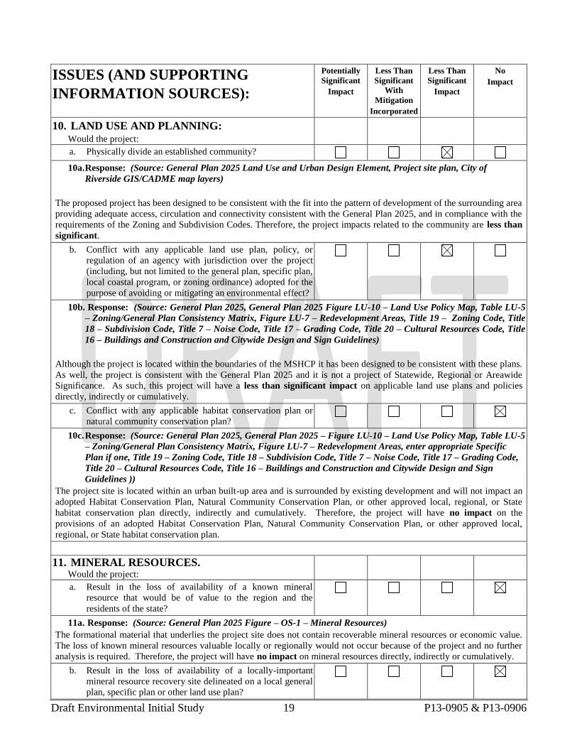
a. Physically divide an established community?
10a. Response: (Source: General Plan 2025 Land Use and Urban Design Element, Project site plan, City of
Riverside GIS/CADME map layers)
The proposed project has been designed to be consistent with the fit into the pattern of development of the surrounding area
providing adequate access, circulation and connectivity consistent with the General Plan 2025, and in compliance with the
requirements of the Zoning and Subdivision Codes. Therefore, the project impacts related to the community are less than
significant.
b. Conflict with any applicable land use plan, policy, or
regulation of an agency with jurisdiction over the project
(including, but not limited to the general plan, specific plan,
local coastal program, or zoning ordinance) adopted for the
purpose of avoiding or mitigating an environmental effect?
10b. Response: (Source: General Plan 2025, General Plan 2025 Figure LU-10 – Land Use Policy Map, Table LU-5
– Zoning/General Plan Consistency Matrix, Figure LU-7 – Redevelopment Areas, Title 19 – Zoning Code, Title
18 – Subdivision Code, Title 7 – Noise Code, Title 17 – Grading Code, Title 20 – Cultural Resources Code, Title
16 – Buildings and Construction and Citywide Design and Sign Guidelines)
Although the project is located within the boundaries of the MSHCP it has been designed to be consistent with these plans.
As well, the project is consistent with the General Plan 2025 and it is not a project of Statewide, Regional or Areawide
Significance. As such, this project will have a less than significant impact on applicable land use plans and policies
directly, indirectly or cumulatively.
c. Conflict with any applicable habitat conservation plan or
natural community conservation plan?
10c. Response: (Source: General Plan 2025, General Plan 2025 – Figure LU-10 – Land Use Policy Map, Table LU-5
– Zoning/General Plan Consistency Matrix, Figure LU-7 – Redevelopment Areas, enter appropriate Specific
Plan if one, Title 19 – Zoning Code, Title 18 – Subdivision Code, Title 7 – Noise Code, Title 17 – Grading Code,
Title 20 – Cultural Resources Code, Title 16 – Buildings and Construction and Citywide Design and Sign
Guidelines ))
The project site is located within an urban built-up area and is surrounded by existing development and will not impact an
adopted Habitat Conservation Plan, Natural Community Conservation Plan, or other approved local, regional, or State
habitat conservation plan directly, indirectly and cumulatively. Therefore, the project will have no impact on the
provisions of an adopted Habitat Conservation Plan, Natural Community Conservation Plan, or other approved local,
regional, or State habitat conservation plan.
11. MINERAL RESOURCES. Would the project:
a. Result in the loss of availability of a known mineral
resource that would be of value to the region and the
residents of the state?
11a. Response: (Source: General Plan 2025 Figure – OS-1 – Mineral Resources)
The formational material that underlies the project site does not contain recoverable mineral resources or economic value.
The loss of known mineral resources valuable locally or regionally would not occur because of the project and no further
analysis is required. Therefore, the project will have no impact on mineral resources directly, indirectly or cumulatively.
b. Result in the loss of availability of a locally-important
mineral resource recovery site delineated on a local general
plan, specific plan or other land use plan?
Draft Environmental Initial Study 20 P13-0905 & P13-0906
ISSUES (AND SUPPORTING
INFORMATION SOURCES):
Potentially
Significant
Impact
Less Than
Significant
With
Mitigation
Incorporated
Less Than
Significant
Impact
No
Impact
11b. Response: (Source: General Plan 2025 Figure – OS-1 – Mineral Resources)
The GP 2025 FPEIR determined that there are no specific areas with the City of Sphere Area which have locally-important
mineral resource recovery sites and that the implementation of the General Plan 2025 would not significantly preclude the
ability to extract state-designated resources. The proposed project is consistent with the General Plan 2025. Therefore,
there is no impact.
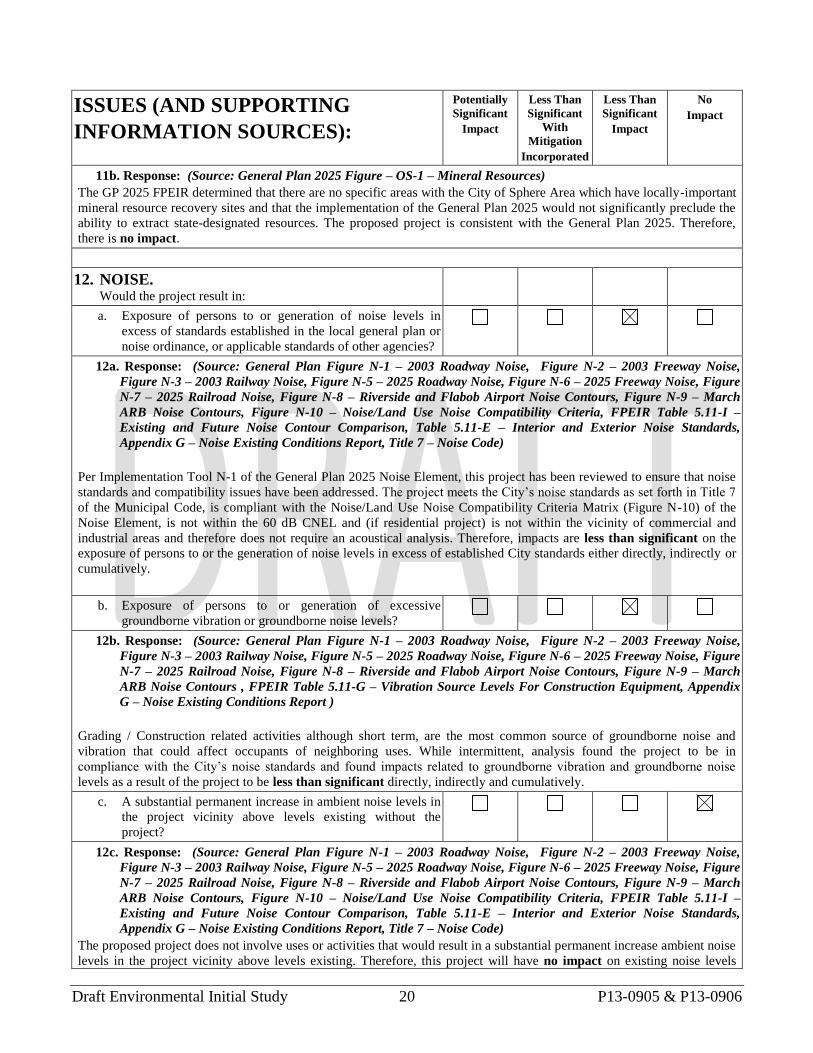
12. NOISE. Would the project result in:
a. Exposure of persons to or generation of noise levels in
excess of standards established in the local general plan or
noise ordinance, or applicable standards of other agencies?
12a. Response: (Source: General Plan Figure N-1 – 2003 Roadway Noise, Figure N-2 – 2003 Freeway Noise,
Figure N-3 – 2003 Railway Noise, Figure N-5 – 2025 Roadway Noise, Figure N-6 – 2025 Freeway Noise, Figure
N-7 – 2025 Railroad Noise, Figure N-8 – Riverside and Flabob Airport Noise Contours, Figure N-9 – March
ARB Noise Contours, Figure N-10 – Noise/Land Use Noise Compatibility Criteria, FPEIR Table 5.11-I –
Existing and Future Noise Contour Comparison, Table 5.11-E – Interior and Exterior Noise Standards,
Appendix G – Noise Existing Conditions Report, Title 7 – Noise Code)
Per Implementation Tool N-1 of the General Plan 2025 Noise Element, this project has been reviewed to ensure that noise
standards and compatibility issues have been addressed. The project meets the City’s noise standards as set forth in Title 7
of the Municipal Code, is compliant with the Noise/Land Use Noise Compatibility Criteria Matrix (Figure N-10) of the
Noise Element, is not within the 60 dB CNEL and (if residential project) is not within the vicinity of commercial and
industrial areas and therefore does not require an acoustical analysis. Therefore, impacts are less than significant on the
exposure of persons to or the generation of noise levels in excess of established City standards either directly, indirectly or
cumulatively.
b. Exposure of persons to or generation of excessive
groundborne vibration or groundborne noise levels?
12b. Response: (Source: General Plan Figure N-1 – 2003 Roadway Noise, Figure N-2 – 2003 Freeway Noise,
Figure N-3 – 2003 Railway Noise, Figure N-5 – 2025 Roadway Noise, Figure N-6 – 2025 Freeway Noise, Figure
N-7 – 2025 Railroad Noise, Figure N-8 – Riverside and Flabob Airport Noise Contours, Figure N-9 – March
ARB Noise Contours , FPEIR Table 5.11-G – Vibration Source Levels For Construction Equipment, Appendix
G – Noise Existing Conditions Report )
Grading / Construction related activities although short term, are the most common source of groundborne noise and
vibration that could affect occupants of neighboring uses. While intermittent, analysis found the project to be in
compliance with the City’s noise standards and found impacts related to groundborne vibration and groundborne noise
levels as a result of the project to be less than significant directly, indirectly and cumulatively.
c. A substantial permanent increase in ambient noise levels in
the project vicinity above levels existing without the
project?
12c. Response: (Source: General Plan Figure N-1 – 2003 Roadway Noise, Figure N-2 – 2003 Freeway Noise,
Figure N-3 – 2003 Railway Noise, Figure N-5 – 2025 Roadway Noise, Figure N-6 – 2025 Freeway Noise, Figure
N-7 – 2025 Railroad Noise, Figure N-8 – Riverside and Flabob Airport Noise Contours, Figure N-9 – March
ARB Noise Contours, Figure N-10 – Noise/Land Use Noise Compatibility Criteria, FPEIR Table 5.11-I –
Existing and Future Noise Contour Comparison, Table 5.11-E – Interior and Exterior Noise Standards,
Appendix G – Noise Existing Conditions Report, Title 7 – Noise Code)
The proposed project does not involve uses or activities that would result in a substantial permanent increase ambient noise
levels in the project vicinity above levels existing. Therefore, this project will have no impact on existing noise levels
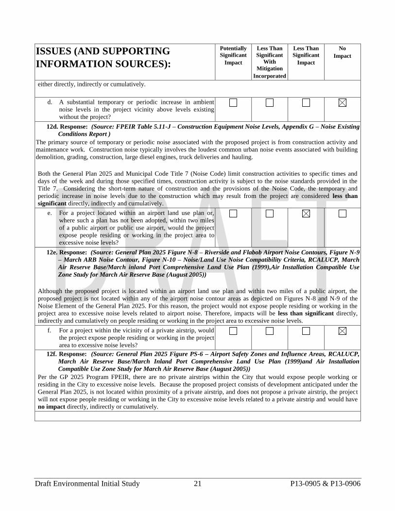
Draft Environmental Initial Study 21 P13-0905 & P13-0906
ISSUES (AND SUPPORTING
INFORMATION SOURCES):
Potentially
Significant
Impact
Less Than
Significant
With
Mitigation
Incorporated
Less Than
Significant
Impact
No
Impact
either directly, indirectly or cumulatively.
d. A substantial temporary or periodic increase in ambient
noise levels in the project vicinity above levels existing
without the project?
12d. Response: (Source: FPEIR Table 5.11-J – Construction Equipment Noise Levels, Appendix G – Noise Existing
Conditions Report )
The primary source of temporary or periodic noise associated with the proposed project is from construction activity and
maintenance work. Construction noise typically involves the loudest common urban noise events associated with building
demolition, grading, construction, large diesel engines, truck deliveries and hauling.
Both the General Plan 2025 and Municipal Code Title 7 (Noise Code) limit construction activities to specific times and
days of the week and during those specified times, construction activity is subject to the noise standards provided in the
Title 7. Considering the short-term nature of construction and the provisions of the Noise Code, the temporary and
periodic increase in noise levels due to the construction which may result from the project are considered less than
significant directly, indirectly and cumulatively.
e. For a project located within an airport land use plan or,
where such a plan has not been adopted, within two miles
of a public airport or public use airport, would the project
expose people residing or working in the project area to
excessive noise levels?
12e. Response: (Source: General Plan 2025 Figure N-8 – Riverside and Flabob Airport Noise Contours, Figure N-9
– March ARB Noise Contour, Figure N-10 – Noise/Land Use Noise Compatibility Criteria, RCALUCP, March
Air Reserve Base/March inland Port Comprehensive Land Use Plan (1999),Air Installation Compatible Use
Zone Study for March Air Reserve Base (August 2005))
Although the proposed project is located within an airport land use plan and within two miles of a public airport, the
proposed project is not located within any of the airport noise contour areas as depicted on Figures N-8 and N-9 of the
Noise Element of the General Plan 2025. For this reason, the project would not expose people residing or working in the
project area to excessive noise levels related to airport noise. Therefore, impacts will be less than significant directly,
indirectly and cumulatively on people residing or working in the project area to excessive noise levels.
f. For a project within the vicinity of a private airstrip, would
the project expose people residing or working in the project
area to excessive noise levels?
12f. Response: (Source: General Plan 2025 Figure PS-6 – Airport Safety Zones and Influence Areas, RCALUCP,
March Air Reserve Base/March Inland Port Comprehensive Land Use Plan (1999)and Air Installation
Compatible Use Zone Study for March Air Reserve Base (August 2005))
Per the GP 2025 Program FPEIR, there are no private airstrips within the City that would expose people working or
residing in the City to excessive noise levels. Because the proposed project consists of development anticipated under the
General Plan 2025, is not located within proximity of a private airstrip, and does not propose a private airstrip, the project
will not expose people residing or working in the City to excessive noise levels related to a private airstrip and would have
no impact directly, indirectly or cumulatively.
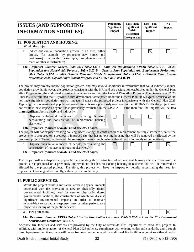
Draft Environmental Initial Study 22 P13-0905 & P13-0906
ISSUES (AND SUPPORTING
INFORMATION SOURCES):
Potentially
Significant
Impact
Less Than
Significant
With
Mitigation
Incorporated
Less Than
Significant
Impact
No
Impact
13. POPULATION AND HOUSING. Would the project:
a. Induce substantial population growth in an area, either
directly (for example, by proposing new homes and
businesses) or indirectly (for example, through extension of
roads or other infrastructure)?
13a. Response: (Source: General Plan 2025 Table LU-3 – Land Use Designations, FPEIR Table 5.12-A – SCAG
Population and Households Forecast, Table 5.12-B – General Plan Population and Employment Projections–
2025, Table 5.12-C – 2025 General Plan and SCAG Comparisons, Table 5.12-D - General Plan Housing
Projections 2025, Capital Improvement Program and SCAG’s RCP and RTP)
The project may directly induce population growth, and may involve additional infrastructure that could indirectly induce
population growth. However, the project is consistent with the HR land use designation established under the General Plan
2025 Program and the additional infrastructure is consistent with the General Plan 2025 Program. The General Plan 2025
Final PEIR determined that Citywide, future development anticipated under the General Plan 2025 Typical scenario would
not have significant population growth impacts. Because the proposed project is consistent with the General Plan 2025
Typical growth scenario and population growth impacts were previously evaluated in the GP 2025 FPEIR the project does
not result in new impacts beyond those previously evaluated in the GP 2025 FPEIR; therefore, the impacts will be less
than significant both directly and indirectly.
b. Displace substantial numbers of existing housing,
necessitating the construction of replacement housing
elsewhere?
13b. Response: (Source: CADME Land Use 2003 Layer)
The project will not displace existing housing, necessitating the construction of replacement housing elsewhere because the
project site is proposed on a previously improved site that has no existing housing that will be removed or affected by the
proposed project. Therefore, there will be no impact on existing housing either directly, indirectly or cumulatively.
c. Displace substantial numbers of people, necessitating the
construction of replacement housing elsewhere?
13c. Response: (Source: CADME Land Use 2003 Layer)
The project will not displace any people, necessitating the construction of replacement housing elsewhere because the
project site is proposed on a previously improved site that has no existing housing or residents that will be removed or
affected by the proposed project. Therefore, this project will have no impact on people, necessitating the need for
replacement housing either directly, indirectly or cumulatively.
14. PUBLIC SERVICES.
Would the project result in substantial adverse physical impacts
associated with the provision of new or physically altered
governmental facilities, need for new or physically altered
governmental facilities, the construction of which could cause
significant environmental impacts, in order to maintain
acceptable service ratios, response times or other performance
objectives for any of the public services:
a. Fire protection?
14a. Response: (Source: FPEIR Table 5.13-B – Fire Station Locations, Table 5.13-C – Riverside Fire Department
Statistics and Ordinance 5948 § 1)
Adequate fire facilities and services are provided by the City of Riverside Fire Department to serve this project. In
addition, with implementation of General Plan 2025 policies, compliance with existing codes and standards, and through
Fire Department practices, there will be no impacts on the demand for additional fire facilities or services either directly,
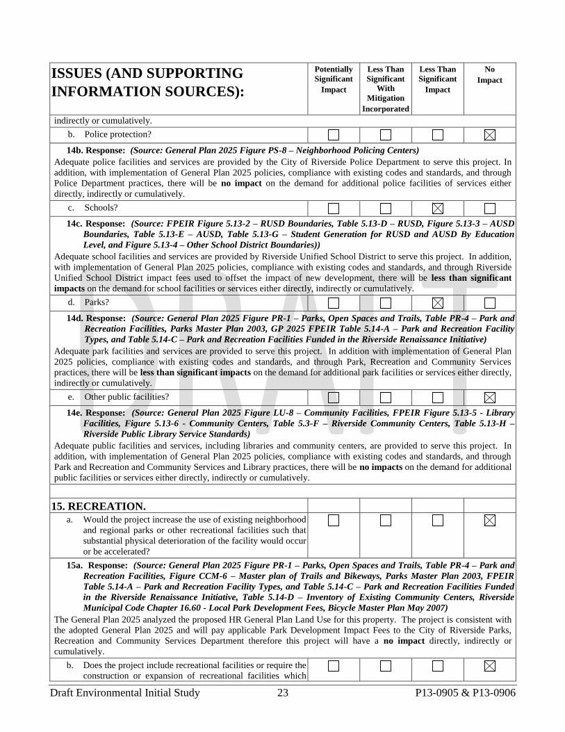
Draft Environmental Initial Study 23 P13-0905 & P13-0906
ISSUES (AND SUPPORTING
INFORMATION SOURCES):
Potentially
Significant
Impact
Less Than
Significant
With
Mitigation
Incorporated
Less Than
Significant
Impact
No
Impact
indirectly or cumulatively.
b. Police protection?
14b. Response: (Source: General Plan 2025 Figure PS-8 – Neighborhood Policing Centers)
Adequate police facilities and services are provided by the City of Riverside Police Department to serve this project. In
addition, with implementation of General Plan 2025 policies, compliance with existing codes and standards, and through
Police Department practices, there will be no impact on the demand for additional police facilities of services either
directly, indirectly or cumulatively.
c. Schools?
14c. Response: (Source: FPEIR Figure 5.13-2 – RUSD Boundaries, Table 5.13-D – RUSD, Figure 5.13-3 – AUSD
Boundaries, Table 5.13-E – AUSD, Table 5.13-G – Student Generation for RUSD and AUSD By Education
Level, and Figure 5.13-4 – Other School District Boundaries))
Adequate school facilities and services are provided by Riverside Unified School District to serve this project. In addition,
with implementation of General Plan 2025 policies, compliance with existing codes and standards, and through Riverside
Unified School District impact fees used to offset the impact of new development, there will be less than significant
impacts on the demand for school facilities or services either directly, indirectly or cumulatively.
d. Parks?
14d. Response: (Source: General Plan 2025 Figure PR-1 – Parks, Open Spaces and Trails, Table PR-4 – Park and
Recreation Facilities, Parks Master Plan 2003, GP 2025 FPEIR Table 5.14-A – Park and Recreation Facility
Types, and Table 5.14-C – Park and Recreation Facilities Funded in the Riverside Renaissance Initiative)
Adequate park facilities and services are provided to serve this project. In addition with implementation of General Plan
2025 policies, compliance with existing codes and standards, and through Park, Recreation and Community Services
practices, there will be less than significant impacts on the demand for additional park facilities or services either directly,
indirectly or cumulatively.
e. Other public facilities?
14e. Response: (Source: General Plan 2025 Figure LU-8 – Community Facilities, FPEIR Figure 5.13-5 - Library
Facilities, Figure 5.13-6 - Community Centers, Table 5.3-F – Riverside Community Centers, Table 5.13-H –
Riverside Public Library Service Standards)
Adequate public facilities and services, including libraries and community centers, are provided to serve this project. In
addition, with implementation of General Plan 2025 policies, compliance with existing codes and standards, and through
Park and Recreation and Community Services and Library practices, there will be no impacts on the demand for additional
public facilities or services either directly, indirectly or cumulatively.
15. RECREATION.
a. Would the project increase the use of existing neighborhood
and regional parks or other recreational facilities such that
substantial physical deterioration of the facility would occur
or be accelerated?
15a. Response: (Source: General Plan 2025 Figure PR-1 – Parks, Open Spaces and Trails, Table PR-4 – Park and
Recreation Facilities, Figure CCM-6 – Master plan of Trails and Bikeways, Parks Master Plan 2003, FPEIR
Table 5.14-A – Park and Recreation Facility Types, and Table 5.14-C – Park and Recreation Facilities Funded
in the Riverside Renaissance Initiative, Table 5.14-D – Inventory of Existing Community Centers, Riverside
Municipal Code Chapter 16.60 - Local Park Development Fees, Bicycle Master Plan May 2007)
The General Plan 2025 analyzed the proposed HR General Plan Land Use for this property. The project is consistent with
the adopted General Plan 2025 and will pay applicable Park Development Impact Fees to the City of Riverside Parks,
Recreation and Community Services Department therefore this project will have a no impact directly, indirectly or
cumulatively.
b. Does the project include recreational facilities or require the
construction or expansion of recreational facilities which
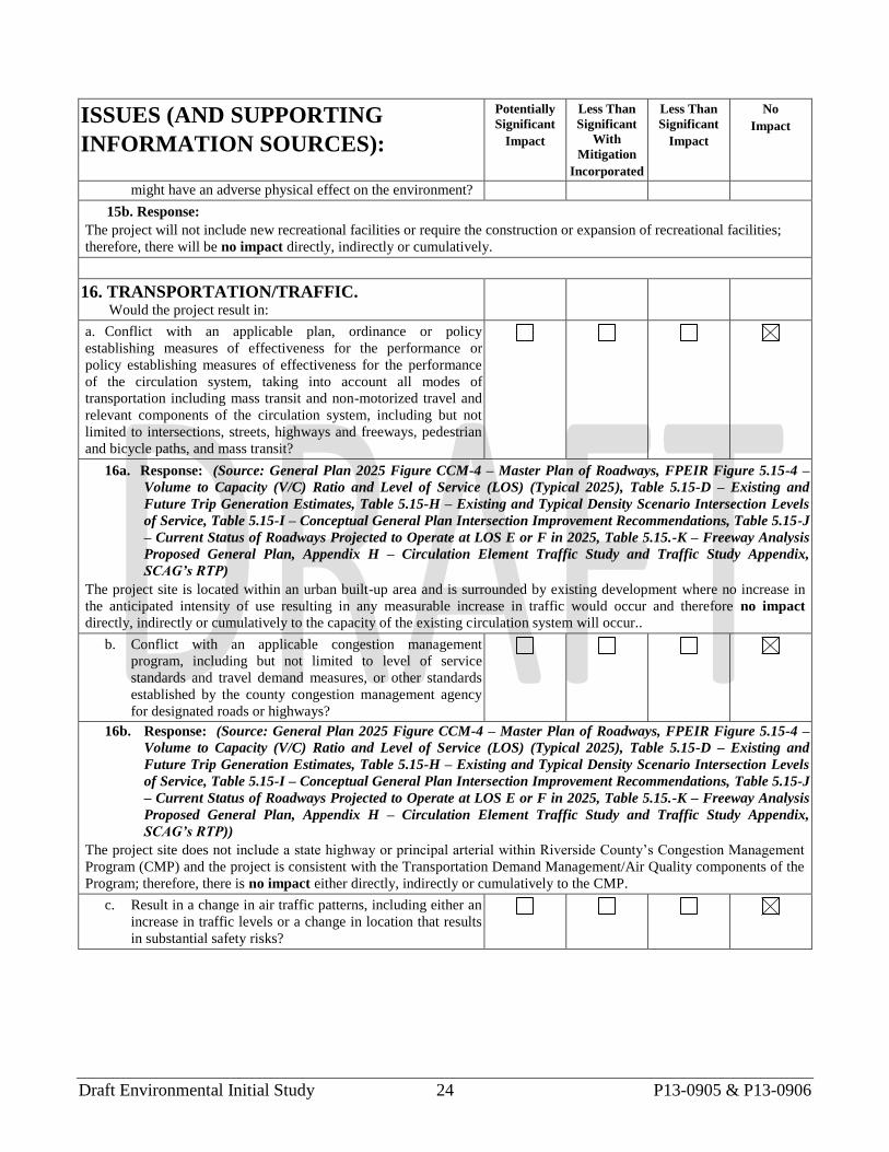
Draft Environmental Initial Study 24 P13-0905 & P13-0906
ISSUES (AND SUPPORTING
INFORMATION SOURCES):
Potentially
Significant
Impact
Less Than
Significant
With
Mitigation
Incorporated
Less Than
Significant
Impact
No
Impact
might have an adverse physical effect on the environment?
15b. Response:
The project will not include new recreational facilities or require the construction or expansion of recreational facilities;
therefore, there will be no impact directly, indirectly or cumulatively.
16. TRANSPORTATION/TRAFFIC. Would the project result in:
a. Conflict with an applicable plan, ordinance or policy
establishing measures of effectiveness for the performance or
policy establishing measures of effectiveness for the performance
of the circulation system, taking into account all modes of
transportation including mass transit and non-motorized travel and
relevant components of the circulation system, including but not
limited to intersections, streets, highways and freeways, pedestrian
and bicycle paths, and mass transit?
16a. Response: (Source: General Plan 2025 Figure CCM-4 – Master Plan of Roadways, FPEIR Figure 5.15-4 –
Volume to Capacity (V/C) Ratio and Level of Service (LOS) (Typical 2025), Table 5.15-D – Existing and
Future Trip Generation Estimates, Table 5.15-H – Existing and Typical Density Scenario Intersection Levels
of Service, Table 5.15-I – Conceptual General Plan Intersection Improvement Recommendations, Table 5.15-J
– Current Status of Roadways Projected to Operate at LOS E or F in 2025, Table 5.15.-K – Freeway Analysis
Proposed General Plan, Appendix H – Circulation Element Traffic Study and Traffic Study Appendix,
SCAG’s RTP)
The project site is located within an urban built-up area and is surrounded by existing development where no increase in
the anticipated intensity of use resulting in any measurable increase in traffic would occur and therefore no impact
directly, indirectly or cumulatively to the capacity of the existing circulation system will occur..
b. Conflict with an applicable congestion management
program, including but not limited to level of service
standards and travel demand measures, or other standards
established by the county congestion management agency
for designated roads or highways?
16b. Response: (Source: General Plan 2025 Figure CCM-4 – Master Plan of Roadways, FPEIR Figure 5.15-4 –
Volume to Capacity (V/C) Ratio and Level of Service (LOS) (Typical 2025), Table 5.15-D – Existing and
Future Trip Generation Estimates, Table 5.15-H – Existing and Typical Density Scenario Intersection Levels
of Service, Table 5.15-I – Conceptual General Plan Intersection Improvement Recommendations, Table 5.15-J
– Current Status of Roadways Projected to Operate at LOS E or F in 2025, Table 5.15.-K – Freeway Analysis
Proposed General Plan, Appendix H – Circulation Element Traffic Study and Traffic Study Appendix,
SCAG’s RTP))
The project site does not include a state highway or principal arterial within Riverside County’s Congestion Management
Program (CMP) and the project is consistent with the Transportation Demand Management/Air Quality components of the
Program; therefore, there is no impact either directly, indirectly or cumulatively to the CMP.
c. Result in a change in air traffic patterns, including either an
increase in traffic levels or a change in location that results
in substantial safety risks?

Draft Environmental Initial Study 25 P13-0905 & P13-0906
ISSUES (AND SUPPORTING
INFORMATION SOURCES):
Potentially
Significant
Impact
Less Than
Significant
With
Mitigation
Incorporated
Less Than
Significant
Impact
No
Impact
16c. Response: (Source: General Plan 2025 Figure PS-6 – Airport Safety Zones and Influence Areas, RCALUCP,
March Air Reserve Base/March Inland Port Comprehensive Land Use Plan (1999)and Air Installation
Compatible Use Zone Study for March Air Reserve Base (August 2005)
The proposed project is located in Zone E of RCALUCP for MARB JLUS and has been designed to be consistent with this
plan. The project will not change air traffic patterns, increase air traffic levels or change the location of air traffic patterns.
It is not located within an airport influence area. As such, this project will have no impact directly, indirectly or
cumulatively on air traffic patterns.
d. Substantially increase hazards due to a design feature (e.g.,
sharp curves or dangerous intersections) or incompatible
uses (e.g., farm equipment)?
16d. Response: (Source: Project Site Plans, Lane Striping and Signing Plans)
The project site is located within an urban built-up area and is surrounded by existing development where no site
modifications will occur that would result in hazards. In addition, the proposed use is compatible with surrounding uses
on. As such, the project will have no impact on increasing hazards through design or incompatible uses either directly,
indirectly or cumulatively.
e. Result in inadequate emergency access?
16e. Response: (Source: California Department of Transportation Highway Design Manual, Municipal Code, and
Fire Code)
The project has been developed in compliance with Title 18, Section 18.210.030 and the City’s Fire Code Section 503
(California Fire Code 2007); therefore, there will be no impact directly, indirectly or cumulatively to emergency access.
f. Conflict with adopted policies, plans or programs regarding
public transit, bicycle, or pedestrian facilities, or otherwise
decrease the performance or safety of such facilities)?
16f. Response: (Source: FPEIR, General Plan 2025 Land Use and Urban Design, Circulation and Community
Mobility and Education Elements, Bicycle Master Plan, School Safety Program – Walk Safe! – Drive Safe!)
The project, as designed, does not create conflicts with adopted policies, plans or programs supporting alternative
transportation (e.g. bus turnouts, bicycle racks). As such, the project will have no impact directly, indirectly or
cumulatively on adopted policies, plans, or programs supporting alternative transportation.
17. UTILITIES AND SYSTEM SERVICES. Would the project:
a. Exceed wastewater treatment requirements of the applicable
Regional Water Quality Control Board?
17a. Response: (Source: General Plan 2025 Figure PF-2 – Sewer Facilities Map, FPEIR Figure 5.16-5 – Sewer
Service Areas, Table 5.16-K - Estimated Future Wastewater Generation for the City of Riverside’s Sewer Service
Area, Table 5.16-L - Estimated Future Wastewater Generation for the Planning Area Served by WMWD ,
Figure 5.8-1 – Watersheds, Wastewater Integrated Master Plan and Certified EIR)
The project will not exceed wastewater treatment requirements of the Regional Water Quality Control Board (RWQCB).
The project is located on a site that is currently developed, with all site improvements in place, and where no site
modifications are proposed that would affect wastewater treatment; therefore there will be no impact directly, indirectly or
cumulatively to wastewater treatment.
b. Require or result in the construction of new water or
wastewater treatment facilities or expansion of existing
facilities, the construction of which could cause significant
environmental effects?
17b. Response: (Source: General Plan 2025 Table PF-1 – RPU PROJECTED DOMESTIC WATER Supply (AC-FT/YR),
Table PF-2 – RPU Projected Water Demand, Table PF-3 – Western Municipal Water District Projected
Domestic Water Supply (AC-FT/YR), RPU, FPEIR Table 5.16-G – General Plan Projected Water Demand for

Draft Environmental Initial Study 26 P13-0905 & P13-0906
ISSUES (AND SUPPORTING
INFORMATION SOURCES):
Potentially
Significant
Impact
Less Than
Significant
With
Mitigation
Incorporated
Less Than
Significant
Impact
No
Impact
RPU Including Water Reliability for 2025, Table 5.16-I - Current and Projected Water Use WMWD, Table 5.16-
J - General Plan Projected Water Demand for WMWD Including Water Reliability 2025, Table 5.16-K -
Estimated Future Wastewater Generation for the City of Riverside’s Sewer Service Area & Table 5.16-L -
Estimated Future Wastewater Generation for the Planning Area Served by WMWD, Figure 5.16-4 – Water
Facilities and Figure 5.16-6 – Sewer Infrastructure and Wastewater Integrated Master Plan and Certified EIR.)
The project will not result in the construction of new or expanded water or wastewater treatment facilities. The project is
consistent with the Typical Growth Scenario of the General Plan 2025 where future water and wastewater generation was
determined to be adequate (see Tables 5.16-E, 5.16-F, 5.16-G, 5.16-H, 5.16-I, 5.16-J and 5.16-K of the General Plan 2025
Final PEIR). Therefore, the project will have no impact resulting in the construction of new water or wastewater treatment
facilities or the expansion of existing facilities directly, indirectly or cumulatively.
c. Require or result in the construction of new storm water
drainage facilities or expansion of existing facilities, the
construction of which could cause significant environmental
effects?
17c. Response: (Source: FPEIR Figure 5.16-2 - Drainage Facilities)
The Subdivision Code (Title 18, Section 18.48.020) requires drainage fees to be paid to the City for new construction. Fees
are transferred into a drainage facilities fund that is maintained by Riverside County Flood Control and Water
Conservation District. This Section also complies with the California Government Code (section 66483), which provides
for the payment of fees for construction of drainage facilities. Fees are required to be paid as part of the conditions of
approval/waiver for filing of a final map or parcel map.
General Plan 2025 Policies PF 4.1 and PF 4.3 require the City to continue to routinely monitor its storm drain system and
to fund and improve those systems as identified in the City’s Capital Improvement plan. Implementation of these policies
will ensure that the City is adequately served by drainage systems. The General Plan 2025 also includes policies and
programs that will minimize the environmental effects of the development of such facilities. Therefore, the project will
have less than significant on existing storm water drainage facilities that would not require the expansion of existing
facilities directly, indirectly or cumulatively.
d. Have sufficient water supplies available to serve the project
from existing entitlements and resources, or are new or
expanded entitlements needed?
17d. Response: (Source: FPEIR Figure 5.16-3 – Water Service Areas, Figure 5.16-4 – Water Facilities, Table 5.16-
E – RPU Projected Domestic Water Supply (AC-FT/YR, Table 5.16-F – Projected Water Demand, Table 5.16-G
– General Plan Projected Water Demand for RPU including Water Reliability for 2025, Table 5.16-H – Current
and Projected Domestic Water Supply (acre-ft/year) WMWD Table 5.16-I Current and Projected Water Use
WMWD, Table 5.16-J – General Plan Projected Water Demand for WMWD Including Water Reliability 2025,
RPU Master Plan, EMWD Master Plan, WMWD Master Plan, and Highgrove Water District Master Plan)
The project will not exceed expected water supplies. The project is consistent with the General Plan 2025 Typical Growth
Scenario where future water supplies were determined to be adequate (see Tables t.16-E, 5.16-F, 5.16-G, 5.16-H, 5.16-I
and 5.16-J of the General Plan 2025 Final PEIR). Therefore, the project will have no impact resulting in the insufficient
water supplies either directly, indirectly or cumulatively.
e. Result in a determination by the wastewater treatment
provider which serves or may serve the project that it has
adequate capacity to serve the project’s projected demand in
addition to the provider’s existing commitments?
17e. Response: (Source: FPEIR Figure 5.16-5 - Sewer Service Areas, Figure 5.16-6 -Sewer Infrastructure, Table
5.16-K - Estimated Future Wastewater Generation for the City of Riverside’s Sewer Service Area, Table 5.16-L -
Estimated Future Wastewater Generation for the Planning Area Served by WMWD, and Wastewater Integrated
Master Plan and Certified EIR)
The project will not exceed wastewater treatment requirements of (Regional Water Quality Control Board). The project is
consistent with the General Plan 2025 Typical Growth Scenario where future wastewater generation was determined to be
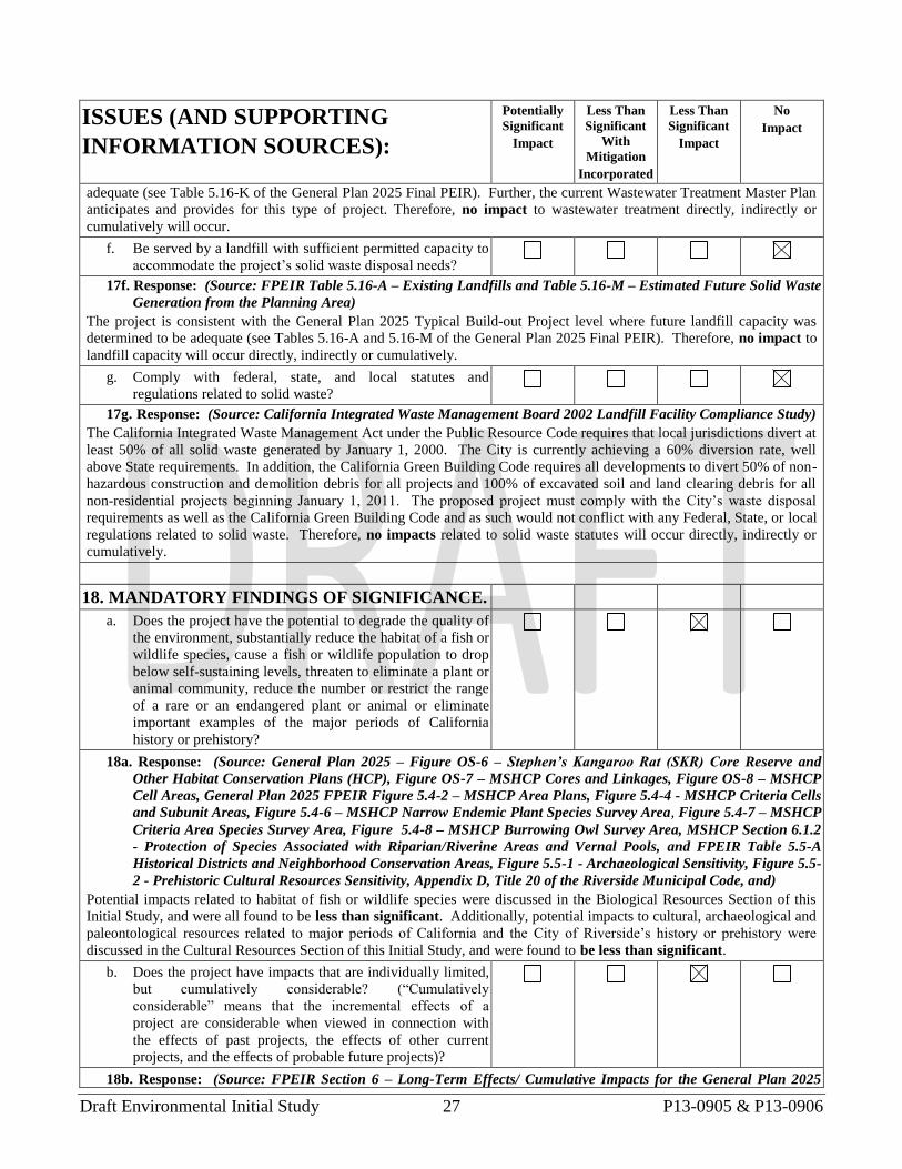
Draft Environmental Initial Study 27 P13-0905 & P13-0906
ISSUES (AND SUPPORTING
INFORMATION SOURCES):
Potentially
Significant
Impact
Less Than
Significant
With
Mitigation
Incorporated
Less Than
Significant
Impact
No
Impact
adequate (see Table 5.16-K of the General Plan 2025 Final PEIR). Further, the current Wastewater Treatment Master Plan
anticipates and provides for this type of project. Therefore, no impact to wastewater treatment directly, indirectly or
cumulatively will occur.
f. Be served by a landfill with sufficient permitted capacity to
accommodate the project’s solid waste disposal needs?
17f. Response: (Source: FPEIR Table 5.16-A – Existing Landfills and Table 5.16-M – Estimated Future Solid Waste
Generation from the Planning Area)
The project is consistent with the General Plan 2025 Typical Build-out Project level where future landfill capacity was
determined to be adequate (see Tables 5.16-A and 5.16-M of the General Plan 2025 Final PEIR). Therefore, no impact to
landfill capacity will occur directly, indirectly or cumulatively.
g. Comply with federal, state, and local statutes and
regulations related to solid waste?
17g. Response: (Source: California Integrated Waste Management Board 2002 Landfill Facility Compliance Study)
The California Integrated Waste Management Act under the Public Resource Code requires that local jurisdictions divert at
least 50% of all solid waste generated by January 1, 2000. The City is currently achieving a 60% diversion rate, well
above State requirements. In addition, the California Green Building Code requires all developments to divert 50% of non-
hazardous construction and demolition debris for all projects and 100% of excavated soil and land clearing debris for all
non-residential projects beginning January 1, 2011. The proposed project must comply with the City’s waste disposal
requirements as well as the California Green Building Code and as such would not conflict with any Federal, State, or local
regulations related to solid waste. Therefore, no impacts related to solid waste statutes will occur directly, indirectly or
cumulatively.
18. MANDATORY FINDINGS OF SIGNIFICANCE.
a. Does the project have the potential to degrade the quality of
the environment, substantially reduce the habitat of a fish or
wildlife species, cause a fish or wildlife population to drop
below self-sustaining levels, threaten to eliminate a plant or
animal community, reduce the number or restrict the range
of a rare or an endangered plant or animal or eliminate
important examples of the major periods of California
history or prehistory?
18a. Response: (Source: General Plan 2025 – Figure OS-6 – Stephen’s Kangaroo Rat (SKR) Core Reserve and
Other Habitat Conservation Plans (HCP), Figure OS-7 – MSHCP Cores and Linkages, Figure OS-8 – MSHCP
Cell Areas, General Plan 2025 FPEIR Figure 5.4-2 – MSHCP Area Plans, Figure 5.4-4 - MSHCP Criteria Cells
and Subunit Areas, Figure 5.4-6 – MSHCP Narrow Endemic Plant Species Survey Area, Figure 5.4-7 – MSHCP
Criteria Area Species Survey Area, Figure 5.4-8 – MSHCP Burrowing Owl Survey Area, MSHCP Section 6.1.2
- Protection of Species Associated with Riparian/Riverine Areas and Vernal Pools, and FPEIR Table 5.5-A
Historical Districts and Neighborhood Conservation Areas, Figure 5.5-1 - Archaeological Sensitivity, Figure 5.5-
2 - Prehistoric Cultural Resources Sensitivity, Appendix D, Title 20 of the Riverside Municipal Code, and)
Potential impacts related to habitat of fish or wildlife species were discussed in the Biological Resources Section of this
Initial Study, and were all found to be less than significant. Additionally, potential impacts to cultural, archaeological and
paleontological resources related to major periods of California and the City of Riverside’s history or prehistory were
discussed in the Cultural Resources Section of this Initial Study, and were found to be less than significant.
b. Does the project have impacts that are individually limited,
but cumulatively considerable? (“Cumulatively
considerable” means that the incremental effects of a
project are considerable when viewed in connection with
the effects of past projects, the effects of other current
projects, and the effects of probable future projects)?
18b. Response: (Source: FPEIR Section 6 – Long-Term Effects/ Cumulative Impacts for the General Plan 2025

Draft Environmental Initial Study 28 P13-0905 & P13-0906
ISSUES (AND SUPPORTING
INFORMATION SOURCES):
Potentially
Significant
Impact
Less Than
Significant
With
Mitigation
Incorporated
Less Than
Significant
Impact
No
Impact
Program)
Because the project is consistent with the General Plan 2025, no new cumulative impacts are anticipated and therefore
cumulative impacts of the proposed project beyond those previously considered in the GP 2025 FPEIR are less than
significant.
c. Does the project have environmental effects which will
cause substantial adverse effects on human beings, either
directly or indirectly?
18c. Response: (Source: FPEIR Section 5 – Environmental Impact Analysis for the General Plan 2025 Program)
Effects on human beings were evaluated as part of the aesthetics, air quality, hydrology & water quality, noise, population
and housing, hazards and hazardous materials, and traffic sections of this initial study and found to be less than significant
for each of the above sections. Based on the analysis and conclusions in this initial study, the project will not cause
substantial adverse effects, directly or indirectly to human beings. Therefore, potential direct and indirect impacts on
human beings that result from the proposed project are less than significant.
Note: Authority cited: Sections 21083 and 21087, Public Resources Code. Reference: Sections 21080(c), 21080.1, 21080.3, 21082.1, 21083, 21083.3,
21093, 21094, 21151, Public Resources Code; Sundstrom v. County of Mendocino, 202 Cal.App.3d 296 (1988); Leonoff v. Monterey Board of Supervisors, 222 Cal.App.3d 1337 (1990).