compliance certification - in.gov
TRANSCRIPT

Compliance Certification
Permit Number: LRL-2016-511-scm
Name of Permittee: Indiana Department of Transportation
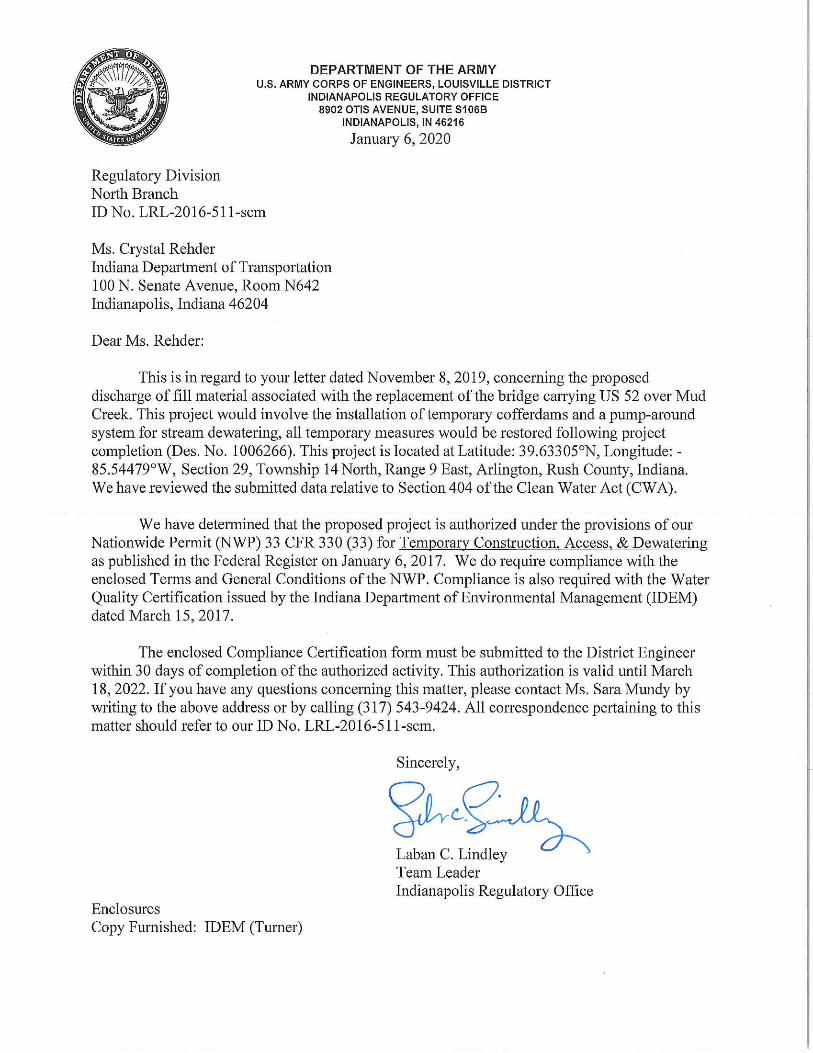
Date of Issuance: January 6, 2020
Within 30 days of completion of the activity authorized by this permit and any
mitigation required by this permit, sign this certification and return it to the
following address:
USACE - Louisville District
Indianapolis Regulatory Office
8902 Otis Avenue, Suite S106B
Indianapolis, IN 46216-1055
Please note that your permitted activity is subject to a compliance inspection by an
U.S. Army Corps of Engineers representative. If you fail to comply with this
permit you are subject to permit suspension, modification, or revocation.
I hereby certify that the work authorized by the above referenced permit has been
completed in accordance with the terms and conditions of the said permit, and
required mitigation was completed in accordance with the permit conditions.
_________________________________ __________________
Signature for Permittee Date
(Crystal Rehder)

SECTION 401 WQC REGIONAL GENERAL PERMIT NOTIFICATION State Form 51937 (R5 / 7-18) INDIANA DEPARTMENT OF ENVIRONMENTAL MANAGEMENT (IDEM) and U.S. ARMY CORPS OF ENGINEERS (USACE)
Authorities: Section 401 Water Quality Certification, Section 404 of the Clean Water Act,
and Section 10 of the Rivers and Harbor Act
INSTRUCTIONS: 1. Familiarize yourself with the terms and conditions of this permit. 2. Read the instructions before filling out this form. 3. All applicable sections of this two (2) page form must be completed.
APPLICANT INFORMATION
Name of Project: US 52 over Mud Creek Bridge Replacement Designation Number: 1006266, Contract B-35450
Applicant: Indiana Department of Transportation Agent (Name of Company): HNTB
Contact Person: Crystal Rehder Contact Person: Aaron Grisel
Address (number and street): Address (number and street) :
100 N. Senate Avenue, Room N624-ESD 111 Monument Circle, Suite 1200
City: Indianapolis State: IN ZIP Code: 46204 City: Indianapolis State: IN ZIP Code: 46204
Telephone Number: 317-233-2062 Telephone Number: 317-917-5220
E-mail Address: [email protected] E-mail Address: [email protected]
PROJECT LOCATION
County: Rush Nearest Town: Arlington
Quad Name: Carthage Section: 29 Township: 14 North Range: 9 East
Latitude: 39.63305 N Longitude: 85.54479 W
Project Address and Driving Directions:
The project is located in a rural, unincorporated portion of Rush County. From the US 52 and SR 44 intersection in Rushville, Indiana, travel northwest along US 52. The US 52 over Mud Creek bridge is located approximately 5.46 miles northwest of the US 52 and SR 44 intersection.
EXISTING CONDITIONS ON THE PROJECT SITE
Lake: Yes No Name of Lake: N/A
Stream: Yes No Name of Stream: Mud Creek Stream Type: Perennial Intermittent Ephemeral
Wetlands: Yes No Acreage on the site by Wetland Type(s): N/A Emergent N/A Scrub-Shrub N/A Forested
Date (mm/dd/yyyy) of Wetland Delineation: N/A
Date (mm/dd/yyyy) of the U.S. Army Corps of Engineers Jurisdiction Correspondence: N/A
PROJECT IMPACTS
Activity Description:
This project, Des. No. 1006266, includes replacement of the existing structure with a three-span reinforced concrete slab bridge, replacement of the roadway approach slabs, milling and resurfacing of the approach roadway pavement, and replacement of guardrail. Class I riprap will be placed at the abutments for scour protection and will be placed flush with the existing ground elevation; however, proposed riprap will not extend below the OHWM of Mud Creek. Temporary cofferdams and temporary sump holes will be required to provide a dry work area for the bridge replacement. The work within the stream channel will result in approximately 92 linear feet (0.02 acre and 61 cubic yards) of temporary impacts to Mud Creek. Construction activities will not require the placement of permanent fill below the OHWM of Mud Creek. Contractors will return all affected areas to pre-construction conditions. Disturbed areas above the OHWM will be reseeded with INDOT Seed Mix R following construction. See Attachments A1-A3 for additional.
Purpose of Project:
The purpose of this project is to maintain a safe vehicular crossing of US 52 over Mud Creek by replacing existing the bridge. Class I riprap will be installed above the OHWM for scour protection.
For Lake Impact (Acceptable fill is defined in the instructions):
(1) Linear feet of shoreline impact (Example – Seawall): N/A
(2) Type of fill below the Ordinary High Water Mark: N/A Volume (Cubic Yards): N/A Acres: N/A
(3) Does the shoreline or open water area have vegetation present? Yes No
AGENCY USE ONLY
Date Received (mm/dd/yyyy)
IDEM ID
Processing Date (mm/dd/yyyy)

If Yes, are you proposing natural shoreline stabilization? Yes No Description: N/A
(4) Open water fill beyond shoreline (Examples – Boat Well, Underwater Beach): Type of Fill: N/A Acres: N/A
For Stream Impact (Acceptable fill is defined in instructions):
(1) Total linear feet of stream impact (Examples - bank stabilization, bridge construction or culvert placement, seawall work): 0
(2) Total acre(s) of stream impact: 0
(3) Type of fill below the Ordinary High Water Mark: N/A Volume (Cubic Yards): 0
(4) Proposed start date of work in the stream (mm/dd/yyyy): 10/01/2020 Proposed end date of work in the stream (mm/dd/yyyy): 04/01/2021
(5) Channel width in feet (See instructions): 27.7 Channel depth in feet (See instructions): 2.2
(6) Cross-sectional area below the Ordinary High Water Mark: 60.9
(7) For stream crossings, type of structure proposed to be Installed (Examples: three-sided or four-sided culvert, bridge, pipe): three-span, reinforced concrete slab bridge
(8) For stream crossings, width of culvert structure/diameter of pipe to be Installed (feet): N/A Length of culvert structure/pipe (feet): N/A
(9) For stream crossings, substrate type (i.e. sand, soil or unconsolidated till, bedrock or consolidated till): Sand
(10) Open water fill that projects beyond the stream bank: Type of fill: N/A Acre(s) of open water impact: N/A
For Wetland Impact (Acceptable fill is defined in instructions):
(1) Type of fill: N/A
(2) Acre(s) of Impact: N/A Emergent N/A Scrub-Shrub N/A Forested
SIGNATURE OF APPLICANT – STATEMENT OF AFFIRMATION
I swear or affirm, under penalty of perjury as specified by IC 35-44.1-2-1 and other penalties specified by IC 13-30-10, that the statements and representations in this notification are true, accurate, and complete.
I certify that I have the authority to undertake and will undertake the activities exactly as described in this notification form. I am aware that there are penalties for submitting false information. I understand that any changes in project design subsequent to IDEM's and the USACE’s granting of authorization to discharge to a water of the U.S. are not authorized, and that I may be subject to civil and criminal penalties for proceeding without proper authorization. I agree to allow representatives of IDEM and the USACE to enter and inspect the project site. I understand that the granting of other permits by local, state, or federal agencies does not release me from the requirement of obtaining the authorization requested herein before commencing the project.
Signature of Applicant: ________________________________________________ Date (mm/dd/yyyy):
Printed Name of Applicant: Crystal Rehder Title: Team Lead
Enclose copies of the following documents (all enclosures must be on 8.5” by 11” paper). Failure to provide all applicable documents and information may result in a determination that the proposed project is out of scope.
(1) Location Map
(2) Drawings of existing site and proposed project
(3) Cross sections of proposed activities showing extent of fill waterward (for seawall, shoreline, and stream bank stabilization impacts)
(4) Cross sections of proposed activities showing the bankfull width or Ordinary High Water Mark of the stream
(5) At least three photos of the site, labeled
(6) Copy of wetland delineation report (for projects with wetland impacts)
(7) Copies of all correspondence from the USACE (for projects with wetland impacts)
(8) Copies of all correspondence from the Indiana Department of Natural Resources, Division of Nature Preserves (required)
Please Note:
(1) It is recommended that you send this form and the attachments via certified mail. The agencies will not notify you when this form is received.
(2) IDEM and the USACE will review this form and all attachments for completeness and accuracy. You will not be contacted during the application process unless deficiencies are identified at which time the agencies may require additional information to verify that the project meets all conditions of the Regional General Permit and the Section 401 Water Quality Certification (WQC). If you are not contacted by IDEM within thirty (30) days of the date IDEM receives this notification form, your project is authorized, subject to the terms and conditions of the Section 401 Water Quality Certification and its conditions. You will not receive a written confirmation of authorization from IDEM, however the USACE will issue written authorization.
(3) Read all the terms and conditions of the IDEM Regional General Permit, including all USACE and IDEM conditions. The terms and conditions of this general permit as instituted by IDEM can be found at: http://www.in.gov/idem/wetlands/2353.htm . Do not submit this notification form or commence work on the proposed project until you understand and are familiar with the limitations and restrictions of the IDEM Regional General Permit Notification Form.
(4) Consult this webpage for more information: http://www.in.gov/idem/wetlands/index.htm

Upon completion of the application, mail this form and all enclosures to:
Indiana Department of Environmental Management Office of Water Quality, Wetlands and Stormwater Section Section 401 WQC/Isolated Wetlands Program 100 North Senate Avenue, IGCN, Room 1255 Indianapolis, Indiana 46204-2251
U.S. Army Corps of Engineers Regulatory Branch
For office locations serving Indiana, please visit: http://www.usace.army.mil/Locations.aspx
ATTACHMENT 1
Additional Information for US 52 over Mud Creek
(Des. No. 1006266)
Project Description
The Indiana Department of Transportation (INDOT) is proposing to replace the existing bridge (Bridge No.
052-70-04004; Des. No. 1006266) carrying Mud Creek beneath United States Highway (US) 52
approximately 5.46 miles west of State Road (SR) 44 in Rush County. The project is in Section 29, Township
14 North, Range 9 East in Posey Township. Maps of the project are included in Attachments A25-A29.
The purpose of this project is to maintain a safe vehicular crossing of US 52 over Mud Creek by replacing
existing the bridge. The need for this project is due to the deteriorated condition of the existing structure
carrying US 52 over Mud Creek. The existing structure is a three-span, reinforced concrete slab bridge
measuring 91.5 feet long with an out-to-out width of 81.5 feet. The existing bridge deck wearing surface
is in fair condition with cracking and large existing patches. Bridge deck spalling is present near one of the
deck patches. The underside of the bridge deck has delamination, spalling, and efflorescence along the
longitudinal construction joints. The existing piers are in fair to poor condition with spalling and exposed
reinforcing. The existing bridge was previously programmed as a bridge rehabilitation project; however,
due to an inadequate load rating, the project has been re-programmed as a bridge replacement. These
conditions are documented in the Bridge Inspection Report completed by INDOT on March 24, 2019. An
existing riprap footprint is not present at the piers or abutments. The INDOT Hydraulic Approval Memo
dated November 26, 2018, recommends that riprap be placed along the sloping abutment (Attachments
A87-A88). Based on the maximum channel velocity, scour countermeasures at the piers is not required.
Proposed construction activities for Des. No. 1006266 includes the replacement of the existing structure
with a new three-span, continuous reinforced concrete slab bridge. New bridge piers and Type 1A joints
will be constructed as part of the bridge replacement. The existing approach slabs will be replaced and
the approach roadway pavement will be milled and resurfaced to accommodate the new approach slabs.
New 6-foot, 8-inch paved shoulders will be constructed. Class 1 riprap will be placed along the roadway
fill slope for the construction of riprap drainage turnouts and along the bridge abutments. The existing
approach roadway guardrail will be replaced and new bridge railing transitions will be constructed.
Construction access to the underside of the bridge will occur from all four quadrants. Construction is
anticipated to start following contractor selection in the fall of 2020 and end in the spring of 2021.The
Maintenance of Traffic (MOT) plan for the project includes the closure of US 52 with a state route detour
utilizing SR 44, SR 9, and I-74. The MOT will be implemented per the current IDM guidelines.
Potential Waters of the U.S.
During the field investigation conducted on May 16, 2018, INDOT staff identified one jurisdictional stream,
Mud Creek, within the investigated area. Mud Creek flows south to Conns Creek, which flows to Flatrock
River which flows to the White River, which flows to the Wabash River, a traditionally navigable waterway.
Des. No. 1006266 A1
Due to the connectivity to a traditionally navigable waterway, Mud Creek is likely considered a Waters of
the U.S. The approved US 52 over Mud Creek Wetland and Waterways Delineation Report containing
project maps and photographs is included in Attachment A21-A56.
Cumulative Impacts
The cumulative impacts to streams caused by the US 52 over Mud Creek bridge replacement project,
including both permanent and temporary impacts, will total approximately 92 linear feet, 0.02 acre, and
61 cubic yards. A plan set depicting detailed construction activities is included as Attachments A5-A7.
Temporary Impacts
The US 52 over Mud Creek project will require the installation of temporary cofferdams, dewatering
pumps, temporary supports, sump holes, and filter bags on a leveling pad with filter fabric to provide a
dry working area for replacement of the bridge and to prevent sediment from migrating downstream
during construction. The contractor will be responsible for determining whether sheet piling or sandbags
will be used to construct the temporary cofferdams.
The temporary dewatering impacts within the ordinary high-water mark (OHWM) limits of Mud Creek,
including cofferdams, will total approximately 92 linear feet (0.02 acre; 61 cubic yards of temporary fill).
The sump hole is limited to two feet in diameter by 18 inches in depth and will result in <0.001 cubic yard
of disturbance to the stream bed. A plan set depicting temporary dewatering measures and impacts are
included in Attachment A5.
Disturbed areas above the OHWM will be reseeded with INDOT Seed Mix R and mulched in accordance
with INDOT Standard Specification 621. INDOT anticipates the temporary cofferdams to be in place for
approximately 13 weeks.
Permanent Impacts
No permanent impacts below the OHWM of Mud Creek are anticipated (Attachment A6).
Additional Considerations and Restoration
Following construction, all temporary measures are to be removed. Any bare soil areas above the OHMW
caused by incidental construction activities or temporary impacts to the stream channels and/or stream
banks shall be restored to pre-construction contours and reseeded with INDOT Seed Mixture R and
mulched following INDOT Standard Specification 621.
Mitigation will not be required as no tree clearing will occur and impacts to water resources are less than
300 linear feet and less than 0.1 acre.
Des. No. 1006266 A2

INDOT Seed Mixture R
Scientific Name Common Name Application Rate (lb/acre)
Schedonorus arundinaceus Tall False Rye Grass 100
Lolium perenne Perennial Rye Grass 50
Festuca rubra Creeping Red Fescue 50
Trifolium repens White Dutch Clover 5
Total (lbs/acre) 205
The project meets the criteria of a Minor Project Programmatic Agreement (MPPA) Category A-9 project
(Attachment A57-A59). Coordination with Indiana Department of Natural Resources Division of Fish and
Wildlife (IDNR DFW) and the US Fish and Wildlife Service (USFWS) is included in Attachments A60-A86.
Des. No. 1006266 A3

BRIDGE FILE
PROJECT NO.
BRIDGE FILE
DESIGNATION
SHEETS
PROJECT
SURVEY BOOK
CONTRACT
of
PROJECT DESIGNATION
CONTRACT
OF TRANSPORTATION
INDIANA DEPARTMENT
FOR LETTING:
APPROVED
DATE
PHONE NUMBER
PREPARED BY:
PLANS
DATE
CERTIFIED BY:
TOTAL LENGTH:
BRIDGE LENGTH:
ROADWAY LENGTH:
MAX. GRADE: %
LATITUDE: LONGITUDE:
MI.
MI.
MI.
FOR SPANS OVER 20 FEET
INDIANA DEPARTMENT OF TRANSPORTATION
TO BE USED WITH THESE PLANS.
DATEDSTANDARD SPECIFICATIONS
INDIANA DEPARTMENT OF TRANSPORTATION
2018
OP
TR
S
TFNA
AO
D
R
T
I
IT
NO
NA
D
AII
N
DN
E
N
E
OT
MA
PT
R
ROUTE:
PROJECT LOCATION SHOWN BY
11
Indianapolis, IN 46204
Suite 1200
111 Monument Circle
REQUIRED FOR THIS PROJECT
NO ADDITIONAL RIGHT-OF-WAY
HNTB Indiana, Inc.
Infrastructure Solutions
The HNTB CompaniesHNTB Indiana, Inc. (317) 636-4682
1006266
1006266
BRIDGE PLANS
ELECTRONIC 1
052-70-10277
B-35450
1006266
B-35450
1006266
052-70-10277
DRAFT
NOT F
OR C
ONST
RUCTIO
N
LOCATION MAP
(317) 636-4682
US 52
0.017
0.075
± 0.50
HNTB Indiana, Inc.
1006266 (P.E., CONST.)
2020
2040
RURAL
N/A
55
NOT TO SCALE
3R (NON-FREEWAY)
0.058
39° 37' 59" 85° 32' 41"
2040
LEVEL
MINOR ARTERIAL
US 52 OVER MUD CREEK
MUD C
REEK
US 52
ARLINGTON
BRIDGE FILE NO 052-70-10277
STRUCTURE INFORMATIONSTRUCTURE TYPE SPAN AND SKEW OVER STATION
SLAB BRIDGE
REINF. CONCRETE
CONTINUOUS
SKEW: 00°00'00"
27'-0"
3 SPANS: 27'-0", 36'-0",
MUD CREEKLine "A"
458+17,
(RUSH COUNTY)
TRAFFIC DATA
DESIGN DATA
A.A.D.T.
A.A.D.T.
D.H.V.
DIRECTIONAL DISTRIBUTION
TRUCKS
3371
3739
50.26
366
11.57
V.P.D.
V.P.D.
V.P.H.
%
% A.A.D.T.
% D.H.V.
DESIGN SPEED
FUNCTIONAL CLASSIFICATION
PROJECT DESIGN CRITERIA
RURAL/URBAN
TERRAIN
ACCESS CONTROL
MPH
052-70-10277
AT: RP 119+92
R-9-E, POSEY TOWNSHIP, RUSH COUNTY, INDIANA.
APPROXIMATELY 5.46 MILES WEST OF SR 44, IN SECTION 29, T-14-N,
NEW BRIDGE CONSTRUCTION ON US 52 OVER MUD CREEK, LOCATED
HYDROLOGIC UNIT CODE: 05120205040040
10.43
NOTE TO REVIEWER
DESIGN DECISIONS
FOR DOCUMENTATION OF
CORRESPONDENCE FILE
PLEASE SEE
APRIL 16, 2019
STAGE 1 PLANS
Sheetseed
model:
file:
c:\caddlib\p
w\h
ntb
_jm
rodrick\gre
atlakes\d
0195487\6
9847-s-br-ttl0
1.d
gn
10/1
5/2
019 3:5
3:4
1 p
m
rrjacobs
Des. No. 1006266 A4

RRM
RRM
RRM
RRM
RRM
RRM
922
919
919
919
919
922
917
917
918
918
918
918
919
919
919
919
920
920
920
920
921
921
921
921
922
922
922
922
923
923
923
923923
923
923
924
924
924
924
924
924925
925
925
925
925
925
925
926
926
926
926
926
926
926
927
927
927
927
927
927
927
927
928
928
928
928
928
928
928928
928
929
929
929
929
929
929
929
929
930
930
930
930
930
930
930
930
931
931
931
931
931
931
931
FOR APPROVAL
RECOMMENDED
DESIGN ENGINEER DATE
DESIGNED:
CHECKED:
DRAWN:
CHECKED:
SURVEY BOOK
CONTRACT
DESIGNATION
SHEETS
of
PROJECT
BRIDGE FILE
DEPARTMENT OF TRANSPORTATION
INDIANAHORIZONTAL SCALE
VERTICAL SCALE
11
1006266
1006266
ELECTRONIC
052-70-10277
B-35450
JWC
JWC
CVH
MSS
DRAFT
NOT F
OR C
ONST
RUCTIO
N
MU
D C
REE
K
US 52 W.B.L.
US 52 E.B.L.
LSTA. 458+17.00
C STRUCTURE
+50
+50
+50
25'
25'
50'+00
50'
+00
50'
+00
25'
+00
25'
50' EXISTING R/W
50' EXISTING R/W
model:
file:
7
EXISTING FENCE
EXISTING FENCE
+50
50'
EXISTING OVERHEAD LINE, (FRONTIER)
456+
00
457+
00
459+
00
460+
00
458+
00
PUMP-AROUND DETAIL
IMPERVIOUS SHEETING
COFFERDAM WITH
NOTE:IMPERVIOUS SHEETING
COFFERDAM WITH
OHWM + 1 FT. EL. 920.0
OHWM EL. 919.0
SECTION A-A
PUMP
DEWATERING
UTILITY
EXISTING OVERHEAD
DEWATERING / WORK AREA
IMPERVIOUS SHEETING
COFFERDAM WITH
CONTAINMENT
SECONDARY
PAD
LEVELING
BAG
FILTER
12" OR 18" DEEP X 2'-0" DIA.
SUMP HOLE OR POOL WITH PUMP
DEWATERING HOSE
OHWM + 1 FT. EL. 920.0
OHWM EL. 919.0
MUD CREEK
A A
LEGEND
OHWM
PUMP
DEWATERING
CONTAINMENT
SECONDARY
CONTAINMENT
SECONDARY
WITH FILTER FABRIC
FILTER BAG ON LEVELING PAD
IMPERVIOUS SHEETING
COFFERDAM WITH
FILTER SOCK
ORDINARY HIGH WATER MARK
WITH FILTER FABRIC
FILTER BAG ON LEVELING PAD
12" OR 18" DEEP
POOL WITH PUMP
SUMP HOLE OR
S 71°18'18" E
LINE "A"
EROSION CONTROL DETAILS
AS NOTED
AS NOTED
" = 1'-0"161SCALE:
NOT TO SCALE
NOT TO SCALE
FLOWLINE EL. 916.80
FLOWLINE EL. 916.80
COFFERDAM WITH IMPERVIOUS SHEETING
MODIFIED
TEMPORARY CHECK DAM REVETMENT RIPRAPRRM
Erosio
n c
ontrol details 0
2
OHWM
OHWM
OHWM
c:\caddlib\p
w\h
ntb
_jm
rodrick\gre
atlakes\d
0195487\6
9847-s-br-erd
02.d
gn
jmro
drick
AND DEWATERING OF MUD CREEK.
7. THE CONTRACTOR SHALL PHASE PLACEMENT OF COFFERDAMS
THE INTAKE DOES NOT REST ON THE STREAM BED.
6. THE DEWATERING HOSE SHALL BE POSITIONED SUCH THAT
RESTORED WITH MULCHED SEED MIXTURE R.
5. DISTURBED AREAS ABOVE THE OHWM WILL BE REGRADED AND
4. MUD CREEK DRAINAGE AREA = 14.43 SQUARE MILES.
PLACE FOR 13 WEEKS.
TEMPORARY DEWATERING MEASURES ARE EXPECTED TO BE IN3.
INCLUDED FOR PERMIT APPROVAL. SEE SPECIAL PROVISIONS.
PUMP AROUND DETAILS SHOWN ARE PART OF DOCUMENTATION 2.
TO SET THE APPROPRIATE PUMP DEPTH.
CONTRACTOR SHALL VERIFY EXISTING FLOW LINE ELEVATION1.
10/1
5/2
019 3:2
9:3
5 p
m
1'-0"
4'-6"
Des. No. 1006266 A5

922
917
917
918
918
918
918
919
919
919
919
920
920
920
920
921
921
921
921
922
922
922
922
923
923
923
923923
923
923
924
924
924
924
924
924925
925
925
925
925
925
925
926
926
926
926
926
926
926
927
927
927
927
927
927
927
927
928
928
928
928
928
928
928928
928
929
929
929
929
929
929
929
929
930
930
930
930
930
930
930
930
931
931
931
931
931
931
931
STRUCTURE LIMITS
RIPRAP DRAINAGE
8'-0"
SOD STRIP
4'-0"
FOR APPROVAL
RECOMMENDED
DESIGN ENGINEER DATE
DESIGNED:
CHECKED:
DRAWN:
CHECKED:
SURVEY BOOK
CONTRACT
DESIGNATION
SHEETS
of
PROJECT
BRIDGE FILESCALE
DEPARTMENT OF TRANSPORTATION
INDIANAVERTICAL SCALE
1006266
1006266
ELECTRONIC
052-70-10277
B-35450
DRAFT
NOT F
OR C
ONST
RUCTIO
N
MEW
AKP
MEW
AKP
LAYOUT11
EXISTING STRUCTURE
HYDRAULIC DATA
HYDRAULIC SCOUR DATA
(NOT TO SCALE)
POSEY TWP., RUSH COUNTY
SECTION 29, T-14-N, R-9-E,
CIRCLE W. FARMS, LLC
CIRCLE W. FARMS, LLC MU
D C
REE
K
US 52 W.B.L.
US 52 E.B.L.
S 71°18'18" E
LSTA. 458+17.00
C STRUCTURE
+50
+50
+50
25'
25'
50'
+00
50'
+00
50'
+00
25'
+00
25'
456+
00
457+
00
458+
00
459+
00
460+
00
456+00 457+00 458+00 459+00 460+00
905
EL. 924.00
CHANNEL CLEARING
2
1
2
1
RUSH COUNTY
US 52 OVER MUD CREEK
37'-4" CLEAR ROADWAY
SKEW: NONE
3 SPAN: 27'-0", 36'-0", 27'-0"
CONCRETE SLAB BRIDGE
CONTINUOUS REINFORCED
910
915
920
925
930
935
905
910
915
920
925
930
935
EL. 919.00
OHWM
SLOPE 1:4 (TYP.)
" = 1'-0"161
" = 1'-0"163
FT929.55EXISTING LOW STRUCTURE ELEV.
FT927.73MIN. LOW STRUCTURE ELEV. REQ.
FT2.63EXISTING BACKWATER
SFT339.44EXISTING WATERWAY OPENING
FT2.44BACKWATER AT Q100
FT894.70ESTIMATED SCOUR ELEV.
FT925.73Q100 ELEV.
FT/S8.55VELOCITY
CFS3350DESIGN DISCHARGE, Q100
SQ MI14.44DRAINAGE AREA
SFT361.83WATERWAY OPENING PROVIDED
SFT361.83WATERWAY OPENING REQUIRED
FT889.09LOW SCOUR ELEV.
FT27.71SCOUR DETPH (TOTAL)
FT22.91SCOUR DEPTH (CONTRACTION)
FT/S13.14VELOCITY AT Q500 (MAX.)
FT926.29Q500 ELEV.
CFS4522.5Q500 DISCHARGE
FT894.70LOW SCOUR ELEV.
FT22.10SCOUR DEPTH (TOTAL)
FT17.30SCOUR DEPTH (CONTRACTION)
FT/S11.00VELOCITY AT Q100 (MAX.)
FT925.73Q100 ELEV.
CFS3350Q100 DISCHARGE
F EL. 916.80L
50' EXISTING R/W
50' EXISTING R/W
model:
file:
Layout
LINE "A"
BERM EL. 928.20BERM EL. 928.20
7
EL. 929.42
LOW STR.
BACKFILL (TYP.)
FLOWABLE
EXISTING FENCE
EXISTING FENCE
WITH PILE SHOES (TYP.)
STEEL H-PILES
+71.2
5
+62.7
5
EL. 925.73
Q100
+50
50'TURNOUT, (TYP.) (TYP.)
EXISTING OVERHEAD LINE, (FRONTIER)
NOTE TO REVIEWER
COMPLETE
LABELED APPROPRIATELY WHEN
PROPOSED UTILITIES WILL BE
THEREFORE EXISTING AND
UTILITY COORDINATION IS ONGOING,
NO. 052-70-4004.
DEPARTMENT OF TRANSPORTATION AS FILE
EXISTING PLANS ARE ON FILE WITH THE INDIANA
1' MINIMUM BELOW PROPOSED GROUND LINE.
REMOVE EXISTING END BENT PILING TO
(TO BE REMOVED).
81'-6" AND A CLEAR ROADWAY WIDTH OF 40'-2"
1955 WITH AN OUT-TO-OUT BRIDGE FLOOR OF
REINFORCED CONCRETE SLAB BRIDGE BUILT IN
THE EXISTING STRUCTURE IS A THREE-SPAN
ON GEOTEXTILE, TYPE X (TYP.)
2'-0" DEEP, CLASS 1 RIPRAP
c:\caddlib\p
w\h
ntb
_jm
rodrick\gre
atlakes\d
0195487\6
9847-s-br-la
y01.d
gn
9/3
0/2
019 3:4
8:3
1 p
m
jmro
drick
Des. No. 1006266 A6

BRIDGE APPR.
20'-6" R.C.
1'-6"
1'-6"
91'-6" OUT-TO-OUT BRIDGE FLOOR
9"
9"
37'-4"
CLE
AR R
OA
DW
AY
40'-4"
OU
T-T
O-O
UT C
OPIN
G
CAP (TYP.)
2'-6" BENT
SH
LD
R.
6'-8"
LA
NE
12'-0"
LA
NE
12'-0"
SH
LD
R.
6'-8"
C BENT
27'-0" C PIER TO
C PIER
36'-0" C PIER TO
C PIER
27'-0" C BENT TO
LEDGE (TYP.)
9" PAVEMENT
TURNOUT (TYP.)
8'-0" RIPRAP DRAINAGE
STRIP (TYP.)
4'-0" SODDING
FOR APPROVAL
RECOMMENDED
DESIGN ENGINEER DATE
DESIGNED:
CHECKED:
DRAWN:
CHECKED:
SURVEY BOOK
CONTRACT
DESIGNATION
SHEETS
of
PROJECT
BRIDGE FILE
DEPARTMENT OF TRANSPORTATION
INDIANAHORIZONTAL SCALE
VERTICAL SCALE
11
1006266
1006266
ELECTRONIC
052-70-10277
B-35450
JWC
JWC
CVH
MSS
DRAFT
NOT F
OR C
ONST
RUCTIO
N
MU
D C
REE
KUS 52 W.B.L.
US 52 E.B.L.
Q100 EL. 925.73
RUSH COUNTY
US 52 OVER MUD CREEK
37'-4" CLEAR ROADWAY
SKEW: NONE
3 SPAN: 27'-0", 36'-0", 27'-0"
CONCRETE SLAB BRIDGE
CONTINUOUS REINFORCED
" = 1'-0"161
model:
file:
Layout
BERM EL. 928.20
BERM EL. 928.20
(TYP.)
L
21
L L
L
L
L
L L L
L L
21
ELEVATION
PLAN
SPAN A SPAN B SPAN C
SLOPE 1:4 (TYP.)
F EL. 916.80
(TYP.)
TYPE IA JOINT
-0.50%+0.50%
EXISTING GROUND
SPAN A SPAN B SPAN C
NOTE TO REVIEWER
PIERS ON A SINGLE ROW OF PILES.
PIERS ARE ASSUMED TO BE WALL
STRUCTURE TO BE BUILT ON A 135' VERTICAL CURVE
BRIDGE RAILING TYPE FC (TYP.)
GENERAL PLAN
9/3
0/2
019 4:1
8:0
3 p
m
TOE OF SLOPE (TYP.)
90°0'0"
8
" = 1'-0"161
SHOES (TYP.)
STEEL H-PILES WITH PILEEL. 929.42
LOW STR.
WITHOUT CURB (TYP.)
MGS GUARDRAIL TRANSITION
TRANSITION TYPE TFC (TYP.)
CONCRETE BRIDGE RAILING
BACKFILL (TYP.)
FLOWABLE
& LINE "A"
PROFILE GRADE
US 52
2'-0"
PIER CAP (TYP.)
RAILING (TYP.)
FACE OF
(TYP.)
COPING
LSTA. 458+17.00
C STRUCTURE
EL. 931.76
STA. 457+72.00
C BENT NO. 1
EL. 931.82
STA. 457+99.00
C PIER NO. 2
EL. 931.82
STA. 458+35.00
C PIER NO. 3
EL. 931.76
STA. 458+62.00
C BENT NO. 4
BENT NO. 1 PIER NO. 2 PIER NO. 3 BENT NO. 4
NOTE TO REVIEWER
NOTE TO REVIEWER
INDOT STRUCTURES COMMITTEE.
COORDINATION WITH THE
INCREASED TO 9" PER
PAVEMENT LEDGE HAS BEEN
INT. INT.INT. INT.
GEOTEXTILES, TYPE X (TYP.)
2'-0" CLASS 1 RIPRAP ON
GEOTEXTILES, TYPE X (TYP.)
2'-0" CLASS 1 RIPRAP ON
EL. 924.00 (TYP.)
CHANNEL CLEARING
CONSTRUCTION TECHNIQUES.
REFLECT CONVENTIONAL
DECISION IS MADE, THESE PLANS
CORRESPONDENCE FILE. UNTIL A FINAL
ENGINEERS REPORT DISCUSSION AND
CONSTRUCTION TECHNIQUES. SEE
CANDIDATE FOR ACCELERATED BRIDGE
INDOT IS CONSIDERING THIS BRIDGE A
c:\caddlib\p
w\h
ntb
_jm
rodrick\gre
atlakes\d
0195487\6
9847-s-br-pln
02.d
gn
EL. 919.00
OHWM
jmro
drick
Des. No. 1006266 A7

Louisville District The following General Conditions must be followed in order for any authorization by NWP to be valid:
1. Navigation. (a) No activity may cause more than a minimal adverse effect on navigation.
(b) Any safety lights and signals prescribed by the US Coast Guard, through regulations or otherwise, must be installed and maintained at the permittee's expense on authorized facilities in navigable waters of the United States.
(c) The permittee understands and agrees that, if future operations by the United States require the removal, relocation, or other alteration, of the structure or work herein authorized, or if, in the opinion of the Secretary of the Army or his authorized representative, said structure or work shall cause unreasonable obstruction to the free navigation of the navigable waters, the permittee will be required, upon due notice from the Corps of Engineers, to remove, relocate, or alter the structural work or obstructions caused thereby, without expense to the United States. No claim shall be made against the United States on account of any such removal or alteration.
2. Aquatic Life Movements. No activity may substantially disrupt the necessary life cycle movements of those species of aquatic life indigenous to the waterbody, including those species that normally migrate through the area, unless the activity's primary purpose is to impound water. All permanent and temporary crossings of waterbodies shall be suitably culverted, bridged, or otherwise designed and constructed to maintain low flows to sustain the movement of those aquatic species.
3. Spawning Areas. Activities in spawning areas during spawning seasons must be avoided to the maximum extent practicable. Activities that result in the physical destruction (e.g., through excavation, fill, or downstream smothering by substantial turbidity) of an important spawning area are not authorized.
4. Migratory Bird Breeding Areas. Activities in waters of the United States that serve as breeding areas for migratory birds must be avoided to the maximum extent practicable.
5. Shellfish Beds. No activity may occur in areas of concentrated shellfish populations, unless the activity is directly related to a shellfish harvesting activity authorized by NWPs 4 and 48, or is a shellfish seeding or habitat restoration activity authorized by NWP 27.
6. Suitable Material. No activity may use unsuitable material (e.g., trash, debris, car bodies, asphalt, etc.). Material used for construction or discharged must be free from toxic pollutants in toxic amounts (see Section 307 of the Clean Water Act).
7. Water Supply Intakes. No activity may occur in the proximity of a public water supply intake, except where the activity is for the repair or improvement of public water supply intake structures or adjacent bank stabilization.
8. Adverse Effects From Impoundments. If the activity creates an impoundment of water, adverse effects to the aquatic system due to accelerating the passage of water, and/or restricting its flow must be minimized to the maximum extent practicable.
9. Management of Water Flows. To the maximum extent practicable, the pre-construction course, condition, capacity, and location of open waters must be maintained for each activity, including stream channelization, storm water management activities, and temporary and permanent road crossings, except as provided below. The activity must be constructed to withstand expected high flows. The activity must not restrict or impede the passage of normal or high flows, unless the primary purpose of the activity is to impound water or manage high flows. The activity may alter the pre-construction course, condition, capacity, and location of open waters if it benefits the aquatic environment (e.g., stream restoration or relocation activities).
10. Fills Within 100-Year Floodplains. The activity must comply with applicable FEMA-approved state or local floodplain management requirements.
11. Equipment. Heavy equipment working in wetlands or mudflats must be placed on mats, or other measures must be taken to minimize soil disturbance.
12. Soil Erosion and Sediment Controls. Appropriate soil erosion and sediment controls must be used and maintained in effective operating condition during construction, and all exposed soil and other fills, as well as any work below the ordinary high water mark or high tide line, must be permanently stabilized at the earliest practicable date. Permittees are encouraged to perform work within waters of the United States during periods of low-flow or no-flow, or during low tides.
13. Removal of Temporary Fills. Temporary fills must be removed in their entirety and the affected areas returned to pre-construction elevations. The affected areas must be revegetated, as appropriate.
14. Proper Maintenance. Any authorized structure or fill shall be properly maintained, including maintenance to ensure public safety and compliance with applicable NWP general conditions, as well as any activity-specific conditions added by the district engineer to an NWP authorization.
15. Single and Complete Project. The activity must be a single and complete project. The same NWP cannot be used more than once for the same single and complete project.
16. Wild and Scenic Rivers. (a) No activity may occur in a component of the National Wild and Scenic River System, or in a river officially designated by Congress as a “study river” for possible inclusion in the system while the river is in an official study status, unless the appropriate Federal agency with direct management responsibility for such river, has determined in writing that the proposed activity will not adversely affect the Wild and Scenic River designation or study status.
(b) If a proposed NWP activity will occur in a component of the National Wild and Scenic River System, or in a river officially designated by Congress as a “study river” for possible inclusion in the system while the river is in an official study status, the permittee must submit a pre-construction notification (see general condition 32). The district engineer will coordinate the PCN with the Federal agency with direct management responsibility for that river. The permittee shall not begin the NWP activity until notified by the district engineer that the Federal agency with direct management responsibility for that river has determined in writing that the proposed NWP activity will not adversely affect the Wild and Scenic River designation or study status.
(c) Information on Wild and Scenic Rivers may be obtained from the appropriate Federal land management agency responsible for the designated Wild and Scenic River or study river (e.g., National Park Service, U.S. Forest Service, Bureau of Land Management, U.S. Fish and Wildlife Service). Information on these rivers is also available at: http://www.rivers.gov/
17. Tribal Rights. No activity may impair tribal rights (including treaty rights), protected tribal resources, or tribal lands.
18. Endangered Species. (a) No activity is authorized under any NWP which is likely to directly or indirectly jeopardize the continued existence of a threatened or endangered species or a species proposed for such designation, as identified under the Federal Endangered Species Act (ESA), or which will directly or indirectly destroy or adversely modify the critical habitat of such species. No activity is authorized under any NWP which “may affect” a listed species or critical habitat, unless section 7 consultation addressing the effects of the proposed activity has been completed. Direct effects are the immediate effects on the listed species and critical habitat caused by the NWP activity. Indirect effects are those effects on listed species and critical habitat that are caused by the NWP activity and are later in time, but still are reasonably certain to occur.
(b) Federal agencies should follow their own procedures for complying with the requirements of the ESA. If pre-construction notification is required for the proposed activity, the Federal permittee must provide the district engineer with the appropriate documentation to demonstrate compliance with those requirements. The district engineer will verify that the appropriate documentation has been submitted. If the appropriate documentation has not been submitted, additional ESA section 7 consultation may be necessary for the activity and the respective federal agency would be responsible for fulfilling its obligation under section 7 of the ESA.
2017 Nationwide Permit General Conditions

(c) Non-federal permittees must submit a pre-construction notification (PCN) to the district engineer if any listed species or designated critical habitat might be affected or is in the vicinity of the activity, or if the activity is located in designated critical habitat, and shall not begin work on the activity until notified by the district engineer that the requirements of the ESA have been satisfied and that the activity is authorized. For activities that might affect Federally-listed endangered or threatened species or designated critical habitat, the PCN must include the name(s) of the endangered or threatened species that might be affected by the proposed activity or that utilize the designated critical habitat that might be affected by the proposed work. The district engineer will determine whether the proposed activity “may affect” or will have “no effect” to listed species and designated critical habitat and will notify the non-Federal applicant of the Corps’ determination within 45 days of receipt of a complete PCN. In cases where the non-Federal applicant has identified listed species or critical habitat that might be affected or is in the vicinity of the activity, and has so notified the Corps, the applicant shall not begin work until the Corps has provided notification the proposed activities will have “no effect” on listed species or critical habitat, or until Section 7 consultation has been completed. If the non-Federal applicant has not heard back from the Corps within 45 days, the applicant must still wait for notification from Corps.
(d) As a result of formal or informal consultation with the USFWS or NMFS the district engineer may add species-specific permit conditions to the NWPs.
(e) Authorization of an activity by a NWP does not authorize the “take” of a threatened or endangered species as defined under the ESA. In the absence of separate authorization (e.g., an ESA Section 10 Permit, a Biological Opinion with “incidental take” provisions, etc.) from the USFWS or the NMFS, the Endangered Species Act prohibits any person subject to the jurisdiction of the United States to take a listed species, where "take" means to harass, harm, pursue, hunt, shoot, wound, kill, trap, capture, or collect, or to attempt to engage in any such conduct. The word “harm” in the definition of “take'' means an act which actually kills or injures wildlife. Such an act may include significant habitat modification or degradation where it actually kills or injures wildlife by significantly impairing essential behavioral patterns, including breeding, feeding or sheltering.
(f) If the non-federal permittee has a valid ESA section 10(a)(1)(B) incidental take permit with an approved Habitat Conservation Plan for a project or a group of projects that includes the proposed NWP activity, the non-federal applicant should provide a copy of that ESA section 10(a)(1)(B) permit with the PCN required by paragraph (c) of this general condition. The district engineer will review the ESA section 10(a)(1)(B) permit, and if he or she determines that it covers the proposed NWP activity, including any incidental take of listed species that might occur as a result of conducting the proposed NWP activity, the district engineer does not need to conduct a separate section 7 consultation for the proposed NWP activity. The district engineer will notify the non-federal applicant within 45 days of receipt of a complete PCN whether the ESA section 10(a)(1)(B) permit covers the proposed NWP activity or whether additional ESA section 7 consultation is required.
(g) Information on the location of threatened and endangered species and their critical habitat can be obtained directly from the offices of the USFWS and NMFS or their world wide web pages at http://www.fws.gov/ or http://www.fws.gov/ipac and http://www.nmfs.noaa.gov/pr/species/esa respectively.
19. Migratory Birds and Bald and Golden Eagles. The permittee is responsible for ensuring their action complies with the Migratory Bird Treaty Act and the Bald and Golden Eagle Protection Act. The permittee is responsible for contacting appropriate local office of the U.S. Fish and Wildlife Service to determine applicable measures to reduce impacts to migratory birds or eagles, including whether “incidental take” permits are necessary and available under the Migratory Bird Treaty Act or Bald and Golden Eagle Protection Act for a particular activity.
20. Historic Properties. (a) In cases where the district engineer determines that the activity may have the potential to cause effects to properties listed, or eligible for listing, in the National Register of Historic Places, the activity is not authorized, until the requirements of Section 106 of the National Historic Preservation Act (NHPA) have been satisfied.
(b) Federal permittees should follow their own procedures for complying with the requirements of Section 106 of the National Historic Preservation Act. If pre-construction notification is required for the proposed NWP activity, the Federal permittee must provide the district engineer with the appropriate documentation to demonstrate compliance with those
requirements. The district engineer will verify that the appropriate documentation has been submitted. If the appropriate documentation is not submitted, then additional consultation under section 106 may be necessary. The respective federal agency is responsible for fulfilling its obligation to comply with section 106.
(c) Non-federal permittees must submit a pre-construction notification to the district engineer if the NWP activity might have the potential to cause effects to any historic properties listed on, determined to be eligible for listing on, or potentially eligible for listing on the National Register of Historic Places, including previously unidentified properties. For such activities, the pre-construction notification must state which historic properties might have the potential to be affected by the proposed activity or include a vicinity map indicating the location of the historic properties or the potential for the presence of historic properties. Assistance regarding information on the location of or potential for the presence of historic properties can be sought from the State Historic Preservation Officer, Tribal Historic Preservation Officer, or designated tribal representative, as appropriate, and the National Register of Historic Places (see 33 CFR 330.4(g)). When reviewing pre-construction notifications, district engineers will comply with the current procedures for addressing the requirements of Section 106 of the National Historic Preservation Act. The district engineer shall make a reasonable and good faith effort to carry out appropriate identification efforts, which may include background research, consultation, oral history interviews, sample field investigation, and field survey. Based on the information submitted in the PCN and these identification efforts, the district engineer shall determine whether the proposed NWP activity has the potential to cause an effect on the historic properties. Section 106 consultation is not required when the district engineer determines that the activity does not have the potential to cause effects on historic properties (see 36 CFR 800.3(a)). Section 106 consultation is required when the district engineer determines that the activity has the potential to cause effects on historic properties. The district engineer will conduct consultation with consulting parties identified under 36 CFR 800.2(c) when he or she makes any of the following effect determinations for the purposes of section 106 of the NHPA: no historic properties affected, no adverse effect, and adverse effect. Where the non-Federal applicant has identified historic properties on which the activity might have the potential to cause effects and notified the Corps, the non-Federal applicant shall not begin the activity until notified by the district engineer either that the activity has no potential to cause effects to historic properties or that NHPA section 106 consultation has been completed.
(d) For non-federal permittees, the district engineer will notify the prospective permittee within 45 days of receipt of a complete pre-construction notification whether NHPA section 106 consultation is required. If NHPA section 106 consultation is required, the district engineer will notify the non-Federal applicant that he or she cannot begin the activity until Section 106 consultation is completed. If the non-Federal applicant has not heard back from the Corps within 45 days, the applicant must still wait for notification from the Corps.
(e) Prospective permittees should be aware that section 110k of the NHPA (54 U.S.C. 306113) prevents the Corps from granting a permit or other assistance to an applicant who, with intent to avoid the requirements of Section 106 of the NHPA, has intentionally significantly adversely affected a historic property to which the permit would relate, or having legal power to prevent it, allowed such significant adverse effect to occur, unless the Corps, after consultation with the Advisory Council on Historic Preservation (ACHP), determines that circumstances justify granting such assistance despite the adverse effect created or permitted by the applicant. If circumstances justify granting the assistance, the Corps is required to notify the ACHP and provide documentation specifying the circumstances, the degree of damage to the integrity of any historic properties affected, and proposed mitigation. This documentation must include any views obtained from the applicant, SHPO/THPO, appropriate Indian tribes if the undertaking occurs on or affects historic properties on tribal lands or affects properties of interest to those tribes, and other parties known to have a legitimate interest in the impacts to the activity on historic properties.
21. Discovery of Previously Unknown Remains and Artifacts. If you discover any previously unknown historic, cultural or archeological remains and artifacts while accomplishing the activity authorized by this permit, you must immediately notify the district engineer of what you have found, and to the maximum extent practicable, avoid construction activities that may affect the remains and artifacts until the required coordination has been completed. The district engineer will initiate the Federal, Tribal and state coordination required to determine if the items or remains warrant recovery effort or if the site is eligible for listing in the National Register of Historic Places.

22. Designated Critical Resource Waters. Critical resource waters include, NOAA-managed marine sanctuaries and marine monuments, and National Estuarine Research Reserves. The district engineer may designate, after notice and opportunity for public comment, additional waters officially designated by a state as having particular environmental or ecological significance, such as outstanding national resource waters or state natural heritage sites. The district engineer may also designate additional critical resource waters after notice and opportunity for public comment.
(a) Discharges of dredged or fill material into waters of the US are not authorized by NWPs 7, 12, 14, 16, 17, 21, 29, 31, 35, 39, 40, 42, 43, 44, 49, 50, 51, and 52 for any activity within, or directly affecting, critical resource waters, including wetlands adjacent to such waters.
(b) For NWPs 3, 8, 10, 13, 15, 18, 19, 22, 23, 25, 27, 28, 30, 33, 34, 36, 37, 38, and 54, notification is required in accordance with general condition 32, for any activity proposed in the designated critical resource waters including wetlands adjacent to those waters. The district engineer may authorize activities under these NWPs only after it is determined that the impacts to the critical resource waters will be no more than minimal.
23. Mitigation. The district engineer will consider the following factors when determining appropriate and practicable mitigation necessary to ensure that the individual and cumulative adverse environmental effects are no more than minimal:
(a) The activity must be designed and constructed to avoid and minimize adverse effects, both temporary and permanent, to waters of the United States to the maximum extent practicable at the project site (i.e., on site).
(b) Mitigation in all its forms (avoiding, minimizing, rectifying, reducing, or compensating for resource losses) will be required to the extent necessary to ensure that the individual and cumulative adverse environmental effects are no more than minimal.
(c) Compensatory mitigation at a minimum one-for-one ratio will be required for all wetland losses that exceed 1/10-acre and require pre-construction notification, unless the district engineer determines in writing that either some other form of mitigation would be more environmentally appropriate or the adverse effects of the proposed activity are minimal, and provides a project-specific waiver of this requirement. For wetland losses of 1/10-acre or less that require pre-construction notification, the district engineer may determine on a case-by-case basis that compensatory mitigation is required to ensure that the activity results in minimal adverse environmental effects.
(d) For losses of streams or other open waters that require pre-construction notification, the district engineer may require compensatory mitigation to ensure that the activity results in no more than minimal adverse environmental effects. Compensatory mitigation for losses of streams should be provided, if practicable, through stream rehabilitation, enhancement, or preservation, since streams are difficult-to-replace resources (see 33 CFR 332.3(e)(3)).
(e) Compensatory mitigation plans for NWP activities in or near streams or other open waters will normally include a requirement for the restoration or enhancement, maintenance, and legal protection (e.g. conservation easements) of riparian areas next to open waters. In some cases, the restoration or maintenance/protection of riparian areas may be the only compensatory mitigation required. Restored riparian areas should consist of native species. The width of the required riparian area will address documented water quality or aquatic habitat loss concerns. Normally, the riparian area will be 25 to 50 feet wide on each side of the stream, but the district engineer may require slightly wider riparian areas to address documented water quality or habitat loss concerns. If it is not possible to restore or maintain/protect a riparian area on the both sides of a stream or if the waterbody is a lake or coastal waters. Then restoring or maintaining/protecting a riparian area along a single bank or shoreline may be sufficient. Where both wetlands and open waters exist on the project site, the district engineer will determine the appropriate compensatory mitigation (e.g. riparian areas and/or wetlands compensation) based on what is best for the aquatic environmental on a watershed basis. In cases where riparian areas are determined to be the most appropriate form of minimization or compensatory mitigation, the district engineer may waive or reduce the requirement to provide wetland compensatory mitigation for wetland losses.
(f) Compensatory mitigation projects provided to offset losses of aquatic resources must comply with the applicable provisions of 33 CFR part 332.
(1) The prospective permittee is responsible for proposing an appropriate compensatory mitigation option if compensatory mitigation is necessary to ensure that the activity results in no more than minimal adverse environmental effects. For the NWPs, the preferred mechanism for providing compensatory mitigation is mitigation bank credits or in-lieu fee program credits (see 33 CFR 332.3(b)(2) and (3)). However, if an appropriate number and type of mitigation bank or in-lieu credits are not available at the time the PCN is submitted to the district engineer, the district engineer may approve the use of permittee-responsible mitigation if the use of mitigation bank or in-lieu fee program credits is not appropriate and practicable.
(2) The amount of compensatory mitigation required by the district engineer must be sufficient to ensure that the authorized activity results in no more than minimal individual and cumulative adverse environmental effects (see 33 CFR 330.1(e)(3)). (See also 33 CFR 332.3(f).)
(3) Since the likelihood of success is greater and the impacts to potentially valuable uplands are reduced, aquatic resource restoration should be the first compensatory mitigation option considered for permittee-responsible mitigation.
(4) If permittee-responsible mitigation is the proposed option, the prospective permittee is responsible for submitting a mitigation plan. A conceptual or detailed mitigation plan may be used by the district engineer to make the decision on the NWP verification request, but a final mitigation plan that addresses the applicable requirements of 33 CFR 332.4(c)(2) through (14) must be approved by the district engineer before the permittee begins work in waters of the United States, unless the district engineer determines that prior approval of the final mitigation plan is not practicable or not necessary to ensure timely completion of the required compensatory mitigation (see 33 CFR 332.3(k)(3)).
(5) If mitigation bank or in-lieu fee program credits are the proposed option, the mitigation plan only needs to address the baseline conditions at the impact site and the number of credits to be provided.
(6) Compensatory mitigation requirements (e.g., resource type and amount to be provided as compensatory mitigation, site protection, ecological performance standards, monitoring requirements) may be addressed through conditions added to the NWP authorization, instead of components of a compensatory mitigation plan.
(g) Compensatory mitigation will not be used to increase the acreage losses allowed by the acreage limits of the NWPs. For example, if an NWP has an acreage limit of 1/2-acre, it cannot be used to authorize any project resulting in the loss of greater than 1/2-acre of waters of the United States, even if compensatory mitigation is provided that replaces or restores some of the lost waters. However, compensatory mitigation can and should be used, as necessary, to ensure that an NWP activity already meeting the established acreage limits also satisfies the minimal impact requirement for the NWPs.
(h) Permittees may propose the use of mitigation banks, in-lieu fee programs, or separate permittee-responsible mitigation. When developing a compensatory mitigation proposal, the permittee must consider appropriate and practicable options consistent with the framework at 33 CFR 332.3(b). For activities resulting in the loss of marine or estuarine resources, permittee-responsible compensatory mitigation may be environmentally preferable if there are no mitigation banks or in-lieu fee programs in the area that have marine or estuarine credits available for sale or transfer to the permittee. For permittee-responsible mitigation, the special conditions of the NWP verification must clearly indicate the party or parties responsible for the implementation and performance of the compensatory mitigation project, and, if required, its long-term management.
(i) Where certain functions and services of waters of the United States are permanently adversely affected by a regulated activity, such as discharges of dredged or fill material into waters of the United States that will convert a forested or scrub-shrub wetland to a herbaceous wetland in a permanently maintained utility line right-of-way, mitigation may be required to reduce the adverse environmental effects of the activity to the no more than minimal level.
24. Safety of Impoundment Structures. To ensure that all impoundment structures are safely designed, the district engineer may require non-Federal applicants to demonstrate that the structures comply with established state dam safety criteria or have been designed by qualified persons. The district engineer may also require documentation that the design has been independently reviewed by similarly qualified persons, and appropriate modifications made to ensure safety.
25. Water Quality. Where States and authorized Tribes, or EPA where applicable, have not previously certified compliance of an NWP with CWA Section 401, individual 401 Water Quality
Certification must be obtained or waived (see 33 CFR 330.4(c)). The district engineer or State or Tribe may require additional water quality management measures to ensure that the authorized activity does not result in more than minimal degradation of water quality.
26. Coastal Zone Management. In coastal states where an NWP has not previously received a state coastal zone management consistency concurrence, an individual state coastal zone management consistency concurrence must be obtained, or a presumption of concurrence must occur (see 33 CFR 330.4(d)). The district engineer or a State may require additional measures to ensure that the authorized activity is consistent with state coastal zone management requirements.
27. Regional and Case-By-Case Conditions. The activity must comply with any regional conditions that may have been added by the Division Engineer (see 33 CFR 330.4(e)) and with any case specific conditions added by the Corps or by the state, Indian Tribe, or USEPA in its section 401 Water Quality Certification, or by the state in its Coastal Zone Management Act consistency determination.
28. Use of Multiple Nationwide Permits. The use of more than one NWP for a single and complete project is prohibited, except when the acreage loss of waters of the United States authorized by the NWPs does not exceed the acreage limit of the NWP with the highest specified acreage limit. For example, if a road crossing over tidal waters is constructed under NWP 14, with associated bank stabilization authorized by NWP 13, the maximum acreage loss of waters of the United States for the total project cannot exceed 1/3-acre.
29. Transfer of Nationwide Permit Verifications. If the permittee sells the property associated with a nationwide permit verification, the permittee may transfer the nationwide permit verification to the new owner by submitting a letter to the appropriate Corps district office to validate the transfer. A copy of the nationwide permit verification must be attached to the letter, and the letter must contain the following statement and signature: “When the structures or work authorized by this nationwide permit are still in existence at the time the property is transferred, the terms and conditions of this nationwide permit, including any special conditions, will continue to be binding on the new owner(s) of the property. To validate the transfer of this nationwide permit and the associated liabilities associated with compliance with its terms and conditions, have the transferee sign and date below.”
_____________________________________________ (Transferee) _____________________________________________ (Date) 30. Compliance Certification. Each permittee who receives an NWP verification letter
from the Corps must provide a signed certification documenting completion of the authorized activity and implementation of any required compensatory mitigation. The success of any required permittee-responsible mitigation, including the achievement of ecological performance standards, will be addressed separately by the district engineer. The Corps will provide the permittee the certification document with the NWP verification letter. The certification document will include:
(a) A statement that the authorized work was done in accordance with the NWP authorization, including any general, regional, or activity-specific conditions;
(b) A statement that the implementation of any required compensatory mitigation was completed in accordance with the permit conditions. If credits from a mitigation bank or in-lieu fee program are used to satisfy the compensatory mitigation requirements, the certification must include the documentation required by 33 CFR 332.3(l)(3) to confirm that the permittee secured the appropriate number and resource type of credits; and
(c) The signature of the permittee certifying the completion of the work and mitigation. The completed certification document must be submitted to the district engineer within 30 days of completion of the authorized activity or the implementation of any required compensatory mitigation, whichever occurs later. 31. Activities Affecting Structures or Works Built by the United States. If an NWP activity also requires permission from the Corps pursuant to 33 U.S.C. 408 because it will alter or temporarily or permanently occupy or use a U.S. Army Corps of Engineers (USACE) federally
authorized Civil Works project (a “USACE project”), the prospective permittee must submit a pre-construction notification. See paragraph (b)(10) of general condition 32. An activity that requires Section 408 permission is not authorized by the NWP until the appropriate Corps office issues the section 408 permission to altar, occupy, or use the USACE project, and the district engineer issues a written NWP verification.
32. Pre-Construction Notification (PCN). (a) Timing. Where required by the terms of the NWP, the prospective permittee must notify the district engineer by submitting a pre-construction notification (PCN) as early as possible. The district engineer must determine if the PCN is complete within 30 calendar days of the date of receipt and, if the PCN is determined to be incomplete, notify the prospective permittee within that 30 day period to request the additional information necessary to make the PCN complete. As a general rule, district engineers will request additional information necessary to make the PCN complete only once. However, if the prospective permittee does not provide all of the requested information, then the district engineer will notify the prospective permittee that the PCN is still incomplete and the PCN review process will not commence until all of the requested information has been received by the district engineer. The prospective permittee shall not begin the activity until either:
(1) He or she is notified in writing by the district engineer that the activity may proceed under the NWP with any special conditions imposed by the district or division engineer; or
(2) 45 calendar days have passed from the district engineer’s receipt of the complete PCN and the prospective permittee has not received written notice from the district or division engineer. However, if the permittee was required to notify the Corps pursuant to general condition 18 that listed species or critical habitat might be affected or in the vicinity of the project, or to notify the Corps pursuant to general condition 20 that the activity might have the potential to cause effects to historic properties, the permittee cannot begin the activity until receiving written notification from the Corps that there is “no effect” on listed species or “no potential to cause effects” on historic properties, or that any consultation required under Section 7 of the Endangered Species Act (see 33 CFR 330.4(f)) and/or Section 106 of the National Historic Preservation (see 33 CFR 330.4(g)) has been completed. Also, work cannot begin under NWPs 21, 49, or 50 until the permittee has received written approval from the Corps. If the proposed activity requires a written waiver to exceed specified limits of an NWP, the permittee may not begin the activity until the district engineer issues the waiver. If the district or division engineer notifies the permittee in writing that an individual permit is required within 45 calendar days of receipt of a complete PCN, the permittee cannot begin the activity until an individual permit has been obtained. Subsequently, the permittee’s right to proceed under the NWP may be modified, suspended, or revoked only in accordance with the procedure set forth in 33 CFR 330.5(d)(2).
(b) Contents of Pre-Construction Notification: The PCN must be in writing and include the following information:
(1) Name, address and telephone numbers of the prospective permittee; (2) Location of the proposed activity; (3) Identify the specific NWP or NWP(s) the prospective permittee wants to use to
authorize the proposed activity; (4) A description of the proposed activity; the activity’s purpose; direct and indirect
adverse environmental effects the activity would cause, including the anticipated amount of loss of wetlands, other special aquatic sites, and other waters expected to result from the NWP activity, in acres, linear feet, or other appropriate unit of measure; a description of any proposed mitigation measures intended to reduce the adverse environmental effects caused by the proposed activity; and any other NWP(s), regional general permit(s), or individual permit(s) used or intended to be used to authorize any part of the proposed project or any related activity, including other separate and distant crossings for linear projects that require Department of the Army authorization but do not require pre-construction notification. The description of the proposed activity and any proposed mitigation measures should be sufficiently detailed to allow the district engineer to determine that the adverse environmental effects of the activity will be no more than minimal and to determine the need for compensatory mitigation or other mitigation measures. For single and complete linear projects, the PCN must include the quantity of anticipated losses of wetlands, other special aquatic sites, and other water for each single and complete crossing of those wetlands, other special aquatic sites, and other waters. Sketches should be provided when necessary to show that the activity complies with the terms of the NWP. (Sketches usually clarify the project and when provided results in a quicker decision. Sketches should contain sufficient detail to provide an

Terms for Nationwide Permit No. 33 – Temporary Construction, Access, and Dewatering
Temporary structures work, and discharges, including cofferdams, necessary for
construction activities or access fills or dewatering of construction sites, provided
that the associated primary activity is authorized by the Corps of Engineers or the
U.S. Coast Guard. This NWP also authorizes temporary structures, work, and
discharges, including cofferdams, necessary for construction activities not otherwise
subject to the Corps or U.S. Coast Guard permit requirements. Appropriate measures
must be taken to maintain near normal downstream flows and to minimize flooding.
Fill must consist of materials, and be placed in a manner, that will not be eroded by
expected high flows. The use of dredged material may be allowed if the district
engineer determines that it will not cause more than minimal adverse environmental
effects. Following completion of construction, temporary fill must be entirely
removed to an area that has no waters of the United States, dredged material must be
returned to its original location, and the affected areas must be restored to pre-
construction elevations. The affected areas must also be revegetated, as appropriate.
This permit does not authorize the use of cofferdams to dewater wetlands or other
aquatic areas to change their use. Structures left in place after construction is
completed require a separate section 10 permit if located in navigable waters of the
United States. (See 33 CFR part 322.)
Notification: The permittee must submit a pre-construction notification to the
district engineer prior to commencing the activity if the activity is conducted in navigable
waters of the United States (i.e., section 10 waters) (see general condition 32). The pre-
construction notification must include a restoration plan showing how all temporary fills
and structures will be removed and the area restored to pre-project conditions.
(Authorities: Sections 10 and 404)
illustrative description of the proposed activity (e.g., a conceptual plan), but do not need to be detailed engineering plans);
(5) The PCN must include a delineation of wetlands, other special aquatic sites, and other waters, such as lakes and ponds, and perennial, intermittent, and ephemeral streams, on the project site. Wetland delineations must be prepared in accordance with the current method required by the Corps. The permittee may ask the Corps to delineate the special aquatic sites and other waters on the project site, but there may be a delay if the Corps does the delineation, especially if the project site is large or contains many wetlands, other special aquatic sites, and other waters. Furthermore, the 45 day period will not start until the delineation has been submitted to or completed by the Corps, as appropriate;
(6) If the proposed activity will result in the loss of greater than 1/10-acre of wetlands and a PCN is required, the prospective permittee must submit a statement describing how the mitigation requirement will be satisfied, or explaining why the adverse environmental effects are no more than minimal and why compensatory mitigation should not be required. As an alternative, the prospective permittee may submit a conceptual or detailed mitigation plan.
(7) For non-federal permittees, if any listed species or designated critical habitat might be affected or is in the vicinity of the project, or if the project is located in designated critical habitat, for non-Federal applicants the PCN must include the name(s) of those endangered or threatened species that might be affected by the proposed activity or utilize the designated critical habitat that may be affected by the proposed activity. For any NWP activity that requires pre-construction notification, Federal permittees must provide documentation demonstrating compliance with the Endangered Species Act;
(8) For non-federal permittees, if the NWP activity might have the potential to cause effects to a historic property listed on, determined to be eligible for listing on, or potentially eligible for listing on, the National Register of Historic Places, the PCN must state which historic property might have the potential to be affected by the proposed activity or include a vicinity map indicating the location of the historic property. Federal permittees must provide documentation demonstrating compliance with Section 106 of the National Historic Preservation Act.
(9) For an activity that will occur in a component of the National Wild and Scenic River System, or in a river officially designated by Congress as a “study river” for possible inclusion in the system while the river is in an official study status, the PCN must identify the Wild and Scenic River or the “study river” (see general condition 16); and (10) For an activity that requires permission from the Corps pursuant to 33 U.S.C. 408 because it will alter or temporarily or permanently occupy or use a U.S. Army Corps of Engineers federally authorized civil works project, the pre-construction notification must include a statement confirming that the project proponent has submitted a written request for section 408 permission from the Corps office having jurisdiction over that USACE project.
(c) Form of PCN Notification: The standard individual permit application form (Form ENG 4345) may be used, but the completed application form must clearly indicate that it is an NWP PCN and must include all of the information required in paragraphs (b)(1) through (10) of this general condition. A letter containing the required information may also be used. Applicants may provide electronic files of PCNs and supporting materials if the district engineer has established tools and procedures for electronic submittals.
(d) Agency Coordination: (1) The district engineer will consider any comments from Federal and state agencies concerning the proposed activity’s compliance with the terms and conditions of the NWPs and the need for mitigation to reduce the project’s adverse environmental effects so that they are no more than minimal.
(2) Agency coordination is required for: (i) all NWP activities that require preconstruction notification and result in the loss of greater than 1/2-acre of waters of the United States; (ii) NWP 21, 29, 39, 40, 42, 43, 44, 50, 51, and 52 activities that require pre-construction notification and will result in the loss of greater than 300 linear feet of stream bed; (iii) NWP 13 activities in excess of 500 linear feet, fills greater than one cubic yard per running foot, or involve discharges of dredged or fill material into special aquatic sites; and (iv) NWP 54 activities in excess of 500 linear feet, or that extend into the waterbody more than 30 feet from the mean low water line or ordinary high water mark.
(3) When agency coordination is required, the district engineer will immediately provide (e.g., via e-mail, facsimile transmission, overnight mail, or other expeditious manner) a copy of the complete PCN to the appropriate Federal or state offices (FWS, state natural
resource or water quality agency, EPA, and, if appropriate, the NMFS). With the exception of NWP 37, these agencies will have 10 calendar days from the date the material is transmitted to notify the district engineer via telephone, facsimile transmission, or e-mail that they intend to provide substantive, sites pecific comments. The comments must explain why the agency believes the adverse environmental effects will be more than minimal. If so contacted by an agency, the district engineer will wait an additional 15 calendar days before making a decision on the pre-construction notification. The district engineer will fully consider agency comments received within the specified time frame concerning the proposed activity’s compliance with the terms and conditions of the NWPs, including the need for mitigation to ensure the net adverse environmental effects of the proposed activity are no more than minimal. The district engineer will provide no response to the resource agency, except as provided below. The district engineer will indicate in the administrative record associated with each pre-construction notification that the resource agencies’ concerns were considered. For NWP 37, the emergency watershed protection and rehabilitation activity may proceed immediately in cases where there is an unacceptable hazard to life or a significant loss of property or economic hardship will occur. The district engineer will consider any comments received to decide whether the NWP 37 authorization should be modified, suspended, or revoked in accordance with the procedures at 33 CFR 330.5.
(4) In cases of where the prospective permittee is not a Federal agency, the district engineer will provide a response to NMFS within 30 calendar days of receipt of any Essential Fish Habitat conservation recommendations, as required by Section 305(b)(4)(B) of the Magnuson-Stevens Fishery Conservation and Management Act.
(5) Applicants are encouraged to provide the Corps with either electronic files or multiple copies of PCN notifications to expedite agency coordination. Further Information
1. District Engineers have authority to determine if an activity complies with the terms and conditions of an NWP.
2. NWPs do not obviate the need to obtain other federal, state, or local permits, approvals, or authorizations required by law.
3. NWPs do not grant any property rights or exclusive privileges. 4. NWPs do not authorize any injury to the property or rights of others. 5. NWPs do not authorize interference with any existing or proposed Federal project
(see general condition 31).

IDEM Section 401 WQC General and Specific Conditions for Nationwide Permit 33
GENERAL CONDITIONS
The following conditions shall apply to any permittee whose project qualifies under any NWP approved by this
certification. All activities that do not meet these conditions require an individual Water Quality Certification from
the IDEM and are not authorized under this WQC.
1) The permittee shall deposit any dredged material in a contained upland disposal area to prevent sediment runoff to
any waterbody.
2) This WQC does not authorize the discharge of pollutants, principally sediment, associated with storm water. These
discharges are regulated through the storm water general permit program and are applicable to land disturbing
activities of one or more acres in size or are part of a larger common plan. Currently, this Water Quality Certification
incorporates the conditions at 327 lAC 15-5-7(b)(1), 7(b)(5), and 7(b)(8) through 7(b)(20) as general conditions for
all construction sites regardless of size. Compliance with the general permits at 327 lAC 15-5 or 327 lAC 15-6
(commonly referred to as a Rule 5 and Rule 6 respectively) is sufficient to demonstrate compliance with this condition
of the WQC.
3) The permittee shall allow the commissioner or an authorized representative of the commissioner (including an
authorized contractor), upon the presentation of credentials to conduct the following activities:
a) enter upon the permittee's property;
b) have access to and copy at reasonable times any records that must be kept under the conditions of these
permits or this certification;
c) inspect, at reasonable times, any monitoring or operational equipment or method; collection, treatment,
pollution management or discharge facility or device; practices required by this certification; and any
mitigation site; and
d) sample or monitor any discharge of pollutants or any mitigation site.
4) This granting of WQC does not relieve the recipient of the certification from the responsibility of obtaining any
other permits or authorizations that may be required for this project or related activities from IDEM or any other
agency or person.
5) This WQC does not:
a) authorize impacts or activities outside the scope of this certification;
b) authorize any injury to permittees or private property or invasion of other private rights, or any
infringement of federal, state or local laws or regulations;
c) convey any property rights of any sort, or any exclusive privileges;
d) preempt any duty to obtain federal, state or local permits or authorizations required by law for the execution
of the project or related activities; or
e) authorize changes in the plan design detailed in the application.
6) This WQC does not authorize point source discharges of pollutants other than clean fill1 and uncontaminated
dredged material.
7) This WQC does not authorize activities on or in any of the State's waters that have been designated as salmonid
waters (cold water streams), tributaries of salmonid waters within a two river mile reach upstream from the confluence
with the salmonid water, or Outstanding State and/or National Resource Waters (see Attachment #1).
8) This WQC does not authorize activities on or in any critical wetland or critical special aquatic sites (see Attachment
#2).
9) The permittee must demonstrate, via letter from the Indiana Department of Natural Resources, Division of Nature
Preserves, that no state endangered, threatened, or rare species are documented on a permanent or seasonal basis
within a 1/2-mile radius of the proposed project site by the Indiana Natural Heritage Data Center, or must provide
documentation from the Indiana Department of Natural Resources that states that the activities proposed will not
constitute a violation of state laws protecting these species.
10) This WQC does not authorize activities associated with the establishment of a mitigation bank.
11) This WQC allows the use of multiple NWPs on the same project as long as the cumulative effect for the entire
project is less than the specified impact thresholds identified in the approved NWP or as specified in this WQC. If a
project exceeds the specified impact thresholds, the activities are not authorized by this WQC and an individual WQC
is required. The IDEM may certify several federal permits or licenses under one individual WQC.

12) In order to verify that a given project will qualify under the terms and conditions of this certification, IDEM may
require additional information from the applicant. If the applicant fails to provide any information requested by IDEM,
then the project is not authorized.
13) All stream pump-around activities must be discharged in a manner that does not cause erosion at the outlet.
Cofferdam dewatering activities must use filter bags, upland sediment basins/traps, or a combination of other
appropriate sediment control measures to minimize the discharge of sediment-laden water into waters of the U.S. All
sediment control measures must be installed and maintained in good working order. For stream pump-around
activities, the in-stream material used to construct the dam must be constructed of non sediment producing sources.
Examples include sand bags and sheet pile walls.
14) Ensure all discharges of riprap into streams are flush with the upstream and downstream bank and stream channel
elevations and grades.
15) The activity would not result in a permanent secondary effect to waters of the U.S. (e.g., dredging, excavation,
damming, creation of in-channel ponds) that when combined with the primary effect exceeds the area and length
thresholds specified above.
16) Notification to IDEM is required for any project authorized by a NWP for which the District Engineer has issued
a waiver for intermittent and stream impacts greater than 300 feet. IDEM will review the notification within 30 days
to determine whether or not IDEM will elevate the NWP to an Individual Water Quality Certification or authorize it
as submitted.
17) The department, for any project that qualifies under the terms and conditions of this certification, may choose to
require an individual Water Quality Certification if it determines that the project would have more than minimal
impacts to water quality, either viewed individually or collectively with other projects that may affect the same
waterbody affected by the proposed project.