computer-aided construction planning for...
TRANSCRIPT

TRANSPORTATION RESEARCH RECORD 1282 57
Computer-Aided Construction Planning for Boston's Central Artery Project
BRIAN R. BRENNER
Some new computer applications are being developed for and applied to the construction planning and traffic studies associated with the design of the Central Artery and Third Harbor Tunnel in Boston. This project is one of the most massive and complex urban highway projects in the country. It features an immersedtube harbor tunnel, depression of the downtown expressway in a cut-and-cover tunnel without interrupting service on the existing overhead viaduct, major new or revised urban interchanges, and long-span river crossings. The construction site, with its old existing and historic buildings and subways, permits limited clearances, posing formidable challenges to engineers planning the work. The computer applications described include computerized composite mapping for archeological planning; analysis of multilevel curved-girder viaducts; transportation forecasting using highway network models; planning associated with the construction of the depressed Central Artery tunnels; and computer-aided planning and mitigation measures for underpinning, protection of a subway tube, and other construction problems.
The Central Artery and Third Harbor Tunnel (CA/THT) project is a massive urban highway improvement job being planned and designed in Boston. A key map is shown in Figure 1. The work features the addition of a third harbor tunnel, a new immersed tube tunnel that will cross Boston Harbor and extend I-90 to Logan Airport and Route lA. The six-lane Seaport Access Road will connect this tunnel to the end of the Massachusetts Turnpike. In downtown Boston, the existing elevated Central Artery expressway (I-93) will be depressed and widened in a cut-and-cover tunnel. In between these major components of the project, engineers are planning four new or extensively redesigned expressway interchanges, two longspan river bridges, and an assortment of underpinning and construction mitigation measures. Automated analysis and computer-aided design and development (CADD) methods are playing a major role in the project design. Some applications related to its construction planning and traffic mitigation are described.
ARCHEOLOGICAL PLANNING: THE OLD AND THE NEW
In the study of archeology, digging is customary in Egypt or Persia. Downtown Boston is not a site that usually comes to mind. Nevertheless, construction of Boston's CA/THT project will involve miles of excavation in land that has some of the oldest settlements in the country. The potential for archeological discovery along the new highway's alignment is enormous, although not at every site. Project archeologists have
Bechtel/Parsons-Brinckerhoff, 1 South Station, Boston, Mass. 02110.
Roule IA
1-90
SOUTH BOSTON
•• •• • • • • Artery/Tunnel Project
FIGURE 1 Key map, CA/THT project.
had to select their sites carefully before heavy construction damages what records remain underground. Computerized composite mapping is assisting this effort.
From experience, archeologists know that several factors can reduce the potential for significant finds at an excavation. In Boston, the first and most obvious factor is whether or not the site was on land during the earlier periods. Downtown Boston today is constructed mostly on landfill. Figure 2 shows the original shore outline of Boston superimposed on today's shoreline. In the 1700s, Boston occupied a jutting peninsula with a narrow neck. The "One if by land, two if by sea" story helps in understanding the limited choice when looking at this map. The area around the Back Bay really was a bay at that time, and most of the Sound End was under water. During the decades that followed, new land was formed by landfills and construction of wharves, with sedimentation. Although portions of colonial wharves might be worthwhile finds, unfilled harbor areas probably are not.
The alignment of the depressed Central Artery indicates that the planned highway clearly crosses an area that is land today but was largely in Boston Harbor for much of its past. The longer a site was underwater, the less likely anything of value will be found during an archeological excavation. The

The Neck
FIGURE
Proposed Archaeological Test Sites
FIGURE 2 Boston shore outlines.
--~"'
D
--·MIU.OW --
LEGEND
Original Seventeenth Century Landmass
The Commonwealth of Massachusetts Department of Public Works Central Artery (1-93)/Third Harbor Tunnel (1-90) Project
SUPPLEMENTAL EIS
- - - -o 800 1600 2400 3200 Feel (!) -~WW

Brenner
highway will cross what was a neck of original, unfilled land in the North End (at the point NE03 in Figure 2). This area would seem to have better potential for archeological exploration than the other areas, which were out in the harbor until 1850 to 1860.
In the archeological probability game, modern civilization is another factor to deal with in selecting sites. Areas that may have had excellent underground deposits can be despoiled by subsequent construction. Boston is a continuously settled and densely populated urban area, and the digging required for building basements often will scuttle a possible site.
To make things more complicated, consider the effect of utility installation. Use of this form of underground construction has a long history in downtown Boston. The installation process is anathema to archeological exploration.
Considering all of these effects and impacts, project archeologists prepared composite maps by computer for the various areas of the project. Figure 3 shows a sample with a plan of 1929 basement footprints. Using the composite mapping, the archeologists selected sites with the greatest potential for finds. One prospective site rests on the original Boston neck near the North End (indicated by point NEOJ, Figure 2). The site is located in what was an airwell between three 19th century buildings. It is away from the path of water, sewer, gas, and power lines. Conveniently enough, today the site is a parking lot beneath the existing elevated Central Artery expressway.
Digging at this site proceeded last fall. Interesting finds include the well-preserved remains of a wharf that jutted out into the adjacent Mill Cove and an assortment of ceramic pieces representative of early American colonial life. Composite mapping for the archeological planning was set up on a NASA satellite mapping program. This approach was workable, but it had some drawbacks. One key problem was that
+
M
FIGURE 9.5
NORTH END SANBORN l 32 9 AND HO DERN I-30, I-93 ARCHAEOLOoV
OPR,CRS BOSTON UNIVERSITV
59
the software lacked adequate screen-editing capability. The user interface for this program was too cumbersome to handle frequent editing of the maps. Another problem was getting all the old maps in the same coordinates. Predicting the location of juicy excavation sites would have been considerably easier if archeologists could find old landmarks with certainty. However, satellite mapping, and even good surveying information, are fairly recent innovations. A big part of the challenge in this effort was to get the old shoreline, locations of now-demolished buildings, locations of utilities (past and present), and the position of the highway all in line on the same map. Without clear-cut information, this feat required considerable judgment and educated guesswork. Project archeologists attempted to locate landmark points, constantly adjusting the maps to achieve a better fit with the available information. Having the maps computerized simplified this procedure considerably. The mechanics of trying to adjust the overlays manually would have precluded much of the trial-anderror adjustment that went into the successful archeological planning work.
CURVING MULTILEVEL RAMPS: FROM THE GROUND UP
Subsequent iterations of the revised intersection of Routes 1 and 93 in the project north area have featured increasingly complex ramp layouts. The selected alignment features curving exit ramps with as many as five levels on some support bents. For preliminary design, project engineers relied heavily on computer-aided analysis of the ramp superstructures and foundations. Ramp model geometry generators were created to save time and to help keep up with the civil layout iterations.
• 1~19 BUILDINGS , NO BASEMENTS
• 1919 OPEN LOTS
+
FIGURE 3 Archeological composite map sample.

60
Ramp plans were mathematized using the program COGOPC. From a mathematized baseline, framing for girders, diaphragms, and support bents was located. A plot of a sample layout is shown in Figure 4. Without a plotter connected directly to the PC programs, the COGOPC plan had to be translated to International Graphics Exchange System (IGES) format, a standard computer graphical syntax that many CADD programs recognized. The drawing was then loaded up using the CADD package, Graphics Design System (GDS), on the project VAX minicomputer.
To design the column support frames, structural models were generated for the structural analysis package, ST AAD III. A bent model generator was programmed in BASIC language. The trick was to take the geometry already available from the COGOPC runs and automatically translate it to a form digestible by STAAD III. For each ramp level, mathematized coordinates and framing information was sent to ASCII files, standard computer text files that are conducive to translation for use in different software packages. The bent model generator program then used these files to assemble a three-dimensional ST AAD III frame model with node coordinates, member numbering, and command syntax all in the proper form for ST AAD Ill.
In a highly iterative design process, with viaduct layouts changing on an almost daily basis, the advantages of this type of approach are obvious. Mathematizing the geometry of the bridges at the preliminary design level allowed quick and accurate adjustment of the layout design. A structural model generator custom-tailored to this design permitted quick regeneration of the computer analysis and testing of each new scheme. These computerized tools saved hours of manually performed labor and even made possible a level of design effort that otherwise would have been impossible at this time.
One of the first goals in preliminary design was to size some column footings for the enormous curved girder bents. The ST AAD III models returned axial loads and biaxial moments at the base of the support frames, using a variety of AASHTO loading conditions. The footings were to feature pile groups, a simple but tedious design problem. To speed the pile group selection, some Lotus 123 spreadsheet templates were developed. Part of template printout is shown in Figure 5. The
SPAN CTl1
•,P, CTUI STA, ,, + 2 ..
FIGURE 4 Highway framing layout plan.
l BENT CTIT
LOOP RAii' C-T
TRANSPORTATION RESEARCH RECORD 1282
• BECHTEL/PARSONS BRINCKERHOFF CENTRAL ARTERY ENGi NEER I NG • • PI LE GROUP ANALYSIS SPREADSHEET BY' •DATE: 03/19 /88 CHECKED,
• FILLTRB_SAMP SUBJECT' SAMPLE FOR TRB PAPER ._._ ... _ ........ .. ,...,,.. ........................ ___ .. _ ........ -.......... - ............................. ..... ... ................ -..- ........ -.....
SUMMARY DI AGRAM
···· · -· · ·· ·· ·· · ·· ·· ··· ·· · ·· ···· ···· · · · ·- ·· ·· ·- · · · · · · <ON ON ON : 170. 0 144 .8 118 . 9 I
: 159. 4 133. 5 107. 7
: 148. 2 122 .3 96.45
I 136. 9 111. 1 85. 22
I 148. 2 122 .3 96.45
: 159 . • 133 .5 107. 7
1110. 6 144. 8 118.9
A c SPAC' 5
ON ON 106 118.9
94. 75 107. 7
83. 52 96.45 - - --I : 85. 22
-----83 . 52 96.45
94 . 75 107. 7
106 118.9
ON 144 . 8
133. 5
122 .3
111.1
122.3
133. 5
144. 8
F s
ROW ON SPACING 170 . 6 : 1 -ON--
' 5 159 •• : 2 -ON--
5 148 . 2 : 3 -ON--
5 136 . 9 : 4 -ON--
5 148 . 2 : 5 -ON--
5 159 . 4 : 6 -ON--
5 170 . 6 ' 7 -ON--
3470 ' MX 11006 : MY 15840 '
Above is a summary sheet for a I a you t of pi I es . The group was ana I yzed for moments and axial force applied at the centroid , Numbers above are calculated pi le loads, in kips . The geometry for this group is identified by row and column spacings for the piles in plan, shown above in feet. Notice that the center of the summary is blank , This arrangement does not include a pi le at the center .
FIGURE S Spreadsheet template used for pile group analysis.
spreadsheets featured preprogrammed menus and design screens. To operate a sheet, designers entered such parameters as the design loads and moments and a trial footing and pile group layout. With this information, the design screen automatically returned pile group analysis results. Using the menus, the geometry could be quickly adjusted to achieve the optimum design.
The spreadsheets reduced the iteration time of the pile group analysis from hours to minutes. As an added benefit, the sheets could be written in such a way as to look like manually written calculations. These calculation pages could be checked easily, avoiding the computer black-box problem.
For the curved ramp superstructures, some alternatives involved the use of steel box sections. Accurate accounting of the structural effects of curvature on the box sections was
W.P . CT lr ST"• 68 • ~t
SPAN CTll
W.P , CTUI STA. ~ + 15

Brenner
beyond the capabilities of the STAAD analysis. To further study this problem, project engineers used Bridge Software Development International's system, BSDI-3D. This software has, at its core, a sophisticated finite element module. Other parts of the program preprocess the bridge layout and then enable the engineer to iteratively size the section once the analysis is run. Although the central module is too large to fit on a PC, the preprocessors and postprocessors are operated from a PC, giving the bridge designer access to the power of mainframe analysis and the flexibility of PC data processing.
BSDI had some drawbacks for this use. Because of the way the software is currently configured, performing several analyses of a structure is not practical. This limitation means that, although the design module can be used to iteratively size a section, the iteration is based on analysis results from the first trial. Results are not automatically updated for each trial section. Therefore, the first guess must be a good one. Also, the preprocessor is somewhat limited in the range of structures it can handle. The bents to be analyzed were unusual in that the support box frames tie directly into the curving box superstructure. The effort to isolate the superstructure for this detailed computer analysis was slightly unrealistic because, in actuality, members of the entire multilevel structure behave interactively. To focus on the box beams alone, special spring support conditions must be incorporated into the computer model. This was possible with direct help from the support staff from BSDI but not through the preprocessors.
TRANSPORTATION PLANNING: BREAKING UP THE BACKUPS
Imagine, for a moment, a society in which all transport is planned. In this unusual world, planners know beforehand where each person will go, what route that person will take, and what vehicle will be used . Of course , events like car breakdowns and meteors landing on transit facilities would be foreseen. This transportation planning utopia also features some database software that can store, digest, and interpret the incredible load of information and then spit it back out in some meaningful form . Under these conditions, each transit facility could be perfectly planned and designed. In such a utopia, subways are just large enough at rush hour (the air conditioners always work, and everyone has a seat!), and highways all feature Level-of-Service A at all times.
Returning to the real world, project transportation planners have had to solve difficult problems that do not work out as neatly as in the scenario just described. Sophisticated software is helping to forecast Boston's transportation demand in the next century, and it is assisting the effort to fine-tune alignments to maximize the results of transportation project spending~
Early planning efforts went into modeling the performance of new expressways. Planners used FREQ8, a freeway modeling package from the University of California at Berkeley. For input to this software, a highway is modeled as a series of segments. The definition of the segments depends on geometric characteristics such as number of Janes, entrance and exit ramps, profile, and plan curvature. Each segment is chosen to have similar characteristics. The freeway model is then
61
loaded with projected trip demands. An origin-destination table can be explicitly entered, or it can be generated synthetically by the program. The traffic demand is input in chunks of time , typically 15-min intervals. On the basis of this information input, the computer algorithm simulates the performance of the expressway with time. If a segment, with its associated penalties for excessive curvature, limited Jane capacity, or weaving problems , is overloaded, a computerized queue forms, and this backup is sent to the next time chunk. In this way, one can almost watch traffic jams forming during rush hour , only to dissipate when the traffic demand diminishes.
Although quite powerful, FREQ8 is not particularly userfriendly . Preprocessors and postprocessors were written to dissipate the FREQ8 run backup. For data input, the current version uses the PC version of the old FORTRAN punchedcard method. In the input file, all data must line up by column and position, a nuisance in the age of menu-driven software. Also, feeding trip demand data to the program for all the time chunks can be tedious, especially when you have to extrapolate from hourly data anyway (typically the case) . Lotus 123 spreadsheets were written to handle the extrapolation automatically. Results from the sheet were sent to an ASCII file, which was read into a preprocessor program written in BASIC. This program created a FREQ8 input file, with all the variables in the right place.
FREQ8 output is useful , featuring tables displaying numerical ratings of freeway segments during the model period and other information. The volume of output is toggled by input variables, which control the various degrees of detail the program is to prepare. To make the output easier to digest, BASIC postprocessors were written. These programs read in output files and split them up for easier handling. One feature of the postprocessor read in a numerical freeway performance table and translated it to a color plot on the screen. Segments with modeled performance speeds of 10 mph or less were displayed in red. The screen plot helped to illustrate quickly which areas of a particular model were failing and at what times during the model run .
Because highway design is an iterative process, different expressway layouts could be tested and fine-tuned on the basis of the model results. FREQ8 runs indicated, for example, that some severe weaving distances between ramps in the depressed artery could be expected to cause the highway to fail during evening rush hours. In part, on the basis of this assessment, the decision was made not to use a series of highway layouts featuring this unacceptable weave. The combination of FREQ8 and our supplemental software proved to be a valuable tool in tracking down alignment problems and optimizing the design.
The FREQ8 model is effective, but it is limited in its evaluation of the overall transportation picture. The depressed Central Artery, the new Third Harbor Tunnel, the Seaport Access Road, and all of the interchanges in between form only a part of the complex transportation grid that Bostonians rely on to move around in the metropolitan area. Project planners also needed to develop models to predict the way the transportation grid as a whole would behave, given the highway improvements. This computer job was accomplished with TRANPLAN. This software was used to develop an elaborate grid representative of Boston's city streets with the addition of the new links. The models were loaded up

62
with traffic demand forecasts by the Commonwealth of Massachusetts Central Transportation Planning Staff.
With street geometry and traffic demand electronically developed by TRANPLAN, elaborate what-if scenarios were tested for the highway network as a whole. The results for the various model runs were used to move exit ramp locations, to propose the modification of some city boulevards (in some cases, changing the direction of one-way streets) . The data were also used extensively in project environmental reports to predict quantities such as air quality.
TRANPLAN was operated on Compaq 386 personal computers. To develop the node and link map, planners used the NEDS program, which has a screen editor for the network map.
TRANPLAN is an unwieldy program , but project planners tried to tame it with an array of preprocessor and postprocessor programs, developed in-house. These programs were written in C and dBASE programming codes. The processors read ASCII files produced byTRANPLAN and, for example, created a database for dBASE III. Once the data were in dBASE, the options for processing multiplied rapidly. Sorting information and preparing reports for various conditions and project locations was easy. The processor programs also featured elaborate customized screens to simplify the work.
AUTOMATED CUT-AND-COVER TUNNELS: FROM THE GROUND DOWN
Much of the planned CA/THT construction will be underground. In fact, the project features miles of cut-and-cover highway tunnels, some with unusually large design loads and dimensions. In the central area of the project, tunnels will be constructed underneath the existing Central Artery viaduct while this expressway remains in service. In addition to the usual tunneling concerns, a massive underpinning job in this area will be required.
FIGURE 6 CADD tunnel sections.
TRANSPORTA TION RESEARCH RECORD 1282
Computers are helping with several aspects of the preliminary design. A variety of automated tools have been developed to help the design effort. Figure 6 shows a series of tunnel section drawings. The sections were developed in CADD at every 100 ft along the depressed I-93 alignment . A quick review of these sections demonstrates the complexity of the planned underground work, especially at the new interchange with the existing Calahan and Sumner cross-harbor tunnels . At this area, five ramp tunnels peel off the mainline and go in various directions.
The tunnel sections were particularly useful for preliminary quantity estimates. Using GDS commands, engineers created graphic objects for tunnel walls, excavation zones, and other areas of interest. The computer then automatically calculated cross-sectional areas. These results were sent to a Lotus 123 spreadsheet for additional calculation and display. Tabulating the numbers in this way was particularly convenient for reporting on the results for portions of the alignment. Quantities were required for different design and construction contracts , which would have area boundaries at different stations. Using the computerized spreadsheet, the data could be manipulated easily in whatever fashion was required .
Tunneling design is a multidisciplinary task, perhaps to a greater degree than other civil engineering work. While the layout group is planning the highway, structural engineers must be sure that what is laid out in plan and profile can be designed. Ventilation and electrical engineers hover in the background, reserving room for their ductwork in each scheme . In an older, intensively developed area like downtown Boston, utility engineers will shoot down several preliminary concepts in their quest to keep the sewers and water lines flowing during and after construction. Construction engineers must be sure that any preliminary design can be built in the first place. Urban planners and architects are also involved, especially on a project like the Central Artery, which will create acres of developable urban land.

Brenner
For a tunneling job of this magnitude, a major problem with manual methods is the difficulty of moving tremendous quantities of information quickly to those designers who must see it. Moving a tunnel alignment might involve weeks of redrawing sections and accounting for all the pieces that make up this multidisciplinary design puzzle. A great advantage of automation is that it cuts down the iteration time. During preliminary design, new schemes can be accurately analyzed faster. For example, the station tunnel sections were started by structural engineers to help develop structural analysis models for the flying ramps. The urban planning group adapted the sections and developed a tunnel drive-through slide show, in which one section faded into the next as they were flashed on the screen . This display made an effective presentation for community meeting groups. The construction team used the material to develop staging plans.
CONSTRUCTION PLANNING: MITIGATING THE DIGGING
The task of planning the CAffHT construction is complex and iterative, two good motives for relying on computer-aided
63
design. The work features difficult scheduling problems, traffic maintenance challenges, and construction next to sensitive older structures.
Construction of the 1-93/I-90 project will require underpinning solutions of every kind used in construction. Perhaps the most difficult underpinning job will be building the newly depressed Central Artery in a tunnel under the existing expressway while it remains in service. This viaduct, built in the 1950s, has more than 70 bents that must be underpinned . Complicating the design task is the fact that the geometry of the existing bents and the planned tunnel, with its exit ramps, varies at each site. No one standard design will work for each bent because, in fact, each site is an exception to any standard detail.
Project engineers have considered several options, including extension of existing artery cross beams laterally, construction of new support bents , grade beams in steel and posttensioned concrete, and a scheme involving deep caissons . Because each site must be examined separately and checked with traffic maintenance schemes and staging plans, engineers must process a tremendous amount of data for each preliminary design .
Figure 7 shows a sample Lotus spreadsheet used for a series of underpinning options involving posttensioned grade beams. Many features of this analysis were automated. Loads from
::::::::::::: :: ::::: : :::: : ::::::::::::::::::::::: : : :::::::: ::: : :::::: :: : :!!
: BECHTEL/PARSONS BR I t«:KERKJFF Sl.8JECT: : CENTRAL ARTERY I lUNNEL PROJECT SAll'LE FOR TRB PN'ER : :::::::: ::: :: : :: :: :::: : : : ::::::: : :::: :: ::: :: : :: : :: : : : : :::: : : :::::: : : :: : ::: POST TENSION U~ERPINNI~ DESIGN PROORAM BY : .xJHN G. HARDI~
SECTION PROPERTIES •• l~ICATES USER I~
**DEPTH (in.) h • ••WIDTH: (in.) b**ECCENTRIC ITV :( In .) **d: (in.)
MATER I AL PROPERTIES
78 126 30 69
COFFI C I ENTS
••f ' c (psi .) ••fy (ks i) ••tu (ks i . ) ••fci (psi . ) ••Aps (in."2)
6000 60
270 4000
0.215
**a n 1.76 (SEE AC I HAKl!OOK, FUt«:T ION Of fc & fs)
LOADS (KIPS.FEET)
**~NT (DL) ••t.()MENT (LL + I) **t.«lMENT (SELFl\C IGiT)
**SHEAR (LL + I) **SHEAR (DL)
22150 k ' 14407 k •
16244.5 k '
1332 k 1887 .8 k
CALCULATIONS
IZ • b*h"3/12 =
IY • h*b"3/12 =
AREA A • b*h =
SZ • IVc = h(f • h()l +l.U =
VT • VDL+VLL =
FIGURE 7 Spreadsheet template used for underpinning analysis.
4982796 in"4 13002444 ln"4
9828 1n•2 12n64 ln"3 36557 k '
3219 .8 k

64
the existing artery were calculated by computer, and then the grade beam was analyzed by STAAD III. Input for STAAD was automatically generated by the customized preprocessor program, written in BASIC. From this analysis, results were imported into the posttensioning spreadsheet to study this grade beam option. In general, studies revealed that, in cases in which the new depressed artery will be high in profile,
FIGURE 8 Sample of staging plan.
TRANSPORTATION RESEARCH RECORD 1282
posttensioned grade beams may be a valid underpinning solution, because they can support the overhead viaduct and form the new tunnel roof in the same limited structural clearance. Difficulties in placing precast, posttensioned members , however, may preclude their use for other deeper sites.
Underpinning an expressway viaduct is difficult enough, but recent highway plans require that the existing expressway
WALL TO BE BUILT THIS STAGE
WALL BUil T PREVIOUS ST AGE
.. DETOUR ROADS PREVIOUSLY BUil T
c=J DISCONTINUED ROADS
Brenner
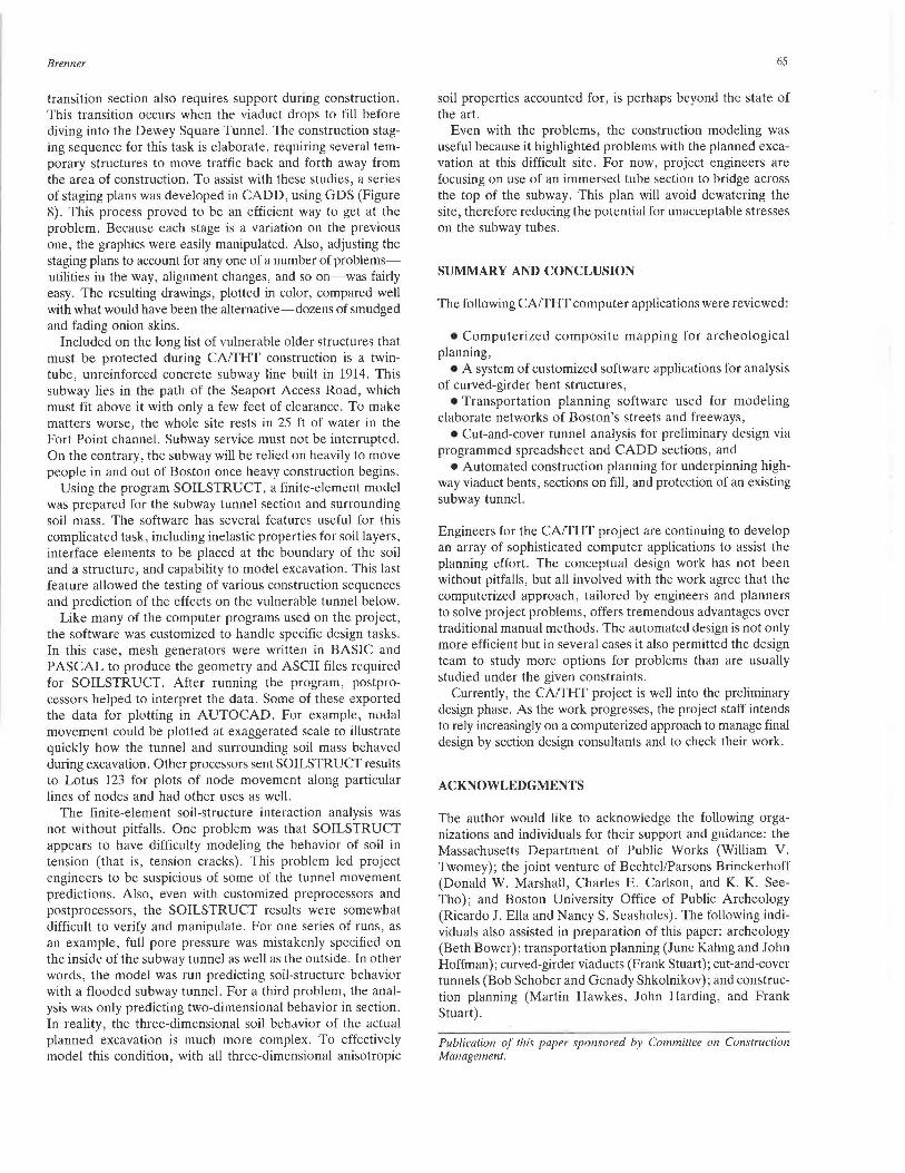
transition section also requires support during construction. This transition occurs when the viaduct drops to fill before diving into the Dewey Square Tunnel. The construction staging sequence for this task is elaborate, requiring several temporary structures to move traffic back and forth away from the area of construction. To assist with these studies, a series of staging plans was developed in CADD, using GDS (Figure 8). This process proved to be an efficient way to get at the problem. Because each stage is a variation on the previous one, the graphics were easily manipulated. Also, adjusting the staging plans to account for any one of a number of problemsutilities in the way, alignment changes, and so on-was fairly easy. The resulting drawings, plotted in color, compared well with what would have been the alternative-dozens of smudged and fading onion skins.
Included on the long list of vulnerable older structures that must be protected during CA/THT construction is a twintube, unreinforced concrete subway line built in 1914. This subway lies in the path of the Seaport Access Road, which must fit above it with only a few feet of clearance. To make matters worse, the whole site rests in 25 ft of water in the Fort Point channel. Subway service must not be interrupted. On the contrary, the subway will be relied on heavily to move people in and out of Boston once heavy construction begins.
Using the program SOILSTRUCT, a finite-element model was prepared for the subway tunnel section and surrounding soil mass. The software has several features useful for this complicated task, including inelastic properties for soil layers, interface elements to be placed at the boundary of the soil and a structure, and capability to model excavation. This last feature allowed the testing of various construction sequences and prediction of the effects on the vulnerable tunnel below.
Like many of the computer programs used on the project, the software was customized to handle specific design tasks. In this case, mesh generators were written in BASIC and PAS CAL to produce the geometry and ASCII files required for SOILSTRUCT. After running the program, postprocessors helped to interpret the data. Some of these exported the data for plotting in AUTOCAD. For example, nodal movement could be plotted at exaggerated scale to illustrate quickly how the tunnel and surrounding soil mass behaved during excavation. Other processors sent SOILSTRUCT results to Lotus 123 for plots of node movement along particular lines of nodes and had other uses as well.
The finite-element soil-structure interaction analysis was not without pitfalls. One problem was that SOILSTRUCT appears to have difficulty modeling the behavior of soil in tension (that is, tension cracks). This problem led project engineers to be suspicious of some of the tunnel movement predictions. Also, even with customized preprocessors and postprocessors, the SOILSTRUCT results were somewhat difficult to verify and manipulate. For one series of runs, as an example, full pore pressure was mistakenly specified on the inside of the subway tunnel as well as the outside. In other words, the model was run predicting soil-structure behavior with a flooded subway tunnel. For a third problem, the analysis was only predicting two-dimensional behavior in section. In reality, the three-dimensional soil behavior of the actual planned excavation is much more complex. To effectively model this condition, with all three-dimensional anisotropic
65
soil properties accounted for, is perhaps beyond the state of the art.
Even with the problems, the construction modeling was useful because it highlighted problems with the planned excavation at this difficult site. For now, project engineers are focusing on use of an immersed tube section to bridge across the top of the subway. This plan will avoid dewatering the site, therefore reducing the potential for unacceptable stresses on the subway tubes.
SUMMARY AND CONCLUSION
The following CA/THT computer applications were reviewed:
• Computerized composite mapping for archeological planning,
• A system of customized software applications for analysis of curved-girder bent structures,
• Transportation planning software used for modeling elaborate networks of Boston's streets and freeways,
• Cut-and-cover tunnel analysis for preliminary design via programmed spreadsheet and CADD sections, and
• Automated construction planning for underpinning highway viaduct bents, sections on fill, and protection of an existing subway tunnel.
Engineers for the CA/THT project are continuing to develop an array of sophisticated computer applications to assist the planning effort. The conceptual design work has not been without pitfalls, but all involved with the work agree that the computerized approach, tailored by engineers and planners to solve project problems, offers tremendous advantages over traditional manual methods. The automated design is not only more efficient but in several cases it also permitted the design team to study more options for problems than are usually studied under the given constraints.
Currently, the CA/THT project is well into the preliminary design phase. As the work progresses, the project staff intends to rely increasingly on a computerized approach to manage final design by section design consultants and to check their work.
ACKNOWLEDGMENTS
The author would like to acknowledge the following organizations and individuals for their support and guidance: the Massachusetts Department of Public Works (William V. Twomey); the joint venture of Bechtel/Parsons Brinckerhoff (Donald W. Marshall, Charles E. Carlson, and K. K. SeeTho); and Boston University Office of Public Archeology (Ricardo J. Ella and Nancy S. Seasholes). The following individuals also assisted in preparation of this paper: archeology (Beth Bower); transportation planning (June Kahng and John Hoffman); curved-girder viaducts (Frank Stuart); cut-and-cover tunnels (Bob Schober and Genady Shkolnikov); and construction planning (Martin Hawkes, John Harding, and Frank Stuart).
Publication of this paper sponsored by Cammi/lee on Construction Management.