concept prepared by r.g. gupta on the basis of mini master plan of delhi...
TRANSCRIPT
R.G. GUPTA POLICY/CITY PLANNER
CONTENTS
1 Review of literature including provisions in Five Year Plans
2 Concepts of Growth Centres, Growth Points and Basic Village
3 Plans and Scope of the Project
4 Planning of Kanjhawla Growth Centre (4.1) Background, (4.2) Existing landuse, (4.3) Principles to locate land uses, (4.4) Proposed landuse, (4.5) Layout plan of Focal Point, (4.6) Layout plan of Residential cum institutional complex, (4.7) Layout plan of Industrial Complex, (4.8) Layout Plan of Wholesale Fruit and Vegetable Market, (4.9) Cross-sections of Roads.
R.G. GUPTA ON THE BASIS OF MINI MASTER
PLAN OF DELHI AND APPROVED IN 1984-85
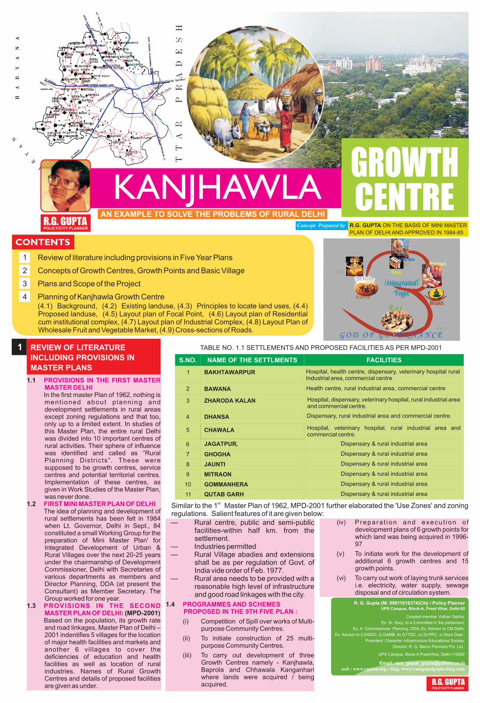
GROWTH CENTRE
1 REVIEW OF LITERATURE
INCLUDING PROVISIONS IN
MASTER PLANS
1.1
In the first master Plan of 1962, nothing is ment ioned about p lann ing and development settlements in rural areas except zoning regulations and that too, only up to a limited extent. In studies of this Master Plan, the entire rural Delhi was divided into 10 important centres of rural activities. Their sphere of influence was identified and called as “Rural Planning Distr icts”. These were supposed to be growth centres, service centres and potential territorial centres. Implementation of these centres, as given in Work Studies of the Master Plan, was never done.
1.2The idea of planning and development of rural settlements has been felt in 1984 when Lt. Governor, Delhi in Sept., 84 constituted a small Working Group for the preparation of Mini Master Plan' for Integrated Development of Urban & Rural Villages over the next 20-25 years under the chairmanship of Development Commissioner, Delhi with Secretaries of various departments as members and Director Planning, DDA (at present the Consultant) as Member Secretary. The Group worked for one year.
1.3: (MPD-2001)
Based on the population, its growth rate and road linkages, Master Plan of Delhi – 2001 indentifies 5 villages for the location of major health facilities and markets and another 6 villages to cover the deficiencies of education and health facilities as well as location of rural industries. Names of Rural Growth Centres and details of proposed facilities are given as under.
PROVISIONS IN THE FIRST MASTER MASTER DELHI
FIRST MINI MASTER PLAN OF DELHI
PROVISIONS IN THE SECOND MASTER PLAN OF DELHI
TABLE NO. 1.1 SETTLEMENTS AND PROPOSED FACILITIES AS PER MPD-2001
FACILITIESNAME OF THE SETTLMENTSS.NO.
1
2
3
9
10
11
BAKHTAWARPUR
BAWANA
ZHARODA KALAN
DHANSA
CHAWALA
JAGATPUR,
GHOGHA
JAUNTI
MITRAON
GOMMANHERA
QUTAB GARH
Hospital, health centre, dispensary, veterinary hospital rural Industrial area, commercial centre
4
5
6
7
8
Health centre, rural industrial area, commercial centre
Hospital, dispensary, veterinary hospital, rural industrial area and commercial centre.
Dispensary, rural industrial area and commercial centre.
Hospital, veterinary hospital, rural industrial area and commercial centre.
Dispensary & rural industrial area
Dispensary & rural industrial area
Dispensary & rural industrial area
Dispensary & rural industrial area
Dispensary & rural industrial area
Dispensary & rural industrial area
stSimilar to the 1 Master Plan of 1962, MPD-2001 further elaborated the 'Use Zones' and zoning regulations. Salient features of it are given below:— Rural centre, public and semi-public
facilities-within half km. from the settlement.
— Industries permitted — Rural Village abadies and extensions
shall be as per regulation of Govt. of India vide order of Feb. 1977.
— Rural area needs to be provided with a reasonable high level of infrastructure and good road linkages with the city.
Concept Prepared by
KANJHAWLA R.G. GUPTA POLICY/CITY PLANNER
AN EXAMPLE TO SOLVE THE PROBLEMS OF RURAL DELHI
1.4
(i) Competition of Spill over works of Multi-purpose Community Centres.
(ii) To initiate construction of 25 multi-purpose Community Centres.
(iii) To carry out development of three Growth Centres namely - Kanjhawla, Baprola and Chhawala Kanganhari where lands were acquired / being acquired.
PROGRAMMES AND SCHEMES PROPOSED IN THE 9TH FIVE PLAN :
(iv) Prepara t ion and execu t ion o f development plans of 6 growth points for which land was being acquired in 1996-97
(v) To initiate work for the development of additional 6 growth centres and 15 growth points.
(vi) To carry out work of laying trunk services i.e. electricity, water supply, sewage disposal and of circulation system.
R. G. Gupta (M: 09811018374)City / Policy Planner
Email: [email protected] web : www.rgplan.org ; blog. www.ramgopalgupta.blog.com
UPS Campus, Block-A, Preet Vihar, Delhi-92
Coopted member Vidhan Sabha,
Ex. Sr. Secy. to a Committee in the parliament,
Ex. A. Commissioner. Planning. DDA,;Ex. Advisor to CM Delhi,
Ex. Advisor to i) DSIDC, ii) DAMB, iii) DTTDC, iv) DLPPC, v) Slum Dept.,
President: Character Infrastructure Educational Society,
Director: R. G. Macro Planners Pvt. Ltd.,
UPS Campus, Block-A PreetVihar, Delhi-110092
2 CONCEPTS OF GROWTH CENTRES,
GROWTH POINTS AND BASIC
VILLAGES
2.1
The entire system of physical planning of different types of settlements in NCR, DMA and NCTD, urban & rural areas is governed by terms of policies of NCR document, MPD-2001 and programmes of Mini Master Plans of Delhi and 9th Five Year Plan of development of rural areas. On this basis, facilities in Growth Centres, Growth Points and Basic Villages are proposed and planned.
2.2 :
Each growth centre will serve an area between 60 to 70 sq. km. and population between 80,000 to one lakh. These centres, being of upper order, would, naturally perform higher order functions and activities, mainly of non-agricultural nature. They will have all centralised amenities and facilities in the field of education, medical, health, security, justice, wholesale and retail shopping, civic cultural and recreational including organised industrial estates and the shelter.
These facilities are: (i) Shopping on a bigger scale , (ii) mandi (collecting and distributing centre); (iii) Large community hall / Panchayat Ghar; (iv) Post Office with telegraph facilities; (v) Primary, middle, senior secondary school and college; (vi) Dispensary/ Hospital; (vii) Administrative office of the Block Development Officer; (viii) Office of the irrigation Department, Delhi Govt. (ix) Office of Municipal Corporation of Delhi ; (x) Police Station; (xi) Economic infrastructure i.e. banks & financial institutions; ( x i i ) C i n e m a ; ( x i i i ) L i b r a r y ; ( x i v ) Parks/Playgrounds & open spaces; (xv) Storage for pesticides/insecticides and fertilisers; (xiv) Veterinary hospital; (xvi) Potable water supply; (xvii) Domestic and industrial power; (xvii) Industrial Estate and flatted factories; (xviii) bus terminal; (xix) bus depot.
Type of industries - Small machine shop, workshop for welding, electroplating, small – scale hosiery goods, cotton spinning and weaving, trunk and suitcase making, tailoring
GENERAL
GROWTH CENTRES
and ready - made garments, earthen pottery, footwear, dari and carpets, wire products, paper envelops, cardboards, button, combs, hair clips, dairy and its products.
One small Service Centre consisting of petrol pumps, car garages and workshops, repair shops for day-to-day needs, gas godowns etc. will be provided.
2.3 :
33 Growth Points were identified. Each Point to serve an area of 20 to 25 Sq. km with 15,000 to 25,000 population, Each would have facilities of - (i) Shopping on a medium scale; (ii) Posts & telegraph office; (iii) Primary, middle and senior secondary school; (iv) Library / club / adult education centre; (v) Seed / Grain / fertiliser storage; (vi) Cooperative societies management office; (vii) Police Post; (viii) Veterinary Centre; (ix) A small service centre; (x) Primary health centre/dispensary; (xi) Playground, gathering places and religious places; (xii) drinking water, electricity and sewerage facilities and (xiii) Community hall. No industry other than household would be permitted.
2.4 :
Each village would have only the existing abadi area with 8 to 10 shops, community hall/ chopal, primary school, sub-post office, panchayat ghar, adult reading room, small gathering place, park, playground and open space, community water hydrants, latrines and electricity. No industry other than household would be allowed in these villages.
2.5:
Physical setting of Kanjhawla including some adjoining settlements is in 2.9 km in length and 1.5 km. maximum width. Approximate area of this complex including authorised and unauthorised construction in its vicinity is 472 hect. or 4.72 sq. km.
GROWTH POINTS
BASIC VILLAGES
CONCEPT OF KANJHAWLA GROWTH CENTRE
2.5.1 KANJHAWLA GROWTH CENTRE
(i) It has been selected on the basis of following criteria:
(ii) Population - 1981 and 1991 Census
(iii) Rate of growth of population, and other demographic characteristics
(iv) Nodality of the centre and its importance.
(v) Availability and potentiality of physical, social, economic and ecological infrastructure.
(vi) Availability of land (acquired or of gaon sabha)
(vii) Potentiality of development
(viii) Capability to act as a Counter attractive Centre for rural population.
R.G. GUPTA POLICY/CITY PLANNER
2.5.2 KANJHAWLA GROWTH CENTRE WOULD ACT AS A CENTRE OF:
(i) Primary and secondary activities only for Kanjhawla basic villages.
(ii) Tertiary activities for all the basic villages, Growth points in its catchment area and also for Kanjhawla.
2.5.3 TO MAKE IT A FOCAL POINT FOR NORTH-WEST DELHI AND JUST EQUAL TO BAWANA GROWTH CENTRE IN TERMS OF:
(i) Collection & distribution centre of agriculture & floriculture products of nearby villages.
(ii) Location of small scale and rural industries required for the catchment area.
(iii) Location of higher level of functions of education, health, security, justice, recreation, employment shelter and housing specially for Govt. employees.
2.5.4 L O C A T I O N O F S T R E E T FURNITURE:
(i) Electric poles, (ii) Telephone poles, public telephone booths, (iii) Tree plantation along roads landscaping of roundabouts, channelisers and footpaths along road sides, (iv) Dustbins, dhalaos, garbage depots, (v) Bus queue shelters, bus terminals, (vi) hoarding, painting of roads, zebra crossing, neon signs, (vii) Street lighting on different roads and special illuminations at different intersections, (viii) Milk bars and milk booths, (ix) Car parking, scooter parking, rickshaw parking, slow vehicle parking, taxi stands including booths and fare boards, (xi) design of railings along nallahs (xii) Speed breakers, properly painted and with sign boards, (xiii) Sculpture pieces at suitable locations along with water fountains, water bodies and other attractive features, (xiv) Overhead tanks, underground water tanks, (xv) Tree-guards, (xvi) Guide maps at i m p o r t a n t p l a c e s , ( x v i i ) D e v e l o p m e n t o f p a r k s , playgrounds, open spaces along with railings, sitting benches, tree plantation and other landscape features.
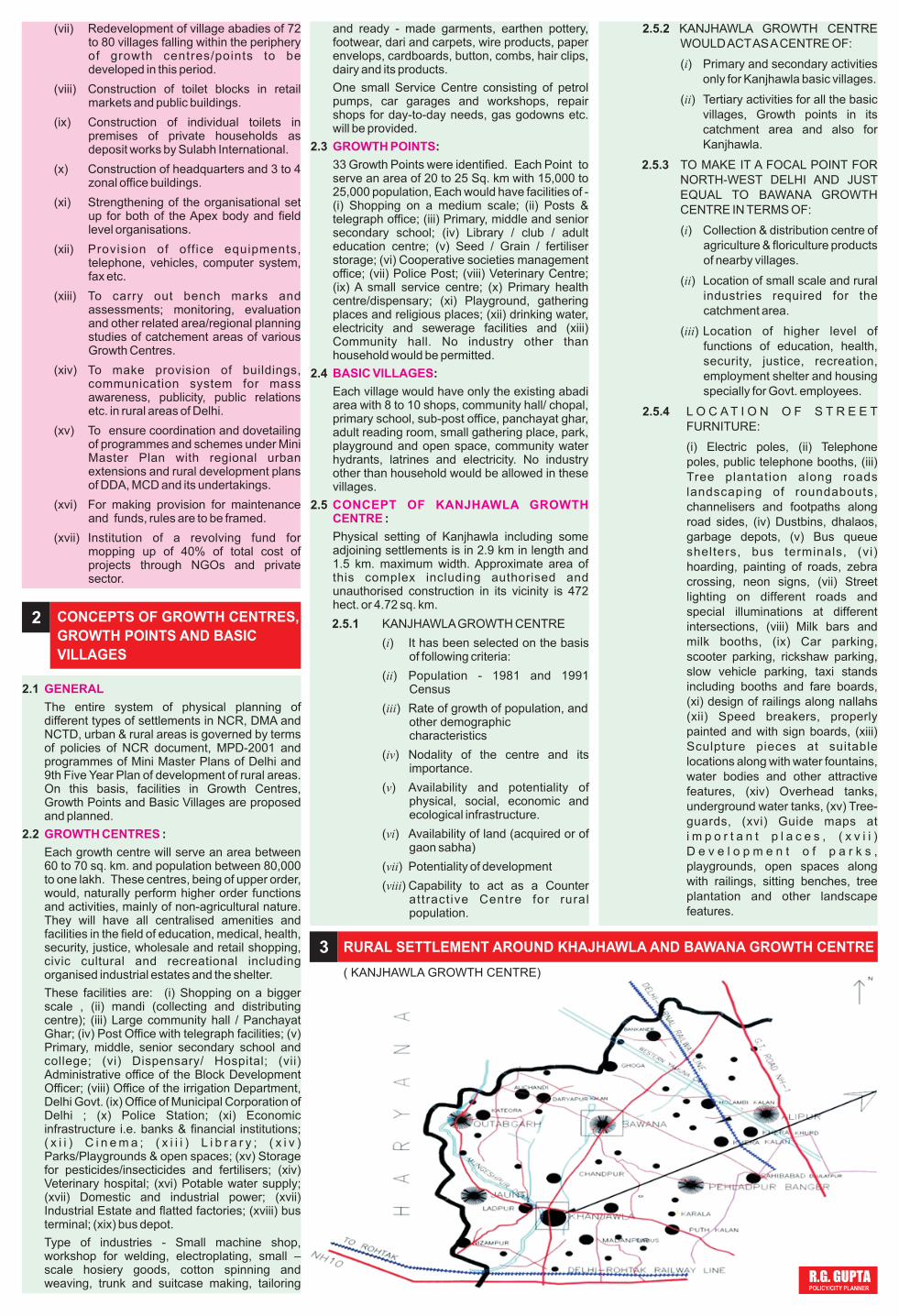
( KANJHAWLA GROWTH CENTRE)
3 RURAL SETTLEMENT AROUND KHAJHAWLA AND BAWANA GROWTH CENTRE
(vii) Redevelopment of village abadies of 72 to 80 villages falling within the periphery of growth centres/points to be developed in this period.
(viii) Construction of toilet blocks in retail markets and public buildings.
(ix) Construction of individual toilets in premises of private households as deposit works by Sulabh International.
(x) Construction of headquarters and 3 to 4 zonal office buildings.
(xi) Strengthening of the organisational set up for both of the Apex body and field level organisations.
(xii) Provision of off ice equipments, telephone, vehicles, computer system, fax etc.
(xiii) To carry out bench marks and assessments; monitoring, evaluation and other related area/regional planning studies of catchement areas of various Growth Centres.
(xiv) To make provision of buildings, communication system for mass awareness, publicity, public relations etc. in rural areas of Delhi.
(xv) To ensure coordination and dovetailing of programmes and schemes under Mini Master Plan with regional urban extensions and rural development plans of DDA, MCD and its undertakings.
(xvi) For making provision for maintenance and funds, rules are to be framed.
(xvii) Institution of a revolving fund for mopping up of 40% of total cost of projects through NGOs and private sector.
4 PLANNING OF KANJHAWLA GROWTH CENTRE
(All the chapters are concerned with the main report available with me.4.1 BACKGROUND4.2 EXISTING LAND USE4.3 PRINCIPLES OF PLANNING AND TO
LOCATE LAND USE4.4 PROPOSED LAND USE4.5 LAYOUT PLAN OF FOCAL POINT4.6 LAYOUT PLAN OF RESIDENTIAL CUM
INSTITUTIONAL COMPLEX.4.7 LAYOUT PLAN OF INDUSTRIAL
COMPLEX4.8 LAYOUT PLAN OF WHOLE SALE
MARKET4.9 CROSS-SECTIONS OF ROADS
4.1 BACKGROUND
4.2 EXISTING LAND USE
4.3 PRINCIPLES OF PLANNING AND TO LOCATE LAND USES.
Chapter 1 to 6 describe the background to plan Kanjhawla Growth Centre in terms of ; reasons of changes in landuse, transformation of society in rural Delhi, Review of literature on the subject, various concepts developed, avai labi l i ty of socio-economic resources, and division of land and land uses. Chapter 7 onwards are the operative part of the project of development of Kanjhawla Growth Centre.
Kanjhawla village and its extended abadi is in an area of 42.3 hect. with a population of 6000 as per 1991 census, and 12,000 in the built up abadi in the proposed project. About 15 ,000 popu la t i on wou ld be accommodated in the extended Lal Dora Area which is in the east and west of GK Road. Kanjhawla village has the following features:-
(i) It is a large village surrounded by major roads Ghewra-Kanjhawla on the eastern side, Qutab Garh road on the northern side and Mungeshpur drain in the west.
(ii) One PWD office, office of Irrigation of flood department, office of DWS & SDU, B.D.O. office, Dy. Commissioner office, 2 primary schools, 2 higher secondary schools, Veterinary hospital (small), 1 small private hospital, 1 panchayat ghar, 2 samadhis, 4 - 5 temples, Multi-purpose community centre, 220 KV substation, other electricity substation, 1 petrol pump, 1 police station, MCD h o s p i t a l w i t h d i l a p i d a t e d residential structures, few farm houses, many bricks kilns and 6 ponds.
(iii) It has a large Catchment area to serve 3 Growth points and 8 Basic villages.
(iv) Details of existing land use of Ladpur Village have not been added as they were not available.
(i) Focal Point
(a) Location and planning of Kanjhawla Growth Centre has b e e n g i v e n m a x i m u m importance and attention. Therefore, it has been located in between the existing abadi and new developments so that it can be used by the villages, new population, f loating population and the visitors.
(b) Focal point is a combination of four components i.e. (i) Rural shopping centre, (ii) Socio-cultural centre, (iii) Swarn Jayanti park and (iv) Recreational use to be developed by DTTDC. The
Focal Point would have heritage centre (museum, and exhibits of handicrafts etc.), community hall / barat ghar, library, recreational club, meditation & spiritual centre, Polyclinic, Maternity & Child Welfare, Nursing Homes, Banks Service, Leisure activities, rural amusement park, Activities in the Water i.e. water sports, outdoor sports with tennis, hand ball, basket ball, volley ball and indoor sports consisting of badminton, table tennis, etc.
(c) It has been located in the Central area between 45m & 30 m. ROW roads so that it is accessible to population from three sides. On the fourth side, there is physical barrier Mungeshpur Drain whose water, after tertiary treatment, to be used for recreational & other purposes.
(d) Rural Character of the Focal Point is maintained by providing low height buildings i.e. maximum up to three storeys, and some buildings with pitched roofs.
(e) Adequate parking lots have been provided for normal traffic and for the peak period during festivals.
(ii) Institutional Complex
(a) The Complex would have many institutional buildings namely - police station, fire station, college, h o s p i t a l , s o c i a l s c i e n c e development (to be reserved for future use), training-cum-production centre, polytechnic-cum-ITI and Socio cultural complex. Other Institutional buildings have been located at other suitable places.
(b) This complex has been located on main Ghewra-Kanjhawla 45 m wide road, with access from other important roads.
(c) This system of planning has been adopted with the idea that there should be minimum entries & exits from the main roads and that it is easily approachable for local residents and outsiders.
(d) Adequate parking lots based on Master Plan norms have been provided.
(iii) Harder uses (activities)
In this category, industrial estate, flatted factories, sewage treatment plant, garbage dumping yard and idle parking have been located in the southern part of the complex. This has been done due to the following reasons.
(a) To avoid adverse effects of wind, (b) To avoid unnecessary and unwanted traffic, and (c) Use of depressed area
(iv) Whole Sale Market
In this market, the plan has been prepared keeping following features in view:
(a)Segregated traffic lines, (b) Service corridor for movement of goods and garbage, (c) System of solid waste disposal, (d) Services in ducts, (e) Facilities core, (f) Pedestrian mall, (g) Facility parks, (h) Green belt, (i) Sorting, grading and collection square, (j) Solar energy system, (k) Electronic display / information board.
4.4.1 Activity wise Use ( Area in Hect.)
(1) Residential use (54.3)
(i)Village abadi -16.5; (ii) Extended Lal dora (area in the east of GK Road has not been added) - 25.8; (iii) Area for resettlement of affected units - 1.0; (iv) Area for govt. housing & group housing - 11.0
(2) Focal Points - 13.2
2.1 Rural community centre- 6.6
4.4 PROPOSED LANDUSE IN HECT. (PLAN IS GIVEN ON THE LAST PAGE)
(i) Rural shopping centre - 4.5; (ii) Socio-cultural centre consisting of heritage- 0.5; (iii) Polyclinic -0.2; (iv) Maternity & Child Welfare -0.2; (v) Nursing Homes (4 in Nos.) - 0.4; (vi) Banks & Economic infrastructure -0.3; (vii)Service shops - 0.5.
2.2 Swaran Jayanti Park - 3.6
(i) Park (meeting ground, for fairs & festivals)- 3.0; (ii) Community Hall - 0.3; (iii) 66KV Electric Sub-station-0.35; (iv) Petrol filling station- 0.05, (v) Command tank- 0.26
2.3 Tourism (DTTDC) - 3.0
Leisure activities like electronic games, rural amusement parks, activities in the water - open air swimming pool and aqua - gymnastic facilities, aqua - sports such as boating, sailing. On the land outdoor sports with tennis, hand ball, basket ball, volley ball and indoor sports consisting of badminton, table tennis, etc. one 66 KV. Sub-station.
(3) Industrial Use-14.0
(i)Flatted Factories- 3.9; (ii) Plotted developments - 9.9; (iii) Service Centre with plots of garages & repair shops scooter repairs - 0.2
(4) Idle parking - 2.0
(5) Wholesale Market - 3.0
(6) Institutions/public & semi-public facilities-16.9
(i) Police Station-1.0; (Ii) Fire Station -1.0; (iii) College - 4.0; (iv) Hospital- 3.5; (v) Social Science Development (SPA)- 3.0; (vi) Training-cum-production centre - 0.7; (vii) Polytechnic-cum-IIT - 2.5; (viii) Bus terminal - 1.2; (ix) Facilities for village abadi & extended abadies would be shown in the detailed redevelopment plan of village Kanjhawla and extended abadi, (x) Facilities for industrial area, Focal Point (commercial + socio cultural) have been shown in detailed plans, (xi) Informal commercial sector as given in MPD-2001 and street furniture would be shown in detailed plan in each landuse.
(7) Govt. Offices - 1.0
(i) Dy. Commissioner Office (Existing) - 0.2; (ii) Other Govt. Offices including of MCD & Rural Development - 0.8
(8) Utilities & services - 6.22
(i) 220 KVS S/Stn. (existing) - 3.50; (ii) 66 KV S/Stn. (two in No.) - 0.72; (iii) 11 KV S/Stn. (50 in NOs) each of 250 sq,m; (iv) Sewage Treatment Plant - 1.00; (v) Command Tank (for potable water ) , (vi) Garbage dumping ground - 1.00; (vii) Telecommunication system of desired standard (area of 1000 sqm earmarked in Rural Community Centre)
(9) Transport & Circulation -29.52
(i)Roads -28.00; (ii) Bus Depot - 0.70; (iii) Bus Terminal - 0.50; (iv) Parking areas other than idle & in Focal Point - 0.20; (v) Petrol pumps - 0.12
(10) Ecological infrastructure -16.86
(i) Green buffers of 24 m. width on either side of Mungeshpur drain and Sultanpur Minor, (ii) A sewer line of 1200 mm dia in 24 m green buffer along Mungeshpur drain, (iii) Thick planted trees along roads, (iv) Development of ponds at proper places, (v) Laying of services either along main roads or in green buffers, (vi) Mungeshpur drain in 10.2 hect. is proposed to be mentioned in good condition with (a) Desilting, (b) Repairs & improvements and (c) Lining in the required portions, (vii) Limited access to buildings abutting on 45 m wide roads. For this institutional buildings have been located on them, (viii) To supply potable water to the Growth Centre by laying a pipe line of 1000mm from Bawana Water Treatment Plant to Command Tank at Kanjhawla,
R.G. GUPTA POLICY/CITY PLANNER
(ix) Adequate active & passive parking spaces so that roads are not congested by parking of vehicles, (x) Garbage dumping ground at the end of the complex, (xi) Location of industrial area at such a place so that air pollution is not increased, (xii) A large complex for recreational use to be developed by
4.5
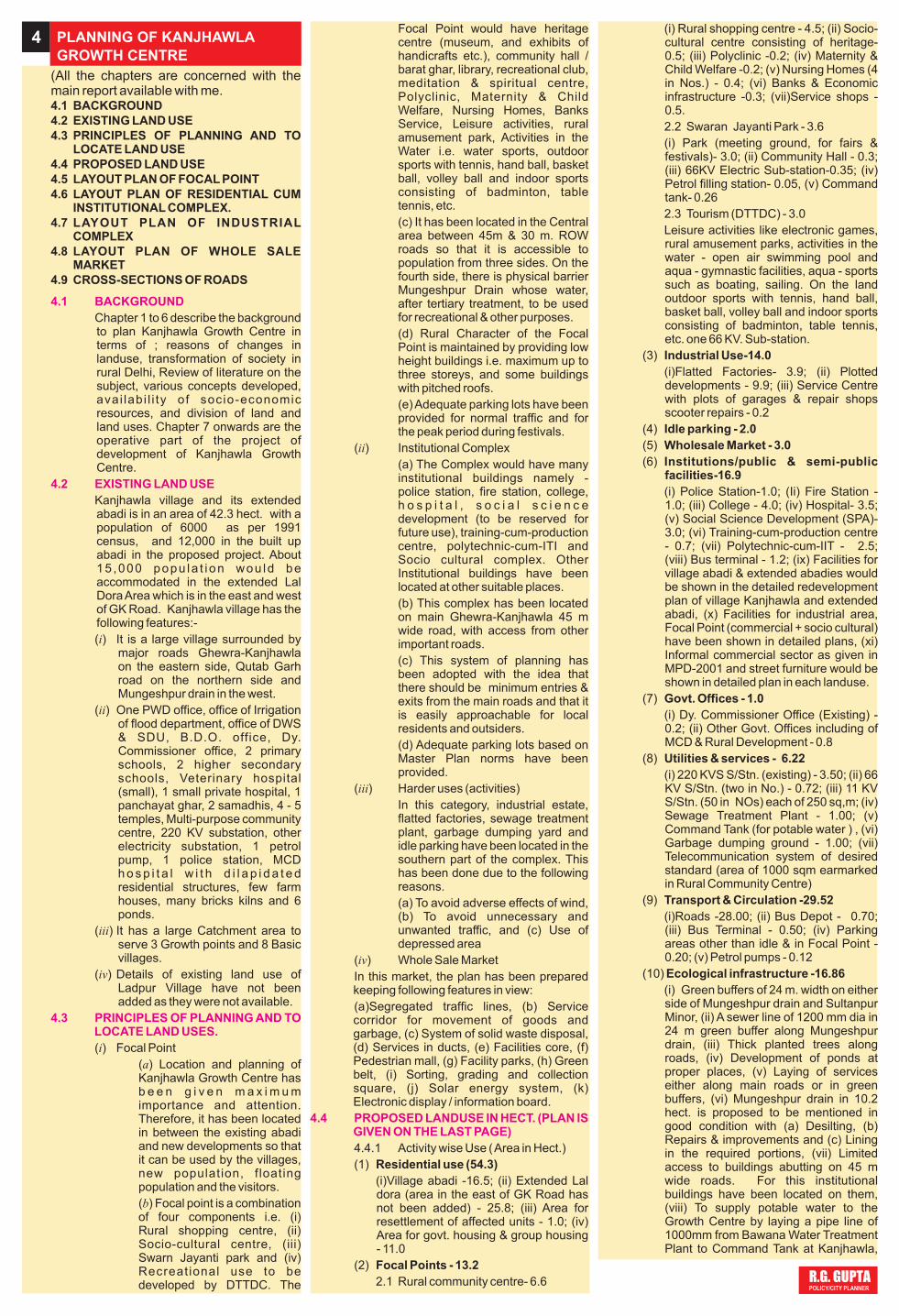
Location of Focal point with its 4 components i.e. (i) Rural Community centre, (ii) Socio cultural complex (iii) Swarn Jayanti Park and (iv) recreational use. The last has to be developed by DTTDC. The location wise the complex has been given maximum importance in location & easy use for everyone. Focal point is such that
LAYOUT PLAN OF FOCAL POINTs
whosoever visits the Growth Centre would be attracted and influenced by it.
The entire area of 13.2 hect. has the following 4 main categories :
(i)Rural Community Centre -6.1 hect., (ii) Socio cultural complex - 0.5 hect., (iii) Swarn Jayanti Park 3.6 hect., (iv) Recreational use (DTTDC) -3.0 hect.
MAP OF THE RURAL CRAFT CENTRE HAS ALSO BEEN GIVEN.
R.G. GUPTA POLICY/CITY PLANNER
FOCAL POINT – RURAL CRAFT CENTRE
Area in hect. %age
Residential 54.30 34.58
Focal 13.20 8.40
Industrial + Parking 16.00 10.19
Wholesale 3.00 1.91
Public & Semi Public 16.90 10.76
Govt. Office 1.00 0.64
Utilities & Services 6.22 3.96
Transport & Circulation 29.52 18.80
Ecological Infrastructure 16.86 10.75
Total 157.00 100.00
TABLE NO. 4.1 LAND USE BREAK UP (ACTIVITY WISE)
Delhi Transport & Tourism Development Corporation, along Mungeshpur drain and (xiii) Provision of green areas in the hierarchy for different age groups & various activities, and also to make them noise barriers between distinct land uses.
TOTAL - 158.0
(11) In summary, areas (activities wise) would be as under :
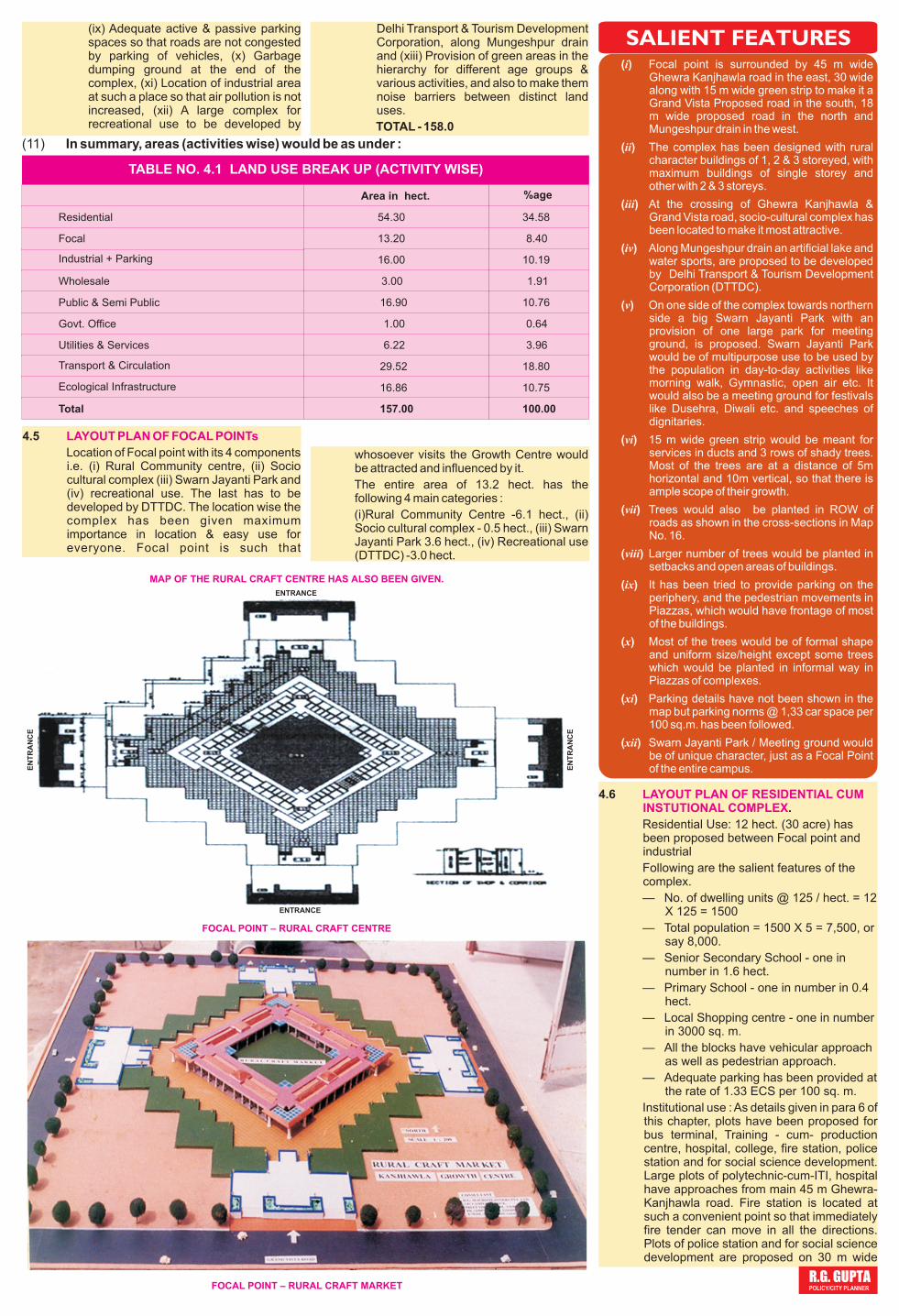
FOCAL POINT – RURAL CRAFT MARKET
SALIENT FEATURES(i) Focal point is surrounded by 45 m wide
Ghewra Kanjhawla road in the east, 30 wide along with 15 m wide green strip to make it a Grand Vista Proposed road in the south, 18 m wide proposed road in the north and Mungeshpur drain in the west.
(ii) The complex has been designed with rural character buildings of 1, 2 & 3 storeyed, with maximum buildings of single storey and other with 2 & 3 storeys.
(iii) At the crossing of Ghewra Kanjhawla & Grand Vista road, socio-cultural complex has been located to make it most attractive.
(iv) Along Mungeshpur drain an artificial lake and water sports, are proposed to be developed by Delhi Transport & Tourism Development Corporation (DTTDC).
(v) On one side of the complex towards northern side a big Swarn Jayanti Park with an provision of one large park for meeting ground, is proposed. Swarn Jayanti Park would be of multipurpose use to be used by the population in day-to-day activities like morning walk, Gymnastic, open air etc. It would also be a meeting ground for festivals like Dusehra, Diwali etc. and speeches of dignitaries.
(vi) 15 m wide green strip would be meant for services in ducts and 3 rows of shady trees. Most of the trees are at a distance of 5m horizontal and 10m vertical, so that there is ample scope of their growth.
(vii) Trees would also be planted in ROW of roads as shown in the cross-sections in Map No. 16.
(viii) Larger number of trees would be planted in setbacks and open areas of buildings.
(ix) It has been tried to provide parking on the periphery, and the pedestrian movements in Piazzas, which would have frontage of most of the buildings.
(x) Most of the trees would be of formal shape and uniform size/height except some trees which would be planted in informal way in Piazzas of complexes.
(xi) Parking details have not been shown in the map but parking norms @ 1,33 car space per 100 sq.m. has been followed.
(xii) Swarn Jayanti Park / Meeting ground would be of unique character, just as a Focal Point of the entire campus.
4.6 .
Residential Use: 12 hect. (30 acre) has been proposed between Focal point and industrial
Following are the salient features of the complex.
— No. of dwelling units @ 125 / hect. = 12 X 125 = 1500
— Total population = 1500 X 5 = 7,500, or say 8,000.
— Senior Secondary School - one in number in 1.6 hect.
— Primary School - one in number in 0.4 hect.
— Local Shopping centre - one in number in 3000 sq. m.
— All the blocks have vehicular approach as well as pedestrian approach.
— Adequate parking has been provided at the rate of 1.33 ECS per 100 sq. m.
Institutional use : As details given in para 6 of this chapter, plots have been proposed for bus terminal, Training - cum- production centre, hospital, college, fire station, police station and for social science development. Large plots of polytechnic-cum-ITI, hospital have approaches from main 45 m Ghewra-Kanjhawla road. Fire station is located at such a convenient point so that immediately fire tender can move in all the directions. Plots of police station and for social science development are proposed on 30 m wide
LAYOUT PLAN OF RESIDENTIAL CUM INSTUTIONAL COMPLEX
ENTRANCE
EN
TR
AN
CE
EN
TR
AN
CE
ENTRANCE
R.G. GUPTA POLICY/CITY PLANNER
road. Adequate parking has been shown in all the plots on the norms of one car space per 100 sq.m. Location of trees has been shown in the plan as well as in the model.
4.7
(i) Dimension of the Complex
Industrial complex has been planned in 16.0 hect. with a break-up of 9.9 hect. for plotted development carving out plots of 100,200 & 600 sqm ; 0.2 hect. for Service Centre; 3.9 for flatted factories and 2 hect. for idle parking (in the adjoining area), Location of idle parking has been made at such a place that this can be used by Industrial Estate and Who lesa le marke t . I n p lo t ted development, a strip has been left for workshops. Garages and repair shops for day-to-day needs.
(ii) Statement of plots(iii) Flatted factories
Four H shaped, 3 storyed blocks have been proposed for flatted factories with 504 built-up units of each of 50sq.m. units.
(iv) Provision of electric Sub stationsAdequate number of Electric Sub-stations, details given in Chapter No. 8, have been provided in plotted development and flatted factories area. Common facilities have also been provided in a strip of 0.2 hect. in plotted development and some
LAYOUT PLAN OF INDUSTRIAL COMPLEX
area in flatted factories complex.(v) Total No. of units
Like this, total number of 360 plots and 504 built-up industrial units i.e. a total of 864 industrial units would be available.
(vi Salient features
(a) Construction of 4 blocks of flatted factories would be in Corporate sector to be managed & maintained by a single agency.
(b) Plantation of trees in ROW of roads would be as per roads sections.
(c) Plantation of other trees would be as shown in the plan.
(d) Day to day facilities have also been provided in the pockets marked for them. Adequate number of public conveniences and potable water fountains are provided.]
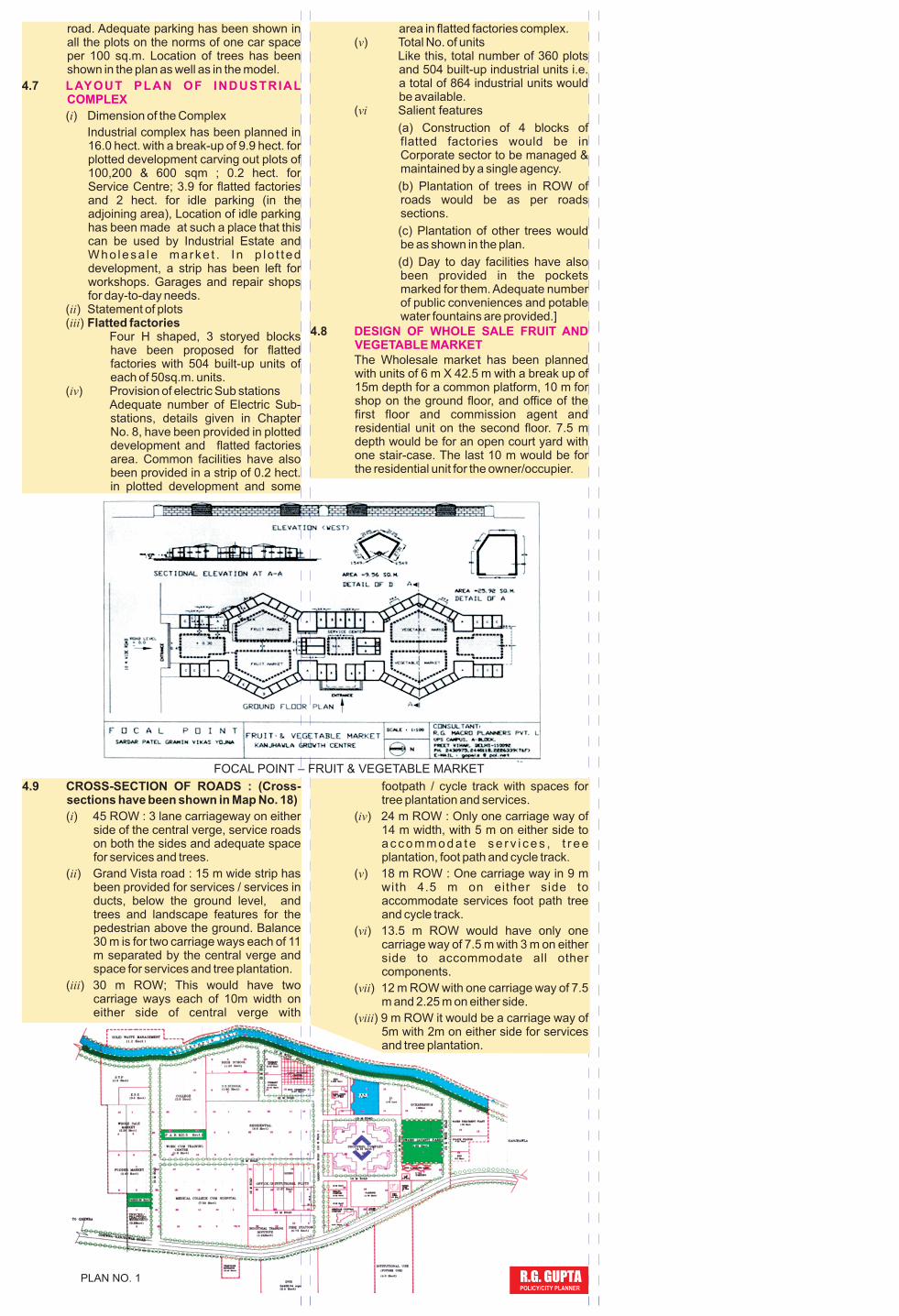
4.8
The Wholesale market has been planned with units of 6 m X 42.5 m with a break up of 15m depth for a common platform, 10 m for shop on the ground floor, and office of the first floor and commission agent and residential unit on the second floor. 7.5 m depth would be for an open court yard with one stair-case. The last 10 m would be for the residential unit for the owner/occupier.
DESIGN OF WHOLE SALE FRUIT AND VEGETABLE MARKET
FOCAL POINT – FRUIT & VEGETABLE MARKET
footpath / cycle track with spaces for tree plantation and services.
(iv) 24 m ROW : Only one carriage way of 14 m width, with 5 m on either side to a c c o m m o d a t e s e r v i c e s , t r e e plantation, foot path and cycle track.
(v) 18 m ROW : One carriage way in 9 m with 4.5 m on either side to accommodate services foot path tree and cycle track.
(vi) 13.5 m ROW would have only one carriage way of 7.5 m with 3 m on either side to accommodate all other components.
(vii) 12 m ROW with one carriage way of 7.5 m and 2.25 m on either side.
(viii) 9 m ROW it would be a carriage way of 5m with 2m on either side for services and tree plantation.
4.9 CROSS-SECTION OF ROADS : (Cross-sections have been shown in Map No. 18)
(i) 45 ROW : 3 lane carriageway on either side of the central verge, service roads on both the sides and adequate space for services and trees.
(ii) Grand Vista road : 15 m wide strip has been provided for services / services in ducts, below the ground level, and trees and landscape features for the pedestrian above the ground. Balance 30 m is for two carriage ways each of 11 m separated by the central verge and space for services and tree plantation.
(iii) 30 m ROW; This would have two carriage ways each of 10m width on either side of central verge with
PLAN NO. 1