concord reconnaissance report - mass. · pdf fileit is outlined in the dcr publication reading...
TRANSCRIPT

CONCORD RECONNAISSANCE REPORT
FREEDOM’S WAY LANDSCAPE INVENTORY
MASSACHUSETTS HERITAGE LANDSCAPE
INVENTORY PROGRAM
Massachusetts Department of Conservation and Recreation
Freedom’s Way Heritage Association

PROJECT TEAM
Massachusetts Department of Conservation and Recreation
Jessica Rowcroft, Preservation Planner
Division of Planning and Engineering
Freedom’s Way Heritage Association
Mary Whitney, President
Marge Darby, Chair, Advisory Committee
Project Consultants
Shary Page Berg
Gretchen G. Schuler
Anne M. Forbes
Local Project Coordinator
Marcia Rasmussen
Local Heritage Landscape Participants
Gordon Bell
Jamie Bemis
Karen Berchtold
Debbie Bier
Patricia Bruttomesso
Matthew Burne
Mary Clarke
Cathy Gates
Bill Edgerton
Joanne Gibson
Marion Grabhorn
Carol Kowalski
Lorna Mack
Dorcas Mill
Polly Reeve
Sarah Schnitzer
Gordon Shaw
Stephanie Stillman
Marian Thornton
Jan Turnquist
Carol Wilson
June 2006, revised March 2007
Cover Photos
Concord River
St. Bernard's Church (now Holy Family Parish) and Old Hill Burying Ground
Willow Guzzle Reservation

CONTENTS
Introduction . . . . . . . . . . . . . . . . . . . . . . . . . . . . . . . . . . . . . . . . . . . . . . . . . . . . . 1
Concord History . . . . . . . . . . . . . . . . . . . . . . . . . . . . . . . . . . . . . . . . . . . . . . . . . 2
Priority Heritage Landscapes. . . . . . . . . . . . . . . . . . . . . . . . . . . . . . . . . . . . . . . 4
Barrett Farm
Estabrook Woods
Flood Meadows
Massachusetts Department of Correction Land
Nine Acre Corner
Virginia Road
Walden Woods/Route 126 Corridor
West Concord Village
Critical Concerns. . . . . . . . . . . . . . . . . . . . . . . . . . . . . . . . . . . . . . . . . . . . . . . . 13
Agricultural Land
Churches as Community Focal Points
Land Stewardship and Regional Landscapes
Scenic Roads
Existing Resource Documentation and Planning Tools . . . . . . . . . . . . . . . . 14
Inventory of Historic and Archaeological Assets
State and National Registers of Historic Places
Other Preservation Planning Tools and Documents
General Preservation Planning Recommendations . . . . . . . . . . . . . . . . . . . . 16
Inventory of Heritage Landscapes
National Register Program
Neighborhood Character
Scenic Roads
Funding of Preservation Projects
Conclusion . . . . . . . . . . . . . . . . . . . . . . . . . . . . . . . . . . . . . . . . . . . . . . . . . . . . . 21
Appendix: Heritage Landscapes Identified by Community . . . . . . . . . . . . . 22

Massachusetts Heritage Landscape Inventory Program 1
Concord Reconnaissance Report
INTRODUCTION
The Freedom’s Way Heritage Association includes 37 Massachusetts
communities that are linked by historic events that helped to shape America’s
democratic form of governance and the intellectual traditions that underpin
American freedom, democracy, conservation and social justice. Freedom’s Way
communities extend from Arlington on the east to Winchendon on the west.
They represent a wide range of cities and towns, each shaped by the relationship
between nature and culture.
Heritage landscapes are special places created by human interaction with the
natural environment that help define the character of a community and reflect its
past. They are dynamic and evolving; they reflect the history of a community
and provide a sense of place; they show the natural ecology that influenced land
use patterns; and they often have scenic qualities. The wealth of landscapes is
central to each community’s character, yet heritage landscapes are vulnerable and
ever changing. For this reason it is important to take the first steps towards their
preservation by identifying those landscapes that are particularly valued by the
community – a favorite local farm, a distinctive neighborhood or mill village, a
unique natural feature or an important river corridor. To this end, the
Massachusetts Department of Conservation and Recreation (DCR) and the
Freedom’s Way Heritage Association (FWHA) have collaborated to bring the
Heritage Landscape Inventory program (HLI) to communities in the Freedom’s
Way area. The primary goal of the program is to help communities identify a
wide range of landscape resources, particularly those that are significant and
unprotected. The focus is on landscapes that have not been identified in previous
survey efforts in a given community. Another important goal of the program is
to provide communities with strategies for preserving heritage landscapes.
The methodology for the Heritage Landscape Inventory program was developed
in a pilot project conducted in southeast Massachusetts and refined in Essex
County. It is outlined in the DCR publication Reading the Land which has
provided guidance for the program since its inception. In summary, each
participating community appoints a Local Project Coordinator (LPC) to assist the
DCR-FWHA consulting team. The LPC organizes a heritage landscape
identification meeting at which interested residents and town officials offer
community input by identifying heritage landscapes. This meeting is followed
by a fieldwork session including the consulting team and the LPC, often
accompanied by other community members. This group visits the priority
landscapes identified in the meeting and gathers information about the
community. The final product is this Reconnaissance Report, prepared for each
participating community. It outlines the history of the community; describes the
priority heritage landscapes; discusses planning issues identified by the
community; identifies planning tools available in the community; and concludes
with preservation recommendations. A list of all of the heritage landscapes
identified by the community is included in the Appendix.
Massachusetts Heritage Landscape Inventory Program 2
Concord Reconnaissance Report
CONCORD HISTORY
Located 18 miles west-northwest of Boston, the town of Concord was
incorporated in 1635 as the first inland settlement in the Massachusetts Bay
Colony. Situated at a major confluence point where the Sudbury and Assabet
Rivers join to become the Concord, there were initially nine miles of river within
its borders providing a major attraction for trappers, fur traders and farmers. By
the beginning of the 18th century the original English settlement between a
sheltering ridge and a secondary brook, the Mill Brook, had grown into the
bustling core of an important shire town, where the Middlesex County courts
convened on a regular basis and a variety of colonial trades were carried on.
In 1775 the town was a well-established, prosperous farming community and a
thriving regional center with ready access to Boston along the Bay Road, when
on April 19th the first full battle of the Revolutionary War was fought just outside
the town center at the North Bridge on the Concord River.
After the war ended, the center village further evolved into a busy commercial,
civic and institutional town center. Near the meetinghouse and two burial
grounds, schools, taverns and stores commingled with the courthouse, jail and
other county buildings around the town common just northeast of the Mill Brook.
Many small industrial and craftsmen’s shops, which were particularly active
during the War of 1812 and its associated embargoes, were concentrated south of
the common and on the road that crossed the broad dam on the mill pond. A
radical change occurred at the town center in 1828, when the Milldam Company,
a group of local businessmen, filled in the millpond and began replacing the
buildings on and west of the dam with brick and wood-frame business blocks.
This was the beginning of a true “downtown” of substantial commercial
structures, many of which still survive.
Through the 19th century, outlying farms prospered with dairying and market-
gardening. Strawberries and asparagus became important specialties toward the
end of the century. Two turnpikes built before 1810, the Cambridge/Concord
and the Union Turnpike, and the arrival in 1844 of the Fitchburg Railroad,
speeded travel, shipping and communication with Boston and the wider region.
The transportation improvements also spurred pockets of industrial development,
especially in the west end of town where an 1808 cotton spinning mill on the
Assabet River expanded through the Civil War as the Damon Manufacturing
Company, and a long-lived powder mill straddled the town border with Acton
and Sudbury.
Also in the west part of town, a small hamlet, begun around an 1850s pail
factory, grew into the major secondary village of Concord Junction after the
Framingham & Lowell Railroad was extended north to the Fitchburg line in
1871-72. Over the next two decades West Concord rapidly developed as the
most populous section of town. The main catalyst for the expansion of housing,
commerce and industry there was the establishment of the State Prison in 1878
between the railroad junction and the former Union Turnpike. Two more
railroad lines, the Middlesex Central and the Acton, Nashua & Boston, reached

Massachusetts Heritage Landscape Inventory Program 3
Concord Reconnaissance Report
the prison by 1879, and in 1884 the prison became the Massachusetts
Reformatory for Men—a major local employer for the next several decades.
Paralleling the industrial and institutional expansion at West Concord, the
community as a whole was developing a reputation as a progressive agricultural
center. The Middlesex Agricultural Society began holding its annual cattle
shows in Concord in 1820, with indoor agricultural exhibits and competitions in
the county courthouse. Concord farmers were among the regular prizewinners,
including Ephraim Bull, breeder of the Concord Grape, and several “seedsmen”--
horticulturalists who developed and marketed new and improved varieties of
plants. Simon Brown, editor of the influential New England Farmer, operated a
model farm overlooking the Concord River from 1848 to 1873. He was joined in
1867 by his brother-in-law Judge Henry French, an agricultural authority and
first President of the Massachusetts Agricultural College (the predecessor of the
University of Massachusetts).
While the progressive group of agricultural thinkers and innovators attracted
others with similar interests to the town, Concord is even better known as a
magnet for authors and intellectuals who gathered around a core group of 19th-
century literary luminaries during what has been called the intellectual
“flowering of New England.” At the center of the group from the 1820s to the
1880s was Ralph Waldo Emerson. Others whose influence is still felt today (and
whose homes are among the primary attractions of the town) include Henry
David Thoreau, Nathaniel Hawthorne, Louisa May Alcott and her father Bronson
Alcott, and poet William Ellery Channing. Most were Transcendentalists, and
they found in Concord’s natural and domestic landscape the embodiment of the
transcendental philosophy. Thanks to the multi-faceted mind of Thoreau, that
landscape was also the first laboratory in the science of ecology.
Farming in Concord continued well into the 20th century, much of it having been
transformed by 1900 under a new population of immigrant farmers from Ireland,
Italy, Scandinavia and Canada. Many old farms near the town center and in West
Concord, however, were subdivided into house lots, with houses put up in the
prevailing styles of the day. Stylish late-Victorian enclaves are located at
Concord center, and together with large early 20th-century houses built near the
railroads (many of them architect-designed), indicate the rise of a prosperous
group of residents who commuted to the city. The coming of two streetcar lines
in 1900-1901, one east to Bedford and one west toward Hudson, also spawned
residential development along the Bedford Street corridor at the east, and
flanking Main Street at the west end of town. Beginning in the 1890s, several
large country estates were established overlooking the rivers.
The streetcar era ended in the 1920s, and in the mid-1930s a major auto route, the
Concord Turnpike (later part of Route 2), was built to bypass the center of town.
More transportation improvements followed, and Concord developed into a
major suburb of Boston; the population more than doubled between 1940 and
1980. Today it stands at 17,000. After World War II, local developers put up
subdivisions and clusters of affordable houses in the prevailing Cape-Cod and
Ranch styles, and the large wooded area of Conantum south of the Sudbury River
was filled with modern modular houses influenced by the International Style.

Massachusetts Heritage Landscape Inventory Program 4
Concord Reconnaissance Report
Large estates continued to be built as well. But throughout the town Concord’s
historic character is still evident, much of it protected in local historic districts,
by the presence of Minuteman National Historic Park in the vicinity of the Old
North Bridge and east along the 1775 “Battle Road,” and by an active program of
land conservation.
PRIORITY HERITAGE LANDSCAPES
Concord's Heritage Landscape Identification meeting, attended by approximately
19 residents, some representing town boards and local non-profit organizations,
was held on February 28, 2006. During the meeting residents compiled a lengthy
list of the town's heritage landscapes, which is included in the Appendix. Once
the comprehensive list was created, attendees were asked to articulate the value
of each landscape and the issues relating to its preservation. Based on the
information gathered, community members identified a group of priority
landscapes to be visited by the consulting team during the fieldwork. Each of the
priority landscapes is highly valued, contributes to community character and is
not permanently protected or preserved. These landscapes, which are listed
alphabetically, represent a range of scales and types of resources. The
descriptions and recommendations included here are an initial step in identifying
resources valued by the community and suggesting action strategies.
Barrett Farm
The Barrett Farm, located at 448 Barrett’s Mill Road a short distance west of the
Old North Bridge, includes historic buildings, natural areas and agricultural land.
It is a strategically important property that has garnered wide institutional and
governmental support. The farm is historically significant as the original
destination of the British soldiers who marched to Concord on April 19, 1775,
believing that Colonial munitions were stored there. It is listed in the National
Register of Historic Places and is also a Local Historic District. The land has
remained in continuous agricultural use since Colonial times and is also part of
an important open space corridor along the Assabet River. The Barrett
farmhouse, built in 1705, retains much of its Colonial character, as does its
setting, which includes fields on the north side of the road as well as agricultural
land and later residential buildings on the south side of the road associated with
the most recent owners, the McGraths. The 3.5-acre parcel on the north side of
Barrett Farm Road where the Barrett farmhouse is located is owned by Save Our
Heritage, a non-profit organization that plans to preserve the building in the hope
of future acquisition by the National Park Service. The house is currently vacant.
There is undeveloped town-owned land to the north and east of the farmhouse,
which is important to the rural and agricultural character of the area. The part of
the former Barrett Farm on the south side of Barrett’s Mill Road along the
Assabet River is now largely town conservation land. Barrett’s Mill Road is part
of a larger agricultural area that has been identified by the town as significant.

Massachusetts Heritage Landscape Inventory Program 5
Concord Reconnaissance Report
Recommendations
The National Park Service is interested in acquiring the farmhouse parcel, which
would be an important asset in interpreting the park story. Adjacent land that is
significant for its agricultural or open space value might be best protected
through other means and will require cooperation between the town and other
groups such as the Land Conservation Trust.
! Work with National Park Service and other groups to assure permanent
protection of the Barrett farmhouse parcel as part of Minuteman National
Park.
! Designate town-owned land that abuts the farmhouse parcel on the north and
east as conservation land to assure permanent protection of this important
historic area.
! Explore the feasibility of an agricultural overlay district along the section of
Barrett’s Mill Road extending east from Barrett Farm as recommended in
the town’s Long Range Plan.
Estabrook Woods
Estabrook Woods, Concord’s largest intact natural area is located in the northern
part of town and also extends into Carlisle. Harvard University’s 678-acre
Estabrook Woods property is the core of the area, which also includes land along
Lowell Road owned by Middlesex School as well as Bateman’s Pond,
Punkatasset Conservation Land, several parcels of Land Conservation Trust
property, and smaller parcels. This area, which is largely wooded, was identified
as one of seven priority open spaces in the town’s open space and long range
plans. Abutting the wooded areas are agricultural parcels to the west and east
that extend roughly from Lowell Road to Monument Street, creating the largest
undeveloped area in Concord. Over 900 acres in Estabrook Woods is considered
permanently protected, including the Harvard land, which has a deed restriction
designating it as permanent open space. Primary concerns are the undeveloped
land adjacent to Estabrook Woods as well as future plans for parcels owned by
the educational institutions.
Massachusetts Heritage Landscape Inventory Program 6
Concord Reconnaissance Report
Recommendations
Goals for the Estabrook Woods area are three-fold: to permanently protect
additional parcels of natural land; to minimize the impacts of adjacent
development on natural areas; and to assure appropriate stewardship and use of
preserved land, which is in multiple ownerships. All of these goals will require
cooperation among the town, Concord Land Conservation Trust and institutional
owners. See also discussion of land stewardship.
! Continue to pursue opportunities for permanent protection of parcels in the
Estabrook Woods area such as partnerships for acquisition, agricultural
preservation restrictions and use of CPA funds.
! Work with private and institutional owners of parcels on the periphery of
Estabrook Woods to minimize impacts of development on natural and
recreational resources.
! Coordinate on land stewardship issues of mutual concern, including land
management practices, public use and access.
Flood Meadows
Native Americans called the Concord area Musketaquid or Marsh Grass River.
The open grassy areas along the Assabet, Sudbury and Concord Rivers were
critical to Concord’s earliest residents, important to Concord’s early European
settlers, and are still a distinctive landscape type that is highly valued by Concord
residents. While there are many flood meadows along Concord’s rivers and
streams, the area that is best known and most visible is at the junction of the
Sudbury and Assabet Rivers where they meet to form the Concord River. Egg
Rock, a distinctive glacial erratic, is located here as well. The flood meadows are
most visible from Lowell Road (where there is a boat launch), from Nashawtuc
Road and from Sudbury Road, with views also from Monument Street and Elm
Street. Other important areas include land along the Concord River that is part of
Great Meadows National Wildlife Refuge and land along the Sudbury River in
the southern part of town. The flood meadows are valued for their scenic open
landscape character (an increasing rarity in eastern Massachusetts), as well as
their role in flood prevention, water quality, wildlife habitat and their historical
associations. Concord residents also expressed general concern about the
importance of riverbanks, tributaries and wetlands as an essential part of
Concord’s open space and ecology.
Recommendations
Flood meadows are by definition wet areas that are vulnerable to seasonal
flooding. Much of the land is owned by public agencies or the Land
Conservation Trust and is protected to some extent from development by the
Wetlands Protection Act. An important concern of Concord residents is
preserving the open grassy character of the landscape, which might otherwise
evolve into woodland. Key groups involved in stewardship of Concord’s
meadowlands include the Natural Resources Commission, the Concord Land
Massachusetts Heritage Landscape Inventory Program 7
Concord Reconnaissance Report
Conservation Trust, the National Park Service and the US Fish and Wildlife
Service. See also discussion of land stewardship.
! Develop a local wetlands protection bylaw as recommended in the town’s
Comprehensive Long Range Plan to protect unique natural features such as
flood meadows.
! Work collaboratively with the Concord Land Conservation Trust to acquire
additional meadow and riverbank land.
! Work collaboratively with other meadow stewards on issues of mutual
concern such as land management, public access and invasive vegetation
removal.
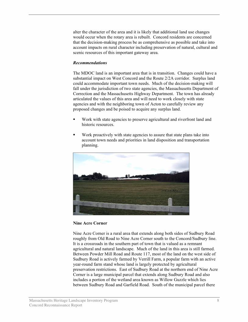
Massachusetts Department of Correction Land
A state prison was established in Concord in 1878. In 1884 it was renamed the
Massachusetts Reformatory for Men. The complex, which includes two major
correctional institutions, has grown over the years and is now one of the largest
properties in Concord, totaling about 300 acres, prominently located along Route
2 and 2A in the western part of town. MCI-Concord, located on the southwest
side of Route 2 at the Concord Rotary, is a maximum security state prison.
Facilities associated with this complex include a late 19th century brick
administration building, staff housing, a cemetery and remnants of a formal
garden. The complex also includes a large late 20th century walled prison on the
south side of Route 2 with state police facilities opposite on the north side of
Route 2. West of the rotary are extensive agricultural fields on both sides of
Route 2 that extend into Acton.
Along Route 2A west and north of the rotary is the Northeast Correctional
Center, a minimum-security state prison that includes mid to late 20th century
institutional buildings, barns and silos as well as extensive pastureland and pine
forest. Until very recently this land was occupied by a large dairy herd so there
is now speculation that it may be declared surplus.
The Massachusetts Department of Correction (MDOC) land was identified as a
priority landscape for many reasons. The 19th century administration building,
residences and garden are historic resources that contribute to the character of the
community. Stewardship of these historic buildings is a community concern,
especially since a row of historic houses built for prison staff along
Commonwealth Avenue was demolished in the 1990s. The farmland associated
with the property represents a significant portion of the agricultural land in
Concord and is also an important scenic resource and a prominent gateway to the
community from the west. MDOC land also includes extensive frontage along
the Assabet River.
The Concord Rotary, which is at the center of the MDOC land, is a major traffic
bottleneck that is considered a regional problem. The Massachusetts Highway
Department is currently exploring options for alternative designs that would
make traffic flow more smoothly. Any proposed changes would dramatically
Massachusetts Heritage Landscape Inventory Program 8
Concord Reconnaissance Report
alter the character of the area and it is likely that additional land use changes
would occur when the rotary area is rebuilt. Concord residents are concerned
that the decision-making process be as comprehensive as possible and take into
account impacts on rural character including preservation of natural, cultural and
scenic resources of this important gateway area.
Recommendations
The MDOC land is an important area that is in transition. Changes could have a
substantial impact on West Concord and the Route 2/2A corridor. Surplus land
could accommodate important town needs. Much of the decision-making will
fall under the jurisdiction of two state agencies, the Massachusetts Department of
Correction and the Massachusetts Highway Department. The town has already
articulated the values of this area and will need to work closely with state
agencies and with the neighboring town of Acton to carefully review any
proposed changes and be poised to acquire any surplus land.
! Work with state agencies to preserve agricultural and riverfront land and
historic resources.
! Work proactively with state agencies to assure that state plans take into
account town needs and priorities in land disposition and transportation
planning.
Nine Acre Corner
Nine Acre Corner is a rural area that extends along both sides of Sudbury Road
roughly from Old Road to Nine Acre Corner south to the Concord/Sudbury line.
It is a crossroads in the southern part of town that is valued as a remnant
agricultural and natural landscape. Much of the land in this area is still farmed.
Between Powder Mill Road and Route 117, most of the land on the west side of
Sudbury Road is actively farmed by Verrill Farm, a popular farm with an active
year-round farm stand whose land is largely protected by agricultural
preservation restrictions. East of Sudbury Road at the northern end of Nine Acre
Corner is a large municipal parcel that extends along Sudbury Road and also
includes a portion of the wetland area known as Willow Guzzle which lies
between Sudbury Road and Garfield Road. South of the municipal parcel there
Massachusetts Heritage Landscape Inventory Program 9
Concord Reconnaissance Report
are several small residential properties and a large parcel known as the Taranto
land which includes a handsome 19th century house and barn complex, which has
been used for various agricultural purposes. A portion is currently leased for
nursery use. There is a cluster of small-scale late 20th century commercial and
residential buildings at the intersection of Sudbury Road and Route 117. On the
south side of Route 117 is more agricultural land and a golf course, with
evidence of drainage ditches, and a tributary of the Sudbury River with
associated wetlands.
Nine Acre Corner is one of six large agricultural areas identified in Concord’s
long range plan. It also includes extensive wetlands and is valued for scenic
views and wildlife habitat. At the Heritage Landscape meeting, residents
expressed particular concern about the part of this area east of Sudbury Road,
including the town-owned parcel, the Taranto land and wetlands along the
Sudbury River.
Recommendations
Nine Acre Corner is an important area that is vulnerable to transition as land
becomes more valuable for residential development. The Department of
Planning and Land Management, working with the Land Conservation Trust, is
the logical agency to take the lead in preserving this area.
! Work with owners of large agricultural parcels to develop strategies to
preserve farm fields and woodland through conservation and preservation
restrictions using M.G.L. Chapter 184, Sections 31-33 or agricultural
preservation restriction if farming activities are sufficient to qualify. See
general agricultural recommendations.
Virginia Road
Virginia Road, located in the eastern part of Concord, is one of the oldest roads
in town but it has not received the same attention as other historic roads. The
easternmost section of Virginia Road is located adjacent to Hanscom Air Force
Base. The road extends from the Air Force Base on the east to Old Bedford
Road on the west, a distance of just over a mile. The road itself is a narrow two-
lane roadway that has a fairly rural character. The eastern end is zoned for a
limited industrial park use and includes the Wheeler Farm mixed-use
development with a cluster of late 20th century office buildings, an adaptively
reused barn and a farmhouse. West of that development are the extensive
wetlands associated with Elm Brook in an area known as the “Bedford Levels”.
At 341 Virginia Road is the Thoreau Birth House (also known as the Wheeler-
Minot House and Thoreau Farm), now a town-owned historic site that has
recently been listed on the National Register. The Thoreau Farm Trust is raising
funds to acquire and restore the house and Gaining Ground, a non-profit
agricultural group, is leasing the land for organic farming on the adjacent town-
owned property. West of the Thoreau Birth House there is a mix of late 20th
century residential development on both sides of the road; undeveloped Hanscom
land on the north side of the road that includes extensive wetlands; and town

Massachusetts Heritage Landscape Inventory Program 10
Concord Reconnaissance Report
conservation land on the south side of the road, some of which is leased for
agricultural use.
Residents were particularly concerned about the Thoreau Birth House, an
important historic site that had been largely ignored until recently. They were
also concerned about the extensive wetlands in the area (some of which are under
a term conservation restriction that will soon expire) and the possible impacts of
future Hanscom expansion.
Recommendations
The Historical Commission, the Natural Resources Commission and the Concord
Public Works are logical town departments to work together on preserving the
historic and rural character of Virginia Road, working in conjunction with
Hanscom officials and other organizations such as the Thoreau Farm Trust and
Gaining Ground.
! Document historic, natural and scenic resources along Virginia Road. Use
this understanding of the area’s history, environmental and scenic qualities to
build a case for preserving the historic and natural resources along the
roadway, as well as the rural character of the road corridor itself.
Walden Woods/Route 126 Corridor
Walden Woods is a 2,680-acre area in Concord and Lincoln that lies east of the
Sudbury River. It is characterized by sandy, acidic soils and includes two large
ponds, Walden Pond and Sandy Pond, as well as several smaller ponds. Walden
Pond is nationally significant for its association with Henry David Thoreau, who
built a small cabin near the shore in the 19th century. The pond has twice been
included on the National Trust’s list of Eleven Most Endangered Historic Places.
It was also listed as one of seven priority open space resources in Concord’s 2004
Open Space and Recreation Plan. In Concord, Walden Woods includes
Fairhaven Hill, Walden Pond State Reservation, the former Concord Landfill and
the Town Forest as well as surrounding land. Walden Pond State Reservation is
a popular facility that draws up to 600,000 users per year.

Massachusetts Heritage Landscape Inventory Program 11
Concord Reconnaissance Report
Most of Walden Woods has been set aside for conservation through the efforts of
state and local agencies and non-profit organizations such as the Walden Woods
Project, which has acquired key parcels that have been threatened by
development. However land stewardship and impacts from adjacent non-
conservation uses still have the potential to impact the area.
While there are other planning issues associated with Walden Woods, at the
Heritage Landscape meeting residents expressed particular concern about the
Route 126 corridor (also known as Walden Street) through Walden Woods,
which provides the primary public access to Walden Pond. Only the Concord
section of Route 126 is addressed here, although it forms the eastern boundary of
Walden Pond Reservation in Lincoln as well.
Most of Walden Pond Reservation, including Walden Pond itself, is located on
the west side of Route 126. However, parking for the reservation is located on
the east side of the road, which also functions as a regional roadway. A trailer
park located on the east side of Route 126 is being phased out and the former
landfill has been regraded and is now becoming vegetated. State agencies have
been considering a plan that would relocate the road away from Walden Pond.
Residents were concerned that a redesigned road could be detrimental to the
relatively rural character of the area and would potentially eliminate the views of
the pond for passersby.
Recommendations
The Route 126 corridor south of Route 2 is an important part of Walden Woods
that is in transition. Much of the decision-making will fall under the jurisdiction
of two state agencies, Massachusetts Department of Conservation and Recreation
and Massachusetts Highway Department. The towns of Lincoln and Concord
and the Walden Woods Project are also important stakeholders in decisions
affecting the area and the design of the road.
! Work with state agencies, local non-profits and the town of Lincoln to
preserve the rural character of the roadway and views of the pond from the
road and to accommodate all users including pedestrians and bicyclists.
West Concord Village
Concord has three village centers: Concord Center, Depot/Thoreau Street and
West Concord. The town values each of these distinct areas and is working to
preserve their unique character. While all three were identified by the
community as heritage landscapes, West Concord was selected as a priority
landscape because it is considered most vulnerable to change. West Concord is a
mixed use village area between Route 2 and the Assabet River that reflects its
late 19th and early 20
th century development and has generally been considered
secondary to other parts of Concord, but has recently been recognized as a vital
and active part of the community with a distinct character of its own that is
derived from the mix of buildings and uses, particularly its role as an incubator
for small businesses.

Massachusetts Heritage Landscape Inventory Program 12
Concord Reconnaissance Report
West Concord developed as an industrial village in the 19th century, with mills
along the Assabet River, Warner’s Pond and Nashoba Brook that made it the
industrial center of the community. Today it reflects its industrial heritage as
well as the presence of MCI-Concord, the railroad and a diverse commercial
center with many startup businesses and specialty stores. Our Lady’s Church,
industrial buildings and the West Concord Depot were institutions specifically
mentioned by community residents. Key issues are preserving the physical
character of the area, as well as the unique mix of businesses, institutions and
natural areas, including the Assabet River and Nashoba Brook. Proposed
reconfiguration of the Route 2 rotary and potential changes at MCI-Concord
would heavily impact West Concord.
Recommendations
The Planning Board, working in conjunction with the Historical Commission, is
in the best position to take a leadership role in promoting the preservation of
West Concord, which has recently been documented on MHC survey forms. The
Our Lady’s Church was recently designated a part of the first local historic
district in West Concord. To preserve the integrity of this architecturally and
historically significant neighborhood:
! Prepare a National Register nomination for eligible portions of West
Concord.
! Establish a village overlay district as recommended in the Long Range Plan
and develop rehabilitation standards to assist property owners in preserving
character defining features of these architecturally significant properties.
! Extend the local historic district that is currently comprised of the Our
Lady’s Church and associated office building, the Harvey Wheeler
Community Center, the Concord Children’s Center and the Fowler Library.
! Another tool that might be effective in preserving West Concord’s
neighborhood character and important architectural features is a
Neighborhood Architectural Conservation District. See the description of
this type of district in General Preservation Planning Recommendations.

Massachusetts Heritage Landscape Inventory Program 13
Concord Reconnaissance Report
CRITICAL CONCERNS
In addition to the priority landscapes listed in the previous section, residents also
identified critical issues related to heritage landscapes and community character.
Critical concerns are town-wide issues that are linked to a group or category of
heritage landscapes, not to a particular place. These issues are listed in
alphabetical order. Community members also expressed interest in learning
about preservation tools and strategies that have been effective in other
Massachusetts communities and in identifying sources for preservation funding.
Agricultural Land
The identity of Concord is closely linked to its farms at the gateways to the
community and along the many scenic roads. Preservation of farms, including
farming activities, is critical to the rural character of the town. Concord’s Long
Range Plan indicates that in 2005 Concord had roughly 1,500 acres of land that
was actively farmed, including land owned by the National Park Service and the
Massachusetts Department of Correction, as well as town-owned land that is
leased to local farmers. The town has been losing farmland at a rate of about 36
acres per year for the past 20 years. Although half of Concord’s agricultural land
is protected, there are about 662 acres that are unprotected and vulnerable to
development. See General Preservation Planning Recommendations for
recommendations regarding agriculture.
Churches as Community Focal Points
Churches are landmarks within the community that serve as physical place
makers, particularly those that are prominently sited and have visible steeples.
Many are also neighborhood centers that are the focal point of numerous social
and community activities. There are a large number of churches in Concord.
Some may be vulnerable to closing and others may have difficulty maintaining
their historic buildings. Loss of active churches and church buildings is an issue
not just for the congregation but also for the whole community. Most of
Concord’s historic churches have been documented on MHC inventory forms
and many are in local historic districts.
Land Stewardship and Regional Landscapes
Concord is fortunate to have large areas of public and institutionally owned
landscapes. Primary owners include the town, the National Park Service, U.S
Fish and Wildlife Service, Hanscom Field/Air Force Base, Department of
Conservation and Recreation, Massachusetts Department of Correction, the
Concord Land Conservation Trust, Harvard University and Walden Woods, as
well as private owners. These areas include riverfront land, wetlands,
agricultural land and woodlands, as well as parcels that serve specific
commercial or institutional uses.
In many cases parcels are intertwined and boundaries are visually
undistinguishable. Particularly in wet or agricultural areas, stewardship of one
parcel often impacts another. For example, preserving Concord’s flood meadows

Massachusetts Heritage Landscape Inventory Program 14
Concord Reconnaissance Report
is an important goal shared by the Natural Resources Commission and the Land
Conservation Trust, who frequently work together on joint projects. The
National Park Service has taken a bolder approach to maintaining its flood
meadows, while the Fish and Wildlife Service is primarily concerned with
preserving habitat. Similarly the various museum groups and historic houses
have many shared concerns and different approaches. In each case,
communication among land stewards with common interests is an important
goal.
Similarly, regional landscapes are shared by several communities. Concord has
important land use relationships with each of the abutting communities because
of these landscapes that extend beyond the town’s borders. These include rivers,
bike trails, MDOC lands, Minuteman National Park, Great Meadows National
Wildlife Refuge and Walden Pond State Reservation. In general there has been
good communication and cooperation on most issues to date. Concord will need
to remain alert to opportunities that involve cooperation of several communities.
Scenic Roads
Concord residents emphatically stated that all Concord roads are considered
scenic. Elements of roads that are valued are narrow width, irregular alignment,
bridges, stone walls, trees and views. Views from roads and bridges are central
to Concord’s community character, especially at Nine Acre Corner and Great
Meadows. Concord does not have a scenic roads bylaw. Instead, the Concord
Public Works employs a “context-sensitive” roads policy that it feels provides
more flexibility in designing roads appropriate to the unique needs of each
setting.
EXISTING RESOURCE DOCUMENTATION AND PLANNING TOOLS
Concord already has important planning tools in place to document current
conditions within the town; identify issues of concern to town residents; and
develop strategies for action. This section of the Reconnaissance Report
identifies existing planning documents and tools that provide information
relevant to the Heritage Landscape Inventory program.

Massachusetts Heritage Landscape Inventory Program 15
Concord Reconnaissance Report
Inventory of Historic and Archaeological Assets
The Massachusetts Historical Commission’s (MHC) Inventory of Historic and
Archaeological Assets is a statewide list that identifies significant historic
resources throughout the Commonwealth. In order to be included in the
inventory, a property must be documented on an MHC inventory form, which is
then entered into the MHC database. This searchable database, known as
MACRIS, is now available online at http://www.sec.state.ma.us/mhc.
Concord has an extensive inventory of historic buildings, structures, sites, areas
and objects (including some mid-20th century buildings and neighborhoods) that
was begun in the early 1970s and is ongoing. The survey includes not only
traditional architectural resources but also areas and corridors of historical
importance, several of which were identified as priority landscapes in the
Heritage Landscape Inventory.
Concord has 134 ancient Native American sites dating back to the Middle
Archaic Period (8,000-6,000 B.P.) and 34 historic archaeological sites. In spite
of the fact that Concord has more documented archaeological sites than any other
community in the region, it is likely that more archaeological sites will be
identified in the future due to the known rich Native American use of the land.
State and National Registers of Historic Places
The National Register of Historic Places is the official federal list of districts,
sites, buildings, structures and objects that have been determined significant in
American history, architecture, archaeology, engineering and culture.
Concord has 18 buildings that are individually listed on the National Register of
Historic Places (five of which are also National Historic Landmarks), as well as
Sleepy Hollow Cemetery and Walden Pond. Concord also has three National
Register Districts: Minuteman National Park, Hubbard-French Historic District
and Monument Square/Lexington Road Historic District. Concord has six local
historic districts, five in the vicinity of Concord Center: American Mile HD,
Barrett Farm HD, Hubbardville HD, Main Street HD and North Bridge-
Monument Square HD, as well as the Church Street HD in West Concord. Four
of the districts were established prior to M.G.L Chapter 40C; therefore they are
Special Acts districts. Subsequent expansion and added districts also have been
designated under the Special Act, Ch. 345. Concord also has two preservation
restrictions on individual properties, the Old Manse and Orchard House.
Other Preservation Planning Tools and Documents
In 1995 the Concord Historical Commission published Narrative Histories of
Concord and West Concord and in 2001 it published an update of the Historic
Resources Masterplan of Concord, Massachusetts. Both documents make
information from the survey readily available to the public. The Masterplan
summarizes the findings of the survey work; provides a list of about 900 historic
resources; prioritizes these resources; and includes recommendations for action.

Massachusetts Heritage Landscape Inventory Program 16
Concord Reconnaissance Report
Concord also has a six-month demolition delay bylaw that applies to 58 houses
and structures not included within the local historic districts.
Concord completed its Comprehensive Long Range Plan, A Vision for 2020 in
2005. Primary themes of the plan are protecting Concord’s assets and character;
enhancing the quality of life; and balancing the town’s needs with its ability to
pay. Concord’s Open Space and Recreation Plan was completed in 2004. It
established an open space framework that looked at regional patterns, town-wide
patterns (broken down into large intact areas, major corridors and special sites);
and neighborhood patterns. The open space plan also looked at Concord in terms
of land use which includes developed land (38%), protected open space (30%)
and uncommitted land (32%). Other relevant plans include Comprehensive
Wastewater Management Plan (2003) and Sewer Program Rules and Regulations
(2004), both of which provide important growth management tools.
In 2004 Concord adopted the Community Preservation Act at a 1.5% surcharge
on real estate taxes; the proceeds must be used for historic preservation, open
space and affordable housing. Many of the recommendations included in this
Reconnaissance Report could be funded with CPA money.
GENERAL PRESERVATION PLANNING RECOMMENDATIONS
Recommendations pertaining to priority heritage landscapes can be found
beginning on page 4. This section of the Reconnaissance Report offers more
general recommendations relevant to preserving the overall character of the
community that would be applicable to a wide range of community resources.
Concord's varied natural features played a critical role in the settlement and
historical development of the community and remain among the town's most
important assets. Concord is also fortunate to have an unusually rich and well-
documented collection of historic resources. The town has taken important steps
to preserve its most significant buildings and natural areas by establishing land
use regulations that support community goals articulated in the town’s planning
documents. Concord is now looking beyond these resources to the other natural
and cultural assets that define the overall fabric of the community. Like most
municipalities, Concord is under intense pressure for development. Special
places that were once taken for granted are now more vulnerable than ever to
change.
Preservation planning is a three-step process: identification, evaluation and
protection. Four useful documents to consult before beginning to implement
preservation strategies are:
! Department of Conservation and Recreation, Reading the Land
! Freedom’s Way Heritage Association, Feasibility Study
! Massachusetts Historical Commission, Survey Manual

Massachusetts Heritage Landscape Inventory Program 17
Concord Reconnaissance Report
! Massachusetts Historical Commission, Preservation through Bylaws and
Ordinances
Recommendations that apply to a broad range of resources are discussed below.
The recommendations are listed in the order in which they are most logically
addressed when applying the three-step preservation planning process as
described above. Thus the goal will be to (1) identify, (2) evaluate, (3) protect.
Inventory of Heritage Landscapes
The vital first step in developing preservation strategies for heritage landscapes is
to record information about the resources on MHC inventory forms. One cannot
advocate for something unless one knows precisely what it is – the physical
characteristics and the historical development. The Historic Resources
Masterplan indicates that relatively little information is included about farm
outbuildings, road beds, stone wall networks, cellar holes, railroad structures,
garages and early archaeological sites, including Native American sites as well as
17th and 18
th century sites. Thus, using the Massachusetts Historical Commission
survey methodology, the Concord Historical Commission should:
! Compile a list of resources that are under-represented or not sufficiently
documented, beginning with the priority heritage landscapes identified in this
report.
! Document unprotected resources first, beginning with the most threatened
resources.
! Document secondary features on rural, agricultural and residential properties,
such as barns, stone walls and landscape elements.
! Record a wide range of historic and pre-historic resources including
archaeological sites, landscape features and industrial resources.
! Conduct a community-wide archaeological reconnaissance survey to identify
patterns of ancient Native American and historic occupation and to identify
known and probable locations of archaeological resources associated with
these patterns. Known and potential ancient Native American and historic
archaeological sites should be documented in the field for evidence of their
cultural association and/or integrity. All survey work should be completed
by a professional archaeologist who meets the professional qualifications
(950 CMR 70.01) outlined in the State Archaeologist Permit Regulations
(950 CMR 70.00). The Inventory of Archaeological Assets of the
Commonwealth contains sensitive information about archaeological sites.
The inventory is confidential; it is not a public record (G.L. c. 9, ss. 26A (1)).
Care should be taken to keep archaeological site information in a secure
location with restricted access. Refer to the MHC article "Community-Wide
Archaeological Surveys" which appeared in the Preservation Advocate, Fall
2005 which can be found at the following MHC
link:http://www.sec.state.ma.us/mhc/mhcpdf/pafall05.pdf.
Massachusetts Heritage Landscape Inventory Program 18
Concord Reconnaissance Report
National Register Program
Most of Concord’s National Register nominations were prepared some time ago
as part of historic districts and may not be up to current standards. Some of these
early nominations would most likely benefit from updating. Many other
properties are undoubtedly eligible and would be worth evaluating for their
potential to be nominated. The Concord Historical Commission should:
! Review Concord’s existing National Register nominations and develop a
National Register listing plan taking into consideration a property’s integrity
and vulnerability. Properties that are in need of recognition and preservation
should be given highest priority for listing.
Agricultural Preservation
Preservation of agricultural landscapes means preservation of the farming
activities, particularly in Concord where the character of farms is integral to the
community’s past. It is important to know what the features of these agricultural
landscapes are and which features the community treasures in order to make a
case for preservation of these farms. Some preservation tools are available that
can assist communities in preserving the actual farming activities even if only a
few farms remain. Others are tools to preserve the landscape when the farm is
sold. The town already has an agricultural committee and may want to consider
other strategies that support farming activities. It may also wish to consult with
other communities in the area that have implemented similar programs.
! Document additional farms that may not presently be included in Concord’s
inventory of historic resources, or update forms that focus solely on the
farmhouse. Use MHC area forms to convey the historical development of
the entire farm.
! Adopt a right-to-farm bylaw that allows farmers to carry on farming
activities that may be considered a nuisance to neighbors.
! Develop public-private partnerships to raise funds to purchase development
rights on farms or to assist a farmer in the restoration of historic farm
buildings (for which the farmer would be required to donate a preservation
restriction.
! Continue public-private partnerships to preserve farmland through purchase
of conservation restrictions (CRs) or agricultural preservation restrictions
(APRs). CPA funding may be used.
! Establish agricultural overlay districts in areas as identified in Long Range
Plan.
Downtown and Neighborhood Character
Nearly all preservation strategies address neighborhood character in some
manner. As described above, thorough documentation on MHC inventory forms

Massachusetts Heritage Landscape Inventory Program 19
Concord Reconnaissance Report
is an important first step in the preservation planning process, followed by
National Register listing where appropriate. Concord has already implemented
two important preservation tools, a demolition delay bylaw and local historic
districts; expanding the number of properties subject to the demolition delay
bylaw and expanding the area of the local historic districts are could extend the
usefulness of these tools. Another preservation tool that may be particularly
applicable to some of Concord’s newer historic neighborhoods is neighborhood
architectural conservation district designation. Neighborhood architectural
conservation districts are local initiatives that recognize special areas within a
community where the distinctive characteristics of buildings and places are
preserved and protected. They are less restrictive than local historic districts but
still embrace neighborhood character. Neighborhood architectural conservation
district designation is appropriate for neighborhoods that may have less integrity,
where more flexibility is needed, or in neighborhoods of the recent past. The
Concord Historical Commission should:
! Work with MHC staff to develop a neighborhood architectural conservation
district bylaw that would best suit Concord’s needs and work with other town
groups to publicize the advantages of such a bylaw to the community.
! Work with MHC staff to determine how a neighborhood architectural
conservation district would help to preserve Concord’s downtown
commercial districts, particularly West Concord and the Thoreau
Street/Depot area.
! Explore options for revising the demolition delay bylaw. Consider
expanding it to one year to allow more time to negotiate and revising to
include all properties that are more than 75 years old.
Scenic Roads
Scenic roads are an integral part of the historic fabric of the community. They
are highly valued by Concord residents and visitors alike and were listed as a
critical concern. Roads must also accommodate modern transportation needs and
decisions regarding roadways are often made with travel requirements as the only
consideration. Yet, in addition to roadway issues, much of what we value about
scenic roads – the stone walls, views across open fields – is not within the public
right-of-way. The preservation and protection of scenic roads therefore requires
more than one approach.
! Complete an inventory with descriptions and photo documentation of each
of the roads in Concord including the character defining features.
! Consider means of formalizing Concord’s “context-sensitive” roads policy
to include specific design criteria to be considered when approving removal
of trees and stone walls. Also consider other design criteria such as a
provision allowing only one driveway cut per property on scenic roads.
Coordinate procedures between Concord Public Works and Planning Board.
! Consider a scenic overlay district, which may provide a no-disturb buffer on
private property bordering on scenic roads or adopt flexible zoning

Massachusetts Heritage Landscape Inventory Program 20
Concord Reconnaissance Report
standards to protect certain views. Such bylaws could be written to apply to
the State numbered routes also, which are not protected under the Scenic
Roads Bylaw.
! Develop policies and implementation standards for road maintenance and
reconstruction, including bridge reconstructions that address the scenic and
historic characteristics while also addressing safety. This is an important
public process in which the community may have to accept responsibility
for certain costs to implement standards that are not acceptable to projects
funded by Mass Highway Department. Such standards should have a
section addressing the way in which the local Concord Public Works
maintains roads, for example requiring a public hearing if any additional
pavement is to be added to a town road during reconstruction or repair.
Policies can be adopted by local boards having jurisdiction over roads, or
can be adopted at Town Meeting through a bylaw. In developing policies
consider factors such as road width, clearing of shoulders, walking paths,
posted speeds. A delicate balance is required.
Funding of Preservation Projects
Funding for preservation projects is an important aspect of implementing
preservation strategies. Both the MHC and DCR have funding programs to assist
communities in preservation related issues. The town should investigate which
of the following programs are currently funded:
! Survey and Planning Grants, administered by the MHC, support survey,
National Register and preservation planning work.
! The Massachusetts Preservation Projects Fund (MPPF) administered by
the MHC, funds restoration and rehabilitation projects.
! The Historic Landscape Preservation Grant Program (HLPGP)
administered by DCR funds planning, rehabilitation, education and
stewardship projects focused on historic landscapes, including cemeteries.
Funding for state programs varies from year to year. When planning Concord’s
heritage landscape inventory program, contact relevant agencies to determine
whether funding is available.
Concord has recently adopted the Community Preservation Act (CPA) and will
find it to be an excellent funding source for many heritage landscape projects;
Concord certainly is aware of the number and types of projects that are benefiting
from this funding source across the Commonwealth. Concord projects eligible
for CPA funding could include MHC inventory, National Register nominations,
cemetery preservation, open space acquisition and preservation/restoration of
public buildings.
Towns, like Concord, which have a local historic district bylaw, may apply for
Certified Local Government (CLG) status which is granted by the National
Park Service (NPS) through the MHC. At least 10% of the MHC’s yearly federal
Massachusetts Heritage Landscape Inventory Program 21
Concord Reconnaissance Report
funding allocation is distributed to CLG communities through Survey and
Planning matching grants. To become a CLG, the town completes an
application; after being accepted as a CLG, it files a report yearly on the status of
applications, meetings, and decisions; in return the town may apply for the
matching grant funding that the MHC awards competitively to CLGs annually.
Presently 18 cities and towns are CLGs in Massachusetts.
CONCLUSION
The Concord Reconnaissance Report is a critical tool in starting to identify the
rich and diverse heritage landscapes in Concord and in beginning to think about
preservation strategies. Concord will have to determine the best way to
implement the recommendations discussed above. One approach that might help
Concord begin the process is to form a Heritage Landscape Committee, as
described in Reading the Land.
Landscapes identified in this report, especially the priority landscapes, will
typically need further documentation on MHC inventory forms. The
documentation in turn can be used in publicity efforts to build consensus and
gather public support for their preservation. Implementation of recommendations
will require a concerted effort of and partnerships with municipal boards and
agencies, local non-profits, and state agencies and commissions.
Distribution of this Reconnaissance Report to the municipal land use boards and
commissions will assist in making this one of the planning documents that guides
Concord in preserving important features of the community’s character. The
tasks that are recommended will require cooperation and coordination among
boards and commissions, particularly Concord’s Historical Commission,
Planning Board, Natural Resources Commission, Public Works Commission,
Opens Space Task Force and others. It also is advisable to present this
information to the Selectmen, the applicants to the Heritage Landscape Inventory
program on behalf of the town. Finally distribution of the report to the Concord
Land Conservation Trust, Walden Woods Project, neighborhood associations and
other preservation minded organizations, along with owners of properties of
historic significance will broaden the audience and assist in gathering interest and
support for Concord's heritage landscapes.

Massachusetts Heritage Landscape Inventory Program 22
Concord Reconnaissance Report
APPENDIX: HERITAGE LANDSCAPES IDENTIFIED BY COMMUNITY
This list was prepared as a summary of the Heritage Landscape Identification meeting held in Concord on
February 28 and follow-up fieldwork on April 11, 2006. There are undoubtedly other heritage
landscapes that were not identified at the HLI meeting noted above. The chart has two columns, the
name and location of the resource are in the first; notes about the resource are in the second. Landscapes
are grouped by land use category. Abbreviations used are listed below.
APR = Agricultural Preservation Restriction CR = Conservation Restriction
LHD = Local Historic District LRP = Long Range Plan
NR = National Register OSRP = Open Space and Recreation Plan
PR = Preservation Restriction * = Priority Landscape
+ = Part of a Priority Landscape TTOR = The Trustees of Reservations
Agriculture
Barrett Farm *
448 Barrett’s Mill
Road
NRIND, LHD. More recently known as the McGrath Farm. Farmhouse is a Colonial
building with historical significance and a high level of integrity. Property also includes
agricultural outbuildings and fields that were actively farmed until recently. Critical parcel
with conservation land across the street and other town-owned land to the north and east.
Barrett’s Mill Road
Area
Includes Prison Farm and Barrett/McGrath Farm. One of six major agricultural areas
identified in LRP and OSRP.
Farmland around
Alcott School
Walden Street
Agricultural land,
Harrington Avenue
Area
Marshall Farms. One of six major agricultural areas identified in LRP and OSRP.
Includes town-owned Harrington House, with 15 acres on the Assabet.
Lexington Road
Area
Palumbo Farm and National Park. One of six major agricultural areas identified in LRP
and OSRP.
Monument Street
Area
Hutchins Farm (protected by APR). One of six major agricultural areas identified in LRP
and OSRP.
Nine Acre Corner *
Sudbury Road
Verrill, Taranto and Poutasse Farms. Willow Guzzle is an area of particular concern. One
of six major agricultural areas identified in LRP and OSRP. Part of Verrill land is
preserved by APR. Also mentioned were ridges and views.
Old Bedford Road/
Bedford Road Area
Scimone, Burke and Kenney Farms. One of six major agricultural areas identified in LRP
and OSRP.
Prison Farm +
Route 2
Part in Concord and part in Acton. This is a very visible part of the larger MDOC land. It
is also listed in the institutional category and is part of a priority landscape.
Triangle Farm
Westford Road
Not in planning documents. No longer has any agricultural land. Two barns are under
demolition delay. Northwest corner of town, goes into Acton and Carlisle.

Massachusetts Heritage Landscape Inventory Program 23
Concord Reconnaissance Report
Williams/Sudbury
Roads/Route 2
Mattison, Souter and Arena Farms. One of six major agricultural areas identified in LRP
and OSRP.
Archaeological
Archaeological
Corridor
Corridor through Concord River, Sleepy Hollow, Ripley Corner, Colonial Road.
Old Powder Mill
Ruins Main Street
In West Concord, 40+ acres with adjoining sections in Acton and Maynard. Now a private
recreational business/facility owned primarily by the Thoreau Club.
Burial Grounds
Chandler Family
Plot
Barrett’s Mill Road
Smallpox cemetery with only one headstone.
Hosmer Family Plot
600 Main Street
Graves on Hosmer property near railroad.
MCI Prison
Cemetery +
Elm Street
212 marked graves. Part of MDOC priority landscape.
Old Hill Burying
Ground
Lexington Road
NR, LHD. 481 marked graves from the year 1635. Town-owned. Located in Monument
Square.
Saint Bernard’s
Catholic Cemetery
Bedford Street
19th
century Catholic cemetery.
Sleepy Hollow
Cemetery
Bedford Street
NRIND. Originally established 1823 as New Burying Ground. Embodies rural cemetery
style. Town-owned. Knoll area (newly developed – Native American Indian site)
specifically mentioned.
South Burying
Place
Main Street
LHD. Also known as Main Street Burying Ground, 231 marked graves from the year
1697. Town-owned. Note: Headstones were realigned by the WPA during the 1930s.
Conservation of grave markers was completed in 2006.
Smallpox Cemetery
Fairhaven Road
Active from 1700s on. Also known as Potter Family Plot.
Civic/Villages
Concord Center
Main Street
LHD. Monument Square and portion of Main Street. Focal point is town green with
monuments encircled by public buildings and spaces including Town House, Hill Burying
Ground, Holy Family, Christian Science and First Parish Churches, Wright Tavern,
Colonial Inn and former Middlesex County buildings.

Massachusetts Heritage Landscape Inventory Program 24
Concord Reconnaissance Report
Depot/Thoreau
Street Area
Commercial area along Thoreau Street with railroad tracks and depot. Depot building is
also listed separately under transportation. Area includes Concord Crossing, a complex of
mixed retail, office and residential uses.
West Concord *
Main Street
Village center and industrial area. Includes entire village including mills, churches,
commercial area and residential neighborhoods.
Industrial
Damon Mill & Dam
Main Street
In West Concord at Westvale on the Assabet River.
Warners Pond Dam
Commonwealth
Avenue
In West Concord on Nashoba Brook. Dam was initially constructed to provide power for
Pail Factory; created Warners Pond. Area includes dam and mill pond adjacent to West
Concord center industrial area; by late 19th
century had become a local recreational area.
Dam reconstruction is expected in 2007.
Institutional
Concord Free
Public Library
Main Street
Library is prominently sited. Library lawn is a major green space at the town center.
First Parish Church
Lexington Road
NR, LHD. Spires and the land around the church are important. Part of Concord Center
area.
Mass Department of
Correction Land *
Route 2
Includes MCI-Concord (maximum security facility on southwest side of Route 2, with
adjoining cemetery and agricultural fields) as well as Northeast Correctional Center
(minimum security) northeast of the rotary on Barrett’s Mill Road. Large land holdings
also include land along the river.
Our Lady’s
Church +
Church Street
LHD. Church and land around it are important to the community. Included in West
Concord priority landscape.
Military
Battle Road
Corridor
Lexington Road
NR, NHL, LHD. Historic battle road extends along Lexington Road and Monument Street
to the Old North Bridge. Part of the Concord section of the Battle Road is included in
Minuteman National Park. Other sections are privately owned and are included in
Concord’s historic districts. An effort to obtain a Scenic Byway designation for the Battle
Road through Concord as well as through Arlington, Lexington and Lincoln, which also
have sections of the Battle Road, is underway.

Massachusetts Heritage Landscape Inventory Program 25
Concord Reconnaissance Report
Miscellaneous
Buttrick Garden
Liberty Street
Adjacent to Buttrick Mansion. Early 20th
century garden in historical park. Part of the Old
North Bridge Area.
Minuteman Statue
NR, NHL, LHD. 1875, by Daniel Chester French. At the Old North Bridge in Minuteman
National Park.
Natural
Egg Rock +
Boulder near junction of Sudbury and Assabet Rivers. Part of Flood Meadows priority
landscape.
Quaking Bog
Old Bedford Road
Near Ripley School and the Old Bedford Road/Bedford Street agricultural area; part of the
archeological corridor.
Revolutionary
Ridge
Stretches along north side of Lexington Road, geologic feature important to events of April
19, 1775.
Open Space /Parks
Annursnac Hill
Strawberry Hill Rd.
Town-owned conservation land north of Strawberry Hill Road. Priority open space in
OSRP and LRP.
Calf Pasture
Lowell Road
Town conservation land near the confluence of the Assabet, Sudbury and Concord Rivers
and town canoe launch site.
Chamberlin Park
and Garden
Lowell Road
Designed garden path from Lowell Road to the Mill Brook (opposite the Colonial Inn),
now like a green. Footbridge spanning Mill Brook provides link to downtown
Concord Country
Club
Old Marlboro Road
Golf course that includes brook, woods, beaver area and Jenny Dugan Kames. Extends
east across Sudbury River towards the Concord Land Conservation Trust’s Soutter Land.
Priority open space in OSRP and LRP.
Emerson
Playground
Thoreau Street
Established 1887; given to the Town as a gift from the Emerson family.
Estabrook Woods *
Lowell Road
Includes Harvard University’s Estabrook Woods, Middlesex School land, Bateman’s Pond,
Punkatasset Town Conservation land and areas north to Carlisle. Priority open space in
OSRP and LRP. Also the undeveloped land adjacent to Estabrook Woods.
Great Meadows/
Ball’s Hill Area
Great Meadows National Wildlife Refuge, continuous vegetation to the north and west of
Concord River. Priority open space in OSRP and LRP.
Heywood Meadow
NR. Remnant meadow land along Mill Brook in the heart of Concord Center. Town-
owned.

Massachusetts Heritage Landscape Inventory Program 26
Concord Reconnaissance Report
Nashawtuc Country
Club Route 117
Along Sudbury River in southeastern part of town. Partially in Sudbury.
The Old North
Bridge
Monument Street
NR, NHL, LHD. This area is valued for its open space value as well as its historic value.
Includes bridge, Old Manse, Buttrick Mansion. Largely owned by Town, TTOR and
National Park Service but some parts of this area are not permanently protected.
Rideout
Playground +
In West Concord priority landscape.
Town Green and
Veterans Memorial
In the heart of Concord Center.
Virginia Road
Woods +
Bedford Levels, Elm Brook, Pine Hill, areas north to Bedford. Priority open space in
OSRP and LRP.
Walden Woods * Fairyland Pond, Hapgood Wright Town Forest, Brister’s Hill, Walden Pond State
Reservation, Fairhaven Hill, Lincoln line to Fairhaven Bay. Large area, partially
delineated by geography. Priority open space in OSRP and LRP.
Residential
American Mile
Lexington Road
Local historic district along Lexington Road. Includes Meriam’s Corner. Much of this
area is part of Minuteman National Park.
Emerson House
Cambridge Turnpike
NR, NHL, LHD. Home of Ralph Waldo Emerson. Now a house museum. Along the Mill
Brook adjacent to Heywood Meadow.
Grapevine Cottage
Lexington Road
LHD. Along American Mile. Home of Ephraim Bull who developed the Concord grape.
Old Manse
Monument Street
NR, NHL, LHD. Historic house with important associations to Concord’s 19th
century
literary figures. Located in the Old North Bridge Area. Owned by TTOR.
Orchard House
Lexington Road
NR, NHL, LHD. Historic house; home of the Alcotts, including surrounding land. Part of
the Battle Road experience.
Thoreau Birth
House +
341 Virginia Road
NRIND. Also known as Thoreau Farm and the Wheeler-Minot House, including 20 acres
of farmland around it. Part of Virginia Road priority landscape.
Transportation
Colonial Cartpath In archaeological corridor. An ancient cart path/statutory private way, 3 rods wide, laid out
by the Board of Selectmen in 1685.
Concord Depot
Thoreau Street
Active train station. Part of Concord Depot/Thoreau Street area. Station is now primarily
retail space.
Derby’s Bridge
One of four stone arched bridges in Concord.
Massachusetts Heritage Landscape Inventory Program 27
Concord Reconnaissance Report
Elm Street Bridge
One of four stone arched bridges in Concord.
Fitchburg Railroad
Active rail corridor. Includes Concord and West Concord stops on commuter rail line.
Flint’s Bridge
Monument Street
Stone-arch bridge built in late 19th
century. Bridge itself is valued as well as views from
and of bridge. One of four stone-arched bridges in Concord.
Middlesex Central
Railroad Corridor
Runs from the Bedford town line to Concord Center. Railroad corridor is adjacent to Great
Meadows. Town owned, no longer active.
Nashawtuc Bridge
Nashawtuc Road
Stone-arch bridge built in late 19th
century by C. H. Hurd with W. Wheeler, Engineer. .
Bridge itself is valued as well as views from and of bridge. One of four stone-arched
bridges in Concord.
Old Colony
Railroad
Unused railroad corridor identified for future Bruce Freeman Rail Trail. Has potential as a
historic resource.
Route 126
Corridor +
Viewshed along road corridor, especially section south of Route 2. Part of Walden Woods
priority landscape.
Strawberry Hill
Road
Scenic road in northern part of town near Barrett Farm.
Virginia Road *
One of the oldest roads in Concord. Properties along Virginia Road include significant
historic buildings, some of which have been adapted to accommodate modern uses, as well
as the Concord Farms industrial area.
West Concord
Depot +
State owned train station. Part of West Concord priority landscape.
Waterbodies
Brooks, Ponds, Rivers
Assabet River Joins with Sudbury River to form the Concord River near Egg Rock.
Bateman’s Pond
Great Pond (public fishing allowed).
Concord River Runs east from Egg Rock where the Sudbury and the Assabet join.
Elm Brook
Part of Shawsheen watershed.
Flood Meadows *
Meadow area where Sudbury and Assabet Rivers meet to form Concord River. The
original Native American name for Concord was Musketaquid or Marsh Grass River.
Mill Brook
Stream that flows through Concord Center.
Moses Pond
Kettle pond; neighborhood ice skating location, historical association with Louisa May
Alcott.
Nashoba River
Smaller river.

Massachusetts Heritage Landscape Inventory Program 28
Concord Reconnaissance Report
Sawmill Brook
Originates in Estabrook Woods near Punkatassett conservation land, flows easterly to cross
Monument Street and join the Concord River.
Spencer Brook
Defines the valley westerly of and parallel to Lowell Road.
Sudbury River Joins with Assabet River to form the Concord River near Egg Rock.
Walden Pond + Kettle pond, has historical significance for association with Thoreau. Also listed in open
space category.
White Pond
Kettle pond and great pond.

BARRETTS MILL ROAD
LOWELL ROAD
OLD BED
FORD ROAD
CONCORD TURNPIKE
CAMBRIDGE TURNPIKE
ELM STREET
SUDBURY ROAD
MAIN STREET
UNION TURNPIKE
COMM. AVE
WILLIAMS ROAD
GARFIELD ROAD
FITCHBURG TURNPIKE
OLD P
ICKAR
D ROA
D
HARRINGTON AVENUE
MONUMENT S
TREET
LOWE
LL RO
AD
ESTA
BROO
K RO
AD
WALDEN STREET
BEDFORD STREET VIRGINIA ROAD
1
2
4
4
5
6
7
7
8
POWDERMILL ROAD
W ESTFORD ROAD
Concord River
Walden Pond
Warners Pond
White Pond
Sudbury River
Assabet
River
Cherry Pond
Sherman Bridge Pond
Mill Brook
L i n c o l nL i n c o l n
A c t o nA c t o n
C a r l i s l eC a r l i s l e
S u d b u r yS u d b u r y
B e d f o r dB e d f o r d
W a y l a n dW a y l a n d
W e s t o nW e s t o n
W e s t f o r dW e s t f o r d
B i l l e r i c aB i l l e r i c a
L i t t l e t o nL i t t l e t o n
M a y n a r dM a y n a r d
CONCORDOPENSPACE & HISTORIC RESOURCES
1. Barrett Farm2. Estabrook Woods3. Flood Meadows - not mapped4. Massachusetts Department of Correction Land5. Nine Acre Corner6. Virginia Road7. Walden Woods/Route 126 Corridor8. West Concord Village
High Priority Heritage Landscapes
¯0 0.5 1 Miles
DCRDCRS/DFGDFGOther StateCounty
MunicipalFederalLand TrustNon-ProfitConservation Restriction
Agricultural Preservation RestrictionCR/APR CombinationOther Legal InterestState Historic Resources
InterstateState Local Road
Note: Default Legend, all categories may not appear on the map.