connecting the dots: regional green infrastructure network
TRANSCRIPT
CONNECTING THE DOTSREGIONAL GREEN INFRASTRUCTURE
NETWORK RESOURCE GUIDE

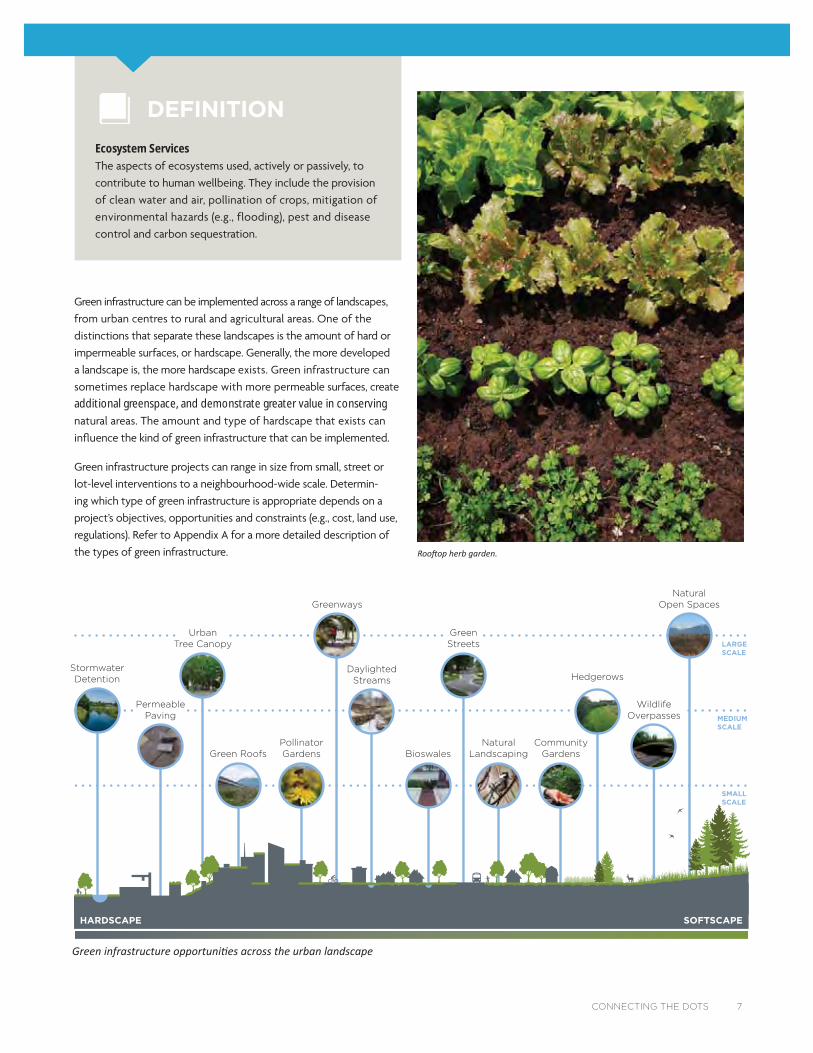
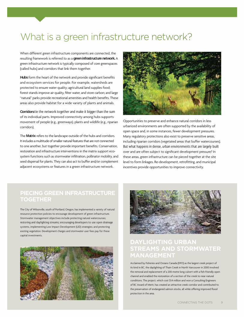
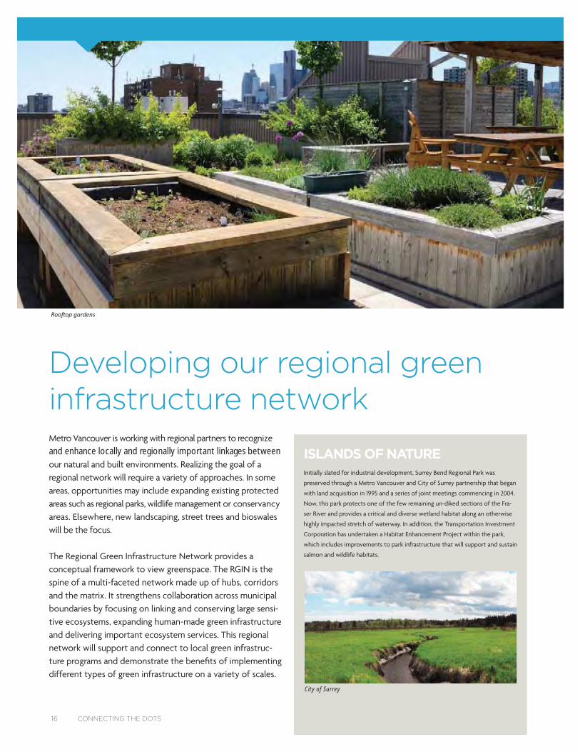
Lafarge Lake, Coquitlam.
Table of ContentsIntroduction: A regional green infrastructure network ...................................... 5
A primer on green infrastructure ...................................................................................6
What is green infrastructure? ....................................................................................... 6
What is a green infrastructure network? ................................................................ 9
How do we benefit from green infrastructure? ..................................................10
Can we afford to build a green infrastructure network? ................................ 12
Moving towards a regional green infrastructure network .................................14
Developing our regional green infrastructure network ......................................16
The regional green infrastructure network today .............................................. 17
Essential concepts of connectivity. ...........................................................................18
Exploring regional opportunities for green infrastructure .......................... 20
Green infrastructure on the ground: case studies ...............................................22
Appendix – Types of green infrastructure ........................................................... 44
CONNECTING THE DOTS 3
Content provided by:
DIAMOND HEAD CONSULTING LTD
ECOPLAN INTERNATIONAL
CALYPSO DESIGN
Acknowledgements
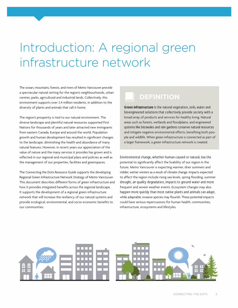
Introduction: A regional greeninfrastructure network
CONNECTING THE DOTS 5
Environmental change, whether human-caused or natural, has the
drought, air quality degradation, impacts to ground water and more
happen more quickly than most native plants and animals can adapt,
DEFINITIONGreen infrastructure is the natural vegetation, soils, water and bioengineered solutions that collectively provide society with a
systems like bioswales and rain gardens conserve natural resources

A primer on green infrastructure
What is green infrasstructure? urban
MULTI-FUNCTIONAL.
ADAPTIVE.
can be
SUSTAINABLE. broad-based community sustainability goals,
including social well-being, community
health, and ecological and environmental
6 CONNECTING THE DOTS
GREEN INFRASTRUCTURE
NaturalGrasslands
Riparian areasForests
FieldsWetlands
Human-madeStreet treesRain gardensGreen roofsPorous pavementBioswales
Clean water, clean air,wildlife habitat and higher quality of life
INTERCONNECTEDNATURAL SYSTEMS AND
ECOLOGICAL PROCESSES
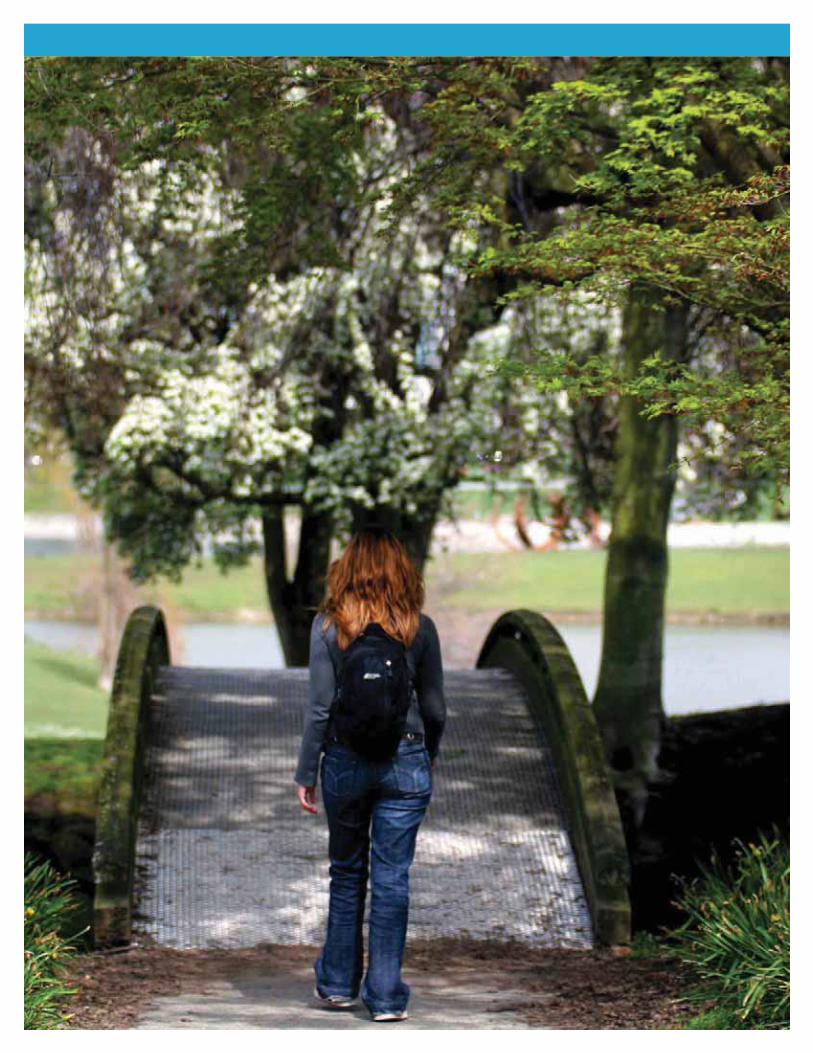
Naturalized path at UniverCity at Simon Fraser University, Burnaby, BC.
SMALL SCALE
MEDIUM SCALE
LARGE SCALE
Greenways
PermeablePaving
BioswalesGreen RoofsPollinatorGardens
StormwaterDetention
GreenStreets
UrbanTree Canopy
NaturalLandscaping
DaylightedStreams
CommunityGardens
Hedgerows
WildlifeOverpasses
NaturalOpen Spaces
HARDSCAPE SOFTSCAPE
additional greenspace, and demonstrate greater value in conserving
Ecosystem Services
CONNECTING THE DOTS 7
DEFINITION

SMALL SCALE
REGIONALGREEN INFRASTRUCTURENETWORK
MEDIUM SCALE
LARGE SCALE
Agriculturalhedgerow
Large forested park
Riparian setback
Greenways
Permeablepaving
Smallurban park
Detentionpond
Backyardgardens
Communitygardens
Bioswale
Green roofs
Green street
8 CONNECTING THE DOTS
DAYLIGHTING URBAN STREAMS AND STORMWATER MANAGEMENT
What is a green infrrastructuree networkk?
green infrastructure network.
Hubs
Corridors tie the network together and make it bigger than the sum
Matrix
-
But what happens in dense, urban environments that are largely built
PIECING GREEN INFRASTRUCTURE TOGETHER
CONNECTING THE DOTS 9
restoring and daylighting streams; encouraging developers to use open drainage
How do we benefi t from greeen infrastrructure?
$
SOCIAL
ECON
OM
IC
EN
VIR
O
NMENTAL
10 CONNECTING THE DOTS
THE ECONOMIC VALUE OF NATURE
QUALITY OF LIFE.
HUMAN HEALTH.
abroad clearly demonstrates that physical, social and psychological
RECREATION.
FOOD PRODUCTION.
ENVIRONMENTAL EDUCATION. Urban greenspace creates more
FINANCIAL.
requirements and reduce long-term maintenance and replacement
STORMWATER MANAGEMENT.
pipes and tanks resulting in reduced capital and maintenance
ENERGY EFFICIENCY.
AIR QUALITY.
WATER QUALITY. and allow water to be absorbed into the ground, recharging
HAZARD REDUCTION.
BIODIVERSITY.
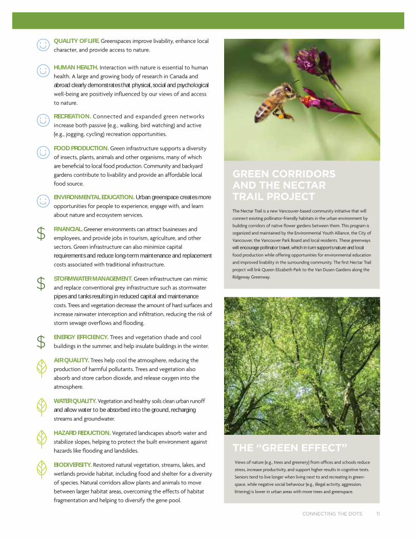
will encourage pollinator travel, which in turn supports nature and local
THE “GREEN EFFECT”
-
GREEN CORRIDORS AND THE NECTAR TRAIL PROJECT
CONNECTING THE DOTS 11
Can we afford to buuild a Greeen Infrastrructure Networkk?
DIRECT COST SAVINGS:
INDIRECT COST SAVINGS:
installation costs can be higher than conventional paving, these costs are recouped over time through savings in maintenance and stormwater
MULTIPLE BENEFITS:
12 CONNECTING THE DOTS
$410
$2,579
$21,049
$11,671
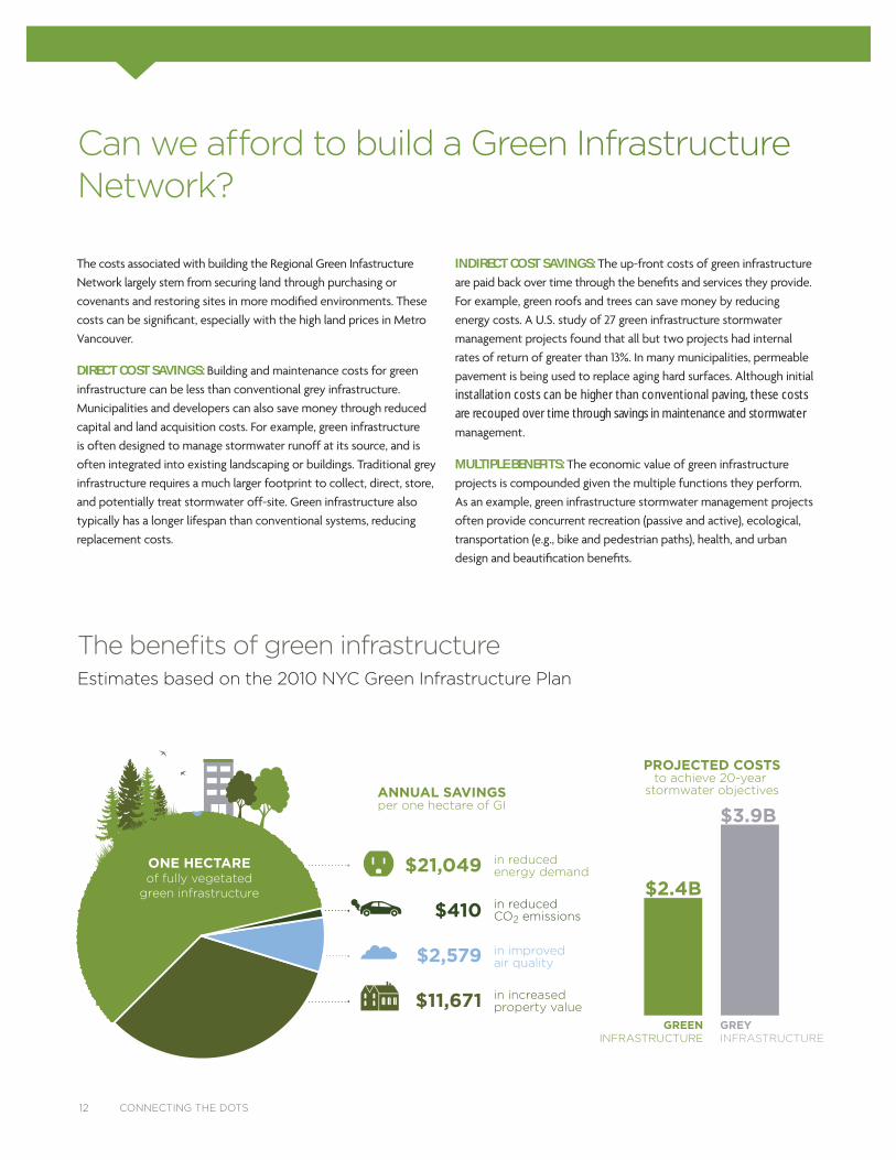
in reducedenergy demand
in reducedCO2 emissions
in improvedair quality
in increasedproperty value
THE BENEFIT OF GREEN INFRASTRUCTUREestimates based on the 2010 NYC Green Infrastructure Plan
ONE HECTAREof fully vegetated
green infrastructure
GREENINFRASTRUCTURE
ANNUAL SAVINGSper one hectare of GI
PROJECTED COSTSto achieve 20-year
stormwater objectives
GREYINFRASTRUCTURE
$2.4B
$3.9B
The benefits of green infrastructureEstimates based on the 2010 NYC Green Infrastructure Plan
CONNECTING THE DOTS 13
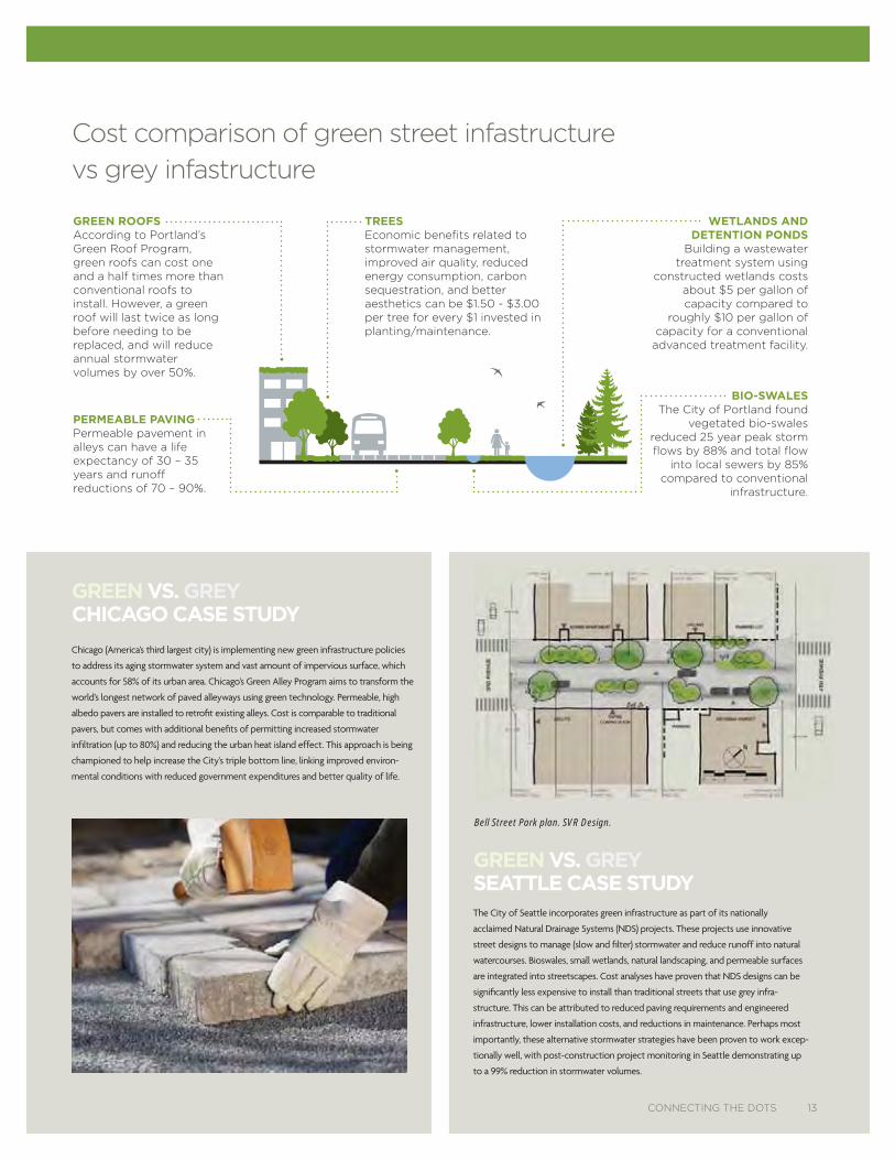
GREEN VS. GREYSEATTLE CASE STUDY
GREEN ROOFS According to Portland’s Green Roof Program, green roofs can cost one and a half times more than conventional roofs to install. However, a green roof will last twice as long before needing to be replaced, and will reduce annual stormwater volumes by over 50%.
BIO-SWALESThe City of Portland found
vegetated bio-swales reduced 25 year peak storm flows by 88% and total flow
into local sewers by 85% compared to conventional
infrastructure.
PERMEABLE PAVINGPermeable pavement in alleys can have a life expectancy of 30 – 35 years and runoff reductions of 70 – 90%.
WETLANDS ANDDETENTION PONDS
Building a wastewater treatment system using
constructed wetlands costs about $5 per gallon of capacity compared to
roughly $10 per gallon of capacity for a conventional
advanced treatment facility.
TREES Economic benefits related to stormwater management, improved air quality, reduced energy consumption, carbon sequestration, and better aesthetics can be $1.50 - $3.00 per tree for every $1 invested in planting/maintenance.
GREEN VS. GREYCHICAGO CASE STUDY
Bell Street Park plan. SVR Design.
Cost comparison of green street infastructure vs grey infastructure
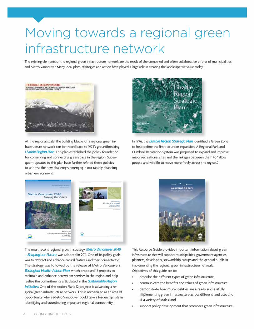
Moving towards a regional green infrastructure network
Metro Vancouver 2040 – Shaping our Future
Ecological Health Action Planmaintain and enhance ecosystem services in the region and help
Sustainable Region Initiative
Livable Region Plan
to address the new challenges emerging in our rapidly changing
Livable Region Strategic Plan
Adopted by theGreater Vancouver Regional District Board
on July 29, 2011Updated to July 26, 2013
www.metrovancouver.org
SUSTAINABLE REGION INITIATIVE... TURNING IDEAS INTO ACTION
Metro Vancouver 2040 Shaping Our Future
Regional Growth StrategyBylaw No.1136, 2010
Ecological HealthAction Plan
Metro Vancouver’s
www.metrovancouver.org
OCTOBER 2011
SUSTAINABLE REGION INITIATIVE... TURNING IDEAS INTO ACTION
planners, developers, stewardship groups and the general public in
impleat a
CONNECTING THE DOTSREGIONAL GREEN INFRASTRUCTURE
NETWORK RESOURCE GUIDE
14 CONNECTING THE DOTS
Developing our regional green infrastructure networkand enhance locally and regionally important linkages between
-
-
-
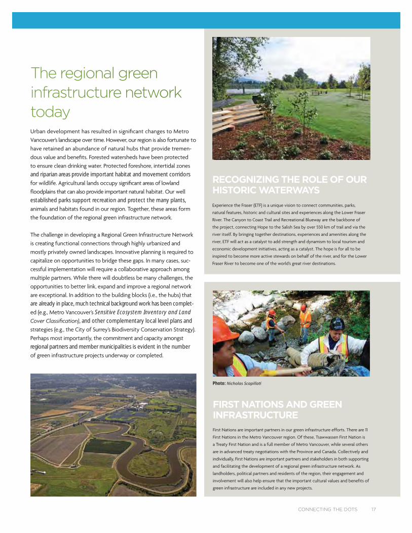
ISLANDS OF NATURE
16 CONNECTING THE DOTS
City of Surrey
The regionnal grreen infraastructture nnetwoork todaay
-
and riparian areas provide important habitat and movement corridors
established parks support recreation and protect the many plants,
-
are already in place, much technical background work has been complet-Sensitive Ecosystem Inventory and Land
, and other complementary local level plans and
regional partners and member municipalities is evident in the number
RECOGNIZING THE ROLE OF OUR HISTORIC WATERWAYS
CONNECTING THE DOTS 17
FIRST NATIONS AND GREEN INFRASTRUCTURE
Photo:
Essentiaal concepts of connecctivity
-
network will not be immediate and will involve a phased
-gically when opportunities arise and avoids unintended
approach involving local and regional politicians, planners,
-
-
-
--
-
municipal, regional and provincial parks, protected
play the primary role in determining where and when
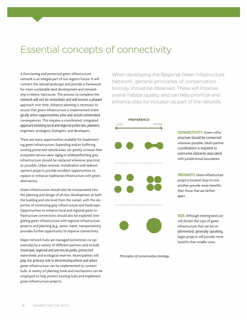
PREFERENCELESS MORE
SIZE.
-
plemented, generally speaking,
18 CONNECTING THE DOTS
When developing the Regional Green Infastructure Network, general principles of conservation biology should be observed. These will improve overall habitat quality, and can help prioritize and enhance sites for inclusion as part of the network.
CONNECTIVITY. -
structure should be connected
coordination is required to
overcome obstacles associated
PROXIMITY.
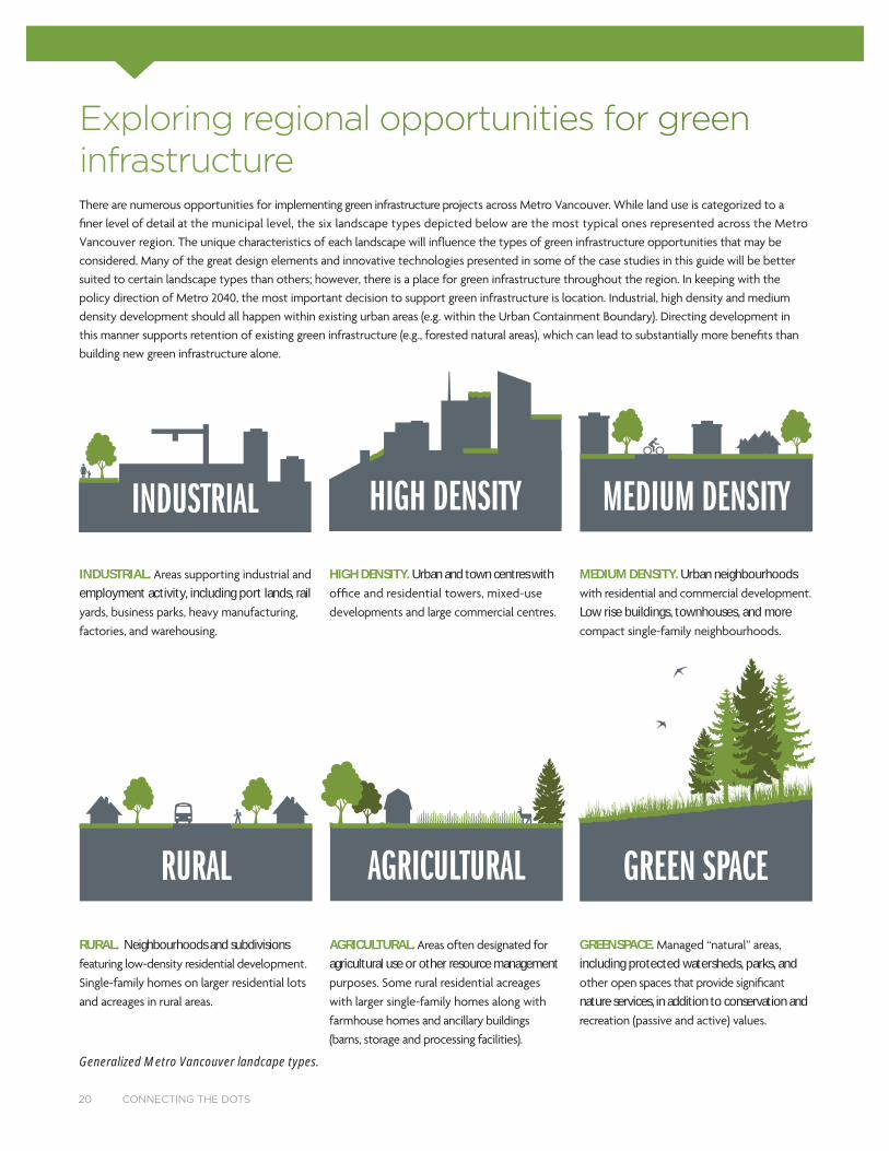
Explorinng regional opportunities for ggreen infrastruucture
INDUSTRIAL
Generalized Metro Vancouver landcape types.
RURAL. Neighbourhoods and subdivisions AGRICULTURAL.agricultural use or other resource management
GREENSPACE. including protected watersheds, parks, and
nature services, in addition to conservation and
20 CONNECTING THE DOTS
HIGH DENSITY MEDIUM DENSITY
INDUSTRIAL. employment activity, including port lands, rail
HIGH DENSITY. Urban and town centres with MEDIUM DENSITY. Urban neighbourhoods
Low rise buildings, townhouses, and more
RURAL AGRICULTURAL GREEN SPACE

INDUSTRIAL MEDIUM DENSITY RURAL AGRICULTURAL GREEN SPACEHIGH DENSITY
GREEN INFRASTRUCTURE OPPORTUNITY
Hubs
Small natural/open areas
Riparian corridors
Urban tree canopy
Greenways
Detention/Infiltration ponds
Bioswales
Rain gardens
Permeable pavement
Community gardens
Green roofs/walls
Natural landscaping
Container gardens
Green streets
Daylighted streams
Hedgerows
Pollinator-friendly gardens
more opportunities less opportunities
CONNECTING THE DOTS 21
LANDSCAPE TYPE
GREEN INFRASTRUCTURE ON THE GROUND
• PROJECT DESCRIPTION
• PROJECT PLANNING AND IMPLEMENTATION
• PROJECT OUTCOMES AND LESSONS LEARNED
• ENABLING FISCAL AND POLICY TOOLS
The following case studies highlight successful regional green infrastructure projects implemented in each of the six landscape categories. Each case study provides the following information:
22 CONNECTING THE DOTS
CONNECTING THE DOTS 23

CREEKWAY PARK STREAM RESTORATIONPROJECT LOCATIONNorth of Hastings Park (McGill Street), Vancouver, BC
PROJECT DESCRIPTIONCreekway Park is one of the City of Vancouver’s newest parks.
Located just north of busy McGill Street and next to the CN Rail
corridor, it begins to build ecological and human connections be-
tween Hastings Park (PNE) and New Brighton Park on Burrard Inlet.
The park is an initial phase of a project that will eventually restore an
historical stream that once flowed through Hastings Park to Burrard
Inlet. This park also improves east-west bikeway and pedestrian
connections through east Vancouver.
PLANNING AND IMPLEMENTATIONCreekway Park was developed in an abandoned parking lot as
part of the Hastings Park revitalization program. The project was
designed by an interdisciplinary team that included landscape archi-
tects, water resources engineers, geotechnical engineers, biologists,
and transportation planners. It also went through an extensive
public engagement process including open houses and meetings
with the Hastings Park Open Space Advisory Group.
The water system consists of a series of vegetated wetlands
connected with a cobble-lined channel. Stormwater from the im-
mediate area is recirculated using a pump-based system. At a later
stage, stormwater from the larger Hastings Park catchment will
be redirected to ensure the stream and wetlands have year-round
flow. Diverse herbaceous, wetland, and shrub communities provide
the foundation for increasing biodiversity over time. Eventually,
stormwater filtration through the constructed stream will help
restore fish habitat in a tidal salt marsh in New Brighton Park.
Creekway Park is a novel ecosystem that emulates some of the
forms and functions of native ecosystems, while blending them with
urban landscape components. While the plant communities are
generally native, they also include blue irises and other flowering
plants that are not native to coastal BC. These were included to
increase diversity and create bolder colours and textures to enhance
the park experience. Many of the native plant species such as coastal
strawberry, thimbleberry, and spiraea are important for native bees
and other pollinators.
PROJECT OUTCOMES AND LESSONS LEARNEDCreekway Park was built in a narrow linear parcel at the intersection
of a broad range of municipal infrastructure: roads, rail lines, storm
drains, regional sanitary sewers, gas lines, and power lines. The
design needed to respond to these infrastructure constraints by
building above the existing ground plane to avoid sub-surface
disturbance. This precluded the creation of deeper wetlands and
streams enclosed in a shallow ravine. Trees could only be planted
along the park’s perimeter.
Setting clear targets for habitat restoration projects ensures that ex-
pectations are met. Some members of the public felt that fish habitat
should be an important component of Creekway Park. However,
given the highly urbanized catchment, channel gradient issues, and
small stream size, salmon and trout habitat was not considered an ap-
propriate restoration target. Instead, the design promoted the goal of
restoring a dynamic ecosystem that will benefit many urban species.
ENABLING FISCAL AND POLICY TOOLS• Greenest City Action Plan (Access to Nature target)
• Hastings Park/PNE Master Plan
24 CONNECTING THE DOTS
INDUSTRIAL
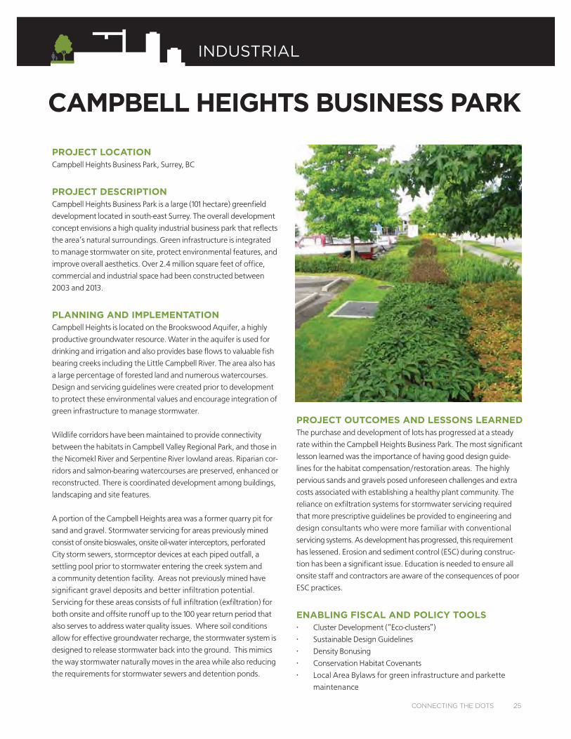
PROJECT LOCATIONCampbell Heights Business Park, Surrey, BC
PROJECT DESCRIPTIONCampbell Heights Business Park is a large (101 hectare) greenfield
development located in south-east Surrey. The overall development
concept envisions a high quality industrial business park that reflects
the area’s natural surroundings. Green infrastructure is integrated
to manage stormwater on site, protect environmental features, and
improve overall aesthetics. Over 2.4 million square feet of office,
commercial and industrial space had been constructed between
2003 and 2013.
PLANNING AND IMPLEMENTATIONCampbell Heights is located on the Brookswood Aquifer, a highly
productive groundwater resource. Water in the aquifer is used for
drinking and irrigation and also provides base flows to valuable fish
bearing creeks including the Little Campbell River. The area also has
a large percentage of forested land and numerous watercourses.
Design and servicing guidelines were created prior to development
to protect these environmental values and encourage integration of
green infrastructure to manage stormwater.
Wildlife corridors have been maintained to provide connectivity
between the habitats in Campbell Valley Regional Park, and those in
the Nicomekl River and Serpentine River lowland areas. Riparian cor-
ridors and salmon-bearing watercourses are preserved, enhanced or
reconstructed. There is coordinated development among buildings,
landscaping and site features.
A portion of the Campbell Heights area was a former quarry pit for
sand and gravel. Stormwater servicing for areas previously mined
consist of onsite bioswales, onsite oil-water interceptors, perforated
City storm sewers, stormceptor devices at each piped outfall, a
settling pool prior to stormwater entering the creek system and
a community detention facility. Areas not previously mined have
significant gravel deposits and better infiltration potential.
Servicing for these areas consists of full infiltration (exfiltration) for
both onsite and offsite runoff up to the 100 year return period that
also serves to address water quality issues. Where soil conditions
allow for effective groundwater recharge, the stormwater system is
designed to release stormwater back into the ground. This mimics
the way stormwater naturally moves in the area while also reducing
the requirements for stormwater sewers and detention ponds.
PROJECT OUTCOMES AND LESSONS LEARNEDThe purchase and development of lots has progressed at a steady
rate within the Campbell Heights Business Park. The most significant
lesson learned was the importance of having good design guide-
lines for the habitat compensation/restoration areas. The highly
pervious sands and gravels posed unforeseen challenges and extra
costs associated with establishing a healthy plant community. The
reliance on exfiltration systems for stormwater servicing required
that more prescriptive guidelines be provided to engineering and
design consultants who were more familiar with conventional
servicing systems. As development has progressed, this requirement
has lessened. Erosion and sediment control (ESC) during construc-
tion has been a significant issue. Education is needed to ensure all
onsite staff and contractors are aware of the consequences of poor
ESC practices.
ENABLING FISCAL AND POLICY TOOLS• Cluster Development (“Eco-clusters”)
• Sustainable Design Guidelines
• Density Bonusing
• Conservation Habitat Covenants
• Local Area Bylaws for green infrastructure and parkette
maintenance
CAMPBELL HEIGHTS BUSINESS PARK
CONNECTING THE DOTS 25
INDUSTRIAL
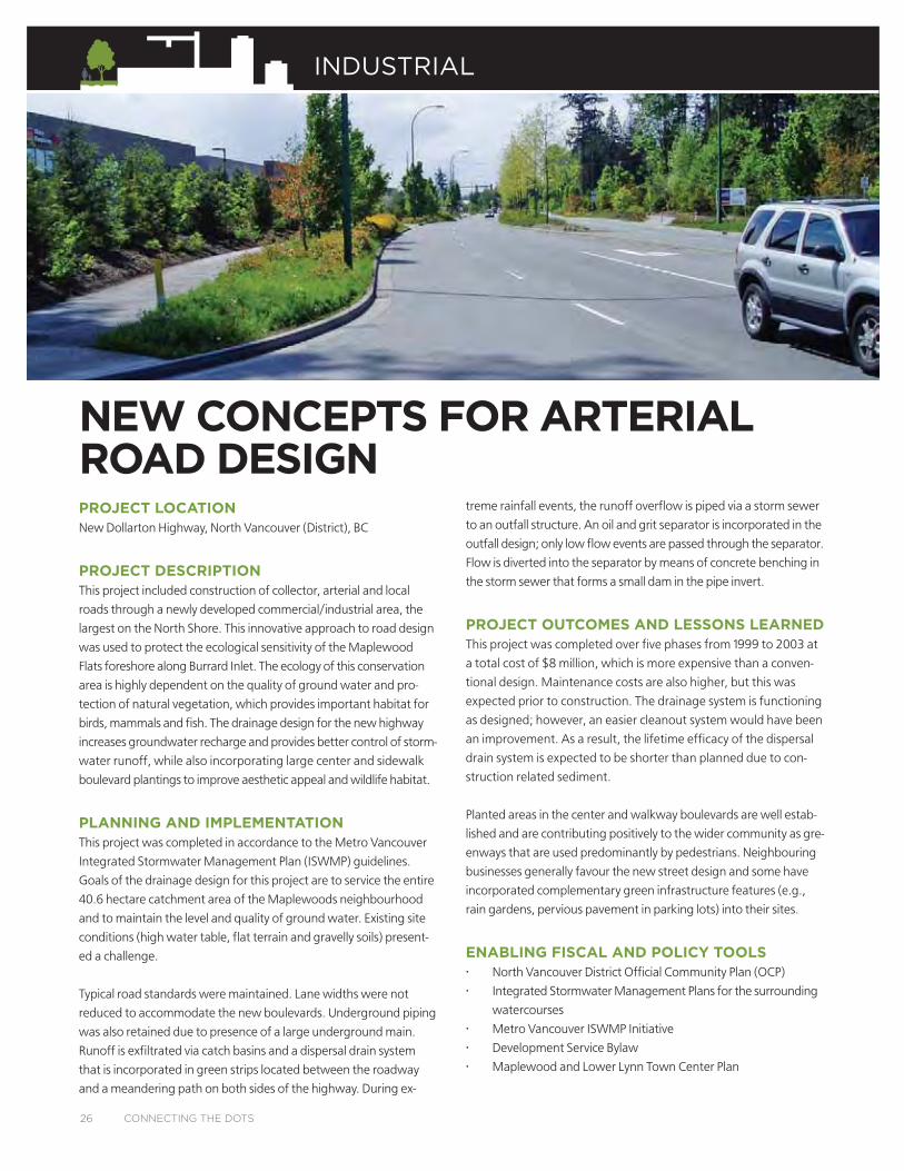
NEW CONCEPTS FOR ARTERIAL ROAD DESIGNPROJECT LOCATIONNew Dollarton Highway, North Vancouver (District), BC
PROJECT DESCRIPTIONThis project included construction of collector, arterial and local
roads through a newly developed commercial/industrial area, the
largest on the North Shore. This innovative approach to road design
was used to protect the ecological sensitivity of the Maplewood
Flats foreshore along Burrard Inlet. The ecology of this conservation
area is highly dependent on the quality of ground water and pro-
tection of natural vegetation, which provides important habitat for
birds, mammals and fish. The drainage design for the new highway
increases groundwater recharge and provides better control of storm-
water runoff, while also incorporating large center and sidewalk
boulevard plantings to improve aesthetic appeal and wildlife habitat.
PLANNING AND IMPLEMENTATIONThis project was completed in accordance to the Metro Vancouver
Integrated Stormwater Management Plan (ISWMP) guidelines.
Goals of the drainage design for this project are to service the entire
40.6 hectare catchment area of the Maplewoods neighbourhood
and to maintain the level and quality of ground water. Existing site
conditions (high water table, flat terrain and gravelly soils) present-
ed a challenge.
Typical road standards were maintained. Lane widths were not
reduced to accommodate the new boulevards. Underground piping
was also retained due to presence of a large underground main.
Runoff is exfiltrated via catch basins and a dispersal drain system
that is incorporated in green strips located between the roadway
and a meandering path on both sides of the highway. During ex-
treme rainfall events, the runoff overflow is piped via a storm sewer
to an outfall structure. An oil and grit separator is incorporated in the
outfall design; only low flow events are passed through the separator.
Flow is diverted into the separator by means of concrete benching in
the storm sewer that forms a small dam in the pipe invert.
PROJECT OUTCOMES AND LESSONS LEARNEDThis project was completed over five phases from 1999 to 2003 at
a total cost of $8 million, which is more expensive than a conven-
tional design. Maintenance costs are also higher, but this was
expected prior to construction. The drainage system is functioning
as designed; however, an easier cleanout system would have been
an improvement. As a result, the lifetime efficacy of the dispersal
drain system is expected to be shorter than planned due to con-
struction related sediment.
Planted areas in the center and walkway boulevards are well estab-
lished and are contributing positively to the wider community as gre-
enways that are used predominantly by pedestrians. Neighbouring
businesses generally favour the new street design and some have
incorporated complementary green infrastructure features (e.g.,
rain gardens, pervious pavement in parking lots) into their sites.
ENABLING FISCAL AND POLICY TOOLS• North Vancouver District Official Community Plan (OCP)
• Integrated Stormwater Management Plans for the surrounding
watercourses
• Metro Vancouver ISWMP Initiative
• Development Service Bylaw
• Maplewood and Lower Lynn Town Center Plan
26 CONNECTING THE DOTS
INDUSTRIAL
TOWN CENTRE GAMING FACILITYPROJECT LOCATIONLougheed Highway and 227
th
Street, Maple Ridge, BC
PROJECT DESCRIPTIONA former brownfield site in the heart of Maple Ridge was turned into
an innovative urban landscape supporting a mixed-use entertainment
and community gaming facility. This project set out to create a
new vibrant space in the Town Centre, with priorities to remediate
contaminated soils and incorporate green infrastructure into the
building and site design. Further work to enhance habitat and
restore ecosystems on the Gaming Centre site and the municipal
park conservation areas to the south add to the community and
ecological health benefits of the project.
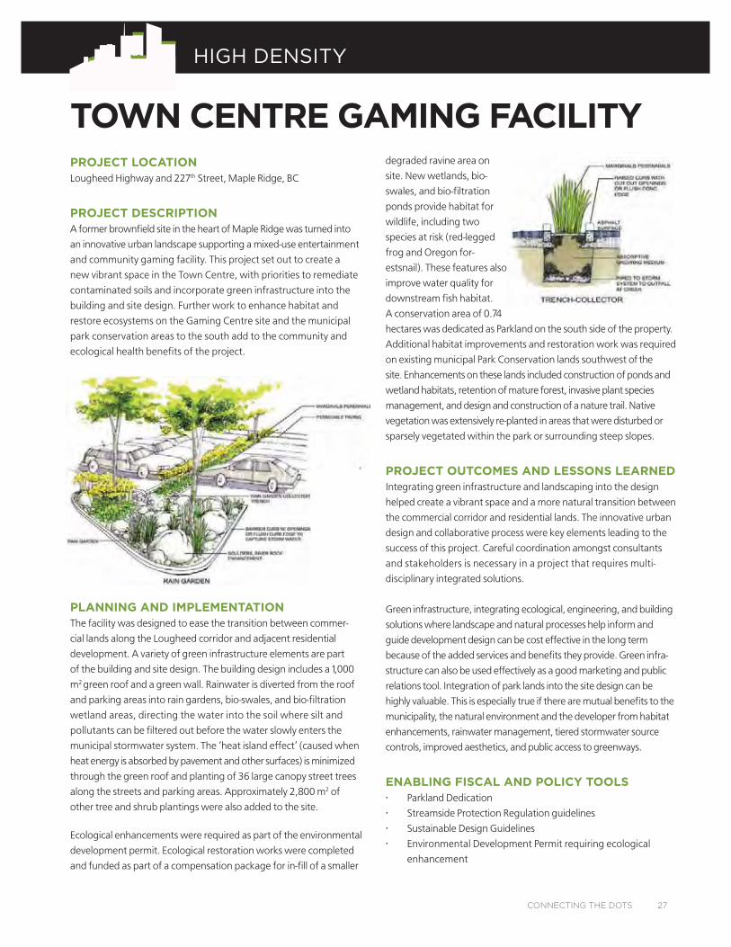
PLANNING AND IMPLEMENTATIONThe facility was designed to ease the transition between commer-
cial lands along the Lougheed corridor and adjacent residential
development. A variety of green infrastructure elements are part
of the building and site design. The building design includes a 1,000
m
2
green roof and a green wall. Rainwater is diverted from the roof
and parking areas into rain gardens, bio-swales, and bio-filtration
wetland areas, directing the water into the soil where silt and
pollutants can be filtered out before the water slowly enters the
municipal stormwater system. The ‘heat island effect’ (caused when
heat energy is absorbed by pavement and other surfaces) is minimized
through the green roof and planting of 36 large canopy street trees
along the streets and parking areas. Approximately 2,800 m
2
of
other tree and shrub plantings were also added to the site.
Ecological enhancements were required as part of the environmental
development permit. Ecological restoration works were completed
and funded as part of a compensation package for in-fill of a smaller
degraded ravine area on
site. New wetlands, bio-
swales, and bio-filtration
ponds provide habitat for
wildlife, including two
species at risk (red-legged
frog and Oregon for-
estsnail). These features also
improve water quality for
downstream fish habitat.
A conservation area of 0.74
hectares was dedicated as Parkland on the south side of the property.
Additional habitat improvements and restoration work was required
on existing municipal Park Conservation lands southwest of the
site. Enhancements on these lands included construction of ponds and
wetland habitats, retention of mature forest, invasive plant species
management, and design and construction of a nature trail. Native
vegetation was extensively re-planted in areas that were disturbed or
sparsely vegetated within the park or surrounding steep slopes.
PROJECT OUTCOMES AND LESSONS LEARNEDIntegrating green infrastructure and landscaping into the design
helped create a vibrant space and a more natural transition between
the commercial corridor and residential lands. The innovative urban
design and collaborative process were key elements leading to the
success of this project. Careful coordination amongst consultants
and stakeholders is necessary in a project that requires multi-
disciplinary integrated solutions.
Green infrastructure, integrating ecological, engineering, and building
solutions where landscape and natural processes help inform and
guide development design can be cost effective in the long term
because of the added services and benefits they provide. Green infra-
structure can also be used effectively as a good marketing and public
relations tool. Integration of park lands into the site design can be
highly valuable. This is especially true if there are mutual benefits to the
municipality, the natural environment and the developer from habitat
enhancements, rainwater management, tiered stormwater source
controls, improved aesthetics, and public access to greenways.
ENABLING FISCAL AND POLICY TOOLS• Parkland Dedication
• Streamside Protection Regulation guidelines
• Sustainable Design Guidelines
• Environmental Development Permit requiring ecological
enhancement
CONNECTING THE DOTS 27
HIGH DENSITY
PROJECT LOCATIONUniverCity, Simon Fraser University (SFU), Burnaby, BC
PROJECT DESCRIPTIONUniverCity is a mixed-use community located at the top of Burnaby
Mountain. When fully developed, the population is expected
to be 10,000 residents. It is envisioned as a ‘complete community’
integrating a variety of green infrastructure and natural ecosystems
and features into its design.
PLANNING AND IMPLEMENTATIONPlanning for UniverCity began in the early 1990s. Sustainability and
environmental protection were key principles included in the 1996
SFU Official Community Plan. In 1997, the SFU Community Trust was
created to plan and implement development in the community in
partnership with the City. This collaboration resulted in development
guidelines and requirements for green building performance,
stormwater management and natural landscaping.
The 2002 Stormwater Management Plan outlines specific
approaches for reducing runoff, protecting water quality of
downstream creeks, and enhancing watercourses on-site. Rain-
water percolates into the soils via permeable pavement, infiltration
galleries and bioswales, and is detained in underground cisterns,
before making its way into constructed streams, wetlands and
downstream watercourses. This design means that no standard
stormwater pipes are used within the community, with the excep-
tion of overflow facilities to safely convey extreme rain events. The
features are designed to be attractive, fit into the urban landscape,
and provide wildlife habitat. Each development site is required
to infiltrate and detain rainwater to specified standards, and to
monitor and report how the systems are functioning for at least two
years. Systems must be approved by SFU Community Trust and the
City through the development permit process. Covenants are reg-
istered over stormwater infrastructure on each property specifying
these requirements. Monitoring of hydrology and water quality is
overseen by an Adaptive Management Committee.
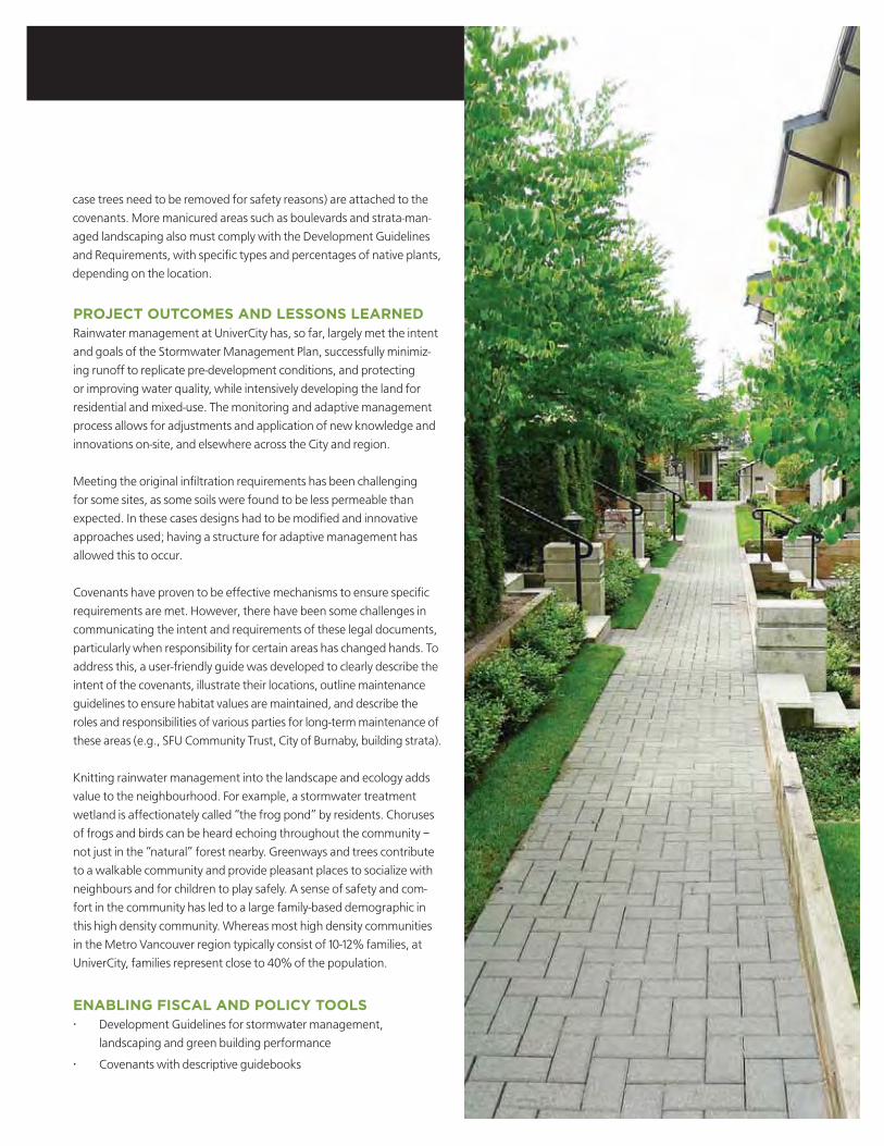
SFU Community Trust and the City of Burnaby also allowed for
nature to permeate throughout the community. By preserving
individual and groups of large trees and incorporating them into
pedestrian greenways, the site became a part of its surroundings,
instead of an urban enclave surrounded by forest. On private
property, significant trees identified for retention, greenways and
riparian corridors are protected by covenants held by SFU Commu-
nity Trust and/or the City of Burnaby. In some cases, guidelines for
tree management, view management, and replanting criteria (in
UNIVERCITY COMMUNITY
28 CONNECTING THE DOTS
HIGH DENSITY
PROJECT OUTCOMES AND LESSONS LEARNEDRainwater management at UniverCity has, so far, largely met the intent
and goals of the Stormwater Management Plan, successfully minimiz-
ing runoff to replicate pre-development conditions, and protecting
or improving water quality, while intensively developing the land for
residential and mixed-use. The monitoring and adaptive management
process allows for adjustments and application of new knowledge and
innovations on-site, and elsewhere across the City and region.
Meeting the original infiltration requirements has been challenging
for some sites, as some soils were found to be less permeable than
expected. In these cases designs had to be modified and innovative
approaches used; having a structure for adaptive management has
allowed this to occur.
Covenants have proven to be effective mechanisms to ensure specific
requirements are met. However, there have been some challenges in
communicating the intent and requirements of these legal documents,
particularly when responsibility for certain areas has changed hands. To
address this, a user-friendly guide was developed to clearly describe the
intent of the covenants, illustrate their locations, outline maintenance
guidelines to ensure habitat values are maintained, and describe the
roles and responsibilities of various parties for long-term maintenance of
these areas (e.g., SFU Community Trust, City of Burnaby, building strata).
Knitting rainwater management into the landscape and ecology adds
value to the neighbourhood. For example, a stormwater treatment
wetland is affectionately called “the frog pond” by residents. Choruses
of frogs and birds can be heard echoing throughout the community –
not just in the “natural” forest nearby. Greenways and trees contribute
to a walkable community and provide pleasant places to socialize with
neighbours and for children to play safely. A sense of safety and com-
fort in the community has led to a large family-based demographic in
this high density community. Whereas most high density communities
in the Metro Vancouver region typically consist of 10-12% families, at
UniverCity, families represent close to 40% of the population.
ENABLING FISCAL AND POLICY TOOLS• Development Guidelines for stormwater management,
landscaping and green building performance
• Covenants with descriptive guidebooks
case trees need to be removed for safety reasons) are attached to the
covenants. More manicured areas such as boulevards and strata-man-
aged landscaping also must comply with the Development Guidelines
and Requirements, with specific types and percentages of native plants,
depending on the location.

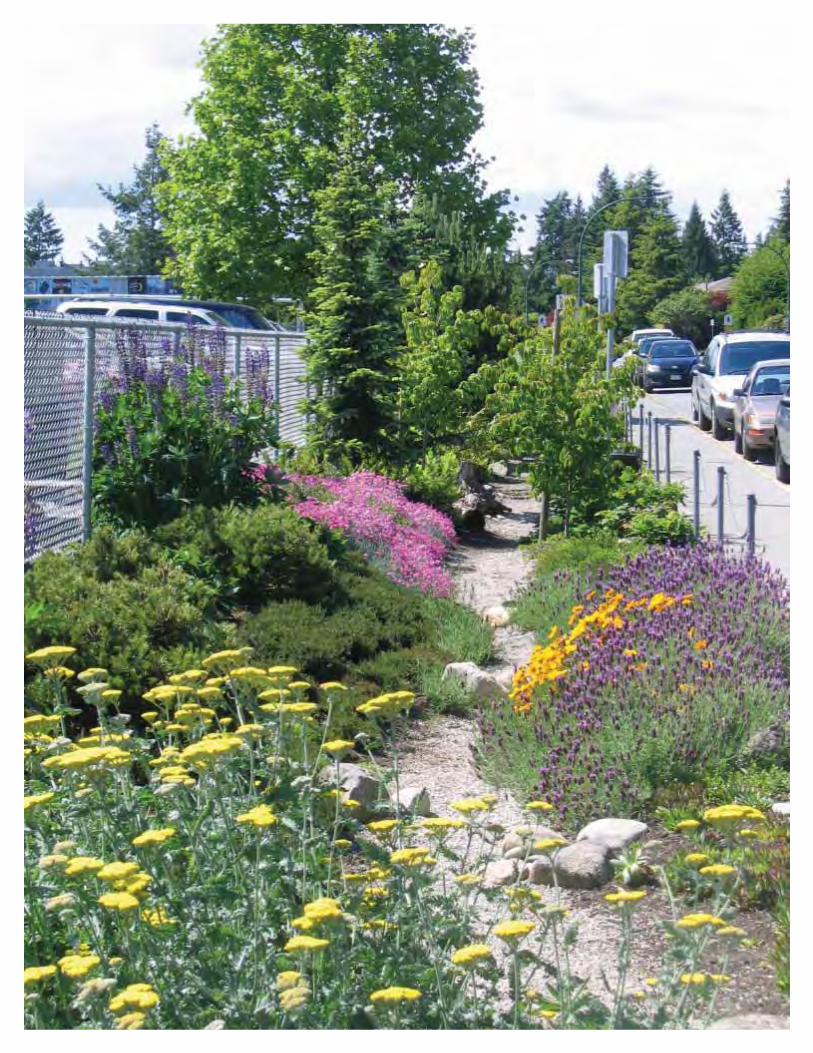
MEDIUM DENSITY
PROJECT LOCATIONLonsdale Avenue & 21
st
Street, North Vancouver (City), BC
PROJECT DESCRIPTIONThe City of North Vancouver renovated a busy section of Lonsdale
Avenue in North Vancouver, converting a 45m long section of
conventional roadway with a longstanding bus stop into an attractive
bus bulge and rain garden.
PLANNING AND IMPLEMENTATIONThis rain garden was installed as part of a public transportation and
park improvement project. The site fronts one of the City’s busiest
streets and is also located next to an urban pocket park. The rain
garden provides an added park feature and improves the natural aes-
thetic of the street. Civil works were contributed following negotiations
with a developer on an adjacent site.
City staff seized the opportunity to integrate multiple objectives and
increase functionality by managing stormwater on site. The rain
garden captures run off from a six lane arterial road and bus route, thus
becoming more than just a passive landscape element. A curb inlet at
the upper end of the bulge channels the water into a pipe underneath
the sidewalk, which then diverts the water into the rain garden. Water
flowing through the rain garden is also channeled into a pipe where the
seat walls and bus shelter are located. Soils, granular material and large
aggregate were placed in the bottom of the channel to ensure as much
water as possible was detained and encouraged to infiltrate into the
substrate. During storm events or when the soils are saturated, water
overflows into a grate at the southern end (bottom) of the rain garden.
Plants are a mix of regionally adaptive ornamental perennials and native
plants suited to rain gardens. Native soft rush (Juncus effusus) for
example, has a striking spikey growth habit and evergreen foliage, is
tolerant of full immersion in water and extensive drought periods, has
minimal to no maintenance requirements, and is tolerant of pollution
and siltation. Boulders and stones were included in the design, many of
which were salvaged from the site.
PROJECT OUTCOMES AND LESSONS LEARNEDThis project created a visually attractive and natural landscape feature that
works simultaneously as an important piece of civil infrastructure. The City
is still assessing the value of this investment to determine the change in
quality and quantity of water leaving the site. There are plans to replicate
this project elsewhere using civil works contributions adjacent to major
projects, in addition to integrating this style of roadway design into regular
updates to street infrastructure in areas of high stormater flow.
ENABLING FISCAL AND POLICY TOOLS• Sustainable design guidelines
• Official Community Plan (OCP) goals
• Urban wildlife habitat creation
• Civil works contribution
STREET BUS BULGE RAIN GARDEN
MEDIUM DENSITY
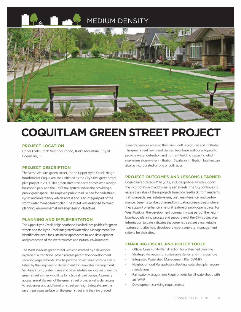
PROJECT LOCATIONUpper Hyde Creek Neighbourhood, Burke Mountain, City of
Coquitlam, BC
PROJECT DESCRIPTIONThe West Watkins green street, in the Upper Hyde Creek Neigh-
bourhood of Coquitlam, was initiated as the City’s first green street
pilot project in 2007. This green street connects homes with a neigh-
bourhood park and the City’s trail system, while also providing a
public greenspace. The unpaved public road is used for pedestrian,
cyclist and emergency vehicle access and is an integral part of the
stormwater management plan. The street was designed to meet
planning, environmental and engineering objectives.
PLANNING AND IMPLEMENTATIONThe Upper Hyde Creek Neighbourhood Plan includes policies for green
streets and the Hyde Creek Integrated Watershed Management Plan
identifies the need for sustainable approaches to land development
and protection of the watercourses and natural environment.
The West Watkins green street was constructed by a developer
in place of a traditional paved road as part of their development
servicing requirements. This helped the project meet criteria estab-
lished by the Engineering department for rainwater management.
Sanitary, storm, water mains and other utilities are located under the
green street as they would be for a typical road design. A primary
access lane at the rear of the green street provides vehicular access
to residences and additional on-street parking. Sidewalks are the
only impervious surface on the green street and they are graded
towards pervious areas so that rain runoff is captured and infiltrated.
The green street lawns and planted beds have additional topsoil to
provide water detention and nutrient holding capacity, which
maximizes stormwater infiltration. Swales or infiltration facilities can
also be incorporated on one or both sides.
PROJECT OUTCOMES AND LESSONS LEARNEDCoquitlam’s Strategic Plan (2012) includes policies which support
the incorporation of additional green streets. The City continues to
assess the value of these projects based on feedback from residents,
traffic impacts, real estate values, cost, maintenance, and perfor-
mance. Benefits can be optimized by situating green streets where
they support or enhance a natural feature or public open space. For
West Watkins, the development community was part of the neigh-
bourhood planning process and supportive of the City’s objectives.
Information to date indicates that green streets are a marketable
feature and also help developers meet rainwater management
criteria for their sites.
ENABLING FISCAL AND POLICY TOOLS• Official Community Plan direction for watershed planning
• Strategic Plan goals for sustainable design and infrastructure
• Integrated Watershed Management Plan (IWMP)
• Neighbourhood Plan policies reflecting watershed plan recom-
mendations
• Rainwater Management Requirements for all watersheds with
an IWMP
• Development servicing requirements
COQUITLAM GREEN STREET PROJECT
CONNECTING THE DOTS 31
RURAL
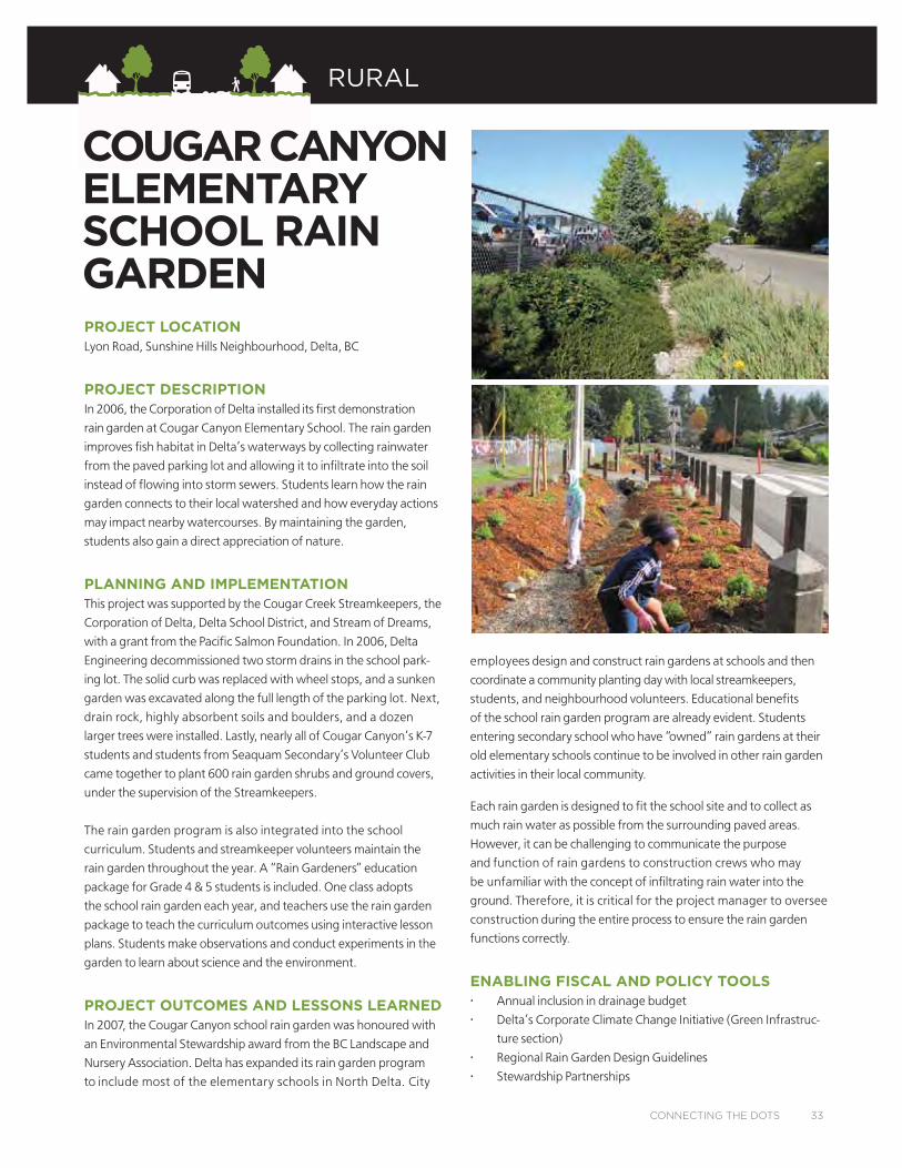
PROJECT LOCATIONLyon Road, Sunshine Hills Neighbourhood, Delta, BC
PROJECT DESCRIPTIONIn 2006, the Corporation of Delta installed its first demonstration
rain garden at Cougar Canyon Elementary School. The rain garden
improves fish habitat in Delta’s waterways by collecting rainwater
from the paved parking lot and allowing it to infiltrate into the soil
instead of flowing into storm sewers. Students learn how the rain
garden connects to their local watershed and how everyday actions
may impact nearby watercourses. By maintaining the garden,
students also gain a direct appreciation of nature.
PLANNING AND IMPLEMENTATIONThis project was supported by the Cougar Creek Streamkeepers, the
Corporation of Delta, Delta School District, and Stream of Dreams,
with a grant from the Pacific Salmon Foundation. In 2006, Delta
Engineering decommissioned two storm drains in the school park-
ing lot. The solid curb was replaced with wheel stops, and a sunken
garden was excavated along the full length of the parking lot. Next,
drain rock, highly absorbent soils and boulders, and a dozen
larger trees were installed. Lastly, nearly all of Cougar Canyon’s K-7
students and students from Seaquam Secondary’s Volunteer Club
came together to plant 600 rain garden shrubs and ground covers,
under the supervision of the Streamkeepers.
The rain garden program is also integrated into the school
curriculum. Students and streamkeeper volunteers maintain the
rain garden throughout the year. A “Rain Gardeners” education
package for Grade 4 & 5 students is included. One class adopts
the school rain garden each year, and teachers use the rain garden
package to teach the curriculum outcomes using interactive lesson
plans. Students make observations and conduct experiments in the
garden to learn about science and the environment.
PROJECT OUTCOMES AND LESSONS LEARNEDIn 2007, the Cougar Canyon school rain garden was honoured with
an Environmental Stewardship award from the BC Landscape and
Nursery Association. Delta has expanded its rain garden program
to include most of the elementary schools in North Delta. City
employees design and construct rain gardens at schools and then
coordinate a community planting day with local streamkeepers,
students, and neighbourhood volunteers. Educational benefits
of the school rain garden program are already evident. Students
entering secondary school who have “owned” rain gardens at their
old elementary schools continue to be involved in other rain garden
activities in their local community.
Each rain garden is designed to fit the school site and to collect as
much rain water as possible from the surrounding paved areas.
However, it can be challenging to communicate the purpose
and function of rain gardens to construction crews who may
be unfamiliar with the concept of infiltrating rain water into the
ground. Therefore, it is critical for the project manager to oversee
construction during the entire process to ensure the rain garden
functions correctly.
ENABLING FISCAL AND POLICY TOOLS• Annual inclusion in drainage budget
• Delta’s Corporate Climate Change Initiative (Green Infrastruc-
ture section)
• Regional Rain Garden Design Guidelines
• Stewardship Partnerships
COUGAR CANYONELEMENTARY SCHOOL RAIN GARDEN
CONNECTING THE DOTS 33
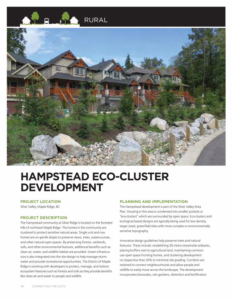
HAMPSTEAD ECO-CLUSTER DEVELOPMENTPROJECT LOCATIONSilver Valley, Maple Ridge, BC
PROJECT DESCRIPTIONThe Hampstead community at Silver Ridge is located on the forested
hills of northeast Maple Ridge. The homes in the community are
clustered to protect sensitive natural areas. Single unit and row
homes are on gentle slopes to preserve views, trees, watercourses,
and other natural open spaces. By preserving forests, wetlands,
soils, and other environmental features, additional benefits such as
clean air, water, and wildlife habitat are provided. Green infrastruc-
ture is also integrated into the site design to help manage storm-
water and provide recreational opportunities. The District of Maple
Ridge is working with developers to protect, manage, and restore
ecosystem features such as forests and soils as they provide benefits
like clean air and water to people and wildlife.
PLANNING AND IMPLEMENTATIONThe Hampstead development is part of the Silver Valley Area
Plan. Housing in this area is condensed into smaller pockets or
“eco-clusters” which are surrounded by open space. Eco-clusters and
ecological based designs are typically being used for low density,
larger sized, greenfield sites with more complex or environmentally
sensitive topography.
Innovative design guidelines help preserve trees and natural
features. These include: establishing 30 metre streamside setbacks,
placing buffers next to agricultural land, maintaining common
use open space fronting homes, and clustering development
on slopes less than 20% to minimize site grading. Corridors are
retained to connect neighbourhoods and allow people and
wildlife to easily move across the landscape. The development
incorporates bioswales, rain gardens, detention and biofiltration
34 CONNECTING THE DOTS
RURAL

ponds, and permeable pavement to help manage stormwater from roads
and other hard surfaces. On-lot underground detention pits are also
used to retain water that is shed from roofs, which is then redirected to
surrounding natural areas or ponds.
Density bonusing is used as an incentive to preserve additional open
space. The municipality also accommodates density requirements and
affordability concerns in complex topographic environments, on condi-
tion that appropriate sustainable design and mitigation measures are
used by developers. Conservation habitat
covenants are sometimes used rather
than full scale dedication of environ-
mentally sensitive lands for park conser-
vation. This permits a larger parcel size
for development yield. In exchange, the
developer sets aside or provides addition-
al conservation protection in the form of
habitat covenants for significant natural
areas and/or features on site that are not
regulated to ensure an overall net ben-
efit to the natural environment. Some
yearly maintenance costs for parkettes
and green infrastructure are passed on
to the property owners through a Local
Area Bylaw.
PROJECT OUTCOMES AND LESSONS LEARNED
Silver Ridge has won numerous national,
provincial, and regional awards. By
preserving greenspace and using green
infrastructure, livability has increased,
but so have some of the costs. Increased
costs are associated with design,
servicing infrastructure, risk mitigation,
and restoration. For example, appropriate building and landscape
materials are required to reduce wildfire risk. Secondary emergency
access corridors are also needed. In Silver Valley, these double as service
corridors and multi-use trails between Eco-clusters. Although there were
increased up-front costs, many of these initial investments are expected
to offset longer term costs that would otherwise be transferred to
neighbouring properties, public taxpayers and to the District. The District
now requires developers to evaluate how and where they plan on using
ecological design principles and sustainable design practices to improve
livability and protect the natural environment.
ENABLING FISCAL AND POLICY TOOLS
• Cluster Development
(“Eco-clusters”)
• Streamside Protection Regulation guidelines
• Sustainable Design guidelines
• Density Bonusing
• Conservation Habitat Covenants
• Local Area Bylaws for green
infrastructure and parkette
maintenance
CONNECTING THE DOTS 35

AGRICULTURE
PROJECT LOCATIONDelta, BC
PROJECT DESCRIPTIONA West Delta farm had a field that was struggling with reduced
yields due to salinity issues. The farmer was looking for ways to
increase productivity and transition it to organic production. These
challenges and desired objectives made the farm a perfect
candidate for the Delta Farmland and Wildlife Trust (DF&WT)
Grassland Set-aside Program. Farm fields in Delta and Richmond
often integrate fallow grassland into their regular crop rotation. This
“rest” period provides an opportunity for soil fertility to be improved
by introducing tall grass that later becomes green manure. Additional
benefits to farmers and the environment can be achieved by
strategically planting and managing these spaces.
PLANNING AND IMPLEMENTATIONThrough the Grassland Set-aside Program, the farmer of this 5.7
ha site planted a specific mix of grasses in the field, including
orchardgrass, tall fescue, timothy and double cut red clover. Grasses
were left to mature for four years. This Grassland Set-aside helped
improve soil fertility by increasing soil porosity and allowing rain
water to percolate into newly installed tile drains and flush salt from
the field. The Set-aside also increased soil organic matter content,
which is important to maintain long-term productivity. Other
benefits of maintaining grass during the fallow period include
reducing soil erosion from wind and rain, suppressing weeds by
increasing competition for light, soil, and water, and breaking pest
cycles. The tall grass habitat also supports an array of grassland
raptors, songbirds, small mammals, and native pollinators, some of
which are listed as Species at Risk in Canada.
The Grassland Set-aside Program was developed using DF&WT’s
“Partners in Stewardship” Model. The model explores challenges
to farming and wildlife habitat requirements through scientific
research. The results of studies (by DF&WT, often in partnership
with post-secondary institutions) are presented to local farmers.
If supported by the agricultural community, the Trust raises funds
through grants and long-term partnerships to initiate a Stewardship
Program. All Stewardship Programs operate as cost-shares. Farmers
are compensated for providing ecosystem services, and reimbursed
for a portion of their cost. Ongoing monitoring, evaluation and
research are used to refine management practices, improve habitat
elements and address farm challenges.
GRASSLAND SET-ASIDE, WEST DELTA FARM
Photo: David Bradbeer
36 CONNECTING THE DOTS
Photos: (top) Hank Tseng, (middle)
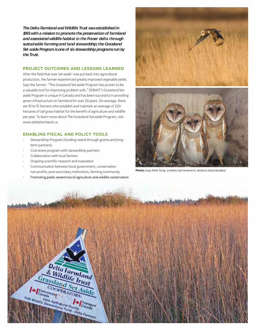
PROJECT OUTCOMES AND LESSONS LEARNEDAfter the fi eld that was ‘set-aside’ was put back into agricultural
production, the farmer experienced greatly improved vegetable yields.
Says the farmer: “The Grassland Set-aside Program has proven to be
a valuable tool for improving problem soils.” DF&WT’s Grassland Set-
aside Program is unique in Canada and has been successful in providing
green infrastructure on farmland for over 20 years. On average, there
are 10 to 15 farmers who establish and maintain an average of 220
hectares of tall grass habitat for the benefi t of agriculture and wildlife
per year. To learn more about The Grassland Set-aside Program, visit
www.deltafarmland.ca.
ENABLING FISCAL AND POLICY TOOLS• Stewardship Program (funding raised through grants and long-
term partners)
• Cost-share program with stewardship partners
• Collaboration with local farmers
• Ongoing scientifi c research and evaluation
• Communication between local government, conservation
non-profi ts, post-secondary institutions, farming community
• Promoting public awareness of agriculture and wildlife conservation
The Delta Farmland and Wildlife Trust was established in 1993 with a mission to promote the preservation of farmland and associated wildlife habitat in the Fraser delta through sustainable farming and land stewardship; the Grassland Set-aside Program is one of six stewardship programs run by the Trust.

PROJECT LOCATIONSouth Surrey, Surrey, BC
PROJECT DESCRIPTIONThe Semiahmoo Trail is a historic wagon road built in 1873-74. It
originally crossed Surrey, extending from the Fraser River to the US
border. Today, the only remaining sections of this Trail are between
the Nicomekl River and 20th Avenue. These remnants form part of
a popular linear park that is subject to heritage designation. Design
Guidelines for the Semiahmoo Trail were established to ensure
coordinated development of the public trail, and to provide guide-
lines for development abutting the Trail to protect the heritage
value and character of this important public amenity.
PLANNING AND IMPLEMENTATIONThe Semiahmoo Trail Design Guidelines are implemented and/
or financed by private development abutting the Trail. Design
Guidelines for new single-family dwellings and development
permits for multi-family developments along the Semiahmoo Trail
require preservation of the unique natural and heritage character of
the Trail. This includes a review of building heights and topographical
considerations to ensure minimal building massing impact along the
Trail. Additionally, direct vehicular access to the Semiahmoo Trail is
not permitted to new developments fronting the Trail. Existing drive-
ways must be removed and alternative access provided as part of the
review and approval of development proposals, subdivision applica-
tions and building permit applications along the Semiahmoo Trail.
Developers of properties abutting the Trail are required to dedicate
additional lands to complete the Trail as necessary. Registration of
a restrictive covenant is required to establish a 10 metre landscape
buffer on private property fronting the Trail and to prohibit con-
struction within the buffer. The landscaping plan for the buffer is es-
tablished either on the building scheme for single-family residential
lots, or as part of the development permit for multi-family projects.
The Guidelines require that landscape buffer plantings emphasize
native plants and flowering and fruiting shrub species that provide
wildlife habitat and aesthetic appeal. New landscaping is required
to complement existing Trail conditions. Prior to obtaining a building
permit, applicants are required to complete landscaping and con-
struction of split-rail fencing within the Trail’s landscape buffer area.
The Friends of the Semiahmoo Trail, a local community advocacy
group, act as stewards of the Semiahmoo Trail and regularly
organize work parties to remove invasive species and plant eco-
logically appropriate species.
PROJECT OUTCOMES AND LESSONS LEARNEDThe Semiahmoo Trail Design Guidelines have been in place since
2004. Project outcomes include a minimum 20 metre wide park cor-
ridor, a 40 metre wide corridor for habitat & biodiversity, pedestrian
connectivity, stormwater management, and preservation of a signif-
icant natural and cultural heritage site in a relatively urban area.
Implementation of the Semiahmoo Trail Design Guidelines is a
good example of collaboration between the City, the development
community, and a local advocacy group. It is also a good example of
what can be achieved with a plan that has a specific vision and the
tools to make that vision a reality.
ENABLING FISCAL AND POLICY TOOLS• Restrictive covenant
• Building scheme approvals
• Development permits
• Design guidelines
SEMIAHMOO TRAIL
38 CONNECTING THE DOTS
GREENSPACE

PROJECT LOCATION12678 - 100 Avenue, Surrey, BC
PROJECT DESCRIPTIONRobson Ravine Park protects over 3.6 hectares of a uniquely
sensitive ecosystem. The largest portions of the park date back to
1956 when the upper ravine was protected through neighbourhood
subdivision. Decades later, portions of the lower ravine were
added through additional land dedication and purchase.
Robson Park represents the headwaters of Robson Creek. An older
park with limited recreational opportunities and natural habitat values,
Robson Park was in need of aesthetic and functional upgrades. The
project was initiated based on requirements in the Manson Master
Drainage Plan and commitments to Fisheries and Oceans Canada.
The park revitalization project was aimed at providing stormwater
management and ecosystem services, celebrating the positive
attributes of the park, and inviting the citizens back into the space.
Park enhancements included: re-establishing a natural watercourse
through the site, providing detention facilities for erosion and
water quality protection, the update and addition of recreation
amenities and improved public safety using crime prevention
through environmental design (CEPTED) techniques. Environmental
enhancement works included: stream daylighting, the creation
of in-line pond habitats, aeration of urban runoff, and restoration
of streamside habitats with phased natural successional planting
schemes. The project successfully merged the need for stormwater
management in an older neighbourhood with the need to revitalize
a dated park facility.
PLANNING AND IMPLEMENTATIONFunding was challenging due to increasing construction costs in
the province since 2002. With the City’s drainage priorities focused
on lowland flood mitigation, the project was delayed until 2009.
Final construction costs amounted to $3.35 million dollars. All
works were funded through the City’s Drainage Utility (Engineering
Department).
PROJECT OUTCOMES AND LESSONS LEARNEDRobson Park is a great example of Surrey’s commitment to
sustainability and infrastructure investments through the “Build
Surrey program”. The community played a key role in park design
and continues to be involved with participation by local organiza-
tions in planting, education and maintenance to help ensure the
newly constructed facilities will be respected and cared for.
ENABLING FISCAL AND POLICY TOOLS• Land dedication and purchase during subdivision
• Master Drainage Plan
• Engineering Department helped identify an integrated green
infrastructure approach as the preferred option.
ROBSON PARK REVITALIZATION
CONNECTING THE DOTS 39
GREENSPACE

PROJECT LOCATIONTerra Nova Rural Park, Richmond, BC
PROJECT DESCRIPTIONThe 63 acres of this park, together with the existing 35 acre
natural area to the south, play a significant role in the ecology of the
Metro Vancouver region as well as the Fraser River estuary eco-
system. It is part of the Pacific Flyway and a complex, interrelated
network of marine, intertidal, and terrestrial ecosystems. It is located
adjacent to the estuary and provides a combination of habitats
including: open fields, ditches, treed areas, a daylighted historic
slough, landscaped gardens and hedgerows. The land that has
been farmed for approximately 125 years and left fallow in more
recent years provides foraging and nesting sites for a large number
of shorebirds, songbirds, waterfowl and wading birds. Field grasses
that take up 70% of the land provide habitat for small mammals that
are a food source for the raptors in the area, including: eagles, blue
heron, hawks, and owls.
PLANNING AND IMPLEMENTATIONIn the 1970s, Richmond was undergoing a rapid change from rural
to suburban. The slow erosion of the farmland base inspired the com-
munity to respond in 1986 to the imminent residential rezoning of a
former farming area called Terra Nova.
In 1996, the Save Richmond Farmland Society was formed to preserve
this rural landscape. Tens of thousands of residents shared the vision
of protecting the land. In 1996, voters approved the City borrowing
$28.5 million to purchase 63 acres of land in Terra Nova for public use.
An overall Park Plan was developed in 2005 based on bio-physical and
cultural research studies and public input from three open houses.
The public support was the highest that the City had ever received for
a park plan with 98% of the people strongly supporting the planning
principles, the key features, and the park vision: “to preserve the
unique rural character while providing a balance between agricultural
heritage, wildlife conservation, and recreational uses.”.
Historic uses are being brought to life through community based ag-
ricultural programs run by non-profit groups. The site has become a
venue for teaching about the local and global issues of food security
and environmental stewardship.
The fallow farm fields which are rapidly disappearing in urban areas
are now managed to maintain a rich grass environment for raptors
and other birds. Through diligent historic research, lost environmen-
tal features such as a buried slough were discovered and recreated.
Adaptive re-uses have been implemented and others are being
considered for the five heritage buildings and former residential
buildings in the park. These uses include: two park caretaker units, a
Farm Centre office and meeting space for the four non-profit groups,
a ‘barn’ that is a community learning kitchen and meeting space; and
an 1892 former cannery store that is being restored to function as a
shop/coffee store selling food that is grown in the park.
The uniqueness of this park has inspired Kwantlen Polytechnic
University to create a diploma program, called the Richmond Farm
School which conducts many of its classes in Terra Nova.
PROJECT OUTCOMES AND LESSONS LEARNEDCommunity involvement, engagement and partnerships are the
cornerstones to the success of this park. The Richmond Fruit Tree
Project has been a partner in the park for several years and manages
a community based one hectare Sharing Farm. Together with the
Food Security Society and Kwantlen Polytechnic University, they offer
programs, food festivals and harvest vegetables for the Food Bank.
The Terra Nova Schoolyard Society started a gardening program in
2006 with one elementary class and, presently, 500 students are
actively involved in gardening and cooking. These community groups
create an environment that inspires a value for fresh food, healthy
eating habits and personal and social responsibility and ecological
stewardship that will last a lifetime.
ENABLING FISCAL AND POLICY TOOLS• Annual Parks Operations Budget
• Development Cost Charges (DCC) Capital Budget Program
• Additional funding for non-profit programming has been
obtained by on-site non-profits through the Health Authority
and VanCity
• Richmond Foundation Endowment Fund
TERRA NOVA RURAL PARK
40 CONNECTING THE DOTS
GREENSPACE
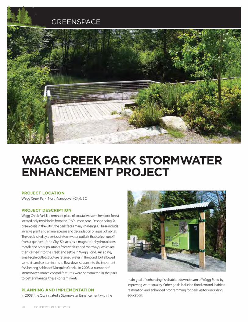
PROJECT LOCATIONWagg Creek Park, North Vancouver (City), BC
PROJECT DESCRIPTIONWagg Creek Park is a remnant piece of coastal western hemlock forest
located only two blocks from the City’s urban core. Despite being “a
green oasis in the City”, the park faces many challenges. These include:
invasive plant and animal species and degradation of aquatic habitat.
The creek is fed by a series of stormwater outfalls that collect runoff
from a quarter of the City. Silt acts as a magnet for hydrocarbons,
metals and other pollutants from vehicles and roadways, which are
then carried into the creek and settle in Wagg Pond. An aging,
small-scale outlet structure retained water in the pond, but allowed
some silt and contaminants to flow downstream into the important
fish-bearing habitat of Mosquito Creek. In 2008, a number of
stormwater source control features were constructed in the park
to better manage these contaminants.
PLANNING AND IMPLEMENTATIONIn 2008, the City initiated a Stormwater Enhancement with the
main goal of enhancing fish habitat downstream of Wagg Pond by
improving water quality. Other goals included flood control, habitat
restoration and enhanced programming for park visitors including
education.
WAGG CREEK PARK STORMWATER ENHANCEMENT PROJECT
42 CONNECTING THE DOTS
GREENSPACE
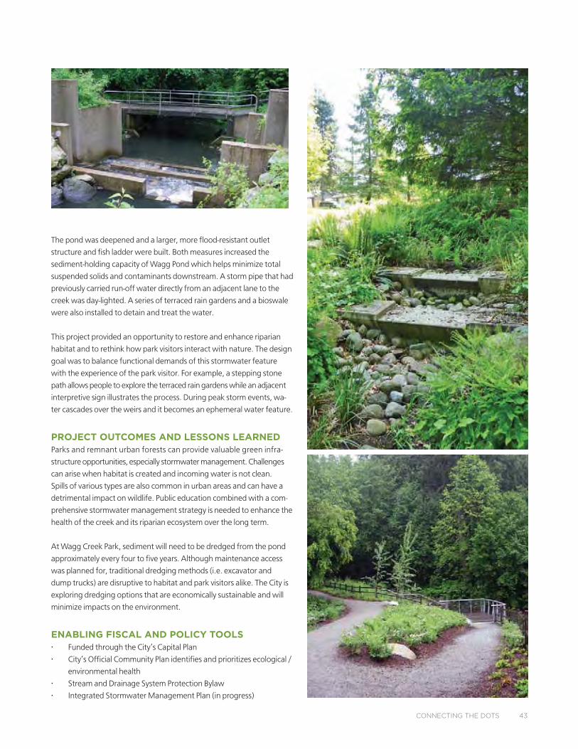
The pond was deepened and a larger, more flood-resistant outlet
structure and fish ladder were built. Both measures increased the
sediment-holding capacity of Wagg Pond which helps minimize total
suspended solids and contaminants downstream. A storm pipe that had
previously carried run-off water directly from an adjacent lane to the
creek was day-lighted. A series of terraced rain gardens and a bioswale
were also installed to detain and treat the water.
This project provided an opportunity to restore and enhance riparian
habitat and to rethink how park visitors interact with nature. The design
goal was to balance functional demands of this stormwater feature
with the experience of the park visitor. For example, a stepping stone
path allows people to explore the terraced rain gardens while an adjacent
interpretive sign illustrates the process. During peak storm events, wa-
ter cascades over the weirs and it becomes an ephemeral water feature.
PROJECT OUTCOMES AND LESSONS LEARNEDParks and remnant urban forests can provide valuable green infra-
structure opportunities, especially stormwater management. Challenges
can arise when habitat is created and incoming water is not clean.
Spills of various types are also common in urban areas and can have a
detrimental impact on wildlife. Public education combined with a com-
prehensive stormwater management strategy is needed to enhance the
health of the creek and its riparian ecosystem over the long term.
At Wagg Creek Park, sediment will need to be dredged from the pond
approximately every four to five years. Although maintenance access
was planned for, traditional dredging methods (i.e. excavator and
dump trucks) are disruptive to habitat and park visitors alike. The City is
exploring dredging options that are economically sustainable and will
minimize impacts on the environment.
ENABLING FISCAL AND POLICY TOOLS• Funded through the City’s Capital Plan
• City’s Official Community Plan identifies and prioritizes ecological /
environmental health
• Stream and Drainage System Protection Bylaw
• Integrated Stormwater Management Plan (in progress)
CONNECTING THE DOTS 43
GREENSPACE
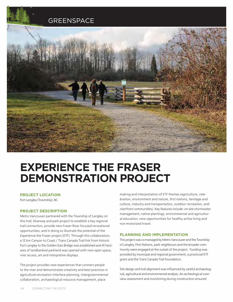
PROJECT LOCATIONFort Langley (Township), BC
PROJECT DESCRIPTIONMetro Vancouver partnered with the Township of Langley on
this trail, blueway and park project to establish a key regional
trail connection, provide new Fraser River focused recreational
opportunities, and in doing so illustrate the potential of the
Experience the Fraser project (ETF). Through this collaboration,
a 12 km Canyon to Coast / Trans Canada Trail link from historic
Fort Langley to the Golden Ears Bridge was established and 41 hect-
ares of landbanked parkland was opened with new open space,
river access, art and interpretive displays.
The project provides new experiences that connect people
to the river and demonstrates creativity and best practices in
agriculture-recreation interface planning, intergovernmental
collaboration, archaeological resource management, place
making and interpretation of ETF themes (agriculture, cele-
bration, environment and nature, first nations, heritage and
culture, industry and transportation, outdoor recreation, and
riverfront communities). Key features include: on-site stormwater
management, native plantings, environmental and agricultur-
al education, new opportunities for healthy active living and
non-motorized travel.
PLANNING AND IMPLEMENTATIONThis project was co-managed by Metro Vancouver and the Township
of Langley. First Nations, park neighbours and the broader com-
munity were engaged at the outset of the project. Funding was
provided by municipal and regional government, a provincial ETF
grant and the Trans Canada Trail Foundation.
Site design and trail alignment was influenced by careful archaeolog-
ical, agricultural and environmental analysis. An archeological over-
view assessment and monitoring during construction ensured
EXPERIENCE THE FRASER DEMONSTRATION PROJECT
44 CONNECTING THE DOTS

archeological resources were protected. The trail was routed to avoid
disturbing sensitive ecosystems and no large trees were removed
during construction. Trail runoff is managed on site, and new seasonal
wetland habitat areas and native species plantings were established.
The project team prepared an Agricultural Strategy to minimize the
project’s impact on parkland leased for farming and neighbouring
farm operations. This process involved engaging with neighbouring
farmers, lease holders and the Agricultural Land Commission. Trail
routing utilized existing farm roads and road right of ways and was
aligned to keep actively farmed land intact and maintain access for
farm equipment. Agricultural inspired art and interpretive features
were incorporated to educate trail users.
The trail route traverses varied landscapes and key points of interest.
Interpretive displays along the trail celebrate ETF themes and the
cultural landscape. Direct contact with the Fraser River is enhanced
with a new picnic area, open space, shade trees, access to the park
from the blueway and organized group camping facilities to support
multi-day paddling excursions on the Fraser River.
PROJECT OUTCOMES AND LESSONS LEARNEDThis project resulted in a major regional trail connection that provided
new opportunities to experience the Fraser River, to connect with
and learn about nature close to home, to experience an agricultural
and working farm landscape, and to promote healthy, active living.
This demonstration project illustrates creativity and best practice in
collaborative trail and open space planning and design, agriculture
– recreation interface planning and design, archaeological resource
management and community partnerships, as well as the potential
for great results arising from intergovernmental collaboration.
ENABLING FISCAL AND POLICY TOOLS• Provincial grant funding of the Experience the Fraser project
• Metro Vancouver capital funding of park and trail projects
• Township of Langley capital funding of park and trail projects
• Non-government organization grant programs
CONNECTING THE DOTS 45

BIOSWALES/RAIN GARDENS
DAYLIGHTED STREAMSUncovered streams that had previously been diverted into pipes and
GREEN ROOFS/WALLS
GREEN STREETS/GREEN ALLEYSral-
GREENWAYS
con
HEDGEROWS
TYPES OF GREEN INFRASTRUCTURE
GR
EE
N S
TR
EE
TS
GR
EE
N A
LLE
YS
BIO
SWA
LES
RA
IN G
AR
DE
NS
DA
YLI
GH
TED
STR
EA
MS
GR
EE
N R
OO
FS
GR
EE
N W
ALL
SH
ED
GE
RO
WS
GR
EE
NW
AY
SAPPENDIX A

NATURAL LANDSCAPINGhabitat,
PERMEABLE PAVEMENT
POLLINATOR-FRIENDLY GARDENS
STORMWATER DETENTION/INFILTRATION PONDS
URBAN TREE CANOPY
WILDLIFE UNDERPASSES/OVERPASSES
NA
TU
RA
LLA
ND
SC
AP
ING
WILD
LIFE U
ND
ER
PASSE
SW
ILDLIFE
OV
ER
PASSE
SP
ER
ME
AB
LEPA
VE
ME
NT
PO
LLINA
TOR
-FR
IEN
DLY
GA
RD
EN
SU
RB
AN
TR
EE
CA
NO
PY
STOR
MW
ATE
R D
ETE
NTIO
NIN
FILT
RA
TIO
N P
ON
DS
