contours - uc santa barbara geographykclarke/geography12/lecture15.pdf1 geography 12: maps and...
TRANSCRIPT

1
Geography 12: Maps and Spatial Reasoning
Lecture 15:Topographic Features on Maps
Professor Keith Clarke
Contours• Review: CI, index, rule-of-V’s, concave,
more=steeper• Can get absolute information: elevations,
gradients, etc.• Pattern of contours requires interpretation• Knowledge of landforms helps interpretation• Compressed class in physical geography and
geomorphology• Geomorphology has a sub-field of
geomorphometry• Often goal is to interpret process from form
A tension
• Erosion: breaking down and removal of surface materials– Processes can be fast or slow
• Deposition: erosional material is moved from one location to another and redeposited
• Forces are chemical, mechanical, gravity, water, wind, etc.
• Each creates distinctive landforms
Terrain skeleton

2
Some key terms• Peak• Pit• Ridge• Spur• Scarp/Scree• Drainage (Channel)• Inflection point• Saddle (Pass)• Basin/Watershed
Peak (and false summit)Landscape: Mountain, Glacial erosional (Glacial
Peak, Washington)
Yosemite Valley Pit: DolinaLandscape: Karst (Chemical erosion)
(Skocjanske Jame, Slovenia)

3
Depression/Sink-hole Limestone sink-hole (FL)
Saddle PointCalifornia Coastal Savanna
(Figueroa Mountain Road)
Saddle point

4
Watershed Hill and ridge
Drumlin and dune
Ridge and ridgeline Spur

5
Wadi Hatan, Western Desert, Egypt Landscape: Aeolian
Wind-formed landscapes: Erosion
Deposition:Loess Plateau-China & Iowa Drainage/Stream Channellandscape: Prairie (Clay Co. MN)

6
Stream features Draw/Gully/Spring
Stream order and landscape River features: Meanders
7
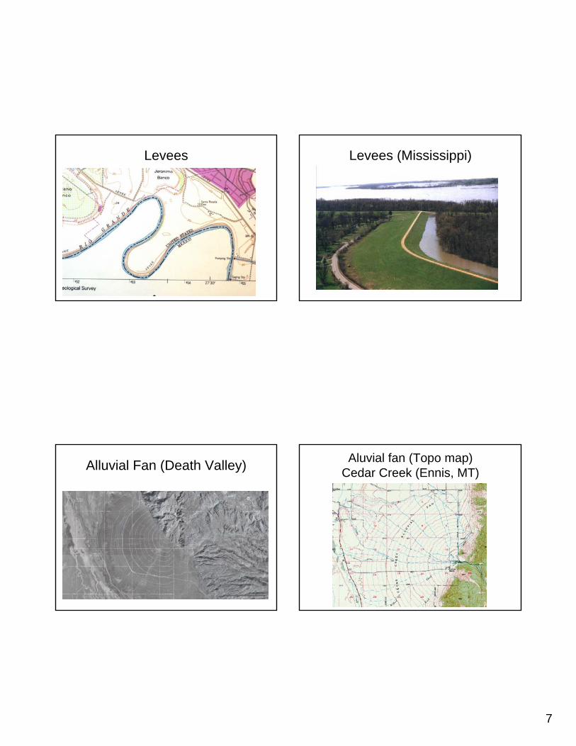
Levees Levees (Mississippi)
Alluvial Fan (Death Valley) Aluvial fan (Topo map) Cedar Creek (Ennis, MT)

8
What and where? What and where?
What landscape and where? What?

9
All together now! Summary
• Contours and other relief methods can show terrain structure
• Structure can be interpreted to see what natural and human features are present
• Skeleton features of the landscape• Different landscapes have different
features• Many clues for interpreting where and
what