copyright 2009 garna salida, colorado all rights … peaks byway brochure.pdf · the settling of...
TRANSCRIPT
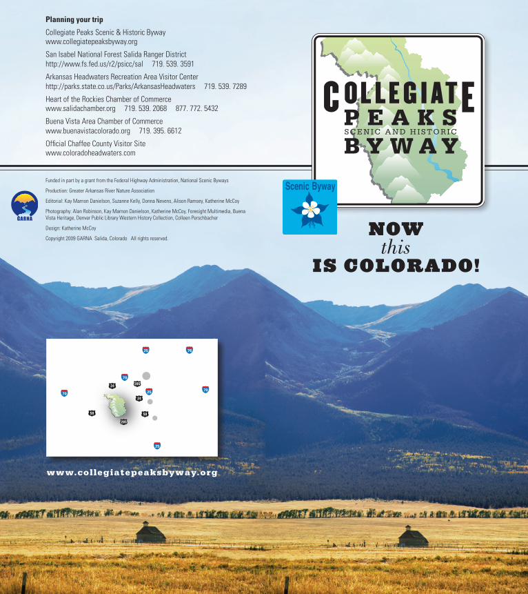
NOW this
IS COLORADO!
Planning your trip
Collegiate Peaks Scenic & Historic Bywaywww.collegiatepeaksbyway.org
San Isabel National Forest Salida Ranger Districthttp://www.fs.fed.us/r2/psicc/sal 719. 539. 3591
Arkansas Headwaters Recreation Area Visitor Centerhttp://parks.state.co.us/Parks/ArkansasHeadwaters 719. 539. 7289
Heart of the Rockies Chamber of Commercewww.salidachamber.org 719. 539. 2068 877. 772. 5432
Buena Vista Area Chamber of Commercewww.buenavistacolorado.org 719. 395. 6612
Official Chaffee County Visitor Sitewww.coloradoheadwaters.com
Funded in part by a grant from the Federal Highway Administration, National Scenic Byways
Production: Greater Arkansas River Nature Association
Editorial: Kay Marnon Danielson, Suzanne Kelly, Donna Nevens, Alison Ramsey, Katherine McCoy
Photography: Alan Robinson, Kay Marnon Danielson, Katherine McCoy, Foresight Multimedia, Buena Vista Heritage, Denver Public Library Western History Collection, Colleen Perschbacher
Design: Katherine McCoy
Copyright 2009 GARNA Salida, Colorado All rights reserved.
www.collegiatepeaksbyway.org
FPO
Scenic Byway
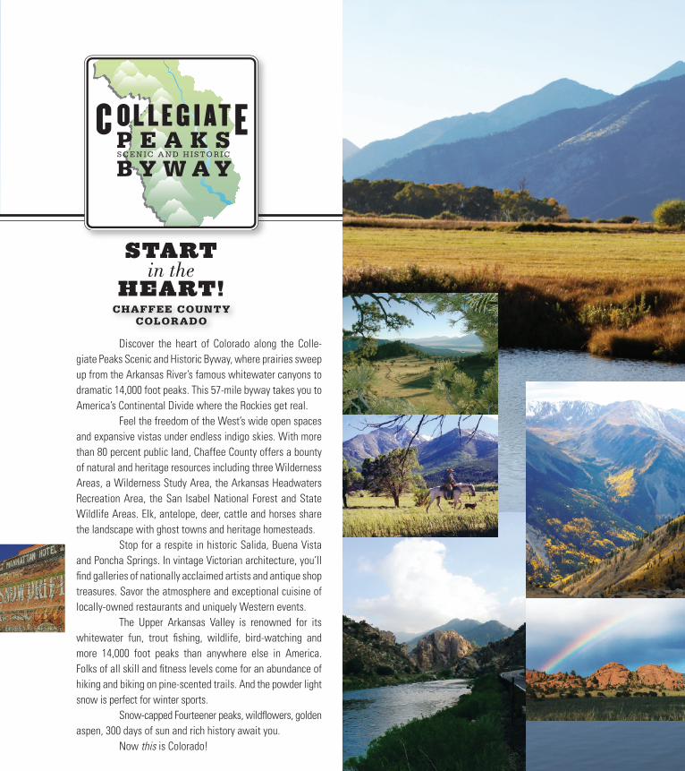
START
HEART!CHAFFEE COUNTY
COLORADO
Discover the heart of Colorado along the Colle-giate Peaks Scenic and Historic Byway, where prairies sweep up from the Arkansas River’s famous whitewater canyons to dramatic 14,000 foot peaks. This 57-mile byway takes you to America’s Continental Divide where the Rockies get real. Feel the freedom of the West’s wide open spaces and expansive vistas under endless indigo skies. With more than 80 percent public land, Chaffee County offers a bounty of natural and heritage resources including three Wilderness Areas, a Wilderness Study Area, the Arkansas Headwaters Recreation Area, the San Isabel National Forest and State Wildlife Areas. Elk, antelope, deer, cattle and horses share the landscape with ghost towns and heritage homesteads. Stop for a respite in historic Salida, Buena Vista and Poncha Springs. In vintage Victorian architecture, you’ll find galleries of nationally acclaimed artists and antique shop treasures. Savor the atmosphere and exceptional cuisine of locally-owned restaurants and uniquely Western events. The Upper Arkansas Valley is renowned for its whitewater fun, trout fishing, wildlife, bird-watching and more 14,000 foot peaks than anywhere else in America. Folks of all skill and fitness levels come for an abundance of hiking and biking on pine-scented trails. And the powder light snow is perfect for winter sports. Snow-capped Fourteener peaks, wildflowers, golden aspen, 300 days of sun and rich history await you. Now this is Colorado!
in the
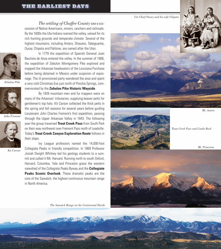
The settling of Chaffee County saw a suc-cession of Native Americans, miners, ranchers and railroads. By the 1600s the Ute Indians roamed the valley, valued for its rich hunting grounds and temperate climate. Several of the highest mountains, including Antero, Shavano, Tabeguache, Ouray, Chipeta and Pahlone, are named after the Utes. In 1779 the expedition of Spanish General Juan Bautista de Anza entered the valley. In the summer of 1806, the expedition of Zebulon Montgomery Pike explored and mapped the Arkansas headwaters of the Louisiana Purchase before being detained in Mexico under suspicion of espio-nage. The ill-provisioned party wandered the area and spent a very cold Christmas Eve just north of Poncha Springs, com-memorated by the Zebulon Pike Historic Wayside. By 1826 mountain men and fur trappers were on many of the Arkansas’ tributaries, supplying beaver pelts for gentlemen’s top hats. Kit Carson collected the thick pelts in the spring and fall seasons for several years before guiding Lieutenant John Charles Fremont’s first expedition, passing through the Upper Arkansas Valley in 1843. The following year the group traversed Trout Creek Pass from South Park on their way northwest over Fremont Pass north of Leadville. Today’s Trout Creek Canyon Exploration Route follows in their steps. Ivy League professors named the 14,000-foot Collegiate Peaks in friendly competition. In 1869 Professor Josiah Dwight Whitney led his geology students to a sum-mit and called it Mt. Harvard. Running north to south Oxford, Harvard, Columbia, Yale and Princeton grace the western viewshed of the Collegiate Peaks Byway and the Collegiate Peaks Scenic Overlook. These dramatic peaks are the core of the Sawatch, the highest continuous mountain range in North America.
Ute Chief Ouray and his wife Chipeta
Zebulon Pike
Kit Carson
John Fremont
Mt. Antero
Trout Creek Pass and Castle Rock
Mt. Princeton
THE EARLIEST DAYS
The Sawatch Range on the Continental Divide
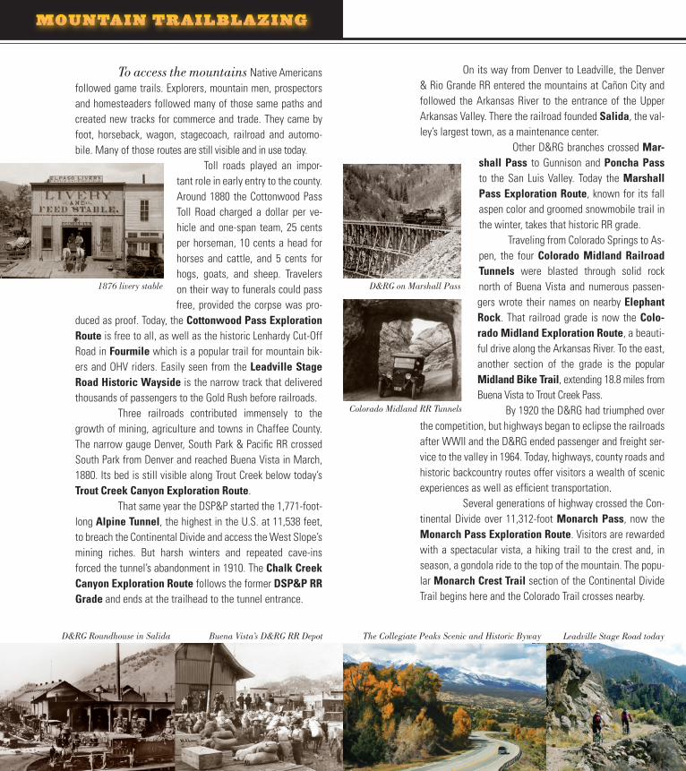
To access the mountains Native Americans followed game trails. Explorers, mountain men, prospectors and homesteaders followed many of those same paths and created new tracks for commerce and trade. They came by foot, horseback, wagon, stagecoach, railroad and automo-bile. Many of those routes are still visible and in use today.
Toll roads played an impor-tant role in early entry to the county. Around 1880 the Cottonwood Pass Toll Road charged a dollar per ve-hicle and one-span team, 25 cents per horseman, 10 cents a head for horses and cattle, and 5 cents for hogs, goats, and sheep. Travelers on their way to funerals could pass free, provided the corpse was pro-
duced as proof. Today, the Cottonwood Pass Exploration Route is free to all, as well as the historic Lenhardy Cut-Off Road in Fourmile which is a popular trail for mountain bik-ers and OHV riders. Easily seen from the Leadville Stage Road Historic Wayside is the narrow track that delivered thousands of passengers to the Gold Rush before railroads. Three railroads contributed immensely to the growth of mining, agriculture and towns in Chaffee County. The narrow gauge Denver, South Park & Pacific RR crossed South Park from Denver and reached Buena Vista in March, 1880. Its bed is still visible along Trout Creek below today’s Trout Creek Canyon Exploration Route. That same year the DSP&P started the 1,771-foot- long Alpine Tunnel, the highest in the U.S. at 11,538 feet, to breach the Continental Divide and access the West Slope’s mining riches. But harsh winters and repeated cave-ins forced the tunnel’s abandonment in 1910. The Chalk Creek Canyon Exploration Route follows the former DSP&P RR Grade and ends at the trailhead to the tunnel entrance.
On its way from Denver to Leadville, the Denver & Rio Grande RR entered the mountains at Cañon City and followed the Arkansas River to the entrance of the Upper Arkansas Valley. There the railroad founded Salida, the val-ley’s largest town, as a maintenance center. Other D&RG branches crossed Mar-
shall Pass to Gunnison and Poncha Pass to the San Luis Valley. Today the Marshall Pass Exploration Route, known for its fall aspen color and groomed snowmobile trail in the winter, takes that historic RR grade. Traveling from Colorado Springs to As-pen, the four Colorado Midland Railroad Tunnels were blasted through solid rock north of Buena Vista and numerous passen-gers wrote their names on nearby Elephant Rock. That railroad grade is now the Colo-rado Midland Exploration Route, a beauti-ful drive along the Arkansas River. To the east, another section of the grade is the popular Midland Bike Trail, extending 18.8 miles from Buena Vista to Trout Creek Pass. By 1920 the D&RG had triumphed over
the competition, but highways began to eclipse the railroads after WWII and the D&RG ended passenger and freight ser-vice to the valley in 1964. Today, highways, county roads and historic backcountry routes offer visitors a wealth of scenic experiences as well as efficient transportation. Several generations of highway crossed the Con-tinental Divide over 11,312-foot Monarch Pass, now the Monarch Pass Exploration Route. Visitors are rewarded with a spectacular vista, a hiking trail to the crest and, in season, a gondola ride to the top of the mountain. The popu-lar Monarch Crest Trail section of the Continental Divide Trail begins here and the Colorado Trail crosses nearby.
MOUNTAIN TRAILBLAZING
D&RG Roundhouse in Salida Buena Vista’s D&RG RR Depot Leadville Stage Road today
1876 livery stable
Colorado Midland RR Tunnels
D&RG on Marshall Pass
The Collegiate Peaks Scenic and Historic Byway
A NATURAL PARADISE
Over a billion years ago this region be-gan a long sequence of immense uplifts interspersed by sea sedimentation, volcanic action, and water and wind erosion. In more recent geologic time, huge glaciers chiseled the Up-per Arkansas Valley’s monumental Collegiate Peaks. Other geologic formations include the Buffalo Peaks’ massive volcanic humpback and the water-carved forms of Browns
Canyon that cut through the Arkansas Hills. The Rio Grande Rift, a fault running from Leadville to El Paso, Texas, runs down the valley’s center.
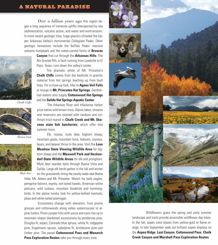
The dramatic white of Mt. Princeton’s Chalk Cliffs comes from the kaolinite in granitic material from hot springs leaching up from fault lines. For a close-up look, hike to Agnes Veil Falls or lounge in Mt. Princeton Hot Springs. Geother-mal waters also supply Cottonwood Hot Springs and the Salida Hot Springs Aquatic Center.
The Arkansas River and tributaries harbor prize native wild brown trout. Alpine lakes, streams and reservoirs are stocked with rainbow and cut-throat trout reared in Chalk Creek and Mt. Sha-vano state fish hatcheries, which offer free summer tours.
Elk, moose, mule deer, bighorn sheep, mountain goats, mountain lions, bobcats, coyotes, bears, and beaver thrive in the area. Visit the Love Meadow State Viewing Wildlife Area for big-horn sheep and the Maxwell Park and Hecken-dorf State Wildlife Areas for elk and pronghorn. Mule deer wander daily through Buena Vista and Salida. Large elk herds gather in the fall and winter on the grasslands lining the county roads near Buena
Vista, Mt. Antero and Mt. Princeton. Watch for bald eagles, peregrine falcons, osprey, red-tailed hawks, American white pelicans, wild turkeys, mountain bluebirds and humming-birds. In the alpine tundra look for yellow-bellied marmots, pikas and white-tailed ptarmigan. Ecosystems change with elevation, from prairie grasses and cottonwoods along valley watercourses to al-pine tundra. Pinon-juniper hills with yucca and cacti rise up to mountain slopes blanketed successively by ponderosa pine, Douglas fir, aspen, Colorado blue spruce, white fir, lodgepole pine, Engelmann spruce, subalpine fir, bristlecone pine and limber pine. The paved Cottonwood Pass and Monarch Pass Exploration Routes take you through every zone.
Wildflowers grace the spring and early summer landscape and trails provide accessible wildflower day hikes. In the fall, aspen color blazes from yellow-gold to flame or-ange. In late September seek out brilliant aspen displays on the Aspen Ridge, Lost Canyon, Cottonwood Pass, Chalk Creek Canyon and Marshall Pass Exploration Routes.
Chalk Cliffs
Brown trout
Mule deer
Ohio-Colorado smokestack
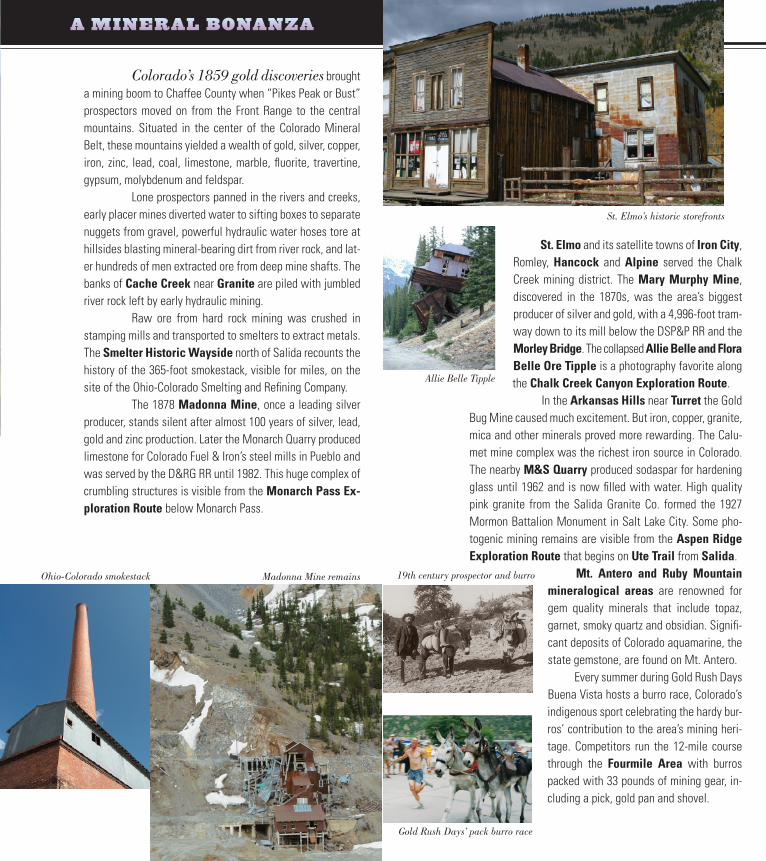
St. Elmo and its satellite towns of Iron City, Romley, Hancock and Alpine served the Chalk Creek mining district. The Mary Murphy Mine, discovered in the 1870s, was the area’s biggest producer of silver and gold, with a 4,996-foot tram-way down to its mill below the DSP&P RR and the Morley Bridge. The collapsed Allie Belle and Flora Belle Ore Tipple is a photography favorite along the Chalk Creek Canyon Exploration Route.
In the Arkansas Hills near Turret the Gold Bug Mine caused much excitement. But iron, copper, granite, mica and other minerals proved more rewarding. The Calu-met mine complex was the richest iron source in Colorado. The nearby M&S Quarry produced sodaspar for hardening glass until 1962 and is now filled with water. High quality pink granite from the Salida Granite Co. formed the 1927 Mormon Battalion Monument in Salt Lake City. Some pho-togenic mining remains are visible from the Aspen Ridge Exploration Route that begins on Ute Trail from Salida.
Mt. Antero and Ruby Mountain mineralogical areas are renowned for gem quality minerals that include topaz, garnet, smoky quartz and obsidian. Signifi-cant deposits of Colorado aquamarine, the state gemstone, are found on Mt. Antero. Every summer during Gold Rush Days Buena Vista hosts a burro race, Colorado’s indigenous sport celebrating the hardy bur-ros’ contribution to the area’s mining heri-tage. Competitors run the 12-mile course through the Fourmile Area with burros packed with 33 pounds of mining gear, in-cluding a pick, gold pan and shovel.
Colorado’s 1859 gold discoveries brought a mining boom to Chaffee County when “Pikes Peak or Bust” prospectors moved on from the Front Range to the central mountains. Situated in the center of the Colorado Mineral Belt, these mountains yielded a wealth of gold, silver, copper, iron, zinc, lead, coal, limestone, marble, fluorite, travertine, gypsum, molybdenum and feldspar. Lone prospectors panned in the rivers and creeks, early placer mines diverted water to sifting boxes to separate nuggets from gravel, powerful hydraulic water hoses tore at hillsides blasting mineral-bearing dirt from river rock, and lat-er hundreds of men extracted ore from deep mine shafts. The banks of Cache Creek near Granite are piled with jumbled river rock left by early hydraulic mining. Raw ore from hard rock mining was crushed in stamping mills and transported to smelters to extract metals. The Smelter Historic Wayside north of Salida recounts the history of the 365-foot smokestack, visible for miles, on the site of the Ohio-Colorado Smelting and Refining Company. The 1878 Madonna Mine, once a leading silver producer, stands silent after almost 100 years of silver, lead, gold and zinc production. Later the Monarch Quarry produced limestone for Colorado Fuel & Iron’s steel mills in Pueblo and was served by the D&RG RR until 1982. This huge complex of crumbling structures is visible from the Monarch Pass Ex-ploration Route below Monarch Pass.
A MINERAL BONANZA
Ohio-Colorado smokestack Madonna Mine remains
St. Elmo’s historic storefronts
Allie Belle Tipple
Gold Rush Days’ pack burro race
19th century prospector and burro
AT HOME ON THE RANGE
A 150-year ranching heritage lines the Byway with authentic working family ranches. Early home-steaders found many advantages: fertile bottomland, public domain grasslands, a temperate climate, water for irriga-
tion and a good market in the mining boomtowns and new Front Range cities. Ranchers drove their cattle to the high country for summer grazing while the irrigated pastures produced alfalfa, hay, oats, wheat and barley. Cattle continue to graze in peaceful Bassam Park and Chubb Park ev-ery summer.
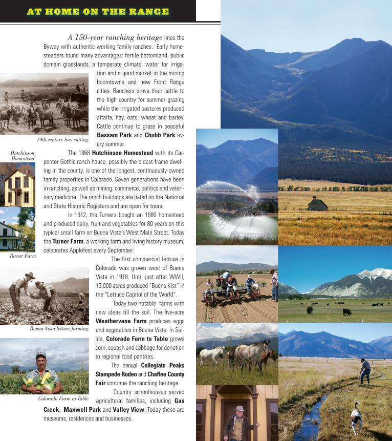
The 1868 Hutchinson Homestead with its Car-penter Gothic ranch house, possibly the oldest frame dwell-ing in the county, is one of the longest, continuously-owned family properties in Colorado. Seven generations have been in ranching, as well as mining, commerce, politics and veteri-nary medicine. The ranch buildings are listed on the National and State Historic Registers and are open for tours. In 1912, the Turners bought an 1880 homestead and produced dairy, fruit and vegetables for 80 years on this typical small farm on Buena Vista’s West Main Street. Today the Turner Farm, a working farm and living history museum, celebrates Applefest every September. The first commercial lettuce in
Colorado was grown west of Buena Vista in 1918. Until just after WWII, 13,000 acres produced “Buena Kist” in the “Lettuce Capitol of the World”. Today two notable farms with new ideas till the soil. The five-acre Weathervane Farm produces eggs and vegetables in Buena Vista. In Sal-ida, Colorado Farm to Table grows corn, squash and cabbage for donation to regional food pantries.
The annual Collegiate Peaks Stampede Rodeo and Chaffee County Fair continue the ranching heritage. Country schoolhouses served agricultural families, including Gas
Creek, Maxwell Park and Valley View. Today these are museums, residences and businesses.
19th century hay cutting
Turner Farm
Buena Vista lettuce farming
Colorado Farm to Table
Hutchinson Homestead
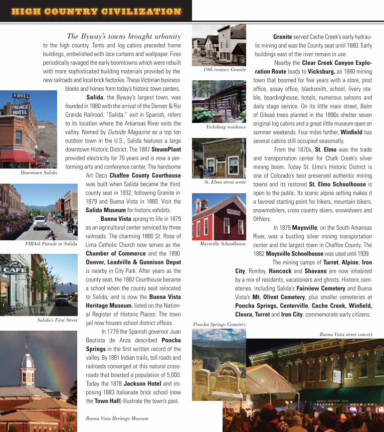
Granite served Cache Creek’s early hydrau-lic mining and was the County seat until 1880. Early buildings east of the river remain in use. Nearby the Clear Creek Canyon Explo-ration Route leads to Vicksburg, an 1880 mining
town that boomed for five years with a store, post office, assay office, blacksmith, school, livery sta-ble, boardinghouse, hotels, numerous saloons and daily stage service. On its little main street, Balm of Gilead trees planted in the 1890s shelter seven original log cabins and a great little museum open on summer weekends. Four miles further, Winfield has several cabins still occupied seasonally.
From the 1870s, St. Elmo was the trade and transportation center for Chalk Creek’s silver mining boom. Today St. Elmo’s Historic District is one of Colorado’s best preserved authentic mining towns and its restored St. Elmo Schoolhouse is open to the public. Its scenic alpine setting makes it a favored starting point for hikers, mountain bikers, snowmobilers, cross country skiers, snowshoers and OHVers. In 1879 Maysville, on the South Arkansas River, was a bustling silver mining transportation center and the largest town in Chaffee County. The 1882 Maysville Schoolhouse was used until 1939.
The mining camps of Turret, Alpine, Iron City, Romley, Hancock and Shavano are now inhabited by a mix of residents, vacationers and ghosts. Historic cem-eteries, including Salida’s Fairview Cemetery and Buena Vista’s Mt. Olivet Cemetery, plus smaller cemeteries at Poncha Springs, Centerville, Cache Creek, Winfield, Cleora, Turret and Iron City, commemorate early citizens.
The Byway’s towns brought urbanity to the high country. Tents and log cabins preceded frame buildings, embelished with lace curtains and wallpaper. Fires periodically ravaged the early boomtowns which were rebuilt with more sophisticated building materials provided by the new railroads and local brick factories. These Victorian business
blocks and homes form today’s historic town centers.Salida, the Byway’s largest town, was
founded in 1880 with the arrival of the Denver & Rio Grande Railroad. “Salida,” exit in Spanish, refers to its location where the Arkansas River exits the valley. Named by Outside Magazine as a top ten outdoor town in the U.S., Salida features a large downtown Historic District. The 1887 SteamPlant provided electricity for 70 years and is now a per-forming arts and conference center. The handsome
Art Deco Chaffee County Courthouse was built when Salida became the third county seat in 1932, following Granite in 1879 and Buena Vista in 1880. Visit the Salida Museum for historic exhibits. Buena Vista sprang to life in 1879 as an agricultural center serviced by three railroads. The charming 1880 St. Rose of Lima Catholic Church now serves as the Chamber of Commerce and the 1890 Denver, Leadville & Gunnison Depot is nearby in City Park. After years as the county seat, the 1882 Courthouse became a school when the county seat relocated to Salida, and is now the Buena Vista Heritage Museum, listed on the Nation-al Register of Historic Places. The town jail now houses school district offices. In 1779 the Spanish governor Juan Bautista de Anza described Poncha Springs in the first written record of the valley. By 1881 Indian trails, toll roads and railroads converged at this natural cross-roads that boasted a population of 5,000. Today the 1878 Jackson Hotel and im-posing 1883 Italianate brick school (now the Town Hall) illustrate the town’s past.
HIGH COUNTRY CIVILIZATION
Downtown Salida
FIBArk Parade in Salida
Buena Vista Heritage Museum
19th century Granite
Vicksburg residence
St. Elmo street scene
Maysville Schoolhouse
Poncha Springs Cemetery
Buena Vista street concert
Salida’s First Street
A RECREATION PANORAMA
Alpine scenery, extensive public lands and famed whitewater have created a new bonanza. The Byway boasts abundant, pristine backcountry – the Colle-
giate Peaks Wilderness Area, Buffalo Peaks Wilderness Area and Browns Canyon Wilder-ness Study Area. The San Isabel National Forest and BLM provide numerous campgrounds. The heart of the 150-mile Arkansas Headwaters Recreation Area parallels the Byway and offers camping, picnick-ing, hiking, fishing access, wildlife viewing areas, mountain biking, OHV travel and boat ramps. Anglers come from around the world to fish the Byway’s rivers, lakes and reservoirs for brown, rainbow, brook and cutthroat trout. The early May caddis hatch is celebrated by an annual festival. The Arkansas River, the most commercially rafted river in the U.S, provides rafting and kayak-ing for all skill levels, including the renowned Class III–IV rapids in Browns Canyon and The Numbers.
Salida and Buena Vista Whitewater Parks challenge amateur and world-class kayakers while spectators watch from riverside. Salida’s FIBArk whitewa-ter festival, the oldest in the U.S., takes place every June.
Cottonwood Hot Springs opened in 1878 and Mt. Princeton Hot
Springs has warmed guests since 1879. The Poncha Hot Springs feeds the Salida Hot Springs Aquatic Center. The Fourmile Area encompasses 100,000 acres of colorful geology, including the Castles’ volcanic forma-tions and an exposure of the 1.7 billion year-old Great Uncon-formity. This joint BLM and USFS travel management area offers a wealth of recreation to campers, hikers, bicyclers, rock climbers, horseback riders, rockhounds and OHV riders
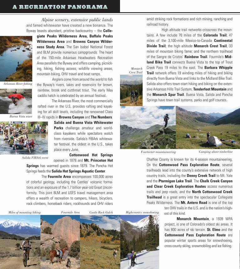
amid striking rock formations and rich mining, ranching and railroad history. High altitude trail networks crisscross the moun-tains. A few include 76 miles of the Colorado Trail; 47 miles of the 3,100-mile Mexico-to-Canada Continental Divide Trail; the high altitude Monarch Crest Trail, 33 miles of mountain biking fame; and the northern trailhead of the Sangre de Cristos’ Rainbow Trail. Fourmile’s Mid-land Bike Trail connects Buena Vista to the top of Trout Creek Pass 19 miles to the east. The Barbara Whipple Trail network offers 19 winding miles of hiking and biking directly from Buena Vista and links to the Midland Bike Trail. Salida also offers town-start hiking and biking on the exten-sive Arkansas Hills Trail System, Tenderfoot Mountain and the Monarch Spur Trail. Buena Vista, Salida and Poncha Springs have town trail systems, parks and golf courses.
Chaffee County is known for its 4-season mountaineering. On the Cottonwood Pass Exploration Route, several trailheads lead into the county’s extensive network of high country trails, including the Denny Creek Trail to Mt. Yale and the Ptarmigan Lake Trail. The Chalk Creek Canyon and Clear Creek Exploration Routes access numerous trails and jeep roads, and the North Cottonwood Creek Trailhead is a great entry into the spectacular Collegiate Peaks Wilderness. The Mt. Antero Road is one of the top
ten OHV trails in the U.S. and is the nation’s high-est of this kind. Monarch Mountain, a 1939 WPA project, is one of Colorado’s oldest ski areas. It has 800 acres of ski terrain. St. Elmo and the Cottonwood Pass Exploration Route are popular winter sports areas for snowshoeing, cross county skiing, snowmobiling and ice fishing.
Arkansas River fishing
Salida FIBArk event
Buena Vista wave
Fourteener mountaineering Camping above timberline
Monarch Crest Trail
Miles of mounting biking Fourmile Area Castle Rock Gulch Highcountry snowshoeing
Along the Byway many side routes offer spectacu-lar scenery and experiences. Plan to include some of these in your explorations (see map on following page). Note that several are prime fall color aspen-viewing territory! Most routes are eas-ily accessible by car; routes requiring high clearance or 4-wheel drive are noted. Please check with local visitor centers for de-tailed information on attractions, amenities and road conditions.
1 Lost Canyon on CR 398 to Gold Basin is graded the first 2 miles west of Granite. As the road switchbacks through a lush as-pen forest that opens to expansive vistas, it becomes steeper but
still 2-wheel drive accessible. The road becomes rough at timberline, requiring 4-wheel drive. The road ends above Gold Basin at 12,570-foot eleva-tion with 360 degree views of the Fourteeners and Pikes Peak 90 miles to the east. A fall color destination. Closed in winter. 22.5 miles round trip (2-wheel drive portion) from US 24.
2
Clear Creek Canyon on CR 390 is a graded county road up a deep canyon lined with Fourteeners to the isolated mining ghost towns of Vicksburg and Winfield, about 8.5 and 12.5 miles respectively from US 24. The road beyond Winfield is 4-wheel drive only. Closed in winter. 25 miles round trip from US 24.
3 Cottonwood Pass on CR 306 is paved as it climbs up a sce-nic canyon between Fourteeners to the Continental Divide at 12,126-foot elevation. Side trips include Cottonwood Hot Springs and the South Cottonwood Creek Road to Cottonwood Lake. A fall color destination. Upper portion closed in winter. 44 miles round trip to the pass from US 24-285.
4 Rodeo Road is the paved CR 321 connecting Cottonwood Pass and Buena Vista to Chalk Creek Canyon. It crosses the val-ley’s broad western slope with spectacular views of Mt. Prince-ton, open ranchlands and possible glimpses of pronghorn antelope. 9 miles one way.
5 Chalk Creek Canyon winds along Chalk Creek to Mt. Prince-ton Hot Springs, the Chalk Cliffs, the Cascades and the historic mining towns of Alpine, St. Elmo, Romley and Hancock. CR 162 is a graded county road 17 miles to St. Elmo. Then CR 295 follows
the bumpy DSP&P RR Grade but is still 2-wheel drive accessible to the Hancock townsite. The driving route ends at the Alpine Tunnel Trailhead, a gentle 6-mile round trip hike to the tunnel entrance on the historic RR grade through alpine scen-ery. 45 miles round trip from US 24-285.
EXPLORATION ROUTES
6 Colorado Midland runs north of Buena Vista on CR 371. This graded road through four his-toric railroad tunnels hugs the east side of the Arkansas River and passes Elephant Rock. The route’s north end crosses the Arkansas River to meet US 24 – a leisurely alternative to US 24. 10.5 miles one way.
7
Trout Creek Canyon on US 24-285, a paved highway, as-cends from the Arkansas River to Castle Rock and through love-ly Chubb Park to Trout Creek Pass. This 9,346-foot pass is the
gateway to Park County with spectacular views in both directions. The return trip provides the famed telephoto view of Mt. Princeton. 28 miles round trip to the pass from Johnson Village.
8
Aspen Ridge is a colorful high country route between Sali-da and Trout Creek Canyon via Ute Trail (CR 175), CR 185 and CR 187. Photogenic mining remains dot the southern portion with numerous scenic branch roads, including CR 184 to Turret. The Aspen Ridge forests open to expansive Continental Divide views and descend to Bassam Park’s highcountry meadows. Castle
Rock Gulch’s dramatic rock formations lead to Trout Creek Canyon. The southern Ute Trail sec-tion and northern Castle Rock Gulch section are graded roads; the middle Aspen Ridge section is rough, with 4-wheel drive recommended. A fall color destination. Center section closed in winter. 26 miles one way.
9 Monarch Pass on US 50, a paved highway, crosses the Continental Divide at 11,312 feet. This dramatic pass connects the Upper Arkansas Valley to the Gunnison Valley and has spec-tacular views and numerous visitor attractions. Visit Monarch Mountain ski area and enjoy a gondola ride along this route. 40 miles round trip to the pass from Poncha Springs.
10
Spiral Drive on CR 176, a graded road to the top of Ten-derfoot Mountain, is poised over Salida with sweeping views of downtown, the Sangre de Cristo Mountains and the southern Up-per Arkansas Valley. 7 miles round trip from downtown Salida.
11 Poncha Pass on US 285 is a paved highway that crosses the 9,010-foot saddle between the Sawatch and Sangre de Cris-to mountain ranges and presents a “wow” view of the San Luis Valley. 16 miles round trip to the pass from Poncha Springs.
12 Marshall Pass on CR 200 is a graded county road on the former Denver & Rio Grande RR grade. It passes close to O’Haver Lake, a fishing favorite, and winds around Mt. Ouray to the Continental Divide at 10,842 feet. A fall color destination. Closed in winter. 29 miles round trip to the pass from US 285.