county of kauai kane-i-o-lo-u-ma heiau complex
TRANSCRIPT
COUNTY OF KAUAI
KANE-I-O-LO-U-MA HEIAU COMPLEX
HISTORICAL OVERVIEW
Presented to:
MAYOR BERNARD CARVALHO
August, 2010
Submitted by:
HUI MALAMA O KANEIOLOUMA
Board of Directors Billy Kaohelauli‘i, Rupert Rowe, John Stem,
Tessie Kinnaman, Terrie Hayes, Kane Turalde, Cheryl Lovell-Obatake, John Spaar, Randy Wichman
2
3
INTRODUCTION
The Kaneiolouma Heiau complex is considered sacred to the Hawaiian culture and an important historic landmark to the residents of Kauai. Currently under the jurisdiction of the County of Kauai and known as the Poipu Beach Park Mauka Preserve, the stewardship group Hui Malama O Kaneiolouma is proposing to clear, maintain, and rehabilitate this complex as a public cultural preserve.
It is fortunate that this unique complex has been studied by eminent scholars for more than a century. They have provided us with detailed maps and descriptions creating a body of work that outlines a scientific and cultural methodology. Prominent among these is Henry Kekahuna who wrote and campaigned extensively for the preservation of the Kaneiolouma Heiau complex.
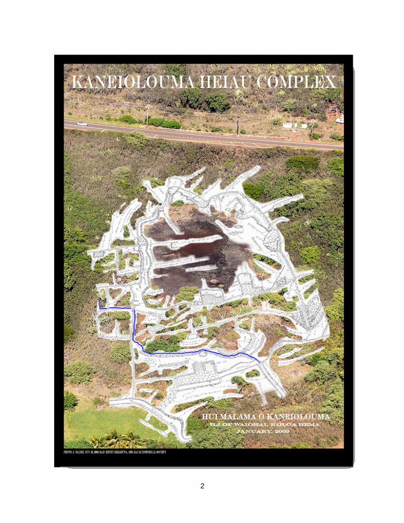
There are three components to this complex: religion, agriculture and aquaculture (fish ponds). This site also contains the sacred spring of Waiohai. The amount of monumental Hawaiian architecture represented here has the potential of yielding important information regarding ancient temple religion, agriculture, and fishpond management. Extensive walled enclosures, alters, numerous bases for temple images, shrines, taro patches, irrigation ditches, a series of large fishponds, house platforms, extensive cooking areas, and terracing throughout make this complex ideal for rehabilitation.
The County of Kauai’s Poipu Beach Park has consistently been recognized as one of our Nations most beautiful beaches. The Kaneiolouma Heiau complex is a component of Poipu Beach Park and by preserving and enhancing both elements, the County of Kauai is enriching its world class destination. Yet, perhaps more important to us as an island, is a sense of pride that our unique cultural heritage is preserved in perpetuity.
4
HUI MALAMA O KANEIOLOUMA The Stewards of Kaneiolouma Heiau
Mission Statement
The mission of Hui Malama O Kaneiolouma shall be to perpetuate the Hawaiian culture by preserving, protecting, and to rehabilitate the Kaneiolouma Heiau Complex, otherwise known as the Poipu Beach Park Mauka Preserve, and to provide cultural education by the perpetuation of the Hawaiian cultural traditions practiced at Southern Kōloa, Kona, Kauai.
5
6
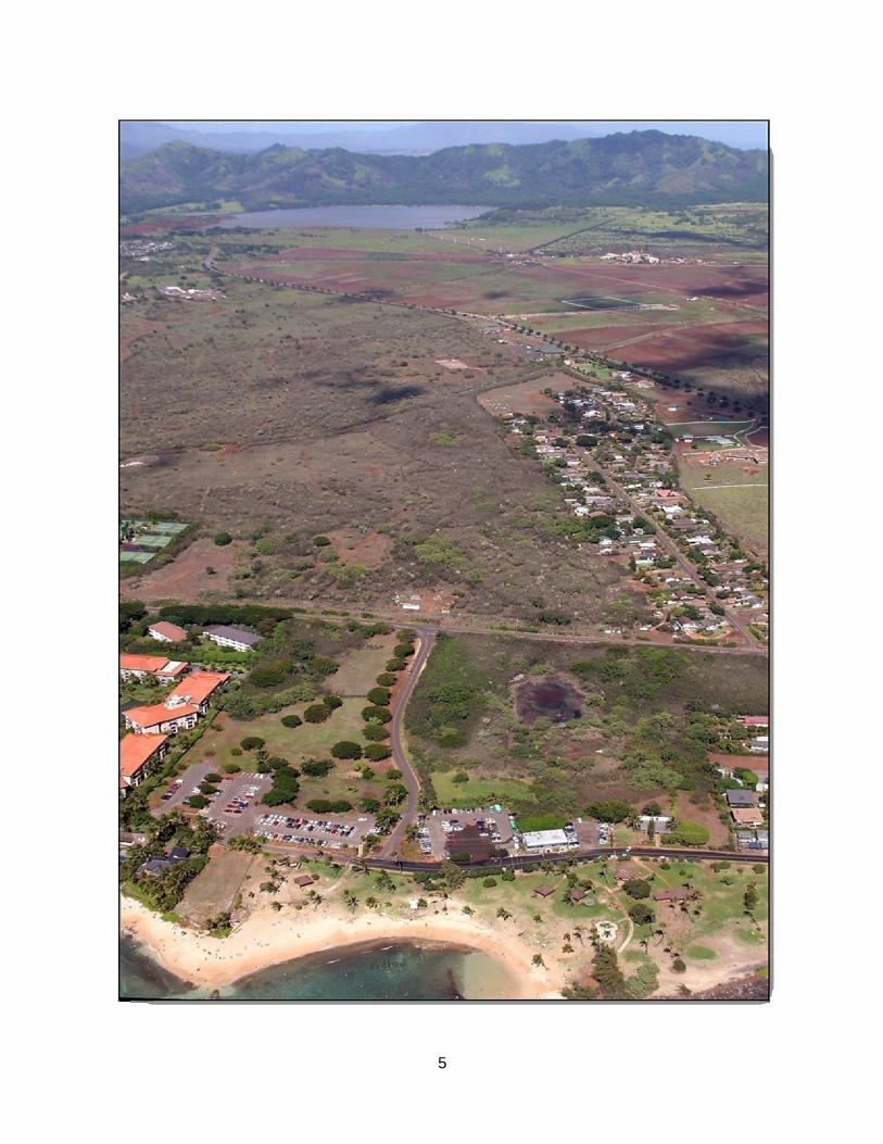
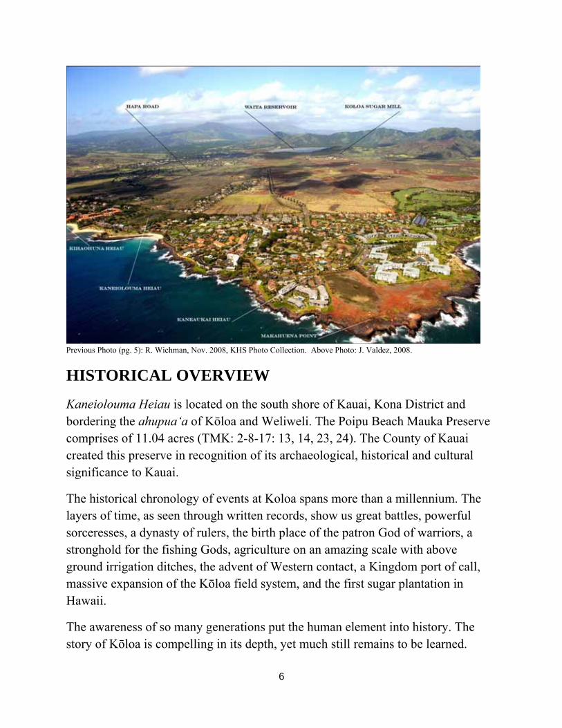
Previous Photo (pg. 5): R. Wichman, Nov. 2008, KHS Photo Collection. Above Photo: J. Valdez, 2008.
HISTORICAL OVERVIEW
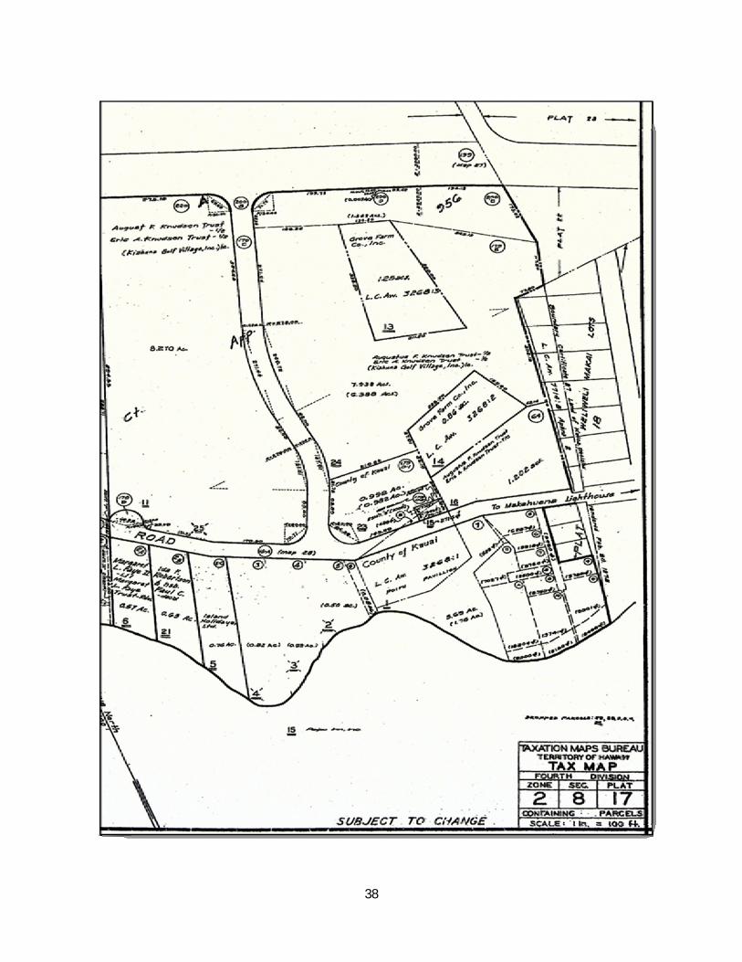
Kaneiolouma Heiau is located on the south shore of Kauai, Kona District and bordering the ahupua‘a of Kōloa and Weliweli. The Poipu Beach Mauka Preserve comprises of 11.04 acres (TMK: 2-8-17: 13, 14, 23, 24). The County of Kauai created this preserve in recognition of its archaeological, historical and cultural significance to Kauai.
The historical chronology of events at Koloa spans more than a millennium. The layers of time, as seen through written records, show us great battles, powerful sorceresses, a dynasty of rulers, the birth place of the patron God of warriors, a stronghold for the fishing Gods, agriculture on an amazing scale with above ground irrigation ditches, the advent of Western contact, a Kingdom port of call, massive expansion of the Kōloa field system, and the first sugar plantation in Hawaii.
The awareness of so many generations put the human element into history. The story of Kōloa is compelling in its depth, yet much still remains to be learned.
7
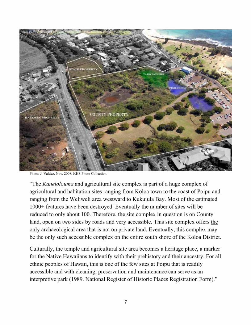
Photo: J. Valdez, Nov. 2008, KHS Photo Collection.
“The Kaneiolouma and agricultural site complex is part of a huge complex of agricultural and habitation sites ranging from Koloa town to the coast of Poipu and ranging from the Weliweli area westward to Kukuiula Bay. Most of the estimated 1000+ features have been destroyed. Eventually the number of sites will be reduced to only about 100. Therefore, the site complex in question is on County land, open on two sides by roads and very accessible. This site complex offers the only archaeological area that is not on private land. Eventually, this complex may be the only such accessible complex on the entire south shore of the Koloa District.
Culturally, the temple and agricultural site area becomes a heritage place, a marker for the Native Hawaiians to identify with their prehistory and their ancestry. For all ethnic peoples of Hawaii, this is one of the few sites at Poipu that is readily accessible and with cleaning; preservation and maintenance can serve as an interpretive park (1989. National Register of Historic Places Registration Form).”
8
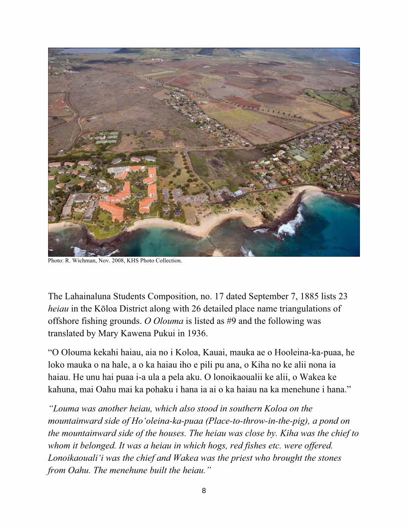
Photo: R. Wichman, Nov. 2008, KHS Photo Collection.
The Lahainaluna Students Composition, no. 17 dated September 7, 1885 lists 23 heiau in the Kōloa District along with 26 detailed place name triangulations of offshore fishing grounds. O Olouma is listed as #9 and the following was translated by Mary Kawena Pukui in 1936.
“O Olouma kekahi haiau, aia no i Koloa, Kauai, mauka ae o Hooleina-ka-puaa, he loko mauka o na hale, a o ka haiau iho e pili pu ana, o Kiha no ke alii nona ia haiau. He unu hai puaa i-a ula a pela aku. O lonoikaoualii ke alii, o Wakea ke kahuna, mai Oahu mai ka pohaku i hana ia ai o ka haiau na ka menehune i hana.”
“Louma was another heiau, which also stood in southern Koloa on the mountainward side of Ho‘oleina-ka-puaa (Place-to-throw-in-the-pig), a pond on the mountainward side of the houses. The heiau was close by. Kiha was the chief to whom it belonged. It was a heiau in which hogs, red fishes etc. were offered. Lonoikaouali‘i was the chief and Wakea was the priest who brought the stones from Oahu. The menehune built the heiau.”
9
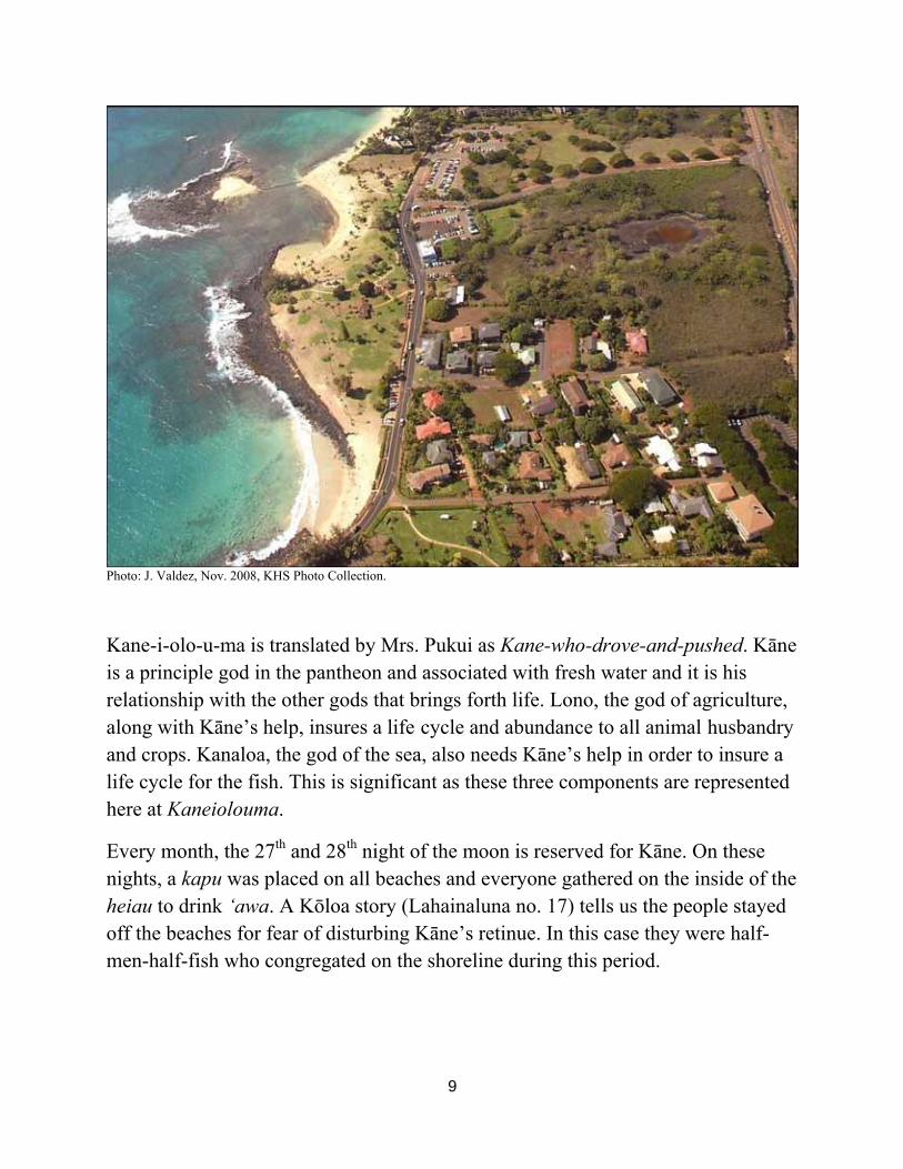
Photo: J. Valdez, Nov. 2008, KHS Photo Collection.
Kane-i-olo-u-ma is translated by Mrs. Pukui as Kane-who-drove-and-pushed. Kāne is a principle god in the pantheon and associated with fresh water and it is his relationship with the other gods that brings forth life. Lono, the god of agriculture, along with Kāne’s help, insures a life cycle and abundance to all animal husbandry and crops. Kanaloa, the god of the sea, also needs Kāne’s help in order to insure a life cycle for the fish. This is significant as these three components are represented here at Kaneiolouma.
Every month, the 27th and 28th night of the moon is reserved for Kāne. On these nights, a kapu was placed on all beaches and everyone gathered on the inside of the heiau to drink ‘awa. A Kōloa story (Lahainaluna no. 17) tells us the people stayed off the beaches for fear of disturbing Kāne’s retinue. In this case they were half-men-half-fish who congregated on the shoreline during this period.
10
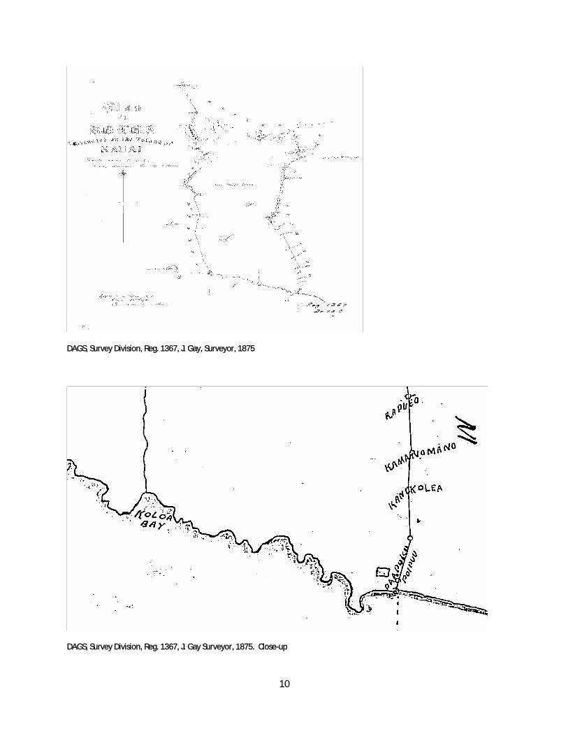
DAGS, Survey Division, Reg. 1367, J. Gay, Surveyor, 1875
DAGS, Survey Division, Reg. 1367, J. Gay Surveyor, 1875. Close-up
11
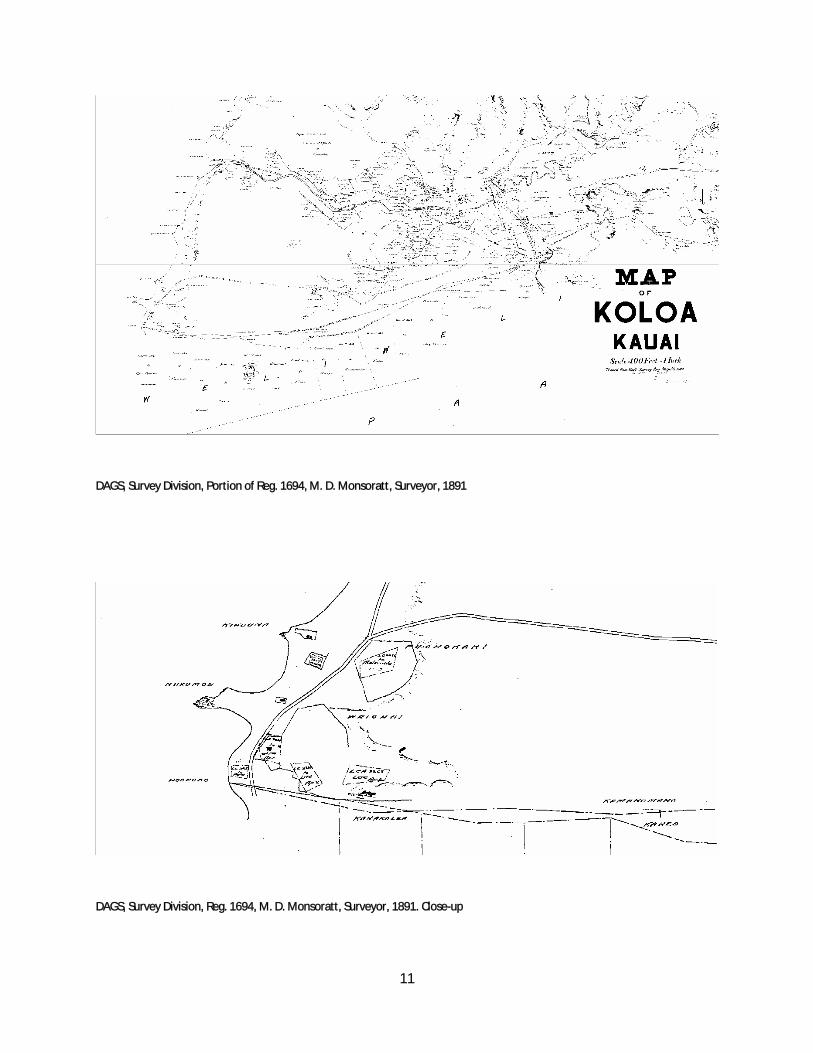
DAGS, Survey Division, Portion of Reg. 1694, M. D. Monsoratt, Surveyor, 1891
DAGS, Survey Division, Reg. 1694, M. D. Monsoratt, Surveyor, 1891. Close-up
12
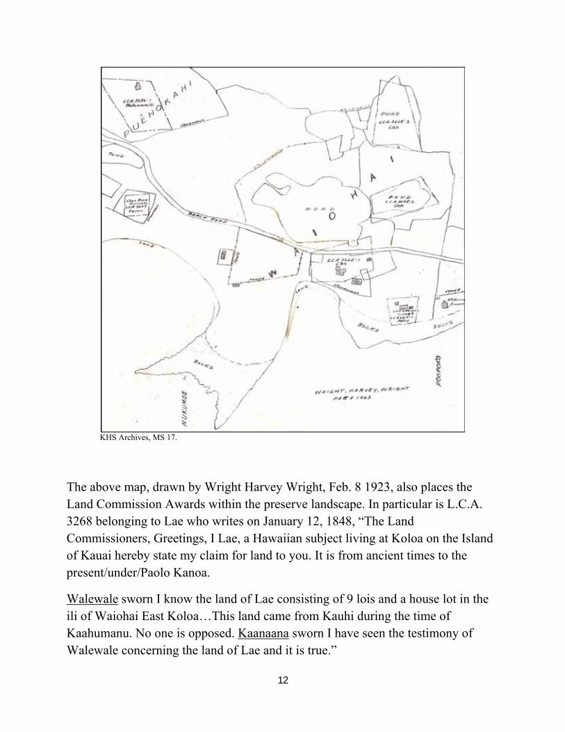
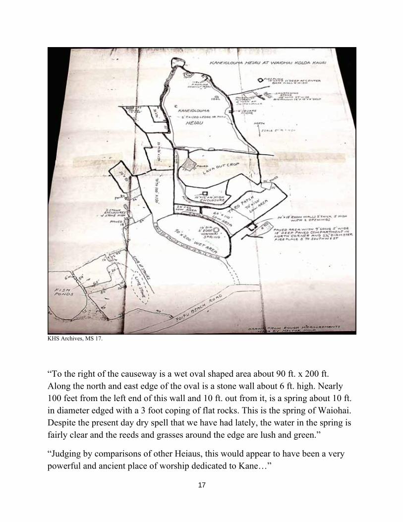
KHS Archives, MS 17.
The above map, drawn by Wright Harvey Wright, Feb. 8 1923, also places the Land Commission Awards within the preserve landscape. In particular is L.C.A. 3268 belonging to Lae who writes on January 12, 1848, “The Land Commissioners, Greetings, I Lae, a Hawaiian subject living at Koloa on the Island of Kauai hereby state my claim for land to you. It is from ancient times to the present/under/Paolo Kanoa.
Walewale sworn I know the land of Lae consisting of 9 lois and a house lot in the ili of Waiohai East Koloa…This land came from Kauhi during the time of Kaahumanu. No one is opposed. Kaanaana sworn I have seen the testimony of Walewale concerning the land of Lae and it is true.”
13
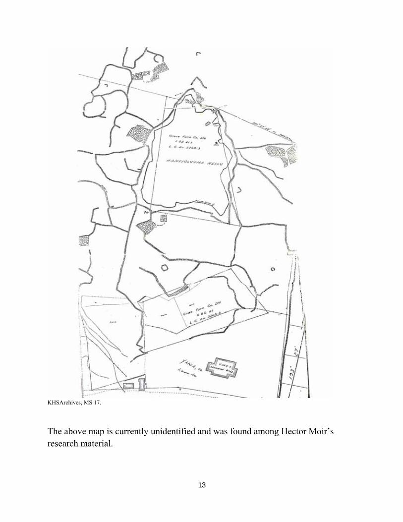
KHSArchives, MS 17.
The above map is currently unidentified and was found among Hector Moir’s research material.
14
15
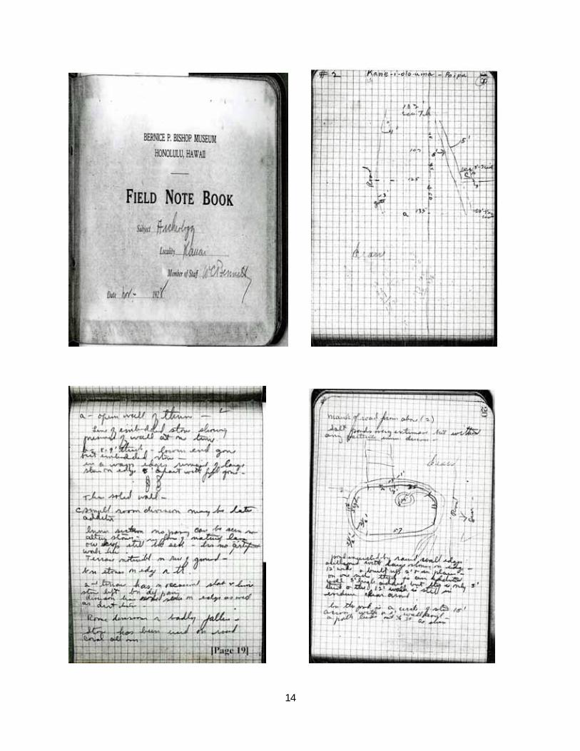
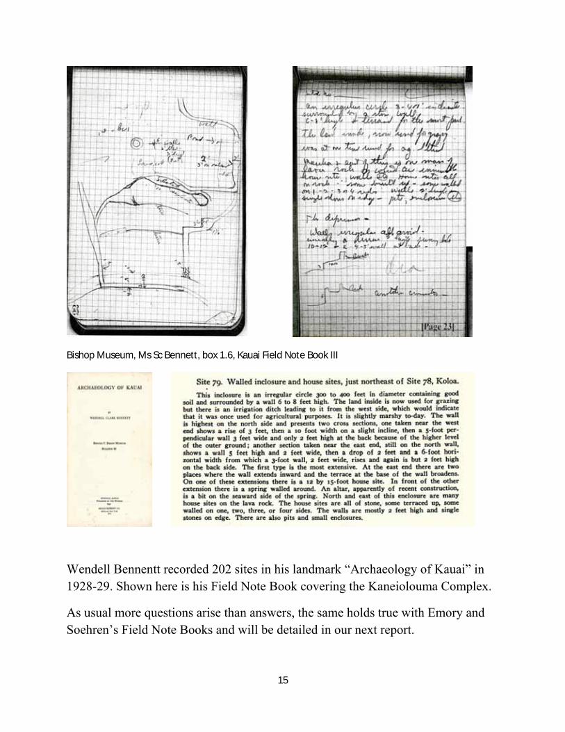
Bishop Museum, Ms Sc Bennett, box 1.6, Kauai Field Note Book III
Wendell Bennentt recorded 202 sites in his landmark “Archaeology of Kauai” in 1928-29. Shown here is his Field Note Book covering the Kaneiolouma Complex.
As usual more questions arise than answers, the same holds true with Emory and Soehren’s Field Note Books and will be detailed in our next report.
16
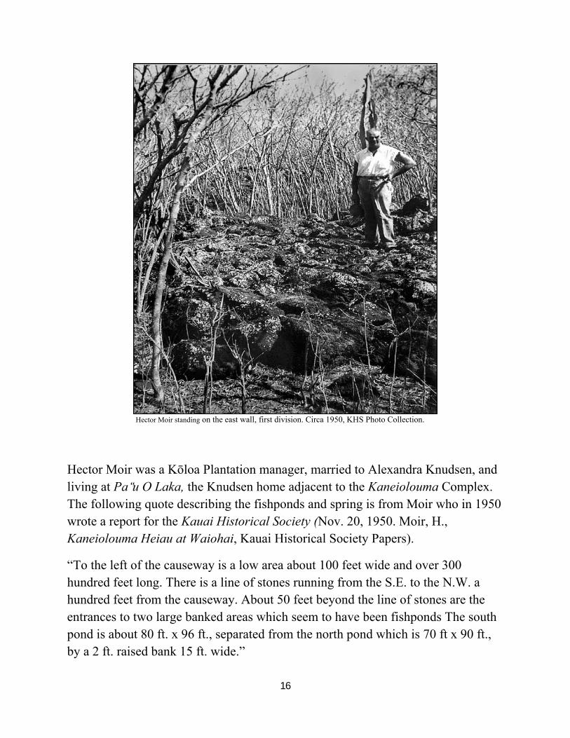
Hector Moir standing on the east wall, first division. Circa 1950, KHS Photo Collection.
Hector Moir was a Kōloa Plantation manager, married to Alexandra Knudsen, and living at Pa‘u̒ O Laka, the Knudsen home adjacent to the Kaneiolouma Complex. The following quote describing the fishponds and spring is from Moir who in 1950 wrote a report for the Kauai Historical Society (Nov. 20, 1950. Moir, H., Kaneiolouma Heiau at Waiohai, Kauai Historical Society Papers).
“To the left of the causeway is a low area about 100 feet wide and over 300 hundred feet long. There is a line of stones running from the S.E. to the N.W. a hundred feet from the causeway. About 50 feet beyond the line of stones are the entrances to two large banked areas which seem to have been fishponds The south pond is about 80 ft. x 96 ft., separated from the north pond which is 70 ft x 90 ft., by a 2 ft. raised bank 15 ft. wide.”
17
KHS Archives, MS 17.
“To the right of the causeway is a wet oval shaped area about 90 ft. x 200 ft. Along the north and east edge of the oval is a stone wall about 6 ft. high. Nearly 100 feet from the left end of this wall and 10 ft. out from it, is a spring about 10 ft. in diameter edged with a 3 foot coping of flat rocks. This is the spring of Waiohai. Despite the present day dry spell that we have had lately, the water in the spring is fairly clear and the reeds and grasses around the edge are lush and green.”
“Judging by comparisons of other Heiaus, this would appear to have been a very powerful and ancient place of worship dedicated to Kane…”
18
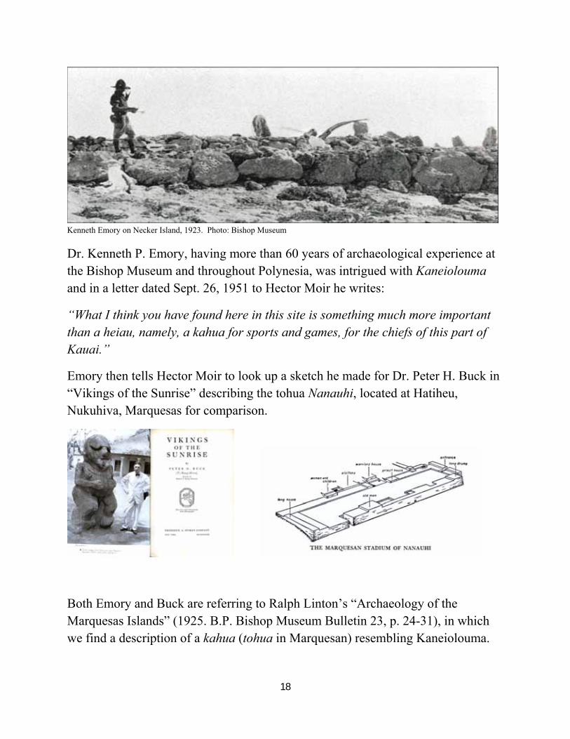
Kenneth Emory on Necker Island, 1923. Photo: Bishop Museum
Dr. Kenneth P. Emory, having more than 60 years of archaeological experience at the Bishop Museum and throughout Polynesia, was intrigued with Kaneiolouma and in a letter dated Sept. 26, 1951 to Hector Moir he writes:
“What I think you have found here in this site is something much more important than a heiau, namely, a kahua for sports and games, for the chiefs of this part of Kauai.”
Emory then tells Hector Moir to look up a sketch he made for Dr. Peter H. Buck in “Vikings of the Sunrise” describing the tohua Nanauhi, located at Hatiheu, Nukuhiva, Marquesas for comparison.
Both Emory and Buck are referring to Ralph Linton’s “Archaeology of the Marquesas Islands” (1925. B.P. Bishop Museum Bulletin 23, p. 24-31), in which we find a description of a kahua (tohua in Marquesan) resembling Kaneiolouma.
19
“The practice of reserving an open space in or near each village as an assembly place was practically universal in Polynesia and was probably a feature of the culture of the original settlers of the region.”
“The Marquesans applied the name tohua or taka ko’ina to the tribal assembly place at which feasts were given and certain classes of ceremonies preformed.”
“The essential and only constant feature of the tohua was the dance floor, a piece of level ground large enough to accommodate the assembled tribe.”
“The low platforms surrounding the dance floor were almost entirely built over so that the structure, at the time of the fête, must have given the effect of a plaza surrounded by houses.”
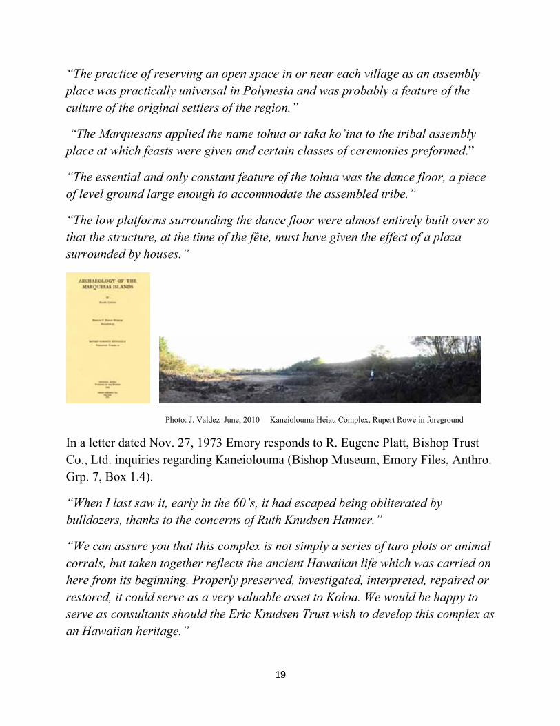
Photo: J. Valdez June, 2010 Kaneiolouma Heiau Complex, Rupert Rowe in foreground
In a letter dated Nov. 27, 1973 Emory responds to R. Eugene Platt, Bishop Trust Co., Ltd. inquiries regarding Kaneiolouma (Bishop Museum, Emory Files, Anthro. Grp. 7, Box 1.4).
“When I last saw it, early in the 60’s, it had escaped being obliterated by bulldozers, thanks to the concerns of Ruth Knudsen Hanner.”
“We can assure you that this complex is not simply a series of taro plots or animal corrals, but taken together reflects the ancient Hawaiian life which was carried on here from its beginning. Properly preserved, investigated, interpreted, repaired or restored, it could serve as a very valuable asset to Koloa. We would be happy to serve as consultants should the Eric Knudsen Trust wish to develop this complex as an Hawaiian heritage.”
20
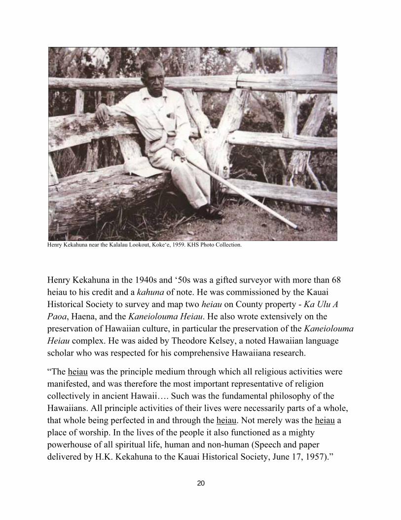
Henry Kekahuna near the Kalalau Lookout, Koke‘e, 1959. KHS Photo Collection.
Henry Kekahuna in the 1940s and ‘50s was a gifted surveyor with more than 68 heiau to his credit and a kahuna of note. He was commissioned by the Kauai Historical Society to survey and map two heiau on County property - Ka Ulu A Paoa, Haena, and the Kaneiolouma Heiau. He also wrote extensively on the preservation of Hawaiian culture, in particular the preservation of the Kaneiolouma Heiau complex. He was aided by Theodore Kelsey, a noted Hawaiian language scholar who was respected for his comprehensive Hawaiiana research.
“The heiau was the principle medium through which all religious activities were manifested, and was therefore the most important representative of religion collectively in ancient Hawaii…. Such was the fundamental philosophy of the Hawaiians. All principle activities of their lives were necessarily parts of a whole, that whole being perfected in and through the heiau. Not merely was the heiau a place of worship. In the lives of the people it also functioned as a mighty powerhouse of all spiritual life, human and non-human (Speech and paper delivered by H.K. Kekahuna to the Kauai Historical Society, June 17, 1957).”
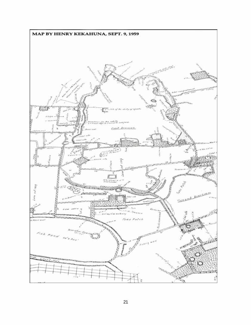
21
22
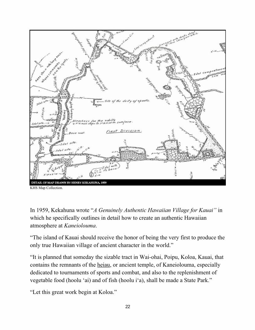
KHS Map Collection.
In 1959, Kekahuna wrote “A Genuinely Authentic Hawaiian Village for Kauai” in which he specifically outlines in detail how to create an authentic Hawaiian atmosphere at Kaneiolouma.
“The island of Kauai should receive the honor of being the very first to produce the only true Hawaiian village of ancient character in the world.”
“It is planned that someday the sizable tract in Wai-ohai, Poipu, Koloa, Kauai, that contains the remnants of the heiau, or ancient temple, of Kaneiolouma, especially dedicated to tournaments of sports and combat, and also to the replenishment of vegetable food (hoolu ‘ai) and of fish (hoolu i‘a), shall be made a State Park.”
“Let this great work begin at Koloa.”
23
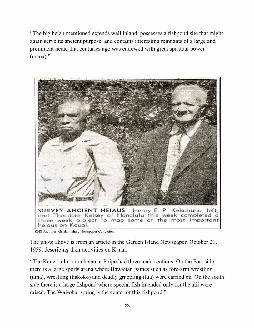
“The big heiau mentioned extends well inland, possesses a fishpond site that might again serve its ancient purpose, and contains interesting remnants of a large and prominent heiau that centuries ago was endowed with great spiritual power (mana).”
KHS Archives, Garden Island Newspaper Collection.
The photo above is from an article in the Garden Island Newspaper, October 21, 1959, describing their activities on Kauai.
“The Kane-i-olo-u-ma heiau at Poipu had three main sections. On the East side there is a large sports arena where Hawaiian games such as fore-arm wrestling (uma), wrestling (hakoko) and deadly grappling (lua) were carried on. On the south side there is a large fishpond where special fish intended only for the alii were raised. The Wai-ohai spring is the center of this fishpond.”
24
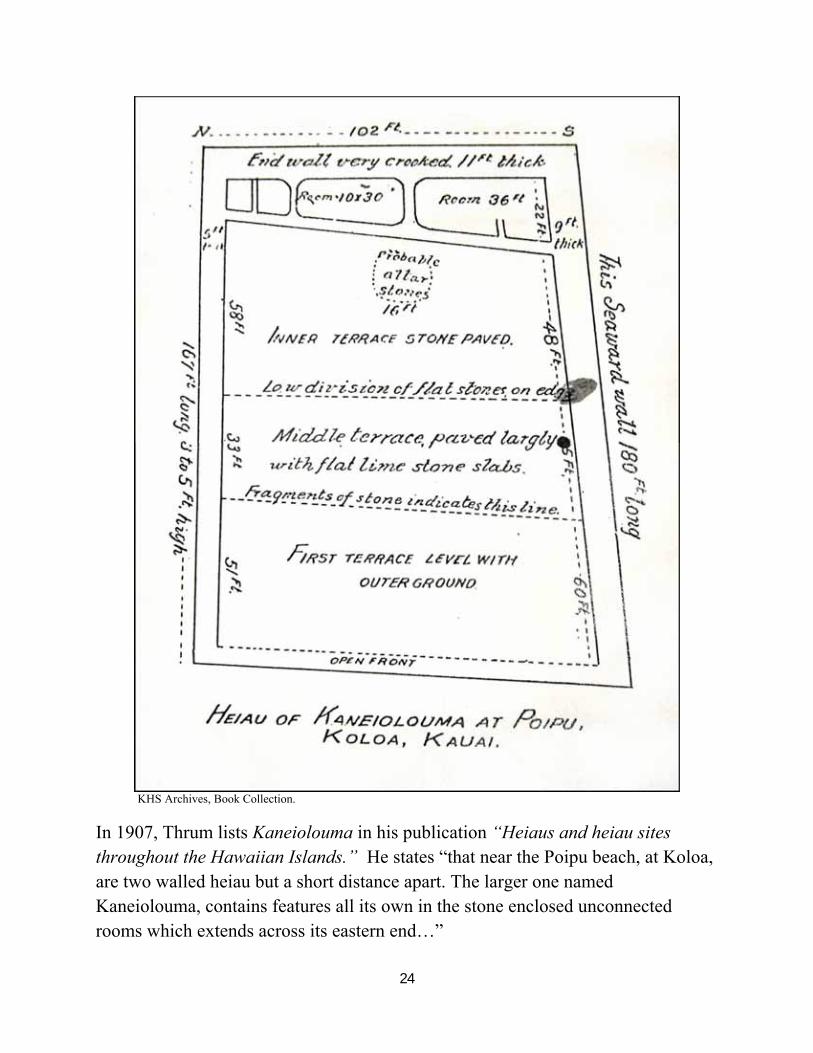
KHS Archives, Book Collection.
In 1907, Thrum lists Kaneiolouma in his publication “Heiaus and heiau sites throughout the Hawaiian Islands.” He states “that near the Poipu beach, at Koloa, are two walled heiau but a short distance apart. The larger one named Kaneiolouma, contains features all its own in the stone enclosed unconnected rooms which extends across its eastern end…”
25
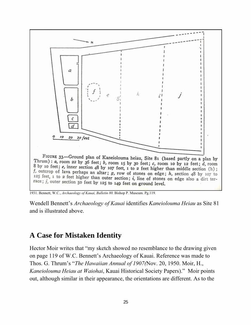
1931. Bennett, W.C., Archaeology of Kauai, Bulletin 80. Bishop P. Museum. Pg.119.
Wendell Bennett’s Archaeology of Kauai identifies Kaneiolouma Heiau as Site 81 and is illustrated above.
A Case for Mistaken Identity
Hector Moir writes that “my sketch showed no resemblance to the drawing given on page 119 of W.C. Bennett’s Archaeology of Kauai. Reference was made to Thos. G. Thrum’s “The Hawaiian Annual of 1907(Nov. 20, 1950. Moir, H., Kaneiolouma Heiau at Waiohai, Kauai Historical Society Papers).” Moir points out, although similar in their appearance, the orientations are different. As to the
26
limestone paving noted in both drawings, he states that “a natural limestone ledge is found in the low area which is not far from the present Poipu Beach road.”
Kekahuna and Kelsey also agree with Moir as to the location of Kaneiolouma Heiau.
Yet, in a one page manuscript (February 22, 1967) Lloyd Soehren, Assistant in Anthropology for Bishop Museum states that “the site presently identified as that of Kaneiolouma heiau on maps drawn by Hector Moir in November, 1950, by Henry Kekahuna in September, 1959, on the State tax maps, …is erroneous.”
Soehren suggested that Kaneiolouma Heiau was located on Nukumoi Point and on lots once owned by the Robinson Family (TMK 2-8-17-2,3,4,5). This would situate the heiau at the present day Poipu Beach Park. Soehren based his position on previous notes made by Thrum, and echoed by Bennett and Emory, that the heiau was makai of the Poipu Beach road. Although, he did suggest caution in that a thorough search of the Mahele records could reveal more.
As a result of the Soehren/Bishop Museum position, the nomination of the Poipu Beach Mauka Preserve to the National Register of Historic Places was rejected by the State of Hawaii in 1989.
It appears that Thrum, Bennett, Emory and Soehren were not aware of the Lahainaluna Papers which places Kaneiolouma “…on the mountainward side of Hooleina-ka-puaa (Place-to-throw-in-the-pig), a pond on the montainward side of the houses.” The place name Ho‘oleina-ka-pua‘a is also associated with the fish pond drawn by both Moir and Kekahuna. One of the sources for the Lahainaluna Papers was Walewale who claimed LCA 3286:1 and lived in close proximity to Poipu Beach.
Of further interest is that a case can now be made indicating the presence of a second heiau located within the Poipu Beach Park.
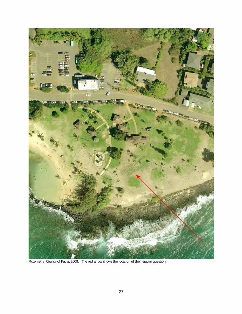
27
Pictometry, County of Kauai, 2008. The red arrow shows the location of the heiau in question.
28
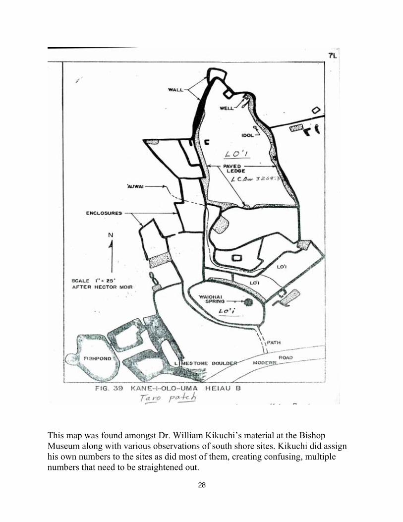
This map was found amongst Dr. William Kikuchi’s material at the Bishop Museum along with various observations of south shore sites. Kikuchi did assign his own numbers to the sites as did most of them, creating confusing, multiple numbers that need to be straightened out.
29
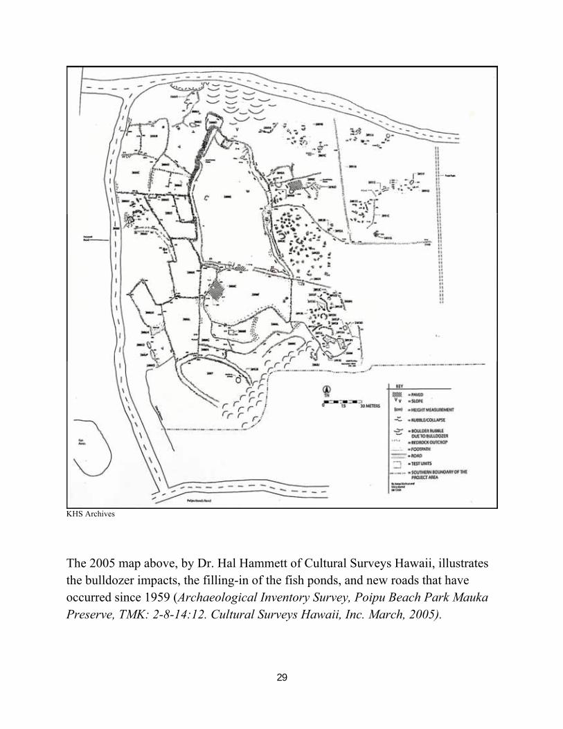
KHS Archives
The 2005 map above, by Dr. Hal Hammett of Cultural Surveys Hawaii, illustrates the bulldozer impacts, the filling-in of the fish ponds, and new roads that have occurred since 1959 (Archaeological Inventory Survey, Poipu Beach Park Mauka Preserve, TMK: 2-8-14:12. Cultural Surveys Hawaii, Inc. March, 2005).
30
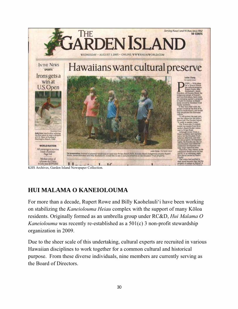
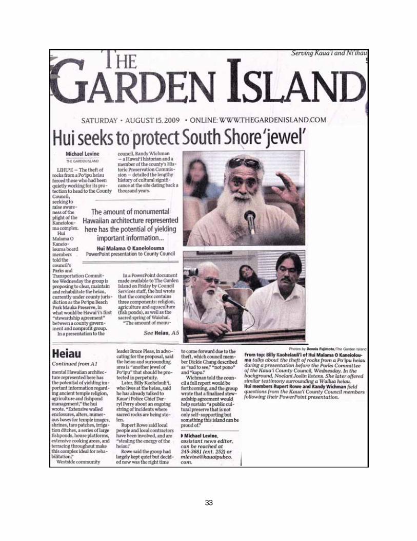
KHS Archives, Garden Island Newspaper Collection.
HUI MALAMA O KANEIOLOUMA
For more than a decade, Rupert Rowe and Billy Kaohelauli‘i have been working on stabilizing the Kaneiolouma Heiau complex with the support of many Kōloa residents. Originally formed as an umbrella group under RC&D, Hui Malama O Kaneiolouma was recently re-established as a 501(c) 3 non-profit stewardship organization in 2009.
Due to the sheer scale of this undertaking, cultural experts are recruited in various Hawaiian disciplines to work together for a common cultural and historical purpose. From these diverse individuals, nine members are currently serving as the Board of Directors.
31
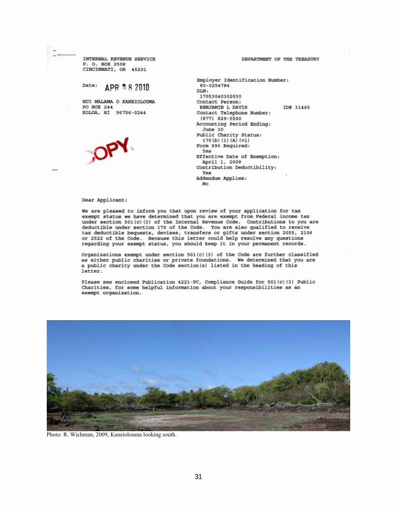
Photo: R. Wichman, 2009, Kaneiolouma looking south.
32
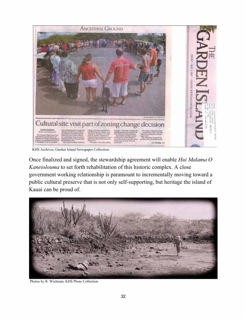
KHS Archives, Garden Island Newspaper Collection.
Once finalized and signed, the stewardship agreement will enable Hui Malama O Kaneiolouma to set forth rehabilitation of this historic complex. A close government working relationship is paramount to incrementally moving toward a public cultural preserve that is not only self-supporting, but heritage the island of Kauai can be proud of.
Photos by R. Wichman, KHS Photo Collection.
33
34
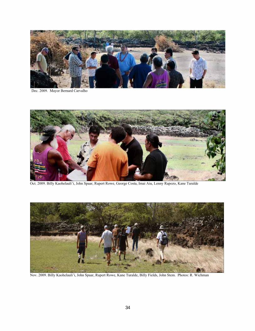
Dec. 2009. Mayor Bernard Carvalho
Oct. 2009. Billy Kaohelauli’i, John Spaar, Rupert Rowe, George Costa, Imai Aiu, Lenny Rapozo, Kane Turalde
Nov. 2009. Billy Kaohelauli’i, John Spaar, Rupert Rowe, Kane Turalde, Billy Fields, John Stem. Photos: R. Wichman
35
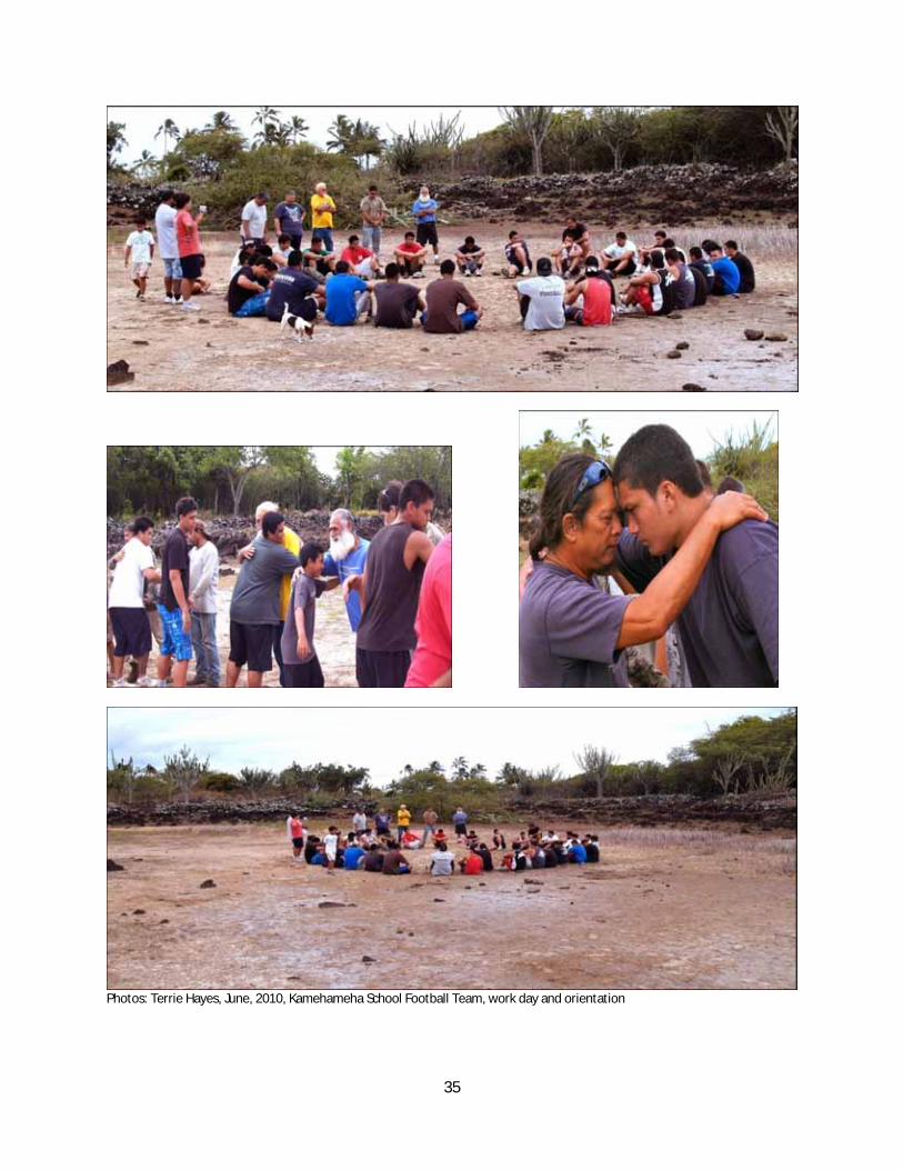
Photos: Terrie Hayes, June, 2010, Kamehameha School Football Team, work day and orientation
36
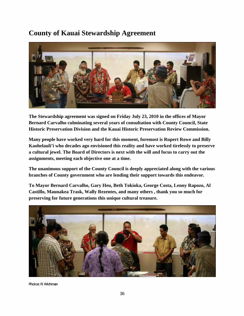
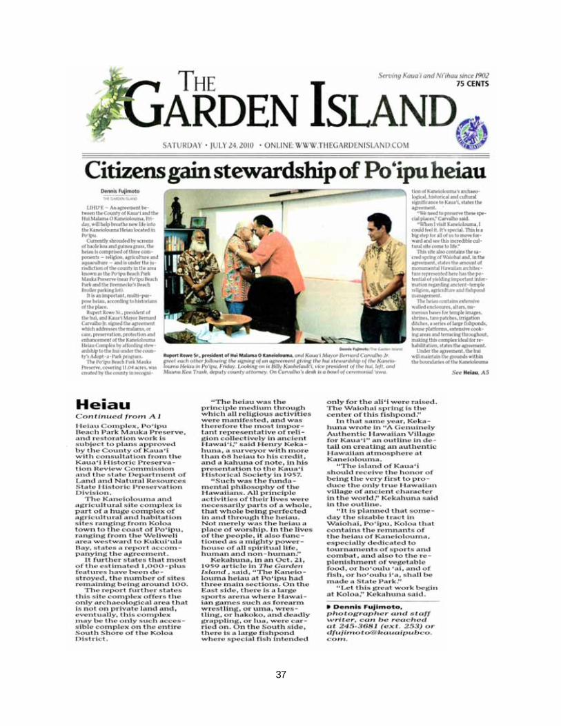
County of Kauai Stewardship Agreement
The Stewardship agreement was signed on Friday July 23, 2010 in the offices of Mayor Bernard Carvalho culminating several years of consultation with County Council, State Historic Preservation Division and the Kauai Historic Preservation Review Commission.
Many people have worked very hard for this moment, foremost is Rupert Rowe and Billy Kaohelauli’i who decades ago envisioned this reality and have worked tirelessly to preserve a cultural jewel. The Board of Directors is next with the will and focus to carry out the assignments, meeting each objective one at a time.
The unanimous support of the County Council is deeply appreciated along with the various branches of County government who are lending their support towards this endeavor.
To Mayor Bernard Carvalho, Gary Heu, Beth Tokioka, George Costa, Lenny Rapozo, Al Castillo, Maunakea Trask, Wally Rezentes, and many others , thank you so much for preserving for future generations this unique cultural treasure.
Photos: R. Wichman
37
38
39
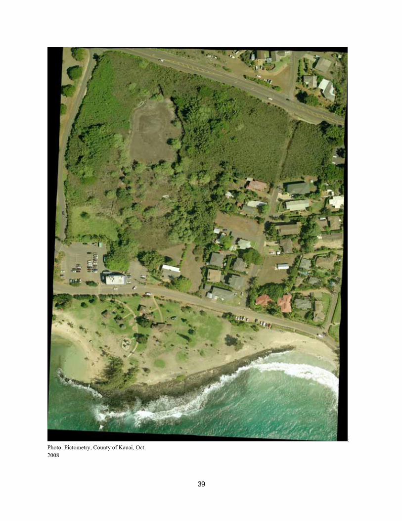
: Photo: Pictometry, County of Kauai, Oct. 2008
40
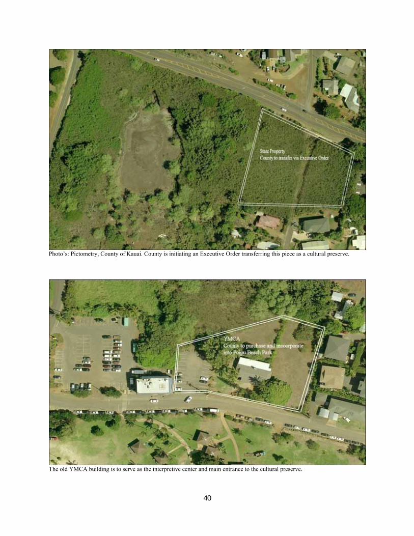
Photo’s: Pictometry, County of Kauai. County is initiating an Executive Order transferring this piece as a cultural preserve.
The old YMCA building is to serve as the interpretive center and main entrance to the cultural preserve.
41
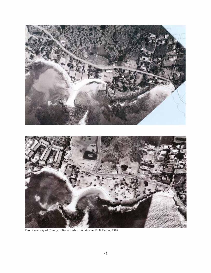
Photos courtesy of County of Kauai. Above is taken in 1960. Below, 1987
42
AAA.jpg
Photo: State Archives. Circa 1965.
43
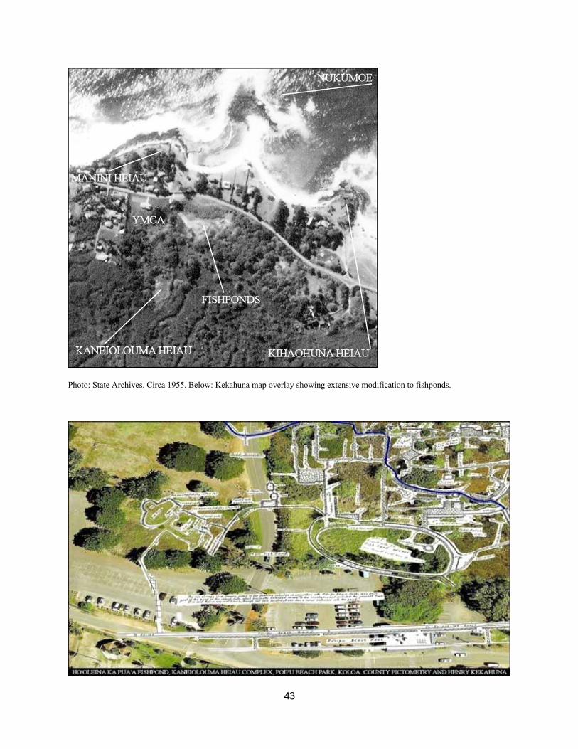
Photo: State Archives. Circa 1955. Below: Kekahuna map overlay showing extensive modification to fishponds.
44
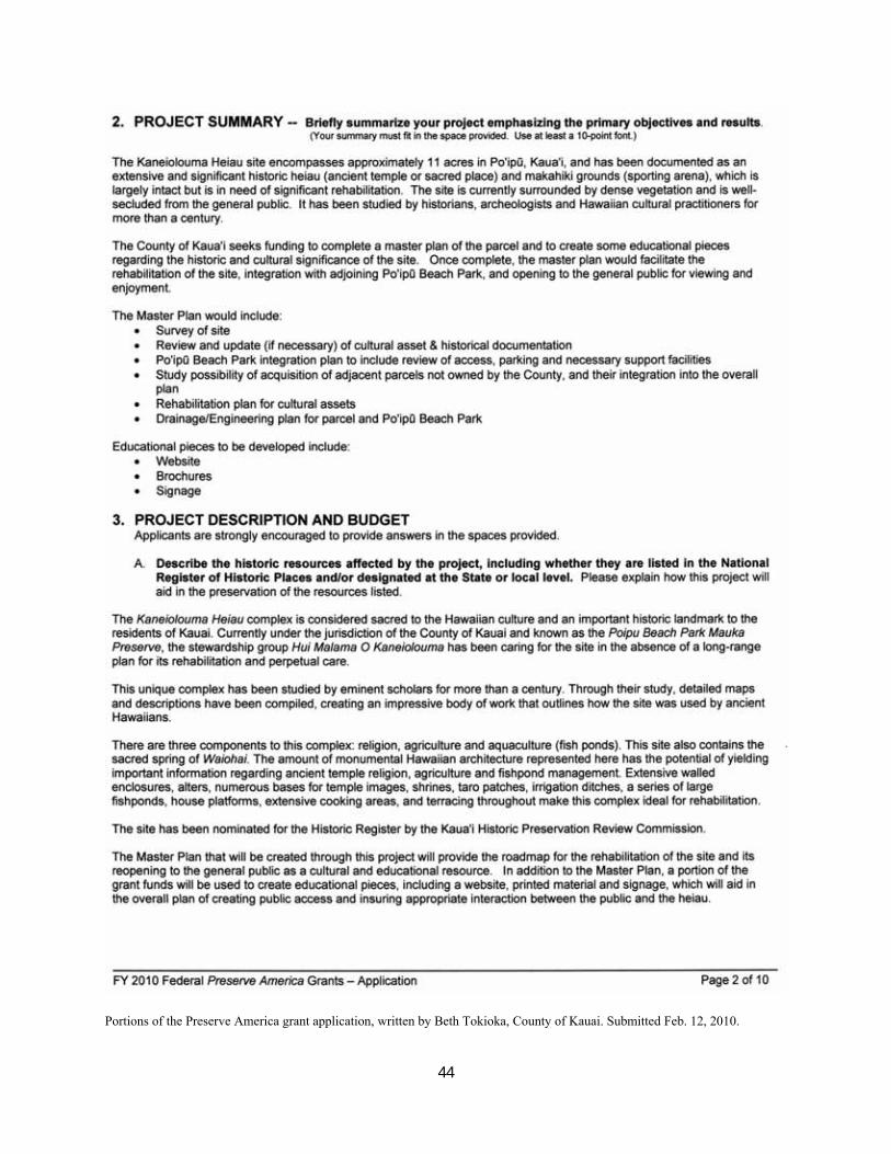
Portions of the Preserve America grant application, written by Beth Tokioka, County of Kauai. Submitted Feb. 12, 2010.
45
46
47
48
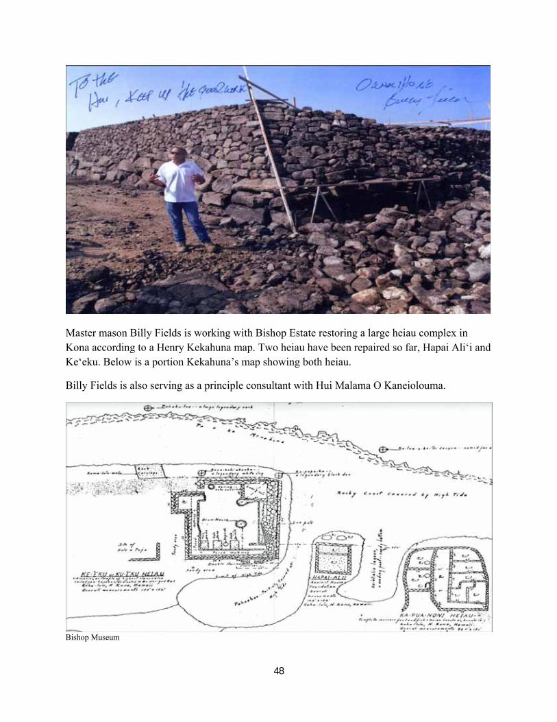
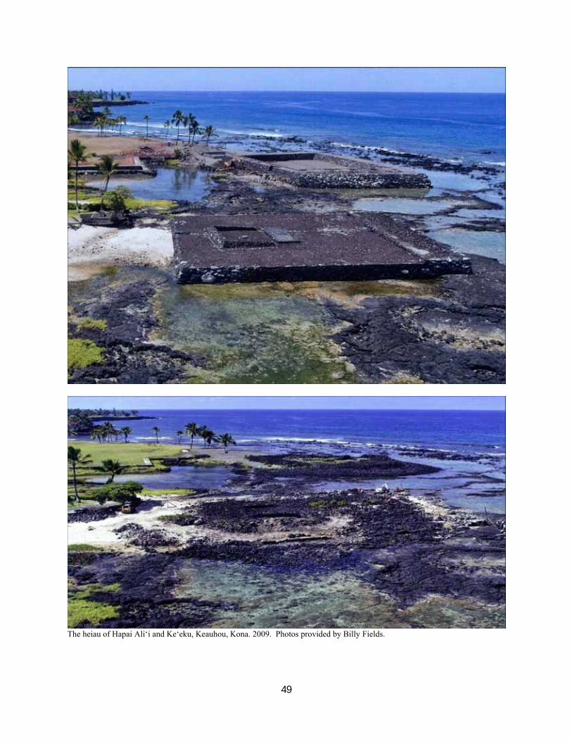
Master mason Billy Fields is working with Bishop Estate restoring a large heiau complex in Kona according to a Henry Kekahuna map. Two heiau have been repaired so far, Hapai Ali‘i and Ke‘eku. Below is a portion Kekahuna’s map showing both heiau.
Billy Fields is also serving as a principle consultant with Hui Malama O Kaneiolouma.
Bishop Museum
49
The heiau of Hapai Ali‘i and Ke‘eku, Keauhou, Kona. 2009. Photos provided by Billy Fields.
50
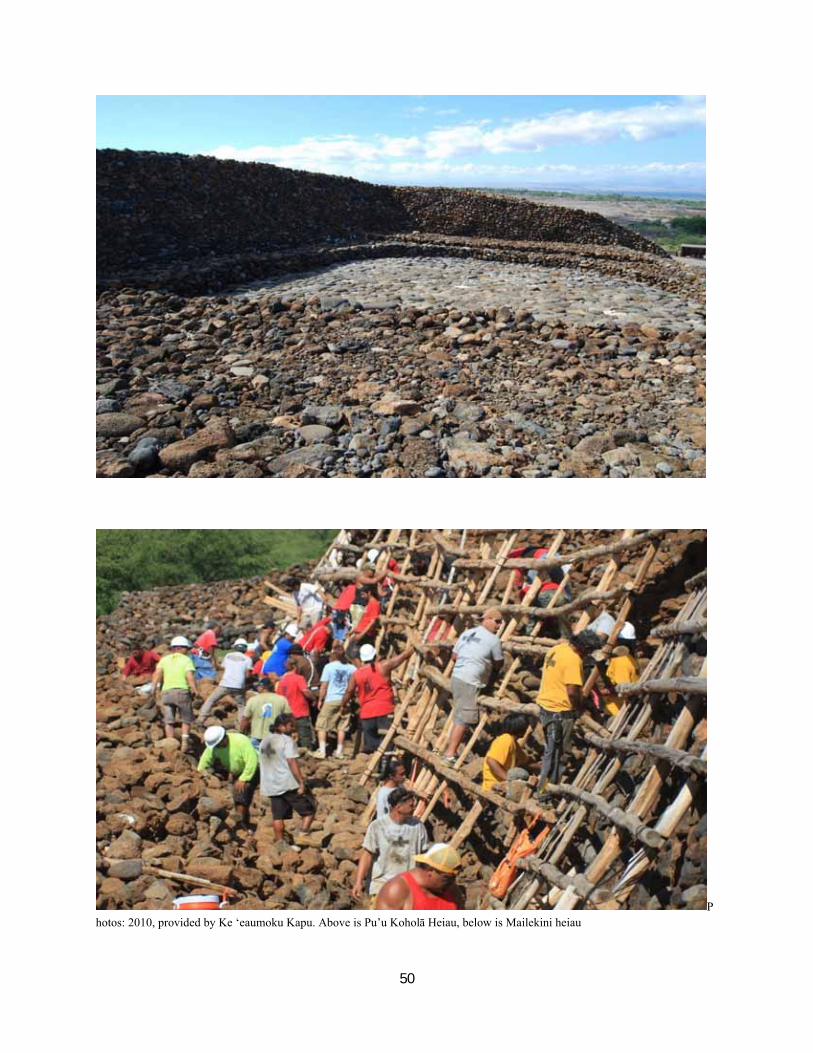
Photos: 2010, provided by Ke ‘eaumoku Kapu. Above is Pu’u Koholā Heiau, below is Mailekini heiau
51
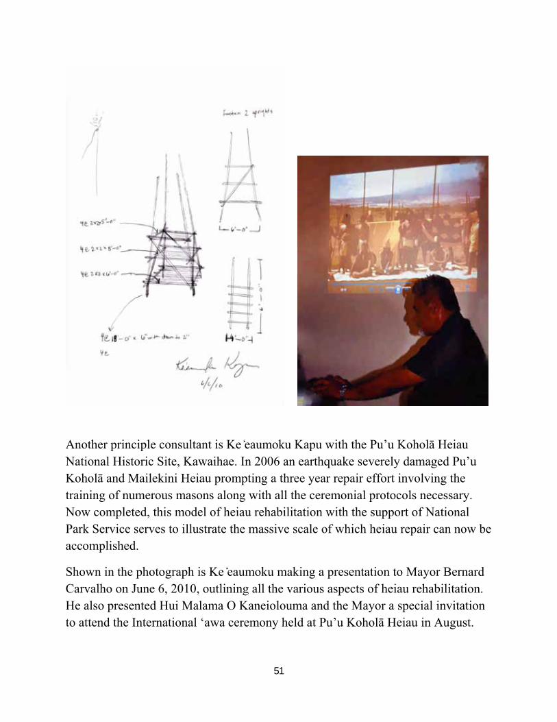
Another principle consultant is Ke ̒eaumoku Kapu with the Pu’u Koholā Heiau National Historic Site, Kawaihae. In 2006 an earthquake severely damaged Pu’u Koholā and Mailekini Heiau prompting a three year repair effort involving the training of numerous masons along with all the ceremonial protocols necessary. Now completed, this model of heiau rehabilitation with the support of National Park Service serves to illustrate the massive scale of which heiau repair can now be accomplished.
Shown in the photograph is Ke ̒eaumoku making a presentation to Mayor Bernard Carvalho on June 6, 2010, outlining all the various aspects of heiau rehabilitation. He also presented Hui Malama O Kaneiolouma and the Mayor a special invitation to attend the International ‘awa ceremony held at Pu’u Koholā Heiau in August.
52
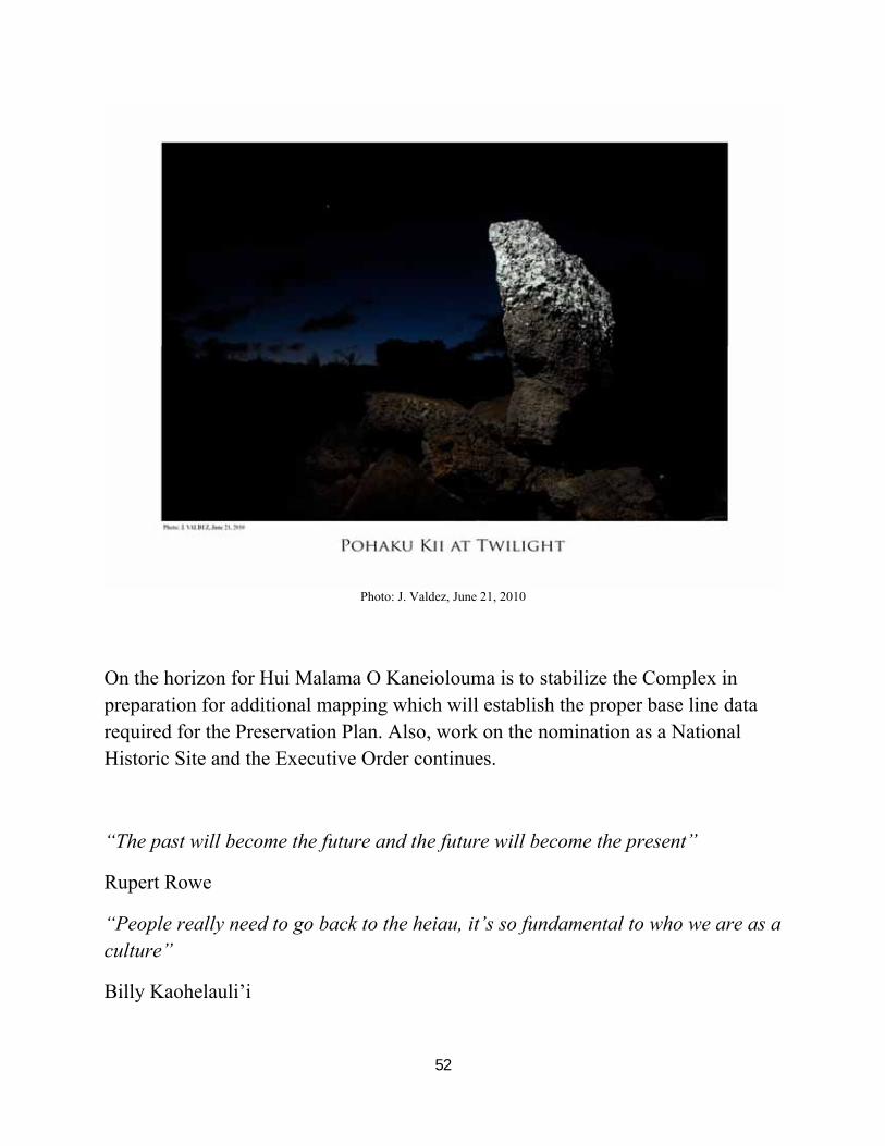
Photo: J. Valdez, June 21, 2010
On the horizon for Hui Malama O Kaneiolouma is to stabilize the Complex in preparation for additional mapping which will establish the proper base line data required for the Preservation Plan. Also, work on the nomination as a National Historic Site and the Executive Order continues.
“The past will become the future and the future will become the present”
Rupert Rowe
“People really need to go back to the heiau, it’s so fundamental to who we are as a culture”
Billy Kaohelauli’i
53
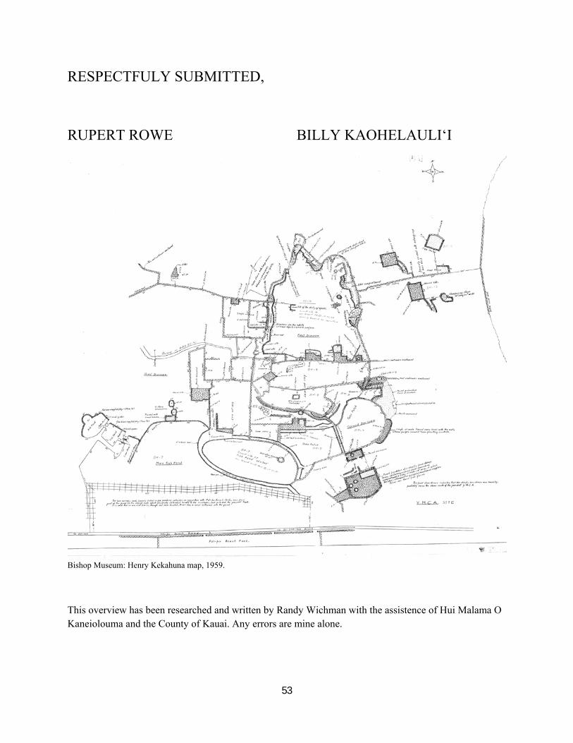
RESPECTFULY SUBMITTED,
RUPERT ROWE BILLY KAOHELAULI‘I
Bishop Museum: Henry Kekahuna map, 1959.
This overview has been researched and written by Randy Wichman with the assistence of Hui Malama O Kaneiolouma and the County of Kauai. Any errors are mine alone.
54