d el a w a r e 2014 r nce are honored to have three accomplished professionals to start our day off:...
TRANSCRIPT

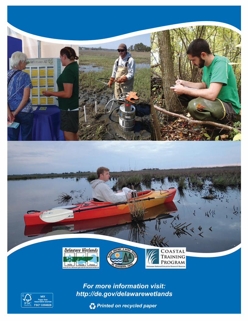
For more information visit: http://de.gov/delawarewetlands
Printed on recycled paper
Delaware Wetlands Conference2014
Conserving Wetland Resources through Science and Education
January 30, 2014Dover, DE

Thank You to our Sponsors
SUPPORTERS
FRIENDS
FANS

1
Welcome and thank you for attending the 6th Wetlands Conference hosted in Delaware. If you are a returning attendee we appreciate your continued interest and support. If you are attending for the first time we hope you find the program to be informative and worthwhile. With one quarter of Delaware’s surface area covered in wetlands that provide important services to our communities every day, it is no surprise that there is a growing interest in learning about wetlands and recent advances in their management.
As organizers we appreciate the opportunity to bring together such a diverse group of professionals to share current and relevant developments in wetland science. Today’s group consists of land managers, regulators, conservation partners, students, educators, and biologists as well as elected officials and members of the public. We hope to take advantage of this opportunity to promote the importance of wetlands to our state, encourage information sharing, and offer education on wetland ecology with the hopes of improving wetland conservation and protection in Delaware and surrounding states.
We are honored to have three accomplished professionals to start our day off: DNREC Secretary Collin O’Mara, EPA Region III Administrator Shawn Garvin, and Riparia’s Founder and Director Dr. Rob Brooks. Today’s agenda will cover a variety of topics on wetland ecology, conservation, modeling, and planning. Between the plenary speakers, professional breakout session presentations, poster presentations and networking opportunities we hope that what you gain today will enhance your role as a wetland steward tomorrow. By promoting awareness and appreciation for the resource that has supported Delaware’s recreational and economic way of life we will ensure the same benefits for future generations. Thank you to all of our contributors, presenters, volunteers and attendees for making this year’s conference a success.
Enjoy the day,Wetland Monitoring and Assessment Program and Coastal Training Program
Welcome Message

2
Conference Map

3
Shawn M. Garvin Regional Administrator, EPA Region III
Shawn M. Garvin was named Regional Administrator of EPA Region III in November 2009. EPA Region III includes the states of Delaware, Maryland, Pennsylvania, Virginia and West Virginia, and the District of Columbia. Shawn’s career in intergovernmental affairs spans more than 20 years at the federal and local levels. Prior to being named RA, Shawn most recently served as the Senior State and Congressional Li-aison for EPA Region III where he provided counsel to agency leadership, environmental program man-agers, press officers and others involved in complex and controversial public health and environmental matters. In addition to his work at EPA, Shawn served as an aide to then Senator Joe Biden, D-Del., and
worked on the staff of former New Castle County (Del.) Executive Dennis Greenhouse. Shawn is a native Delawarean and gradu-ate of the University of Delaware. He lives in Wilmington with his wife and their son.
Dr. Rob BrooksProfessor of Geography and Ecology, and Founder and Director of Riparia at the Pennsylvania State University
Dr. Rob Brooks, Professor of Geography and Ecology, and Founder and Director of Riparia at the Penn-sylvania State University is the recipient of the 2013 National Wetlands Award in Science Research by the Environmental Law Institute. He is a practicing wetland scientist and wildlife biologist certified by the Society of Wetland Scientists and The Wildlife Society, respectively. For over 30 years, Dr. Brooks has built a research program in wetlands science and wildlife ecology that spans the full realm of top-ics relating to the ecology, management, policy, and conservation of wetlands, streams, and riparian areas, and their associated biota. In 1993, Dr. Brooks founded Riparia, a center focused on advancing
wetlands and aquatic ecosystems science. Under his direction, Riparia has led or participated in some of the most significant research on wetlands and wetlands assessment techniques in the United States. He has published over 100 scientific articles and mentored 42 graduate students to completion of their degrees, furthering his contributions to wetland science and conserva-tion. Most recently, Dr. Brooks edited and co-authored the book Mid-Atlantic Freshwater Wetlands: Advances in Wetlands Science, Management, Policy, and Practice in 2013.
Biography

4
8:00 AM Registration and Refreshments (lobby)
9:00 AM Opening Remarks – Ballroom B
9:15 AM Welcome – DNREC Secretary Collin O’Mara – Ballroom B
9:30 AMPlenary Speakers- Ballroom B
Mr. Shawn Garvin, EPADr. Robert Brooks, Penn State University
10:15 AM Coffee Break - Sponsored by Envirotech
Session I: GIS and Mapping
Chesapeake Room
Session II: Monitoring & Assessment
Silver Lake Room
Session III: Restoration
Delaware Room
10:30 AM
NWI+ Web Mapper – New Information to Aid Wetland Conservation and Restoration in
DelawareRalph Tiner, U.S. Fish and Wildlife
Landscape Change and the Condition of Tidal and Non-tidal Wetlands in Southern
Delaware’s Coastal WatershedsMatthew Jennette, DNREC
Army Creek Marsh: Integration of Remediation Strategy and Wetland Restoration
Bruce Bayne,
URS Corporation
10:55 AM
Landscape Assessment of Wetlands for Conservation Priorities in Delaware
Ted Weber,
The Conservation Fund
Variation in Coastal Wetland Condition and Stressors Among Eight Watersheds
of the Delaware EstuaryDanielle Kreeger,
Partnership for the Delaware Estuary
Beneficial Reuse of Dredge Material to Rebuild Spartina alterniflora Wetlands
along Pepper CreekBart Wilson,
Delaware Center for the Inland Bays
11:20 AM
GIS-based Watershed Resources Registry Supports Collaboration in Maryland
Ralph Spagnolo,
U.S. Environmental Protection Agency
Developing a Sentinel Site Research and Monitoring Program in the Delaware National
Estuarine Research ReserveLyndie Hice-Dunton, DNREC
Rehabilitating Historically Ditched Salt Marsh in Delaware’s Inland Bays:
The Slough’s Gut ExperienceChris Pfeifer, Cardno ENTRIX
11:45 AM
Advances in Wetland Remote SensingVictor V. Klemas
University of Delaware
Delaware National Estuarine Research Reserve: Marsh Bird Monitoring along the St. Jones River
Christina Whiteman, DNREC
Comparison of Three Created Freshwater Wetland Types Implemented on
Saturated Agricultural LandKenneth Smith, DNREC
12:15 PM Lunch - Ballroom B
Conference Agenda

5
1:15 PM Poster and Networking Session
2:00 PM Concurrent Sessions
Session IV: Wetland Biology
Chesapeake Room
Session V: Wetland Modeling and Dynamics
Silver Lake Room
Session VI: Planning and Conservation
Delaware Room
2:00 PM
Northern Diamondback Terrapin Nesting Beach Restoration Project
Robert Meadows, DNREC
Modeling the Response of a Tidally-driven Salt Marsh with a Complex Channel Network
Ryan Mieras,
University of Delaware
The Economic Value of the Brandywine Creek Watershed
Catherine Cruz-Ortiz and Kate Miller,
University of Delaware
2:25 PM
The Effects of Sea Level Rise on the Population Distribution of the Fiddler Crab, Uca pugnax, in
Southern Delaware Salt MarshesCynthia Hanson, University of Delaware
Flow Characteristics and Inundation of a Tidal Flat and Saltmarsh in Kent County, Delaware
Aline Pieterse,
University of Delaware
Preparing for Tomorrow’s High Tide: Recommendations for Adapting Wetlands
Conservation and ManagementSusan Love, DNREC
2:50 PM
The Conservation of Tidal Marsh Birds: Guiding Action at the Intersection of our
Changing Land and SeascapesRebecca Kern,
University of Delaware
Hydrodynamic Modeling of a Tidal Estuary for Marsh Restoration and Optimization: Prime Hook National Wildlife Refuge, Milton, DE
Todd DeMunda, Atkins Global
Integrating Socio-ecological Research andCollaborative Learning to Increase
Resilience to Sea-level RiseBrian A. Needelman, University of Maryland
3:15 PM
Developing Coefficients of Conservatism to Advance Floristic Quality Assessment in
the Mid-Atlantic RegionSarah Chamberlain,
Pennsylvania State University
Tidal Marsh Restoration Design at Prime Hook National Wildlife Refuge
Susan Guiteras,
U.S. Fish and Wildlife Service
The Effect of a Flood Mitigation Structure Utilizing Filtrexx® Land Improvement Systems
on Flooding in the Town of Dewey Beach Bayard Avenue Watershed
Todd A. Fritchman, Envirotech
3:40 PM
A Bio-based Living Shoreline Design for Salt Marsh Erosion Control
Joshua Moody,
Partnership for the Delaware Estuary
Effect of Hurricane Sandy on Salt Marshes of the Delaware Estuary and Barnegat Bay
Tracy Quirk,
Drexel University
Instituting a Challenge to a Plant’s Indicator Status in the 2013 National Wetland Plant List
Glynn Rountree1 and Jim McCulley2, 1National Association of Home Builders,
2Watershed Eco LLC
4:00 PM Refreshments and Socializing
4:30 PM Adjourn
Conference Agenda

6
Poster Presentations
Effects of Sea Level Rise on Freshwater Impoundments for Migratory WaterbirdsJoshua N. Barth, Delaware State University
Influences of Soil Composition and Measurement Time Span on Marsh Accretion RatesBrandon Boyd, University of Delaware
Wetland Monitoring and Assessment: Data Correlation from Rapid Assessment Method to Site-Specific Intensive Monitoring
Jessie Buckner, Partnership for the Delaware Estuary
Determining the Effect of Phragmites australis on Blue Crab (Callinectes sapidus) Survival in Blackbird Creek, Delaware
Akida J. Ferguson, NOAA Environmental Cooperative Science Center
How Environmental Planning Implements Wetland, Subaqueous Lands, and Other Natural Resource Protection Measures on Transmission, Distribution, and Substation Projects in DPL Service Territory
Annina Hazel, Pepco Holdings Inc.
How Well Do We Know Our Wetlands? The Remarkable Discoveries of Photuris mysticalampas and Lejeunea maxonii From the Nanticoke River Floodplain
Christopher M. Heckscher, Delaware State University
Effects of Nest Depredation and Anthropogenic Activities on Diamondback Terrapins (Malaclemys terrapin) in Delaware
Lori A. Lester, NOAA Environmental Cooperative Science Center
Predicting the Effects of Sea Level Rise on Wintering Waterfowl Carrying Capacity in DelawareMark C. Livolsi, University of Delaware
Pre-Restoration Preliminary Ecohydrological Results of Atlantic Coast and Chesapeake Bay Ditched-Drained Marshes on Eastern Shore Maryland
Dorothea J. Lundberg, University of Maryland
Establishing a Statewide Database for Delaware Sediment Elevation Tables (SETs)Drexel Siok, Delaware Coastal Program
Quantifying Carbon Accumulation and Stocks in Delaware Estuarine WetlandsKaitlin Tucker, University of Delaware
Restoring Barren Island through Partnerships and Community InvolvementMatt Whitbeck, U.S. Fish and Wildlife Service
Creating a Value-Based Rapid Wetland Assessment MethodMatthew A. Jennette, DNREC Watershed Assessment and Management Section

7
GIS-BASED WATERSHED RESOURCES REGISTRY SUPPORTS COLLABORATION IN MARYLANDEllen Bryson1, Ralph Spagnolo2, Brittany Smith2
“Protecting Maryland’s streams and wetlands involves multiple agencies, including the EPA, USACE, several state agencies and others. This can hamper holistic, collaborative approaches to resource protection. The GIS-based Watershed Resources Registry (WRR) addresses this challenge. It lays out in map form Maryland’s most valuable resources. Partner agencies and permit applicants can work more efficiently using a big picture perspective.
The analyses in the WRR score aquatic and upland resources for preservation and restoration value. The findings are avail-able through an easy-to-use website, which includes specialized tools to search by score, size, location, etc. Project designers can now consider valuable resource areas early in the design process to avoid impacting them, saving thousands of research and design hours.
The WRR analyses were created using ArcGIS Model Builder. The website was built on ESRI’s web application development framework. Data layers include both local data and remote data from external web services.”
1U.S. Army Corps of Engineers, Baltimore District2U.S. Environmental Protection Agency, Region 3
DEVELOPING COEFFICIENTS OF CONSERVATISM TO ADVANCE FLORISTIC QUALITY ASSESSMENT IN THE MID-ATLANTIC REGIONSarah Chamberlain, Hannah Ingram; Pennsylvania State University
Floristic Quality Assessment (FQA) is a recognized technique for assessing habitat quality. The Floristic Quality Index (FQI), a primary component of FQA, uses richness and conservatism of the plant community (expressed as a coefficient of conservatism) to derive a quantitative estimate of habitat nativity or condition. The Mid-Atlantic Floristic Quality Assessment Project was initiated in 2009 to advance floristic quality assessment in the region. We convened a panel of 13 botanists to assign coefficients of conservatism. The botanical panel identified 4180 unique plant species of which 2794 were ranked. Two-thirds of the flora were native, the majority of which were forbs. Conservative taxa occurred throughout the region in numbers similar to generalist taxa, although there was a slight decrease in conservative species from the Appalachian Plateau to the Coastal Plain. We also used data from wetland reference sites to examine the potential subjectivity of coefficient values. In investigating bias, we found subjectively assigned conservatism values were remarkably accurate. Over 75% of highly conservative taxa were found exclusively at high-quality sites while less than 5% of generalist taxa were restricted to a single condition category. FQA has many uses including evaluating condition and tracking trends, prioritizing sites for acquisition or restoration, and aiding in the development of design and performance criteria for future restoration projects. To facilitate the use of FQA by the natural resources community, Riparia has developed an interactive web-based calculator. The calculator and underlying techniques serve as an important addition to any natural resource manager’s tool kit.
THE ECONOMIC VALUE OF THE BRANDYWINE CREEK WATERSHED: THE WATER RESOURCES AGENCY, UNIVERSITY OF DELAWARECatherine Cruz-Ortiz1, Kate Miller2
The historic Brandywine Creek has been a cultural and economic engine for northern Delaware since before the American colonies and continues to be a driving force for economic development by today’s standards. But how much is the Brandywine Creek actually worth? This question was approached in three different ways: by calculating the economic values of activities directly related to the watershed; calculating the value of the watershed’s natural goods and services; and calculating employment directly related to the watershed. Through these separate assessments, the Water Resources Agency was able to estimate that a healthy Brandywine Creek watershed provides between $560 million to $2 billion annually to the economies of Northern Delaware and Southern Pennsylvania.
1University of Delaware, Water Sciences Research Fellow2University of Delaware, Public Administration Fellow
Presentation Abstracts

8
Presentation Abstracts
HYDRODYNAMIC MODELING OF A TIDAL ESTUARY FOR MARSH RESTORATION AND OPTIMIZATIONPRIME HOOK NATIONAL WILDLIFE REFUGE, MILTON, DETodd DeMunda, P.E.1, Jeffrey Tabar, P.E.2, Al Rizzo3, Susan Guiteras3, Art Coppola3
Prime Hook National Wildlife Refuge and its adjacent water bodies are important natural features along western Delaware Bay. Historically salt and brackish marsh habitats, these units were diked and managed as freshwater impoundments starting in the early 1980s. Over the past decade, some of these impoundments have reverted to saline conditions, largely due to a number of storm events that have caused flooding, erosion, and opened several breaches between the Refuge and Delaware Bay.
Most recently, as a result of significant changes caused by Hurricane Sandy, the USFWS tasked Atkins with a survey and coastal engineering analysis to develop restoration alternatives for managing the Refuge as a saltwater environment. Part of this task was to develop a hydrodynamic and sediment transport model of the Refuge and adjacent bay region using Delft3D. The Delft3D model was chosen for its ability to readily include morphology, salinity, and constituent transport within the hydrodynamic modeling framework.
Using this model, a variety of alternative marsh configurations were developed and tested for their effects on water levels, salinity distribution, and sediment transport within the affected area. The model was driven by tidal, riverine, and wind forces for both operational (“normal”) conditions and for conditions during Hurricane Sandy, for which a wealth of measured data was available within the Refuge for model verification. The results of the modeling effort were used in conjunction with the coastal engineering analysis to recommend a preferred alternative for modifying and managing the Refuge under the new environmental regime post-Sandy.
1 Atkins, Melbourne, FL2 Atkins, Edison, NJ3 USFWS, Milton, DE
THE EFFECT OF A FLOOD MITIGATION STRUCTURE UTILIZING FILTREXX® LAND IMPROVEMENT SYSTEMS ON FLOODING IN THE TOWN OF DEWEY BEACH BAYARD AVENUE WATERSHED Todd A. Fritchman; Envirotech Environmental Consulting, Inc.
Abstract: The Town of Dewey Beach, Sussex County, Delaware experienced drainage problems within the drainage area along Bayard Avenue. These problems resulted in flooding of Bayard Avenue and associated parking areas and yards. The untreated stormwater generated by the impervious areas within the drainage area continued to pollution loadings and water quality impacts to Rehoboth Bay. The Town of Dewey Beach commissioned a committee (the Roads Committee) to identify and evaluate potential options of addressing flooding problems and water quality impacts along Bayard Avenue that result from stormwater runoff and tidal surges in 2009.
Background: The Town of Dewey Beach offered a Request for Proposal (RFP) regarding an analysis of possible conceptual alternative for addressing drainage, flooding and water quality problems within the drainage area along Bayard Avenue.
Methods: Background Study, Bid Specifications, Project Partnering, Concept Design, Wetland Delineations, Environmental Study, Site Prep, Engineering, Permitting, Construction Bids/Construction, Planting/Ecological Restoration, Maintenance and Management.
Project Partnering: In February 2009, Envirotech Environmental Consulting, Inc. (EECI) was retained in conjunction with ECI Engineering Planning Surveying (ECI) to create a Green Technology Best Management Practices (BMP) for low-impact development and coastal watershed management.
Results: Project was completed after two growing seasons, by September 2012. The effect was 100% performance zero flooding within the watershed occurred from the point of construction completion withstood the impact of Hurricane Irene (August 27-31, 2011). However, on August 25, 2012, due to malfunction within a control panel the pumps failed to operate and flooding occurred.
9
Presentation Abstracts
TIDAL MARSH RESTORATION DESIGN AT PRIME HOOK NATIONAL WILDLIFE REFUGESusan Guiteras1, Al Rizzo1, Arthur Coppola1, Annabella Larsen1, Michael Stroeh2, Jeff Tabar3, Todd DeMunda3, Pam Latham3, Walker Dawson3, Robert Scarborough4, Mike Mensinger4, Drexel Siok4, Kenneth Smith4, Christina Whiteman4, Bartholomew Wilson5
Prime Hook National Wildlife Refuge has been struggling for several years with how best to manage the wetlands in Unit II and Unit III, previous freshwater impoundments which were impacted by saltwater intrusion through breaches along Unit II. Dur-ing its Comprehensive Conservation Plan (CCP) process, the refuge approved a plan to conduct proactive restoration of the refuge’s impounded wetlands to tidal salt and brackish marsh, including some level of repair to the dune breaches. Through discussions with wetland restoration professionals and a review of restoration conducted elsewhere in the country, a number of potential ac-tions were identified to restore elevation, hydrology, and salinity suitable to support a salt marsh. The refuge contracted with Atkins Global, a private firm, to conduct hydrodynamic modeling and an analysis of restoration scenarios, the details of which are present-ed separately. The next steps of marsh restoration design are building upon these model findings, in combination with additional local wetland monitoring data and consultation with wetland restoration partners. The proposed marsh restoration framework will be described in more detail.
1U.S. Fish and Wildlife Service, Coastal Delaware National Wildlife Refuge Complex2U.S. Fish and Wildlife Service, South Arkansas National Wildlife Refuge Complex3Atkins Global 4DNREC Delaware Coastal Programs, Delaware Coastal Management Program5Delaware Center for the Inland Bays
THE EFFECTS OF SEA LEVEL RISE ON THE POPULATION DISTRIBUTION OF THE FIDDLER CRAB, UCA PUGNAX, IN SOUTHERN DELAWARE SALT MARSHESCynthia Hanson; College of Earth, Ocean and Environment, University of Delaware
The marsh fiddler crab (Uca pugnax) plays a fundamental role in coastal saltmarshes by aerating and mixing nutrients into the sediments through its burrowing behavior. Accretion rates in many coastal marshes can no longer keep pace with increased sea level rise (SLR) due to climate change, putting these marshes at risk of subsidence and habitat loss. Understanding the role of native fiddler crabs and how they will be affected by SLR will help inform preservation efforts and predict the future survival and recovery of tidal saltmarshes. This study worked to characterize the fiddler crab populations in two Southern Delaware marshes through abundance and distribution field surveys. Results show that while the crabs are found throughout the majority of the marsh, they are primarily absent from pooling areas of heavy dieback. They are most abundant in the low regions near riverbanks, showing an affinity for areas optimal for burrowing with softer substrates, lower water content and moderate vegetation; and an aversion to areas with denser substrates. From this data I will construct a species distribution model for the area which I will compare to SLR predictions generated using Sea Level Affect Marshes Model (SLAMM) to predict the impact of SLR on the crab populations and local marsh habitat. The findings of this study could be applied and expended to larger marshes along Delaware Bay and provide insight for coastal management in the future.
DEVELOPING A SENTINEL SITE RESEARCH AND MONITORING PROGRAM IN THE DELAWARE NATIONAL ESTUARINE RESEARCH RESERVELyndie Hice-Dunton, Ph.D.1,2, Christina Whiteman2, Drexel Siok2, Kenneth Smith2, Mike Mensinger1, Robert Scarborough, Ph.D.2
In recent years the National Estuarine Research Reserve System (NERRS) has initiated plans to designate research areas at NERRS locations as sentinel sites, particularly for climate change research and monitoring. This program will build upon long term water quality and meteorological monitoring within the Reserve System with the goals to track changes in vegetation communities, water level and inundation patterns, and sediment elevation in critical estuarine habitats. The Delaware National Estuarine Research Reserve (DNERR) began implementing the required components outlined in NERRS guidance documents in 2012 by establishing sites to monitor long-term changes in marsh ecosystems within the St. Jones Reserve. These efforts will be extended to the Black-bird Creek Reserve in 2014, allowing for the comparison of changes in different habitat types within the Delaware Bay system. Once established, the DNERR and other NERRs will provide critical research and monitoring sites to examine the effects of climate change and sea level rise. All information collected will be incorporated into a larger NOAA Sentinel Site Program.
1Delaware Coastal Programs, Delaware National Estuarine Research Reserve, Dover, DE2Delaware Coastal Programs, Delaware Coastal Management Program, Dover, DE

10
Presentation Abstracts
LANDSCAPE CHANGE AND THE CONDITION OF TIDAL AND NON-TIDAL WETLANDS IN SOUTHERN DELAWARE’S COASTAL WATERSHEDSMatthew A. Jennette, Alison B. Rogerson, Andy M. Howard; DNREC Watershed Assessment and Management Section
Delaware’s Wetland Monitoring and Assessment Program is tasked with assessing the condition of tidal and non-tidal wetlands throughout the State, and the ecosystem services provided by these wetlands. Wetlands are assessed at the watershed-scale to identify common stressors and regionally-specific trends. Land-use in southern Delaware’s coastal watersheds (St. Jones, Murderkill, Mispillion, Cedar Creek, Broadkill, and the Inland Bays) varies greatly – from areas dominated by forest cover to agricultural land and urbanization. Each watershed has experienced a significant loss of historic wetland acreage and a continued trend of nontidal wetland losses. Rapid wetland assessments conducted at 581 randomly-selected sites between 2006 and 2012 identified several wetland stressors common to each of the watersheds, including ditching, filling, and invasive plant cover. The frequency of these stressors varies among watersheds and wetland types, reflecting differences in historic land use and development pressures.
ADVANCES IN WETLAND REMOTE SENSINGVictor Klemas; School of Marine Science and Policy, University of Delaware
To plan for wetland protection and sensible coastal development, scientists and managers need to monitor the changes in coastal wetlands as the sea level continues to rise and the coastal population keeps expanding. Advances in remote sensor design and data analysis techniques are providing significant improvements for mapping natural and man-induced changes in coastal wetlands. Results of case studies show that analysis of new satellite and aircraft imagery combined with some on-the-ground observations, allows researchers to effectively determine long- term trends and short- term changes of wetland vegetation and hydrology. The objective of this paper is to review recent developments in wetland remote sensing and to evaluate their practicality and cost.
VARIATION IN COASTAL WETLAND CONDITION AND STRESSORS AMONG EIGHTWATERSHEDS OF THE DELAWARE ESTUARY Danielle Kreeger1, Angela Padaletti1, Alison Rogerson2, Andy Howard2, Martha Maxwell Doyle3, Kurt Cheng1, Jessie Buckner1
The Delaware Estuary is a wetland-fringed system with a broad salinity gradient and a diverse array of historic and current anthropogenic stressors. The system is currently losing about an acre per day of its hallmark coastal wetlands. As part of the Mid-Atlantic Coastal Wetland Assessment, we used the Mid-Atlantic Tidal Rapid Assessment Method (Mid-TRAM v.3) to examine buffer, hydrology, habitat and shoreline condition at more than 250 random sites during 2010-2013, concentrated in eight representative watersheds within three states (3 in DE, 4 in NJ, 1 in PA) around the estuary (~30 points per watershed). For each watershed, a “report card” was prepared that assigned a grade to that area’s coastal wetlands based on various biological, physical and landscape features and stressor-response relationships. Moderate or severe stress was evident at the majority of randomly assessed coastal wetland sites, and therefore the composite condition scores per watershed differed only modestly. Comparative analysis of specific MidTRAM metrics revealed much more information regarding the nature of specific stressor gradients, which were associated with both natural variability (e.g. salinity) and anthropogenic influences (e.g., urban versus rural). Canopy robsutness, landward migration blockages, and shoreline erosion were three of the most responsive rapid assessment metrics. Mosquito ditching, filling, hydrological alteration, landward migration blockages, invasive species and shoreline erosion were some of the most common stressors. These comparative data on coastal wetland health associated with local impairments will aid state managers in making informed decisions regarding how best to conserve or enhance the many ecosystem services furnished by coastal marshes in the wetland-dominated Delaware Estuary.
1Partnership for the Delaware Estuary2DNREC Watershed Assessment and Management Section3Barnegat Bay Partnership, Ocean County College

11
Presentation Abstracts
PREPARING FOR TOMORROW’S HIGH TIDE: RECOMMENDATIONS FOR ADAPTING WETLANDS CONSERVATION AND MANAGEMENTSusan Love, Molly Ellwood, Tricia Arndt; DNREC Delaware Coastal Programs
After 3 years of collaborative effort, the state’s Sea Level Rise Advisory Committee this fall approved 55 recommendations for adapting to sea level rise in Delaware—many of which relate to the conservation and management of wetlands in the state. The vulnerability assessment conducted by the committee last year found that up to 99% of the state’s tidal wetlands are at risk of being inundated by rising tides by the year 2100, resulting in losses of wildlife habitat, flood attenuation and recreational opportunities. Wetland losses from sea level rise were ranked by the committee as among the most pressing vulnerabilities in the state. This talk will review the relevant vulnerabilities of the state’s tidal wetlands to sea level rise and highlight a number of the committee recommendations, particularly those that may require cooperation and buy-in from numerous partners.
NORTHERN DIAMONDBACK TERRAPIN NESTING BEACH RESTORATION PROJECTRobert Meadows; DNREC Fish and Wildlife
The Delaware Estuary with its ring of broad sandy beaches is an important nesting habitat for Northern Diamondback Terrapins in the Mid-Atlantic region. Over the course of the past century this population has been seriously impacted by water pollution, oil spills, and over harvesting among other challenges. More recently in the upper portion of the estuary a new threat has emerged that reduces access to many prime nesting beaches for returning female terrapins. The culprit in this loss has been the rapid expansion of introduced Phragmites over tens of thousands of acres of prime tidal marsh and shoreline habitat. Much has been done over the past two decades to control this introduced grass in the marsh interior by spraying, but the bayfront beaches were generally avoided due to concern of accelerating shoreline erosion. In the summer of 2006, a comprehensive survey of all bayfront beaches from Smyrna River north to the C & D Canal was conducted to document terrapins nesting activity and presence and extent of Phragmites cover along the beach front. Most beaches had well established stands of Phragmites that extending out to below the high tide line. No terrapin nesting was documented in these stands due to the dense nature of the aboveground culms and belowground rhizome mat. The effected beaches were sprayed with glyphosate starting in the fall of 2006. A nesting survey in 2013 documented significant nest density in former Phragmites dominated areas of the beach, comparable to that found in unaffected beach habitat.
MODELING THE RESPONSE OF A TIDALLY-DRIVEN SALT MARSH WITH A COMPLEX CHANNEL NETWORKRyan Mieras, James T. Kirby, Fengyan Shi; Center for Applied Coastal Research, Department of Civil and Environmental Engineering, University of Delaware
A field study was conducted on the main channel of Brockonbridge Marsh, which opens to the Delaware Bay, in Kent County, Delaware. The study lasted 2 weeks during March and April 2013 and encompassed a full neap-spring tidal cycle. Additionally, in the summer of 2013, two extensive surveys of the channel’s bathymetry were completed. Of particular interest was understanding how the predominately semi-diurnal tide propagates throughout the marsh, given its complex network of secondary and tertiary channels. In order to measure surface elevation, five pressure gauges and an Aquadopp Profiler (ADCP) were deployed at six various locations, spanning 2.5 km along the channel. The ADCP was deployed on the bottom, facing upward, at the channel’s mouth to record the velocity profile. Finally, during the spring phase, the moving-boat method with a second ADCP was used to measure discharge at the mouth. The hydrodynamics of Brockonbridge Marsh are then modeled using a quasi-3D nearshore circulation model, NearCoM, with the surface elevation data at the mouth used as a boundary condition. LIDAR data are combined with the measured bathymetry data to create an accurate 3D depiction of the marsh. The model results are compared to the data collected at all six gauge locations. Furthermore, a mathematical model is offered for computing discharge from the moving-boat data, then is extended to the upward facing ADCP data to provide a correlation between discharge and current profile. These results are finally compared to the discharge values computed from NearCoM.
12
Presentation Abstracts
A BIO-BASED LIVING SHORELINE DESIGN FOR SALT MARSH EROSION CONTROLJoshua Moody1, Danielle Kreeger1, David Bushek2, Angela Padaletti1
Tidal salt marshes are a hallmark feature of the Delaware Estuary providing many beneficial ecosystem services. Currently, the Delaware Estuary is experiencing a net loss of salt marsh due to sea level rise and other factors, and reducing edge erosion is one way to offset this deficit. To offer a more environmentally sound alternative to “hard-armoring”, such as bulkheads and rip-rap, we developed and tested a bio-based tactic that takes advantage of naturally resilient properties of intertidal plants and shellfish. The ribbed mussel (Geukensia demissa) lives along the marsh edge where it binds tightly to the rhizomes of cordgrass, Spartina alterniflora. Erosion in areas of high mussel/plant density appears to be less severe than in areas where mussels are absent. Our bio-based tactic seeks to slow erosion and build resilience of the marsh edge by enhancing the integrity of this natural mutualism. To test this method, coir fiber logs and mats were used to stabilize and trap sediments at several sites in the Maurice River, NJ, and were subsequently planted with Spartina and ribbed mussels. Treatments in lower energy areas have persisted and stabilized (some for up to 5 years so far), tolerating seasonal ice flows and hurricane conditions while also stemming landward retreat of the vegetated edge. Maintaining correct elevations proved critical in the survival and persistence of Spartina. Nekton usage increased after converting rip-rap to fringing marsh, demonstrating enhanced fish habitat. Bio-based living shorelines can help control shoreline erosion and protect vital marsh habitat while enhancing ecological value.
1The Partnership for the Delaware Estuary2Haskin Shellfish Research Laboratory, Rutgers, the State University of New Jersey
INTEGRATING SOCIO-ECOLOGICAL RESEARCH AND COLLABORATIVE LEARNINGTO INCREASE RESILIENCE TO SEA-LEVEL RISEBrian A. Needelman1, Paul Leisnham1, Andrew H. Baldwin1, Robert L. Tjaden Jr1, Dorothea Lundberg1, Diane Leason1
Michael J. Paolisso2, Katherine Joanne Johnson2, Patricia Delgado3, Sasha Land3, Chris Snow3, Lisa Wainger4, Natallia Leuchanka5
Coastal habitats and communities are facing widespread degradation and losses of coastal marshes in the Mid-Atlantic region due to sea-level rise and other stressors. In this project, we are using the coastal peninsula of Deal Island, MD as a case study of a community with a strong coastal heritage that is facing ecological and social stresses from sea-level rise. We are using collaborative learning and integrated anthropological, economic, and ecological investigations to better understand and improve the resilience of this socio-ecological system. The goals of this project are to: 1) Establish a continuing collaboration among local community, state and federal agency, academic, and non-governmental organization stakeholders working towards the resilience of the marshes and local communities of the Deal Island peninsula; 2) Develop and test a broadly transferable process of engaging stakeholders to optimize and implement strategies that restore and conserve marshes and local communities; and 3) Better understand the provision of socio-ecological services by marsh systems and decision-making processes within the stakeholder community. We are conducting three focused Collaborative Research Projects on the topics of marsh restoration, flooding, and heritage. The restoration of ditch-drained marshes is being used as a case study within these Collaborative Research Projects. Through this project, we are establishing a partnership to address sea-level rise in this community as well as improve strategies for adaptation elsewhere. The methodologies developed through this project hold promise to facilitate the implementation of marsh conservation and restoration and community adaptation strategies throughout coastal regions.
1 University of Maryland, Department of Environmental Science and Technology2 University of Maryland, Department of Anthropology3 Chesapeake Bay National Estuarine Research Reserve4 Chesapeake Biology Laboratory, University of Maryland Center for Environmental Science5 University of New Hampshire

13
Presentation Abstracts
REHABILITATING HISTORICALLY DITCHED SALT MARSH IN DELAWARE’S INLAND BAYS: THE SLOUGH’S GUT EXPERIENCEChris Pfeifer; Cardno ENTRIX
It is now recognized that the once common practice of ditching salt marshes for mosquito control can severely alter habitat structure and diminish the ecological functions and values of coastal wetlands. In 2009, Delmarva Power & Light, in partnership with the Delaware Center for the Inland Bays, and DNREC’s Mosquito Control Section, undertook a project to enhance a tract of historically ditched salt marsh along Slough’s Gut in southeastern Indian River Bay. The project, located within the James Farm Ecological Preserve near Ocean View, entailed constructing pools, mud flats, and meandering tidal creeks within the otherwise uniform marsh and backfilling linear mosquito ditches with the excavated spoil. The project utilized specialized equipment and construction techniques similar to those employed with open marsh water management (OMWM), a contemporary mosquito control technique. The Slough’s Gut project successfully increased micro-habitat diversity, expanded foraging opportunities for marsh-dependent species, and restored more natural hydrologic patterns to the site. Noteworthy aspects of project planning and design, such as tidal prism modeling and morphometric landscape analysis, will be discussed, as well as challenges encountered and lessons learned during construction and beyond. Key findings from more than five years of intensive pre- and post-construction monitoring will also be presented. Although similar work has been performed in New England on a limited basis, to our knowledge, this is among the first projects of this type completed in the Mid-Atlantic. Given its apparent success, the Slough’s Gut project serves as a useful model for future salt marsh rehabilitation efforts.
FLOW CHARACTERISTICS AND INUNDATION OF A TIDAL FLAT AND SALTMARSH IN KENT COUNTY, DELAWAREAline Pieterse1,*, Jack A. Puleo2, Thomas E. McKenna3
A 2-week field experiment was conducted in March and April 2013 in a tidal wetland in Kent County, Delaware. The study area was a tidal flat fed by a secondary channel of the Brockonbridge Gut, a small tributary of Delaware Bay. The goal of the field study was to investigate spatio-temporal variability in the hydrodynamics of the saltmarsh and tidal flat, over the period of one spring-neap tidal cycle. The experiment combined remotely-sensed imagery with high-frequency in-situ measurements. A tower with visible light (RGB), near-infrared (NIR), and thermal-infrared (TIR) imagers was deployed to quantify the spatial variations of inundation of the channels, flat and marsh. In-situ sensors that measured flow velocity, sediment concentration and water depth were deployed at six different locations on the tidal flat and in the channels. At three locations, a Nortek Vectrino II – profiling velocimeter was deployed that measured a 30 mm velocity profile at 1 mm vertical increments at 100 Hz. These velocity profiles are used to compute turbulent kinetic energy, energy dissipation and stress profiles close to the bed. Preliminary results of the experiment show that peak velocities, turbulence, stresses, and sediment concentrations occur at low water levels, at the beginning of the rising and end of ebbing tide. The initial inundation of the tidal flat at rising tide can be tracked using the thermal imagery. Results show that the inundation of the flat happens quickly at the onset of flooding tide.
1 Department of Geological Sciences, University of Delaware2 Center For Applied Coastal Research, Department of Civil and Environmental Engineering, University of Delaware3 Delaware Geological Survey, University of Delaware* Corresponding author: [email protected]

14
Presentation Abstracts
DELAWARE NATIONAL ESTUARINE RESEARCH RESERVE: MARSH BIRD MONITORING ALONG THE ST. JONES RIVERChristina Whiteman; Delaware Coastal Programs
In 2012, the Delaware National Estuarine Research Reserve (DNERR) initiated a Marsh Bird Monitoring Program at the St. Jones Reserve to join a nationwide network of marsh bird monitoring within and outside the NERRS. The purpose of this study is to determine baseline data for marsh birds and their habitat, monitor long term population trends, and to link population and community variation to the ecological health of emergent wetlands in the St. Jones Reserve. The DNERR Marsh Bird Monitoring Program also aims to create a citizen science project to give volunteers a unique opportunity to learn about wetland ecosystems. Several other NERRs are currently using a Marsh Bird Monitoring Program as a successful citizen science opportunity including the Guana Tolomato Matanzas NERR (Florida), North Inlet-Winyah Bay NERR (South Carolina) and Sapelo Island NERR (Georgia). The DNERR has recently completed the second year of participating in this nationwide research effort. The first year of this survey the DNERR followed the National Marsh Bird Monitoring Protocol and modified the study for the second year to use the SHARP protocol. Since all survey dates still fall within the National Monitoring Protocol, all data is being uploaded to the National Marsh Bird Database. Preliminary baseline data and lessons learned from project implementation will be presented.
EFFECT OF HURRICANE SANDY ON SALT MARSHES OF THE DELAWARE ESTUARY AND BARNEGAT BAYTracy Quirk; Drexel University
Coastal marshes are exceedingly vulnerable to sea-level rise and erosion during storm events. However, marsh systems can benefit from extreme events through the supply of sediment to the marsh plain, thereby increasing accretion and elevation relative to sea level. Hurricane Sandy made landfall along the coast of New Jersey on October 29, 2012 as a Category 1 hurricane raising water levels throughout the northeast and causing extreme inundation increasing the potential for sediment deposition on the marsh surface.
We measured inundation and accretion at six salt marsh sites representing the northern shore of the Delaware Estuary and Barnegat Bay, New Jersey before and after the storm. Marshes of the Delaware Estuary were flooded 23 to 100 hours and marshes of Barnegat Bay experienced 72 to 136 hours of continuous inundation. Despite the potential for sediment deposition, surface accretion was variable within and among sites. Although temporary, the Delaware Bay marshes had a greater morphodynamic response to the storm than Barnegat marshes. Overall, measurements suggest that the storm was not a significant source of accretion to the marsh systems as a whole, and indicate the redistribution of sediments with little or no new deposition. Measurements from this extreme event are discussed in context of information from initial long term monitoring results.
INSTITUTING A CHALLENGE TO A PLANT’S INDICATOR STATUS IN THE 2013 NATIONAL WETLAND PLANT LISTGlynn Rountree1, Jim McCulley2
The National Wetland Plant List (NWPL) is used to evaluate the vegetation factor in jurisdictional determinations made under the Clean Water Act. Each plant listed in the NWPL has an assigned indicator status that reflects the probability of finding that plant in a wetland or an upland situation. When the NWPL was updated and published in 2012, a variety of changes were made to the document, including the addition of nearly 1,500 new species and changes in the indicator status used for the plants in the document. While the Army Corps of Engineers (Corps) argued that the changes would not impact wetland delineations, many wetland professionals say that delineations have changed markedly, leading to the suspicion that some plants in the NWPL are mischaracterized as to their indicator status. With the new publication of the 2013 NWPL, a “Challenge Procedure” has been published by the Corps to seek change to the indicator status of a plant.
In January of 2014, The National Association of Home Builders (NAHB) will institute a challenge to one or more plant species. In October of 2013, NAHB will select a contractor to provide technical assistance in this effort. The contractor will assist NAHB in selecting the plant to challenge from a short list of plants that may be mischaracterized as to their indicator status.
1National Association of Home Builders2Watershed ECO LLC

15
Presentation Abstracts
ARMY CREEK MARSH: INTEGRATION OF REMEDIATION STRATEGY AND WETLAND RESTORATIONMartin L. Schmidt1, Paul G. Johnson2, Bruce Bayne1
This project integrates the remedial action associated with a former polymer/polypropylene plant with the restoration of an impounded freshwater marsh adjacent to Army Creek (a Delaware River tributary) in New Castle, Delaware. In cooperation with the Delaware Department of Natural Resources and Environmental Control Site Investigation and Remedial Branch (DNREC-SIRB) an Integrated Remedial Action Work Plan (IRAWP) was prepared by Atlantic Richfield Company (ARC) to finalize a program for remediation of process residuals from historical manufacturing operations and completion of wetland restoration.
The remedial approach addressed potential risks to human health and the environment by establishing a removal area and volume for five metals and for alkyl/nonyl phenols based on achieving the 95% Upper Confidence Limit of the Mean of the DNREC-SIRB established cleanup goals. The restoration included a technical approach that incorporated benchmark site and regional conditions and remedial action opportunities/limitations to form a foundation for restoration establishment and enhancement. The approach was supported by extensive physical surveys and hydrodynamic modeling designed to assess a range of marsh elevations and channel configurations that included the existing impounded conditions and potential tidal inundation. The IRAWP activities were completed in 2012. Approximately 17,100 cy of process residuals were removed from 10.1 acres. Restoration established lower marsh, far-reaching channels, enhancement areas, and buffers that were seeded and planted with nearly 22,000 native herbaceous and woody plants. Restoration was integrated into the remedial approach to complement and enhance the existing marsh complex. A three-year monitoring program is documenting progression toward restoration success metrics.
1URS Corporation2Atlantic Richfield Company
THE CONSERVATION OF TIDAL MARSH BIRDS: GUIDING ACTION AT THE INTERSECTION OF OUR CHANGING LAND AND SEASCAPESW. Greg Shriver, Rebecca Kern; Department of Entomology and Wildlife Ecology, University of Delaware
Worldwide, tidal marshes cover an estimated 45,000 km2, and over one-third of these marshes are found along the U.S. Atlantic and Gulf coasts. These ecotonal ecosystems form the dominant transition zone between terrestrial and marine communities and, in eastern North America, tidal marshes possess the greatest level of vertebrate biodiversity and endemism of any tidal marsh region worldwide. The Saltmarsh Habitat and Avian Research Program (SHARP) coordinated a multi-tiered research and conservation initiative from Virginia to Maine to provide a population monitoring framework, standardized sampling protocols, and information exchange focused on tidal marsh bird conservation. In 2011 - 2013, we coordinated a survey of 1660 randomly selected points, including 440 that were surveyed in 1999 - 2000. These data will be used to identify regional tidal marsh bird “hot spots,” as well as generate the first assessment of population trends for these species. We established six demographic study sites between New Jersey and Maine, which will allow us to develop fecundity models to identify priority sites and landscapes. Given that increases in sea-levels will reduce the extent of tidal marsh habitat and may eliminate breeding opportunities for the endemic Saltmarsh Sparrow (Ammodramus caudacutus), the information and coordination of this effort is connecting stakeholders across the region to develop novel conservation actions before it is too late.
16
COMPARISON OF 3 CREATED FRESHWATER WETLAND TYPES IMPLEMENTED ON SATURATED AGRICULTURAL LANDKenneth Smith, Drexel Siok, Bob Scarborough; Delaware Coastal Programs Demonstration areas for are a beneficial practice to establish techniques which allow landowners to become more ecologically sound while maintaining control of the activities on their land. The Delaware National Estuarine Research Reserve (DNERR) has had a demonstration plot of 3 created freshwater wetland types since 2003. The plots were designed following the U.S. Department of Agricultures (USDA) Conservation Reserve Enhancement Program (CREP) protocols for creating shallow water areas for wildlife (CP9) with the goals to evaluate created wetland habitat types for their function and ecosystem services. These plots provide 3 different options for landowners who may be looking into wetland creation on their property using the USDA CREP protocols. In the summer of 2012, the wetlands were analyzed using the Delaware Division of Watershed Stewardships Delaware Comprehensive Assessment Procedures as a 10 year follow up of their condition and status. The 3 wetland types were compared to determine which techniques would provide the environment with the greatest positive impact and guide future wetland creation projects.
NWI+ WEB MAPPER – NEW INFORMATION TO AID WETLAND CONSERVATION AND RESTORATION IN DELAWARERalph Tiner; U.S. Fish and Wildlife Service
States and other agencies often want more information (e.g., more detail, more current data, and potential wetland restoration site locations) than provided by the U.S. Fish and Wildlife Service’s National Wetlands Inventory (NWI) Program. The NWI is a national program and has focused on producing wetland maps (now geospatial data) showing the general location of wetlands classified according to the Service’s official wetland classification system. The Delaware Department of Natural Resources and Environmental Control recently cooperated with the NWI to produce updated and enhanced wetland inventory information for the state. The project involved updating conventional NWI data plus building a more extensive wetland database for the state including: 1) more detailed wetland classification by adding hydrogeomorphic attributes, 2) a landscape-level assessment of wetland functions, 3) an assessment of recent wetland trends, and 4) an inventory of potential wetland restoration sites. While a 2011 interagency report summarized most of the results of the upgraded inventory, most of the “map” data were unavailable to the public. The Northeast Region of the FWS worked with Virginia Tech and the Association of State Wetland Managers to develop a website for posting “special project” geospatial data. The site contains an “NWI+ web mapper” that displays these data for Delaware and for other areas across the country. This presentation will introduce the new mapper, describe the available data for Delaware, how to access these data, and show examples of outputs.
LANDSCAPE ASSESSMENT OF WETLANDS FOR CONSERVATION PRIORITIES IN DELAWARETed Weber; The Conservation Fund
In 2007, The Conservation Fund delineated a system of key wildlife habitat, ecosystems, and linkages called the Delaware Ecological Network (DEN). As part of an effort to identify Conservation Opportunity Areas in Delaware, a holistic approach to identifying and setting priorities for preservation, protection and restoration, The Conservation Fund and the Delaware Department of Natural Resources and Environmental Control (DNREC) updated the DEN, identifying core areas, which contain relatively intact natural ecosystems and provide high-quality habitat for native plants and animals; and corridors, which link core areas together, allowing wildlife movement and seed and pollen transfer between them. As one component of the DEN, we compared existing wetland condition data to landscape data. Pruned regression tree models showed that “Good” condition or minimally disturbed wetlands had <5% of the assessment area disturbed and >97% of the wetland mature. Having >99% of the assessment area mature and wetlands ≥7 ac further helped discriminate these high quality wetlands from lower quality. Based on the regression tree models, we identified core wetland complexes: contiguous blocks of potentially natural, undisturbed cover containing at least 7 acres of mature, undisturbed wetlands. We added wetlands in Habitats of Conservation Concern, and wetlands containing documented occurrences of wetland-dependent rare species. Finally, we added adjacent natural land and open water. For corridors, we identified paths of least resistance by simulating the movement of wetland-dependent organisms through the landscape. We discriminated between intact corridors (natural vegetation) and potential corridors (potentially important for connectivity, but on degraded or altered land.)
Presentation Abstracts

17
BENEFICIAL REUSE OF DREDGE MATERIAL TO REBUILD SPARTINA ALTERNIFLORA WETLANDS ALONG PEPPER CREEKBartholomew Wilson, P.G.1, Alison Rogerson2, Andy Howard2, Dan Brower3, Ariane Nichols3
In an effort to utilize the thin-layer application of dredge material to aid in the restoration of tidal wetlands, a cooperative workgroup of State and non-profit partners was initiated to locate and prioritize restoration areas adjacent to potential future navigational dredging projects in Delaware Inland Bays. The Fringe Wetland Workgroup has completed its first beneficial reuse project as part of this initiative, which consisted of using a high pressure spray nozzle to spray silty dredge material over a ~25 acre Spartina alterniflora wetland, along Pepper Creek as part of the navigational channel dredging project. This project was conducted in two phases, a 5.3 demonstration areas (completed in March 2013) and a larger continuation of ~15 to 20 acre section (completed in the fall 2013). The thickness of the dredge material application varied from 1 to 10 inches on the marsh surface, and was controlled by efforts to management the disbursement to the areas of the highest need. A detailed site assessment was conducted to integrate the marsh surface elevation, and tidal datums to evaluate the existing growth range and health of the Spartina alterniflora platform and identify the areas in the greatest need of sediment to supplement their elevation deficits with respect to the current rate of sea level rise. This presentation will go through the GIS planning process, the pre- and post- site assessments, pre-restoration site preparations, and dredging and thin-layer application process.
1Delaware Center for the Inland Bays2DNREC Watershed Assessment and Management Section3DNREC Shoreline and Waterway Section
Presentation Abstracts

18
Poster Abstracts
EFFECTS OF SEA LEVEL RISE ON FRESH WATER IMPOUNDMENTS FOR MIGRATORY WATERBIRDSJoshua N. Barth, Dr. Lori A. Lester, Dr. Christopher M. Heckscher; Department of Agriculture and Natural Resources, Delaware State University
Sea level rise is expected to increase as a result of global warming. This would have major implications on freshwater habitat availability in the Ted Harvey Wildlife Refuge along the Delaware Bay. This particular wetland habitat hosts many freshwater migratory bird species each year. This freshwater habitat provides a staging ground which supplies food and shelter to depleted migratory birds. A saline pond (15-20ppt) in Little Creek Wildlife Refuge along the Delaware Bay will be compared to a freshwater pond (0-2ppt) in Ted Harvey Wildlife Refuge. Species utilizing each site will be compared to determine each species preferred salinity. Our oceans have already risen 30cm in the past century (Titus, 2008). As of now, sea level rise is occurring at a rate of 3mm/yr or more in low lying areas. Rising sea level inundates low-lying lands, erodes wetlands and beaches, exacerbates flooding, and increases the salinity of estuaries and aquifers (IPCC, 2007). This research represents how sea level rise may affect waterbirds freshwater habitat availability if freshwater impoundments are inundated with saltwater.
INFLUENCES OF SOIL COMPOSITION AND MEASUREMENT TIME SPAN ON MARSH ACCRETION RATESBrandon Boyd, Christopher K. Sommerfield; School of Marine Science and Policy, University of Delaware
Marsh accretion studies are increasingly undertaken by coastal scientists and managers to address questions of wetland sustainability in the face of accelerated sea-level rise and human pressures. Linear accretion rates (length/time) driven by some combination of organic and mineral mass accumulation rates (mass/area/time) are frequently the focus of such studies. Mass accumulation varies widely within and among different types of wetlands, thus understanding the nature of accumulation is essential when interpreting measured accretion rates. Additionally, mass accumulation and accretion rates exhibit methodological differences related to the time span of averaging. Rates are generally higher on short time spans (weeks to years) when measured using sediment plates or marker beds than rates averaged over longer time spans (decades to millennia) by radionuclide chronometry. While the inverse relationship between accumulation rates and time span is a truism of stratigraphy, it is not squarely addressed in the marsh accretion literature.
This study explores influences of marsh accretion rates on soil composition and averaging time span using a large suite of data from the tidal wetland coasts of Delaware Estuary and Barnegat Bay. For wide range of tidal freshwater, brackish and salt marshes we show that organic accumulation sets the lower limit of marsh accretion rates whereas mineral accumulation sets the upper limit. Moreover, we demonstrate that mass accumulation and marsh accretion rates are inversely related to the period of averaging and exhibit rate vs. time-span trends similar to other types of coastal and marine sedimentary environments. These findings have important implications to the use of marsh accretion rates in restoration projects and projections of wetland stability under scenarios of sea-level rise.

19
Poster Abstracts
WETLAND MONITORING AND ASSESSMENT: DATA CORRELATION FROM RAPID ASSESSMENT METHOD TO SITE SPECIFIC INTENSIVE MONITORING Jessie Buckner, Danielle Kreeger, Angela Padeletti, Priscilla Cole; Partnership for the Delaware Estuary
Coastal wetlands are disappearing and becoming more degraded despite strict regulations. To aid in wetland management and protection, in 2006 the United States Environmental Protection Agency (EPA) published a recommendation for monitoring and assessing wetlands as part of the Clean Water Act. The EPA recommended a three-tiered approach consisting of Landscape Assessment, Rapid Wetland Assessment, and Intensive Site Assessment. Several organizations formed a coalition to design and implement an ongoing Mid-Atlantic Coastal Wetland Assessment (MACWA) to look specifically at the tidal wetlands in the Mid-Atlantic on a four-tier assessment scheme based on the EPA recommendation. The premise of the multi-level approach is that successive tiers serve as ground-truthing and help answer questions regarding stressor-response relationships. But to date, no studies have examined such cross-level interrelationships. This study correlates relationships between MACWA Tier 2- probabilistic sampling on the ground using Rapid Assessment Method (RAM) and Tier 4- site specific intensive monitoring (SSIM) of condition and function at a smaller number of fixed stations. Through careful data analysis focusing on only a few metrics: biomass, bearing capacity, and erosion, one can see the relationships between indicators across the tiers. An analysis across watersheds, within watersheds, and measuring similar wetland types across the tiers will examine if there are redundancies, gratuitous steps, or significant measurements which could be furthered with additional assessment metrics. By viewing the cross-tier correlations, scientists gain the broadest spectrum of meaningful data and wetland managers can ascertain which metrics can be most helpful for management purposes, with limited time and budget.
DETERMINING THE EFFECT OF PHRAGMITES AUSTRALIS ON BLUE CRAB (CALLINECTES SAPIDUS) SURVIVAL IN BLACKBIRD CREEK, DELAWAREAkida J. Ferguson1, Kris Roeske1, Michael G. Mensinger2
The invasion of the nonnative common reed, Phragmites australis, at Blackbird Creek in Townsend, Delaware has altered the ecosystem which previously consisted primarily of saltmarsh cord grass, Spartina alterniflora. Containment of Phragmites spread is being managed by applying glyphosate herbicide to the marsh and burning it. The effect of Phragmites’ presence on native plants and animals is under investigation. A species of particular concern and ecological importance is the blue crab, Callinectes sapidus, which is economically valuable in fisheries. A concurrent study is being conducted to determine the habitat and sites blue crabs prefer using trawl nets and crab traps to determine their abundance at six different sites. The six 300 meter stretches along the creek vary in vegetation by being Phragmites dominated, Spartina dominated, mixed vegetation or having been sprayed with herbicide and burned. This study uses those sites to investigate blue crab survivability in various vegetation types. Crabs are tethered to a stake in the marsh using approximately 1.5 to 3 m of fishing line to limit their movement but allow them to function normally. Three crabs are placed within each site 150 m apart and after one day the crabs are retrieved from the line and their conditions are recorded. This survivability information in conjunction with the abundance and distribution data can be used to determine how Phragmites growth impacts the blue crab population in Blackbird Creek.
1NOAA Environmental Cooperative Science Center, Department of Agriculture and Natural Resources, Delaware State University2Delaware Coastal Programs, Delaware National Estuarine Research Reserve

20
Poster Abstracts
HOW ENVIRONMENTAL PLANNING IMPLEMENTS WETLAND, SUBAQUEOUS LANDS, AND OTHER NATURAL RESOURCE PROTECTION MEASURES ON TRANSMISSION, DISTRIBUTION, AND SUBSTATION PROJECTS IN DPL SERVICE TERRITORYAnnina Hazel; Environmental Planning
1) Project InitiationGIS System EGRET: Use of the PHI GIS system “EGRET” enables Environmental Planning to assess potential environmental impacts and determine potential avoidance and minimization measures.
Field Visits: Field visits and constructability reviews are conducted with DPL internal stakeholders and project team members to identify potential impacts and discuss preliminary design.
2) Project Planning and DesignConsultation Letters: Consultation letter responses from various agencies (DNREC, USFWS, NMFS, DHCA, NHESP, etc.) identify resources of concern so Environmental Planning can initiate the necessary field studies.
Resource Studies: Field studies are initiated (wetland delineations, habitat suitability assessments, raptor nest surveys, etc.) and mapping is developed to incorporate into the design process to minimize environmental impacts where possible.
Avian Protection: The DPL Avian Protection Plan and staff biologists assist engineers in designing facilities to avian-safe standards.
Project Mapping: Project mapping developed by Environmental Planning marries engineering design with surveyed resource mapping and construction access plans based on the constructability review.
3) Project CompletionBest Management Practices: Environmental Planning works with Construction Management to develop BMPs (matting, filter sock, exclusion fencing, etc.) to facilitate construction activities while simultaneously protecting natural resources.
Environmental Monitoring Program: Environmental monitors are assigned to projects when environmental permits (federal, state, and/or local) are acquired or avoidance and minimization plans developed. The monitor coordinates with the construction representatives; making recommendations to reduce impacts and to ensure compliance with permit conditions and project plans. The monitor also uses an online “Toolkit,” in which construction progress is documented, photos are uploaded, and permit conditions are tracked to ensure compliance.
HOW WELL DO WE KNOW OUR WETLANDS? THE REMARKABLE DISCOVERIES OF PHOTURIS MYSTICALAMPAS AND LEJEUNEA MAXONII FROM THE NANTICOKE RIVER FLOODPLAINChristopher M. Heckscher1, William A. McAvoy2, Lori A. Lester1
Over the last several decades ecologists have largely moved from knee deep in muck to carpal tunnel syndrome. Few would argue that biological inventory has taken a back seat to geospatial modeling - but at what cost? Here we highlight two recent remarkable discoveries from the same Delaware wetland that we feel symbolize how much we have to learn about our wetland flora and fauna: (1) the discovery of a firefly new to science (Photuris mysticalampas), and (2) the significant range expansion of a leafy liverwort (Lejeunea maxonii). Delaware has lost >1300 ha of wetlands in the past 15 years. We believe the discovery of these species exemplifies the need for continued biological inventory of our wetlands particularly in the face of climate change and associated habitat loss. We believe that field inventory should complement or perhaps play a leading role in ongoing geospatial efforts rather than be an afterthought. All species play a part in ecosystem function and a lack of knowledge regarding species distributions can undermine the potential effectiveness of our conservation efforts.
1Delaware Environmental Cooperative Science Center, Delaware Department of Agriculture and Natural Resources, Delaware State University2 DNREC Fish and Wildlife

21
Poster Abstracts
EFFECTS OF NEST DEPREDATION AND ANTHROPOGENIC ACTIVITIES ON DIAMONDBACK TERRAPINS (MALACLEMYS TERRAPIN) IN DELAWARELori A. Lester1, Jack S. Suss2
Nest depredation and anthropogenic activities are major conservation concerns for many different species of turtles. During June and July 2013, we surveyed upper Delaware Bay beaches for depredated diamondback terrapin (Malaclemys terrapin) nests. Six beaches were assessed including Bowers Beach, Collins Beach, Kitts Hummock, Pickering Beach, Port Mahon, and Woodland Beach. We counted a nest as depredated if we located an empty nest hole accompanied by one or more egg shells. Depredated terrapin nests (n = 238) were found on all six beaches. The number of depredated shells per nest ranged from one to sixteen with a mean of 6.3 ± 0.2 SE. We observed potential terrapin nest predators including raccoons (Procyon lotor), red foxes (Vulpes vulpes), brown rats (Rattus norvegicus), and feral cats (Felis catus) on or near nesting beaches. While some nests were located directly on the beach, the majority of nests were in Phragmites spp. stands near tidal marshes at the back of the beach. We also witnessed multiple interactions between anthropogenic activities and terrapins. At Port Mahon, we observed nesting terrapins climbing over riprap, crossing the road, and aggregating in the water proximate to commercial and recreational boating activities. We also found dead terrapins on roads near Pickering Beach, Port Mahon, and Woodland Beach with automobile injuries and one dead terrapin washed up on Kitts Hummock beach with boat injury scars. Nest depredation and anthropogenic activities appear to be threats to diamondback terrapins in Delaware by limiting recruitment to the population and causing injury and mortality.
1NOAA Environmental Cooperative Science Center, Department of Agriculture and Natural Resources, Delaware State University2Department of Biodiversity, Earth, and Environmental Science, Drexel University
PREDICTING THE EFFECTS OF SEA LEVEL RISE ON WINTERING WATERFOWL CARRYING CAPACITY IN DELAWAREMark C. Livolsi1, Christopher K. Williams2, Matthew DiBona3, John M. Coluccy4
Tidal wetlands and coastal impoundments in Delaware serve as important wintering habitats for several migrating waterfowl species. Sea level rise (SLR) will likely alter Delaware’s marshland habitat over time, which may in turn alter food composition and availability for wintering waterfowl. Reduced food availability can lead to mortality, health degradation, and impeded recruitment in waterfowl populations. To address this problem, we are comparing food availability, energy expenditure and waterfowl use between impounded and unmanaged wetlands, and apply SLR models to determine current and future wintering waterfowl carrying capacities. To quantify waterfowl food availability, we collected soil core, nekton, and vegetation samples in six habitat types: impoundment, subtidal, mudflat, low marsh, high marsh, and tidal pool. To quantify waterfowl energy expenditure, we conducted instantaneous behavioral scans, and are converting the percentages of each exhibited behavior into energy expended. To determine waterfowl use we are using point counts and aerial survey data to determine which habitats waterfowl preferentially select. Finally, we will apply a variety of SLR scenarios based on Delaware’s Sea Level Rise Affecting Marsh Model (SLAMM) and NOAA’s Coastal Impacts model to determine changes in marsh composition and its effect on carrying capacity. Additionally, we will create “hotspot” maps to predict where future wintering waterfowl will likely be most concentrated.
1 M.S. Candidate, Department of Entomology and Wildlife Ecology, University of Delaware2 Associate Professor, Department of Entomology and Wildlife Ecology, University of Delaware3 DNREC Fish and Wildlife4 Director of Conservation Planning, Ducks Unlimited

22
Poster Abstracts
PRE-RESTORATION PRELIMINARY ECOHYDROLOGICAL RESULTS OF ATLANTIC COAST AND CHESAPEAKE BAY DITCHED-DRAINED MARSHES ON EASTERN SHORE MARYLAND Dorothea J. Lundberg, Brian A. Needelman; University of Maryland
The effects of ditching and restoration on the hydrological regime and ecosystem services on coastal marshes have been briefly studied. This project is the first intensive examination of the hydrologic and associated ecological processes of ditch-drained coastal marshes in Maryland. The goal of this project is to assess ecohydrological processes operating in ditched-drained marshes as well as the effects of restoration on Atlantic Coast and Chesapeake Bay marsh ecosystems. The main objectives of the study are to identify and compare pre-restoration, post-restoration, and natural unaltered unditched site characteristics; and determine restoration hydro-ecological effects. Three paired marsh systems of ditched and unditched marshes are being used in this study and one overall reference site. Data collection includes hydrological and ecological properties such as ditch intensity, water table fluctuations and interaction with surface water, salinity and soil profiles, weather, and vegetation composition. Preliminary results of the pre-restoration period, 2012- 2013, to be presented include soil profiles, time series of hydraulic head, salinity patterns, duration curves, and species composition. Identification of these site variables could be used to predict the success of future restoration projects.
ESTABLISHING A STATEWIDE DATABASE FOR DELAWARE SEDIMENT ELEVATION TABLES (SETS)Drexel Siok1, Lyndie Hice-Dunton, Ph.D.1,2
Over the past five years, the Delaware Coastal Programs has been collecting data from a total of eight Sediment Elevation Tables (SETs) within the Saint Jones River and Blackbird Creek watersheds. This data is used to monitor long term marsh accretion, surface change, and subsidence within a marsh and its associated watershed. Currently, SET data is limited to its use within a watershed and is usually withheld by the agency or program that collects the data.
The Delaware Coastal Programs has partnered with the US Fish and Wildlife Service at Bombay Hook and Prime Hook National Wildlife Refuges, the Center for the Inland Bays, and the Partnership for the Delaware Estuary to establish a Delaware SET Committee to enable data sharing and statewide collaboration, using a format established by the National Park Service. Users will be able to submit and download data on any SET site in the state from a shared database, allowing for broader collaboration and tracking of statewide trends. This database will also allow the data to be maintained in a centralized location with a uniform format, increasing accessibility to other state and regional partners.
1Delaware Coastal Programs, Delaware Coastal Management2Delaware Coastal Programs, Delaware National Estuarine Research Reserve

23
Poster Abstracts
QUANTIFYING CARBON ACCUMULATION AND STOCKS IN DELAWARE ESTUARINE WETLANDSKaitlin Tucker, Christopher K. Sommerfield; University of Delaware
Carbon sequestration is considered an important means to mitigate the impacts of greenhouse gas emissions on climate change. Increasing the amount of carbon stored in wetlands may become an important policy goal with economic benefits relevant to carbon offset programs. Coastal and estuarine marshes are an important sink for atmospheric carbon dioxide, but it is unclear how much biomass carbon accumulates in marsh soils. This study addresses the question of carbon sequestration in marshes of the Delaware River and Bay estuary. Rates of sediment accumulation and marsh accretion in the estuary have been established through past research, but carbon accumulation rates are unknown. Carbon accumulation rates will be quantified for a range of saline, brackish, and tidal freshwater marshes to establish the spatial variability and time-dependence of carbon sequestration. Nested radionuclide chronometry (137Cs, 210Pb, 14C) of soil cores will be used to compute carbon accumulation averaged over decadal to millennial timescales. These rates will be extrapolated over the extent of Delaware wetlands as mapped by the National Wetlands Inventory to estimate carbon storage (stocks). Knowledge of carbon stocks will inform scientists, coastal managers, and policymakers involved in regional evaluations of blue carbon sequestration, and provide context for wetland restoration in the region.
RESTORING BARREN ISLAND THROUGH PARTNERSHIPS AND COMMUNITY INVOLVEMENTMatt Whitbeck, U.S. Fish and Wildlife
Blackwater NWR has partnered with the U.S. Army Corps of Engineers, the National Aquarium in Baltimore, and the Friends of Blackwater NWR to restore Barren Island, a rapidly disappearing Chesapeake Bay island. Using dredge material pumped from a navigation channel and active revegetation, approximately 25 acres of marsh has been restored since 2000.
CREATING A VALUE-BASED RAPID WETLAND ASSESSMENT METHODMatthew A. Jennette, Alison B. Rogerson, Margaret K. Pletta, Andrew M. Howard; DNREC Watershed Assessment and Management Section
Currently the Wetland Monitoring and Assessment Program uses a condition-based rapid (Level 2) assessment method to measure the health of non-tidal wetlands and how disturbances impact wetland function. In order to capture non-condition features, such as a wetland’s value for rare or endangered species or being a unique habitat type in Delaware, we created a value-based rapid assessment method. Wetland values are useful because they capture non-condition related wetland benefits such as flood storage, habitat provision, supporting rare species, diversity, education, and recreation. This 7-metric method was designed to be a companion to the traditional Delaware Rapid Assessment Method (DERAP) used for assessing wetlands on a watershed basis, for evaluating proposed wetland projects, determining appropriate mitigation for wetland impacts, and for prioritizing wetland parcels for protection and restoration. Values included are: rarity/uniqueness, wetland polygon size, habitat availability, Delaware Ecological Network, habitat complexity, flood storage capacity, and education potential. Assessment results can be compared to DNREC’s reference data from wetlands nearby or of similar type. The value assessment method will be made available to practitioners and the public with trainings available starting in fall 2014. More information will be posted online at: http://de.gov/delawarewetlands.
24
Adopt-A-Wetland: http://www.dnrec.delaware.gov/Admin/DelawareWetlands/Pages/AdoptaWetland.aspx
Maryland Coastal Bays Program: www.mdcoastalbays.org
Exhibitors
Wetland Monitoring and Assessment Program: http://de.gov/delawarewetlands
dawarewetlands DE_Wetlands DelawareDNREC

Thank You to our Sponsors
SUPPORTERS
FRIENDS
FANS
For more information visit: http://de.gov/delawarewetlands
Printed on recycled paper
Delaware Wetlands Conference2014
Conserving Wetland Resources through Science and Education
January 30, 2014Dover, DE