d-{$ legal reference: location
TRANSCRIPT
D-{$y
STATE OF HAWAIIDEPARTMENT OF LAND AND NATURAL RESOURCES
Land Division
Honolulu, Hawaii 96813
November 13,2015
Board of Land and Natural Resources PSF No.: 1 SOD-110
State of Hawaii
Honolulu, Hawaii OAHU
Grant of Term, Non-Exclusive Easement to Scott Porter and Colleen Anne Porter for
Seawall Purposes; Assess Administrative Cost of $500, Kaneohe, Koolaupoko,
Oahu, Tax Map Key: (1) 4-4-016:Seaward of 015
APPLICANTS:
Scott Porter, husband, to an undivided two-third (2/3) interest; and Colleen Anne Porter,
wife, as to an undivided one-third (1/3) interest, as Tenants in Common
LEGAL REFERENCE:
Section 171-6, 13, 17, and 53(c), Hawaii Revised Statutes, as amended.
LOCATION:
Portion of Government land located seaward of Kaneohe, Koolaupoko, Oahu, identified by
Tax Map Key: (1) 4-4-016: seaward of 015, as shown on the attached map labeled Exhibit A.
AREA:
31 square feet, more or less, subject to review and approval by the Department of Accounting
and General Services, Survey Division.
ZONING:
State Land Use District: Conservation
City & County of Honolulu LUO: R-5 [for the abutting private property]
TRUST LAND STATUS:
Section 5(b) lands of the Hawaii Admission ActDHHL 30% entitlement lands pursuant to the Hawaii State Constitution: No
CURRENT USE STATUS:
Unencumbered with encroachments.D-16
BLNR - Easement - Porter Page 2 November 13, 2015
CHARACTER OF USE:
Right, privilege and authority to use, maintain, repair, replace and remove existing seawall
over, under and across State-owned land.
COMMENCEMENT DATE:
To be determined by the Chairperson.
CONSIDERATION:
One-time payment to be determined by independent appraisal establishing fair market rent,
subject to review and approval by the Chairperson.
EASEMENT TERM:
Fifty-five (55) years
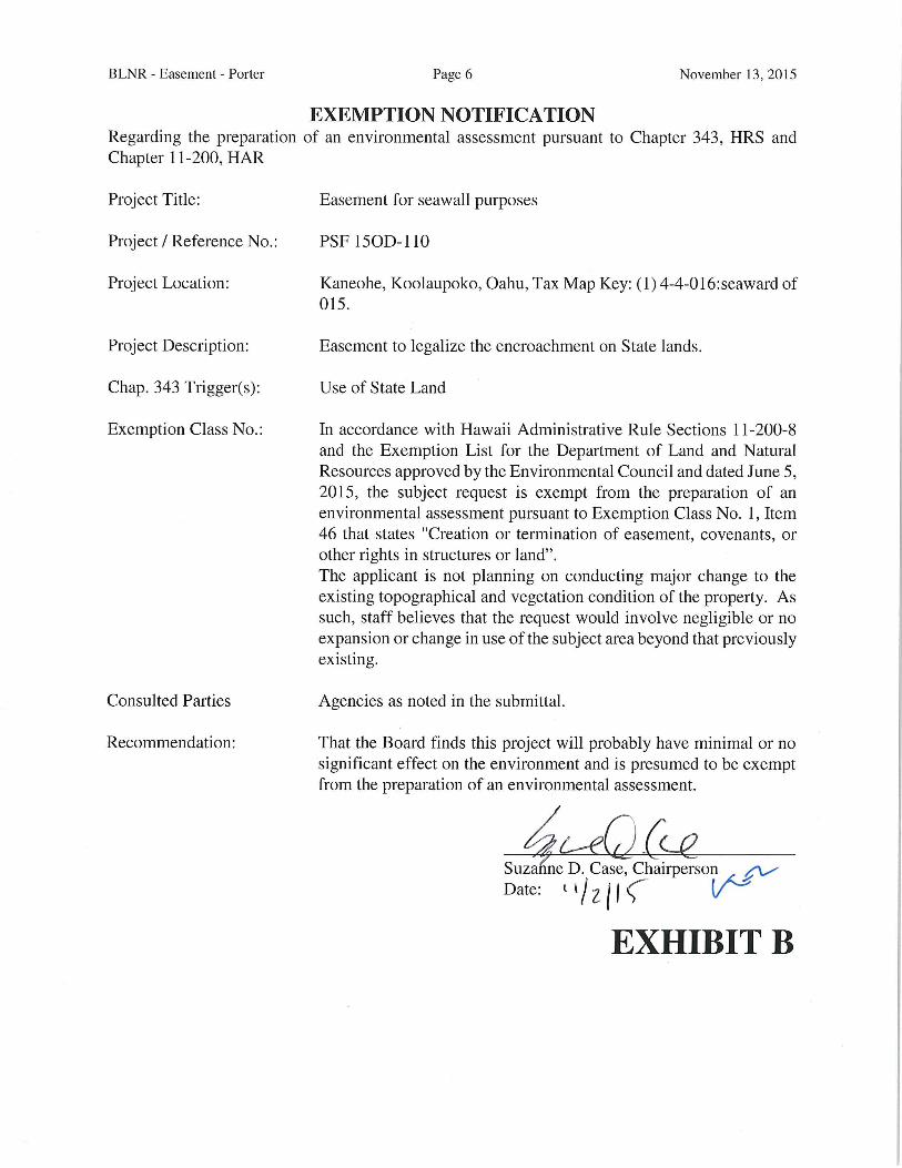
CHAPTER 343 - ENVIRONMENTAL ASSESSMENT:
In accordance with Hawaii Administrative Rule Sections 11-200-8 and the Exemption List
for the Department of Land and Natural Resources approved by the Environmental Council
and dated June 5, 2015, the subject request is exempt from the preparation of an
environmental assessment pursuant to Exemption Class No. 1, Item 46 that states "Creation
or termination of easement, covenants, or other rights in structures or land". See exemption
declaration attached as Exhibit B.
DCCA VERIFICATION:
Not applicable.
APPLICANT REQUIREMENTS: Applicants shall be required to:
1. Provide survey maps and descriptions according to State DAGS standards and at
Applicants' own cost;
2. Pay for an appraisal to determine one-time payment; and
3. Obtain concurrent resolution from the Legislature pursuant to 171-53 (c), HRS.
REMARKS:
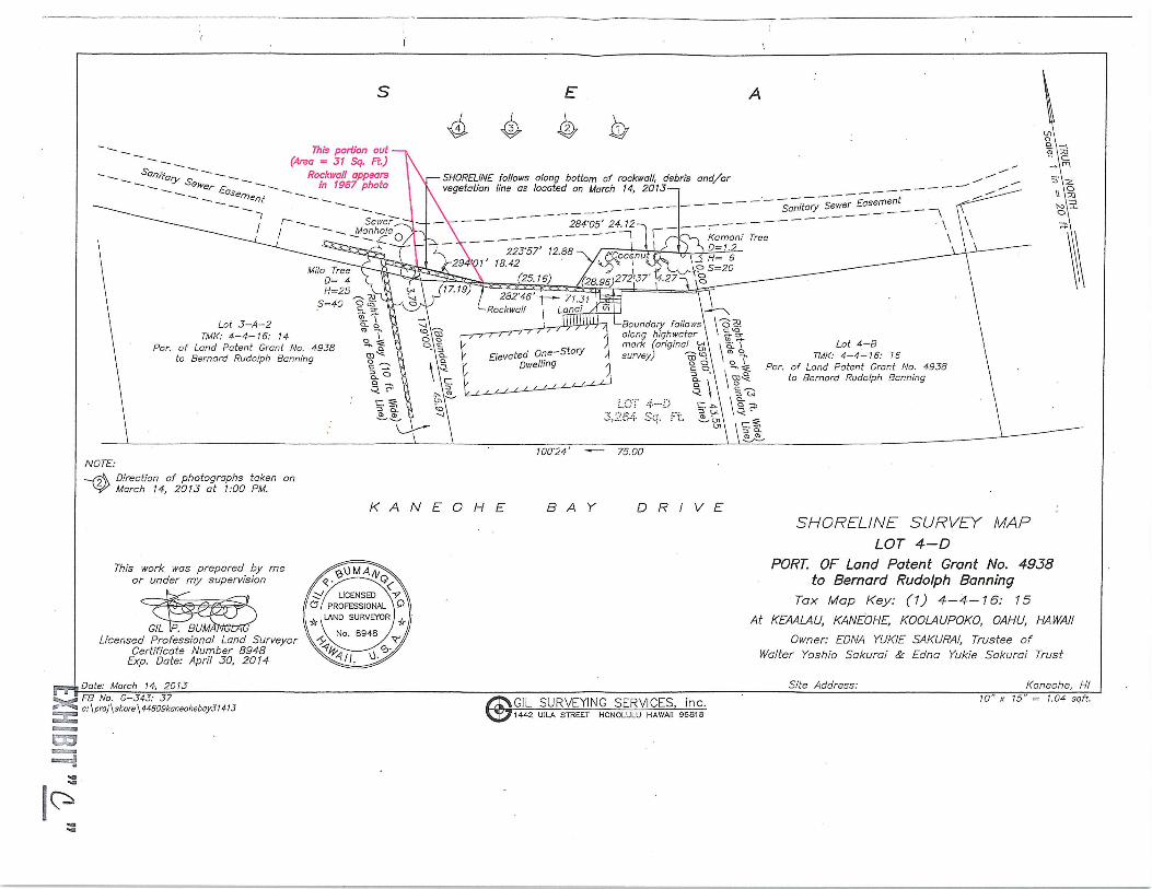
The previous homeowners requested a certified shoreline to obtain permits for house repairs.
During the survey of the subject property, identified as tax map key (1) 4-4-016:015 ("Parcel
15"), an encroachment onto State submerged land beyond the private property's boundary
was noted. In the due diligence period, the subject encroachment was noted on the survey
map (attached as Exhibit C).
BLNR - Easement - Porter Page 3 November 13, 2015
According to the material provide by the applicants and the research conducted by the Office
of Conservation and Coastal Lands ("OCCL"), there is evidence indicating that the seawall is
non-conforming. Given this determination, OCCL will not require an after-the-fact
Conservation District Use Application, and supports a disposition to resolve the
encroachment. A copy of OCCL's review on the encroachment is attached as Exhibit D.
Pursuant to the Board's action of June 28,2002, under agenda item D-17, which established
criteria for imposing fines for encroachments, a fine of $500 is to be imposed if the
encroachment is over 100 square feet. Since the encroachment area is 31 square feet (more
or less), staff recommends that no fine be imposed by the Board.
The Division ofAquatics Resources, Office of Hawaiian Affairs, Department of Parks and
Recreation, Department of Facility Maintenance, and the Board of Water Supply have no
objections/comments to the subject request.
The Department of Health, State Historic Preservation Division, and the Department of
Planning and Permitting have not responded to the solicitation for comments before the
deadline.
Upon approval of today's request, Applicant will be reminded of the requirement for
concurrent resolution from both houses of the legislature under Sect.l71-53(c), HRS prior
to the issuance of the requested easement.
RECOMMENDATION: That the Board:
1. Declare that, after considering the potential effects of the proposed disposition as
provided by Chapter 343, HRS, and Chapter 11-200, HAR, this project will probablyhave minimal or no significant effect on the environment and is therefore exempt
from the preparation of an environmental assessment.
2. Assess a non-refundable administrative cost of $500, under Section 171-6, HRS.
3. Authorize the subject requests to be applicable in the event of a change in the
ownership of the abutting parcel described as Tax Map Key: (1) 4-4-016:015,
provided" the succeeding owner has not had a lease, permit, easement or other
disposition of State lands terminated within the last five (5) years due to non-
compliance with such terms and conditions.
4. Subject to the Applicants fulfilling all of the Applicant Requirements listed above,authorize the issuance of a term, non-exclusive easement to Scott and Colleen Anne
Porter covering the subject area for encroachment purposes under the terms and
conditions cited above, which are by this reference incorporated herein and further
subject to the following:
A. The standard terms and conditions of the most current term shoreline
encroachment easement document form, as may be amended from time to
time;

B LNR - Easement - Porter Page 4 November 13, 2015
B. The easement shall run with the land and shall inure to the benefit of the real
property described as Tax Map Key: (1) 4-4-016:015, provided however: (1)
it is specifically understood and agreed that the easement shall immediately
cease to run with the land upon the expiration or other termination or
abandonment of the easement; and (2) if and when the easement is sold,
assigned, conveyed, or otherwise transferred, the Grantee shall notify the
Grantor of such transaction in writing, and shall notify Grantee's successors
or assigns of the insurance requirement in writing, separate and apart from the
easement document;
C. Approval by the Governor and concurrence from the Legislature pursuant to
171-53 (c),HRS;
D. Review and approval by the Department of the Attorney General;
E. Such other terms and conditions as may be prescribed by the Chairperson to
best serve the interests of the State; and
F. Any shoreline hardening policy that may be adopted by the Board prior to
execution of the grant of easement
Respectfully Submitted,
///t^JJi^&^.bal lyfiyahara UShoreline Disposition Specialist
APPROVED FOR SU&MHTAL:
^ (.^iSuzanfie D. Case, Chairperson
v-^

BLNR - Easement - Porter Page 5 November 13,2015
Subject Property
TMK: (1) 4-4-016:seaward of 15
EXHIBIT A
BLNR - Easement - Porter Page 6 November 13,2015
EXEMPTION NOTIFICATIONRegarding the preparation of an environmental assessment pursuant to Chapter 343, HRS and
Chapter 11-200, HAR
Project Title: Easement for seawall purposes
Project / Reference No.: PSF 150D-110
Project Location:
Project Description:
Chap. 343 Trigger(s):
Exemption Class No.:
Consulted Parties
Recommendation:
Kaneohe, Koolaupoko, Oahu, Tax Map Key: (1) 4-4-016: seaward of
015.
Easement to legalize the encroachment on State lands.
Use of State Land
In accordance with Hawaii Administrative Rule Sections 11-200-8
and the Exemption List for the Department of Land and Natural
Resources approved by the Environmental Council and dated June 5,
2015, the subject request is exempt from the preparation of an
environmental assessment pursuant to Exemption Class No. 1, Item
46 that states "Creation or termination of easement, covenants, or
other rights in structures or land".
The applicant is not planning on conducting major change to the
existing topographical and vegetation condition of the property. As
such, staff believes that the request would involve negligible or no
expansion or change in use of the subject area beyond that previously
existing.
Agencies as noted in the submittal.
That the Board finds this project will probably have minimal or no
significant effect on the environment and is presumed to be exempt
from the preparation of an environmental assessment.
~7..̂
L^\^)C^Suzanne D. Case, Chairperson ^
Date: l*/^|<
EXHIBIT B
^n
s°w,'to,rry Stetver
£~of
Tnis portion out(Arsa = 31 Sq. Fi)
Rockimll appearsin 1937 photo
-SHORELINE follows along bottom of rockwall, debris and/orvegetation line as located on March 14, 2013 — [
Sanitary'Se^^ent^ _ _^
NOTE:
Direction of photographs taken onMarch 14, 2013 at 1:00 PM.
TTp/'s work was prepared by meor under my supervision
K A N E 0 H E
100-24'
BAY
75.00
DRIVE
GIL IP. BUM/-Licensed Professional Land Surveyor
Certificate Number 8948Exp. Date: April 30, 2014
Date: March 14. 2013
SHORELINE SURVEY MAPLOT 4-D
PORT. OF Land Patent Grant No. 4938to Bernard Rudolph Banning
Tax Map Key: (1) 4-4-16: 15
At KEMLAU, KANEOHE, KOOLAUPOKO, OAHU, HAWAII
Owner: EDNA YUKIE SAKURAI, Trustee ofWalter Yoshio Sakurai & Edna Yukle Sakurai Trust
Site Address: Kaneohe, HIS.^ FB No. G-34J: 37E_^0 c: \proj\shore\44609kaneohebayJ1413
E"33
GIL SURVEYING SERVICES, inc.1442 U[LA STREET HONOLULU HAWAII 96818
10" x 15" = 1.04 sqft.
lc^
DAVID Y. IGEGOVERNOR OF HAWAII
fHpr^^^-.t
s^^ySTATE OF HAWAII ., ^-:\;- !!:\ J..
DEPARTMENT OF LAND AND NATURAL RE^QURICES '1
OFFICE OF CONSERVATION AND COASTAL LANDS ~ " 'POST OFFICE BOX 621
SUZANNE D. CASECHAIRPERSON
BOARD OF LAND AND NATURAL ItESOUKCIiS- CP?USS10N ON WATER RI:SOU"CE MANAGFiM^NT
KEKOA KALUHIWAFIRST nEI'lITY
JEFFREY T. PEARSONDEPLTTY DHUiCTQR - WATCR
;AQUATIC RKSCWRCESlVJ-6s[G AND OCEAN RECREATION
UUItEAU OF CONVIiYANCU;COMMISSION ON WATER RESOURCE MANAUHMlim'
CONSERVATION AND COASTAL LANDS.CONSKRVATION AND RESOURCES ENI-'ORCEN-IKN'I'
ENGINEKRINUFORHSTRY AND WILDLIFE
-'; ' ~ ^HISTORIC PRESERVATION;• KAliCKA-AWE ISI.AND RESI;R\rU CO^^^•HSS10N
LANDSTATE PAIIKS
HONOLULU, HAWAII 96809
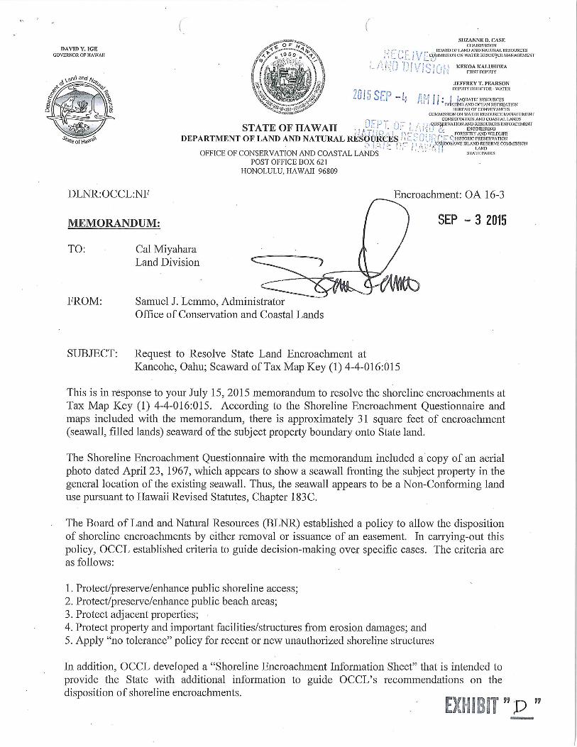
DLNR:OCCL:NF
MEMORANDUM:
TO: Cal MiyaharaLand Division
FROM: Samuel J. Lemmo, Administrator
Office of Conservation and Coastal Lands
Encroachment: OA 16-3
SEP - 3 2015
SUBJECT: Request to Resolve State Land Encroachment at
Kaneohe, Oahu; Seawai-d of Tax Map Key (1) 4-4-016:015
This is in response to your July 15, 2015 memorandum to resolve the shoreline encroachments atTax Map Key (1) 4-4-016:015. According to the Shoreline Encroachment Questionnaire and
maps included with the memorandum, there is approximately 31 square feet of encroachment
(seawall, filled lands) seaward of the subject property boundary onto State land.
The Shoreline Encroachment Questionnaire with the memorandum included a copy of an aerial
photo dated April 23, 1967, which appears to show a seawall fronting the subject property in thegeneral location of the existing seawall. Thus, the seawall appears to be a Non-Conforming land
use pursuant to Hawaii Revised Statutes, Chapter 183C.
The Board of Land and Natural Resources (BLNR) established a policy to allow the dispositionof shoreline encroachments by either removal or issuance of an easement. In carrying-out this
policy, OCCL established criteria to guide decision-making over specific cases. The criteria are
as follows:
1. Protect/preserve/enhance public shoreline access;
2. ProtecVpreserve/enhance public beach areas;
3. Protect adjacent properties;4. Protect property and important facilities/structures from erosion damages; and
5. Apply "no tolerance" policy for recent or new unauthorized shoreline structures
In addition, OCCL developed a "Shoreline Encroachment Information Sheet" that is intended to
provide the State with additional information to guide OCCL's recommendations on the
disposition of shoreline encroachments.
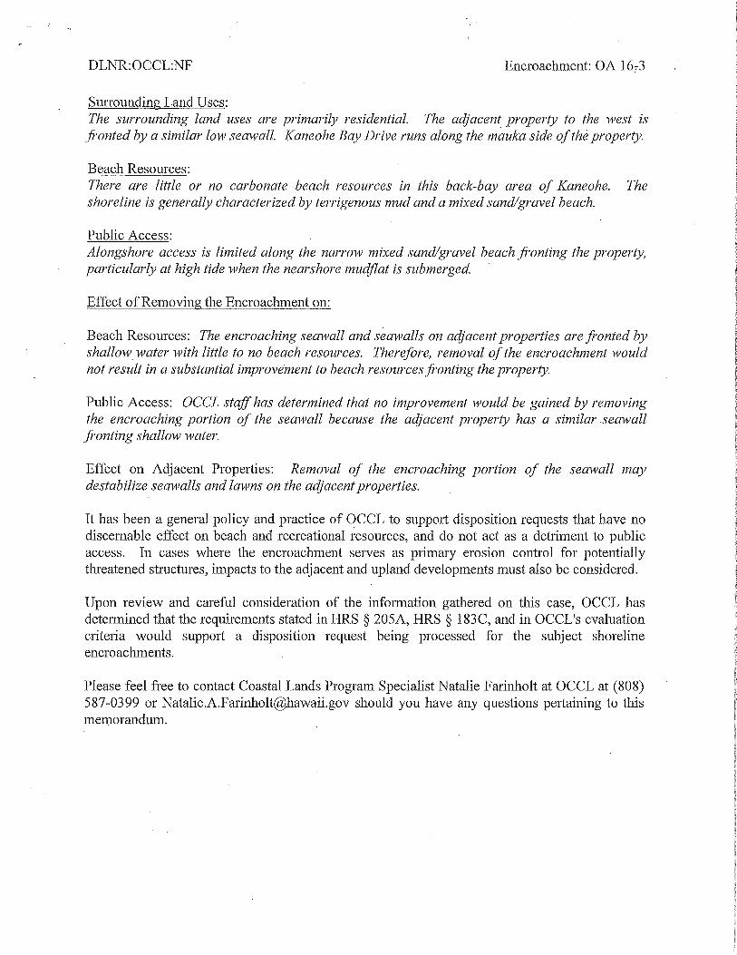
DLNR:OCCL:NF Encroachment: OA 16-3
Surrounding Land Uses:
The surrounding land uses are primarily residential. The adjacent property to the west is
fronted by a similar low seawall. Kaneohe Bay Drive runs along the mauka side of the property.
Beach Resources:
There are little or no carbonate beach resources in this back-bay area of Kaneohe. The
shoreline is generally characterized by terrigenous mud and a mixed sand/gravel beach.
Public Access:
Alongshore access is limited along the narrow mixed sand/gravel beach fronting the property,
particularly at high tide when the nearshore nmdflat is submerged.
Effect of Removing the Encroachment on:
Beach Resources: The encroaching seawall and seawalls on adjacent properties are fronted by
shallow water with little to no beach resources. Therefore, removal of the encroachment would
not result in a substantial improvement to beach resources fronting the property.
Public Access: OCCL staff has determined that no improvement would be gained by removing
the encroaching portion of the seawall because the adjacent property has a similar seawall
fronting shallow water.
Effect on Adjacent Properties: Removal of the encroaching portion of the seawall may
destabilize sean'alls and lawns on the adjacent properties.
It has been a general policy and practice of OCCL to support disposition requests that have no
discernable effect on beach and recreational resources, and do not act as a detriment to public
access. In cases where the encroachment serves as primary erosion control for potentially
threatened structures, impacts to the adjacent and upland developments must also be considered.
Upon review and careful consideration of the information gathered on this case, OCCL has
determined that the requirements stated in HRS § 205A, HRS § 183C, and in OCCL's evaluationcriteria would support a disposition request being processed for the subject shoreline
encroachments.
Please feel free to contact Coastal Lands Program Specialist Natalie Farmholt at OCCL at (808)587-0399 or [email protected] should you have any questions pertaining to this
memorandum.