dallas water utilities water/wastewater covenant · sample statement; basis of bearing is the north...
TRANSCRIPT

Revised 11/17
DALLAS WATER UTILITIES WATER/WASTEWATER COVENANT
Procedure for obtaining a water and wastewater covenant, water covenant, or wastewater covenant;
Required for initial submittal: 1. One letter from the owner requesting a covenant agreement on the property2. One copy of the subject Plat being processed3. One copy of current owner’s recorded warranty deed or deeds4. Three sets of field notes that follow the Survey Plat Review Group’s Legal
Description Preparation Guideline and Checklist
CITY PROCEDURE Engineering Division:
• Officially submit the above stated information to Engineering Division,Water Engineering, 320 E. Jefferson Blvd., Room 200, Dallas, Texas75203.
• The field notes are then routed to the Survey Plat Review Group for areview and approval process.
• After the field notes are approved by Survey, the field notes and warrantydeed or deeds are forwarded to the Real Estate Division office.
Time frame: This process has an approximate one to two-week time frame per review iteration. An average review process (approved field notes) is approximately 4-6 weeks. This time for completion is dependent upon field notes correction requests and timely response.
Real Estate Division
• Real Estate Division contacts the property owner for necessaryinformation and documents for preparation of the covenant agreement.
• Once the required information is received by the Real Estate Division,documents are prepared and submitted to the City Attorney for reviewand approval.
• Following City Attorney approval, Real Estate Division sends originalcovenant agreement to the property owner for proper signature.
• Once the signed covenant agreement is returned to the Real EstateDivision, the signed covenant agreement and other required Citydocuments are packaged for final approval and signatures by the CityAttorney and Assistant City Manager.
• The Real Estate Division then sends the covenant agreement documentto the appropriate County Records office to be recorded.
Time frame: The Real Estate Division has a process time of approximately 6 weeks for completion. This time frame is exclusive of any time allocated by Engineering Services, and is subject to timely responses from the property owner, as well as workload within the City Attorney’s Office. It is strongly advised that the owner proactively gathers the necessary ownership documents as soon as the need for a covenant agreement is identified.

Rev. 6/16 SHEET 1 OF 5
LEGAL DESCRIPTION PREPARATION GUIDELINE AND CHECKLIST
The following guideline and checklist are provided to assist in the preparation of real property descriptions for fee title conveyances, rights-of-way, easements, lease agreements, license agreements, etc., either for or on behalf of the City of Dallas. Legal Descriptions will be reviewed by the Sustainable Development & Construction, Engineering Division, Survey Plat Review Group (SPRG) staff to insure substantial compliance with both the form and content outlined in these guidelines. Legal Descriptions and Parcel Sketches must comply with both the rules of the Texas Board of Professional Land Surveying and the Professional Land Surveying Practices Act.
Legal Descriptions, for the purposes previously described, are defined as a written metes and bounds description of the boundary of the subject tract. A Parcel Sketch or map is a graphic depiction of the area described by the metes and bounds description. Both documents are prepared from data collected during an on the ground survey. All Legal Descriptions must include a reference to recorded monumentation (Corners of parent tract, platted subdivision, adjoining tract, etc.). The following checklist is provided for your assistance in preparing Legal Descriptions and Parcel Sketches for submittal to the Survey Plat Review Group (SPRG).
SPRG NO.:_________________
ALL DOCUMENTATION REFERENCED IN THE
LEGAL DESCRIPTION & PARCEL SKETCH MUST BE SUBMITTED GENERAL REQUIREMENTS
APPLI- CITY
CANT STAFF
1. _____ _____ ADD “SPRG REVIEW BOX” TO EACH SHEET/PAGE OF LEGAL DESCRIPTION & PARCEL SKETCH.
SPRG REVIEW BOX
(For SPRG use only) Reviewed by: _________________ Date: _________________ SPRG No. _________________
2. _____ _____ SUBMIT 3 ORIGINALS OF THE LEGAL DESCRIPTION AND PARCEL SKETCH ON 8-1/2” X 11” PLAIN WHITE BOND, SIGNED (IN BLUE INK), SEALED, AND DATED BYTHE REGISTERED PROFESSIONAL LAND SURVEYOR.
Sustainable Development & Construction Engineering; Survey Plat Review Group
“SPRG”
CITY OF DALLAS
RE: City Plan File No. S________ - _________ Addition Name: ________________________
Owner Name___________________ Owner Email ____________________________________ (If Applicable)
(Required) (Required)

Rev. 6/16 SHEET 2 OF 5
HEADER REQUIREMENTS
3. _____ _____ HEADER (USE THE ORDER THAT FOLLOWS) – SEE APPENDIX (SHEET 5) FOR EXAMPLES
a.) TYPE OF CONVEYANCE (I.E. WATER EASEMENT, WASTEWATER EASEMENT, STREET ABANDONMENT, DRAINAGE EASEMENT, ETC.).
b.) SUBDIVISION NAME, OR PARENT ACREAGE, OR (IF IN STREET) STREET NAME.
c.) LOT No. (IF APPLICABLE), CITY OF DALLAS BLOCK No. OR (IF IN STREET) ADJACENT BLOCK No.s.
d.) ORIGINAL LAND SURVEY GRANTEE NAME, ABSTRACT No.
e.) “CITY OF DALLAS, (FILL IN COUNTY NAME) COUNTY, TEXAS”
4. _____ _____ HEADER MUST BE SHOWN AND MATCH ON ALL SHEETS OF LEGAL DESCRIPTION & PARCEL SKETCH.
5. _____ _____ DO NOT PLACE OR ASSIGN EXHIBIT LABELS (I.E. “EXHIBIT A”, “EXHIBIT “B”, ETC.).
LEGAL DESCRIPTION; PREAMBLE REQUIREMENTS
6. _____ _____ DESCRIBE AREA, UNDER AN ACRE= (1234 SQ. FT., 0.0283 ACRES) AN ACRE AND ABOVE = (1.234 ACRES)
7. _____ _____ ORIGINAL LAND SURVEY GRANTEE NAME, ABSTRACT No.
8. _____ _____ CITY OF DALLAS BLOCK No.(S).
9. _____ _____ PARENT TRACT ACREAGE OR LOT, BLOCK, SUBDIVISION NAME, AND RECORDING INFORMATION AS IT APPEARS IN INSTRUMENT OF CONVEYANCE.
10. _____ _____ CURRENT OWNER’S NAME(S).
11. _____ _____ TYPE OF CONVEYANCE (I.E. WARRANTY DEED, SPECIAL WARRANTY DEED, etc.) (DEED OF TRUST IS NOT ACCEPTABLE.)
12. _____ _____ CURRENT OWNER’S DEED RECORDING INFORMATION (VOLUME AND PAGE, OR INSTRUMENT No. WITH COUNTY AND STATE.)
LEGAL DESCRIPTION; SPECIFIC METES AND BOUNDS REQUIREMENTS
13. _____ _____ POINT OF COMMENCING (IF APPLICABLE).
14. _____ _____ POINT OF BEGINNING. (COMMENCE OR BEGIN AT A STREET INTERSECTION, RECORDED ADDITION CORNER, OR LOT CORNER OF A RECORDED ADDITION.)
15. _____ _____ BEARINGS AND DISTANCES.
16. _____ _____ CURVE DATA (IF APPLICABLE), TO INCLUDE:
a. WHETHER CURVE IS TANGENT OR NON-TANGENT
b. DIRECTION TO THE RIGHT OR LEFT
c. ARC LENGTH
d. RADIUS
e. DELTA ANGLE
f. CHORD BEARING FROM THE BEGINNING OF THE CURVE
g. CHORD LENGTH
Rev. 6/16 SHEET 3 OF 5
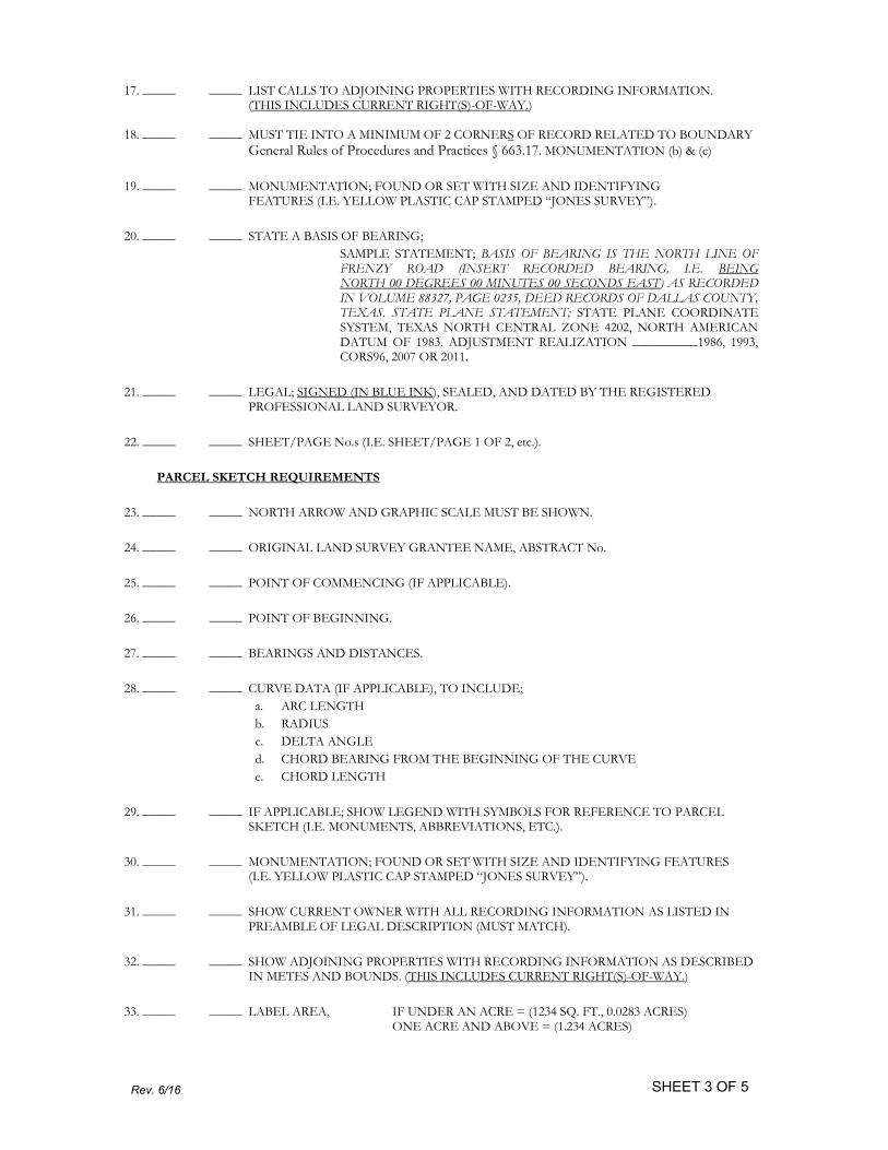
17. _____ _____ LIST CALLS TO ADJOINING PROPERTIES WITH RECORDING INFORMATION. (THIS INCLUDES CURRENT RIGHT(S)-OF-WAY.)
18. _____ _____ MUST TIE INTO A MINIMUM OF 2 CORNERS OF RECORD RELATED TO BOUNDARY
General Rules of Procedures and Practices § 663.17. MONUMENTATION (b) & (c)
19. _____ _____ MONUMENTATION; FOUND OR SET WITH SIZE AND IDENTIFYING FEATURES (I.E. YELLOW PLASTIC CAP STAMPED “JONES SURVEY”).
20. _____ _____ STATE A BASIS OF BEARING;
SAMPLE STATEMENT; BASIS OF BEARING IS THE NORTH LINE OF FRENZY ROAD (INSERT RECORDED BEARING, I.E. BEING NORTH 00 DEGREES 00 MINUTES 00 SECONDS EAST) AS RECORDED IN VOLUME 88327, PAGE 0235, DEED RECORDS OF DALLAS COUNTY, TEXAS. STATE PLANE STATEMENT; STATE PLANE COORDINATE SYSTEM, TEXAS NORTH CENTRAL ZONE 4202, NORTH AMERICAN DATUM OF 1983. ADJUSTMENT REALIZATION __________1986, 1993, CORS96, 2007 OR 2011.
21. _____ _____ LEGAL; SIGNED (IN BLUE INK), SEALED, AND DATED BY THE REGISTERED PROFESSIONAL LAND SURVEYOR.
22. _____ _____ SHEET/PAGE No.s (I.E. SHEET/PAGE 1 OF 2, etc.).
PARCEL SKETCH REQUIREMENTS
23. _____ _____ NORTH ARROW AND GRAPHIC SCALE MUST BE SHOWN.
24. _____ _____ ORIGINAL LAND SURVEY GRANTEE NAME, ABSTRACT No.
25. _____ _____ POINT OF COMMENCING (IF APPLICABLE).
26. _____ _____ POINT OF BEGINNING.
27. _____ _____ BEARINGS AND DISTANCES.
28. _____ _____ CURVE DATA (IF APPLICABLE), TO INCLUDE;
a. ARC LENGTH
b. RADIUS
c. DELTA ANGLE
d. CHORD BEARING FROM THE BEGINNING OF THE CURVE
e. CHORD LENGTH
29. _____ _____ IF APPLICABLE; SHOW LEGEND WITH SYMBOLS FOR REFERENCE TO PARCEL SKETCH (I.E. MONUMENTS, ABBREVIATIONS, ETC.).
30. _____ _____ MONUMENTATION; FOUND OR SET WITH SIZE AND IDENTIFYING FEATURES (I.E. YELLOW PLASTIC CAP STAMPED “JONES SURVEY”).
31. _____ _____ SHOW CURRENT OWNER WITH ALL RECORDING INFORMATION AS LISTED IN PREAMBLE OF LEGAL DESCRIPTION (MUST MATCH).
32. _____ _____ SHOW ADJOINING PROPERTIES WITH RECORDING INFORMATION AS DESCRIBED IN METES AND BOUNDS. (THIS INCLUDES CURRENT RIGHT(S)-OF-WAY.)
33. _____ _____ LABEL AREA, IF UNDER AN ACRE = (1234 SQ. FT., 0.0283 ACRES) ONE ACRE AND ABOVE = (1.234 ACRES)

Rev. 6/16 SHEET 4 OF 5
34. _____ _____ SHOW AREA WITHIN IMMEDIATE PERIMETER OF PARCEL BOUNDARY MUST BE DETAILED:
a. SHOW ADDITION NAME(S)
b. PROPERTY OWNER NAME(S)
c. LABEL APPROPRIATE NUMBERS FOR LOTS, BLOCKS, OR TRACTS,
d. SHOW VOLUME AND PAGE, AND SOURCE OF RECORD (D.R.D.C.TX., ETC.).
e. SHOW WIDTHS OF STREETS, ALLEYS, AND EXISTING EASEMENTS LEGIBLY.LABEL VOLUME AND PAGE AND SOURCE OF RECORD. ADD DISTANCE TIESACROSS R.O.W. AT VARIABLE WIDTH R.O.W.
f. OTHER PERTINENT DATA
35. _____ _____ SUBMIT DOCUMENTATION TO SUPPORT EXISTING STREET RIGHT-OF-WAY WIDTH (I.E. FILE RESEARCH; SEPARATE INSTRUMENT, PLAT, COUNTY R.O.W. MAP). THE SURVEY RECORDS VAULT AT 320 E. JEFFERSON, ROOM 314, DALLAS, TEXAS, OAKCLIFF MUNICIPAL CENTER IS A VALUABLE SOURCE OF THIS DATA.
36. _____ _____ STATE THE BASIS OF BEARING ON PARCEL SKETCH, (FROM AN IDENTIFIABLE
SOURCE, I.E. TWO CONTROLLING MONUMENTS).
SAMPLE STATEMENT; BASIS OF BEARING IS THE NORTH LINE OF FRENZY ROAD (INSERT RECORDED BEARING, I.E. BEING NORTH 00 DEGREES 00 MINUTES 00 SECONDS EAST) AS RECORDED IN VOLUME 88327, PAGE 0235, DEED RECORDS OF DALLAS COUNTY, TEXAS.
STATE PLANE STATEMENT; STATE PLANE COORDINATE SYSTEM, TEXAS NORTH CENTRAL ZONE 4202, NORTH AMERICAN DATUM OF 1983. ADJUSTMENT REALIZATION __________
1986, 1993, CORS96, 2007 OR 2011
37. _____ _____ PARCEL SKETCH; SIGNED (IN BLUE INK), SEALED, AND DATED BY THE REGISTERED PROFESSIONAL LAND SURVEYOR.
38. _____ _____ SHEET/PAGE No.s (I.E. SHEET/PAGE 1 OF 2, ETC.)
39. _____ _____ SUBMIT A GEOMETRIC CLOSURE FOR THE BOUNDARY OF THE PARCELS
(THIS IS REQUIRED IN THE PROJECT FILE PRIOR TO RELEASE, ATTACH TO
SUBMITTAL):
a. INCLUDE BEARINGS AND DISTANCES
b. CURVE DATA TO INCLUDE:
1. DIRECTION TO THE RIGHT OR LEFT
2. ARC LENGTH
3. RADIUS
4. DELTA ANGLE
5. RADIUS
6. CHORD BEARING FROM THE BEGINNING OF THE CURVE
7. CHORD LENGTH
c. PRECISION OF BOUNDARY CLOSURE (MINIMUM 1:15000)
VICINITY MAP
VICINITY MAPS ARE NO LONGER REQUIRED TO BE SUBMITTED.

SHEET 5 OF 5
THIS COMPLETED AND SIGNED LIST MUST ACCOMPANY THE THREE (3) EXECUTED ORIGINAL COPIES OF THE LEGAL DESCRIPTION AND PARCEL SKETCH EXHIBIT SUBMITTAL. COMPLETE ALL APPLICABLE ITEMS. PLACE A CHECKMARK IN THE SPACE LABELED “APPLICANT”. ITEMS THAT ARE NOT APPLICABLE TO YOUR SITUATION SHOULD BE LABELED “N/A”.
ADDITIONAL COMMENTS:
________________________________________________________________________________________________
________________________________________________________________________________________________
________________________________________________________________________________________________
________________________________________________________________________________________________
________________________________________________________________________________________________
________________________________________________________________________________________________
________________________________________________________________________________________________
________________________________________________________________________________________________
I, the Surveyor of Record, understand and agree that the City Staff Surveyor will require that the exhibits be resubmitted for review and approval if it is determined that this checklist contained incorrect information.
By review of the submitted separate instrument(s), this Department does not assume any liability for the separate instrument(s), nor does this review release the surveyor of record from her/his responsibilities as a surveyor as set forth by the Texas Board of Professional Land Surveying.
Signature: ________________________________ Date: ________________
Printed Name: _______________________________
APPENDIX
HEADER EXAMPLES
LICENSE AGREEMENT THOMAS JEFFERSON AVENUE
ADJACENT TO BLOCK A/1234 & B/5678 STEPHEN F. AUSTIN SURVEY, ABSTRACT No. 567
CITY OF DALLAS, DALLAS COUNTY, TEXAS
IN PLATED SUBDIVISION
WATER EASEMENT GEORGE WASHINGTON ADDITION
LOT 1, BLOCK A/234 STEPHEN F. AUSTIN SURVEY, ABSTRACT No. 567
CITY OF DALLAS, DALLAS COUNTY, TEXAS
Rev. 6/16
IN ACREAGE
WATER EASEMENT BEING IN 89.5 ACRES
BLOCK A/234 STEPHEN F. AUSTIN SURVEY, ABSTRACT No. 567
CITY OF DALLAS, DALLAS COUNTY, TEXAS


Page 1 of 2 Rev. 7/17
City of Dallas Real Estate Division
REQUIRED COPORATE DOCUMENTATION
OBJECTIVE: The City of Dallas – City Attorney’s Office requires proof of ownership for the requested easement, license, agreement, abandonment, etc. It is imperative that the documents are submitted in a timely manner, as this may delay the release of permits/approvals from other Departments and/or Divisions. Preparing these documents prior to the Real Estate Division’s review is encouraged as a proactive measure. Please be prepared to submit these documents upon request from Real Estate. The required documents for each type of ownership is listed below: Limited Partnership (Ltd., LP)
Example of Signature Block
Limited Partnership Agreement
Certificate of Limited Partnership
Consent - For the transfer of real property, the limited partnership agreement may require the consent or ratification of general partners. If not an opinion letter from the partnership’s attorney stating that such ratification is not necessary.
Certificate of Incumbency (official document that lists the names of incumbent individuals and their respective corporate office within an organization)
Non-Profit Corporation
Example of Signature Block for authorized signing agent
Certificate of Incorporation
Articles of Incorporation and Bylaws
Corporate Resolution
Certificate of Incumbency
Good Standing Certificate – a good standing certificate obtained from the state Comptroller of Public Accounts in Texas, confirming the required filings of reports and payments.

Page 2 of 2 Rev. 7/17
Limited Liability Company (LLC)
Example of Signature Block for authorized signer
Certificate of Formation
Entity Regulations (Bylaws)
Good Standing Certificate – a good standing certificate obtained from the state Comptroller of Public Accounts in Texas, confirming the required filings of reports and payments.
Authorization Documentation (corporate resolution authorizing the water easement and stating who will be authorized to execute the documents)
Incorporated (Inc.)
Example of Signature Block for signing officer
Certificate of Formation
Bylaws – organizational documents identifying the authority and limitations of authority of officers to enter into the transaction
Good Standing Certificate
Corporate Resolution – executed resolution of the shareholders or directors of the Grantor authorizing the proposed transaction and granting authority to the signing officer to act on behalf of the corporation.
Certificate of Incumbency (official document that lists the names of incumbent individuals and their respective corporate office within an organization)
Individuals – (needed for each owner listed if multiple)
Completed Marital Affidavit
No Conflict of Interest Statement
Homestead/Non-Homestead Affidavit