data visualization - cudo.carleton.ca › ... › dli_training › 2753 ›...
TRANSCRIPT
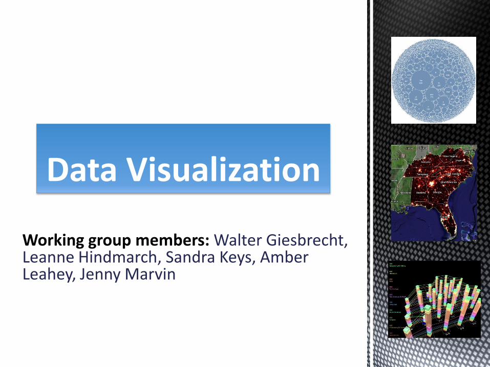
Working group members: Walter Giesbrecht, Leanne Hindmarch, Sandra Keys, Amber Leahey, Jenny Marvin
Data Visualization
Purpose of group:
Keep up to date on data visualization technologies;
Assess tools and keep a list of required functionalities;
Be informed and prepared should a funding opportunity arise.
Mandate
Two data portals (limited visualization)
Spatial portal displays data as single symbol (i.e. mapping of location, soil classifications)
Numeric data portal (some categorical charting)
Visual and data literacy
Find patterns in data
Convey messages
Interact with data
Support teaching and learning through visuals
Why visualize?
Visualize attributes of spatial data
mapping of locations and spatial attributes (boundaries, rivers, terrain, soil classifications)
Visualize numeric data geographically
spatial distributions of geographic characteristics (species, disease, demographics)
Visualize statistics
wide variety of graphic methods used to portray patterns, trends, and indicators.
Desired Functionality
Visuals
What is possible?
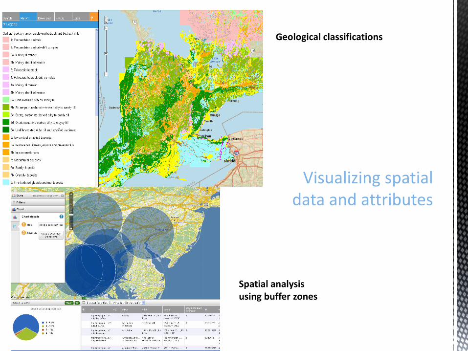
Include an image allowing user to create a map from spatial data on the fly
Visualizing spatial data and attributes
Geological classifications
Spatial analysis using buffer zones
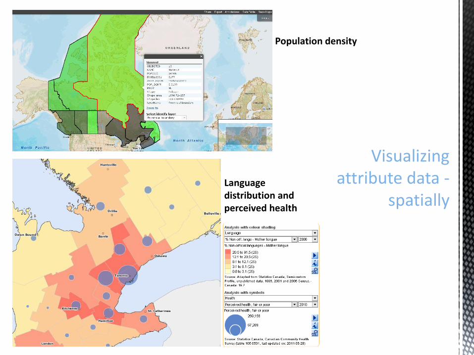
Visualizing attribute data -
spatially
Population density
Language distribution and perceived health
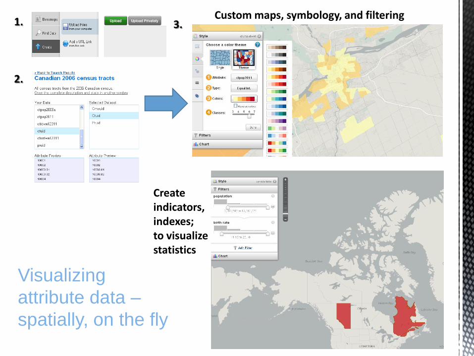
Visualizing
attribute data –
spatially, on the fly
1.
2.
3.
Create indicators, indexes; to visualize statistics
Custom maps, symbology, and filtering
Visualizing numeric data and statistics
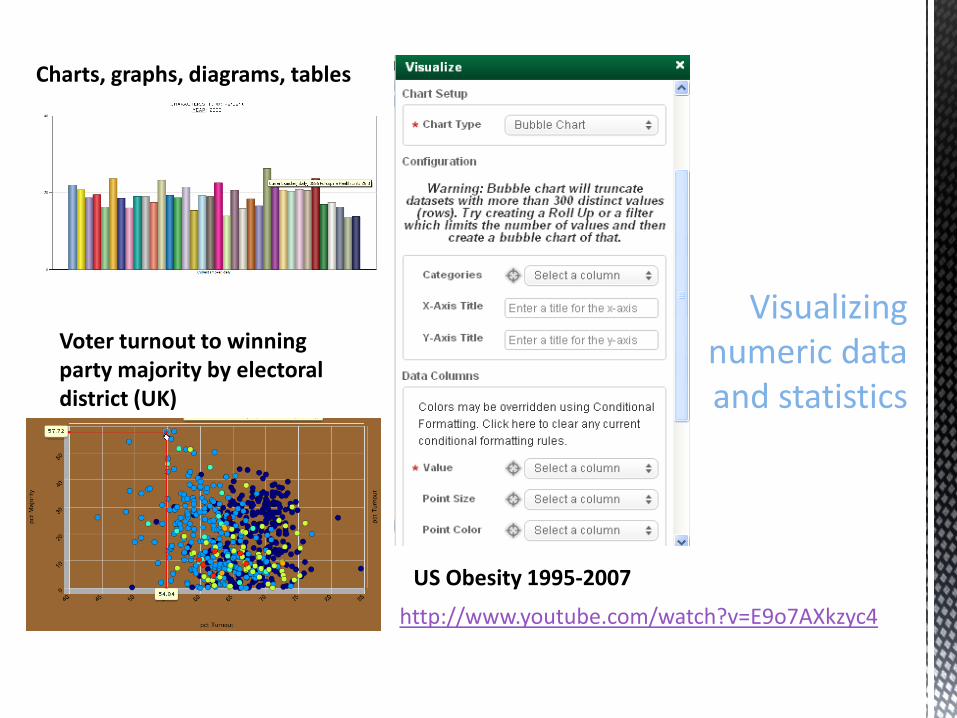
Charts, graphs, diagrams, tables
Voter turnout to winning party majority by electoral district (UK)
US Obesity 1995-2007
http://www.youtube.com/watch?v=E9o7AXkzyc4
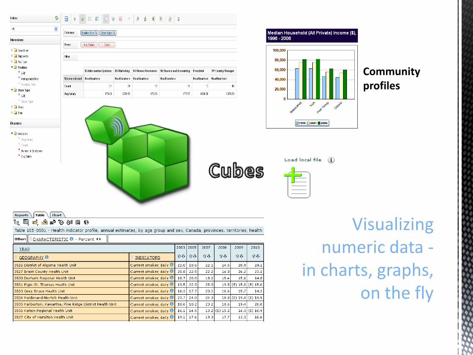
Visualizing numeric data -
in charts, graphs, on the fly
Community profiles
Visualizing microdata and
other data
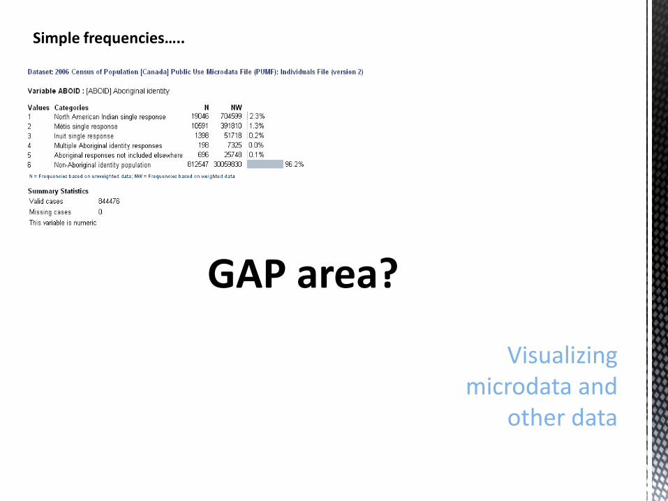
GAP area?
Simple frequencies…..
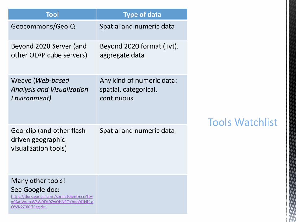
Tool Type of data
Geocommons/GeoIQ Spatial and numeric data
Beyond 2020 Server (and other OLAP cube servers)
Beyond 2020 format (.ivt), aggregate data
Weave (Web-based Analysis and Visualization Environment)
Any kind of numeric data: spatial, categorical, continuous
Geo-clip (and other flash driven geographic visualization tools)
Spatial and numeric data
Many other tools! See Google doc: https://docs.google.com/spreadsheet/ccc?key=0AmVqurcWSW0KdDZwOHNPOXhnb0I1Nk1oOWN2Z3l0SlE#gid=1
Tools Watchlist
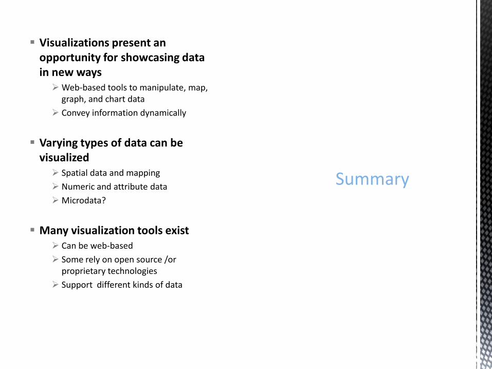
Visualizations present an opportunity for showcasing data in new ways Web-based tools to manipulate, map,
graph, and chart data
Convey information dynamically
Varying types of data can be visualized Spatial data and mapping
Numeric and attribute data
Microdata?
Many visualization tools exist Can be web-based
Some rely on open source /or proprietary technologies
Support different kinds of data
Summary

Any questions / comments?